LOWER ZAMBEZI RIVER BASIN BASELINE DATA ON LANDUSE ...
LOWER ZAMBEZI RIVER BASIN BASELINE DATA ON LANDUSE ...
LOWER ZAMBEZI RIVER BASIN BASELINE DATA ON LANDUSE ...

You also want an ePaper? Increase the reach of your titles
YUMPU automatically turns print PDFs into web optimized ePapers that Google loves.
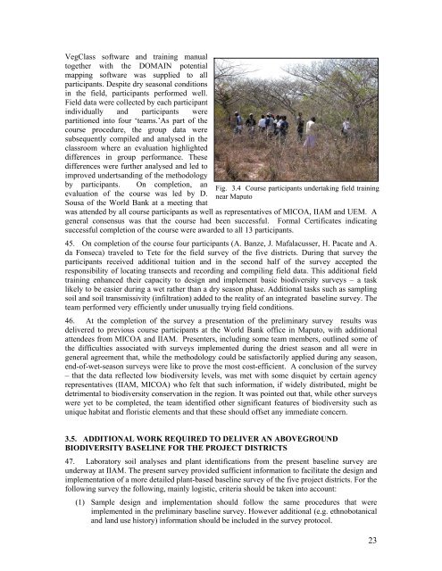
VegClass software and training manualtogether with the DOMAIN potentialmapping software was supplied to allparticipants. Despite dry seasonal conditionsin the field, participants performed well.Field data were collected by each participantindividually and participants werepartitioned into four ‘teams.’As part of thecourse procedure, the group data weresubsequently compiled and analysed in theclassroom where an evaluation highlighteddifferences in group performance. Thesedifferences were further analysed and led toimproved undertsanding of the methodologyby participants. On completion, anevaluation of the course was led by D.Sousa of the World Bank at a meeting thatFig. 3.4 Course participants undertaking field trainingnear Maputowas attended by all course participants as well as representatives of MICOA, IIAM and UEM. Ageneral consensus was that the course had been successful. Formal Certificates indicatingsuccessful completion of the course were awarded to all 13 participants.45. On completion of the course four participants (A. Banze, J. Mafalacusser, H. Pacate and A.da Fonseca) traveled to Tete for the field survey of the five districts. During that survey theparticipants received additional tuition and in the second half of the survey accepted theresponsibility of locating transects and recording and compiling field data. This additional fieldtraining enhanced their capacity to design and implement basic biodiversity surveys – a tasklikely to be easier during a wet rather than a dry season phase. Additional tasks such as samplingsoil and soil transmissivity (infiltration) added to the reality of an integrated baseline survey. Theteam performed very efficiently under unusually trying field conditions.46. At the completion of the survey a presentation of the preliminary survey results wasdelivered to previous course participants at the World Bank office in Maputo, with additionalattendees from MICOA and IIAM. Presenters, including some team members, outlined some ofthe difficulties associated with surveys implemented during the driest season and all were ingeneral agreement that, while the methodology could be satisfactorily applied during any season,end-of-wet-season surveys were like to prove the most cost-efficient. A conclusion of the survey– that the data reflected low biodiversity levels, was met with some disquiet by certain agencyrepresentatives (IIAM, MICOA) who felt that such information, if widely distributed, might bedetrimental to biodiversity conservation in the region. It was pointed out that, while other surveyswere yet to be completed, the team identified other significant features of biodiversity such asunique habitat and floristic elements and that these should offset any immediate concern.3.5. ADDITI<strong>ON</strong>AL WORK REQUIRED TO DELIVER AN ABOVEGROUNDBIODIVERSITY <strong>BASELINE</strong> FOR THE PROJECT DISTRICTS47. Laboratory soil analyses and plant identifications from the present baseline survey areunderway at IIAM. The present survey provided sufficient information to facilitate the design andimplementation of a more detailed plant-based baseline survey of the five project districts. For thefollowing survey the following, mainly logistic, criteria should be taken into account:(1) Sample design and implementation should follow the same procedures that wereimplemented in the preliminary baseline survey. However additional (e.g. ethnobotanicaland land use history) information should be included in the survey protocol.23