

SHLAA _version 6_ - 2011 Update Document - Basingstoke and ...
SHLAA _version 6_ - 2011 Update Document - Basingstoke and ...
SHLAA _version 6_ - 2011 Update Document - Basingstoke and ...

You also want an ePaper? Increase the reach of your titles
YUMPU automatically turns print PDFs into web optimized ePapers that Google loves.
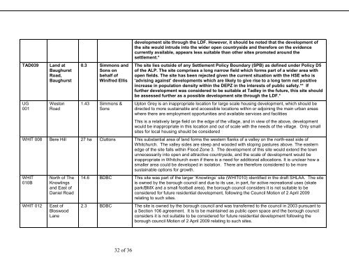
TAD039UG001L<strong>and</strong> atBaughurstRoad,BaughurstWestonRoad0.3 Simmons <strong>and</strong>Sons onbehalf ofWinifred Ellis1.43 Simmons &Sonsdevelopment site through the LDF. However, it should be noted that the development ofthe site would intrude into the wider open countryside <strong>and</strong> therefore on the evidencecurrently available, appears less suitable than other sites promoted around thesettlement.*The site lies outside of any Settlement Policy Boundary (SPB) as defined under Policy D5of the ALP. The site comprises a long narrow field which forms part of a wider area withopen fields. The site has been rejected given the current situation with the HSE who is‘advising against’ developments which are likely to give rise to a long term net positiveincrease in population density within the DEPZ in the interests of public safety.** Iffurther development was considered to be suitable at Tadley in the future, this site shouldbe assessed further as a possible development site through the LDF.*Upton Grey is an inappropriate location for large scale housing development, which should bedirected to more sustainable <strong>and</strong> accessible locations within or adjoining the main urban areaswhere there are employment opportunities <strong>and</strong> available services <strong>and</strong> facilitiesThis is a relatively large field on the edge of the village, <strong>and</strong> in view of the above, developmentwould be inappropriate in this location <strong>and</strong> out of scale with the needs of the village. Only smallsites for local housing should be consideredWHIT 008 Bere Hill 27 ha Cluttons This substantial area of l<strong>and</strong> forms the western flanks of a valley on the north-east side ofWhitchurch. The valley sides are steep <strong>and</strong> wooded with sloping pastures above. The easternedge of the site falls within Flood Zone 3. The development of this site would extend the townunnecessarily into open <strong>and</strong> attractive countryside, <strong>and</strong> the scale of development would beinappropriate in Whitchurch even if there is a need for additional allocations. It is unclear how asmaller area could be developed in isolation. There are therefore considered to be moresustainable options for growth.WHIT010BWHIT 012North of TheKnowlings<strong>and</strong> East ofDaniel RoadEast ofBloswoodLane14.6 BDBC This site was part of the larger ‘Knowlings’ site (WHIT010) identified in the draft <strong>SHLAA</strong>. The siteis owned by the borough council <strong>and</strong> due to its use, in part, for active recreational uses (skatepark/BMX <strong>and</strong> a small football area), the borough council considers it is not suitable to beconsidered for future residential development, following the Council Motion of 2 April 2009relating to such sites.2.3 BDBC The site is owned by the borough council <strong>and</strong> was transferred to the council in 2003 pursuant toa Section 106 agreement. It is to be maintained as public open space <strong>and</strong> the borough councilconsiders it is not suitable to be considered for future residential development following theborough council Motion of 2 April 2009 relating to such sites.32 of 36


