

Aboriginal Waterways Assessment program
dCckIF
dCckIF

You also want an ePaper? Increase the reach of your titles
YUMPU automatically turns print PDFs into web optimized ePapers that Google loves.
24 <strong>Aboriginal</strong> <strong>Waterways</strong> <strong>Assessment</strong> — Part B The <strong>program</strong><br />
How to present the data?<br />
Because at the time there was<br />
insufficient knowledge in local<br />
communities of the mapping<br />
technology and how to use it,<br />
the research team developed the<br />
approach to assimilating the data.<br />
Scores from each place were recorded<br />
in a results chart, which were then<br />
transposed to a matrix. The matrix<br />
shows the assessment locations using<br />
the same identifiers that were used in<br />
the results table. The matrix presents<br />
scores that integrate river health with<br />
cultural uses and values to provide<br />
a ‘high’, ‘medium’ or ‘low’ score<br />
distributed across a graph.<br />
The scores are also transposed onto<br />
an AWA regional map of the whole<br />
assessment location. Each assessment<br />
place is identified on the map, with<br />
the same identifier and colour coding<br />
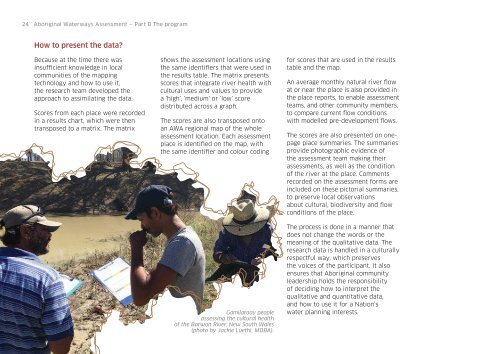
Gamilaraay people<br />
assessing the cultural health<br />
of the Barwon River, New South Wales<br />
(photo by Jackie Luethi, MDBA).<br />
for scores that are used in the results<br />
table and the map.<br />
An average monthly natural river flow<br />
at or near the place is also provided in<br />
the place reports, to enable assessment<br />
teams, and other community members,<br />
to compare current flow conditions<br />
with modelled pre-development flows.<br />
The scores are also presented on onepage<br />
place summaries. The summaries<br />
provide photographic evidence of<br />
the assessment team making their<br />
assessments, as well as the condition<br />
of the river at the place. Comments<br />
recorded on the assessment forms are<br />
included on these pictorial summaries,<br />
to preserve local observations<br />
about cultural, biodiversity and flow<br />
conditions of the place.<br />
The process is done in a manner that<br />
does not change the words or the<br />
meaning of the qualitative data. The<br />
research data is handled in a culturally<br />
respectful way, which preserves<br />
the voices of the participant. It also<br />
ensures that <strong>Aboriginal</strong> community<br />
leadership holds the responsibility<br />
of deciding how to interpret the<br />
qualitative and quantitative data,<br />
and how to use it for a Nation’s<br />
water planning interests.