
Create successful ePaper yourself
Turn your PDF publications into a flip-book with our unique Google optimized e-Paper software.
22 <strong>Selwyn</strong> District Residents' Guide <strong>2018</strong><br />
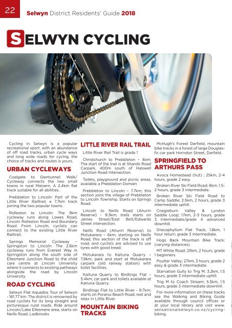
S ELWYN CYCLING<br />
Cycling in <strong>Selwyn</strong> is a popular<br />
recreational sport, with an abundance<br />
of off road tracks, urban cycle ways<br />
and long wide roads for cyclng, the<br />
choice of tracks and routes is yours.<br />
URBAN CYCLEWAYS<br />
Coalgate to Glentunnel: Walk/<br />
Cycleway connects the two small<br />
towns in rural Malvern. A 2.4km flat<br />
track suitable for all abilities.<br />
Prebbleton to Lincoln: Part of the<br />
Little River Railtrail, a 7.7km track<br />
joining the two popular towns.<br />
Rolleston to Lincoln: The 9km<br />
cycleway runs along Lowes Road,<br />
Lincoln Rolleston Road and Boundary<br />
Road. From Lincoln, cyclists can<br />
connect to the existing Little River<br />
Railtrail.<br />
Springs Memorial Cycleway –<br />
Springston to Lincoln: The 2.6km<br />
cycleway runs from Everest Way in<br />
Springston along the south side of<br />
Ellesmere Junction Road to the child<br />
care centre at Lincoln University<br />
where it connects to existing pathways<br />
alongside the road by Lincoln<br />
University.<br />
ROAD CYCLING<br />
<strong>Selwyn</strong> Flat Aquados Tour of <strong>Selwyn</strong><br />
- 161.77 km: The district is renowned by<br />
road cyclists for its long straight and<br />
picturesque rural roads. Ride around<br />
Lincoln/Lake Ellesmere area, starts on<br />
Neills Road, Ladbrooks<br />
LITTLE RIVER RAIL TRAIL<br />
Little River Rail Trail is grade 1<br />
Christchurch to Prebbleton – 4km:<br />
The start of the trail is at Shands Road<br />
Carpark, 400m south of Halswell<br />
Junction Road Intersection.<br />
Toilets, playground and picnic areas,<br />
available a Prebbleton Domain<br />
Prebbleton to Lincoln – 7.7km; this<br />
section joins the village of Prebbleton<br />
to Lincoln Township. Starts on Springs<br />
Road.<br />
Lincoln to Neills Road (Ahuriri<br />
Reserve) - 9.3km; trails starts on<br />
James Street/East Belt/Edwards<br />
Street intersection.<br />
Neills Road (Ahuriri Reserve) to<br />
Motukarara – 6km; starting on Neills<br />
Road, this section of the track is off<br />
road, and cyclists are advised to use<br />
tyres with good tread.<br />
Motukarara to Kaituna Quarry –<br />
7.9km; park and start at Motukarara<br />
carpark (old railway station) with<br />
toilet facilities.<br />
Kaituna Quarry to Birdlings Flat –<br />
5.4km; car park and toilets available at<br />
Kaituna Quarry.<br />
Birdlings Flat to Little River - 9.7km;<br />
starts on Poranui Beach Road, rest and<br />
relax in Little River.<br />
MOUNTAIN BIKING<br />
TRACKS<br />
McHugh’s Forest Darfield, mountain<br />
bike tracks in a forest of large Douglasfir,<br />
car park Horndon Street, Darfield.<br />
SPRINGFIELD TO<br />
ARTHURS PASS<br />
Avoca Homestead (hut) ; 25km, 2-4<br />
hours, grade 2 easy.<br />
Broken River Ski Field Road; 6km, 1.5-<br />
2 hours, grade 3 intermediate.<br />
Broken River Ski Field Road to<br />
Camp Saddle; 2.5km, 2 hours, grade 3<br />
intermediate uphill.<br />
Craigieburn Valley & Lyndon<br />
Saddle Loop; 17km, 2-3 hours, grade<br />
3 Intermediate/grade 4 advanced<br />
downhill.<br />
Dracophyllum Flat Track; 1.8km, 1<br />
hour return, grade 3 intermediate.<br />
Hogs Back Mountain Bike Track;<br />
(varying distances).<br />
MT White Road; 25km, 2 hours, grade<br />
1 beginners.<br />
Poulter Valley; <strong>27</strong>km, 3 hours, grade 2<br />
easy & grade 3 intermediate.<br />
Starvation Gully to Trig M; 3.2km, 1.5<br />
hours, grade 3 intermediate uphill.<br />
Trig M to Coach Stream; 5.5km, 1.5<br />
hours, grade 3 intermediate downhill.<br />
For more information on these tracks<br />
see the Walking and Biking Guide<br />
available through council offices or<br />
at your local library and visit www.<br />
sensationalselwyn.co.nz/cyclingbiking.