2018 4WDrive Overland SE - June

You also want an ePaper? Increase the reach of your titles
YUMPU automatically turns print PDFs into web optimized ePapers that Google loves.
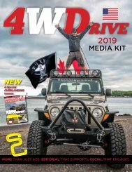
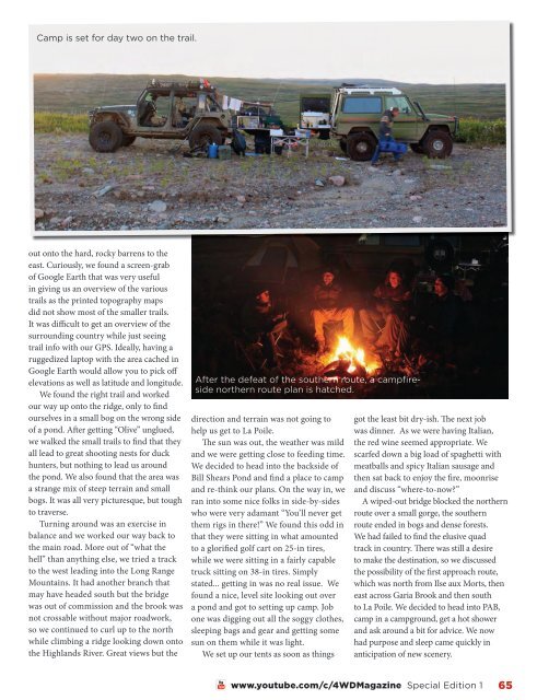
Camp is set for day two on the trail.<br />
out onto the hard, rocky barrens to the<br />
east. Curiously, we found a screen-grab<br />
of Google Earth that was very useful<br />
in giving us an overview of the various<br />
trails as the printed topography maps<br />
did not show most of the smaller trails.<br />
It was difficult to get an overview of the<br />
surrounding country while just seeing<br />
trail info with our GPS. Ideally, having a<br />
ruggedized laptop with the area cached in<br />
Google Earth would allow you to pick off<br />
elevations as well as latitude and longitude.<br />
We found the right trail and worked<br />
our way up onto the ridge, only to find<br />
ourselves in a small bog on the wrong side<br />
of a pond. After getting “Olive” unglued,<br />
we walked the small trails to find that they<br />
all lead to great shooting nests for duck<br />
hunters, but nothing to lead us around<br />
the pond. We also found that the area was<br />
a strange mix of steep terrain and small<br />
bogs. It was all very picturesque, but tough<br />
to traverse.<br />
Turning around was an exercise in<br />
balance and we worked our way back to<br />
the main road. More out of “what the<br />
hell” than anything else, we tried a track<br />
to the west leading into the Long Range<br />
Mountains. It had another branch that<br />
may have headed south but the bridge<br />
was out of commission and the brook was<br />
not crossable without major roadwork,<br />
so we continued to curl up to the north<br />
while climbing a ridge looking down onto<br />
the Highlands River. Great views but the<br />
After the defeat of the southern route, a campfireside<br />
northern route plan is hatched.<br />
direction and terrain was not going to<br />
help us get to La Poile.<br />
The sun was out, the weather was mild<br />
and we were getting close to feeding time.<br />
We decided to head into the backside of<br />
Bill Shears Pond and find a place to camp<br />
and re-think our plans. On the way in, we<br />
ran into some nice folks in side-by-sides<br />
who were very adamant “You’ll never get<br />
them rigs in there!” We found this odd in<br />
that they were sitting in what amounted<br />
to a glorified golf cart on 25-in tires,<br />
while we were sitting in a fairly capable<br />
truck sitting on 38-in tires. Simply<br />
stated... getting in was no real issue. We<br />
found a nice, level site looking out over<br />
a pond and got to setting up camp. Job<br />
one was digging out all the soggy clothes,<br />
sleeping bags and gear and getting some<br />
sun on them while it was light.<br />
We set up our tents as soon as things<br />
got the least bit dry-ish. The next job<br />
was dinner. As we were having Italian,<br />
the red wine seemed appropriate. We<br />
scarfed down a big load of spaghetti with<br />
meatballs and spicy Italian sausage and<br />
then sat back to enjoy the fire, moonrise<br />
and discuss “where-to-now?”<br />
A wiped-out bridge blocked the northern<br />
route over a small gorge, the southern<br />
route ended in bogs and dense forests.<br />
We had failed to find the elusive quad<br />
track in country. There was still a desire<br />
to make the destination, so we discussed<br />
the possibility of the first approach route,<br />
which was north from Ilse aux Morts, then<br />
east across Garia Brook and then south<br />
to La Poile. We decided to head into PAB,<br />
camp in a campground, get a hot shower<br />
and ask around a bit for advice. We now<br />
had purpose and sleep came quickly in<br />
anticipation of new scenery.<br />
www.youtube.com/c/4WDMagazine Special Edition 1 65