

GEOmedia_3_2018
GEOmedia - the first Italian magazine on geomatics
GEOmedia - the first Italian magazine on geomatics

You also want an ePaper? Increase the reach of your titles
YUMPU automatically turns print PDFs into web optimized ePapers that Google loves.
REPORT<br />
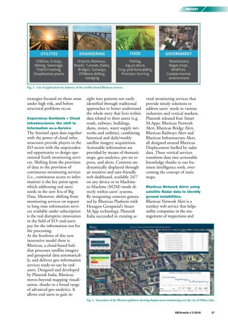
Fig. 2 - List of applications by industry of the satellite-based Rheticus services.<br />
strategies focused on those areas<br />
under high risk, and before<br />
structural problems occur.<br />
Copernicus Sentinels + Cloud<br />
infrastructures: the shift to<br />
Information as-a-Service<br />
The Sentinel open data together<br />
with the power of cloud infrastructures<br />
provide players in the<br />
EO sector with the unprecedented<br />
opportunity to design operational<br />
Earth monitoring services.<br />
Shifting from the provision<br />
of data to the provision of<br />
continuous monitoring services<br />
(i.e., continuous access to information)<br />
is the key point upon<br />
which addressing real users’<br />
needs in the new Era of Big<br />
Data. Moreover, shifting from<br />
monitoring services on request<br />
to long time information services<br />
available under subscription<br />
is the real disruptive innovation<br />
in the field of EO: end-users<br />
pay for the information not for<br />
the processing.<br />
At the forefront of this new<br />
innovative model there is<br />
Rheticus, a cloud-based hub<br />
that processes satellite imagery<br />
and geospatial data automatically,<br />
and delivers geo-information<br />
services ready-to-use by endusers.<br />
Designed and developed<br />
by Planetek Italia, Rheticus<br />
moves beyond mapping visualisation,<br />
thanks to a broad range<br />
of advanced geo-analytics. It<br />
allows end-users to gain insight<br />
into patterns not easily<br />
identified through traditional<br />
approaches to better understand<br />
the whole story that lives within<br />
data related to their assets (e.g.<br />
roads, railways, buildings,<br />
dams, mines, water supply networks<br />
and utilities), combining<br />
historical and daily/weekly<br />
satellite imagery acquisitions.<br />
Actionable information are<br />
provided by means of thematic<br />
maps, geo-analytics, pre-set reports,<br />
and alerts. Contents are<br />
dynamically displayed through<br />
an intuitive and user-friendly<br />
web dashboard, available 24/7<br />
on any device or in Machineto-Machine<br />
(M2M) mode directly<br />
within users’ systems.<br />
By integrating contents generated<br />
by Rheticus Platform with<br />
Hexagon Geospatial’s Smart<br />
M.App technology, Planetek<br />
Italia succeeded in creating several<br />
monitoring services that<br />
provide timely solutions to<br />
address users’ needs in various<br />
industries and vertical markets.<br />
Planetek released four Smart<br />
M.Apps: Rheticus Network<br />
Alert, Rheticus Bridge Alert,<br />
Rheticus Railways Alert and<br />
Rheticus Infrastructure Alert,<br />
all designed around Rheticus<br />
Displacement fuelled by radar<br />
data. These vertical services<br />
transform data into actionable<br />
knowledge thanks to our business<br />
intelligence tools, overcoming<br />
the concept of static<br />
maps.<br />
Rheticus Network Alert: using<br />
satellite Radar data to identify<br />
ground instabilities.<br />
Rheticus Network Alert is a<br />
turnkey web service that helps<br />
utility companies in the management<br />
of inspections and<br />
Fig. 3 - Screenshot of the Rheticus platform showing displacement monitoring over the city of Milan, Italy.<br />
<strong>GEOmedia</strong> n°3-<strong>2018</strong> 37


