


Create successful ePaper yourself
Turn your PDF publications into a flip-book with our unique Google optimized e-Paper software.
NEWS<br />
LEICA GEOSYSTEMS ANNOUNCES<br />
MAJOR PERFORMANCE INCREASE IN<br />
AIRBORNE BATHYMETRIC SURVEY<br />
Leica Geosystems, part of Hexagon, announced today<br />
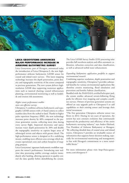
the introduction of Leica Chiroptera-5, the new highperformance<br />
airborne bathymetric LiDAR sensor for<br />
coastal and inland water surveys. This latest mapping<br />
technology increases the depth penetration, point density<br />
and topographic sensitivity of the sensor compared<br />
to previous generations. The new system delivers highresolution<br />
LiDAR data supporting numerous applications<br />
such as nautical charting, coastal infrastructure<br />
planning, environmental monitoring as well as landslide<br />
and erosion risk assessments.<br />
Higher sensor performance enables<br />
more cost-effective surveys<br />
Chiroptera-5 combines airborne bathymetric and topographic<br />
LiDAR sensors with a 4-band camera to collect<br />
seamless data from the seabed to land. Thanks to higher<br />
pulse repetition frequency (PRF), the new technology<br />
increases point density by 40% compared to the previous<br />
generation system, collecting more data during<br />
every survey flight. Improved electronics and optics<br />
increase water depth penetration by 20% and double<br />
the topographic sensitivity to capture larger areas of<br />
submerged terrain and objects with greater detail. The<br />
high-performance sensor is designed to fit a stabilising<br />
mount, enabling more efficient area coverage which decreases<br />
operational costs and carbon footprint of mapping<br />
projects.<br />
Leica Geosystems’ signature bathymetric workflow supports<br />
the sensor’s performance. Introducing near realtime<br />
data processing enables coverage analysis immediately<br />
after landing, allowing operators to quality control<br />
the data quickly before demobilising the system.<br />
The Leica LiDAR Survey Studio (LSS) processing suite<br />
provides full waveform analysis and offers automatic calibration,<br />
refraction correction and data classification,<br />
as well as advanced turbid water enhancement.<br />
Expanding bathymetric application portfolio to support<br />
environmental research<br />
Combining superior resolution, depth penetration and<br />
topographic sensitivity, Chiroptera-5 provides substantial<br />
benefits for various environmental applications like<br />
shoreline erosion monitoring, flood simulation and<br />
prevention and benthic habitat classification.<br />
Bundled with the FAAS/EASA certified helicopter pod,<br />
the system enables advanced terrain-following flying<br />
paths for efficient river mapping and complex coastlines<br />
surveys. Owners of previous generation systems are<br />
offered an easy upgrade path to Chiroptera-5 to add<br />
capabilities to their existing sensor and leverage their<br />
initial investment.<br />
“The first generation Chiroptera airborne sensor was<br />
flown in 2012. During its ten years of operation, the<br />
system has seen constant evolution that continuously<br />
improved the productivity and efficiency of the entire<br />
bathymetric surveying industry,” says Anders Ekelund,<br />
Vice President of Airborne Bathymetry at Hexagon.<br />
“By collecting detailed data of coastal areas and inland<br />
waters, Chiroptera-5 provides an invaluable source of<br />
information that supports better decision making, especially<br />
for environmental monitoring and management,<br />
in line with Hexagon’s commitment to a more sustainable<br />
future.”<br />
For more information please visit: http://leica-geosystems.com/chiroptera-5<br />
38 <strong>GEOmedia</strong> n°3-<strong>2022</strong>


