Precise Orbit Determination of Global Navigation Satellite System of ...
Precise Orbit Determination of Global Navigation Satellite System of ...
Precise Orbit Determination of Global Navigation Satellite System of ...

You also want an ePaper? Increase the reach of your titles
YUMPU automatically turns print PDFs into web optimized ePapers that Google loves.
Chapter 3 <strong>Orbit</strong> Tracking <strong>System</strong> and Their Error Budgets<br />
The S-Band orbit tracking systems are daily used by NASA and ESA for operational orbit determination <strong>of</strong><br />
various types <strong>of</strong> satellites. The advantage is that there are many tracking stations currently available all over the<br />
world. If they are used for satellite orbit determination <strong>of</strong> the GNSS-2 system, the costs could be much reduced<br />
because current equipment and tracking stations could be used without significant modification. A disadvantage<br />
is the low accuracy.<br />
3.1.3 IGS Tracking Station Network<br />
IGS Tracking Station Network was <strong>of</strong>ficially established in January 1, 1994 by the International Association <strong>of</strong><br />
Geodesy (IAG) (Beutler et al, 1996). The early objective <strong>of</strong> the IGS is to provide highly accurate orbits, earth<br />
rotation parameters, and station coordinates derived from GPS observations to support geodetic and geophysical<br />
research activities. Now the IGS products are not only used for geodetic and geodynamic research activities, but<br />
also support applications <strong>of</strong> atmospheric sciences, accurate time and frequency transfer.<br />
IGS tracking stations are equipped with high accuracy, dual frequency, P-code geodetic GPS receivers operating<br />
at a thirty-second sampling rate (Noll et al, 1996). At present, the IGS tracking station network is composed <strong>of</strong><br />
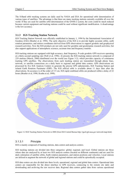
229 stations (March, 2000) distributed over the world (see Figure 3-2), which provides capacity <strong>of</strong> continuous<br />
tracking GPS satellites. The observations from each tracking station are transmitted through phone lines,<br />
network, or satellite connections on a daily basis to regional and global data centers. GPS observations are<br />
processed by five IGS Analysis Centers to generate the precise GPS ephemeredes, IGS Tracking Station and<br />
related Earth Rotation Parameter (ERP). The IGS <strong>of</strong>ficial orbit is available about 11 days later after the<br />
observations. Its accuracy is <strong>of</strong> the order <strong>of</strong> 3-5 cm. IGS rapid combined orbits are produced within a delay <strong>of</strong> 22<br />
hours (Beutler et al, 1996; Kouba et al, 1998).<br />
Figure 3-2 IGS Tracking Station Network in 2000 (from IGS Central Bureau http://igscb.jpl.nasa.gov/network/map.html)<br />
3.1.3.1 Principle<br />
IGS is mainly composed <strong>of</strong> tracking stations, data centers and analysis centers.<br />
IGS tracking stations are divided into three categories: global, regional, and local. <strong>Global</strong> stations are those<br />
whose data are analyzed by at least two IGS analysis centers (located on different continents) and are used for<br />
daily estimation <strong>of</strong> satellite orbits, Earth rotation parameters, and station positions and velocities. Local stations<br />
are utilized to augment the network <strong>of</strong> global and regional stations and could be episodically occupied.<br />
IGS data centers are also divided into three levels, operational, regional and global data centers. Operational data<br />
centers are responsible for the direct interface to GPS receivers, connecting to the remote site daily and<br />
downloading and archiving the raw receiver data. Regional data centers gather data from various operational<br />
20