- Page 1 and 2:
INTERNATIONAL BIBLIOGRAPHY OF VEGET
- Page 3 and 4:
INTERNATIONAL BIBLIOGRAPHY OF VEGET
- Page 5 and 6:
PRINTED IN LAWRENCE, KANSAS, U.S.A.
- Page 7 and 8:
name. All of them deserve my most s
- Page 9 and 10:
may be published long after they we
- Page 11 and 12:
graphical as indicated in the table
- Page 13 and 14:
SOUTH AMERICA SOUTH By A. W. AMERIC
- Page 15 and 16:
SOUTH AMERICA LAMB, W. H. 1916 In Z
- Page 17 and 18:
SOUTH AMERICA 2. Hardwood forests o
- Page 19 and 20:
SOUTH AMERICA 1928 "SOUTH AMERICA"
- Page 21 and 22:
1930 "SOUTH AMERICA BETWEEN LATITUD
- Page 23 and 24:
SOUTH AMERICA Reprinted: 1 95 3, 1:
- Page 25 and 26:
SOUTH AMERICA b. Dornbuschwald c. P
- Page 27 and 28:
SOUTH AMERICA JAMES, PRESTON E. 193
- Page 29 and 30:
SOUTH AMERICA 1942 "APPROXIMATE LOC
- Page 31 and 32:
SOUTH AMERICA UNSTEAD, J. F. AND E.
- Page 33 and 34:
SOUTH AMERICA C. Semideciduous upla
- Page 35 and 36:
3. Barrskog 6. Õken 4. Savann 7. O
- Page 37 and 38:
SOUTH AMERICA 32. Región de los ll
- Page 39 and 40:
SOUTH AMERICA 5. Prairie 6. Steppe
- Page 41 and 42:
SOUTH AMERICA LEGEND 1. Tropischer
- Page 43 and 44:
SOUTH AMERICA Dioscorea spectabilis
- Page 45 and 46:
SOUTH AMERICA 42. Tucuman-Cordoba s
- Page 47 and 48:
SOUTH AMERICA 10. Devastierter oder
- Page 49 and 50:
SOUTH AMERICA 2. Andean tropical fo
- Page 51 and 52:
SOUTH AMERICA 4. Thorn and succulen
- Page 53 and 54:
SOUTH AMERICA MANN, G. 1 9 68 "Die
- Page 55 and 56:
SOUTH AMERICA 11. ditto: Region der
- Page 57 and 58:
G SOUTH AMERICA b. Von Wanderdünen
- Page 59 and 60:
SOUTH AMERICA 19. Domínio do "mont
- Page 61 and 62:
LEGEND 1. Chaco 4. Salinas 2. Monte
- Page 63 and 64:
ARGENTINA SKOTTS BERG, CARL 190 5 "
- Page 65 and 66:
ARGENTINA 4. Cespugliati fitti e ma
- Page 67 and 68:
"ZONAS CUBIERTAS POR Araucaria arau
- Page 69 and 70:
ARGENTINA LEGEND 1. Salzpflanzen (v
- Page 71 and 72:
ARGENTINA 3. Región con bosque cad
- Page 73 and 74:
ARGENTINA LEGEND 1. Selva subtropic
- Page 75 and 76:
ARGENTINA de Gruyter Verlag. Reprin
- Page 77 and 78:
ARGENTINA 9. Mancha con jarilla (La
- Page 79 and 80:
ARGENTINA 5. Feuchte Park- u. Savan
- Page 81 and 82:
ARGENTINA 1942 "NORTHWESTERN ARGENT
- Page 83 and 84:
ARGENTINA 1944 "LA PAMPA—REGIONES
- Page 85 and 86:
ARGENTINA LEGEND 1. Prairie 2. Rain
- Page 87 and 88:
ARGENTINA b. Bosque de Nothofagus d
- Page 89 and 90:
ARGENTINA 7. Monte c. Micromonte pu
- Page 91 and 92:
ARGENTINA CABRERA, ANGEL LULIO 1 95
- Page 93 and 94:
ARGENTINA 8. Semidesierto patagóni
- Page 95 and 96:
ARGENTINA Pftanzen- in der Provinz
- Page 97 and 98:
ARGENTINA LEGEND 1. Bosque alto cer
- Page 99 and 100:
ARGENTINA 8. Jumial de saladillo: e
- Page 101 and 102:
LEGEND ARGENTINA A. Dominio de la A
- Page 103 and 104:
RAGONESE, ARTURO E. ARGENTINA 1 96
- Page 105 and 106:
ARGENTINA 1. Bosque higrófilo maga
- Page 107 and 108:
ARGENTINA 15. Isletas de chañar. F
- Page 109 and 110:
ARGENTINA RAGONESE, ARTURO E. 1967
- Page 111 and 112:
ARGENTINA 1967 "DISPOSICIÓN DE ALG
- Page 113 and 114:
ARGENTINA MARLANGE, M. 1 9 73 "Cont
- Page 115 and 116:
ARGENTINA 14. Nothojagus antárctic
- Page 117 and 118:
ARGENTINA 6. Vinalar bosque 7. Vina
- Page 119 and 120:
6. Bosques de transición 12. Pelad
- Page 121 and 122:
ARGENTINA 7. Matorral claro enano,
- Page 123 and 124:
ARGENTINA 15. Cauces transitorios e
- Page 125 and 126:
ARGENTINA 18. Pastizales (espartill
- Page 127 and 128:
2. Vegetación de ambientes salinos
- Page 129 and 130:
BOLIVIA 5. Polylepisgehölze, gemis
- Page 131 and 132:
BOLIVIA LEGEND 1. Hylea 2. Formaci
- Page 133 and 134:
BOLIVIA 30. Bosque semi siempre ver
- Page 135 and 136:
BOLIVIA LEGEND 1. Tierras con pasto
- Page 137 and 138:
BRAZIL 1900 "DEN SYD-BRASILIANSKA V
- Page 139 and 140:
BRAZIL 7. Formações xerophilas (c
- Page 141 and 142:
BRAZIL 1923 "MAPPA DAS MATT AS E CA
- Page 143 and 144:
BRAZIL MORAES REGO FLORES, LUIZ DE
- Page 145 and 146:
BRAZIL FREISE, FRIEDRICH W. 193 8 "
- Page 147 and 148:
BRAZIL 5. Caatingas 7. Vegetação
- Page 149 and 150:
BRAZIL LEGEND 1. Mato 2. Campo WAIB
- Page 151 and 152:
BRAZIL 1950 "MAPA DA VEGETAÇÃO DO
- Page 153 and 154:
BRAZIL 14. Comunidades herbáceas c
- Page 155 and 156:
BRAZIL 3. Areas de ocorrência da f
- Page 157 and 158:
BRAZIL 1952 "PLANTA FITOGEOGRÁFICA
- Page 159 and 160:
BRAZIL FROÉS ABREU, SYLVIO 195 7 0
- Page 161 and 162:
BRAZIL 6. Áreas ocupadas com cultu
- Page 163 and 164:
BRAZIL 7. Campos inundáveis 8. Pal
- Page 165 and 166:
BRAZIL 1959 "ESBOÇO DA DISTRIBUÇ
- Page 167 and 168:
BRAZIL 1959 "GRANDE REGIÃO SUL, TI
- Page 169 and 170:
BRAZIL ANONYMOUS 196 2 Rio de Janei
- Page 171 and 172:
BRAZIL 4. Copernicia-Tabebuia-Cttra
- Page 173 and 174:
BRAZIL LEÃO, ANTÔNIO CARLOS AND J
- Page 175 and 176:
BRAZIL 1966 "TIPOS DE VEGETAÇÃO"
- Page 177 and 178:
BRAZIL LEGEND A. Savanna woodlands
- Page 179 and 180:
BRAZIL b. Brejo c. Mangue d. Várze
- Page 181 and 182:
BRAZIL 1970 "BRASIL: VEGETAÇÃO" i
- Page 183 and 184:
BRAZIL TROPPMAIR, HELMUT 1971 "Perf
- Page 185 and 186:
BRAZIL 4. Caatinga 5. Cerrado 6. Ca
- Page 187 and 188:
BRAZIL ANONYMOUS 1974 Brasilia, Min
- Page 189 and 190:
BRAZIL 3. Floresta tropical de alti
- Page 191 and 192:
BRAZIL 9. Floresta densa, baixo pla
- Page 193 and 194:
BRAZIL 1973-1976 "PORTO VELHO, MAPA
- Page 195 and 196:
BRAZIL ANONYMOUS 19 77 Brasilia, Mi
- Page 197 and 198:
BRAZIL nância de ipé-amarelo (Tab
- Page 199 and 200:
CHILE CHILE by REYNALDO BÕRGEL OLI
- Page 201 and 202:
CHILE LEGEND 1. Desierto costero 2.
- Page 203 and 204:
CHTLE 7. Vegetationsgebiet mit somm
- Page 205 and 206:
CHILE 1964 "REGIONES BIOGEOGRÁEICA
- Page 207 and 208:
CHILE LEGEND 1. Bosques de Nothofag
- Page 209 and 210:
CHILE 2. Lagos y lagunas 3. Desiert
- Page 211 and 212:
CHILE 9. Asociación Maytenus magel
- Page 213 and 214:
COLOMBIA COLOMBIA by A. W. KÜCHLER
- Page 215 and 216:
COLOMBIA 1948 "DISTRIBUTION OF THE
- Page 217 and 218:
COLOMBIA 7. Bosque pluvial tropical
- Page 219 and 220:
COLOMBIA LEGEND 1. Manglar y otras
- Page 221 and 222:
COLOMBIA 1966 "VALLE DEL CAUCA: bla
- Page 223 and 224:
COLOMBIA LEGEND A. Bosques naturale
- Page 225 and 226:
COLOMBIA 3. Libidibia-Trockenbuschw
- Page 227 and 228:
COLOMBIA 1977 "COLOMBIA: in color E
- Page 229 and 230:
COLOMBIA 10. Bosque húmedo montano
- Page 231 and 232:
ECUADOR LEGEND 1. Páramo 2. Regió
- Page 233 and 234:
ECUADOR ANONYMOUS 1 95 8 [Separatel
- Page 235 and 236:
ECUADOR 5. Bosques de hoja ancha de
- Page 237 and 238:
FRENCH GUYANA FRENCH GUYANA by A. W
- Page 239 and 240:
GUYANA 8. Dry savannah 10. Areas no
- Page 241 and 242:
GUYANA 11. Low, open mangrove woodl
- Page 243 and 244:
NETHERLANDS ANTILLES NETHERLANDS AN
- Page 245 and 246: NETHERLANDS ANTILLES III. Other 18.
- Page 247 and 248: PARAGUAY F. Chaco-Region 12. Haloph
- Page 249 and 250: PARAGUAY 4. Zona central media y no
- Page 251 and 252: PARAGUAY 1969 "PARAGUAY: VEGETATION
- Page 253 and 254: PARAGUAY LEGEND 1. Bosque 2. Prader
- Page 255: PERU 11. Gehölze wie bei No. 10, a
- Page 258 and 259: PERU LEGEND 1. Mountain forest 5. P
- Page 260 and 261: PERU 12. Bosques naturales de Quinu
- Page 262 and 263: PERU 1956 "VEGETATION OF THE EASTER
- Page 264 and 265: PERU 3. Bosque de pendientes accide
- Page 266 and 267: PERU ANONYMOUS 197 5 Inventario, ev
- Page 268 and 269: PERU LEGEND A. Desierto premontano
- Page 270 and 271: PERU ANONYMOUS 1 96 2 in Week, Joha
- Page 272 and 273: PERU 1962 "ZONA DE LA SAIS "TUPAC A
- Page 274 and 275: PERU ROBINSON, DAVID A. 1 96 4 Peru
- Page 276 and 277: PERU LEGEND 1. Bosque seco tropical
- Page 278 and 279: PERU de la costa, cuencas de los R
- Page 280 and 281: PERU 4. Área hidromórfica 5. Mont
- Page 282 and 283: PERU 13. Bosques residuales F. Tund
- Page 284 and 285: PERU 9. Bosque seco tipo sabana 10.
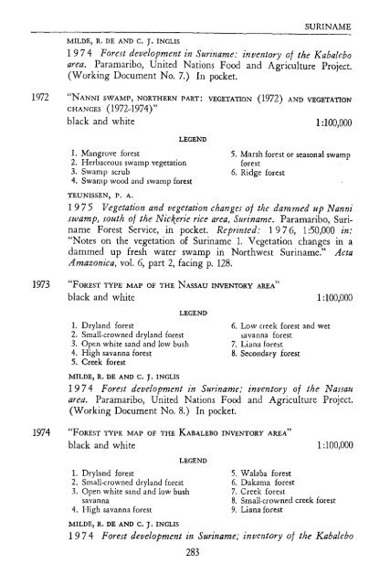
- Page 286 and 287: SURINAME SURINAME by P. A. TEUNISSE
- Page 288 and 289: SURINAME LINDEMAN, J. C. 195 3 "The
- Page 290 and 291: SURINAME 1954 "VEGETATIONSTYPEN IN
- Page 292 and 293: SURINAME Reprinted: 1 9 60, 1:67,00
- Page 294 and 295: SURINAME LEGEND 1. Vegetation of wh
- Page 298 and 299: SURINAME locally xerophytic forest;
- Page 300 and 301: TRINIDAD and TOBAGO TRINIDAD and TO
- Page 302 and 303: TRINIDAD and TOBAGO 28. Poix doux-r
- Page 304 and 305: TRINIDAD and TOBAGO LEGEND 1. Monta
- Page 306 and 307: URUGUAY LEGEND 1. Cultivated vegeta
- Page 308 and 309: VENEZUELA VENEZUELA by VALOIS GONZA
- Page 310 and 311: VENEZUELA LEGEND 1. Selva 3. Scrub
- Page 312 and 313: VENEZUELA VEILLON, J. P. 194 8 [Sep
- Page 314 and 315: VENEZUELA MAGUIRE, BASSETT 195 5 "C
- Page 316 and 317: VENEZUELA botánicos sobre el Pico
- Page 318 and 319: VENEZUELA LEGEND 1. Pantano con veg
- Page 320 and 321: VENEZUELA VILA, PABLO 19 6 0 Geogra
- Page 322 and 323: VENEZUELA LEGEND 1. Selvas y bosque
- Page 324 and 325: VENEZUELA 3. Scoparia dulcís L. 4.
- Page 326: UNIVERSITY OI? KANSAS PUBLICATIONS


