BOOK degli ABSTRACT - Dipartimento di Economia e Sistemi ...
BOOK degli ABSTRACT - Dipartimento di Economia e Sistemi ...
BOOK degli ABSTRACT - Dipartimento di Economia e Sistemi ...
- No tags were found...

You also want an ePaper? Increase the reach of your titles
YUMPU automatically turns print PDFs into web optimized ePapers that Google loves.
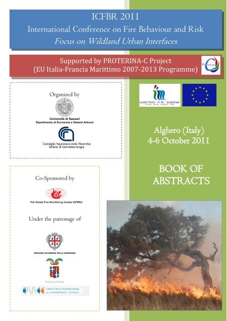
ICFBR 2011International Conference on Fire Behaviour and RiskFocus on Wildland Urban InterfacesSupported by PROTERINA-C Project(EU Italia-Francia Marittimo 2007-2013 Programme)Organized byUniversità <strong>di</strong> Sassari<strong>Dipartimento</strong> <strong>di</strong> <strong>Economia</strong> e <strong>Sistemi</strong> ArboreiAlghero (Italy)4-6 October 2011Co-Sponsored by<strong>BOOK</strong> OF<strong>ABSTRACT</strong>SUnder the patronage ofREGIONE AUTONOMA DELLA SARDEGNA
ICFBR 2011International Conference on Fire Behaviour and RiskFocus on Wildland Urban InterfacesAlghero (Italy), 4-6 October, 2011Supported by PROTERINA-C Project:A forecast and prevention system for climate change impacts on riskvariability for wildlands and urban areas(EU Italia-Francia Marittimo 2007-2013 Programme)E<strong>di</strong>ted byPierpaolo DuceNational Research Councilof Italy, Institute of Biometeorology(CNR-IBIMET), Sassari, ItalyDonatella SpanoDepartment of Economics and Woody PlantSystems (DESA), University of Sassari, Italy;Euro-Me<strong>di</strong>terranean Center for ClimateChanges, IAFENT Division, Sassari, Italy
© Department of Economics and Woody Plant Systems (DESA), University of Sassari, Italy;National Research Council of Italy, Institute of Biometeorology (CNR-IBIMET), Sassari, ItalyISBN 978-88-6025-190-9 Supported by Co-Sponsored byEDESE<strong>di</strong>trice Democratica SardaVia Principessa Iolanda, 97 –Tel. 079.262236SASSARIPROTERINA-C ProjectEU Italia-Francia Marittimo 2007-2013 ProgrammeGraphic Design and LayoutValentina Bacciu and MicheleSalisPrinted byTAS, Tipografi Associati SassariZona Industriale Predda NieddaSud – Strada 10SASSARIUnder the patronage ofREGIONE AUTONOMA DELLA SARDEGNAOctober,2011
«Dixerat ille, et iam per moenia clarior ignisau<strong>di</strong>tur, propiusque aestus incen<strong>di</strong>a volvunt.―ergo age, care pater, cervici imponere nostrae;ipse subibo umeris nec me labor iste gravabit;quo res cumque cadent, unum et commune periclum,una salus ambobus erit.‖ »Publius Vergilius MaroAeneis, Liber II, vv 705-710«He spoke; and higher o'er the blazing wallsleaped the loud fire, while ever nearer drewthe rolling surges of tumultuous flame.―Haste, father, on these ben<strong>di</strong>ng shoulders climb!This back is ready, and the burden light;one peril smites us both, whate'er befall;one rescue both shall find.‖ »Publius Vergilius MaroAeneid, Book II, vv 705-710Theodore C. Williams, trans., 1910
ICFBR 2011International Conference on Fire Behaviour and RiskAlghero, Italy - October 4-6, 2011Scientific CommitteeConvenorsPierpaolo DuceNational Research Council of Italy, Institute ofBiometeorology (CNR-IBIMET), Sassari, ItalyDonatella SpanoDepartment of Economics and Woody PlantSystems (DESA), University of Sassari, Italy;Euro-Me<strong>di</strong>terranean Center for Climate Changes,IAFENT Division, Sassari, ItalyMembersBachisio Arca Institute of Biometeorology – CNR IBIMET (ITALY)Margarita Arianoutsou-FaragitakiValentina BacciuUniversity of AthensEuroMe<strong>di</strong>terranean Center for Climate Change –CMCC, IAFENT Division;University of Sassari – DESA(GREECE)(ITALY)Carlos Borrego University of Aveiro (PORTUGAL)Giovanni Bovio University of Torino (ITALY)Francisco Castro Rego University of Lisbon (PORTUGAL)Jack CohenMarco ConederaUSDA Forest Service – Rocky Mountain ResearchStation, Missoula, MTSwiss Federal Institute for Forest, Snow andLandscape Research, Bellinzona(USA)(SWITZERLAND)Clau<strong>di</strong>o Conese Institute of Biometeorology – CNR IBIMET (ITALY)Sandro Dettori University of Sassari – DESA (ITALY)John Dold University of Manchester (UK)Mike FlanniganCana<strong>di</strong>an Forest Service, Northern Forestry Centre,Alberta(CANADA)iii
ICFBR 2011International Conference on Fire Behaviour and RiskAlghero, Italy - October 4-6, 2011Francis FujiokaUSDA Forest Service, Pacific Southwest ResearchStation, Riverside, CA(USA)Corinne Lampin CEMAGREF, Aix-en-Provence (FRANCE)Stefano Mazzoleni University of Napoli (ITALY)Domingo Molina Terren University of Lleida (SPAIN)Josè Manuel MorenoRodriguezUniversity of Castilla La Mancha(SPAIN)Grazia Pellizzaro Institute of Biometeorology – CNR IBIMET (ITALY)Michele SalisJesús San-Miguel-AyanzUniversity of Sassari – DESA; EuroMe<strong>di</strong>terraneanCenter for Climate Change – CMCC, IAFENTDivisionInstitute for Environment and Sustainability – EC –JRC, Ispra, Varese(ITALY)(ITALY)Albert Simeoni Worcester Polytechnic Istitute, Worcester, MA (USA )Costantino SircaRamon Vallejo CalzadaUniversity of Sassari – DESA;EuroMe<strong>di</strong>terranean Center for Climate Change –CMCC, IAFENT DivisionCentro de Estu<strong>di</strong>os Ambientales del Me<strong>di</strong>terraneoCEAM(ITALY)(SPAIN)Andrea Ventura Istitute of Biometeorology – CNR IBIMET (ITALY)Xavier Viegas Domingos University of Coimbra (PORTUGAL)Gavriil XanthopoulosInstitute of Me<strong>di</strong>terranean Forest Ecosystems andForest Products Technology – NAGREF, Athens(GREECE)iv
ICFBR 2011International Conference on Fire Behaviour and RiskAlghero, Italy - October 4-6, 2011Organizing CommitteeGiorgio Onorato CicalòNicolò Antonio CorrainePierpaolo DucePaolo FiorucciUlderica Paro<strong>di</strong>Paul Antoine SantoniDonatella SpanoCivil Protection – Sar<strong>di</strong>nia Forest ServiceARPAS – Environmental Protection Agency of Sar<strong>di</strong>niaInstitute of Biometeorology – CNR IBIMETCIMA Research Foundation – International Centre on EnvironmentalMonitoringCivil Protection of LiguriaUniversity of CorsicaUniversity of Sassari – DESA;EuroMe<strong>di</strong>terranean Center for Climate Change – CMCC, IAFENTDivisionValentina BacciuElena CampusTiziano GhisuGian Valeriano PintusMichele SalisScientific SecretariatEuroMe<strong>di</strong>terranean Center for Climate Change – CMCC, IAFENTDivision;University of Sassari – DESAInstitute of Biometeorology – CNR IBIMETInstitute of Biometeorology – CNR IBIMETInstitute of Biometeorology – CNR IBIMETUniversity of Sassari – DESA;EuroMe<strong>di</strong>terranean Center for Climate Change – CMCC, IAFENTDivisionOrganizing SecretariatElena CampusMarcello CillaraCinzia FoisGian Valeriano PintusInstitute of Biometeorology – CNR IBIMETUniversity of Sassari – DESAUniversity of Sassari – DESAInstitute of Biometeorology – CNR IBIMETv
ConvenorsICFBR 2011International Conference on Fire Behaviour and RiskAlghero, Italy - October 4-6, 2011DONATELLA SPANOProfessor at the Department of Economics and Woody PlantEcosystems (DESA) at the University of Sassari and coor<strong>di</strong>nator ofthe Euro-Me<strong>di</strong>terranean Center on Climate Changes (CMCC) Unitin Sassari, Italy. She is Chair of the PhD Course on Agrometeorologyand Ecophysiology. Appointed to the Italian Department of CivilProtection - National Committee on Natural Hazards, subcommitteeon Forest Fire. She is a biometeorogist with relevant experience onresearch activity on the interaction between the lower atmosphere andvegetative surfaces with emphasis on the development and refinementof micrometeorological methods for estimating evapotranspiration andCO2 exchanges. Most recent research effort is <strong>di</strong>rected towards the development and testing of wildfire riskand forecasting models and the assessment of climate change impacts on agricultural and forest ecosystems.She is involved as principle investigator in several national and international research projects and authoredand co-authored more than 150 national and international scientific papers. She is serving as Pro Rector ofScientific Research at the University of Sassari.PIERPAOLO DUCESenior research scientist, head of the research unit of the Institute ofBiometeorology (CNR Ibimet) located in Sassari, biometeorologistwith relevant experience in research team and project management. Hedeveloped a significant experience on biometeorological andecophysiological researches with emphasis on methods and modelingfor the analysis and protection of agricultural and forest ecosystem.Specific research activities have been conducted on: (i) flux modellingin agricultural and forest systems, (ii) methods and instruments formonitoring terrestrial ecosystems, and (iii) ecophysiology of crops andforest species. Most recent research efforts were <strong>di</strong>rected to modellingenergy and mass exchanges in the lower atmosphere, to assess Me<strong>di</strong>terranean ecosystems functioning, todetermine fire risk and behaviour, and to investigate potential climate change impacts on agricultural andnatural ecosystems. He is currently involved in several national and international research projects aiming tobetter understand forest and shrubland ecosystems functioning and improve fire behaviour modelling. Todate, he has authored and co-authored more than 150 national and international scientific papers.vi
ICFBR 2011International Conference on Fire Behaviour and RiskAlghero, Italy - October 4-6, 2011ForewordDear friends and colleagues,Welcome to the International Conference on Fire Behaviour and Risk 2011 and to Alghero!ICFBR2011 is organized by the Institute of Biometeorology of the National Research Council of Italy (CNR Ibimet,Sassari) and the Department of Economics and Woody Plant Ecosystems (DESA) of the University of Sassari with thepurpose of exchanging scientific results, information, and experiences between Me<strong>di</strong>terranean and extra-Me<strong>di</strong>terraneancountries and contributing to the reinforcement of forest fire knowledge, prevention and suppression.The Me<strong>di</strong>terranean basin ecosystems are extremely sensitive and vulnerable to anthropogenic <strong>di</strong>sturbances and fire is oneof the most significant threats for the Me<strong>di</strong>terranean forested areas. In the last three decades, forest fires showed anincrease of both occurrence and number of extreme fire seasons. Moreover, a growing number of fires threats thewildland-urban interface, with potential risk for people safety and damage for villages, tourist resorts and other humanactivities. Therefore, the development of fire management policies are required to reduce the wildland and wildlandurbaninterface fire risk by applying methods and models for planning the operational phases of fire management. In theMe<strong>di</strong>terranean countries, considerable knowledge, several tools and adapted methodologies, typical for each country,were developed to help in improving the efficiency in forest fire prevention and suppression systems and they need to bebetter known and shared.The Conference, an initiative of the Proterina-C Project (A forecast and prevention system for climate change impactson risk variability for wildlands and urban areas), is co-funded by the European Regional Development Fund under theTransboundary Co-operation Program ―Italy-France Maritime‖, and is co-sponsored by the Global Fire MonitoringCenter (GFMC), an activity of the UN International Strategy for Disaster Reduction (UN-ISDR), with the patronageof the Regional Administration of Sar<strong>di</strong>nia, the Province Administration of Sassari, and the Euro-Me<strong>di</strong>terranean Centrefor Climate Change (CMCC).The aim is to present advancements in forest fire research and to illustrate the contribution of researchers to scientificand operational knowledge of wildland fire, with particular attention to fire behaviour and risk modelling, relationshipsbetween climate and fires, and fire risk at wildland urban interface. Every session is opened by keynote speakers fromUSDA and Cana<strong>di</strong>an Forest Services, which will present the state-of-the-art of each issue and specific research stu<strong>di</strong>es.Special sessions are de<strong>di</strong>cated to illustrate results from the Proterina-C Project and to give an overview of the morerelevant European projects. The present Book of Abstracts contains all the lectures, papers and posters that wereaccepted for presentation at the Conference, with the original version in English as well as the French and Italiantranslation.We would like to thank all the Authors for their interest and contribution to the Conference. The good quality of thesubmitted papers was acknowledged by the Scientific Committee of the Conference that evaluated more than 130papers. We would also like to express our personal thanks to all the components of the Organizing Committee and theSecretariat for the great effort and care during all the months that preceded the Conference days. Lastly, with over 25Countries from around the globe here these days, we thank you for coming.We hope that you will enjoy ICFBR2011, learn something new, <strong>di</strong>scuss the issues, take time to renew contacts andmake new friends.Yours sincerely,The Convenors of the Conference:Pierpaolo DuceDonatella Spanovii
Keynote SpeakersICFBR 2011International Conference on Fire Behaviour and RiskAlghero, Italy - October 4-6, 2011FRANCIS FUJIOKAis a Research Meteorologist with the USDA Forest Service, assigned tothe Pacific Southwest Research Station in Riverside, California. Hespecializes in the development of weather models for fire managementapplications, such as weather/fire behavior simulation and pre<strong>di</strong>ction,and seasonal fire potential forecasting at regional and national scales. Dr.Fujioka served as Project Leader for Fire Meteorology and FireManagement Research in the PSW Station at Riverside. His AMSinvolvement has included co-chair for three AMS Fire and ForestMeteorology Conferences, and member of the Committee onAgricultural and Forest Meteorology. He also served as a member of the2007 Fire Weather Research Working Group commissioned by theNOAA Science Advisory Board to review the nation's research andoperational needs for fire weather information. Dr. Fujioka's current research focuses on developing riskassessment tools for fire management decision support. He has B.S. and M.S. degrees in meteorology from theUniversity of Hawaii, an M.A. degree in statistics from the University of California, Berkeley, and a Ph.D.degree in Earth Sciences from the University of California, Riverside.MIKE FLANNIGANis a professor with the Department of Renewable Resources at theUniversity of Alberta and a senior Research Scientist with the Cana<strong>di</strong>anForest Service. He received his BSc (Physics) from the University ofManitoba, his MS (Atmospheric Science) from Colorado StateUniversity and his PhD (Plant Sciences) from Cambridge University. Healso completed Meteorologist course MT35 with Environment Canadaand worked as a meteorologist for a few years. Dr. Flannigan‘s primaryresearch interests include fire and weather/climate interactions inclu<strong>di</strong>ngthe potential impact of climatic change, lightning-ignited forest fires,landscape fire modelling and interactions between vegetation (peat inparticular), fire and weather. He was the E<strong>di</strong>tor-in-Chief of theInternational Journal of Wildland Fire (2002-2008) and has taken onleadership roles with the US National Assessment on Global Change, IPCC, IGBP Fire Fast Track Initiativeand Global Change Terrestrial Ecosystems (GCTE) efforts on the global impacts of fire. He is the <strong>di</strong>rector ofthe newly formed Western Partnership for Wildland Fire Science located at the University of Alberta.viii
ICFBR 2011International Conference on Fire Behaviour and RiskAlghero, Italy - October 4-6, 2011JACK COHENis a Research Physical Scientist for the Missoula Fire SciencesLaboratory. He has been involved in wildland fire research since1972 and has served at US Forest Service fire laboratories inMissoula, MT, Riverside, CA and Macon, GA. He was a codeveloperof the U.S. National Fire Danger Rating System and hascontributed to the development of U.S. fire behavior pre<strong>di</strong>ctionsystems. At the Riverside Fire Laboratory he conducted research onlive fuel fire behavior in southern California shrub lands (chaparral)and also served operationally as a prescribed fire ignition supervisorand fire behavior analyst. For most of two decades Dr. Cohenfocused his research on how wildland-urban interface (WUI) fire<strong>di</strong>sasters occur and how homes ignite during extreme wildfires. Hewas one of the principal scientists involved in the International Crown Fire Modeling Experiment, NWT,Canada, where he investigated the thermal characteristics of crown fire related to structure ignition and firespread. He currently focuses his research on the fire dynamics related to live shrub and tree canopy firebehavior (active crown fires) and continues a portion of his time revealing opportunities for preventingwildland-urban fire <strong>di</strong>sasters.ix
First SessionEuropean Projects on Forest Fires
ICFBR 2011International Conference on Fire Behaviour and RiskAlghero, Italy - October 4-6, 2011PR.1 - An overview of the Proterina-C European projectParo<strong>di</strong> U. 1 , Fanti S. 2 , Galar<strong>di</strong> M. 11. Regione Liguria, Via Fieschi, 15 16121 Genova, Italy; 2. CIMA Foundation,Via Magliotto, 2 1700 Savona, Italyulderica.paro<strong>di</strong>@regione.liguria.it, silvia.fanti@regione.liguria.it, massimo.galar<strong>di</strong>@regione.liguria.itThe PROTERINA-C project is funded, for the period 2009-2012, by the European cross-border maritimeITALIA-FRANCIA programme. It combines scientific activities with the design and experimentation of sustainablerisk mitigation measures for pilot areas and use of pre- operational forecast models for forest fires and wild-urbaninterface fires. The project aims to promote the scientific transfer to local communities and governmental authoritiesof the maritime border area by encouraging the development of sustainable policies and the construction and a sharedculture of risk mitigation. The project develops common tools for pre<strong>di</strong>cting risk (platforms and models) an<strong>di</strong>nvolves local communities in developing sustainable risk prevention projects. In ad<strong>di</strong>tion to the results of scientificstu<strong>di</strong>es that show some characters of interest and novelty the project highlights the importance of side by side workdone by scientific partners and technicians of local or regional authorities in developing pilot projects for sustainablerisk prevention, information activities and training. This working mode favours scientific enrichment of localoperators and the development of a greater attention of scientific community to operational and management issues.A further element of strength of the project PROTERINA-C is the multi-<strong>di</strong>sciplinary. The project sees involved abroad spectrum of scientists and professionals ranging from sociologists to physicists, to computing, statistics,biologists and plant physiologists, engineers and architects in a synergistic framework of scientific analysis for thedevelopment of sustainable prevention projects, risk management and spread of risk culture. The presentationillustrates the technical and financial aspects of the project and gives a rapid survey of the results obtained from theproject.Keywords: sustainability, risk prevention, climate change, risk management, European fun<strong>di</strong>ngIl progetto PROTERINA-C, finanziato per il triennio 2009-2012 nell'ambito del programma europeotransfrontaliero Italia-Francia marittimo, coniuga attività <strong>di</strong> tipo scientifico con la progettazione e realizzazione <strong>di</strong>interventi sperimentali <strong>di</strong> mitigazione del rischio su aree pilota e l'implementazione pre-operativa <strong>di</strong> modelli <strong>di</strong>previsione per gli incen<strong>di</strong> boschivi e <strong>di</strong> interfaccia. Il progetto vuole favorire il trasferimento <strong>di</strong> competenze dalmondo della ricerca scientifica alle comunità locali ed ai governi dell'area transfrontaliera favorendo lo sviluppo <strong>di</strong>politiche sostenibili e la costruzione ed una cultura del rischio con<strong>di</strong>visa nell'ambito della regione marittima. Sonostati quin<strong>di</strong> sviluppati strumenti comuni per la previsione dei rischi (piattaforme e modelli) e coinvolte le comunitàlocali nello sviluppo <strong>di</strong> progetti <strong>di</strong> prevenzione sostenibile del rischio. Oltre ai risultati dei lavori scientifici chepresentano alcuni caratteri <strong>di</strong> interesse e novità, si evidenzia l'importanza dell'affiancamento <strong>di</strong> partner scientifici eamministratori o tecnici <strong>di</strong> enti locali o regionali nella realizzazione dei progetti pilota <strong>di</strong> prevenzione sostenibile delrischio e nelle attività <strong>di</strong> informazione e formazione. Tale affiancamento favorisce sia l'arricchimento scientifico <strong>di</strong>chi si trova ad operare sul territorio sia lo sviluppo <strong>di</strong> una maggiore attenzione del mondo scientifico alleproblematiche gestionali ed operative. Un ulteriore elemento <strong>di</strong> forza del progetto Proterina-C è la multi<strong>di</strong>sciplinarietà.Il progetto vede infatti coinvolto un ampio spettro <strong>di</strong> scienziati ed operatori che spaziano dallasociologia alla fisica, all'informatica, alla matematica statistica, alla biologia e fisiologia vegetale, all'ingegneria edarchitettura in un quadro sinergico <strong>di</strong> analisi scientifica e sviluppo <strong>di</strong> progetti <strong>di</strong> prevenzione sostenibile e <strong>di</strong><strong>di</strong>ffusione della cultura del rischio. La presentazione illustra gli aspetti tecnici e finanziari del progetto oltre a fornireun rapido excursus dei risultati ottenuti dal progetto.Le projet PROTERINA-C est financé, pour la période 2009-2012, par le programme frontalier maritime Italie-France. Il combine des activités scientifiques avec la conception et l‘expérimentation des mesures durables demitigation du risque pour des zones pilotes et l‘utilisation de modèles de prévision pré-opérationnels pour lesincen<strong>di</strong>es de forêt et les incen<strong>di</strong>es de l‘interface péri-urbaine. Le projet vise à promouvoir le transfert scientifique auxcommunautés locales et aux autorités gouvernementales de la zone de frontière maritime en encourageant ledéveloppement de politiques durables et la construction d‘une culture partagée de la mitigation du risque. Il veloppeSESSION 1: European Projects on Forest FiresSESSION 2: European Project on Forest Fires3
ICFBR 2011International Conference on Fire Behaviour and RiskAlghero, Italy - October 4-6, 2011des outils or<strong>di</strong>naires de prévision du risque (plateformes et modèles) et implique les communautés locales dans ledéveloppement de projets de prévention durable du risque. Outre les résultats des études scientifiques qui ont montré certainstraits d‘intérêt et d‘innovation, le projet met en évidence l‘importance du travail côte à côte des partenaires scientifiques et destechniciens des autorités locales et régionales dans le développement de projets pilotes pour une prévention durable du risque,des activités d‘information et de formation. Ce mode de travail favorise l‘enrichissement scientifique des opérateurs locaux et ledéveloppement d‘une plus grande attention de la communauté scientifique aux questions de gestion et de fonctionnement. Unautre élément de force du projet PROTERINA-C est la multi<strong>di</strong>sciplinarité. Le projet semble impliquer un large spectre descientifiques et professionnels, allant des sociologues aux physiciens, informaticiens, statisticiens, biologistes et physiologistesdes plantes, ingénieurs et architectes dans un cadre synergique d‘analyse scientifique pour le développement de projets deprévention durable, gestion du risque et expansion de culture du risque. L‘article montre les aspects techniques et financiers duprojet et présente une étude rapide de ses résultats.4
ICFBR 2011International Conference on Fire Behaviour and RiskAlghero, Italy - October 4-6, 2011PR.2 - Fuel types and potential fire behavior in Sar<strong>di</strong>nia and Corsica islands: a pilot studyDuce P. 1 , Pellizzaro G. 1 , Arca B. 1 , Bacciu V. 2,3 , Salis M. 2,3 , Spano D. 2,3 , Santoni P.A. 4 , Barboni T. 4 ,Leroy V. 4 , Cancellieri D. 4 , Leoni E. 4 , Ferrat L. 4 , Perez Y. 41. National Research Council of Italy, Institute of Biometeorology (CNR-IBIMET), Sassari, Italy; 2. Department ofEconomics and Woody Plant Systems (DESA), University of Sassari, Italy; 3. Euro-Me<strong>di</strong>terranean Center for ClimateChanges, IAFENT Division, Sassari, Italy; 4. SPE UMR 6134 CNRS – University of Corsica, Campus Grimal<strong>di</strong> BP 52,20250 Corte, Francep.duce@ibimet.cnr.it, vbacciu@uniss.it, santoni@univ-corse.frWildland fires represent a serious threat to forests and wooded areas of Me<strong>di</strong>terranean Basin. Regar<strong>di</strong>ng the last tenyears, Spain, Portugal, Italy, Greece and France recorded an annual average of about 50,000 forest fires and about470,000 burned hectares (European Communities, 2009). Cover, type, humi<strong>di</strong>ty status, and biomass and necromassload of vegetation are critical variables in affecting wildland fire occurrence. In particular, fuel physical characteristicssuch as loa<strong>di</strong>ng (weight per unit area), size (particle <strong>di</strong>ameter), and bulk density (weight per unit volume) of the liveand dead biomass contribute to the spread, intensity, and severity of wildland fire. So that, the availability of accuratefuel data at <strong>di</strong>fferent spatial and temporal scales is essential for fire management applications, from fire behaviorpre<strong>di</strong>ction to fire effects simulation to ecosystem simulation modeling. One of the goals of Proterina-C project is toevaluate the fire danger in Me<strong>di</strong>terranean areas and characterize the vegetation parameters involved in the combustionprocess. In this context, the objectives of this work are i) to identify and describe the <strong>di</strong>fferent fuel types mainlyaffected by fire occurrence in Sar<strong>di</strong>nia and Corsica Islands and ii) clusterize the selected fuel types in function oftheir potential fire behavior. In the first part of the work, the available time series of fire event perimeters and theland use map data were crossed and analysed in order to identify the main land use types affected by fires. Fieldsampling sites were then randomly identified on selected vegetation types and the following variables were collected:live and dead fuel load, depth of the fuel layer, plant cover. Dead and live fuel load were inventoried following thestandar<strong>di</strong>zed classes (1h, 10h, 100h) of the USDA National Fire Danger Rating System. In the second part of thework the potential fire behavior for every experimental site was then calculated by BEHAVE fire behavior pre<strong>di</strong>ctionsystem (Andrews, 1989), using as input data the collected fuel variables. Fire behavior was simulated by setting<strong>di</strong>fferent weather scenarios representing the most frequent summer meteorological con<strong>di</strong>tions. The simulationoutputs (fireline intensity, rate of spread, flame length) were then used to perform a cluster analysis in order to groupthe <strong>di</strong>fferent fuel types based on their potential fire behavior. The results of this analysis can be used to produce firebehavior fuel maps that are important tools in locating and rating fuel treatments, evaluating fire hazard and risk forland management planning, and ai<strong>di</strong>ng in environmental assessments and fire danger programs modeling.Keywords: Proterina-C, fuel characteristics, potential fire behaviorGli incen<strong>di</strong> boschivi rappresentano una seria minaccia per foreste e aree boscate nelle aree del bacino delMe<strong>di</strong>terraneo. Negli ultimi <strong>di</strong>eci anni in Spagna, Portogallo, Francia, Italia e Grecia è stata registrata una me<strong>di</strong>aannuale <strong>di</strong> circa 50,000 incen<strong>di</strong> boschivi con una superficie bruciata <strong>di</strong> circa 470,000. L‘insorgenza <strong>di</strong> incen<strong>di</strong>boschivi è largamente influenzata anche da <strong>di</strong>verse variabili legate alla vegetazione quali la copertura, le con<strong>di</strong>zioni <strong>di</strong>umi<strong>di</strong>tà della vegetazione e il carico <strong>di</strong> biomassa e necromassa. In particolare, alcune caratteristiche del combustibilequali il carico, la <strong>di</strong>mensione delle particelle e la densità influiscono sulla velocità <strong>di</strong> propagazione, sull‘intensità esulla severità <strong>di</strong> un incen<strong>di</strong>o. La <strong>di</strong>sponibilità, a <strong>di</strong>fferenti scale spaziali e temporali, <strong>di</strong> dati accurati relativi alcombustibile è, quin<strong>di</strong>, essenziale per la previsione del comportamento dell‘incen<strong>di</strong>o, per simularne gli effetti e perattuare una corretta gestione del fenomeno. Uno <strong>degli</strong> obiettivi del progetto Proterina-C è quello <strong>di</strong> valutare ilpericolo <strong>di</strong> incen<strong>di</strong>o in area Me<strong>di</strong>terranea anche attraverso la caratterizzazione delle proprietà della vegetazione cheinfluenzano il processo <strong>di</strong> combustione. In questo contesto, gli obiettivi del presente lavoro sono: i) identificare edescrivere le <strong>di</strong>fferenti tipologie <strong>di</strong> combustibile vegetale maggiormente interessate dagli incen<strong>di</strong> boschivi in Sardegnae Corsica, ii) classificare le <strong>di</strong>verse tipologie <strong>di</strong> combustibile selezionate in funzione del comportamento potenzialedel fuoco associato ad esse. Nella prima parte del lavoro, i perimetri <strong>degli</strong> incen<strong>di</strong> passati e la mappa <strong>di</strong> uso del suolosono stati incrociati al fine <strong>di</strong> identificare quali fossero le tipologie <strong>di</strong> vegetazione maggiormente interessate dalfenomeno <strong>degli</strong> incen<strong>di</strong>. Successivamente, per le tipologie in<strong>di</strong>viduate, sono stati selezionati <strong>di</strong>versi siti sperimentaliSESSION 1: European Projects on Forest Fires5
ICFBR 2011International Conference on Fire Behaviour and RiskAlghero, Italy - October 4-6, 2011nei quali sono state misurate le seguenti grandezze: carico <strong>di</strong> combustibile vivo e morto, altezza dello strato <strong>di</strong> combustibile,copertura vegetale. Il carico <strong>di</strong> combustibile vivo e morto è stato sud<strong>di</strong>viso seguendo la classificazione standard (1h, 10h,100h) riportata nel National Fire Danger Rating System realizzato dall‘USDA. Nella seconda parte del lavoro, per ciascunsito sperimentale, è stato simulato, tramite l‘uso del fire behavior pre<strong>di</strong>ction system BEHAVE (Andrews, 1989), ilcomportamento potenziale del fuoco, usando le caratteristiche del combustibile misurate in campo come variabili <strong>di</strong> input. Ilcomportamento del fuoco è stato simulato utilizzando <strong>di</strong>fferenti scenari meteorologici rappresentativi delle con<strong>di</strong>zionimeteorologiche estive maggiormente frequenti nelle aree oggetto <strong>di</strong> stu<strong>di</strong>o. I risultati delle simulazioni (intensità del fronte <strong>di</strong>fiamma, velocità <strong>di</strong> propagazione, altezza della fiamma) sono stati analizzati me<strong>di</strong>ante cluster analysis per identificare <strong>di</strong>verseclassi <strong>di</strong> tipologie <strong>di</strong> combustibile in funzione del comportamento potenziale dell‘incen<strong>di</strong>o ad esse associato.Les incen<strong>di</strong>es de végétation représentent une menace grave pour les forêts et les zones boisées du bassin mé<strong>di</strong>terranéen.Concernant les <strong>di</strong>x dernières années, l‘Espagne, le Portugal, l‘Italie, la Grèce et la France ont enregistré une moyenne annuelled‘environ 50,000 incen<strong>di</strong>es de forêt et 470,000 ha brûlés (Communauté européenne, 2009). La couverture, le type, l‘étatd‘humi<strong>di</strong>té, ainsi que la biomasse et la charge de nécromasse de la végétation sont des variables critiques concernantl‘occurrence de feux de broussailles. En particulier, les caractéristiques physiques du combustible telles que la charge (massepar unité de surface), la taille (<strong>di</strong>amètre des particules) et la densité apparente (masse par unité de volume) de la biomassevivante et morte contribuent à la propagation, la puissance et la gravité du feu de broussailles. De ce fait, la <strong>di</strong>sponibilité dedonnées appropriées sur le combustible à <strong>di</strong>fférentes échelles spatio-temporelles est nécessaire pour les applications de gestiond‘incen<strong>di</strong>e, allant de la prévision du comportement de l‘incen<strong>di</strong>e, à la simulation des effets de l‘incen<strong>di</strong>e, et à la modélisation dela simulation de l‘écosystème. L‘un des objectifs du projet Proterina-C est d‘évaluer le risque d‘incen<strong>di</strong>e dans les régionsmé<strong>di</strong>terranéennes et de caractériser les paramètres de la végétation impliqués dans le processus de combustion. Dans cecontexte, les objectifs de ce travail sont : i) l‘identification et la description de <strong>di</strong>fférents types de combustibles principalementconcernés par la survenance d‘incen<strong>di</strong>es en Sardaigne et en Corse et ii) le regroupement des types de combustibles sélectionnésen fonction de leur comportement potentiel lors de l‘incen<strong>di</strong>e. Dans la première partie du travail, la série temporelle <strong>di</strong>sponibledes périmètres des événements d‘incen<strong>di</strong>e et les données de la carte d‘utilisation du sol ont été croisées et analysées en vue del‘identification des principaux territoires concernés par les incen<strong>di</strong>es. Les sites d‘échantillonnage de terrain ont été identifiés defaçon aléatoire sur les types de végétation sélectionnés et les variables suivantes ont été collectées : charge combustible vivanteet morte, profondeur de couche du combustible, couverture végétale. La charge combustible vivante et morte a été inventoriéesuivant les classes normalisées (1 h, 10 h, 100 h) du système national du risque d‘incen<strong>di</strong>e USDA. Dans la deuxième partie dutravail, le comportement potentiel d‘incen<strong>di</strong>e pour chaque site expérimental a ensuite été calculé par le système de prévision ducomportement potentiel de l‘incen<strong>di</strong>e BEHAVE (Andrews, 1989), en utilisant comme données les variables de combustiblecollectées. Le comportement de l‘incen<strong>di</strong>e a été simulé en établissant <strong>di</strong>fférents scénarios climatiques représentant lescon<strong>di</strong>tions météorologiques d‘été les plus fréquentes. Les résultats de la simulation (puissance du feu, vitesse de propagation,longueur de la flamme) ont été ensuite utilisés pour faire une analyse typologique pour regrouper les <strong>di</strong>fférents types decombustible en fonction de leur comportement potentiel au feu. Les résultats de cette analyse peuvent être utilisés pourproduire des cartes des combustibles selon leur comportement au feu, qui sont des outils importants pour la localisation etl‘évaluation des traitements du combustible, l‘évaluation du risque d‘incen<strong>di</strong>e et du risque pour la planification de la gestion dusol, ainsi que pour l‘assistance aux évaluations environnementales et à la modélisation des programmes de risque d‘incen<strong>di</strong>e.6
ICFBR 2011International Conference on Fire Behaviour and RiskAlghero, Italy - October 4-6, 2011PR.3 - Fire propagation modelingSantoni P.A.SPE UMR 6134 CNRS – University of Corsica, Campus Grimal<strong>di</strong> BP 52, 20250 Corte, Francesantoni@univ-corse.frThe ability of the forest fire community in modelling and simulating forest fire spread, as well as developingmanagement approaches and techniques, has increased significantly in recent years. Modelling has become anessential tool in forest fire research and becomes a crucial instrument in the stu<strong>di</strong>es of wildland–urban interface fires,fire mitigation and risk mapping. Wildfires are driven by complex physical and chemical processes, operating onvastly <strong>di</strong>fferent scales ranging from micrometers to kilometers. Their interactions depend on coupling between nonlinearphenomena such as turbulence in the lower part of the atmospheric boundary layer, topography, vegetation andfire itself (chemical reactions, ra<strong>di</strong>ation heat transfer and degradation of the vegetation). Different reviews of firespread models have been conducted these last ten years. Depen<strong>di</strong>ng on the authors, wildland fire mathematicalmodels may be classified accor<strong>di</strong>ng to the nature of the equations (physical, quasi-physical, quasi-empirical andempirical) or accor<strong>di</strong>ng to the physical system modeled (surface fire models, crown fire models, spotting models,ground fire models). With regard to the first classification, the simplest models are the statistical ones, which makeno attempt to involve physical mechanisms. Empirical models are based upon the conservation of energy, but they donot <strong>di</strong>stinguish the mode of heat transfer. Finally, physical models <strong>di</strong>fferentiate the various kinds of heat transfer inorder to pre<strong>di</strong>ct fire behaviour. Among them, multiphase modeling and coupled fire–fuel–atmosphere modelsrepresent the most complete approach developed so far. Whatever the classification there is a general agreement onthe fact that simple models have to be used if one wants to provide real time operational tools. Converselymulti<strong>di</strong>mensional numerical fluid-dynamical wildfire simulation models must be used to study the behavior ofwildfire and wildland–urban interface fires. However, these last models require computational resources that precludereal-time forecasts. The computational cost of physics-based wildland fire modeling limits the application of theapproach to modeling wildfire behaviour within a certain scale range. On another hand, quasi-empirical and empiricalmodel may be very efficient for fuel and environmental con<strong>di</strong>tions comparable to those of test-fires, but the absenceof a real physical description makes them inapplicable to other situations. The <strong>di</strong>lemma is whether one wants tosimulate wildfire phenomenon accurately or quickly. The aim of this communication is twofold. We will first presentsome of the most important trends in modelling fire behaviour. Based on this review we will explain the reasons whysimple model must be used if one want to develop real time land management decision support systems. Secondly wewill compare the modelling assumption and the structural equations of three fire spread models used in decisionsupport systems for Me<strong>di</strong>terranean con<strong>di</strong>tions at landscape scale. Finally the work conducted in Proterina-C projectconcerning fire propagation modeling strategy will be presented.Keywords: fire spread model, landscape scale, combustionLa competenza della comunità che si occupa <strong>di</strong> antincen<strong>di</strong>o ricreando modelli e simulando la propagazione <strong>degli</strong>incen<strong>di</strong> boschivi, e sviluppando approcci e tecniche <strong>di</strong> gestione, è cresciuta enormemente negli anni recenti. Lamodellazione è <strong>di</strong>ventata uno strumento essenziale nella ricerca sugli incen<strong>di</strong> boschivi e <strong>di</strong>venta un mezzo <strong>di</strong> crucialeimportanza negli stu<strong>di</strong> sugli incen<strong>di</strong> nell‘interfaccia urbano-rurale, mitigazione <strong>degli</strong> incen<strong>di</strong> e mappatura del rischio.Gli incen<strong>di</strong> sono guidati da processi fisici e chimici complessi, che operano su scale molto <strong>di</strong>verse che vanno damicrometri a chilometri. Le loro interazioni <strong>di</strong>pendono dall‘azione congiunta fra i fenomeni non lineari come laturbolenza nella parte inferiore dello strato <strong>di</strong> confine atmosferico, la topografia, la vegetazione e lo stesso fuoco(reazioni chimiche, trasferimento del calore per irra<strong>di</strong>azione e deterioramento della vegetazione). Negli ultimi <strong>di</strong>ecianni sono state condotte <strong>di</strong>verse analisi dei modelli <strong>di</strong> propagazione <strong>degli</strong> incen<strong>di</strong>. A seconda <strong>degli</strong> autori, i modellimatematici <strong>degli</strong> incen<strong>di</strong> in aree non coltivate possono essere classificati secondo la natura delle equazioni (fisiche,quasi-fisiche, quasi-empiriche ed empiriche) o secondo il sistema fisico ricreato (modelli <strong>di</strong> incen<strong>di</strong> <strong>di</strong> superficie,incen<strong>di</strong> <strong>di</strong> chioma, focolai secondari, incen<strong>di</strong> <strong>di</strong> suolo). Quanto alla prima classificazione, i modelli più semplici sonoquelli statistici, che non fanno alcun tentativo <strong>di</strong> coinvolgere meccanismi fisici. I modelli empirici si basano sullaconservazione dell‘energia, ma non <strong>di</strong>stinguono la modalità <strong>di</strong> trasferimento del calore. Infine, i modelli fisici<strong>di</strong>fferenziano i vari tipi <strong>di</strong> trasferimento <strong>di</strong> calore al fine <strong>di</strong> prevedere il comportamento dell‘incen<strong>di</strong>o. Fra essi, laSESSION 1: European Projects on Forest Fires7
ICFBR 2011International Conference on Fire Behaviour and RiskAlghero, Italy - October 4-6, 2011modellazione multifase e i modelli che accoppiano incen<strong>di</strong>o-combustibile-atmosfera rappresentano l‘approccio più completofinora sviluppato. Qualunque sia la classificazione, tutti concordano sul fatto che devono essere utilizzati i modelli semplici sesi intende fornire <strong>degli</strong> strumenti operativi in tempo reale. Al contrario, i modelli <strong>di</strong> simulazione multi<strong>di</strong>mensionali, numerici efluido-<strong>di</strong>namici devono essere utilizzati per stu<strong>di</strong>are il comportamento <strong>degli</strong> incen<strong>di</strong> boschivi e <strong>di</strong> quelli nell‘interfacciaurbano-rurale. Tuttavia, questi ultimi richiedono delle risorse computazionali che precludono le previsioni in tempo reale. Ilcosto computazionale della modellazione <strong>di</strong> incen<strong>di</strong> boschivi basati sulla fisica, limita l‘applicazione dell‘approccio allamodellazione del comportamento dell'incen<strong>di</strong>o entro una certa gamma <strong>di</strong> scale. Dall‘altra parte, il modello quasi-empirico edempirico potrebbe essere molto efficiente per il combustibile e le con<strong>di</strong>zioni ambientali confrontabili a quelle <strong>degli</strong> incen<strong>di</strong> <strong>di</strong>prova, ma l‘assenza <strong>di</strong> una reale descrizione fisica li rende inapplicabili ad altre situazioni. Il <strong>di</strong>lemma è se si vuole simulare ilfenomeno <strong>di</strong> un incen<strong>di</strong>o boschivo in modo accurato o rapido. Lo scopo <strong>di</strong> questa comunicazione è duplice. Presenteremoprima alcuni dei trend più importanti nella modellazione del comportamento <strong>degli</strong> incen<strong>di</strong>. Sulla base <strong>di</strong> questa analisispiegheremo le ragioni per cui il modello semplice deve essere utilizzato se si vogliono sviluppare in tempo reale dei sistemi <strong>di</strong>sostegno alle decisioni da prendere per la gestione del territorio. In secondo luogo, confronteremo il presupposto modellisticoe le equazioni strutturali dei tre modelli <strong>di</strong> propagazione del fuoco utilizzati nei sistemi <strong>di</strong> sostegno alle decisioni per lecon<strong>di</strong>zioni me<strong>di</strong>terranee su scala paesaggistica. Infine, sarà presentato il lavoro realizzato nel progetto Proterina-C riguardantela strategia <strong>di</strong> modellazione della propagazione <strong>degli</strong> incen<strong>di</strong>.La capacité de la communauté travaillant sur les feux de forêt à modéliser et simuler la propagation de l‘incen<strong>di</strong>e de forêt et àdévelopper les approches et les techniques de gestion a considérablement évolué ces dernières années. La modélisation estdevenue un outil essentiel dans la recherche sur les incen<strong>di</strong>es de forêt et un instrument capital pour les études des incen<strong>di</strong>esdans l‘interface péri-urbaine, la lutte contre les incen<strong>di</strong>es et la cartographie du risque. Ces incen<strong>di</strong>es sont causés par desprocessus physiques et chimiques, opérant sur <strong>di</strong>fférentes échelles allant du micromètre au kilomètre. Leurs interactionsdépendent du couplage entre les phénomènes non linéaires, tels que la turbulence dans la partie inférieure de la couche limiteatmosphérique, la topographie, la végétation et l‘incen<strong>di</strong>e lui-même (réactions chimiques, transfert de chaleur par rayonnementet dégradation de la végétation). Différentes revues des modèles de propagation d‘incen<strong>di</strong>e ont été menées ces <strong>di</strong>x dernièresannées. Selon les auteurs, les modèles mathématiques des feux peuvent être classés selon la nature des équations (physique,quasi physique, quasi empirique et empirique) ou selon le système physique modélisé (modèles d‘incen<strong>di</strong>e de surface, modèlesde feux de cimes, modèles de brandons, modèles d‘incen<strong>di</strong>e au sol). En ce qui concerne la première classification, les modèlesles plus simples sont les modèles statistiques qui n‘essayent pas d‘impliquer les mécanismes physiques. Les modèles empiriquessont basés sur la conservation de l‘énergie, mais ils ne <strong>di</strong>stinguent pas les modes de transfert de chaleur. Enfin, les modèlesphysiques <strong>di</strong>fférentient les <strong>di</strong>vers types de transfert de chaleur pour pré<strong>di</strong>re le comportement de l‘incen<strong>di</strong>e. Parmi eux, lamodélisation multiphasique et les modèles d‘atmosphère-combustible-incen<strong>di</strong>e couplés représentent l‘approche la pluscomplète développée à ce jour. Quelle que soit la classification, il y a un accord général sur le fait que les modèles simplesdoivent être utilisés si l‘on veut créer des outils opérationnels en temps réel. Inversement, les modèles multi<strong>di</strong>mensionnels desimulation numérique de la dynamique des fluides doivent être utilisés pour l‘étude du comportement des incen<strong>di</strong>es et desincen<strong>di</strong>es de l‘interface péri-urbaine. Cependant, ces derniers modèles exigent des ressources de calcul qui excluent lesprévisions en temps réel. Le coût de calcul de la modélisation des incen<strong>di</strong>es basée sur la physique limite l‘application del‘approche à modéliser le comportement de l‘incen<strong>di</strong>e à une certaine échelle. D‘autre part, le modèle quasi empirique etempirique peut être très efficace pour les con<strong>di</strong>tions environnementales et de combustible, comparables à celles des incen<strong>di</strong>estest,mais l‘absence d‘une description physique réelle les rend inapplicables à d‘autres situations. Le <strong>di</strong>lemme est de savoir sil‘on veut simuler le phénomène de l‘incen<strong>di</strong>e avec exactitude ou avec rapi<strong>di</strong>té. L‘objectif de cette communication a deux volets.Nous présenterons d‘abord certaines des tendances les plus importantes dans la modélisation du comportement de l‘incen<strong>di</strong>e.Sur la base de cette revue, nous expliquerons pourquoi le modèle simple doit être utilisé si l‘on veut développer les systèmesd‘aide à la décision en temps réel. Ensuite, nous comparerons les hypothèses de modélisation et les équations structurales detrois modèles de propagation d‘incen<strong>di</strong>e, utilisées dans les systèmes de support de décision pour les con<strong>di</strong>tions de laMé<strong>di</strong>terranée à l‘échelle du paysage. Enfin, nous présenterons le travail mené dans le projet Proterina-C concernant la stratégiede modélisation de propagation de l‘incen<strong>di</strong>e.8
ICFBR 2011International Conference on Fire Behaviour and RiskAlghero, Italy - October 4-6, 2011PR.4 - IFI: applications at local and regional scale in the Euro-Me<strong>di</strong>terranean areaSpano D. 1,2 , Sirca C. 1,2 , Salis M. 1,2 , Bacciu V. 1,2 , Arca B. 3 , Duce P. 31. Department of Economics and Woody Plant Systems (DESA), University of Sassari, Italy; 2. Euro-Me<strong>di</strong>terraneanCenter for Climate Changes, IAFENT Division, Sassari, Italy; 3. National Research Council of Italy, Institute ofBiometeorology (CNR-IBIMET), Sassari, Italyspano@uniss.it, p.duce@ibimet.cnr.itEurope, especially in the Southern part, heavily experiences wildland fires. About 60,000 fires occur every year onaverage, burning more than 600,000 ha (EEA, 2003; JRC, 2007), and aside the statistical effects, there are morefires than a century ago (Moreno et al., 1998; Mouillot et al., 2005; Mouillot and Field, 2005). In these areas, theignition is mainly assignable to humans (voluntary or involuntary actions), but fires seems to be governed by weatherand climate (Piñol et al., 1998; Pausas 2004; Pereira et al., 2005); also vegetation plays a fundamental role. Basing onthis context, it is crucial the role of fire danger assessment, also in order to efficiently <strong>di</strong>stribute the fire-fightingresources and, in general, to optimize the fire planning and management. There are several and heterogeneousdefinitions of fire danger. Following the definition of Chuvieco et al. (2003), and Bachman and Allgöwer (1998),fire danger can be defined as ―the probability of a fire happens and its consequences‖. Estimating fire danger isobtained by the identification of potentially contributing variables and integrating them into a mathematicalexpression, i.e. an index. IFI (Integrated Fire Index) is a fire danger index originally developed for Sar<strong>di</strong>nia, Italy. Thegeneral index structure includes four codes: 1) Drought Code (DC) linked to water status of plants; 2) Meteo Code(MC) related to turbulence and weather con<strong>di</strong>tions; 3) Fuel Code (FC) which takes into account fuel characteristicsand moisture; 4) Topological Code (TC) which considers slope and aspect of the study area. IFI is operatively use<strong>di</strong>n Sar<strong>di</strong>nia by the Regional Forestry Corp as tool to forecast fire danger using daily weather forecast. In Proterina C,an improved version of IFI was developed and tested. In this presentation, an overview of the IFI applications isshowed both at local and regional scales. At local scale, IFI was tested for several years in Sar<strong>di</strong>nia (Italy) and showedgood performances in order to pre<strong>di</strong>ct fire occurrence and burnt areas. At regional scale, IFI also showed good skills,in conjunction to the Seasonal climatic Pre<strong>di</strong>ction System of CMCC (Euro-Me<strong>di</strong>terranean Centre on ClimateChange), to pre<strong>di</strong>ct the seasonal fire danger in the EuroMe<strong>di</strong>terranean area.Keywords: wildfire, Me<strong>di</strong>terranean, fire dangerL‘Europa, soprattutto gli stati meri<strong>di</strong>onali, è pesantemente soggetta agli incen<strong>di</strong> boschivi. Ogni anno, in me<strong>di</strong>a, siverificano circa 60,000 incen<strong>di</strong>, che bruciano più <strong>di</strong> 600,000 ettari (EEA, 2003; JRC, 2007), e a parte gli effettistatistici, ci sono più fuochi <strong>di</strong> un secolo fa (Moreno et al., 1998; Mouillot et al , 2005; Mouillot e Field, 2005). Inqueste aree, i fattori che giocano un ruolo chiave nell‘innesco e nella propagazione <strong>degli</strong> incen<strong>di</strong>, oltre all‘attivitàantropica (con azioni volontarie o involontarie), sono le con<strong>di</strong>zioni meteorologiche e climatiche (Piñol et al., 1998;.Pausas 2004;. Pereira et al., 2005), nonché lo stato e le caratteristiche della vegetazione. Al fine <strong>di</strong> <strong>di</strong>stribuire inmodo efficiente le risorse antincen<strong>di</strong>o e, in generale, per ottimizzare la pianificazione e la gestione del fuoco, lavalutazione del pericolo d'incen<strong>di</strong>o assume un ruolo fondamentale. Esistono <strong>di</strong>verse definizioni <strong>di</strong> pericolo incen<strong>di</strong>o.Seguendo quelle <strong>di</strong> Chuvieco et al. (2003) e <strong>di</strong> Bachman e Allgöwer (1998), il pericolo <strong>di</strong> incen<strong>di</strong>o può esseredefinito come "la probabilità che si verifichi un incen<strong>di</strong>o e le sue conseguenze". La stima del pericolo <strong>di</strong> incen<strong>di</strong>o siottiene attraverso l'identificazione delle variabili che contribuiscono potenzialmente al pericolo e la loro integrazionein un‘espressione matematica, per esempio un in<strong>di</strong>ce. L‘in<strong>di</strong>ce IFI (In<strong>di</strong>ce Fuoco Integrato) è un in<strong>di</strong>ce <strong>di</strong> pericoloincen<strong>di</strong>o originariamente sviluppato per la Sardegna (Italia). La struttura generale dell'in<strong>di</strong>ce comprende quattroco<strong>di</strong>ci: 1) Co<strong>di</strong>ce <strong>di</strong> Siccità (DC) legato allo stato idrico della vegetazione, 2) Co<strong>di</strong>ce Meteo (MC) relativo allecon<strong>di</strong>zioni meteorologiche e <strong>di</strong> turbolenza; 3) Co<strong>di</strong>ce del Combustibile (FC) che prende in considerazione lecaratteristiche del combustibile e la sua umi<strong>di</strong>tà; 4) Co<strong>di</strong>ce topografico (TC) che considera la pendenza e esposizionedell'area <strong>di</strong> stu<strong>di</strong>o. L‘IFI è attualmente utilizzato in Sardegna dal Corpo Forestale Regionale come strumento per laprevisione del pericolo <strong>di</strong> incen<strong>di</strong>o a partire da previsioni meteorologiche giornaliere. Nell‘ambito del progettoPROTERINA C è stata sviluppata e testata una versione migliorata dell‘IFI. In questa presentazione verrà illustratauna panoramica delle applicazioni IFI a scala locale e regionale. A scala locale, l‘IFI è stato testato per <strong>di</strong>versi anni inSardegna e ha mostrato buone prestazioni al fine <strong>di</strong> prevedere il verificarsi <strong>di</strong> incen<strong>di</strong>. A scala regionale, l‘IFI haSESSION 1: European Projects on Forest Fires9
ICFBR 2011International Conference on Fire Behaviour and RiskAlghero, Italy - October 4-6, 2011mostrato una buona capacità, insieme al sistema <strong>di</strong> previsione climatica stagionale del CMCC (Centro Euro-Me<strong>di</strong>terraneo suiCambiamenti Climatici), <strong>di</strong> previsione del pericolo stagionale <strong>di</strong> incen<strong>di</strong> nell'area euro-me<strong>di</strong>terranea.L‘Europe, et plus particulièrement sa partie sud, connaît beaucoup de feux de broussailles. En moyenne 60,000 incen<strong>di</strong>es sedéclarent chaque année, brûlant plus de 600,000 ha (EEA, 2003; JRC, 2007), et hormis les effets statistiques, il y a plusd‘incen<strong>di</strong>es qu‘il y a un siècle (Moreno et coll., 1998; Mouillot et coll., 2005; Mouillot et Field, 2005). Dans ces zones,l‘inflammation est principalement imputable aux hommes (actions volontaires ou involontaires), mais les incen<strong>di</strong>es semblentêtre régis par le climat et le temps (Piñol et coll., 1998; Pausas, 2004; Pereira et coll., 2005). Par ailleurs, la végétation joue unrôle fondamental. Sur la base de ce contexte, il est capital d‘évaluer le rôle de l‘évaluation du risque d‘incen<strong>di</strong>e afin de<strong>di</strong>stribuer efficacement les ressources de lutte contre l‘incen<strong>di</strong>e et, en général, pour optimiser la planification et la gestion desincen<strong>di</strong>es. Il existe plusieurs définitions hétérogènes du risque d‘incen<strong>di</strong>e. Selon la définition de Chuvieco et coll. (2003) et deBachman et Allgöwer (1998), le risque d‘incen<strong>di</strong>e peut se définir comme «la probabilité de survenance d‘un incen<strong>di</strong>e et sesconséquences». La prévision du risque d‘incen<strong>di</strong>e s‘obtient par identification des variables potentiellement contributives et leurintégration dans une expression mathématique, c‘est-à-<strong>di</strong>re un in<strong>di</strong>ce. L‘IFI (In<strong>di</strong>ce d‘incen<strong>di</strong>e intégré) est un in<strong>di</strong>ce de risqued‘incen<strong>di</strong>e développé au départ pour la Sardaigne (Italie). La structure générale de l‘in<strong>di</strong>ce comprend quatre codes: 1) le codesécheresse (DC) lié à l‘état des eaux des plantes; 2) le code météo (MC) lié à la perturbation et aux con<strong>di</strong>tionsmétéorologiques; 3) le code du carburant (FC) qui prend en compte les caractéristiques et la teneur en eau du combustible; 4)le code topologique (TC) qui considère la pente et l‘aspect de la zone étu<strong>di</strong>ée. IFI est utilisé en Sardaigne par le Corps régionaldes gardes forestiers comme outil de prévision du risque d‘incen<strong>di</strong>e à l'aide des prévisions météorologiques quoti<strong>di</strong>ennes. DansPROTERINA-C, une version améliorée d‘IFI a été développée et testée. Notre présentation illustre un aperçu desapplications IFI aux échelles locales et régionales. À l‘échelle locale, IFI a été testé pendant plusieurs années en Sardaigne(Italie) et a enregistré de bonnes performances dans la prévision de survenances d‘incen<strong>di</strong>es et de zones brûlées. À l‘échellerégionale, IFI a également présenté de bonnes aptitudes, en association avec le système de prévision météorologique saisonnièredu CMCC (Centre euro-mé<strong>di</strong>terranéen pour le changement climatique) dans la prévision du risque d‘incen<strong>di</strong>e saisonnier dansla région euro-mé<strong>di</strong>terranéenne.10
ICFBR 2011International Conference on Fire Behaviour and RiskAlghero, Italy - October 4-6, 2011PR.5 - RISICO: A decision support system (DSS) for dynamic wildfire risk evaluation in ItalyBion<strong>di</strong> G. 1 , D‘Andrea M. 1 , Fiorucci P. 1 , Gaetani F. 1 , Gollini A. 2 , Negro D. 2 , Severino M. 21. CIMA Research Foundation. International Centre on Environmental Monitoring, via A. Magliotto 2, 17100 Savona,Italy; 2. Presidency of the Council of Ministers, Civil Protection Department, Office of Hydrogeological and anthropicrisk, Service Forest and WUI Fires Risk, via Vitorchiano 4, 00189 Roma, Italypaolo.fiorucci@cimafoundation.org, Massimiliano.Severino@protezionecivile.itThe system RISICO provides Italian Civil Protection Department (DPC) with daily wildland fire risk forecast mapsrelevant to the whole national territory since 2003. RISICO support the activities relating to Italian national forestfires warning system and National fires fighting air fleet. The RISICO system has a complex software architecturebased on a framework able to manage geospatial data as well as time dependent information (e.g, Numerical WeatherPre<strong>di</strong>ction, real time meteorological observations, and satellite data). Within the system semi-physical models, able tosimulate in space and time the variability of the fuel moisture content, are implemented. This parameter representsthe main variable related with the ignition of a fire. Based on this information and introducing information ontopography and wind field the model provides the rate of spread and the linear intensity of a potential fire generatedby accidental or deliberate ignition.The model takes into account the vegetation patterns, in terms of fuel load and flammability. It needs territorial andmeteorological data. Territorial data used by the system are vegetation cover and topography. Meteorological data aremainly represented by Numerical Weather Pre<strong>di</strong>ction (Limited Area model). Meteorological data provided in realtime by a meteorological network are also used by the model as well as satellite data (e.g., vegetation index, snowcover). The output information is provided on a web-gis based system accor<strong>di</strong>ng with the OGC-INSPIRE standard.In 2007 the system has been improved introducing some changes both in the model structure and its functionality.Spatial resolution is increased up to 100 m in the implementation at regional level. The fine fuel moisture model hasbeen changed, introducing the FFMC of the CFFDRS with some slightly <strong>di</strong>fferences. In ad<strong>di</strong>tion, a <strong>di</strong>fferentnominal rate of spread (no-wind on flat terrain) has been introduced for each <strong>di</strong>fferent class of vegetation.The operational chain of the RISICO system is considerably changed. In the first release the system run daily makinguse of observations only to define the initial state of the dead fine fuel moisture content. The new version of thesystem is able to run each 3-h making use of observations at each time step. In order to validate the RISICO system,the information obtained from the analysis of really occurred fires has been compared with the information generatedby RISICO system. The performance indexes selected in order to measure the system effectiveness are relevant to thecapability of identifying the correct danger classes with reference to the extension and duration of the fire. In thisconnection, a comparison between the performance obtained by the new release of the RISICO system and theprevious one has been carried out highlighting separately the improvement given by the higher resolution, the modelstructure and the operational chain.The objective of the paper is to promote the use of Fire Hazard Forecast as operational tool in fire risk preventionand management and to provide know-how for standar<strong>di</strong>sation of the fire hazard "mapping" or "alert" systems inEurope. This work was funded by the Italian Civil Protection.Keywords: fire danger rating, fire prevention, civil protection.Il sistema RISICO fornisce quoti<strong>di</strong>anamente dal 2003 mappe <strong>di</strong> previsione della pericolosità conseguente all‘innescopotenziale <strong>di</strong> incen<strong>di</strong> boschivi. RISICO supporta le attività <strong>di</strong> allerta a scala nazionale e le attività <strong>di</strong> spegnimento checoinvolgono la flotta aerea dell‘apparato antincen<strong>di</strong>o boschivo dello Stato. Il sistema RISICO ha una complessaarchitettura software basata su una struttura in grado <strong>di</strong> gestire dati geospaziali e informazioni tempo-varianti (adesempio, previsioni ed osservazioni meteorologiche in tempo reale e dati satellitari). All'interno del sistema sonodefiniti modelli semi-fisici, in grado <strong>di</strong> simulare nello spazio e nel tempo la variabilità del contenuto <strong>di</strong> umi<strong>di</strong>tà delcombustibile vegetale. Questo parametro rappresenta la variabile maggiormente correlata all'accensione <strong>di</strong> un fuoco.Sulla base <strong>di</strong> queste informazioni, e grazie all'introduzione <strong>di</strong> informazioni orografiche e del campo <strong>di</strong> vento al suolo,il modello fornisce la velocità <strong>di</strong> propagazione e l'intensità lineare <strong>di</strong> un potenziale incen<strong>di</strong>o generato accidentalmenteo intenzionalmente in un qualunque punto del territorio nazionale.Il modello si basa sulla parametrizzazione del carico <strong>di</strong> combustibile e del potere calorico delle <strong>di</strong>verse tipologie <strong>di</strong>copertura vegetali presenti al suolo. Il sistema fa quin<strong>di</strong> principalmente uso <strong>di</strong> dati territoriali e dati meteorologici. ISESSION 1: European Projects on Forest Fires11
ICFBR 2011International Conference on Fire Behaviour and RiskAlghero, Italy - October 4-6, 2011dati territoriali utilizzati dal sistema sono la copertura vegetale e l‘orografia. I dati meteorologici sono principalmenterappresentati da modelli meteorologici ad area limitata. Anche i dati meteorologici forniti in tempo reale dalla rete <strong>di</strong>osservazione meteorologica sono utilizzati dal modello, nonché, quando <strong>di</strong>sponibili, i dati satellitari (ad esempio, NDVI,manto nevoso). Le informazioni in uscita sono fornite attraverso un sistema web-gis in accordo con lo standard OGC-INSPIRE. Nel 2007 il sistema è stato migliorato introducendo alcune mo<strong>di</strong>fiche sia nella struttura del modello sia nelle suefunzionalità. La risoluzione spaziale è aumentata fino a 100 m per applicazioni a scala regionale. Il modello <strong>di</strong> umi<strong>di</strong>tà delcombustibile è stato mo<strong>di</strong>ficato, introducendo alcune relazioni che definiscono il FFMC del CFFDRS opportunamentecalibrate e adattate alla realtà nazionale. Inoltre, una <strong>di</strong>versa velocità nominale (propagazione in assenza <strong>di</strong> vento e su suolopiatto) è stata definita per ciascuna classe <strong>di</strong> vegetazione. La catena operativa del sistema RISICO è anch‘essa notevolmentecambiata. Nella prima versione il sistema veniva eseguito una volta al giorno facendo uso <strong>di</strong> dati osservati per poter definire lostato iniziale del combustibile morto fine, relativamente al contenuto in acqua.La nuova versione <strong>di</strong> RISICO è in grado <strong>di</strong> eseguire run ogni 3-h facendo uso continuo delle osservazioni che si rendono<strong>di</strong>sponibili. Al fine <strong>di</strong> validare il sistema RISICO, le informazioni ottenute dall'analisi <strong>degli</strong> incen<strong>di</strong> occorsi sono confrontatecon le informazioni generate dal sistema RISICO. Gli in<strong>di</strong>ci <strong>di</strong> prestazione selezionati al fine <strong>di</strong> misurare l'efficacia del sistemasono relativi alla capacità <strong>di</strong> in<strong>di</strong>viduare le classi <strong>di</strong> pericolo corrette in riferimento all‘estensione e alla durata dell‘incen<strong>di</strong>o. Aquesto proposito, un confronto tra le prestazioni ottenute dalla nuova versione del sistema RISICO e dalla precedente è statoeffettuato evidenziando separatamente il miglioramento dato dalla risoluzione più elevata, dalla struttura del modello e dallacatena operativa.L'obiettivo del lavoro è quello <strong>di</strong> promuovere l'uso <strong>di</strong> sistemi <strong>di</strong> previsione come strumento operativo nella prevenzione <strong>degli</strong>incen<strong>di</strong> e nella gestione dei rischi e <strong>di</strong> fornire il know-how per la standar<strong>di</strong>zzazione della "mappatura" del rischio d'incen<strong>di</strong>o alivello Europeo. Questo lavoro è stato finanziato dal <strong>Dipartimento</strong> <strong>di</strong> Protezione Civile Nazionale.Le système RISICO produit au Département de la protection civile italienne (DPC) des cartes quoti<strong>di</strong>ennes de prévision desrisques de feux de broussailles qui sont pertinentes pour tout le territoire national depuis 2000. RISICO supporte les activitésliées au système national italien d‘alarme incen<strong>di</strong>e de forêt et à la flotte aérienne nationale de lutte contre les incen<strong>di</strong>es. Lesystème RISICO a une architecture logicielle complexe basée sur un cadre en mesure de gérer les données géospatiales, ainsique les informations dépendant du temps (par ex.: prévision climatique numérique, observations météorologiques en tempsréel et données satellite). Dans ce système, des modèles semi-physiques, en mesure de simuler, dans l‘espace et le temps, lavariabilité de la teneur en eau du combustible, sont également mis en œuvre. Ce paramètre constitue la principale variable liée àl‘inflammation d‘un incen<strong>di</strong>e. Sur la base de cette information et l‘introduction d‘informations sur la topographie et le champdu vent, le modèle donne le taux d‘expansion et l‘intensité linéaire d‘un incen<strong>di</strong>e potentiel produit par une inflammationdélibérée ou accidentelle. Le modèle prend en considération les profils de végétation, en termes de charge de combustible etd‘inflammabilité. Il nécessite des données territoriales et météorologiques. Les données territoriales utilisées par le système sontla couverture végétale et la topographie. Les données météorologiques sont représentées principalement par la prévisionmétéorologique numérique (Modèle de zone restreinte). Les données météorologiques fournies en temps réel par un réseaumétéorologique sont également utilisées par le modèle, de même que les données satellite (par ex.: in<strong>di</strong>ce de végétation,couverture de neige). Les informations résultantes sont fournies dans un système basé sur web-gis conformément à la normeOGC-INSPIRE. En 2007, le système a été amélioré par l‘introduction de certains changements dans la structure du modèle etsa fonctionnalité. La résolution spatiale a augmenté jusqu‘à 100 m dans la mise en œuvre au niveau régional. Le modèled‘humi<strong>di</strong>té du combustible a été changé avec l‘introduction du FFMC du CFFDRS avec quelques légères <strong>di</strong>fférences. Parailleurs, un taux nominal d‘expansion <strong>di</strong>fférent (aucun vent sur terrain plat) a été introduit pour chaque classe <strong>di</strong>fférente devégétation.La chaîne opérationnelle du système RISICO a considérablement changé. Dans sa première version, le système fonctionnaittous les jours en utilisant les observations uniquement pour définir le statut initial de la teneur en eau du combustible mort. Lanouvelle version du système peut fonctionner toutes les 3h en utilisant les observations à chaque étape temporelle. Pour validerle système RISICO, les informations obtenues de l‘analyse d‘incen<strong>di</strong>es réels ont été comparées à celles générées par le systèmeRISICO. Les in<strong>di</strong>ces de performance sélectionnés pour mesurer l‘efficacité du système sont pertinents pour la capacitéd‘identification des bonnes classes de risque par rapport à l‘extension et la durée de l‘incen<strong>di</strong>e. Ainsi, la performance obtenuepar la nouvelle version du système RISICO a été comparée à la précédente: elle met en évidence séparément l‘améliorationfournie par une résolution plus haute, la structure du modèle et la chaîne opérationnelle.L‘objectif de cet article est de promouvoir l‘utilisation de la prévision du risque d‘incen<strong>di</strong>e comme outil opérationnel dans laprévention et la gestion du risque d‘incen<strong>di</strong>e et de fournir un savoir-faire en vue de la standar<strong>di</strong>sation des systèmes de«cartographie» ou d‘«alerte» du risque d‘incen<strong>di</strong>e en Europe. Ce travail a été financé par la Protection Civile Italienne.12
ICFBR 2011International Conference on Fire Behaviour and RiskAlghero, Italy - October 4-6, 2011PR.6 - European projects on forest firesSan-Miguel-Ayanz J.European Commission Joint Research Centre, Via Fermi 1, Ispra, Italyjesus.san-miguel@jrc.ec.europa.euForest fire research in Europe has now been conducted for more than 3 decades with a large contribution comingfrom the Research and Development Projects co-financed by the European Commission (EC). The main instrumentfor this financing has been the so-called research Framework Program (FP), which often lasted 4 years, until the lastone, the on-going FP7 with a 7 year duration. The main objective of the research FP is the enhancement ofcooperation among the national research institutions with the goal of reaching objectives that could eventually have aEuropean <strong>di</strong>mension. Ad<strong>di</strong>tionally, other EC co-funded activities are those of the Inter-Reg projects, aimed atenhancing collaboration among regional Administrations, and the COST Actions, in which research networks arefinanced. The most recent projects financed by the EC RTD programs are the FIREPARADOX project in FP6, andthe FUME and the FIRESMART projects in FP7. On-going Inter-Reg projects include the ALPFIRS, thePyrosudoe, and MED Protect projects. On the COST Action side, the FP7001 focuses on Post-fire regenerationmeasures in the Me<strong>di</strong>terranean countries. Most of the early FP projects focused on fire research topics dealing withforest fire behavior, forest fire danger, fire risk, and forest fire impact, as well as the inclusion of new technologiessuch as GIS, remote sensing and decision support tools in fire management. The FIREPARADOX project brokethis line of research and presented an innovative approach looking at the integration of fire in forest fire management,i.e. the paradox of using fire to reduce the impact of uncontrolled forest fires. The main objective underlined inFIREPARADOX was the use of fire as a tool, either through prescribed fires or backfires, to control forest fires; theproject had a large component of training and technology transfer from research results to the fire community; agreat deal of interaction took place between the researchers in the team and the fire fighter crews that deal with firecontrol in the countries. Once FIREPARADOX finished in Feb. 2010, fire research in the context of FP continuedthrough the FUME and FIRESMART projects. FUME is an integrated project focused on the analysis of forest fireregimes and the potential impact of land cover and climate changes accor<strong>di</strong>ng to the foreseen IPCC scenarios. Theproject is built in two main phases, the reconstruction of past trends of land cover and fire regimes in the lastdecades, and the modeling of potential changes in the future. With a <strong>di</strong>fferent perspective, FIRESMART looks intoforest management options that may reduce the number and impact of unwanted forest fires. It is well known thathumans cause most fires in Europe; thus, the main objective of the project is to draw recommendations at European,regional, and national levels to improve forest fire prevention. One major <strong>di</strong>fficulty is in the implementation ofresearch fin<strong>di</strong>ngs in the RTD projects and the documentation of the knowledge in a stable repository. Following theThink-Tank workshop organized by DG RTD in Nov. 2009, the European Forest Fire Information System at theJRC is seen as the natural repository of research fin<strong>di</strong>ngs in FP projects.Keywords: fire research, cooperationLa ricerca sugli incen<strong>di</strong> boschivi è andata avanti per più <strong>di</strong> 3 decenni in Europa, con un grande contributoproveniente dai Progetti <strong>di</strong> Ricerca e Sviluppo cofinanziati dalla Commissione Europea (EC). Lo strumentoprincipale per questo finanziamento è stato il cosiddetto Programma Quadro (FP) <strong>di</strong> ricerca, che spesso durava 4anni, fino allo scorso anno, il programma FP7 in corso prevede una durata <strong>di</strong> 7 anni. L‘obiettivo principale delprogramma quadro <strong>di</strong> ricerca è il rafforzamento della cooperazione fra gli istituti nazionali <strong>di</strong> ricerca allo scopo <strong>di</strong>raggiungere traguar<strong>di</strong> che possano avere ricadute a livello europeo. Inoltre, altre attività co-finanziate dallaCommissione Europea sono quelle dei progetti Inter-Reg, che mirano a rafforzare la collaborazione fra leamministrazioni regionali, e le Azioni COST, in cui vengono finanziate delle reti per la ricerca. I progetti più recentifinanziati dai Programmi RTD della C.E. sono il progetto FIREPARADOX nell‘ambito dell‘FP6, e i progettiFUME e FIRESMART nell‘ambito dell‘FP7. I progetti Inter-Reg attualmente in corso comprendono l‘ALPFIRS, ilPyrosudoe e MED Protect. Per quanto riguarda l‘Azione COST, l‘FP7001 è incentrato sui provve<strong>di</strong>menti per larigenerazione post-incen<strong>di</strong>o nei paesi del Me<strong>di</strong>terraneo. Gran parte dei primi progetti FP riguardava argomenti <strong>di</strong>ricerca sugli incen<strong>di</strong> e il loro comportamento, il pericolo <strong>di</strong> incen<strong>di</strong>o, il rischio e l‘impatto, oltre all‘introduzione <strong>di</strong>nuove tecnologie come il GIS, il telerilevamento e gli strumenti <strong>di</strong> sostegno alle decisioni nella gestione <strong>degli</strong> incen<strong>di</strong>.SESSION 1: European Projects on Forest Fires13
ICFBR 2011International Conference on Fire Behaviour and RiskAlghero, Italy - October 4-6, 2011Il progetto FIREPARADOX ha superato questa linea <strong>di</strong> ricerca presentando un approccio innovativo che consideral‘integrazione <strong>degli</strong> incen<strong>di</strong> nella gestione <strong>degli</strong> incen<strong>di</strong> boschivi, ovvero, il paradosso <strong>di</strong> utilizzare il fuoco per ridurre l‘impatto<strong>degli</strong> incen<strong>di</strong> boschivi fuori controllo. L‘obiettivo principale sottolineato in FIREPARADOX è stato l‘uso del fuoco comestrumento, sia me<strong>di</strong>ante fuochi prescritti sia controfuochi, per il controllo <strong>degli</strong> incen<strong>di</strong> boschivi; il progetto prevede unagrande componente <strong>di</strong> formazione e nel trasferimento <strong>di</strong> tecnologie dai risultati della ricerca alla comunità dell‘antincen<strong>di</strong>o; c‘èstata molta interazione fra i ricercatori del gruppo e le squadre <strong>degli</strong> operatori che lottano contro gli incen<strong>di</strong> nei paesi. QuandoFIREPARADOX è giunto a termine nel mese <strong>di</strong> Febbraio 2010, la ricerca sugli incen<strong>di</strong> nell‘ambito dell‘FP è proseguitaattraverso i progetti FUME e FIRESMART. FUME è un progetto integrato incentrato sull‘analisi dei regimi <strong>degli</strong> incen<strong>di</strong>boschivi e il potenziale impatto della copertura del suolo e dei cambiamenti climatici secondo gli scenari previsti dell‘IPCC. Ilprogetto è strutturato in due fasi principali, la ricostruzione dei trend del passato relativamente alla copertura del suolo e airegimi <strong>degli</strong> incen<strong>di</strong> negli ultimi decenni, e la realizzazione <strong>di</strong> modelli dei cambiamenti potenziali in futuro. Con unaprospettiva <strong>di</strong>versa, FIRESMART prende in considerazione le opzioni <strong>di</strong> gestione delle foreste che possono ridurre il numeroe l‘impatto <strong>di</strong> incen<strong>di</strong> boschivi non desiderati. È ben noto che sono gli uomini a causare la maggioranza d‘incen<strong>di</strong> in Europa;quin<strong>di</strong>, l‘obiettivo principale del progetto è <strong>di</strong> re<strong>di</strong>gere delle raccomandazioni a livello europeo, nazionale e regionale permigliorare la prevenzione <strong>degli</strong> incen<strong>di</strong> boschivi. Una <strong>di</strong>fficoltà rilevante è l‘implementazione dei risultati della ricerca neiprogetti RTD e la raccolta <strong>di</strong> documentazione delle conoscenze apprese in un sistema stabile. In seguito al laboratorio Think-Tank organizzato dalla DG RTD a Novembre 2009, il Sistema Informativo Europeo sugli Incen<strong>di</strong> Boschivi presso il JRC èconsiderato come naturale depositario dei risultati della ricerca nell‘ambito dei progetti FP.La recherche sur l‘incen<strong>di</strong>e de forêt en Europe est menée depuis déjà plus de 3 décennies avec une contribution importante desprojets de recherche et de développement cofinancés par la Commission européenne (CE). Le principal instrument definancement a été le Programme-cadre de recherche (FP), qui a souvent duré 4 ans, jusqu‘à l‘an dernier, le FP7 en cours avecune durée de 7 ans. L‘objectif principal de la recherche FP est le renforcement de la coopération entre les institutionsnationales de recherches en vue d‘atteindre des objectifs pouvant éventuellement avoir une <strong>di</strong>mension européenne. Par ailleurs,la CE cofinance d‘autres activités: celles des projets Inter-Reg, visant au renforcement de la collaboration entre lesadministrations régionales, et le COST Actions, qui finance les réseaux de recherche. Les projets les plus récents financés parles programmes EC RTD sont le projet FIREPARADOX dans le cadre de FP6, ainsi que les projets FUME etFIRESMART dans le cadre de FP7. Les projets en cours Inter-Reg comprennent les projets ALPFIRS, Pyrosudoe et MEDProtect. Côté COST Action, le FP7001 se concentre sur les mesures de régénération après l‘incen<strong>di</strong>e dans les pays de laMé<strong>di</strong>terranée. La plupart des projets FP de la première heure portent sur les sujets de recherche sur l‘incen<strong>di</strong>e en rapport avecle comportement de l‘incen<strong>di</strong>e de forêt, le risque d‘incen<strong>di</strong>e, les dangers liés aux incen<strong>di</strong>es et l‘impact de l‘incen<strong>di</strong>e de forêt,ainsi que l‘introduction de nouvelles technologies comme le GIS, la télédétection et les outils de support de décision dans lagestion de l‘incen<strong>di</strong>e. Le projet FIREPARADOX a rompu avec cette ligne de recherche et a présenté une approche innovanteportant sur l‘intégration de la gestion de l‘incen<strong>di</strong>e de forêt, c‘est-à-<strong>di</strong>re le paradoxe d‘utiliser le feu pour réduire l‘impact desincen<strong>di</strong>es de forêt non contrôlés. L‘objectif principal de FIREPARADOX est l‘utilisation de l‘incen<strong>di</strong>e comme un outil, soit àtravers les feux prescrits ou des contre-feux pour le contrôle des incen<strong>di</strong>es; le projet a une grande composante de formation etde transfert de la technologie des résultats de la recherche à la communauté de lutte contre l‘incen<strong>di</strong>e; une grande interactions‘est mise en place entre les chercheurs au sein de l‘équipe et entre les pompiers chargés du contrôle des incen<strong>di</strong>es dans les pays.Une fois FIREPARADOX terminé, au mois de février 2010, la recherche sur l‘incen<strong>di</strong>e dans le contexte du FP a continuéavec les projets FUME et FIRESMART. FUME est un projet intégré qui porte sur l‘analyse des régimes d‘incen<strong>di</strong>e de forêt etsur l‘impact potentiel de la couverture terrestre et des changements climatiques selon les scénarios IPCC prévus. Le projet estconstruit en deux phases principales: la reconstruction des tendances passées de la couverture terrestre et les régimes d‘incen<strong>di</strong>edans les dernières décennies, et la modélisation de potentiels changements dans le futur. Sous une perspective <strong>di</strong>fférente,FIRESMART s‘intéresse aux options de gestion de la forêt qui peut réduire le nombre et l‘impact des incen<strong>di</strong>es non désirés. Ilest de notoriété publique que les êtres humains sont la cause de la plupart des incen<strong>di</strong>es en Europe. Par conséquent, l‘objectifprincipal est d‘ébaucher des recommandations aux niveaux européen, régional et national pour améliorer la prévention desincen<strong>di</strong>es. La mise en œuvre des résultats des recherches dans les projets RTD et la documentation des connaissances dans unrépertoire stable représentent une <strong>di</strong>fficulté majeure. Selon l‘atelier de réflexion organisé par la DG RDT au mois de novembre2009, le système d‘information européen sur les incen<strong>di</strong>es de forêt auprès du JRC est considéré comme le dépositaire natureldes résultats des recherches dans les projets FP.14
ICFBR 2011International Conference on Fire Behaviour and RiskAlghero, Italy - October 4-6, 2011PR.7 - The Fire Paradox Project: an OverviewCastro Rego F.Instituto Superior de Agronomia, Lisboa, Portugalfrego@isa.utl.ptFire Paradox is the name of an Integrated Project originally developed at the European scale but with partners fromaround the World, from the neighbouring countries Morocco and Tunisia to Mongolia and Russia or to ourSouthern Hemisphere colleagues of South Africa or Argentina. Fire Paradox is also a philosophy: "Fire is a BadMaster but a good Servant" The integration of the wise use of fire in forest management and in operationalfirefighting can be achieved with Science, Education and Experience. Many developments occurred during the projectin practical use of fire provi<strong>di</strong>ng an excellent opportunity to learn by doing. At National level many efforts andachievements were made in several countries. Many of these European experiences were collected, analysed, andpublished in the book of "Best Practices of Fire Use - Prescribed Burning and Suppression Fire Programmes inSelected Case-Study Regions in Europe". Significant developments on cooperation for the use of fire wereencouraged by the project. Examples on the pioneer use of prescribed fire in Italy or in the adequate use ofsuppression fire in Portugal illustrate the practical importance and impact of the project. Scientific production of theproject was abundant and a significant part was included in the book "Towards Integrated Fire Management -Outcomes of the European Project Fire Paradox". The scientific production continued after the official end of theproject with special issues in two scientific journals and efforts to develop the work made are continuing in severalareas. The modelling of fire behaviour is a good example and a new product "Tiger" will be presented. Finally, tocontribute to the policy debate at the European scale an EFI Policy Brief "Towards Integrated Fire Management"was produced and <strong>di</strong>scussions on a possible European Directive on Forest Fires started. The opportunity presentedby this important meeting allows for continuing the sharing of the progress made during the project in this fieldwhere much is already done and still much is yet to achieve.SESSION 1: European Projects on Forest Fires15
ICFBR 2011International Conference on Fire Behaviour and RiskAlghero, Italy - October 4-6, 2011PR.9 - The ALP FFIRS project: towards a common Alpine forest fire management perspectivePelosini R., Cane D.Arpa Piemonte, Via Pio VII 9, Torino, Italyrenata.pelosini@arpa.piemonte.it, daniele.cane@arpa.piemonte.itThe ALP FFIRS (Alpine Forest Fire Warning System) project aims to improve forest fire prevention under a changingclimate in the Alpine Space, by creating a shared warning system based on weather con<strong>di</strong>tions. The fire regime at any givenlocation is the result of complex interactions between fuels, social issues, topography, ignitions and weather con<strong>di</strong>tions. Theanalysis of fires frequency and <strong>di</strong>stribution will allow to model forest fire danger in the alpine region. The definition of aunivocal Alpine Forest Fire Danger Scale will support the interpretation of danger thresholds as enhancement of emergencyplans and operational procedures. Due to the climate change, forest fires as potential <strong>di</strong>sturbance have become an issue in theAlpine region over the last decade. An Alpine network on forest fire impact mitigation was assembled reflecting commonpolicies in risk prevention management, by fostering mutual aid in prevention, preparedness and suppression procedures. Asconcern technical activities, tools have been developed to allow all the partners to evaluate forest fire danger in<strong>di</strong>ces and amassive data exchange has been realized. The forest fire prevention and suppression procedures used in alpine regions havebeen collected and a comparison is ongoing to foster mutual aid protocols. At the same time operational people in fireprevention and suppression have been involved actively through a user committee establishment, to assure the stakeholderrequirements be considered. The wildfire potential in the climate scenario is being evaluated at the alpine scale withappropriate dynamical and statistical downscaling of the climate scenarios, and comparison with historical forest fires. Theproject partnership is composed by 14 members of all the Alpine countries, mixing together operational fire suppressionservices, weather experts, forestry services, universities, local authorities. Together with their 12 observers and 4 local partners,the project partners cover all the main institutions involved in the forest fire managements in the Alps, thus permitting a realenhancement of the procedures towards a common Alpine framework. The ALP FFIRS project is part of the EuropeanTerritorial Cooperation and co-funded by the European Regional Development Fund (ERDF) in the scope of the AlpineSpace Programme (www.alpine-space.eu).Keywords: Alps, INTERREG projectsIl progetto ALP FFIRS (Sistema <strong>di</strong> allarme incen<strong>di</strong> boschivi alpini) mira a migliorare la prevenzione <strong>degli</strong> incen<strong>di</strong> forestali inuna fase <strong>di</strong> cambiamenti climatici nello spazio alpino, creando un sistema <strong>di</strong> allarme con<strong>di</strong>viso basato sulle con<strong>di</strong>zionimeteorologiche. Il regime <strong>degli</strong> incen<strong>di</strong> in qualsiasi luogo è il risultato <strong>di</strong> complesse interazioni tra combustibili, questionisociali, topografia, ignizioni e con<strong>di</strong>zioni meteorologiche. L'analisi della frequenza e <strong>di</strong>stribuzione <strong>degli</strong> incen<strong>di</strong> permette <strong>di</strong>descrivere con un modello il pericolo <strong>di</strong> incen<strong>di</strong> boschivi nella regione alpina. La definizione <strong>di</strong> una scala univoca <strong>di</strong> pericolo<strong>di</strong> incen<strong>di</strong> boschivi nelle Alpi favorirà l'interpretazione <strong>di</strong> soglie <strong>di</strong> pericolo sotto forma <strong>di</strong> valorizzazione <strong>di</strong> piani <strong>di</strong>emergenza e procedure operative. A causa del cambiamento climatico, il pericolo potenziale <strong>di</strong> incen<strong>di</strong> boschivi è <strong>di</strong>ventato unproblema nella regione alpina durante gli ultimi <strong>di</strong>eci anni. È stata creata una rete alpina <strong>di</strong> mitigazione dell'impatto <strong>degli</strong>incen<strong>di</strong> boschivi, basata sulle politiche comuni per la gestione della prevenzione dei rischi, favorendo l'aiuto reciproco nelleprocedure <strong>di</strong> prevenzione, preparazione e soppressione. Per quanto riguarda le attività tecniche, sono stati sviluppati strumentiche permettessero a tutti i partner <strong>di</strong> valutare gli in<strong>di</strong>ci <strong>di</strong> pericolo <strong>di</strong> incen<strong>di</strong> forestali e ha avuto luogo un considerevolescambio <strong>di</strong> dati. Sono stati raccolti dati sulle procedure <strong>di</strong> soppressione e prevenzione <strong>degli</strong> incen<strong>di</strong> boschivi utilizzate nelleregioni alpine ed è in corso un confronto per promuovere i protocolli <strong>di</strong> mutuo soccorso. Allo stesso tempo, sono statecoinvolte attivamente le persone impegnate nella prevenzione e soppressione <strong>degli</strong> incen<strong>di</strong> attraverso la creazione <strong>di</strong> uncomitato <strong>degli</strong> utenti, per garantire che venissero prese in considerazione le esigenze delle parti interessate. Il potenziale <strong>di</strong>incen<strong>di</strong> boschivi nello scenario climatico viene valutato su scala alpina con appositi ri<strong>di</strong>mensionamenti <strong>di</strong>namici e statistici<strong>degli</strong> scenari climatici e col confronto con gli incen<strong>di</strong> forestali storici. Il partenariato del progetto è composto da 14 membri <strong>di</strong>tutti i Paesi alpini, e unisce servizi operativi antincen<strong>di</strong>o, esperti meteo, servizi forestali, università ed enti locali. Insieme con iloro 12 osservatori e i 4 partner locali, i partner del progetto coprono tutte le principali istituzioni coinvolte nella gestione<strong>degli</strong> incen<strong>di</strong> forestali alpini, permettendo così un reale miglioramento delle procedure per l'istituzione <strong>di</strong> un quadro alpinocomune. Il progetto ALP FFIRS fa parte della Cooperazione territoriale europea ed è cofinanziato dal Fondo europeo <strong>di</strong>sviluppo regionale (FESR) nell'ambito del Programma Spazio Alpino (www.alpine-space.eu).16
ICFBR 2011International Conference on Fire Behaviour and RiskAlghero, Italy - October 4-6, 2011Le projet ALP FFIRS (Alpine Forest Fire Warning System) vise à améliorer la prévention des feux de forêt sous unclimat changeant dans l‘espace alpin, par le biais de la création d‘un système d‘alarme partagé basé sur les con<strong>di</strong>tionsclimatiques. Le régime d‘incen<strong>di</strong>e à un endroit donné est le résultat d‘interactions complexes entre les combustibles,les questions sociales, la topographie et les con<strong>di</strong>tions climatiques. L‘analyse de la fréquence et de la <strong>di</strong>stribution desincen<strong>di</strong>es permettra de créer un modèle de risque de feu de forêt dans la région alpine. La définition d‘une échelle dedanger feu de forêt alpin supportera l‘interprétation des seuils de risque pour améliorer les plans d‘urgence et lesprocédures opérationnelles. Du fait du changement climatique, les feux de forêt, en tant que perturbation potentielle,sont devenus un problème dans la région alpine durant la dernière décennie. Un réseau alpin visant la mitigation del‘impact des feux de forêt a été mis en place et reflète les politiques communes de gestion de la prévention du risquepar le biais de l‘amélioration de l‘assistance mutuelle au cours de la prévention, la préparation et les procédures delutte contre le feu. En ce qui concerne les activités techniques, des outils ont été développés pour permettre à tous lespartenaires d‘évaluer les in<strong>di</strong>ces de danger feu et un échange massif de données a été mis en place. Les procédures deprévention et de lutte contre le feu, utilisées dans les régions alpines, ont été rassemblées et une comparaison est encours pour améliorer les protocoles d‘assistance mutuelle. Parallèlement, des personnes travaillant dans la préventionet la lutte contre le feu ont été activement impliquées à travers la mise sur pied d‘un comité d‘utilisateurs, afind‘assurer une prise en compte des besoins des participants. Le potentiel de l‘incen<strong>di</strong>e, dans ce scénario climatique, aété évalué à l‘échelle alpine avec un échelonnage statistique et dynamique approprié des scénarios climatiques et unecomparaison avec les feux de forêt historiques. Le partenariat se compose de 14 membres des pays alpins, rassemblantles services opérationnels de lutte contre le feu, les experts en climat, les services des forêts, les universités, lesautorités locales. Avec 12 observateurs et 4 partenaires locaux, les partenaires du projet couvrent toutes lesinstitutions impliquées dans les gestions de feux de forêt dans les Alpes, favorisant ainsi une amélioration desprocédures dans un cadre alpin commun. Le projet ALP FFIRS fait partie de la coopération territoriale européenneet il est cofondé par le Fonds de développement régional européen (ERDF) dans le cadre du Programme de l‘espacealpin (www.alpine-space.eu).SESSION 1: European Projects on Forest Fires17
ICFBR 2011International Conference on Fire Behaviour and RiskAlghero, Italy - October 4-6, 2011PR.10 - SIGRI: a national project for forest fire managementLaneve G. 1 , Jahjah M. 1 , Ferrucci F. 2 , Hirn B. 3 , Batazza F. 41. CRPSM – Sapienza, Università <strong>di</strong> Roma, Via Salaria, 851- 00138 Roma, Italy; 2. <strong>Dipartimento</strong> <strong>di</strong> Scienza della Terra,Università della Calabria, Rende, Italy; 3. IES Consulting-Intelligence for Environment and Security, Roma, Italy; 4. AgenziaSpaziale Italiana, Viale Liegi 26 – 00198 Roma, Italylaneve@psm.uniroma1.it, jahjah@psm.uniroma1.it, f.ferrucci@yahoo.it, b.hirn@iesconsulting.net, fabrizio.battazza@asi.itThe SIGRI (Integrated System for Fire Risk Management) pilot project funded by the ASI (Italian Space Agency) foreseenthe development of products like fire risk index, real-time hot spots maps, burned areas estimate. This project, in themainframe of the program ―Civil Protection from forest fires‖, should take into account the institutional requirements, as: thenormative aspects in forest fires matter, the <strong>di</strong>stribution of responsibilities and competence of the authorities involved in thefollowing activities: planning and management of the land, dangerousness forecast and risk assessment, prompt fire detection,monitoring and management of the fire event, damage assessment. The principal user (reference user) of such a system wouldbe the Italian Dept. of the Civil Protection (DPC). Nevertheless, the system would be able to generate information useful forsupporting <strong>di</strong>fferent user types having the role of respon<strong>di</strong>ng, operationally, to the forest fire management accor<strong>di</strong>ng with theguideline and operational addresses in<strong>di</strong>cated by DPC. In particular, the objective of SIGRI is the development of productswhich can be useful to the fire fighting activities along all the phases which can be <strong>di</strong>stinguished in the fire contrasting activity:forecast, monitoring/detection, counteract/propagation pre<strong>di</strong>ction, damage assessment/recover. One of the constraints of theproject is that the products provided by the system should be mostly based on satellite imagery. Three test areas, namelyCalabria, Liguria and Sar<strong>di</strong>nia, have been selected. The present paper is devoted to present the objectives of such project andthe activities carried out in order to achieve them. In particular, the fire risk index developed within the project will be<strong>di</strong>scussed. The starting point for the development of the fire risk index is represented by the well known FPI (Fire ProbabilityIndex). To make such index more suitable to describe the very <strong>di</strong>fferent environmental con<strong>di</strong>tions which are typical of theEuropean reality and the Italian one in particular the effect of the solar illumination has been introduced by computing of theevapotranspiration (ET) and the equivalent water thickness (EWT). Moreover, an effort has been made to improve theknowledge of the vegetation types covering the area of interest with the objective of determining the correspondence betweenthese and the fire fuel types. The possibility of using hyperspectral images to classify the land cover by using a series ofvegetation in<strong>di</strong>ces capable to estimate <strong>di</strong>fferent vegetation characteristics (greenness, senescence, canopy water content, etc.)has been analyzed. This idea aims at exploiting the images which will be made available in the next future as consequence ofthe launch (possibly in 2013) of the satellite sensor PRISMA, funded by ASI. The utilization of these in<strong>di</strong>ces in theclassification approach should present the double advantage of provi<strong>di</strong>ng values not affected by illumination con<strong>di</strong>tions aswell as values <strong>di</strong>rectly linked to the characteristics of the vegetation as fire fuel. Other products of the project, like the realtimefire detection system based on geostationary sensor SEVIRI, the high resolution satellite images automated procedure forburned scar mapping, the fire simulation behaviour will also be illustrated.Keywords: satellite, remote sensing, fire detection, risk index, burned areasIl progetto pilota SIGRI (Sistema Integrato per la Gestione del Rischio Incen<strong>di</strong>) finanziato dall‘ASI (Agenzia SpazialeItaliana) prevede lo sviluppo <strong>di</strong> prodotti come l‘in<strong>di</strong>ce del rischio incen<strong>di</strong>, le mappe dei punti pericolosi in tempo reale e lastima delle aree incen<strong>di</strong>ate. Questo progetto, nell‘ambito del programma ―Difesa Civile contro gli incen<strong>di</strong> boschivi‖ dovrebbeprendere in considerazione i requisiti istituzionali, quali: gli aspetti normativi in materia d‘incen<strong>di</strong> forestali, la <strong>di</strong>stribuzionedelle responsabilità e competenze delle autorità coinvolte nelle seguenti attività: pianificazione e gestione del territorio,previsione della pericolosità e valutazione dei rischi, in<strong>di</strong>viduazione sollecita dell‘incen<strong>di</strong>o, monitoraggio e gestione dell‘eventoincen<strong>di</strong>ario, valutazione dei danni. L‘utente principale (utente <strong>di</strong> riferimento) <strong>di</strong> tale sistema sarebbe il <strong>Dipartimento</strong> Italianodella Protezione Civile (DPC). Ciononostante, il sistema sarebbe in grado <strong>di</strong> generare informazioni utili a sostenere <strong>di</strong>versi tipi<strong>di</strong> utenti che hanno il ruolo <strong>di</strong> rispondere operativamente alla gestione <strong>degli</strong> incen<strong>di</strong> boschivi, secondo le linee guida e gliin<strong>di</strong>rizzi operativi in<strong>di</strong>cati dal DPC. In particolare, l‘obiettivo del SIGRI è lo sviluppo <strong>di</strong> prodotti che possono rivelarsi utilialle attività antincen<strong>di</strong>o insieme a tutte le fasi che si <strong>di</strong>stinguono nell‘attività <strong>di</strong> contrasto all‘incen<strong>di</strong>o: previsione,monitoraggio/in<strong>di</strong>viduazione, contrasto/previsione della propagazione, valutazione del danno/risanamento. Uno dei vincolidel progetto è che i prodotti forniti dal sistema dovrebbero essere principalmente basati sulle immagini satellitari. Sono stateselezionate tre aree <strong>di</strong> sperimentazione, ovvero Calabria, Liguria e Sardegna. La presente relazione è de<strong>di</strong>cata a presentare gli18
ICFBR 2011International Conference on Fire Behaviour and RiskAlghero, Italy - October 4-6, 2011obiettivi <strong>di</strong> questo progetto e le attività portate avanti per il loro conseguimento. In particolare, si <strong>di</strong>scuterà sull‘in<strong>di</strong>ce<strong>di</strong> rischio incen<strong>di</strong> sviluppato all‘interno del progetto. Il punto <strong>di</strong> partenza per lo sviluppo <strong>di</strong> tale in<strong>di</strong>ce è costituitodal celebre FPI (In<strong>di</strong>ce <strong>di</strong> Probabilità Incen<strong>di</strong>). Per rendere questo in<strong>di</strong>ce più adeguato nel descrivere le con<strong>di</strong>zioniambientali molto <strong>di</strong>verse che sono tipiche della realtà europea e <strong>di</strong> quella italiana in particolare, è stato introdottol‘effetto dell‘illuminazione solare calcolando l‘evapotraspirazione (ET) e lo spessore equivalente dell‘acqua (EWT).Inoltre, ci siamo impegnati a migliorare la conoscenza dei tipi <strong>di</strong> vegetazione che coprono l‘area d‘interesse conl‘obiettivo <strong>di</strong> determinare la corrispondenza fra questi e i tipi <strong>di</strong> combustibile. È stata analizzata la possibilità <strong>di</strong>utilizzare le immagini iperspettrali per classificare la copertura terrestre utilizzando una serie <strong>di</strong> in<strong>di</strong>ci <strong>di</strong> vegetazionein grado <strong>di</strong> stimare le sue <strong>di</strong>verse caratteristiche (il verde, la senescenza, il contenuto d‘acqua della chioma, ecc.).Questa idea mira a sfruttare le immagini che saranno rese <strong>di</strong>sponibili nel prossimo futuro in conseguenza al lancio(forse nel 2013) del sensore satellitare PRISMA, finanziato dall‘ASI. L'utilizzo <strong>di</strong> questi in<strong>di</strong>ci nell‘approccio allaclassificazione dovrebbe presentare il doppio vantaggio <strong>di</strong> fornire i valori non influenzati dalle con<strong>di</strong>zionid‘illuminazione insieme ai valori <strong>di</strong>rettamente collegati alle caratteristiche della vegetazione, come il combustibiledell‘incen<strong>di</strong>o. Si illustreranno anche altri prodotti del progetto, come il sistema <strong>di</strong> in<strong>di</strong>viduazione <strong>degli</strong> incen<strong>di</strong> intempo reale basato sul sensore geostazionario SEVIRI, la procedura automatizzata con immagini satellitari ad altarisoluzione per la mappatura delle tracce <strong>di</strong> incen<strong>di</strong>o, e il comportamento <strong>di</strong> simulazione dell‘incen<strong>di</strong>o.Le projet pilote SIGRI (Système intégré pour la gestion du risque d‘incen<strong>di</strong>e), financé par l‘ASI (Agence spatialeitalienne), a prévu le développement de produits tels que l‘in<strong>di</strong>ce de risque d‘incen<strong>di</strong>e, les cartes de points chauds entemps réel, les estimations des zones brûlées. Ce projet, qui évolue dans le cadre du programme de « Protection civiledes incen<strong>di</strong>es forestiers », doit prendre en considération les con<strong>di</strong>tions institutionnelles notamment: les aspectsnormatifs en matière d‘incen<strong>di</strong>es de forêt, la <strong>di</strong>stribution des responsabilités et la compétence des autorités impliquéesdans les activités suivantes: planification et gestion du sol, prévision du danger et évaluation de risque, détectionrapide des incen<strong>di</strong>es, surveillance et gestion de l‘incen<strong>di</strong>e, évaluation des dégâts. L‘utilisateur principal (utilisateur deréférence) de ce système est le Département italien de la protection civile (DPC). Néanmoins, le système pourragénérer des informations utiles pour assister <strong>di</strong>fférents types d‘utilisateurs ayant la responsabilité de réagir de façonopérationnelle à la gestion des incen<strong>di</strong>es selon les <strong>di</strong>rectives et instructions du DPC. En particulier, l‘objectif deSIGRI est de développer des produits pouvant être utiles aux activités de lutte contre les incen<strong>di</strong>es au cours de toutesles phases pouvant être <strong>di</strong>stinguées dans l‘activité contrastive de l‘incen<strong>di</strong>e: prévision, surveillance/détection,réaction/prévision de propagation, évaluation des dégâts/récupération. L‘une des contraintes du projet est que lesproduits fournis par le système doivent être basés principalement sur l‘imagerie satellite. Trois zones de test,notamment la Calabre, la Ligurie et la Sardaigne, ont été sélectionnées. Cet article vise à présenter les objectifs de ceprojet et les activités menées pour les atteindre. En particulier, l‘in<strong>di</strong>ce de risque d‘incen<strong>di</strong>e développé dans le projetsera examiné. Le point de départ pour le développement de l‘in<strong>di</strong>ce de risque d‘incen<strong>di</strong>e est représenté par le FPI derenom (In<strong>di</strong>ce de probabilité d‘incen<strong>di</strong>e). Pour rendre cet in<strong>di</strong>ce plus approprié à la description des con<strong>di</strong>tionsenvironnementales très <strong>di</strong>fférentes, typiques de la réalité européenne et italienne en particulier, nous avons introduitl‘effet de l‘éclairage solaire en calculant l‘évapotranspiration (ET) et l‘épaisseur d‘eau équivalente (EWT). Par ailleurs,un effort a été fait pour améliorer la connaissance des types de végétation couvrant la zone d‘intérêt avec pour objectifde déterminer la relation entre ceux-ci et les types de combustible. La possibilité d‘utilisation d‘images hyperspectralespour classifier la couverture terrestre en utilisant une série d‘in<strong>di</strong>ces de végétation en mesure d‘estimer les <strong>di</strong>fférentescaractéristiques de la végétation (verdure, sénescence, teneur en eau de la canopée, etc.) a été analysée. L‘objectif estd‘exploiter les images <strong>di</strong>sponibles dans un futur proche comme conséquence du lancement (probablement en 2013)du détecteur satellisé PRISME, financé par l‘ASI. L‘utilisation de ces in<strong>di</strong>ces dans l‘approche de classification doitprésenter le double avantage de fournir les valeurs non influencées par les con<strong>di</strong>tions d‘éclairage ou des valeurs liées<strong>di</strong>rectement aux caractéristiques de la végétation comme le combustible. D‘autres produits du projet, tels que lesystème de détection d‘incen<strong>di</strong>e en temps réel basé sur le détecteur géostationnaire SEVIRI, la procédure automatiséed‘images satellite à haute résolution pour la cartographie des aires brûlées, le comportement de la simulation d‘unincen<strong>di</strong>e, seront également présentés.SESSION 1: European Projects on Forest Fires19
ICFBR 2011International Conference on Fire Behaviour and RiskAlghero, Italy - October 4-6, 2011PR.11 - ArcFIRE TM on the BRISEIDE PlatformBonazountas M. 1 , Kallidromitou D. 2 , Kanellopoulos S. 2 , Karampourniotis I. 2 , Astyakopoulos A. 21. National Technical University of Athens, School of Civil Engineering, Department of Water Resources & Environment, IroonPolytechniou 5, GR-15780 Zografou, Greece.; 2. Epsilon International SA, Monemvasias 27, GR-15125 Marousi, Greecebonazoun@central.ntua.gr, bonazountas@epsilon.gr, kallidromitou@epsilon.gr, rtd-projects@epsilon.gr, aerospace@epsilon.gr,rtd-geo@epsilon.grBRISEIDE is a project partially funded under the ICT Policy Support Programme (ICT PSP) as part of the Competitivenessand Innovation Framework Programme by the European Community" (ideally with a link to the ICT PSP website:http://ec.europa.eu/ict_psp) and delivers: 1.Time-aware extension of data models developed in the context ofprevious/ongoing EU INSPIRE related projects (e.g. in the context of GMES, eContentPlus), 2.Application (e.g. CivilProtection) based on the integration of existing, user operational information and 3.Value added services for spatio-temporaldata management, authoring, processing, analysis and interactive visualisation. Technology. BRISEIDE develops spatialanalysis WPSs and integrates them within existing open source frameworks (e.g., WPS extension of Sextante by 52°North).Spatio-temporal processing services are exposed via the web and are made available through compatible WebGIS applications.Newly developed or protypical OWSs already made available by relevant INSPIRE-related EU projects and exposingstandard services such as WMS, WCS and WFS, will be used to provide access to relevant geodatabases, enriched, whenneeded, with information, extracted from heterogeneous, <strong>di</strong>stributed user operational databases. BRISEIDE services areaccessible through a multi-platform 3D client, developed by FG, invoked from a web page as a Java WebStart application.The 3D client allows interactive orchestration of spatio-temporal WPSs provi<strong>di</strong>ng support to chaining of required processingunits. This ensures interactive access to datasets and asynchronous processing at the server side. ArcFIRE TM Pilot. This Pilotis set in Greece and it involves NAGREF - National Agricultural Research Foundations and the Regional Government ofMacedonia with support of partner Epsilon International S.A., which is the host / responsible partner for this Pilot. TheArcFIRE TM in place aims at supporting Decision Making among Civil Protection Operators, Public Administrations andForest Fires experts during the four life cycle phases of forest fires management. Specifically, the goal of the ArcFIRE TMscenario is manifold: a) Prior to a fire: it needs to provide the required tools to help operators analyse regional and localsituations by provi<strong>di</strong>ng, on a daily basis, accurate forecast within the area of interest. Furthermore the ArcFIRE TM needs tosupport operators to identify areas of high risk for fire ignition taking into account the dynamic daily information of themeteorological con<strong>di</strong>tion. b) During the fire: the ArcFIRE TM needs to provide access to dynamic tools for modelling as well asinformation tools that can help assist the planners, decision makers and fire fighters in their mission. c) After the fire: theArcFIRE TM needs to provide quantitative impact assessment through other specific tools (e.g. to assess flood risk). d) Ex-postanalysis: the ArcFIRE TM needs to provide access to statistic information of the area of interest related to the fire history of thearea, together with causes of fire and the meteorological con<strong>di</strong>tion prior the fire.An overview of the whole risk management process20
ICFBR 2011International Conference on Fire Behaviour and RiskAlghero, Italy - October 4-6, 2011Keywords: BRISEIDE, ArcFIRE TM , Forest Fire Management, Spatio-temporal processing services, multi-platform3D client, decision making systemBRISEIDE è un progetto parzialmente finanziato nell'ambito del Programma <strong>di</strong> Sostegno alle Politiche ICT (ICTPSP), in quanto parte del Programma Quadro per la Competitività e Innovazione della Comunità Europea(idealmente con un link al sito web dell‘ICT PSP: http://ec.europa.eu/ict_psp), e offre: a) Estensione in base altempo dei modelli <strong>di</strong> dati sviluppati nel contesto dei progetti precedenti/in corso collegati a EU INSPIRE (per es.:nell‘ambito del GMES, eContentPlus), b) Applicazione (per es.: la Protezione Civile) sulla base dell‘integrazionedelle informazioni esistenti e operative per l‘utente e c) servizi a valore aggiunto per la gestione dei dati spaziotemporali,authoring, elaborazione, analisi e visualizzazione interattiva. Tecnologia. BRISEIDE sviluppa i WPS perl‘analisi spaziale e li integra nelle strutture esistenti <strong>di</strong> open source (per es.: l‘estensione WPS su Sextante a 52° aNord). I servizi <strong>di</strong> elaborazione spazio-temporali sono esposti attraverso il web e sono <strong>di</strong>sponibili me<strong>di</strong>ante leapplicazioni compatibili con il WebGIS. Gli OWS <strong>di</strong> recente sviluppo o prototipi, già <strong>di</strong>sponibili attraverso i relativiprogetti EU collegati a INSPIRE e che espongono servizi standard quali WMS, WCS e WFS, saranno utilizzati perfornire l‘accesso ai relativi geodatabase, arricchiti, laddove necessario, da informazioni estratte da database eterogenei,<strong>di</strong>stribuiti, operativi per l‘utente. I servizi BRISEIDE sono accessibili attraverso un client 3D su piattaforma multipla,sviluppata da FG, richiamata da una pagina web come applicazione Java WebStart. Il client 3D permettel‘orchestrazione interattiva dei WPS spazio-temporali fornendo il sostegno alla concatenazione delle unità <strong>di</strong>elaborazione necessarie. Questo garantisce l‘accesso interattivo ai dataset e l‘elaborazione asincrona dalla parte delserver. ArcFIRETM Pilot. Questo Pilot si trova in Grecia e coinvolge le Fondazioni Nazionali <strong>di</strong> Ricerca AgricolaNAGREF e il Governo Regionale della Macedonia, con il sostegno del partner Epsilon International S.A., che èl‘ospite/partner responsabile <strong>di</strong> questo Pilot. L‘ArcFIRETM installato ha lo scopo <strong>di</strong> sostenere la capacitàdecisionale <strong>degli</strong> operatori della Protezione Civile, delle Amministrazioni Pubbliche e <strong>degli</strong> esperti d‘incen<strong>di</strong> boschividurante le quattro fasi vitali della loro gestione. Nello specifico, l'obiettivo dello scenario dell'ArcFIRETM èmolteplice: -Prima <strong>di</strong> un incen<strong>di</strong>o: deve fornire gli strumenti necessari per aiutare gli operatori ad analizzare lesituazioni regionali e locali offrendo, su base giornaliera, delle previsioni accurate nell‘area d'interesse. Inoltrel‘ArcFIRETM serve a sostenere gli operatori nell‘in<strong>di</strong>viduare le aree ad alto rischio d‘innesco <strong>di</strong> incen<strong>di</strong> prendendo inconsiderazione le informazioni giornaliere <strong>di</strong>namiche sulle con<strong>di</strong>zioni meteo. – Durante l'incen<strong>di</strong>o: l‘ArcFIRETMserve ad avere accesso agli strumenti <strong>di</strong>namici per la modellazione come pure gli strumenti informativi per poterassistere i pianificatori, le autorità e gli operatori antincen<strong>di</strong>o nella loro missione. – Dopo l‘incen<strong>di</strong>o: l‘ArcFIRETMserve a fornire una valutazione d‘impatto quantitativa attraverso altri strumenti specifici (per es.: valutare il rischio <strong>di</strong>allagamento). – Analisi ex-post: l‘ArcFIRETM serve ad avere accesso alle informazioni statistiche dell‘area d‘interessecollegate alla storia <strong>degli</strong> incen<strong>di</strong> della zona, insieme alle cause dell‘incen<strong>di</strong>o e alle con<strong>di</strong>zioni meteo prima dellostesso.BRISEIDE est un projet financé en partie par le Programme d‘appui à la politique ICT (ICT PSP) comme partie duProgramme-cadre pour la compétitivité et l‘innovation de la Communauté Européenne (avec un lien au site InternetICT PSP: http://ec.europa.eu/ict_psp) et fournit: a) une extension sur le temps des modèles de données développésdans le contexte des projets liés à EU INSPIRE en cours/antérieurs (par ex.: dans le contexte du GMES,eContentPlus); b) application (par ex.: Protection civile) basée sur l‘intégration d‘informations existantes,opérationnelles de l‘utilisateur; et c) les services à valeur ajoutée pour la gestion de données spatio-temporelles,conception, traitement, analyse et visualisation interactive. Technologie. BRISEIDE développe une analyse spatialedes WPS et les intègre dans les cadres de source libre existante (par ex.: extension WPS de Sextante à 52° Nord). Lesservices de traitement spatio-temporels sont exposés sur le net et sont rendus <strong>di</strong>sponibles par le biais d‘applicationscompatibles WebGIS. Les OWS récemment développés ou à l‘état de prototype, rendus déjà <strong>di</strong>sponibles par lesprojets INSPIRE de l‘UE et exposant des services standards, tels que le WMS, WCS et WFS, seront utilisés pourdonner accès aux bases de données géographiques pertinentes, enrichies, si nécessaire, par des informations extraitesde bases de données opérationnelles à l‘utilisateur, <strong>di</strong>stribuées et hétérogènes. Les services BRISEIDE sont accessiblespar le biais d‘un client 3D à plusieurs plateformes, développé par FG, sur une page Internet en tant qu‘applicationJava WebStart. Le client 3D permet l‘orchestration interactive des WPS spatio-temporels offrant un supportd‘enchaînement des unités de traitement nécessaires. Ceci assure l‘accès interactif aux ensembles de données et letraitement asynchrone côté serveur. ArcFIRETM Pilot. Ce pilote est établi en Grèce et il implique les fondations derecherche sur l‘agriculture nationale NAGREF et le gouvernement régional de Macédoine avec le support dupartenaire Epsilon International S.A., qui est le partenaire hôte/responsable de ce pilote. L‘ArcFIRETM en place viseSESSION 1: European Projects on Forest Fires21
ICFBR 2011International Conference on Fire Behaviour and RiskAlghero, Italy - October 4-6, 2011le support de la prise de décision par les opérateurs de la protection civile, les administrations publiques et les experts desincen<strong>di</strong>es de forêt pendant les quatre phases du cycle de gestion des incen<strong>di</strong>es. Plus particulièrement, l‘objectif du scénarioArcFIRETM a deux volets. — Avant un incen<strong>di</strong>e: il offre les outils nécessaires pour permettre aux opérateurs d‘analyser lessituations régionales et locales en fournissant, sur une base quoti<strong>di</strong>enne, une prévision exacte dans la zone d‘intérêt. De plus,l‘ArcFIRETM doit assister les opérateurs dans l‘identification des zones à haut risque d‘incen<strong>di</strong>e en prenant en compte lesinformations quoti<strong>di</strong>ennes dynamiques de la con<strong>di</strong>tion météorologique. – Pendant l‘incen<strong>di</strong>e: l‘ArcFIRETM doit donneraccès aux outils dynamiques de modélisation et aux outils d‘information pouvant permettre d‘assister les planificateurs, lesdécideurs et les pompiers dans leur mission. – Après l‘incen<strong>di</strong>e: l‘ArcFIRETM doit donner une évaluation d‘impactquantitative à travers d‘autres outils spécifiques (par ex.: évaluation du risque d‘inondation). – Analyse ex post: l‘ArcFIRETMdoit donner accès aux informations statistiques de la zone d‘intérêt concernant l‘histoire des incen<strong>di</strong>es de la zone en question,avec les causes de l‘incen<strong>di</strong>e et les con<strong>di</strong>tions météorologiques avant l‘incen<strong>di</strong>e.22
ICFBR 2011International Conference on Fire Behaviour and RiskAlghero, Italy - October 4-6, 2011PR.12 - In<strong>di</strong>genous fire management and carbon abatement: the WALFA project in NorthernAustraliaConcu N.Centre for Aboriginal Economic Policy Research, Australian National UniversityNanni.concu@anu.edu.auThe West Arnhem Land Fire Abatement (WALFA) project involves the Tra<strong>di</strong>tional Owners of two In<strong>di</strong>genousProtected Areas and a mining company for the exchange of carbon cre<strong>di</strong>ts generated by tra<strong>di</strong>tional fire managementpractices. In<strong>di</strong>genous fire management in Northern Australia is based on selective early dry season patch burning.This practice prevents late season, highly destructive fires, and thus reduces carbon emissions. Since its start, theWALFA project has demonstrated that the Tra<strong>di</strong>tional Owners have prevented emissions of over 100,000 tons ofCO2 equivalent. In this paper I describe this innovative approach to carbon abatement and income generation forIn<strong>di</strong>genous communities. I also describe the factors that makes it a successful partnership between In<strong>di</strong>genouscommunities and mining companies, as well some important drawbacks and obstacles to the extension of the projectto other communities and regions.Keywords: fire management practices, carbon abatement, carbon cre<strong>di</strong>tsIl progetto West Arnhem Land Fire Abatement (WALFA) coinvolge i Proprietari Tra<strong>di</strong>zionali <strong>di</strong> due Aree In<strong>di</strong>geneProtette e una società <strong>di</strong> estrazione mineraria per lo scambio <strong>di</strong> cre<strong>di</strong>ti <strong>di</strong> carbonio generati dalle pratiche <strong>di</strong> gestionetra<strong>di</strong>zionale <strong>degli</strong> incen<strong>di</strong>. La gestione in<strong>di</strong>gena <strong>degli</strong> incen<strong>di</strong> nel Nord dell‘Australia si basa sull‘abbruciamentoselettivo <strong>di</strong> appezzamenti <strong>di</strong> terreno all‘inizio della stagione secca. Tale pratica previene gli incen<strong>di</strong> altamente<strong>di</strong>struttivi <strong>di</strong> fine stagione, riducendo quin<strong>di</strong> le emissioni <strong>di</strong> carbonio. Sin dal principio, il progetto WALFA ha<strong>di</strong>mostrato che i Proprietari Tra<strong>di</strong>zionali hanno evitato l‘emissione dell‘equivalente <strong>di</strong> oltre 100,000 tonnellate <strong>di</strong>CO2. La mia relazione descrive questo approccio innovativo per la riduzione del carbonio e la produzione <strong>di</strong> red<strong>di</strong>toper le comunità in<strong>di</strong>gene. Descrive anche i fattori che determinano il successo del partenariato fra le comunitàin<strong>di</strong>gene e le società minerarie, ma anche i gravi inconvenienti e gli ostacoli all‘estensione del progetto ad altrecomunità e regioni.Le projet West Arnhem Land Fire Abatement (WALFA) implique les propriétaires tra<strong>di</strong>tionnels de deux airesprotégées in<strong>di</strong>gènes et une société minière pour l‘échange de carbone généré par les pratiques tra<strong>di</strong>tionnelles degestion des incen<strong>di</strong>es. La gestion d‘incen<strong>di</strong>e in<strong>di</strong>gène au nord de l‘Australie est basée sur le brûlage précoce sélectif audébut de la saison sèche. Cette pratique empêche des incen<strong>di</strong>es extrêmement destructifs en fin de saison et réduit ainsiles émissions de carbone. Depuis son lancement, le projet WALFA a démontré que les propriétaires tra<strong>di</strong>tionnels ontempêché des émissions de plus de 100,000 tonnes de CO2 équivalent. Dans cet article, nous décrivons cette approcheinnovante de <strong>di</strong>minution du carbone et de génération de revenus pour les communautés in<strong>di</strong>gènes. Nous décrivonségalement les facteurs qui font du partenariat un succès entre les communautés in<strong>di</strong>gènes et les sociétés minières, ainsique quelques inconvénients et obstacles majeurs à l‘extension du projet à d‘autres communautés et régions.SESSION 1: European Projects on Forest Fires23
Second SessionFire Risk at WUI
ICFBR 2011International Conference on Fire Behaviour and RiskAlghero, Italy - October 4-6, 2011KN.1 - Residential fire destruction during wildfires: A home ignition problemCohen J.US Forest Service, Fire Sciences Laboratory, 5775 W US Highway 10, Missoula, MT 59808, USAjcohen@fs.fed.usWildfires are inevitable and thus wildfires burning during extreme con<strong>di</strong>tions are inevitable. In the United States, 2-5percent of wildfires overwhelms firefighters and escapes control to become large. These wildfires occur duringextreme burning con<strong>di</strong>tions. Wildland-urban interface (WUI) fires resulting in hundreds of destroyed homes occurduring these large, intensely burning wildfires. This suggests WUI fire <strong>di</strong>sasters are also inevitable. However, researchreveals opportunities for preventing WUI home destruction by taking a home ignition approach rather than wildfirecontrol. Results from modeling, experiments and actual <strong>di</strong>saster examinations in<strong>di</strong>cate a home‘s exterior materials,design and maintenance in relation to its imme<strong>di</strong>ate surroun<strong>di</strong>ngs within 30 meters principally determine homeignition potential. I call this area of the house and its imme<strong>di</strong>ate surroun<strong>di</strong>ngs the home ignition zone (HIZ).Reducing home ignition potential by treating homes and vegetation within the small area of a community‘s HIZsprovides an effective alternative for preventing WUI fire <strong>di</strong>sasters without necessarily controlling wildfires.Keywords: wildland-urban interface, WUI fire <strong>di</strong>sasters, home ignition potential, home ignition zoneGli incen<strong>di</strong> boschivi sono inevitabili e quin<strong>di</strong> lo sono anche quelli causati durante con<strong>di</strong>zioni meteo estreme. NegliStati Uniti, dal 2 al 5% <strong>di</strong> incen<strong>di</strong> prende <strong>di</strong> sorpresa le squadre antincen<strong>di</strong>o e sfugge al controllo <strong>di</strong>ventando <strong>di</strong><strong>di</strong>mensioni più estese. Questi incen<strong>di</strong> si verificano in con<strong>di</strong>zioni <strong>di</strong> gravità estrema. Gli incen<strong>di</strong> dell'interfacciaurbano-rurale (WUI) che provocano la <strong>di</strong>struzione <strong>di</strong> centinaia <strong>di</strong> case si verificano durante questi intensi incen<strong>di</strong>estesi. Ciò in<strong>di</strong>ca che anche i <strong>di</strong>sastri dovuti a incen<strong>di</strong> nella zona WUI sono inevitabili. Tuttavia, la ricerca rivela cheesiste la possibilità <strong>di</strong> prevenire la <strong>di</strong>struzione delle case nell'interfaccia urbano-rurale assumendo un approccio <strong>di</strong>prevenzione all‘innesco dell‘incen<strong>di</strong>o alla casa piuttosto che <strong>di</strong> controllo dell‘incen<strong>di</strong>o. I risultati dello stu<strong>di</strong>o <strong>di</strong>modelli, esperimenti e analisi dei <strong>di</strong>sastri in<strong>di</strong>cano che i materiali esterni <strong>di</strong> una casa, il suo design e la manutenzionein rapporto alle sue imme<strong>di</strong>ate vicinanze, nel raggio <strong>di</strong> 30 metri, determinano in modo predominante il potenzialed‘innesco della casa. Questa parte della casa e le sue imme<strong>di</strong>ate vicinanze sono da me definite zona d‘innesco dellacasa (HIZ). Ridurre il potenziale d‘innesco della casa trattando le case e la vegetazione nella piccola zona <strong>di</strong> HIZ <strong>di</strong>una comunità offre un‘efficace alternativa per la prevenzione dei <strong>di</strong>sastri che si verificano nelle WUI senzanecessariamente dover controllare gli incen<strong>di</strong>.Les incen<strong>di</strong>es sont inévitables et par conséquent, il en est de même pour les incen<strong>di</strong>es dans les con<strong>di</strong>tions extrêmes.Aux États-Unis, 2-5% des incen<strong>di</strong>es dépassent les pompiers et échappent au contrôle pour se répandre. Ces incen<strong>di</strong>esont lieu dans des con<strong>di</strong>tions de combustion extrêmes. Les incen<strong>di</strong>es de l‘interface péri-urbaine (WUI) sont à l‘originede la destruction de centaines de maisons lors de incen<strong>di</strong>es intenses et d‘envergure. Ceci suggère que l‘incen<strong>di</strong>e de laWUI est également inévitable. Cependant, la recherche dévoile des opportunités de prévention contre la destructionde maisons de la WUI en adoptant une approche d‘inflammation de maison plutôt que de contrôle de l‘incen<strong>di</strong>e. Lesrésultats obtenus à partir de la modélisation, les expériences et les examens des dégâts réels in<strong>di</strong>quent que lesmatériaux extérieurs de maison, la conception et la maintenance en relation avec son voisinage immé<strong>di</strong>at dans unrayon de 30 mètres déterminent principalement le potentiel d‘inflammation de la maison. Nous désignons cette zonede la maison et ses alentours immé<strong>di</strong>ats la «zone d‘inflammation de la maison» (HIZ). La réduction du potentield‘inflammation de la maison en traitant les maisons et la végétation dans cette petite zone d‘un groupe d‘HIZconstitue une alternative efficace de prévention des catastrophes d‘incen<strong>di</strong>e WUI sans nécessairement devoir contrôlerles incen<strong>di</strong>es.SESSION 2: Fire Risk at WUI27
ICFBR 2011International Conference on Fire Behaviour and RiskAlghero, Italy - October 4-6, 2011WUI.1 - Modelling the scattered urbanization process within RUI for forest fire risk control planningMaillé E. 1 , Espinasse B. 21. Me<strong>di</strong>terranean Ecosystems and Risks Research Group, CEMAGREF, Aix-en-Provence, F-13182, France; 2. InformationSciences and Systems Laboratory (LSIS), Paul Cézanne University, Marseille, Franceeric.maille@cemagref.fr, bernard.espinasse@lsis.orgDiscontinuous urban entities mixed with fuel (forest) areas are key factors of forest fire risk within RUI (Lampin-Maillet,2009). Planning of forest fire risk control requires spatio-temporal information about the future evolution of spatialstructures related to the scattered urbanisation process. This process is complex, driven by interactions between human socioeconomicalsystem and ecosystem dynamics. We propose a simulation model to represent this process using the Multi-AgentsBased Systems (MABS) para<strong>di</strong>gm. Discontinuous urbanisation process has for original formation mechanism parcelscommercial exchange activity between historical landowners (farmers, forest owners) and buyers whose objective is to build ahouse. These transactions have for first consequence change in land use, and then change in land cover: agricultural or forestuse and cover change for new "urban" use and cover. However, before selling one plot of land, the spatial description of theparcels should be mo<strong>di</strong>fied in order to better suit to the new use: agricultural or forest parcels are usually far larger then urbanparcels, and have <strong>di</strong>fferent other spatial characters. In relation to the buil<strong>di</strong>ng regulation, original parcels have to be split,merged, reshaped, etc. before the can be built in. Combination of land use/land cover changes on one hand, and populationand spatial description changes of elementary spatial objects (cadastral parcels, isolated buil<strong>di</strong>ngs) on the other hand, leads tonew spatial structures and risk changes. An example of a whole process of spatial structure change is shown in the followingfigure.New parcelNew buil<strong>di</strong>ngInital parcel(forest)splittingSelling (andchanging landuse)Buil<strong>di</strong>ng-inIn order to represent spatial structure dynamics, two very <strong>di</strong>fferent kinds of human activities have to be modelled: the first isgeographical elementary objects population and spatial description change activity (inclu<strong>di</strong>ng land use/cover change), thesecond is geographical objects economical exchanges activity between human actors. Both activities are linked: for example,parcels are usually split or reshaped with the aim to be able to sell and build-in them in relation with the regulationcon<strong>di</strong>tions. Both activities have human decision origin. In order to model human driven spatial structure changes, we specifyan agents-based model called MICROPOLIS. Within MICROPOLIS, two kinds of agents interact: social agents,representing social actors (land owners, buyers, etc.) and geographical agents, representing parcels and buil<strong>di</strong>ngs. Social agentsnegotiate land commercial exchanges while geographical agents optimise spatial operations under the control (order) of socialagents. Agents behaviours are based on atomic models provided by <strong>di</strong>fferent <strong>di</strong>sciplines: social agents choices and exchangesare based on generic models from micro-economics (hedonic models), geographical agents operate spatial optimisation usingspatial analysis models, etc. Simulations produce new buil<strong>di</strong>ngs and new spatial structures in terms of spatial relationshipbetween vulnerable areas and fuel areas, under the constraints of the local regulation policy (land use regulation plan). It isaimed at helping decision makers to choose between <strong>di</strong>fferent planning options, in order to limit forest fire risk. A researchprototype of the Micropolis model was developed and some tests have been led on Me<strong>di</strong>terranean periurban local territoriesof Southern East of France.Keywords: land use/land cover change, spatial modelling, agents based modelling, multi-agents based systems, <strong>di</strong>scontinuousurbanisation process, rural urban interface.Entità <strong>di</strong>scontinue urbane mescolate ad aree (forestali) <strong>di</strong> combustibile sono fattori chiave per il rischio <strong>di</strong> incen<strong>di</strong> boschivinelle WUI (Lampin-Maillet, 2009). La pianificazione del controllo del rischio <strong>di</strong> incen<strong>di</strong> boschivi richiede informazionispazio-temporali circa l'evoluzione futura delle strutture spaziali relative al processo <strong>di</strong> urbanizzazione <strong>di</strong>ffusa. Questoprocesso è complesso e guidato dalle interazioni tra il sistema socio-economico umano e le <strong>di</strong>namiche <strong>degli</strong> ecosistemi.Proponiamo un modello <strong>di</strong> simulazione che rappresenti questo processo, utilizzando il Modello del Sistema Multi-Agente(MABS). Il processo <strong>di</strong> urbanizzazione <strong>di</strong>scontinuo ha per meccanismo <strong>di</strong> formazione originale, l'attività <strong>di</strong> scambio28
ICFBR 2011International Conference on Fire Behaviour and RiskAlghero, Italy - October 4-6, 2011commerciale <strong>di</strong> lotti tra proprietari terrieri storici (agricoltori, proprietari <strong>di</strong> foreste) e acquirenti il cui obiettivo è <strong>di</strong>costruire una casa. Tali transazioni hanno come prima conseguenza il cambiamento <strong>di</strong> destinazione d'uso dei terreni,e poi la mo<strong>di</strong>fica della copertura del suolo: uso agricolo o forestale, cambiamento della copertura per il nuovo uso ela nuova copertura <strong>di</strong> tipo ―urbano‖. Tuttavia, prima <strong>di</strong> vendere un appezzamento <strong>di</strong> terreno, la descrizione spazialedei lotti dovrebbe essere mo<strong>di</strong>ficata per meglio adattarsi al nuovo utilizzo: i lotti agricoli o forestali sono in generemolto più gran<strong>di</strong> <strong>di</strong> quelli urbani, e hanno <strong>di</strong>verse caratteristiche spaziali. In relazione al regolamento e<strong>di</strong>lizio, i lottioriginali devono essere <strong>di</strong>visi, uniti, riorganizzati, ecc. prima che vi si possa costruire. Una combinazione <strong>di</strong>cambiamento nell'utilizzo del territorio/copertura del suolo da una parte, e cambiamenti nella popolazione edescrizione spaziale <strong>di</strong> oggetti spaziali elementari (lotti catastali, e<strong>di</strong>fici isolati) dall'altra, portano a nuove strutturespaziali e mo<strong>di</strong>fiche dei rischi. Nella figura seguente si può osservare l‘esempio <strong>di</strong> un intero processo <strong>di</strong> cambiamentodella struttura spaziale. Al fine <strong>di</strong> rappresentare la <strong>di</strong>namica della struttura spaziale, devono essere descritti con unmodello due tipi molto <strong>di</strong>versi <strong>di</strong> attività umane: la prima è l'attività <strong>di</strong> cambiamento nella popolazione e descrizionespaziale <strong>di</strong> oggetti elementari geografici (compresi cambiamenti nell'utilizzo/copertura del suolo), la seconda èl'attività <strong>di</strong> scambio economico <strong>di</strong> oggetti geografici tra attori umani. Entrambe le attività sono collegate: peresempio, i lotti <strong>di</strong> solito sono <strong>di</strong>visi o riorganizzati con l'obiettivo <strong>di</strong> poter essere venduti e costruiti in relazione allecon<strong>di</strong>zioni del regolamento. Entrambe le attività <strong>di</strong>pendono dalle decisioni umane. Al fine <strong>di</strong> modellare icambiamenti delle strutture spaziali determinati dall'uomo, abbiamo creato un modello basato su agenti chiamatoMICROPOLIS. All'interno <strong>di</strong> MICROPOLIS, interagiscono tra loro due tipi <strong>di</strong> agenti: gli agenti sociali, cherappresentano gli attori sociali (proprietari terrieri, acquirenti, ecc.) e gli agenti geografici, che rappresentano i lotti egli e<strong>di</strong>fici. Gli agenti sociali negoziano gli scambi commerciali terrieri mentre gli agenti geografici ottimizzano leoperazioni spaziali sotto il controllo (or<strong>di</strong>ne) <strong>degli</strong> agenti sociali. I comportamenti <strong>degli</strong> agenti sono basati su modelliatomici forniti da <strong>di</strong>scipline <strong>di</strong>verse: le scelte e gli scambi <strong>degli</strong> agenti sociali si basano su modelli generici dellamicro-economia (modelli edonistici); gli agenti geografici operano un'ottimizzazione dello spazio utilizzando modelli<strong>di</strong> analisi spaziale, ecc. Le simulazioni producono nuovi e<strong>di</strong>fici e nuove strutture spaziali in termini <strong>di</strong> rapportospaziale tra aree vulnerabili e aree <strong>di</strong> combustibile, sotto i vincoli della politica dei regolamenti locali (pianoregolatore sulla destinazione d'uso dei terreni), con lo scopo <strong>di</strong> aiutare i decisori a scegliere tra <strong>di</strong>verse opzioni <strong>di</strong>pianificazione, al fine <strong>di</strong> limitare il rischio <strong>di</strong> incen<strong>di</strong> boschivi. È stato sviluppato un prototipo <strong>di</strong> ricerca del modelloMicropolis e sono stati condotti alcuni test sui territori locali peri-urbani me<strong>di</strong>terranei della Francia sud-orientale.Les entités urbaines <strong>di</strong>scontinues mêlées aux zones combustibles (forêt) constituent des facteurs clés du risque de feude forêt dans l'interface rural-urbain (RUI; Lampin-Maillet, 2009). La planification du contrôle du risque d‘incen<strong>di</strong>enécessite des informations spatiales et temporelles sur l‘évolution future des structures spatiales liées au processusd‘urbanisation <strong>di</strong>scontinu. Ce processus est complexe, déterminé par les interactions entre le système socioéconomiquehumain et la dynamique de l‘écosystème. Nous proposons un modèle de simulation pour représenter ceprocessus en utilisant le para<strong>di</strong>gme des systèmes multiagents (MABS). Le processus d‘urbanisation <strong>di</strong>scontinue a pourorigine l‘activité d‘échanges commerciaux des parcelles entre les propriétaires terriens historiques (agriculteurs,propriétaires forestiers) et les acheteurs dont l‘objectif est la construction d‘un logement. Ces transactions ont pourconséquence première le changement d‘utilisation du sol, et dans un deuxième temps le changement d‘occupation dusol: d'une utilisation agricole ou forestière, les parcelles acquièrent leur nouvelle utilisation et occupation «urbaines».Cependant, avant la vente d'un lot de terre, la description spatiale des parcelles doit être mo<strong>di</strong>fiée pour mieuxs‘adapter à la nouvelle utilisation : les parcelles agricoles ou forestières sont généralement plus grandes que lesparcelles urbaines et ont des caractéristiques spatiales <strong>di</strong>fférentes. Pour s'adapter au règlement d'urbanisme, lesparcelles originales doivent être morcelées, fusionnées, déformées, etc. avant la construction. La combinaison deschangements dans l‘utilisation/occupation du sol d‘une part, et dans la population et la description spatiale des objetsspatiaux élémentaires (parcelles cadastrales, immeubles isolés) d‘autre part, entraîne de nouvelles structures spatiales etde nouveaux changements du risque. Un exemple d‘un processus global de changement de structure spatiale estprésenté dans la figure suivante. Pour représenter la dynamique de la structure spatiale, deux types très <strong>di</strong>fférentsd‘activités humaines doivent être modélisés: le premier est la population des objets élémentaires géographiques etl‘activité de changement de la description spatiale (y compris le changement d‘utilisation/occupation du sol), ladeuxième est l‘activité d‘échange économique des objets géographiques entre les acteurs humains. Les deux activitéssont liées: par exemple, les parcelles sont généralement séparées ou déformées dans le but de pouvoir les vendre et lesconstruire conformément à la réglementation. Les deux activités ont pour origine une décision humaine. Pourmodéliser les changements des structures spatiales d'origine anthropique, nous avons mis sur pied un modèle baséagents, appelé MICROPOLIS. Deux types d‘agents interagissent dans MICROPOLIS: les agents sociauxreprésentant les acteurs sociaux (propriétaires terriens, acheteurs, etc.) et les agents géographiques, représentant lesSESSION 2: Fire Risk at WUI29
ICFBR 2011International Conference on Fire Behaviour and RiskAlghero, Italy - October 4-6, 2011parcelles et les immeubles (bâtis). Les agents sociaux négocient les échanges commerciaux fonciers tan<strong>di</strong>s que les agentsgéographiques optimisent les opérations spatiales sous le contrôle des agents sociaux (commande). Les comportements desagents sont basés sur les modèles atomiques issus de <strong>di</strong>fférentes <strong>di</strong>sciplines: les choix et les échanges des agents sociaux sontbasés sur les modèles génériques de la micro-économie (modèles hédoniques); les agents géographiques optimisent lesopérations spatiales commandées par les agents sociaux en utilisant les modèles d‘analyse spatiale. Les simulations produisentde nouvelles entités bâties et de nouvelles structures et relations spatiales entre les zones vulnérables et les zones combustibles,sous les contraintes de la politique urbaine réglementaire locale (plan locaux d'urbanisme, plan d‘occupation du sol). Ellesconstituent, pour les aménageurs, une aide à la décision du choix entre les <strong>di</strong>fférentes options de planification possibles afin delimiter le risque d‘incen<strong>di</strong>e de forêt. Un prototype de recherche du modèle MICROPOLIS a été développé et des tests ont étéeffectués sur des territoires locaux périurbains du sud-est de la France.30
ICFBR 2011International Conference on Fire Behaviour and RiskAlghero, Italy - October 4-6, 2011WUI.2 - Patterns and drivers of wildfire occurrence at the urban interface in Sydney, AustraliaPrice O., Bradstock R.Centre for Environmental Risk Management of Bushfires, Institute for Conservation Biology and EnvironmentalManagement. University of Wollongong, Wollongong, NSW 2522, Australiaoprice@uow.edu.au, rossb@uow.edu.auSydney suffers major fire seasons with associated house loss at the urban interface once or twice per decade.Analysing the drivers of these events will help us to understand which risk factors can be reduced by management.The likelihood of a fire occurring at the interface can be broken into two components: that of ignitions occurringand that of the fire sprea<strong>di</strong>ng from the ignition to the interface. We hypothesise that urbanisation is a double-edgedsword because it both increases the likelihood of ignition but also protects areas from fire spread. We investigatedthese hypotheses using 38 years of historical fire mapping by examining the patterns and statistical drivers of ignitiondensity and wildfire count at 1,280 points in the urban interface. Ignitions and fire count had <strong>di</strong>stinct but <strong>di</strong>fferingspatial patterns across Sydney. Near the interface, fires tend to be frequent but small, while in the broader landscapethey are rarer but larger. The extent of vegetation clearing within 1 km of the interface reduces the density ofignitions, but the extent of clearing within 20 km has the opposite effect. However, for fire count, clearing has anegative effect at both scales. We interpret this to mean that clearing (or urbanisation) at close proximity acts toprotect areas from fire, but clearing at larger scales is also associated with large populations and hence sources ofignition. Urban centres provide both sources of ignition and a degree of protection from fire spread. Reducingignitions would significantly reduce the risk of wildfire. We further investigated how weather and <strong>di</strong>stance of theignition from the interface affect the likelihood that the interface will be burnt, using a sample of 1,100 fires withknown ignition location and date. We found a strong interaction such that if the fire weather is mild or moderate,there is less than 5% chance that a fire more than 3 km from the interface will reach it. However, when weather issevere, the chance remains above 20% even if the ignition is more than 10 km away. This information may help toimprove public warnings.Keywords: urbanisation, likelihood of fire, ignition density, fire spread, historical fire mappingSydney è soggetta a stagioni <strong>degli</strong> incen<strong>di</strong> <strong>di</strong> particolare gravità, con relative per<strong>di</strong>te <strong>di</strong> case nell'interfaccia urbanorurale,una o due volte per decennio. L‘analisi delle cause <strong>di</strong> tali eventi ci aiuterà a capire quali fattori <strong>di</strong> rischiopossono essere ridotti grazie ad una giusta gestione. La probabilità che un incen<strong>di</strong>o avvenga nell‘interfaccia può esseresud<strong>di</strong>visa in due componenti: quella del verificarsi <strong>di</strong> accensioni e quella della propagazione dell‘incen<strong>di</strong>o dall‘innescoall‘interfaccia. Abbiamo ipotizzato che l‘urbanizzazione sia una lama a doppio taglio, in quanto aumenta laprobabilità d‘inneschi ma protegge anche le zone interessate dalla propagazione dell‘incen<strong>di</strong>o. Abbiamo approfon<strong>di</strong>toqueste ipotesi utilizzando 38 anni <strong>di</strong> mappatura d‘incen<strong>di</strong> storici me<strong>di</strong>ante l‘esame dei pattern e dei fattori chiavestatistici per la densità <strong>di</strong> innesco e per il numero <strong>di</strong> incen<strong>di</strong> su I,280 punti dell‘interfaccia urbano-rurale. Gli inneschie il numero d‘incen<strong>di</strong> avevano <strong>degli</strong> schemi <strong>di</strong>stinti ma <strong>di</strong>versi in tutta Sydney. Vicino all‘interfaccia, gli incen<strong>di</strong>tendono a essere frequenti ma <strong>di</strong> piccole <strong>di</strong>mensioni, mentre nel paesaggio più spazioso sono più rari ma più estesi.L‘estensione della vegetazione che <strong>di</strong>venta più rada entro 1 km dell‘interfaccia riduce la densità <strong>degli</strong> inneschi, mal‘estensione <strong>di</strong> tale parte entro 20 km ha l‘effetto opposto. Tuttavia, per il conteggio <strong>degli</strong> incen<strong>di</strong>, la presenza <strong>di</strong>radure ha un effetto negativo su entrambe le scale. L'interpretazione da noi data è che la parte <strong>di</strong>sboscata (ol'urbanizzazione) nella vicina prossimità agisce a tutela del territorio contro gli incen<strong>di</strong>, ma le parti <strong>di</strong>sboscate sugrande scala sono anche collegate a gran<strong>di</strong> popolazioni e quin<strong>di</strong> a fonti d‘innesco. I centri urbani forniscono sia dellecause d‘innesco sia un grado <strong>di</strong> protezione contro la propagazione dell‘incen<strong>di</strong>o. Riducendo gli inneschi sicircoscriverebbe notevolmente il rischio d‘incen<strong>di</strong> boschivi. Abbiamo inoltre approfon<strong>di</strong>to come il tempo atmosfericoe la <strong>di</strong>stanza dell‘innesco dall‘interfaccia incida sulla probabilità che questa venga incen<strong>di</strong>ata, utilizzando un campione<strong>di</strong> 1,100 incen<strong>di</strong> per cui è nota l‘ubicazione dell‘innesco e la data. Abbiamo scoperto una forte interazione, tale che seil tempo che favorisce l‘incen<strong>di</strong>o è mite o moderato, c‘è una possibilità inferiore al 5% che un incen<strong>di</strong>o a più <strong>di</strong> 3 kmdall‘interfaccia la raggiunga. Tuttavia, quando le con<strong>di</strong>zioni meteo sono gravi, rimane una percentuale <strong>di</strong> possibilitàoltre il 20%, anche se l‘innesco si trova a più <strong>di</strong> 10 km. Queste informazioni potrebbero aiutare a migliorare gli avvisial pubblico.SESSION 2: Fire Risk at WUI31
ICFBR 2011International Conference on Fire Behaviour and RiskAlghero, Italy - October 4-6, 2011Sydney fait face à de grandes saisons d‘incen<strong>di</strong>es associées à la perte de maisons sur l‘interface urbaine une ou deux fois tous les<strong>di</strong>x ans. L‘analyse des raisons de ces événements nous permettra de comprendre les facteurs de risque pouvant être réduits àtravers la gestion. La probabilité de l‘apparition d‘un incen<strong>di</strong>e peut être <strong>di</strong>visée en deux composantes: l‘apparition del‘inflammation et l‘expansion de l‘incen<strong>di</strong>e de l‘inflammation à l‘interface. Notre hypothèse est que l‘urbanisation est une épéeà double tranchant parce qu‘elle augmente la probabilité d‘inflammation, mais qu‘elle protège en même temps des zones contrel‘expansion de l‘incen<strong>di</strong>e. Notre recherche repose sur 38 ans de cartographie historique des incen<strong>di</strong>es: nous avons examiné lesprofils et les motivations statistiques de la densité d‘inflammation, ainsi que le comptage des incen<strong>di</strong>es dans 1,280 points del‘interface urbaine. L‘inflammation et le comptage des incen<strong>di</strong>es ont eu des profils spatiaux <strong>di</strong>stincts, mais <strong>di</strong>fférents à Sydney.Près de l‘interface, les feux tendent à être fréquents, mais petits, tan<strong>di</strong>s que dans un paysage plus vaste, ils sont plus rares, maisplus grands. L‘étendue de la <strong>di</strong>sparition de végétation sur 1 km d‘interface réduit la densité des inflammations, mais a un effetcontraire sur 20 km. Cependant, en ce qui concerne le comptage des incen<strong>di</strong>es, la <strong>di</strong>sparition a un effet négatif aux deuxéchelles. Ceci signifie que la <strong>di</strong>sparition (ou l‘urbanisation) dans un voisinage proche agit en tant que protecteur des zonescontre l‘incen<strong>di</strong>e, mais à des échelles plus grandes, elle est également associée au grand nombre de la population et devient ainsiune source d‘inflammation. Les centres urbains présentent les deux sources d‘inflammation et un degré de protection contrel‘expansion de l‘incen<strong>di</strong>e. La réduction des inflammations <strong>di</strong>minuerait considérablement le risque de incen<strong>di</strong>e. Notre recherches‘est également penchée sur la façon dont le climat et la <strong>di</strong>stance de l‘inflammation de l‘interface influent sur la probabilitéd‘incen<strong>di</strong>e de cette dernière, en utilisant un échantillon de 1,100 incen<strong>di</strong>es dont la date et le lieu d‘inflammation sont connus.Nous avons trouvé une forte interaction de sorte que lorsque les con<strong>di</strong>tions d‘alerte météorologiques sont tempérées oumodérées, il y a moins de 5% de chance qu‘un incen<strong>di</strong>e à plus de 3 km de l‘interface atteigne cette dernière. Cependant,lorsque le climat est rude, la chance est supérieure à 20% même si l‘inflammation se situe à plus de 10 km. Ces informationspeuvent permettre d‘améliorer les avertissements au public.32
ICFBR 2011International Conference on Fire Behaviour and RiskAlghero, Italy - October 4-6, 2011WUI.3 - Evacuation, shelter in place, forced confinement or run-away? The reality of fire situations inthe WUI in EuropeCaballero D., Quesada C.MeteoGRID, Almansa 88, 28040, Madrid, Spaindavid@meteogrid.com, clara@meteogrid.comIn Spain, as well as in other Me<strong>di</strong>terranean countries, the main protection operation in a wildfire conflagration is toproceed with evacuation of people to a safer place, and more rarely the confining and defense (Caballero et al., 2010)But instead of a pre-planed, trained and well performed evacuation process done with enough time ahead, the realityis that most of the people in these situations are literally running away in the very last minute, or even entering to theconflagration area from a safer point in order to save animals or goods of their property, following uncontrolled oreven chaotic patterns in an environment of smoke, fire and stress they are not used to. Hence, it can be expected thatmost of the exposure of people to the sources of danger occurs not inside the houses but in the roads when in transitto a safer place. Besides, in the Me<strong>di</strong>terranean cases show that houses are made primarily of non-ignitable materials,and when burned and destroyed is because the fire manages to enter and ignite the flammable materials inside. Inmost of Me<strong>di</strong>terranean countries a higher density of houses commonly entails a reduction of available fuels, hencethe house and road density and aggregation strongly mo<strong>di</strong>fies fire spread, fire behavior but also the risk spatial<strong>di</strong>stribution (Caballero et al., 2007). This paper explores the opportunities and limitations of <strong>di</strong>fferent types ofwildland-urban interface (WUI) patterns to the effective management of a fire emergency, based in real situations,where the education and training of people is as important as the fuel management and the structures preparation, forthe design and development of a fire-resistant community.Keywords: civil protection, communities, Europe, evacuation, fire emergency, fire management, Me<strong>di</strong>terraneanrealities, risk, shelter in place, wildland urban interface patternsIn Spagna, come anche in altri paesi del Me<strong>di</strong>terraneo, l‘operazione principale <strong>di</strong> protezione nello scoppio <strong>di</strong> unincen<strong>di</strong>o è quella <strong>di</strong> procedere all‘evacuazione della popolazione verso un luogo sicuro, e più raramente ilconfinamento e la <strong>di</strong>fesa (Caballero et al., 2010). Ma, invece <strong>di</strong> un‘evacuazione pre-pianificata, preparata e beneseguita con sufficiente anticipo, la realtà è che la maggior parte delle persone in queste situazioni fugge letteralmenteall‘ultimo momento, o ad<strong>di</strong>rittura si muove da un luogo sicuro verso la zona dell‘incen<strong>di</strong>o per mettere in salvoanimali e beni, secondo schemi incontrollati o persino caotici in un ambiente in cui c'è fumo, fuoco e stress, insituazioni alle quali non è abituata. Quin<strong>di</strong>, si può prevedere che gran parte dell‘esposizione delle persone alle fonti <strong>di</strong>pericolo avvenga non dentro le case, ma fuori sulle strade, quando sono in transito verso un luogo più sicuro. Inoltre,nel Me<strong>di</strong>terraneo è <strong>di</strong>mostrato che le case sono realizzate principalmente <strong>di</strong> materiali non-infiammabili e quandovengono bruciate e <strong>di</strong>strutte è perché il fuoco è riuscito a penetrare e attaccare i materiali infiammabili che si trovanoal loro interno. Nella maggior parte dei paesi del Me<strong>di</strong>terraneo una densità maggiore <strong>di</strong> case comporta <strong>di</strong> solito unariduzione <strong>di</strong> combustibile <strong>di</strong>sponibile, quin<strong>di</strong> la densità <strong>di</strong> case e strade e l‘aggregazione mo<strong>di</strong>fica in mododeterminante la <strong>di</strong>ffusione del fuoco, il suo comportamento, nonché il rischio <strong>di</strong> <strong>di</strong>stribuzione spaziale (Caballero etal., 2007). Questa relazione esplora le opportunità e limitazioni dei <strong>di</strong>versi tipi <strong>di</strong> modelli <strong>di</strong> interfaccia urbano-rurale(WUI) alla gestione effettiva <strong>di</strong> un'emergenza incen<strong>di</strong>, sulla base <strong>di</strong> situazioni reali, laddove l'educazione epreparazione della popolazione è tanto importante quanto la gestione del combustibile e la pre<strong>di</strong>sposizione dellestrutture, per la creazione e lo sviluppo <strong>di</strong> una comunità ‗resistente al fuoco‘.SESSION 2: Fire Risk at WUIEn Espagne et dans d‘autres pays de la Mé<strong>di</strong>terranée, la principale opération de protection dans une conflagration deincen<strong>di</strong>es est de procéder à l‘évacuation des personnes vers un endroit plus sécurisé et très rarement des lieux deconfinement et de défense (Caballero et coll., 2010). Mais au lieu d‘un processus d‘évacuation préplanifié, essayé etbien fait avec une bonne avance, la réalité est que la plupart des personnes dans ces situations fuient littéralement à ladernière minute ou entrent même dans la zone de conflagration d‘un point plus sécurisé pour sauver des animaux oudes biens de leur propriété, en suivant des modèles incontrôlés et même chaotiques dans un environnement de fumée,feu et stress auquel elles ne sont pas habituées. Ainsi, l‘on peut s‘attendre à ce que la plus grande exposition des33
ICFBR 2011International Conference on Fire Behaviour and RiskAlghero, Italy - October 4-6, 2011personnes aux sources de danger se produise non pas dans les maisons, mais dans les rues, lorsqu‘elles se <strong>di</strong>rigent vers un lieuplus sûr. Par ailleurs, en ce qui concerne la Mé<strong>di</strong>terranée, les cas montrent que les maisons sont faites avec des matériauxfondamentalement non inflammables et lorsque celles-ci brûlent et sont détruites, c‘est parce que le feu pénètre et enflammeles matériaux inflammables à l‘intérieur de la maison. Dans la plupart des pays de la Mé<strong>di</strong>terranée, une plus grande densité demaisons substitue généralement une réduction de combustibles <strong>di</strong>sponibles. Ainsi, la maison et la densité de routes, ainsi quel‘agrégation mo<strong>di</strong>fient fortement l‘expansion de l‘incen<strong>di</strong>e, le comportement de l‘incen<strong>di</strong>e, et également la <strong>di</strong>stribution spatialedu risque (Caballero et coll., 2007). Cet article examine les opportunités et les limites de <strong>di</strong>fférents types de modèlesd‘interface péri-urbaine (WUI) par rapport à la gestion efficace d‘une urgence d‘incen<strong>di</strong>e en fonction de situations réelles danslesquelles l‘éducation et la formation des personnes sont aussi importantes que la gestion du combustible et la préparation desstructures pour la conception et le développement d‘une communauté résistant à l‘incen<strong>di</strong>e.34
ICFBR 2011International Conference on Fire Behaviour and RiskAlghero, Italy - October 4-6, 2011WUI.4 - An analysis on Wildland Urban Interface in PortugalRibeiro L.M. 1 , Viegas D.X. 21. Forest Fire Research Centre (CEIF/ADAI); Rua Pedro Hispano n 12, 3030 - 289 Coimbra, Portugal; 2. CEIF/ADAI.Dep. Mechanical Engineering, Univ. of Coimbra, Portugalluis.mario@adai.ptThe problem of forest fires in the Wildland-Urban Interface (WUI) is a growing issue not only in Portugal butworldwide where fires tend to coexist with increasing frequency and danger with human presence in dwellings orsettlements. Some of the worst wildfire <strong>di</strong>sasters involving human losses are precisely associated with the approach offire to settlements, as was the case of Greece in 2007 or Australia in 2009. A simple definition of WUI is thephysical space where vegetation and structures coexist in a fire prone environment. In Portugal this is applicable to alarge extension of the territory. Although there is some work done is European countries, there is still a gap in theresearch and understan<strong>di</strong>ng of the WUI problem concerning its characterization and real extent. This work aims topresent a <strong>di</strong>agnostic analysis and characterization of the problem performed for Portugal. The main objective was theproduction of a WUI risk map at a regional level identifying high priority areas in terms of structural and humanexposure to wildfire. Given the scale of the work as well as the financial means and input data available for this studythe methodology used is mainly based on the use of free data sources. A catalogue for the identification of WUIsituations and the respective associated risk was the basis for its assessment. This catalogue, that was adapted frompublished bibliography, aims to be representative of Portugal, and it allows a fast and precise way to identify WUIsituations comparing real cases to an intuitive photographic key. This photographic key associates a risk class to eachWUI typology. The catalogue of WUI situations is <strong>di</strong>vided into 3 groups, accor<strong>di</strong>ng to the main land use wherebuil<strong>di</strong>ngs are established: A) forests, B) shrub lands and C) agro-forestry. In total 21 <strong>di</strong>fferent situations compose the3 groups of the catalogue. Each one of these situations has a correspondent risk value associated, from 1 (low) to 4(very high). The work consisted of an in<strong>di</strong>vidual analysis of each of the considered regions (Portuguese <strong>di</strong>stricts). Inevery <strong>di</strong>strict a value of presence for each situation of the catalogue was attributed. Values of presence range from 0(non-significant) to 3 (very frequent). The results were then merged with other relevant information (land use, firehistory…) in order to produce in<strong>di</strong>vidual analysis for each <strong>di</strong>strict. The proposed methodology can be adapted toother regions of Europe with similar types of house construction. Extension of the typology to other types ofstructures is the vicinity of the forest or rural areas is being developed.Keywords: wildland-urban interface; risk assessment; free data sourcesIl problema <strong>degli</strong> incen<strong>di</strong> forestali nell‘interfaccia urbano-rurale (WUI) è un tema sempre più importante non solo inPortogallo ma in tutto il mondo, in quanto gli incen<strong>di</strong> tendono a coesistere, a causa della crescente frequenza epericolo, con la presenza dell'uomo nelle abitazioni o negli inse<strong>di</strong>amenti. Alcuni dei <strong>di</strong>sastri più gravi che comportanoper<strong>di</strong>te umane sono appunto legati alla prossimità dell‘incen<strong>di</strong>o agli inse<strong>di</strong>amenti, come visto nel caso della Grecia nel2007 o dell‘Australia nel 2009. Una semplice definizione della WUI è lo spazio fisico dove la vegetazione e lestrutture coesistono in un ambiente soggetto a incen<strong>di</strong>. In Portogallo si applica a una grande estensione del territorio.Sebbene sia stato realizzato qualche stu<strong>di</strong>o nei paesi europei, ci sono ancora lacune nella ricerca e nella comprensionedel problema della WUI riguardante la sua caratterizzazione e la reale estensione. Questo lavoro mira a presentareun‘analisi <strong>di</strong>agnostica e una caratterizzazione del problema effettuata per il Portogallo. L‘obiettivo principale è statoquello <strong>di</strong> produrre una mappa del rischio della WUI a livello regionale che in<strong>di</strong>vidui aree ad alta priorità in termini <strong>di</strong>esposizione agli incen<strong>di</strong> delle strutture e dell‘uomo. Data la scala del lavoro nonché i mezzi finanziari e i dati <strong>di</strong> input<strong>di</strong>sponibili per questo stu<strong>di</strong>o, la metodologia utilizzata è principalmente fondata sull‘uso <strong>di</strong> fonti gratuite <strong>di</strong> dati. Uncatalogo per l‘in<strong>di</strong>viduazione <strong>di</strong> realtà <strong>di</strong> WUI e il relativo rischio collegato sono stati presi come base per talevalutazione. Questo catalogo, che è stato adattato dalla bibliografia pubblicata, vuole essere rappresentativo delPortogallo e permette <strong>di</strong> identificare in modo rapido e preciso le realtà <strong>di</strong> WUI confrontando i casi reali con unachiave fotografica intuitiva. Questa chiave fotografica associa una classe <strong>di</strong> rischio a ogni tipologia <strong>di</strong> WUI. Ilcatalogo delle realtà <strong>di</strong> WUI è <strong>di</strong>viso in 3 gruppi, secondo il principale uso del territorio dove sorgono e<strong>di</strong>fici: A)foreste, B) macchia e C) agro-forestale. In totale, 21 situazioni <strong>di</strong>verse compongono i 3 gruppi del catalogo. Ciascunasituazione ha un valore <strong>di</strong> rischio corrispondente a essa associato, da 1 (basso) a 4 (molto alto). Il lavoro è consistitoSESSION 2: Fire Risk at WUI35
ICFBR 2011International Conference on Fire Behaviour and RiskAlghero, Italy - October 4-6, 2011in un‘analisi in<strong>di</strong>viduale <strong>di</strong> ciascuna delle regioni sotto esame (<strong>di</strong>stretti portoghesi). In ogni <strong>di</strong>stretto è stato attribuito unvalore <strong>di</strong> presenza per ogni situazione del catalogo. I valori <strong>di</strong> presenza vanno da 0 (non significativo) a 3 (molto frequente). Irisultati sono stati poi integrati con altre informazioni importanti (uso del territorio, storia <strong>degli</strong> incen<strong>di</strong>…) per poterprodurre un'analisi in<strong>di</strong>viduale per ogni <strong>di</strong>stretto. La metodologia proposta può essere adattata ad altre regioni d‘Europa consimili tipi <strong>di</strong> costruzioni residenziali. È in corso <strong>di</strong> sviluppo l‘estensione della tipologia ad altri tipi <strong>di</strong> strutture in prossimitàdelle foreste o <strong>di</strong> aree rurali.Le problème des incen<strong>di</strong>es de forêt dans l‘interface péri-urbaine (WUI) est une question préoccupante non seulement auPortugal, mais aussi dans le monde entier où les incen<strong>di</strong>es tendent à coexister avec une fréquence de plus en plus grande et undanger pour la présence humaine dans les habitations ou autres établissements. Certains des pires désastres de incen<strong>di</strong>esimpliquant des pertes humaines sont spécialement associés à la proximité de l‘incen<strong>di</strong>e avec les établissements comme tel a étéle cas en Grèce en 2007 ou en Australie en 2009. Une définition simple de la WUI est l‘espace physique dans lequel lavégétation et les structures coexistent dans un environnement propice aux feux. Au Portugal, ceci est applicable à une vasteportion du territoire. Bien que des travaux soient faits dans les pays européens, il existe toujours un fossé entre la recherche etla compréhension du problème de la WUI en ce qui concerne sa caractérisation et sa portée réelle. Cet article présente uneanalyse <strong>di</strong>agnostique et une caractérisation du problème, réalisées au Portugal. L‘objectif principal est la production d‘unecartographie du risque de la WUI à un niveau régional en identifiant des zones à haute priorité en ce qui concerne l‘expositionstructurale et humaine aux incen<strong>di</strong>es. Étant donné l‘envergure du travail, ainsi que les moyens financiers et les données<strong>di</strong>sponibles pour cette étude, la méthodologie utilisée est principalement basée sur l‘utilisation de sources de données libres.Un catalogue identifiant les situations des WUI et le risque associé correspondant a été pris pour base dans cette évaluation.Ce catalogue, adapté à partir d‘une bibliographie publiée, veut être une représentation du Portugal et offrir une manière préciseet rapide d‘identifier les situations des WUI en comparant des cas réels à une clé photographique intuitive. Cette cléphotographique associe une classe de risque à chaque type de WUI. Le catalogue des situations des WUI est <strong>di</strong>visé en troisgroupes, selon l‘utilisation du sol où sont construits les immeubles: A) forêts, B) zones arbustives et C) agroforesterie. Autotal, 21 situations <strong>di</strong>fférentes forment les 3 groupes du catalogue. Chacune de ces situations a une valeur de risquecorrespondante associée, allant de 1 (faible) à 4 (très élevé). L‘étude a consisté en une analyse in<strong>di</strong>viduelle de chacune desrégions considérées (<strong>di</strong>stricts portugais). Il a été attribué à chaque <strong>di</strong>strict une valeur de la présence de chaque situation ducatalogue. Les valeurs de présence vont de 0 (pas important) à 3 (très fréquent). Les résultats ont été ensuite associés auxautres informations pertinentes (utilisation du sol, histoire des incen<strong>di</strong>es…) pour produire l‘analyse in<strong>di</strong>viduelle de chaque<strong>di</strong>strict. La méthodologie proposée peut être adaptée aux autres régions d‘Europe présentant des types similaires deconstruction de maisons. L‘extension de la typologie aux autres types de structures à proximité de la forêt ou dans des zonesrurales est en cours d‘étude.36
ICFBR 2011International Conference on Fire Behaviour and RiskAlghero, Italy - October 4-6, 2011WUI.5 - A methodology for the assessment of infrastructures vulnerability to forest fires in wildlandurban interfacesMarchi E. 1 , Brachetti Montorselli N. 1 , Bonora L. 2 , Tesi E. 11. DEISTAF – University of Florence via S. Bonaventura, 13 Firenze (Italy); 2. National Research Council – Institute ofBiometerology (IBIMET-CNR), Via Madonna del Piano 10, Sesto Fiorentino, Firenze, Italy; 3. Regione Toscana -Settore programmazione forestale, Via <strong>di</strong> Novoli, 26 Firenze, Italyenrico.marchi@unifi.it, l.bonora@ibimet.cnr.it, enrico.tesi@regione.toscana.itThe aim of this study was to develop a model for the evaluation of infrastructures vulnerability to forest fires in theWildland Urban Interface. The model was developed using GIS and it is able:- to show the <strong>di</strong>fferent grades of vulnerability of the infrastructures using de<strong>di</strong>cated maps;- to analyse which factors contribute the most to reach a specific level of vulnerability.The factors introduced in the model are: types of vegetation, historical number of fires, slope and operational<strong>di</strong>fficulties for suppression. A Multi-Criteria Analysis technique (Analytic Hierarchy Process - AHP) was used tocompare the data and fuzzy logic functions were adopted to reduce errors. The AHP was based on interviews toexperts (operative room managers, firebosses, researchers). The final product was a map with pixel classified in fiverisk level that may be useful by decision makers in planning prevention action and in establish the priorities.Keywords: forest fires, wildland urban interface, multi-criteria decision analysis, analytic hierarchy processLo scopo <strong>di</strong> questo stu<strong>di</strong>o era <strong>di</strong> sviluppare un modello per la valutazione della vulnerabilità delle infrastrutture agliincen<strong>di</strong> boschivi nell‘interfaccia urbano-rurale. Il modello è stato sviluppato utilizzando il GIS ed è in grado <strong>di</strong>: a)mostrare i <strong>di</strong>versi gra<strong>di</strong> <strong>di</strong> vulnerabilità delle infrastrutture utilizzando mappe de<strong>di</strong>cate; b) analizzare quali fattoricontribuiscono maggiormente a raggiungere un determinato livello <strong>di</strong> vulnerabilità. I fattori introdotti nel modellosono: tipi <strong>di</strong> vegetazione, numero storico <strong>di</strong> incen<strong>di</strong>, pendenza del terreno e <strong>di</strong>fficoltà operative per lo spegnimento. Èstata utilizzata una tecnica <strong>di</strong> analisi multi-criteriale (Analytic Hierarchy Process-AHP) per confrontare i dati e sonostate adottate delle funzioni logiche ‗fuzzy‘ per ridurre gli errori. L‘AHP si è fondata su interviste a esperti(responsabili delle sale operative, capi dell‘antincen<strong>di</strong>o, ricercatori). Il prodotto finale è rappresentato da una mappacon i pixel classificati in cinque livelli <strong>di</strong> rischio che potrebbero essere utili ai responsabili delle decisioni nellapianificazione <strong>di</strong> interventi <strong>di</strong> prevenzione oltre che per stabilire delle priorità.L‘objectif de cette étude est de développer un modèle d‘évaluation de la vulnérabilité des infrastructures aux incen<strong>di</strong>esde forêt dans l‘interface péri-urbaine. Le modèle a été développé à l‘aide du GIS et il est en mesure de: a) montrer les<strong>di</strong>fférents niveaux de vulnérabilité des infrastructures en utilisant des cartes spécialisées; b) analyser les facteurs quipermettent le plus d‘atteindre un niveau spécifique de vulnérabilité. Les facteurs introduits dans le modèle sont: typesde végétation, nombre historique d‘incen<strong>di</strong>es, inclinaison et <strong>di</strong>fficultés opérationnelles d‘extinction. Une techniqued‘analyse à plusieurs critères (Analytic Hierarchy Process-AHP) a été utilisée pour comparer les données et desfonctions logiques floues ont été adoptées pour réduire les erreurs. L‘AHP s‘est basé sur des interviews d‘experts(gestionnaires de salle de réponse, responsables de lutte contre les incen<strong>di</strong>es, chercheurs). Le produit final a abouti àune carte avec pixels, classée en cinq niveaux de risque qui peuvent être utilisés par les décideurs pour planifier l‘actionde prévention et établir les priorités.SESSION 2: Fire Risk at WUI37
ICFBR 2011International Conference on Fire Behaviour and RiskAlghero, Italy - October 4-6, 2011WUI.6 - CFD Modeling of interaction between crown forest fires and urban structuresAgranat V.M. 1 , Perminov V.A. 21. Applied Computational Fluid Dynamics Analysis, 81 Rejane Crescent, Thornhill, Ontario L4J 5A5, Canada; 2. Belovo Branch ofKemerovo State University, Belovo, Kemerovo region, Russia 652600,vlad@acfda.org, valerperminov@gmail.comAn objective of this study is the development of pragmatic and robust computational tools for pre<strong>di</strong>cting the hydrodynamicand thermal interaction between forest fires and urban structures such as houses and buil<strong>di</strong>ngs. A new semi-empiricalmathematical model of interaction between the crown forest fire and the urban structures is based on numerical solution oftransient 3D conservation equations that govern the turbulent flow and heat/mass transfer in the wildland/urban interface(WUI) taking into account <strong>di</strong>ffusion and convection of chemical species, heat transfer between gaseous and condensed phasesand ra<strong>di</strong>ative heat transfer. It is assumed that the forest can be modeled as a non-deformable porous me<strong>di</strong>um with empiricallyknown hydraulic resistance. Some empirical correlations available for crown forest fires are employed to describe the effect ofheat and mass source caused by forest fire on atmospheric boundary layer. The general-purpose Computational FluidDynamics (CFD) software, PHOENICS, is used as a solver. As a result of mathematical modeling, the transient 3D fields ofpressure, velocity components, temperatures, mass concentrations of gaseous species and ra<strong>di</strong>ation fluxes are obtained takinginto account the interaction of crown forest fire with houses and buil<strong>di</strong>ngs. The model developed could be used for detailedanalyses of urban fire initiation by forest fire under the influence of various external con<strong>di</strong>tions: a) meteorological con<strong>di</strong>tions(air temperature and moisture, wind velocity etc.), b) complex terrain, c) forest type (height of trees, various kinds ofcombustible materials, their load and moisture, etc.), d) geometrical and thermophysical parameters of urban structures. Themodel pre<strong>di</strong>ctions could be applied for establishing the limiting con<strong>di</strong>tions of fire initiation and the methods of fireprevention and suppression in the WUI.Keywords: forest fire, wildland/urban interface, CFD, convection, ra<strong>di</strong>ation, turbulence, ignitionUno <strong>degli</strong> obiettivi <strong>di</strong> questo stu<strong>di</strong>o è lo sviluppo <strong>di</strong> strumenti computazionali pragmatici ed efficaci per prevederel'interazione idro<strong>di</strong>namica e termica tra incen<strong>di</strong> boschivi e strutture urbane come case ed e<strong>di</strong>fici. Un nuovo modellomatematico semi-empirico <strong>di</strong> interazione tra l'incen<strong>di</strong>o <strong>di</strong> chioma e le strutture urbane si basa sulla soluzione numerica delleequazioni transitorie <strong>di</strong> conservazione 3D che governano il flusso turbolento e il trasferimento <strong>di</strong> calore/massa nell'interfacciaurbano/forestale (WUI) prendendo in considerazione la <strong>di</strong>ffusione e convezione <strong>di</strong> specie chimiche, il trasferimento <strong>di</strong> caloretra fasi gassose e condensate e il trasferimento <strong>di</strong> calore ra<strong>di</strong>ativo. Si presume che la foresta possa essere descritta con ilmodello <strong>di</strong> un mezzo poroso non-deformabile con resistenza idraulica empiricamente nota. Alcune correlazioni empiriche<strong>di</strong>sponibili per gli incen<strong>di</strong> <strong>di</strong> chioma sono impiegate per descrivere l'effetto <strong>di</strong> fonti <strong>di</strong> calore e <strong>di</strong> massa causato da incen<strong>di</strong>boschivi sullo strato limite atmosferico. Viene utilizzato come risolutore il software generale <strong>di</strong> fluido<strong>di</strong>namicacomputazionale (CFD), PHOENICS. Come risultato <strong>di</strong> modelli matematici, vengono ottenuti campi <strong>di</strong> pressione transitori in3D, componenti <strong>di</strong> velocità, temperature, concentrazioni <strong>di</strong> massa delle specie gassose e flussi <strong>di</strong> irra<strong>di</strong>azione, considerandol'interazione <strong>degli</strong> incen<strong>di</strong> <strong>di</strong> chioma con case ed e<strong>di</strong>fici. Il modello sviluppato potrebbe essere utilizzato per analisi dettagliatedell'inizio <strong>di</strong> incen<strong>di</strong> urbani da incen<strong>di</strong> boschivi sotto l'influenza <strong>di</strong> <strong>di</strong>verse con<strong>di</strong>zioni esterne: a) con<strong>di</strong>zioni meteorologiche(temperatura e umi<strong>di</strong>tà dell'aria, velocità del vento, ecc.), b) orografia complessa, c) tipo <strong>di</strong> foresta (altezza <strong>degli</strong> alberi, varitipi <strong>di</strong> materiali combustibili, il relativo carico e umi<strong>di</strong>tà, ecc.), d) parametri geometrici e termo-fisici delle strutture urbane. Leprevisioni del modello potrebbero essere applicate per stabilire le con<strong>di</strong>zioni restrittive dell'inizio <strong>di</strong> incen<strong>di</strong> e i meto<strong>di</strong> <strong>di</strong>prevenzione e soppressione <strong>degli</strong> stessi nella WUI.L‘objectif de cette étude est de développer des outils de calcul fiables et pragmatiques pour prévoir l‘interactionhydrodynamique et thermique entre les feux de forêt et les structures urbaines, telles que les maisons et les bâtiments. Unmodèle mathématique semi-empirique d‘interaction entre les feux de forêt domaniale et les structures urbaines se base sur lasolution numérique des équations de conservation transitoire 3D, qui régissent la turbulence et le transfert de la chaleur/massedans l‘interface péri-urbaine (WUI), tout en tenant compte de la <strong>di</strong>ffusion et de la convection des espèces chimiques, dutransfert de chaleur entre les phases gazeuses et condensées et du transfert ra<strong>di</strong>atif de chaleur. On suppose que la forêt peutêtre modélisée comme moyen poreux non déformable avec une résistance hydraulique empiriquement connue. Certaines38
ICFBR 2011International Conference on Fire Behaviour and RiskAlghero, Italy - October 4-6, 2011corrélations empiriques <strong>di</strong>sponibles pour les feux de forêt domaniale sont utilisées pour décrire l‘effet de la source dechaleur et de masse provoquée par le feu de forêt sur la couche limite de l‘atmosphère. Le logiciel général demécanique numérique des fluides (CFD), PHOENICS, est utilisé comme résolveur. Comme résultat de lamodélisation mathématique, les champs 3D transitoires de pression, les composantes de vitesse, les températures, lesconcentrations de masse d‘espèces gazeuses et de flux de ra<strong>di</strong>ation sont obtenus en prenant en compte l‘interaction dufeu de forêt domaniale avec les maisons et les bâtiments. Le modèle développé peut être utilisé pour les analysesdétaillées d‘amorce de feu urbain par les feux de forêt sous l‘influence de con<strong>di</strong>tions externes <strong>di</strong>verses: a) con<strong>di</strong>tionsmétéorologiques (température de l‘air et humi<strong>di</strong>té, vitesse du vent, etc.), b) terrain complexe, c) type de forêt (hauteurdes arbres, <strong>di</strong>vers types de matériaux combustibles, leurs masse et humi<strong>di</strong>té, etc.), d) paramètres géométriques etthermophysiques des structures urbaines. Les prévisions du modèle peuvent être appliquées pour établir lescon<strong>di</strong>tions limites d‘amorce du feu et les méthodes de prévention et lutte contre l‘incen<strong>di</strong>e dans la WUI.SESSION 2: Fire Risk at WUI39
ICFBR 2011International Conference on Fire Behaviour and RiskAlghero, Italy - October 4-6, 2011WUI.7 - Firebrand attack – the most dominant ignition risk in AustraliaLeonard J., Blanchi R.CSIRO, Graham Rd Highett Victoria Australiajustin.leonard@csiro.au, justin.leonard@csiro.auOver many surveys of bushfire impact on the WUI in Australia it has become clear that the vast majority of houses are lostwithout <strong>di</strong>rect flame or ra<strong>di</strong>ation interaction from the main fire front. The dominant models of house ignition are viaFirebrand entry into the house, Firebrand ignition of elements on the house, or Firebrand ignition of adjacent elements to thehouse. The nature and severity of Firebrand attack varies greatly with both weather and fuel con<strong>di</strong>tions making it <strong>di</strong>fficult toquantify for a range of fire scenarios. In contrast the processes of managing the attack through urban design are simple anddefinitive. This paper describes the way WUI elements respond to Firebrand attack and the measures that can be used toeffectively manage the risk.Keywords: Bushfire, Wildfire, forest fire, urban interface, ember, ignition, risk, vulnerabilityIn seguito a molti sondaggi sull‘impatto <strong>degli</strong> incen<strong>di</strong> boschivi nell'interfaccia urbano-rurale in Australia, è <strong>di</strong>ventato evidenteche la grande maggioranza <strong>di</strong> case vengono <strong>di</strong>strutte senza il contatto <strong>di</strong>retto con le fiamme o l‘interazione dell‘irra<strong>di</strong>azione dalfronte principale dell‘incen<strong>di</strong>o. Le modalità dominanti dell‘innesco delle case sono legate all‘arrivo <strong>di</strong> una favilla, all‘ignizionedella favilla sugli elementi della casa, o ad elementi a<strong>di</strong>acenti alla casa. La natura e gravità dell‘attacco dei tizzoni varianoenormemente sia per il tempo atmosferico sia per le con<strong>di</strong>zioni del combustibile rendendo <strong>di</strong>fficile la quantificazione in unaserie <strong>di</strong> scenari <strong>di</strong> incen<strong>di</strong>. Per contro, i processi <strong>di</strong> gestione <strong>di</strong> tali attacchi attraverso la pianificazione urbana sono semplici edecisivi. Questo documento descrive il modo in cui gli elementi della WUI rispondono all‘attacco <strong>di</strong> tizzoni e i provve<strong>di</strong>mentiche si possono prendere per gestire in modo efficace il rischio.Plusieurs études d‘impact des feux de foret sur la WUI en Australie ont montré clairement que la grande majorité de maisonsest dévastée sans une interaction de ra<strong>di</strong>ation ou d‘inflammation <strong>di</strong>recte avec le front principal d‘incen<strong>di</strong>e. Les modesdominants d‘inflammation des maisons sont: la pénétration de brandons dans la maison, l‘inflammation d‘éléments de lamaison par des brandons, ou inflammation d‘éléments adjacents à la maison par des brandons. La nature et la gravité del‘attaque de brandons varient considérablement avec les con<strong>di</strong>tions aussi bien du combustible que climatiques, ce qui rend<strong>di</strong>fficile la quantification pour une gamme de scénarios d‘incen<strong>di</strong>es. Par contre, les processus de gestion de l‘attaque à travers laconception urbaine sont simples et définitifs. Cet article décrit la façon dont les éléments WUI réagissent à l‘attaque debrandons et les mesures pouvant être prises pour gérer le risque de manière efficace.40
ICFBR 2011International Conference on Fire Behaviour and RiskAlghero, Italy - October 4-6, 2011WUI.8 - An innovative approach for wildfire risk spatial assessment in wildland-urban-interfaces: astudy case in South of FranceLampin C., Jappiot M., Long-Fournel M., Ganteaume A.Cemagref, UR EMAX, 3275 route Cézanne CS40061, 13182 Aix-en-Provence Cedex 5, Francecorinne.lampin@cemagref.fr, marlene.long@cemagref.frThe submission presents a methodology to obtain a spatial total fire risk map in wildland-urban interfaces using aGeographic Information System (GIS) and spatial analysis. The study area is located in the county of Provence,South-eastern of France. The following fire risk variables were generated for this area: housing configuration, natureand structure of vegetation, topography, land cover data, etc. Combined, these variables in<strong>di</strong>cate the interme<strong>di</strong>ate firerisk in<strong>di</strong>cators, which represent the density of fire ignition, the density of wildfire and the burned surface ratio. Thecoefficients for generating these interme<strong>di</strong>ate in<strong>di</strong>cators as well as the final index were obtained from PLS regressions,where density of fire ignition, density of wildfire and burned surface ratio data were considered as the dependentvariables. A total fire risk index was also built from these three in<strong>di</strong>cators bearer of information of hazard and/orvulnerability. This index was mapped and results are promising in terms of fire risk assessment. Finally spatialimplications of the results, and their potential use for prevention planning appeared interesting in terms of firemanagement.Keywords: Wildfire, wildland-urban interface, statistical analysis, PLS, geographic information system,Me<strong>di</strong>terranean region, total fire risk index, territory scaleLa relazione presenta una metodologia per ottenere una mappa spaziale del rischio totale <strong>di</strong> incen<strong>di</strong> in interfacceurbano-rurali utilizzando un Sistema Informativo Territoriale (GIS) e l'analisi spaziale. L'area osservata si trova nellaregione della Provenza, Francia sud-orientale. Per questa zona sono state generate le seguenti variabili <strong>di</strong> rischioincen<strong>di</strong>: configurazione abitativa, natura e struttura della vegetazione, topografia, dati <strong>di</strong> copertura del suolo, ecc.Insieme, queste variabili mostrano gli in<strong>di</strong>catori interme<strong>di</strong> <strong>di</strong> rischio incen<strong>di</strong>, che rappresentano la densità <strong>di</strong> innescodel fuoco, la densità dell‘incen<strong>di</strong>o e il rapporto con la superficie bruciata. I coefficienti per la generazione <strong>di</strong> questiin<strong>di</strong>catori interme<strong>di</strong>, come pure l'in<strong>di</strong>ce finale, sono stati ottenuti da regressioni PLS, dove i dati della densità <strong>di</strong>innesco dell‘incen<strong>di</strong>o, della densità dell‘incen<strong>di</strong>o e del rapporto con la superficie bruciata sono stati considerati comevariabili <strong>di</strong>pendenti. È stato determinato anche un in<strong>di</strong>ce <strong>di</strong> rischio incen<strong>di</strong> totale da questi tre in<strong>di</strong>catori, che fornisceinformazioni su pericolo e/o vulnerabilità. Questo in<strong>di</strong>ce è stato mappato e i risultati sono promettenti in termini <strong>di</strong>valutazione del rischio incen<strong>di</strong>. Infine, le implicazioni spaziali dei risultati e il loro uso potenziale per lapianificazione della prevenzione sono apparse interessanti in termini <strong>di</strong> gestione <strong>degli</strong> incen<strong>di</strong>.L‘article présente une méthodologie pour obtenir une carte du risque de feu total dans les interfaces péri-urbaines enutilisant un système d‘information géographique (GIS) et une analyse spatiale. La zone d‘étude se situe en Provence,au sud-est de la France. Les variables de risque de feu suivantes ont été produites pour cette zone: habitations,configuration, nature et structure de la végétation, topographie, données concernant la couverture du terrain, etc. Unefois combinées, ces variables montrent les in<strong>di</strong>cateurs intermé<strong>di</strong>aires de risque de feu qui représentent la densité del‘amorce du feu, la densité des incen<strong>di</strong>es et le coefficient de surface brûlée. Les coefficients de production de cesin<strong>di</strong>cateurs intermé<strong>di</strong>aires et l‘in<strong>di</strong>ce final ont été obtenus à partir des régressions PLS, où la densité de l‘amorce dufeu, la densité du feu de friche et les données de coefficient de surface brûlée ont été considérées comme des variablesdépendantes. Un in<strong>di</strong>ce de risque total de feu a également été produit à partir de ces trois facteurs porteursd‘informations du danger ou de la vulnérabilité. Cet in<strong>di</strong>ce a été cartographié et les résultats sont prometteurs enmatière d‘évaluation du risque d‘incen<strong>di</strong>e. Enfin, les implications spatiales des résultats et leur utilisation potentiellepour la planification de la prévention semblent intéressantes en matière de gestion des incen<strong>di</strong>es.SESSION 2: Fire Risk at WUI41
ICFBR 2011International Conference on Fire Behaviour and RiskAlghero, Italy - October 4-6, 2011WUI.9 - Multiscale modelling of forest fire smoke emissions impact on urban air quality at the pedestrianlevelAmorim J.H. 1 , Miranda A.I. 1 , Sá E. 1 , Martins V. 1 , Ribeiro C. 2 , Coutinho M. 2 , Borrego C. 11. CESAM & Department of Environment and Planning, University of Aveiro, Portugal; 2. IDAD – Instituto do Ambiente eDesenvolvimento, Aveiro, Portugalamorim@ua.pt, miranda@ua.pt, mariaelisasa@ua.pt, veram@ua.pt, clararibeiro@ua.pt, miguel.coutinho@ua.pt, cborrego@ua.ptForest fires are known to have serious consequences on air quality levels both at local and regional scales due to the heavyemission of particles, and several gaseous compounds, to the atmosphere. Currently, one of the most critical air pollutionproblems is associated with the high concentrations of particulate matter (PM) in the atmosphere. Estimates from theEuropean Environment Agency in<strong>di</strong>cate that the exposure to PM causes approximately three million deaths per year in theworld. This work addresses the numerical modelling of PM10 (PM with less than 10 μm in equivalent aerodynamic <strong>di</strong>ameter)levels at the pedestrian level applying a meso- to microscale approach to a specific fire event, which occurred in northernPortugal, close to the town of Trofa, and consumed 93 ha of forest and shrublands during a period of 18 hours. Theimplemented methodology was based on a three stage process: (1) the estimation of smoke emissions taking into account thespecificities of southern-European fuels and climate, (2) the innovative application of the TAPM (The Air Pollution Model)model to a forest fire accounting for the temporal <strong>di</strong>scretization of the area burned, and (3) the use of TAPM outputs asboundary/initial con<strong>di</strong>tions for the application of the CFD (Computational Fluid Dynamics) model Fluent. Regar<strong>di</strong>ngemissions, in average and comparing with road traffic emissions, the fire contributed with 85% of the mass of particles at five<strong>di</strong>fferent spots in the city during the period of simulation. TAPM results revealed the impact on daily levels of PM10 in theambient air close to the fire and in an area that extends 10 km further south. Microscale simulations allowed extracting thecomplex characteristics of the airflow inside the city, resulting from the presence and configuration of buil<strong>di</strong>ngs and trees andthe microclimate con<strong>di</strong>tions. Highly ventilated zones were identified, allowing an efficient removal of particles, in oppositionto others where decreased wind speed and the formation of recirculations lead to hot-spots. However, the PM10 limitsestablished by the air quality <strong>di</strong>rective (2008/50/EC) for the protection of human health were not exceeded. This workprovided spatially and timely detailed PM10 concentrations in a typical southern European town facing a me<strong>di</strong>um-size forestfire and therefore contributes to the understan<strong>di</strong>ng of the potential impacts of forest fires on short-term human health and thedefinition of emergency action plans, meeting the growing need of data for smoke impact management in urban areas.Keywords: forest fire emissions, urban air quality, numerical modelling, multi-scale approachÈ ben noto che gli incen<strong>di</strong> boschivi hanno gravi conseguenze sui livelli <strong>di</strong> qualità dell‘aria su scala locale e regionale a causadella notevole emissione <strong>di</strong> particolato, e <strong>di</strong> <strong>di</strong>versi composti gassosi, nell‘atmosfera. Attualmente, uno dei problemi più criticidell‘inquinamento dell‘aria è legato alle alte concentrazioni <strong>di</strong> particolato (PM) nell‘atmosfera. Le stime dell‘Agenzia Europeaper l‘Ambiente in<strong>di</strong>cano che l‘esposizione al PM causa circa tre milioni <strong>di</strong> vittime all‘anno in tutto il mondo. Questo lavoroaffronta i modelli numerici <strong>di</strong> livelli PM10 (PM con <strong>di</strong>ametro aero<strong>di</strong>namico equivalente inferiore a 10 μm) al livello deipedoni con un approccio da meso a microscala ad uno specifico evento incen<strong>di</strong>ario, che si è verificato a nord del Portogallo,vicino alla città <strong>di</strong> Trofa, <strong>di</strong>struggendo 93 ha <strong>di</strong> foresta e macchia nell‘arco <strong>di</strong> 18 ore. La metodologia messa in atto si basavasu un processo a tre fasi: (1) la stima delle emissioni <strong>di</strong> fumo che prendeva in esame le specificità dei combustibili e del climadel sud-Europa, (2) l‘applicazione innovativa del modello TAPM (Modello <strong>di</strong> Inquinamento dell‘Aria) a un incen<strong>di</strong>oforestale che giustificava la <strong>di</strong>scretizzazione temporale dell‘area incen<strong>di</strong>ata, e (3) l‘uso dei risultati TAPM come con<strong>di</strong>zionilimite/iniziali per l‘applicazione del modello Fluent CFD (Computational Fluid Dynamics). Per quanto riguarda le emissioni,in me<strong>di</strong>a e a confronto con le emissioni del traffico stradale, l‘incen<strong>di</strong>o contribuiva con l‘85% della massa <strong>di</strong> particelle incinque <strong>di</strong>versi punti della città durante il periodo della simulazione. I risultati del TAPM hanno rivelato l‘impatto sui livelligiornalieri <strong>di</strong> PM10 nell‘aria dell‘ambiente vicino all‘incen<strong>di</strong>o e in un‘area che si estende a 10 km più a sud. Le simulazioni sumicroscala hanno permesso <strong>di</strong> estrapolare le caratteristiche complesse del flusso d‘aria dentro la città, derivanti dalla presenza econfigurazione <strong>degli</strong> e<strong>di</strong>fici e <strong>degli</strong> alberi insieme alle con<strong>di</strong>zioni microclimatiche. Sono state in<strong>di</strong>viduate delle zone moltoventilate, che permettono un ricambio efficiente <strong>di</strong> particolato, al contrario <strong>di</strong> altre in cui una minore velocità del vento e laformazione <strong>di</strong> ricircoli conducono a dei punti cal<strong>di</strong>. Tuttavia, non sono stati superati i limiti per il PM10 stabiliti dalla <strong>di</strong>rettivasulla qualità dell‘aria (2008/50/EC) per tutelare la salute dell‘uomo. Questo lavoro ha fornito delle concentrazioni specifiche<strong>di</strong> PM10 in senso spaziale e temporale, in una città tipica del sud-Europa che deve affrontare un incen<strong>di</strong>o boschivo <strong>di</strong> me<strong>di</strong>e42
ICFBR 2011International Conference on Fire Behaviour and RiskAlghero, Italy - October 4-6, 2011<strong>di</strong>mensioni. Pertanto, contribuisce a comprendere gli impatti potenziali a breve termine <strong>degli</strong> incen<strong>di</strong> sulla salutedell‘uomo e a definire dei piani d‘intervento d‘emergenza, per sod<strong>di</strong>sfare la crescente esigenza <strong>di</strong> avere dati per lagestione dell‘impatto del fumo nelle aree urbane.Les feux de forêt sont connus pour avoir des conséquences graves sur les niveaux de qualité de l‘air aux échelleslocales et régionales du fait de l‘émission des particules et de plusieurs composantes gazeuses dans l‘atmosphère.Actuellement, l‘un des problèmes de pollution de l‘air les plus critiques est associé aux fortes concentrations departicules (PM) dans l‘atmosphère. Les prévisions de l‘Agence de l‘environnement européenne in<strong>di</strong>quent quel‘exposition au PM cause environ trois millions de décès par an dans le monde. Le travail traite de la modélisationnumérique des niveaux de PM10 (PM avec moins de 10 μm dans un <strong>di</strong>amètre aérodynamique équivalent) au niveaupiétonnier en appliquant une approche méso-micro à un incen<strong>di</strong>e qui a lieu au nord du Portugal, près de la ville deTrofa, et qui a ravagé 93 ha de forêt et de zones arbustières pendant 18 heures. La méthodologie mise en œuvre s‘estbasée sur un processus à trois étapes: (1) évaluation des émissions de fumée en prenant en compte les spécificités descombustibles et du climat du sud de l‘Europe, (2) application innovante du modèle TAPM (le Modèle de pollutionde l‘air) à un incen<strong>di</strong>e de forêt en tenant en compte la <strong>di</strong>scrétisation temporelle de la zone brûlée et (3) utilisation desproduits TAPM comme con<strong>di</strong>tions initiales/limites d‘application du modèle CFD (Dynamique du fluide de calcul)Fluent. Pour ce qui est des émissions, en moyenne et en comparaison avec les émissions du trafic routier, le feureprésente 85% de la masse de particules à cinq <strong>di</strong>fférents niveaux de la ville pendant la période de simulation. Lesrésultats TAPM ont révélé l‘impact sur les niveaux quoti<strong>di</strong>ens de PM10 dans l‘air ambiant près de l‘incen<strong>di</strong>e et dans lazone s‘étendant sur 10 km au sud. Les simulations à petite échelle ont permis d‘extraire les caractéristiques complexesdu flux d‘air dans la ville ayant pour origine la présence et la configuration des immeubles et des arbres, ainsi que lescon<strong>di</strong>tions de microclimat. Les zones fortement ventilées ont été identifiées, car elles permettent une éliminationefficace des particules, contrairement aux autres où la vitesse décroissante du vent et la formation de recirculationsentraînent des zones chaudes. Cependant, les limites de PM10 fixées par la <strong>di</strong>rective concernant les normes de qualitéde l‘air (2008/50/EC) pour la protection de la santé humaine n‘ont pas été dépassées. Cette étude a fourni desconcentrations spatiales et temporelles détaillées de PM10 dans une ville normale du sud de l‘Europe face à unincen<strong>di</strong>e moyen et elle a contribué par conséquent à la compréhension des impacts potentiels des feux de forêt sur lasanté humaine à court terme et à la définition des plans d‘action d‘urgence. Elle satisfait la nécessité de plus en plusgrande des données de gestion de l‘impact de la fumée dans les zones urbaines.SESSION 2: Fire Risk at WUI43
ICFBR 2011International Conference on Fire Behaviour and RiskAlghero, Italy - October 4-6, 2011WUI.10 - Investigating zone models based for compartment fire modelingAttar A.A., Naderabbasi M.Petroleum University of Technology, Iranattar@put.ac.ir, mild.naderabbasi@yahoo.comFires in buil<strong>di</strong>ngs and transportation systems are a threat to human lives and also to buil<strong>di</strong>ngs and cultural heritage. In a fireinferno, most of the victims <strong>di</strong>e due to late detection of the fire and consequent inhalation of toxic smoke gases.Computational fluid dynamics (field models) are nowadays widely used to simulate smoke spread and temperature<strong>di</strong>stribution and also multi-layer zone fire growth models (zone models) are developed to pre<strong>di</strong>ct the fire behavior in a singleroom. In this case fire room volume is <strong>di</strong>vided into an arbitrary number of horizontal layers, in which the temperature andother physical properties are assumed to be uniform. The principal equations for each laminated horizontal layer are derivedfrom the conservation equations of mass and energy. In this project a brief investigation on theoretical modeling ofcompartment fire based on zone models has been made then physical modeling of fire with CFAST and FDS software‘s hasbeen done. Finally computational data validated with experimental ones. In ad<strong>di</strong>tional polyurethane and blanket are materialsused for unexpected fire accrued in this confined space. At the end of project HRR, soot, mean temperature <strong>di</strong>agrams anddetector activation time compared with each others.Keywords: compartment fire, CFAST, FDS, buil<strong>di</strong>ngGli incen<strong>di</strong> negli e<strong>di</strong>fici e nei sistemi <strong>di</strong> trasporto sono una minaccia non solo per gli uomini, ma anche per gli e<strong>di</strong>fici e ilpatrimonio culturale. In un inferno <strong>di</strong> fuoco, la maggior parte delle vittime muore a causa della tarda rilevazione del fuoco ealla conseguente inalazione <strong>di</strong> gas <strong>di</strong> fumi tossici. La fluido<strong>di</strong>namica computazionale (modelli <strong>di</strong> campo) è oggi ampiamenteutilizzata per simulare la <strong>di</strong>ffusione del fumo e la <strong>di</strong>stribuzione della temperatura e vengono sviluppati anche modelli <strong>di</strong>incremento del fuoco a zona multistrato (modelli a zona) per prevedere il comportamento del fuoco in una singola stanza. Inquesto caso, il volume dell'incen<strong>di</strong>o della stanza viene <strong>di</strong>viso in un numero arbitrario <strong>di</strong> strati orizzontali, in cui si assume chela temperatura e le altre proprietà fisiche siano uniformi. Le equazioni principali per ogni strato laminato orizzontale sonoderivate dalle equazioni <strong>di</strong> conservazione della massa e dell'energia. In questo progetto è stata compiuta una breve indaginesulla modellazione teorica del fuoco del compartimento basata su modelli a zona, seguita da una modellazione fisicadell'incen<strong>di</strong>o con i software CFAST e FDS. Infine, i dati <strong>di</strong> calcolo sono stati validati con quelli sperimentali. Inoltre,poliuretano e coperta sono materiali utilizzati per incen<strong>di</strong> imprevisti <strong>di</strong>ventati più gravi in questo spazio limitato. Al terminedel progetto HRR, sono stati confrontati tra <strong>di</strong> loro fuliggine, <strong>di</strong>agrammi della temperatura me<strong>di</strong>a e tempi <strong>di</strong> attivazione delrilevatore.Les feux dans les bâtiments et les systèmes de transport constituent une menace pour les vies humaines, ainsi que pour lesbâtiments et l‘héritage culturel. Dans un enfer incen<strong>di</strong>aire, la plupart des victimes meurent à cause de la détection tar<strong>di</strong>ve dufeu et de l‘inhalation conséquente de gaz toxiques. La dynamique numérique des fluides (modèles de terrain) est aujourd‘huitrès utilisée pour simuler l‘expansion de la fumée et la <strong>di</strong>stribution de la température, et les modèles de croissance du feu dansune zone multicouche (modèles de zone) sont également développés pour prévoir le comportement de l‘incen<strong>di</strong>e dans uneseule pièce. Dans ce cas, le volume du feu de salle est <strong>di</strong>visé en un nombre arbitraire de couches horizontales dans lesquelles latempérature et les autres propriétés physiques sont supposées être uniformes. Les équations principales pour chaque couchehorizontale laminée sont dérivées des équations de conservation de masse et d‘énergie. Ce projet a mené une courte recherchesur la modélisation théorique de la <strong>di</strong>vision du feu sur la base des modèles de zone et il a réalisé une modélisation physique dufeu avec le logiciel CFAST et FDS. Enfin, les données de calcul ont été validées avec les données expérimentales. Par ailleurs,le polyuréthane et l‘isolant en rouleaux sont des matériaux utilisés pour les feux inattendus accumulés dans cet espace confiné.À la fin du projet HRR, les <strong>di</strong>agrammes de température et le temps d‘activation de détection ont été comparés.44
ICFBR 2011International Conference on Fire Behaviour and RiskAlghero, Italy - October 4-6, 2011WUI.11 - Multi-criteria modelling of wildfire risk at wildland-urban interfaces residential buil<strong>di</strong>ngscaleHénaff Q., Pugnet L., Bouillon C., Morge D., Meher S., Long-Fournel M., Lampin C.Cemagref, UR EMAX, 3275 route Cézanne CS40061, 13182 Aix-en-Provence Cedex 5, Francelilian.pugnet@cemagref.frIn the Me<strong>di</strong>terranean region of southern France, fires may burn large areas and have major ecological, social andeconomic consequences. Many large fires are linked to the land use changes that have taken place in theMe<strong>di</strong>terranean Region in recent decades, which have generally increased the likelihood of fire spread and the severityof fire impacts. Urbanization combined with forest extension results in new spatial configurations of the wildlandurbaninterface (WUI). The WUI is of key significance in fire management: in Me<strong>di</strong>terranean Europe 90% of fireignitions are related to human activities in the WUI.Our research focuses on wildfire risk and the input key is the WUI. It intrinsically carries synthetic information onrisk/assets/vulnerability, and allows a <strong>di</strong>rect and global evaluation of the risk. This assessment is based on multicriteriaanalysis of wildfire risk at residential buil<strong>di</strong>ngs scale and on a GIS-based modeling of this major risk. Aprototype map of wildfire risk assessment is produced for the city of Langlade (Gard) using AHP method.With this research we aim to contribute to better risk assessment for houses in the wildland-urban interface andmore generally to better management of fire-prone environments in southern Europe.Keywords: wildfire; wildland-urban interface, multi-criteria modelling, geographic information system, Me<strong>di</strong>terraneanregion, fire risk, house scaleNella regione me<strong>di</strong>terranea della Francia meri<strong>di</strong>onale, gli incen<strong>di</strong> possono bruciare aree estese e avere importanticonseguenze ecologiche, sociali ed economiche. Molti incen<strong>di</strong> <strong>di</strong> gran<strong>di</strong> <strong>di</strong>mensioni sono legati ai cambiamentinell'utilizzo dei terreni che hanno avuto luogo nella regione me<strong>di</strong>terranea negli ultimi decenni e che hannogeneralmente aumentato la probabilità <strong>di</strong> propagazione del fuoco e la gravità dell'impatto <strong>degli</strong> incen<strong>di</strong>.L'urbanizzazione abbinata all'estensione delle foreste determina nuove configurazioni spaziali dell'interfaccia urbanorurale(WUI). La WUI è d‘importanza fondamentale nella gestione <strong>degli</strong> incen<strong>di</strong>: nell'Europa me<strong>di</strong>terranea il 90%<strong>degli</strong> inneschi <strong>di</strong> incen<strong>di</strong> sono correlate ad attività umane nella WUI.La nostra ricerca si concentra sul rischio <strong>di</strong> incen<strong>di</strong> boschivi e fattore chiave è la WUI. Presenta intrinsecamenteinformazioni sintetiche su rischi/attività/vulnerabilità e permette una valutazione <strong>di</strong>retta e globale del rischio. Questavalutazione è basata sull‘analisi multi-criterio del rischio <strong>di</strong> incen<strong>di</strong> boschivi a livello <strong>di</strong> e<strong>di</strong>fici residenziali e su unamodellazione basata sul GIS <strong>di</strong> questo rischio principale. È stata realizzata una mappa-prototipo <strong>di</strong> valutazione delrischio incen<strong>di</strong> per la città <strong>di</strong> Langlade (Gard) utilizzando il metodo AHP.Con questa ricerca ci proponiamo <strong>di</strong> contribuire alla migliore valutazione dei rischi per le case nell'interfaccia urbanoruralee più in generale a una migliore gestione <strong>degli</strong> ambienti a rischio <strong>di</strong> incen<strong>di</strong>o nell'Europa meri<strong>di</strong>onale.Dans la région mé<strong>di</strong>terranéenne, au sud de la France, les incen<strong>di</strong>es peuvent ravager de grandes zones et avoir desconséquences économiques, écologiques et sociales majeures. Un grand nombre de grands incen<strong>di</strong>es est lié auxchangements d‘utilisation du sol qui ont eu lieu dans la région mé<strong>di</strong>terranéenne au cours des récentes décennies et quiont généralement augmenté l‘occurrence de l‘expansion d‘incen<strong>di</strong>e et la gravité des impacts. L‘urbanisation combinéeà l‘expansion de la forêt entraîne de nouvelles configurations spatiales de l‘interface péri-urbaine (WUI). La WUI estd‘une importance capitale dans la gestion d‘incen<strong>di</strong>e: en Europe mé<strong>di</strong>terranéenne, 90% des incen<strong>di</strong>es sont liés auxactivités humaines dans la WUI.Notre recherche se penche sur le risque d‘incen<strong>di</strong>e dont la clé est la WUI. Elle porte intrinsèquement sur lesinformations synthétiques sur le risque/valeurs/vulnérabilité et permet une évaluation <strong>di</strong>recte et globale du risque.Cette évaluation se base sur l‘analyse multicritique du risque d‘incen<strong>di</strong>e à l‘échelle des bâtiments d‘habitation et unemodélisation de ce risque majeur sur base du GIS. Une carte prototype d‘évaluation du risque d‘incen<strong>di</strong>e a étéproduite pour la ville de Landglade (Gard) grâce à la méthode AHP.SESSION 2: Fire Risk at WUI45
ICFBR 2011International Conference on Fire Behaviour and RiskAlghero, Italy - October 4-6, 2011Avec cette recherche, nous souhaitons contribuer à une meilleure évaluation du risque pour les maisons dans l‘interface périurbaineet de façon plus générale, à une meilleure gestion des environnements propices à l‘incen<strong>di</strong>e au sud de l‘Europe.46
ICFBR 2011International Conference on Fire Behaviour and RiskAlghero, Italy - October 4-6, 2011WUI.12 - Wildland-Urban Interface and forest fire ignition in Alpine con<strong>di</strong>tionsConedera M. 1 , Tonini M. 2 , Oleggini L. 3 , Pezzatti B. 1 , Vega Orozco C. 21. Swiss Federal Research Institute, Insubric Ecosystems Research Group, Bellinzona, Switzerland; 2. Institute ofGeomatics and Risk Analysis, University of Lausanne, Switzerland; 3. Institute of Cartography and Geoinformation, ETHZurich, Switzerlandmarco.conedera@wsl.ch, boris.pezzatti@wsl.ch, marj.tonini@unil.ch, carmendelia.vegaorozco@unil.ch,oleggini@karto.baug.ethz.chIn Alpine regions, the wildland-urban interface (WUI) exhibits more <strong>di</strong>stinct patterns than those observed inMe<strong>di</strong>terranean areas, mainly due to the <strong>di</strong>fferent general socio-economic and environmental con<strong>di</strong>tions, as well as therelated fuel types and fire behaviour. In Alpine regions, the WUI reflects an ignition source zone rather than an areaat risk itself: indeed the steepness of this region has a great influence in fire behavior resulting usually in fastsprea<strong>di</strong>ng uphill fire fronts. Moreover, coexistence of urbanization and wildland enhances both anthropogenicignition sources and flammable fuels. In this respect, the WUI assessment and the related fire risk are basically anissue of definition and parameterization that have to be adapted to local con<strong>di</strong>tions. Under these assumptions,<strong>di</strong>stances from roads or settlements are certainly the most significant parameters explaining the likelihood of aburnable site to effectively become an ignition point of a forest fire. We therefore propose to use a curve describingthe cumulative percentage of the anthropogenic-induced fires as a function of the minimum <strong>di</strong>stance to a humaninfrastructure (e.g. houses or roads). Such a curve can be parameterized and employed to characterize the WUI zonesin the Alpine context. The main Swiss Alpine cantons (Ticino, Grison and Valais) are considered as study area. Datacomes from the Swissfire database (www.wsl.ch/swissfire), which collects all information on forest fires inSwitzerland. Man-made features (road network and buil<strong>di</strong>ngs) in vector format have been provided by the FederalOffice of Topography (Swisstopo). A GIS analysis was carried out to calculate the shortest <strong>di</strong>stances of each ignitionpoint to the closest human infrastructure such as buil<strong>di</strong>ngs and transportation. Only human-caused forest fires wereconsidered. Random points were generated to compare the <strong>di</strong>stributions of the real and simulated datasets.Cumulative percentage <strong>di</strong>stributions not only <strong>di</strong>ffer among the three considered cantons, but also <strong>di</strong>ffer within thesame region when <strong>di</strong>fferent fire seasons (summer and winter) are taken into account. Results <strong>di</strong>splay that 80% of allignition points arise at about 200m far from the considered human infrastructures, and that this value is rathersmaller for Ticino and bigger for Grison. For each canton, the <strong>di</strong>stance is less in winter than in summer period.These values are not aleatory: though cumulative curves for random generated points present similar shapes than thereal dataset, their range of <strong>di</strong>stances values is about two to three times bigger. This result shows evidence of asignificant attraction of human-caused forest fires to roads and buil<strong>di</strong>ngs. The so defined ―characteristic <strong>di</strong>stance‖can be used in next stu<strong>di</strong>es to define the WUI in the areas under study.Keywords: WUI, Alps, cumulative percentage <strong>di</strong>stributions, GISNelle regioni Alpine, l'interfaccia urbano-rurale (WUI) presenta modelli più <strong>di</strong>stinti <strong>di</strong> quelli osservati nelle zoneme<strong>di</strong>terranee, principalmente dovuti alle <strong>di</strong>verse con<strong>di</strong>zioni socio-economiche e ambientali generali, nonché ai tipi <strong>di</strong>combustibile e al comportamento del fuoco collegati. Nelle regioni alpine, la WUI rappresenta una zona fonte <strong>di</strong>innesco, piuttosto che una zona a rischio <strong>di</strong> per sé: infatti, la pendenza <strong>di</strong> questa regione ha una grande influenza sulcomportamento <strong>degli</strong> incen<strong>di</strong>, provocando <strong>di</strong> solito fronti del fuoco in rapida propagazione in salita. Inoltre, lacompresenza <strong>di</strong> urbanizzazione e foreste aumenta sia le fonti <strong>di</strong> innesco antropogeniche sia i combustibiliinfiammabili. A questo proposito, la valutazione della WUI e il relativo rischio <strong>di</strong> incen<strong>di</strong> sono fondamentalmente unproblema <strong>di</strong> definizione e <strong>di</strong> parametrizzazione che deve essere adattato alle con<strong>di</strong>zioni locali. Partendo da questeipotesi, le <strong>di</strong>stanze da strade e inse<strong>di</strong>amenti sono certamente i parametri più importanti per spiegare la probabilità cheun sito incen<strong>di</strong>abile <strong>di</strong>venti effettivamente il punto <strong>di</strong> innesco <strong>di</strong> un incen<strong>di</strong>o boschivo. Si propone dunque <strong>di</strong>utilizzare una curva che descriva la percentuale cumulativa <strong>di</strong> incen<strong>di</strong> <strong>di</strong> origine antropogenica in funzione della<strong>di</strong>stanza minima da un‘infrastruttura umana (per es. case o strade). Tale curva può essere parametrizzata e impiegataper caratterizzare le zone WUI nel contesto alpino. Sono oggetto <strong>di</strong> stu<strong>di</strong>o i principali cantoni alpini svizzeri(Ticino, Grigioni e Vallese). I dati provengono dal database Swissfire (www.wsl.ch/swissfire), che raccoglie tutte leinformazioni sugli incen<strong>di</strong> boschivi in Svizzera. Gli elementi creati dall'uomo (rete stradale ed e<strong>di</strong>fici) in formatoSESSION 2: Fire Risk at WUI47
ICFBR 2011International Conference on Fire Behaviour and RiskAlghero, Italy - October 4-6, 2011vettoriale sono stati forniti dall'Ufficio federale <strong>di</strong> topografia (Swisstopo). È stata compiuta un'analisi GIS per calcolare la<strong>di</strong>stanza più breve <strong>di</strong> ogni punto <strong>di</strong> innesco dalla più vicina infrastruttura umana, come e<strong>di</strong>fici e trasporti. Sono staticonsiderati solo gli incen<strong>di</strong> boschivi <strong>di</strong> origine umana. Sono stati generati punti casuali per confrontare le <strong>di</strong>stribuzioni <strong>degli</strong>insiemi <strong>di</strong> dati reali e simulati. Le <strong>di</strong>stribuzioni percentuali cumulative non sono solo <strong>di</strong>verse nei tre cantoni considerati, ma<strong>di</strong>fferiscono anche all'interno della stessa regione se si considerano <strong>di</strong>verse stagioni <strong>degli</strong> incen<strong>di</strong> (estate e inverno). I risultatimostrano che l'80% <strong>di</strong> tutti i punti <strong>di</strong> innesco sorgono a circa 200 metri dalle infrastrutture umane considerate e che questovalore è piuttosto ridotto per il Ticino e maggiore per i Grigioni. Per ogni cantone, la <strong>di</strong>stanza è inferiore nel periodoinvernale rispetto a quello estivo. Questi valori non sono aleatori: anche se le curve cumulative per i punti generati a casopresentano forme simili rispetto all'insieme dei dati reali, la loro gamma <strong>di</strong> valori della <strong>di</strong>stanza è <strong>di</strong> circa 2-3 volte più grande.Questo risultato è la prova <strong>di</strong> una notevole propensione <strong>degli</strong> incen<strong>di</strong> boschivi <strong>di</strong> origine umana per strade ed e<strong>di</strong>fici. La―<strong>di</strong>stanza caratteristica‖ così definita può essere usata negli stu<strong>di</strong> successivi per definire la WUI nelle aree oggetto <strong>di</strong> stu<strong>di</strong>o.Dans les régions alpines, l‘interface péri-urbaine (WUI) présente plus de modèles <strong>di</strong>stincts que ceux observés dans les zonesmé<strong>di</strong>terranéennes, principalement du fait des con<strong>di</strong>tions environnementales et socio-économiques générales <strong>di</strong>fférentes, ainsique des types et du comportement des incen<strong>di</strong>es. Dans les régions alpines, la WUI reflète une zone de source d‘inflammationplutôt qu‘une zone à risque: en effet, la raideur de cette région a eu une grande influence sur le comportement des incen<strong>di</strong>esrésultant généralement dans l‘expansion des fronts d‘incen<strong>di</strong>e en montagne. De plus, la coexistence de l‘urbanisation et defriches favorise les sources d‘incen<strong>di</strong>e anthropogéniques et les combustibles inflammables. De ce fait, l‘évaluation WUI et lerisque d‘incen<strong>di</strong>e qui y est lié sont essentiellement une question de définition et de paramétrage qui doivent être adaptés auxcon<strong>di</strong>tions locales. Selon ces hypothèses, les <strong>di</strong>stances par rapport aux routes ou habitats sont certainement les paramètres lesplus significatifs expliquant l‘existence d‘un site combustible pouvant devenir un point d‘allumage de l‘incen<strong>di</strong>e d‘un feu deforêt. Par conséquent, nous proposons d‘utiliser une courbe décrivant le pourcentage cumulatif des incen<strong>di</strong>es d‘origineanthropogéniques comme fonction de la <strong>di</strong>stance minimum par rapport à une infrastructure humaine (par ex.: maisons ouroutes). Cette courbe peut être paramétrée et utilisée pour caractériser les zones WUI dans le contexte alpin. Les principauxcantons alpins suisses (Tessin, Grisons et Valais) constituent la zone d‘étude. Les données proviennent de la base de donnéesSwissfire (www.wsl.ch/swissfire), qui collecte toutes les informations sur les incen<strong>di</strong>es de forêt en Suisse. Les fonctionnalitéshumaines (réseau routier et immeubles) au format vecteur ont été fournies par le Bureau fédéral de topographie (Swisstopo).Une analyse GIS a été menée pour calculer les <strong>di</strong>stances les plus courtes entre chaque point d‘allumage et l‘infrastructurehumaine la plus proche, telle que les immeubles et le transport. Seuls les incen<strong>di</strong>es de forêt d‘origine humaine ont été pris enconsidération. Des points aléatoires ont été produits pour comparer les <strong>di</strong>stributions des ensembles de données simulés etréels. Les <strong>di</strong>stributions de pourcentage cumulatif ne <strong>di</strong>ffèrent pas seulement dans les trois cantons considérés, mais égalementdans la même région lorsque <strong>di</strong>fférentes saisons d‘incen<strong>di</strong>es (été et hiver) sont prises en compte. Les résultats montrent que80% de tous les points d‘incen<strong>di</strong>e se trouvent à 200 m environ des infrastructures humaines considérées et cette valeur estplutôt plus petite pour le Tessin et plus grande pour les Grisons. Pour chaque canton, la <strong>di</strong>stance <strong>di</strong>minue en hiver etaugmente en été. Ces valeurs ne sont pas aléatoires: bien que les courbes cumulatives des points générés au hasard présententdes formes similaires à l‘ensemble des données réelles, leur gamme de valeurs de <strong>di</strong>stances est environ trois fois plus grande. Cerésultat présente la preuve d‘une attraction pertinente des incen<strong>di</strong>es de forêt d‘origine humaine vis-à-vis des routes et desimmeubles. Cette « <strong>di</strong>stance caractéristique » peut être utilisée dans des études ultérieures pour définir la WUI dans les zonesétu<strong>di</strong>ées.48
ICFBR 2011International Conference on Fire Behaviour and RiskAlghero, Italy - October 4-6, 2011WUI.13 - The analysis of facility and buil<strong>di</strong>ng in wildland-urban interface using GIS inKyeongsangbuk-Do, KoreaLee S.Y. 1 , Lee B. 2 , Koo K.S. 2 , Park H.S. 31. Professional Graduate School of Disaster Prevention, Kangwon National University, Joongang-Ro346, Samcheok-Si,Gangwon-Do, Republic of Korea; 2. Division of forest <strong>di</strong>saster management, Korea Forest Research Institute, 57, Hoegiro,Dongdaemun-Gu, Seoul, 130-712, Korea; 3. Department of bio and environmental science, Dongguk University, Pildong3ga 26, Joong-Gu, Seoul, Republic of KoreaLSY925@kangwon.ac.kr, byungdoo@forest.go.kr, kyosang@forest.go.kr, parkhs08@naver.comIn Korea, because of the growth of urban by rapid development and population increase, more forested area waschanged to urbanized area in Korea. These urbanized areas were used variously (apartments, factories, homes,hospitals and etc.). However, this urbanized area and wildland-urban interface was main forest fire ignition point inKorea and forest fire in these areas would bring about fatal damages of life and property. In this study, we tried tomeasure a potential danger rate of forest fire for facilities and buil<strong>di</strong>ngs in wildland-urban interface. To estimatepotential danger of forest fire, we surveyed a <strong>di</strong>stance from forested area, main species of adjoining forests, DBHclass, age class, and density class using GIS program (ARCGIS 9.3) survey areas was classified three class accor<strong>di</strong>ngto forest area and development. Bonghwa was a forested region, Uljin was a developing region and Kyeongju was anurbanized area in Kyeongsangbuk-Do. In result, Bonghwa was nearest from forest and Kyeongju was farmost.Especially, an average <strong>di</strong>stance of all facilities and buil<strong>di</strong>ng in Bonghwa was within 100 m which was a standard forcrackdown on ignition during spring and fall fire season. The average <strong>di</strong>stance accor<strong>di</strong>ng to facilities in whole surveyarea were that power transmission tower, the temple, power plant was within 100 m and others (home, cattle shed,factory, gas station and hospital) was more than 100 m The main species of nearest forest was Pine (Pinusdensiflora) and The age class was 21-30 age. The DBH class was 6-16cm and the density class was 51-70%. Theseforests which had these characteristics would easily be large scale forest fire if forest fire occurred once. Therefore,the forest fire prevention policy for this area would be needed in Korea.Keywords: GIS, Wildland-Urban interface, forest fireIn Corea, a causa della crescita dell'urbanizzazione per il rapido sviluppo e l'aumento della popolazione, altre areeboschive sono state trasformate in aree urbanizzate. Queste aree sono state utilizzate in vario modo (appartamenti,fabbriche, case, ospedali e così via). Tuttavia, queste aree urbanizzate e l'interfaccia urbano-rurale erano il principalepunto <strong>di</strong> innesco <strong>di</strong> incen<strong>di</strong> boschivi in Corea e tali incen<strong>di</strong> boschivi in queste zone causerebbero danni fataliall'uomo e alla proprietà. In questo stu<strong>di</strong>o, abbiamo cercato <strong>di</strong> misurare un tasso potenziale <strong>di</strong> pericolo <strong>di</strong> incen<strong>di</strong>boschivi per le strutture e gli e<strong>di</strong>fici nell'interfaccia urbano-rurale. Per valutare il pericolo potenziale <strong>di</strong> incen<strong>di</strong>boschivi, abbiamo esaminato un tratto a partire dalla zona boschiva, le principali specie forestali a<strong>di</strong>acenti, la classeDBH, la classe <strong>di</strong> età e la classe <strong>di</strong> densità utilizzando il programma GIS (ARCGIS 9.3); le aree oggetto <strong>di</strong> indaginesono state classificate in tre classi secondo l‘area forestale e l‘area abitata. Bonghwa era una regione boscosa, Uljin erauna regione in via <strong>di</strong> sviluppo e Kyeongju era una zona urbanizzata nel Kyeongsangbuk-Do. Di conseguenza,Bonghwa era la più vicina alla foresta e Kyeongju era la più <strong>di</strong>stante; in particolare, la <strong>di</strong>stanza me<strong>di</strong>a da tutte lestrutture e gli e<strong>di</strong>fici <strong>di</strong> Bonghwa rientrava nei 100 metri: una <strong>di</strong>stanza standard per contrastare gli inneschi durante lastagione primaverile e autunnale <strong>degli</strong> incen<strong>di</strong>. La <strong>di</strong>stanza me<strong>di</strong>a delle strutture nell'intera zona esaminata (tralicciodell'alta tensione, tempio, centrale elettrica) rientrava nei 100 metri, mentre per altre (casa, stalla, fabbrica, stazione <strong>di</strong>benzina e ospedale) era più <strong>di</strong> 100 metri. La specie principale della foresta più vicina era il pino (Pinus densiflora) ela classe <strong>di</strong> età era <strong>di</strong> 21-30 anni. La classe DBH era <strong>di</strong> 6-16 centimetri e la classe <strong>di</strong> densità del 51-70%. Le forestecon queste caratteristiche avrebbero potuto facilmente dar luogo a gran<strong>di</strong> incen<strong>di</strong> boschivi se anche si fosse verificatoun solo incen<strong>di</strong>o. Pertanto, in questa zona della Corea sarebbe necessaria una politica forestale <strong>di</strong> prevenzioneincen<strong>di</strong>.SESSION 2: Fire Risk at WUIEn Corée, davantage de zones de forêt sont devenues des zones d‘urbanisation du fait de la croissance rapide dudéveloppement urbain et de la population. Ces zones urbanisées ont été utilisées de manières <strong>di</strong>verses (appartements,49
ICFBR 2011International Conference on Fire Behaviour and RiskAlghero, Italy - October 4-6, 2011usines, maisons, hôpitaux, etc.). Cependant, cette zone urbanisée et l‘interface péri-urbaine est le principal point d‘allumaged‘un incen<strong>di</strong>e de forêt en Corée et le feu de forêt, dans ces zones, endommage gravement la vie et la propriété. Dans cetteétude, nous tentons de mesurer un taux de risque potentiel de feu de forêt pour les infrastructures et les immeubles dansl‘interface péri-urbaine. Pour estimer le risque potentiel de feu de forêt, nous avons mené une étude de <strong>di</strong>stance de la zone deforêt, des principales espèces de forêts contiguës, de la classe DBH, de la classe de densité en utilisant le programme GIS(ARCGIS 9.3). Les zones étu<strong>di</strong>ées ont été classées en trois classes selon la zone de forêt et de développement. Bonghwa estune région de forêt, Uljin est une région de développement et Kyeongju est une zone urbanisée à Kyeongsangbuk-Do. Parconséquent, Bonghwa est la plus proche de la forêt, et Kyeongju la plus éloignée. En particulier, toutes les infrastructures ettous les immeubles de Bonghwa se trouvaient en moyenne à 100 m, ce qui était un standard pour le déclenchement del‘allumage d‘un incen<strong>di</strong>e au printemps et à l‘automne. La <strong>di</strong>stance moyenne des infrastructures, dans toute la zone étu<strong>di</strong>ée, étaitcelle de la tour de transmission d‘énergie, du temple, de la centrale électrique qui se trouvaient à 100 m, alors que les autres(maisons, étables, usine, station à essence et hôpital) n‘étaient pas à plus de 100 m. L‘espèce principale de la forêt la plusproche était le pin (Pinus densiflora). La tranche d‘âge était de 21 à 30 ans. La classe DBH était 6-16cm et la classe de densitéétait de 51-70%. Ces forêts présentant de telles caractéristiques seraient facilement des forêts de grands feux si ceux-ci sedéclenchaient. Par conséquent, la politique de prévention des incen<strong>di</strong>es de forêt serait nécessaire pour cette zone de Corée.50
ICFBR 2011International Conference on Fire Behaviour and RiskAlghero, Italy - October 4-6, 2011WUI.14 - European software tools for mapping Wildland Urban Interfaces in the Me<strong>di</strong>terraneancontextBouillon C. 1 , Fernández Ramiro M.M. 2 , Sirca C. 3,4 , Lampin C. 1 , Fierro García B. 2 , Casula F. 31. Cemagref, UR EMAX, 3275 route de Cezanne, CS 40061, 13182 Aix-en-Provence cedex 5; 2. Tragsatec, C/JuliánCamarillo 6B, 1B, 28035, Madrid, Spain; 3. Department of Economics and Woody Plant Systems (DESA), University ofSassari, Italy; 4. Euro-Me<strong>di</strong>terranean Center for Climate Changes, IAFENT Division, Sassari, Italychristophe.bouillon@cemagref.fr, mfra@tragsa.es, cosirca@uniss.itEach year, some 500,000 ha are destroyed by wildfires in the European Me<strong>di</strong>terranean region. As 90% of wildlandfires are caused by human activities, most of them start in wildland-urban interfaces (WUI) areas where urban areasmeet rural lands. Cemagref (France) and TRAGSATEC (Spain) are involved in the European program FUME (7thPCRD) and have to develop an easy-to-use software tool to map wildland urban interfaces in <strong>di</strong>fferent contexts, atlocal, regional and European scales. DESA (Univ. of Sassari, Italy) will test the developed methods in Sar<strong>di</strong>nia. InFrance, Cemagref has developed a method to characterise and map wildland urban interfaces (WUI) at a large scaleand on great areas. To apply this method as easily as possible, a first application was developed by using a GISsoftware (ArcGis ESRI). A software called WUImap©Cemagref was produced during the FIREPARADOXEuropean program of the 6th PCRD. It is used for WUI mapping in local and regional areas in the South of France.In Spain, TRAGSATEC has developed a specific tool with the same GIS environment. This tool calculates a map ofWUI from the Settlement Map which TRAGSATEC had already produced before FUME project. It wasparticularly tested in the Alicante region. Both software tools were elaborated separately with <strong>di</strong>fferent inputs dataaccor<strong>di</strong>ng to specific methods already developed in France and Spain. The objective in FUME project is to integratethe two GIS applications in one unique easy-to-use tool, with a graphic user interface. It is also to include thepossibility to map WUI at the European scale. The last point considers that Corine Land Cover data has to be usedwith complementary <strong>di</strong>gital data such as soil ceiling and forest data. The paper presents this work. The twoapproaches coming from France and Spain combine data of housing -buil<strong>di</strong>ngs or settlements-, of natural areas -forest and shrubland- and land cover data accor<strong>di</strong>ng to their availability (agricultural areas are included in Spain).The software will offer several modules depen<strong>di</strong>ng on local context and on available data, and a unique formula forthe European level. DESA has to test the tool before the production of a final version. Some tests are already inprogress to improve the software and its user interfaces. The modules correspon<strong>di</strong>ng to the French part and theSpanish part of the tool are under testing in Sar<strong>di</strong>nia by DESA. It is already very useful as it is used in the WUImapping of northern Sar<strong>di</strong>nia (around 1 million ha). The Spanish part of the tool is also under testing in France andvice versa. First mapped results are presented.Keywords: wildland-urban-interfaces, housing configuration, software tool, GIS, spatial analysis, mapOgni anno circa 500,000 ha <strong>di</strong> territorio vengono <strong>di</strong>strutti dagli incen<strong>di</strong> nella regione europea del Me<strong>di</strong>terraneo.Poiché il 90% <strong>degli</strong> incen<strong>di</strong> boschivi è causato dalle attività dell‘uomo, gran parte <strong>di</strong> essi insorgono nelle interfacceurbano-rurali (WUI) dove le aree urbane s‘incontrano con i territori rurali. Cemagref (Francia) e TRAGSATEC(Spagna) sono coinvolte nel programma europeo FUME (7th PCRD) e devono sviluppare uno strumento software<strong>di</strong> facile uso per mappare le interfacce urbano-rurali nei <strong>di</strong>versi contesti, su scala locale, regionale ed europea. IlDESA (Univ. <strong>di</strong> Sassari, Italia) sperimenterà in Sardegna i meto<strong>di</strong> sviluppati. In Francia, la Cemagref ha sviluppatoun metodo per caratterizzare e mappare le interfacce urbano-rurali (WUI) su grande scala e su vaste aree. Perapplicare questo metodo il più facilmente possibile, è stata sviluppata una prima applicazione utilizzando un softwareGIS (ArcGis ESRI). Un software chiamato WUImap©Cemagref è stato prodotto durante il programmaeuropeo FIREPARADOX del 6° PCRD. Viene usato per la mappatura delle WUI nelle aree locali e regionali delsud della Francia. In Spagna, TRAGSATEC ha sviluppato uno strumento specifico con lo stesso ambiente GIS.Questo strumento elabora una mappa <strong>di</strong> WUI dalla Mappa <strong>di</strong> Inse<strong>di</strong>amenti che TRAGSATEC aveva già prodottoprima del progetto FUME. È stato sperimentato in particolare nella regione <strong>di</strong> Alicante. Entrambi gli strumentisoftware sono stati elaborati separatamente con <strong>di</strong>versi dati <strong>di</strong> input secondo i meto<strong>di</strong> specifici già sviluppati inFrancia e Spagna. L‘obiettivo nel progetto FUME è quello <strong>di</strong> integrare le due applicazioni GIS in un unicostrumento <strong>di</strong> facile uso, con un‘interfaccia utente grafica, che dovrà anche prevedere la possibilità <strong>di</strong> mappare le WUISESSION 2: Fire Risk at WUI51
ICFBR 2011International Conference on Fire Behaviour and RiskAlghero, Italy - October 4-6, 2011su scala europea. L‘ultimo punto considera che i dati sulla Copertura del Suolo Corine debbano essere usati con dei dati<strong>di</strong>gitali complementari quali quelli della superficie del suolo e della foresta. La relazione presenta questo lavoro. I due approcciche hanno origine in Francia e Spagna mettono insieme i dati <strong>di</strong> e<strong>di</strong>lizia residenziale o inse<strong>di</strong>amenti, <strong>di</strong> aree naturali-foreste emacchia, e i dati della copertura del suolo secondo la loro <strong>di</strong>sponibilità (in Spagna sono incluse le aree agricole). Il softwareoffrirà <strong>di</strong>versi moduli secondo il contesto locale e dei dati <strong>di</strong>sponibili e una formula unica a livello europeo. Il DESA ha ilcompito <strong>di</strong> sperimentare lo strumento prima della produzione <strong>di</strong> una versione finale. Alcuni test sono già in corso permigliorare il software e le sue interfacce utente. I moduli che corrispondono alla parte francese e alla parte spagnola dellostrumento sono in corso <strong>di</strong> sperimentazione in Sardegna da parte del DESA. Tale strumento è già molto utile in quanto vieneutilizzato nella mappatura delle WUI del nord della Sardegna (circa 1 milione <strong>di</strong> ha). La parte spagnola dello strumento vieneanche sperimentata in Francia e viceversa. Vengono presentati i primi risultati della mappatura.Chaque année, quelques 500,000 ha sont détruits par les incen<strong>di</strong>es dans la région mé<strong>di</strong>terranéenne de l‘Europe. Puisque 90%des feux de broussailles sont causés par les activités humaines, la plupart d‘entre eux commencent dans l‘interface péri-urbaine(WUI) où les zones urbaines rencontrent les zones rurales. Le Cemagref (France) et le TRAGSATEC (Espagne) sontimpliqués dans le programme européen FUME (7e PCRD) et doivent développer un outil logiciel facile à utiliser pourcartographier les interfaces péri-urbaines dans <strong>di</strong>fférents contextes, aux échelles locales, régionales et européennes. Le DESA(Univ. de Sassari, Italie) va tester les méthodes développées en Sardaigne. En France, le Cemagref a développé une méthodepour caractériser et cartographier les interfaces péri-urbaines (WUI) à grande échelle et sur des zones étendues. Pour appliquercette méthode le plus facilement possible, une première application a été développée en utilisant un logiciel GIS (ArcGisESRI). Un logiciel appelé WUImap©Cemagref a été produit pendant le programme européen FIREPARADOX du 6ePCRD. Il est utilisé pour la cartographie de la WUI dans les zones locales et régionales au sud de la France. En Espagne,TRAGSATEC a développé un outil spécifique avec le même environnement GIS. Cet outil calcule une carte de la WUI àpartir de la Settlement Map que TRAGSATEC a déjà produite avant le projet FUME. Il a été particulièrement testé dans larégion d‘Alicante. Les deux outils logiciels ont été élaborés avec <strong>di</strong>fférentes données selon les méthodes spécifiques déjàdéveloppées en France et en Espagne. L‘objectif du projet FUME est d‘intégrer les deux applications GIS dans un seul etunique outil facile à utiliser avec une interface d‘utilisateur graphique. Il offre également la possibilité de cartographier la WUIà l‘échelle européenne. Le dernier point considère que les données du Corine Land Cover peuvent être utilisées avec desdonnées numériques supplémentaires telles que le niveau du sol et les données de la forêt. L‘article présente cette étude. Lesdeux approches française et espagnole combinent les données concernant les habitations ou les bâtiments, dans des zonesnaturelles de forêt et arbustives, avec les données sur la couverture du sol, selon leur <strong>di</strong>sponibilité (les zones agricoles sontincluses en Espagne). Le logiciel offrira plusieurs modules selon le contexte local et les données <strong>di</strong>sponibles, ainsi qu‘uneformule unique pour le niveau européen. DESA doit tester l‘outil avant la production d‘une version définitive. Certains testssont déjà en cours pour l‘amélioration du logiciel et ses interfaces utilisateur. DESA teste actuellement en Sardaigne lesmodules correspondants à la partie française et espagnole de l‘outil. Il est déjà très utile parce qu‘il est employé dans lacartographie de la WUI du nord de la Sardaigne (environ 1 million d‘hectares). La partie espagnole de l‘outil est également encours d‘évaluation en France et vice-versa. Les premiers résultats cartographiés sont présentés.52
ICFBR 2011International Conference on Fire Behaviour and RiskAlghero, Italy - October 4-6, 2011WUI.15 - Australian bushfires and the property loss they causeGirnius T.P.AIR Worldwide, 131 Dartmouth Street, Boston, MA 02116tgirnius@air-worldwide.comWildland fires pose a significant threat to property as well as human lives in many parts of the world. In terms offires resulting in significant property losses, Australia is one of the most active fire regimes. In the past few decades,only California has suffered comparable property losses from fire. The approach to wildfire modeling and riskassessment <strong>di</strong>scussed in this paper involves the numerical simulation of wildland fires. Accurate computational firepropagation algorithms that replicate the fire-front progression of certain historical fires have been developed.However, the computational cost to model in<strong>di</strong>vidual fires using such simulation programs prohibits their use forsimulating the very large ensembles of fires needed for the stochastic modeling of catastrophic risk. Moreover, thecalculations are acutely sensitive to initial and subsequent con<strong>di</strong>tions. From a loss estimation and risk assessmentperspective, the challenges are to capture many plausible fire scenarios with fewer computations than required by afull-fledged simulator and to filter the multitude of wildfires that may occur in nature to the few that would likelycause property loss. The Australian Bushfire model under development is a stochastic wildfire model that simulatesthe ignition and spread of property loss-causing fires and estimates the cost of the insurable damage that they cause.The wildfire hazard is simulated for thousands of scenario years, resulting in comprehensive spatial coverage andstable results. Probability <strong>di</strong>stributions based on historical data are used to simulate the annual frequency, seasonality,and ignition locations. Further <strong>di</strong>stributions for fire size, wind speed and <strong>di</strong>rection, as well as static topography andfuels layers help to determine how each fire propagates. A housing density layer is used to determine where firesuppression efforts should be applied, and the propagated fire perimeter is adjusted accor<strong>di</strong>ngly. Damage functionsbased on insurance claims data and post event on-site damage surveys have been developed and are used to estimatelosses sustained by structures within the simulated perimeters. The modeled damageability functions <strong>di</strong>scriminateamong a wide variety of occupancy and construction classes of exposure structures.Keywords: Fire behavior; wildland urban interface; modeling; risk analysis; loss estimationGli incen<strong>di</strong> boschivi rappresentano una grave minaccia per la proprietà privata oltre che per le vite umane in molteparti del mondo. In termini <strong>di</strong> incen<strong>di</strong> che provocano notevoli per<strong>di</strong>te alla proprietà immobiliare, l‘Australia è unodei paesi a regime <strong>di</strong> incen<strong>di</strong> più attivi. Negli ultimi decenni, solo la California ha subito delle per<strong>di</strong>te paragonabili acausa <strong>degli</strong> incen<strong>di</strong>. L‘approccio alla modellazione <strong>degli</strong> incen<strong>di</strong> boschivi e alla valutazione del rischio <strong>di</strong>scusso inquesta relazione comporta la simulazione numerica <strong>degli</strong> incen<strong>di</strong> boschivi. Sono stati sviluppati dei precisi algoritmicomputazionali <strong>di</strong> propagazione <strong>degli</strong> incen<strong>di</strong> che replicano la progressione del fronte del fuoco <strong>di</strong> alcuni storiciincen<strong>di</strong>. Tuttavia, il costo computazionale per replicare i singoli incen<strong>di</strong> utilizzando tali programmi <strong>di</strong> simulazione nevieta l'uso per simulare l'insieme molto esteso d‘incen<strong>di</strong> necessari per la modellazione stocastica del rischio <strong>di</strong>catastrofe. Inoltre, i calcoli sono estremamente sensibili alle con<strong>di</strong>zioni iniziali e successive. Sotto l‘aspetto della stimadelle per<strong>di</strong>te e della valutazione del rischio, le sfide sono quelle <strong>di</strong> catturare molti scenari d‘incen<strong>di</strong>o plausibili concalcoli inferiori a quelli necessari attraverso un simulatore vero e proprio e filtrare la moltitu<strong>di</strong>ne d‘incen<strong>di</strong> chepotrebbero verificarsi in natura per ottenere quei pochi che potrebbero causare per<strong>di</strong>te alle proprietà. Il modellodell‘Australian Bushfire in via <strong>di</strong> sviluppo è un modello d‘incen<strong>di</strong>o stocastico che simula l‘innesco e la <strong>di</strong>ffusioned‘incen<strong>di</strong> che causano per<strong>di</strong>te alle proprietà e stima il costo dei danni assicurabili da essi provocati. Il rischiod‘incen<strong>di</strong> boschivi viene simulato per scenari <strong>di</strong> migliaia <strong>di</strong> anni <strong>di</strong> fornendo una copertura spaziale complessiva erisultati stabili. Le <strong>di</strong>stribuzioni delle probabilità basate su dati storici sono utilizzate per simulare la frequenzaannuale, la stagionalità e le ubicazioni <strong>degli</strong> inneschi. Ulteriori <strong>di</strong>stribuzioni per estensione dell‘incen<strong>di</strong>o, velocità delvento e <strong>di</strong>rezione, oltre alla topografia statica e agli strati <strong>di</strong> combustibili servono a determinare come si propagaciascun incen<strong>di</strong>o. Si utilizza uno strato <strong>di</strong> densità <strong>di</strong> case per determinare dove impegnare gli sforzi per l‘estinzionedell‘incen<strong>di</strong>o e <strong>di</strong> conseguenza si adatta il perimetro dell‘incen<strong>di</strong>o propagato. Si sono sviluppate delle funzioni in baseai dati sulle denunce alle assicurazioni e alle indagini sui danni in loco, in seguito all‘evento, e si utilizzano per stimarele per<strong>di</strong>te subite dalle strutture all‘interno dei perimetri simulati. Le funzioni <strong>di</strong> dannosità modellizata <strong>di</strong>scriminanotra un‘ampia varietà <strong>di</strong> classi costruttive e <strong>di</strong> occupazione delle strutture soggette a esposizione.SESSION 2: Fire Risk at WUI53
ICFBR 2011International Conference on Fire Behaviour and RiskAlghero, Italy - October 4-6, 2011Les feux de broussailles constituent une grande menace à la propriété et aux vies humaines dans beaucoup de parties dumonde. En ce qui concerne les incen<strong>di</strong>es entraînant des pertes de propriété importantes, l‘Australie est l‘un des régimesd‘incen<strong>di</strong>e les plus actifs. Pendant les <strong>di</strong>x dernières années, seule la Californie a souffert de pertes de propriétés comparablesdues au feu. L‘approche de la modélisation d‘un incen<strong>di</strong>e et de l‘évaluation du risque traitée dans cet article implique lasimulation numérique des feux de broussailles. Les algorithmes informatiques précis de propagation de l‘incen<strong>di</strong>e quirépliquent la progression du front de l‘incen<strong>di</strong>e de certains incen<strong>di</strong>es historiques ont été développés. Cependant, le coûtinformatique pour la modélisation d‘incen<strong>di</strong>es in<strong>di</strong>viduels avec ces programmes de simulation empêche leur utilisation pour lasimulation de très grands ensembles d‘incen<strong>di</strong>es, nécessaires pour la modélisation stochastique du risque de catastrophe. Parailleurs, les calculs sont très sensibles aux con<strong>di</strong>tions initiales et finales. Sous une perspective d‘estimation des pertes etd‘évaluation du risque, il est <strong>di</strong>fficile de capturer plusieurs scénarios d‘incen<strong>di</strong>e plausibles avec moins de calculs que ceux quisont requis par un simulateur fiable et de filtrer la multitude des incen<strong>di</strong>es qui peuvent avoir lieu dans la nature pour arriver aupetit nombre qui pourrait causer une perte de propriété. Le modèle australien Bushfire, en cours de développement, est unmodèle stochastique de incen<strong>di</strong>e qui simule l‘inflammation et l‘expansion de feux causant la perte de propriété et il estime lescoûts des dommages assurables qu‘ils causent. Le risque de incen<strong>di</strong>e est simulé pour des milliers d‘années de scénariosentraînant une couverture spatiale globale et des résultats stables. Les <strong>di</strong>stributions de probabilité basées sur les donnéeshistoriques sont utilisées pour simuler la fréquence annuelle, la saisonnalité et les endroits d‘inflammation. D‘autres<strong>di</strong>stributions par taille de l‘incen<strong>di</strong>e, vitesse et <strong>di</strong>rection du vent, ainsi que par la topographie statique et les couches decombustibles permettent de déterminer la propagation de chaque incen<strong>di</strong>e. Une couche de densité d‘habitat est utilisée pourdéterminer le lieu d‘application des efforts d‘extinction de l‘incen<strong>di</strong>e et le périmètre de la propagation de l‘incen<strong>di</strong>e est ajustéen conséquence. Les fonctions de dommages, basées sur le contenu des déclarations de sinistre et les études sur le site desdommages causés par l‘événement, ont été développées et utilisées pour estimer les pertes endurées par les structures dans lespérimètres simulés. Les fonctions de dommages modélisées écartent une grande variété d‘habitat et de classes de constructiondes structures exposées.54
ICFBR 2011International Conference on Fire Behaviour and RiskAlghero, Italy - October 4-6, 2011WUI.16 - Improving educational aspects as a way to prevent fire risk in fire prone communities.Cases of study in SpainQuesada C., Quesada D.University of Córdoba, Spainclaraquesada@gmail.com, danquefer@yahoo.esCommunities and fire is not a new combination nowadays. Use of fire by human beings has been considered andused in daily tasks over the centuries in economic, cultural, religious and most of aspects of way of life especially inrural areas. This situation has been known as fire culture and it has not been a conflictive relation between peopleand natural spaces. But the rapid and <strong>di</strong>sordered development of structures into fire prone areas has producedresidents and owners living there less implicated in fire aspects ought to an urban conception of rural zones. Theyactually are seeing those as a fire and other risks away places where they don`t realized properly where they live andhow they live. At the same time rural communities have decreased their population because of migrating processesinto towns so that residents have aged. Finally the majority of this rural and wildland urban interface zones presentunusual characteristics to respon<strong>di</strong>ng fire agencies. Many state, regional and local agencies have tried many options toprevent and control this problem but they have realized that this not enough to stop this situation which frequency isincreasing every year. Foresters, State Agencies, Fire Departments and civic leaders have reached the conclusion thatresidents should not be anymore part of the problem but part of the solution. Through educational activities ispossible conduct them to further their knowledge of how wildfire fire behavior process affects them by reducing theirown risk from wildfires. Adopting special but cheap and easy measures is an actual line. But involving homeowners isa <strong>di</strong>fficult issue that requires special understan<strong>di</strong>ng and approaches. Human behavior is an aspect impossible to besimulated and so unpre<strong>di</strong>ctable in emergency cases such as those in wildland urban interface that it could dangerouslyincrease the value of risk in fire prone zones. The situation in Spain presents many fire prone areas and is not anunusual case in Me<strong>di</strong>terranean zone. In that sense some regions have been following in the last year programs to showpopulation to learn proactive steps in reducing homes‘ vulnerability to wildfire, i.e., what every resident of ruralwildlandurban interface areas at risk should know to protect their properties, their lives from wildfire and realizingthat their activities contribute to a firefighting safer job as well. This paper explores the situation in Andalusia,Balearic Islands, Galician Region and many others and how could be the fin<strong>di</strong>ngs and future recommendations basedon a review conducted.Keywords: communities, communities assessment, educational aspects, fire emergency, educational aspects, emergencyevacuation, emergency preparedness, fire prone areas, fire safety education, fire risk, forest fires, how to prevent,human behavior, prevention, safety, wildland urban interface, wildland urban interface fire hazards.Le comunità e gli incen<strong>di</strong> non sono una combinazione nuova al giorno d‘oggi. L‘uso del fuoco da parte <strong>degli</strong> esseriumani è stato considerato e praticato durante i secoli nelle operazioni giornaliere, in campo economico, culturale,religioso e per la maggior parte <strong>degli</strong> aspetti della vita, soprattutto nelle zone rurali. Questa realtà è nota come culturadel fuoco e non ha rappresentato una relazione conflittuale fra la popolazione e gli spazi della natura. Ma lo svilupporapido e <strong>di</strong>sor<strong>di</strong>nato delle strutture in zone soggette ad incen<strong>di</strong> ha prodotto dei residenti e proprietari ivi abitanti chesono meno coinvolti nei risvolti del fuoco a causa <strong>di</strong> una concezione urbana delle zone rurali. Essi considerano gliincen<strong>di</strong> e altri rischi come lontani dal loro orizzonte e non si rendono conto effettivamente <strong>di</strong> dove vivono e in chemodo. Allo stesso tempo, le comunità rurali sono <strong>di</strong>minuite in popolazione a causa dei processi migratori verso lecittà e quin<strong>di</strong> i residenti sono <strong>di</strong>ventati più anziani. Infine, la maggioranza <strong>di</strong> queste zone d‘interfaccia urbano-ruraleha reazioni inconsuete nel rispondere agli organismi dell‘antincen<strong>di</strong>o. Molti organismi statali, regionali e locali hannofatto tanti tentativi per prevenire e controllare questo problema ma si sono resi conto che ciò non è sufficiente adarrestare questa tendenza, la cui frequenza aumenta <strong>di</strong> anno in anno. I forestali, le agenzie statali, i reparti <strong>degli</strong>operatori antincen<strong>di</strong>o e i responsabili delle comunità sono giunti alla conclusione che i residenti non dovrebberorappresentare più parte del problema ma <strong>di</strong>ventare parte della soluzione. Attraverso attività educative è possibilemigliorare le loro conoscenze su come il comportamento del fuoco negli incen<strong>di</strong> boschivi può coinvolgerli riducendoil loro rischio <strong>di</strong> incen<strong>di</strong>. Adottare misure particolari ma economiche e <strong>di</strong> facile applicazione è una linea possibile. Macoinvolgere i proprietari <strong>degli</strong> immobili è una questione <strong>di</strong>fficile che richiede una comprensione e un approccioSESSION 2: Fire Risk at WUI55
ICFBR 2011International Conference on Fire Behaviour and RiskAlghero, Italy - October 4-6, 2011particolari. Il comportamento umano è un aspetto impossibile da simulare e quin<strong>di</strong> impreve<strong>di</strong>bile in casi <strong>di</strong> emergenza comequelli che si verificano nell‘interfaccia urbano-rurale, che potrebbe aumentare esponenzialmente il valore <strong>di</strong> rischio nelle zonesoggette a incen<strong>di</strong>. La situazione in Spagna presenta molte zone soggette ad incen<strong>di</strong> e non è un caso inconsueto nell‘area delMe<strong>di</strong>terraneo. In tal senso, nell‘ultimo anno alcune regioni hanno seguito dei percorsi per mostrare alla popolazione comeimparare a essere proattivi nel ridurre la vulnerabilità delle case agli incen<strong>di</strong>, cioè, quello che dovrebbero sapere tutti i residenti<strong>di</strong> zone d'interfaccia urbano-rurale a rischio per proteggere le proprietà e la propria vita dagli incen<strong>di</strong> boschivi e rendersi contoche le loro attività contribuiscono anche a rendere più sicura l‘opera <strong>di</strong> estinzione <strong>degli</strong> incen<strong>di</strong>. Questa relazione esplora lasituazione in Andalusia, Isole Baleari, Regione della Galizia e molte altre, e come si potrebbero applicare i risultati della ricercae fornire raccomandazioni per il futuro.Les communautés et l‘incen<strong>di</strong>e ne sont pas une combinaison nouvelle de nos jours. L‘utilisation du feu par les êtres humainsest considérée et utilisée dans les tâches quoti<strong>di</strong>ennes depuis des siècles en économie, culture, religion, et dans la plupart desaspects de la vie, particulièrement dans les zones rurales. Cette situation a été appelée la culture du feu et aucune relationconflictuelle n‘a été mentionnée entre les personnes et les espaces naturels. Mais le développement rapide et désordonné desstructures dans les zones propices à l‘incen<strong>di</strong>e a rendu les résidents et propriétaires vivants dans ces zones moins concernésdans les aspects de l‘incen<strong>di</strong>e pour ce qui est de la conception urbaine des zones rurales. Ils considèrent les incen<strong>di</strong>es et autresrisques comme des lieux lointains où ils n‘ont pas particulièrement conscience de l‘environnement dans lequel ils vivent etcomment ils y vivent. Parallèlement, la population des communautés rurales a <strong>di</strong>minué du fait des processus de migration dansdes villes et donc les résidents ont vieilli. Enfin, la majorité de ces zones d‘interface péri-urbaine présente des caractéristiquesinhabituelles quant aux agences d‘intervention contre les incen<strong>di</strong>es. Plusieurs agences gouvernementales, régionales et localesont essayé plusieurs options pour la prévention et le contrôle de ce problème, mais elles ont réalisé que leurs efforts étaientinsuffisants pour mettre fin à cette situation dont la fréquence augmente d‘année en année. Les forestiers, les agencesgouvernementales, les départements de lutte contre les incen<strong>di</strong>es et les leaders politiques ont conclu que les résidents nedoivent plus faire partie du problème, mais de la solution. À travers les activités d‘éducation, il est possible de les amener àapprofon<strong>di</strong>r leur connaissance sur la façon dont le processus du comportement du feu de broussailles les concerne en réduisantleur propre risque face à un feu de broussailles. L‘adoption de mesures spéciales, mais simples et moins coûteuses constitue unesolution envisagée. Mais l‘implication des propriétaires de maisons est un problème <strong>di</strong>fficile qui nécessite une compréhensionet des approches spéciales. Le comportement humain est un aspect impossible à simuler et par conséquent, il est imprévisibledans des cas d‘urgence tels que ceux de l‘interface péri-urbaine et il peut augmenter dangereusement la valeur du risque dans leszones propices aux incen<strong>di</strong>es. La situation en Espagne présente plusieurs zones propices à l‘incen<strong>di</strong>e ce qui n‘est pas rare dansla zone mé<strong>di</strong>terranéenne. Dans ce sens, certaines régions ont suivi ces dernières années des programmes pour montrer auxpopulations les étapes d‘apprentissage proactif de la réduction de la vulnérabilité des maisons au incen<strong>di</strong>es, c‘est-à-<strong>di</strong>re ce quedoit savoir chaque habitant des zones de l‘interface péri-urbaine à risque pour protéger sa propriété, sa vie de l‘incen<strong>di</strong>e et qu‘ildoit prendre conscience que ses activités contribuent également à une lutte contre l‘incen<strong>di</strong>e plus sûre. Cet article examine lasituation en Andalousie, aux îles Baléares, dans la Région Galicie et plusieurs autres, et la façon dont les résultats et lesrecommandations futures peuvent se baser sur une revue.56
ICFBR 2011International Conference on Fire Behaviour and RiskAlghero, Italy - October 4-6, 2011WUI.17 - Ligurian pilot project for forest fire risk prevention: sustainable autoprotection of smallcommunityCapponi L. 1 , Chiuri F. 2 , Moraldo M. 2 , Giovannini S. 2 , Fiorucci P. 3 , Paro<strong>di</strong> U. 11. Regione Liguria, Via Fieschi, 15 - 16121 Genova, Italia; 2. Comune <strong>di</strong> Molini <strong>di</strong> Triora, Imperia, Italia; 3. CIMAFoundation, Via Magliotto, 2 – 17100 Savona, Italialuciano.capponi@regione.liguria.it, ulderica.paro<strong>di</strong>@regione.liguria.it, arch.francesco.chiuri@archiworld.it,marcello.moraldo@provincia.imperia.it, paolo.fiorucci@cimafoundation.orgLiguria is a mountainous region by the sea. After world war 2 great part of the population abandoned the mountainareas for the richer coastal cities. Agriculture and mountain villages were almost abandoned and shrubs and woodsgained land to cultivated terraces causing an increase in hydro-geological and forest fire risk for those that remained.Property is very fractioned and many of the owners go back to their homeland only for holidays and are not aware ofthe risks caused by land abandonment. It has become therefore important to help small mountain communities todevelop sustainable prevention actions giving them means for self-protection and to increase risk awareness amongthose that are not permanent residents. The project described in this work is born from local necessities anddeveloped by the local community itself with the intent to test a sustainable prevention action, train people to selfprotection in case of forest fires nearing the village and to recover memory of big fires WUI of the past to improverisk awareness.Keywords: risk awareness, sustainable prevention, WUI fire riskLa Liguria è una regione montuosa vicino al mare. Dopo la seconda guerra mon<strong>di</strong>ale gran parte della popolazione haabbandonato le zone montane per le più ricche città della costa. Agricoltura e villaggi <strong>di</strong> montagna sono stati quasiabbandonati e arbusti e boschi hanno invaso le terrazze coltivate causando un aumento del rischio idrogeologico e daincen<strong>di</strong> boschivi per coloro che sono rimasti. La proprietà è molto frazionata e molti dei proprietari ritornano aivillaggi natii solo per le vacanze perdendo consapevolezza dei rischi causati dall'abbandono dei terreni. È <strong>di</strong>ventatoquin<strong>di</strong> importante aiutare le piccole comunità montane a sviluppare azioni <strong>di</strong> prevenzione sostenibile, dando loro imezzi per l'auto<strong>di</strong>fesa e per aumentare la consapevolezza dei rischi tra coloro che non sono residenti permanenti. Ilprogetto descritto in questo lavoro nasce da esigenze locali e è sviluppato dalla comunità locale con l'intento <strong>di</strong>testare un'azione sostenibile <strong>di</strong> prevenzione, educare le persone a tutelarsi in caso <strong>di</strong> incen<strong>di</strong> boschivi d'interfaccia erecuperare la memoria dei gran<strong>di</strong> incen<strong>di</strong> del passato migliorando la consapevolezza dei rischi.La Ligurie est une région montagneuse près de la mer. Après la Deuxième Guerre mon<strong>di</strong>ale, une partie de lapopulation a abandonné les zones de montagne pour les villes littorales plus riches. Les villages agricoles et demontagne ont été presque tous abandonnés et les arbustes et la forêt ont gagné du terrain sur les terrasses de culture,entraînant ainsi une augmentation du risque hydrogéologique et d‘incen<strong>di</strong>e de forêt pour les populations qui y sontrestées. La propriété est très fractionnée et bon nombre de propriétaires ne rentrent dans leur village natal que pourles vacances et ils ne sont pas conscients des risques causés par l‘abandon de la terre. Il devient par conséquentimportant d‘aider les petites communautés de montagne à développer des actions de prévention durables leurdonnant les moyens d‘autoprotection et d‘augmenter la sensibilisation du risque parmi ceux qui n‘y habitent pas enpermanence. Le projet décrit dans cette recherche est issu des besoins locaux et il a été développé par la communautélocale elle-même dans l‘intention de tester une action de prévention durable, former les personnes à l‘autoprotectionen cas d‘incen<strong>di</strong>es de forêt près du village et rappeler les grands incen<strong>di</strong>es WUI du passé en vue de l‘amélioration dela sensibilisation au risque.SESSION 2: Fire Risk at WUI57
ICFBR 2011International Conference on Fire Behaviour and RiskAlghero, Italy - October 4-6, 2011WUI.18 - Wildland-urban interface dynamics during the last 50 years in North East Sar<strong>di</strong>niaPellizzaro G., Arca B., Pintus G.V., Ferrara R., Duce P.National Research Council of Italy, Institute of Biometeorology (CNR-IBIMET), Sassari, Italyg.pellizzaro@ibimet.cnr.itThe Me<strong>di</strong>terranean basin ecosystems are extremely sensitive and vulnerable due to the specific characteristics of theMe<strong>di</strong>terranean climate (climate variability, drought, etc.), and the large effects of <strong>di</strong>fferent anthropogenic <strong>di</strong>sturbances(mo<strong>di</strong>fications of land use, deforestation, grazing, forest fires, etc.). In the last three decades, forest fires showed an increase inboth occurrence and number of extreme fire seasons; in ad<strong>di</strong>tion, an increasing number of fires threatening the wildland-urbaninterface (WUI) can be observed. In Sar<strong>di</strong>nia, the WUI is not a new feature in the landscape but, in the last decades, the areasthat can be defined as classic and mixed interfaces are increasing. This phenomenon is particularly evident in tourist andcoastal areas where a large number of resorts are built within and surrounded by Me<strong>di</strong>terranean vegetation that is highly proneto events of wildfire. In these situations, the related risk of damage for villages, tourist resorts, other human activities andpeople is elevated especially in summer when the presence of human people is highest and meteorological con<strong>di</strong>tions areextreme. Therefore, the development of planning policies is required in order to implement strategies to prevent and reducewildfire in wildland-urban interface areas. The main aims of this work are i) to assess recent changes and characteristics ofwildland-urban interface in a touristic area of North East Sar<strong>di</strong>nia and ii) to evaluate changes in term of fire risk due to landuse change during the last five decades. The study was carried out in a coastal area located in North East Sar<strong>di</strong>nia andcharacterized by strong touristic development in the last thirty years. The characterization and mapping of the WUI wereperformed starting from 1954 to 2008 using temporal steps of about 10 years. For each temporal step, WUI areas wereidentified, classified and mapped in order to analyze and evaluate the temporal evolution of their presence and properties. Firehistory data relative to study area were also collected and relationships between fire regime and WUI area trends wereanalyzed. This work is supported by FUME Project- Forest fires under climate, social and economic changes in Europe, theMe<strong>di</strong>terranean and other fire-affected areas of the world- European Commission FP7-ENV-2009-1, Grant AgreementNumber 243888.Keywords: Wildland-urban interface, Urbanization, GIS analysis, Fire riskGli ecosistemi del bacino del Me<strong>di</strong>terraneo sono estremamente sensibili e vulnerabili a causa sia delle specifiche caratteristichedel clima me<strong>di</strong>terraneo (variabilità climatica, siccità, ecc.), sia dei rilevanti effetti dovuti agli interventi antropici (mo<strong>di</strong>ficazionidell‘uso del suolo, <strong>di</strong>sboscamento, pascolamento, incen<strong>di</strong> forestali, ecc.). Nelle ultime tre deca<strong>di</strong> gli incen<strong>di</strong> forestali hannomostrato un incremento sia nella frequenza sia nel numero delle stagioni estreme <strong>degli</strong> incen<strong>di</strong>; inoltre è stato osservato uncrescente numero <strong>di</strong> incen<strong>di</strong> prossimo alle zone <strong>di</strong> interfaccia urbano-rurale. In Sardegna queste zone non rappresentano unanuova configurazione del paesaggio ma, nelle ultime deca<strong>di</strong>, le aree che possono essere definite come interfacce ―classiche‖ e―miste‖ sono in aumento. Questo fenomeno è particolarmente evidente nelle zone turistiche e costiere dove un grande numero<strong>di</strong> villaggi turistici è e<strong>di</strong>ficato all‘interno e in prossimità <strong>di</strong> aree caratterizzate dalla presenza <strong>di</strong> vegetazione me<strong>di</strong>terranea,fortemente incline agli incen<strong>di</strong>. In queste situazioni, il rischio <strong>di</strong> danni per i villaggi turistici, per altre attività antropiche e perle persone è elevato, proprio quando la presenza umana è alta e le con<strong>di</strong>zioni meteorologiche sono estreme. Lo sviluppo <strong>di</strong>politiche <strong>di</strong> pianificazione <strong>di</strong>venta, dunque, un requisito per implementare le strategie <strong>di</strong> prevenzione e riduzione <strong>degli</strong> incen<strong>di</strong>nelle aree <strong>di</strong> interfaccia. Gli obiettivi principali <strong>di</strong> questo lavoro sono: i) ricostruire i recenti cambiamenti e le caratteristichedelle aree <strong>di</strong> interfaccia urbano-rurale in un‘area turistica del nord-est della Sardegna e ii) valutare le variazioni in termini <strong>di</strong>rischio <strong>di</strong> incen<strong>di</strong> dovuti al cambiamento dell‘uso del suolo durante le ultime cinque deca<strong>di</strong>. Lo stu<strong>di</strong>o è stato condotto inun‘area costiera nel nord-est della Sardegna caratterizzata da un forte sviluppo turistico. La caratterizzazione e la mappaturadelle aree <strong>di</strong> interfaccia urbano-rurali sono state eseguite su unità temporali <strong>di</strong> circa 10 anni che vanno dal 1954 al 2008. Perciascuna <strong>di</strong> esse, le aree <strong>di</strong> interfaccia urbano-rurali sono state identificate, classificate e mappate in modo da analizzarel‘evoluzione temporale della loro presenza e delle loro caratteristiche. Sono stati raccolti i dati storici <strong>degli</strong> incen<strong>di</strong> relativiall‘area <strong>di</strong> stu<strong>di</strong>o e sono state analizzate le relazioni tra il regime <strong>di</strong> incen<strong>di</strong> e i trend delle aree <strong>di</strong> interfaccia urbano-rurali.Les écosystèmes du bassin mé<strong>di</strong>terranéen sont extrêmement sensibles et vulnérables du fait des caractéristiques spécifiques duclimat mé<strong>di</strong>terranéen (variabilité climatique, sécheresse, etc.), et les effets importants des <strong>di</strong>fférentes perturbationsanthropogéniques (mo<strong>di</strong>fication d‘utilisation du sol, déforestation, pacage, incen<strong>di</strong>es de forêt, etc.). Dans les trois dernières58
ICFBR 2011International Conference on Fire Behaviour and RiskAlghero, Italy - October 4-6, 2011décennies, les incen<strong>di</strong>es ont augmenté, aussi bien sur le plan de leur survenance que du nombre des saisons d‘incen<strong>di</strong>eextrêmes; par ailleurs, l‘on a observé un nombre de plus en plus grand d‘incen<strong>di</strong>es menaçant l‘interface péri-urbaine.En Sardaigne, la WUI n‘est pas une nouveauté dans le paysage, mais, dans les dernières décennies, les zones pouvantêtre définies comme étant des interfaces mixtes ou classiques ont augmenté. Ce phénomène est particulièrementévident dans les zones littorales et touristiques où l‘on a construit un grand nombre de centres de villégiature sur et aumilieu de la végétation mé<strong>di</strong>terranéenne qui est très propice aux incen<strong>di</strong>es. Dans ces situations, le risquecorrespondant de destruction de villages, centres de villégiature et autres activités humaines est élevé, particulièrementen été, lorsque la présence des personnes est au plus haut et que les con<strong>di</strong>tions météorologiques sont extrêmes. Parconséquent, le développement de politiques de planification est nécessaire pour la mise en œuvre des stratégies deprévention et de réduction des incen<strong>di</strong>es dans les zones de l‘interface péri-urbaine. Les objectifs principaux de cetravail sont: i) l‘évaluation de récents changements et des caractéristiques de l‘interface péri-urbaine dans une zonetouristique au nord-est de la Sardaigne et ii) l‘évaluation des changements en termes de risque d‘incen<strong>di</strong>e du fait duchangement de l‘utilisation du sol pendant les cinq dernières décennies. L‘étude a été menée dans une zone littorale aunord-est de la Sardaigne, qui s‘est caractérisée par un grand développement touristique pendant les trente dernièresannées. La caractérisation et la cartographie de la WUI ont été faites de 1954 à 2008 en utilisant des palierstemporels d‘environ 10 ans. Pour chaque palier temporel, les zones WUI ont été identifiées, classifiées etcartographiées pour analyser et évaluer l‘évolution temporelle de leur présence et de leurs propriétés. Les donnéeshistoriques des incen<strong>di</strong>es de la zone étu<strong>di</strong>ée ont également été collectées et la relation entre le régime d‘incen<strong>di</strong>e et lestendances de la zone de la WUI ont été analysées.SESSION 2: Fire Risk at WUI59
ICFBR 2011International Conference on Fire Behaviour and RiskAlghero, Italy - October 4-6, 2011WUI.19 - A common approach for fire risk analysis within the Proterina-C projectFiorucci P. 1 , Franciosi C. 1 , Bion<strong>di</strong> G. 1 , Trasforini E. 1 , Bacciu V. 2,3 , Arca B. 41. CIMA Research Foundation, International Centre on Environmental Monitoring, Savona, Italy; 2. Euro-Me<strong>di</strong>terranean Centerfor Climate Changes, IAFENT Division, Sassari, Italy; 3. Department of Economics and Woody Plant Systems (DESA), Universityof Sassari, Italy; 4. National Research Council of Italy, Institute of Biometeorology (CNR-IBIMET), Sassari, Italypaolo.fiorucci@cimafoundation.orgClimate change, coupled with economic and social changes (abandonment of agriculture, increasing of the wildland urbaninterface areas, development of tourism activities, etc.), could induce major changes to the present vegetation cover and anincreasing vulnerability to natural <strong>di</strong>sasters. Within the Project PROTERINA-C, one of the objectives is the assessment ofthese impacts on forest fire risk. To achieve this goal, and with the intent to make comparable assessments in three <strong>di</strong>fferentMe<strong>di</strong>terranean regions partners of the project (Liguria, Corsica and Sar<strong>di</strong>nia), a common methodology has been developedand implemented. In the first phase the definition of criteria for identifying homogeneous areas with reference to rural, urbanand forestry aspects have been carried out. For example, for urban areas the criteria were based on the <strong>di</strong>stance from thecoastline, the elevation and the population density, while for rural areas also criteria concerning type of cultivation have beenconsidered. In the second phase, a methodology for forest fire risk mapping, based on the statistical analysis of thehomogeneous areas contained within the perimeters of the past burned areas, has been applied on the three considered regions.The risk map <strong>di</strong>scriminate areas of frequent low intensity fires (pasture burning) from areas affected by fires relatively lessfrequent but characterized by very high intensity (crown fires), introducing the potential energy released in case of fire. In thelast phase of the work, risk assessment has been focused on the interface areas with the considered vulnerable elements.Through this analysis the main features that mostly affect the local system with respect to forest fires have been identified andmapped. This research is part of the project PROTERINA C, funded by the EU under the Italy-France MaritimeProgramme, aiming at investigating the effects that climate change could have on the environment (fuels).Keywords: homogeneous areas, vulnerability, potential energy, risk mapIl cambiamento climatico, associato ai cambiamenti socio-economici in atto (abbandono dell‘agricoltura, accrescimento dellearee <strong>di</strong> interfaccia urbano forestale, sviluppo delle attività turistiche), potrebbe determinare importanti cambiamenti rispettoall‘attuale copertura vegetale del suolo e quin<strong>di</strong> al rischio da incen<strong>di</strong> boschivi. Uno <strong>degli</strong> obiettivi del Progetto Proterina-Criguarda la valutazione <strong>di</strong> questi impatti da un punto <strong>di</strong> vista <strong>di</strong> analisi del rischio da incen<strong>di</strong>. A tal fine, e con l‘intento <strong>di</strong>rendere confrontabili le valutazioni nelle tre <strong>di</strong>fferenti regioni partner del progetto (Liguria, Corsica e Sardegna), si èproceduto con lo sviluppo <strong>di</strong> una metodologia comune e con<strong>di</strong>visa. La prima parte del lavoro ha riguardato la definizione <strong>di</strong>criteri <strong>di</strong> identificazione <strong>di</strong> aree omogenee a carattere rurale, forestale e urbano. Per esempio, per le aree urbane i parametriin<strong>di</strong>viduati sono stati la <strong>di</strong>stanza dalla costa, quota e densità abitativa, mentre per le aree a carattere rurale è stato aggiunto ilparametro relativo alla tipologia <strong>di</strong> attività agricola prevalente tra olivicoltura, vigneto e attività agricola generica. Nellaseconda parte del lavoro è stata sviluppata una metodologia per la caratterizzazione del rischio da incen<strong>di</strong> boschivi sulla basedell‘analisi statistica delle caratteristiche fisiche delle aree percorse dal fuoco. Introducendo fra i parametri in analisi l‘energiapotenziale rilasciata dal fuoco, la mappa del rischio che si ottiene permette <strong>di</strong> <strong>di</strong>scriminare aree con incen<strong>di</strong> frequenti <strong>di</strong> bassaintensità (incen<strong>di</strong> <strong>di</strong> pascolo) da aree soggette a incen<strong>di</strong> relativamente meno frequenti ma caratterizzati da un‘intensità moltoalta (incen<strong>di</strong> <strong>di</strong> chioma). Nell‘ultima fase del lavoro, abbiamo focalizzato l‘attenzione sulla valutazione del rischio nelle zone<strong>di</strong> interfaccia. Attraverso questa analisi e caratterizzazione è stato possibile comprendere quali siano le caratteristicheterritoriali che maggiormente influenzano il regime <strong>degli</strong> incen<strong>di</strong> boschivi, e definire una metodologia per la mappatura delrischio a scala regionale. La presente ricerca fa parte del progetto Proterina-C, finanziato dall‘Unione Europea nell‘ambito delprogramma Italia-Francia Marittimo, che ha per scopo lo stu<strong>di</strong>o <strong>degli</strong> effetti dei cambiamenti climatici sull‘ambiente.Le changement climatique, couplé aux changements économiques et sociaux (abandon de l‘agriculture, augmentation des zonesd‘interface péri-urbaine, croissance des activités touristiques, etc.), pourrait induire des changements majeurs sur le plan de lacouverture végétale actuelle et une vulnérabilité de plus en plus grande aux catastrophes naturelles. L‘un des objectifs du projetPROTERINA-C est l‘évaluation de cet impact sur le risque d‘incen<strong>di</strong>e de forêt. Pour atteindre cet objectif, une méthodologie60
ICFBR 2011International Conference on Fire Behaviour and RiskAlghero, Italy - October 4-6, 2011commune a été développée et mise en œuvre dans le but de faire des évaluations comparables dans trois <strong>di</strong>fférentesrégions partenaires mé<strong>di</strong>terranéennes du projet (Ligurie, Corse et Sardaigne). La première phase a été consacrée à ladéfinition de critères permettant d‘identifier des aires homogènes sur le plan des aspects ruraux, urbains et deforesterie. Par exemple, pour les zones urbaines, les critères étaient basés sur la <strong>di</strong>stance de la côte, l‘altitude et ladensité de population, tan<strong>di</strong>s que pour les zones rurales des critères concernant le type de culture ont été égalementconsidérés. La deuxième phase s‘est employée à appliquer, dans les trois régions considérées, une méthodologie decartographie des risques d‘incen<strong>di</strong>es de forêt, basée sur l‘analyse statistique de zones homogènes à l‘intérieur despérimètres des zones brûlées dans le passé. La carte du risque <strong>di</strong>stingue entre les zones d‘incen<strong>di</strong>es fréquents de faibleintensité (brûlage des pâturages) et les zones touchées par des incen<strong>di</strong>es relativement moins fréquents, maiscaractérisés par une très forte intensité (feux de cimes), avec l‘introduction de l‘énergie potentielle libérée en casd‘incen<strong>di</strong>e. Au cours de la dernière phase du travail, l‘évaluation des risques s‘est concentrée sur les zones d‘interfaceavec les éléments considérés comme vulnérables. Cette analyse a permis d‘identifier et de cartographier lescaractéristiques essentielles qui <strong>di</strong>stinguent principalement le système local en ce qui concerne les incen<strong>di</strong>es de forêt.Cette recherche fait partie du projet PROTERINA C, financé par l‘Union européenne dans le cadre du programmeMaritime Italie-France, visant à étu<strong>di</strong>er les effets du changement climatique sur l‘environnement.SESSION 2: Fire Risk at WUI61
Third SessionClimate and Fires
ICFBR 2011International Conference on Fire Behaviour and RiskAlghero, Italy - October 4-6, 2011KN.2 - Weather, climate and wildland fireFlannigan M.Cana<strong>di</strong>an Forest Service and the University of Alberta,Dept of Renewable Resources, Edmonton Alberta Canada T6G 2H1Mike.Flannigan@ualberta.caWildland fire activity is strongly linked to weather and climate. There are four factors that influence wildland fireactivity, namely, fuels, ignition agents, weather/climate and humans. Fuel moisture, type, <strong>di</strong>stribution (vertically andhorizontally) are important to fire ignition and spread. Humans and lightning are the primary causes for fireoccurrence. Humans, also try to manage wildland fire and we also fragment the landscape with cities, roads andother land uses. Weather and climate inclu<strong>di</strong>ng temperature, wind speed, atmospheric moisture, precipitation, solarra<strong>di</strong>ation, upper atmospheric con<strong>di</strong>tions (e.g., blocking ridges) and atmospheric and oceanic patterns/oscillations(ENSO, PDO, AMO etc.) influence wildland fire. Weather and climate alone may be the most important factor forwildland fire but weather and climate also influence fuel moisture and lightning activity two important aspects ofsome of the other key factors.Keywords: weather, climate, climate change, wildland fire, fire occurrence, area burnedL‘attività <strong>degli</strong> incen<strong>di</strong> in aree non coltivate è fortemente legata alle con<strong>di</strong>zioni meteo e al clima. Ci sono quattrofattori che influenzano l‘attività <strong>di</strong> tali incen<strong>di</strong>, in particolare: combustibili, agenti <strong>di</strong> innesco, tempoatmosferico/clima e uomini. L‘umi<strong>di</strong>tà del combustibile, il tipo, la <strong>di</strong>stribuzione (in verticale e in orizzontale) sonoimportanti per l‘innesco e la propagazione dell‘incen<strong>di</strong>o. Gli uomini e i fulmini sono le cause principali per ilverificarsi <strong>di</strong> incen<strong>di</strong>. Gli uomini, inoltre, tentano <strong>di</strong> gestire gli incen<strong>di</strong> in aree non coltivate, ma frammentano ancheil paesaggio con città, strade e altri usi del territorio. Il tempo atmosferico e il clima, comprendenti la temperatura, lavelocità del vento, l‘umi<strong>di</strong>tà atmosferica, le precipitazioni, l‘irra<strong>di</strong>azione solare, le con<strong>di</strong>zioni negli strati superioridell‘atmosfera (per esempio, i ‗promontori‘ <strong>di</strong> blocco) e i fenomeni tipici/oscillazioni dell‘atmosfera e <strong>degli</strong> oceani(ENSO, PDO, AMO ecc.) influenzano gli incen<strong>di</strong> <strong>di</strong> aree boschive. Il tempo atmosferico e il clima da soli possonorappresentare il fattore più importante per tali incen<strong>di</strong>, ma essi influenzano anche l‘umi<strong>di</strong>tà del combustibile el‘attività dei fulmini, due aspetti importanti <strong>di</strong> alcuni altri fattori chiave.L‘activité d‘incen<strong>di</strong>e est étroitement liée au climat et au temps. Il y a quatre facteurs qui influencent l‘activité desincen<strong>di</strong>es, notamment les combustibles, les agents d‘inflammation, le climat/temps et les hommes. La teneur en eaudu combustible, le type et la <strong>di</strong>stribution (verticale ou horizontale) sont importants sur le plan de l‘inflammation etde la propagation. Les hommes et les étincelles sont les causes principales d‘incen<strong>di</strong>e. Les hommes essayent égalementde gérer le feu de broussailles et nous <strong>di</strong>visons également le paysage en villes, routes et autres utilisations du sol. Letemps et le climat, y compris la température, la vitesse du vent, l‘humi<strong>di</strong>té atmosphérique, les précipitations, lara<strong>di</strong>ation solaire, les con<strong>di</strong>tions atmosphériques supérieures (par ex.: les crêtes verticales), ainsi que lescaractéristiques/oscillations océaniques et atmosphériques (ENSO, PDO, AMO, etc.) influencent les feux debroussailles. Le climat et le temps seuls peuvent constituer le facteur le plus important des feux de broussailles, maisils influencent également la teneur en eau du combustible et l‘activité d‘inflammation, deux aspects importants deplusieurs autres facteurs clés.SESSION 3: Climate and Fires65
ICFBR 2011International Conference on Fire Behaviour and RiskAlghero, Italy - October 4-6, 2011CF.1 - Extreme events as represented by high resolution CMCC Climate Models at Global and Regional(Euro-Me<strong>di</strong>terranean) ScaleScoccimarro E. 1 , Gual<strong>di</strong> S. 1,2 , Bellucci A. 2 , Sanna A. 2 , Montesarchio M. 2,3 , Bucchignani E. 2,3 , Navarra A. 1,21. National Institute for Geophysics and Volcanology (INGV), Bologna, Italy; 2. Euro-Me<strong>di</strong>terranean Center for Climate Changes,ANS Division, Bologna, Italy; 3. CIRA - Centro Italiano Ricerche Aerospaziali, Capua, Italyscoccimarro@bo.ingv.itOne of the conclusions of the IPCC Fourth Assessment Report is that there are evidences that climate change affects thefrequency, intensity, and length of many extreme events, such as floods, droughts, storms and extreme temperatures. At thesame time, gradual and non-linear changes in ecosystems and natural resources further increase the consequences of extremeweather events. Climate extreme events are hard to study and even harder to pre<strong>di</strong>ct because they are, by definition, rare andobey <strong>di</strong>fferent statistical laws than averages. The availability of climate simulations (historical + sresA1B scenario) coveringthe period 1970-2100 from a global Coupled General Circulation Model (70 Km of atmospheric spatial resolution) and aRegional Climate Model (14 Km of spatial resolution) give the possibility to investigate three principal weather fieldsinvolved in extreme events con<strong>di</strong>tions such as surface temperature, precipitation and wind velocity. For each of them thecomputation of several in<strong>di</strong>cators has been done, at global and regional scale, on daily time basis over 4 seasons defined asDecember-February (DJF), March-May (MAM), June-August (JJA), September-November (SON). These in<strong>di</strong>catorscharacterize each model grid point over the relative spatial model domain (global/regional). For each index we computedtrend maps considering only grid points where the detected trend is statistically significant. Available trend maps are definedover five periods of 30 years: 1971-2000 1981-2010, 2011-2040, 2041-2070, 2071-2100, and two periods of 65 years:1971-2035 and 2036-2100.Keywords: extreme events, Global Coupled Model, Regional Climate Model, climate, temperature, precipitation, windUna delle conclusioni della quarta relazione <strong>di</strong> valutazione dell'IPCC è che ci sono prove dell'influsso del cambiamentoclimatico sulla frequenza, intensità e durata <strong>di</strong> molti eventi estremi, come inondazioni, siccità, tempeste e temperature estreme.Allo stesso tempo, cambiamenti graduali e non lineari negli ecosistemi e nelle risorse naturali aumentano ulteriormente leconseguenze <strong>di</strong> eventi meteorologici estremi. Eventi climatici estremi sono <strong>di</strong>fficili da stu<strong>di</strong>are e ancora più <strong>di</strong>fficili daprevedere perché sono, per definizione, rari e obbe<strong>di</strong>scono a leggi statistiche <strong>di</strong>verse dalla me<strong>di</strong>a. La <strong>di</strong>sponibilità <strong>di</strong>simulazioni climatiche (storiche + scenario sresA1B) per il periodo 1970-2100 provenienti da un modello <strong>di</strong> circolazionegenerale accoppiato globale (70 Km <strong>di</strong> risoluzione spaziale atmosferica) e da un modello climatico regionale (14 Km <strong>di</strong>risoluzione spaziale) danno la possibilità <strong>di</strong> indagare i tre principali campi climatici coinvolti in con<strong>di</strong>zioni <strong>di</strong> eventi estremicome temperatura superficiale, precipitazioni e velocità del vento. Per ciascuno <strong>di</strong> essi il calcolo <strong>di</strong> <strong>di</strong>versi in<strong>di</strong>catori è statofatto, su scala globale e regionale, su base temporale giornaliera per 4 stagioni, definite come <strong>di</strong>cembre-febbraio (DJF), marzomaggio(MAM), giugno-agosto (JJA), settembre-novembre (SON). Questi in<strong>di</strong>catori caratterizzano ogni punto della grigliamodello sul relativo dominio <strong>di</strong> modello spaziale (globale/regionale). Per ogni in<strong>di</strong>ce abbiamo calcolato mappe <strong>di</strong> tendenza,considerando solo i punti della griglia dove la tendenza rilevata è statisticamente rilevante. Le mappe <strong>di</strong>sponibili dei trendsono definite per cinque perio<strong>di</strong> <strong>di</strong> 30 anni: 1971-2000, 1981-2010, 2011-2040, 2041-2070, 2071-2100, e due perio<strong>di</strong> <strong>di</strong>65 anni: 1971-2035 e 2036-2100.L‘une des conclusions du Quatrième rapport d‘évaluation IPCC est qu‘il existe des preuves que le changement climatiqueaffecte la fréquence, l‘intensité et la durée de plusieurs évènements extrêmes tels que les inondations, les sécheresses, lestempêtes et les températures extrêmes. Parallèlement, les changements non linéaires des écosystèmes et des ressources naturellesaggravent davantage les conséquences des évènements climatiques extrêmes. Les évènements climatiques extrêmes sont <strong>di</strong>fficilesà étu<strong>di</strong>er et encore plus <strong>di</strong>fficiles à prévoir parce qu‘ils sont rares et obéissent à des lois statistiques <strong>di</strong>fférentes des moyennes.La <strong>di</strong>sponibilité des simulations climatiques (historique + scénario sresA1B) couvrant la période 1970-2100 d‘un modèle decirculation général et global (70 km de résolution spatiale atmosphérique) et d‘un modèle climatique régional (14 km derésolution spatiale) donne la possibilité de faire des recherches sur les principaux champs climatiques impliqués dans lescon<strong>di</strong>tions d‘évènements extrêmes telles que la température de surface, les précipitations et la vitesse du vent. Pour chacuned‘elles, nous avons calculé plusieurs in<strong>di</strong>cateurs, à l‘échelle régionale et internationale, sur une base journalière pendant 466
ICFBR 2011International Conference on Fire Behaviour and RiskAlghero, Italy - October 4-6, 2011saisons définies: décembre-février (DJF), mars-mai (MAM), juin-août (JJA), septembre-novembre (SON). Cesin<strong>di</strong>cateurs caractérisent chaque point de la grille modèle du domaine du modèle spatial correspondant(global/régional). Pour chaque in<strong>di</strong>ce, nous avons calculé les cartes des tendances en considérant uniquement lespoints de la grille sur lesquels la tendance décelée est statistiquement pertinente. Les cartes des tendances <strong>di</strong>sponiblessont définies sur cinq périodes de 30 ans (1971-2000, 1981-2010, 2011-2040, 2041-2070, 2071-2100) et deuxpériodes de 65 ans (1971-2035 et 2036-2100).SESSION 3: Climate and Fires67
ICFBR 2011International Conference on Fire Behaviour and RiskAlghero, Italy - October 4-6, 2011CF.2 - The weather circulation analysis over Croatia during forest fire seasons 1981-2010Mokoric M., Kalin L.Meteorological and Hydrological Service of Croatia, Gric 3, Zagrebmokoric@cirus.dhz.hr, kalin@cirus.dhz.hrThe most frequent natural hazards on Adriatic region of Croatia are forest fires. They strongly depend upon weathercon<strong>di</strong>tions such as drought and warm periods, which are connected with weather types and atmospheric circulation. InCroatia, a large number of forest fires appeared in period 2001-2010. They occurred not only on the coast, but for the firsttime in the mountain region. Furthermore, since 2005 the most dangerous fires appeared at the end of August and first part ofSeptember, when the extreme fires are not common. In order to find a possible explanation of such behaviour, an analysis ofthe upper atmosphere circulation was done for period 1981-2010. The atmospheric circulation. The most frequent synopticsituation over Adriatic coast from June to September is the ra<strong>di</strong>ative weather type, connected with lack of precipitation andhigh air temperature. There are seven main atmospheric circulations patterns: upper atmospheric ridge, non-gra<strong>di</strong>ent field,front side of the ridge, upper through, back side of the upper through or north-west stream, west-stream, front side of upperthrough or south-west stream. First three types are connected with relatively dry and warm weather, which could be connectedwith greater number of forest fires. North-west stream brings cold air with local showers or thunderstorms. West stream ischaracterized by moderate temperatures and precipitation amount, while south-west stream and upper through usually causemore precipitation. The analysis is done for Adriatic coast for period 1981-2010 for June, July, August and September.Charts of mean monthly circulation AT 500 hPa on the Northern hemisphere (Deutsche Wetter<strong>di</strong>enst) were used. Theweather pattern typing is done manually. Results and Conclusion. Most often situations are north-west and west stream withrelative frequency about 25%, the same as non-gra<strong>di</strong>ent field and the upper ridge (although the upper ridge is most often inJuly and August, and very rare - with only one case - in September). Frequency of upper through is about 15%, mostly inSeptember. The southwest stream, which brings more rain, has the frequency 6%, and is most frequent in September. This<strong>di</strong>stribution of weather circulation pattern is expected. The further analysis showed that in June the non-gra<strong>di</strong>ent field andupper ridge mean monthly circulation has appeared since 1991. In July the <strong>di</strong>stribution of mean monthly weather pattern is<strong>di</strong>spersed. The west and north-west stream were most frequent in August, the west stream particularly in the first decade.Finally, in September the most often types are north-west stream and upper through. However, in last five years, since 2005,non-gra<strong>di</strong>ent field also appeared, characterized by less precipitation. To summarize, these possible changes of circulation inthe last decade can be connected to more frequent weather con<strong>di</strong>tions associated with high forest fire risk, particularly in Juneand September. This hypothesis matches well with the fire managers‘ experience.Keywords: forest fires, atmospheric circulation, weather typesI pericoli naturali più frequenti nella regione adriatica della Croazia sono gli incen<strong>di</strong> boschivi. Dipendono fortemente dallecon<strong>di</strong>zioni atmosferiche, come siccità e perio<strong>di</strong> cal<strong>di</strong>, che sono collegate ai tipi <strong>di</strong> clima e alla circolazione atmosferica. InCroazia, si sono verificati un gran numero <strong>di</strong> incen<strong>di</strong> boschivi nel periodo 2001-2010 non solo sulla costa, ma, per la primavolta, anche nella regione montuosa. Inoltre, dal 2005 gli incen<strong>di</strong> più pericolosi sono comparsi a fine agosto e primi <strong>di</strong>settembre, quando gli incen<strong>di</strong> estremi non sono comuni. Per trovare una possibile spiegazione a tale comportamento, è statafatta un'analisi della circolazione atmosferica superiore per il periodo 1981-2010. La circolazione atmosferica. La situazionesinottica più frequente sulla costa adriatica da giugno a settembre è il tipo <strong>di</strong> clima ra<strong>di</strong>ativo, connesso alla mancanza <strong>di</strong>precipitazioni e alla temperatura elevata dell'aria. Ci sono sette modelli principali <strong>di</strong> circolazione atmosferica: promontorioatmosferico superiore, campo <strong>di</strong> non-gra<strong>di</strong>ente, parte anteriore del promontorio, saccatura superiore, parte posteriore dellasaccatura superiore o corrente nord-occidentale, corrente occidentale, parte anteriore della saccatura superiore o corrente sudoccidentale.I primi tre tipi sono collegati a un clima relativamente secco e caldo, che potrebbe essere a sua volta collegato a unmaggior numero <strong>di</strong> incen<strong>di</strong> boschivi. La corrente nord-occidentale porta aria fredda con rovesci locali o temporali. La correnteoccidentale è caratterizzata da temperature e quantità <strong>di</strong> precipitazioni moderate, mentre la corrente sud-occidentale e lasaccatura superiore <strong>di</strong> solito portano maggiori precipitazioni. L'analisi è stata eseguita per la costa adriatica nel periodo 1981-2010 nei mesi <strong>di</strong> giugno, luglio, agosto e settembre. Sono stati utilizzati i grafici della circolazione me<strong>di</strong>a mensile AT 500 hPanell'emisfero settentrionale (Deutsche Wetter<strong>di</strong>enst). La classificazione del modello climatico è stata eseguita manualmente.Risultati e conclusioni. In gran parte dei casi si tratta <strong>di</strong> correnti nord-occidentali e occidentali con relativa frequenza <strong>di</strong> circail 25%, la stessa del campo <strong>di</strong> non-gra<strong>di</strong>ente e del promontorio superiore (sebbene il promontorio superiore sia più frequentea luglio e agosto, e molto raro, con un solo caso, nel mese <strong>di</strong> settembre). La frequenza della saccatura superiore è <strong>di</strong> circa il68
ICFBR 2011International Conference on Fire Behaviour and RiskAlghero, Italy - October 4-6, 201115%, soprattutto nel mese <strong>di</strong> settembre. La corrente sud-occidentale, che porta più pioggia, ha una frequenza del 6%ed è più frequente nel mese <strong>di</strong> settembre. È prevista questa <strong>di</strong>stribuzione del modello <strong>di</strong> circolazione meteorologica.L'ulteriore analisi ha <strong>di</strong>mostrato che nel mese <strong>di</strong> giugno, dal 1991, è comparsa la circolazione me<strong>di</strong>a mensile delcampo <strong>di</strong> non-gra<strong>di</strong>ente e del promontorio superiore. Nel mese <strong>di</strong> luglio la <strong>di</strong>stribuzione del modello climaticomensile me<strong>di</strong>o si è <strong>di</strong>spersa. La corrente occidentale e nord-occidentale è stata più frequente ad agosto, la correnteoccidentale in particolare nei primi <strong>di</strong>eci giorni Infine, nel mese <strong>di</strong> settembre i tipi più frequenti sono la correntenord-occidentale e la saccatura superiore. Tuttavia, negli ultimi cinque anni, dal 2005, è comparso ancheil campo <strong>di</strong> non-gra<strong>di</strong>ente, caratterizzato da minori precipitazioni. Per riassumere: questi possibili cambiamenti dellacircolazione dell'ultimo decennio possono essere collegati a con<strong>di</strong>zioni meteorologiche più frequenti associate aun rischio elevato d'incen<strong>di</strong>, in particolare a giugno e settembre. Quest'ipotesi combacia con l'esperienza dei managerdell'antincen<strong>di</strong>o.Les dangers les plus fréquents dans la région Adriatique de la Croatie sont les incen<strong>di</strong>es de forêt. Ils dépendentfortement des con<strong>di</strong>tions climatiques telles que les périodes de sécheresse et de chaleur, qui ont un lien avec les typesde climat et la circulation atmosphérique. En Croatie, un grand nombre d‘incen<strong>di</strong>es de forêt ont eu lieu en 2001-2010. Non seulement ils ont eu lieu sur la côte, mais aussi, pour la première fois, dans la région montagneuse. Deplus, depuis 2005, les incen<strong>di</strong>es les plus dangereux ont eu lieu fin août et début septembre lorsque les incen<strong>di</strong>esextrêmes ne sont pas or<strong>di</strong>naires. Pour trouver une explication possible à ce comportement, une analyse de lacirculation atmosphérique supérieure a été faite pour la période 1981-2010. La situation synoptique la plusfréquente sur la côte Adriatique de juin à septembre est le type de climat ra<strong>di</strong>atif lié au manque de précipitation et àla forte température d‘air. Il existe sept modèles principaux de circulation atmosphérique: la crête de la hauteatmosphère, le champ non gra<strong>di</strong>ent, le front de la crête, le creux supérieur, le côté arrière du creux supérieur oucourant nord-ouest, le courant est, le front du creux supérieur ou courant sud-ouest. Les trois premiers types ont unlien avec un climat relativement sec et chaud qui peut être relié au plus grand nombre d‘incen<strong>di</strong>es de forêt. Le courantnord-ouest apporte de l‘air frais avec des pluies locales ou des orages. Le courant ouest se caractérise par lestempératures et des volumes de précipitation modérés, tan<strong>di</strong>s que le courant sud-ouest et le creux supérieur entraînentgénéralement plus de précipitations. L‘analyse a porté sur la côte Adriatique pendant la période 1981-2010, pour lesmois de juin, juillet, août et septembre. Nous avons utilisé les <strong>di</strong>agrammes de circulation mensuelle AT 500 hPa surl‘hémisphère nord (Deutsche Wetter<strong>di</strong>enst). La saisie du modèle de climat est faite manuellement. Résultats etconclusion. La plupart du temps, les situations sont un courant nord-ouest et ouest avec une fréquence relatived‘environ 25%, la même que celle du champ non gra<strong>di</strong>ent et de la crête supérieure (bien que la crête supérieure seproduit le plus souvent en juillet et août et très rarement, avec seulement un cas, en septembre). Le creux supérieur estd‘environ 15% et a lieu le plus souvent en septembre. Le courant sud-ouest, qui apporte plus de pluie, a unefréquence de 6% et il se produit davantage en septembre. Cette <strong>di</strong>stribution du profil de la circulationmétéorologique est attendue. Une analyse plus poussée a montré qu‘au mois de juin, le champ non gra<strong>di</strong>ent et lacirculation mensuelle moyenne de la crête supérieure sont apparus depuis 1991. Au mois de juillet, la <strong>di</strong>stribution duprofil météorologique mensuel moyen est <strong>di</strong>spersée. Les courants ouest et nord-ouest ont été les plus fréquents enaoût, le courant ouest en particulier dans la première décade. Enfin, les types les plus fréquents de septembre sont lecourant nord-ouest et le creux supérieur. Cependant, au cours des cinq dernières années, c‘est-à-<strong>di</strong>re depuis 2005, lechamp non gra<strong>di</strong>ent, caractérisé par des précipitations moins abondantes, est également apparu. Pour nous résumer,ces changements possibles de la circulation dans la dernière décennie peuvent être reliés à des con<strong>di</strong>tionsmétéorologiques plus fréquentes, associées à un risque élevé d‘incen<strong>di</strong>e, surtout aux mois de juin et septembre. Cettehypothèse correspond bien à l‘expérience des gestionnaires du feu.SESSION 3: Climate and Fires69
ICFBR 2011International Conference on Fire Behaviour and RiskAlghero, Italy - October 4-6, 2011CF.3 - Assessing fuels treatments in southern California National Forests and WUI in the context of climatechangeBrown T.J. 1 , Kolden C.A. 2 , Abatzoglou J.T. 31. Desert Research Institute, 2215 Raggio Parkway, Reno, NV 89512 USA; 2. University of Idaho, P.O. Box 44302, Moscow, ID83844 USA; 3. University of Idaho, P.O. Box 44302, Moscow, ID 83844 USAtim.brown@dri.edu, ckolden@gmail.com, jabatzoglou@uidaho.eduOne of the key uncertainties in fuels treatments is their longevity under a changing climate. In 2007, southern Californiaexperienced one of the most severe fire seasons to date due to record low fuel moistures early in the fire season (culminating inthe 2-month Zaca fire) and historic Santa Ana winds late in the season (resulting in several large late October fires). 2007 wasone of several years in the last decade (inclu<strong>di</strong>ng 2003, 2006, 2007, and 2009) when large (>40,000 ha) fires burned acrossSouthern California, and climate change projections for the region suggest that these extreme con<strong>di</strong>tions will be observed withincreasingly greater frequency over the next half century. Southern California has one of the largest Wildland Urban Interfaceproblems in the country, and its extent of WUI is projected to increase significantly over the next 50 years. Fuels treatmentsare particularly important in mitigating wildland fire risk in WUI areas when extreme fire con<strong>di</strong>tions occur. However, fuelstreatments are tra<strong>di</strong>tionally designed to withstand historic fire weather con<strong>di</strong>tions, not future con<strong>di</strong>tions, which makes theireffectiveness uncertain in the future. This paper addresses the uncertainties of projected climate change and its impacts on fueltreatments through stu<strong>di</strong>es of six <strong>di</strong>verse fuels treatments spread across three southern California National Forests. It utilizesdownscaled future climate scenarios for 50 RAWS across southern California to test the effectiveness of existing NationalForest fuels treatments under future scenarios and identify thresholds for future fuels treatment effectiveness. It also presentsguidelines and tools for incorporating future climate and fire weather scenarios into fuels treatment development. While thisproject is focused on southern California, the protocols developed can be generalized and applied over a broad spectrum ofecoregions so that fuels managers can address the impacts of climate change in fuels treatment implementation andretreatment.Keywords: Fuels treatments, climate change, WUIUna delle incertezze più rilevanti nei trattamenti del combustibile è la loro longevità in un clima in via <strong>di</strong> cambiamento. Nel2007, la California del sud ha avuto una delle più gravi stagioni <strong>degli</strong> incen<strong>di</strong> fino ad oggi a causa del basso livello record <strong>di</strong>umi<strong>di</strong>tà del combustibile, all'inizio della stagione (che è culminata nell‘incen<strong>di</strong>o <strong>di</strong> Zaca durato due mesi) e <strong>degli</strong> storici venti<strong>di</strong> Santa Ana alla fine della stagione (che hanno provocato <strong>di</strong>versi gran<strong>di</strong> incen<strong>di</strong> alla fine <strong>di</strong> Ottobre). Il 2007 è stato uno dei<strong>di</strong>versi anni dell‘ultimo decennio (compreso il 2003, 2006, 2007 e 2009) quando dei vasti incen<strong>di</strong> (>40,000 ha) sono<strong>di</strong>vampati in tutta la California meri<strong>di</strong>onale; e le proiezioni del cambiamento climatico della regione suggeriscono che talicon<strong>di</strong>zioni estreme perdureranno sempre più <strong>di</strong> frequente nel prossimo mezzo secolo. La California del sud ha uno deiproblemi più gravi del paese relativi all‘interfaccia urbano-rurale, e si prevede che la sua estensione aumenti notevolmente neiprossimi 50 anni. I trattamenti dei combustibili sono particolarmente importanti nel mitigare il rischio <strong>di</strong> incen<strong>di</strong>o in aree noncoltivate quando si verificano con<strong>di</strong>zioni estreme. Tuttavia, tali trattamenti sono <strong>di</strong> solito intesi per funzionare nelletra<strong>di</strong>zionali con<strong>di</strong>zioni meteo rispetto agli incen<strong>di</strong>, non nelle con<strong>di</strong>zioni future, il che rende incerta la loro efficacia. Questarelazione affronta le incertezze dei cambiamenti climatici previsti e il loro impatto sui trattamenti dei combustibili attraversogli stu<strong>di</strong> <strong>di</strong> sei <strong>di</strong>versi trattamenti adottati nelle tre foreste demaniali della California del sud. Utilizza gli scenari climatici delfuturo a scala ridotta per 50 Stazioni Meteo Automatizzate (RAWS) nella California del sud per sperimentare l‘efficacia deitrattamenti <strong>di</strong> combustibili esistenti nella Foresta Demaniale in scenari futuribili e in<strong>di</strong>viduare delle soglie <strong>di</strong> efficacia per iltrattamento <strong>di</strong> combustibili nel futuro. Presenta anche delle linee guida e <strong>degli</strong> strumenti per prendere in esame il clima futuroe gli scenari meteo favorevoli agli incen<strong>di</strong> nello sviluppo dei trattamenti dei combustibili. Benché questo progetto si concentrisulla California del sud, i protocolli sviluppati possono essere adottati in modo generalizzato e applicati su un ampio spettro<strong>di</strong> ecoregioni, così che i responsabili della gestione dei combustibili possano affrontare gli impatti del cambiamento climaticonell‘attuazione <strong>di</strong> trattamenti e ritrattamenti.L‘une des incertitudes clés dans les traitements de combustibles est leur longévité sous un climat changeant. En 2007, laCalifornie du Sud a connu l‘une des saisons d‘incen<strong>di</strong>e les plus rudes jusqu‘à ce jour du fait de basses teneurs en eau ducombustible en début de saison d‘incen<strong>di</strong>es (culminant dans les 2 mois d‘incen<strong>di</strong>e de Zaca) et les vents historiques Santa Ana70
ICFBR 2011International Conference on Fire Behaviour and RiskAlghero, Italy - October 4-6, 2011en fin de saison (résultant en plusieurs grands incen<strong>di</strong>es fin octobre). L‘année 2007 a été l‘une des nombreuses annéesde la dernière décennie (y compris 2003, 2006, 2007 et 2009) au cours de laquelle les grands incen<strong>di</strong>es (>40,000ha) ont brûlé en Californie du Sud et les prévisions de changement climatique de la région suggèrent que cescon<strong>di</strong>tions extrêmes sont envisagées avec une fréquence de plus en plus grande pour la prochaine moitié du siècle. LaCalifornie du Sud connaît l‘un des plus grands problèmes d‘interface péri-urbaine du pays et il est prévu uneaugmentation considérable de la portée de sa WUI pendant les 50 prochaines années. Les traitements ducombustible sont particulièrement importants pour la mitigation du risque d‘incen<strong>di</strong>e dans les zones WUI en cas decon<strong>di</strong>tions d‘incen<strong>di</strong>e extrêmes. Cependant, les traitements du combustible sont tra<strong>di</strong>tionnellement conçus poursupporter les con<strong>di</strong>tions climatiques d‘incen<strong>di</strong>e historique, et non les con<strong>di</strong>tions futures, ce qui rend leur efficacitéincertaine dans le futur. Cet article traite des incertitudes du changement climatique prévu et son impact sur letraitement du combustible à travers les études de six <strong>di</strong>fférents traitements du combustible, répandus dans les forêtsnationales de la Californie du Sud. Elle utilise les scénarios échelonnés de climat futur pour 50 RAWS en Californiedu Sud pour tester l‘efficacité des traitements existants du combustible sur la forêt nationale dans des scénarios futurset afin d‘identifier les seuils d‘efficacité des traitements futurs du combustible. Elle présente également les <strong>di</strong>rectiveset les outils d‘intégration du climat et des scénarios météorologiques d‘incen<strong>di</strong>e futurs dans le développement dutraitement du combustible. Bien que ce projet se focalise sur la Californie du Sud, les protocoles développés peuventêtre généralisés et appliqués à un large spectre d‘écorégions de sorte que les gestionnaires du combustible peuventtraiter les impacts du changement climatique dans la mise en œuvre du traitement et retraitement du combustible.SESSION 3: Climate and Fires71
ICFBR 2011International Conference on Fire Behaviour and RiskAlghero, Italy - October 4-6, 2011CF.4 - Simulating effects of climate changes, land use, and land management on vegetation, fuels, and wildfirerisk in the wildland urban interface and beyond, Northern Rocky Mountains, USALoehman R., Keane R., Silverstein R.USDA Forest Service Rocky Mountain Research Station, Fire Sciences Laboratory, Missoula, MT, USAraloehman@fs.fed.us, rkeane@fs.fed.us, rsilverstein@fs.fed.usWe assessed effects of potential future climate regimes and land use/land management scenarios on vegetation and fuelspatterns and wildfire risk in a complex, forested landscape in the northern Rocky Mountains, USA. We used the mechanisticecosystem process model FireBGCv2 to simulate climate-vegetation interactions over 10-year subperiods for 50-yearsimulations under current, warm/wet, and hot/dry climate con<strong>di</strong>tions and for a range of land use/land management scenariosinclu<strong>di</strong>ng low to high economic growth and management intensity. We then used the large-fire simulation system FSim tosimulate the occurrence and growth of wildfires in our study landscape to estimate average burn probabilities and fire size<strong>di</strong>stributions. Our results showed that climate regime, even during the relatively short simulation duration of 50 years,influenced vegetation composition and landscape structure, and that the resulting spatial fuels <strong>di</strong>stributions influencedprobability of wildfire occurrence and wildfire characteristics such as flame length. Management intensity, via fuels treatments,mo<strong>di</strong>fied wildfire risk and fire effects at local scales, although we <strong>di</strong>d not observe significant treatment effects at locations<strong>di</strong>stant to the stands in which these treatments were implemented. Altered patterns of wildfire risk resulting from changes inthe biophysical and social environment have the potential to increase the vulnerability of human systems to natural hazards,particularly as residential development expands into wildland areas. Balancing the social costs of wildfires are the significantecological benefits, as wildfire is an essential natural process that stimulates vegetative growth, enhances bio<strong>di</strong>versity, andsustains ecosystem health, particularly in the fire-prone ecosystems of the western United States. Our modeling approachexplicitly accounted for complex socio-ecological interactions among climate changes, land use change, economic growth, landuse policy, expansion of residential development into wildland areas, and wildfire risk in the wildland urban interface andbeyond. This modeling approach may be useful for optimal wildfire-related decision-making under alternative climate changeand economic/demographic futures.Keywords: climate change, simulation, ecosystem, wildfire, wildland urban interface, vegetation, fuelsAbbiamo valutato gli effetti dei potenziali regimi climatici futuri e <strong>degli</strong> scenari <strong>di</strong> gestione e utilizzo del territorio sullavegetazione e sui modelli <strong>di</strong> combustibile e il rischio <strong>di</strong> incen<strong>di</strong> boschivi in un paesaggio complesso e boscoso delle MontagneRocciose settentrionali, negli USA. Abbiamo utilizzato il modello meccanicistico <strong>di</strong> processi <strong>di</strong> ecosistemi FireBGCv2 persimulare le interazioni clima-vegetazione in sotto-perio<strong>di</strong> <strong>di</strong> oltre 10 anni per le simulazioni <strong>di</strong> 50 anni in con<strong>di</strong>zioniclimatiche correnti, calde/umide e calde/secche e per una serie <strong>di</strong> scenari <strong>di</strong> gestione e utilizzo del territorio, inclusa unacrescita economica e un'intensità <strong>di</strong> gestione da bassa ad alta. Abbiamo poi utilizzato il sistema <strong>di</strong> simulazione <strong>di</strong> gran<strong>di</strong>incen<strong>di</strong> FSim per simulare il verificarsi e la crescita <strong>di</strong> incen<strong>di</strong> nel paesaggio osservato per stimare la probabilità me<strong>di</strong>a <strong>di</strong>incen<strong>di</strong> e la loro <strong>di</strong>stribuzione per <strong>di</strong>mensione. I nostri risultati hanno <strong>di</strong>mostrato che il regime climatico, anche durante ilperiodo <strong>di</strong> simulazione relativamente breve <strong>di</strong> 50 anni, ha influenzato la composizione della vegetazione e la struttura delpaesaggio, e che la conseguente <strong>di</strong>stribuzione nello spazio dei combustibili ha influenzato la probabilità <strong>di</strong> insorgenza <strong>degli</strong>incen<strong>di</strong> e delle loro caratteristiche come l‘altezza <strong>di</strong> fiamma. La gestione dell'intensità, attraverso il trattamento deicombustibili, ha mo<strong>di</strong>ficato il rischio <strong>di</strong> incen<strong>di</strong> boschivi e gli effetti del fuoco su scala locale, anche se non abbiamo osservatoeffetti rilevanti dei trattamenti in luoghi <strong>di</strong>stanti dai boschi nei quali sono stati realizzati questi trattamenti. Modelli alterati <strong>di</strong>rischio d'incen<strong>di</strong>o derivanti da cambiamenti nell'ambiente sociale e biofisico hanno il potenziale <strong>di</strong> aumentare la vulnerabilitàdei sistemi umani ai rischi naturali, in particolare nei casi <strong>di</strong> espansione dello sviluppo residenziale in aree boschive. Valutare icosti sociali <strong>degli</strong> incen<strong>di</strong> presenta significativi vantaggi ecologici, perché gli incen<strong>di</strong> sono un processo naturale essenziale chestimola la crescita vegetativa, migliora la bio<strong>di</strong>versità e contribuisce alla salute dell'ecosistema, particolarmente negli ecosistemisoggetti a incen<strong>di</strong> <strong>degli</strong> Stati Uniti occidentali. Il nostro approccio <strong>di</strong> modellazione ha esplicitamente tenuto conto dellecomplesse interazioni socio-ecologiche tra cambiamenti climatici, mo<strong>di</strong>fiche nell‘utilizzo del territorio, crescita economica,politica <strong>di</strong> pianificazione territoriale, espansione dello sviluppo residenziale in aree boschive e rischio <strong>di</strong> incen<strong>di</strong> nell'interfacciaurbano-rurale e oltre. Quest‘approccio <strong>di</strong> modellazione può essere utile per un processo decisionale ottimale legato agli incen<strong>di</strong>boschivi in scenari alternativi futuri <strong>di</strong> cambiamenti climatici ed economico/demografici.72
ICFBR 2011International Conference on Fire Behaviour and RiskAlghero, Italy - October 4-6, 2011Nous avons évalué les effets des régimes climatiques potentiels et des scénarios d‘utilisation/gestion des sols sur lavégétation et les modèles de combustibles, ainsi que le risque d‘incen<strong>di</strong>e dans un paysage forestier complexe dans lesNorthern Rocky Mountains (États-Unis). Nous avons utilisé le modèle de traitement de l‘écosystème mécanistiqueFireBGCv2 pour simuler les interactions climat/végétation sur des sous-périodes de 10 ans pour des simulations sur50 ans dans des con<strong>di</strong>tions de climat actuel, chaud/humide et chaud/sec, ainsi que pour une gamme de scénariosd‘utilisation/gestion des sols comprenant une croissance économique et une intensité de gestion de basse à forte.Nous avons ensuite utilisé le système de simulation des grand incen<strong>di</strong>es FSim pour simuler l‘apparition et lacroissance des incen<strong>di</strong>es dans le paysage étu<strong>di</strong>é afin d‘estimer les probabilités moyennes et les <strong>di</strong>stributions de la tailledes incen<strong>di</strong>es. Nos résultats ont montré que le régime climatique, même pendant la durée de simulation relativementcourte de 50 ans, influence la composition de la végétation et la structure du paysage, et que les <strong>di</strong>stributionsspatiales des combustibles résultants influencent la probabilité de l‘apparition et des caractéristiques des incen<strong>di</strong>es,comme la longueur de la flamme. L‘intensité de la gestion, avec les traitements de combustibles, mo<strong>di</strong>fie le risque etles effets d‘incen<strong>di</strong>e aux échelles locales, bien que nous n‘ayons pas observé d‘effets de traitement importants auxendroits <strong>di</strong>stants des lieux dans lesquels ces traitements ont été mis en œuvre. Les modèles altérés de risque d‘incen<strong>di</strong>erésultant des changements de l‘environnement social et biophysique ont la capacité d‘augmenter la vulnérabilité dessystèmes humains aux dangers naturels, notamment lorsque le développement urbain touche des zones forestières.L‘équilibre des coûts sociaux des incen<strong>di</strong>es constitue un avantage écologique important parce que l‘incen<strong>di</strong>e est unprocessus naturel essentiel qui stimule la croissance végétative, améliore la bio<strong>di</strong>versité, la santé de l‘écosystèmenotamment dans les écosystèmes propices à l‘incen<strong>di</strong>e à l‘ouest des États-Unis. Notre approche théorique explique lesinteractions socioécologiques complexes entre les changements climatiques, le changement d‘utilisation du sol, lacroissance, la politique d‘utilisation du sol, l‘expansion du développement urbain dans les zones de friches et le risqued‘incen<strong>di</strong>e dans l‘interface péri-urbaine et au-delà. L‘approche théorique peut s‘avérer utile pour la prise de décisionliée aux incen<strong>di</strong>es dans le changement climatique alternatif et l‘avenir démographique/économique.SESSION 3: Climate and Fires73
ICFBR 2011International Conference on Fire Behaviour and RiskAlghero, Italy - October 4-6, 2011CF.5 - Climate projection for the Me<strong>di</strong>terranean and implications for the forest fire risk (with a stress onSar<strong>di</strong>nia)Dubrovski M. 1 , Duce P. 2 , Arca B. 2 , Pellizzaro G. 21. Institute of Atmospheric Physics ASCR, Prague, Czech Republic; 2. National Research Council of Italy, Institute ofBiometeorology (CNR-IBIMET), Sassari, Italydub@ufa.cas.cz, P.Duce@ibimet.cnr.it; B.Arca@ibimet.cnr.it; G.Pellizzaro@ibimet.cnr.itFuture climate projections are commonly based on Global Climate Models (GCMs). As the GCMs do not realisticallyrepresent the site specific climate, the GCM output must be downscaled (in space and time) to prepare weather/climate datafor the climate change (CC) impact stu<strong>di</strong>es. One of the available downscaling methods is based on a weather generator (WG),whose parameters are derived from the present climate observational weather series and then mo<strong>di</strong>fied accor<strong>di</strong>ng to the GCMbased CC scenario. To account for uncertainties in the future climate projection, we employ multiple scenarios whichrepresent uncertainties related to emission scenarios, climate sensitivity and choice of GCM. The CC scenarios are derivedusing the pattern scaling method, in which the scenario for a specific future is defined as a product of change in global meantemperature (estimated by simple climate model MAGICC for several combinations of climate sensitivity factor and emissionscenario) and standar<strong>di</strong>sed scenario (= changes related to 1K rise in global temperature, which are derived from in<strong>di</strong>vidualGCM simulations). The presentation will consist of two parts: (1) Construction of multi-GCM CC scenarios for theMe<strong>di</strong>terranean (with a stress on Sar<strong>di</strong>nia). We will (i) present maps showing the probabilistic (based on all GCMs included inIPCC-AR4 dataset) projection of temperature, precipitation and PDSI index, and (ii) <strong>di</strong>scuss options for choosing arepresentative subset of GCMs from all available GCMs. (iii) In ad<strong>di</strong>tion to commonly used climatic parameters (changes inmonthly means of temperature and precipitation), the scenarios will include changes of climatic characteristics, which affecthigh frequency variability, e.g. changes in probability of wet day occurrence and variability of daily values. (iv) The M&Rfiweather generator, whose parameters are mo<strong>di</strong>fied accor<strong>di</strong>ng to the above scenarios, will be used to estimate changes in―advanced‖ climatic characteristics with a stress on extremes (inclu<strong>di</strong>ng changes in extreme temperature and precipitation, andchanges in lengths of wet/dry/hot/cold spells). (2) Assessment of possible impacts of climate change on wildland fire risk.The main weather parameters affecting the wildland fire occurrence and propagation (air temperature, air relative humi<strong>di</strong>ty,wind speed, and precipitations) will be used to calculate the Fire Weather Index (FWI) on annual and seasonal basis. Finally,the possible implications of the projected changes in climate on the forest fire risk will be analyzed at local and regional scale.Acknowledgements: The contribution brings outputs of the PRASCE project (project IAA300420806 funded by the GrantAgency of ASCR), CNR-ASCR bilateral project, and the Proterina C project (co-funded by the European RegionalDevelopment Fund (ERDF) under the Italy-France Maritime).Keywords: climate change scenario, Me<strong>di</strong>terranean, Sar<strong>di</strong>nia, GCM, weather generator, drought, wildland fire risk, FireWeather IndexLe proiezioni sul clima futuro sono comunemente realizzate me<strong>di</strong>ante l‘uso <strong>di</strong> Global Climate Models (GCMs). Poiché iGCMs non forniscono una rappresentazione del clima reale <strong>di</strong> ogni specifico sito, per produrre dati meteo-climatici dadestinare a stu<strong>di</strong> <strong>di</strong> impatto dei cambiamenti climatici è necessario sottoporre i dati forniti dal GCM a tecniche <strong>di</strong>downscaling spaziale e temporale. In particolare, fra i <strong>di</strong>versi meto<strong>di</strong> <strong>di</strong> downscaling <strong>di</strong>sponibili, quelli basati sui weathergenerator (WG) consentono <strong>di</strong> derivare i parametri dalle serie meteorologiche osservate nel clima presente che vengonosuccessivamente mo<strong>di</strong>ficate in funzione dei dati forniti dai GCMs basati sugli scenari <strong>di</strong> cambiamento climatico (CC). Pertenere conto dell‘incertezza nella previsione del clima futuro sono utilizzati <strong>di</strong>fferenti scenari che rappresentano l‘incertezzalegata agli scenari <strong>di</strong> emissione, alla sensibilità climatica e alla scelta del GCM. Gli scenari <strong>di</strong> CC sono derivati me<strong>di</strong>ante ilmetodo del pattern scaling, in cui lo scenario per un determinato futuro è definito come il prodotto fra il cambiamento dellatemperatura globale me<strong>di</strong>a (stimato attraverso il modello climatico MAGICC per <strong>di</strong>verse combinazioni <strong>di</strong> fattori <strong>di</strong> sensibilitàclimatica e <strong>di</strong> scenari <strong>di</strong> emissione) e lo scenario standar<strong>di</strong>zzato (cioè i cambiamenti relativi all‘aumento <strong>di</strong> 1 K dellatemperatura globale derivati dalle simulazioni dei singoli GCM). Il presente lavoro sarà organizzato in due parti: (I)Costruzione <strong>di</strong> scenari multipli per il bacino del Me<strong>di</strong>terraneo (con particolare riferimento alla Sardegna). Saranno illustratedelle mappe (basate su tutti i GCMs inclusi nel dataset IPCC-AR4) che rappresentano una proiezione probabilistica <strong>di</strong>temperatura, precipitazione e dell‘in<strong>di</strong>ce PDSI. Saranno inoltre <strong>di</strong>scusse le <strong>di</strong>verse opzioni per la scelta <strong>di</strong> un subsetrappresentativo <strong>di</strong> GCMs da tutti i GCMs <strong>di</strong>sponibili. Oltre ai comuni parametri climatici (cambiamenti delle me<strong>di</strong>e mensili<strong>di</strong> temperatura e precipitazione), gli scenari includeranno i cambiamenti delle caratteristiche del clima che influiscono sulla74
ICFBR 2011International Conference on Fire Behaviour and RiskAlghero, Italy - October 4-6, 2011variabilità ad alta frequenza quali variazione nella probabilità <strong>di</strong> occorrenza <strong>di</strong> giornate piovose e variabilità dei valoria scala giornaliera. Per stimare i cambiamenti delle caratteristiche climatiche ―avanzate‖ con particolare riferimentoagli estremi sarà utilizzato il weather generator M&Rfi in cui i parametri vengono mo<strong>di</strong>ficati in funzione <strong>degli</strong>scenari citati in precedenza. (2) Possibile impatto dei cambiamenti climatici sul rischio <strong>di</strong> incen<strong>di</strong> boschivi. Leprincipali variabili meteorologiche che influiscono sull‘insorgenza e propagazione dell‘incen<strong>di</strong>o (temperatura eumi<strong>di</strong>tà relativa dell‘aria, velocità del vento e precipitazioni) saranno utilizzate per calcolare il Fire Weather Index(FWI) su base annuale e stagionale. Infine, le possibili implicazioni legate ai cambiamenti climatici previsti sulrischio <strong>di</strong> incen<strong>di</strong>o saranno analizzati a scala locale e regionale.Les projections du climat futur sont généralement basées sur des Modèles généraux de climat (GCMs). Puisque lesGCM ne représentent pas de façon réaliste le climat spécifique d‘un site, le produit du GCM doit mis à l‘échelle(dans l‘espace et dans le temps) afin de préparer les données météorologiques/climatiques pour des études d‘impactdu changement de climat (CC). L‘une des méthodes <strong>di</strong>sponibles de mise à l‘échelle se base sur un générateurclimatique (WG) dont les paramètres sont dérivés de la série d‘observations du climat actuel et ensuite mo<strong>di</strong>fiés selonle scénario CC basé sur les GCM. Pour prendre en compte les incertitudes dans la projection du climat futur, nousutilisons de multiples scénarios représentant les incertitudes liées aux scénarios d‘émission, la sensibilité et le choix duGCM. Les scénarios CC sont dérivés en utilisant la méthode d‘échelonnage de modèle dans laquelle le scénario d‘unfutur spécifique est défini comme produit du changement de la température moyenne générale (estimée à l‘aide d‘unmodèle de climat simple MAGICC pour plusieurs combinaisons de facteur de sensibilité climatique et de scénariod‘émission) et comme scénario standar<strong>di</strong>sé (= changements liés à l‘augmentation 1K dans la température généraledérivée des simulations GCM in<strong>di</strong>viduelles). La présentation sera faite en deux parties: (1) Construction de scénariosmulti-GCM CC pour la Mé<strong>di</strong>terranée (avec un accent sur la Sardaigne). Nous (i) présenterons les cartes montrant laprojection probabiliste de la température (sur la base de tous les GCM y compris l‘ensemble de données IPCC-AR4), la précipitation et l‘in<strong>di</strong>ce PDSI, et (ii) nous examinerons les options de choix d‘un sous-ensemblereprésentatif de GCM parmi tous les GCM <strong>di</strong>sponibles. (iii) Outre les paramètres climatiques communément utilisés(changements des moyennes mensuelles de température et de précipitations), les scénarios comprendront leschangements de caractéristiques climatiques qui influent sur la variabilité à haute fréquence, par ex.: changement de laprobabilité du nombre de jours humides et variabilité des valeurs quoti<strong>di</strong>ennes. (iv) Le générateur climatique M&Rfi,dont les paramètres ont été mo<strong>di</strong>fiés selon les scénarios ci-dessus, sera utilisé pour estimer les changements dans lescaractéristiques climatiques « avancées » avec un accent sur les extrêmes (y compris les changements dans lestempératures extrêmes et précipitations, et les changements dans la longueur des périodesd‘humi<strong>di</strong>té/sécheresse/chaleur/froid). (2) L‘évaluation des impacts possibles du changement climatique sur le risquedu feu de broussailles. Les principaux paramètres climatiques affectant l‘apparition et la propagation d‘un feu debroussailles (température de l‘air, humi<strong>di</strong>té relative de l‘air, vitesse du vent et précipitations) seront utilisés pourcalculer l‘in<strong>di</strong>ce climatique d‘incen<strong>di</strong>e (FWI) sur une base annuelle et saisonnière. Enfin, les possibles implicationsdes changements projetés dans le climat sur le risque d‘incen<strong>di</strong>e de forêt seront analysées sur une échelle locale etrégionale.SESSION 3: Climate and Fires75
CF.6 - Climate effect on forest fire static risk assessmentICFBR 2011International Conference on Fire Behaviour and RiskAlghero, Italy - October 4-6, 2011Cossu Q.A. 1 , Fiorucci P. 2 , Gaetani F. 2 , Bo<strong>di</strong>ni A. 3 , Entrade E. 3 , Paro<strong>di</strong> U. 41. Environmental Protection Agency of Sar<strong>di</strong>nia (ARPAS), via Rockfeller 58-60, 07100 Sassari, Italy; 2. CIMA ResearchFoundation. International Centre on Environmental Monitoring, University Campus Armando Magliotto 2, 17100 Savona, Italy; 3.Institute of Applied Mathematics and Information Technology, via Bassini 15, 20133 Milano, Italy; 4. Regione Liguria, CivilProtection and Emergency Department, Viale Brigate Partigiane 2, 16121 Genova, Italyqacossu@arpa.sardegna.it, paolo.fiorucci@cimafoundation.org, antonella.bo<strong>di</strong>ni@mi.imati.cnr.it,Ulderica.Paro<strong>di</strong>@regione.liguria.itThis research is part of the project PROTERINA-C, funded by the EU under the Italy-France Maritime Programme, aimingat investigating the effects that climate change could have on the environment (fuels) and, in turn, on wildfire risk in Sardegna,Liguria and Corsica. A statistical GIS analysis aiming to define the effect of climate on fire regime is presented. This study islimited to Liguria and Sar<strong>di</strong>nia because of the available data for Corsica was not sufficient for the whole analysis. Liguria andSar<strong>di</strong>nia are characterized by high variability in annual fire occurrence and burned area reflecting the high variability ofclimate, land cover and topography in these two regions. Liguria is affected by forest fires both in summer and winter, whileSar<strong>di</strong>nia is affected by the fire phenomenon only in summer. In both the regions, the number of fires shows a negative trend aswell as the burned area. However, in Sar<strong>di</strong>nia the fire seasons of 2007 and 2009 registered high burned area related to alimited number of fires. In both the considered fire summer seasons most of the burned area was related with extremely dryand windy meteorological con<strong>di</strong>tions concentrated in few days of the year (less than a week). The same meteorologicalcon<strong>di</strong>tions were not observed in Liguria. Altogether, the trend in forest fire regime seems to be opposite to the quite spreadassumption that rising temperature lead to an increase of forest fires. However, Flannigan et al. (2000) point out that ―theuniversality of these results is questionable because an in<strong>di</strong>vidual fire is a result of the complex set of interactions that includeignition agents, fuel con<strong>di</strong>tions, topography and weather inclu<strong>di</strong>ng temperature, relative humi<strong>di</strong>ty, wind velocity and theamount and frequency of precipitation. Increasing temperature alone does not necessarily guarantee greater fire <strong>di</strong>sturbance.‖In this study, we try to go beyond the simple analysis of statistical data related with the number of fires and the total burnedarea which can be mislea<strong>di</strong>ng in the context of climate change: we stu<strong>di</strong>ed the relationship among climate as represented bysuitable in<strong>di</strong>ces, land cover and fire regime. The obtained results seem to agree with Flannigan and co-authors.Keywords: Climatic change, static risk, fire regimeQuesta ricerca fa parte del progetto PROTERINA-C, finanziato dall'Unione Europea nell'ambito del programma Italia-Francia ―Marittimo‖, che si propone <strong>di</strong> indagare sugli effetti che il cambiamento climatico potrebbe avere sull'ambiente(combustibili) e, a sua volta, sul rischio <strong>di</strong> incen<strong>di</strong>o in Sardegna, Liguria e Corsica. Si presenta un'analisi statistica basata sutecniche GIS finalizzata alla definizione dell'effetto del clima sul regime <strong>degli</strong> incen<strong>di</strong>. Lo stu<strong>di</strong>o è limitato alla Sardegna edalla Liguria perché i dati <strong>di</strong>sponibili per la Corsica non sono stati sufficienti per un'analisi approfon<strong>di</strong>ta. La Liguria e laSardegna sono caratterizzate da un'alta variabilità sia nel numero annuo <strong>di</strong> incen<strong>di</strong> sia nell'ampiezza delle aree bruciate cheriflette l'alta variabilità del clima, della copertura vegetale e della topografia delle due regioni. In Liguria il fenomeno sipresenta sia in estate sia in inverno, mentre in Sardegna solamente d'estate. In entrambe le regioni, sia il numero <strong>di</strong> incen<strong>di</strong> sial'ampiezza delle aree bruciate mostrano un andamento decrescente negli anni. In Sardegna, tuttavia, nel 2007 e nel 2009l'ampiezza delle aree bruciate è stata particolarmente elevata a fronte <strong>di</strong> un numero limitato <strong>di</strong> incen<strong>di</strong>. In tutti e due gli anni sisono avute con<strong>di</strong>zioni meteorologiche particolarmente asciutte e ventose concentrate in pochi giorni (meno <strong>di</strong> una settimana).Le stesse con<strong>di</strong>zioni meteorologiche non hanno, tuttavia, interessato la Liguria, malgrado la relativa vicinanza tra le dueregioni. Gli andamenti decrescenti ora citati sembrano, complessivamente, smentire l'assunzione, piuttosto <strong>di</strong>ffusa, chel'aumento delle temperature porterà ad un aumento <strong>degli</strong> incen<strong>di</strong> forestali. In effetti, Flannigan et al. (2000) sostengono che―the universality of these results is questionable because an in<strong>di</strong>vidual fire is a result of the complex set of interactions thatinclude ignition agents, fuel con<strong>di</strong>tions, topography and weather inclu<strong>di</strong>ng temperature, relative humi<strong>di</strong>ty, wind velocity andthe amount and frequency of precipitation. Increasing temperature alone does not necessarily guarantee greater fire<strong>di</strong>sturbance.‖ In questo stu<strong>di</strong>o si è tentato <strong>di</strong> andare oltre la semplice analisi del numero <strong>di</strong> incen<strong>di</strong> e dell'area totale bruciatastu<strong>di</strong>ando le relazioni tra il clima, rappresentato tramite in<strong>di</strong>ci opportuni, le caratteristiche della copertura vegetale ed il regime<strong>degli</strong> incen<strong>di</strong>. I risultati ottenuti sembrano in accordo con la tesi <strong>di</strong> Flannigan e dei suoi co-autori.76
ICFBR 2011International Conference on Fire Behaviour and RiskAlghero, Italy - October 4-6, 2011Cette recherche fait partie du projet PROTERINA-C financé par l‘UE dans le cadre du Programme maritime Italie-France visant à étu<strong>di</strong>er les effets du changement climatique sur l‘environnement (combustibles), et partant, sur lerisque d‘incen<strong>di</strong>e en Sardaigne, Ligurie et Corse. Une analyse statistique GIS visant à définir l‘effet du climat sur lerégime d‘incen<strong>di</strong>e est présentée. Cette étude se limite à la Ligurie et à la Sardaigne parce que les données <strong>di</strong>sponiblespour la Corse n‘étaient pas suffisantes pour une analyse complète. La Ligurie et la Sardaigne se caractérisent par uneforte variabilité des évènements annuels d‘incen<strong>di</strong>e et par une zone brûlée reflétant la forte variabilité du climat, de lacouverture du sol et de la topographie de ces deux régions. La Ligurie est concernée par des feux de forêt en été et enhiver, tan<strong>di</strong>s que la Sardaigne est concernée par le phénomène d‘incen<strong>di</strong>e uniquement en été. Dans les deux régions, lenombre d‘incen<strong>di</strong>es et la zone brûlée ont montré une tendance négative. Cependant, en Sardaigne, les saisonsd‘incen<strong>di</strong>e 2007 et 2009 ont enregistré une zone fortement brûlée avec un nombre limité d‘incen<strong>di</strong>es. Dans les deuxsaisons d‘incen<strong>di</strong>e d‘été étu<strong>di</strong>ées, la plupart des zones brûlées étaient liées à l‘extrême sécheresse et aux con<strong>di</strong>tionsmétéorologiques venteuses concentrées en quelques jours de l‘année (moins d‘une semaine). Ces mêmes con<strong>di</strong>tionsmétéorologiques n‘ont pas été observées en Ligurie. Cependant, la tendance du régime d‘incen<strong>di</strong>e de forêt semble êtreopposée à l‘hypothèse d‘expansion complète selon laquelle l‘augmentation de la température entraîne une croissancedes incen<strong>di</strong>es de forêt. Cependant, Flannigan et coll. (2000) soulignent que «l‘universalité de ces résultats est<strong>di</strong>scutable parce qu‘un incen<strong>di</strong>e in<strong>di</strong>viduel est le résultat de l‘ensemble complexe d‘interactions comprenant les agentsd‘allumage, les con<strong>di</strong>tions du carburant, la topographie et le temps notamment la température, l‘humi<strong>di</strong>té relative, lavitesse du vent, ainsi que le volume et la fréquence des précipitations. L‘augmentation de la température à elle seulene garantit pas nécessairement une plus grande perturbation d‘incen<strong>di</strong>e». Dans cette étude, nous avons essayé d‘allerau-delà de la simple analyse des données statistiques liées au nombre d‘incen<strong>di</strong>es et à la zone totale brûlée qui peuventêtre déroutants dans le contexte de changement climatique: nous avons examiné la relation entre le climat représentépar des in<strong>di</strong>ces appropriés, la couverture du sol et le régime d‘incen<strong>di</strong>e. Les résultats obtenus semblent s‘accorder avecFlannigan et ses coauteurs.SESSION 3: Climate and Fires77
ICFBR 2011International Conference on Fire Behaviour and RiskAlghero, Italy - October 4-6, 2011CF.7 - Detailed downscaling through ensemble techniques of the regional climate models for a fire weatherin<strong>di</strong>ces projection in the Alpine regionCane D. 1 , Barbarino S. 1 , Renier L. 2 , Ronchi C. 11. Arpa Piemonte, Via Pio VII 9, Torino, Italy; 2. IPLA Spa, Corso Casale 476, Torino, Italydaniele.cane@arpa.piemonte.it, simona.barbarino@arpa.piemonte.it, luisa.renier@arpa.piemonte.it,christian.ronchi@arpa.piemonte.itThe Regional Climate Models (RCMs) outputs show significant model errors in the control period in areas of complexorography like the Alps, when compared with the observed climatology. In this work we show the use of the MultimodelSuperEnsemble techniques, inclu<strong>di</strong>ng a new probabilistic Multimodel SuperEnsemble Dressing, on a selection of the EUENSEMBLES project RCMs outputs to downscale the temperature and precipitation fields in the whole Alpine Area and ona high-resolution region over Piemonte (North-western Italy) in order to reduce these errors. The Alpine observations comefrom the E-OBS dataset of the Ensemble project (25 km resolution), while the Piemonte data are obtained through a carefulassimilation via Optimal Interpolation of the daily ground station data on a selected regular grid map (14 km resolution, withcareful description of the complex orography of the region). Hence, the outputs of the reanalyses (from ERA40) andscenarios (nested in several Global Circulation Model runs on the A1B SRES scenario) from the RMCs were interpolatedfrom their original 25 km grid to the same grids of observed climatology and the Multimodel SuperEnsemble technique wasapplied. The reanalyses and scenarios obtained with Multimodel SuperEnsemble, in particular with the use of the highresolution analysis, allow a better characterization of the temperature variations in the alpine area, with <strong>di</strong>fferences betweenmountainous and plain regions. The scenario projection changes in the precipitation field are less significant. The down-scaledtemperatures and precipitation so-obtained, in combination with other meteorological variables are used to evaluate futurescenarios of wildfire potential with the Cana<strong>di</strong>an Fire Weather Index. The results were compared with the observed forestfires: the agreement with the modelled fields is surprisingly good and <strong>di</strong>fferences can be found in the Fire Weather Index skillversus the observed fires as a function of the altitude or the dominant weather regimes. The sharp evaluation of forest firedanger behaviour in future climate scenarios, comparing <strong>di</strong>fferent downscaling techniques of the fire weather in<strong>di</strong>ces with firesobserved over Piedmont area, can be a key-point for adaptation and mitigation strategies especially in a rich bio<strong>di</strong>versityregion such as the Alps.Keywords: Multimodel SuperEnsemble, Fire Weather In<strong>di</strong>ces, climatic scenarios, AlpsI risultati dei modelli climatici regionali (RCM) mostrano errori significativi dei modelli nel periodo <strong>di</strong> controllo in aree <strong>di</strong>orografia complessa come le Alpi, se confrontati con la climatologia osservata. In questo lavoro viene mostrato l'uso delletecniche Multimodel SuperEnsemble, tra cui quella nuova probabilistica del Multimodel SuperEnsemble Dressing, su unaselezione dei risultati RCM del progetto EU ENSEMBLES per ri<strong>di</strong>mensionare i campi della temperatura e delleprecipitazioni in tutta l'area alpina e su una regione ad alta risoluzione del Piemonte (Italia nord-occidentale), al fine <strong>di</strong> ridurrequesti errori. Le osservazioni alpine provengono dall‘insieme <strong>di</strong> dati E-OBS del progetto Ensemble (risoluzione <strong>di</strong> 25 km),mentre i dati piemontesi sono stati ottenuti con un'attenta assimilazione tramite interpolazione Optimal dei dati giornalieridella stazione terrestre su una mappa selezionata a griglia regolare (risoluzione <strong>di</strong> 14 km, con una descrizione accurata dellacomplessa orografia della regione). Quin<strong>di</strong>, i risultati delle ri-analisi (da ERA40) e <strong>degli</strong> scenari (inseriti in una serie <strong>di</strong> <strong>di</strong>versimodelli <strong>di</strong> circolazione globale dello scenario A1B SRES) dei RMC sono stati interpolati dalla loro griglia originale <strong>di</strong> 25 kmcon le stesse griglie della climatologia osservata ed è stata applicata la tecnica Multimodel SuperEnsemble. La rianalisi e gliscenari ottenuti con Multimodel SuperEnsemble, in particolare con l'uso delle analisi ad alta risoluzione, permettono unamigliore caratterizzazione delle variazioni <strong>di</strong> temperatura nella zona alpina, con <strong>di</strong>fferenze tra le regioni <strong>di</strong> montagna e <strong>di</strong>pianura. I cambiamenti nella proiezione <strong>di</strong> scenari nel campo delle precipitazioni sono meno significativi. Ilri<strong>di</strong>mensionamento delle temperature e delle precipitazioni così ottenuto, in combinazione con altre variabili meteorologiche èutilizzato per valutare i futuri scenari <strong>di</strong> potenziali incen<strong>di</strong> forestali con l'in<strong>di</strong>ce canadese FWI. I risultati sono stati confrontaticon gli incen<strong>di</strong> boschivi osservati: l'accordo con i campi modellati è sorprendentemente buono e le <strong>di</strong>fferenze stanno nellacapacità dell'in<strong>di</strong>ce FWI rispetto agli incen<strong>di</strong> osservati in funzione dell'altitu<strong>di</strong>ne o dei regimi meteo dominanti. L'acutavalutazione del comportamento pericoloso <strong>degli</strong> incen<strong>di</strong> boschivi in scenari climatici futuri, mettendo a confronto <strong>di</strong>versetecniche <strong>di</strong> ri<strong>di</strong>mensionamento <strong>degli</strong> in<strong>di</strong>ci <strong>di</strong> pericolo incen<strong>di</strong> con gli incen<strong>di</strong> osservati nell'area piemontese, può essere unpunto chiave per le strategie <strong>di</strong> adattamento e mitigazione, soprattutto in una regione ricca <strong>di</strong> bio<strong>di</strong>versità come le Alpi.78
ICFBR 2011International Conference on Fire Behaviour and RiskAlghero, Italy - October 4-6, 2011Les produits des modèles de climat régionaux (RCM) présentent des erreurs importantes du modèle au cours de lapériode de contrôle des zones à l‘orographie complexe comme les Alpes, lorsqu‘on les compare à la climatologieobservée. Ce travail montre l‘utilisation de techniques Multimodel SuperEnsemble, y compris un nouvel ajustementprobabiliste du Multimodel SuperEnsemble, sur une sélection de produits RCM du projet EU ENSEMBLES pouréchelonner les champs de température et de précipitation dans toute la zone alpine et dans une région à hauterésolution du Piémont (nord-ouest de l‘Italie) afin de réduire ces erreurs. Les observations alpines proviennent desdonnées E-OBS du projet Ensemble (25 km de résolution), tan<strong>di</strong>s que les données du Piémont ont été obtenues parle biais d‘une assimilation soigneuse grâce à une interpolation optimale des données quoti<strong>di</strong>ennes de la station au solsur un plan sélectionné quadrillé régulièrement (14 km de résolution avec une description soigneuse de l‘orographiecomplexe de la région). Par conséquent, les données des analyses (de ERA 40) et les scénarios (logés dans plusieursproductions du Modèle de circulation globale sur le scénario A1B SRES) des RCM ont été interpolés à partir deleur grille originale de 25 km avec les mêmes grilles de climatologie observées avant d‘appliquer la techniqueMultimodel SuperEnsemble. Les ré-analyses et scénarios obtenus avec le Multimodel SuperEnsemble, en appliquantnotamment l‘analyse haute résolution, ont permis une meilleure caractérisation des variations de température dans lazone alpine, avec des <strong>di</strong>fférences entre les régions montagneuses et les plaines. Les changements de la projection duscénario au niveau du terrain de précipitation sont moins importants. Les températures et les précipitationséchelonnées obtenues, en association avec les autres variables météorologiques, ont été utilisées pour évaluer les futursscénarios d‘incen<strong>di</strong>e potentiel avec l‘in<strong>di</strong>ce climatique d‘incen<strong>di</strong>e cana<strong>di</strong>en. Les résultats ont été comparés auxincen<strong>di</strong>es de forêt observés: la concordance avec les terrains modélisés est vraiment surprenante et les <strong>di</strong>fférencesobservables au niveau de la capacité de l‘in<strong>di</strong>ce météorologique des incen<strong>di</strong>es par rapport aux incen<strong>di</strong>es observéspeuvent être considérées comme fonction de l‘altitude ou des régimes climatiques dominants. L‘évaluationrapprochée du comportement du risque d‘incen<strong>di</strong>e de forêt dans les scénarios climatiques futurs, comparée auxtechniques d‘échelonnage des in<strong>di</strong>ces climatiques d‘incen<strong>di</strong>e avec les incen<strong>di</strong>es observés dans la zone du Piémont,peut constituer un point clé pour l‘adaptation et les stratégies de mitigation spécialement dans une région riche debio<strong>di</strong>versité comme les Alpes.SESSION 3: Climate and Fires79
CF.8 - Climate change and wildfire risk in CroatiaVucetic V., Vucetic M.ICFBR 2011International Conference on Fire Behaviour and RiskAlghero, Italy - October 4-6, 2011Meteorological and Hydrological Service of Croatia, Gric 3, HR-10000 Zagreb, Croatiavisnja.vucetic@cirus.dhz.hr, marko.vucetic@cirus.dhz.hrThe weather con<strong>di</strong>tions such as a long-lasting dry spell and insolation duration, high air temperature and strong windessentially increase the potential danger for starting and sprea<strong>di</strong>ng of forest fires. All these relevant factors are observed on theCroatian Adriatic coast and islands and lead to the conclusion that the Adriatic area is prone to wildfires during summerseason. The main goal is to research the regional impact of climate change on the potential greater risk of wildfires in Croatiafrom May to September. Monthly and seasonal severity rating (MSR and SSR) are used as in<strong>di</strong>ces for the potential riskassessment of forest fires which are one of the products of the Cana<strong>di</strong>an Forest Fire Weather Index System. Accor<strong>di</strong>ng to themap presentation of mean long-term (1961-1990) seasonal severity ratings, the most endangered area is the mid-Adriaticcoast with the adjacent islands. Using the secular weather series of Crikvenica (1891-2006) and Hvar (1867-2006), whichrepresent the northern and middle Croatian coast and islands respectively, the secular variations of MSR has been estimated.In order to establish the eventual increase in potential wildfire risk on the Croatian mountainous hinterland the secular data ofGospic (1878-2006) has also been used for the MSR assessment. A significant monthly increase (confidence level is 0.05) inthe MSR was observed for Crikvenica for all months of the period considered and for Hvar only for June and July. Thisincrease is particularly important for June, as it in<strong>di</strong>cates the possibility of the earlier onset of the forest fire season on theAdriatic area. The analysis also showed that higher wildfire danger has spread from the middle Adriatic to the northern,especially in July and August, but there is not higher risk towards the mountain inland.Keywords: wildfire, monthly and seasonal severity rating, climate change, CroatiaCon<strong>di</strong>zioni climatiche come una lunga siccità e un'insolazione prolungata, temperatura dell'aria elevata e vento forteessenzialmente aumentano il potenziale pericolo <strong>di</strong> inizio e propagazione <strong>di</strong> incen<strong>di</strong> boschivi. Tutti questi fattori importantisono stati osservati sulla costa e sulle isole adriatiche della Croazia e portano alla conclusione che l'area adriatica è soggetta aincen<strong>di</strong> durante la stagione estiva. L'obiettivo principale è quello <strong>di</strong> stu<strong>di</strong>are l'impatto regionale del cambiamento climatico sulrischio potenzialmente maggiore <strong>di</strong> incen<strong>di</strong> in Croazia da maggio a settembre. Classificazioni <strong>di</strong> gravità mensile e stagionale(MSR e SSR) sono usate come in<strong>di</strong>ci per la valutazione del rischio potenziale <strong>di</strong> incen<strong>di</strong> boschivi, che sono uno dei prodottidel sistema canadese FWI. Secondo la rappresentazione sulla mappa dei livelli <strong>di</strong> gravità stagionale <strong>di</strong> me<strong>di</strong>o-lungo termine(1961-1990), l'area più a rischio è la costa me<strong>di</strong>o-adriatica con le isole a<strong>di</strong>acenti. Utilizzando le serie meteorologiche secolari<strong>di</strong> Crikvenica (1891-2006) e Hvar (1867-2006), che rappresentano la costa e le isole croate centrali e settentrionali,rispettivamente, sono state stimate le variazioni secolari del MSR. Al fine <strong>di</strong> stabilire l'eventuale aumento del rischiopotenziale <strong>di</strong> incen<strong>di</strong> boschivi nell'entroterra croato montuoso, sono stati utilizzati anche i dati secolari <strong>di</strong> Gospic (1878-2006) per la valutazione MSR. È stato osservato un significativo aumento mensile (livello <strong>di</strong> confidenza <strong>di</strong> 0.05) nel MSR aCrikvenica per tutti i mesi del periodo considerato e a Hvar solo per i mesi <strong>di</strong> giugno e luglio. Tale incremento èparticolarmente importante per giugno, in quanto in<strong>di</strong>ca la possibilità <strong>di</strong> un inizio anticipato della stagione <strong>degli</strong> incen<strong>di</strong>boschivi nell'area adriatica. L'analisi ha anche mostrato che il pericolo maggiore <strong>di</strong> incen<strong>di</strong> boschivi si è <strong>di</strong>ffuso dall'Adriaticocentrale a quello settentrionale, specialmente a luglio e agosto, ma che non c'è un rischio più elevato verso l'entroterramontuoso.Les con<strong>di</strong>tions climatiques, telles qu‘une longue période de sécheresse et d‘insolation, une forte température et un vent violentaugmentent essentiellement le danger potentiel de début et d‘expansion des incen<strong>di</strong>es de forêt. Tous ces facteurs pertinentssont observés sur la côte Adriatique croate et dans les îles et mènent à conclure que la zone Adriatique est propice auxincen<strong>di</strong>es pendant l‘été. L‘objectif principal est de rechercher l‘impact régional du changement climatique sur le grand risquepotentiel des incen<strong>di</strong>es en Croatie de mai à septembre. Les régimes saisonnier et mensuel (MRS et SSR) sont utilisés commein<strong>di</strong>ces pour l‘évaluation du risque potentiel des feux de forêt qui constituent l‘un des produits du système d‘in<strong>di</strong>ce climatiqued‘incen<strong>di</strong>e cana<strong>di</strong>en. Selon la présentation de la carte des régimes saisonniers à long terme (1961-1990), la zone la plusexposée est la côte Adriatique et les îles adjacentes. Nous avons utilisé les séries climatiques séculaires de Crikvenica (1891-2006) et Hvar (1867-2006), qui représentent respectivement la côte nord et moyenne croate et les îles, pour estimer lesvariations séculaires du MRS. Pour établir l‘augmentation éventuelle du risque d‘incen<strong>di</strong>e sur l‘intérieur montagneux croate,80
ICFBR 2011International Conference on Fire Behaviour and RiskAlghero, Italy - October 4-6, 2011nous avons également utilisé les données séculaires de Gospic (1878-2006) pour évaluer le MRS. Une augmentationmensuelle significative (niveau de confiance à 0.05) du MRS a été observée pour Crikvenica pendant tous les mois dela période considérée, et seulement pour juin et juillet pour Hvar. Cette augmentation est particulièrementimportante pour le mois de juin parce qu‘elle in<strong>di</strong>que la possibilité d‘un début précoce de la saison des feux de forêtdans la zone Adriatique. L‘analyse montre également qu‘un danger d‘incen<strong>di</strong>e plus élevé s‘est propagé de la zoneAdriatique moyenne vers le nord, notamment en juillet et août, mais il n‘existe pas de risque plus élevé vers l‘intérieurde la montagne.SESSION 3: Climate and Fires81
ICFBR 2011International Conference on Fire Behaviour and RiskAlghero, Italy - October 4-6, 2011CF.9 - Climate-induced fire danger potential pre<strong>di</strong>cted in the Altai-Sayan mountains, Central Asia, during theHoloceneParfenova E.I. 1 , Tchebakova N.M. 1 , Blyakharchuk T.A. 21. V.N. Sukachev Institute of Forest, Siberian Branch, Russian Academy of Sciences, Academgorodok, 660036 Krasnoyarsk, Russia;2. Institute for Monitoring Climatic and Ecological Systems, Siberian Branch, Russian Academy of Sciences, Akademichesky Prosp.10/3, 643055 Tomsk, Russialyeti@ksc.krasn.ru, tarun5@rambler.ruFire is largely under the control of weather and climate. Modern satellite and ground data show an increase in extreme fireseasons, which coincides with the warmer and longer fire seasons of the contemporary climate in Siberia. Under future climatechange, fire frequency, fire severity, area burned and fire season length are pre<strong>di</strong>cted to increase in boreal regions. Frompalinological data in the south of Siberia, large amounts of charcoal are found in deposits associated with large fires duringforest-to-steppe transitions induced by climate warming in the past. Our goal is to pre<strong>di</strong>ct high fire danger periods in the past,present and future over a vast mountain country, Altai-Sayan mountains in Central Asia, using <strong>di</strong>fferent climate changescenarios from 10,000 years before the present (BP) through the present to 2080 AD. To estimate potential fire danger forpast, present and future climates, we developed a linear regression model (R 2 =0.52) that relates an annual number of dayswith high fire danger (Nesterov index is greater than 4,000) to annual moisture index, a ratio between growing degree-daysabove 5°C to annual precipitation, charaterising dryness/wetness of the climate. Climate change scenarios were derived: 1)from pollen data in the past; 2) from weather station record data in the present; 3) from A2 and B1 HadCM3 scenarios (theHadley Centre) in the future, which reflect the largest and lowest temperature increase by 2080 correspon<strong>di</strong>ngly. In the past,at 10,000 BP and 3,200 BP, under colder and dryer climate, forests covered only 30% of the area and 30-40 high fire dangerdays occurred on about 55% of the forest area and 40-50 high fire danger days occurred on 35% of the forest area. Between8,000-5,300 BP, under warm and moist climates, forests covered about three quarters of the Altai-Sayan mountains, mainly inthe northern half. About 30-40 high fire danger days occurred on 60% of the entire forest area and 40-50 days occurred onan area half that size. As current climate changed in the last half of the century, 1960-2010, a number of high fire danger dayswas pre<strong>di</strong>cted to increase 10 days. In the future warmer and dryer climate, the number of high danger days 40-50 wouldprevail on 60% of the forest area in the B1 scenario and on 70% of the forest area in the A1 scenario. A dryer climate wouldresult in increased tree mortality in the transition between forest and steppe, thus increasing fire fuel accumulation. Whensuperimposed, both factors, fuel load and fire weather create high risks of large fires escalation. Thus, in the future, fires arepre<strong>di</strong>cted to be more severe and extended than in the past, because future climates are pre<strong>di</strong>cted to be warmer and dryer, incomparison to the past warmer and wetter climate.Keywords: climate change, forest fires, Holocene, steppeGli incen<strong>di</strong> sono in gran parte controllati da meteo e clima. I dati moderni satellitari e terrestri mostrano un aumento dellestagioni favorevoli agli incen<strong>di</strong>, che coincidono con stagioni <strong>degli</strong> incen<strong>di</strong> più calde e più lunghe del clima contemporaneodella Siberia. A causa dei cambiamenti climatici futuri, si prevede un aumento della frequenza <strong>degli</strong> incen<strong>di</strong>, della loro gravità,dell'area bruciata e della lunghezza della stagione <strong>degli</strong> incen<strong>di</strong> nelle regioni boreali. Dai dati palinologici della Siberiameri<strong>di</strong>onale, gran<strong>di</strong> quantità <strong>di</strong> carbone si trovano in depositi associati a gran<strong>di</strong> incen<strong>di</strong> durante i passaggi da foresta a steppaprovocati dal riscaldamento climatico nel passato. Il nostro obiettivo è <strong>di</strong> prevedere perio<strong>di</strong> <strong>di</strong> pericolo elevato <strong>di</strong> incen<strong>di</strong> nelpassato, presente e futuro in un paese montuoso vasto, i monti <strong>di</strong> Altai-Sayan nell'Asia Centrale, utilizzando <strong>di</strong>versi scenari <strong>di</strong>cambiamenti climatici da 10,000 anni prima del presente (BP), attraverso il presente e fino al 2080. Per stimare un potenzialepericolo d'incen<strong>di</strong>o per i climi del passato, presente e futuro, abbiamo sviluppato un modello <strong>di</strong> regressione lineare (R 2 =0.52)che collega un numero annuo <strong>di</strong> giornate con un rischio <strong>di</strong> incen<strong>di</strong> elevato (l'in<strong>di</strong>ce <strong>di</strong> Nesterov è maggiore <strong>di</strong> 4,000) all'in<strong>di</strong>ce<strong>di</strong> umi<strong>di</strong>tà annuale, un rapporto tra il valore crescente <strong>di</strong> gra<strong>di</strong>-giorno sopra i 5°C con le precipitazioni annue, checaratterizzano la secchezza/umi<strong>di</strong>tà del clima. Sono stati ottenuti scenari <strong>di</strong> cambiamenti climatici: 1) dai dati del polline peril passato, 2) dai dati registrati dalle stazioni meteo per il presente, 3) dagli scenari dell‘A2 e B1 HadCM3 (il Centro Hadley)per il futuro, che riflettono rispettivamente l'aumento della temperatura più alto e più basso per il 2080. In passato, a 10,000BP e 3,200 BP, con climi più fred<strong>di</strong> e asciutti, le foreste coprivano solo il 30% della superficie e si avevano 30-40 giorni <strong>di</strong>pericolo elevato <strong>di</strong> incen<strong>di</strong> su circa il 55% della superficie boschiva e 40-50 giorni <strong>di</strong> pericolo elevato <strong>di</strong> incen<strong>di</strong> sul 35% dellasuperficie boschiva. Tra 8,000-5,300 BP, in climi cal<strong>di</strong> e umi<strong>di</strong>, le foreste coprivano circa tre quarti dei Monti Altai-Sayan,principalmente nella metà settentrionale. Circa 30-40 giorni <strong>di</strong> pericolo elevato <strong>di</strong> incen<strong>di</strong> si verificavano sul 60% dell'intera82
ICFBR 2011International Conference on Fire Behaviour and RiskAlghero, Italy - October 4-6, 2011area forestale e 40-50 giorni su un'area grande la metà. Poiché il clima attuale è cambiato nella seconda metà delsecolo, 1960-2010, si è previsto che il numero <strong>di</strong> giorni <strong>di</strong> pericolo elevato <strong>di</strong> incen<strong>di</strong> aumenterà <strong>di</strong> 10 giorni. Nelclima futuro più caldo e secco, il numero <strong>di</strong> 40-50 giorni <strong>di</strong> pericolo elevato <strong>di</strong> incen<strong>di</strong> sarebbe prevalente sul 60%della superficie forestale nello scenario B1 e sul 70% della superficie forestale nello scenario A1. Un clima più seccoprovocherebbe una maggiore mortalità <strong>degli</strong> alberi nella transizione tra foresta e steppa, aumentando così l'accumulo<strong>di</strong> combustibile per gli incen<strong>di</strong>. Quando sovrapposti, entrambi i fattori, carico <strong>di</strong> combustibile e con<strong>di</strong>zioni meteofavorevoli, creano un rischio elevato <strong>di</strong> aumento <strong>di</strong> incen<strong>di</strong> <strong>di</strong> gran<strong>di</strong> <strong>di</strong>mensioni. Così, in futuro, si prevede che gliincen<strong>di</strong> saranno più gravi ed estesi rispetto al passato, perché i climi futuri saranno più cal<strong>di</strong> e secchi, rispetto ai climipiù cal<strong>di</strong> e umi<strong>di</strong> del passato.L‘incen<strong>di</strong>e est largement sous le contrôle du climat et du temps. Les données au sol et satellitaires modernesmontrent une augmentation des saisons d‘incen<strong>di</strong>es extrêmes qui coïncident avec les saisons d‘incen<strong>di</strong>e plus chaudeset plus longues du climat contemporain en Sibérie. Sous l‘effet du futur changement du climat, on prévoit unecroissance de la fréquence, de la gravité des incen<strong>di</strong>es, de la zone brûlée et de la durée de la saison des incen<strong>di</strong>es dansles régions boréales. À partir des données palynologiques, de grands volumes de charbon sont trouvés, dans le sud dela Sibérie, en dépôts, associés aux grands incen<strong>di</strong>es pendant les transitions de la forêt à la steppe, provoqués par leréchauffement du climat dans le passé. Notre objectif est de prévoir les hautes périodes de risque d‘incen<strong>di</strong>e dans lepassé, le présent et le futur dans un grand pays montagneux — les montagnes Altai-Sayan en Asie centrale — enutilisant les scénarios de changements climatiques de 10,000 ans dans le passé (BP), le présent, et jusqu‘en 2080(AD). Pour estimer le risque d‘incen<strong>di</strong>e potentiel pour des climats dans le passé, le présent et le futur, nousdéveloppons un modèle de régression linéaire (R 2 =0.52) qui lie un nombre annuel de jours au grand risqued‘incen<strong>di</strong>e (l‘in<strong>di</strong>ce Nesterov est supérieur à 4,000) à l‘in<strong>di</strong>ce d‘humi<strong>di</strong>té annuel, un coefficient entre le degrécroissant jours au-delà de 5°C et les précipitations annuelles, caractérisant la sécheresse/humi<strong>di</strong>té du climat. Lesscénarios de changement climatique ont été dérivés: 1) à partir des données de pollen dans le passé; 2) à partir desdonnées enregistrées par la station météorologique jusqu‘à présent; 3) à partir des scénarios A2 et B1 HadCM3 (leCentre Hadley) dans le futur, qui reflète la plus grande augmentation de température jusqu‘en 2080. Dans le passé, à10,000 BP et 3,200 BP, sous un climat froid et sec, les forêts couvraient seulement 30% de la zone qui a connu 30-40 jours de haut risque d‘incen<strong>di</strong>e sur environ 55% de la zone forestière, et 40-50 jours de haut danger d‘incen<strong>di</strong>esur 35% de zone forestière. Entre 8,000-5,300 BP, sous des climats chauds et humides, les forêts couvraient environtrois quarts des monts Altai-Sayan, principalement dans la moitié nord. Environ 60% de toute la zone forestière aconnu environ 30-40 jours de haut risque d‘incen<strong>di</strong>e et 40-50 jours sur une zone de la moitié de cette superficie. Leclimat actuel ayant changé dans la dernière moitié du siècle (1960-2010), l‘on a fait une prévision d‘augmentation de10 jours sur les jours de haut risque d‘incen<strong>di</strong>e. Dans le futur, un climat plus chaud et plus sec, le nombre de 40-50jours de haut risque prédominera sur 60% de la zone forestière dans le scénario B1 et sur 70% de la zone forestièredans le scénario A1. Un climat plus sec entraînera une augmentation de la mortalité des arbres dans la transitionentre la forêt et la steppe, soit une croissance de l‘accumulation du combustible. Lorsque ces deux facteurs – chargecombustible et climat d‘incen<strong>di</strong>e – se superposent, ils créent de hauts risques d‘aggravation de grands incen<strong>di</strong>es. Parconséquent, dans le futur, on prévoit des incen<strong>di</strong>es plus graves et répandus que dans le passé, parce que les climatsfuturs seront plus chauds et plus secs, comparés aux climats plus chauds et plus humides du passé.SESSION 3: Climate and Fires83
ICFBR 2011International Conference on Fire Behaviour and RiskAlghero, Italy - October 4-6, 2011CF.10 - An integrated mesoscale weather and fire propagation forecasting toolMassidda L., Lorrai E., Marroccu M.CRS4, Polaris Bldg. 1, 09010 Pula (CA), ItalyLuca.Massidda@crs4.itAn integrated system for weather and wildfire propagation forecast is under development at CRS4. The goal is to setup a toolthat could be used for wild fire fighting and prevention, for the training of the personnel and for post event stu<strong>di</strong>es that couldbe effectively used in Sar<strong>di</strong>nia and in the Me<strong>di</strong>terranean area. The product/service will be accessible through a web portal, an<strong>di</strong>t will be composed by a Geographical Information System for the management of soil and vegetation data, a limited areameteorological model chain, that will generate the high resolution weather forecast for the wind in the fire area, and finally bya fire spread model, that will allow to pre<strong>di</strong>ct and visualize the flame front position in time. This web service will beintegrated in a pre-existing portal, named Grida3 (grida3.crs4.it) and developed at CRS4 in the framework of a projectfunded by the Italian Research Ministry (MIUR, FAR D.Lvo 297/99, Prog. n. 1433). In particular it will be integratedwithin the meteorological web service of the GRIDA3 portal named PREMIAGRID. We set up, within the GRIDA3 portal,a hydrostatic-non hydrostatic limited area weather forecast chain, that starts from initial and boundary con<strong>di</strong>tions of the USGeneral Circulation Model (NCEP) at 1 degree of resolution and then implements a three nesting levels chain, starting fromthe BOLAM model used at 0.33 degrees of resolution and en<strong>di</strong>ng with the MOLOCH model (third level of nesting) used at0.033 degrees (less than 3km at our latitudes). GRASS (http://grass.osgeo.org/), an open source GIS program, is used toprepare topography and fuel input data (elevation, slope, aspect, canopy cover and fuel model), to manage raster layers at theproper resolution, to perform the required spatial analysis on the data, to export the data in the format required by the firespread model, and to easily visualize the spread model output in a more comprehensive territorial context. The fire spread isbased on a semi empirical method for the calculation of flame front velocity, through the well known Rothermel model andon the Level Set Method as the numerical tool. In this numerical a richer computational space is used for the tracking of theinterface, and in this case a two <strong>di</strong>mensional cartesian grid is used to describe the evolution of a linear boundary. The methodcan automatically deal with topological changes that may take place during fire spread, making it particularly appropriate towildfires propagation problems. It has been recently applied in the WRF-Fire tool [2]. The architecture of the computationalsystem is presented as well as a test case on a past fire scenario in Sar<strong>di</strong>nia.Keywords: level-set method, mesoscale weather, GIS, grid computingUn sistema integrato per il meteo e le previsioni <strong>di</strong> propagazione <strong>degli</strong> incen<strong>di</strong> è in fase <strong>di</strong> sviluppo al CRS4. L'obiettivo è <strong>di</strong>impostare uno strumento che potrebbe essere usato per la lotta e la prevenzione <strong>degli</strong> incen<strong>di</strong> boschivi, per la formazione delpersonale e per gli stu<strong>di</strong> post-evento da utilizzare efficacemente in Sardegna e nel bacino del Me<strong>di</strong>terraneo. Ilprodotto/servizio sarà accessibile attraverso un portale web e sarà composto da un Sistema informativo territoriale per lagestione dei dati su suolo e vegetazione, una catena modellistica meteorologica <strong>di</strong> una zona limitata, che genererà previsionimeteo ad alta risoluzione per il vento nell'area dell'incen<strong>di</strong>o, e infine da un modello <strong>di</strong> propagazione del fuoco, che permetterà<strong>di</strong> prevedere e visualizzare la posizione del fronte <strong>di</strong> fiamma nel tempo. Questo servizio web verrà integrato in un portale preesistente,chiamato Grida3 (grida3.crs4.it) e sviluppato dal CRS4 nel quadro <strong>di</strong> un progetto finanziato dal Ministero italianodella ricerca (MIUR, FAR D. Lvo 297/99, Prog. n. 1433). In particolare, sarà integrato all'interno del servizio meteorologicoweb del portale GRIDA3 chiamato PREMIAGRID. Abbiamo istituito, all'interno del portale GRIDA3, una catena nonidrostatica-idrostatica per previsioni meteorologiche <strong>di</strong> un'area limitata, che parte da con<strong>di</strong>zioni iniziali e limite del Modello <strong>di</strong>circolazione generale statunitense (NCEP) alla risoluzione <strong>di</strong> 1 grado e poi attua una catena a tre livelli <strong>di</strong> ni<strong>di</strong>ficazione, apartire dal modello <strong>di</strong> BOLAM utilizzato a 0.33 gra<strong>di</strong> <strong>di</strong> risoluzione, per finire con il modello <strong>di</strong> MOLOCH (terzo livello <strong>di</strong>ni<strong>di</strong>ficazione) usato a 0.033 gra<strong>di</strong> (meno <strong>di</strong> 3 km alle nostre latitu<strong>di</strong>ni). GRASS (http://grass.osgeo.org/), un programmaGIS open source, viene utilizzato per preparare dati topografici e d'immissione del combustibile (altitu<strong>di</strong>ne, pendenza, aspetto,copertura della chioma e modello <strong>di</strong> combustibile), per gestire strati raster alla corretta risoluzione, per eseguire l'analisispaziale richiesta sui dati, per esportare i dati nel formato richiesto dal modello <strong>di</strong> propagazione del fuoco, e per visualizzarefacilmente i risultati del modello <strong>di</strong> propagazione in un contesto territoriale più ampio. La propagazione dell'incen<strong>di</strong>o si basasu un metodo semi-empirico per il calcolo della velocità del fronte <strong>di</strong> fiamma, attraverso il modello ben noto <strong>di</strong> Rothermel esul metodo level-set come strumento numerico. In questo strumento numerico viene utilizzato uno spazio <strong>di</strong> calcolo più riccoper il tracciamento dell'interfaccia, e in questo caso viene utilizzata una griglia cartesiana bi<strong>di</strong>mensionale per descriverel'evoluzione <strong>di</strong> un limite lineare. Il metodo può automaticamente gestire le mo<strong>di</strong>fiche topologiche che possono verificarsi84
ICFBR 2011International Conference on Fire Behaviour and RiskAlghero, Italy - October 4-6, 2011durante la propagazione del fuoco, rendendolo particolarmente adatto ai problemi <strong>di</strong> propagazione <strong>degli</strong> incen<strong>di</strong>. Èstato recentemente applicato allo strumento WRF-Fire [2]. L'architettura del sistema <strong>di</strong> calcolo si presenta anchecome banco <strong>di</strong> prova per uno scenario precedente <strong>di</strong> incen<strong>di</strong> in Sardegna.Un système intégré pour la prévision de la propagation de l‘incen<strong>di</strong>e est en cours de développement au CRS4.L‘objectif est d‘élaborer un outil pouvant être utilisé pour la lutte contre les incen<strong>di</strong>es et leur prévention, la formationdu personnel et les études post-événement, pouvant être effectivement utilisées en Sardaigne et dans la zonemé<strong>di</strong>terranéenne. Le produit/service sera accessible à travers un portail Web et il sera composé d‘un systèmed‘information géographique pour la gestion des données de la végétation et du sol, d‘une chaîne de modèlemétéorologique de zone limitée qui générera la prévision climatique à haute résolution pour le vent dans la zoned‘incen<strong>di</strong>e et enfin d‘un modèle d‘expansion des incen<strong>di</strong>es qui permettra de prévoir et de visualiser la position dufront de la flamme à l‘instant. Ce service Web sera intégré dans un portail existant, appelé Grida3 (grida3.crs4.it) etdéveloppé au CRS4 dans le cadre d‘un projet financé par le Ministère italien de la Recherche (MIUR, FAR D.Lvo297/99, Prog. no 1433). Il sera notamment intégré au service Web météorologique du portail GRIDA3, appeléPREMIAGRID. Nous élaborons, dans un portail GRIDA3, une chaîne de prévision climatique de zone limitéehydrostatique/non hydrostatique qui commence par les con<strong>di</strong>tions limite et initiales du modèle de circulationgénérale des États-Unis (NCEP) à 1 degré de résolution et met en œuvre une chaîne à trois niveaux imbriqués, àpartir du modèle BOLAM utilisé à 0.33 degré de résolution et qui finit avec le modèle MOLOCH (troisième niveaud‘imbrication) utilisé à 0.033 degré de résolution (moins de 3 km à nos latitudes). GRASS(http://grass.osgeo.org/), un programme GIS de source libre, est utilisé pour préparer la topographie et les donnéesde consommation du combustible (élévation, inclinaison, aspect, couverture de canopée et modèle de combustible),pour la gestion des couches de trame à la bonne résolution, pour faire l‘analyse spatiale requise des données, exporterles données dans le format requis par le modèle d‘expansion de l‘incen<strong>di</strong>e et visualiser facilement le produit dumodèle d‘expansion dans un contexte territorial plus général. L‘expansion de l‘incen<strong>di</strong>e se base sur une méthode semiempiriquepour le calcul de la vitesse du front de la flamme à travers le modèle Rothermel bien connu et sur la LevelSet Method comme outil numérique. Dans cette méthode numérique, un espace de calcul est utilisé pour le traçagede l‘évolution d‘une limite linéaire. La méthode peut gérer automatiquement les changements topologiques pouvantavoir lieu pendant l‘expansion de l‘incen<strong>di</strong>e en la rendant particulièrement appropriée aux problèmes de propagationde l‘incen<strong>di</strong>e. Elle a été récemment appliquée dans l‘outil WRF-Fire [2]. L‘architecture du système de calcul estprésentée avec un cas de test sur un scénario d‘incen<strong>di</strong>e précédent en Sardaigne.SESSION 3: Climate and Fires85
ICFBR 2011International Conference on Fire Behaviour and RiskAlghero, Italy - October 4-6, 2011CF.11 - Vulnerability assessment of Sar<strong>di</strong>nia (Italy) to extreme rainfall eventsCossu Q.A. 1 , Bo<strong>di</strong>ni A. 2 , Martina M.L.V. 31. Environmental Protection Agency of Sar<strong>di</strong>nia (ARPAS), via Rockfeller 58-60, 07100 Sassari, Italy; 2. Institute of AppliedMathematics and Information Technology, via Bassini 15, 20133 Milano, Italy; 3. Department of Earth Sciences, University ofBologna, Bologna, Italyqacossu@arpa.sardegna.it, antonella.bo<strong>di</strong>ni@mi.imati.cnr.it, mario.martina@unibo.itThis research is part of the project PROTERINA-C, funded by the EU under the Italy-France Maritime Programme, aimingat investigating the effects that climate change could have on the environment in Sardegna, Liguria and Corsica. During thelast ten years, at least 5 flash floods caused several deaths, the destruction of houses, land and properties in Sar<strong>di</strong>nia. Despite aclear evidence for the vulnerability of Sar<strong>di</strong>nia to severe rainfall events, at the official level the lack of complete and extendeddata about damaging hydro-geologic events yields misinformation about the true extent of hydro-geological risk. To make upfor this lack of information, authors study the role of meteorological and climatic con<strong>di</strong>tions in the occurrence of damaginghydro-geologic events in Sar<strong>di</strong>nia. To assess the vulnerability of Sar<strong>di</strong>nia to hydro-geological events, a deep analysis of theeffects of past events in terms of types of triggered phenomena, meteorological con<strong>di</strong>tions, and economical and environmentaldamage has been undertaken (PROTERINA C project). Sar<strong>di</strong>nia to the occurrence of heavy rainfall can also depend on landuse, these information will be compared to a few informative layers like forested areas, land abandonment, roads and urbandevelopmentsKeywords: Climate change, extreme rainfall, hydro-geological riskQuesta ricerca fa parte del progetto PROTERINA-C, finanziato dall'Unione Europea nell'ambito del programma Italia-Francia ―Marittimo‖, che si propone <strong>di</strong> indagare sugli effetti che il cambiamento climatico potrebbe avere sull'ambiente(combustibili) e, a sua volta, sul rischio <strong>di</strong> incen<strong>di</strong>o in Sardegna, Liguria e Corsica. In particolare, questo stu<strong>di</strong>o si propone <strong>di</strong>analizzare l'impatto delle piogge intense, particolarmente frequenti in Sardegna ed in Liguria. Si presenta qui il caso dellaSardegna. Durante gli ultimi 10 anni, almeno 5 alluvioni improvvise hanno causato in Sardegna <strong>di</strong>versi morti, la <strong>di</strong>struzione <strong>di</strong>case, terreni e proprietà. Malgrado una chiara evidenza della vulnerabilità della Sardegna al verificarsi <strong>di</strong> piogge intense, sulpiano ufficiale la mancanza <strong>di</strong> dati estesi e completi sui danni prodotti dagli eventi <strong>di</strong> <strong>di</strong>ssesto idrogeologico ha prodotto unainformazione errata sull'estensione del rischio idro-geologico sull'isola. Questo stu<strong>di</strong>o si propone <strong>di</strong> fornire un contributo almiglioramento <strong>di</strong> tale conoscenza. Per valutare la vulnerabilità della Sardegna agli eventi <strong>di</strong> tipo idro-geologico, si è avviata inquesto progetto un'analisi accurata <strong>di</strong> alcuni eventi selezionati del passato in termini <strong>di</strong> tipologia del fenomeno d'innesco, <strong>di</strong>con<strong>di</strong>zioni meteorologiche e <strong>di</strong> danni sia economici sia ambientali. In particolare, si è tenuto conto della tipologia <strong>di</strong> uso delsuolo, e le relative informazioni sono state confrontate con alcuni strati informativi quali l'abbandono dei suoli, le areeforestali, lo sviluppo urbano.Cette recherche fait partie du projet PROTERINA-C financé par l‘UE dans le cadre du Programme maritime Italie-Francevisant à étu<strong>di</strong>er les effets du changement climatique sur l‘environnement en Sardaigne, en Ligurie et en Corse. Pendant les <strong>di</strong>xdernières années, au moins 5 inondations ont causé des décès, la destruction des maisons, de terres et de propriétés enSardaigne. Malgré une preuve tangible de la vulnérabilité de la Sardaigne aux pluies dévastatrices, au niveau officiel, le manquede données complètes et exhaustives sur les évènements hydrogéologiques dévastateurs entraîne une mauvaise information surl‘extension véritable du risque hydrogéologique. Pour combler ce manque d‘informations, les auteurs ont étu<strong>di</strong>é le rôle descon<strong>di</strong>tions météorologiques et climatiques dans l‘apparition d‘évènements hydrogéologiques dévastateurs en Sardaigne. Pourévaluer la vulnérabilité de la Sardaigne aux évènements hydrogéologiques, une analyse profonde des effets des évènementspassés en ce qui concerne les types de phénomènes déclenchés, les con<strong>di</strong>tions météorologiques et les dommagesenvironnementaux et économiques a été faite (Projet PROTERINA C). L‘apparition de grandes pluies en Sardaigne peutégalement dépendre de l‘utilisation du sol. Cette information sera comparée aux quelques couches d‘informations telles que leszones forestières, l‘abandon des terres, les développements routiers et urbains.86
ICFBR 2011International Conference on Fire Behaviour and RiskAlghero, Italy - October 4-6, 2011CF.12 - Assessment of climate variability in Sar<strong>di</strong>nia and LiguriaBo<strong>di</strong>ni A. 1 , Entrade E. 1 , Cossu Q.A. 2 , Canu S. 2 , Fiorucci P. 31. Institute of Applied Mathematics and Information Technology, via Bassini 15, 20133 Milano, Italy; 2. EnvironmentalProtection Agency of Sar<strong>di</strong>nia (ARPAS), via Rockfeller 58-60, 07100 Sassari, Italy; 3. CIMA Research Foundation,International Centre on Environmental Monitoring, University Campus Armando Magliotto 2, 17100 Savona, Italyantonella.bo<strong>di</strong>ni@mi.imati.cnr.it, qacossu@arpa.sardegna.it, paolo.fiorucci@cimafoundation.orgA key concern of PROTERINA C is to investigate on the effects that climate change could have on the environment(fuels) and, in turn, on the whole wildfire risk of the considered area. A set of structural and non-structural measuresto mitigate the effects of climate change on wildfire risk will then be considered and eventually implemented withreference to some pilot areas. Therefore, a deep analysis of climate and climate change signals in the project area(Sar<strong>di</strong>nia and Liguria in Italy, Corsica in France) has been carried out to provide a complete framework for wildfirerisk assessment. Observational data (daily rainfall and temperature data) referring to the period 1951–2008 havebeen analysed using time series a) with more than 30 years of complete records, for trend analysis, and b) with morethan 20 years of complete records in the standard period 1971-2000, for climate analysis. Several climatic indexeshave been analysed, considering extreme events as well.Unfortunately, the available data from Corsica are not sufficient for the whole analysis (monthly data from 8 stationsonly) and therefore a very limited analysis has been carried out. The work provides a comprehensive analysis on theeffects that climate con<strong>di</strong>tions have on the average state of <strong>di</strong>fferent kinds of fuels and, in turn, on wildfire riskscenarios, highlighting the biota and the zones of the considered area more exposed to the effects that climate changehas on their vulnerability.Keywords: Climate change, extreme events, trend analysisQuesta ricerca fa parte del progetto PROTERINA-C, finanziato dall'Unione Europea nell'ambito del programmaItalia-Francia ―Marittimo‖, che si propone <strong>di</strong> indagare sugli effetti che il cambiamento climatico potrebbe averesull'ambiente (combustibili) e, a sua volta, sul rischio <strong>di</strong> incen<strong>di</strong>o in Sardegna, Liguria e Corsica. Scopo del progettoè analizzare ed eventualmente implementare in aree pilota una serie <strong>di</strong> misure, strutturali e non, per mitigare gli effettieventuali del cambiamento climatico sul rischio da incen<strong>di</strong>. Pertanto, un'analisi approfon<strong>di</strong>ta del clima e dei segnali<strong>di</strong> cambiamento climatico è stata svolta nell'area <strong>di</strong> stu<strong>di</strong>o per fornire un quadro complessivo e completo relativo ai<strong>di</strong>versi aspetti del clima, analisi propedeutica alla valutazione del rischio da incen<strong>di</strong>. Dati climatici giornalieri <strong>di</strong>piovosità e temperature per il periodo 1951-2008 sono stati analizzati selezionando le serie storiche con almeno 30anni completi <strong>di</strong> dati per l'analisi dei trend e con almeno 20 anni completi <strong>di</strong> dati durante il periodo standard 1971-2000, per l'analisi del clima. Sono stati considerati <strong>di</strong>versi in<strong>di</strong>ci climatici, inclusi quelli utili ad una descrizione <strong>degli</strong>eventi estremi.Sfortunatamente per la Corsica i dati a <strong>di</strong>sposizione (valori mensili per soltanto otto stazioni) non sono statisufficienti per un'analisi completa ed estesa. Si presenta infine un'analisi <strong>degli</strong> effetti delle con<strong>di</strong>zioni climatiche sullecon<strong>di</strong>zioni generali dei <strong>di</strong>versi tipi <strong>di</strong> biomassa combustibile e, quin<strong>di</strong>, sugli scenari <strong>di</strong> rischio da incen<strong>di</strong>. Vengono inparticolare evidenziate le aree più esposte agli impatti negativi del cambiamento climatico.SESSION 3: Climate and FiresUne question clé de PROTERINA C est la recherche des effets du changement climatique sur l‘environnement(combustibles) et sur tout le risque d‘incen<strong>di</strong>e sur la zone en question. Un ensemble de mesures structurelles et nonstructurelles visant à mitiger les effets du changement climatique sur le risque d‘incen<strong>di</strong>e seront ensuite examinées etéventuellement mises en œuvre avec pour référence quelques zones pilotes. Par conséquent, une analyse profonde duclimat et des in<strong>di</strong>ces de changement climatique dans la zone du projet (Sardaigne et Ligurie en Italie, Corse enFrance) a été menée pour offrir un cadre complet d‘évaluation du risque d‘incen<strong>di</strong>e. Les données d‘observations(pluie quoti<strong>di</strong>enne et données de la température) concernant la période 1951-2008 ont été analysées en utilisant lesséries de temps a) avec plus de 30 ans d‘archives complètes, pour l‘analyse de tendance, et b) avec plus de 20 ansd‘archives complètes dans la période standard 1971-2000, pour l‘analyse du climat. Plusieurs in<strong>di</strong>ces climatiques ontété analysés en considérant également les évènements extrêmes.87
ICFBR 2011International Conference on Fire Behaviour and RiskAlghero, Italy - October 4-6, 2011Malheureusement, les données <strong>di</strong>sponibles pour la Corse sont insuffisantes pour une analyse complète (données mensuelles de8 stations uniquement) et par conséquent, une analyse très limitée a été faite. L‘étude fournit une analyse globale des effets descon<strong>di</strong>tions climatiques sur le statut moyen des <strong>di</strong>fférents types de combustibles et sur les scénarios de risque d‘incen<strong>di</strong>e,mettant ainsi en relief le biote et les zones de la région concernée la plus exposée aux effets du changement climatique sur leurvulnérabilité.88
ICFBR 2011International Conference on Fire Behaviour and RiskAlghero, Italy - October 4-6, 2011CF.13 - Regional frequency analysis by the L-moments approach of annual maxima of daily rainfall inSar<strong>di</strong>niaBo<strong>di</strong>ni A. 1 , Entrade E. 1 , Cossu Q.A. 21. Institute of Applied Mathematics and Information Technology, via E. Bassini 15, 20133 Milano, Italy; 2.Environmental Protection Agency of Sar<strong>di</strong>nia (ARPAS), via Rockfeller 58-60, 07100 Sassari, Italyantonella.bo<strong>di</strong>ni@mi.imati.cnr.it, qacossu@arpa.sardegna.itThis research is part of the project PROTERINA-C, funded by the EU under the Italy-France MaritimeProgramme, aiming at investigating the effects that climate change could have on the environment in Sardegna,Liguria and Corsica. Frequency analysis is the estimation of how often a specified event will occur in a given place. Ifthe considered event is rare, as in the case of extreme environmental events such as heavy rainfall, drought or flood,the lack of sufficient data makes it <strong>di</strong>fficult to estimate its <strong>di</strong>stribution. The regionalization concept uses data fromnearby or similar sites to deal with this lack of data and estimate quantiles of the underlying variable at each site insome region which has been proved to be homogenous, that is where the frequency <strong>di</strong>stribution of the events <strong>di</strong>ffersfrom site to site by a scale factor only. The results of a regional frequency analysis of annual maxima of dailyprecipitation in Sar<strong>di</strong>nia are presented. The data set consists of daily time series from 144 pluviometric stationshaving more than 40 years of complete records from 1951-2000.The analysis has been carried out following the approach based on L-moments introduced by Hosking & Wallis(1993), a computationally simple method provi<strong>di</strong>ng accurate and robust estimates of the quantiles of a probability<strong>di</strong>stribution. The obtained results are compared to the analysis presented in Deidda et al. (2000) and based on theTCEV model.Keywords: annual maximum of daily rainfall, L-moments, Regional frequency analysis, Sar<strong>di</strong>niaQuesta ricerca fa parte del progetto PROTERINA-C, finanziato dall'Unione Europea nell'ambito del programmaItalia-Francia ―Marittimo‖, che si propone <strong>di</strong> indagare sugli effetti che il cambiamento climatico potrebbe averesull'ambiente (combustibili) e, a sua volta, sul rischio <strong>di</strong> incen<strong>di</strong>o in Sardegna, Liguria e Corsica. Per analisi <strong>di</strong>frequenza si intende usualmente la stima <strong>di</strong> quanto spesso un evento, tipicamente un evento estremo, possa verificarsiin una certa località. Se gli eventi sono particolarmente estremi e rari, la stima della loro frequenza in una certalocalità è resa <strong>di</strong>fficoltosa dall‘insufficienza dei dati: obiettivo dell‘analisi <strong>di</strong> frequenza regionale è trovare buone stimeanche in questo caso, aumentando i dati a <strong>di</strong>sposizione con dati da località <strong>di</strong>verse ma con <strong>di</strong>stribuzione <strong>di</strong> frequenzasimile a quella della località designata. Le località con <strong>di</strong>stribuzione <strong>di</strong> frequenza simile sono dette formare unaregione omogenea, e le <strong>di</strong>stribuzioni <strong>di</strong>fferiscono tra loro solamente per un fattore <strong>di</strong> scala.In questo lavoro si presentano i risultati <strong>di</strong> un‘analisi regionale <strong>di</strong> frequenza dei massimi annui <strong>di</strong> precipitazionegiornaliera in Sardegna, condotta secondo l‘approccio basato sugli L-momenti introdotto da Hosking e Wallis(1993). I dati provengono da 144 stazioni pluviometriche con più <strong>di</strong> 40 anni <strong>di</strong> dati completi tra il 1951 ed il 2000.I risultati ottenuti vengono confrontati con l‘analisi presentata in Deidda et al. (2000) e basata sul modello TCEVproposto da Rossi et al. (1984).SESSION 3: Climate and FiresCette recherche fait partie du projet PROTERINA-C financé par l‘UE dans le cadre du Programme maritime Italie-France visant à étu<strong>di</strong>er les effets du changement climatique sur l‘environnement en Sardaigne, en Ligurie et en Corse.L‘analyse de la fréquence est la prévision du nombre d‘apparitions d‘un événement spécifique à un lieu donné. Sil‘événement en question est rare comme dans le cas d‘événements environnementaux extrêmes tels que la forte pluie,la sécheresse ou une inondation, le manque de données suffisantes rend <strong>di</strong>fficile la prévision de sa <strong>di</strong>stribution. Leconcept de régionalisation utilise les données de sites similaires ou avoisinants pour combler le manque de données etestimer les quantiles de la variable sous-tendant chaque site dans une région qui s‘est avérée homogène, c‘est-à-<strong>di</strong>reune région dans laquelle la <strong>di</strong>stribution de la fréquence des événements <strong>di</strong>ffère de site à site uniquement par unfacteur d‘échelle. Nous présentons les résultats d‘une analyse de fréquence régionale du maximum annuel d‘uneprécipitation quoti<strong>di</strong>enne en Sardaigne. L‘ensemble des données est constitué d‘une série chronologique quoti<strong>di</strong>ennede 144 stations pluviométriques ayant plus de 40 ans d‘archives de 1951-2000.89
ICFBR 2011International Conference on Fire Behaviour and RiskAlghero, Italy - October 4-6, 2011L‘analyse a été menée selon l‘approche basée sur les moments L, introduite par Hosking et Wallis (1993), une méthode decalcul simple, donnant des prévisions solides et exactes des quantiles d‘une <strong>di</strong>stribution de probabilité. Les résultats obtenussont comparés à l‘analyse présentée dans Deidda et coll. (2000) et basée sur le modèle TCEV.90
ICFBR 2011International Conference on Fire Behaviour and RiskAlghero, Italy - October 4-6, 2011CF.14 - Climate change effects on fire occurrence and spread in Sar<strong>di</strong>nia and CorsicaSalis M. 1,2 , Preisler H. 3 , Arca B. 4 , Ager A.A. 5 , Finney M.A. 6 , Santoni P.A. 7 , Spano D. 1,21. Department of Economics and Woody Plants Systems (DESA), Sassari, Italy; 2. Euro-Me<strong>di</strong>terranean Center forClimate Changes, IAFENT Division, Sassari, Italy; 3. USDA Forest Service, Pacific Southwest Research Station, Albany,USA; 4. National Research Council of Italy, Institute of Biometeorology (CNR-IBIMET), Sassari, Italy; 5. WWETAC,USDA Forest Service, Pacific Northwest Research Station, Prineville, USA; 6. USDA Forest Service, Missoula FireSciences Laboratory, Missoula, USA; 7. SPE UMR 6134 CNRS – University of Corsica, Campus Grimal<strong>di</strong> BP 52,20250 Corte, Francemiksalis@uniss.it, spano@uniss.it, hpreisler@fs.fed.us, b.arca@ibimet.cnr.it, aager@fs.fed.us, mfinney@fs.fed.us,santoni@univ-corse.frThe projected impacts of climate change in the Me<strong>di</strong>terranean Basin are characterized by a great variability and by anincrease in the occurrence of extreme weather events. The climate changes may increase the wildland fire risk for theMe<strong>di</strong>terranean forests due to the combined effect of air temperature increase and humi<strong>di</strong>ty decrease on fuel moisture,and to the reduction of cumulated precipitation and rainy days. In this work, we pre<strong>di</strong>ct future wildfire incidence inSar<strong>di</strong>nia and Corsica, by developing a spatially explicit statistical model of wildfire probability and large firesoccurrence based on landscape characteristics and weather con<strong>di</strong>tions. Specifically, statistical models were built toexplain current spatiotemporal patterns of wildfire incidence in terms of fire danger in<strong>di</strong>ces. We then calculatedfuture fire danger rating in<strong>di</strong>ces from a regional climate model, and we applied these values to the statistical model topre<strong>di</strong>ct spatiotemporal patterns. The climate data pre<strong>di</strong>cted a future increase of the number of days with extreme fireweather con<strong>di</strong>tions, which, in our modeling, led to a higher incidence of wildfires probability and large firesoccurrence in the future.Keywords: climate change, wildfire incidence, spatial statistical modelGli impatti dei cambiamenti climatici futuri previsti per il Bacino del Me<strong>di</strong>terraneo si caratterizzano per una notevolevariabilità e per l‘incremento nell‘occorrenza <strong>di</strong> eventi meteorologici estremi. I cambiamenti climatici potranno infuturo aumentare il rischio incen<strong>di</strong> per le foreste me<strong>di</strong>terranee a causa dell‘effetto combinato dell‘incremento dellatemperatura dell‘aria e della riduzione dell‘umi<strong>di</strong>tà atmosferica sull‘umi<strong>di</strong>tà dei combustibili, e alla riduzione delleprecipitazioni cumulate e dei giorni piovosi. In questo lavoro, il nostro obiettivo è prevedere l‘incidenza futura <strong>degli</strong>incen<strong>di</strong> in Sardegna e Corsica, me<strong>di</strong>ante lo sviluppo <strong>di</strong> un modello statistico esplicitato su scala spaziale per la stimadella probabilità <strong>di</strong> incen<strong>di</strong>o e <strong>di</strong> insorgenza <strong>di</strong> gran<strong>di</strong> incen<strong>di</strong>, sulla base delle caratteristiche del territorio e dellecon<strong>di</strong>zioni meteorologiche. Nello specifico, i modelli statistici sono stati dapprima sviluppati per interpretare gliattuali andamenti spazio-temporali dell‘incidenza <strong>degli</strong> incen<strong>di</strong> in termini <strong>di</strong> in<strong>di</strong>ci <strong>di</strong> pericolosità <strong>degli</strong> incen<strong>di</strong>. Sonostati quin<strong>di</strong> calcolati gli in<strong>di</strong>ci <strong>di</strong> pericolosità potenziale futura <strong>degli</strong> incen<strong>di</strong>, a partire dai dati <strong>di</strong> un modelloclimatico regionale, e tali valori sono stati infine usati come input per il modello statistico per prevedere gliandamenti spazio-temporali <strong>degli</strong> incen<strong>di</strong>. I dati climatici utilizzati prevedono un incremento del numero <strong>di</strong> giornatecon con<strong>di</strong>zioni meteorologiche potenzialmente associate a eventi estremi, fatto che, secondo il modello statisticosviluppato, porterà a maggiori probabilità <strong>di</strong> incen<strong>di</strong>o e <strong>di</strong> occorrenza <strong>di</strong> gran<strong>di</strong> incen<strong>di</strong>.SESSION 3: Climate and FiresLes impacts projetés du changement climatique dans le bassin mé<strong>di</strong>terranéen sont caractérisés par une grandevariabilité et une augmentation de la survenue d‘événements climatiques extrêmes. Les changements climatiquespeuvent augmenter le risque d‘incen<strong>di</strong>e pour les forêts mé<strong>di</strong>terranéennes du fait de la croissance de l‘effet combiné dela température de l‘air et de la <strong>di</strong>minution de l‘humi<strong>di</strong>té des combustibles, et de la réduction des précipitationscumulées et des jours pluvieux. Dans cette recherche, nous estimons l‘incidence en Sardaigne et en Corse desincen<strong>di</strong>es futurs en développant un modèle statistique explicite spatial de la probabilité d‘incen<strong>di</strong>e et l‘occurrence degrands incen<strong>di</strong>es sur la base des caractéristiques du paysage et des con<strong>di</strong>tions climatiques. En particulier, des modèlesstatistiques ont été construits pour expliquer les profils spatio-temporels d‘incidence des incen<strong>di</strong>es sur les in<strong>di</strong>ces derisque d‘incen<strong>di</strong>e. Ainsi, nous calculons les in<strong>di</strong>ces de taux de risque d‘incen<strong>di</strong>e futurs à partir d‘un modèle climatiquerégional et nous appliquons ces valeurs au modèle statistique pour pré<strong>di</strong>re les profils spatio-temporels. Les donnéesclimatiques prévoient une croissance future du nombre de jours avec con<strong>di</strong>tions climatiques favorables aux incen<strong>di</strong>es91
ICFBR 2011International Conference on Fire Behaviour and RiskAlghero, Italy - October 4-6, 2011extrêmes qui, dans notre modélisation, entraînent une plus grande incidence de probabilité d‘incen<strong>di</strong>e et la survenue de vastesincen<strong>di</strong>es dans l‘avenir.92
ICFBR 2011International Conference on Fire Behaviour and RiskAlghero, Italy - October 4-6, 2011CF.15 - Historical relationship between climate and fire regime in Asagı Köprüçay Basin (Antalya,Turkey)Kavgaci A. 1 , Salis M. 2,3 , Arca B. 4 , Cosgun U. 1 , Gungoroglu C. 1 , Spano D. 2,31. Southwest Anatolia Forest Research Institute, Pob 264 07002 Antalya, Turkey; 2. Department of Economics andWoody Plants Systems (DESA), Sassari, Italy; 3. Euro-Me<strong>di</strong>terranean Center for Climate Changes, IAFENT Division,Sassari, Italy; 4. National Research Council of Italy, Institute of Biometeorology (CNR-IBIMET), Sassari, Italyalikavgaci1977@yahoo.com, miksalis@uniss.it, B.Arca@ibimet.cnr.it, ufukcosgun@gmail.com,cgungoroglu@yahoo.com, spano@uniss.itIn this work, we analyzed fire regime, climatic trend and relationships between fire and climate in the AsağıKöprüçay basin (Antalya, Turkey), an area of about 205,000 hectares. The study area is intensively affected by forestfires. Since the historical data on fires were consistent after 1979, we analyzed the historical period 1979-2009.Regar<strong>di</strong>ng the climate analysis, data of four meteorological stations representing the <strong>di</strong>fferent climatic con<strong>di</strong>tions ofthe study area were taken into consideration. Daily records of maximum, mean and minimum temperatures,precipitation, wind speed and <strong>di</strong>rection, relative humi<strong>di</strong>ty were used for the analysis. In the study period, mean andminimum temperatures showed a statistically significant increasing trend with time. The trends of fire number,burned area and meteorological data were analyzed by using correlation and linear regression techniques. Regar<strong>di</strong>ngthe historical trends in terms of fire number, no statistically significant trends were observed, because of the highinter-annual variability of the data. The burnt areas showed a general increasing trend that is not statisticallysignificant. No statistically significant correlation between fire number and burnt area was observed. Therelationships between weather parameters and the main in<strong>di</strong>cators of fire activity: fire days (FD, at least 1 fire perday), large fire days (LFD, at least 20 hectares per day), multiple fire days (MFD, more than 1 fire per day), wereinvestigated by the application of the logistic regression. The historical relationship between weather variables andthe main in<strong>di</strong>cators of the fire activity (FD, LFD, MFD) were analyzed by a set of logistic regression models. Inparticular, 4 models provided the best combined response in pre<strong>di</strong>cting the <strong>di</strong>fferent fire activity in<strong>di</strong>ces on bothannual and seasonal data. The <strong>di</strong>fferent models were characterised by low estimation accuracies for FD, while thebest results were obtained for LFD. Temperature and relative humi<strong>di</strong>ty were the weather variables mostly correlatedwith the fire activity probability. An increase in the accuracy was generally obtained where the 3 and 7 daysminimum and maximum average values of temperature were used instead of the daily mean values of these weathervariables.Keywords: Antalya, climate and fire, logistic regression, TurkeyIn questo lavoro, abbiamo analizzato il regime <strong>degli</strong> incen<strong>di</strong>, il trend climatico e le relazioni fra incen<strong>di</strong> e clima nelbacino <strong>di</strong> Asağı Köprüçay (Antalya, Turchia), un‘area <strong>di</strong> superficie pari a circa 205,000 ettari. L‘area in esame èintensamente soggetta a incen<strong>di</strong> boschivi. Poiché i dati storici sugli incen<strong>di</strong> sono accurati solo a partire dal 1979,abbiamo analizzato il periodo storico 1979-2009. In merito all‘analisi climatica, abbiamo preso in considerazione idati <strong>di</strong> quattro stazioni meteorologiche che rappresentano le <strong>di</strong>verse con<strong>di</strong>zioni climatiche dell'area stu<strong>di</strong>o. Perl‘analisi sono stati utilizzati i dati giornalieri <strong>di</strong> temperatura massima, me<strong>di</strong>a e minima, precipitazioni, velocità e<strong>di</strong>rezione del vento, e umi<strong>di</strong>tà relativa. Nel periodo stu<strong>di</strong>o, le temperature me<strong>di</strong>e e minime hanno mostrato un trend<strong>di</strong> incremento statisticamente significativo. I trend del numero <strong>degli</strong> incen<strong>di</strong>, della superficie percorsa e i datimeteorologici sono stati analizzati utilizzando tecniche <strong>di</strong> correlazione e regressione lineare. Per quanto riguarda itrend storici del numero <strong>di</strong> incen<strong>di</strong>, non è stato osservato alcun trend statisticamente significativo, a causa dell‘elevatavariabilità interannuale. Le aree percorse dagli incen<strong>di</strong> hanno mostrato un trend generale <strong>di</strong> crescita, che non è peròrisultato statisticamente in<strong>di</strong>cativo. Nessuna correlazione statisticamente significativa è stata osservata fra il numerod‘incen<strong>di</strong> e l‘area percorsa. Le relazioni fra i parametri meteorologici e i principali in<strong>di</strong>catori <strong>di</strong> fire activity (giornicon incen<strong>di</strong>o (FD, almeno 1 incen<strong>di</strong>o al giorno), giorni con superfici estese percorse dagli incen<strong>di</strong> (LFD, almeno 20ettari percorsi al giorno), giorni con incen<strong>di</strong> multipli (MFD, più <strong>di</strong> 1 incen<strong>di</strong>o al giorno)) sono stati oggetto <strong>di</strong>analisi me<strong>di</strong>ante regressione logistica. La relazione storica fra le variabili meteorologiche e i principali in<strong>di</strong>catoridell‘attività <strong>degli</strong> incen<strong>di</strong> (FD, LFD, MFD) sono stati esaminati con <strong>di</strong>versi modelli <strong>di</strong> regressione logistica. Inparticolare, 4 modelli hanno fornito la miglior risposta combinata nel prevedere i <strong>di</strong>versi in<strong>di</strong>ci <strong>di</strong> attività <strong>di</strong> incen<strong>di</strong>oSESSION 3: Climate and Fires93
ICFBR 2011International Conference on Fire Behaviour and RiskAlghero, Italy - October 4-6, 2011sia sui dati annuali sia su quelli stagionali. I <strong>di</strong>versi modelli si sono caratterizzati da scarsa precisione della stima <strong>di</strong> FD, mentrei migliori risultati sono stati ottenuti per LFD. La temperatura e l‘umi<strong>di</strong>tà relativa sono risultate le variabili meteorologichemaggiormente correlate con la probabilità <strong>di</strong> incen<strong>di</strong>. In generale, si è ottenuta una maggiore accuratezza laddove sono statiutilizzati i valori me<strong>di</strong> della temperatura minima e massima <strong>di</strong> 3 e 7 giorni anziché i valori me<strong>di</strong> giornalieri <strong>di</strong> tali variabilimeteorologiche.Dans cette étude, nous analysons le régime des incen<strong>di</strong>es, la tendance climatique et les relations entre les incen<strong>di</strong>es et le climatdans le bassin de Asağı Köprüçay (Antalya, Turquie), une zone d‘environ 205,000 ha. La zone d‘étude est très concernée parles incen<strong>di</strong>es de forêt. Puisque les données historiques sur les incen<strong>di</strong>es sont devenues consistantes après 1979, nous avonsanalysé la période historique 1979-2009. En ce qui concerne l‘analyse du climat, les données de quatre stationsmétéorologiques représentant les <strong>di</strong>fférentes con<strong>di</strong>tions climatiques de la zone étu<strong>di</strong>ée ont été prises en considération. Lesenregistrements quoti<strong>di</strong>ens des valeurs maximum, moyennes et minimum des températures, des précipitations, de la vitesse et<strong>di</strong>rection du vent, de l‘humi<strong>di</strong>té relative ont été utilisés pour l‘analyse. Au cours de la période étu<strong>di</strong>ée, les températuresmoyennes et minimum ont montré une tendance statistique à la croissance dans le temps. Les tendances du nombred‘incen<strong>di</strong>es, zones brûlées et données météorologiques ont été analysées en utilisant les techniques de corrélation et derégression linéaire. En ce qui concerne les tendances historiques du nombre d‘incen<strong>di</strong>es, aucune tendance statistiqueimportante n‘a été observée du fait de la haute variabilité annuelle des données. Les zones brûlées ont montré une tendancegénérale à la hausse qui n‘est pas statistiquement importante. Aucune corrélation statistique importante entre le nombred‘incen<strong>di</strong>es et la zone brûlée n‘a été observée. La relation entre les paramètres climatiques et les principaux in<strong>di</strong>cateurs del‘activité d‘incen<strong>di</strong>e: les jours d‘incen<strong>di</strong>e (FD, au moins un incen<strong>di</strong>e par jour), les jours de grands incen<strong>di</strong>es (LFD, au moins 20hectares par jour), jours d‘incen<strong>di</strong>es multiples (MFD, plus d‘un incen<strong>di</strong>e par jour), ont été examinés en leur appliquant larégression logistique. La relation historique entre les variables climatiques et les principaux in<strong>di</strong>cateurs de l‘activité d‘incen<strong>di</strong>e(FD, LFD, MFD) a été analysée à l‘aide d‘un ensemble de modèles de régression logistique. En particulier, 4 modèles ontdonné la meilleure réponse combinée dans la prévision des <strong>di</strong>fférents in<strong>di</strong>ces d‘activité d‘incen<strong>di</strong>e pour les données annuelles etsaisonnières. Les <strong>di</strong>fférents modèles se sont caractérisés par une faible précision des estimations de FD, tan<strong>di</strong>s que LFD aenregistré les meilleurs résultats. La température et l‘humi<strong>di</strong>té relative ont montré que les variables climatiques ont pour laplupart une corrélation avec la probabilité d‘activité d‘incen<strong>di</strong>e. On a obtenu généralement une augmentation de la précision làoù des valeurs moyennes minimales et maximales des températures de 3 et 7 jours ont été exploitées au lieu des valeursmoyennes quoti<strong>di</strong>ennes des variables climatiques.94
ICFBR 2011International Conference on Fire Behaviour and RiskAlghero, Italy - October 4-6, 2011CF.16 - Trends in number of fires and burned area and their relationships with climatic variablesacross regions in Spain during 1974-2008Zavala G. 1 , Urbieta I.R. 1 , Rieiro I. 1 , Be<strong>di</strong>a J. 2 , Gutiérrez J.M. 2 , Moreno J.M. 11. Departamento de Ciencias Ambientales, Universidad de Castilla-La Mancha, Av. Carlos III s/n, 45071 Toledo, Spain;2. Santander Meteorology Group, Instituto de Física de Cantabria. CSIC-Universidad de Cantabria, Av. de los Castros 44,39005 Santander, Spaingonzalo.zavala@uclm.esUnderstan<strong>di</strong>ng past trends in fire occurrence and the relationship between fire and climatic variables is of utmostimportance in the Me<strong>di</strong>terranean countries. In this study we used the Cana<strong>di</strong>an Fire Weather Index (FWI) and itscomponents to determine what relationships exist between fire danger and monthly number of fires and burned areaacross Spain, and how these relationships have varied in the last 35 years. We analyzed fire statistics (number of firesand burned area, 1974-2008), and the ERA-40 reanalysis database (1974-2001) as input for constructing the FWI.We performed trend analysis and maximum likelihood fire-climate models for the various regions within peninsularSpain and the Balearic Islands. Despite the overall trend of increasing FWI in most of Spain during the last decades,our study shows that <strong>di</strong>fferent regions have been undergoing <strong>di</strong>fferent trends. While in some regions an increasingtrend in the number of fires was detected, in others the opposite trend was detected. Some regions <strong>di</strong>d not exhibitany pattern in burned area, but in some a decreasing trend was demonstrated. In ad<strong>di</strong>tion, we found significantrelationships between the number of fires and monthly burned area and fire danger in<strong>di</strong>ces considering just themeteorological variables. In general, as FWI increased more fires or more burned area occurred. In the mostNorthern regions, where milder climatic con<strong>di</strong>tions and lower fire danger in<strong>di</strong>ces are prevalent, fire activity washighest and so were the correlations between the number of fires and burned area. However, Central, Southern andEastern regions showed no fires below a threshold (FWI of 5 to 10), but then, fire activity increased up to values ofFWI of 40-50. It is remarkable that the relationships varied among regions, some having a saturating-type ofrelationship while others a more exponential one. The goodness of fit and the variance explained by the models wasremarkable for some regions. Most of the Me<strong>di</strong>terranean regions were the most poorly related to the FWI.Therefore, at least some of the regions with greatest fire activity were not pre<strong>di</strong>ctable. Overall, our study shows thatannual burned area is not increasing in Spain in most regions, and even decreasing in some, despite increased firedanger con<strong>di</strong>tions. Yet, the significant relationships between FWI and burned area in<strong>di</strong>cates that ignitions and firefighting capacity might be controlling the lack of, or negative, trend in burned area demonstrated for some regions.Keywords: burned area, climate, Fire Weather Index, fire risk, Me<strong>di</strong>terraneanComprendere le tendenze del passato nell‘incidenza <strong>degli</strong> incen<strong>di</strong> e il rapporto fra questi ultimi e le variabiliclimatiche è <strong>di</strong> massima importanza per i paesi del Me<strong>di</strong>terraneo. In questo stu<strong>di</strong>o abbiamo utilizzato l‘in<strong>di</strong>cecanadese Fire Weather Index (FWI) e le sue componenti per determinare quali relazioni esistevano fra il pericolod‘incen<strong>di</strong>o e il numero d‘incen<strong>di</strong> mensili con l'area incen<strong>di</strong>ata in tutta la Spagna, e come queste sono cambiate negliultimi 35 anni. Abbiamo esaminato le statistiche sugli incen<strong>di</strong> (numero d‘incen<strong>di</strong> e area colpita, 1974-2008) e ildatabase <strong>di</strong> ri-analisi ERA-40 (1974-2001) come elementi per realizzare l‘in<strong>di</strong>ce FWI. Abbiamo eseguito l‘analisidel trend e i modelli <strong>di</strong> massima probabilità <strong>di</strong> clima favorevole agli incen<strong>di</strong> per le varie regioni all‘interno dellaSpagna peninsulare e delle Isole Baleari. Nonostante il complessivo aumento dell'in<strong>di</strong>ce FWI, in gran parte dellaSpagna negli ultimi decenni, il nostro stu<strong>di</strong>o rivela che le varie regioni hanno avuto dei trend <strong>di</strong>fferenti. Mentre inalcune è stato in<strong>di</strong>viduato un trend in aumento del numero <strong>degli</strong> incen<strong>di</strong>, in altre regioni è stato in<strong>di</strong>viduato un trendopposto. Alcune regioni non hanno mostrato nessuno schema tipico nell‘area incen<strong>di</strong>ata, ma in alcune altre è statoevidenziato un trend in <strong>di</strong>minuzione. Inoltre, abbiamo riscontrato delle relazioni in<strong>di</strong>cative fra il numero d‘incen<strong>di</strong> el‘area incen<strong>di</strong>ata mensilmente e gli in<strong>di</strong>ci del pericolo d‘incen<strong>di</strong>o considerando solo le variabili meteorologiche. Ingenere, parallelamente all‘aumento dell‘in<strong>di</strong>ce FWI c‘è stata una maggior incidenza <strong>di</strong> incen<strong>di</strong> o <strong>di</strong> aree colpite. Nelleregioni più a nord, dove sussistono con<strong>di</strong>zioni climatiche più miti e in<strong>di</strong>ci più bassi <strong>di</strong> pericolo d‘incen<strong>di</strong>o, l‘attivitàincen<strong>di</strong>aria è stata maggiore così come la correlazione fra il numero <strong>di</strong> incen<strong>di</strong> e l‘area colpita. Tuttavia, le regioniCentrali, Meri<strong>di</strong>onali e Orientali non hanno rivelato presenza <strong>di</strong> incen<strong>di</strong> al <strong>di</strong> sotto della soglia (FWI da 5 a 10), mapoi, l‘attività incen<strong>di</strong>aria è aumentata fino a valori <strong>di</strong> FWI fra 40 e 50. C‘è da notare che le relazioni variavano fra leSESSION 3: Climate and Fires95
ICFBR 2011International Conference on Fire Behaviour and RiskAlghero, Italy - October 4-6, 2011regioni, alcune con un tipo <strong>di</strong> relazione <strong>di</strong> saturazione mentre altre con un tipo <strong>di</strong> relazione più esponenziale. La bontà del fite la varianza spiegata dai modelli è stata notevole per alcune regioni. La maggior parte delle regioni me<strong>di</strong>terranee era la piùscarsamente rapportabile all‘in<strong>di</strong>ce FWI. Pertanto, almeno alcune delle regioni con maggiore attività incen<strong>di</strong>aria non sono statepreve<strong>di</strong>bili. Nel complesso, il nostro stu<strong>di</strong>o rivela che l‘area incen<strong>di</strong>ata annualmente in Spagna non è in via <strong>di</strong> aumento in granparte delle regioni, e in alcune è ad<strong>di</strong>rittura in <strong>di</strong>minuzione, nonostante le con<strong>di</strong>zioni <strong>di</strong> pericolo d'incen<strong>di</strong>o siano aumentate.Eppure, le significative relazioni fra l'in<strong>di</strong>ce FWI e l'area incen<strong>di</strong>ata in<strong>di</strong>cano che gli inneschi e la capacità <strong>di</strong> estinzione <strong>degli</strong>incen<strong>di</strong> potrebbero spiegare la mancanza <strong>di</strong> un trend, o il trend negativo, nelle aree incen<strong>di</strong>ate come <strong>di</strong>mostrato in alcuneregioni.Comprendre les tendances passées de l‘apparition des incen<strong>di</strong>es et la relation entre les variables climatiques et l‘incen<strong>di</strong>e estd‘une importance capitale dans les pays mé<strong>di</strong>terranéens. Dans cette étude, nous avons utilisé l‘in<strong>di</strong>ce climatique d‘incen<strong>di</strong>ecana<strong>di</strong>en (FWI) et ses composantes pour déterminer la relation qui existe entre le risque d‘incen<strong>di</strong>e et le nombre mensueld‘incen<strong>di</strong>es et de zones brûlées en Espagne, ainsi que la façon dont ces relations ont varié dans les dernières 35 années. Nousavons analysé les statistiques d‘incen<strong>di</strong>e (nombre d‘incen<strong>di</strong>e et zones brûlées, 1974-2008) et la ré-analyse ERA-40 de la basede données (1974-2001) comme données de construction du FWI. Nous avons fait une analyse de tendance et des modèlesclimat-probabilité d‘incen<strong>di</strong>e pour les <strong>di</strong>verses régions de l‘Espagne péninsulaire et des îles Baléares. Malgré la tendance globaled‘un accroissement du FWI en Espagne pendant les <strong>di</strong>x dernières années, notre étude montre que les <strong>di</strong>fférentes régions ontenregistré des tendances <strong>di</strong>fférentes. Alors que dans certaines régions l‘on a observé une tendance croissante du nombred‘incen<strong>di</strong>es, l‘opposé a également été observé dans d‘autres. Certaines régions n‘ont pas présenté de profil de zones brûlées,mais dans d‘autres, une tendance en baisse a été démontrée. Par ailleurs, nous avons noté des relations importantes entre lenombre d‘incen<strong>di</strong>es et les zones brûlées par mois et les in<strong>di</strong>ces de risque d‘incen<strong>di</strong>e sur la seule base des variablesmétéorologiques. En général, lorsque le FWI a augmenté, il y a eu plus d‘incen<strong>di</strong>es ou d‘aires brûlées. Dans la plupart desrégions du nord, où les con<strong>di</strong>tions climatiques tempérées et des in<strong>di</strong>ces de risque d‘incen<strong>di</strong>e plus faibles sont prédominants,l‘activité d‘incen<strong>di</strong>e s‘est avérée plus élevée tout comme les corrélations entre le nombre d‘incen<strong>di</strong>es et les zones brûlées.Cependant, les régions centrale, australe et orientale ont présenté des incen<strong>di</strong>es en dessous d‘un seuil (FWI de 5 à 10), maisl‘activité d‘incen<strong>di</strong>e a augmenté les valeurs de FWI de 40-50. L‘on a observé que les relations variaient entre les régions, dontcertaines avaient un type de relation saturée, tan<strong>di</strong>s que d‘autres présentaient un type plus exponentiel. Le degré d‘ajustement etla variance expliqués par les modèles ont été observés pour certaines régions. La plupart des régions mé<strong>di</strong>terranéennesprésentaient le lien le moins évident avec le FWI. Par conséquent, au moins certaines régions ayant la plus grande activitéd‘incen<strong>di</strong>e n‘étaient pas prévisibles. En général, notre étude montre que la zone brûlée annuelle n‘augmente pas dans bonnombre de régions d‘Espagne et ne décroît pas non plus dans d‘autres, malgré l‘augmentation des con<strong>di</strong>tions du risqued‘incen<strong>di</strong>e. Ainsi, la relation pertinente entre FWI et la zone brûlée in<strong>di</strong>que que les inflammations et la capacité de lutte contrel‘incen<strong>di</strong>e peuvent contrôler le manque de tendance, ou la tendance négative, dans la zone brûlée que connaissent certainesrégions.96
ICFBR 2011International Conference on Fire Behaviour and RiskAlghero, Italy - October 4-6, 2011CF.18 - Use of long-term weather forecasts in fire season planningKalin L., Mokoric M.Meteorological and Hydrological Service of Croatia, Gric 3, Zagreb, Croatiakalin@cirus.dhz.hr, mokoric@cirus.dhz.hrIntroduction. Croatia is a Me<strong>di</strong>terranean country, and therefore is affected by so called ‗climate of olive‘, representedby dry and hot summers (average temperature of the warmest month is higher than 22°C). Since forest and woodedarea cover 35% total land, this results in numerous forest fires, particularly in the summer season. Last decade(period 2001-2010) was particularly severe. In year 2003, which was extremely hot and dry, 12 big fires occurred,and 3 even in the mountain region. The biggest accident in the Croatian history of fire-fighting is the Kornati fire (in2007), that ended with 12 dead and one heavily injured fire-fighter. At that point, 3 out of 4 Canadair planes werenot available, so a necessity for better planning has been pointed. Since there is obvious association between weathercon<strong>di</strong>tions and forest fires, and due to recent climate changes, we try to investigate potential value of long termweather forecast (lead time 1 to 6 months) in pre<strong>di</strong>ction of forest fire hazard. Methods and Conclusion. Long termforecasts of European Centre for Me<strong>di</strong>um Range Weather Forecasts (ECMWF) pre<strong>di</strong>ct anomalies of severalclimatological elements, such as temperature, precipitation and pressure. Verification of these forecasts shows there isa potential value, but also some deficiencies of such forecasting systems. Although the signal is very often too weak,and there is a significant bias for some elements (such as strong negative bias for mean 2 m temperature), forecastingsystem has some skill in resolving periods (weeks, months) with positive/negative anomaly of particularmeteorological element. This skill is expected to be improved in the future. In this study, monthly forecasts (withdaily and weekly anomaly forecast for period of 32 days in advance), as well as seasonal forecasts (with monthlyanomaly for 6 months in advance) were employed. For several points on the Adriatic coast, these values werecompared to calculated mean values of Cana<strong>di</strong>an Fire Weather Index (FWI). Although the relations between thesecan be rather complicated (particularly in case of precipitation), the results exhibit correlation between forecastedclimatological anomalies and FWI. It is more pronounced for temperature and precipitation, and less for thepressure. Such correlation can be used as the objective guidance for interpreting long term forecasts in terms of forestfire danger. Furthermore, these forecasts can be employed for creating a FWI index prognostic system. Such forecastwould undoubtedly improve planning of the fire-fighting activities.Keywords: forest fires, long term weather forecastIntroduzione. La Croazia è un paese del Me<strong>di</strong>terraneo e pertanto è colpito dal cosiddetto ‗clima dell‘olivo‘,rappresentato da estati secche e calde (con temperatura me<strong>di</strong>a nel mese più caldo <strong>di</strong> oltre 22°C). Poiché l‘areaforestale e boschiva copre il 35% del territorio totale, ciò può causare numerosi incen<strong>di</strong> boschivi, in particolare nellastagione estiva. L‘ultimo decennio (periodo 2001-2010) è stato particolarmente duro. Nell‘anno 2003, che è statoestremamente caldo e asciutto, si sono verificati 12 vasti incen<strong>di</strong> e 3 persino nella regione montana. L‘incidente piùgrave nella storia croata <strong>di</strong> lotta agli incen<strong>di</strong> è stato l‘incen<strong>di</strong>o <strong>di</strong> Kornati (nel 2007), che ha causato 12 vittime egravemente ferito un pompiere. In quel momento, 3 su 4 aerei Canadair non erano <strong>di</strong>sponibili, quin<strong>di</strong> è emersal‘esigenza <strong>di</strong> una pianificazione più adeguata. Poiché esiste un‘evidente relazione fra le con<strong>di</strong>zioni atmosferiche e gliincen<strong>di</strong> boschivi, e a causa dei recenti cambiamenti climatici, cerchiamo <strong>di</strong> indagare sul valore potenziale delleprevisioni meteorologiche a lungo termine (intervallo da 1 a 6 mesi) per poter prevedere il rischio <strong>di</strong> incen<strong>di</strong> forestali.Meto<strong>di</strong> e conclusione. Le previsioni a lungo termine del Centro Europeo per le Previsioni Meteo a Me<strong>di</strong>o Termine(ECMWF) prevedono anomalie <strong>di</strong> alcuni elementi climatologici, come la temperatura, le precipitazioni e lapressione. La verifica <strong>di</strong> queste previsioni mostra che esiste un valore potenziale, ma ci sono anche delle carenze inquesti sistemi <strong>di</strong> previsione. Benché il segnale sia molto spesso troppo debole, e ci sia una rilevante influenza <strong>di</strong> alcunielementi (come la forte influenza negativa della temperatura me<strong>di</strong>a a 2 m), il sistema <strong>di</strong> previsione ha una certacapacità nel determinare i perio<strong>di</strong> (settimane, mesi) con anomalia positiva/negativa <strong>di</strong> un particolare elementometeorologico, e si prevede che tale capacità migliori nel futuro. In questo stu<strong>di</strong>o, sono state adottate le previsionimensili (con una previsione <strong>di</strong> anomalia giornaliera e settimanale per un periodo <strong>di</strong> 32 giorni d‘anticipo), così comele previsioni stagionali (con anomalia mensile per 6 mesi d‘anticipo). Per <strong>di</strong>versi punti sulla costa adriatica, questivalori sono stati confrontati con i valori me<strong>di</strong> calcolati in base al Fire Weather Index (FWI) canadese. Sebbene leSESSION 3: Climate and Fires97
ICFBR 2011International Conference on Fire Behaviour and RiskAlghero, Italy - October 4-6, 2011relazioni fra questi possano essere piuttosto complesse (in particolare in caso <strong>di</strong> precipitazioni), i risultati mostrano unacorrelazione fra le anomalie climatologiche previste e l‘in<strong>di</strong>ce FWI. È più evidente per la temperatura e le precipitazioni emeno per la pressione. Tale correlazione può essere utilizzata come guida oggettiva per interpretare le previsioni a lungotermine del rischio <strong>di</strong> incen<strong>di</strong> boschivi. Inoltre, queste previsioni possono essere impiegate per creare un sistema <strong>di</strong> prognosicon in<strong>di</strong>ce FWI. Un tale sistema <strong>di</strong> previsione migliorerebbe decisamente la pianificazione delle attività <strong>di</strong> lotta agli incen<strong>di</strong>.Introduction. La Croatie est un pays mé<strong>di</strong>terranéen. Elle est donc concernée par le «climat d‘olive» caractérisé par des étéschauds et secs (la température moyenne du mois le plus chaud est supérieure à 22°C). La forêt et les zones boisées couvrant35% du sol total, ceci entraîne de nombreux incen<strong>di</strong>es de forêt, particulièrement en été. Les <strong>di</strong>x dernières années (période2001-2010) ont été particulièrement touchées. En 2003, année extrêmement chaude et sèche, 12 grands incen<strong>di</strong>es ont eu lieuet 3 ont même eu lieu dans la région montagneuse. Le plus grand accident de l‘histoire de la lutte contre l‘incen<strong>di</strong>e en Croatieest l‘incen<strong>di</strong>e de Kornati (en 2007) qui s‘est soldé par 12 morts et un pompier gravement blessé. Trois des quatre Canadairsétaient in<strong>di</strong>sponibles et la nécessité d‘une meilleure planification a été soulignée. Puisqu‘il existe une association évidente entreles con<strong>di</strong>tions climatiques et les incen<strong>di</strong>es et du fait des récents changements climatiques, nous avons mené une recherche sur lavaleur potentielle d‘une prévision climatique à long terme (intervalle 1 à 6 mois) en prévision du risque d‘incen<strong>di</strong>e. Méthodeset conclusion. Les prévisions à long terme du Centre européen pour les prévisions météorologiques à moyen terme (ECMWF)prévoient les anomalies de plusieurs éléments climatologiques graves, tels que la température, les précipitations et la pression.La vérification de ces prévisions montre qu‘il existe une valeur potentielle, mais également certains déficits des systèmes deprévision. Bien que le signal soit le plus souvent faible et qu‘il existe une subjectivité importante pour certains éléments(comme la subjectivité négative pour la température moyenne de 2 m), le système de prévision est en mesure de déterminer lespériodes (semaines, mois) avec une anomalie négative/positive d‘un élément météorologique particulier. Cette aptitude devraits‘améliorer dans le futur. Dans cette étude, les prévisions mensuelles (avec des anomalies quoti<strong>di</strong>enne et hebdomadaire pourune période de 32 jours à l‘avance) et des prévisions saisonnières (avec une anomalie mensuelle pour 6 mois à l‘avance) ont étéutilisées. Pour plusieurs lieux sur la côte Adriatique, ces valeurs ont été comparées aux valeurs moyennes calculées de l‘in<strong>di</strong>ceclimatique d‘incen<strong>di</strong>e cana<strong>di</strong>en (FWI). Bien que les relations entre ces éléments soient complexes (notamment dans le cas deprécipitations), les résultats montrent une corrélation entre les anomalies climatologiques prévues et le FWI. Elles sont plusprononcées pour la température et les précipitations, et moins pour la pression. Cette corrélation peut être utilisée comme<strong>di</strong>rective objective pour l‘interprétation des prévisions à long terme du risque d‘incen<strong>di</strong>e de forêt. De plus, ces prévisionspeuvent être utilisées pour la création d‘un système de pronostic d‘in<strong>di</strong>ce FWI. Ceci améliorerait sans aucun doute laplanification des activités de lutte contre les incen<strong>di</strong>es.98
ICFBR 2011International Conference on Fire Behaviour and RiskAlghero, Italy - October 4-6, 2011CF.19 - SIGYM-3: new approaches for the transfer of technology in the assessment on forest firemeteorology and fire managementTorres L., Caballero D., Ribalaygua J., Quesada C.MeteoGRID, Almansa, 88, 28040, Madrid, Spainluis@meteogrid.com, david@meteogrid.com, jrb@meteogrid.com,clara@meteogrid.comThis poster presents the main elements in the performance of assessment on forest fire meteorology and firemanagement provided in real fires in Spain in the 2009 fire campaign, in the aim of transferring research results inthe form of services through Internet. SIGYM-3 is a Web-based evolution of the SIGYM-1 (2002) and SIGYM-2(2004) forecast and risk mapping systems, developed by MeteoGRID team, which provide assessment services since2002 to fire services in several regional Administrations in Spain. This new version incorporates information toolsfor the generation of daily reports on the meteorological con<strong>di</strong>tions and the performance of simulations and severalrisk indexes adapted to the particularities of the regions of interest. A number of strategies, based on the suggestionsand needs of end-users in the fire fighting services, for the system operation and use are provided, as well as theirvalidation in the ‗ground truth‘ field, such as the use of paper reports tailored and automated, or the communicationthrough telematic services. The poster also explores the development, implementation and use of a couple of indexeswhich follow a <strong>di</strong>fferent approach in terms of calculation, namely the wildland-urban interface risk index and the fireconsolidation index. Both indexes consider in their calculation the fire behaviour characteristics of the neighbouringpoints, thus performing topological analysis of territory. Several examples of real application, which provides a viewinto the problems and solutions of practical implementation, regar<strong>di</strong>ng several large fires in Spain in the 2009campaign.Keywords: daily reports, fire index, fire management, fire meteorology, fire prevention, fire simulation, large fires,meteorological and climatic factors, risk mapping, Spain, web services, wildland urban interface.Questo poster presenta gli elementi principali nella realizzazione della rilevazione meteorologica relativa agli incen<strong>di</strong>boschivi e nella loro gestione forniti in incen<strong>di</strong> realmente verificatisi in Spagna, nella campagna antincen<strong>di</strong> del 2009,allo scopo <strong>di</strong> trasferire i risultati della ricerca sotto forma <strong>di</strong> servizi attraverso internet. SIGYM-3 è un‘evoluzione subase web dei sistemi <strong>di</strong> mappatura del rischio e <strong>di</strong> previsione SIGYM-1 (2002) e SIGYM-2 (2004), ottenutadall‘équipe MeteoGRID, che fornisce servizi <strong>di</strong> rilevazione dal 2002 ai servizi antincen<strong>di</strong>o in <strong>di</strong>verse amministrazioniregionali spagnole. Questa nuova versione comprende strumenti informativi per la generazione <strong>di</strong> rapporti quoti<strong>di</strong>anisulle con<strong>di</strong>zioni meteorologiche e sulla realizzazione <strong>di</strong> simulazioni e <strong>di</strong> <strong>di</strong>versi in<strong>di</strong>ci <strong>di</strong> rischio adattati alleparticolarità delle regioni d‘interesse. Vengono fornite una serie <strong>di</strong> strategie, basate sui suggerimenti e i bisogni <strong>degli</strong>utenti finali dei servizi antincen<strong>di</strong>o, per il funzionamento e l‘uso del sistema, insieme alla loro validazione in campocome ‗verità <strong>di</strong> base‘, come l‘uso <strong>di</strong> rapporti cartacei su misura e automatizzati, o comunicazioni me<strong>di</strong>ante i servizitelematici. Il poster esplora anche lo sviluppo, la realizzazione e l‘uso <strong>di</strong> un paio d‘in<strong>di</strong>ci che seguono un <strong>di</strong>versoapproccio in termini <strong>di</strong> calcolo, in particolare l‘in<strong>di</strong>ce <strong>di</strong> rischio dell‘interfaccia urbano-rurale e l‘in<strong>di</strong>ce <strong>di</strong>consolidamento del fuoco. Entrambi gli in<strong>di</strong>ci nel loro calcolo considerano le caratteristiche del comportamentodell'incen<strong>di</strong>o nei punti circostanti, eseguendo così un'analisi topologica del territorio. Saranno presentati <strong>di</strong>versiesempi <strong>di</strong> applicazione reale che danno una panoramica dei problemi e delle soluzioni da mettere in pratica,relativamente a <strong>di</strong>versi incen<strong>di</strong> estesi avvenuti in Spagna nella campagna del 2009.SESSION 3: Climate and FiresCet article présente les principaux éléments de la performance d‘évaluation de la météorologie d‘incen<strong>di</strong>e de forêt etla gestion de l‘incen<strong>di</strong>e fournie lors des incen<strong>di</strong>es réels en Espagne au cours de la campagne de lutte contre l‘incen<strong>di</strong>ede 2009. L‘objectif est de transférer les résultats de la recherche sous forme de services à travers Internet. SIGYM-3est une évolution des systèmes de cartographie du risque et des prévisions SIGYM-1 (2002) et SIGYM-2 (2004),basé sur Internet; il a été mis sur pied par l‘équipe MeteoGRID, qui offre des services d‘évaluation depuis 2002 auxservices de lutte contre les incen<strong>di</strong>es de plusieurs administrations régionales en Espagne. Cette nouvelle versionintègre des outils d‘information pour la production de rapports quoti<strong>di</strong>ens sur les con<strong>di</strong>tions météorologiques et laréalisation de simulations, ainsi que de plusieurs in<strong>di</strong>ces de risque adaptés aux particularités des régions concernées.99
ICFBR 2011International Conference on Fire Behaviour and RiskAlghero, Italy - October 4-6, 2011Elle fournit bon nombre de stratégies, basées sur les suggestions et les besoins des utilisateurs finaux des services de luttecontre les incen<strong>di</strong>es, pour le fonctionnement et l‘utilisation du système, ainsi que leur validation dans le champ « ground truth», notamment l‘utilisation de rapports sur papier taillés sur mesure et automatisés, ou la communication à travers les servicestélématiques. La recherche explore également le développement, la mise en œuvre et l‘utilisation d‘une paire d‘in<strong>di</strong>ces quirépondent à une approche <strong>di</strong>fférente au plan du calcul, notamment l‘in<strong>di</strong>ce de risque de l‘interface péri-urbaine et l‘in<strong>di</strong>ce deconsolidation de l‘incen<strong>di</strong>e. Ces deux in<strong>di</strong>ces prennent en considération, dans leur calcul, les caractéristiques du comportementde l‘incen<strong>di</strong>e dans des points avoisinants, soit une analyse topologique du territoire. Plusieurs exemples d‘application réelledonnent un aperçu des problèmes et des solutions de la mise en œuvre pratique concernant les grands incen<strong>di</strong>es en Espagnependant la campagne de 2009.100
ICFBR 2011International Conference on Fire Behaviour and RiskAlghero, Italy - October 4-6, 2011CF.20 - Potential impact of climate change on length of ignition danger season in Me<strong>di</strong>terraneanshrubland of North Sar<strong>di</strong>niaPellizzaro G. 1 , Arca B. 1 , Ventura A. 1 , Duce P. 1 , Bacciu V. 2,3 , Scoccimarro E. 4,51. National Research Council of Italy, Institute of Biometeorology (CNR-IBIMET), Sassari, Italy; 2. Department ofEconomics and Woody Plants Systems (DESA), Sassari, Italy; 3. Euro-Me<strong>di</strong>terranean Center for Climate Changes,IAFENT Division, Sassari, Italy; 4. National Institute for Geophysics and Volcanology (INGV), Bologna, Italy; 5. Euro-Me<strong>di</strong>terranean Center for Climate Changes, ANS Division, Bologna, Italyg.pellizzaro@ibimet.cnr.itThe flammability of vegetation is influenced by several factors that include structural properties, chemical propertiesand moisture content. The fuel moisture content is one of the critical parameters affecting fire ignition and firepropagation. In ad<strong>di</strong>tion, live fuel moisture content (FMC) plays a crucial role in determining the fire danger inMe<strong>di</strong>terranean shrubland. In these types of ecosystems, a decrease in vegetation moisture during drought season candetermine severe fire danger when combined with extreme meteorological con<strong>di</strong>tions (i.e. strong summer wind). Inthis context, more prolonged drought seasons induced by climatic changes is likely to influence <strong>di</strong>rectly the FMCand the length of critical periods of high ignition danger. The main aim of this work is to propose a methodology toidentify the length of critical periods of high ignitability danger in maquis ecosystems by using meteorological data inorder to pre<strong>di</strong>ct the potential impacts at local scale of climate change on the length of fire danger season inMe<strong>di</strong>terranean shrubland. Moisture content of live fuel was determined perio<strong>di</strong>cally during five years on four shrubspecies (Cistus monspeliensis L., Juniperus phoenicea L, Pistacia lentiscus L., and Rosmarinus officinalis L.). Somemeteorological drought codes were also calculated. Threshold values of codes for estimating the starting and en<strong>di</strong>ngdates of high ignition danger periods were estimated by percentile and logistic analysis. Then, the potential climatechange impacts on length of ignition danger season in Me<strong>di</strong>terranean Basin shrublands was determined using themeteorological code and future climate scenarios at local scale derived from an advanced high resolution RegionalClimate Model.Keywords: Live fuel moisture content, Me<strong>di</strong>terranean shrubs, Forest fires, Climate changeL‘insorgenza <strong>degli</strong> incen<strong>di</strong> boschivi e l‘entità della sua propagazione <strong>di</strong>pendono da una serie <strong>di</strong> fattori <strong>di</strong> tipotopografico, meteorologico e vegetazionale. L‘infiammabilità della vegetazione, in particolare, <strong>di</strong>pende sia dallecaratteristiche chimiche e strutturali sia dal contenuto <strong>di</strong> acqua. L‘umi<strong>di</strong>tà del combustibile della frazione vivaesercita inoltre una grande influenza sul pericolo <strong>di</strong> incen<strong>di</strong>o in sistemi a macchia me<strong>di</strong>terranea. In questo tipo <strong>di</strong>ecosistemi, la <strong>di</strong>minuzione dell‘umi<strong>di</strong>tà del combustibile, legata all‘ari<strong>di</strong>tà estiva, unitamente alla presenza <strong>di</strong>con<strong>di</strong>zioni meteorologiche estreme possono determinare un elevato pericolo <strong>di</strong> incen<strong>di</strong>o. In questo contesto, unamaggiore durata delle con<strong>di</strong>zioni <strong>di</strong> ari<strong>di</strong>tà, indotta dai cambiamenti climatici in ambiente me<strong>di</strong>terraneo, potrebbeinfluire <strong>di</strong>rettamente sul contenuto d‘acqua del combustibile vegetale e sulla lunghezza della stagione ad elevatopericolo. Obiettivo principale <strong>di</strong> questo lavoro è quello <strong>di</strong> proporre una metodologia per identificare, a partire da datimeteorologici, la lunghezza della stagione caratterizzata da elevato pericolo <strong>di</strong> incen<strong>di</strong>o negli ecosistemi a macchiame<strong>di</strong>terranea al fine <strong>di</strong> prevedere, a scala locale, i potenziali impatti dei cambiamenti climatici sulla durata delperiodo considerato critico per l‘insorgenza <strong>di</strong> incen<strong>di</strong> boschivi. Lo stu<strong>di</strong>o è stato condotto in un‘area costiera dellaSardegna nord occidentale ricoperta da vegetazione a macchia Me<strong>di</strong>terranea. Ogni due settimane, per cinque anni,l‘umi<strong>di</strong>tà della frazione fine viva del combustibile è stata misurata sulle seguenti specie dominanti la copertura: Cistusmonspeliensis L., Juniperus phoenicea L, Pistacia lentiscus L. e Rosmarinus officinalis L. Per tutta la durata dellaprova, sono state registrate le variabili meteorologiche e sono stati calcolati alcuni in<strong>di</strong>ci <strong>di</strong> ari<strong>di</strong>tà. I valori soglia dei<strong>di</strong>versi in<strong>di</strong>ci da utilizzare per la stima della data iniziale e finale dei perio<strong>di</strong> caratterizzati da elevato pericolo <strong>di</strong>innesco sono stati stimati attraverso l‘uso dell‘analisi logistica e percentile. Infine, il potenziale impatto deicambiamenti climatici è stato determinato applicando i co<strong>di</strong>ci <strong>di</strong> ari<strong>di</strong>tà agli scenari climatici futuri derivati a scalalocale da un Modello Climatico Regionale ad alta risoluzione.SESSION 3: Climate and Fires101
ICFBR 2011International Conference on Fire Behaviour and RiskAlghero, Italy - October 4-6, 2011L‘inflammabilité de la végétation est influencée par plusieurs facteurs notamment les propriétés structurales et chimiques, ainsique la teneur en eau. La teneur en eau du combustible est l‘un des paramètres critiques qui concernent l‘inflammation et lapropagation de l‘incen<strong>di</strong>e. Par ailleurs, la teneur en eau des combustibles vivants (FMC) joue un rôle capital dans ladétermination du risque d‘incen<strong>di</strong>e dans la zone arbustive mé<strong>di</strong>terranéenne. Dans ces types d‘écosystèmes, une <strong>di</strong>minution dela teneur en eau de la végétation pendant la saison sèche peut déterminer un risque grave d‘incen<strong>di</strong>e lorsqu‘elle est combinée àdes con<strong>di</strong>tions météorologiques extrêmes (c‘est-à-<strong>di</strong>re le vent fort d‘été). Dans ce contexte, des saisons sèches plus longues,provoquées par des changements climatiques, semblent influencer <strong>di</strong>rectement la FMC et la durée des périodes critiques derisque élevé d‘inflammation. L‘objectif principal de ce travail est de proposer une méthodologie d‘identification de la durée despériodes critiques de risque élevé d‘inflammabilité dans les écosystèmes du maquis, en utilisant les données météorologiques,de manière à prévoir à l‘échelle locale les impacts potentiels du changement climatique sur la durée de la saison de risqued‘incen<strong>di</strong>e dans la zone arbustive de la Mé<strong>di</strong>terranée. La teneur en eau du combustible vivant a été déterminée pério<strong>di</strong>quementpendant cinq ans sur quatre espèces arbustives (Cistus monspeliensis L., Juniperus phoenicea L., Pistacia lentiscus L. etRosmarinus officinalis L.). Certains codes météorologiques de sécheresse ont également été calculés. Les valeurs seuil des codespour la prévision des dates de commencement et de fin des périodes de risque élevé d‘inflammation ont été estimées paranalyse par percentile et logistique. Ensuite, les impacts potentiels des changements climatiques sur la durée de la saison derisque d‘inflammation dans les zones arbustives du bassin mé<strong>di</strong>terranéen ont été déterminés en utilisant le codemétéorologique et les futurs scénarios climatiques à l‘échelle locale dérivée d‘un modèle climatique régional avancé hauterésolution.102
ICFBR 2011International Conference on Fire Behaviour and RiskAlghero, Italy - October 4-6, 2011CF.21 - Automatic optimisation to improve wind field pre<strong>di</strong>ctionsGhisu T., Arca B., Pellizzaro G., Ventura A., Arca A., Duce P.National Research Council of Italy, Institute of Biometeorology (CNR-IBIMET), Sassari, Italyt.ghisu@ibimet.cnr.itA number of stu<strong>di</strong>es have reported on the application of computational fluid dynamics (CFD) models to producehigh resolution data of wind flow. CFD models are based on the numerical solution of a number of partial<strong>di</strong>fferential equations expressing conservation of mass, momentum and energy (when buoyancy effects are notnegligible) and make use of a number of simplifications (turbulence models) to reduce the range of length scaleswhich are <strong>di</strong>rectly resolved. Most of these works validate the proposed approaches in simplified domains, whereseparated flows and recirculation regions are limited. In ad<strong>di</strong>tion, application of CFD models requires a precisespecification of both simulation domain characteristics and boundary con<strong>di</strong>tions (in terms of flow <strong>di</strong>rection an<strong>di</strong>ntensity); unfortunately, especially in areas characterised by complex terrains, measured data of wind intensity and<strong>di</strong>rection collected close to the limits of the computational domain (fundamental to prescribe appropriate boundarycon<strong>di</strong>tions) are often not available. The aims of this work were (1) to develop a methodology for simulating windflow in domains with complex orography, by matching data within the domain, (2) to compare wind fields pre<strong>di</strong>ctedby <strong>di</strong>fferent commercial or open-source software and (3) to validate the simulation results on a set of experimentaldata collected in <strong>di</strong>fferent areas of the computational domain. More specifically, CFD simulations were linked to anautomatic optimisation system developed by the authors based on a pattern search algorithm, which attempts tominimise two functions (deviation of wind speed and <strong>di</strong>rection) at a number of prescribed locations within thedomain where experimental data are available. A kriging approximation was used to accelerate convergence to aminimum. The study demonstrates the capabilities of the proposed approach in simulating wind flow in areascharacterised by a complex topography and uncertainty in boundary con<strong>di</strong>tions.Keywords: wind pre<strong>di</strong>ctions, CFDNumerosi stu<strong>di</strong> hanno <strong>di</strong>mostrato l'applicabilità della fluido<strong>di</strong>namica numerica (CFD) per produrre mappe <strong>di</strong> ventoad alta risoluzione. I modelli CFD sono basati sulla risoluzione numerica <strong>di</strong> varie equazioni alle derivate parziali cheesprimono la conservazione della massa, della quantità <strong>di</strong> moto e dell'energia (necessaria quando gli effetti termicinon sono trascurabili) e utilizzano alcune semplificazioni (modelli <strong>di</strong> turbolenza) per ridurre la gamma <strong>di</strong> scalespaziali e temporali risolte <strong>di</strong>rettamente. La maggior parte <strong>degli</strong> stu<strong>di</strong> verifica l'approccio proposto in dominisemplificati, in cui le zone <strong>di</strong> separazione e ricircolo sono limitate. Inoltre, l'applicazione <strong>di</strong> modelli CFD richiedeche sia le caratteristiche del dominio che le con<strong>di</strong>zioni al contorno (<strong>di</strong>rezione e intensità) siano specificate conprecisione; sfortunatamente, soprattutto in porzioni <strong>di</strong> territorio caratterizzate da un'orografia complessa, datisperimentali <strong>di</strong> <strong>di</strong>rezione e intensità del vento in prossimità dei limiti del dominio <strong>di</strong> calcolo (fondamentali perassegnare con<strong>di</strong>zioni al contorno appropriate) spesso non risultano <strong>di</strong>sponibili. Gli obiettivi <strong>di</strong> questo lavoro sonostati: (1) lo sviluppo <strong>di</strong> una metodologia per simulare il comportamento del vento in territori ad orografia complessa,minimizzando lo scarto rispetto ai dati sperimentali a <strong>di</strong>sposizione, (2) il confronto tra i risultati forniti da softwarecommerciali e open-source, (3) la validazione dei risultati delle simulazioni tramite un set <strong>di</strong> dati sperimentaliraccolti in <strong>di</strong>verse zone del dominio simulato. In particolare, le simulazioni numeriche sono state interfacciate a unsistema <strong>di</strong> ottimizzazione numerica sviluppato dagli autori e basato su una ricerca "pattern search", che tenta <strong>di</strong>minimizzare due funzioni (lo scarto <strong>di</strong> <strong>di</strong>rezione e intensità del vento) in vari punti del dominio dove sono<strong>di</strong>sponibili dati sperimentali. Un'approssimazione tramite Kriging è stata utilizzata per accelerare la convergenza. Lostu<strong>di</strong>o <strong>di</strong>mostra l'applicabilità del metodo proposto nel simulare il comportamento del vento in aree caratterizzate daorografia complessa e con<strong>di</strong>zioni al contorno incerte.SESSION 3: Climate and FiresBon nombre d‘études ont traité de l‘application des modèles de la mécanique numérique des fluides (CFD) pourproduire les données haute résolution du flux du vent. Les modèles CFD sont basés sur la solution numérique d‘unnombre d‘équations <strong>di</strong>fférentielles partielles exprimant la conservation de la masse, le moment et l‘énergie (lorsque leseffets de flottabilité ne sont pas négligeables), et ils utilisent un certain nombre de simplifications (modèles de103
ICFBR 2011International Conference on Fire Behaviour and RiskAlghero, Italy - October 4-6, 2011turbulence) afin de réduire l‘intervalle des échelles de longueur qui sont résolues <strong>di</strong>rectement. La plupart de ces travaux ontvalidé les approches proposées dans les domaines simplifiés où les flux séparés et les régions de recirculation sont limités. Parailleurs, l‘application des modèles CDF nécessite une spécification précise des caractéristiques du domaine de simulation et descon<strong>di</strong>tions limite (en termes de <strong>di</strong>rection et d‘intensité du flux); malheureusement, et plus particulièrement dans les zonescaractérisées par les terrains complexes, les données mesurées de l‘intensité et de la <strong>di</strong>rection du vent collectées près des limitesdu domaine de calcul (fondamental pour la prescription de con<strong>di</strong>tions limites) souvent ne sont pas <strong>di</strong>sponibles. Ce travail viseà: (1) développer une méthodologie de simulation du flux du vent dans les domaines à orographie complexe en faisantcorrespondre les données avec le domaine; (2) comparer les champs du vent prévus par <strong>di</strong>fférents logiciels commerciaux ousource libre, et (3) valider les résultats de simulation sur un ensemble de données expérimentales collectées dans <strong>di</strong>fférenteszones du domaine de calcul. Pour être plus précis, les simulations CFD ont été liées à un système automatique d‘optimisation,développé par les auteurs et basé sur un algorithme de recherche de modèle, qui tente de minimiser deux fonctions (ladéviation de la vitesse et de la <strong>di</strong>rection du vent) à un nombre prescrit d‘emplacements dans le domaine où des donnéesexpérimentales sont <strong>di</strong>sponibles. On a utilisé une approximation kriging pour accélérer la convergence vers un minimum.L‘étude montre les capacités de l‘approche proposée dans la simulation du flux du vent dans les zones caractérisées par unetopographie complexe et l‘incertitude aux con<strong>di</strong>tions limites.104
ICFBR 2011International Conference on Fire Behaviour and RiskAlghero, Italy - October 4-6, 2011CF.22 - Potential changes in fire probability and severity under climate change scenarios inMe<strong>di</strong>terranean areasArca B. 1 , Pellizzaro G. 1 , Duce P. 1 , Salis M. 2,3 , Bacciu V. 2,3 , Spano D. 2,3 , Ager A.A. 4 , Finney M.A. 5 ,Scoccimarro E. 61. National Research Council of Italy, Institute of Biometeorology (CNR-IBIMET), Sassari, Italy; 2. Department ofEconomics and Woody Plant Systems (DESA), University of Sassari, Italy; 3. Euro Me<strong>di</strong>terranean Center on ClimateChange (CMCC), Impacts on Agriculture Forests and Natural Ecosystems (IAFENT), Sassari, Italy; 4. WWETAC,USDA Forest Service, Pacific Northwest Research Station, Prineville; 5. USDA Forest Service, Missoula Fire SciencesLaboratory, Missoula; 6. CMCC - Euro-Me<strong>di</strong>terranean Centre for Climate Change, ANS Division, Bologna, Italyb.arca@ibimet.cnr.it, miksalis@uniss.it, aager@fs.fed.us, mfinney@fs.fed.us, scoccimarro@bo.ingv.itComplex and non-linear relationships among vegetation, weather patterns, and topography are responsible forwildfire probability and severity at landscape scales. Consequently, the study of potential climate change impacts onwildfire probability can be expected to have ad<strong>di</strong>tional sources of error and uncertainty, with respect to the wellknow uncertainties in the future climate projections. This will be especially true in the areas of the world, as theMe<strong>di</strong>terranean basin, characterised by a high spatial variability of the factors affecting the meteorological con<strong>di</strong>tionsat local scale, and therefore the wildland fire behaviour; in such areas investigations of climate change effects requirethe use of high resolution climate models, more suitable for regional scale applications. Finally, ad<strong>di</strong>tionalinaccuracies may arise from the <strong>di</strong>fficulties to account for the impacts on wildfires due to in<strong>di</strong>rect effects of climateon vegetation growth, seasonality, and composition. The aim of this work is (1) to analyze the historical weathercon<strong>di</strong>tions associated with severe fire days, (2) to estimate burn probability and fire severity under <strong>di</strong>fferent weatherscenarios, and (3) to assess the future changes in burn probability under several climate change scenarios for theMe<strong>di</strong>terranean area. Climatic data used in this study were generated by the Regional Climate Model (RCM) EBU-POM developed by the Belgrade University in cooperation with the CMCC. The climate projections were generatedas part of the ‖Simulations of climate change in the Me<strong>di</strong>terranean area‖ (SINTA) Project. The baseline climatescenario was forced by the 20C3M greenhouse gas scenario in order to simulate the current Me<strong>di</strong>terranean climatefor the baseline reference period 1961-1990. A future climate scenario was generated using the forcing agentsdefined by the A1B SRES greenhouse gas emission scenario, in order to produce a simulated climate for the period2071-2100. The RCM data used in this study were characterized by a 6 hours time step, a spatial resolution of 20km, and a simulation domain covering the southern Italy. The baseline reference data were compared with theClimate Research Unit (CRU) data and were used to identify weather con<strong>di</strong>tions that generated historical severe firedays, and to generate several daily and hourly reference weather streams for modeling fires. We then generated burnprobability maps for the baseline (1961-1990) and future (2071-2100) climate scenarios using the minimum traveltime (MTT) fire spread algorithm of as implemented in a command line version of FlamMap called ―Ran<strong>di</strong>g‖.Extensive testing over the years has demonstrated that the MTT algorithm can accurately pre<strong>di</strong>ct fire spread andreplicate large fire boundaries on heterogeneous wildlands in the USA and elsewhere. Both random ignition pointsand historic ignition pattern were used in the simulations. The anomalies in burn probability and fire severity(burned area, rate of spread, fireline intensity, flame length) between baseline and A1B gas emission scenarios wereanalyzed in order to identify the areas with increasing frequencies of extreme fire events and new potential fire proneareas. The experimental results showed an increasing trend in fire probability and severity in several areas, as well asgreat <strong>di</strong>fferences among fuel types. For these reasons, climate change impacts on fire frequency and intensity arelikely to pose problems and challenges for natural landscapes and wildland-urban interfaces in the Me<strong>di</strong>terraneanareaSESSION 3: Climate and FiresKeywords: regional climate models, extreme fire days, fire weather indexLa probabilità e la severità <strong>di</strong> incen<strong>di</strong>o a scala comprensoriale sono influenzate da complesse e non lineari relazionitra vegetazione, andamento meteorologico e caratteristiche orografiche. Negli stu<strong>di</strong> sugli impatti potenziali deicambiamenti climatici sulla probabilità <strong>di</strong> incen<strong>di</strong>o gli errori e le incertezze connesse alla stima delle suddetterelazioni potrebbero aggiungersi a quelle riconducibili all‘incertezza delle proiezioni climatiche. Tali inaccuratezzepotrebbero essere maggiormente influenti in quelle aree del mondo, come il bacino del me<strong>di</strong>terraneo, caratterizzate105
ICFBR 2011International Conference on Fire Behaviour and RiskAlghero, Italy - October 4-6, 2011da una elevata variabilità spaziale dei fattori che influenzano le con<strong>di</strong>zioni meteorologiche locali e pertanto il comportamento<strong>degli</strong> incen<strong>di</strong>. In tali aree, lo stu<strong>di</strong>o <strong>degli</strong> effetti dei cambiamenti climatici richiede l‘uso <strong>di</strong> modelli regionali e modelli climaticiad alta risoluzione. Ulteriori fonti <strong>di</strong> inaccuratezza potrebbero essere rappresentate dall‘incertezza <strong>degli</strong> effetti in<strong>di</strong>retti deicambiamenti climatici sulla crescita della vegetazione, sulla stagionalità e sulla composizione specifica delle <strong>di</strong>fferenti tipologievegetazionali. Lo scopo <strong>di</strong> questo lavoro è quello <strong>di</strong> (i) analizzare le con<strong>di</strong>zioni meteorologiche storicamente associate congiorni ad elevata severità <strong>di</strong> incen<strong>di</strong>o, (ii) stimare la probabilità e la severità <strong>di</strong> incen<strong>di</strong>o con <strong>di</strong>fferenti scenari meteorologici, e(iii) stimare le variazioni future della probabilità <strong>di</strong> propagazione in <strong>di</strong>fferenti scenari climatici previsti per il bacino delme<strong>di</strong>terraneo. I dati climatici utilizzati in questo stu<strong>di</strong>o sono stati generati dal modello regionale EBU-POM sviluppatodall‘Università <strong>di</strong> Belgrado in collaborazione con il Centro Euro-Me<strong>di</strong>terraneo per i Cambiamenti Climatici (CMCC). Labaseline relativa al periodo 1961-1990 è stata generata inizializzando il modello con lo scenario <strong>di</strong> emissione 20C3M. Loscenario climatico futuro, relativo al periodo 2071-2100 è stato generato inizializzando il modello con lo scenario <strong>di</strong>emissione A1B SRES. I dati generati dal modello regionale hanno un intervallo temporale <strong>di</strong> 6 ore e una risoluzione spaziale<strong>di</strong> 20 km. Le mappe <strong>di</strong> probabilità <strong>di</strong> incen<strong>di</strong>o per la baseline (1961 1990) e per lo scenario climatico futuro (2071 2100)sono state generate utilizzando l‘algoritmo minimum travel time (MTT) nella forma implementata in una versione a stringa <strong>di</strong>comando del simulatore FlamMap chiamata ―Ran<strong>di</strong>g‖. Le simulazioni sono state condotte utilizzando sia un set <strong>di</strong> punti <strong>di</strong>ignizione generato casualmente, sia un set <strong>di</strong> punti <strong>di</strong> ignizione generato tenendo conto delle frequenze <strong>di</strong> incen<strong>di</strong>o osservatestoricamente. Le anomalie nella probabilità e severità <strong>di</strong> incen<strong>di</strong>o (area bruciata, velocità <strong>di</strong> propagazione, intensità del fronte<strong>di</strong> fiamma e lunghezza delle fiamme) tra la baseline e lo scenario <strong>di</strong> emissione A1B sono state analizzate allo scopo <strong>di</strong>identificare le aree con frequenze crescenti <strong>di</strong> incen<strong>di</strong> estremi ed eventuali nuove aree soggette ad incen<strong>di</strong>. I risultatisperimentali mostrano un trend crescente nella probabilità <strong>di</strong> incen<strong>di</strong>o e nella severità, associato a notevoli <strong>di</strong>fferenze tra le<strong>di</strong>fferenti tipologie <strong>di</strong> combustibile. L‘analisi <strong>di</strong> queste <strong>di</strong>fferenze ha portato all‘evidenziazione delle <strong>di</strong>fferenti problematicheper le aree forestali e per le aree <strong>di</strong> interfaccia urbano-rurale.La relation complexe et non linéaire entre la végétation, les caractéristiques climatiques et la topographie est responsable de laprobabilité d‘incen<strong>di</strong>e et de sa gravité aux échelles de paysage. Par conséquent, l‘étude des impacts du changement climatiquepotentiel sur la probabilité d‘incen<strong>di</strong>e peut contenir des sources supplémentaires d‘erreur et d‘incertitude par rapport auxincertitudes bien connues dans les projections climatiques futures. Ceci sera particulièrement vrai dans les zones du monde,telles que le basin mé<strong>di</strong>terranéen, caractérisées par une forte variabilité spatiale des facteurs concernant les con<strong>di</strong>tionsmétéorologiques à l‘échelle locale, et par conséquent le comportement du feu de broussailles. Dans ces zones, les recherches surles effets du changement climatique exigent l‘utilisation de modèles climatiques à haute résolution plus appropriés pour lesapplications à l‘échelle régionale. Enfin, des erreurs supplémentaires peuvent survenir des <strong>di</strong>fficultés de détermination desimpacts sur les incen<strong>di</strong>es du fait des effets in<strong>di</strong>rects du climat sur la croissance, la saisonnalité et la composition de lavégétation. L‘objectif de ce travail est: (1) d‘analyser les con<strong>di</strong>tions météorologiques historiques associées aux périodes degraves incen<strong>di</strong>es, (2) d‘estimer la probabilité de brûlage et la gravité de l‘incen<strong>di</strong>e dans les scénarios climatiques <strong>di</strong>fférents, et(3) d‘évaluer les futurs changements de la probabilité de brûlage dans plusieurs scénarios de changement climatique pour lazone mé<strong>di</strong>terranéenne. Les données climatiques utilisées dans cette étude ont été générées par le Modèle climatique régional(RCM) EBU-POM, développé par l‘université de Belgrade en coopération avec le Centre Euro-Mé<strong>di</strong>terranéen pour lechangement climatique (CMCC). Les prévisions climatiques ont été générées comme partie du projet « Simulations dechangement climatique dans la zone mé<strong>di</strong>terranéenne » (SINTA). Le scénario climatique de base a été forcé par le scénario degaz à effet de serre 20C3M, afin de simuler le climat mé<strong>di</strong>terranéen actuel pour la période de référence de base 1961-1990.Un scénario climatique futur a été généré en utilisant les agents de forçage définis par le scénario d‘émission de gaz à effet deserre A1B SRES pour produire un climat simulé pour la période 2071-2100. Les données RCM utilisées dans cette étude ontété caractérisées par une étape de 6 heures, une résolution spatiale de 20 km et un domaine de simulation couvrant le sud del‘Italie. Les données de référence de base ont été comparées avec les données de l‘unité de recherche sur le climat (CRU) et ontété utilisées pour identifier les con<strong>di</strong>tions météorologiques qui ont entraîné des périodes d‘incen<strong>di</strong>e historiques graves, et pourgénérer des tendances climatiques de référence quoti<strong>di</strong>enne et par heure pour la modélisation d‘incen<strong>di</strong>es. Nous avons ensuitegénéré les cartes de probabilité d‘incen<strong>di</strong>e pour les scénarios climatiques de base (1961-1990) et futurs (2071-2100), enutilisant un algorithme d‘expansion d‘incen<strong>di</strong>e du temps de voyage minimum (MTT), tel que mis en œuvre dans une versionde ligne de commande de FlamMap appelée « Ran<strong>di</strong>g ». Le test extensif sur des années a démontré que l‘algorithme MTTpeut pré<strong>di</strong>re avec exactitude l‘expansion de l‘incen<strong>di</strong>e et répliquer les grandes limites d‘incen<strong>di</strong>e sur les espaces naturelshétérogènes aux États-Unis et ailleurs. Les points d‘inflammation aléatoire et les caractéristiques historiques d‘inflammationont été utilisés dans les simulations. Les anomalies dans la probabilité de brûlage et la gravité de l‘incen<strong>di</strong>e (surface brûlée, tauxd‘expansion, intensité de la ligne d‘incen<strong>di</strong>e, hauteur de la flamme) entre la base et les scénarios d‘émission de gaz A1B ont étéanalysées pour identifier les zones aux fréquences de plus en plus grandes des incen<strong>di</strong>es extrêmes et les nouvelles zonespotentiellement propices à l‘incen<strong>di</strong>e. Les résultats expérimentaux ont montré une augmentation de la tendance dans la106
ICFBR 2011International Conference on Fire Behaviour and RiskAlghero, Italy - October 4-6, 2011probabilité d‘incen<strong>di</strong>e et la gravité dans plusieurs zones, ainsi que grandes <strong>di</strong>fférences entre les types de combustibles.Pour ces raisons, les impacts du changement climatique sur la fréquence et l‘intensité des incen<strong>di</strong>es semblent poserdes problèmes et des défis aux paysages naturels et aux interfaces péri-urbaines dans la zone mé<strong>di</strong>terranéenne.SESSION 3: Climate and Fires107
ICFBR 2011International Conference on Fire Behaviour and RiskAlghero, Italy - October 4-6, 2011CF.23 - Climate change impacts on forest fire risk scenariosBion<strong>di</strong> G., Fiorucci P., Franciosi C., Trasforini E.Fondazione CIMA - Centro Internazionale in Monitoraggio Ambientale, via A. Magliotto 2, 17110 Savona (SV), Italychiara.franciosi@cimafoundation.orgOne of the key elements of the project PROTERINA-C is the analysis of the potential effects of climate change onenvironmental elements (more specifically, on vegetation cover and thus on fuels) and, consequently, on the overall forest firerisk. This contribution is part of such a research context, with the objective to assess changes in forest fire risk in the region ofthe Me<strong>di</strong>terranean area constituted by Corsica (France), Sar<strong>di</strong>nia and Liguria (Italy); the current fire risk was calculated onbasis of the series of past fires occurred in these areas. Uncertainty in the identification of changes in vegetation cover inducedby climate change is high, partly because of the enormous influence that social and human factors had on Me<strong>di</strong>terraneanvegetation cover, making virtually no natural development. Thus it was chosen to simulate the future context of analysis bymeans of one of the scenarios proposed by IPCC, formulated on the basis of available climate models, and representing futureeconomic and demographic con<strong>di</strong>tions. In particular, Scenario A1, already used in other phases of the project, was taken intoaccount; such a scenario foresees an increase of technological capabilities, a partial retention of knowledge and a partialincrease in population. Starting from this scenario, it is therefore assumed that by 2100 the urbanization <strong>di</strong>stribution willchange mainly in light of economic and social changes. In particular two sub-scenarios have been defined: in the first one it isexpected that urban centres increase their surface area, whereas in the second one a partial exodus from urban centres to ruralareas is expected. The main idea of this study therefore is to assess the change in fire risk on the basis of land use changeresulting from human pressure, and therefore from the <strong>di</strong>fferent <strong>di</strong>stribution of urban and rural areas.Keywords: Proterina C, forest fire risk, climate change, IPPC scenariosUn punto chiave del progetto PROTERINA-C è l'analisi <strong>degli</strong> effetti che il cambiamento climatico potrebbe averesull'ambiente (e più specificamente, sulla copertura vegetale e quin<strong>di</strong> sul combustibile) e, <strong>di</strong> conseguenza, sul rischiocomplessivo da incen<strong>di</strong>o. Questo contributo si inserisce in tale contesto <strong>di</strong> ricerca, con l'obbiettivo <strong>di</strong> valutare le variazioni delrischio incen<strong>di</strong> nella regione del Me<strong>di</strong>terraneo costituita dalla Corsica (Francia), dalla Sardegna e dalla Liguria (Italia); l‘attualerischio incen<strong>di</strong> è stato calcolato sulla base delle serie storiche <strong>degli</strong> incen<strong>di</strong> occorsi in queste regioni. Data l‘elevata incertezzanell'identificare quali saranno le variazioni della copertura vegetale dovute esclusivamente al cambiamento climatico, anche acausa dell'enorme influenza che i fattori sociali ed antropici hanno avuto sulla copertura vegetazionale me<strong>di</strong>terranea,rendendolo praticamente privo <strong>di</strong> uno sviluppo naturale, si è scelto <strong>di</strong> simulare il futuro contesto <strong>di</strong> analisi attraverso l‘utilizzo<strong>degli</strong> scenari proposti dall'IPPC formulati sulla base dei modelli climatici <strong>di</strong>sponibili e che rappresentano le con<strong>di</strong>zionieconomiche e sociali future. In particolare si è preso in considerazione lo scenario A1, già utilizzato in altre fasi del progetto;tale scenario prevede un aumento <strong>di</strong> conoscenza tecnologica, una parziale conservazione dei saperi ed un parziale aumentodemografico. Partendo da tale scenario, si è quin<strong>di</strong> ipotizzato che nel 2100 la <strong>di</strong>stribuzione dell'urbanizzato si mo<strong>di</strong>fichisoprattutto in funzione dei cambiamenti economici e sociali. Sono quin<strong>di</strong> stati definiti due scenari: uno in cui si prevede che icentri urbani aumentino la loro superficie ed un altro in cui si prevede un parziale esodo urbano verso i centri rurali. L'ideaportante del nostro stu<strong>di</strong>o quin<strong>di</strong> è quella <strong>di</strong> valutare la variazione del rischio incen<strong>di</strong> sulla base del cambiamento dell'uso delsuolo derivante dalla <strong>di</strong>fferente pressione antropica e quin<strong>di</strong> dalla <strong>di</strong>fferente <strong>di</strong>stribuzione delle aree urbane e rurali. Ilpaesaggio è un sistema <strong>di</strong>namico che riflette la complessa interazione <strong>di</strong> molti fattori tra cui il clima, i <strong>di</strong>sturbi naturali, lasuccessione naturale, lo sviluppo economico e le politiche pubbliche.L‘un des éléments clés du projet PROTERINA-C est l‘analyse des effets potentiels du changement climatique sur les élémentsde l‘environnement (plus particulièrement sur la couverture végétale et les combustibles) et, par conséquent, sur le risqued‘incen<strong>di</strong>e de toute la forêt. Cette contribution fait partie de ce contexte de recherche, avec pour objectif l‘évaluation leschangements du risque d‘incen<strong>di</strong>e dans la région mé<strong>di</strong>terranéenne de la Corse (France), la Sardaigne et la Ligurie (Italie); lerisque d‘incen<strong>di</strong>e réel a été calculé sur la base de la série d‘incen<strong>di</strong>es du passé qui a eu lieu dans ces zones. L‘incertitude dansl‘identification des changements dans la couverture végétale par le changement climatique est élevée, en partie du fait de lagrande influence des facteurs sociaux et humains sur la couverture végétale mé<strong>di</strong>terranéenne, ce qui n‘implique presque pas dedéveloppement naturel. Par conséquent, nous avons choisi de simuler le contexte futur d‘analyse au moyen de l‘un desscénarios proposés par IPCC, formulé sur la base des modèles climatiques <strong>di</strong>sponibles et représentant les con<strong>di</strong>tions108
ICFBR 2011International Conference on Fire Behaviour and RiskAlghero, Italy - October 4-6, 2011démographiques et économiques futures. En particulier, nous avons pris en compte le scénario A1, déjà utilisé dansd‘autres régions du projet; ce scénario prévoit une augmentation des capacités technologiques, une rétention partielledes connaissances et une augmentation partielle de la population. À partir de ce scénario, l‘on suppose que d‘ici2100, la <strong>di</strong>stribution de l‘urbanisation changera principalement selon les changements économiques et sociaux. Deuxsous-scénarios ont été définis: on prévoit, dans le premier, une augmentation de la surface des centres urbains, et dansle second, un exode partiel des centres urbains vers les zones rurales. Par conséquent, l‘objectif principal de cetteétude est l‘évaluation du changement du risque d‘incen<strong>di</strong>e sur la base du changement de l‘utilisation du sol résultantde la pression humaine et de la <strong>di</strong>stribution <strong>di</strong>fférente des zones urbaines et rurales.SESSION 3: Climate and Fires109
ICFBR 2011International Conference on Fire Behaviour and RiskAlghero, Italy - October 4-6, 2011CF.24 - High-resolution fire danger rating in Sar<strong>di</strong>nia: introducing regional meteorological modelling andforecasts in RISICOD‘Andrea M. 1 , Fiorucci P. 1 , Ficca G. 2 , Castiglia C. 2 , Casula M. 2 , Dessy C. 21. CIMA Research Foundation. International Centre on Environmental Monitoring, via A. Magliotto 2, 17100 Savona, Italy, 2.ARPAS – Agenzia Regionale per la Protezione dell‘Ambiente della Sardegna <strong>Dipartimento</strong> Specialistico RegionaleIdroMeteoClimatico, Viale Porto Torres, 119 - 07100 Sassari, Italypaolo.fiorucci@cimafoundation.org, gficca@arpa.sardegna.itIn the framework of the project PROTERINA-C the system RISICO has been implemented at very high resolution inSar<strong>di</strong>nia Region. The system RISICO provides Italian Civil Protection Department (DPC) with daily wildland fire riskforecast maps relevant to the whole national territory since 2003. The RISICO system has a complex software architecturebased on a framework able to manage geospatial data as well as time dependent information (e.g, Numerical WeatherPre<strong>di</strong>ction, real time meteorological observations, and satellite data). Within the system semi-physical models, able to simulatein space and time the variability of the fuel moisture content, are implemented. This parameter represents the main variablerelated with the ignition of a fire. Based on this information and introducing information on topography and wind field themodel provides the rate of spread and the linear intensity of a potential fire generated by accidental or deliberate ignition. Themodel takes into account the vegetation patterns, in terms of fuel load and flammability. It needs territorial andmeteorological data. Territorial data used by the system are vegetation cover and topography. Meteorological data are mainlyrepresented by Numerical Weather Pre<strong>di</strong>ction (Limited Area model). The regional implementation makes use of the ARPASoperational meteorological chain. The ARPAS meteorological modelling chain starts from a collaboration with the ISACInstitute of CNR in Bologna, and make use of Limited Area Models (BOLAM and MOLOCH) developed by ISAC. Startingfrom the General Circulation Model of the European Meteorological Centre (ECMWF), the chain of models is nested intoeach other to obtain high resolution meteorological forecasts (1.5 km) over the regional territory. This is obtained by meansof two consecutive runs of BOLAM, respectively at 20 and 5 km resolution, and a subsequent run of MOLOCH 1.5 km.The performances obtained introducing high resolution meteorological forecast in the RISICO system, implemented at veryhigh resolution in Sar<strong>di</strong>nia, have been analyzed on the basis of the summer fire season 2011. This research is part of theproject PROTERINA C, funded by the EU under the Italy-France Maritime Programme, aiming at investigating the effectsthat climate change could have on the environment (fuels).Keywords: Fire danger rating, Limited Area ModelNell‘ambito del progetto PROTERINA-C è stato implementato in Regione Sardegna il sistema RISICO ad altissimarisoluzione. Il sistema RISICO fornisce quoti<strong>di</strong>anamente dal 2003 mappe <strong>di</strong> previsione della pericolosità conseguenteall‘innesco potenziale <strong>di</strong> incen<strong>di</strong> boschivi. RISICO, nella sua implementazione a scala nazionale, supporta le attività <strong>di</strong> allerta ascala nazionale e supporta le attività <strong>di</strong> spegnimento che coinvolgono la flotta aerea antincen<strong>di</strong>o boschivo <strong>di</strong> Stato. Il sistemaRISICO ha una complessa architettura software basata su una struttura in grado <strong>di</strong> gestire dati geospaziali e informazionitempo-varianti (ad esempio, previsioni ed osservazioni meteorologiche in tempo reale e dati satellitari). All'interno del sistemasono definiti modelli semi-fisici, in grado <strong>di</strong> simulare nello spazio e nel tempo la variabilità del contenuto <strong>di</strong> umi<strong>di</strong>tà delcombustibile vegetale. Questo parametro rappresenta la variabile maggiormente correlata all'accensione <strong>di</strong> un fuoco. Sulla base<strong>di</strong> queste informazioni e grazie all'introduzione <strong>di</strong> informazioni orografiche e del campo del vento al suolo il modello forniscela velocità <strong>di</strong> propagazione e l'intensità lineare <strong>di</strong> un potenziale incen<strong>di</strong>o generato accidentalmente o intenzionalmente. Ilmodello si basa sulla parametrizzazione del carico <strong>di</strong> combustibile e del potere calorico delle <strong>di</strong>verse tipologie <strong>di</strong> coperturavegetali presenti al suolo. Il sistema fa quin<strong>di</strong> principalmente uso <strong>di</strong> dati territoriali e dati meteorologici. I dati territorialiutilizzati dal sistema sono la copertura vegetale e l‘orografia. I dati meteorologici sono principalmente rappresentati da modellimeteorologici ad area limitata. L'implementazione a scala regionale ha permesso <strong>di</strong> integrare la catena modellisticameteorologica operativa gestita a livello regionale da ARPAS Sardegna. La catena modellistica meteorologica <strong>di</strong> ARPAS nasceda una collaborazione con l'Istituto ISAC del CNR <strong>di</strong> Bologna, e fa uso <strong>di</strong> modelli ad area limitata (BOLAM e Moloch)sviluppati da ISAC. Partendo dal modello <strong>di</strong> circolazione globale del centro meteorologico europeo (ECMWF), una catena <strong>di</strong>modelli è integrata al fine <strong>di</strong> ottenere previsioni meteorologiche ad alta risoluzione (1.5 km) su tutto il territorio regionale.Questo risultato è ottenuto me<strong>di</strong>ante due esecuzioni consecutive <strong>di</strong> BOLAM, rispettivamente a 20 e a 5 km <strong>di</strong> risoluzione, eda una corsa successiva <strong>di</strong> Moloch a 1.5 km. Le prestazioni ottenute introducendo le previsioni meteorologiche ad altarisoluzione nel sistema RISICO nella sua implementazione a scala regionale, sono state analizzate sulla base della stagione110
ICFBR 2011International Conference on Fire Behaviour and RiskAlghero, Italy - October 4-6, 2011<strong>degli</strong> incen<strong>di</strong> occorsi nell'estate 2011. Questa ricerca è stata condotta nell‘ambito del progetto PROTERINA C,finanziato dalla UE nell'ambito del Programma Italia-Francia marittimo, al fine <strong>di</strong> indagare gli effetti che ilcambiamento climatico potrebbe avere sui rischi naturali.Dans le cadre du Projet maritime Italie-France PROTERINA-C, le système RISICO a été mis sur pied à très hauterésolution dans la Région de Sardaigne. Le système RISICO offre au Département de protection civile italien (DPC)des cartes de prévisions de risque d‘incen<strong>di</strong>e pertinentes pour tout le territoire national depuis 2003. Le systèmeRISICO a une architecture logicielle complexe basée sur un cadre pouvant gérer les données géospatiales et lesinformations dépendant du temps (par ex.: prévision climatique numérique, observations météorologiques en tempsréel et données satellite). Dans ce système, des modèles semi-physiques du système, en mesure de simuler la variabilitéde la teneur en eau du combustible dans l‘espace et le temps, sont également développés. Ce paramètre constitue laprincipale variable liée à l‘inflammation d‘un incen<strong>di</strong>e. Sur la base de cette information et avec l‘introductiond‘informations sur la topographie et le champ de vent, le modèle donne le taux d‘expansion et l‘intensité linéaire d‘unincen<strong>di</strong>e potentiel produit par une inflammation délibérée ou accidentelle. Le modèle prend en considération lesmodes de végétation, en termes de masse de combustible et d‘inflammabilité. Il nécessite de données territoriales etmétéorologiques. Les données territoriales utilisées par le système sont la couverture de végétation et la topographie.Les données météorologiques sont principalement représentées par la prévision météorologique numérique (modèlede zone restreinte). La mise en œuvre régionale utilise la chaîne météorologique opérationnelle ARPAS. La chaîne demodélisation météorologique ARPAS commence par une collaboration avec l‘institut du CNR ISAC de Bologne etutilise les modèles de zone restreinte (BOLAM et MOLOCH) développés par ISAC. À partir d‘un modèle decirculation générale du Centre météorologique européen (ECMWF), la chaîne des modèles est imbriquée pourobtenir des prévisions météorologiques haute résolution (1.5 km) sur le territoire régional. Il est donc obtenu aumoyen de deux tours consécutifs du BOLAM, respectivement à une résolution de 20 et de 6 km, et un toursubséquent du MOLOCH de 1.5 km. Les performances obtenues en introduisant la prévision météorologique hauterésolution dans le système RISICO, mise en œuvre à très haute résolution en Sardaigne, ont été analysées sur la basede la saison d‘incen<strong>di</strong>e de l‘été 2011. Cette recherche fait partie du projet PROTERINA-C, financé par l‘UE dans lecadre du Programme maritime Italie-France et ayant pour but la recherche des effets des changements climatiques surl‘environnement (combustibles).SESSION 3: Climate and Fires111
ICFBR 2011International Conference on Fire Behaviour and RiskAlghero, Italy - October 4-6, 2011CF.25 - An operational <strong>di</strong>agnostic chain, implemented within the Proterina-C project, to include weathermeasures in RISICO modelDessy C. 1 , Di Carlo L. 1 , Fois G. 1 , Canu S. 1 , Casula M. 1 , Cavalli G. 1 , Congiu G. 1 , I<strong>di</strong>ni M. 1 , Petretto F. 1 , PinnaNossai R. 1 , Rancati S. 1 , Sirca C. 2 , Pellizzaro G. 3 , Arca B. 3 , Fiorucci P. 4 , D‘Andrea M. 4 , Trasforini E. 41. ARPAS - Environmental Protection Agency of Sar<strong>di</strong>nia, IMC Department, Viale Porto Torres 119 – 07100 Sassari, Italy, 2.University of Sassari – DESA, Via Enrico De Nicola 9 - 07100 Sassari, Italy, 3. CNR - IBIMET (Sassari), Traversa La Crucca 3 -Località Bal<strong>di</strong>nca - Li Punti 07100 Sassari, Italy, 4. CIMA Research Foundation – International Centre in EnvironmentalMonitoring, Via Armando Magliotto 2 - 17100 Savona, Italycdessy@arpa.sardegna.it, cosirca@uniss.it, g.pellizzaro@ibimet.cnr.it, b.arca@ibimet.cnr.it, paolo.fiorucci@cimafoundation.org,mirko.dandrea@cimafoundation.org, eva.trasforini@cimafoundation.orgWithin the Operational Project "PROTERINA-C" (a forecast and prevention system for climate change impacts on riskvariability for wildlands and urban areas), co-funded by the European Regional Development Fund (ERDF) under the Italy-France Maritime Program, methods and strategies, already in use in the regions of Sar<strong>di</strong>nia, Liguria and Corsica, for thepre<strong>di</strong>ctions of wildlands fires have been developed and adapted, RISICO System, by CIMA Foundation which plays the roleof technical and scientific support for the region of Liguria, used by the Italian National Civil Protection Department, is oneof them. In such a pre<strong>di</strong>ction model of risk of wildlands fires, it is arranged the integration, on a regional scale, of productsrelated to the main meteorological, <strong>di</strong>agnostics and prognostics forcing, measured by ground stations, weather radar andadvanced limited area weather pre<strong>di</strong>ction models. ARPAS and his partners, in the ―Phase 5‖ of the project, have designed anddeveloped an operational chain to insert data from ground meteorological monitoring network operating in Sar<strong>di</strong>nia, inRISICO model to improve pre<strong>di</strong>ction of fire. In fact, the forecast errors can be reduced by con<strong>di</strong>tioning the initial state ofdynamic models of fuel moisture on the information obtained from sensors on land, at every time interval at which the fieldsof meteorological variables of interest are available, these fields can be obtained by a process of interpolation of the measuresto the ground possibly complemented by large-scale measures obtained from remote sensors. In the present work are arguedthe characteristics of the system and in particular the configuration of the network of meteorological stations and theoperational <strong>di</strong>agnostic chain to include the weather measures in the model of wildlands fires risk.Keywords: weather, measures, sensors, modelsNell'ambito del Progetto Operativo ―PROTERINA-C‖ (un sistema <strong>di</strong> previsione e prevenzione dell'impatto della variabilitàdelle con<strong>di</strong>zioni climatiche sulla variabilità del rischio per l'ambiente vegetato ed urbano), cofinanziato dall'European RegionalDevelopment Fund (ERDF) nel Programma Italia-Francia Marittimo, sono stati sviluppati e adattati meto<strong>di</strong> e strategie già inuso nelle regioni Sardegna, Liguria e Corsica, per la previsione <strong>degli</strong> incen<strong>di</strong> boschivi; tra questi il sistema RISICO, sviluppatoda CIMA Foundation, che fornisce il supporto tecnico scientifico per la regione Liguria, e utilizzato dal <strong>Dipartimento</strong>Nazionale della Protezione Civile Italiana. In tale modello <strong>di</strong> previsione <strong>di</strong> rischio d'incen<strong>di</strong> boschivi viene pre<strong>di</strong>spostal'integrazione a scala regionale dei prodotti legati alle principali forzanti meteorologiche, <strong>di</strong>agnostiche e previsionali, elaborateda misure da stazioni al suolo, da radar meteorologico e da modellistica numerica avanzata ad area limitata. ARPAS e gli altripartner, nella ―Fase 5‖ del progetto, hanno progettato e sviluppato una catena operativa per inserire nel modello RISICO lemisure della rete <strong>di</strong> stazioni meteorologiche operante in Sardegna al fine <strong>di</strong> migliorarne la previsione del rischio d'incen<strong>di</strong>.Infatti, gli errori <strong>di</strong> previsione possono essere ridotti con<strong>di</strong>zionando, a ogni intervallo temporale in cui sono <strong>di</strong>sponibili icampi delle variabili meteorologiche d'interesse, lo stato iniziale dei modelli <strong>di</strong>namici <strong>di</strong> umi<strong>di</strong>tà dei combustibili alleinformazioni ottenute da sensori a terra; tali campi possono essere ottenuti da un processo d'interpolazione delle misure alsuolo, eventualmente integrandole con misure a grande scala ottenute da sensori remoti. Nel presente lavoro sono esposte lecaratteristiche del sistema e in particolare la configurazione della rete <strong>di</strong> stazioni meteorologiche e la catena operativa<strong>di</strong>agnostica atta ad includere le misure meteorologiche nel modello <strong>di</strong> rischio d'incen<strong>di</strong> boschivi.Dans le cadre du Projet opérationnel PROTERINA-C (un système de prévision et de prévention des impacts du changementclimatique sur la variabilité du risque des zones péri-urbaines), cofinancé par le fonds de développement régional européen(ERDF) sous le Programme maritime Italie-France, les méthodes et stratégies déjà mises en œuvre dans les régions deSardaigne, Ligurie et Corse concernant les prévisions d‘incen<strong>di</strong>e ont été développées et adaptées. Une de ces méthodes est lesystème RISICO de la Fondation CIMA qui joue un rôle de soutien technique et scientifique pour la région de Ligurie: il est112
ICFBR 2011International Conference on Fire Behaviour and RiskAlghero, Italy - October 4-6, 2011utilisé par le Département de protection civile nationale. Ce modèle de prévision de risques d‘incen<strong>di</strong>e s‘occupe del‘intégration, à une échelle régionale, des produits liés au forcing météorologique, <strong>di</strong>agnostique et pronostique,mesuré par les stations au sol, le radar météorologique et les modèles avancés de prévision météorologique de zonelimitée. Dans la « phase 5 » du projet, ARPAS et ses partenaires ont conçu et développé une chaîne opérationnellepour l‘insertion de données à partir d‘un réseau de surveillance météorologique opérant en Sardaigne, dans le modèleRISICO pour améliorer la prévision d‘incen<strong>di</strong>es. En effet, les erreurs de prévision peuvent être réduites encon<strong>di</strong>tionnant l‘état initial des modèles dynamiques de la teneur en eau du combustible sur les informations obtenuesdes capteurs au sol, à chaque intervalle de temps auquel les champs des variables météorologiques sont <strong>di</strong>sponibles;ces champs peuvent s‘obtenir par un processus d‘interpolation des mesures au sol probablement complétées par desmesures sur large échelle obtenues des capteurs à <strong>di</strong>stance. Ce travail se penche sur les caractéristiques du système eten particulier de la configuration du réseau des stations météorologiques et de la chaîne opérationnelle <strong>di</strong>agnostique àinclure dans les mesures météorologiques du modèle de risques d‘incen<strong>di</strong>e.SESSION 3: Climate and Fires113
ICFBR 2011International Conference on Fire Behaviour and RiskAlghero, Italy - October 4-6, 2011CF.26 - Fire–weather relationship in the Italian peninsulaMasala F. 1 , Bacciu V. 1,2 , Sirca C. 1,2 , Spano D. 1,21. Department of Economics and Woody Plant Ecosystems, University of Sassari, Italy, 2. Euro Me<strong>di</strong>terranean Center on ClimateChange (CMCC IAFENT), Sassari, Italymasala.francesco@email.it, valentina.bacciu@cmcc.itClimate and weather are two of the main key factors influencing fire regime and they have a number of <strong>di</strong>fferent effects onfire. All over the world, a large number of stu<strong>di</strong>es have analyzed the relationship between forest fires and weather con<strong>di</strong>tions,but only a few have examined these relationships in Me<strong>di</strong>terranean ecosystems at regional scale. In this context, the objectiveof this paper is to improve our knowledge of the relationship between meteorological variables and forest fire at Nationallevel, in Me<strong>di</strong>terranean ecosystems. Daily meteorological datasets, obtained from the MARS (Monitoring AgriculturalResources) database interpolated at 25x25 km scale, and fire statistics, provided by JRC (Join Research Center) inclu<strong>di</strong>ngmonthly number of fires and total area burned at provincial level, were analysed for the period 1985 through 2008. All thefire and weather data were organized into a GIS to obtain a classification of Italian peninsula in homogeneous climatic areasusing a cluster analysis of meteorological data. Descriptive statistics were initially calculated in each homogeneous area tocharacterize the fire regime and weather con<strong>di</strong>tions. Then, seasonal and annual trend analysis using parametric and nonparametricmethodologies was conducted to assess whether the inter-annual variability in weather patterns and in fire eventshad a significant trend. Autocorrelation and cross-correlation analyses were performed to evaluate the variability and thestructure of time series data. Finally, Spearman and Pearson correlation, linear and nonlinear regressions were carried out tocharacterize the relationship between meteorological variables and forest fire. The results confirm the crucial role of highresolution datasets in analyzing trends and relationships, and could be promisingly applied as input to develop and calibratemodels for studying the impacts of climate change on fires. This work is supported by FUME - Forest fires under climate,social and economic changes in Europe, the Me<strong>di</strong>terranean and other fire-affected areas of the world-, European CommissionFP7-ENV-2009-1, Grant Agreement Number 243888.Keywords: fire regime, MARS, trend analysisIl clima e le con<strong>di</strong>zioni meteorologiche sono due dei principali fattori chiave del regime <strong>degli</strong> incen<strong>di</strong> e hanno molteplicieffetti sull‘attività <strong>degli</strong> incen<strong>di</strong>. In tutto il mondo, un cospicuo numero <strong>di</strong> stu<strong>di</strong> ha analizzato le relazioni fra gli incen<strong>di</strong>boschivi e le con<strong>di</strong>zioni meteorologiche ma pochi hanno analizzato queste relazioni negli ecosistemi me<strong>di</strong>terranei e a scalaregionale. In questo contesto, il presente lavoro si prefigge <strong>di</strong> fornire un contributo per migliorare le conoscenze che si hannonell‘ambito <strong>degli</strong> ecosistemi me<strong>di</strong>terranei sull‘influenza delle variabili meteorologiche sui fenomeni <strong>di</strong> incen<strong>di</strong>o boschivo alivello nazionale. Nella prima parte del lavoro sono stati raccolti i dati <strong>di</strong> input meteorologici e <strong>degli</strong> eventi incen<strong>di</strong>o. Levariabili meteorologiche sono state ottenute tramite i MARS (Monitoring Agricultural ResourceS), dati meteorologicigiornalieri interpolati a scala 25x25 Km. Per quanto riguarda gli incen<strong>di</strong>, la banca dati <strong>di</strong>sponibile per l‘Italia è stata fornita dalJRC (Join Research Center) e consiste nel numero <strong>di</strong> incen<strong>di</strong> e nel totale dell‘area bruciata a scala mensile e a livelloprovinciale, dal 1985 al 2008. La seconda parte del lavoro ha riguardato la creazione <strong>di</strong> un database unico per gli incen<strong>di</strong> e idati meteo e la classificazione della penisola italiana in aree climatiche omogenee, attraverso l‘analisi cluster dei datimeteorologici. In ogni aree identificata sono state inizialmente calcolate le statistiche descrittive, con l‘obiettivo <strong>di</strong> determinarele <strong>di</strong>fferenze regionali relative al regime <strong>degli</strong> incen<strong>di</strong> e alle con<strong>di</strong>zioni climatiche. Quin<strong>di</strong>, si è proceduto con l‘analisi dei trendstagionali e annuali tramite meto<strong>di</strong> parametrici e non, al fine <strong>di</strong> valutare se la variabilità inter-annuale negli andamentimeteorologici e negli eventi <strong>di</strong> incen<strong>di</strong>o avesse un trend significativo. L‘analisi dell‘autocorrelazione ci ha quin<strong>di</strong> permesso <strong>di</strong>valutare la variabilità e la struttura dei dati delle serie temporali. Infine, le relazioni fra incen<strong>di</strong> e variabili meteorologiche sonostate stu<strong>di</strong>ate attraverso la correlazione <strong>di</strong> Spearman e <strong>di</strong> Pearson, regressioni lineari e non, e attraverso la correlazioneincrociata (cross correlation). I risultati del lavoro confermano il ruolo cruciale <strong>di</strong> dataset ad alta risoluzione nell‘analisi deitrend e delle relazioni, e possono essere utilizzati come input per lo sviluppo e la calibrazione della modellistica per lavalutazione dei futuri impatti dei cambiamenti climatici sugli incen<strong>di</strong>.Le climat et le temps sont deux facteurs clés qui influencent le régime d‘incen<strong>di</strong>e et ils ont un certain nombre d‘effets<strong>di</strong>fférents sur l‘incen<strong>di</strong>e. Partout dans le monde, un grand nombre d‘études ont analysé la relation entre les incen<strong>di</strong>es de forêtet les con<strong>di</strong>tions météorologiques, mais très peu ont examiné ces relations dans les écosystèmes mé<strong>di</strong>terranéens à une échelle114
ICFBR 2011International Conference on Fire Behaviour and RiskAlghero, Italy - October 4-6, 2011régionale. Dans ce contexte, cet article contribue et améliore notre connaissance de la relation entre les variablesmétéorologiques et l‘incen<strong>di</strong>e de forêt au niveau national dans les écosystèmes mé<strong>di</strong>terranéens. Dans la premièrepartie de ce travail, nous avons collecté les données météorologiques et des incen<strong>di</strong>es. Les variables météorologiques àl‘échelle journalière ont été obtenues par le biais de la base de données MARS (Supervision des ressources agricoles)interpolée à une échelle 25 x 25 km. En ce qui concerne les statistiques d‘incen<strong>di</strong>e, la base de données <strong>di</strong>sponiblepour l‘Italie a été fournie par le JRC (Centre de recherche conjointe); elle est constituée par le nombre mensueld‘incen<strong>di</strong>es et la surface totale brûlée au niveau provincial et de 1985 à 2008. La deuxième partie du travail porte surl‘assemblage des données météorologiques et des incen<strong>di</strong>es dans un GIS pour faciliter la manipulation et l‘affichagedes données et la classification de la péninsule italienne dans des zones climatiques homogènes à travers l‘analysecluster des données météorologiques. Les statistiques descriptives ont été initialement calculées dans chaque zoneidentifiée dans le but de déterminer les <strong>di</strong>fférences sur le régime d‘incen<strong>di</strong>e et les con<strong>di</strong>tions météorologiques. Nousavons ensuite procédé à l‘analyse de tendance saisonnière et annuelle avec les méthodologies paramétriques et nonparamétriques, afin de déterminer si la variabilité interannuelle des modèles météorologiques et des incen<strong>di</strong>es a unetendance significative. Des analyses de l‘autocorrélation et de la corrélation croisée ont été faites pour évaluer lavariabilité et la structure des données de série de la période. Enfin, la corrélation de Spearman et Pearson, desrégressions linéaires et non linéaires ont été faites pour caractériser la relation entre les variables météorologiques etl‘incen<strong>di</strong>e de forêt. Les résultats de ce travail apportent une contribution importante à la compréhension de l‘effet descon<strong>di</strong>tions météorologiques sur le nombre d‘incen<strong>di</strong>es et la surface brûlée. Ils pourront ainsi être utilisés commedonnées pour le développement et le calibrage des modèles d‘évaluation des impacts futurs du changement climatiquesur l‘incen<strong>di</strong>e.SESSION 3: Climate and Fires115
ICFBR 2011International Conference on Fire Behaviour and RiskAlghero, Italy - October 4-6, 2011CF.27 - Evaluation of climatic risk for crops with phenological modelsFederici S. 1 , Ghironi M. 1 , Guardavilla A. 1 , Pesenti Barili B. 1 , Aicar<strong>di</strong> G. 2 , Di Battista F. 2 , Beruto M. 2 , Cola G. 3 ,Mariani L. 31. Regione Liguria - CAAR (Centro Agrometeorologia Applicata Regionale), Italy; 2. Istituto Regionale per la Floricoltura –Sanremo, Italy; 3. Università <strong>degli</strong> Stu<strong>di</strong> <strong>di</strong> Milano - DiProVe, ItalyPhenological models, adopted for the first time by Reamur in 1740, are useful tools for the evaluation the phenologicalbehaviour of plants. The basic element of this approach is represented by the idea that the phenological rhythms (time ofappearance of phases as for example bud burst and flowering) are ruled by a biological clock founded on physiologicalmechanisms that are quite <strong>di</strong>fficult to represent. As a consequence a thermal clock is considered as a sufficiently accurateproxy of the biological one. This poster shows the phenological monitoring activities carried out in Liguria region in thecontext of the PROTERINA C project and specifically referred to:Fruit trees- Olea europea L. (Olive tree) - collection and validation of time series 1999-2010- Vitis vinifera L. (grapevine) - collection and validation of time series 1999-2010 for a set of 9 VarietiesOrnamental shrubs- Genista monosperma L. - observations carried out on 2010-2011 period- Viburnum tinus macrophilla - time series 2010-2011An insect pest- Olive fruit fly (Bactrocera oleae GMELIN, 1790) - collection and validation of time series 2006-2010.The choice of the selected species was justified by the relevance for the agricultural economy of the Liguria region and by thefact that their behaviour is strictly affected by climatic variability. The phenological activities has been sided by measurementsof physical variables collected by the operational meteorological network of Regione Liguria and by a specific network of sixstations devoted to monitoring activities for ornamental shrubs in the Proterina C context. Phenological models are based on aresponse curve weighting the phenological effect of an hour at a given temperature (Normal Heat Hours approach). Modelshas been calibrated and validated in order to produce tools useful to support operational agrometeorological and extensionservice activities.Keywords: phenological behaviour of plants, Liguria Region, monitoring activities, phenological effectI modelli fenologici, adottati per la prima volta da Reamur nel 1740, sono strumenti utili per la valutazione delcomportamento fenologico delle piante. L'elemento base <strong>di</strong> questo approccio è rappresentato dall'idea che i ritmi fenologici(tempo <strong>di</strong> comparsa delle fasi, come per esempio germogliamento e fioritura) sono governati da un orologio biologico fondatosui meccanismi fisiologici che sono piuttosto <strong>di</strong>fficili da rappresentare. Di conseguenza un orologio termico è considerato unsostituto sufficientemente accurato <strong>di</strong> quello biologico. Questo poster mostra le attività <strong>di</strong> monitoraggio fenologico svolte inLiguria, nel contesto del progetto PROTERINA C e in particolare riferite a:Alberi da frutto- Olea europea L. (Olivo) - raccolta e validazione <strong>di</strong> serie storiche 1999-2010- Vitis vinifera L. (Vite) - raccolta e validazione <strong>di</strong> serie storiche 1999-2010 per un insieme <strong>di</strong> 9 VarietàArbusti ornamentali- Genista monosperma L. - osservazioni effettuate sul periodo 2010-2011- Viburnum tinus macrophilla - serie storica 2010-2011Un insetto dannoso- Mosca olearia (Bactrocera oleae Gmelin, 1790) - raccolta e validazione <strong>di</strong> serie storiche 2006-2010.La scelta delle specie selezionate è stata giustificata dalla loro rilevanza per l'economia agricola della Regione Liguria e per ilfatto che il loro comportamento è strettamente influenzato dalla variabilità climatica. Le attività fenologiche sono stateaffiancate dalle misurazioni delle variabili fisiche raccolte dalla rete meteorologica operativa della Regione Liguria e da unaspecifica rete <strong>di</strong> sei stazioni de<strong>di</strong>cate alle attività <strong>di</strong> monitoraggio per gli arbusti ornamentali nel contesto <strong>di</strong> PROTERINA C.I modelli fenologici sono basati su una curva <strong>di</strong> risposta che pesa l'effetto fenologico <strong>di</strong> un'ora ad una data temperatura(approccio delle ore normali <strong>di</strong> caldo). I modelli sono stati calibrati e validati in modo da produrre strumenti utili persupportare le attività operative agrometeorologiche e <strong>di</strong> assistenza tecnica.116
ICFBR 2011International Conference on Fire Behaviour and RiskAlghero, Italy - October 4-6, 2011Les modèles phénologiques, adoptés pour la première fois par Réaumur en 1740, sont des outils utiles pourl‘évaluation du comportement phénologique des végétaux. L‘élément de base de cette approche est représenté parl‘idée que les rythmes phénologiques (temps d‘apparition des phases telles que le débourrement et la floraison, parexemple) sont régis par une horloge biologique fondée sur les mécanismes physiologiques qui sont assez <strong>di</strong>fficiles àappréhender. En conséquence, une horloge thermique est considérée comme un témoin suffisamment précis de celuibiologique. Notre présentation visuelle montre les activités de suivi phénologique réalisées en Ligurie, dans le cadredu projet PROTERINA C et concernant notamment :des arbres fruitiers— Olea europea L. (olivier) — collecte et validation des séries chronologiques de 1999 à 2010— Vitis vinifera L. (vigne) — collecte et validation des séries chronologiques de 1999 à 2010 pour unensemble de 9 variétés des arbustes ornementaux— Genista monosperma L. — observations réalisées sur la période 2010-2011— Viburnum tinus macrophilla — séries chronologiques 2010-2011un insecte nuisible— la mouche de l‘olivier (Bactrocera oleae GMELIN, 1790) — collecte et validation des séries chronologiques de2006 à 2010.Le choix des espèces choisies est justifié par leur pertinence pour l‘économie agricole de la Ligurie et par le fait queleur comportement dépend strictement de la variabilité climatique. Les activités phénologiques ont été accompagnéespar des mesures de variables physiques, recueillies par le réseau météorologique opérationnel de la Région Ligurie etpar un réseau spécifique de six stations consacrées à des activités de surveillance des arbustes ornementaux dans lecontexte de PROTERINA C. Les modèles phénologiques sont basés sur une courbe de réponse pondérant l‘effetphénologique d‘une heure à une température donnée (approche des heures de chaleur normale). Les modèles ont étécalibrés et validés afin de produire des outils utiles pour soutenir des activités opérationnelles de servicesagrométéorologiques et de vulgarisation.SESSION 3: Climate and Fires117
Fourth SessionModelling Fire Behaviour and Risk
ICFBR 2011International Conference on Fire Behaviour and RiskAlghero, Italy - October 4-6, 2011KN.3 - An integrated weather/fire modeling system for fire risk assessmentFujioka F.M., González-Cabán A., Chen S., Benoit J.W.USDA Forest Service, Pacific Southwest Research Station, 4955Canyon Crest Drive, Riverside, California, USA 92507ffujioka@fs.fed.us, agonzalezcaban@fs.fed.us, schen@fs.fed.us, jbenoit@fs.fed.usWildland fire behaviour models are increasingly fin<strong>di</strong>ng use in the practice of fire management. Federal landmanagement agencies in the USA have recently adopted the Wildland Fire Decision Support System (WFDSS),which uses fire modelling in combination with economic data of values at risk to inform suppression strategies forincidents with significant growth potential. Describing the spatial and temporal variability of the weather con<strong>di</strong>tionsthat affect fire behaviour is arguably one of the most challenging aspects of pre<strong>di</strong>cting fire growth, especially for firesin complex terrain. This study examines the ensemble characteristics of multiple fire simulations in a SouthernCalifornia national forest draped on the San Jacinto Mountains that has experienced numerous fires. A highresolution weather model provides kilometre scale weather for the fire modelling system, FARSITE. We describeongoing work that demonstrates how the integrated weather/fire modelling framework can be used for strategic firerisk assessment and vegetation managementKeywords: MSM, mesoscale weather model, FARSITE, non-market valuationI modelli <strong>di</strong> comportamento <strong>degli</strong> incen<strong>di</strong> boschivi sono sempre più utilizzati nella pratica della gestione <strong>degli</strong>incen<strong>di</strong>. Le agenzie federali per la gestione del territorio <strong>degli</strong> Stati Uniti hanno recentemente adottato il Sistema <strong>di</strong>supporto alle decisioni in materia <strong>di</strong> incen<strong>di</strong> boschivi (WFDSS), che utilizza la modellazione <strong>degli</strong> incen<strong>di</strong> incombinazione con i dati economici dei valori a rischio per ispirare le strategie <strong>di</strong> soppressione <strong>degli</strong> incidenti conelevato potenziale <strong>di</strong> crescita. Descrivere la variabilità spaziale e temporale delle con<strong>di</strong>zioni meteorologiche cheinfluiscono sul comportamento dell'incen<strong>di</strong>o è senza dubbio uno <strong>degli</strong> aspetti più impegnativi della previsioned‘incremento dell'incen<strong>di</strong>o, soprattutto per gli incen<strong>di</strong> in terreni complessi. Questo stu<strong>di</strong>o esamina le caratteristiched'insieme <strong>di</strong> simulazioni d‘incen<strong>di</strong> multipli in una foresta demaniale della California meri<strong>di</strong>onale, che ha subitonumerosi incen<strong>di</strong>, che ricopre le San Jacinto Mountains. Un modello meteorologico ad alta risoluzione fornisce ilmeteo su scala chilometrica per il sistema <strong>di</strong> modellazione <strong>degli</strong> incen<strong>di</strong>, FARSITE. Descriviamo i lavori in corso che<strong>di</strong>mostrano come il sistema <strong>di</strong> modellazione integrato meteo/incen<strong>di</strong> può essere utilizzato per la valutazionestrategica del rischio <strong>di</strong> incen<strong>di</strong> e per la gestione della vegetazione.SESSION 4: Modelling Fire Behaviour and RiskLes modèles de comportement du feu de broussailles sont de plus en plus utilisés dans la pratique de la gestion desincen<strong>di</strong>es. Les agences fédérales d‘aménagement du territoire aux États-Unis ont récemment adopté le Système d‘aideà la décision contre les feux de broussailles (WFDSS), qui s‘appuie sur la modélisation des incen<strong>di</strong>es en combinaisonavec les données économiques des valeurs à risque pour informer des stratégies de lutte contre les accidents à fortpotentiel de croissance. Lorsqu‘on décrit la variabilité spatiale et temporelle des con<strong>di</strong>tions météorologiques influantsur le comportement du feu, la prévision de sa progression, en particulier celle des incen<strong>di</strong>es dans les terrainscomplexes, est sans doute un des aspects des plus délicats. Cette étude examine les caractéristiques d‘ensemble denombreuses simulations d‘incen<strong>di</strong>e dans une forêt nationale de la Californie du sud, couvrant les montagnes de SanJacinto, qui a connu de nombreux incen<strong>di</strong>es. Un modèle météorologique à haute résolution fournit un système météoà l‘échelle kilométrique pour le système de modélisation des incen<strong>di</strong>es, FARSITE. Nous décrivons les travaux encours qui montrent comment le cadre de modélisation intégrée météo/incen<strong>di</strong>e peut être utilisé pour l‘évaluationstratégique des risques d‘incen<strong>di</strong>e et la gestion de la végétation121
ICFBR 2011International Conference on Fire Behaviour and RiskAlghero, Italy - October 4-6, 2011FBR.1 - Modelling fire occurrence probability in Me<strong>di</strong>terranean Europe: comparing the results of multiplelinear regression and random forest methodsOliveira S. 1 , Oehler F. 2 , San-Miguel-Ayanz J. 2 , Camia A. 2 , Pereira J.M. 31. Institute for Environment and Sustainability, Joint Research Centre, European Commission, Via E. Fermi 27498, 21027 Ispra(VA), Italy; Centre of Forestry Stu<strong>di</strong>es, Institute of Agronomy, Technical University of Lisbon, Tapada da Ajuda, 1349-017Lisbon, Portugal; 2. Institute for Environment and Sustainability, Joint Research Centre, European Commission, Via E. Fermi27498, 21027 Ispra (VA), Italy, 3. Centre of Forestry Stu<strong>di</strong>es, Institute of Agronomy, Technical University of Lisbon, Tapada daAjuda, 1349-017 Lisbon, Portugalsandra.santos-de-oliveira@jrc.ec.europa.euFire occurrence probability is an essential component of fire risk assessment. It results from the presence of an ignition sourceand the con<strong>di</strong>tions for a fire to spread. This paper presents the methodology applied to model fire occurrence probability atEuropean scale, considering structural factors in a long-term perspective. Data on number of fires for the countries ofMe<strong>di</strong>terranean Europe, for the main fire season (June to September), were obtained from the European Fire Database of theEuropean Forest Fire Information System. Fire density was calculated based on interpolation techniques and was used as thedependent variable in the model. As pre<strong>di</strong>ctors, <strong>di</strong>fferent physical, socio-economic and demographic variables were obtainedbased on their potential influence in fire occurrence and on their availability at the European level. Two <strong>di</strong>fferent methodswere applied for the analysis: Multiple Linear Regression (MR) and Random Forest (RF), the latter a non-parametricalternative based on an ensemble of classification and regression trees. The data were <strong>di</strong>vided in training and validationsamples and both methods were applied to the same samples. The results obtained, in relation to the pre<strong>di</strong>ctive ability of thetwo models and the level of importance of the variables selected by each method, were compared. The Random Forest modelshowed a higher pre<strong>di</strong>ctive ability than Multiple Linear Regression, probably due to the non-linear relationships between thevariables. Some of the variables selected are common to both models. As such, precipitation and soil moisture seem toinfluence fire occurrence strongly. Unemployment rate, livestock density and density of local roads were also found significantby both methods. Maps of fire occurrence probability based on the selected variables were obtained from each model at 10km resolution. The analysis of the residuals in<strong>di</strong>cates a better performance of the Random Forest model. However, bothmodels show that the spatial <strong>di</strong>stribution of fire occurrence probability is highly variable in this region: highest fire probabilityis prevalent in the northwestern region of the Iberian Peninsula and southern Italy, whereas it is low in northern France,northeast Italy and north of Greece. Further research will focus on the application of these methods at <strong>di</strong>fferent spatial andtemporal scales, to assess the consistency of the explicate power of the variables throughout the whole study area and in<strong>di</strong>fferent time periods.Keywords: Fire occurrence probability, Multiple Linear Regression, Random ForestLa probabilità del verificarsi <strong>di</strong> incen<strong>di</strong> è una componente essenziale della valutazione del rischio <strong>di</strong> incen<strong>di</strong>o. Essa deriva dallapresenza <strong>di</strong> una fonte <strong>di</strong> innesco e delle con<strong>di</strong>zioni per la propagazione dell'incen<strong>di</strong>o. Questo stu<strong>di</strong>o presenta la metodologiaapplicata al modello <strong>di</strong> probabilità <strong>di</strong> comparsa <strong>di</strong> incen<strong>di</strong> su scala europea, considerando fattori strutturali in una prospettivaa lungo termine. I dati sul numero <strong>di</strong> incen<strong>di</strong> per i paesi dell'Europa me<strong>di</strong>terranea, nella stagione principale <strong>degli</strong> incen<strong>di</strong> (dagiugno a settembre), sono stati ottenuti dal database europeo sugli incen<strong>di</strong> EFFIS. La densità del fuoco è stata calcolata in basea tecniche <strong>di</strong> interpolazione ed è stata usata come variabile <strong>di</strong>pendente del modello. Come in<strong>di</strong>catori, sono state ricavate<strong>di</strong>verse variabili fisiche, socio-economiche e demografiche in base alla loro influenza potenziale in caso <strong>di</strong> incen<strong>di</strong>o e sulla loro<strong>di</strong>sponibilità a livello europeo. All'analisi sono stati applicati due meto<strong>di</strong> <strong>di</strong>versi: la regressione lineare multipla (MR) e ilRandom Forest (RF); il secondo è un'alternativa non parametrica basata su un insieme <strong>di</strong> alberi <strong>di</strong> classificazione e regressione.I dati sono stati <strong>di</strong>visi in campioni <strong>di</strong> formazione e convalidazione ed entrambi i meto<strong>di</strong> sono stati applicati agli stessicampioni. Sono stati confrontati i risultati ottenuti in relazione alla capacità pre<strong>di</strong>ttiva dei due modelli e al livello <strong>di</strong>importanza delle variabili selezionate con ciascun metodo. Il modello Random Forest ha mostrato una maggiore capacitàpre<strong>di</strong>ttiva rispetto alla regressione lineare multipla, probabilmente a causa delle relazioni non lineari tra le variabili. Alcunedelle variabili selezionate sono comuni a entrambi i modelli. Come tali, le precipitazioni e l'umi<strong>di</strong>tà del suolo sembranoinfluenzare fortemente il fenomeno <strong>degli</strong> incen<strong>di</strong>. Si è scoperto che anche il tasso <strong>di</strong> <strong>di</strong>soccupazione, la densità <strong>di</strong> bestiame e ladensità <strong>di</strong> strade locali erano importanti con entrambi i meto<strong>di</strong>. Sono state ottenute da ciascun modello mappe dellaprobabilità <strong>di</strong> insorgenza <strong>di</strong> incen<strong>di</strong> in base alle variabili selezionate a 10 km <strong>di</strong> risoluzione. L'analisi dei residui in<strong>di</strong>ca unamigliore performance del modello Random Forest. Tuttavia, entrambi i modelli mostrano che la <strong>di</strong>stribuzione spaziale della122
ICFBR 2011International Conference on Fire Behaviour and RiskAlghero, Italy - October 4-6, 2011probabilità <strong>di</strong> insorgenza <strong>degli</strong> incen<strong>di</strong> è molto variabile in questa regione: una probabilità più alta <strong>di</strong> incen<strong>di</strong> èprevalente nella regione nord-occidentale della penisola iberica e nell'Italia meri<strong>di</strong>onale, mentre è bassa nella Franciasettentrionale, nell'Italia nord-orientale e nella Grecia settentrionale. Ulteriori ricerche si concentrerannosull'applicazione <strong>di</strong> questi meto<strong>di</strong> a <strong>di</strong>verse scale spaziali e temporali, per valutare la coerenza del potere esplicativodelle variabili in tutta l'area <strong>di</strong> stu<strong>di</strong>o e in <strong>di</strong>versi perio<strong>di</strong> <strong>di</strong> tempo.La probabilité d‘apparition d‘un incen<strong>di</strong>e est une composante essentielle pour l‘évaluation du risque d‘incen<strong>di</strong>e. Ellerésulte de la présence d‘une source d‘inflammation et des con<strong>di</strong>tions d‘expansion de l‘incen<strong>di</strong>e. Cet article décrit laméthodologie appliquée pour la modélisation de la probabilité d‘apparition d‘un incen<strong>di</strong>e à l‘échelle européenne enprenant en compte les facteurs structurels sur une perspective à long terme. Les données sur le nombre d‘incen<strong>di</strong>esdans les pays de l‘Europe mé<strong>di</strong>terranéenne, pour la saison principale des incen<strong>di</strong>es (juin-septembre), ont été obtenuesà partir de la base de données européenne des incen<strong>di</strong>es du système européen d'information sur les incen<strong>di</strong>es de forêt.La densité de l‘incen<strong>di</strong>e a été calculée sur la base de techniques d‘interpolation et elle a été utilisée comme variablefonction du modèle. Comme variables libres, <strong>di</strong>fférentes variables socio-économiques et démographiques ont étéobtenues sur la base de leur influence potentielle dans l‘apparition de l‘incen<strong>di</strong>e et sur leur <strong>di</strong>sponibilité au niveaueuropéen. Deux <strong>di</strong>fférentes méthodes ont été appliquées pour l‘analyse: Multiple Linear Regression (MR) et RandomForest (RF), cette dernière étant une alternative non paramétrique basée sur un ensemble d‘arbres de classification etde régression. Les données ont été <strong>di</strong>visées en échantillons d‘étude et de validation, et les deux méthodes ont étéappliquées aux mêmes échantillons. Nous avons comparé les résultats obtenus en ce qui concerne la capacitépré<strong>di</strong>ctive des deux modèles et le niveau d‘importance des variables sélectionnées par chaque méthode. Le modèleRandom Forest a présenté une capacité pré<strong>di</strong>ctive plus grande que le Multiple linear regression, ce qui est dûprobablement aux relations non linéaires entre les variables. Certaines variables sélectionnées sont communes auxdeux modèles. Ainsi, les précipitations et la teneur en eau semblent influencer grandement la survenance d‘unincen<strong>di</strong>e. Le taux de chômage, la densité de bétail et la densité des routes locales se sont également révélés importantspour les deux méthodes. Des cartes de probabilité de survenance d‘un incen<strong>di</strong>e, basées sur les variables sélectionnées,ont été obtenues pour chaque modèle à une résolution de 10 km. L‘analyse des résidus in<strong>di</strong>que une meilleureperformance du modèle Random Forest. Cependant, les deux modèles montrent que la <strong>di</strong>stribution spatiale de laprobabilité de survenance d‘un incen<strong>di</strong>e est fortement variable dans cette région: la plus forte probabilité d‘incen<strong>di</strong>eest prédominante dans la région du nord-ouest de la péninsule Ibérique et au sud de l‘Italie, tan<strong>di</strong>s qu‘elle est faibledans le nord de la France, au nord-est de l‘Italie et au nord de la Grèce. Une recherche poussée s‘intéressera del‘application de ces méthodes aux <strong>di</strong>verses échelles spatiales et temporelles afin d‘évaluer la cohérence du pouvoird‘explication des variables sur toute la zone d‘étude et à des périodes de temps <strong>di</strong>fférentes.SESSION 4: Modelling Fire Behaviour and Risk123
ICFBR 2011International Conference on Fire Behaviour and RiskAlghero, Italy - October 4-6, 2011FBR.2 - Is fire suppression reducing large fires in number and size in Spain? Years1968-2009Molina Terren D.M., Car<strong>di</strong>l Forradellas A.University of Lleida, Av. Rovira Roure 191 , 25198 Lleida, SPAINdmolina@pvcf.udl.esFires of larger size (>100 ha) are the ones that really trouble our suppression resources. Therefore, we have stu<strong>di</strong>ed those fireslarger than 100 ha. After a detailed study of all those wildland fires in the official Spanish Data Base (EGIF) we observe asignificant reduction in both the number of fires and the total area swept by them from 1974 to 2009. We <strong>di</strong>d not find thistrend if we used the first years of the time series (1968-1973). We consider that data from these former years have a <strong>di</strong>fferentbehavior maybe because either the data set was lacking some fires or there were not so many large fires or part of the areasburned in private ownership and was then underreported. Yearly trends were stu<strong>di</strong>ed with virtual five-year average toaccommodate the large year to year <strong>di</strong>ssimilarity. We have classified provinces in Spain in three fire pattern regions: NorthWestern region (NW), Me<strong>di</strong>terranean Coast (MC) and Me<strong>di</strong>terranean Interior (MI). In MC, the number of fires from 1974to 2009 <strong>di</strong>minished (R 2 =0.83) from 99 to 13 large fires per year. By contrast, in MC, the area swept by fire showed a weektrend (R 2 =0.25) from 95,711 to 6,936 ha of large fires per year. In NW, the number of fires from 1974 to 2009 <strong>di</strong>minished(R 2 =0.63) from 305 to 80 large fires per year. In NW, the area swept by fire went down (R 2 =0.45) from 77,244 to 18,949ha of large fires per year. In MI, the number of fires from 1978 to 2009 <strong>di</strong>minished (R 2 =0.62) from 139 to 22 large fires peryear. In MI, the area swept by fire went down (R 2 =0.34) from 58,636 to 8,076 ha of large fires per year. Therefore, there is atrend to have less LF now than in the late 70s and early 80s; and this is clearer MC and less clear in MI and NW. The totalamount of area burned per year has not that clear tendency; this issue warns us that we cannot depend only in suppressionefforts if we want to significantly lessen the yearly area swept by large fires. The trend is similar (but less clear) when using LFas >250 ha or >500 ha. Our interpretation is that these even larger fires are under more extreme weather patterns andtherefore our suppression efforts are less efficient.Keywords: large fires, time series, SpainGli incen<strong>di</strong> <strong>di</strong> vaste <strong>di</strong>mensioni (>100 ha) sono quelli che mettono realmente in crisi le nostre risorse per estinguerli. Pertanto,abbiamo stu<strong>di</strong>ato quegli incen<strong>di</strong> più estesi <strong>di</strong> 100 ha. Dopo uno stu<strong>di</strong>o dettagliato <strong>di</strong> tutti gli incen<strong>di</strong> in aree non coltivatepresenti nel Data Base spagnolo ufficiale (EGIF), abbiamo osservato una notevole riduzione sia nel numero d‘incen<strong>di</strong> sianell'area totale, dove hanno imperversato dal 1974 al 2009. Non avremmo trovato questo andamento se avessimo usato iprimi anni della serie del periodo (1968-1973). Riteniamo che i dati risalenti a quegli anni abbiano un <strong>di</strong>verso trend forseperché i dati non includevano alcuni incen<strong>di</strong> o non c‘erano molti incen<strong>di</strong> estesi, oppure parte delle zone incen<strong>di</strong>ate si trovavain proprietà private e quin<strong>di</strong> non era segnalata. I trend annuali sono stati stu<strong>di</strong>ati con la me<strong>di</strong>a virtuale su cinque anni per tenerconto della grande <strong>di</strong>versità <strong>di</strong> anno in anno. Abbiamo classificato le provincie spagnole in tre regioni modello per ilcomportamento <strong>degli</strong> incen<strong>di</strong>: la regione nordoccidentale (NW), la costa me<strong>di</strong>terranea (MC) e l‘interno del Me<strong>di</strong>terraneo(MI). Nella zona MC, il numero <strong>di</strong> incen<strong>di</strong> dal 1974 al 2009 è <strong>di</strong>minuito (R 2 =0.83) da 99 a 13 incen<strong>di</strong> estesi l‘anno. Percontro, nella zona MC, l‘area interessata dagli incen<strong>di</strong> ha mostrato un trend settimanale (R 2 =0.25) da 95,711 a 6,936 had‘incen<strong>di</strong> estesi ogni anno. Nella zona NW, il numero <strong>di</strong> incen<strong>di</strong> dal 1974 al 2009 è <strong>di</strong>minuito (R 2 =0.63) da 305 a 80incen<strong>di</strong> estesi l‘anno. Nella zona NW, l‘area interessata dagli incen<strong>di</strong> è <strong>di</strong>minuita (R 2 =0.45) da 77,244 a 18,949 ha <strong>di</strong> incen<strong>di</strong>estesi ogni anno. Nella zona MI, il numero <strong>di</strong> incen<strong>di</strong> dal 1978 al 2009 è <strong>di</strong>minuito (R 2 =0.62) da 139 a 22 incen<strong>di</strong> estesil‘anno. Nella zona MI, l‘area interessata dagli incen<strong>di</strong> è <strong>di</strong>minuita (R 2 =0.34) da 58,636 a 8,076 ha d‘incen<strong>di</strong> estesi ogni anno.Pertanto, c‘è una tendenza ad avere meno incen<strong>di</strong> estesi attualmente rispetto alla fine <strong>degli</strong> anni 70 e inizio anni 80; e questo èpiù evidente nella zona MC e lo è meno nella zona MI e NW. La somma totale delle aree incen<strong>di</strong>ate ogni anno non ha unatendenza chiara; ciò ci mette in guar<strong>di</strong>a sul fatto che non possiamo <strong>di</strong>pendere soltanto dall‘impegno nell‘estinguere gli incen<strong>di</strong>se vogliamo ridurre notevolmente le aree che annualmente vengono interessate da gran<strong>di</strong> incen<strong>di</strong>. Il trend è simile (ma menochiaro) quando si tratta <strong>di</strong> incen<strong>di</strong> estesi su >250 ha o >500 ha. La nostra interpretazione è che questi incen<strong>di</strong> ancora piùestesi sono soggetti a con<strong>di</strong>zioni atmosferiche più estreme e quin<strong>di</strong> gli sforzi per estinguerli sono meno efficaci.Les incen<strong>di</strong>es de plus grande envergure (>100 ha) sont ceux qui posent de réels problèmes à nos ressources d‘extinction. Parconséquent, nous avons étu<strong>di</strong>é les incen<strong>di</strong>es s‘étendant sur plus de 100 ha. Après une étude détaillée de tous les feux debroussailles de la base de données officielle espagnole (EGIF), nous avons observé une réduction importante du nombre124
ICFBR 2011International Conference on Fire Behaviour and RiskAlghero, Italy - October 4-6, 2011d‘incen<strong>di</strong>es et de la surface totale nettoyée par les incen<strong>di</strong>es de 1974 à 2009. Cette tendance n‘a pas été trouvée dansles séries des premières années de la période (1968-1973). Nous estimons que les données de ces années antérieuresaffichent un comportement <strong>di</strong>fférent soit parce que l‘ensemble de données n‘affiche pas certains incen<strong>di</strong>es, soit qu‘iln‘y ait pas eu d‘incen<strong>di</strong>es d‘envergure ou alors qu‘une partie des zones brûlées de propriété privée a été mal rapportée.Les tendances annuelles ont été étu<strong>di</strong>ées avec une moyenne virtuelle sur cinq ans pour accommoder la grosse<strong>di</strong>fférence d‘une année sur l‘autre. Nous avons classé les provinces espagnoles en trois régions d‘incen<strong>di</strong>e: région nordouest(NW), côte mé<strong>di</strong>terranéenne (MC) et intérieur mé<strong>di</strong>terranéen (MI). Dans MC, de 1974 à 2009, le nombred‘incen<strong>di</strong>es a <strong>di</strong>minué (R 2 =0,83) de 99 à 13 grands incen<strong>di</strong>es par an. Par contre, dans MC, la zone nettoyée parl‘incen<strong>di</strong>e a présenté une tendance hebdomadaire (R 2 =0.25) de 95,711 à 6,936 ha de grands incen<strong>di</strong>es par an. DansNW, le nombre d‘incen<strong>di</strong>es de 1974 à 2009 a <strong>di</strong>minué (R 2 =0.63) de 305 à 80 grands incen<strong>di</strong>es par an. Dans NW,la zone balayée par l‘incen<strong>di</strong>e a <strong>di</strong>minué (R 2 =0.45) de 77,244 à 18,949 ha de grands incen<strong>di</strong>es par an. Dans MI, lenombre d‘incen<strong>di</strong>es de 1978 à 2009 a <strong>di</strong>minué (R 2 =0.62) de 139 à 22 grands incen<strong>di</strong>es par an. Dans MI, la zonebalayée par l‘incen<strong>di</strong>e a <strong>di</strong>minué (R 2 =0.34) de 58,636 à 8,076 ha de grands incen<strong>di</strong>es par an. Par conséquent, il y aune tendance à avoir moins de LF aujourd‘hui qu‘à la fin des années 70 et début 80; ceci est plus évident dans MC etmoins dans MI et NW. Le montant total de la zone brûlée par an n‘affiche pas clairement cette tendance; cettequestion attire notre attention sur le fait que nous ne pouvons pas dépendre uniquement des efforts d‘extinction sinous voulons amoindrir considérablement la zone balayée chaque année par les grands incen<strong>di</strong>es. La tendance estsimilaire (mais moins évidente) lorsqu‘on utilise LF comme >250 ha ou >500 ha. Notre interprétation est que cesgrands incen<strong>di</strong>es sous soumis à des paramètres climatiques extrêmes et par conséquent, nos efforts d‘extinction sontmoins efficaces.SESSION 4: Modelling Fire Behaviour and Risk125
ICFBR 2011International Conference on Fire Behaviour and RiskAlghero, Italy - October 4-6, 2011FBR.3 - Point pattern analysis of forest fire occurrence in Canton Ticino (Switzerland)Vega Orozco C. 1 , Tonini M. 1 , Kanevski M. 1 , Conedera M. 21. Institute of Geomatics and Risk Analysis, University of Lausanne, CH-1015 Lausanne, Switzerland; 2. WSL Swiss FederalResearch Institute, Insubric Ecosystem Research Group, Via Belsoggiorno 22, CH-6500, Bellinzona, SwitzerlandCarmenDelia.VegaOrozco@unil.ch, Marj.Tonini@unil.ch, Mikhail.Kanevski@unil.ch, marco.conedera@wsl.chForest fires are events occurring in space and in time and their pattern <strong>di</strong>stribution analysis is an important tool supportingactions dealing with their prevention. This study analyzes, by means of statistical tools, the <strong>di</strong>stribution of forest fires in thecanton of Ticino, located in the Southern Swiss Alps. This canton is the most fire prone region of Switzerland; and since the1960s, the number of forest fires has significantly increased due to factors such as climate change and to the accumulation ofcombustible material as a result of socioeconomic shifts undergone by the canton. The Swiss Federal Institute for Forest,Snow and Landscape Research (WSL) upholds an exhaustive database of forest fires in Switzerland (www.wsl.ch/swissfire).These events are characterized by their locations (X,Y coor<strong>di</strong>nates), occurrence in time, size of burnt area, and otherinformation such as ignition cause, slope, aspect, altitude, <strong>di</strong>stribution of vegetation, etc. This data-structure allows studyingthe dynamics of fire ignition pattern through stochastic point processes, which represent an important exploratory analysis forforest services to fire containment. Indeed, the study of the spatial and temporal patterns of forest fire occurrences can assistfire managers and policy-makers to conduct finest <strong>di</strong>stribution of firefighting resources by better understan<strong>di</strong>ng thecharacteristics and structure of clusters. The knowledge of the extent of fire incidence can also be used in the parameterizationand definition of the WUI regar<strong>di</strong>ng local con<strong>di</strong>tions. In this research we considered 2,402 ignition points correspon<strong>di</strong>ng toforest fires occurrences in Ticino during the period from 1969 to 2008; aiming to analyze whether forest fire events occurrandomly, in clusters or in some regular pattern. For that, we used Ripley‘s K-function, which describes how the interactionbetween events varies through the space and defines if time influences this <strong>di</strong>stribution. This nonparametric spatial statisticstool can afterwards support nearest-neighbor analyses to detect areas with higher fire incidences. The Ripley‘s K-function of a1spatial point process is defined as:K r E, where E(.) denotes the expected number of further events within a <strong>di</strong>stancer of an arbitrary event. The analysis tests for complete spatial randomness (CSR) which implies no interactions among points;that is, the probability of the occurrence of fire at any point is independent of each other fire event. Subsequently, departurefrom CSR in<strong>di</strong>cates clustering (aggregation) or <strong>di</strong>spersion (regularity or inhibition) of fire occurrences. This is evaluatedagainst a confidence interval constructed by performing n simulations of the events under the CSR hypothesis. This studydevelops the Ripley‘s K-function implemented for forest fire occurrences in canton Ticino, <strong>di</strong>scusses the spatial implication ofthe obtained results and explains the utility of this technique to fire prevention planning.Keywords: Point process, forest fire occurrence, K-function, spatial patterns, temporal patterns, inhomogeneous K-functionGli incen<strong>di</strong> forestali sono eventi che si verificano nello spazio e nel tempo e l'analisi del loro modello <strong>di</strong> <strong>di</strong>stribuzione è unostrumento importante a sostegno delle azioni per la loro prevenzione. Questo stu<strong>di</strong>o analizza, per mezzo <strong>di</strong> strumentistatistici, la <strong>di</strong>stribuzione <strong>degli</strong> incen<strong>di</strong> boschivi nel Canton Ticino, situato nelle Alpi svizzere meri<strong>di</strong>onali. Questo cantone è laregione svizzera più soggetta agli incen<strong>di</strong>, e dal 1960, il numero <strong>degli</strong> incen<strong>di</strong> boschivi è notevolmente aumentato a causa <strong>di</strong>fattori come il cambiamento climatico e l'accumulo <strong>di</strong> materiale combustibile in conseguenza dei cambiamenti socioeconomicisubiti dal Cantone. L'Istituto federale <strong>di</strong> ricerca su foreste, neve e paesaggio (WSL) mantiene un database completo<strong>degli</strong> incen<strong>di</strong> boschivi in Svizzera (www.wsl.ch/swissfire). Questi eventi sono caratterizzati dalla loro posizione (coor<strong>di</strong>nate X,Y), dal loro verificarsi nel tempo, dalla <strong>di</strong>mensione dell'area incen<strong>di</strong>ata e da altre informazioni come: causa <strong>di</strong> innesco,versante, aspetto, altitu<strong>di</strong>ne, <strong>di</strong>stribuzione della vegetazione, ecc. La struttura dei dati permette <strong>di</strong> stu<strong>di</strong>are le <strong>di</strong>namiche delmodello <strong>di</strong> innesco <strong>degli</strong> incen<strong>di</strong> attraverso processi <strong>di</strong> punto stocastico, che rappresentano un'importante analisi esplorativaper i servizi forestali e per il contenimento <strong>degli</strong> incen<strong>di</strong>. Infatti, lo stu<strong>di</strong>o dei modelli spaziali e temporali del fenomeno <strong>degli</strong>incen<strong>di</strong> boschivi può aiutare i manager antincen<strong>di</strong>o e i responsabili politici a organizzare una migliore <strong>di</strong>stribuzione dellerisorse antincen<strong>di</strong>o attraverso una migliore comprensione delle caratteristiche e della struttura dei cluster. La conoscenzadell'entità dell'incidenza <strong>degli</strong> incen<strong>di</strong> può essere utilizzata anche nella parametrizzazione e nella definizione della WUI perquanto riguarda le con<strong>di</strong>zioni locali. In questa ricerca abbiamo preso in considerazione 2,402 punti <strong>di</strong> innesco corrispondentiagli incen<strong>di</strong> boschivi verificatisi nel Ticino durante il periodo 1969-2008, con l'obiettivo <strong>di</strong> analizzare se gli incen<strong>di</strong> boschivisi siano verificati in modo casuale, in cluster o secondo un modello regolare. Per questo, abbiamo utilizzato la funzione K <strong>di</strong>Ripley, che descrive il variare dell'interazione tra gli eventi attraverso lo spazio e definisce l'influsso del tempo su questa126
ICFBR 2011International Conference on Fire Behaviour and RiskAlghero, Italy - October 4-6, 2011<strong>di</strong>stribuzione. Questo strumento statistico spaziale non-parametrico può successivamente aiutare le analisi del vicinopiù prossimo a rilevare le aree con una più alta incidenza <strong>di</strong> incen<strong>di</strong>. La funzione K <strong>di</strong> Ripley <strong>di</strong> un processo <strong>di</strong> punto1spaziale è definita come:K r E, dove E(.) in<strong>di</strong>ca il numero previsto <strong>di</strong> ulteriori eventi entro una <strong>di</strong>stanza r<strong>di</strong> un evento arbitrario. L'analisi verifica la casualità spaziale completa (CSR) che non implica interazioni tra punti,cioè la probabilità del verificarsi <strong>di</strong> un incen<strong>di</strong>o in ogni punto è in<strong>di</strong>pendente da ogni altro caso <strong>di</strong> incen<strong>di</strong>o. Diconseguenza, lo scostamento dalla CSR in<strong>di</strong>ca clustering (aggregazione) o <strong>di</strong>spersione (regolarità o inibizione) deifenomeni <strong>di</strong> incen<strong>di</strong>o. Questo viene valutato rispetto a un intervallo <strong>di</strong> confidenza costruito me<strong>di</strong>ante l'esecuzione <strong>di</strong>simulazioni n <strong>degli</strong> eventi in base all'ipotesi CSR. Questo stu<strong>di</strong>o sviluppa la funzione K <strong>di</strong> Ripley applicata alfenomeno <strong>degli</strong> incen<strong>di</strong> boschivi nel Canton Ticino, <strong>di</strong>scute le implicazioni spaziali dei risultati ottenuti e spiegal'utilità <strong>di</strong> questa tecnica per la pianificazione della prevenzione incen<strong>di</strong>.Les incen<strong>di</strong>es de forêt sont des évènements qui se produisent dans l‘espace et dans le temps; leur analyse de la<strong>di</strong>stribution des modèles est un outil important appuyant les actions concernant leur prévention. Cette étude analyse,au moyen d‘outils statistiques, la <strong>di</strong>stribution des incen<strong>di</strong>es de forêt dans le canton du Tessin, situé au sud des Alpessuisses. Ce canton est la région la plus propice de Suisse aux incen<strong>di</strong>es; depuis les années 1960, le nombre desincen<strong>di</strong>es de forêt a considérablement augmenté du fait des facteurs tels que le changement climatique etl‘accumulation de matériau combustible comme résultat de bouleversements socioéconomiques du canton. L‘Institutfédéral de recherches sur la forêt, la neige et le paysage (WSL) détient une base de données exhaustive d‘incen<strong>di</strong>es deforêt en Suisse (www.wsl.ch/swissfire). Ces évènements sont caractérisés par leurs emplacements (coordonnés X, Y),leur apparition dans le temps, la surface de la zone brûlée et d‘autres informations telles que la cause de l‘incen<strong>di</strong>e,l‘inclinaison, l‘aspect, l‘altitude, la <strong>di</strong>stribution de la végétation, etc. Cette structure des données permet d‘étu<strong>di</strong>er ladynamique du modèle d‘allumage de l‘incen<strong>di</strong>e à travers les processus ponctuels stochastiques qui représentent uneanalyse exploratoire importante pour les services de la forêt en vue de maîtriser les incen<strong>di</strong>es. En effet, l‘étude desmodèles spatiaux et temporels des apparitions des incen<strong>di</strong>es de forêt peut permettre aux gestionnaires des incen<strong>di</strong>es etaux décideurs de mener la meilleure répartition des ressources de lutte contre l‘incen<strong>di</strong>e par une meilleurecompréhension des caractéristiques et de la structure des agrégats. La connaissance de l‘expansion de l‘incidence del‘incen<strong>di</strong>e peut également être utilisée pour le paramétrage et la définition de la WUI concernant les con<strong>di</strong>tionslocales. Dans cette recherche, nous considérons 2,402 points d‘amorce de l‘incen<strong>di</strong>e correspondant aux apparitionsd‘incen<strong>di</strong>e de forêt dans le Tessin pendant la période 1969-2008; l‘étude vise à déterminer si les évènementsd‘incen<strong>di</strong>e de forêt ont lieu de façon aléatoire, dans les agrégats ou dans un modèle régulier. Pour ce faire, nous avonsutilisé la fonction K de Ripley qui décrit comment l‘interaction entre les évènements varie dans l‘espace et définit si letemps influence cette <strong>di</strong>stribution. Cet outil statistique spatial non paramétrique peut également supporter lesanalyses du voisinage immé<strong>di</strong>at afin de détecter les zones ayant les incidences d‘incen<strong>di</strong>e les plus élevées. La fonctionK de Ripley du processus d‘un point spatial se définit comme:K r E, où E(.) est le nombre prévud‘évènements futurs sur une <strong>di</strong>stance r d‘un évènement arbitraire. Les tests d‘analyse du caractère totalement aléatoirespatial (CSR) n‘impliquent pas d‘interactions entre les points; en d‘autres termes, la probabilité d‘apparition du feudans un point quelconque est indépendante de tout autre événement de feu. Ainsi, le départ du CSR in<strong>di</strong>que l‘agrégat(agrégation) ou la <strong>di</strong>spersion (régularité ou inhibition) des apparitions d‘incen<strong>di</strong>e. Ceci a été évalué avec un intervallede confiance construit par des simulations des évènements selon l‘hypothèse CSR. Cette étude développe la fonctionK de Ripley mise en œuvre pour les apparitions d‘incen<strong>di</strong>e dans le canton du Tessin, elle examine l‘implicationspatiale des résultats obtenus et elle explique l‘utilité de cette technique de planification de prévention des incen<strong>di</strong>es.1SESSION 4: Modelling Fire Behaviour and Risk127
ICFBR 2011International Conference on Fire Behaviour and RiskAlghero, Italy - October 4-6, 2011FBR.4 - Managing fire risk in temperate forests: insights from the 2009 Victorian (Australia) bushfiresBradstock R., Price O.Centre for Environmental Risk Management of Bushfires, Institute for Conservation Biology & Management, University ofWollongong, NSW, 2522 Australiarossb@uow.edu.au; oprice@uow.edu.auFires in the south eastern state of Victoria in early February 2009 destroyed over 2500 buil<strong>di</strong>ngs and killed 173 people.These fires occurred chiefly in temperate forested landscapes under weather con<strong>di</strong>tions of the utmost recorded severity. Whilethe size, intensity and level of damage of to human infrastructure are not unprecedented, the opportunities for analyses of thecauses of losses are unique due to the potential to integrate detailed spatial data. Analyses in<strong>di</strong>cate that weather con<strong>di</strong>tions arethe dominant factor controlling fire severity and inferred fire intensity. Therefore, opportunities for effective suppression inthese forests may be negligible when the weather is at its worst. Probability of house destruction under these con<strong>di</strong>tions is acomplex function of the interaction between fuel age, forest cover, housing density and <strong>di</strong>stance of vegetation from property.Losses tended to be low when: houses are more than 100m from forests; fuel age in adjacent forests is low; house density islow, and; forest cover up to a <strong>di</strong>stance of 2 km from property is low (i.e. substantially cleared). These results reinforce thenecessity to implement appropriate planning for development in the future to limit the exposure of property to fire-proneforests. They also reinforce the necessity to focus fuel treatments to the imme<strong>di</strong>ate vicinity of existing developments. Thelatter requirement poses a formidable challenge to land and fire managers.Keywords: weather, fuel, forest cover, fire severityAll‘inizio del mese <strong>di</strong> Febbraio del 2009 gli incen<strong>di</strong> nello stato sud-orientale <strong>di</strong> Victoria hanno <strong>di</strong>strutto oltre 2500 e<strong>di</strong>fici eucciso 173 persone. Questi incen<strong>di</strong> si sono verificati principalmente in ambienti <strong>di</strong> foreste temperate in con<strong>di</strong>zionimeteorologiche <strong>di</strong> severità mai registrate. Mentre non sono eccezionali l‘entità, intensità e il livello <strong>di</strong> danni arrecati alleinfrastrutture umane, l‘opportunità <strong>di</strong> analizzare le cause delle per<strong>di</strong>te grazie alla possibilità <strong>di</strong> integrare dati spaziali dettagliatiè unica. Le analisi in<strong>di</strong>cano che le con<strong>di</strong>zioni meteo sono l‘elemento dominante che controlla la gravità dell‘incen<strong>di</strong>o el‘intensità presupposta. Quin<strong>di</strong>, le possibilità <strong>di</strong> estinguere gli incen<strong>di</strong> in modo efficace in queste foreste potrebbero esseretrascurabili quando le con<strong>di</strong>zioni meteorologiche sono così gravi. La probabilità <strong>di</strong> <strong>di</strong>struggere le case in tali con<strong>di</strong>zioni è unafunzione complessa dell'interazione fra l'età del combustibile, la copertura forestale, la densità <strong>di</strong> abitazioni e la <strong>di</strong>stanza dellavegetazione dagli immobili. Le per<strong>di</strong>te tendevano a essere basse quando: le case si trovavano a più <strong>di</strong> 100 m dai boschi; l‘etàdel combustibile nelle foreste a<strong>di</strong>acenti era bassa; la densità <strong>di</strong> abitazioni era scarsa e non c‘era molta copertura forestale fino auna <strong>di</strong>stanza <strong>di</strong> 2 km dagli immobili (cioè sostanzialmente sgombra). Questi risultati rafforzano la necessità <strong>di</strong> realizzare unapianificazione adeguata da sviluppare in futuro, al fine <strong>di</strong> limitare l‘esposizione delle case e <strong>degli</strong> e<strong>di</strong>fici alle foreste soggette a<strong>di</strong>ncen<strong>di</strong>. Risulta più forte anche la necessità <strong>di</strong> concentrare i trattamenti del combustibile nell‘imme<strong>di</strong>ata vicinanza <strong>degli</strong> abitatiesistenti. Quest‘ultima esigenza rappresenta una straor<strong>di</strong>naria sfida per chi deve gestire il territorio e le operazioni antincen<strong>di</strong>o.Les incen<strong>di</strong>es dans le sud-est de l‘État de Victoria, début février 2009, ont détruit plus de 2 500 constructions et tués 173personnes. Ces incen<strong>di</strong>es ont eu lieu principalement dans les paysages forestiers tempérés, dans des con<strong>di</strong>tions climatiques de laplus grande gravité enregistrée. Alors que la taille, l‘intensité et le niveau de dommage des infrastructures humaines sont sansprécédent, les opportunités d‘analyses des causes des pertes sont uniques du fait de la possibilité d‘intégrer des donnéesspatiales détaillées. Les analyses in<strong>di</strong>quent que les con<strong>di</strong>tions climatiques sont le facteur dominant contrôlant la gravité etl‘intensité d‘incen<strong>di</strong>e inférée. Par conséquent, les opportunités d‘extinction efficace dans ces forêts peuvent être négligeableslorsque le climat est au pire. La probabilité de destruction de maisons dans ces con<strong>di</strong>tions est une fonction complexe del‘interaction entre l‘âge du combustible, la couverture de la forêt, la densité de l‘habitat et la <strong>di</strong>stance entre al végétation et lapropriété. La tendance des pertes est basse lorsque: les maisons sont à plus de 100 m des forêts; l‘âge du combustible dans lesforêts adjacentes est petit; la densité d‘habitat est faible et la couverture de la forêt sur une <strong>di</strong>stance de 2 km de la propriété estfaible (c‘est-à-<strong>di</strong>re substantiellement vierge). Ces résultats renforcent la nécessité de mettre en œuvre une planificationappropriée pour le développement futur afin de limiter l‘exposition de la propriété aux forêts propices à l‘incen<strong>di</strong>e. Ilsappuient aussi la nécessité de focaliser les traitements du combustible dans le sillage immé<strong>di</strong>at des développements existants.Cette dernière nécessité est un défi remarquable aux gestionnaires des incen<strong>di</strong>es et du sol.128
ICFBR 2011International Conference on Fire Behaviour and RiskAlghero, Italy - October 4-6, 2011FBR.5 - Fire spread in ageing Calabrian Pine slashBilgili E. 1 , Baysal I. 2 , Dinc Durmaz B. 11. Karadeniz Technical University, Faculty of Forestry ,Turkey; 2. Ontario Forest Research Institute, Forest LandscapeEcology Program, Canadabilgili@ktu.edu.tr, ismail.baysal@ontario.ca, bahar<strong>di</strong>nc@gmail.comCalabrian pine (Pinus brutia Ten.) is the most widely <strong>di</strong>stributed coniferous species in Turkey and constitute 25.6%of the total forested land. Most calabrian pine stands are relatively young and constitute high fire hazard calling forimme<strong>di</strong>ate reduction of fuels through silvicultural interventions (i.e., thinning and pruning). However, the effect ofslash deposited to the forest floor and the changes in slash fuel characteristics over time on fire behavior is not wellunderstood. This study reports and evaluates the results of a fire behavior study conducted in four <strong>di</strong>fferent agingcalabrian pine slash fuels. A total of 48 slash plots (5x2 m) with two <strong>di</strong>fferent fuel loa<strong>di</strong>ngs were used. Experimentalfires were conducted under varying weather con<strong>di</strong>tions. Rate of spread was closely related to wind speed, foliageretention and fuel moisture contents. Rate of fire spread ranged from 0.29 to 10.44 m*min -1 . The results obtained inthis study should be important in fire management practices in young calabrian pine standsKeywords: Fire behavior, slash fuel, thinning, Pinus brutia, TurkeyIl pino calabro (Pinus brutia Ten.) è la specie <strong>di</strong> conifere più <strong>di</strong>ffusa in Turchia e costituisce il 25.6% del territorioforestale totale. La maggior parte dei soprassuoli <strong>di</strong> pino calabro sono relativamente giovani e presentano un rischioincen<strong>di</strong> elevato, richiedendo una riduzione imme<strong>di</strong>ata dei combustibili attraverso interventi silvicolturali (cioè,sfoltimento e potatura). Tuttavia, non sono ben chiari l'effetto dei residui <strong>di</strong> vegetazione depositati sul mantoforestale e le variazioni nelle caratteristiche del combustibile <strong>di</strong> tali residui nel corso del tempo sul comportamentodel fuoco. Questo stu<strong>di</strong>o esamina e valuta i risultati <strong>di</strong> uno stu<strong>di</strong>o sul comportamento del fuoco condotto su quattro<strong>di</strong>fferenti combustibili a base <strong>di</strong> residui vegetali stagionati <strong>di</strong> pino calabro. Sono stati utilizzati un totale <strong>di</strong> 48appezzamenti <strong>di</strong> residui forestali (5x2 m) con due <strong>di</strong>versi carichi <strong>di</strong> combustibile. Sono stati eseguiti incen<strong>di</strong>sperimentali in con<strong>di</strong>zioni meteorologiche variabili. Il tasso <strong>di</strong> propagazione era strettamente legato a velocità delvento, ritenzione <strong>di</strong> fogliame e umi<strong>di</strong>tà del combustibile. Il tasso <strong>di</strong> propagazione del fuoco variava da 0.29 a 10.44m min -1 . I risultati ottenuti in questo stu<strong>di</strong>o dovrebbero essere importanti per le pratiche <strong>di</strong> gestione del fuoco nellepinete <strong>di</strong> pino calabro <strong>di</strong> recente formazione.SESSION 4: Modelling Fire Behaviour and RiskLe pin de Calabre (Pinus brutia Ten.) est l‘espèce de conifères la plus commune en Turquie et il constitue 25.6% detoute la forêt. La plupart des peuplements de pins de Calabre sont relativement jeunes et constituent un grand risqued‘incen<strong>di</strong>e impliquant une réduction immé<strong>di</strong>ate des combustibles par le biais d‘interventions de sylviculture (c‘est-à<strong>di</strong>rel‘éclaircissage et l‘élagage). Cependant, les rémanents laissés sur le sol de la forêt et les changements dans le tempsdes caractéristiques du combustible formé par les rémanents ont des effets sur le comportement de l‘incen<strong>di</strong>e qui nesont n‘bien appréhendée. Cette recherche décrit et évalue les résultats d‘une étude du comportement de l‘incen<strong>di</strong>emenée dans quatre <strong>di</strong>fférents vieillissements des combustibles formés par des rémanents de pin de Calabre. Un totalde 48 lots de rémanents (5x2 m), avec deux <strong>di</strong>fférentes charges combustibles, ont été utilisés. Des incen<strong>di</strong>esexpérimentaux ont été provoqués sous <strong>di</strong>fférentes con<strong>di</strong>tions climatiques. Le taux d‘expansion était étroitement lié àla vitesse du vent, à la rétention du feuillage et au contenu d‘humi<strong>di</strong>té du combustible. Le taux d‘expansion del‘incen<strong>di</strong>e allait de 0.29 à 10.44 m min -1 . Les résultats obtenus dans cette étude sont importants pour les pratiques degestion de l‘incen<strong>di</strong>e dans les jeunes peuplements de pin de Calabre.129
ICFBR 2011International Conference on Fire Behaviour and RiskAlghero, Italy - October 4-6, 2011FBR.6 - Estimation of fire load using remote sensing methodsWozniak E., Kwiatkowski M.Forest Research Institute, Forest Fire Protection Department, Sękocin Stary, 3, Braci Leśnej Street, 05-090 Raszyn, PolandE.Wozniak@ibles.waw.pl, M.Kwiatkowski@ibles.waw.plThe forests where the pine tree is the dominant species constitute the largest surface area in Poland. At the same time thatkind of forest stand is more susceptible to fires then the others. The fire load, the quantity of biomass which burns up in theforest fire, is the essential element which influences on the fire risk and fire spread dynamic. The determination of itsmagnitude permits to establish the areas with high risk of fire. Furthermore, the knowledge about the amount of fire loadallows to model fire spread in forests. It is crucial for the proper planning of the fire extinction action. The vast majority offires in Polish con<strong>di</strong>tion are bed fires. The crown fires comprise 10% of total number of blazes, of which 90% happens inyoung forest stands up to 40 years. The mathematical models of fire load were developed for coniferous forest habitats in the90's by the Forest Research Institute. They permit to establish the amount of total biomass available for fire consumption inthe selected coniferous forest habitats. The aim of the study was to develop the method which allows the application of themodel into <strong>di</strong>fferent kind of forests where the pine species is dominant independently on the habitat. The test area is locate<strong>di</strong>n five forest inspectorates: Dobieszyn, Kozienice, Marcule, Radom i Zwoleń. On the base of the detailed numeric forestinventory maps the fire load was establish for forest habitats accor<strong>di</strong>ng to the existent models. Then, using vegetation indexes:SAVI, NDVI, VARI obtained from Landsat TM satellite images, the models were extrapolated to the rest of the stand. Thesimple method for estimation fire load was elaborated. It permits the calculation of fire load for the most of forest stands inPoland with high spatial resolution. The fire load estimated in such way can be used for modeling of fire spread dynamicsfacilitating the planning of firefighting action as well as it permits the estimation of carbon <strong>di</strong>oxide released during the fire.Keywords: forest fire, fire load, remote sensingLe foreste dove il pino è la specie dominante costituiscono la superficie più estesa in Polonia. Allo stesso tempo, quel tipo <strong>di</strong>soprassuolo è più suscettibile agli incen<strong>di</strong> <strong>di</strong> altri. Il carico <strong>di</strong> combustibile, la quantità <strong>di</strong> biomassa che brucia nell'incen<strong>di</strong>oforestale, è l'elemento fondamentale che influenza il rischio <strong>di</strong> incen<strong>di</strong> e la relativa <strong>di</strong>namica <strong>di</strong> propagazione. Ladeterminazione della sua grandezza permette <strong>di</strong> stabilire le aree ad alto rischio <strong>di</strong> incen<strong>di</strong>. Inoltre, le conoscenze sulla quantitàdel carico <strong>di</strong> combustibile permettono <strong>di</strong> descrivere con un modello la propagazione del fuoco nelle foreste. È fondamentaleper la corretta pianificazione dell'azione <strong>di</strong> spegnimento <strong>degli</strong> incen<strong>di</strong>. La stragrande maggioranza <strong>degli</strong> incen<strong>di</strong> in Poloniasono gli incen<strong>di</strong> <strong>di</strong> lettiera. Gli incen<strong>di</strong> <strong>di</strong> chioma costituiscono il 10% del numero totale, <strong>di</strong> cui il 90% avviene in boschirecenti <strong>di</strong> massimo 40 anni <strong>di</strong> età. I modelli matematici del carico <strong>di</strong> combustibile sono stati sviluppati per gli habitat forestali<strong>di</strong> conifere negli anni 90 dall'Istituto per la ricerca forestale. Essi consentono <strong>di</strong> stabilire la quantità <strong>di</strong> biomassa totale<strong>di</strong>sponibile per il consumo da parte <strong>di</strong> un incen<strong>di</strong>o negli habitat forestali <strong>di</strong> conifere selezionati. Lo scopo dello stu<strong>di</strong>o era <strong>di</strong>sviluppare un metodo che permettesse l'applicazione del modello a <strong>di</strong>versi tipi <strong>di</strong> foreste in cui il pino è la specie dominante,in<strong>di</strong>pendentemente dall'habitat. L'area del test è situata in cinque ispettorati forestali: Dobieszyn, Kozienice, Marcule, Radome Zwoleń. Sulla base <strong>di</strong> mappe numeriche dettagliate del catasto forestale, è stato stabilito il carico <strong>di</strong> combustibile per glihabitat forestali secondo i modelli esistenti. Poi, utilizzando gli in<strong>di</strong>ci <strong>di</strong> vegetazione SAVI, NDVI, VARI, ottenuti daimmagini satellitari Landsat TM, sono stati estrapolati modelli per il resto del bosco. È stato elaborato un metodo sempliceper la stima del carico <strong>di</strong> combustibile che permette <strong>di</strong> calcolarlo per la maggior parte dei soprassuoli polacchi con elevatarisoluzione spaziale. Il carico <strong>di</strong> combustibile stimato in questo modo può essere utilizzato per la modellazione della <strong>di</strong>namica<strong>di</strong> propagazione dell‘incen<strong>di</strong>o, semplificando la pianificazione dell'azione antincen<strong>di</strong>o e permettendo anche la valutazionedell'anidride carbonica rilasciata durante l'incen<strong>di</strong>o.Les forêts dans lesquelles les pins sont l‘espèce dominante constituent la zone la plus vaste de la Pologne. Parallèlement, cetype de peuplement forestier est plus susceptible d‘incen<strong>di</strong>e que les autres. La charge combustible, c‘est-à-<strong>di</strong>re la quantité debiomasse qui brûle pendant l‘incen<strong>di</strong>e, est l‘élément essentiel qui influence le risque d‘incen<strong>di</strong>e et la dynamique d‘expansion dufeu. La détermination de sa magnitude permet d‘établir les zones présentant un risque élevé d‘incen<strong>di</strong>e. De plus, laconnaissance du volume de la charge combustible permet de modéliser l‘expansion de l‘incen<strong>di</strong>e dans les forêts. Elle estcapitale pour la bonne planification de l‘action d‘extinction de l‘incen<strong>di</strong>e. La grande majorité des incen<strong>di</strong>es, dans la con<strong>di</strong>tion130
ICFBR 2011International Conference on Fire Behaviour and RiskAlghero, Italy - October 4-6, 2011polonaise, est formée par des lits de feu. Les feux de cimes représentent 10% du nombre total d‘incen<strong>di</strong>es, dont 90%se produisant dans les jeunes forêts dure jusqu‘à 40 ans. Des modèles mathématiques de charge combustible ont étédéveloppés pour les habitats de forêts conifères dans les années 1990 par l‘Institut de recherche sur les forêts. Ilspermettent d‘établir la quantité de biomasse totale <strong>di</strong>sponible pour la consommation dans les habitats de forêtsconifères. L‘objectif de l‘étude est de développer une méthode qui permet d‘appliquer ce modèle dans <strong>di</strong>vers types deforêts où l‘espèce du chêne est dominante, indépendamment de l‘habitat. La zone d‘évaluation se situe dans cinqinspectorats forestiers: Dobieszyn, Kozienice, Marcule, Radom et Zwoleń. Nous avons établi, sur la base d‘une cartenumérique d‘inventaire des forêts, la charge combustible pour les habitats des forêts selon les modèles existants.Ensuite, grâce aux in<strong>di</strong>ces de végétation SAVI, NDVI, VARI, obtenus grâce aux images satellite Landsat TM, lesmodèles ont été extrapolés du reste du lot. La méthode simple d‘estimation de la charge combustible a été élaborée.Elle permet de calculer la charge combustible pour la plupart des types de forêts en Pologne avec une hauterésolution spatiale. La charge combustible estimée de la sorte peut être utilisée pour la modélisation de la dynamiqued‘expansion des incen<strong>di</strong>es, ce qui facilite la planification de l‘action de lutte contre les incen<strong>di</strong>es, ainsi que l‘estimationdu <strong>di</strong>oxyde de carbone émis pendant ces incen<strong>di</strong>es.SESSION 4: Modelling Fire Behaviour and Risk131
ICFBR 2011International Conference on Fire Behaviour and RiskAlghero, Italy - October 4-6, 2011FBR.7 - Experimental study on the coupling between flame and porous forest fuelsBartoli P. 1,2 , Simeoni A. 3 , Torero J.L. 2 , Santoni P.A. 11. SPE-UMR CNRS 6134, University of Corsica, Corte, France; 2. BRE Centre for Fire Safety Engineering, University ofE<strong>di</strong>nburg, E<strong>di</strong>nburg, UK; 3. Department of Fire Protection Engineering, Worcester Polytechnic Institute, Worcester, MA, USApauline.bartoli@univ-corse.fr, asimeoni@wpi.edu, J.Torero@ec.ad.uk, santoni@univ-corse.frIn Me<strong>di</strong>terranean areas, forest fires are a common phenomenon. They have ecological, economic and human repercussions.Forest fires stu<strong>di</strong>es require the consideration of numerous interconnected complex phenomena such as vegetal fuel thermaldegradation, gaseous combustion, thermal transfers, atmospheric coupling, and so on. The aim of this work is to increase thefundamental knowledge on the coupling between fuel and flame. It has been focused on the particle and the vegetable complexscale. We applied to our study on the combustion dynamics of forest fuels tools used in the field of fire safety research andengineering. For each experimental study presented, specific experimental protocols have been used and\or elaborated. Aphysical and a chemical characterization of the fine particles have been done for six species representatives of theMe<strong>di</strong>terranean ecosystem namely Pinus halepensis, Pinus laricio, Pinus pinaster, Avena fatua, Erica arborea and Cistusmonspeliensis. Then, we considered the arrangement of those particles between them making a porous fuel bed such as a litterabove the forest ground. We determined their permeability for various fuel loads usually found on the ground. A simpleempirical law linking the permeability of pine needles fuel beds with their porosity and the pine needles geometrical propertieshas been proposed. A study on the combustion dynamics of porous vegetative fuels has been carried out thanks to the tools ofthe oxygen consumption calorimetry. For that purpose, we used classic calorimetry apparatus namely the Cone Calorimeterand the Fire Propagation Apparatus. We showed that the flow, the pine needles litters‘ bulk properties, the ra<strong>di</strong>ative heat fluximposed or the particle geometrical and physical characteristics and there state (dead or alive) have a clear influence on theircombustion dynamics (time to ignition and heat release rate).Keywords: combustion, forest fires, calorimetry, porous fuel beds, heat release rateNelle aree me<strong>di</strong>terranee, gli incen<strong>di</strong> forestali sono un fenomeno comune. Essi hanno ripercussioni ecologiche, economiche eumane. Gli stu<strong>di</strong> sugli incen<strong>di</strong> boschivi devono prendere in considerazione numerosi fenomeni complessi interconnessi, quali ildeterioramento termico del combustibile vegetale, la combustione gassosa, i trasferimenti termici, l‘accoppiamento atmosfericoe così via. Lo scopo <strong>di</strong> questo lavoro è <strong>di</strong> approfon<strong>di</strong>re le conoscenze <strong>di</strong> base sull‘accoppiamento del combustibile con lafiamma, concentrandosi sulle particelle e la complessa scala vegetale. Diversi strumenti usati nell‘ambito della sicurezza edell‘ingegneria antincen<strong>di</strong>o sono stati applicati ai nostri stu<strong>di</strong> sulla <strong>di</strong>namica della combustione della vegetazione forestale. Perogni stu<strong>di</strong>o sperimentale presentato, sono stati utilizzati e/o elaborati dei protocolli sperimentali specifici. È stata effettuatauna caratterizzazione fisica e chimica delle particelle fini per sei specie rappresentative dell‘ecosistema del Me<strong>di</strong>terraneo, inparticolare Pinus halepensis, Pinus laricio, Pinus pinaster, Avena fatua, Erica arborea e Cistus monspeliensis. Poi abbiamoconsiderato la sistemazione <strong>di</strong> quelle particelle che, fra queste, costituiscono un letto <strong>di</strong> combustibile poroso come lettierasopra la superficie del bosco. Abbiamo determinato la loro permeabilità per vari carichi <strong>di</strong> combustibile che si trovano <strong>di</strong>solito sul terreno. È stata così proposta una semplice legge empirica che collega la permeabilità dei letti <strong>di</strong> combustibile <strong>di</strong> aghi<strong>di</strong> pino con la loro porosità e le proprietà geometriche <strong>degli</strong> aghi <strong>di</strong> pino. Uno stu<strong>di</strong>o sulla <strong>di</strong>namica <strong>di</strong> combustione deicombustibili vegetali porosi è stato eseguito grazie agli strumenti <strong>di</strong> calorimetria del consumo <strong>di</strong> ossigeno. A tal fine abbiamoutilizzato un classico apparato per la calorimetria, ovvero il Cono Calorimetrico e l‘Apparato per la Propagazionedell‘Incen<strong>di</strong>o. Abbiamo mostrato che il flusso, le proprietà globali delle lettiere <strong>di</strong> aghi <strong>di</strong> pino, il flusso <strong>di</strong> calore ra<strong>di</strong>ativoimposto o le caratteristiche geometriche e fisiche delle particelle e il loro stato (morte o vive) hanno un'evidente influenza sullaloro <strong>di</strong>namica <strong>di</strong> combustione (tempo <strong>di</strong> accensione e tasso <strong>di</strong> rilascio del calore).Dans les zones mé<strong>di</strong>terranéennes, les feux de forêts sont un phénomène or<strong>di</strong>naire. Ils ont des répercussions écologiques,économiques et humaines. Les études d‘incen<strong>di</strong>es de forêt nécessitent la prise en compte des nombreux phénomènes complexesinterconnectés, tels que la dégradation thermique du combustible végétal, la combustion gazeuse, les transferts thermiques, lecouplage atmosphérique, etc. L‘objectif de cette étude est de renforcer la connaissance fondamentale du couplage entre lecombustible et la flamme. Elle a été concentrée sur la particule et l‘échelle complexe végétale. Nous appliquons à notre étudede la dynamique de combustion des combustibles forestiers, les outils utilisés dans le cadre de la recherche et de l‘ingénierie surla sécurité incen<strong>di</strong>e. Pour chaque étude expérimentale présentée, des protocoles expérimentaux spécifiques ont été utilisés ou132
ICFBR 2011International Conference on Fire Behaviour and RiskAlghero, Italy - October 4-6, 2011élaborés. Une caractérisation chimique et physique des particules fines a été faite pour six espèces représentatives del‘écosystème mé<strong>di</strong>terranéen, notamment le Pinus halepensis, le Pinus laricio, le Pinus pinaster, l‘Avena fatua, l‘Ericaarborea et le Cistus monspeliensis. Puis, nous avons considéré la <strong>di</strong>sposition de ces particules entre elles en faisant unlit de combustible poreux comme une litière sur le sol de la forêt. Nous avons déterminé leur perméabilité aux<strong>di</strong>fférentes charges combustibles généralement trouvées sur le sol. Une loi empirique simple liant la perméabilité deslits d‘aiguilles de pin à leur porosité et aux propriétés géométriques des aiguilles de pin a été proposée. Une étude dela dynamique de combustion des combustibles végétaux poreux a été menée grâce aux outils de la calorimétrie àconsommation d‘oxygène. Pour ce faire, nous avons utilisé le cône calorimètre et le FPA. Nous avons démontré quel‘écoulement, les propriétés globales de la litière d‘aiguilles de pin, le flux de chaleur ra<strong>di</strong>ative imposé ou lescaractéristiques physiques et géométrique des particules, et leur état (mort ou vivant) ont une influence évidente sur ladynamique de combustion (temps d‘allumage et taux de production de chaleur).SESSION 4: Modelling Fire Behaviour and Risk133
ICFBR 2011International Conference on Fire Behaviour and RiskAlghero, Italy - October 4-6, 2011FBR.8 - Fire behavior modeling in laboratory experimentsBeutling A. 1 , Batista A.C. 2 , Viana Soares R. 21. Federal University of Mato Grosso do Sul Chapadão do Sul, MS, Brazil; 2. Forest Fire Laboratory, Federal University of ParanáCuritiba, PR, Brazilbeutling.a@gmail.com, batistaufpr@ufpr.br, rvsoares@ufpr.brThe objective of this research was to develop and adjust fire behavior models in laboratory experiments. The work was carriedout in two locations: the University of Paraná Forest Fire Research Laboratory and the Rio Sagrado Industrial Chemistry FireControl Laboratory, located in Curitiba and Quatro Barras Municipalities, Paraná State, Brazil, respectively. The dependentvariables rate of spread and fire intensity were estimated through the independent and predetermined variables fuel load, fueldepth, flame high, and slope degree. Results showed that in slopes lower than 15º fuel load was the main factor in the rate ofspread estimation, whereas in slopes higher than 15º inclination became the main factor. Second order polynomial modelspresented best fit to estimate fire spread based on the slope degree (R 2 =0.76). Flame height presented good results to estimaterate of spread (R 2 =0.81) and fire intensity (R 2 =0.83).Keywords: Fire behavior, Fire intensity, Rate of spread, Flame highL'obiettivo <strong>di</strong> questa ricerca è stato quello <strong>di</strong> sviluppare e mo<strong>di</strong>ficare modelli <strong>di</strong> comportamento dell'incen<strong>di</strong>o in esperimenti<strong>di</strong> laboratorio. Il lavoro è stato svolto in due se<strong>di</strong>: il Laboratorio <strong>di</strong> ricerca sugli incen<strong>di</strong> boschivi dell'Università <strong>di</strong> Paraná e ilLaboratorio <strong>di</strong> chimica industriale per il controllo <strong>degli</strong> incen<strong>di</strong> <strong>di</strong> Rio Sagrado, situati rispettivamente nei comuni <strong>di</strong> Curitibae Quatro Barras, nello stato <strong>di</strong> Paraná, Brasile. Sono state valutate variabili <strong>di</strong>pendenti come il tasso <strong>di</strong> propagazione el'intensità del fuoco attraverso le variabili in<strong>di</strong>pendenti e predeterminate del carico e altezza del combustibile, altezza <strong>di</strong>fiamma e grado <strong>di</strong> pendenza. I risultati hanno <strong>di</strong>mostrato che in pendenze inferiori a 15° il carico <strong>di</strong> combustibile era il fattoreprincipale nella previsione del tasso <strong>di</strong> propagazione, mentre in pendenze superiori a 15° il fattore principale era l'inclinazione.Modelli polinomiali <strong>di</strong> secondo livello si sono <strong>di</strong>mostrati la soluzione più adatta per valutare la propagazione del fuoco in baseal grado pendenza (R 2 =0.76). L'altezza <strong>di</strong> fiamma ha dato buoni risultati per valutare il tasso <strong>di</strong> propagazione (R 2 =0.81) el'intensità del fuoco (R 2 =0.83).L‘objectif de cette recherche est de développer et ajuster les modèles de comportement d‘incen<strong>di</strong>e dans les expériences delaboratoire. L‘étude a été menée à deux endroits: auprès du Laboratoire de recherche d‘incen<strong>di</strong>e de forêt du Paraná et duLaboratoire de contrôle d‘incen<strong>di</strong>e de chimie industrielle de Rio Sagrado, situés respectivement dans les municipalités deCuritiba et Quatro Barras, État du Paraná, Brésil. Les variables dépendantes du taux d‘expansion et d‘intensité d‘incen<strong>di</strong>e ontété estimées par le biais des valeurs indépendantes et prédéterminées de masse de combustible, profondeur du combustible,hauteur de flamme et inclinaison de la pente. Les résultats ont montré que sur les inclinaisons inférieures à 15º, la masse decombustible était le principal facteur dans le taux d‘estimation de l‘expansion, tan<strong>di</strong>s que sur les pentes inférieures à 15º, lefacteur principal était l‘inclinaison. Les modèles polynomiaux de deuxième ordre se sont révélés les meilleurs pour estimerl‘expansion de l‘incen<strong>di</strong>e sur la base du degré d‘inclinaison (R 2 =0.76). La hauteur de la flamme s‘est révélée appropriée pourl‘estimation du taux d‘expansion (R 2 =0.81) et de l‘intensité de l‘incen<strong>di</strong>e (R 2 =0.83).134
ICFBR 2011International Conference on Fire Behaviour and RiskAlghero, Italy - October 4-6, 2011FBR.9 - Effects of fire and stand age, on carbon fluxes, carbon sequestration, and water use in thechaparral of Southern CaliforniaOechel W. 1,2 , Rossi A. 1 , Murphy P. 11. Global Change Research Group San Diego State University, USA; 2. Fondazione Edmund Mach, San Michele all‘A<strong>di</strong>ge(TN), Italyoechel@sunstroke.sdsu.eduThe chaparral is a significant sink of carbon from the atmosphere in all years, and at all ages, except for the time offire, 1-3 years imme<strong>di</strong>ately after fire, and in years of extreme drought. Measurements and models in<strong>di</strong>cate that evenwith recurrent fire, the chaparral can be a significant sink for atmospheric CO2, and that by managing for olderstands, that the rates of carbon sequestration can be increased as habitat value, bio<strong>di</strong>versity, and forage value areincreased. These results contra<strong>di</strong>ct the long held notion that mature ecosystems are carbon neutral. Here, we showcontinuing strong sinks to stand ages 3-4 times the age of typical stand age at the time of fire. Current research isinvestigating the fate, turnover time, and long-term storage potential of carbon fixed, and laterally transported toalluvial deposits and other areas of se<strong>di</strong>mentation.Keywords: fire effects, carbon fluxes, chaparralIl chaparral è un notevole fissatore <strong>di</strong> carbonio proveniente dall‘atmosfera in qualunque anno, e a tutte le età, tranneche nel momento dell'incen<strong>di</strong>o, 1-3 anni imme<strong>di</strong>atamente dopo l'incen<strong>di</strong>o e negli anni <strong>di</strong> estrema siccità. I rilevamentie i modelli in<strong>di</strong>cano che persino con incen<strong>di</strong> ricorrenti, il chaparral può essere un importante fissatore <strong>di</strong> CO2atmosferica, e che, grazie alla gestione dei boschi maturi, i tassi <strong>di</strong> sequestro del carbonio possono essere aumentatitanto quanto aumenta il valore dell‘habitat, la bio<strong>di</strong>versità e il valore del foraggio. Questi risultati contrad<strong>di</strong>cono ilconcetto a lungo considerato vero che gli ecosistemi maturi sono neutri rispetto al carbonio. Nel presente lavoroviene mostrato che questi importanti fissatori <strong>di</strong> CO2 assorbono 3-4 volte in più rispetto ad un bosco tipico, almomento dell‘incen<strong>di</strong>o. La ricerca attualmente si sta occupando del destino, tempo <strong>di</strong> turnover e potenziale <strong>di</strong>conservazione a lungo termine del carbonio fissato e collateralmente trasportato a depositi alluvionali e in altre aree<strong>di</strong> se<strong>di</strong>mentazione.SESSION 4: Modelling Fire Behaviour and RiskLe chaparral est un piège à carbone de l‘atmosphère toutes les années et à tous les temps, sauf lors d‘un incen<strong>di</strong>e, 1-3ans immé<strong>di</strong>atement après l‘incen<strong>di</strong>e, et pendant les années d‘extrême sécheresse. Les mesures et modèles in<strong>di</strong>quent quemême avec un incen<strong>di</strong>e récurrent, le chaparral peut être un piège pour le CO2 atmosphérique et en gérant lespeuplements plus anciens, les taux de piégeage du carbone peuvent être augmentés, de même que la valeur d‘habitat, labio<strong>di</strong>versité et la valeur de forage sont augmentées. Ces résultats contre<strong>di</strong>sent la vieille notion selon laquelle lesécosystèmes matures sont neutres vis-à-vis du carbone. Ici, nous montrons la continuation de piégeages forts despeuplements, qui atteignent 3-4 fois l‘âge de peuplement typique au moment de l‘incen<strong>di</strong>e. La recherche actuelles‘intéresse au sort, temps de fonctionnement et stockage à long terme potentiel du carbone fixé et transporté avec lesdépôts alluviaux et autres zones de sé<strong>di</strong>mentation.135
ICFBR 2011International Conference on Fire Behaviour and RiskAlghero, Italy - October 4-6, 2011FBR.10 - Modeling weather, orographic effects, and fire-atmosphere interactions in the unfol<strong>di</strong>ng of largewildfiresCoen J.L. 1 , Riggan P.J. 21. National Center for Atmospheric Research, P. O. Box 3000, Boulder, CO, 80307-3000; 2. U.S. Forest Service, Pacific SouthwestResearch Station, Forest Fire Laboratory, 4955 Canyon Crest Drive, Riverside, California, 92507janicec@ucar.edu, priggan@fs.fed.usPrevious case stu<strong>di</strong>es using remote sensing and coupled weather-wildland fire behavior models have identified mesoscaleatmospheric flow effects in complex terrain that, along with feedbacks between the fire and the atmosphere, largely capturedthe unfol<strong>di</strong>ng of large wildfires, presenting new questions about the dynamic mechanisms through which combinations oftopographic features and the structure of atmospheric flows come together to produce seemingly inexplicable runs, splitting offires, and blow ups. We investigate the factors influencing the growth of large wildland fires using a coupled weather-wildlandfire model to simulate the growth of a fire, its impact on the atmosphere through heat release, and the subsequent feedback ofthese fire-induced winds on fire behavior. The methodology involves the use of a numerical weather pre<strong>di</strong>ction model capableof modeling fine scale atmospheric flows (under 1 km horizontal resolution) in very steep (slope where the rise over run ofterrain may exceed 0.6) terrain. The wildland fire component is based upon semi-empirical relationships (one example beingthe Rothermel surface fire algorithms) and a canopy fire model. The fire behavior is coupled to the atmospheric model suchthat low level winds drive the spread of the surface fire, which in turn release sensible heat, latent heat, and smoke fluxes intothe lower atmosphere, in turn fee<strong>di</strong>ng back to affect the winds <strong>di</strong>recting the fire. Although this influence is most dramatic nearthe fire, model simulations show this influence can change windspeeds by several kilometers per hour even kilometers from thefire. The model is initialized with a synoptic-scale simulation of the region and fuel mapping data enhanced by ad<strong>di</strong>tionalsources to examine the meteorological flow in the vicinity of a wildfire, model the fire growth and interaction with theatmospheric flow, and compare with meteorological observations and airborne measurements during cases when it is available.The airborne remote sensing imagery from the FireMapper thermal-imaging ra<strong>di</strong>ometer on the USDA Forest Service PSWAirborne Sciences Aircraft maps the fire and is used not only for evaluating the error in the simulated extent of the fireperimeter but to reveal dynamically active regions of the fire fronts, their intensity, and their depth. Together, thesesimulations and observations are used to understand the dynamics of fire fronts, combined effects of fuel, terrain, and weatheron fire behavior, and convective effects on fire evolution. Similar to previous case stu<strong>di</strong>es, simulations from southernCalifornia fires and other regions show that surface fire behavior results from three-<strong>di</strong>mensional atmospheric structure andflow effects over topographic features over a wide range of scales. Convective columns created by the fire can serve toaccelerate the fire in <strong>di</strong>rections perpen<strong>di</strong>cular to the mean wind in restricted areas, creating running flanks when exposed to thewind, or split the fire into multiple heads. We re-examine the role of mass loa<strong>di</strong>ng in dynamic models of fire behavior, whereits effect is more complex.Keywords: fire behavior, wildfire modelling, fire mappingGli esempi precedenti che utilizzavano il telerilevamento e i modelli <strong>di</strong> comportamento accoppiato incen<strong>di</strong>-meteo, hannoin<strong>di</strong>viduato gli effetti del flusso atmosferico su scala mesoscopica in terreni complessi che, insieme al feedback fra l‘incen<strong>di</strong>o el‘atmosfera, hanno catturato ampiamente lo svolgimento <strong>di</strong> gran<strong>di</strong> incen<strong>di</strong>, ponendo nuove domande sulle <strong>di</strong>namicheattraverso cui la combinazione <strong>di</strong> caratteristiche topografiche e la struttura dei flussi atmosferici interagiscono per produrrepercorsi apparentemente inspiegabili, moltiplicazioni d‘incen<strong>di</strong> ed esplosioni. Qui approfon<strong>di</strong>amo i fattori che influenzano losviluppo d‘incen<strong>di</strong> estesi in aree non coltivate utilizzando il modello accoppiato incen<strong>di</strong>-meteo per simulare l‘andamento <strong>di</strong> unincen<strong>di</strong>o, il suo impatto sull‘atmosfera attraverso il calore emanato e il conseguente effetto dei venti indotti dall‘incen<strong>di</strong>o sulcomportamento del fuoco. La metodologia comporta l‘uso <strong>di</strong> un modello numerico <strong>di</strong> previsione meteo in grado <strong>di</strong> replicare iflussi atmosferici a scala piccola (con risoluzione orizzontale inferiore a 1 km) in terreni molto scoscesi (la pendenza rispettoalla linea del terreno potrebbe superare lo 0.6). La componente dell‘incen<strong>di</strong>o boschivo si basa su relazioni semi-empiriche (unesempio è rappresentato dagli algoritmi dell‘incen<strong>di</strong>o <strong>di</strong> superficie <strong>di</strong> Rothermel) e un modello d‘incen<strong>di</strong>o <strong>di</strong> chioma. Ilcomportamento dell‘incen<strong>di</strong>o si accoppia al modello atmosferico così che i venti a livello basso provocano la propagazionedell‘incen<strong>di</strong>o <strong>di</strong> superficie, che a sua volta emana un notevole calore, calore latente, e flussi <strong>di</strong> fumo nello strato bassodell‘atmosfera, che a loro volta alimentano i venti che <strong>di</strong>rigono il fuoco. Benché questa influenza sia piuttosto forte vicinoall'incen<strong>di</strong>o, le simulazioni <strong>di</strong> modelli mostrano che questa influenza può mo<strong>di</strong>ficare la velocità del vento <strong>di</strong> <strong>di</strong>versi chilometriorari, anche a chilometri dall‘incen<strong>di</strong>o. Il modello viene inizializzato con una simulazione su scala sinottica della regione e i136
ICFBR 2011International Conference on Fire Behaviour and RiskAlghero, Italy - October 4-6, 2011dati sulla mappatura del combustibile rinforzati da fonti supplementari per esaminare il flusso meteorologico inprossimità <strong>di</strong> un incen<strong>di</strong>o, replicare l‘andamento dell‘incen<strong>di</strong>o e l‘interazione con il flusso atmosferico e fare unconfronto con le osservazioni meteorologiche e i rilevamenti aerei nei casi in cui ciò sia possibile. Le immagini <strong>di</strong>telerilevamento aereo ricavate dal ra<strong>di</strong>ometro a immagini termiche FireMapper sui velivoli PSW Airborne SciencesAircraft del Servizio Forestale USDA fanno una mappatura dell'incen<strong>di</strong>o e vengono utilizzate non solo per valutarel‘errore nell‘estensione simulata del perimetro del fuoco, ma per rivelare in modo <strong>di</strong>namico le regioni attive dei frontidell'incen<strong>di</strong>o, la loro intensità e altezza. Queste simulazioni e osservazioni, insieme, sono utilizzate per comprenderela <strong>di</strong>namica dei fronti dell‘incen<strong>di</strong>o, gli effetti congiunti del combustibile, terreno e con<strong>di</strong>zioni meteo sulcomportamento del fuoco, nonché gli effetti convettivi sull‘evoluzione dello stesso. Similmente ai casi precedenti, lesimulazioni <strong>degli</strong> incen<strong>di</strong> nel sud della California e in altre regioni mostrano che il comportamento dell‘incen<strong>di</strong>o <strong>di</strong>superficie deriva dalla struttura atmosferica tri<strong>di</strong>mensionale e dagli effetti del flusso sulle caratteristiche topografichesu una vasta gamma <strong>di</strong> scale. Le colonne convettive create dal fuoco possono servire ad accelerare l'incen<strong>di</strong>o in<strong>di</strong>rezioni perpen<strong>di</strong>colari al vento me<strong>di</strong>o nelle aree ristrette, creando fianchi <strong>di</strong> incen<strong>di</strong>o continui quando esposti alvento, o <strong>di</strong>videre l‘incen<strong>di</strong>o in fronti multipli. Riesaminiamo qui il ruolo del carico della massa in modelli <strong>di</strong>namici <strong>di</strong>comportamento dell‘incen<strong>di</strong>o, dove il suo effetto è più complesso.Les cas d‘étude antérieurs utilisant la télédétection et les modèles couplés de comportement de l‘incen<strong>di</strong>e-climat ontidentifié les effets de courants atmosphériques à moyenne échelle sur un terrain complexe; avec des rétroactions entrel‘incen<strong>di</strong>e et l‘atmosphère, ils ont intensément capturé la gamme de grands incen<strong>di</strong>es, présentant de nouvellesquestions sur les mécanismes dynamiques à travers lesquels les combinaisons de caractéristiques topographiques et lastructure des courants atmosphériques s‘assemblent pour produire des fonctionnements apparemment inexplicables,des morcellements des incen<strong>di</strong>es et des flambées explosives. Notre recherche se penche sur les facteurs qui influencentla croissance de grands feux de broussailles en utilisant un modèle couplé de feu de broussailles-climat pour simuler lacroissance d‘un incen<strong>di</strong>e, son impact sur l‘atmosphère à travers la production de chaleur et la rétroaction subséquentede ces vents provoqués par l‘incen<strong>di</strong>e sur le comportement de l‘incen<strong>di</strong>e. Cette méthodologie implique l‘utilisationd‘un modèle de prévision météorologique numérique en mesure de modéliser les courants atmosphériques à petiteéchelle (résolution horizontale inférieure à 1 km) dans un terrain très raide (pente où l‘élévation du terrain peutdépasser 0.6). La composante de l‘incen<strong>di</strong>e est basée sur une relation semi-empirique (un exemple étant lesalgorithmes d‘incen<strong>di</strong>e de surface de Rothermel) et un modèle d‘incen<strong>di</strong>e de canopée. Le comportement de l‘incen<strong>di</strong>eest associé au modèle atmosphérique de sorte que les vents à faible niveau <strong>di</strong>rigent la propagation de l‘incen<strong>di</strong>e desurface qui à son tour dégage une chaleur sensible, une chaleur latente et des flux de fumées dans l‘atmosphère basse,qui s‘alimente pour affecter les vents <strong>di</strong>rigeant l‘incen<strong>di</strong>e. Bien que cette influence soit plus dramatique près del‘incen<strong>di</strong>e, les simulations du modèle montrent que cette influence peut changer les vitesses du vent de plusieurskilomètres par heure et même à des kilomètres de l‘incen<strong>di</strong>e. Le modèle est initialisé avec une simulation à l‘échellesynoptique de la région et les données de cartographie du combustible améliorées par des sources supplémentairespour examiner le courant météorologique dans le voisinage d‘un feu de foret, il modélise la croissance de l‘incen<strong>di</strong>e etl‘interaction avec le courant atmosphérique, et compare aux observations météorologiques et aux mesures embarquéesdurant les cas, lorsqu‘elles sont <strong>di</strong>sponibles. L‘imagerie embarquée de téléobservation du ra<strong>di</strong>omètre d‘imagesthermiques FireMapper de l‘aéronef des sciences aérogènes PSW du service des forêts USDA cartographie l‘incen<strong>di</strong>eet il est utilisé non seulement pour l‘évaluation de l‘erreur dans l‘étendue simulée du périmètre de l‘incen<strong>di</strong>e, maisaussi pour la détermination des région actives dynamiquement des fronts d‘incen<strong>di</strong>e, leur intensité et leur profondeur.Ensemble, ces simulations et observations sont utilisées pour la compréhension de la dynamique des frontsd‘incen<strong>di</strong>e, des effets associés au combustible, au sol et au climat sur le comportement de l‘incen<strong>di</strong>e, ainsi que deseffets de convection sur l‘évolution d‘incen<strong>di</strong>e. Comme les cas d‘étude antérieurs, les simulations d‘incen<strong>di</strong>e enCalifornie du Sud et autres régions montrent que le comportement de l‘incen<strong>di</strong>e de surface résulte de la structureatmosphérique tri<strong>di</strong>mensionnelle et les effets du courant sur les caractéristiques topographiques sur une grandegamme d‘échelles. Les colonnes de convection crées par l‘incen<strong>di</strong>e peuvent favoriser l‘accélération de l‘incen<strong>di</strong>e dansdes <strong>di</strong>rections perpen<strong>di</strong>culaires au vent dans les zones restreintes créant ainsi des flancs de roulement lorsqu‘elles sontexposées au vent ou répandent l‘incen<strong>di</strong>e sur plusieurs fronts. Nous réexaminons le rôle de la masse générale desmodèles dynamiques du comportement de l‘incen<strong>di</strong>e où les effets sont encore plus complexes.SESSION 4: Modelling Fire Behaviour and Risk137
ICFBR 2011International Conference on Fire Behaviour and RiskAlghero, Italy - October 4-6, 2011FBR.11 - Crown forest fire initiation in three <strong>di</strong>mensional settingPerminov V.A.Belovo Branch of Kemerovo State University, Belovo, Kemerovo region, Russia 652600valerperminov@gmail.comMathematical model of forest fire was based on an analysis of known experimental data and using concept and methods fromreactive me<strong>di</strong>a mechanics. In this paper the assignment and theoretical investigations of the problems of crown forest fireinitiation in windy con<strong>di</strong>tion were carried out. The investigation takes in to account the mutual interaction of the forest firesand three <strong>di</strong>mensional atmosphere flows. The research is done by means of mathematical modeling of physical processes. It isbased on numerical solution of Reynolds equations for chemical components and equations of energy conservation forgaseous and condensed phases. It is assumed that the forest during a forest fire can be modeled as a two-temperaturemultiphase non-deformable porous reactive me<strong>di</strong>um. The boundary-value problem is solved numerically using the method ofsplitting accor<strong>di</strong>ng to physical processes. A <strong>di</strong>screte analog for the system of equations was obtained by means of the controlvolume method. The developed numerical model of forest fire initiation and sprea<strong>di</strong>ng would make it possible to obtain adetailed picture of the variation in the velocity, temperature and chemical species concentration fields with time. Mathematicalmodel and the result of the calculation give an opportunity to evaluate critical con<strong>di</strong>tions of the forest fire initiation andspread which allows applying the given model for of means for preventing fires. The model overestimates the rate of thecrown forest fires spread. The results obtained agree with the laws of physics and experimental data.Keywords: mathematical model, forest fire, ignition, control volume, <strong>di</strong>screte analogue, method of splittingIl modello matematico <strong>degli</strong> incen<strong>di</strong> boschivi è basato su un'analisi dei dati sperimentali noti e sull'utilizzo <strong>di</strong> concetti emeto<strong>di</strong> della meccanica dei mezzi reattivi. In questo lavoro sono state svolte indagini teoriche sui problemi legati all‘inizio <strong>di</strong>incen<strong>di</strong> <strong>di</strong> chioma in con<strong>di</strong>zioni ventose. L'indagine prende in considerazione l'interazione reciproca <strong>degli</strong> incen<strong>di</strong> boschivi edei flussi atmosferici tri<strong>di</strong>mensionali. La ricerca è stata effettuata per mezzo della modellazione matematica dei processi fisici.Si basa sulla risoluzione numerica delle equazioni <strong>di</strong> Reynolds per i componenti chimici e per le equazioni <strong>di</strong> conservazionedell'energia per le fasi gassose e condensate. Si presume che il bosco durante un incen<strong>di</strong>o possa essere modellato come unmezzo reattivo e poroso indeformabile multi-fase a due temperature. Il problema del valore limite è risolto numericamente conil metodo <strong>di</strong> sud<strong>di</strong>visione in base a processi fisici. Un analogo <strong>di</strong>screto per il sistema <strong>di</strong> equazioni è stato ottenuto me<strong>di</strong>ante ilmetodo <strong>di</strong> controllo del volume. Il modello numerico sviluppato dell'inizio e della propagazione <strong>degli</strong> incen<strong>di</strong> forestalipermetterebbe <strong>di</strong> ottenere un quadro dettagliato della variazione dei campi <strong>di</strong> concentrazione <strong>di</strong> velocità, temperatura e speciechimiche con il tempo. Il modello matematico e il risultato del calcolo danno l'opportunità <strong>di</strong> valutare le con<strong>di</strong>zioni critichedell'inizio e della propagazione <strong>degli</strong> incen<strong>di</strong> boschivi, permettendo <strong>di</strong> applicare il modello dato alla prevenzione <strong>degli</strong> incen<strong>di</strong>.Il modello sopravvaluta il tasso <strong>di</strong> propagazione <strong>degli</strong> incen<strong>di</strong> <strong>di</strong> chioma. I risultati ottenuti concordano con le leggi della fisicae con i dati sperimentali.Le modèle mathématique du feu de forêt est basé sur une analyse des données expérimentales connues, et l‘utilisation deconcepts et de méthodes de la mécanique de moyens réactifs. Dans cet article, nous avons mené des recherches théoriques etpratiques sur les problèmes d‘amorce du feu de forêt domaniale sous l‘effet du vent. L‘étude prend en considérationl‘interaction mutuelle des feux de forêt et trois flux atmosphériques. La recherche s‘appuie sur le modèle mathématique deprocessus physiques. Elle est basée sur une solution numérique des équations de Reynolds pour les composants chimiques etles équations de conservation de l‘énergie pour les phases gazeuses et condensées. On suppose que la forêt peut être modélisée,pendant un feu de forêt, comme un moyen réactif poreux non déformable multiphase à deux températures. Le problème auxlimites est résolu de façon numérique en utilisant la méthode de séparation en fonction des processus physiques. Un analogue<strong>di</strong>scret pour le système d‘équations a été obtenu par le biais de la méthode du contrôle du volume. Le modèle numériquedéveloppé d‘amorce et d‘expansion du feu de forêt permet d‘obtenir un aperçu détaillé de la variation de la vitesse, de latempérature et des champs de concentrations des espèces chimiques dans le temps. Le modèle mathématique et le résultat descalculs ont permis d‘évaluer les con<strong>di</strong>tions critiques d‘amorce et d‘expansion du feu de forêt qui permettent d‘appliquer lemodèle donné de moyens pour prévenir les incen<strong>di</strong>es. Le modèle surestime le taux d‘expansion des incen<strong>di</strong>es de forêtdomaniale. Les résultats obtenus vont de pair avec les lois de la physique et les données expérimentales.138
ICFBR 2011International Conference on Fire Behaviour and RiskAlghero, Italy - October 4-6, 2011FBR.12 - TIGER LAB: dynamic integration of wind simulator with combustion and convectionprocesses to model fire propagation in heterogeneous landscapesMazzoleni S. 1 , Giannino F. 1 , Sirignano M. 1 , D‘Anna A. 1 , D‘Aquino M. 2 , Heathfield D. 3 , Li Q. 3 ,Castro Rego F. 41. University of Naples Federico II, Italy; 2. University of Naples Parthenope, Italy; 3. World in a Box, Finland; 4.CEABN, Lisboamazzolen@unina.it, giannino@unina.it, marianosirignano@yahoo.it, andrea.danna@unina.it, daquino@uniparthenope.it,duncan.heathfield@worl<strong>di</strong>nabox.eu, qiangbing.li@wasptechnical.dk, frego@isa.utl.ptAvailable fire propagation simulators are based on either 2D (rather simplistic empirically-based) or 3D(complicated, physically-based) spatial representations, the latter requiring very heavy computational capacity. Wepresent a new integrated model, named TIGER LAB, developed within the FIRE PARADOX EU research project.This new system is characterized by an interme<strong>di</strong>ate level of complexity and is able to simulate fire propagation in alandscape described by a DEM and characterized by heterogeneous fuel <strong>di</strong>stribution and dynamic wind fields at highspatial resolution (1m 2 cells). The tool is based on a modular modelling approach and on the integration of <strong>di</strong>fferentsub-models (combustion, convection/<strong>di</strong>ffusion, irra<strong>di</strong>ation, wind, insolation). In particular, a cell thermodynamicmodel represents the mass and energy dynamics due to combustion of <strong>di</strong>fferent fuel types (leaves and wood) and toevaporation processes. Temperature balance is calculated in each cell and balanced by convection/<strong>di</strong>ffusion processeswith neighbouring cells, inclu<strong>di</strong>ng an implicit representation of vertical updraft due to existing thermal gra<strong>di</strong>ents.Background wind field is calculated, by a simplified WAsP Engineering model, from either synoptic (geostrophic)wind inputs, or observations near to the fire area. This model dynamically defines local wind speeds and <strong>di</strong>rections,corrected by orography, surface aerodynamic roughness and the effect of thermal convection processes induced byboth fire and insolation. The software interface uses Google Earth technology for visualization. The model is aimedto be an advanced tool for teaching applications to show the interactions between wind and fire in <strong>di</strong>fferentlandscape scenarios and the dynamic behaviour of backfire applications.Keywords: Integrated model, fire contagion, backfire, wind fire interactionSESSION 4: Modelling Fire Behaviour and RiskI simulatori <strong>di</strong> propagazione <strong>degli</strong> incen<strong>di</strong> <strong>di</strong>sponibili si basano su rappresentazioni spaziali in modalità 2D(piuttosto semplicistica <strong>di</strong> tipo empirico) o 3D (complicata, <strong>di</strong> tipo fisico), quest‘ultima richiede una notevolecapacità <strong>di</strong> calcolo. Presentiamo qui un nuovo modello integrato, denominato TIGER LAB, sviluppato nell‘ambitodel progetto <strong>di</strong> ricerca dell'U.E. FIRE PARADOX. Questo nuovo sistema è caratterizzato da un livello interme<strong>di</strong>o<strong>di</strong> complessità ed è in grado <strong>di</strong> simulare la propagazione dell‘incen<strong>di</strong>o in un ambiente descritto da un DEM ecaratterizzato dalla <strong>di</strong>stribuzione eterogenea <strong>di</strong> combustibile e campi <strong>di</strong> vento <strong>di</strong>namici ad alta risoluzione spaziale(1m 2 <strong>di</strong> celle). Questo strumento si basa su un approccio modellistico modulare e sull‘integrazione <strong>di</strong> <strong>di</strong>versi sottomodelli(combustione, convezione/<strong>di</strong>ffusione, irra<strong>di</strong>azione, vento, insolazione). In particolare, un modellotermo<strong>di</strong>namico a celle rappresenta la <strong>di</strong>namica della massa e dell‘energia risultante dalla combustione <strong>di</strong> <strong>di</strong>versi tipi <strong>di</strong>combustibile (foglie e legno) e dai processi <strong>di</strong> evaporazione. L‘equilibrio della temperatura viene calcolato in ognicella e bilanciato con i processi <strong>di</strong> convezione/<strong>di</strong>ffusione con le celle vicine, compresa una rappresentazione implicitadella corrente ascensionale verticale dovuta ai gra<strong>di</strong>enti termici esistenti. Il campo del vento <strong>di</strong> fondo viene calcolatocon un modello semplificato <strong>di</strong> WAsP Engineering sia me<strong>di</strong>ante immissione sinottica <strong>di</strong> vento (geostrofico), cheattraverso osservazioni vicine all‘area dell‘incen<strong>di</strong>o. Questo modello definisce in modo <strong>di</strong>namico le velocità e<strong>di</strong>rezioni locali del vento, corrette me<strong>di</strong>ante orografia, rugosità aero<strong>di</strong>namica <strong>di</strong> superficie e l‘effetto dei processi <strong>di</strong>convezione termica indotti sia dal fuoco sia dall‘insolazione. Per la visualizzazione l‘interfaccia software utilizza latecnologia Google Earth. Questo modello mira ad essere uno strumento avanzato per applicazioni <strong>di</strong>dattiche al fine<strong>di</strong> mostrare le interazioni fra il vento e il fuoco in <strong>di</strong>versi scenari paesaggistici e il comportamento <strong>di</strong>namico delleapplicazioni del controfuoco.Les simulateurs de propagation d‘incen<strong>di</strong>e <strong>di</strong>sponibles sont basés sur des représentations spatiales 2D (plutôtsimpliste, empirique) ou 3D (complexe, physique), ce dernier système nécessitant une grande capacité de calcul. Nous139
ICFBR 2011International Conference on Fire Behaviour and RiskAlghero, Italy - October 4-6, 2011présentons un nouveau modèle intégré appelé TIGER LAB, développé dans le cadre du projet de recherche FIREPARADOX EU. Ce nouveau système se caractérise par un niveau intermé<strong>di</strong>aire de complexité et peut simuler la propagationde l‘incen<strong>di</strong>e dans un paysage décrit par un SEM et caractérisé par une <strong>di</strong>stribution de combustion hétérogène et des champsde vent dynamiques à une haute résolution spatiale (cellules de 1 m 2 ). L‘outil se base sur une approche de modélisationmodulaire et l‘intégration de <strong>di</strong>fférents sous-modèles (combustion, convection/<strong>di</strong>ffusion, irra<strong>di</strong>ation, vent, insolation). Enparticulier, un modèle thermodynamique de cellule représente la masse et la dynamique de l‘énergie due à la combustion de<strong>di</strong>fférents types de combustibles (feuilles et bois) et des processus d‘évaporation. L‘équilibre de la température est calculé danschaque cellule et équilibré par des processus de convection/<strong>di</strong>ffusion avec des cellules voisines, y compris une représentationimplicite de l‘ascendance verticale due aux gra<strong>di</strong>ents thermiques existants. Le champ du vent arrière est calculé, par le biais d‘unmodèle d‘ingénierie WAsP simplifié, à partir des données synoptiques (géostrophiques) ou des observations près de la zoned‘incen<strong>di</strong>e. Ce modèle définit avec dynamisme les vitesses et les <strong>di</strong>rections du vent local, corrigé par l‘orographie, la rugositéaérodynamique de la surface et l‘effet des processus de convection thermique causés par l‘incen<strong>di</strong>e et l‘insolation. L‘interfacelogicielle utilise la technologie Google Earth pour la visualisation. Le modèle se veut un outil avancé d‘applicationsd‘enseignement pour démontrer les interactions entre le vent et l‘incen<strong>di</strong>e dans <strong>di</strong>fférents scénarios de paysage, ainsi que lecomportement dynamique des applications inverses.140
ICFBR 2011International Conference on Fire Behaviour and RiskAlghero, Italy - October 4-6, 2011FBR.13- Evaluation of the performances of the fire simulators FOREFIRE and FARSITE inMe<strong>di</strong>terranean areasBalbi J.H. 1 , Bosseur F. 1 , Filippi J.B. 1 , Santoni P.A. 1 , Salis M. 2,3 , Spano D. 2,3 , Arca B. 4 , Duce P. 41. UMR CNRS 6134, campus Grimal<strong>di</strong>, BP 52, 20250 Corte-France; 2. Department of Economics and Woody PlantEcosystems, University of Sassari, Italy; 3. Euro Me<strong>di</strong>terranean Center on Climate Change (CMCC IAFENT), Sassari,Italy; 4. Institute of Biometeorology, CNR IBIMET, Sassari, Italybalbi@univ-corse.fr; bosseur@univ-corse.fr; filippi@univ-corse.fr; santoni@univ-corse.fr, miksalis@uniss.it;spano@uniss.it, B.Arca@ibimet.cnr.it; P.Duce@ibimet.cnr.itThis work presents the comparison between two fire simulation codes that implement two <strong>di</strong>stinct wildfire frontrates of spread (RoS) models. Farsite simulator, developed by Missoula‘s firelab, is based on the Rothermel model,and has been used for years by firefighters around the world. ForeFire, developed at the University of Corsica, is anovel simulation code that aims to perform simulation at very high resolution while keeping very quick simulationtime on regular computers. Farsite benefits from a much larger user base and has been very successful at pre<strong>di</strong>ctingfire front shape and behaviour of fires occurring in the rather large forests that may be found in North America.ForeFire aims mostly to simulate fires occurring in very complex landscapes, trying to take into account meter largedetails (small roads, large rock bo<strong>di</strong>es), often present in Me<strong>di</strong>terranean region and that may have significant impacton the fire front behaviour. The fire RoS model used in ForeFire <strong>di</strong>ffers from the Rothermel model and provides amore physical formulation of the phenomenon‘s involved in wildfire propagation. The objective here is not tocompare performance of the two simulation codes, but to verify and validate the ability of the two codes inMe<strong>di</strong>terranean landscape. Both codes serves <strong>di</strong>fferent purposes as it is easier to change and try novel formulation ofRoS and fuel models in ForeFire, and Farsite benefits from years of development to be rea<strong>di</strong>ly useable for forestersand fire fighters around the globe. To perform the comparison, both codes are presented and compared on 4 fires,two in Corsica and two in Sar<strong>di</strong>nia that have been selected to be representative of typical fires that may occurs in theregion. For all simulations, inputs were strictly identical, at the exception of the fuel models that <strong>di</strong>ffers (slightly) forthe two RoS models. Comparison is made using typical error in<strong>di</strong>ces, and presented using intensity and arrival timefields. If simulation time for both models is in the same (sub-minute) range, the simulation resolution was muchhigher for ForeFire. It appears that simulation results are rather similar, and compare well with observations availablefrom those case stu<strong>di</strong>es.SESSION 4: Modelling Fire Behaviour and RiskKeywords: wildfire, simulation, Me<strong>di</strong>terraneanQuesto lavoro presenta il confronto tra due co<strong>di</strong>ci <strong>di</strong> simulazione <strong>degli</strong> incen<strong>di</strong> che implementano due <strong>di</strong>stintimodelli del tasso <strong>di</strong> propagazione del fronte del fuoco (RoS). Il simulatore Farsite, sviluppato dal Firelab <strong>di</strong>Missoula, si basa sul modello <strong>di</strong> Rothermel, ed è stato utilizzato per anni dagli operatori antincen<strong>di</strong>o in tutto ilmondo. ForeFire, sviluppato presso l'Università della Corsica, è un nuovo co<strong>di</strong>ce <strong>di</strong> simulazione che si propone <strong>di</strong>eseguire simulazioni ad altissima risoluzione, con un tempo <strong>di</strong> simulazione molto veloce sui computer normali.Farsite si avvantaggia <strong>di</strong> una base <strong>di</strong> utenti molto più vasta e ha avuto molto successo nel pre<strong>di</strong>re la forma del frontedel fuoco e il comportamento <strong>degli</strong> incen<strong>di</strong> che si verificano in foreste piuttosto estese come quelle dell'Americasettentrionale. ForeFire ha come scopo principale quello <strong>di</strong> simulare gli incen<strong>di</strong> che si verificano in territori moltocomplessi, cercando <strong>di</strong> tener conto <strong>di</strong> dettagli dell‘or<strong>di</strong>ne del metro in larghezza (piccole strade, gruppi <strong>di</strong> rocce <strong>di</strong>gran<strong>di</strong> <strong>di</strong>mensioni), spesso presenti nella regione del Me<strong>di</strong>terraneo e che possono avere un impatto significativo sulcomportamento del fronte del fuoco. Il modello <strong>di</strong> propagazione <strong>degli</strong> incen<strong>di</strong> usato in ForeFire si <strong>di</strong>fferenzia dalmodello <strong>di</strong> Rothermel e fornisce una formulazione più fisica dei fenomeni implicati nella propagazione <strong>di</strong> unincen<strong>di</strong>o boschivo. L'obiettivo non è quello <strong>di</strong> confrontare le prestazioni dei due co<strong>di</strong>ci <strong>di</strong> simulazione, ma <strong>di</strong>verificare e validare la capacità dei due co<strong>di</strong>ci in ambiente me<strong>di</strong>terraneo. Entrambi i co<strong>di</strong>ci hanno scopi <strong>di</strong>versi, datoche è più facile cambiare e provare nuove formulazioni del modello <strong>di</strong> propagazione e nuovi modelli <strong>di</strong> combustibilein ForeFire, mentre Farsite beneficia <strong>di</strong> anni <strong>di</strong> sviluppo che lo rendono facilmente utilizzabile dalle guar<strong>di</strong>e forestalie dagli operatori antincen<strong>di</strong>o in tutto il mondo. Per eseguire il confronto, entrambi i co<strong>di</strong>ci sono presentati econfrontati su 4 incen<strong>di</strong>, due in Corsica e due in Sardegna, selezionati per essere rappresentativi <strong>di</strong> incen<strong>di</strong> tipici chepossono verificarsi in questa regione. Per tutte le simulazioni, gli input sono stati rigorosamente identici, a eccezione141
ICFBR 2011International Conference on Fire Behaviour and RiskAlghero, Italy - October 4-6, 2011dei modelli <strong>di</strong> combustibile che si <strong>di</strong>fferenziano (leggermente) per i due modelli <strong>di</strong> propagazione. Il confronto viene eseguitoutilizzando in<strong>di</strong>ci statistici <strong>di</strong> errore tipici e viene presentato utilizzando l‘intensità e il tempo <strong>di</strong> arrivo. Il tempo <strong>di</strong>simulazione per entrambi i modelli è nella stessa gamma (sub-minuto), mentre la risoluzione della simulazione è stata moltopiù alta per ForeFire. Sembra che i risultati delle simulazioni siano piuttosto simili, e si confrontino bene con i dati osservatiper questi casi stu<strong>di</strong>o.Cet article présente la comparaison entre deux codes de simulation d‘incen<strong>di</strong>e qui mettent en œuvre deux modèles <strong>di</strong>fférentsde vitesse de propagation d‘incen<strong>di</strong>e (RoS). Le simulateur Farsite, développé par le laboratoire d‘incen<strong>di</strong>e Missoula, est basésur le modèle Rothermel et a été utilisé pendant des années par les pompiers dans le monde. ForeFire, développé à l‘universitéde Corse, est un nouveau code de simulation visant à effectuer une simulation à une très haute résolution en gardant un tempsde simulation très court sur des or<strong>di</strong>nateurs or<strong>di</strong>naires. Farsite a une base d‘utilisateurs plus grande et a été très apprécié dans laprévision de la forme et du comportement de l‘incen<strong>di</strong>e dans les grandes forêts d‘Amérique du Nord. ForeFire vise davantagela simulation des incen<strong>di</strong>es dans des paysages très complexes. Il essaye de prendre en compte les innombrables détails (petitesroutes, corps de rocher large), que l‘on trouve généralement dans la région mé<strong>di</strong>terranéenne et pouvant avoir un impactconsidérable sur le comportement du front de l‘incen<strong>di</strong>e. Le modèle d‘incen<strong>di</strong>e RoS utilisé dans ForeFire <strong>di</strong>ffère du modèleRothermel et offre une formulation plus physique du phénomène impliqué dans la propagation de l‘incen<strong>di</strong>e. L‘objectif icin‘est pas de comparer la performance des deux codes de simulation, mais de vérifier et valider la capacité des deux codes dansle paysage mé<strong>di</strong>terranéen. Les deux codes ont des objectifs <strong>di</strong>fférents : il est facile de changer et d‘essayer une nouvelleformulation RoS et des modèles de combustible dans ForeFire, alors que Farsite bénéficie d‘années de développement pourêtre prêt à être utilisé par les forestiers et les pompiers dans le monde entier. Pour mener la comparaison, les deux codes sontprésentés et comparés sur 4 incen<strong>di</strong>es, deux en Corse et deux en Sardaigne, qui ont été sélectionnés pour représenter lesincen<strong>di</strong>es types pouvant avoir lieu dans la région. Pour toutes les simulations, les données étaient strictement identiques àl‘exception des modèles de combustible qui <strong>di</strong>ffèrent (légèrement) pour les deux modèles de RoS. La comparaison a été faiteen utilisant les in<strong>di</strong>ces d‘erreur type et elle a été présentée en utilisant les champs d‘intensité et de temps d‘arrivée. Si le tempsde simulation des deux modèles a été dans le même ordre (sous-minute), la résolution de simulation a été beaucoup plus élevéepour ForeFire. Il apparait que les résultats de la simulation sont plutôt similaires et en accord avec les observations <strong>di</strong>sponiblespour les incen<strong>di</strong>es études.142
ICFBR 2011International Conference on Fire Behaviour and RiskAlghero, Italy - October 4-6, 2011FBR.14 - Advances in modelling wildfire risk on federal lands in the USAger A.A. 1 , Finney M.A. 2 , Calkin D. 2 , Thompson M. 2 , Vaillant N.M. 1 , Salis M. 3,41. WWETAC, USDA Forest Service, Pacific Northwest Research Station, Prineville, OR, USA; 2. USDA Forest Service,Missoula Fire Sciences Laboratory, Missoula, USA; 3. Department of Economics and Woody Plant Ecosystems,University of Sassari, Italy; 4. Euro Me<strong>di</strong>terranean Center on Climate Change (CMCC IAFENT), Sassari, Italyaager@fs.fed.us, mfinney@fs.fed.us, decalkin@fs.fed.us, mpthompson@fs.fed.us, nvaillant@fs.fed.us, miksalis@uniss.itWildfire simulation models are being widely applied by fire and fuels specialists in the US to support wildfire riskassessments and analyze the potential benefits of large scale fuel reduction programs. Much of this application hasresulted from the development of a minimum travel time (MTT) fire spread algorithm (M. Finney) that makes itcomputationally feasible to simulate many thousands of large (e.g., 30,000 ha) fires and generate burn probabilityand intensity maps. These large fires are the main drivers of risk and loss in many parts of the US and typically resultfrom lightning-caused ignitions. The MTT algorithm is parallelized for multi-threaded processing and is imbedde<strong>di</strong>n a number of research and applied fire modeling applications. High performance computers (e.g., 32-way 64 bitSMP) are typically used for MTT simulations, although the algorithm is also implemented in the 32 bit desktopFlamMap3 program (www.fire.org). Extensive testing has shown that this algorithm can replicate large fireboundaries in the heterogeneous landscapes that typify much of the wildlands in the US. Data inputs for themodelling are typically derived from the Landfire spatial dataset that covers the conterminous US. We recently usedthese wildfire simulation methods to complete a national scale risk assessment for the US. The process coupledwildfire simulation outputs (burn probability, flame length, etc.) with geospatial data on highly valued resources. Wedeveloped loss functions that related fire intensity to loss in value for each of the highly valued resources. The resultswere used to generate maps of expected annual loss of social and ecological values from wildfire. Several detailedstu<strong>di</strong>es at smaller scales were also completed that demonstrated formal risk assessment methods to assess potentialwildfire impacts to old growth forests, urban interface, and carbon stocks. These analyses revealed spatial patterns inburn probability and intensity that can be used by managers to prioritize and plan fuel reduction activities and otherwildfire mitigation efforts. This talk will summarize the simulation methods and present selected results fromsimulation-based wildfire risk assessments in the US. The work demonstrates the operational application of wildfirespread models to quantify wildfire risk for fuel management programs on federally lands in the US.SESSION 4: Modelling Fire Behaviour and RiskKeywords: fire risk, fuel management, wildfire simulationNegli Stati Uniti, i modelli <strong>di</strong> simulazione <strong>degli</strong> incen<strong>di</strong> boschivi sono largamente utilizzati dagli specialisti <strong>di</strong> incen<strong>di</strong>e combustibili per avere un supporto sulle valutazioni del rischio incen<strong>di</strong> e analizzare i potenziali vantaggi deiprogrammi <strong>di</strong> gestione e riduzione del combustibile su grande scala. Gran parte <strong>di</strong> queste applicazioni sono ilrisultato dello sviluppo <strong>di</strong> un algoritmo <strong>di</strong> propagazione <strong>degli</strong> incen<strong>di</strong> (M. Finney) noto come minimum travel time(MTT), me<strong>di</strong>ante il quale è possibile simulare, con tempi <strong>di</strong> calcolo relativamente ridotti, migliaia d‘incen<strong>di</strong> <strong>di</strong>superficie elevata (per es. 30,000 ha) e generare delle mappe <strong>di</strong> probabilità e intensità d‘incen<strong>di</strong>o. La possibileoccorrenza <strong>di</strong> gran<strong>di</strong> incen<strong>di</strong> rappresenta il fattore chiave nella valutazione del rischio e delle relative per<strong>di</strong>te(economiche, ecologiche, etc.) in molte parti <strong>degli</strong> Stati Uniti, sebbene tali incen<strong>di</strong> siano tipicamente originati daifulmini. L'algoritmo MTT è parallelizzato per l‘elaborazione multi-thread ed è integrato in una serie <strong>di</strong> ricerche e <strong>di</strong>applicazioni modellistiche per gli incen<strong>di</strong>. Per le simulazioni con l‘algoritmo MTT sono generalmente utilizzaticomputer ad alto ren<strong>di</strong>mento, sebbene l‘algoritmo sia anche implementato in FlamMap3 (www.fire.org). Un‘ampiaserie <strong>di</strong> sperimentazioni e test ha evidenziato come questo algoritmo possa replicare i perimetri <strong>di</strong> incen<strong>di</strong> moltoestesi in ambienti eterogenei che caratterizzano molte foreste naturali negli Stati Uniti. I dati <strong>di</strong> input del modellosono <strong>di</strong> solito ottenuti dall‘insieme <strong>di</strong> dati spaziali Landfire che coprono e caratterizzano gli Stati Uniti.Recentemente abbiamo utilizzato questi meto<strong>di</strong> <strong>di</strong> simulazione <strong>degli</strong> incen<strong>di</strong> boschivi per definire una il rischioincen<strong>di</strong> a scala nazionale per gli Stati Uniti. Con tale approccio modellistico si sono associati i risultati dellesimulazioni <strong>degli</strong> incen<strong>di</strong> (probabilità d‘incen<strong>di</strong>o, lunghezza della fiamma, etc.) con i dati geo-spaziali relativi arisorse <strong>di</strong> interesse e valore elevato. Abbiamo sviluppato delle funzioni <strong>di</strong> stima delle per<strong>di</strong>te che hanno messo incorrelazione l‘intensità del fuoco con la per<strong>di</strong>ta <strong>di</strong> valore economico per ognuna delle risorse ad alto valore. I risultatisono stati utilizzati per generare mappe <strong>di</strong> previsione delle per<strong>di</strong>te economiche annuali relative ai beni sociali ed143
ICFBR 2011International Conference on Fire Behaviour and RiskAlghero, Italy - October 4-6, 2011ecologici, a causa <strong>degli</strong> incen<strong>di</strong>. Sono stati inoltre conclusi <strong>di</strong>versi stu<strong>di</strong> dettagliati a scala più ridotta che hanno <strong>di</strong>mostrato lavali<strong>di</strong>tà dei meto<strong>di</strong> <strong>di</strong> valutazione del rischio incen<strong>di</strong>o per valutare l‘impatto <strong>di</strong> potenziali incen<strong>di</strong> sulle foreste più conservate,sull‘interfaccia urbana e sulle riserve <strong>di</strong> carbonio. Queste analisi hanno evidenziato i pattern spaziali nella probabilità eintensità d‘incen<strong>di</strong>o che possono essere utilizzati dai responsabili per stabilire le priorità e programmare attività <strong>di</strong>riduzione/gestione del combustibile e altri interventi per mitigare il rischio incen<strong>di</strong> boschivi. Questo lavoro presenterà unasintesi dei meto<strong>di</strong> <strong>di</strong> simulazione e i risultati ottenuti dalle valutazioni <strong>di</strong> rischio d‘incen<strong>di</strong>o basati sulla simulazione con ilMTT per gli Stati Uniti. Il lavoro <strong>di</strong>mostra l'applicazione operativa dei modelli <strong>di</strong> propagazione <strong>degli</strong> incen<strong>di</strong> boschivi perquantificare il rischio d‘incen<strong>di</strong>o in merito ai programmi <strong>di</strong> gestione dei combustibili nei territori federali statunitensi.Les modèles de simulation d‘incen<strong>di</strong>e ont été largement appliqués par les experts en combustibles et en incen<strong>di</strong>es aux États-Unis pour appuyer l‘évaluation du risque d‘incen<strong>di</strong>e et analyser les avantages potentiels des programmes de réduction descombustibles à grande échelle. Une grande partie de cette application provient de la mise au point d‘un algorithme (M.Finney) d‘expansion de l‘incen<strong>di</strong>e connu comme Minimum Travel Time (MTT), dont le calcul rend possible la simulation demilliers de grands incen<strong>di</strong>es (par ex.: 30,000 ha) et produit des cartes de probabilité et d‘intensité des incen<strong>di</strong>es. Les grandsincen<strong>di</strong>es sont les principaux conducteurs de risque et de perte dans plusieurs zones des États-Unis et résultent typiquementcausées par les éclairs. L‘algorithme MTT est rendu parallèle pour le traitement multiple, intégré dans un nombre derecherches et appliqué aux applications de modélisation des incen<strong>di</strong>es. Les or<strong>di</strong>nateurs hautes performances (par ex.: 32-way64 bit SMP) sont généralement utilisés pour les simulations MTT, bien que l‘algorithme soit également mis en œuvre dans leprogramme 32 bit desktop FlamMap3 (www.fire.org). L‘évaluation approfon<strong>di</strong>e a montré que cet algorithme peut répliquerde grands incen<strong>di</strong>es dans les paysages hétérogènes, représentant la plupart des terres aux États-Unis. Les données demodélisation sont généralement dérivées de l‘ensemble des données spatiales des feux de forêt couvrant les États-Unis.Récemment, nous avons utilisé ces méthodes de simulation de feux de foret pour une évaluation du risque à l‘échelle nationaledes États-Unis. Le processus a impliqué les données de simulation des incen<strong>di</strong>es (probabilité d‘incen<strong>di</strong>e, longueur de laflamme) et les données géospatiales sur les ressources capitales. Nous avons développé des fonctions de perte reliant l‘intensitéde l‘incen<strong>di</strong>e à la perte de valeur de chacune des ressources capitales. Les résultats ont été utilisés pour générer des cartes deperte annuelle prévue de valeurs sociales et écologiques du fait des incen<strong>di</strong>es. Plusieurs études détaillées à des échelles pluspetites ont également été réalisées: elles ont démontré des méthodes formelles d‘évaluation des risques afin d‘évaluer lesimpacts potentiels des feux sur les forêts anciennes, l‘interface urbaine et les stocks de carbone. Ces analyses ont révélé lesmodèles spatiaux de probabilité et intensité des incen<strong>di</strong>e qui peuvent être utilisés par les gestionnaires pour rendre prioritaire etplanifier les activités de réduction du combustible et autres efforts de mitigation des incen<strong>di</strong>es. Cet article résume les méthodesde simulation et présente les résultats sélectionnés de la simulation sur la base des évaluations du risque d‘incen<strong>di</strong>e aux États-Unis. La recherche démontre l‘application opérationnelle des modèles d‘expansion des incen<strong>di</strong>es pour quantifier le risqued‘incen<strong>di</strong>e pour les programmes de gestion du combustible sur le sol fédéral des États-Unis.144
ICFBR 2011International Conference on Fire Behaviour and RiskAlghero, Italy - October 4-6, 2011FBR.15 - Natural and social factors influencing wildfires risk at local spatial scaleChas-Amil M.L. 1 , Touza J. 2 , Prestemon J.P. 3 , McClean C.J. 41. University of Santiago de Compostela, Baixada Burgo das Nacións s/n. 15782 Santiago de Compostela. Spain; 2.University of Vigo, Campus As Lagoas-Marcosende. 36310 Vigo. Spain; 3. USDA Forest Service, Research TrianglePark, NC 27709. USA; 4. University of York, Heslington Road York, YO10 5DD, UKmarisa.chas@usc.es, julia.touza@uvigo.es, jprestemon@fs.fed.us, colin.mcclean@york.ac.ukDevelopment of efficient forest fire policies requires an understan<strong>di</strong>ng of the underlying reasons behind forest fireignitions. These ignitions may be the result of natural phenomena (e.g. lightning) or human behaviour. Globally,there is a close relationship between forest fires and human activities, i.e., fires understood as human events due tonegligence (e.g., agricultural burning escapes), and deliberate actions (e.g., pyromania, revenge, land use changeattempts). Of course, wildfire occurrence even for human-ignited fires has also been shown to be dependent onbiophysical variables (e.g., fuel con<strong>di</strong>tions). Accor<strong>di</strong>ngly, this paper assesses the spatial risk of forest fires occurrenceas a function of natural as well as socioeconomic variables. The study area is the region of Galicia (NW Spain).Although Galicia comprises just 6% of the Spanish territory, the region contains over half of Spain‘s wildfires, andnearly all of these (99%) are human-caused. Our data include approximately 86,000 forest fires in nearly 3,800Galician parishes, the unit of our study, during the ten years period 1999-2008, inclusive. The mean parish size is779 ha provi<strong>di</strong>ng a sufficiently small spatial scale for the analysis; socioeconomic characteristics are likely to be morehomogeneous within small geographical areas. Land use, population density, ownership, accessibility, climate andtopographic variables are pre<strong>di</strong>ctors in our model. Our forest fire risk model takes into account that forest fireobservations are typically spatially autocorrelated (i.e., locations close to each other have more similar values ofhypothesized wildfire ignition explanatory variables than those farther apart). To do this, we test for spatialautocorrelation and use generalized least squares approaches to account for spatial autocorrelation in the model‘sresiduals.Keywords: intentional wildfires, fire occurrence, spatial autocorrelationSESSION 4: Modelling Fire Behaviour and RiskLo sviluppo <strong>di</strong> politiche efficaci in materia <strong>di</strong> incen<strong>di</strong> boschivi richiede una comprensione delle ragioni alla base delloro innesco, che può essere il risultato <strong>di</strong> fenomeni naturali (es. fulmini) o del comportamento umano. A livelloglobale, c'è una stretta relazione tra gli incen<strong>di</strong> boschivi e le attività umane, cioè incen<strong>di</strong> intesi come vicende umanedovute a negligenza (ad es., incen<strong>di</strong> agricoli fuori controllo) e azioni intenzionali (ad es., piromania, vendetta,tentativi <strong>di</strong> cambiare la destinazione d'uso dei terreni). Naturalmente, è stato <strong>di</strong>mostrato che anche il verificarsi <strong>di</strong>incen<strong>di</strong> in seguito a fuochi accesi dall'uomo è <strong>di</strong>pendente da variabili biofisiche (ad es. con<strong>di</strong>zioni del combustibile).Di conseguenza, questo lavoro valuta il rischio spaziale del verificarsi <strong>di</strong> incen<strong>di</strong> boschivi in funzione <strong>di</strong> variabilinaturali e socio-economiche. L'area oggetto <strong>di</strong> stu<strong>di</strong>o è la regione della Galizia (Spagna nord-occidentale). Sebbene laGalizia comprenda solo il 6% del territorio spagnolo, la regione subisce più della metà <strong>degli</strong> incen<strong>di</strong> della Spagna, equasi tutti questi (99%) sono causati dall'uomo. I nostri dati includono circa 86,000 incen<strong>di</strong> boschivi in quasi 3.800<strong>di</strong>stretti rurali galiziani, l'unità del nostro stu<strong>di</strong>o, durante un periodo <strong>di</strong> <strong>di</strong>eci anni: 1999-2008 incluso. La<strong>di</strong>mensione me<strong>di</strong>a <strong>di</strong> un <strong>di</strong>stretto rurale è <strong>di</strong> 779 ettari e fornisce una scala spaziale sufficientemente piccola perl'analisi; le caratteristiche socio-economiche sono verosimilmente più omogenee all'interno <strong>di</strong> piccole areegeografiche. Utilizzo del territorio, densità <strong>di</strong> popolazione, proprietà, accessibilità, clima e variabili topografiche sonogli in<strong>di</strong>catori del nostro modello. Il nostro modello <strong>di</strong> rischio <strong>di</strong> incen<strong>di</strong> forestali tiene conto del fatto che leosservazioni <strong>degli</strong> incen<strong>di</strong> sono tipicamente auto-correlate a livello <strong>di</strong> spazio (cioè località vicine tra loro hanno valoripiù simili delle variabili esplicative dell'innesco ipotetico <strong>di</strong> incen<strong>di</strong> rispetto a quelle molto più <strong>di</strong>stanti). Per farequesto, verifichiamo l'autocorrelazione spaziale e l'uso generalizzato <strong>degli</strong> approcci dei minimi quadrati perrappresentare l'autocorrelazione spaziale nelle <strong>di</strong>fferenze del modello.Le développement de politiques d‘incen<strong>di</strong>e de forêt efficaces nécessite une compréhension des raisons sous-tendantles allumages des incen<strong>di</strong>es de forêt. Ces amorces peuvent résulter de phénomènes naturels (par ex.: éclair) ou ducomportement humain. De manière générale, il existe une relation étroite entre les incen<strong>di</strong>es de forêt et les activités145
ICFBR 2011International Conference on Fire Behaviour and RiskAlghero, Italy - October 4-6, 2011humaines, c‘est-à-<strong>di</strong>re que les feux sont considérés comme des évènements humains dus à la négligence (par ex.: échappementdes brûlages agricoles) et des actes délibérés (par ex.: pyromanie, vengeance, tentative de changement d‘utilisation du sol). Bienentendu, l‘apparition d‘incen<strong>di</strong>e, même pour les feux de nature humaine, ont également été considérés comme dépendants devariables biophysiques (par ex.: con<strong>di</strong>tions du combustible). Ainsi, cet article examine le risque spatial de l‘apparition de feuxde forêt comme fonction de variables naturelles et socioéconomiques. La zone d‘étude est la région de la Galice (NO del‘Espagne). Bien que la Galice ne représente que 6% du territoire de l‘Espagne, on dénombre dans cette région plus de lamoitié des incen<strong>di</strong>es de toute l‘Espagne et presque tous (99%) ont des causes humaines. Nos données sont constituéesd‘environ 86,000 incen<strong>di</strong>es de forêt dans presque 3,800 communes de la Galice, l‘unité de notre étude, sur une période de <strong>di</strong>xans (1999-2008). La taille moyenne de la commune est de 779 ha avec une échelle spatiale suffisamment petite pour l‘analyse;les caractéristiques socioéconomiques semblent être plus homogènes dans de petites zones géographiques. Les pré<strong>di</strong>cteurs denotre modèle sont l‘utilisation du sol, la densité de population, la propriété, l‘accessibilité, les variables de climat et detopographie sont les prévisions. Notre modèle de risque d‘incen<strong>di</strong>e prend en compte le fait que les observations d‘incen<strong>di</strong>e deforêt sont typiquement liées à l‘espace (c‘est-à-<strong>di</strong>re que les variables expliquant les incen<strong>di</strong>es hypothétiques dans des localitésproches l‘une de l‘autre ont plus de valeurs similaires que celles qui sont éloignées). Pour ce faire, nous avons testél‘autocorrélation spatiale et nous avons utilisé des approches carrées moins généralisées pour expliquer l‘autocorrélationspatiale dans les résidus du modèle.146
ICFBR 2011International Conference on Fire Behaviour and RiskAlghero, Italy - October 4-6, 2011FBR.16 - Fire emission estimates in the boreal forests of SiberiaKukavskaya E.A. 1 , Ivanova G.A. 1 , Soja A.J. 21. V.N. Sukachev Institute of Forest, Siberian Branch, Russian Academy of Sciences, 50/28 Akademgorodok,Krasnoyarsk, 660036, Russia; 2. National Institute of Aerospace, Resident at NASA Langley Research Center, MS 420,Hampton, VA 23681-2199, USAkukavskaya@ksc.krasn.ruWildfire is the primary boreal forest <strong>di</strong>sturbance and can burn 10-30 million hectares (M ha) annually, thusmo<strong>di</strong>fying the global carbon budget through <strong>di</strong>rect fire emissions, postfire biogenic emissions, and by maintaining oraltering ecosystems through establishing the beginning and end of successional processes. Fires in the Russian borealforest range from low-severity surface fires to high-severity crown fires. Estimates of carbon emissions from fires inRussian boreal forests vary substantially due to <strong>di</strong>fferences in ecosystems types, burned area calculations, and theamount of fuel consumed. There is an urgent need to obtain more accurate and impartial fire carbon loss estimates inthe boreal forests of Siberia due to their considerable contribution to the regional and global carbon balance. Weexamined <strong>di</strong>fferent uncertainties in estimates of carbon emissions. Area burned and geographic locations of burnedareas in the Siberian region were compared using <strong>di</strong>stinct methodologies. Differences between mapped ecosystemswere also compared and contrasted to evaluate the potential for error resulting from <strong>di</strong>sparate vegetation structureand fuel consumption estimates. Accurate fuel consumption estimates are obtained in the course of fire experimentswith pre- and post-fire biomass measuring. From 2000 to 2007 in the course of the FIRE BEAR (Fire Effects in theBoreal Eurasia Region) Project, a series of 1-4 ha experiments on modeling fires of varying fireline severity wereconducted in pine (Pinus sylvestris) and mixed larch (Larix sibirica) sites of central Siberia. Our large-scaleexperiments provided quantitative and qualitative data on ecosystem state and carbon emissions due to fires ofknown behavior that could be used to verify large-scale carbon emissions estimates. Carbon emissions from fires varyannually and interannually and can increase several times in extreme fire years in comparison to normal fire years.Climate change and increasing drought length, like that observed in recent decades, have increased the probability ofhigh-severity fire occurrences. This would result in greater carbon losses and efflux to the atmosphere. This researchwas supported by NASA LCLUC Program, International Science and Technology center (project #3695) andFulbright Program.SESSION 4: Modelling Fire Behaviour and RiskKeywords: boreal forests, Siberia, wildfires, carbon emissionsGli incen<strong>di</strong> boschivi sono il problema principale delle foreste boreali e possono bruciare 10-30 milioni <strong>di</strong> ettari (Mettari) annualmente, e quin<strong>di</strong> mo<strong>di</strong>ficare il bilancio globale del carbonio attraverso le emissioni <strong>di</strong>rette <strong>degli</strong> incen<strong>di</strong>,le emissioni biogeniche post-incen<strong>di</strong>o e conservando o alterando gli ecosistemi attraverso la determinazione dell'inizioe fine <strong>di</strong> processi <strong>di</strong> successione ecologica. Gli incen<strong>di</strong> della foresta boreale russa vanno da incen<strong>di</strong> <strong>di</strong> superficie <strong>di</strong>bassa gravità a incen<strong>di</strong> <strong>di</strong> chioma <strong>di</strong> alta gravità. Le valutazioni delle emissioni <strong>di</strong> carbonio da incen<strong>di</strong> nelle foresteboreali russe variano notevolmente a causa delle <strong>di</strong>fferenze nei tipi <strong>di</strong> ecosistemi, nei calcoli delle zone bruciate e nellaquantità <strong>di</strong> combustibile consumato. Vi è urgenza <strong>di</strong> ottenere stime più accurate e imparziali sulla per<strong>di</strong>ta <strong>di</strong> carbonionegli incen<strong>di</strong> delle foreste boreali della Siberia a causa del loro notevole contributo al bilancio del carbonio regionalee globale. Abbiamo esaminato <strong>di</strong>versi dubbi nelle stime delle emissioni <strong>di</strong> carbonio. Sono state confrontate areeincen<strong>di</strong>ate e ubicazione geografica delle aree bruciate nella regione siberiana con metodologie <strong>di</strong>verse. Sono stateconfrontate e contrapposte anche le <strong>di</strong>fferenze tra gli ecosistemi mappati per valutare il potenziale <strong>di</strong> errori risultantedalla struttura eterogenea della vegetazione e dalle stime del consumo <strong>di</strong> combustibile. Sono state ottenute stimeaccurate sul consumo <strong>di</strong> combustibile nel corso <strong>di</strong> esperimenti sugli incen<strong>di</strong> misurando la biomassa pre- e postincen<strong>di</strong>o.Dal 2000 al 2007, nel corso del progetto FIRE BEAR (Effetti <strong>degli</strong> incen<strong>di</strong> nella regione borealeeurasiatica), sono stati condotti una serie <strong>di</strong> esperimenti <strong>di</strong> 1-4 ettari sulla modellazione <strong>degli</strong> incen<strong>di</strong> con fronte <strong>di</strong>fiamma <strong>di</strong> gravità variabile su siti <strong>di</strong> pini (Pinus sylvestris) e larice misto (Larix sibirica) della Siberia centrale. I nostriesperimenti su larga scala hanno fornito dati quantitativi e qualitativi sullo stato <strong>degli</strong> ecosistemi e sulle emissioni <strong>di</strong>carbonio dovute a incen<strong>di</strong> dal comportamento noto che potrebbero essere utilizzati per verificare le stime delleemissioni <strong>di</strong> carbonio su larga scala. Le emissioni <strong>di</strong> carbonio da incen<strong>di</strong> variano ogni anno e tra gli anni, e possonoaumentare <strong>di</strong> <strong>di</strong>verse volte negli anni con incen<strong>di</strong> gravi rispetto agli anni con incen<strong>di</strong> normali. Il cambiamento147
ICFBR 2011International Conference on Fire Behaviour and RiskAlghero, Italy - October 4-6, 2011climatico e la durata crescente dei perio<strong>di</strong> <strong>di</strong> siccità, come quelli osservati negli ultimi decenni, hanno aumentato la probabilitàdel verificarsi <strong>di</strong> incen<strong>di</strong> <strong>di</strong> alta gravità. Questo si tradurrebbe in maggiori per<strong>di</strong>te <strong>di</strong> carbonio e <strong>di</strong> efflusso nell'atmosfera.Questa ricerca è stata finanziata dal Programma della NASA LCLUC, dal centro internazionale <strong>di</strong> scienza e tecnologia(progetto #3695) e dal Programma Fulbright.Le feu de foret est la perturbation principale de la forêt boréale et peut brûler 10-30 millions d‘hectares (M ha) chaque année,en mo<strong>di</strong>fiant ainsi le bilan carbone global à travers les émissions <strong>di</strong>rectes des incen<strong>di</strong>es, les émissions biogéniquespostincen<strong>di</strong>es, et en maintenant ou en altérant les écosystèmes à travers la détermination du commencement et de la fin desprocessus sériels. Les incen<strong>di</strong>es dans la forêt boréale de Russie vont des feux de surface à faible gravité à ceux de haute gravité.Les estimations des émissions de carbone des incen<strong>di</strong>es dans les forêts boréales russes varient substantiellement du fait des<strong>di</strong>fférences des types d‘écosystèmes, des calculs des zones brûlées et du volume de combustible consommé. Il y a un besoinurgent d‘obtenir plus d‘estimations des pertes de carbone dues aux incen<strong>di</strong>es, impartiales et exactes, dans les forêts boréales deSibérie du fait de leur grande contribution au bilan carbone régional et global. Nous examinons les <strong>di</strong>fférentes incertitudesdans les estimations d‘émissions de carbone. Les lieux géographiques et brûlés dans la région de Sibérie ont été comparés enutilisant des méthodologies <strong>di</strong>stinctes. Les <strong>di</strong>fférences entre les écosystèmes cartographiés ont été également comparées etcontrastées pour évaluer le potentiel d‘erreur résultant de la structure <strong>di</strong>sparate de la végétation et des estimations deconsommation de combustible. Les estimations de consommation de combustible exactes ont été obtenues au cours desexpériences d‘incen<strong>di</strong>es avec la mesure de la biomasse postincen<strong>di</strong>e. De 2000 à 2007, au cours du projet FIRE BEAR (Effetsdes incen<strong>di</strong>es dans la région de l‘Eurasie boréale), une série d‘expériences 1-4 ha sur les incen<strong>di</strong>es de modélisation de <strong>di</strong>versegravité de ligne de feu a été menée sur les sites mixtes de pins (Pinus sylvestris) et de mélèzes (Larix sibirica) de la Sibériecentrale. Nos expériences à grande échelle ont fourni des données quantitatives et qualitatives sur l‘état de l‘écosystème et lesémissions de carbone dues aux incen<strong>di</strong>es au comportement connu, pouvant être utilisées pour vérifier les estimationsd‘émissions de carbone à grande échelle. Les émissions de carbone des incen<strong>di</strong>es varient annuellement et pendant l‘année, etelles peuvent s‘accroître plusieurs fois au cours des années d‘incen<strong>di</strong>es extrêmes par rapport aux années d‘incen<strong>di</strong>es normaux.Le changement et l‘augmentation de la durée de la sécheresse comme ceux observés pendant les récentes décennies ont accru laprobabilité d‘apparition d‘incen<strong>di</strong>es graves. Ceci engendrerait des pertes de carbone et un écoulement atmosphérique plusimportant. Cette recherche a été appuyée par le programme NADA LCLUC, Centre de technologie et de scienceinternationale (projet #3695) et le programme Fulbright.148
ICFBR 2011International Conference on Fire Behaviour and RiskAlghero, Italy - October 4-6, 2011FBR.17 - Estimating volume and shape factor of laboratory sprea<strong>di</strong>ng fires using a computer visionframeworkMolinier T. 1 , Rossi L. 1 , Pieri A. 1 , Akhloufi M. 2 , Tison Y. 11. UMR CNRS 6134 SPE – University of Corsica, Quartier Grossetti, 20250 Corte (France); 2. CRVI, 205, rue Mgr-Bourget, Lévis (Québec), G6V 6Z9, Canadamolinier@univ-corse.fr, rossi@univ-corse.fr, apieri@univ-corse.fr, moulay.akhloufi@crvi.ca, yves.tison@ac-corse.frThis paper presents the estimation of the volume and the shape factor of sprea<strong>di</strong>ng fires on inclinable table in indoorlaboratory experiments using a computer vision framework. The experimental system is composed of twosynchronized pre-calibrated multi-baseline stereo camera from Point Grey, positioned respectively in a back positionand in a front position of the fire propagation <strong>di</strong>rection. The two vision systems are used in order to extractautomatically complementary 3D salient fire points using stereo image processing. A registration procedure with acubic pattern is necessary to estimate the coor<strong>di</strong>nate transformations of each system with respect to a single referencesystem. It permits to project in one reference frame all the extracted 3D fire point. The position of the inclinabletable which corresponds to the base plane of the fire is estimated by using the lower 3D points belonging to the firefronts extracted at successive times. The equation of the plane is obtained by using a least-squares technique. Two2D front lines correspon<strong>di</strong>ng to the position of the front side and the back side of the fire front are computed usinga B-spline interpolation of the set of 3D points belonging to the back stereo camera images and the front stereocamera images. The space between these two curves corresponds to the depth of the base of the fire front. In order toobtain the modelled shape of the fire front, the height of the front is estimated along the front width. From the frontand back lines, a mean line is computed and <strong>di</strong>vided into regular intervals. The 3D points that are into the volumedefined by the two perpen<strong>di</strong>cular planes on the border of each interval are used to compute a mean 3D point of eacharea that is positioned on the mean curve. A 3D meshing based on a triangulation procedure is performed in order toestimate the three <strong>di</strong>mensional surface rendering of the fire. The estimation of the volume is performed by the sum oftetrahedrons from the mesh. The shape factor of the fire front is computed as the sum of the shape factor of eachtriangle of the surface mesh.Keywords: volume, shape factor, fire front, stereovision, registrationSESSION 4: Modelling Fire Behaviour and RiskQuesto stu<strong>di</strong>o presenta una previsione del volume e del fattore <strong>di</strong> forma della propagazione <strong>degli</strong> incen<strong>di</strong> su tavoleinclinabili in esperimenti <strong>di</strong> laboratorio al chiuso, utilizzando una struttura <strong>di</strong> visualizzazione computerizzata. Ilsistema sperimentale si compone <strong>di</strong> due telecamere stereo multi-baseline pre-calibrate sincronizzate <strong>di</strong> Point Grey,collocate rispettivamente in posizione posteriore e frontale rispetto alla <strong>di</strong>rezione <strong>di</strong> propagazione del fuoco. I duesistemi <strong>di</strong> visualizzazione vengono utilizzati per estrarre automaticamente i principali punti <strong>di</strong> infiammabilitàcomplementari in 3D, utilizzando l'elaborazione stereo delle immagini. La procedura <strong>di</strong> registrazione con unoschema cubico è necessaria per valutare le trasformazioni coor<strong>di</strong>nate <strong>di</strong> ciascun sistema rispetto a un sistema <strong>di</strong>riferimento unico. Permette <strong>di</strong> proiettare in un unico sistema <strong>di</strong> riferimento tutti i punti <strong>di</strong> infiammabilità estratti in3D. La posizione della tavola inclinabile che corrisponde al piano <strong>di</strong> base del fuoco viene determinata utilizzando ipunti inferiori in 3D appartenenti ai fronti del fuoco ricavati in tempi successivi. L'equazione del piano si ottieneutilizzando la tecnica dei minimi quadrati. Le due linee del fronte in 2D, corrispondenti alla posizione del latoanteriore e posteriore del fronte del fuoco, vengono calcolate utilizzando un'interpolazione B-Spline del set <strong>di</strong> punti3D appartenenti alle immagini della telecamera stereo anteriore e posteriore. Lo spazio tra queste due curvecorrisponde alla profon<strong>di</strong>tà della base del fronte del fuoco. Al fine <strong>di</strong> ottenere la forma modellata del fronte delfuoco, l'altezza del fronte viene valutata lungo la larghezza del fronte. Dalle linee anteriori e posteriori, viene calcolatauna bisettrice, <strong>di</strong>visa in intervalli regolari. I punti 3D che sono nel volume definito dai due piani perpen<strong>di</strong>colariall'estremità <strong>di</strong> ogni intervallo vengono utilizzati per calcolare il punto me<strong>di</strong>o 3D <strong>di</strong> ogni area, collocato sulla curvame<strong>di</strong>ana. Viene eseguita una griglia 3D basata su una procedura <strong>di</strong> triangolazione al fine <strong>di</strong> valutare il rendering dellasuperficie tri<strong>di</strong>mensionale del fuoco. La stima del volume viene eseguita sulla somma <strong>di</strong> tetraedri della griglia. Ilfattore <strong>di</strong> forma del fronte del fuoco viene calcolato come la somma del fattore <strong>di</strong> forma <strong>di</strong> ogni triangolo dellagriglia <strong>di</strong> superficie.149
ICFBR 2011International Conference on Fire Behaviour and RiskAlghero, Italy - October 4-6, 2011Cet article présente l‘estimation du volume et du facteur de forme d‘un feu se propageant sur un plan incliné dans lesexpériences de laboratoire en salle en utilisant un cadre de vision informatique. Le système expérimental se compose de deuxcaméras stéréo à plusieurs lignes de base précalibrées Point Grey ; elles sont positionnées respectivement à l‘arrière et à l‘avantde la <strong>di</strong>rection de propagation de l‘incen<strong>di</strong>e. Les deux systèmes de vision sont utilisés pour extraire automatiquement les pointsd‘incen<strong>di</strong>e essentiels complémentaires en utilisant un traitement d‘image stéréo. Une procédure de repérage avec un modèlecubique est nécessaire pour estimer les transformations des coordonnées de chaque système par rapport à un seul système deréférence. Il permet de projeter dans un plan de référence tous les points d‘incen<strong>di</strong>e 3D extraits. La position du plan inclinable,qui correspond au plan de base de l‘incen<strong>di</strong>e, est estimée en utilisant les points 3D inférieurs appartenant aux fronts d‘incen<strong>di</strong>eextraits à des moments successifs. L‘équation du plan est obtenue en utilisant une technique des moindres carrés. Deux lignesavant 2D, correspondant à la position du côté avant et arrière du front d‘incen<strong>di</strong>e, sont informatisées grâce à une interpolationB-spline de l‘ensemble des points 3D appartenant aux images des caméras stéréo arrière et avant. L‘espace entre ces deuxcourbes correspond à la profondeur de la base du front d‘incen<strong>di</strong>e. Pour obtenir la forme modélisée du front d‘incen<strong>di</strong>e, lahauteur du front est estimée par rapport à la largeur. À partir des lignes avant et arrière, une ligne mé<strong>di</strong>ane est informatisée et<strong>di</strong>visée en intervalles réguliers. Les points 3D du volume défini par les deux plans perpen<strong>di</strong>culaires du bord de chaqueintervalle sont utilisés pour informatiser un point 3D mé<strong>di</strong>an de chaque zone positionnée sur la courbe mé<strong>di</strong>ane. Un maillage3D basé sur une procédure de triangulation est effectué pour estimer le rendu d‘image de la surface à trois <strong>di</strong>mensions del‘incen<strong>di</strong>e. L‘estimation du volume est obtenue en ad<strong>di</strong>tionnant les tétraèdres du maillage. Le facteur forme du front d‘incen<strong>di</strong>eest informatisé comme la somme du facteur forme de chaque triangle du maillage de surface.150
ICFBR 2011International Conference on Fire Behaviour and RiskAlghero, Italy - October 4-6, 2011FBR.18 - A case study on the role of a long term fire assessment in management of long-duration firesin the Blue Mountains of the northwestern United StatesAney W.C. 1 , Harbert S.R. 21. Pacific Northwest Region, United States Forest Service, 2517 SW Hailey Avenue, Pendleton OR97801 USA; 2. SRHarbert Consulting 3212 54th Avenue NE, Albany OR 9732 USAwaney@fs.fed.us, srharbert@comcast.netNational Forest fire managers in the United States are increasingly sensitive to the costs, risks, and long-termenvironmental effects of aggressive and rapid suppression of wildland fires. They have a variety of fire modeling toolsto help them make good decisions about the long-term management of wildfires, and in many cases these tools arehelping managers choose to allow a wildfire (or portions of a fire) to burn until the end of the fire season. This paperuses the 2009 North Fork Complex of wildfires in northeastern Oregon (U.S.) as a case study, demonstrating how avariety of fire models and assessment techniques were used to answer specific questions that fire managers had aboutvalues at risk, fire spread, weather events, costs, and safety. A long term fire assessment team helped managers andline officers select a course of action that resulted in a fire that was safer, less expensive, and more consistent withland management objectives than a <strong>di</strong>rect attack option. The long term assessment accurately pre<strong>di</strong>cted the effect ofan unusual early August rainstorm on the fires, the likelihood that the fires would spread to private lands by the endof the season, and the remaining length of the fire season, and also accurately pre<strong>di</strong>cted the weather events that wouldlead to periods of significant fire growth periods and periods of little to no fire growth. The risk assessment gavemanagers the confidence and preparation that they needed to manage the fire with local resources for more than 60days as it covered more than 5,660 ha (14,000 ac) of National Forest, saving an estimated $3.5 million (U.S)compared to the costs of <strong>di</strong>rect attack.Keywords: Blue Mountains, wilderness fire, case study, risk assessmentI manager dell'antincen<strong>di</strong>o delle foreste demaniali <strong>degli</strong> Stati Uniti sono sempre più attenti a costi, rischi ed effettiambientali a lungo termine derivanti da un attacco aggressivo e rapido agli incen<strong>di</strong> boschivi. Hanno una varietà <strong>di</strong>strumenti <strong>di</strong> modellazione <strong>degli</strong> incen<strong>di</strong> per poter prendere decisioni corrette circa la gestione a lungo termine <strong>degli</strong>incen<strong>di</strong> boschivi e in molti casi questi strumenti stanno aiutando i manager a scegliere <strong>di</strong> far bruciare un incen<strong>di</strong>oboschivo (o parti <strong>di</strong> questo) fino alla fine della stagione <strong>degli</strong> incen<strong>di</strong>. Questo stu<strong>di</strong>o utilizza l‘esempio del NorthFork Complex 2009 sugli incen<strong>di</strong> boschivi nell'Oregon nord-orientale (U.S.A.), <strong>di</strong>mostrando come una varietà <strong>di</strong>modelli <strong>di</strong> incen<strong>di</strong>o e <strong>di</strong> tecniche <strong>di</strong> valutazione sono stati utilizzati per rispondere a domande specifiche dei manager<strong>degli</strong> incen<strong>di</strong> su: valori a rischio, propagazione del fuoco, eventi atmosferici, costi e sicurezza. Un team <strong>di</strong> valutazione<strong>degli</strong> incen<strong>di</strong> a lungo termine ha aiutato manager e funzionari <strong>di</strong>retti a scegliere una linea d'azione nei confronti <strong>degli</strong>incen<strong>di</strong> più sicura, meno costosa e più coerente con gli obiettivi <strong>di</strong> gestione del territorio rispetto all'opzione <strong>di</strong>attacco <strong>di</strong>retto. La valutazione a lungo termine ha previsto con precisione l'effetto sugli incen<strong>di</strong> <strong>di</strong> un temporaleverificatosi eccezionalmente all'inizio <strong>di</strong> agosto, la probabilità che gli incen<strong>di</strong> si propagassero ai terreni privati entro lafine della stagione e la restante durata della stagione <strong>degli</strong> incen<strong>di</strong>, e ha anche previsto con precisione gli eventimeteorologici che avrebbero portato a perio<strong>di</strong> significativi <strong>di</strong> aumento <strong>degli</strong> incen<strong>di</strong> e a perio<strong>di</strong> in cui gli incen<strong>di</strong>sarebbero aumentati <strong>di</strong> poco o niente. La valutazione dei rischi ha dato ai manager la fiducia e la preparazionenecessarie per gestire l'incen<strong>di</strong>o con risorse locali per più <strong>di</strong> 60 giorni, nei quali ha percorso oltre 5,660 ettari(14,000 acri) <strong>di</strong> foreste demaniali, consentendo un risparmio <strong>di</strong> circa $3.5 milioni <strong>di</strong> dollari rispetto ai costi <strong>di</strong> unattacco <strong>di</strong>retto.SESSION 4: Modelling Fire Behaviour and RiskLes gestionnaires d‘incen<strong>di</strong>e des forêts nationales aux États-Unis sont de plus en plus sensibles aux coûts, risques eteffets à long terme sur l‘environnement de la lutte rapide et agressive des incen<strong>di</strong>es de broussailles. Ils <strong>di</strong>sposent d‘une<strong>di</strong>versité d‘outils de modélisation d‘incen<strong>di</strong>e leur permettant de prendre les bonnes décisions quant à la gestion à longterme des incen<strong>di</strong>es de broussailles, et dans plusieurs cas, ces outils aident les gestionnaires à opter pour un incen<strong>di</strong>ede broussailles (ou portion d‘un feu) qui brûle jusqu‘à la fin de la saison des incen<strong>di</strong>es. Cet article utilise le 2009North Fork Complex des incen<strong>di</strong>es de broussailles au nord-est de l‘Oregon (États-Unis) comme étude de cas, et151
ICFBR 2011International Conference on Fire Behaviour and RiskAlghero, Italy - October 4-6, 2011démontre comment une variété de modèles d‘incen<strong>di</strong>e et de techniques d‘évaluation a été utilisée pour répondre aux questionsspécifiques des gestionnaires d‘incen<strong>di</strong>e sur les valeurs à risque, expansion de l‘incen<strong>di</strong>e, évènements climatiques, coûts etsécurité. Une équipe d‘évaluation des incen<strong>di</strong>es à long terme a assisté les gestionnaires et les responsables hiérarchiques en vuede sélectionner des actions plus sécurisées, moins coûteuses et plus harmonieuses avec les objectifs de gestion de terrain contreun incen<strong>di</strong>e plutôt qu‘une option d‘attaque <strong>di</strong>recte. L‘évaluation à long terme a pré<strong>di</strong>t avec exactitude l‘effet d‘une tempête depluie inhabituelle début août sur les incen<strong>di</strong>es, ce qui semble in<strong>di</strong>quer que les incen<strong>di</strong>es vont se propager aux terres privées d‘icila fin de la saison et pendant le reste de la saison des incen<strong>di</strong>es. Elle a également révélé les évènements climatiques quientraîneraient des périodes d‘augmentation importante des incen<strong>di</strong>es, des périodes de faible croissance et des périodesd‘absence de croissance des incen<strong>di</strong>es. L‘évaluation du risque a fourni aux gestionnaires la confiance et la préparation dont ilsont besoin pour gérer les incen<strong>di</strong>es avec les ressources locales pendant plus de 60 jours sur plus de 5,660 ha (14,000 ac) deforêt nationale, permettant d‘économiser une somme d‘environ 3.5 millions de dollars (américains) comparés aux coûts del‘attaque <strong>di</strong>recte.152
ICFBR 2011International Conference on Fire Behaviour and RiskAlghero, Italy - October 4-6, 2011FBR.19 - Vegetation dynamism in the mixed conifer/broadleaves species artificial stands crossed byfire. The Arci Mountain case study in Sar<strong>di</strong>niaPuxeddu M. 1 , Pallanza S. 2 , Citterio G., Giannini R. 31. Ente Foreste della Sardegna, Servizio Territoriale Oristano; 2. Corpo Forestale e <strong>di</strong> Vigilanza Ambientale, ServizioIspettorato Ripartimentale Oristano; 3. Università <strong>degli</strong> Stu<strong>di</strong> <strong>di</strong> Firenzempuxeddu@enteforestesardegna.itIt is well known that the effects of fire in forest show complex aspects that have reflect on rehabilitation strategiestoo. For example, the response of vegetation typologies to stress after fire passage may impose to use <strong>di</strong>fferentsilvicultural systems. Since the main objective is focused on re-establishment of forest canopy in the shortest time, itappears essential prerequisite for well operating in <strong>di</strong>fferent situations to have clear assessments getting up fromspecific cases. In this work we report about the establishment and the development of some forestry species inrelation to <strong>di</strong>fferent types of rehabilitation actions in a man-made forest of conifer and broadleaves species, burned in2009 in the Arci Mountain in Sar<strong>di</strong>nia. The case study concerns a mixed artificial stand characterized by Aleppopine (Pinus halepensis Mill.), holm oak (Quercus ilex L.) and cork oak (Quercus suber L.) in Pardu locality at thecountryside of Pau, a village of Arci Mountain in the Oristano province (Sar<strong>di</strong>nia), realized in the 1980s onsilvopastoral lands partially covered by bushes of Me<strong>di</strong>terranean vegetation dominated by Cistus spp. and crossed, atthe end of July 2009, by a great fire (over 2,200 hectares in 5 days). The observations have been focused on naturalregeneration by seed (seeder strategy). In a large homogeneous wildland representative for stational characters and fireeffects, we identified two macro-areas, both of them greater than 20 hectares, contiguous and related to two <strong>di</strong>fferentmodels: Thesis A: cutting and logging of all trees; Thesis B: cutting and logging of only heavily damaged trees ofoaks. After the first growing season, in each of the two macro-areas, we carried out surveys on 12 transects (10 x 1meters) - defined by a grid of 100 meters on each side - on settled seedlings. In the case study, Thesis B reportedsignificant <strong>di</strong>fferences and better results both in the density and in the height of seedlings and showed that the notimme<strong>di</strong>ate cutting and logging of all damaged pines seem to assign a manifest role as tree seeder to the Aleppo pine.Keywords: pine/oak man-made forest crossed by fire, post-fire regeneration, Pinus halepensis Mill., Quercus ilex L.,Quercus suber L.SESSION 4: Modelling Fire Behaviour and RiskÈ risaputo che gli effetti del fuoco sulle foreste mostrano aspetti complessi che si riflettono anche sulle strategie <strong>di</strong>riabilitazione. Per esempio, la risposta delle tipologie vegetali allo stress dopo il passaggio del fuoco può richiederel'utilizzo <strong>di</strong> <strong>di</strong>versi sistemi silvicolturali. Dato che l'obiettivo principale punta a ricreare la copertura forestale nel piùbreve tempo possibile, un prerequisito essenziale per operare bene in <strong>di</strong>verse situazioni sembra essere quello <strong>di</strong> farechiare valutazioni partendo da casi specifici. Questo lavoro affronta la creazione e lo sviluppo <strong>di</strong> alcune specieforestali in relazione a <strong>di</strong>verse tipologie <strong>di</strong> azioni <strong>di</strong> risanamento <strong>di</strong> una foresta <strong>di</strong> conifere e latifoglie piantatadall'uomo, bruciata nel 2009 a Monte Arci in Sardegna. Materiali e meto<strong>di</strong>. Questo caso stu<strong>di</strong>o riguarda un boscoartificiale misto caratterizzato da pini d'Aleppo (Pinus halepensis Mill.), lecci (Quercus ilex L.) e querce da sughero(Quercus suber L.) in località Pardu presso la campagna <strong>di</strong> Pau, un villaggio <strong>di</strong> Monte Arci nella provincia <strong>di</strong>Oristano (Sardegna), realizzato negli anni ‗80 su terreni silvopastorali parzialmente coperti da cespugli <strong>di</strong> macchiame<strong>di</strong>terranea dominata da Cistus spp. e attraversato alla fine <strong>di</strong> luglio 2009, da un grande incen<strong>di</strong>o (oltre 2,200 ettariin 5 giorni). Le osservazioni si sono concentrate sulla rigenerazione naturale per semina (strategia <strong>di</strong> semina). In unampio territorio boschivo omogeneo rappresentativo per caratteri stazionali ed effetti <strong>degli</strong> incen<strong>di</strong>, abbiamoidentificato due macro-aree, entrambe maggiori <strong>di</strong> 20 ettari, contigue e legate a due <strong>di</strong>versi modelli: Tesi A: taglio etrasporto <strong>di</strong> tutti gli alberi; Tesi B: taglio e trasporto solamente <strong>degli</strong> alberi <strong>di</strong> quercia molto danneggiati. Dopo laprima stagione <strong>di</strong> crescita, in ciascuna delle due macro-aree, abbiamo effettuato sondaggi su 12 transetti (10 x 1 m.),definiti da una griglia <strong>di</strong> 100 metri <strong>di</strong> lato, su piantine messe a <strong>di</strong>mora. Risultati. Nel caso stu<strong>di</strong>o, la tesi B hariportato <strong>di</strong>fferenze rilevanti e migliori risultati sia nella densità sia nell‘altezza delle piantine e ha <strong>di</strong>mostrato che iltaglio e trasporto non imme<strong>di</strong>ato <strong>di</strong> tutti i pini danneggiati sembra assegnare un ruolo importante come alberoseminatore al pino <strong>di</strong> Aleppo.153
ICFBR 2011International Conference on Fire Behaviour and RiskAlghero, Italy - October 4-6, 2011Il est de notoriété publique que les effets de l‘incen<strong>di</strong>e de forêt présentent des aspects complexes qui se reflètent également surles stratégies de réhabilitation. Par exemple, la réaction des types de végétation au stress après le passage du feu peut imposerl‘utilisation de systèmes de sylviculture <strong>di</strong>fférents. Puisque l‘objectif principal est centré sur la réhabilitation de la canopée deforêt dans un délai court, il semble qu‘avoir des évaluations précises de cas spécifiques est une con<strong>di</strong>tion préalable essentiellepour le bon fonctionnement dans <strong>di</strong>fférentes situations. Dans le présent article, nous examinons la réhabilitation et ledéveloppement de certaines espèces forestières en fonction de <strong>di</strong>fférents types d‘actions de réhabilitation dans une forêtartificialisée d‘espèces conifères et caduques, brûlées en 2009 dans les monts Arci en Sardaigne. Méthodes et matériels. L‘étudede cas porte sur une position artificielle mixte caractérisée par le pin d‘Alep (Pinus halepensis Mill.), le chêne vert (Quercusilex L.) et le chêne-liège (Quercus suber L.), dans la localité de Pardu de la campagne de Pau, un village des monts Arci dans laprovince d‘Oristano (Sardaigne), réalisée au cours des années 1980 sur les terres sylvicoles partiellement couvertes devégétation mé<strong>di</strong>terranéenne, dominées par le Cistus spp. et traversées, fin juillet 2009, par un grand incen<strong>di</strong>e (plus de 2,200hectares en 5 jours). Les observations se sont concentrées sur la régénération naturelle des semences (stratégie du semoir).Nous avons identifié deux zones macro sur une friche homogène, représentative des caractères fixes et des effets du feu: toutesles deux sont supérieures à 20 hectares, contiguës et liées à deux modèles <strong>di</strong>fférents. Thèse A: coupe et abattage de tous lesarbres; Thèse B: coupe et abattage uniquement des chênes très endommagés. Après la première saison de croissance, danschacune des zones macro, nous avons mené des études sur 12 transects (10 x 1 m) – définis par un quadrillage de 100 mètresde chaque côté – sur des semis ensemencés. Résultats: dans l‘étude de cas, la thèse B a présenté des <strong>di</strong>fférences importantes etde meilleurs résultats concernant la densité et la taille des semis et a révélé que la coupe et l‘abattage non immé<strong>di</strong>ats de tous lespins endommagés semblent attribuer au pin d‘Alep un rôle manifeste de semeur d‘arbres.154
ICFBR 2011International Conference on Fire Behaviour and RiskAlghero, Italy - October 4-6, 2011FBR.20 - Experimental investigation into dynamics of flame temperature characteristics duringburning of combustible plant materials by IR methodsLoboda E.L. 1 , Reyno V.V. 21. Tomsk State University, Tomsk, 36 Lenin Prospekt; 2. Zuev Institute of Atmospheric Optics, Tomsk, 1 AcademicianZuev squareLoboda@mail.tsu.ru reyno@iao.ruExperiments were conducted under laboratory con<strong>di</strong>tions. The samples represented the mixture of steppe plantmaterials (Elytrigia repens (couch grass), Artemisia austriaca (wormwood Austrian), Festuca ovina (fescue or sheep'sfescue grass) typical for the Karasuk town in Novosibirsk Oblast, and pine needle litter. To conduct measurements, itwas used the JADE J530SB thermal imager equipped with the narrow-band optical filter in the band of 2.5÷2.7 mmand capable of the image registration in actual time up to 170 images per second. The high operational speed of thethermal imager allowed the data to be good <strong>di</strong>scretized accor<strong>di</strong>ng to the time and location of thermocouples. Inad<strong>di</strong>tion, it was used the channel of the speed temperature registration with a <strong>di</strong>scretization frequency of 500 Hz (16bit). The tungsten - rhenium thermocouple 50 mm in thermal junction <strong>di</strong>ameter served as a measuring transducer.The mass of the samples was varied in the range from 50 to 200g. The moisture content of the samples was alsovaried in the range from 3.6 to 21.6%. The samples were ignited by a point ignition source [1]. The thermal imagerwas located at 3 m from the sample under study. The thermograms (42,500 images) and temperature profiles wereprocessed by the <strong>di</strong>screte Fourier transform method with subsequent averaging. Thermal temperature profiles werechosen in a flame at 20 levels located on horizontal and vertical lines. By using the <strong>di</strong>screte Fourier transform,frequency spectra of temperature were received in every point on a vertical line, which then were averaged.a, K14121086a, K10987654SESSION 4: Modelling Fire Behaviour and Risk4232102 4 6 8 10 12 14 16 18 20 22 24f, Hz02 4 6 8 10 12 14 16 18 20 22 24f, HzFigure 1a illustrates the averaged frequency spectrum of the temperature recorded by a thermal imager andthermocouple in Figure 1b. Figure 1a shows that there are the temperature fluctuations with high amplitude at therange of 0.01 Hz. The characteristic frequency maxima of temperature fluctuations with amplitude up to 8K takeplace at the range of 2-7 Hz. To eliminate the influence of a scale effect, the size of the burning center and mass ofsamples were varied. The moisture content of samples was also varied. The variation of these parameters does notinfluenced on a frequency temperature spectrum. It is seen from Figures 1b and 2a that there are characteristicfrequency maxima of temperature fluctuations with amplitude in some degrees at the range of 2-6 Hz. The fact thatthe amplitude of the thermocouple temperature change is lower than the amplitude recorded by a thermal imager, isprobably caused by that the thermocouple changes the structure of a flame and is inertial. This work was supportedby the grant from the President of the Russian Federation for the government support of young Russian scientists №MK-4331.2011.1, the Federal Target Program «Scientific and academic and teaching staff of innovation Russia,2009-2013, No. 1109, and Research-Education Center № 02.740.11.0674 .Keywords: Temperature, IR-measurements, spectrum, burning, combustible plant materialsGli esperimenti sono stati condotti in con<strong>di</strong>zioni <strong>di</strong> laboratorio. I campioni rappresentavano una miscela <strong>di</strong> materialivegetali <strong>di</strong> steppa, Elytrigia repens (gramigna dei me<strong>di</strong>ci), Artemisia austriaca (assenzio austriaco), Festuca ovina155
ICFBR 2011International Conference on Fire Behaviour and RiskAlghero, Italy - October 4-6, 2011(festuca o festuca ovina) tipica della città <strong>di</strong> Karasuk a Novosibirsk Oblast, e <strong>di</strong> lettiera <strong>di</strong> aghi <strong>di</strong> pino. Per eseguire lemisurazioni, è stata utilizzata la termo-camera JADE J530SB dotata <strong>di</strong> filtro ottico a banda stretta, nella banda <strong>di</strong> 2.5÷2.7mm. e capace <strong>di</strong> registrare fino a 170 immagini al secondo in tempo reale. L'alta velocità operativa della termo-camera hapermesso che i dati fossero ben <strong>di</strong>scretizzati in base a ora e luogo delle termocoppie. Inoltre, è stato utilizzato il canale <strong>di</strong>registrazione della temperatura della velocità con una frequenza <strong>di</strong> <strong>di</strong>scretizzazione <strong>di</strong> 500 Hz (16 bit). La termocoppia intungsteno-renio <strong>di</strong> 50 mm nel <strong>di</strong>ametro <strong>di</strong> giunzione termica è servita da trasduttore <strong>di</strong> misurazione. La massa dei campioni èstata variata nella gamma da 50 a 200 g. Il contenuto <strong>di</strong> umi<strong>di</strong>tà dei campioni è stato variato nella gamma da 3.6 a 21.6%. Icampioni sono stati accesi da una fonte punto <strong>di</strong> innesco [1]. La termo-camera era situata a 3 m. dal campione oggetto <strong>di</strong>stu<strong>di</strong>o. I termogrammi (42,500 immagini) e i profili della temperatura sono stati elaborati con il metodo della trasformata<strong>di</strong>screta <strong>di</strong> Fourier e successivamente è stata fatta una me<strong>di</strong>a. Sono stati scelti dei profili <strong>di</strong> temperatura termica in una fiammaa 20 livelli situata nelle linee orizzontali e verticali. Utilizzando la trasformata <strong>di</strong>screta <strong>di</strong> Fourier, sono stati ricevuti spettri <strong>di</strong>frequenza della temperatura in ogni punto su una linea verticale, <strong>di</strong> cui è stata calcolata quin<strong>di</strong> la me<strong>di</strong>a. La figura 1а illustra lospettro <strong>di</strong> frequenza me<strong>di</strong>o della temperatura registrata da termo-camera e termocoppia nella figura 1b. La figura 1a mostrache ci sono variazioni <strong>di</strong> temperatura <strong>di</strong> elevata ampiezza nella gamma <strong>di</strong> 0.01 Hz. I massimi <strong>di</strong> frequenza caratteristici dellefluttuazioni <strong>di</strong> temperatura con ampiezza fino a 8K hanno luogo nella gamma <strong>di</strong> 2-7 Hz. Per eliminare l'influenza <strong>di</strong> uneffetto <strong>di</strong> scala, la <strong>di</strong>mensione del centro <strong>di</strong> combustione e la massa dei campioni variavano. Anche il contenuto <strong>di</strong> umi<strong>di</strong>tà deicampioni variava. La variazione <strong>di</strong> questi parametri non ha influenzato lo spettro <strong>di</strong> frequenza della temperatura. È evidentedalle figure 1b e 2a, che ci sono massimi <strong>di</strong> frequenza caratteristici delle fluttuazioni <strong>di</strong> temperatura con ampiezza in alcunigra<strong>di</strong> nella gamma <strong>di</strong> 2-6 Hz. Il fatto che l'ampiezza della variazione <strong>di</strong> temperatura della termocoppia sia inferioreall'ampiezza registrata da una termo-camera è probabilmente dovuto al fatto che la termocoppia cambia la struttura <strong>di</strong> unafiamma ed è inerziale. Questo lavoro è stato finanziato con la sovvenzione del presidente della Federazione Russa per ilsostegno governativo ai giovani scienziati russi № MK-4331.2011.1, dal Programma obiettivo federale ―Personale scientifico,accademico e docente per l'innovazione Russia‖, 2009-2013, n. 1109, e dal Centro d‘istruzione e ricerca № 02.740.11.0674.Les expériences ont été menées dans des con<strong>di</strong>tions de laboratoire. Les échantillons représentent un mélange de matériaux deplantes de steppe (Elytrigia repens [chiendent], Artemisia austriaca [Armoise d‘Autriche], Festuca ovina [fétuque ovine oufétuque des moutons]), typique de la ville de Karasuk dans le Novosibirk Oblast, et d‘une litière d‘aiguilles de pin. Les mesuresont été prises avec un imageur thermographique JADE J530SB, équipé d‘un filtre optique à bande étroite dans la bande2.5’2.7 mm, en mesure d‘enregistrer des images en temps réel jusqu‘à 170 images par seconde. La vitesse opérationnelle élevéede l‘imageur thermographique a permis de bien <strong>di</strong>scerner les données selon le temps et l‘emplacement des thermocouples. Parailleurs, le canal de la vitesse d‘enregistrement de la température a été utilisé avec une fréquence de <strong>di</strong>scrétisation de 500 Hz(16 bits). Le thermocouple tungstène-rhénium de 50 mm de <strong>di</strong>amètre à la jonction thermique a servi comme transducteur demesure. La masse des échantillons a varié dans la gamme de 50 à 200 g. Le contenu de moisissure des échantillons a égalementvarié dans la gamme de 3.6 à 21.6%. Les échantillons ont été enflammés par une source de point d‘inflammation [1].L‘imageur thermographique a été placé à 3 m de l‘échantillon étu<strong>di</strong>é. Les thermogrammes (42,500 images) et les profils detempérature ont été traités avec une méthode de transformation de Fourier <strong>di</strong>scrète avec une moyenne subséquente. Les profilsde température thermique ont été choisis dans une flamme à 20 niveaux situés sur les lignes horizontales et verticales. Lespectre de fréquence de la température a été obtenu en utilisant la méthode de transformation de Fourier <strong>di</strong>scrète pour chaquepoint sur une ligne verticale dont la moyenne a été ensuite calculée. La figure 1a présente la moyenne calculée du spectre defréquence de la température enregistrée par un imageur thermographique et un thermocouple dans la figure 1b. La figure 1amontre qu‘il existe des fluctuations de température ayant une forte amplitude dans la gamme 0.01 Hz. Le maximum de lafréquence caractéristique des fluctuations de température ayant une amplitude allant jusqu‘à 8 K s‘est produit dans la gamme2-7 Hz. Pour éviter l‘influence d‘un effet d‘échelle, la taille du centre et de la masse de combustion des échantillons a étévariée. La teneur en eau des échantillons a également été variée. La variation de ces paramètres n‘influence pas le spectre defréquence de la température. On constate, dans les figures 1b et 2a, qu‘il existe un maximum de fréquence caractéristique desfluctuations de la température avec une amplitude à certains degrés de la gamme 2-6 Hz. Le fait que l‘amplitude duchangement de température du thermocouple soit inférieure à celle enregistrée par un imageur thermographique estprobablement provoqué par le fait que le thermocouple change la structure d‘une flamme et qu‘il est inertiel. Cette étude a étéfinancée par le Président de la Fédération russe pour l‘appui du gouvernement aux jeunes scientifiques russes № MK-4331.2011.1, le Programme cible fédéral « Personnel scientifique, académique et enseignant de l‘innovation en Russie, 2009-2013, No 1109 », et le Centre Recherche-Éducation № 02.740.11.0674.156
ICFBR 2011International Conference on Fire Behaviour and RiskAlghero, Italy - October 4-6, 2011FBR.21 - Fire impact on carbon balance and components of forest ecosystems of Siberia, RussiaIvanova G.A., Bogorodskaya A.V., Kovaleva N.M., Kukavskaya E.A., Zhila S.V.V.N. Sukachev Institute of Forest, Siberian Branch, Russian Academy of Sciences, 50/28 Akademgorodok, Krasnoyarsk,660036, RussiaGAIvanova@ksc.krasn.ruSiberian boreal forests contribute considerably to global carbon budget, since they take up vast areas, accumulatelarge amount of carbon and are sensible to climatic changes. Fires cover annually millions of hectares of borealforests, of which the biggest part is in Siberia. Fire is the major factor of profound ecological changes in forestecosystems. Emissions released from biomass burning influence atmospheric chemistry and global carbon cycling.Changing climate and land use influence the number and intensity of wildfires, forest state and productivity, as wellas global carbon balance. This study focuses on collecting quantitative data and modeling influences of fires ofvarying intensity on fire emissions, carbon budget, and ecosystem processes in coniferous stands of central Siberia. Ineffort to assess fire influence on carbon balance, emissions, and forest ecosystem sustainability, experimental firesaimed at modeling fire behavior were conducted in larch and Scots pine stands. It is estimated that fire severityinfluences on carbon release. Fires have a profound impact on forest-atmospheric carbon exchange and makeecosystem carbon sources for a long time after burning. Fire influences all forest ecosystem components inclu<strong>di</strong>ng theoverstory, living ground vegetation, soil structure, microorganisms, and invertebrates. Our long-term experimentsallowed us to identify vegetation succession patterns in central and southern taiga Scots pine stands after fires ofknown behavior. Ground vegetation on Scots pine plots was determined to degrade after fires of any severity, whereit was dominated by small shrubs, lichens, and feather moss. The initial postfire succession stage was found todepend on site con<strong>di</strong>tions, pre-fire forest type, and the last fire type and severity. Monitoring of forest ecosystemrecovery after varying-severity fires of known behavior was first carried out in Russia as a part of Fire Bear (FireEffects in the Boreal Eurasia Region) and ISTC (#3695) Projects.Keywords: forest fire, fire intensity, boreal forests, ecosystem, carbonSESSION 4: Modelling Fire Behaviour and RiskLe foreste boreali siberiane contribuiscono in modo considerevole al bilancio globale del carbonio, poiché occupanovaste aree, accumulano gran<strong>di</strong> quantità <strong>di</strong> carbonio e sono sensibili ai cambiamenti climatici. Gli incen<strong>di</strong> copronoogni anno milioni <strong>di</strong> ettari <strong>di</strong> foreste boreali, <strong>di</strong> cui la maggior parte è in Siberia, e sono il fattore principale <strong>di</strong>profon<strong>di</strong> cambiamenti ecologici negli ecosistemi forestali. Le emissioni rilasciate dalla combustione <strong>di</strong> biomassainfluenzano la chimica atmosferica e il ciclo globale del carbonio. Il cambiamento del clima e dell'utilizzo delterritorio influisce sul numero e sull'intensità <strong>degli</strong> incen<strong>di</strong>, sullo stato e sulla produttività delle foreste, così comesull'equilibrio globale del carbonio. Questo stu<strong>di</strong>o si concentra sulla raccolta <strong>di</strong> dati quantitativi e sulla modellazionedell'impatto <strong>di</strong> incen<strong>di</strong> <strong>di</strong> intensità variabile sulle emissioni <strong>degli</strong> incen<strong>di</strong>, sul bilancio del carbonio e sui processi <strong>degli</strong>ecosistemi nei boschetti <strong>di</strong> conifere della Siberia centrale. Nel tentativo <strong>di</strong> valutare l'influenza <strong>degli</strong> incen<strong>di</strong> sulbilancio del carbonio, sulle emissioni e sulla sostenibilità <strong>degli</strong> ecosistemi forestali, sono stati eseguiti incen<strong>di</strong>sperimentali volti a descrivere con un modello il comportamento del fuoco in boschi <strong>di</strong> larice e pino silvestre. Sistima che la gravità dell‘incen<strong>di</strong>o influisca sul rilascio <strong>di</strong> carbonio. Gli incen<strong>di</strong> hanno un profondo impatto sulloscambio <strong>di</strong> carbonio forestale-atmosferico e restano come fonti <strong>di</strong> carbonio nell'ecosistema per lungo tempo dopo lacombustione. Il fuoco influisce su tutti i componenti <strong>degli</strong> ecosistemi forestali, compresi chioma, sottobosco vivente,struttura del suolo, microrganismi e invertebrati. I nostri esperimenti a lungo termine ci hanno permesso <strong>di</strong>identificare modelli <strong>di</strong> avvicendamento vegetale nei boschetti <strong>di</strong> pino silvestre della taiga centrale e meri<strong>di</strong>onale dopoincen<strong>di</strong> dal comportamento conosciuto. Il sottobosco <strong>degli</strong> appezzamenti <strong>di</strong> pino silvestre era destinato a degradarsidopo incen<strong>di</strong> <strong>di</strong> qualsiasi gravità, in caso <strong>di</strong> prevalenza <strong>di</strong> piccoli arbusti, licheni e muschio piumoso. Si è scopertoche la prima fase <strong>di</strong> avvicendamento post-incen<strong>di</strong>o <strong>di</strong>pendeva da con<strong>di</strong>zioni del sito, tipo <strong>di</strong> foresta pre-incen<strong>di</strong>o etipo e gravità dell'ultimo incen<strong>di</strong>o. Il controllo del recupero <strong>degli</strong> ecosistemi forestali dopo incen<strong>di</strong> <strong>di</strong> gravità variabiledal comportamento conosciuto è stato eseguito per la prima volta in Russia come parte dei progetti Fire Bear (Effetti<strong>degli</strong> incen<strong>di</strong> nella regione boreale eurasiatica) e ISTC (# 3695).157
ICFBR 2011International Conference on Fire Behaviour and RiskAlghero, Italy - October 4-6, 2011Les forêts boréales de Sibérie contribuent considérablement au bilan carbone mon<strong>di</strong>al parce qu‘elles occupent de vastes zones,accumulent de grandes quantités de carbone et sont sensibles aux changements climatiques. Chaque année, des incen<strong>di</strong>esravagent des millions d‘hectares de forêts boréales, dont la plus grande partie se trouve en Sibérie. L‘incen<strong>di</strong>e est le facteurmajeur de profonds changements écologiques dans les écosystèmes des forêts. Les émissions provenant des incen<strong>di</strong>es debiomasse influencent la chimie atmosphérique et le cycle global du carbone. Le changement climatique et l‘utilisation du solinfluencent le nombre et l‘intensité des incen<strong>di</strong>es, l‘état et la productivité de forêt, ainsi que le bilan carbone global. Cette étudeporte sur la collecte de données quantitatives et sur les influences de la modélisation des incen<strong>di</strong>es de <strong>di</strong>verse intensité sur lesémissions des incen<strong>di</strong>es, le bilan carbone et les processus d‘écosystème dans les parcelles de conifères de la Sibérie centrale.Voulant évaluer l‘influence des incen<strong>di</strong>es sur le bilan carbone, les émissions et la durabilité de l‘écosystème des forêts, desincen<strong>di</strong>es expérimentaux, visant à modéliser le comportement des incen<strong>di</strong>es, ont été produits dans des zones de mélèzes et depins sylvestres. On suppose que l‘incen<strong>di</strong>e influence grandement l‘émission de carbone. Les incen<strong>di</strong>es affectent grandementl‘échange de carbone atmosphérique des forêts et génèrent des sources de carbone de l‘écosystème pendant un long momentaprès la combustion. L‘incen<strong>di</strong>e influence toutes les composantes de l‘écosystème des forêts, y compris la végétationdominante, vivant au sol, la structure du sol, les microorganismes et les invertébrés. Nos expériences à long terme nouspermettent d‘identifier les modèles sériels de la végétation dans les zones de pins sylvestres de la taïga sud et centrale après lesincen<strong>di</strong>es, dont le comportement est connu. La végétation au sol sur les lots de pins sylvestres s‘est révélée dégradée après lesincen<strong>di</strong>es graves alors qu‘elle était dominée par des arbustes, des lichens et de la mousse hypnacée. La série suivante initialepostincen<strong>di</strong>e s‘est avérée dépendre des con<strong>di</strong>tions du site, du type de forêt préincen<strong>di</strong>e, ainsi que du type et de la gravité dudernier incen<strong>di</strong>e. La surveillance de la récupération de l‘écosystème de la forêt après de graves incen<strong>di</strong>es variés aucomportement <strong>di</strong>fférent a d‘abord été menée en Russie comme partie du Fire Bear (Effets des incen<strong>di</strong>es dans la région del‘Eurasie boréale) et les projets ISTC (#3695).158
ICFBR 2011International Conference on Fire Behaviour and RiskAlghero, Italy - October 4-6, 2011FBR.22 - The use of satellite imagery for the assessment of fire risk associated with repetitive armedconflicts in North LebanonMitri G. 1 , Nader M. 1 , Van der Molen I. 2 , Lovett J. 21. Institute of the Environment, University of Balamand, Lebanon; University of Balamand - P.O.Box: 100, Tripoli -North Lebanon, Lebanon; 2. Technology & Sustainable Development (TSD) Group, Center for Clean Technology andEnvironmental Policy (CSTM), University of Twente, The Netherlandsgeorge.mitri@balamand.edu.lb, p.vandermolen@utwente.nlThe recent history of Lebanon has known repetitive armed conflicts which had significant impacts in terms ofmortality and injuries, <strong>di</strong>splacement, insecurity, economic <strong>di</strong>sruption, and damage to the physical environment. Moreprecisely, repetitive armed conflicts may be <strong>di</strong>rectly responsible for severe bio-physical mo<strong>di</strong>fication (UNDP, 2006)by causing damage to the environment (e.g. littoral pollution from oil spill, impact on natural resources fromquarrying, loss of flora, fauna and degradation of ecosystems due to fires, etc.). The environment may also bein<strong>di</strong>rectly affected by conflict as the result of changes in the way of life of inhabitants and their use of naturalresources (Mubareka and Ehrlich, 2010). The aim of this work was to assess fire risk associated with repetitivearmed conflicts on the coastal zone in North Lebanon. A number of recent armed conflict events (dating between1982 and 2008) which are deemed as hazards to the communities and the environment on the coastal area of North-Lebanon were considered in this study. The methodology of work involved the use of five multi-temporal Landsat(MSS and TM) satellite imageries acquired between 1975 and 2010. The Object-Based Image Analysis (OBIA)approach (Mitri and Gitas, 2008) was employed in this work. The concept here is that the information necessary tointerpret an image is not represented in a single pixel, but in image objects. OBIA, which is based on fuzzy logic,allows the integration of a broad spectrum of <strong>di</strong>fferent object features such as spectral, shape and texture andcontextual values, for image analysis. The satellite images were segmented (a total of 6 segmentation levels) and thenclassified incorporating contextual and semantic information. This involved the use of image object attributes and therelationship between networked image objects of the <strong>di</strong>fferent Landsat images. A fire risk map was producedcomprising five classes, namely, ―No risk‖, ―Low risk‖, ―Moderate risk‖, ―High risk‖ and ―Water‖. Using imagesbefore and after each conflict event, the fire risk classes were associated to the degree of negative changes (e.g. forestfires) and positive changes (e.g. vegetation recovery) in the green cover. In most cases, armed conflicts have either<strong>di</strong>rect or in<strong>di</strong>rect effects on these changes. A preliminary assessment of the results showed that most high risk areaswere mainly located in vegetated areas along the North Lebanon coastline, especially those neighbouring agriculturalareas and big urban conglomerations such as the municipalities of Tripoli and the surroun<strong>di</strong>ng villages, while low riskclasses were located 1) in areas that are relatively <strong>di</strong>stant from villages and infrastructure, and 2) near low densityurban areas. Also, it was observed that the fire risk pattern reflected many of the <strong>di</strong>rect and in<strong>di</strong>rect effects of therepetitive armed conflicts on vegetated areas. In 1982–83 the society in Tripoli and the surroun<strong>di</strong>ng villages wasgravely <strong>di</strong>srupted by the civil war from 1975. There has been major <strong>di</strong>splacement of populations in the region whichpossibly contributed to increasing the vulnerability of the surroun<strong>di</strong>ng green cover. In 2006-07 agriculture areassuffered from the interruption in the labor supply and the inaccessibility of some farming fields because of two otherarmed conflicts, namely the July war (2006) and Naher El Bared war (2007). This increased the risk of fire inmunicipalities which sustained the largest amount of landcover/landuse change. Future work will involve furtherinvestigation about the degree of association between fire risk and repetitive armed conflicts.SESSION 4: Modelling Fire Behaviour and RiskKeywords: Fire risk, satellite imagery, armed conflicts, coastal zone, Landsat imagery, Object-Based Image AnalysisLa storia recente del Libano ha visto continui conflitti armati che hanno avuto ripercussioni significative in termini <strong>di</strong>morti e feriti, evacuazioni, insicurezza, sconvolgimento economico e danni per l'ambiente fisico. Più precisamente, icontinui conflitti armati possono essere <strong>di</strong>rettamente responsabili dei gravi cambiamenti bio-fisici (UNDP, 2006),provocando danni all'ambiente (ad es. inquinamento dei litorali per lo sversamento <strong>di</strong> petrolio, impatto sulle risorsenaturali dovuto allo sfruttamento delle cave, per<strong>di</strong>ta della flora e fauna e degrado <strong>degli</strong> ecosistemi a causa <strong>degli</strong>incen<strong>di</strong>, ecc.). L'ambiente può anche essere in<strong>di</strong>rettamente colpito dal conflitto che determina cambiamenti nel modo<strong>di</strong> vivere <strong>degli</strong> abitanti e nel loro utilizzo delle risorse naturali (Mubareka e Ehrlich, 2010). Lo scopo <strong>di</strong> questolavoro è stato quello <strong>di</strong> valutare il rischio <strong>di</strong> incen<strong>di</strong> associato a continui conflitti armati sulle zone costiere del159
ICFBR 2011International Conference on Fire Behaviour and RiskAlghero, Italy - October 4-6, 2011Libano settentrionale. In questo stu<strong>di</strong>o sono stati esaminati una serie <strong>di</strong> casi recenti <strong>di</strong> conflitti armati (databili tra il 1982 e il2008) che sono considerati pericolosi per le comunità e l'ambiente della zona costiera del Libano settentrionale. Lametodologia <strong>di</strong> lavoro ha comportato l'utilizzo <strong>di</strong> immagini satellitari <strong>di</strong> cinque Landsat (MSS e TM) multi-temporali,acquisite tra il 1975 e il 2010. In questo lavoro è stato impiegato l'approccio <strong>di</strong> analisi <strong>di</strong> immagini basata su oggetti (OBIA)(Mitri e Gitas, 2008). Il concetto è che le informazioni necessarie per interpretare un'immagine non sono rappresentate in unsingolo pixel, ma in oggetti delle immagini. OBIA, che si basa sulla logica fuzzy, permette <strong>di</strong> integrare un ampio spettro <strong>di</strong>caratteristiche <strong>di</strong> oggetti <strong>di</strong>versi, come quelle relative a spettro, forma, consistenza e valori contestuali, per l'analisi delleimmagini. Le immagini satellitari sono state segmentate (per un totale <strong>di</strong> 6 livelli <strong>di</strong> segmentazione) e quin<strong>di</strong> classificate conl'inserimento <strong>di</strong> informazioni contestuali e semantiche. Questo ha comportato l'utilizzo <strong>di</strong> attributi <strong>degli</strong> oggetti delleimmagini e il rapporto tra gli oggetti delle immagini in rete delle immagini dei <strong>di</strong>versi Landsat. È stata creata una mappa delrischio <strong>di</strong> incen<strong>di</strong> comprendente cinque classi, cioè ―nessun rischio‖, ―basso rischio‖, ―rischio moderato‖, ―alto rischio‖ e―acqua‖. Utilizzando le immagini prima e dopo ogni evento <strong>di</strong> guerra, le classi <strong>di</strong> rischio incen<strong>di</strong> sono state associate al grado<strong>di</strong> cambiamenti negativi (per es. incen<strong>di</strong> boschivi) e cambiamenti positivi (ad es. recupero della vegetazione) nella coperturavegetale. Nella maggior parte dei casi, i conflitti armati hanno effetti <strong>di</strong>retti o in<strong>di</strong>retti su questi cambiamenti. Una valutazionepreliminare dei risultati ha mostrato che gran parte delle aree ad alto rischio erano prevalentemente situate in zone ver<strong>di</strong> lungola costa settentrionale del Libano, in particolare quelle vicino ad aree agricole e ai gran<strong>di</strong> agglomerati urbani, come i comuni <strong>di</strong>Tripoli e dei paesi circostanti, mentre le classi a basso rischio si trovavano 1) nelle aree che sono relativamente lontane davillaggi e infrastrutture, e 2) in prossimità <strong>di</strong> zone a bassa densità urbana. Inoltre, è stato osservato che il modello <strong>di</strong> rischioincen<strong>di</strong> rifletteva molti <strong>degli</strong> effetti <strong>di</strong>retti e in<strong>di</strong>retti dei continui conflitti armati sulle zone ver<strong>di</strong>. Nel 1982-83 la società aTripoli e nei paesi vicini è stata gravemente sconvolta dalla guerra civile del 1975. Ci sono state importanti evacuazioni dellapopolazione nella regione e questo forse ha contribuito ad aumentare la vulnerabilità della copertura vegetale circostante. Nel2006-07 le aree agricole hanno subito interruzioni nella <strong>di</strong>sponibilità <strong>di</strong> manodopera e l'inaccessibilità <strong>di</strong> alcuni campi agricolia causa <strong>di</strong> due altri conflitti armati, e cioè la guerra <strong>di</strong> luglio (2006) e la guerra <strong>di</strong> Naher El Bared (2007). Ciò ha aumentato ilrischio <strong>di</strong> incen<strong>di</strong> nei comuni che hanno subito i maggiori cambiamenti nella copertura/utilizzo del suolo. I lavori futuririchiederanno altre indagini sul grado <strong>di</strong> associazione tra il rischio <strong>di</strong> incen<strong>di</strong> e i continui conflitti armati.L‘histoire récente du Liban a connu des conflits armés répétés qui ont eu des effets significatifs en matière de mortalité et deblessures, déplacement, insécurité, perturbations économiques et destruction de l‘environnement physique. Pour être plusprécis, les conflits armés répétés peuvent être <strong>di</strong>rectement responsables de grandes mo<strong>di</strong>fications biophysiques (PNUD,2006), car ils causent des dommages à l‘environnement (par ex.: pollution du littoral avec les déversements de pétrole, impactsur les ressources naturelles par extraction, perte de flore, faune et dégradation des écosystèmes dus aux incen<strong>di</strong>es, etc.).L‘environnement également a pu être affecté <strong>di</strong>rectement par le conflit du fait du résultat des changements du mode de vie deshabitants et de leur utilisation des ressources naturelles (Mubareka et Ehrich, 2010). L‘objectif de cette étude est d‘évaluer lerisque d‘incen<strong>di</strong>e associé aux conflits armés répétés sur la zone côtière du Nord Liban. Cette étude a examiné un certainnombre de conflits armés récents (entre 1982 et 2008), jugés dangereux pour les communautés et l‘environnement, sur la zonecôtière du Nord Liban. La méthodologie de travail implique l‘utilisation de cinq imageries satellitaires Landsatmultitemporelles (MSS et TM), acquises entre 1975 et 2010. L‘approche par l‘analyse des images basée sur l‘objet (OBIA) aété utilisée dans cette recherche. Le concept est que les informations nécessaires pour l‘interprétation d‘une image ne sont pasreprésentées par de simples pixels, mais en objets image. Basée sur une logique floue, OBIA permet d‘intégrer un large spectrede fonctions objet <strong>di</strong>fférentes, telles que les valeurs contextuelles et de texture, la forme et le spectre pour l‘analyse de l‘image.Les images satellitaires ont été segmentées (6 niveaux de segmentation au total) et ensuite classées en incorporant lesinformations sémantiques et contextuelles. Ceci implique l‘utilisation des attributs de l‘objet image et de la relation entre lesobjets image en réseau des <strong>di</strong>fférentes images Landsat. Une carte de risque d‘incen<strong>di</strong>e a été produite comprenant cinq classes:notamment, « Aucun risque », « Risque faible », « Risque modéré », « Risque élevé » et « Eau ». Les images avant et aprèschaque conflit ont été utilisées pour associer les classes de risque d‘incen<strong>di</strong>e au degré de changements négatifs (par ex.:incen<strong>di</strong>es de forêt) et de changements positifs (par ex.: régénération de la végétation) sur l‘environnement. Dans la plupart descas, les conflits armés ont des conséquences <strong>di</strong>rectes ou in<strong>di</strong>rectes sur ces changements. Une évaluation préliminaire desrésultats a montré que la plupart des zones à haut risque étaient principalement situées dans les zones de végétation le long dela côte du Nord Liban, notamment celle avoisinant les zones agricoles et les grands conglomérats urbains, tels que lesmunicipalités de Tripoli et les villages voisins, tan<strong>di</strong>s que les classes à faible risque se situent: 1) dans les zones relativement<strong>di</strong>stantes des villages et des infrastructures, et 2) près des zones urbaines à faible densité. De même, il a été constaté que lemodèle de risque d‘incen<strong>di</strong>e reflétait plusieurs conséquences <strong>di</strong>rectes et in<strong>di</strong>rectes des conflits armés répétés sur les zones devégétation. En 1982-83, la société de Tripoli et des villages avoisinants a été gravement perturbée par la guerre civile de 1975.Il y a eu un déplacement important de populations dans la région qui a sans doute contribué à l‘augmentation de lavulnérabilité de l‘environnement voisin. En 2006-07, les zones agricoles ont subi l‘interruption de l‘offre de main d‘œuvre et160
ICFBR 2011International Conference on Fire Behaviour and RiskAlghero, Italy - October 4-6, 2011l‘inaccessibilité de certains terrains arables du fait de deux autres conflits armés, notamment la guerre de Juillet(2006) et la guerre de Naher El Bared (2007). Cette situation a augmenté le risque d‘incen<strong>di</strong>e dans les municipalitésqui totalisaient la plus grande surface de changement d‘utilisation/occupation des terres. Une recherche ultérieureportera sur le degré d‘association entre le risque d‘incen<strong>di</strong>e et les conflits armés répétés.SESSION 4: Modelling Fire Behaviour and Risk161
ICFBR 2011International Conference on Fire Behaviour and RiskAlghero, Italy - October 4-6, 2011FBR.23 - Mapping of fire danger potential in Sinop-Boyabat Forest enterpriseKucuk O. 1 , Topaloglu O. 21. Kastamonu University, Faculty of Forestry, 37100 Kastamonu, Turkey; 2. Sinop Forest District, Department of ForestManagement, Sinop, Turkey,kucuk61@yahoo.com, m_ozertopaloglu@hotmail.comForest fires are one of the major natural hazards for ecosystem dynamics. An accurate assessment of fire danger potential iscritical for fire fighting and fuel management. Fire danger potential has generally been associated with stand fuelcharacteristics, topographical features. Knowing of the fire danger is extremely useful in fire management decisions concerningpre-suppression and suppression planning, as well as for prescribed burning planning. The study area is located in the BoyabatForest District in Sinop, in latitude and longitude, i.e., 41° 12' 12" - 41° 41' 22" N and 34° 13' 30" - 35° 01' 48" E and anelevation of 1,500 m above sea level. Total area is 166,354 ha (100,779 ha forest area, 65,575 ha open area). Anatolian blackpine (Pinus nigra Arnold) and calabrian pine (Pinus brutia Ten.) are dominant pine species in this area. In this study, we usedGeographic Information Systems (GIS) to develop fire danger maps. Digital maps was developed accor<strong>di</strong>ng to fuels (types,closure, stand development stage), aspect and slope con<strong>di</strong>tions. And finally these maps were synthesized to generate the finalfire danger map for the Boyabat Forest District. Results showed where forest fire can be danger or not danger.Keywords: Fuels, environmental data, fire danger, geographic information systems, BoyabatGli incen<strong>di</strong> boschivi sono uno dei maggiori pericoli naturali per la <strong>di</strong>namica <strong>degli</strong> ecosistemi. Una valutazione accurata delpotenziale pericolo d'incen<strong>di</strong> è fondamentale per la lotta antincen<strong>di</strong>o e la gestione del combustibile. Il potenziale <strong>di</strong> pericoloincen<strong>di</strong> è stato generalmente associato alle caratteristiche del combustibile e della topografia del bosco. Conoscere il pericolod'incen<strong>di</strong> è estremamente utile nelle decisioni sulla gestione <strong>degli</strong> incen<strong>di</strong> in materia <strong>di</strong> pianificazione della pre-soppressione esoppressione, come pure per la pianificazione del fuoco prescritto. L'area <strong>di</strong> stu<strong>di</strong>o si trova nel <strong>di</strong>stretto forestale Boyabat aSinop, latitu<strong>di</strong>ne e longitu<strong>di</strong>ne 41° 12' 12"-41° 41' 22" N e 34° 13' 30"-35° 01' 48" E e <strong>di</strong>slivello <strong>di</strong> 1,500 m. sul livellodel mare. La superficie totale è <strong>di</strong> 166,354 ettari (100,779 ettari <strong>di</strong> zona forestale, 65,575 ettari <strong>di</strong> zona aperta). Il pino nerodell'Anatolia (Pinus nigra Arnold) e il pino calabro (Pinus brutia Ten.) sono le specie <strong>di</strong> pino dominanti in questa zona. Inquesto stu<strong>di</strong>o, abbiamo utilizzato i sistemi informativi territoriali (GIS) per sviluppare mappe del pericolo incen<strong>di</strong>. Le mappe<strong>di</strong>gitali sono state sviluppate in base ai combustibili (tipi, chiusura, fase <strong>di</strong> sviluppo del soprassuolo), all‘esposizione e allecon<strong>di</strong>zioni <strong>di</strong> pendenza. E, infine, queste mappe sono state sintetizzate per generare la mappa finale del pericolo <strong>di</strong> incen<strong>di</strong> peril <strong>di</strong>stretto forestale <strong>di</strong> Boyabat. I risultati hanno mostrato dove gli incen<strong>di</strong> boschivi possono essere un pericolo o no.Les incen<strong>di</strong>es de forêt sont l‘une des catastrophes naturelles majeures pour la dynamique de l‘écosystème. Une évaluationadéquate du risque d‘incen<strong>di</strong>e est capitale pour la lutte contre le feu et la gestion du combustible. Le potentiel du risqued‘incen<strong>di</strong>e a généralement été associé aux caractéristiques de combustion du peuplement, aux fonctions topographiques. Laconnaissance du risque d‘incen<strong>di</strong>e est extrêmement utile dans les décisions de gestion des incen<strong>di</strong>es concernant la planificationde la présuppression et de la suppression, ainsi que la planification d‘un feu prescrit. La zone d‘étude est située dans le Districtde Boyabat Forest à Sinop, c‘est-à-<strong>di</strong>re à 41° 12‘ 12"-41° 41‘ 22" N et 34° 13‘ 30"-35° 01‘ 48" E de latitude et longitude,et à une altitude de 1,500 m au-dessus du niveau de la mer. L‘aire totale est de 166 354 ha (100,779 ha d‘aire de forêt,65,575 ha d‘espace découvert). Le pin noir d‘Anatolie (Pinus nigra Arnold) et le pin de Calabre (Pinus brutia Ten.) sont lesespèces de pin dominantes dans cette zone. Dans cette étude, nous utilisons les systèmes d‘information géographique (GIS)pour développer les cartes de risque d‘incen<strong>di</strong>e. Les cartes numériques ont été développées selon les combustibles (types,fermeture, étape de développement), ainsi que les con<strong>di</strong>tions d‘inclinaison et l‘aspect3. Et à la fin, ces cartes ont étésynthétisées pour générer la carte finale du risque d‘incen<strong>di</strong>e pour le <strong>di</strong>strict de Boyabat Forest. Les résultats ont montré où cefeu de forêt peut constituer ou non un risque.162
ICFBR 2011International Conference on Fire Behaviour and RiskAlghero, Italy - October 4-6, 2011FBR.24 - Random level-set method to model fire-induced turbulent flow in wildland fire propagationPagnini G., Massidda L.CRS4, Polaris Bldg. 1, 09010 Pula (CA), Italypagnini@crs4.it, Luca.Massidda@crs4.itThe level-set method has been recently successfully introduced to track the fire front contour in wildland fire propagation[1]. Due to its practical usefulness, it has been used as the mathematical core of the public operational tool WRF-Fire [2], in which a semi-empirical fire spread model coupled with the mesoscale Weather Research Forecasting(WRF) model drives the level-set equations. The level-set method allows the submesh representation of the burningregion and the flexible implementation of various ignition modes. Moreover, this method is particularly appropriateto tackle problems that arise from propagation of wildfires because it permits an accurate calculation of the frontnormal, which is necessary to compute the burning velocity, and it can automatically deal with topological changesthat can occur during the fire sprea<strong>di</strong>ng, as the merging of separate flame fronts or the formation of "islands" that donot burn. Despite the Atmosphere-fire coupling, the small-scale turbulent heat transfer and the fire-induced turbulentflow still require modelling, unless it is adopted an extremely detailed and complex CFD model with a spatial andtemporal mesh capable of solving the details of the turbulent flow around the flame. In order to physically model thefire-induced flow due to turbulence, the suitability of a recent approach [3] based on the statistical <strong>di</strong>stribution of thelevel-set contour is investigated. The fire front contour is no more assumed to be deterministically located on theboundary of a burned area, but it is assumed to be a random contour driven by turbulence so that a statistically<strong>di</strong>stributed fireline follows. The resulting fire front is a weighted superposition of random level-set contours wherethe weight function is stated to be the probability density function of turbulent <strong>di</strong>spersion of Lagrangian particles.This fire front <strong>di</strong>stribution permits to model the pre-heating of the area ahead the front and then to take intoaccount also the drying process of the fuel. The proposed new physical model of fire propagation includes the effectsof the atmospheric turbulent flow and those of the fire-induced turbulent flow close to the flame front. The systemof equations that follow from the new formulation has been numerically solved and the results are <strong>di</strong>scussed andcompared with standard approaches.Keywords: fire front, level-set method, fire-induced flow, turbulenceSESSION 4: Modelling Fire Behaviour and RiskIl metodo level-set è stato recentemente introdotto con successo per tracciare il contorno del fronte del fuoco nellapropagazione <strong>degli</strong> incen<strong>di</strong> boschivi [1]. Grazie alla sua utilità pratica, è stato utilizzato come base matematica dellostrumento pubblico operativo WRF-Fire [2], in cui un modello semi-empirico <strong>di</strong> propagazione del fuoco insieme almodello <strong>di</strong> previsione <strong>di</strong> ricerca meteorologica su mesoscala (WRF) guida le equazioni level-set. Il metodo level-setconsente la rappresentazione sub-griglia della regione in fiamme e l'applicazione flessibile <strong>di</strong> varie modalità <strong>di</strong>innesco. Inoltre, questo metodo è particolarmente appropriato ad affrontare i problemi che derivano dallapropagazione <strong>di</strong> incen<strong>di</strong> boschivi perché permette un calcolo accurato della normale al fronte, che è necessario perdeterminare la velocità <strong>di</strong> combustione, e può automaticamente gestire i cambiamenti topologici che possonoverificarsi durante la propagazione dell'incen<strong>di</strong>o, come la fusione <strong>di</strong> fronti <strong>di</strong> fiamma separati o la formazione <strong>di</strong>―isole‖ che non bruciano. Nonostante l‗accoppiamento atmosfera-incen<strong>di</strong>o, il trasferimento <strong>di</strong> calore turbolento supiccola scala e il flusso turbolento provocato dal fuoco ancora richiedono modellizzazione, a meno che non si adottiun modello estremamente dettagliato e complesso CFD con una griglia spaziale e temporale in grado <strong>di</strong> risolvere idettagli del flusso turbolento intorno alla fiamma. Al fine <strong>di</strong> descrivere fisicamente con un modello il flussoprovocato dal fuoco a causa della turbolenza, viene verificata l'adeguatezza <strong>di</strong> un approccio recente [3] basato sulla<strong>di</strong>stribuzione statistica del contorno level-set. Non si presume più che il contorno del fronte del fuoco sia situatodeterministicamente al limite <strong>di</strong> una zona bruciata, ma si presume che sia un contorno casuale guidato dallaturbolenza e seguito perciò da un fronte <strong>di</strong> fiamma statisticamente <strong>di</strong>stribuito. Il fronte del fuoco risultante è unasovrapposizione pesata <strong>di</strong> contorni casuali level-set dove la funzione <strong>di</strong> peso si definisce come la probabilità dellafunzione <strong>di</strong> densità della <strong>di</strong>spersione turbolenta <strong>di</strong> particelle lagrangiane. Questa <strong>di</strong>stribuzione del fronte del fuocopermette <strong>di</strong> descrivere con un modello il pre-riscaldamento della zona davanti al fronte e poi <strong>di</strong> prendere inconsiderazione anche il processo <strong>di</strong> essiccazione del combustibile. Il nuovo modello fisico proposto <strong>di</strong> propagazionedell'incen<strong>di</strong>o include gli effetti del flusso atmosferico turbolento e quelli del flusso turbolento provocato dal fuoco163
ICFBR 2011International Conference on Fire Behaviour and RiskAlghero, Italy - October 4-6, 2011nei pressi del fronte <strong>di</strong> fiamma. Il sistema <strong>di</strong> equazioni che derivano dalla nuova formulazione sono state risoltenumericamente e i risultati <strong>di</strong>scussi e confrontati con approcci standard.La méthode des surfaces de niveau a été récemment introduite avec succès pour tracer le contour du front de l‘incen<strong>di</strong>e aucours de la propagation du feu de broussailles [1]. Du fait de son utilité pratique, elle a été employée comme noyaumathématique de l‘outil opérationnel WRF-Fire [2], dans lequel le modèle semi-empirique d‘expansion de l‘incen<strong>di</strong>e associéau modèle à échelle moyenne Weather Research Forecasting (WRF) régit les équations des surfaces de niveau. La méthodedes surfaces de niveau permet une représentation sous <strong>di</strong>visionnaire de la région en feu et la mise en œuvre flexible de <strong>di</strong>versmodes d‘allumage. Par ailleurs, cette méthode est particulièrement appropriée pour la résolution de problèmes survenant dufait de la propagation des incen<strong>di</strong>es puisqu‘elle permet un calcul exact de la <strong>di</strong>rection normale au front normal, nécessaire pourle calcul de la vitesse de propagation, et qu‘elle peut gérer automatiquement les changements topologiques pouvant survenirpendant l‘expansion de l‘incen<strong>di</strong>e, comme le mélange des fronts de flammes ou la formation « d‘îlots » ne pouvant pas brûler.Malgré l‘association atmosphère-incen<strong>di</strong>e, le transfert de chaleur turbulent à petite échelle et l‘écoulement turbulent del‘incen<strong>di</strong>e ont besoin d‘une modélisation bien qu‘on ait adopté un modèle CFD extrêmement complexe et détaillé avec unegrille temporelle et spatiale en mesure de résoudre les détails de l‘écoulement turbulent autour de la flamme. Pour modéliserphysiquement l‘écoulement provoqué par l‘incen<strong>di</strong>e du fait de la turbulence, l‘adéquation d‘une nouvelle approche [3], baséesur la <strong>di</strong>stribution statistique du contour des surfaces de niveau, fait l‘objet de recherches. Le contour du front d‘incen<strong>di</strong>e nesemble plus être situé à la limite d‘une zone brûlée, mais semble plutôt être un contour aléatoire engendré par la turbulence, desorte qu‘il s‘ensuit une ligne de feu <strong>di</strong>stribuée de manière statistique. Le front d‘incen<strong>di</strong>e résultant est une superpositionmesurée des contours des surfaces de niveau aléatoires où la fonction de poids est considérée comme la fonction de la densitéde probabilité de la <strong>di</strong>spersion turbulente des particules lagrangiennes. Cette <strong>di</strong>stribution de front d‘incen<strong>di</strong>e permet demodéliser le préchauffage de la zone devant le front et de prendre en compte le processus de séchage du combustible. Lenouveau modèle physique de propagation de l‘incen<strong>di</strong>e inclut les conséquences de l‘écoulement turbulent atmosphérique etcelles de l‘écoulement provoqué par l‘incen<strong>di</strong>e près du front de flamme. Le système d‘équations qui suit la nouvelleformulation a été numériquement résolu et les résultats ont été <strong>di</strong>scutés et comparés aux approches standards.164
ICFBR 2011International Conference on Fire Behaviour and RiskAlghero, Italy - October 4-6, 2011FBR.25 - Quantifying prescribed fire effectiveness in theory and in practicePrice O., Bradstock R.Centre for Environmental Risk Management of Bushfires, Institute for Conservation Biology and EnvironmentalManagement. University of Wollongong, Wollongong, NSW 2522. Australiaoprice@uow.edu.au, rossb@uow.edu.auPrescribed fire is applied throughout the world to reduce the risk from wildfire, but there has been little rigorousevaluation of its effectiveness. One of the main measures of effectiveness is the reduction in wildfire area as a result oftreatment (so called ‗leverage‘). Here, we quantify this effect using empirical analysis and fire simulation. Historicalfire mapping is used to quantify the relationship between annual area burnt and the area burnt in prece<strong>di</strong>ng years. Weapply this method to three contrasting biomes: Australian tropical savannas, New South Wales eucalypt forest andCalifornia chaparral. We use simulation to corroborate the results and to explore the theoretical drivers of leverage.Contrasting results were seen across the three biomes. Prescribed fires provide <strong>di</strong>rect 1:1 replacement of wildfires intropical savannas, whereas in eucalypt forests 3 hectares of prescribed fire are required to reduce wildfires by 1hectare. In California chaparral there is no relationship between wildfire extent and recent fire history. Thesimulation identifies two main drivers responsible for the observed <strong>di</strong>fferences: the probability of encountering awildfire and the probability of fire spread. Probability of encounter is higher in biomes with higher fire activity.Probability of spread is a product of weather effects and the degree of reduction in fuel produced by treatment. Weargue that in California, treatment is ineffective because wildfires are rare (only 2% of the vegetation burns each year)and extreme fire weather allows fires to spread in sparse fuels.Keywords: Wildfire risk, Wildfire management, simulation, leverageIl fuoco prescritto viene applicato in tutto il mondo per ridurre il rischio <strong>di</strong> incen<strong>di</strong> boschivi, ma c'è stata unavalutazione poco rigorosa della sua efficacia. Una delle principali misure della sua efficacia è la riduzione dellasuperficie interessata da incen<strong>di</strong> boschivi a seguito del trattamento (il cosiddetto ―leverage‖). In questa sede vienequantificato questo effetto utilizzando l'analisi empirica e la simulazione <strong>di</strong> incen<strong>di</strong>o. La mappatura storica <strong>degli</strong>incen<strong>di</strong> viene utilizzata per quantificare il rapporto tra superficie annua bruciata e superficie bruciata negli anniprecedenti. Questo metodo viene applicato a tre biomi ben <strong>di</strong>stinti: savane tropicali australiane, foresta <strong>di</strong> eucaliptidel Nuovo Galles del Sud e chaparral californiana. Viene utilizzata la simulazione per corroborare i risultati edesplorare i fattori teorici <strong>di</strong> leverage. Sono stati rilevati risultati contrastanti nei tre biomi. I fuochi prescritticostituiscono una sostituzione <strong>di</strong>retta 1:1 <strong>degli</strong> incen<strong>di</strong> nelle savane tropicali, mentre nelle foreste <strong>di</strong> eucalipto 3 ettari<strong>di</strong> fuoco prescritto sono necessari per ridurre gli incen<strong>di</strong> <strong>di</strong> 1 ettaro. Nel chaparral californiano non esiste unarelazione tra l'estensione <strong>degli</strong> incen<strong>di</strong> e la loro storia recente. La simulazione identifica i due principali fattoriresponsabili delle <strong>di</strong>fferenze osservate: la probabilità del verificarsi <strong>di</strong> incen<strong>di</strong> e la relativa probabilità <strong>di</strong> propagazione.La probabilità che accada è superiore nei biomi con maggiore presenza <strong>di</strong> incen<strong>di</strong>. La probabilità <strong>di</strong> propagazione è ilprodotto <strong>degli</strong> effetti atmosferici e del grado <strong>di</strong> riduzione del combustibile prodotto col trattamento. Se ne deduceche in California il trattamento è inefficace perché gli incen<strong>di</strong> boschivi sono rari (solo il 2% della vegetazione bruciaogni anno) e con<strong>di</strong>zioni meteo favorevoli agli incen<strong>di</strong> permettono la loro propagazione a combustibili scarsi.SESSION 4: Modelling Fire Behaviour and RiskLe feu prévu est appliqué dans le monde pour réduire le risque d‘incen<strong>di</strong>e, mais son efficacité n‘a pas étérigoureusement démontrée. L‘une des mesures principales d‘efficacité est la réduction de la zone d‘incen<strong>di</strong>e résultantd‘un traitement (appelé «leverage»). Dans cette recherche, nous quantifions cet effet en utilisant l‘analyse empiriqueet la simulation de l‘incen<strong>di</strong>e. La cartographie historique des incen<strong>di</strong>es est utilisée pour quantifier la relation entre lazone annuelle brûlée et la zone brûlée durant les années précédentes. Nous appliquons cette méthode à trois biomescontrastés: les savanes tropicales australiennes, la forêt d‘eucalyptus du New South Wales et du California chaparral.Nous utilisons la simulation pour corroborer les résultats et explorer les motivations théoriques du leverage. Desrésultats contrastants ont été observés sur les trois biomes. Les incen<strong>di</strong>es prévus ont fourni un remplacement 1:1<strong>di</strong>rect des incen<strong>di</strong>es dans les savanes tropicales, tan<strong>di</strong>s que dans les forêts d‘eucalyptus 3 ha les incen<strong>di</strong>es prévus ontété nécessaires pour une réduction des incen<strong>di</strong>es de 1 ha. En Californie chaparral, il n‘y a aucune relation entre165
ICFBR 2011International Conference on Fire Behaviour and RiskAlghero, Italy - October 4-6, 2011l‘extension de l‘incen<strong>di</strong>e et l‘histoire récente des incen<strong>di</strong>es. La simulation détermine deux principaux types de motivations pourles <strong>di</strong>fférences observées: la probabilité d‘un incen<strong>di</strong>e et la probabilité d‘une expansion de l‘incen<strong>di</strong>e. La probabilitéd‘apparition est plus élevée dans les biomes ayant une activité d‘incen<strong>di</strong>e plus importante. La probabilité d‘expansion est unproduit des conséquences climatiques et du degré de réduction du combustible produit par le traitement. Nous soutenonsqu‘en Californie, le traitement est inefficace parce que les incen<strong>di</strong>es sont rares (2% seulement de la végétation brûle chaqueannée) et le climat d‘incen<strong>di</strong>e extrême permet l‘expansion d‘incen<strong>di</strong>es dans les combustibles épars.166
ICFBR 2011International Conference on Fire Behaviour and RiskAlghero, Italy - October 4-6, 2011FBR.26 - Study of the combustion of the evolved gases in wildland fires and the emission ofpollutantsPerez Y. 1 , Santoni P.A. 1 , Leroy V. 1 , Leoni E. 1 , Darabiha N. 21. CNRS UMR 6134 University of Corsica, Corte 20250, France; 2. Laboratoire EM2C, CNRS UPR 288, EcoleCentrale Paris, Grande Voie des Vignesperez-ramirez@univ-corse.fr, santoni@univ-corse.frThe gases released from the thermal degradation of vegetation form a complex mixture composed by a great varietyof chemical species. However, it is generally assumed that a simplified gaseous mixture can be used to represent itscombustion. Moreover, it is also important to have global kinetic models for this kind of mixtures. This work is<strong>di</strong>vided in two sections. On the one hand, the influence of the composition of simplified mixtures on the emission ofpollutants has been stu<strong>di</strong>ed. For this purpose several simulations have been run using the Chemkin package (PSRcode) with a detailed kinetic mechanism for <strong>di</strong>fferent gaseous compositions. Special attention has been paid to theinfluence of water vapour and the nitrogenous compounds. On the other hand a 7-steps global kinetic mechanismhas been proposed; 5-steps related to the combustion of CO/CH4 and 2-steps describing the NO production. Thismodel has been tested in <strong>di</strong>fferent con<strong>di</strong>tions of equivalence ratio and temperatures.Keywords: Global mechanism, gas oxidation, NO emissions, wildland fires combustionI gas rilasciati dal degrado termico della vegetazione formano una miscela complessa composta da una grande varietà<strong>di</strong> specie chimiche. Tuttavia, si ritiene generalmente che una miscela gassosa semplificata possa essere utilizzata perrappresentarne la combustione. Inoltre, è anche importante avere modelli cinetici globali per questo tipo <strong>di</strong> miscele.Questo lavoro è <strong>di</strong>viso in due sezioni. Da un lato, è stata stu<strong>di</strong>ata l'influenza della composizione delle miscelesemplificate sull'emissione <strong>di</strong> inquinanti. A questo scopo sono state eseguite <strong>di</strong>verse simulazioni utilizzando ilpacchetto Chemkin (co<strong>di</strong>ce PSR) con un meccanismo cinetico dettagliato per le <strong>di</strong>verse composizioni gassose. È stataprestata particolare attenzione all'influenza del vapore acqueo e dei composti azotati. Dall'altro lato, è stato propostoun meccanismo cinetico globale in 7 fasi; 5 fasi legate alla combustione <strong>di</strong> CO/CH4 e 2 fasi che descrivono laproduzione <strong>di</strong> NO. Questo modello è stato testato in <strong>di</strong>verse con<strong>di</strong>zioni <strong>di</strong> rapporto <strong>di</strong> equivalenza e <strong>di</strong> temperature.SESSION 4: Modelling Fire Behaviour and RiskLes gaz émis par la dégradation thermique de la végétation forment un mélange complexe composé d‘une grandevariété d‘espèces chimiques. Cependant, l‘on suppose qu‘un mélange gazeux simplifié peut être utilisé pour représentersa combustion. Par ailleurs, il est également important d‘avoir des modèles cinétiques globaux pour ce type demélanges. Cette recherche se <strong>di</strong>vise en deux parties. D‘une part, elle examine l‘influence de la composition desmélanges simplifiés sur l‘émission des polluants. De ce fait, plusieurs simulations ont été faites en utilisant leChemkin package (code PSR) avec un mécanisme cinétique détaillé pour <strong>di</strong>fférentes compositions gazeuses. Uneattention particulière a été portée à la vapeur d‘eau et aux composants azotés. D‘autre part, un mécanisme cinétiqueglobal à 7 étapes a été proposé: 5 étapes liées à la combustion du CO/CH4 et 2 étapes décrivant la production deNO. Ce modèle a été testé dans <strong>di</strong>fférentes con<strong>di</strong>tions de coefficient d‘équivalence et de températures.167
FBR.27 – Smoke toxicity of Me<strong>di</strong>terranean speciesChiaramonti N., Romagnoli E., Barboni T., Santoni P.A.ICFBR 2011International Conference on Fire Behaviour and RiskAlghero, Italy - October 4-6, 2011Université de Corse, Equipe Feux, UMR CNRS 6134, Campus Grimal<strong>di</strong>, BP 52, 2025 CORTE, Francechiaramo@univ-corse.fr, santoni@univ-corse.frFire is a complex physicochemical process, the smoke contain many substances, some of which have significant toxicity. Thestudy showed that there are <strong>di</strong>fferences in smoke composition accor<strong>di</strong>ng to six representative Me<strong>di</strong>terranean plant species.Species were Pinus pinaster, Arbutus unedo, Erica arborea, Pistacia lentiscus, Rosmarinus officinalis and Cistus monspeliensis.The plant samples were burned using a cone calorimeter (20 kW m -2 ). Automated Thermal Desorption / GasChromatography / Mass Spectrometry (ATD / GC / MS) analysis identified 79, the compounds emitted are benzene,toluene, ethylbenzene and xylenes (BTEX), linear compounds (octene, acetic acid...), derivatives of furan and pyrrole but alsoterpenes. Some molecules have a significant toxicity and potentially dangerous to the health of fire-fighters. Pistacia lentiscusis the fuel that contains most of smoke. These are significant <strong>di</strong>fferences in the total emissions BTEX accor<strong>di</strong>ng to the species.Vegetals fuels with greater humi<strong>di</strong>ty generated more smoke. The aim of this work is to contribute to the study of fire bychemical characterisation of composition of smoke from dried plant and fresh. Statistical analyses were carried out tosummarize the smoke toxicity.Keywords: smoke, Me<strong>di</strong>terranean plants, toxicity, cone calorimeter ATD/GC/MSIl fuoco è un processo fisico-chimico complesso, il fumo contiene numerose sostanze, alcune delle quali con una tossicitàrilevante. Lo stu<strong>di</strong>o ha <strong>di</strong>mostrato che ci sono <strong>di</strong>fferenze nella composizione del fumo in base a sei specie vegetalime<strong>di</strong>terranee rappresentative. Si tratta delle seguenti specie: Pinus pinaster, Arbutus unedo, Erica arborea, Pistacia lentiscus,Rosmarinus officinalis e Cistus monspeliensis. I campioni vegetali sono stati bruciati con un calorimetro a cono (20 kW m -2 ).Le analisi automatizzate <strong>di</strong> desorbimento termico / gascromatografia / spettrometria <strong>di</strong> massa (ATD / GC / MS) ne hannoidentificato 79; i composti emessi sono benzene, toluene, etilbenzene e xilene (BTEX), composti lineari (ottene, acido acetico...), derivati <strong>di</strong> furano e pirrolo ma anche terpeni. Alcune molecole hanno una tossicità significativa e sono potenzialmentepericolose per la salute <strong>degli</strong> operai antincen<strong>di</strong>o. Pistacia lentiscus è il combustibile la cui combustione genera più fumo. Cisono <strong>di</strong>fferenze sostanziali nelle emissioni totali <strong>di</strong> BTEX a seconda della specie. I combustibili vegetali con una maggioreumi<strong>di</strong>tà hanno prodotto più fumo. Lo scopo <strong>di</strong> questo lavoro è <strong>di</strong> contribuire allo stu<strong>di</strong>o <strong>degli</strong> incen<strong>di</strong> con la caratterizzazionechimica della composizione del fumo <strong>di</strong> piante vive e secche. Sono state condotte analisi statistiche per sintetizzare la tossicitàdel fumo.L‘incen<strong>di</strong>e est un processus physicochimique complexe, la fumée contenant plusieurs substances dont certaines ont une toxicitéimportante. L‘étude a montré qu‘il existe des <strong>di</strong>fférences dans la composition de la fumée selon six espèces de plantesmé<strong>di</strong>terranéennes. Les espèces sont le Pinus pinaster, l‘Arbustus unedo, l‘Erica arborea, le Pistacia lentiscus, le Rosmaninusofficinalis et le Cistus monspeliensis. Les échantillons de plantes ont été brûlés en utilisant un cône calorimètre (20 kW m -2 ).L‘analyse effectué avec un désorbeur thermique automatisée/une chromatographie en phase gazeuse/un spectromètre de masse(ATD/GC/MS) a permis d‘identifié 79 composés, les composantes émis sont le benzène, le toluène, l‘éthylbenzène et lexylène (BTEX), les composantes linéaires (octène, acide acétique…), les dérivés du furane et du pyrrole et également desterpènes. Certaines molécules ont une toxicité significative et sont potentiellement dangereuses pour la santé des pompiers. LePistacia lentiscus est le combustible contenant le plus de fumée. Il y a des <strong>di</strong>fférences importantes dans les émissions totalesBTEX selon les espèces. Les combustibles végétaux ayant plus d‘humi<strong>di</strong>té ont généré plus de fumée. L‘objectif de cette étudeest de contribuer à l‘étude des incen<strong>di</strong>es par la caractérisation chimique de la composition de la fumée à partir des plantesséchées et fraîches. Les analyses statistiques ont été menées pour résumer la toxicité de la fumée.168
ICFBR 2011International Conference on Fire Behaviour and RiskAlghero, Italy - October 4-6, 2011FBR.28 - The comparison of the fuel moisture change on deciduous forests in Korea East Sea Regionin spring and fallLee S.Y. 1 , Kwon C.G. 1 , Park H.S. 21. Professional Graduate School of Disaster Prevention, Kangwon National University, Joongang-Ro346, Samcheok-Si,Gangwon-Do, Republic of Korea; 2. Department of bio and environmental science, Dongguk University, Pildong 3ga 26,Joong-Gu, Seoul, Republic of KoreaLSY925@kangwon.ac.kr, kcg3338@kangwon.ac.kr, parkhs08@naver.comIn this study, we traced the fuel moisture changes of broadleaf forests after rain day in East sea region during springand fall fire season. The broadleaf forests were classified by tree density (sparse, normal, close) and each sample wasclassified accor<strong>di</strong>ng to layers (fallen leaf layer, humus layer, soil upper layer, soil lower layer) In results, the fuelmoisture contents rate of fallen leaf layer in sparse density forest was 14-15% which was the forest fire initialignition danger rate, when it was 3 days (spring) and 4 days (fall) after rain day. The contents rate on humus layerwas high in spring and fall. And the forest fire initial ignition danger rate in close density forest was low as thecontents rate was over 40% on 6 days after rain day. The moisture contents of soil upper layer (0-5cm) was 30-60%on a day after rain day and over 20% on 6 days after rain day in spring and fall. The moisture contents of soil lowerlayers (5-10cm) were 20-25% regardless of density, season and elapsed day.Keywords: Forest fire, Fuel moisture, Fallen leaves layer, Humus layer, Soil layerIn questo stu<strong>di</strong>o abbiamo tracciato le variazioni nell'umi<strong>di</strong>tà del combustibile dei boschi <strong>di</strong> latifoglie dopo un giorno<strong>di</strong> pioggia nella regione marittima orientale, durante la stagione primaverile e autunnale <strong>degli</strong> incen<strong>di</strong>. Le foreste <strong>di</strong>latifoglie sono state classificate per fittezza <strong>degli</strong> alberi (scarsa, normale, compatta) e ogni campione è statoclassificato secondo gli strati (strato <strong>di</strong> foglie cadute, strato <strong>di</strong> humus, strato superiore del suolo, strato inferiore delsuolo). Nei risultati, il tasso del contenuto <strong>di</strong> umi<strong>di</strong>tà del combustibile nello strato <strong>di</strong> foglie cadute nella foresta conscarsa fittezza era il 14-15%, che rappresentava il tasso <strong>di</strong> pericolo <strong>di</strong> innesco iniziale <strong>di</strong> incen<strong>di</strong> boschivi, a <strong>di</strong>stanza<strong>di</strong> 3 giorni (primavera) e 4 giorni (autunno) dal giorno <strong>di</strong> pioggia. Il tasso <strong>di</strong> contenuto sullo strato <strong>di</strong> humus eraelevato in primavera e autunno. E il tasso <strong>di</strong> pericolo <strong>di</strong> innesco iniziale <strong>di</strong> incen<strong>di</strong> boschivi nella foresta con fittezzacompatta era basso perché il tasso <strong>di</strong> contenuto superava il 40% a <strong>di</strong>stanza <strong>di</strong> 6 giorni dal giorno <strong>di</strong> pioggia. Ilcontenuto <strong>di</strong> umi<strong>di</strong>tà dello strato superiore del suolo (0-5 cm) era del 30-60% a <strong>di</strong>stanza <strong>di</strong> un giorno dal giorno <strong>di</strong>pioggia e superava il 20% a <strong>di</strong>stanza <strong>di</strong> 6 giorni dal giorno <strong>di</strong> pioggia in primavera e autunno. Il contenuto <strong>di</strong> umi<strong>di</strong>tàdello strato inferiore del suolo (5-10 cm) era del 20-25%, in<strong>di</strong>pendentemente da fittezza, stagione e giorni trascorsi.SESSION 4: Modelling Fire Behaviour and RiskDans cette étude, nous avons examiné les changements d‘humi<strong>di</strong>té du combustible des forêts de plantes à feuilleslarges après une journée de pluie, dans la région maritime orientale, pendant le printemps et l‘automne. Les forêts deplantes à feuilles larges ont été classées selon la densité des arbres (épars, normal, proches) et chaque échantillon a étéclassé selon les couches (couche de feuilles mortes, couche d‘humus, couche supérieure du sol, couche inférieure dusol). Selon les résultats, la teneur en eau de la couche du combustible de feuilles mortes dans la forêt de densité éparseétait de 14-15%, correspondant à un taux de risque d‘incen<strong>di</strong>e initial de la forêt en trois jours (printemps) et 4 jours(automne) après la journée de pluie. Le taux de la couche d‘humus était élevé au printemps et à l‘automne. Lecoefficient de risque initial d‘incen<strong>di</strong>e de la forêt, dans la forêt à densité proche, était faible, parce que le taux ducontenu était supérieur à 40% 6 jours après la journée de pluie. Les teneurs de la couche supérieure du sol (0-5 cm)étaient de 30-60% au lendemain de la journée de pluie et à plus de 20% 6 jours après la journée de pluie auprintemps et à l‘automne. La teneur en eau de la couche inférieure du sol (5-10cm) était de 20-25% compte nontenu de la densité, de la saison et du jour écoulé.169
ICFBR 2011International Conference on Fire Behaviour and RiskAlghero, Italy - October 4-6, 2011FBR.29 - A study on the risk rating of Korean forest fires by using GISPark Y.J. 1 , Lee H.P. 2 , Lee S.Y. 3 , Lee H.S. 41. Chemical Engineering Research Center, Kangwon National University, 1 Jungang-ro, Samcheok-si, Gangwon-do, 245-711,Republic of Korea; 2. Department of Fire & Emergency Management, Kangwon National University, 1 Jungang-ro, Samcheok-si,Gangwon-do, 245-711, Republic of Korea; 3. Professional Graduate School of Disaster Prevention, Kangwon National University,1 Jungang-ro, Samcheok-si, Gangwon-do, 245-711, Republic of Korea; l; 4. Department of the Faculty of Engineering, HanzhongUniversity, 200 Jiyang-gil, Donghae-si, Gangwon-do, 240-713, Republic of Koreayjpolymer@kangwon.ac.kr, : crelab@kangwon.ac.kr, sy925@kangwon.ac.kr, hslee@hanzhong.ac.krAbout 65% of Korea land is composed of mountainous areas, and pure pine forests are occupying 78.3% among total ones,coniferous forests and larch etc having been planted artificially nearly 1.1%, and forest stands formed of broad-leaved forestsand mixed forests about 14.4%. Pine forests are occupying most regions, and oak forests are <strong>di</strong>stributed widely by 13.6%(Forest area: 20.3%) degrees among the whole country. Also types and <strong>di</strong>rections of forest fires are set up accor<strong>di</strong>ng to forestenvironments such as fuel, meteorological and geographical con<strong>di</strong>tions. This study analyzed fuel characteristics by <strong>di</strong>stributedspecies so as to pre<strong>di</strong>ct forest fire‘s risks objecting to fuel factors among forest fire‘s ones. Also, the study selected Samcheokarea of Gangwon Province as an object, and made risk maps of forest fire‘s occurrences by utilizing GIS, and then proposed itsrisk ratings. When making the GIS risk map, this study used 16 ecology-nature maps of 1:25,000 scale at 2007 e<strong>di</strong>tionsprovided from Ministry of Environment‘s geography information services. The study illustrated Samcheok City of GangwonProvince in Korea only by using clip functions and thus extracting it after making 16 tiles into a feature class through GISmerge functions. As a research result, a colony of pine trees was appeared as being more vulnerable than that of oaks relativelyin the stem fire and crown fire, and the area having high risks of stem fires was Miro-myeon of Samcheok City, and thusclassified into a region having high risk ratings. ACKNOWLEDGEMENT. This study was carried out with the support ofForest Science & Technology Projects (Project No. S210811L010130) provided by Korea Forest Service.Keywords: forest fire risk mapping, GIS, classification, samcheok cityCirca il 65% del territorio coreano è costituito da zone montuose, le foreste pure <strong>di</strong> pini occupano il 78.3% del totale, leforeste <strong>di</strong> conifere, larici ecc. piantati artificialmente quasi l‘1.1%, e i soprassuoli forestali formati da foreste <strong>di</strong> latifoglie eboschi misti circa il 14.4%. Le pinete occupano quasi tutte le regioni e le foreste <strong>di</strong> quercia sono <strong>di</strong>stribuite ampiamente per il13.6% (area forestale: 20.3%) in tutto il paese. Anche i tipi e le <strong>di</strong>rezioni <strong>degli</strong> incen<strong>di</strong> boschivi sono impostati secondo gliambienti forestali, come le con<strong>di</strong>zioni meteorologiche, geografiche e <strong>di</strong> combustibile. Questo stu<strong>di</strong>o ha analizzato lecaratteristiche del combustibile per specie <strong>di</strong>stribuite al fine <strong>di</strong> prevedere i rischi <strong>di</strong> incen<strong>di</strong>o boschivo contrapposti, tra quelli<strong>degli</strong> incen<strong>di</strong> boschivi, ai fattori del combustibile. Inoltre, lo stu<strong>di</strong>o ha per oggetto la zona <strong>di</strong> Samcheok nella provincia <strong>di</strong>Gangwon, e ha creato mappe del rischio <strong>di</strong> incen<strong>di</strong> boschivi utilizzando il GIS, e quin<strong>di</strong> ha proposto le sue classificazioni <strong>di</strong>rischio. Per fare la mappa GIS dei rischi, questo stu<strong>di</strong>o ha utilizzato 16 mappe ecologico-naturali su scala 1:25,000dell'e<strong>di</strong>zione del 2007 fornite dal servizio informazioni geografiche del Ministero dell'Ambiente. Lo stu<strong>di</strong>o ha presentato lacittà <strong>di</strong> Samcheok nella provincia <strong>di</strong> Gangwon in Corea utilizzando solo le funzioni <strong>di</strong> clip e quin<strong>di</strong> estraendole dopo averfatto 16 ―riquadri‖ (tiles) in una classe <strong>di</strong> caratteristiche attraverso le funzioni GIS <strong>di</strong> accorpamento. Come risultato dellaricerca, la colonia <strong>di</strong> pini è sembrata essere più vulnerabile <strong>di</strong> quella <strong>di</strong> querce per quanto riguarda gli incen<strong>di</strong> del tronco e dellachioma, e la zona con elevati rischi <strong>di</strong> incen<strong>di</strong> del tronco era quella <strong>di</strong> Miro-myeon nella città <strong>di</strong> Samcheok, classificata quin<strong>di</strong>come regione con livelli <strong>di</strong> rischio elevato.Environ 65% du sol coréen est formé de zones montagneuses: les forêts de pins pures occupent 78.3% du total, les forêts deconifères et de mélèzes, etc., plantées de façon artificielle, près de 1.1% et les peuplements forestiers formés de forêts à largesfeuilles et de forêts mixtes près de 14.4%. Les forêts de pins occupent la plus grande superficie des régions et les forêts dechênes sont <strong>di</strong>stribuées largement sur 13.6% (zone forestière: 20.3%) à tous les degrés du territoire. De même, les types et les<strong>di</strong>rections des feux de forêt sont définis selon les environnements forestiers, tels que le combustible, les con<strong>di</strong>tionsgéographiques et météorologiques. Cette étude analyse les caractéristiques du combustible selon les espèces en présence, defaçon à prévoir les risques d‘incen<strong>di</strong>e de forêt s‘opposant aux facteurs de combustible parmi ceux de l‘incen<strong>di</strong>e de forêt. Parailleurs, l‘étude a sélectionné la zone de Samcheok de la province de Gangwon et a établi les cartes de risque des apparitionsd‘incen<strong>di</strong>es de forêt en utilisant un GIS pour proposer finalement ses coefficients de risque. Lors de l‘établissement de la carte170
ICFBR 2011International Conference on Fire Behaviour and RiskAlghero, Italy - October 4-6, 2011de risque GIS, cette étude s‘est appuyée sur 16 cartes de nature écologique à l‘échelle 1:25,000 (é<strong>di</strong>tions 2007),fournies par le Ministère des Services d‘information géographique de l‘environnement. Elle illustre la ville deSamcheok de la province de Gangwon en Corée en utilisant uniquement les fonctions clip et en l‘extrayant après avoireffectué 16 mosaïques dans une classe d‘entités à l‘aide des fonctions de fusion GIS. Résultat: la colonie de pins s‘estrévélée plus vulnérable que celle de chênes relativement au feu de souches et de cimes, et la zone enregistrant desrisques élevés de feux de souche est Miro-myeon de la ville de Samcheok, qui a été classée par conséquent commerégion ayant des coefficients de risque élevés.SESSION 4: Modelling Fire Behaviour and Risk171
ICFBR 2011International Conference on Fire Behaviour and RiskAlghero, Italy - October 4-6, 2011FBR.31 - Enhancing forest fires preparedness in Portugal: the relevance of integrating risk communicationwith community engagement and developmentPaton D. 1 , Te<strong>di</strong>m F. 21. University of Tasmania, Newnham Campus, Buil<strong>di</strong>ng O, 004 Newnham, 7248 Tasmania, Australia; 2. University of Porto, ViaPanorâmica s/n, 4150-564 Porto, PortugalDouglas.Paton@utas.edu.au, fte<strong>di</strong>m@letras.up.ptThis study explored how familiarity with a hazard and cultural factors influenced hazard preparedness. Data were obtainedfrom a study of forest fire preparedness in Portugal. It was proposed, compared with data obtained from a country (USA)that was culturally in<strong>di</strong>vidualistic, that in<strong>di</strong>vidual level factors (positive and negative outcome expectancies) would be lessrelevant as pre<strong>di</strong>ctors of preparedness in a country, Portugal, which has a high collectivistic cultural orientation. As Portugalexperiences forest fire risk annually, it was also proposed that high hazard familiarity would result in factors that influencehow people evaluate information under con<strong>di</strong>tions of uncertainty, empowerment and trust, being less important as pre<strong>di</strong>ctorsof hazard preparedness. One thousand participants from Portugal identified as being at high risk of forest fire were invited toparticipate. To examine the effects of hazard familiarity on empowerment and trust, two models were tested (Model 1 withempowerment and trust and Model 2 without) using structural equation modeling. Results in<strong>di</strong>cated Model 1 was a poor fitto the data while Model 2 was a good fit. It was concluded that in<strong>di</strong>vidual level factors were not culturally relevant to thehighly collectivistic Portuguese society. It was also concluded that hazard familiarity reduced the importance of empowermentand trust but that preparedness relies heavily on the social construction of risk and mitigation. These fin<strong>di</strong>ngs highlight theimportance of integrating risk communication with community engagement and development strategies if the goal ofincreasing preparedness is to be effectively pursued. Positive comparison of Portuguese and Australian data (from acommunity that is susceptible to experiencing forest fire) suggests that the model of forest fire preparedness that is crossculturallyapplicable and could be used to inform the development of community outreach programs throughout Europe andAustralia.Keywords: Forest fires, Risk Communication, Preparedness, Community engagement, Cross-cultural, Portugal, AustraliaQuesto stu<strong>di</strong>o ha analizzato in che modo la familiarità col pericolo e i fattori culturali influenzino la preparazione adaffrontare i pericoli. I dati sono stati ottenuti da uno stu<strong>di</strong>o sulla preparazione a contrastare gli incen<strong>di</strong> boschivi in Portogallo.Si suggeriva, e confrontava con i dati ottenuti da un paese (USA) culturalmente in<strong>di</strong>vidualista, che i fattori a livello in<strong>di</strong>viduale(aspettative <strong>di</strong> esito positivo e negativo) sarebbero stati meno rilevanti come in<strong>di</strong>catori della preparazione in un paese, ilPortogallo, che ha un elevato orientamento culturale collettivistico. Dato che il Portogallo affronta il rischio <strong>di</strong> incen<strong>di</strong>boschivi ogni anno, è stato anche suggerito che un'elevata familiarità col pericolo si tradurrebbe in fattori che influenzano ilmodo in cui le persone valutano le informazioni in con<strong>di</strong>zioni <strong>di</strong> incertezza, <strong>di</strong> empowerment e <strong>di</strong> fiducia, essendo menoimportanti come in<strong>di</strong>catori della preparazione al pericolo. Sono stati invitati a partecipare un migliaio <strong>di</strong> partecipantiprovenienti dal Portogallo, identificati come ad alto rischio <strong>di</strong> incen<strong>di</strong> boschivi. Per esaminare gli effetti della familiarità colpericolo su empowerment e fiducia, sono stati testati due modelli (modello 1 con empowerment e fiducia e modello 2 senza)utilizzando la modellazione con equazioni strutturali. I risultati hanno in<strong>di</strong>cato che il modello 1 si adattava male ai datimentre il modello 2 andava bene. Se n‘è dedotto che i fattori a livello in<strong>di</strong>viduale non erano culturalmente rilevanti per lasocietà portoghese molto collettivistica. Se n‘è dedotto anche che la familiarità col pericolo ha ridotto l'importanza <strong>di</strong>empowerment e fiducia, ma che la preparazione si basa molto sulla costruzione sociale del rischio e sulla minimizzazione.Questi risultati sottolineano l'importanza <strong>di</strong> integrare la comunicazione del rischio con l'impegno comunitario e le strategie <strong>di</strong>sviluppo se l'obiettivo <strong>di</strong> accrescere la preparazione deve essere perseguito in modo efficace. Un confronto positivo dei datiportoghesi e australiani (<strong>di</strong> una comunità che è pre<strong>di</strong>sposta al verificarsi <strong>di</strong> incen<strong>di</strong> boschivi) suggerisce che il modello <strong>di</strong>preparazione ad affrontare gli incen<strong>di</strong> boschivi è applicabile inter-culturalmente e potrebbe essere utilizzato per ispirare losviluppo <strong>di</strong> programmi <strong>di</strong> sensibilizzazione comunitaria in tutta l'Europa e l'Australia.Cette étude explore la façon dont la familiarité avec un danger et les facteurs culturels influencent la préparation face à undanger. Les données ont été tirées d‘une étude de préparation à l‘incen<strong>di</strong>e de forêt au Portugal. Nous avons proposé, aprèscomparaison avec les données obtenues d‘un pays (États-Unis) culturellement in<strong>di</strong>vidualiste, que les facteurs de niveauin<strong>di</strong>viduels (attentes de résultats positifs et négatifs) soient moins pertinents que les pré<strong>di</strong>cteurs de préparation d‘un pays, le172
ICFBR 2011International Conference on Fire Behaviour and RiskAlghero, Italy - October 4-6, 2011Portugal, qui a une orientation culturelle fortement collectiviste. Le Portugal faisant face au risque d‘incen<strong>di</strong>e annuelde forêt, nous avons également proposé que la familiarité à un risque élevé soit le résultat de facteurs qui influencentla façon dont la population évalue les informations dans des con<strong>di</strong>tions d‘incertitude, d‘autonomisation et deconfiance, qui sont moins importants que les pré<strong>di</strong>cteurs de préparation au danger. Mille participants portugais,identifiés comme vivant dans les zones à haut risque de feu de forêt, ont été invités à participer. Pour examiner lesconséquences de la familiarité avec le risque sur l‘autonomisation et la confiance, deux modèles ont été testés (Modèle1 avec l‘autonomisation et la confiance, et Modèle 2 sans ces deux composantes) en utilisant une modélisationd‘équation structurale. Les résultats ont in<strong>di</strong>qué que le Modèle 1 était mal approprié aux données tan<strong>di</strong>s que leModèle 2 était adéquat. En conclusion, les facteurs de niveau in<strong>di</strong>viduel n‘étaient pas culturellement pertinents pourla société portugaise fortement collectiviste. Par ailleurs, la familiarité avec le danger réduit l‘importance del‘autonomisation et de la confiance, mais la préparation repose fortement sur la construction sociale du risque et lamitigation. Ces résultats mettent en exergue l‘importance d‘intégrer la communication du risque à l‘engagement de lacommunauté et aux stratégies de développement si le but d‘une augmentation de la préparation se poursuitconvenablement. La comparaison positive des données du Portugal et de l‘Australie (dans une communautésusceptible de vivre des incen<strong>di</strong>es de forêt) suggère que le modèle de préparation à l‘incen<strong>di</strong>e de forêt est applicable demanière interculturelle et peut être utilisé pour informer sur le développement des programmes de la communauté enEurope et en Australie.SESSION 4: Modelling Fire Behaviour and Risk173
ICFBR 2011International Conference on Fire Behaviour and RiskAlghero, Italy - October 4-6, 2011FBR.32 - Relationship between fire-line intensity and flame lengthBarboni T., Moran<strong>di</strong>ni F., Rossi L., Molinier T., Santoni P.A.UMR CNRS 6134, campus Grimal<strong>di</strong>, BP 52, 20250 Corte – FRANCEsantoni@univ-corse.fr, barboni@univ-corse.fr, lrossi@univ-corse.fr, molinier@univ-corse.fr, moran<strong>di</strong>n@univ-corse.frFireline intensity (or Byram‘s intensity) is one of the most relevant quantities used in forest fire science. It helps to evaluate theeffects of fuel treatment on fire behavior or to establish limits for prescribed burning. It is also used as a quantitative basis tosupport fire suppression activities. However, its measurement is particularly tricky for <strong>di</strong>fferent reasons: <strong>di</strong>fficulty inmeasuring the weight of the fuel consumed in the active fire front, <strong>di</strong>fficulty to evaluate the rate of spread of the fire front anduncertainty on combustion efficiency. The <strong>di</strong>fficulties in measuring the Byram‘s fireline intensity have led a large number ofresearchers to derive an empirical relation between the fireline intensity and flame length, which is easier to measure at thepractical (fire fighting) level. In this paper, we first address the estimation of Byram‘s fireline intensity by comparison withoxygen consumption calorimetry (OC) measurement. These measurements were performed in a Large Scale Heat ReleaseCalorimeter. The fires were conducted across beds of Pinus pinaster needles, Avena fatua straw, and Genista salzmannii spinesunder no wind and no slope con<strong>di</strong>tion. Fire-line intensity obtained by OC ranged from 17 to 160 kW/m, depen<strong>di</strong>ng onspecies and load. The Byram‘s index of fire intensity ranged from 20 to 175 kW/m. It was observed that Byram‘s intensityoverestimated the fireline intensity measured by OC. The combustion efficiency was introduced in Byram‘s formulation,which led to a better estimate of fire-line intensity. Then we tested <strong>di</strong>fferent formulations for fire-line intensity versus flamelength for these fires. The formulations were taken from the literature. The measurement of the flame length was carried outusing a stereovision system located in a lateral position relative to the <strong>di</strong>rection of the fire spread. Mean flame length rangedfrom 0.37 m to 0.82 m accor<strong>di</strong>ng to the species and the fuel load. A new relation between fireline intensity and flame lengthwas established at laboratory scale which is more relevant from the purpose of the measured intensity. Finally, this formulationwas tested against tested field scale results in order to assess its performance for changing scale.Keywords: fireline intensity, flame length, calorimetry, stereovisionL'intensità del fronte <strong>di</strong> fiamma (o intensità <strong>di</strong> Byram) è una delle grandezze più rilevanti utilizzate nel campo della scienza<strong>degli</strong> incen<strong>di</strong> boschivi. Contribuisce a valutare gli effetti del trattamento dei combustibili sul comportamento dell'incen<strong>di</strong>o o astabilire limiti per il fuoco prescritto. Viene anche usata come base quantitativa a supporto delle attività antincen<strong>di</strong>o. Tuttavia,la sua misurazione è particolarmente <strong>di</strong>fficile per <strong>di</strong>versi motivi: <strong>di</strong>fficoltà nel misurare il peso del combustibile consumato nelfronte del fuoco attivo, <strong>di</strong>fficoltà <strong>di</strong> valutare il tasso <strong>di</strong> avanzamento del fronte del fuoco e incertezza sull'efficienza dellacombustione. Le <strong>di</strong>fficoltà nel misurare l'intensità del fronte <strong>di</strong> fiamma <strong>di</strong> Byram hanno portato un gran numero <strong>di</strong> ricercatoria dedurre una relazione empirica tra l'intensità del fronte <strong>di</strong> fiamma e l'altezza <strong>di</strong> fiamma, che è più facile da misurare a livellopratico (lotta agli incen<strong>di</strong>). In questo stu<strong>di</strong>o, viene affrontata in primo luogo la valutazione dell'intensità del fronte <strong>di</strong> fiamma<strong>di</strong> Byram in confronto alla misurazione calorimetrica del consumo <strong>di</strong> ossigeno (OC). Queste misure sono state eseguite in uncalorimetro con rilascio <strong>di</strong> calore su larga scala. Gli incen<strong>di</strong> sono stati condotti su letti <strong>di</strong> aghi <strong>di</strong> Pinus pinaster, paglia <strong>di</strong>Avena fatua e spine <strong>di</strong> Genista salzmannii in con<strong>di</strong>zione <strong>di</strong> assenza <strong>di</strong> vento e <strong>di</strong> pendenza. L'intensità del fronte <strong>di</strong> fiammaottenuta con OC variava da 17 a 160 kW/m, secondo la specie e il carico. L'in<strong>di</strong>ce <strong>di</strong> Byram dell'intensità del fuoco variavada 20 a 175 kW/m. Si è osservato che l'intensità <strong>di</strong> Byram sopravalutava l'intensità del fronte <strong>di</strong> fiamma misurato con OC.L'efficienza della combustione è stata introdotta nella formulazione <strong>di</strong> Byram, portando a una valutazione miglioredell'intensità del fronte <strong>di</strong> fiamma. Poi abbiamo provato <strong>di</strong>verse formulazioni per l'intensità del fronte <strong>di</strong> fiamma rispettoall'altezza <strong>di</strong> fiamma per questi incen<strong>di</strong>. Le formulazioni sono state tratte dalla letteratura. La misura dell'altezza <strong>di</strong> fiamma èstata eseguita utilizzando un sistema in stereo-visione situato in posizione laterale rispetto alla <strong>di</strong>rezione della propagazione delfuoco. L'altezza <strong>di</strong> fiamma me<strong>di</strong>a variava da 0.37 m a 0.82 m secondo la specie e il carico <strong>di</strong> combustibile. Una nuovarelazione tra intensità del fronte <strong>di</strong> fiamma e altezza <strong>di</strong> fiamma è stata stabilita su scala <strong>di</strong> laboratorio, il che è più pertinenteallo scopo <strong>di</strong> misurarne l'intensità. Infine, questa formulazione è stata collaudata in base a risultati testati su scala perdeterminarne le prestazioni per <strong>di</strong>mensioni mutevoli.La puissance du front d‘un incen<strong>di</strong>e (ou puissance de Byram) est l‘une des quantités les plus pertinentes utilisées par la sciencedes incen<strong>di</strong>es de forêt. Elle permet d‘évaluer les conséquences du traitement du combustible sur le comportement de l‘incen<strong>di</strong>eou d‘établir des limites pour les brûlages <strong>di</strong>rigés. Elle est également utilisée comme base quantitative pour appuyer les activités174
ICFBR 2011International Conference on Fire Behaviour and RiskAlghero, Italy - October 4-6, 2011de lutte contre l‘incen<strong>di</strong>e. Cependant, sa mesure est particulièrement complexe pour <strong>di</strong>verses raisons: <strong>di</strong>fficulté àmesurer le poids du combustible consommé dans le front d‘incen<strong>di</strong>e actif, <strong>di</strong>fficulté à évaluer la vitesse depropagation du front d‘incen<strong>di</strong>e et incertitude sur l‘efficacité de la combustion. Les <strong>di</strong>fficultés à mesurer la puissancede Byram ont poussé un grand nombre de chercheurs à dériver une relation empirique entre la puissance du frontd‘un incen<strong>di</strong>e et la longueur des flammes, ce qui est plus simple à mesurer au niveau pratique (lutte contre l‘incen<strong>di</strong>e).Dans cet article, nous examinons d‘abord l‘estimation de la puissance de Byram en la comparant avec la mesurecalorimétrique à consommation d‘oxygène (OC). Ces mesures ont été faites dans un calorimètre à dégagement dechaleur à grande échelle. Les incen<strong>di</strong>es ont été faits sur les lits d‘aiguilles de Pinus pinaster, de paille d‘Avena fatua etd‘épines de Genista salzmannii pour des con<strong>di</strong>tions sans vent et sans pente. La puissance du front de l‘incen<strong>di</strong>eobtenue par OC allait de 17 à 160 kW/m, selon l‘espèce et la masse. La puissance de Byram allait de 20 à 175kW/m. Il a été remarqué que la puissance de Byram a surestimé la puissance du front de l‘incen<strong>di</strong>e mesuré par OC.L‘efficacité de la combustion a été introduite dans la formule de Byram qui conduit à une meilleure estimation de lapuissance du front de l‘incen<strong>di</strong>e. Ensuite, nous avons testé <strong>di</strong>fférentes formules de la puissance du front d‘un incen<strong>di</strong>epar rapport à la longueur de la flamme de ces incen<strong>di</strong>es. Les formules ont été tirées de la littérature. La mesure de lalongueur de la flamme a été prise en utilisant un système de stéréovision placé dans une position latérale par rapport àla <strong>di</strong>rection de propagation de l‘incen<strong>di</strong>e. La longueur moyenne de la flamme allait de 0.37 à 0.82 m selon les espèceset la charge combustible. Une nouvelle relation entre la puissance du front de feu et la longueur de flamme a étéétablie à l‘échelle de laboratoire qui est plus pertinente du point de vue de la puissance mesurée. Enfin, cette formulea été testée par rapport à des résultats obtenus à l‘échelle du terrain pour évaluer sa performance lors du changementd‘échelle.SESSION 4: Modelling Fire Behaviour and Risk175
ICFBR 2011International Conference on Fire Behaviour and RiskAlghero, Italy - October 4-6, 2011FBR.33 - Prescribed burning effects on soil and plant communities of a Turkey oak forest and a shrubland inCilento and Vallo <strong>di</strong> Diano National Park (Campania, Italy)Catalanotti A.E. 1 , Esposito A. 2 , Strumia S. 1 , Ascoli D. 3 , Marzaioli R. 1 , D‘Ascoli R. 1 , Mazzoleni S. 4 , RutiglianoF.A. 11. Dip. Scienze Ambientali, Seconda Università <strong>di</strong> Napoli, Via Vival<strong>di</strong> 43, 81100-Caserta, Italy; 2. Dip. Scienze della Vita, SecondaUniversità <strong>di</strong> Napoli, Via Vival<strong>di</strong> 43, 81100-Caserta, Italy; 3. Dip. Agronomia, Selvicoltura e Gestione del Territorio, Università <strong>di</strong>Torino, Via Leonardo Da Vinci 44, 10095-Grugliasco, Italy; 4. Dip. Arboricoltura, Botanica e Patologia Vegetale, Università <strong>di</strong>Napoli Federico II, Via Università 100, 80055-Portici, Italyambraelena.catalanotti@unina2.it, assunta.esposito@unina2.it, sandro.strumia@unina2.it, d.ascoli@unito.it,rossana.marzaioli@unina2.it; rosaria.dascoli@unina2.it mazzolen@unina.it, floraa.rutigliano@unina2.itPrescribed burning, a tool of integrated fire management, has to meet the objectives set in the burning plan that are mainly firerisk reduction, pasture improvement and habitat conservation. Once the objectives are set and prescriptions are prepared, thesewill generate a certain fire behaviour lea<strong>di</strong>ng to defined effects. Scientists agree with the usefulness of prescribed fire in fuelreduction, but the sustainability of this practice needs further investigations to adjust prescriptions and reduce undesirableeffects. In particular, it is important to evaluate and monitor fire effects in the <strong>di</strong>fferent local con<strong>di</strong>tions, vegetation types andecosystem components. With these aims, a multi<strong>di</strong>sciplinary project started in 2009 in two pinewoods of Cilento e Vallo <strong>di</strong>Diano National Park and continued in further two plant communities of the same Park. In particular, prescribed fire wasapplied, in February 2011, to i) Quercus cerris forest, for fire risk reduction; ii) Spartium junceum dominated shrubland(colonizing grasslands rich in endemic and rare herbaceous species), for fire risk reduction, pasture improvement and grasslandconservation. Fire behaviour was characterized in terms of intensity and temperature residence time. Fire effects weremonitored on vegetation and soil microbial community, the latter being often neglected in these stu<strong>di</strong>es though it plays afundamental role in nutrient cycling. Both in control and burned sites, floristic composition and cover value of each specieswere assessed using the phytosociological approach. Moreover, in the same sites, samples were collected in both fermentationlayer and the 5 cm of soil beneath, 3 hours after the burn and one month later, to measure microbial biomass and activity,total fungal mycelium and some physical and chemical parameters. Results showed that prescribed fire in the Turkey oakforest, with a low intensity (50 kW m -1 ) and a short residence time (114 s > 100°C), <strong>di</strong>d not generally affect soil microbialcommunity, except for a temporary decrease in total fungal mycelium (3 hours after the burn) and microbial biomass (30 daysafter the burn) of the fermentation layer. On the other hand, in the shrubland the <strong>di</strong>fferent fuel type, prescriptions an<strong>di</strong>gnition technique led to a more intense (1,500 kW m -1 ) and lasting fire (428 s > 100°C). In fact, shrubland fire generated astatistically significant decrease in both microbial biomass and activity in the fermentation layer during the whole studyperiod, and in the 5 cm of soil beneath, 30 days after the burn. In the Turkey oak forest no significant changes in floristiccomposition resulted one year after fire treatment; on the contrary <strong>di</strong>fferences were observed in the shrubland, with an increasein herbaceous species number. Data suggest that longer time investigations are needed in order to verify if the observednegative effects on microbial community are persistent, to better investigate the dynamics of vegetation and the role of seedsoil bank and, thus, to adjust prescriptions, if necessary. Moreover, the whole dataset could be a useful tool for calibration andvalidation of models concerning fire effects.Keywords: fire ecology, microbial biomass, microbial activity, Quercus cerris, Spartium junceumIl fuoco prescritto, uno strumento <strong>di</strong> gestione integrata <strong>degli</strong> incen<strong>di</strong>, deve sod<strong>di</strong>sfare gli obiettivi fissati nel piano per gliincen<strong>di</strong>, ovvero principalmente la riduzione del rischio <strong>di</strong> incen<strong>di</strong>, il miglioramento del pascolo e la conservazione dell'habitat.Una volta fissati gli obiettivi e preparate le norme, questi determineranno un certo comportamento dell'incen<strong>di</strong>o che porta aeffetti definiti. Gli scienziati sono d'accordo con l'utilità del fuoco prescritto per la riduzione del combustibile, ma lasostenibilità <strong>di</strong> questa pratica ha bisogno <strong>di</strong> altre indagini per regolarne le norme e ridurne gli effetti indesiderati. Inparticolare, è importante valutare e monitorare gli effetti <strong>degli</strong> incen<strong>di</strong> in <strong>di</strong>verse con<strong>di</strong>zioni locali, tipi <strong>di</strong> vegetazione ecomponenti <strong>di</strong> ecosistema. Con questi obiettivi, nel 2009 è stato avviato un progetto multi<strong>di</strong>sciplinare in due pinete del Parconazionale del Cilento e Vallo <strong>di</strong> Diano, proseguito in altre due comunità vegetali dello stesso Parco. In particolare, il fuocoprescritto è stato applicato, nel febbraio 2011, i) a una foresta <strong>di</strong> Quercus cerris, per la riduzione del rischio <strong>di</strong> incen<strong>di</strong>; ii) aboscaglie invase da Spartium junceum (che colonizzavano pascoli ricchi <strong>di</strong> specie erbacee endemiche e rare), per la riduzionedel rischio <strong>di</strong> incen<strong>di</strong>, il miglioramento del foraggio e la conservazione dei pascoli. Il comportamento del fuoco è statorappresentato in termini <strong>di</strong> intensità e tempo <strong>di</strong> permanenza della temperatura. Gli effetti del fuoco sono stati monitorati sulla176
ICFBR 2011International Conference on Fire Behaviour and RiskAlghero, Italy - October 4-6, 2011vegetazione e sulla comunità microbica del terreno, dato che quest'ultima viene spesso trascurata in questi stu<strong>di</strong>,anche se gioca un ruolo fondamentale nel ciclo dei nutrienti. Sia nei siti <strong>di</strong> controllo sia in quelli bruciati, lacomposizione floristica e il valore <strong>di</strong> copertura <strong>di</strong> ciascuna specie sono stati valutati utilizzando l'approcciofitosociologico. Inoltre, negli stessi siti, sono stati raccolti campioni sia nello strato <strong>di</strong> fermentazione sia nei 5 cm <strong>di</strong>terra sottostanti, 3 ore dopo l'incen<strong>di</strong>o e un mese più tar<strong>di</strong>, per misurare l'attività e la biomassa microbica, il miceliofungino totale e alcuni parametri fisici e chimici. I risultati hanno mostrato che il fuoco prescritto in una foresta <strong>di</strong>cerri, con una bassa intensità (50 kW m -1 ) e un tempo <strong>di</strong> permanenza breve (114 s > 100°C), <strong>di</strong> solito non ha effettisulla comunità microbica del terreno, se non per un calo temporaneo nel micelio fungino totale (3 ore dopol'incen<strong>di</strong>o) e la biomassa microbica (30 giorni dopo l'incen<strong>di</strong>o) dello strato <strong>di</strong> fermentazione. D'altra parte, nellaboscaglia tipi <strong>di</strong> combustibile, norme e tecniche <strong>di</strong> innesco <strong>di</strong>versi hanno portato a un incen<strong>di</strong>o più intenso (1,500kW m -1 ) e duraturo (428 s > 100°C). In realtà, l'incen<strong>di</strong>o della boscaglia ha determinato un calo statisticamentesignificativo nella biomassa microbica e nell'attività dello strato <strong>di</strong> fermentazione durante tutto il periodo <strong>di</strong> stu<strong>di</strong>o, enei 5 cm <strong>di</strong> terreno sottostante, 30 giorni dopo l'incen<strong>di</strong>o. Nella foresta <strong>di</strong> cerro non si è verificato nessuncambiamento rilevante nella composizione floristica un anno dopo il trattamento col fuoco; al contrario sono stateosservate <strong>di</strong>fferenze nella boscaglia, con un aumento del numero <strong>di</strong> specie erbacee. I dati suggeriscono che sononecessarie indagini più lunghe per verificare se gli effetti negativi osservati sulla comunità microbica siano permanenti,per indagare meglio le <strong>di</strong>namiche della vegetazione e il ruolo della banca dei semi del suolo e, quin<strong>di</strong>, per adeguare lenorme, se necessario. Inoltre, l'intero insieme <strong>di</strong> dati potrebbe essere uno strumento utile per la calibrazione evalidazione dei modelli riguardanti gli effetti <strong>degli</strong> incen<strong>di</strong>.Le feu prescrit, un outil intégré de gestion de l‘incen<strong>di</strong>e, doit satisfaire les objectifs fixés dans le plan de brûlage quisont principalement la réduction du risque d‘incen<strong>di</strong>e, l‘amélioration du pâturage et la conservation de l‘habitat.Après avoir fixé les objectifs et préparé les prescriptions, ceux-ci produiront un certain comportement de l‘incen<strong>di</strong>eentraînant des conséquences déterminées. Les chercheurs conviennent sur l‘utilité du feu prescrit dans la réduction ducombustible, mais la durabilité de cette pratique nécessite davantage de recherche afin d‘ajuster les prescriptions et deréduire les conséquences indésirables. En particulier, il est important d‘évaluer et de surveiller les conséquences del‘incen<strong>di</strong>e dans <strong>di</strong>fférentes con<strong>di</strong>tions locales, types de végétation et composantes de l‘écosystème. Avec ces objectifs àl‘esprit, un projet multi<strong>di</strong>sciplinaire a été entrepris en 2009 dans deux pinèdes de Cilento et du parc national Vallo <strong>di</strong>Diano, et il continue dans deux communautés végétales du même parc. En particulier, le feu prescrit a été appliqué, enfévrier 2011, à une forêt de i) Quercus cerris, pour la réduction du risque d‘incen<strong>di</strong>e; ii) à une zone arbustivedominée par le Spartium junceum (prairies colonisatrices riches en espèces herbacées rares et endémiques), pour laréduction du risque d‘incen<strong>di</strong>e, l‘amélioration du pâturage et la conservation de la prairie. Le comportement du feu aété caractérisé en matière d‘intensité et de temps de séjour de la température. Les conséquences de l‘incen<strong>di</strong>e ont étésurveillées dans la communauté microbienne du sol et de la végétation, qui était souvent négligée dans ces études, bienqu‘elle joue un rôle fondamental dans le cycle nutritif. Sur les sites de contrôle et brûlés, la composition floristique etla valeur de protection de chaque espèce ont été évaluées en utilisant l‘approche phytosociologique. Par ailleurs, surles mêmes sites, des échantillons ont été collectés sur la couche de fermentation et à 5 cm sous le sol, 3 heures après lebrûlage et un mois après, afin de mesurer la biomasse et l‘activité microbiennes, le mycélium fongique total et certainsparamètres chimiques et physiques. Les résultats ont montré que le feu prescrit dans la forêt turque de chênes, avecune faible intensité (50 kW m -1 ) et un temps de séjour court (114 s > 100°C), n‘a pas influé, en général, sur lacommunauté microbienne du sol, sauf pour une <strong>di</strong>minution temporaire dans le mycélium fongique total (3 heuresaprès le brûlage) et la biomasse microbienne (30 jours après le brûlage) de la couche de fermentation. D‘autre part,dans la zone arbustive, le type de combustible <strong>di</strong>fférent, les prescriptions et techniques d‘allumage ont entraîné unincen<strong>di</strong>e plus intense (1,500 kW m -1 ) et plus long (428 s > 100°C). En effet, le feu de la zone arbustive a montréune <strong>di</strong>minution statistique considérable aussi bien dans la biomasse que dans l‘activité microbiennes de la couche defermentation pendant toute la période d‘étude et à 5 cm sous le sol, 30 jours après le brûlage. Dans la forêt de chêneturque, il n‘y a eu aucun changement important dans la composition floristique un an après le traitement par le feu;au contraire, des <strong>di</strong>fférences ont été observées dans la zone arbustive avec une augmentation du nombre d‘espècesherbacées. Les données suggèrent que des recherches plus longues sont nécessaires pour vérifier si les conséquencesnégatives observées sur la communauté microbienne sont persistantes, afin de mieux rechercher la dynamique de lavégétation et le rôle de la banque de graines dans le sol, et donc, ajuster les prescriptions, si nécessaire. Par ailleurs,l‘ensemble des données peut être un outil utile pour le calibrage et la validation des modèles concernant lesconséquences des incen<strong>di</strong>es.SESSION 4: Modelling Fire Behaviour and Risk177
ICFBR 2011International Conference on Fire Behaviour and RiskAlghero, Italy - October 4-6, 2011FBR.34 - Multitemporal burnt area detection methods based on a couple of images acquired after the fireeventCarlà R. 1 , Santurri L. 1 , Bonora L. 2 , Conese C. 21. National Research Council – Institute Applied Physics ―N. Carrara‖ (IFAC-CNR) Via Madonna del Piano 10, Sesto Fiorentino,Firenze, 50019, Italy; 2. National Research Council – Institute of Biometerology (IBIMET-CNR) Via Madonna del Piano 10,Sesto Fiorentino, Firenze, 50019, Italyl.bonora@cnr.ibimet.itBurnt areas detection methods based on R.S. data represent a methodology useful to integrate limited costs, seasonal rerun andlarge areas coverage, aspects very important for Public Administrations. Algorithms usually apply a suitable threshold to amultispectral index such as NBR or NDII evaluated on a single image acquired after fire season. Other methods use amultitemporal approach based on a couple of images acquired before and after fire season, and applying a chosen threshold tothe <strong>di</strong>fferential value of the same. This paper proposes to detect burnt areas using a couple of images acquired both after fireseason, to avoid problems of acquiring planning. The threshold method applied to the <strong>di</strong>fferential form of the NDII andNDVI is based on their capacity of detecting burnt areas and performances are evaluated and compared with thecorrespon<strong>di</strong>ng ones of the same methods applied to a single image after the fire season.Keywords: Fire Detection, NBR, NDII, NDVI, Multitemporal methodI meto<strong>di</strong> <strong>di</strong> in<strong>di</strong>viduazione delle aeree incen<strong>di</strong>ate che si basano sui dati R.S. rappresentano un‘utile metodologia per integrare icosti limitati, le repliche stagionali e la copertura <strong>di</strong> gran<strong>di</strong> aree, aspetti molto importanti per le Amministrazioni Pubbliche.Gli algoritmi <strong>di</strong> solito applicano una soglia adeguata a un in<strong>di</strong>ce multispettrale come l‘NBR o NDII valutati su <strong>di</strong> una singolaimmagine acquisita dopo la stagione <strong>degli</strong> incen<strong>di</strong>. Altri meto<strong>di</strong> adottano un approccio multitemporale su un paio <strong>di</strong> immaginiacquisite prima e dopo la stagione <strong>degli</strong> incen<strong>di</strong>, e applicando una determinata soglia al valore <strong>di</strong>fferenziale delle stesse. Questarelazione propone <strong>di</strong> in<strong>di</strong>viduare le aree incen<strong>di</strong>ate utilizzando un paio <strong>di</strong> immagini acquisite entrambe dopo la stagione <strong>degli</strong>incen<strong>di</strong> per evitare problemi <strong>di</strong> pianificazione. Il metodo della soglia applicato alla forma <strong>di</strong>fferenziale dell‘NDII e NDVI sibasa sulla loro capacità <strong>di</strong> in<strong>di</strong>viduare le aree incen<strong>di</strong>ate, e le prestazioni vengono valutate e confrontate con quellecorrispondenti agli stessi meto<strong>di</strong> applicati a una singola immagine dopo la stagione <strong>degli</strong> incen<strong>di</strong>.Les méthodes de détection des zones brûlées sur la base des données R.S sont une méthodologie utile pour intégrer les coûtslimités, la répétition saisonnière et les couvertes de grandes zones, des aspects très importants pour les administrationspubliques. Les algorithmes appliquent généralement un seuil approprié à un in<strong>di</strong>ce multispectral, tel que le NBR ou le NDIIévalués sur une seule image acquise après la saison d‘incen<strong>di</strong>es. Les autres méthodes utilisent une approche multitemporellebasée sur une paire d‘images acquises avant et après la saison d‘incen<strong>di</strong>es et en appliquant un seuil donné à sa valeur<strong>di</strong>fférentielle. Cet article se propose de détecter les zones brûlées en utilisant une paire d‘images acquises après la saisond‘incen<strong>di</strong>es pour éviter les problèmes de planification de l‘acquisition. La méthode du seuil appliquée à la forme <strong>di</strong>fférentielledu NDII et du NDVI est basée sur leur capacité à détecter les zones brûlées et les performances sont évaluées et comparées àcelles correspondant aux mêmes méthodes appliquées à une seule image après la saison d‘incen<strong>di</strong>es.178
ICFBR 2011International Conference on Fire Behaviour and RiskAlghero, Italy - October 4-6, 2011FBR.35 - Muravera 2010: analysis of an extreme wildfireDelogu G. 1 , Murranca S. 1 , Deiana E. 1 , Cabiddu S. 21. Corpo forestale e <strong>di</strong> V.A. Regione Sardegna, Via Biasi 9, 09131, Cagliari, ITALY; 2. Corpo Forestale e <strong>di</strong> V.A.Regione Sardegna, Via Gennauara 08045, Lanusei, ITALYgdelogu@regione.sardegna.it, smurranca@regione.sardegna.it, edeiana@regione.sardegna.it, scabiddu@regione.sardegna.itLarge and extreme wildfires represent an issue that Forest Services and firefighting Institutions in the Me<strong>di</strong>terraneanareas and worldwide have to face. Usually extreme wildfires are associated with environmental con<strong>di</strong>tions thatovercome the extinguishing efforts and capacity. Fuel accumulation, frequently linked to land abandonment andsocio-economic changes, and extreme weather con<strong>di</strong>tions, in a context of expected climate changes for the future, canlead to mega-fires characterized by very high rate of spread and severe intensity, in con<strong>di</strong>tions more dangerous withrespect to the past decades. In these cases, it is common to have to deal with problems of civil protection and stronglimitations to fire crews operations; these extreme fire behaviors are often responsible for accidents and casualties.The Muravera case study (24 July 2010) represented an example of extreme fire behavior. The fire, favored by strongwinds and complex topography, burned for 3 hours and was able to burn 461 hectares of grasslands, Me<strong>di</strong>terraneanmaquis, Quercus ilex woods and Eucaliptus and Pinus stands. The fire behavior analysis of this case study, carriedout with reports, interviews, videos and observed weather data, highlighted the very high values of fire spread an<strong>di</strong>ntensity, in particular in some WUI areas, together with several <strong>di</strong>fficulties for the fire crews to extinguish or slowdown the fire spread. Moreover, it was observed the need to define correct plans of fuel reduction and management,in particular in the WUI, to limit potential damages to houses and people. The analysis of historical fires withextreme behavior could give useful guides to future planning of landscapes and urban areas, in order to take intoaccount the observed pathways, shape and behavior of the most dangerous fires.Keywords: large fires, extreme fire behaviour, analysis of case stu<strong>di</strong>es, fire fightingGli incen<strong>di</strong> forestali più vasti e con comportamento estremo costituiscono una problematica che tutte leorganizzazioni <strong>di</strong> lotta antincen<strong>di</strong>o nel Me<strong>di</strong>terraneo e nel resto del mondo si trovano a fronteggiare. Generalmentegli incen<strong>di</strong> più estremi sono associati a con<strong>di</strong>zioni ambientali che oltrepassano gli sforzi e le capacità <strong>di</strong> soppressione.L‘accumulo <strong>di</strong> combustibile, spesso legato all‘abbandono delle campagne e ai cambiamenti socio-economici, insiemealle con<strong>di</strong>zioni meteorologiche, in un contesto <strong>di</strong> cambiamenti climatici previsti per il futuro, possono permettere lapropagazione <strong>di</strong> mega-incen<strong>di</strong> con velocità <strong>di</strong> propagazione e intensità estreme, in con<strong>di</strong>zioni più pericolose rispettoai decenni passati. Di fronte a tali situazioni, è frequente avere problemi <strong>di</strong> protezione civile e l‘azione <strong>di</strong> lottapresenta forti limitazioni per le squadre antincen<strong>di</strong>o; gli incen<strong>di</strong> con comportamento estremo sono spessoresponsabili <strong>di</strong> incidenti e morti. Il caso stu<strong>di</strong>o <strong>di</strong> Muravera (24 luglio 2010) rappresenta un esempio <strong>di</strong> incen<strong>di</strong>o concomportamento estremo. L‘incen<strong>di</strong>o, guidato da forti venti e dalla morfologia complessa, si è protratto per 3 ore ed èstato in grado <strong>di</strong> bruciare 461 ettari <strong>di</strong> zone con copertura erbacea, macchia me<strong>di</strong>terranea, leccete e rimboschimenti <strong>di</strong>Pinus e Eucaliptus. L‘analisi del comportamento <strong>di</strong> questo incen<strong>di</strong>o, svolta sulla base <strong>di</strong> interviste dei protagonisti sulcampo, rapporti, video, e con il conforto dei dati meteorologici, ha messo in evidenza una grande velocità <strong>di</strong>propagazione del fuoco e la sua rilevante intensità, in particolare in alcune aree a ridosso del centro abitato, insiemealle numerose <strong>di</strong>fficoltà per la struttura <strong>di</strong> lotta <strong>di</strong> interrompere o rallentare l‘avanzata dell‘incen<strong>di</strong>o. Inoltre, è stataevidenziata la necessità <strong>di</strong> definire dei piani <strong>di</strong> gestione e riduzione del combustibile, in particolare nelle aree <strong>di</strong>interfaccia urbano-rurale, per limitare i danni potenziali alle persone e alle abitazioni. L‘analisi <strong>degli</strong> incen<strong>di</strong> concomportamento estremo può fornire delle linee-guida utili per i pianificatori del territorio e delle aree urbane, al fine<strong>di</strong> tenere in considerazione la <strong>di</strong>namica <strong>di</strong> sviluppo, la forma ed il comportamento <strong>degli</strong> incen<strong>di</strong> più pericolosi.SESSION 4: Modelling Fire Behaviour and RiskLes incen<strong>di</strong>es extrêmes et d‘envergure sont une question à laquelle doivent faire face les services des forêts et lesinstitutions de lutte contre les incen<strong>di</strong>es dans les zones mé<strong>di</strong>terranéennes et dans le monde. Généralement, lesincen<strong>di</strong>es extrêmes sont associés aux con<strong>di</strong>tions environnementales qui surpassent les efforts et la capacitéd‘extinction. L‘accumulation de combustible, fréquemment liée à l‘abandon des terres et aux changements socioéconomiques,ainsi qu‘aux con<strong>di</strong>tions climatiques extrêmes, dans un contexte de changements climatiques attendus179
ICFBR 2011International Conference on Fire Behaviour and RiskAlghero, Italy - October 4-6, 2011dans le futur, peut entraîner d‘importants incen<strong>di</strong>es caractérisés par un taux très élevé d‘expansion et de forte intensité dans descon<strong>di</strong>tions plus dangereuses que par le passé. Dans ces cas, on doit faire face habituellement aux problèmes de protection civileet aux fortes limitations des activités des pompiers; ces comportements d‘incen<strong>di</strong>e extrêmes sont souvent responsablesd‘accidents et de lourdes pertes. L‘étude de cas Muravera (24 juillet 2010) constitue un exemple de comportement d‘incen<strong>di</strong>eextrême. L‘incen<strong>di</strong>e, favorisé par des vents forts et une topographie complexe, a brûlé pendant 3 heures et a ravagé 461hectares de prairie, de maquis mé<strong>di</strong>terranéen, de chênes verts, d‘eucalyptus et de pins. L‘analyse du comportement de l‘incen<strong>di</strong>ede cette étude de cas, menée par le biais de rapports, interviews, vidéos et données climatiques observées, a mis en exergue lestrès fortes valeurs d‘expansion et d‘intensité de l‘incen<strong>di</strong>e, en particulier dans certaines zones WUI, comportant d‘énormes<strong>di</strong>fficultés pour les pompiers pour éteindre ou <strong>di</strong>minuer l‘expansion du feu. Par ailleurs, l‘étude a relevé la nécessité de définirles plans exacts de réduction et gestion du combustible, en particulier dans la WUI pour limiter les dommages potentiels auxmaisons et aux vies humaines. L‘analyse des incen<strong>di</strong>es historiques au comportement extrême peut donner des informationsutiles pour la planification future des paysages et aires urbaines afin de prendre en compte les pistes, formes et comportementsobservés au cours des incen<strong>di</strong>es les plus dangereux.180
ICFBR 2011International Conference on Fire Behaviour and RiskAlghero, Italy - October 4-6, 2011FBR.36 - Parametric uncertainty quantification in the context of wildland fire spreadErvilha A.R., Chaves Pereira J.M., Fernandes Pereira J.C.Instituto Superior Técnico, Universidade Técnica de Lisboa, Av. Rovisco Pais, 1, Pav. Mecânica I, 1º andar, LASEF,1049-001 Lisboa, Portugalrita.ervilha@ist.utl.pt, jose.chaves@ist.utl.pt, jcfpereira@ist.utl.ptUncertainty is present in almost all parameters related with wildland fires. In ad<strong>di</strong>tion, modeling uncertainties is sogreat that error bars should be provide for the pre<strong>di</strong>ction of fire location etc. The aim of the present communicationis to describe a Non-Intrusive Polynomial Chaos methodology applied to wildland fire spread. The propagation ofparametric uncertainty through a semi-physical model of wildfire spread, namely the Rothermel's model, is the basisof the present work. This model provides outputs such as the rate of spread, the spread <strong>di</strong>rection, the effective windspeed, and the Byram's fire line intensity, which are all dependent of uncertain inputs regar<strong>di</strong>ng the properties of thefuel bed, the orography and the meteorological con<strong>di</strong>tions. For the stochastic variables projection we use thePolynomial Chaos decomposition, where the Galerkin projection of the variables in the stochastic space is donethrough a numerical projection instead of an algebraic one. The goal of using such approach is to avoid the inherentcomplexity in dealing with strong non linearities of the equations. The choice of the Polynomial Chaosdecompositions is due to the lack of efficiency or stochastic variables description of other methods such as MonteCarlo. The proposed methodology is applied to two main purposes. The first is related with validation of thepresented methodology as well as getting a prior estimate of the in<strong>di</strong>vidual relevance of each input variable in theoverall fire spread process. We first analyze the sensitivity of the input variables in both senses, the numerical and thephysical one. A further aim of this phase is to compare the results obtained (in particular the error bars) with theexisting literature. The second purpose of the reported work is to present faster-than-real-time stochastic pre<strong>di</strong>ctionsusing graphical processors. Some application examples are presented, obtained from GPU high performancecomputing, where a process kind a cellular automata produces the ignition time over all the considered landscape.The huge effort needed to produce fire spread pre<strong>di</strong>ctions with uncertainty quantification can then be obtained in afaster-than-real-time manner by using the referred para<strong>di</strong>gms.Keywords: uncertainty quantification, non-intrusive polynomial chaos, fire spreadSESSION 4: Modelling Fire Behaviour and RiskL‘incertezza è presente in quasi tutti i parametri collegati agli incen<strong>di</strong> boschivi. Inoltre, le incertezze dei modelli sonotali che dovrebbero essere fornite delle barre <strong>di</strong> errore per prevedere l‘ubicazione dell‘incen<strong>di</strong>o, ecc. Lo scopo dellapresente comunicazione è <strong>di</strong> descrivere una metodologia del Caos Polinomiale Non-Intrusivo applicata allapropagazione dell‘incen<strong>di</strong>o boschivo. La propagazione dell‘incertezza parametrica me<strong>di</strong>ante un modello semi-fisico <strong>di</strong>propagazione dell'incen<strong>di</strong>o, ovvero il modello <strong>di</strong> Rothermel, costituisce la base <strong>di</strong> questo lavoro. Questo modellofornisce dei risultati quali il tasso <strong>di</strong> propagazione, la <strong>di</strong>rezione <strong>di</strong> propagazione, l‘effettiva velocità del vento, el‘intensità del fronte <strong>di</strong> fiamma <strong>di</strong> Byram, che <strong>di</strong>pendono tutti da elementi incerti relativi alle proprietà del letto delcombustibile, l‘orografia e le con<strong>di</strong>zioni meteorologiche. Per la proiezione delle variabili stocastiche utilizziamo lascomposizione del Caos Polinomiale, dove la proiezione <strong>di</strong> Galerkin delle variabili nello spazio stocastico si ottieneattraverso una proiezione numerica invece che algebrica. L‘obiettivo nell‘utilizzare tale approccio è quello <strong>di</strong> evitare lacomplessità inerente nell‘affrontare le forti non-linearità delle equazioni. La scelta delle scomposizioni del CaosPolinomiale è dovuta alla mancanza <strong>di</strong> efficienza o descrizione delle variabili stocastiche <strong>di</strong> altri meto<strong>di</strong> come ilMonte Carlo. La metodologia proposta è applicata con due finalità principali. La prima è collegata alla validazionedella metodologia presentata, oltre ad ottenere una stima iniziale della rilevanza in<strong>di</strong>viduale <strong>di</strong> ogni variabile <strong>di</strong> inputnel processo globale <strong>di</strong> propagazione dell‘incen<strong>di</strong>o. Prima analizziamo la sensibilità delle variabili <strong>di</strong> input inentrambi i sensi, quello numerico e fisico. Un ulteriore fine <strong>di</strong> questa fase è <strong>di</strong> confrontare i risultati ottenuti (inparticolare le barre <strong>di</strong> errore) con la letteratura esistente. Il secondo scopo del lavoro qui riportato è quello <strong>di</strong>presentare delle previsioni stocastiche più velocemente del tempo reale utilizzando processori grafici. Vengonopresentati <strong>degli</strong> esempi <strong>di</strong> applicazione, ottenuti da calcoli ad alto ren<strong>di</strong>mento me<strong>di</strong>ante GPU, dove un processosimile a <strong>degli</strong> automi cellulari produce il tempo d‘innesco su tutto il paesaggio preso in esame. L‘enorme sforzo181
ICFBR 2011International Conference on Fire Behaviour and RiskAlghero, Italy - October 4-6, 2011necessario a ottenere le previsioni sulla propagazione dell‘incen<strong>di</strong>o con la quantificazione delle incertezze può essere quin<strong>di</strong>messo in atto più velocemente che in tempo reale utilizzando i para<strong>di</strong>gmi qui riferiti.Il y a de l‘incertitude dans presque tous les paramètres liés aux feux de broussailles. Par ailleurs, les incertitudes demodélisation sont si grandes que des bandes d‘erreur doivent être fournies pour prévoir l‘emplacement de l‘incen<strong>di</strong>e, etc.L‘objectif de cette communication est de décrire une méthodologie de chaos polynomial non intrusif appliqué à l‘expansion dufeu de broussaille. Ce travail se base sur la propagation de l‘incertitude paramétrique à travers un modèle semi-physiqued‘expansion du feu, notamment le modèle Rothermel. Ce modèle fournit des éléments tels que le taux d‘expansion, la <strong>di</strong>rectiond‘expansion, la vitesse exacte du vent et l‘intensité de la ligne d‘incen<strong>di</strong>e de Byram qui dépendent tous de données incertainesconcernant les propriétés du lit de combustible, l‘orographie et les con<strong>di</strong>tions météorologiques. Pour la projection de variablesstochastiques, nous utilisons la décomposition du chaos polynomial dans laquelle la projection de Galerkin des variables del‘espace stochastique se fait à travers la projection numérique plutôt que la projection algébrique. Cette approche est utiliséeparce qu‘elle permet d‘éviter la complexité inhérente à la gestion de fortes non-linéarités des équations. Le choix desdécompositions du chaos polynomial est dû au manque d‘efficacité ou à la description des variables stochastiques ou d‘autresméthodes telles que le Monte Carlo. La méthodologie proposée est appliquée dans deux buts principaux. Le premier est lavalidation de la méthodologie présentée et l‘estimation préalable de la pertinence in<strong>di</strong>viduelle de chaque variable d‘entrée danstout le processus d‘expansion de l‘incen<strong>di</strong>e. Nous analysons d‘abord la sensibilité des variables d‘entrée dans les deux sens,c‘est-à-<strong>di</strong>re numérique et physique. Un autre objectif de cette phase est de comparer les résultats obtenus (en particulier lesbandes d‘erreur) avec la littérature existante. Le second objectif du travail est de présenter les prévisions stochastiques plusrapidement qu‘en temps réel en utilisant des processeurs graphiques. Certains exemples d‘application obtenus par le biais ducalcul GPU haute performance sont présentés; dans ce cas, un traitement d‘automate cellulaire produit le temps d‘allumage surtous les paysages considérés. Le grand effort nécessaire pour la production des prévisions d‘expansion de l‘incen<strong>di</strong>e avec unequantification incertaine peut s‘obtenir d‘une manière plus rapide qu‘en temps réel en utilisant les para<strong>di</strong>gmes décrits.182
ICFBR 2011International Conference on Fire Behaviour and RiskAlghero, Italy - October 4-6, 2011FBR.37 - Tiger Hazard: software to assess wildfire spread inclu<strong>di</strong>ng spottingHeathfield D. 1 ; Orso A. 1 ; Li Q. 1 , Mazzoleni S. 2 , Kivistö V. 3 , Castro Rego F. 41. World in a Box, Finland; 2. ARBOPAVE, Napoli, Italy; 3. Nepton OY, Finland; 4. CEABN, Lisboa, Portugalduncan.heathfield@worl<strong>di</strong>nabox.eu, mazzolen@unina.it, vesa.kivisto@nepton.fi, frego@isa.utl.ptSome parts of the Tiger software from the Fire Paradox project are extracted and re-assembled into a convenient,self-contained, package of tools called "Tiger Hazard". The software supports the assessment of wildfire spread riskby mapping contributory factors. These outputs are useful for planning incident responses and allocating firefightingresources. Tiger Hazard uses a <strong>di</strong>gital elevation model to calculate local maps of slope, wind and insolation,given some information about the general wind con<strong>di</strong>tions and the date and time. These outputs are mapped asoverlays in Google Earth, and are combined to give spread vectors. Changes to the inputs are imme<strong>di</strong>ately applied toupdate the pre<strong>di</strong>ction maps, so the software provides a quick in<strong>di</strong>cation of the effects of changing wind con<strong>di</strong>tionsand the movement of the sun. The location of a fire (actual or imagined) can be entered, to generate an estimate ofthe maximum spotting <strong>di</strong>stance and likely <strong>di</strong>rection. A straightforward plume model is combined with highresolutionwind field calculations to mo<strong>di</strong>fy the path of the firebrands along their trajectory. The fire's thermalintensity, the brands' "viable" lifetime and their terminal velocity are used to pre<strong>di</strong>ct the vertical component of thepath. This is then mo<strong>di</strong>fied by the wind vectors encountered by the brands during flight to pre<strong>di</strong>ct the eventual pointof arrival. The resulting trajectory is <strong>di</strong>splayed in Google Earth. The software is simple and self-contained. Anelevation map is the only required input data. The area of interest is selected graphically, and the internal models areautomatically initialised for the domain, which is represented as grid with typical resolution of 50-100 m. Theinsolation model is an implementation of the standard solar geometry, adjusted by terrain slope and aspect, and witha correction for hill sha<strong>di</strong>ng. The wind model used is the linear flow model LINCOM.Keywords: Spotting, wildfire, wind and slope, firebrands, spread riskAlcune parti del software Tiger del progetto Fire Paradox sono estratte e riassemblate in pacchetto <strong>di</strong> strumenticompatto e pratico chiamato ―Tiger Hazard". Il software permette la determinazione del rischio <strong>di</strong> propagazione<strong>degli</strong> incen<strong>di</strong> attraverso la mappatura dei fattori che vi contribuiscono. Questi risultati sono utili per pianificare lerisposte agli incidenti e assegnare le risorse dell‘antincen<strong>di</strong>o. Tiger Hazard usa un modello <strong>di</strong> elevazione <strong>di</strong>gitale percalcolare le mappe locali <strong>di</strong> pendenza, il vento e l‘insolazione, date determinate informazioni sulle con<strong>di</strong>zioni delvento in generale e la data e l‘ora. Questi risultati sono mappati in sovrapposizione con Google Earth e vengonocombinati per ottenere i vettori <strong>di</strong> propagazione. Variazioni agli input sono applicate imme<strong>di</strong>atamente per aggiornarele mappe <strong>di</strong> previsione, così il software fornisce una rapida in<strong>di</strong>cazione <strong>degli</strong> effetti delle con<strong>di</strong>zioni del vento chevariano e il movimento del sole. L‘ubicazione <strong>di</strong> un incen<strong>di</strong>o (reale o immaginato) può essere inserita per generareuna stima della <strong>di</strong>stanza massima <strong>di</strong> focolai secondari e <strong>di</strong>rezione probabile. Un semplice modello della colonna <strong>di</strong>fumo viene abbinato con i calcoli ad alta risoluzione dei campi <strong>di</strong> vento per mo<strong>di</strong>ficare il percorso dei tizzoni lungola loro traiettoria. L‘intensità termica del fuoco, il ciclo <strong>di</strong> vita ―probabile‖ dei tizzoni e la loro velocità terminalesono utilizzati per prevedere la componente verticale del percorso. Questo viene poi mo<strong>di</strong>ficato dai vettori del ventoincontrati dai tizzoni durante il viaggio per prevedere il punto finale d‘arrivo. La traiettoria che ne risulta è illustratasu Google Earth. Il software è semplice e compatto. Una mappa in elevazione è l‘unico dato necessario da inserire.L‘area d‘interesse è selezionata graficamente e i modelli interni sono automaticamente inizializzati per il dominio, cheè rappresentato come griglia con risoluzione tipica <strong>di</strong> 50-100 m. Il modello d‘insolazione è una realizzazione dellageometria solare standard, adattata con la pendenza e l‘aspetto del terreno, e con una correzione per l‘ombreggiaturacollinare. Il modello del vento utilizzato è il modello <strong>di</strong> flusso lineare LINCOM.SESSION 4: Modelling Fire Behaviour and RiskCertaines parties du logiciel Tiger du projet Fire Paradox sont extraites et réassemblées dans un paquet d‘outilspratique et autonome, appelé « Tiger Hazard ». Le logiciel évalue le risque d‘expansion des incen<strong>di</strong>es en faisant unecartographie des facteurs contributifs. Ces produits sont utiles pour la planification des réactions d‘incidents etfournissent des ressources de lutte contre les incen<strong>di</strong>es. Tiger Hazard utilise un modèle d‘élévation numérique pour lecalcul des cartes locales d‘inclinaison, du vent et de l‘insolation, donne des informations sur les con<strong>di</strong>tions générales183
ICFBR 2011International Conference on Fire Behaviour and RiskAlghero, Italy - October 4-6, 2011de vent, ainsi que la date et l‘heure. Ces données sont cartographiées comme des niveaux dans Google Earth, puis combinéespour fournir des vecteurs d‘expansion. Les changements de données sont immé<strong>di</strong>atement appliqués pour mettre à jour lescartes de prévision: ainsi, le logiciel in<strong>di</strong>que rapidement les effets du changement des con<strong>di</strong>tions de vent et du mouvement dusoleil. L‘endroit d‘un incen<strong>di</strong>e (réel ou imaginé) peut être saisi pour générer une estimation de la <strong>di</strong>stance maximum et la<strong>di</strong>rection éventuelle. Un modèle de colonne de flammes <strong>di</strong>recte est combiné aux calculs de champ de vent haute résolutionpour mo<strong>di</strong>fier le chemin des brandons sur leur trajectoire. L‘intensité thermique du feu, la durée de vie « viable » des brandonset leur vitesse terminale sont utilisés pour pré<strong>di</strong>re la composante verticale du chemin. Elle est ensuite mo<strong>di</strong>fiée par les vecteursde vent rencontrés par les brandons pendant le vol afin de pré<strong>di</strong>re le point d‘arrivée éventuel. La trajectoire résultante estaffichée dans Google Earth. Le logiciel est simple et autonome. Une carte d‘élévation est la seule donnée d‘entrée. La zoned‘intérêt est sélectionnée de façon graphique et les modèles internes sont automatiquement initialisés pour le domaine qui estreprésenté sous forme de grille avec une résolution typique de 50-100 m. Ce modèle d‘insolation est une mise en œuvre de lagéométrie solaire standard, ajustée par l‘inclinaison et l‘aspect du terrain, et avec une correction d‘estompage. Le modèle devent utilisé est le modèle de flux linéaire LINCOM.184
ICFBR 2011International Conference on Fire Behaviour and RiskAlghero, Italy - October 4-6, 2011FBR.38 - Muravera 2010: analysis of a ―quasi-entrapment‖ in the light of the LACES securityprotocolDelogu G. 1 , Murranca S. 1 , Deiana E. 1 , Cabiddu S. 21. Corpo Forestale e <strong>di</strong> Vigilanza Ambientale della Regione Sardegna Via Biasi, 9 Cagliari; 2. Corpo Forestale e <strong>di</strong>Vigilanza Ambientale della Regione Sardegna Via Gennauara, Lanuseigdelogu@regione.sardegna.it, smurranca@regione.sardegna.it, edeiana@regione.sardegna.it, scabiddu@regione.sardegna.itFirefighting is a dangerous activity. In general, it is done by experienced people but sometimes, because of newrecruits for issues of age, experience is not a guarantee of security in this kind of actions: it is now fundamental andwidespread the requirement of a strong training to fill up the lack of experience. The main theme of every trainingcourse is that of security: in the USA in particular, it has been elaborated the ―L.A.C.E.S.‖ protocol, from the analysisof a series of accidents (sometimes fatal accidents). The name LACES is an acronym coming from those 5 words:lookout, awareness (or anchor point), communication, escape routes, safety zone. During the Muravera wildfire ofthe 24 th of July 2010, an accident occurred. No one got injured, but it could have gone worse. It has been defined akind of ―quasi-entrapment‖ accident, in which two operators got almost trapped between the flames. Accor<strong>di</strong>ng tothe LACES protocol many procedural mistakes had been made in the <strong>di</strong>rect attack to fire. Those mistakes have beentaken into account and analysed in the headquarters of the Corpo Forestale in Villasalto (helicopter base) with the―After Action Review‖ method. The description of the episode and its evaluation made by following the LACESprotocol are reported here as a model of formative interchange between operators.Keywords: LACES, Muravera, quasi-entrapmentLa lotta agli incen<strong>di</strong> boschivi è un mestiere pericoloso; in genere a tale attività sono de<strong>di</strong>cate persone <strong>di</strong> esperienza sulcampo; ma con i necessari ricambi generazionali per invecchiamento e nuovi reclutamenti, spesso l‘esperienza noncostituisce garanzia <strong>di</strong> sicurezza nelle operazioni, pertanto è ormai <strong>di</strong>ffusa in tutte le organizzazioni <strong>di</strong> lotta al fuocol‘esigenza <strong>di</strong> colmare le carenze esperienziali con la formazione. Il tema principale che ricorre nelle formazioni <strong>di</strong>tutte le organizzazioni <strong>di</strong> lotta occidentali è quello della sicurezza: in USA in particolare, dall‘analisi <strong>di</strong> una lungaserie <strong>di</strong> incidenti anche mortali è stato elaborato e approfon<strong>di</strong>to il protocollo ―L.A.C.E.S.‖ acronimo derivato dalle 5parole lookout, awareness (anchor point), communication, escape routes, safety zone. Durante l‘incen<strong>di</strong>o <strong>di</strong> Muraveradel 24 luglio 2010 si è verificato un incidente, fortunatamente senza feriti né danni alle persone, che avrebbe potutoessere molto più grave: è stato chiamato incidente <strong>di</strong> ―quasi-intrappolamento‖ poiché i <strong>di</strong> due operatori si son trovatiquasi intrappolati tra le fiamme. Alla luce del protocollo LACES, si è potuto evidenziare che sono stati commessialcuni errori <strong>di</strong> procedura: tali errori sono stati oggetto <strong>di</strong> accurata <strong>di</strong>scussione e analisi presso la Base elicotteri <strong>di</strong>Villasalto del CFVA con il metodo dell‘‖After action review‖. La descrizione dell‘episo<strong>di</strong>o e la valutazione secondo ilprotocollo LACES vengono qui riportati come modello <strong>di</strong> interscambio formativo tra operatori.SESSION 4: Modelling Fire Behaviour and RiskLa lutte contre l‘incen<strong>di</strong>e est une activité dangereuse. En général, elle est réservée à des personnes expérimentées. Maisparfois, du fait de nouvelles recrues pour des questions d‘âge, l‘expérience n‘est pas une garantie de sécurité dans cetype d‘actions: aujourd‘hui, une bonne formation est exigée et essentielle pour combler le manque d‘expérience. Lethème principal de tous les cours de formation est celui de la sécurité: aux États-Unis en particulier, le protocole «L.A.C.E.S. » a été élaboré à partir de l‘analyse d‘une série d‘accidents (parfois des accidents mortels). L.A.C.E.S. estl‘acronyme des cinq mots suivants: vigilance, conscience (ou point stratégique), communication, routesd‘échappement, zone de sécurité. Pendant l‘incen<strong>di</strong>e de Muravera du 24 juillet 2010, un accident a eu lieu. Il n‘y a euaucun blessé, mais cela aurait pu être plus grave. Il a été qualifié d‘accident « quasi-piège » dans lequel deuxopérateurs ont été presque piégés dans les flammes. Selon le protocole L.A.C.E.S., plusieurs erreurs procédurales ontété commises dans l‘attaque <strong>di</strong>recte de l‘incen<strong>di</strong>e. Ces erreurs ont été prises en compte et analysées au siège social duCorpo Forestale de Villasalto (base hélicoptère) avec la méthode « After Action Review » (analyse a posteriori). Ladescription de l‘épisode et son évaluation faite selon le protocole LACES sont rapportées ici comme un modèle decommunication instructive entre les opérateurs.185
FBR.39 - Spatial patterns of wildfire risk in Sar<strong>di</strong>niaICFBR 2011International Conference on Fire Behaviour and RiskAlghero, Italy - October 4-6, 2011Salis M. 1 , Ager A.A. 2 , Arca B. 3 , Finney M.A. 4 , Bacciu V. 1 , Duce P. 3 , Spano D. 11. Department of Economics and Woody Plant Ecosystems, University of Sassari, Italy; Euro Me<strong>di</strong>terranean Center on ClimateChange (CMCC IAFENT), Sassari, Italy; 2. WWETAC, USDA Forest Service, Pacific Northwest Research Station, Prineville,USA; 3. Institute of Biometeorology, National Research Council (CNR IBIMET), Sassari, Italy; 4. USDA Forest Service, MissoulaFire Sciences Laboratory, Missoula, USAmiksalis@uniss.it, aager@fs.fed.us, b.arca@ibimet.cnr.it, mfinney@fs.fed.usWildfires are a growing threat to human and ecological values worldwide, particularly in the fire-prone areas of theMe<strong>di</strong>terranean Basin. The ecosystems of this region have experienced an increasing occurrence of severe and extreme fireseasons, with severe damages to areas of high interest and loss of life. Like other Me<strong>di</strong>terranean areas, Sar<strong>di</strong>nia contains a highdensity of urban interfaces, recreational values and highly valued agricultural areas that are threatened by increasing frequencyof wildfires. We used historical fire data and wildfire simulations with the MTT algorithm to estimate burn probability (BP),flame length, and fire size in Sar<strong>di</strong>nia, and compared wildfire risk among and within highly valued features. Variation in flamelength, fire size and BP among and within the <strong>di</strong>fferent land designations illustrated the effects of fuels, ignition location,topography and weather on wildfire occurrence and spread patterns. The approach offers a compact model of wildfire riskand incorporates landscape effects of large wildfire spread. The results revealed spatial variation in fire risk that is useful inprioritizing fuel treatments and gui<strong>di</strong>ng other wildfire risk management activities. The modeling approach can also be used totest the effects of <strong>di</strong>fferent investment strategies to reduce wildfire risk to specific landscape features.Keywords: fire risk, burn probability, spatial patternsGli incen<strong>di</strong> rappresentano una crescente minaccia al patrimonio umano ed ecologico in varie aree del mondo, ed in particolarenelle aree del Bacino del Me<strong>di</strong>terraneo più esposte agli incen<strong>di</strong>. Gli ecosistemi <strong>di</strong> questa regione hanno registrato unincremento nella frequenza delle stagioni con incen<strong>di</strong> severi e con comportamento estremo, associati a danni rilevanti ad aree<strong>di</strong> notevole pregio e per<strong>di</strong>te <strong>di</strong> vite umane. Così come altre regioni me<strong>di</strong>terranee, la Sardegna si caratterizza per un‘alta densità<strong>di</strong> interfacce urbane, beni <strong>di</strong> interesse naturalistico-ricreativo e aree agricole <strong>di</strong> notevole valenza economica, tutte minacciatedall‘incremento della frequenza <strong>degli</strong> incen<strong>di</strong>. In questo lavoro abbiamo utilizzato la banca dati storica <strong>degli</strong> incen<strong>di</strong> e una serie<strong>di</strong> simulazioni facendo ricorso all‘algoritmo MTT per stimare la burn probability (BP), la lunghezza delle fiamme, e la<strong>di</strong>mensione <strong>degli</strong> incen<strong>di</strong> in Sardegna, e abbiamo comparato il rischio incen<strong>di</strong>o tra <strong>di</strong>verse categorie <strong>di</strong> beni <strong>di</strong> interesse,nonché all‘interno <strong>di</strong> una stessa categoria <strong>di</strong> beni. Le <strong>di</strong>fferenze in termini <strong>di</strong> lunghezza delle fiamme, <strong>di</strong>mensione <strong>degli</strong> incen<strong>di</strong>e BP fra le migliaia <strong>di</strong> beni <strong>di</strong> interesse analizzati sono risultate riconducibili all‘effetto del combustibile, della posizione delpunto <strong>di</strong> insorgenza dell‘incen<strong>di</strong>o, della topografia e delle con<strong>di</strong>zioni meteorologiche sulla frequenza <strong>degli</strong> incen<strong>di</strong> e sulle viepreferenziali <strong>di</strong> propagazione <strong>di</strong> un incen<strong>di</strong>o in un territorio. Questo approccio permette una modellizzazionemetodologicamente solida del rischio incen<strong>di</strong> su larga scala e consente <strong>di</strong> incorporare gli effetti del territorio sullapropagazione <strong>degli</strong> incen<strong>di</strong> più estesi. I risultati ottenuti hanno evidenziato le variazioni spaziali del rischio incen<strong>di</strong>, aspettomolto utile per assegnare delle scale <strong>di</strong> priorità sugli interventi <strong>di</strong> gestione del combustibile e per guidare altre attività <strong>di</strong>gestione del rischio incen<strong>di</strong>. L‘approccio modellistico può inoltre essere utilizzato per valutare gli effetti <strong>di</strong> <strong>di</strong>verse strategie <strong>di</strong>investimento per la riduzione del rischio incen<strong>di</strong> rispetto a specifiche situazioni territoriali.Les incen<strong>di</strong>es constituent une menace croissante aux valeurs humaines et écologiques dans le monde, notamment dans leszones propices au feu du bassin mé<strong>di</strong>terranéen. Les écosystèmes de cette région ont fait l‘expérience d‘une occurrencecroissante de saisons d‘incen<strong>di</strong>es extrêmes et graves qui ont endommagé considérablement des zones de grand intérêt etprovoqué des morts. Comme les autres zones mé<strong>di</strong>terranéennes, la Sardaigne a une forte densité d‘interfaces urbaines, activitésrécréatives et zones agricoles importantes qui sont menacées par la croissance de la fréquence des incen<strong>di</strong>es. Nous utilisons lesdonnées historiques d‘incen<strong>di</strong>es et les simulations d‘incen<strong>di</strong>e pour estimer la probabilité d‘incen<strong>di</strong>e (BP), la longueur de laflamme et l‘envergure des incen<strong>di</strong>es en Sardaigne; puis nous avons comparé le risque d‘incen<strong>di</strong>e avec les caractéristiques desvaleurs analysés. La variation dans la longueur de la flamme, la taille de l‘incen<strong>di</strong>e et la BP, parmi et entre les <strong>di</strong>fférentestypologies de végétation, ont illustré les effets des combustibles, le point d‘ignition de l‘incen<strong>di</strong>e, la topographie et le temps surl‘occurrence et les modes d‘expansion des incen<strong>di</strong>es. L‘approche offre un modèle compact de risque d‘incen<strong>di</strong>e et intègre leseffets sur le paysage de l‘expansion des grands incen<strong>di</strong>es. Les résultats ont montré que la variation spatiale du risque d‘incen<strong>di</strong>e186
ICFBR 2011International Conference on Fire Behaviour and RiskAlghero, Italy - October 4-6, 2011est utile pour la priorité des traitements des combustibles et la conduite des autres activités de gestion du risqued‘incen<strong>di</strong>e. L‘approche de modélisation peut également être utilisée pour tester les effets des <strong>di</strong>verses stratégiesd‘investissement pour réduire le risque d‘incen<strong>di</strong>e en considérant les caractéristiques spécifiques du paysage.SESSION 4: Modelling Fire Behaviour and Risk187
ICFBR 2011International Conference on Fire Behaviour and RiskAlghero, Italy - October 4-6, 2011FBR.40 – ―Mastros de Fogu‖ - Group of analisys and use of fire from CFVA – A presentationDelogu G. 1 , Diana G. 2 , Congiu F. 3 , Cabiddu S. 3 , Murranca S. 1 , Deiana E. 1 , Peluffo L. 2 , Deiana A. 3 , Magari L. 4 ,Becchia A. 3 , Melis L. 31. Corpo Forestale e <strong>di</strong> Vigilanza Ambientale della Regione Sardegna Via Biasi, 9 Cagliari; 2. Corpo Forestale e <strong>di</strong> VigilanzaAmbientale della Regione Sardegna Via Trieste Nuoro; 3. Corpo Forestale e <strong>di</strong> Vigilanza Ambientale della Regione Sardegna ViaGennauara, Lanusei; 4. Corpo Forestale e <strong>di</strong> Vigilanza Ambientale della Regione Sardegna, Via Donizetti 15/a Oristanogdelogu@regione.sardegna.it; fcongiu@regione.sardegna.it; antdeiana@regione.sardegna.it; lpeluffo@regione.sardegna.it;smurranca@regione.sardegna.it; lmagari@regione.sardegna.it; g<strong>di</strong>ana@regione.sardegna.it; edeiana@regione.sardegna.it;scabiddu@regione.sardegna.it; abecchia@regione.sardegna.it, luimelis@regione.sardegna.itThanks to a wide international project financed by the European Union, named Fire Paradox, our Corpo Forestale e <strong>di</strong>Vigilanza Ambientale has managed to experience a strong professional exchange from 2007 to 2010. Thanks to thecooperation with several teams involved in firefighting (each of them operating in various areas of the Me<strong>di</strong>terranean sea, suchas Catalonia, Spain, France, Portugal, Morocco, Greece and so on), our team has improved its skills and got acquainted withnew more suitable organizational patterns for a faster reaction to fire, in order to get over the tra<strong>di</strong>tional approach of the ―firstattack‖ with water. Accor<strong>di</strong>ng to the Portuguese experience, in 2008 it has been created the so-called ―GAUF‖ (Group ofAnalysis and Use of Fire), also known as ―Mastros de Fogu‖ (masters of fire) in Sar<strong>di</strong>nian language: it is composed by a crewof experts, properly trained with special courses and interchanges, in order to set up a collection of information on firebehaviour, to create an analysis of the patterns and the dynamics of important wildfires and to act promptly (where and whenpossible) with in<strong>di</strong>rect attacks by using suppression fire. It aims also to plan some actions of prescribed burning in the localarea, with preventive purposes. Nowadays, our team is empowering its action with local units, properly provided with vehiclesand tools for in<strong>di</strong>rect attacks; it also aims to gather information on the most important wildfires in order to set up a databaseon fire behaviour and, finally, aims to establish future scenarios of prevention accor<strong>di</strong>ng to the variety of morphological areasand local history. The poster here makes a list of the activities performed until now and those that will be made in the future.Keywords: GAUF, Gruppo analisi incen<strong>di</strong>, uso del fuocoGrazie a un importante progetto internazionale finanziato dall‘Unione Europea, chiamato Fire Paradox, il Corpo Forestale e<strong>di</strong> Vigilanza Ambientale ha maturato esperienza me<strong>di</strong>ante forti scambi professionali fra il 2007 e il 2010. Grazie allacooperazione con vari teams coinvolti nella lotta agli incen<strong>di</strong> (ognuno <strong>di</strong> questi team opera in <strong>di</strong>verse aree del MarMe<strong>di</strong>terraneo, quali Catalogna, Spagna, Francia, Portogallo, Marocco, Grecia, e altri), il nostro team ha migliorato le propriecompetenze e ha acquisito familiarità con modelli organizzativi più adatti a una rapida risposta agli incen<strong>di</strong>, al fine <strong>di</strong>affiancare tale approccio a quello tra<strong>di</strong>zionale <strong>di</strong> primo attacco con l‘uso dell‘acqua. Sulla base dell‘esperienza portoghese, nel2008 è stato creato il ―GAUF‖ (Gruppo <strong>di</strong> Analisi e Uso del Fuoco), anche conosciuto in Sardo col nome ―Mastros de Fogu‖(Maestri del Fuoco): tale gruppo è composto da un team <strong>di</strong> esperti, specificamente addestrati con corsi speciali e interscambi,al fine <strong>di</strong> <strong>di</strong>sporre <strong>di</strong> una serie <strong>di</strong> informazioni sul comportamento del fuoco, analizzare i patterns e le <strong>di</strong>namiche <strong>di</strong> incen<strong>di</strong>rilevanti per procedere attivamente (dove e quando possibile) con attacchi in<strong>di</strong>retti me<strong>di</strong>ante il ricorso al controfuoco. Unaltro obiettivo è quello <strong>di</strong> pianificare azioni <strong>di</strong> fuoco controllato su scala locale, a fini preventivi. Allo stato attuale, il nostroteam sta svolgendo le proprie attività insieme alle unità locali, propriamente dotate <strong>di</strong> veicoli e attrezzature per l‘attaccoin<strong>di</strong>retto; un altro obiettivo è <strong>di</strong> raccogliere informazioni sui più importanti incen<strong>di</strong> per costruire un database sulcomportamento <strong>degli</strong> incen<strong>di</strong> e, infine, <strong>di</strong> definire scenari futuri <strong>di</strong> prevenzione sulla base <strong>di</strong> una varietà <strong>di</strong> aree morfologiche estoria locale. Il presente poster presenta una lista delle attività svolte finora dal gruppo e <strong>di</strong> quelle che verranno effettuate infuturo.Grâce à un grand projet international appelé Fire Paradox et financé par l‘Union Européenne, le Corpo Forestale e <strong>di</strong>Vigilanza Ambientale a expérimenté un échange professionnel important de 2007 à 2010. Grâce à la coopération avecplusieurs équipes impliquées dans la lutte contre les incen<strong>di</strong>es (chacune d‘elle opérant dans <strong>di</strong>verses zones de la merMé<strong>di</strong>terranée telles que la Catalogne, l‘Espagne, la France, le Portugal, le Maroc, etc.), notre équipe a amélioré sesconnaissances et s‘est familiarisée avec des modes d‘organisation plus appropriés pour une réaction plus rapide par rapport àl‘incen<strong>di</strong>e pour comprendre l‘approche tra<strong>di</strong>tionnelle de la « première attaque » à l‘eau. Selon l‘expérience portugaise, le «GAUF » (Groupe d‘analyse et d‘usage du feu) – également connu comme « Mastros de Fogu » (maîtres du feu) en langue188
ICFBR 2011International Conference on Fire Behaviour and RiskAlghero, Italy - October 4-6, 2011sarde – a été créé en 2008: il se compose d‘experts bien formés par des cours et des échanges spéciaux pour collecterdes informations sur le comportement du feu, faire une analyse des modes et de la dynamique des incen<strong>di</strong>esimportants et agir rapidement (en cas de nécessité) par le biais d‘attaques in<strong>di</strong>rectes par voie d‘extinction del‘incen<strong>di</strong>e. Il vise également à planifier des actions de feu prescrit dans la zone locale avec des objectifs de prévention.Aujourd‘hui, notre équipe renforce son action avec des unités locales, bien équipées de véhicules et d‘outils pour desattaques in<strong>di</strong>rectes; elle vise également à rassembler des informations sur les incen<strong>di</strong>es les plus importants en vued‘organiser une base de données sur le comportement de l‘incen<strong>di</strong>e, et enfin, à établir des scénarios futurs deprévention selon la variété des zones morphologiques et de l‘histoire locale. Notre présentation visuelle énumère uneliste d‘activités menées jusqu‘à présent et celles qui seront mises en œuvre dans le futur.SESSION 4: Modelling Fire Behaviour and Risk189
ICFBR 2011International Conference on Fire Behaviour and RiskAlghero, Italy - October 4-6, 2011FBR.41 - Prescribed burning and tactical fires potential effects on fire risk mitigation: the Sar<strong>di</strong>nianexperienceDiana G. 1 , Salis M. 2,3 , Farris G. 1 , Farris O. 1 , Licheri F. 1 , Musina G. 1 , Peluffo L. 1 , Pirisi A.M. 1 , Bacciu V. 2,3 ,Casula F. 2 , Fois C. 2 , Sirca C. 2,3 , Spano D. 2,31. Corpo Forestale e <strong>di</strong> Vigilanza Ambientale della Regione Sardegna - Ispettorato Ripartimentale Nuoro, Italy; 2. Department ofEconomics and Woody Plant Ecosystems, University of Sassari, Italy; 3. Euro Me<strong>di</strong>terranean Center on Climate Change (CMCCIAFENT), Sassari, Italyg<strong>di</strong>ana@regione.sardegna.it, gfarris@regione.sardegna.it, ofarris@regione.sardegna.it, flicheri@regione.sardegna.it,gmusina@regione.sardegna.it, lpeluffo@regione.sardegna.it, sorotelli@regione.sardegna.it, apirisi@regione.sardegna.it,miksalis@uniss.it, vbacciu@uniss.it, cosirca@uniss.it, spano@uniss.it, fcasula@uniss.it, cfois@uniss.itPrescribed burning and tactical fires in fire prone ecosystems like the Me<strong>di</strong>terranean areas can represent useful techniques tomitigate wildfire risk and to strengthen fire suppression actions. The mitigation effect of prescribed burning and tactical firesare particularly significant, accor<strong>di</strong>ng to several field experiences and the scientific literature, when the fire weather con<strong>di</strong>tionsare low or moderate, while its impact is more limited when wildfires spread with extreme weather con<strong>di</strong>tions. The Sar<strong>di</strong>niaForest Service (CFVA) has been testing for the last years the potential and the usefulness of the use of fire, both in preventionand fire-fighting phases, with the aim to reduce fuel load and to create strategic fuel-breaks and larger anchor points. It aimedto contrast the wildfire spread in sites where the fire occurrence is historically more frequent and the potential fire behaviorcan abruptly change, as well as to treat strips and areas to stop the wildfire propagation when no other solutions are possible.Moreover, another important goal of the ―smart‖ and controlled use of fire is to train teams and to test fire drills and tacticsin con<strong>di</strong>tions of moderate-low fire behavior. The experiences of prescribed burning in Sar<strong>di</strong>nia highlighted the operationalcapacity of small and skilled teams with limited equipments (drip torch, blowers, tools for <strong>di</strong>rect attack) in prescribed burningoperations, to reduce fuel load, and in tactical fires, to contrast the fire spread. The objective of this work is to present theprescribed burning experience that was carried out in three <strong>di</strong>fferent sites (Nuoro, Bolotana, Orani), in the central area ofSar<strong>di</strong>nia, Italy, from 13th to 30th June 2011. Fuel characteristics and moisture, weather con<strong>di</strong>tions and some fire behaviorvariables were monitored and collected in order to characterize the experiments. Finally, the potential effects of the controlleduse of fire on wildfire behavior were evaluated using FARSITE (Finney, 2004).Keywords: prescribed burning, tactical fires, fire risk mitigationNegli ecosistemi più esposti agli incen<strong>di</strong>, come quelli delle aree me<strong>di</strong>terranee, il fuoco controllato e il fuoco tattico possonorappresentare delle tecniche utili per mitigare il rischio e consolidare le azioni <strong>di</strong> contenimento <strong>degli</strong> incen<strong>di</strong>. L‘effetto <strong>di</strong>mitigazione <strong>di</strong> tali tecniche è particolarmente significativo, sulla base <strong>di</strong> varie esperienze empiriche e della letteraturascientifica, quando le con<strong>di</strong>zioni meteorologiche sono <strong>di</strong> ridotta o moderata severità, mentre tale effetto è più limitato quandogli incen<strong>di</strong> si propagano in con<strong>di</strong>zioni meteorologiche estreme. Nel corso <strong>degli</strong> ultimi anni, il Corpo Forestale e <strong>di</strong> VigilanzaAmbientale (CFVA) della Regione Sardegna sta testando le potenzialità e l‘utilità dell‘uso del fuoco, nelle fasi preventive eoperative, per ridurre il carico <strong>di</strong> combustibile e per creare fuel-breaks strategici e punti <strong>di</strong> ancoraggio più ampi, al fine <strong>di</strong>contrastare la propagazione <strong>degli</strong> incen<strong>di</strong> in aree in cui storicamente l‘insorgenza <strong>degli</strong> incen<strong>di</strong> è più frequente e ilcomportamento potenziale dell‘incen<strong>di</strong>o può cambiare repentinamente, così come per intervenire con l‘uso del fuoco su fasce earee più estese qualora non ci siano altre soluzioni praticabili per bloccare l‘avanzata <strong>di</strong> un incen<strong>di</strong>o. Inoltre, un altroimportante obiettivo dell‘uso intelligente e controllato del fuoco è quello <strong>di</strong> addestrare il personale, compiere esercitazioni etestare le tattiche in con<strong>di</strong>zioni moderate-basse <strong>di</strong> comportamento dell‘incen<strong>di</strong>o. Le esperienze <strong>di</strong> fuoco controllato inSardegna hanno evidenziato le capacità operative <strong>di</strong> piccoli teams ben addestrati con equipaggiamento ridotto (torcia <strong>di</strong>accensione, atomizzatori ad aria, attrezzi manuali polivalenti) nelle operazioni <strong>di</strong> fuoco controllato, per ridurre il carico <strong>di</strong>combustibile, e nei fuochi tattici, per contrastare l‘evoluzione <strong>di</strong> un incen<strong>di</strong>o. L‘obiettivo <strong>di</strong> questo lavoro è <strong>di</strong> presentarel‘esperienza <strong>di</strong> fuoco controllato che è stata condotta in 3 siti sperimentali <strong>di</strong>fferenti (Nuoro, Bolotana, Orani), nella zonacentrale della Sardegna (Italia), dal 13 al 30 Giugno 2011. Le caratteristiche e l‘umi<strong>di</strong>tà del combustibile, le con<strong>di</strong>zionimeteorologiche e alcune variabili del comportamento del fuoco sono state monitorate e raccolte per caratterizzare gliesperimenti. Infine, gli effetti potenziali dell‘uso controllato del fuoco sono stati valutati con il modello FARSITE (Finney,2004).190
ICFBR 2011International Conference on Fire Behaviour and RiskAlghero, Italy - October 4-6, 2011Les feux prescrits et tactiques dans les écosystèmes propices aux incen<strong>di</strong>es tels que les zones mé<strong>di</strong>terranéennespeuvent représenter des techniques utiles pour mitiger le risque d‘incen<strong>di</strong>e et renforcer les actions d‘extinction du feu.L‘effet de mitigation du feu prescrit et des feux tactiques est particulièrement important selon plusieurs expériencessur le terrain et la littérature scientifique, lorsque les con<strong>di</strong>tions climatiques d‘incen<strong>di</strong>e sont faibles ou modérées,tan<strong>di</strong>s que son impact est plus limité lorsque les incen<strong>di</strong>es s‘étendent avec des con<strong>di</strong>tions climatiques extrêmes.Pendant les dernières années, le Service des forêts de Sardaigne (CFVA) a évalué le potentiel et l‘utilité des techniquesd‘incen<strong>di</strong>e, aussi bien dans les phases de prévention que de lutte contre l‘incen<strong>di</strong>e. Cette évaluation visait à réduire lamasse de combustible et de créer des pare-feu stratégiques et des points d‘appui plus larges; ceci en vue de contrasterl‘expansion de l‘incen<strong>di</strong>e dans les sites où l‘occurrence du feu est historiquement plus fréquente et le comportementpotentiel de l‘incen<strong>di</strong>e peut changer soudainement, ainsi que de traiter les bandes et les zones dans le but d‘arrêter lapropagation de l‘incen<strong>di</strong>e lorsqu‘aucune autre solution n‘est possible. Par ailleurs, un autre objectif important del‘utilisation contrôlée et « habile » du feu est de former des équipes et de tester les exercices et les tactiques antiincen<strong>di</strong>edans des con<strong>di</strong>tions de comportement du feu modérées-légères. Les expériences de feu prescrit en Sardaignemettent en relief la capacité opérationnelle des petites équipes expérimentées, munies d‘équipements limités(chalumeau, soufflerie, outils pour attaque <strong>di</strong>recte), au cours des opérations du feu prescrit, en vue de réduire la massede combustible, et au cours des feux tactiques en vue de contraster l‘expansion de l‘incen<strong>di</strong>e. L‘objectif de cetterecherche est de présenter l‘expérience du feu prescrit menée sur trois <strong>di</strong>fférents sites (Nuoro, Bolotana, Orani), dansla zone centrale de Sardaigne (Italie), du 13 au 30 juin 2011. Les caractéristiques du combustible et l‘humi<strong>di</strong>té, lescon<strong>di</strong>tions climatiques et quelques variables de comportement de l‘incen<strong>di</strong>e ont été surveillées et collectées pourcaractériser les expériences. Enfin, les effets potentiels de l‘utilisation contrôlée du feu sur le comportement desincen<strong>di</strong>es ont été évalués avec FARSITE (Finney, 2004).SESSION 4: Modelling Fire Behaviour and Risk191
ICFBR 2011International Conference on Fire Behaviour and RiskAlghero, Italy - October 4-6, 2011FBR.42 - A method to estimate the ignition characteristics of forest litterLeutner C., Schunk C., Leuchner M., Menzel A.Chair of Ecoclimatology, Technische Universität München, Hans-Carl-von-Carlowitz Platz 2, 85354 Freising, Germanyclemens.leutner@mytum.de, schunk@wzw.tum.de, leuchner@wzw.tum.de, amenzel@wzw.tum.deThe start of almost every wildland fire is located in the litter or ground vegetation layer. Therefore it is necessary to knowtheir ignition and combustion characteristics to pre<strong>di</strong>ct fire risk as well as behaviour and development of already burning fires.As there are lots of <strong>di</strong>fferent experiments described in the literature but no standards for such assessments we present animproved method of measuring ignition and combustion behaviour of forest litter dependent on moisture content and otherparameters. Fuel moisture content, which is a complex function of fuel type, wetting and drying, is known as a crucialdeterminant of ignitability. Hence, the following experiments were conducted to examine its influence on the ignition delaytime and combustion behaviour. As forest litters are very heterogeneous materials concerning morphology, fuel bed densityand thickness etc. we classified them in <strong>di</strong>fferent groups. For the angiosperm litter of European beech (Fagus sylvatica L.) andEuropean oak (Quercus robur L.) we tested single leaves with known thickness, surface area and weight. The litter of conifertrees, Norway spruce (Picea abies (L.) Karst.) and Scots pine (Pinus sylvestris L.), were tested with the number of in<strong>di</strong>vidualneedles that amounted to the respective mean weight of a single angiosperm leaf. Before burning the samples they werecon<strong>di</strong>tioned in a walk-in climate chamber until reaching the equilibrium moisture content. This allowed doing theexperiments over a wide range (oven-dry to about 45% fuel moisture) of moisture contents. For the ignition experiments thesamples were exposed to a ra<strong>di</strong>ation heat source under a pilot flame using an electric heating panel with a fused quartz glasssurface. In contrast to the well known epira<strong>di</strong>ator experiments (circular, 10 cm <strong>di</strong>ameter), the quadratic heater surfaceextended to 20x20 cm², thus covering all fuels completely and subjecting them to a highly homogenous heat flux. Allexperiments were video recorded to facilitate a precise determination of ignition and combustion time as well as maximumflame height. Results showed a meaningful correlation between ignition delay time and moisture content. Furthermore, treespecies and fuel properties as well as the orientation of the leaves (upside up or down) to the heat source exerted considerableinfluence on ignition and combustion behaviour. The presented method allows comparing <strong>di</strong>fferent tree species in respect totheir ignition and combustion behaviour dependent on moisture content. On this basis it will be possible to refine the Germanfire danger rating systems with measured data of the main tree species.Keywords: dead fine fuels, moisture content, ignition, ignition delay time, combustion, heating panelL‘inizio <strong>di</strong> quasi tutti gli incen<strong>di</strong> boschivi si localizza nella lettiera o allo strato <strong>di</strong> sottobosco. Pertanto, è necessario conoscerele loro caratteristiche d‘innesco e combustione per prevenire il rischio d‘incen<strong>di</strong>, nonché il comportamento e l'evoluzioned‘incen<strong>di</strong> già in corso. Poiché ci sono tanti <strong>di</strong>versi esperimenti descritti in letteratura, ma nessuno standard per tali verifiche,presentiamo un metodo migliore per misurare l‘ignizione e il comportamento <strong>di</strong> combustione della lettiera boschiva secondo ilcontenuto <strong>di</strong> umi<strong>di</strong>tà e <strong>di</strong> altri parametri. Si sa che il contenuto <strong>di</strong> umi<strong>di</strong>tà del combustibile, che è una funzione complessa deltipo <strong>di</strong> combustibile, <strong>di</strong> quanto sia bagnato o asciutto, è un fattore cruciale nell‘infiammabilità. Quin<strong>di</strong>, sono stati effettuati iseguenti esperimenti per esaminare la sua influenza sul ritardo d‘innesco e il comportamento della combustione. Poiché lelettiere boschive sono composte <strong>di</strong> materiali molto eterogenei legati alla morfologia, densità e spessore del letto <strong>di</strong>combustibile, ecc., li abbiamo classificati in <strong>di</strong>versi gruppi. Per la lettiera <strong>di</strong> angiosperma <strong>di</strong> faggio europeo (Fagus sylvatica L.)e <strong>di</strong> farnia (Quercus robur L.) abbiamo sperimentato foglie singole con spessore, area <strong>di</strong> superficie e peso noti. Le lettiere <strong>di</strong>alberi <strong>di</strong> conifere, abete rosso norvegese (Picea abies L. Karst.) e pino scozzese (Pinus sylvestris L.), sono state sperimentatecon il numero <strong>di</strong> aghi in<strong>di</strong>viduali che corrispondevano al peso me<strong>di</strong>o rispettivo <strong>di</strong> una singola foglia <strong>di</strong> angiosperma. Prima <strong>di</strong>bruciare i campioni sono stati con<strong>di</strong>zionati in una camera climatica accessibile fino a raggiungere il contenuto d‘umi<strong>di</strong>tàd‘equilibrio. Ciò ha permesso <strong>di</strong> effettuare gli esperimenti su <strong>di</strong> un‘ampia gamma (dall‘essicazione in forno a circa il 45% <strong>di</strong>umi<strong>di</strong>tà del combustibile) <strong>di</strong> contenuti <strong>di</strong> umi<strong>di</strong>tà. Per gli esperimenti con l‘accensione i campioni sono stati esposti alla fonte<strong>di</strong> calore <strong>di</strong> ra<strong>di</strong>azione sotto una fiamma pilota utilizzando un pannello elettrico <strong>di</strong> riscaldamento con una superficie <strong>di</strong> vetro<strong>di</strong> quarzo fuso. In contrasto con i ben noti esperimenti con l'epira<strong>di</strong>atore (circolare, <strong>di</strong>ametro <strong>di</strong> 10 cm), la superficiequadratica del riscaldatore si estendeva a 20x20 cm², coprendo così tutti i combustibili completamente ed esponendoli a unflusso <strong>di</strong> calore molto omogeneo. Tutti gli esperimenti sono stati video registrati per facilitare una determinazione precisa deltempo <strong>di</strong> accensione e combustione oltre che l‘altezza massima della fiamma. I risultati hanno mostrato una correlazionesignificativa fra il ritardo d‘innesco e il contenuto <strong>di</strong> umi<strong>di</strong>tà. Inoltre, le specie arboree e le proprietà del combustibile insiemeall‘orientamento delle foglie (verso l‘alto o verso il basso) verso la fonte <strong>di</strong> calore esercitava una notevole influenza192
ICFBR 2011International Conference on Fire Behaviour and RiskAlghero, Italy - October 4-6, 2011sull‘accensione e il comportamento della combustione. Il metodo presentato permette <strong>di</strong> confrontare <strong>di</strong>verse speciearboree rispetto al loro innesco e comportamento <strong>di</strong> combustione secondo il contenuto <strong>di</strong> umi<strong>di</strong>tà. Su questa basesarà possibile perfezionare i sistemi tedeschi <strong>di</strong> classificazione del pericolo d‘incen<strong>di</strong>o con i dati rilevati per leprincipali specie <strong>di</strong> alberi.Le début de presque tous les feux de broussailles se situe dans la litière ou sur la couche de végétation au sol. Parconséquent, il est nécessaire de connaître leurs caractéristiques d‘inflammation et de combustion pour prévoir lerisque d‘incen<strong>di</strong>e, ainsi que le comportement et le développement des incen<strong>di</strong>es déjà déclarés. Puisqu‘il existe bonnombre d‘expériences <strong>di</strong>fférentes décrites dans la littérature, mais sans standards de ces évaluations, nous présentonsune méthode améliorée de mesure du comportement de l‘allumage et de la combustion de la litière forestière selon sateneur en eau et autres paramètres. La teneur en eau du combustible, qui est une fonction complexe selon le type decombustible, humi<strong>di</strong>fiant et séchant, est connue comme un déterminant capital d‘inflammabilité. Par conséquent, lesexpériences suivantes ont été menées pour examiner son influence sur le temps de retard d‘inflammation et lecomportement de combustion. Puisque les litières forestières sont des matériaux très hétérogènes pour ce qui est deleur morphologie, la densité du lit de combustible, son épaisseur, etc., nous les classons en <strong>di</strong>fférents groupes. Pour lalitière d‘angiospermes du hêtre blanc (Fagus sylvatica L.) et du chêne pédonculé (Quercus robur L.), nous avons testédes feuilles simples dont l‘épaisseur, la zone de surface et le poids sont connus. La litière des conifères – épicéacommun (Picea abies [L.] Karst.) et pin sylvestre (Pinus sylvestris L.) - a été testée avec un nombre d‘aiguillesin<strong>di</strong>viduelles qui correspondait au poids moyen correspondant d‘une seule feuille d‘angiosperme. Avant le brûlage deséchantillons, ces derniers ont été con<strong>di</strong>tionnés dans une chambre climatique normale jusqu‘à ce qu‘ils atteignent uneteneur en eau équilibrée. Ceci permet de faire des expériences sur une vaste gamme (du sec absolu jusqu‘à 45%environ d‘humi<strong>di</strong>té du combustible) de teneurs en eau. Pour les expériences d‘inflammation, les échantillons ont étéexposés à une source de chaleur par rayonnement sous une flamme pilote en utilisant un panneau chauffant électriqueavec une surface en silice fondue. Contrairement aux expériences d‘épira<strong>di</strong>ateurs bien connues (circulaire, 10 cm de<strong>di</strong>amètre), la surface chauffante quadratique s‘étendait sur 20x20 cm², couvrant ainsi totalement les combustibles etles soumettant à un flux de chaleur fortement homogène. Toutes les expériences ont été enregistrées par une camérapour faciliter une détermination exacte du temps d‘inflammation et de combustion, ainsi que la hauteur de flammemaximum. Les résultats ont présenté une corrélation importante entre le temps de retard d‘inflammation et la teneuren eau. De plus, les propriétés de trois espèces et du combustible, ainsi que l‘orientation des feuilles (endroit ouenvers) vis-à-vis de la source de chaleur ont eu une influence considérable sur le comportement de l‘inflammation etde la combustion. La méthode présentée permet de comparer les trois <strong>di</strong>fférentes espèces par rapport à leurcomportement d‘inflammation et de combustion selon leur teneur en eau. Sur cette base, il sera possible d‘affiner lessystèmes allemands d‘évaluation des risques d‘incen<strong>di</strong>e avec les données mesurées des trois principales espèces.SESSION 4: Modelling Fire Behaviour and Risk193
ICFBR 2011International Conference on Fire Behaviour and RiskAlghero, Italy - October 4-6, 2011FBR.43 - The 1983 Curraggia (Sar<strong>di</strong>nia) wildfire. Analysis of an entrapmentCabiddu S. 1 , Congiu F. 1 , Brigaglia S. 2 , Muntoni G. 2 , Usai L. 1 , Lara G. 11. Corpo Forestale e <strong>di</strong> V.A. Regione Sardegna, Via Gennauara, Lanusei, Italy; 2. Corpo Forestale e <strong>di</strong> V.A. Regione Sardegna, ViaKennedy, Tempio Pausania, Italyscabiddu@regione.sardegna.it, leusai@regione.sardegna.it, fcongiu@regione.sardegna.it, glara@regione.sardegna.it,gmuntoni@regione.sardegna.it, sbrigaglia@regione.sardegna.itThe analysis and awareness of the complex processes associated with wildfires are in<strong>di</strong>spensable con<strong>di</strong>tions to monitor andforecast the <strong>di</strong>fferent wildfires phases and to detect and eventually correct, in retrospect, the mistakes in the fire fighting. Thedramatic wildfire of Curraggia, that affected the northern part of Sar<strong>di</strong>nia and was ignited at the end of July 1983, representedthe historical <strong>di</strong>vi<strong>di</strong>ng line for the Sar<strong>di</strong>nia Forest Service (CFVA) and, more widely, for the firefighting in Italy. After theCurraggia wildfire, that killed 9 people and injured several others, a regional law founded the CFVA and increased theSar<strong>di</strong>nian fire crews in both number and potential, together with a significant strengthening of the firefighting organization, inparticular the aerial forces. 28 years have passed since the ―shocking‖ summer of 1983, during which Sar<strong>di</strong>nia was devastatedby wildfires. The Curraggia wildfire affected an area of about 18,000 ha and burned with very extreme weather con<strong>di</strong>tions. Inthe last years, in Sar<strong>di</strong>nia both environmental and socio-economic con<strong>di</strong>tions are clearly changed with respect to 1983, with alarge increase of WUIs and RUIs, in particular along the coast, and with a marked reduction of fuel management activities inforests and rural areas. Are we able nowadays to stop potential extreme wildfires like the Curraggia fire, considering these newenvironmental and socio-economic con<strong>di</strong>tions? What could be main limitations and critical points for the fire crews in thefuture? The goals of this work are a) to give a contribution to the analysis of the historical wildfires with extreme firebehavior, like the Curraggia wildfire, considering experience and knowledge of the CFVA in this topic, in order to share theseinformation with other fire crews, people involved in wildfires and the scientific community; b) to give cue for reflectionabout the wildfires problem that, considering climate change, land use changes and land abandonment, socio-economicchanges, is becoming more and more concerning in the last years.Keywords: extreme fires, fire behaviour analysis, fire fight.L‘analisi e la comprensione dei complessi meccanismi legati agli incen<strong>di</strong> boschivi rappresentano un presupposto fondamentaleper il monitoraggio e la previsione delle <strong>di</strong>verse fasi <strong>di</strong> un evento e per in<strong>di</strong>viduare e correggere, a posteriori, gli eventuali erroricommessi nelle operazioni <strong>di</strong> lotta. Il drammatico incen<strong>di</strong>o <strong>di</strong> Curraggia, che ha interessato la parte settentrionale dellaSardegna e che si è verificato nel Luglio del 1983, ha rappresentato lo spartiacque nella storia del Corpo Forestale e <strong>di</strong>Vigilanza Ambientale (CFVA) della Regione Sardegna e nella lotta agli incen<strong>di</strong> boschivi in Italia. Imme<strong>di</strong>atamente dopol‘incen<strong>di</strong>o <strong>di</strong> Curraggia, che ha causato 9 morti e <strong>di</strong>versi feriti, è stata varata una legge regionale che ha istituito il CFVA e haincrementato numericamente e qualitativamente le squadre forestali, con un significativo potenziamento dell‘apparato <strong>di</strong> lotta,in particolare quella aerea. Sono passati 28 anni da quella terribile estate del 1983, nella quale tutta la Sardegna era statadevastata dagli incen<strong>di</strong>. L‘incen<strong>di</strong>o <strong>di</strong> Curraggia ha interessato una superficie <strong>di</strong> circa 18,000 ha e si è propagato inconcomitanza <strong>di</strong> una situazione meteorologica eccezionale. Negli ultimi anni, in Sardegna le con<strong>di</strong>zioni ambientali e socioeconomichesono nettamente cambiate rispetto al 1983, con un forte incremento <strong>di</strong> WUI e RUI, in particolare lungo le coste,accompagnato da una netta riduzione delle attività <strong>di</strong> gestione del combustibile nelle aree rurali e forestali. Siamo ai giornid‘oggi in grado <strong>di</strong> bloccare potenziali incen<strong>di</strong> estremi come quello <strong>di</strong> Curraggia, considerando le nuove con<strong>di</strong>zioni ambientalied economiche? Quali potrebbero essere i principali limiti e quali criticità ci saranno per le squadre <strong>di</strong> lotta nel prossimofuturo? Gli obiettivi <strong>di</strong> questo lavoro sono: a) fornire un contributo all‘analisi <strong>di</strong> un incen<strong>di</strong>o storico con comportamentoestremo, quale quello <strong>di</strong> Curraggia, alla luce delle nuove esperienze e conoscenze del CFVA su questo argomento, finalizzatoalla con<strong>di</strong>visione delle stesse esperienze con il personale del CFVA, con gli addetti ai lavori e con il mondo scientifico; b)offrire <strong>degli</strong> spunti <strong>di</strong> riflessione su una tematica che, considerati i cambiamenti climatici, i cambiamenti <strong>di</strong> uso del suolo el‘abbandono dei terreni agricoli, i cambiamenti socio-economici, sta <strong>di</strong>ventando sempre più preoccupante negli ultimi anni.L‘analyse et la prise de conscience des processus complexes associés aux incen<strong>di</strong>es sont des con<strong>di</strong>tions in<strong>di</strong>spensables pour lasurveillance et la prévision des <strong>di</strong>fférentes phases de l‘incen<strong>di</strong>e, ainsi que pour la détection et éventuellement la correction,rétrospective, des erreurs au cours de la lutte contre les incen<strong>di</strong>es. L‘incen<strong>di</strong>e dramatique de Curraggia, qui a concerné la partienord de la Sardaigne et a débuté fin juillet 1983, est une ligne historique nette pour le Service des forêts de la Sardaigne194
ICFBR 2011International Conference on Fire Behaviour and RiskAlghero, Italy - October 4-6, 2011(CFVA) et plus encore pour les pompiers en Italie. Après l‘incen<strong>di</strong>e de Curraggia, qui a tué 9 personnes et blesséplusieurs autres, une loi régionale a créé le CFVA et augmenté les équipes de pompiers en Sardaigne, aussi bien auniveau du nombre et que du potentiel, tout en renforçant significativement l‘organisation de lutte contre l‘incen<strong>di</strong>e, enparticulier les forces aériennes. Vingt-huit (28) ans sont passés depuis l‘été « choquant » de 1983 au cours duquel laSardaigne a été ravagée par des incen<strong>di</strong>es. L‘incen<strong>di</strong>e de Curraggia a concerné une zone d‘environ 18,000 ha et brûlédans des con<strong>di</strong>tions climatiques très extrêmes. Au cours des dernières années, les con<strong>di</strong>tions environnementales etsocio-économiques ont clairement changé si on les compare à celles de 1983, avec une grande croissance de WUI etRUI, en particulier le long de la côte, et avec une réduction marquée des activités de gestion du combustible dans lesforêts et les zones rurales. Sommes-nous capables aujourd‘hui d‘arrêter les incen<strong>di</strong>es extrêmes comme celui deCurraggia en prenant en compte ces nouvelles con<strong>di</strong>tions environnementales et socio-économiques ? Quels peuventêtre les limitations majeures et les points critiques pour les pompiers dans le futur ? Cette étude vise à: a) offrir unecontribution à l‘analyse des incen<strong>di</strong>es historiques avec un comportement d‘incen<strong>di</strong>e extrême, comme celui deCurraggia, en considérant l‘expérience et la connaissance du CFVA dans ce domaine, afin de partager cesinformations avec d‘autres pompiers, les personnes impliquées dans la lutte contre les incen<strong>di</strong>es et la communautéscientifique; b) donner matière à réfléchir sur le problème des incen<strong>di</strong>es qui, considérant le changement climatique, leschangements d‘utilisation du sol et l‘abandon des terres, les changements socio-économiques, devient de plus en plusaigu ces dernières années.SESSION 4: Modelling Fire Behaviour and Risk195
FBR.44 - Mathematical modelling of a peat layer dryingFilkov A.I., Grishin A.M., Gladky D.A.Tomsk State University, 36, Lenin av., Tomsk, 634050, RussiaFilkov@mail.tsu.ruICFBR 2011International Conference on Fire Behaviour and RiskAlghero, Italy - October 4-6, 2011A one-temperature mathematical model for drying of a peat layer is proposed in the work. Peat is considered to be a multiphaseme<strong>di</strong>a consisting of a dry organic substance, free and bound water, and gas phase. The iterated-interpolation method is used to solvenumerically the mathematical model. The volume fraction of water, gas phase, and temperature of a peat layer versus time wereobtained. It was investigated the influence of initial volume fraction content on the drying rate of a peat layer.Keywords: multiphase model, drying, peat layerIn questa relazione si propone un modello matematico a temperatura unica per l‘essicazione <strong>di</strong> uno strato <strong>di</strong> torba. La torba èconsiderata un mezzo multifase che consiste in una sostanza organica secca, acqua libera e trattenuta e una fase gassosa. Per risolverenumericamente il modello matematico si utilizza il metodo dell‘interpolazione reiterata. Si è calcolato la frazione <strong>di</strong> volume d‘acqua,fase gassosa e temperatura <strong>di</strong> uno strato <strong>di</strong> torba rispetto al tempo. Si è analizzata l‘influenza del contenuto iniziale della frazione <strong>di</strong>volume sul tasso <strong>di</strong> essicazione <strong>di</strong> uno strato <strong>di</strong> torba.Un modèle mathématique à température unique pour le séchage d‘une couche de tourbe est proposé dans cette étude. La tourbe estconsidérée comme un mé<strong>di</strong>a multiphase constitué d‘une substance organique sèche, d‘eau libre et liée, et d‘une phase gazeuse. Laméthode d‘interpolation itérée est utilisée pour résoudre numériquement le modèle mathématique. Nous avons ainsi obtenu lafraction de volume d‘eau, la phase gazeuse et la température d‘une couche de tourbe par rapport au temps. La recherche s‘est penchéesur l‘influence du contenu de la fraction de volume initial sur le taux de sécheresse d‘une couche de tourbe.196
ICFBR 2011International Conference on Fire Behaviour and RiskAlghero, Italy - October 4-6, 2011FBR.45 - Different approaches for kinetic study of peat pyrolysisFilkov A.I. 1 , Sharypov O.V. 1 , Kuztetsov V.T. 1 , Novikov D.V. 1 , Leroy V. 2 , Cancellieri D. 2 , Leoni E. 2 ,Simeoni A. 3 , Rein G. 41. Tomsk State University, 36, Lenin av., Tomsk, 634050, Russia, 2. SPE - UMR CNRS 6134, University of Corsica,Corte, France, 3. Worcester Polytechnic Institute, Worcester, MA, USA, 4. BRE Centre for Fire Safety Engineering,University of E<strong>di</strong>nburgh, E<strong>di</strong>nburgh, UKFilkov@mail.tsu.ruThis work presents the thermokinetic constants determination of the pyrolysis process for <strong>di</strong>fferent kinds of peatusing two independent invers methods. The first for isothermal con<strong>di</strong>tions, experimental data was obtained byHumidy Analiser AND MX-50®. And the second for nonisothermal con<strong>di</strong>tions, experimental data was obtained byPyris® 1 TGA Perkin Elmer®.Keywords: thermokinetic constants, invers methods, isothermal and nonisothermal con<strong>di</strong>tionsQuesto lavoro presenta la determinazione delle costanti termocinetiche del processo <strong>di</strong> pirolisi per i <strong>di</strong>versi tipi <strong>di</strong>torba utilizzando due meto<strong>di</strong> inversi in<strong>di</strong>pendenti. Nel primo per le con<strong>di</strong>zioni isotermiche, i dati sperimentali sisono ricavati me<strong>di</strong>ante l‘Analizzatore <strong>di</strong> Umi<strong>di</strong>tà AND MX-50®. E nel secondo per le con<strong>di</strong>zioni non-isotermiche,si sono ricavati i dati sperimentali grazie al Pyris® 1 TGA Perkin Elmer®.Cet article présente la détermination des constantes thermocinétiques du processus de pyrolyse pour <strong>di</strong>fférents typesde tourbe en utilisant deux méthodes contraires indépendantes. Pour la première concernant les con<strong>di</strong>tionsisothermiques, les données expérimentales ont été obtenues à l‘aide d‘un Humidy Analiser AND MX-50®. Pour ladeuxième qui s‘occupe des con<strong>di</strong>tions non isothermiques, les données expérimentales ont été obtenues à partir d‘unPyris® 1 TGA Perkin Elmer®.SESSION 4: Modelling Fire Behaviour and Risk197
ICFBR 2011International Conference on Fire Behaviour and RiskAlghero, Italy - October 4-6, 2011FBR.46 - The potential of remote sensing measurements of canopy reflectance for the evaluation of fuelmoisture content and fire hazard mappingMaffei C., Menenti M.Delft University of Technology, Kluyverweg 1, 2629 HS Delft, The Netherlandsc.maffei@tudelft.nl, m.menenti@tudelft.nlForest fires are one of the major environmental threats in Me<strong>di</strong>terranean Europe. The high population densities in the areausually allow for timely spontaneous warnings from civilians; moreover, the European Parliament has clearly underlined therole of prevention over damage reparation activities. For these reasons, modern prevention tools are needed by local authoritiesto forecast fire danger, allowing a sound allocation of intervention resources. Various factors contribute to the quantificationof fire hazard, and among them vegetation moisture is the one that <strong>di</strong>ctates vegetation susceptibility to fire ignition andpropagation. Many authors have demonstrated the role of remote sensing in the assessment of vegetation equivalent waterthickness (EWT), which is defined as the weight of leaf liquid water per unit of leaf surface. However, fire models rely on thefuel moisture content (FMC) as a measure of vegetation moisture. FMC is defined as the ratio of the weight of the liquidwater in a leaf over the weight of dry matter, and its retrieval from remote sensing measurements might be problematic, sinceit is worked out from two biophysical properties that independently affect vegetation reflectance spectrum. The aim of thisresearch is to show the potential and limitations of the Moderate Resolution Imaging Spectrometer (MODIS) in retrievingFMC from top of the canopy reflectance. To this purpose, a dataset of synthetic canopy spectra has been constructed basingon two coupled ra<strong>di</strong>ative transfer models: PROSPECT to simulate leaf reflectance and transmittance as a function of leafproperties; SAILH to scale leaf optical properties to top of the canopy reflectance. The spectral space spanned by the seven―land‖ MODIS channels has then been inspected to understand their sensitivity to FMC, and a novel spectral index has beendeveloped. Validation has been performed against LOPEX dataset. Our results show that in the spectral plain of MODISchannels 2 (0.86 μm) and 5 (1.24 μm) isolines of FMC can be identified, although patterns of FMC <strong>di</strong>splacement depend onboth water and dry matter contents. The observations allowed for the construction of a spectral index that is <strong>di</strong>rectly relatedto FMC. It appears that the proposed in<strong>di</strong>cator is robust to all variable factors affecting canopy reflectance except leaf areaindex (LAI). The index explains most of the variability in FMC when LAI is large enough (R 2 =0.68 when LAI>2; R 2 =0.89when LAI>4), while decreasing values of LAI enhance the effect of soil background on the observed relationship between theindex and FMC, degra<strong>di</strong>ng it. When evaluated against data from the LOPEX dataset, scaled to canopy level using SAILHmodel, significant results are achieved as well (R 2 =0.56 when LAI>2; R 2 =0.63 when LAI>4).Keywords: Remote sensing; Fuel moisture content (FMC); Fire hazard mapping; MODISGli incen<strong>di</strong> forestali sono una delle peggiori minacce ambientali dell‘Europa Me<strong>di</strong>terranea. Le alte densità <strong>di</strong> popolazione <strong>di</strong>solito permettono <strong>di</strong> ricevere avvertimenti tempestivi spontaneamente da parte <strong>di</strong> civili; inoltre, il Parlamento Europeo hachiaramente sottolineato il ruolo della prevenzione rispetto alle attività <strong>di</strong> riparazione dei danni. Per queste ragioni, agli entilocali occorrono strumenti moderni <strong>di</strong> prevenzione per prevedere potenziali incen<strong>di</strong>, che permettano <strong>di</strong> assegnareefficacemente le risorse per i relativi interventi. Vari fattori contribuiscono alla quantificazione del pericolo d‘incen<strong>di</strong>o, e fraquesti il tasso <strong>di</strong> umi<strong>di</strong>tà della vegetazione è quello che determina la sua suscettibilità all‘accensione e propagazione del fuoco.Molti autori hanno <strong>di</strong>mostrato il ruolo del telerilevamento nella valutazione dello spessore equivalente d‘acqua (EWT) dellavegetazione, che si definisce come il peso dell‘acqua in forma liquida nella foglia per unità <strong>di</strong> superficie fogliare. Tuttavia, imodelli <strong>di</strong> incen<strong>di</strong>o si basano sul contenuto <strong>di</strong> umi<strong>di</strong>tà del combustibile (FMC) come unità <strong>di</strong> misura dell‘umi<strong>di</strong>tà dellavegetazione. L‘FMC viene definito come il rapporto del peso dell‘acqua in forma liquida in una foglia con il peso della materiasecca, e la sua misurazione attraverso telerilevamenti potrebbe essere problematica, in quanto si ottiene me<strong>di</strong>ante due proprietàbiofisiche che incidono in<strong>di</strong>pendentemente sullo spettro <strong>di</strong> riflettenza della vegetazione. Lo scopo <strong>di</strong> questa ricerca è<strong>di</strong>mostrare il potenziale e le limitazioni dello Spettrometro a Immagini a Me<strong>di</strong>a Risoluzione (MODIS) nell‘ottenimentodell‘FMC dalla parte superiore della riflettenza della chioma. A questo fine, è stato costruito un insieme <strong>di</strong> dati sugli spettrifogliari sintetici sulla base <strong>di</strong> due modelli accoppiati <strong>di</strong> trasferimento ra<strong>di</strong>ativo: PROSPECT per simulare la riflettanza fogliaree la trasmittanza come funzione delle proprietà fogliari; SAILH per scalare le proprietà ottiche fogliari nella parte superioredella riflettanza della chioma. Lo spazio spettrale coperto dai sette canali ―terrestri‖ MODIS è stato poi controllato percomprendere la loro sensibilità all‘FMC, ed è stato sviluppato un nuovo in<strong>di</strong>ce spettrale. È stata effettuata la validazione afronte dell‘insieme <strong>di</strong> dati LOPEX. I nostri risultati <strong>di</strong>mostrano che sul piano spettrale dei canali MODIS 2 (0.86 μm) e 5198
ICFBR 2011International Conference on Fire Behaviour and RiskAlghero, Italy - October 4-6, 2011(1.24 μm) isolinee <strong>di</strong> FMC si possono in<strong>di</strong>viduare, benché gli schemi <strong>di</strong> spostamento <strong>di</strong> FMC <strong>di</strong>pendano daicontenuti sia d‘acqua sia <strong>di</strong> materia secca. Le osservazioni hanno permesso la costruzione <strong>di</strong> un in<strong>di</strong>ce spettrale che è<strong>di</strong>rettamente correlato all‘FMC. Sembra che l‘in<strong>di</strong>catore proposto sia efficace per tutti i fattori variabili che incidonosulla riflettenza della chioma, tranne che per l‘in<strong>di</strong>ce dell‘area fogliare (LAI). L‘in<strong>di</strong>ce spiega gran parte dellavariabilità nell‘FMC quando il LAI è abbastanza ampio (R 2 =0.68 quando LAI>2; R 2 =0.89 quando LAI>4),mentre i valori decrescenti del LAI rafforzano l‘effetto del fondo del suolo sulla relazione osservata fra l‘in<strong>di</strong>ce el‘FMC, peggiorandolo. Quando si valuta a fronte dei dati del dataset LOPEX, scalati al livello <strong>di</strong> chioma utilizzandoil modello SAILH, si raggiungono anche risultati significativi (R 2 =0.56 quando LAI>2; R 2 =0.63 quando LAI>4).Les incen<strong>di</strong>es de forêt sont l‘une des menaces majeures en Europe mé<strong>di</strong>terranéenne. Les fortes densitésdémographiques dans cette région permettent généralement l‘avertissement spontané en temps utile de la populationcivile; le Parlement européen a clairement souligné le rôle de prévention pour les activités de réparation desdommages. Pour ces raisons, les pouvoirs locaux ont besoin d‘outils de prévention modernes pour prévoir le risqued‘incen<strong>di</strong>e, permettant une allocation importante des ressources d‘intervention. Divers facteurs contribuent à laquantification du risque d‘incen<strong>di</strong>e, parmi lesquels l‘humi<strong>di</strong>té de la végétation est celui qui <strong>di</strong>cte la susceptibilité de lavégétation à l‘inflammation et à la propagation de l‘incen<strong>di</strong>e. Plusieurs auteurs ont démontré le rôle de latélédétection dans l‘évaluation de l‘épaisseur d‘eau équivalente dans la végétation (EWT), qui est définie comme lepoids de l‘eau liquide d‘une feuille par unité de surface de feuille. Cependant, les modèles d‘incen<strong>di</strong>e reposent sur lateneur en eau du combustible (FMC) comme mesure de l‘humi<strong>di</strong>té de la végétation. Le FMC se définit comme lecoefficient du poids d‘eau liquide dans une feuille par rapport au poids de matières sèches, et son extraction desmesures de télédétection peut être problématique parce qu‘il fonctionne à partir de deux propriétés biophysiques quiconcernent indépendamment le spectre de réflexion de la végétation. L‘objectif de cette recherche est de montrer lepotentiel et les limites du spectromètre pour imagerie de résolution moyenne (MODIS) dans l‘extraction du FMC audessus du coefficient de réflexion de la canopée. À cet effet, un ensemble de données du spectre de canopéesynthétique a été construit sur la base de deux modèles de transfert ra<strong>di</strong>atifs couplés: PROSPECT pour la simulationdu coefficient de réflexion de feuille et la transmission comme fonction des propriétés de la feuille; SAILH pourl‘échelonnage des propriétés optiques de la feuille au dessus du coefficient de réflexion de la canopée. L‘espacespectral s‘étendant sur les sept bandes « terre » MODIS a ensuite été inspecté pour comprendre leur sensibilité auFMC et un nouvel in<strong>di</strong>ce spectral a été développé. La validation a été faite sur la base de l‘ensemble des donnéesLOPEX. Nos résultats ont montré que dans le plan spectral des canaux MODIS 2 (0.86 μm) et 5 (1.24 μm) lescourbes d‘isovaleur du FMC peuvent être identifiées, bien que les profils de déplacement de FMC dépendent ducontenu de matières sèches et d‘eau. Les observations ont permis de construire un in<strong>di</strong>ce spectral <strong>di</strong>rectement lié auFMC. Il semble que l‘in<strong>di</strong>cateur proposé tient tous les facteurs variables concernant la réflexion de la canopée, saufl‘in<strong>di</strong>ce de la surface de feuille (LAI). L‘in<strong>di</strong>ce explique la grande variabilité dans le FMC lorsque LAI estsuffisamment large (R 2 =0.68 lorsque LAI>2; R 2 =0.89 lorsque LAI>4), tan<strong>di</strong>s que la <strong>di</strong>minution des valeurs deLAI augmente l‘effet du fond du sol sur la relation observée entre l‘in<strong>di</strong>ce et le FMC qui le dégrade. Après évaluationpar rapport aux données de l‘ensemble LOPEX, échelonné au niveau de la canopée en utilisant le modèle SAILH,l‘on obtient également des résultats significatifs (R 2 =0.56 lorsque LAI>2; R 2 =0.63 lorsque LAI>4).SESSION 4: Modelling Fire Behaviour and Risk199
ICFBR 2011International Conference on Fire Behaviour and RiskAlghero, Italy - October 4-6, 2011FBR.47 - The pre<strong>di</strong>ction of future forest fire occurrence using Cana<strong>di</strong>an fire weather index (FWI) inKangwon province, KoreaPark H.S. 1 , Lee S.Y. 2 , Kwon C.G. 2 , Yun H.Y. 11. Department of bio and environmental science, Dongguk University, Pildong 3ga 26, Joong-Gu, Seoul, Republic of Korea; 2.Professional Graduate School of Disaster Prevention, Kangwon National University, Joongang-Ro346, Samcheok-Si, Gangwon-Do,Republic of Koreaparkhs08@naver.com, LSY925@kangwon.ac.kr, kcg3338@kangwon.ac.kr, yunhy@dongguk.eduFWI (Fire Weather Index) was a factor of CFFDRS (Cana<strong>di</strong>an forest fire danger rating system) which was composed by afew of index like FWI, DC, DMC and etc. Each index was made by weather con<strong>di</strong>tion like temperature, humi<strong>di</strong>ty, wind speedand rainfall. For this reason, many researcher pre<strong>di</strong>cted forest fire occurrence probabilities in several country. In this study, wepre<strong>di</strong>cted the forest fire probabilities using model developed from FWI and GCMs (global circulation models) from CCIC(Korean climate change information center) Kangwon province experienced large forest fire in 1996, 2000, and 2005. Inspring and fall, air was very dry and the wind was very fast because of the fohn event. In the results, FFMC had a relationshipwith forest fire occurrence during 1991-2010 in Kangwon region, Korea. But, DMC and DC <strong>di</strong>d not. And we validated aFFMC in Korea. As the correlation coefficients between actual and calculated moisture from FFMC under various forestdensities were very high, we would assume moisture contents in deciduous forest and apply FFMC in Kangwon province,Korea. And we analyzed actual forest fire occurrence in this region and FFMC during 1991-2010. When FFMC was 75-90,the probability of forest fire occurrence was very high like the result in Canada. After the examination of FFMC in this region,we pre<strong>di</strong>cted a FFMC under future climate con<strong>di</strong>tion using GCMs. In future, the forest fire season will be shorter thanpresent con<strong>di</strong>tion because of the extension of the rainfall season. However, the intensity of dry season would be more thannow. Therefore, under this dry con<strong>di</strong>tion, larger fire would easily occur. Especially, the probability of forest fire occurrence inspring was higher than present probability in spring. This result about pre<strong>di</strong>ction of forest fire danger rate would help toimprove a Korean forest fire danger rating system and the result about future forest fire would help to prepare a long-termforest fire prevention policy for this area under future climate con<strong>di</strong>tion. This study was carried out with the support ofForest Science & Technology Projects (Project No. S210811L010130) provided by Korea Forest ServiceKeywords: Climate change, Global warming, forest fire forecast, FWIIl FWI (Fire Weather Index) è stato un fattore del CFFDRS (Sistema canadese <strong>di</strong> classificazione del rischio d‘incen<strong>di</strong>oboschivo), composto da alcuni in<strong>di</strong>ci quali l‘FWI, DC, DMC ecc. Ciascun in<strong>di</strong>ce comprende le con<strong>di</strong>zioni meteo come latemperatura, l'umi<strong>di</strong>tà, la velocità del vento e le precipitazioni. Quin<strong>di</strong>, molti ricercatori hanno previsto in <strong>di</strong>versi paesi lapossibilità del verificarsi d‘incen<strong>di</strong> boschivi. In questo stu<strong>di</strong>o, abbiamo previsto le probabilità d‘incen<strong>di</strong> utilizzando il modellosviluppato dal FWI e GCM (modelli <strong>di</strong> circolazione globale) e dal CCIC (Centro Informativo Coreano sul cambiamentoclimatico). La provincia del Kanwon ha subìto incen<strong>di</strong> boschivi estesi nel 1996, 2000 e 2005. In primavera e autunno l‘ariaera molto secca e il vento molto forte a causa del fenomeno del fohn. I risultati hanno mostrato, che esisteva una correlazionefra l‘FFMC e il verificarsi d‘incen<strong>di</strong> boschivi fra il 1991 e il 2010 nella regione del Kangwon, in Corea. Ma non con il DMC eil DC. E abbiamo validato un FFMC in Corea. Poiché i coefficienti <strong>di</strong> correlazione fra l‘umi<strong>di</strong>tà reale e quella calcolatadall‘FFMC in varie densità forestali erano molto alti, abbiamo desunto i contenuti <strong>di</strong> umi<strong>di</strong>tà nelle foreste decidue e applicatol‘FFMC nella provincia <strong>di</strong> Kangwon, in Corea. E abbiamo analizzato l‘effettiva incidenza d‘incen<strong>di</strong> boschivi in questa regionee l‘FFMC nel periodo 1991-2010. Quando l'FFMC risultava essere fra 75 e 90, la probabilità che si verificasse un incen<strong>di</strong>oera molto alta, equivalente al risultato in Canada. Dopo l‘esame dell‘FFMC in questa regione, abbiamo previsto un FFMC incon<strong>di</strong>zioni climatiche future utilizzando il GCM. In futuro, la stagione <strong>degli</strong> incen<strong>di</strong> boschivi sarà più breve rispetto a quellaattuale a causa del prolungamento della stagione delle piogge. Tuttavia, la siccità nella stagione secca sarà più grave. Pertanto,in tali con<strong>di</strong>zioni, potrebbero verificarsi facilmente incen<strong>di</strong> estesi. Soprattutto la probabilità che si verifichino incen<strong>di</strong> boschiviin primavera sarà maggiore <strong>di</strong> quella dell‘attuale primavera. Questo risultato relativo alle previsioni del tasso <strong>di</strong> pericolod‘incen<strong>di</strong>o aiuterà a migliorare il sistema <strong>di</strong> classificazione dello stesso in Corea e la previsione <strong>degli</strong> incen<strong>di</strong> servirà apre<strong>di</strong>sporre una politica <strong>di</strong> prevenzione a lungo termine in questa zona.Le FWI (In<strong>di</strong>ce climatique d‘incen<strong>di</strong>e) est un facteur du CFFDRS (système d‘évaluation du risque d‘incen<strong>di</strong>e de forêtcana<strong>di</strong>en) composé d‘un petit nombre d‘in<strong>di</strong>ces tels que FXI, DC, DMC, etc. Chaque in<strong>di</strong>ce est sous-tendu par la con<strong>di</strong>tion200
ICFBR 2011International Conference on Fire Behaviour and RiskAlghero, Italy - October 4-6, 2011climatique, comme la température, l‘humi<strong>di</strong>té, la vitesse du vent et la pluie. Pour cette raison, plusieurs chercheurs ontfait des prévisions de probabilité d‘apparition d‘incen<strong>di</strong>es dans plusieurs pays. Dans cette étude, nous avons fait desprobabilités sur les incen<strong>di</strong>es de forêt en utilisant le modèle développé à partir de FWI et le GCM (modèles decirculation globale) du CCIC (centre d‘information du changement climatique coréen). La province de Kangwon aconnu de grands incen<strong>di</strong>es de forêt en 1996, 2000 et 2005. En automne et au printemps, l‘air était très sec et le venttrès rapide du fait du föhn. Dans les résultats, le FFMC avait une relation avec l‘apparition d‘incen<strong>di</strong>es en 1999-2010dans la région de Kangwon, Corée. Mais tel n‘était pas le cas avec DMC et DC. Nous avons alors validé un FFMCen Corée. Les coefficients de corrélation entre l‘humi<strong>di</strong>té réelle et calculée à partir du FFMC dans <strong>di</strong>verses densités deforêt étant très élevés; nous supposerons les teneurs en eau dans la forêt à feuilles caduques et appliquerons le FFMCdans la province de Kangwon, Corée. Nous avons analysé l‘apparition réelle d‘incen<strong>di</strong>es dans cette région et le FFMCen 1991-2010. Lorsque le FFMC oscille entre 75-90, la probabilité apparition d‘un incen<strong>di</strong>e de forêt est très élevéecomme au Canada. Après l‘examen du FFMC dans cette région, nous avons pré<strong>di</strong>t un FFMC dans une con<strong>di</strong>tionclimatique future en utilisant les GCM. Dans le futur, la saison d‘incen<strong>di</strong>e sera plus courte que dans la con<strong>di</strong>tionactuelle du fait de l‘extension de la saison des pluies. Cependant, l‘intensité de la saison sèche sera plus fortequ‘actuellement. Par conséquent, dans une con<strong>di</strong>tion climatique sèche, un incen<strong>di</strong>e plus grand peut facilement avoirlieu. Plus particulièrement, la probabilité de l‘apparition d‘un incen<strong>di</strong>e au printemps sera plus élevée que la probabilitéau printemps actuel. Ce résultat de la prévision du taux de risque d‘incen<strong>di</strong>e de forêt permettrait d‘améliorer lesystème du régime de danger d‘incen<strong>di</strong>e coréen et le résultat d‘incen<strong>di</strong>e de forêt permettra de préparer une politique àlong terme de prévention des incen<strong>di</strong>es pour cette zone dans une con<strong>di</strong>tion climatique future.SESSION 4: Modelling Fire Behaviour and Risk201
FBR.48 - Fire risk and local communitiesICFBR 2011International Conference on Fire Behaviour and RiskAlghero, Italy - October 4-6, 2011Cicalò G.O. 1 , Meloni B. 2 , Tedesco N. 2 , Cinus S. 1 , Tola F. 1 ,Carboni S. 2 , Batteta E. 2 , Podda A. 21. Regione Autonoma della Sardegna-Corpo Forestale e <strong>di</strong> Vigilanza Ambientale- Servizio Protezione Civile e Antincen<strong>di</strong>o via Biasi7, 09100 Cagliari; 2. Università <strong>degli</strong> stu<strong>di</strong> <strong>di</strong> Cagliari – <strong>Dipartimento</strong> <strong>di</strong> Ricerche Economiche e Sociali, via Sant'Ignazio daLaconi, 78 - 09123 Cagliari, Italygcicalo@regione.sardegna.it, bmeloni@unica.it, tedesco@unica.it, ftola@regione.sardegna.it, carbostefano@unica.it,batteta@unica.it, podda@unica.itWithin the European Italy-France Maritime Project ―PROTERINA-C‖, the Department of Social and Economic Researchof the University of Cagliari (DRES) and the Sar<strong>di</strong>nia Civil Protection carried out an interesting study with the aim to relatethe fire risk with population behavior at local scale. On the basis of scientific results achieved by DRES in the research, theSar<strong>di</strong>nia Civil Protection will evaluate the best initiatives to be implemented in order to improve existing prevention activitiesand tools (e.g. Sar<strong>di</strong>nia Guidelines for fire prevention, 2011,http://www.regione.sardegna.it/documenti/1_274_20110506084925.pdf). The evaluation will be carried out insidespecific study areas, where an effective communication campaign for fire prevention will be tested. Scientific Analysis: Theresearch started considering the existing state of art and the knowledge on this topic of the Institutions involved in fire fight,then focused on fire risk analysis, planning and integrated management. With the aim to investigate the relationship betweenfire and territory, an accurate database was created. This analysis allowed the characterization of homogeneous geographicalareas. The analysis of the relationships among observed historical fires and landscape, cultural contexts that characterized thestudy areas, human influences on fires ignitions were carried out for each homogeneous area. By means of data collected,spatial and temporal dynamics of fire have been interpreted and explained. The study highlights the positive results obtainedby the fire fight Institutions in extinguishing fires. In order to reduce fire number and size, not only fire fight strengthening,but mainly the prevention activities should be taken into account, through careful identification of causes and above allthrough an effective landscape policy management, as required by the new European Community guidelines, with theinvolvement of local Authorities and communities. Prevention Activities: It is necessary to improve general fire mitigationstrategies, because at the present these strategies are based on fire fight, that usually plays the most important role. Conversely,it is necessary to focus on fire prevention as a goal that can be achieved especially through the involvement of localcommunities, in order to reduce the number of fires and to mitigate related damages, for example by reducing landscapevulnerability and by increasing the self-protection level of settlements, in particular for the coastal tourist structures. The firemitigation activities, that are able to contrast the fire spread, as for example the removal of dry fuels and the realization offuel-breaks and vegetation <strong>di</strong>scontinuity, can be, if properly planned, a very useful tool in the Me<strong>di</strong>terranean area. In thiscontext, from many years now the Sar<strong>di</strong>nia Forest Service has been publishing and <strong>di</strong>sseminating detailed booklets on fireprevention. Within the PROTERINA-C Project, a special campaign that aims to increase awareness of correct behaviors forpeople and stakeholders will be implemented in two study areas. Specific tools aimed to support fire prevention policies willbe tested.Keywords: fire prevention, Sar<strong>di</strong>nia Forest Service, reduce fires number, prevention policiesNell'ambito del Progetto Europeo Italia-Francia Marittimo Proterina-C, il <strong>Dipartimento</strong> <strong>di</strong> Ricerche Economiche e Socialidell'Università <strong>di</strong> Cagliari (DRES), su incarico della Protezione Civile della Regione Sardegna ed in collaborazione con lastessa, ha effettuato un interessante stu<strong>di</strong>o con l‘obiettivo <strong>di</strong> mettere in relazione il rischio incen<strong>di</strong> con la <strong>di</strong>mensione locale.Sulla base dei risultati della ricerca scientifica <strong>di</strong> questo stu<strong>di</strong>o, il servizio Protezione Civile e Antincen<strong>di</strong>o Regionale valuteràquali sono le migliori iniziative da attuare per migliorare attività e strumenti <strong>di</strong> prevenzione (si vedano ad esempio leprescrizioni antincen<strong>di</strong>o 2011, http://www.regione.sardegna.it/documenti/1_274_20110506084925.pdf). La valutazionesarà effettuata all‘interno <strong>di</strong> specifiche aree pilota, in cui verrà testata una efficace campagna <strong>di</strong> comunicazione per laprevenzione <strong>degli</strong> incen<strong>di</strong>.Analisi Scientifica: La ricerca è partita dall‘analisi dello stato dell‘arte e delle conoscenze sul tema da parte delle Istituzionipreposte in tema <strong>di</strong> lotta agli incen<strong>di</strong>, pianificazione e gestione integrata del rischio. Al fine <strong>di</strong> approfon<strong>di</strong>re le relazioni fraincen<strong>di</strong> e territorio, è stata creata una banca dati accurata. Questa analisi ha permesso la caratterizzazione <strong>di</strong> aree geograficheomogenee. Le relazioni tra gli incen<strong>di</strong> osservati ed il territorio, i contesti storico culturali che hanno caratterizzato le aree202
ICFBR 2011International Conference on Fire Behaviour and RiskAlghero, Italy - October 4-6, 2011stu<strong>di</strong>o, l‘influenza umana sulle insorgenze <strong>degli</strong> incen<strong>di</strong> sono state esaminate per ambiti territoriali omogenei. Grazieai dati raccolti, sono state interpretate e spiegate le <strong>di</strong>namiche spaziali e temporali <strong>degli</strong> incen<strong>di</strong>. Il lavoro <strong>di</strong> indagineevidenzia i risultati positivi ottenuti dalle Istituzioni impegnate nello spegnimento <strong>degli</strong> incen<strong>di</strong>. Al fine <strong>di</strong> ridurrenumero e <strong>di</strong>mensione <strong>degli</strong> incen<strong>di</strong>, non deve essere tenuto in considerazione solamente il potenziamentodell‘apparato <strong>di</strong> lotta, ma innanzitutto va promossa l‘attività <strong>di</strong> prevenzione finalizzata a un‘accurata in<strong>di</strong>viduazionedelle cause e soprattutto attraverso politiche <strong>di</strong> gestione delle risorse territoriali, come richiesto dai nuovi in<strong>di</strong>rizzicomunitari, e il coinvolgimento delle comunità e delle Autorità locali. Attività <strong>di</strong> Prevenzione: Nella lotta contro gliincen<strong>di</strong> è necessario migliorare le strategie generali <strong>di</strong> mitigazione del rischio, perché finora le strategie si sono basatesoprattutto sulla lotta attiva, che svolge un ruolo molto importante. Al contrario, è necessario focalizzare l‘attenzionesulla prevenzione <strong>degli</strong> incen<strong>di</strong>, che è un obiettivo che può essere conseguito solo attraverso il coinvolgimento dellecomunità locali, sia al fine <strong>di</strong> ridurre il numero <strong>di</strong> incen<strong>di</strong> sia per la mitigazione dei danni da essi causati, ad esempioriducendo la vulnerabilità del territorio e aumentando il livello <strong>di</strong> auto-protezione <strong>degli</strong> inse<strong>di</strong>amenti abitativi esoprattutto <strong>di</strong> quelli turistico ricettivi costieri. Le attività <strong>di</strong> mitigazione del rischio incen<strong>di</strong>, in grado <strong>di</strong> contrastare lapropagazione <strong>degli</strong> incen<strong>di</strong>, me<strong>di</strong>ante l‘eliminazione dei combustibili secchi, e la realizzazione <strong>di</strong> fasce <strong>di</strong><strong>di</strong>scontinuità della vegetazione rappresentano, se adeguatamente pianificate, uno strumento utile per il conseguimento<strong>di</strong> questi obiettivi nell‘area Me<strong>di</strong>terranea. In questo contesto il Servizio Forestale della Sardegna pubblica e <strong>di</strong>ffondenel territorio da <strong>di</strong>versi anni delle dettagliate Prescrizioni regionali antincen<strong>di</strong>o. Nell'ambito del progetto Proterina-C, nelle aree pilota sarà attuata una specifica campagna <strong>di</strong> comunicazione che mirerà a introdurre comportamentimaggiormente consapevoli tra la popolazione. Saranno valutati ulteriori specifici strumenti <strong>di</strong> incentivazione perl'attuazione <strong>di</strong> politiche <strong>di</strong> prevenzione <strong>degli</strong> incen<strong>di</strong>.Dans le cadre du Projet européen maritime Italie-France « PROTERINA-C », le Département de la rechercheéconomique et sociale de l‘université de Cagliari (DRES) et le Service de la protection civile en Sardaigne ont menéune étude intéressante dans le but de lier le risque d‘incen<strong>di</strong>e au comportement de la population à l‘échelle locale. Surla base de résultats scientifiques obtenus par le DRES dans la recherche, le Service de la protection civile en Sardaigneévaluera les meilleures initiatives à mettre en œuvre pour l‘amélioration des activités et des outils de préventionexistants (par ex.: <strong>di</strong>rectives de la Sardaigne pour la prévention des incen<strong>di</strong>es, 2011,http://www.regione.sardegna.it/documenti/1_274_20110506084925.pdf). L‘évaluation sera menée dans les zonesd‘étude spécifiques, dans lesquelles une campagne de communication effective de prévention des incen<strong>di</strong>es seraévaluée. Analyse scientifique: la recherche a commencé par examiner l‘état actuel et les connaissances sur la questiondes institutions impliquées dans la lutte contre l‘incen<strong>di</strong>e, avant de se concentrer sur l‘analyse, la planification et lagestion intégrée du risque d‘incen<strong>di</strong>e. Une base de données précise a été créée dans le but de rechercher la relationentre l‘incen<strong>di</strong>e et le territoire. Cette analyse a permis de caractériser les zones géographiques homogènes. L‘analysedes relations entre les incen<strong>di</strong>es historiques observés et le paysage, les contextes culturels qui ont caractérisé les zonesétu<strong>di</strong>ées, les influences humaines sur les inflammations des feux ont été examinés pour chaque zone homogène. Aumoyen des données collectées, la dynamique spatiale et temporelle de l‘incen<strong>di</strong>e a été interprétée et expliquée. L‘étudemet en relief les résultats positifs obtenus par les institutions de lutte contre les incen<strong>di</strong>es dans l‘extinction desincen<strong>di</strong>es. Pour réduire le nombre et la taille des incen<strong>di</strong>es, il faut prendre en compte non seulement le renforcementde la lutte contre l‘incen<strong>di</strong>e, mais aussi les activités de prévention par le biais de l‘identification soignée des causes etpar-dessus tout à travers une gestion de la politique de paysage, comme le requièrent les nouvelles instructions de laCommunauté européenne, avec la participation des autorités et communautés locales. Activités de prévention: il estnécessaire d‘améliorer les stratégies générales de mitigation des incen<strong>di</strong>es parce qu‘aujourd‘hui ces stratégies sontbasées sur la lutte contre l‘incen<strong>di</strong>e qui joue habituellement le rôle le plus important. Inversement, il est nécessaire deconcentrer la recherche sur la prévention d‘incen<strong>di</strong>e qui peut se faire notamment par le biais de l‘implication descommunautés locales afin de réduire le nombre d‘incen<strong>di</strong>es et mitiger les dommages qui leur sont associés. Parexemple, en réduisant la vulnérabilité du paysage et l‘augmentation du niveau d‘autoprotection des territoires enparticulier pour les équipements touristiques côtiers. Les activités de mitigation d‘incen<strong>di</strong>e pouvant entraverl‘expansion des incen<strong>di</strong>es, notamment le retrait des combustibles secs et la réalisation de pare-feu et la <strong>di</strong>scontinuitéde la végétation, peuvent constituer un outil très utile dans la région mé<strong>di</strong>terranéenne lorsqu‘elles sont planifiées.Dans ce contexte, depuis plusieurs années, le Service des forêts de la Sardaigne a publié et <strong>di</strong>ffusé des livrets détailléssur la prévention des incen<strong>di</strong>es. Dans le cadre du Projet PROTERINA-C, une campagne spéciale visantl‘augmentation de la prise de conscience des bons comportements des personnes et des parties intéressées sera lancéedans deux zones d‘étude. Elle permettra d‘évaluer les outils spécifiques d‘appui aux politiques de prévention desincen<strong>di</strong>es.SESSION 4: Modelling Fire Behaviour and Risk203
ICFBR 2011International Conference on Fire Behaviour and RiskAlghero, Italy - October 4-6, 2011FBR.49 - Pilot projects in Sar<strong>di</strong>nia's test areas - the case of Siligo (SS)Capece P. 1 , Mannu G. 1 , Bianco G. 1 , Urgeghe G. 2I. ARPAS, Dip. Spec. Reg. Idrometeoclimatico, v. P. Torres 119, 07100 Sassari; 2. Comune <strong>di</strong> Siligo, Ufficio tecnico, ViaVittorio Emanuele 32, 07040, Siligo (SS)pcapece@arpa.sardegna.itPhase 6 of Proterina C requires ARPAS to set up a series of pilot projects in specific test areas, designed to identifysustainable practices and proper measures aimed at the mitigation of the effects of climate variability on crop yields and onhydro-geological risks. In this poster we present the case of Siligo, a site selected by ARPAS for the present investigation. InSiligo the local municipality is very aware of the risk of fires, its 40 square-kilometres area having being hit by a large numberof interface fires in the last few years. The collaboration with the local authorities has made it possible to carry out a studyconcerning an area of approximately 100 hectares in the territory of Monte Santo. Some of the ideas resulting from this studyhave also been implemented, such as the positioning of fire control devices.Keywords: pilot projects, test areas, proterina C, phase 6, SiligoLa fase 6 del Progetto Proterina C prevede per ARPAS la definizione <strong>di</strong> pratiche sostenibili e la progettazione <strong>di</strong> interventiper la mitigazione <strong>degli</strong> effetti della variabilità delle con<strong>di</strong>zioni climatiche sulla produzione agricola, la progettazione esecutiva<strong>degli</strong> interventi <strong>di</strong> mitigazione <strong>degli</strong> effetti della variabilità delle con<strong>di</strong>zioni climatiche sul rischio idrogeologico, la definizione<strong>di</strong> linee guida per la progettazione <strong>di</strong> interventi sostenibili per la mitigazione <strong>degli</strong> effetti della variabilità delle con<strong>di</strong>zioniclimatiche sulle con<strong>di</strong>zioni <strong>di</strong> rischio, andando a definire modelli <strong>di</strong> intervento della protezione civile da adottare a scalacomunale o intercomunale. Per ogni tipo <strong>di</strong> intervento sono state scelte con gli altri partner <strong>di</strong> Proterina C alcune aree testrappresentative dei <strong>di</strong>versi casi stu<strong>di</strong>o, sulle quali andare a proporre <strong>degli</strong> interventi pilota con il know how sviluppato nelprogetto. Viene presentata la metodologia applicata all'area test <strong>di</strong> Siligo, scelta da ARPAS. Il comune <strong>di</strong> Siligo èparticolarmente attento alla problematica <strong>degli</strong> incen<strong>di</strong> in quanto i 40 km 2 del territorio comunale sono stati caratterizzatinegli anni da numerosi incen<strong>di</strong> <strong>di</strong> interfaccia. La collaborazione con l'ufficio tecnico del Comune <strong>di</strong> Siligo ha permesso <strong>di</strong>avviare la creazione <strong>di</strong> un laboratorio pilota e un progetto area test incen<strong>di</strong> su una superficie <strong>di</strong> circa 100 ettari nel territorio <strong>di</strong>Monte Santo, inoltre sono in fase <strong>di</strong> programmazione alcuni interventi operativi (es. posizionamento vasche antincen<strong>di</strong>o).La phase 6 de PROTERINA-C exige que l‘ARPAS mette sur pied une série de projets pilotes dans des aires de testspécifiques, conçues pour identifier des pratiques durables et de bonnes mesures visant la mitigation des effets de la variabilitéclimatique sur les rendements des cultures et les risques hydrogéologiques. Dans cette présentation visuelle, nous présentons lecas de Siligo, un site sélectionné par ARPAS pour la présente recherche. À Siligo, la municipalité locale est très avertie durisque d‘incen<strong>di</strong>e, ses 40 kilomètres carrés ayant été frappés par un grand nombre d‘incen<strong>di</strong>es d‘interface durant ces dernièresannées. La collaboration avec les autorités locales a rendu possible l‘étude de la zone sur environ 100 ha dans la zone deMonte Santo. Certains des résultats de cette étude ont également été mis en œuvre, notamment le positionnement desappareils de contrôle des incen<strong>di</strong>es.204
ICFBR 2011International Conference on Fire Behaviour and RiskAlghero, Italy - October 4-6, 2011FBR.50 - A stochastic Forest Fire Model for fire regime analysisD‘Andrea M. 1 , Fiorucci P. 1 , Holmes T. 2 , Wotton M. 31. CIMA Research Foundation. International Centre on Environmental Monitoring, via A. Magliotto 2, 17100 Savona,Italy, 2. Forestry Sciences Lab, Southern Research Station, USDA Forest Service, Research Triangle Park, NC, USA; 3.Great Lakes Forestry Centre, 1219 Queen Street East Sault Ste. Marie, Ontario, Canadapaolo.fiorucci@cimafoundation.org, tholmes@fs.fed.us, mike.wotton@utoronto.caLandscapes are dynamic systems that reflect the complex interplay of many factors inclu<strong>di</strong>ng climate, natural<strong>di</strong>sturbance, natural succession, economic development and public policy. Public planning efforts <strong>di</strong>rected atprovi<strong>di</strong>ng the best mix of social benefits derived from complex landscapes requires an understan<strong>di</strong>ng of the keyfactors driving landscape change and how economic and ecological factors interact over time and space. Forecasts ofanticipated future con<strong>di</strong>tions required for landscape planning and public policy will improve as scientists come tounderstand the slow variables that constrain fast ecological and economic processes. Within the context of wildfiresand land use planning, species change and fuel accumulation resulting from fire suppression, climate change, andlandscape homogenization are slow moving processes that influence the occurrence of wildfires. Public planningefforts designed to protect the public from the undesirable consequences of wildfires would benefit from a betterunderstan<strong>di</strong>ng of the feedback between slow and fast processes at a landscape scale. Forest fire regimes are generallycharacterized by a large number of low-intensity events and a small number of catastrophic events. Size-frequencymodels for these types of <strong>di</strong>sturbances can be represented by heavy-tailed <strong>di</strong>stributions, that is, <strong>di</strong>stributions forwhich unusual events occur more often than generally anticipated. Among the heavy-tailed <strong>di</strong>stributions, the powerlaw<strong>di</strong>stribution is one of the most frequently used for the statistical characterization of wildfire regimes. Many forestfire regimes, in <strong>di</strong>fferent forest types and regions, exhibit power law frequency-area <strong>di</strong>stributions. The standardDrossel-Schwabl cellular automata Forest Fire Model (DS-FFM) produces simulations that reproduce this observedpattern. Although there is no local heterogeneity governing the behavior of the system, large-scale patterns are createdfrom purely local interactions. The power-law spatial pattern that results from many iterations of this model dependson a separation of time scales: fire spread is a fast process, forest growth is a slow process, and the rate of ignition is avery slow process. The standard model is simplistic in that it considers land cover to be binary – each cell eithercontains a tree or it is empty – and the model overestimates the frequency of large fires relative to actual landscapes.The model proposed in the present work, called Mo<strong>di</strong>fied Forest Fire Model (MFFM) addresses these limitations byincorporating information on actual land use and <strong>di</strong>fferentiating among various types of flammable vegetation.Different case stu<strong>di</strong>es relevant to the Me<strong>di</strong>terranean ecosystem (Liguria and Sar<strong>di</strong>nia), the Boreal Forest (Ontario)and the sub-tropical ecosystem (Florida) show some interesting preliminary results about the capacity of the modelto identify the main features of <strong>di</strong>fferent fire regimes.SESSION 4: Modelling Fire Behaviour and RiskKeywords: Forest Fire Model, Fire regime, natural <strong>di</strong>sturbanceIl paesaggio è un sistema <strong>di</strong>namico che riflette la complessa interazione <strong>di</strong> molti fattori tra cui il clima, i <strong>di</strong>sturbinaturali, la successione naturale, lo sviluppo economico e le politiche pubbliche. La pianificazione del territoriofinalizzata a fornire la migliore combinazione <strong>di</strong> benefici sociali derivanti da paesaggi complessi richiede lacomprensione dei fattori chiave che guidano il cambiamento del paesaggio e <strong>di</strong> come i fattori economici ed ecologiciinteragiscono nel tempo e nello spazio. La previsione <strong>degli</strong> impatti della pianificazione e delle politiche pubblichepuò essere migliorata quanto più la ricerca scientifica permetterà <strong>di</strong> comprendere come i processi caratterizzati da<strong>di</strong>namiche lente sono in grado <strong>di</strong> influenzare rapi<strong>di</strong> processi ecologici ed economici. Nel contesto <strong>degli</strong> incen<strong>di</strong>boschivi e della pianificazione del territorio, il cambiamento della copertura vegetale del suolo e l'accumulo <strong>di</strong>combustibile derivante dallo spegnimento del fuoco, il cambiamento climatico, e l'omogeneizzazione del paesaggiocontribuiscono ed influenzano fortemente il regime <strong>degli</strong> incen<strong>di</strong> boschivi. Il regime da incen<strong>di</strong>o boschivo ègeneralmente caratterizzato da un elevato numero <strong>di</strong> eventi <strong>di</strong> bassa intensità e da un limitato numero <strong>di</strong> eventicatastrofici. Modelli <strong>di</strong> <strong>di</strong>stribuzione del numero <strong>di</strong> eventi in relazione alla loro area bruciata possono essere descrittida <strong>di</strong>stribuzioni <strong>di</strong> tipo heavy-tailed. Fra questo tipo <strong>di</strong> <strong>di</strong>stribuzioni, la legge <strong>di</strong> potenza è una delle piùcomunemente utilizzate nella caratterizzazione statistica del regime da incen<strong>di</strong>o. Molti <strong>di</strong>fferenti regimi da incen<strong>di</strong>oboschivo, in <strong>di</strong>verse tipologie <strong>di</strong> foreste e aree del pianeta, mostrano che la <strong>di</strong>stribuzione del numero <strong>di</strong> incen<strong>di</strong> per205
ICFBR 2011International Conference on Fire Behaviour and RiskAlghero, Italy - October 4-6, 2011area bruciata segue la legge <strong>di</strong> potenza. Il modello ad automi cellulari FFM sviluppato da Drossel-Schwabl producesimulazioni che riproducono questo tipo <strong>di</strong> <strong>di</strong>stribuzione. Sebbene l‘eterogeneità locale non governi il comportamento delsistema, i pattern omogenei a grande scala sono determinati da interazioni esclusivamente locali. I pattern che si ottengonodopo molte iterazioni del modello <strong>di</strong>pendono da processi caratterizzati da scale temporali <strong>di</strong>fferenti: la propagazione del fuocoche è un processo veloce, la ricrescita successiva della vegetazione che è un processo lento, e l‘accensione del fuoco che è unprocesso istantaneo. Il modello FFM standard è estremamente semplicistico in quanto considera la copertura del suolo comeuna variabile binaria, ogni cella può essere vegetata o non vegetata. Tale semplificazione determina una sovrastima dellafrequenza <strong>di</strong> acca<strong>di</strong>mento <strong>di</strong> gran<strong>di</strong> eventi se applicato a casi <strong>di</strong> stu<strong>di</strong>o reali. Il modello proposto nel presente lavoro, chiamatoFFM mo<strong>di</strong>ficato (MFFM) affronta queste limitazioni, integrando le informazioni sull'uso del suolo reale e <strong>di</strong>fferenziando leprobabilità <strong>di</strong> propagazione e <strong>di</strong> ricrescita per le <strong>di</strong>fferenti tipologie <strong>di</strong> vegetazione realmente presenti al suolo. Casi <strong>di</strong> stu<strong>di</strong>o<strong>di</strong>fferenti rilevanti per l'ecosistema del Me<strong>di</strong>terraneo (Liguria e Sardegna), la foresta boreale (Ontario) e l‘ecosistema subtropicale(Florida) mostrano alcuni interessanti risultati preliminari circa la capacità del modello <strong>di</strong> identificare le principalicaratteristiche dei <strong>di</strong>versi regimi da incen<strong>di</strong>o boschivo.Les paysages sont des systèmes dynamiques qui reflètent l‘échange complexe de plusieurs facteurs, y compris le climat, lesperturbations naturelles, la succession naturelle, le développement économique et la politique publique. Les efforts deplanification publique visant à offrir la meilleure combinaison des avantages sociaux dérivés des paysages complexes nécessitentune compréhension des facteurs clés entraînant le changement de paysage et la façon dont les facteurs économiques etécologiques interagissent dans le temps et l‘espace. Les prévisions des con<strong>di</strong>tions futures anticipées nécessaires pour uneplanification du paysage et une politique publique amélioreront, et les experts l‘ont compris, les variables lentes qui exigent desprocessus économiques et écologiques rapides. Dans le contexte des incen<strong>di</strong>es et de la planification de l‘utilisation du sol, lechangement d‘espèce et l‘accumulation du combustible résultant de l‘extinction de l‘incen<strong>di</strong>e, le changement climatique etl‘homogénéisation du paysage constituent des processus lents qui influencent l‘apparition des incen<strong>di</strong>es. Les efforts deplanification publique visant la protection du public des conséquences indésirables des incen<strong>di</strong>es tireront profit d‘unemeilleure compréhension du feed-back entre les processus lents et rapides à l‘échelle d‘un paysage. Les régimes d‘incen<strong>di</strong>es deforêt sont souvent caractérisés par un grand nombre d‘événements à faible intensité et un petit nombre d‘événementscatastrophiques. Les modèles taille-fréquence pour ces types de perturbations peuvent être représentés par des <strong>di</strong>stributionsbien conçues, c‘est-à-<strong>di</strong>re des <strong>di</strong>stributions dans lesquelles les évènements inhabituels ont lieu plus souvent qu‘ils ne sontprévus. Parmi les <strong>di</strong>stributions bien conçues, la <strong>di</strong>stribution exponentielle est l‘une des plus fréquemment utilisées pour lacaractérisation statistique des régimes des incen<strong>di</strong>es. Plusieurs régimes de forêt, dans <strong>di</strong>fférents types de forêts et de régions,présentent des <strong>di</strong>stributions de zones-fréquence exponentielles. Le modèle d‘incen<strong>di</strong>e de forêt automate cellulaire Drossel-Schwabl standard (DS-FFM) produit des simulations qui reproduisent ce profil observé. Bien qu‘il n‘existe pas d‘hétérogénéitélocale régissant le comportement du système, des profils à grande échelle sont créés à partir d‘interactions purement locales. Leprofil spatial exponentiel résultant de plusieurs itérations de ce modèle dépend d‘une séparation d‘échelles de temps:l‘expansion de l‘incen<strong>di</strong>e est un processus rapide, la croissance des forêts est un processus lent, et le taux d‘inflammation est unprocessus très lent. Le modèle standard est simpliste dans ce sens qu‘il considère la couverture du sol comme étant binaire –chaque cellule contient un arbre ou est vide – et le modèle surestime la fréquence de grands incen<strong>di</strong>es liés aux paysages réels.Le modèle proposé dans le présent article, appelé modèle d‘incen<strong>di</strong>e de forêt mo<strong>di</strong>fié (MFFM), traite ces limitations enintégrant les informations sur l‘utilisation réelle du sol et en <strong>di</strong>fférentiant les types de végétation inflammable. Des cas d‘étude<strong>di</strong>fférents concernant l‘écosystème mé<strong>di</strong>terranéen (Ligurie et Sardaigne), la forêt boréale (Ontario) et l‘écosystème soustropical(Floride) présentent des résultats préliminaires intéressants sur la capacité de ce modèle à identifier les principalesfonctions des <strong>di</strong>fférents régimes d‘incen<strong>di</strong>e.206
ICFBR 2011International Conference on Fire Behaviour and RiskAlghero, Italy - October 4-6, 2011FBR.51 - Ten years fire observations from space: trends and anomalies of African firesPalumbo I., Gregoire G.M., Clerici M., Pekel J.F.European Commission - Joint Research Centre, Institute for Environment and Sustainability, Via Fermi, TP 440, I-21027Ispra (VA) ITALYilaria.palumbo@jrc.ec.europa.eu; jean-marie.gregoire@jrc.ec.europa.eu; marco.clerici@jrc.ec.europa.eu; jeanfrancois.pekel@jrc.ec.europa.euFire is an important factor in the ecology of African ecosystems but also a common practice used in many humanactivities. In Africa fire occurs regularly and affects on average 2.5x10 6 km 2 every year. Although for many ecosystemsfire is an essential natural component most of the burnings occurring in Africa are associated with anthropogenicactivities like agriculture, farming and hunting, to mention a few. These activities are carried out regularly and theirtiming is reflected in the fire patterns. Monitoring fire over time is therefore important to understand the natural andanthropogenic dynamics associated with it and identify possible changes. Recently long time series of data on firehave been made available from satellite observations. These large datasets allow, for the first time, to study therelations between the fire activity and the land cover/land cover change and climate. Although we will need longertime series to draw conclusions on the effects of climate and climate change on the fire patterns. The objective of thisstudy is to assess the evolution of fires over time and space. We use ten years observations from MODIS todetermine fire annual cycles and identify areas of change or anomaly during the ten years. Our analysis is based onthe MODIS active fire product and covers the period 2002-2011. For each year we determine the cumulative firepixels by month over a 1x1 degree grid cell and derive their interannual variability. We also determine, annually, thefire activity duration and when its maximum is reached to relate this with rainfall data (FEWSNET database) duringthe same time frame (2002-2011). This study improves the current understan<strong>di</strong>ng of fire dynamics and theirtemporal and spatial evolution. Ad<strong>di</strong>tionally our fin<strong>di</strong>ngs contribute to the research on land cover change and naturalresources in Africa.Keywords: Africa, active fires, fire occurrence, time series analysis, satelliteSESSION 4: Modelling Fire Behaviour and RiskGli incen<strong>di</strong> sono un elemento importante nell‘ecologia <strong>degli</strong> ecosistemi africani ma sono altresì una pratica comuneadottata in molte attività dell'uomo. In Africa gli incen<strong>di</strong> rappresentano un evento regolare che colpisce in me<strong>di</strong>a2,5x10 6 km 2 ogni anno. Benché per molti ecosistemi gli incen<strong>di</strong> siano una componente naturale fondamentale, lamaggior parte <strong>di</strong> quelli che si verificano in Africa sono associati ad attività antropogeniche come l‘agricoltura,l'allevamento e la caccia, per citarne solo alcune. Tali attività vengono eseguite regolarmente e i loro calendari siriflettono nello scan<strong>di</strong>rsi <strong>degli</strong> incen<strong>di</strong>. Pertanto, controllare gli incen<strong>di</strong> nel corso del tempo è importante percomprendere la <strong>di</strong>namica naturale e antropogenica a essi associata e introdurre possibili cambiamenti. Recentemente èstata messa a <strong>di</strong>sposizione una serie <strong>di</strong> dati sugli incen<strong>di</strong> risalenti a molto tempo fa, grazie alle osservazioni satellitari.Questo enorme insieme <strong>di</strong> dati, per la prima volta, permette <strong>di</strong> stu<strong>di</strong>are le relazioni fra l‘attività <strong>degli</strong> incen<strong>di</strong> e l‘usodel suolo/i cambiamenti nella copertura del suolo e il clima. Benché abbiamo bisogno <strong>di</strong> dati <strong>di</strong> maggiore durata perpoter trarre delle conclusioni sugli effetti del clima e dei cambiamenti climatici sui modelli <strong>di</strong> comportamento <strong>degli</strong>incen<strong>di</strong>, l‘obiettivo <strong>di</strong> questo stu<strong>di</strong>o è <strong>di</strong> valutare l‘evoluzione <strong>degli</strong> incen<strong>di</strong> nel corso del tempo e nello spazio. Perdeterminare i cicli annuali <strong>degli</strong> incen<strong>di</strong> e in<strong>di</strong>viduare le aree <strong>di</strong> cambiamento o <strong>di</strong> anomalia nel relativo periodo,utilizziamo le osservazioni del MODIS nell‘arco <strong>di</strong> <strong>di</strong>eci anni. La nostra analisi si basa sul prodotto dell‘incen<strong>di</strong>oattivo del MODIS e copre il periodo 2002-2011. Per ogni anno determiniamo i pixel cumulativi dell‘incen<strong>di</strong>omensilmente in una cella <strong>di</strong> una griglia graduata 1x1 e ne ricaviamo la variabilità fra gli anni. Determiniamo inoltre,su base annuale, la durata dell‘attività incen<strong>di</strong>aria e quando si raggiunge il massimo per fare un collegamento con idati sulle precipitazioni (database FEWSNET) durante lo stesso periodo <strong>di</strong> tempo (2002-2011). Questo stu<strong>di</strong>omigliora le attuali conoscenze sulla <strong>di</strong>namica <strong>degli</strong> incen<strong>di</strong> e la loro evoluzione temporale e spaziale. Inoltre, i nostririsultati contribuiscono alla ricerca sui cambiamenti della copertura terrestre e le risorse naturali in Africa.L‘incen<strong>di</strong>e est un facteur important dans l‘écologie des écosystèmes africains, mais également une pratique or<strong>di</strong>naireutilisée dans plusieurs activités humaines. En Afrique, l‘incen<strong>di</strong>e se produit régulièrement et concerne en moyenne207
ICFBR 2011International Conference on Fire Behaviour and RiskAlghero, Italy - October 4-6, 20112,5x10 6 km 2 chaque année. Bien que pour plusieurs écosystèmes, l‘incen<strong>di</strong>e est une composante naturelle essentielle, la plupartdes brûlages qui ont lieu en Afrique sont associés aux activités anthropogéniques, telles que l‘agriculture, les cultures agricoleset la chasse, pour ne citer que celles-là. Ces activités sont menées régulièrement et leur rythme est reflété dans les profilsd‘incen<strong>di</strong>e. La surveillance de l‘incen<strong>di</strong>e dans le temps est par conséquent importante pour la compréhension de la dynamiquenaturelle et anthropogénique qui lui est associée et l‘identification de possibles changements. Récemment, une longue série dedonnées sur l‘incen<strong>di</strong>e ont été rendues <strong>di</strong>sponibles à partir des observations par satellite. Ces grands ensembles de donnéespermettent, pour la première fois, d‘étu<strong>di</strong>er les relations qui existent entre l‘activité d‘incen<strong>di</strong>e et la couverture terrestre ou sonchangement, et le climat. Cependant, nous aurons besoin de plus de temps pour tirer des conclusions sur les conséquences duclimat et du changement climatique sur les profils d‘incen<strong>di</strong>e. L‘objectif de cette étude est dévaluer l‘évolution des incen<strong>di</strong>esdans le temps et dans l‘espace. Nous utilisons les observations sur une période de <strong>di</strong>x ans de MODIS pour déterminer lescycles annuels et identifier les zones de changement ou d‘anomalie pendant les <strong>di</strong>x années. Notre analyse est basée sur leproduit d‘incen<strong>di</strong>e actif MODIS et couvre la période de 2002-2011. Pour chaque année, nous avons déterminé les pixelsd‘incen<strong>di</strong>e cumulatifs par mois sur une cellule grille de 1x1 degré et nous avons dérivé leur variabilité interannuelle. Nousavons déterminé également la durée annuelle de l‘activité d‘incen<strong>di</strong>e et le moment auquel son maximum est atteint afin de lelier aux données des précipitations (base de données FEWSNET) de la même période (2002-2011). Cette étude améliore lacompréhension actuelle de la dynamique d‘incen<strong>di</strong>e et son évolution spatio-temporelle. Par ailleurs, nos résultats contribuent àla recherche sur le changement de la couverture terrestre et des ressources naturelles en Afrique.208
ICFBR 2011International Conference on Fire Behaviour and RiskAlghero, Italy - October 4-6, 2011FBR.52 - Controlled vegetation fires as a means to adapted intensification of land use in tropic andsub-tropic ecosystems: Case of Benin (Western Africa)Teka O, Houessou L., Oumorou M., Sinsin B.Laboratory of Applied Ecology, University of Abomey-Calavi, Republic of Benin, BP 1967 Abomey-Calavi, Benintekaos@yahoo.fr, houeslaur@yahoo.fr, moumorou@yahoo.fr, bsinsin@gmail.comThe land use system in sub-Saharan Africa is characterized by numerous problems which reemerge in conflictsinclu<strong>di</strong>ng the management of very <strong>di</strong>fferent interfering forms of land use like transhumance and slash and burncultivation. At the same time, increasing numbers of people have to be fed on smaller areas of land due to the rapidhuman population growth. Therefore, intensification of land use occurs in many places, lea<strong>di</strong>ng to overexploitationand its associated negative effects, which increase the process of land degradation. The central task of landmanagement under these con<strong>di</strong>tions consists in investigating and applying the possibilities for adapted intensificationof land use. Fire is a very important form of increasing the grassland productivity that has been tested as a planningtool. This paper investigated the social acceptability, technical feasibility, economical profitability and ecologicaleffects of controlled fires in two agro-ecological zones of Benin in western Africa. The objectives were: (i) to test theeffects of various controlled fires on the grassland‘s productivity and quality; (ii) to make a comparative socioeconomicanalysis of the use of controlled fires and the establishment and utilization of artificial pastures. Socioeconomicdata were collected through surveys with small breeders, farmers, and managers of pilots' ranches of the―Projet de Développement de l'Elevage au Bénin‖. Three types of vegetation fires (early fires, late fires and out-ofseasonfires) were tested. The use of phytosociological and linear surveys results in the typology and determination ofthe pastures‘ pastoral values. Phytomass was harvested inside and outside protected plots. Pastures respond<strong>di</strong>fferently to various types of fires. Early fires significantly improve productivity with a coefficient of improvementof 18.2% in the Sudano-Guinean zone and 24.4% in the Guineo-Sudanian zone. Pasture productivities were low inresponse to both late and out-of-season fires in both Guineo-Sudanian and Sudano-Guinean zones. The coefficientof productivity reduction ranged from 10.0 to 20.1% for the late fire and 26.2 to 50.3% for the out-of-season fire.Both early and late fires improved the pastoral values in the two zones. The average values were 51.2% and 50.7%respectively for early and late fires. Conversely, the out-of-season fires decreased this value by a magnitude of 9%.Fires are used in Benin for economic, ritual and hygienic reasons. Their application on natural pastures is relativelymore profitable than producing artificial pastures. Establishing and maintaining 1 hectare of artificial pasture requires306.76 $US/ha*year while managing a natural pasture by fire costs 11.43 $US/ha in the first year andapproximately 4.82 $US in the last four years. Finally, managing natural pasture by fire is more profitable thanproducing an artificial pasture which requires investments that small breeders and farmers cannot afford with theirlimited resources. Controlled fires might improve the productivity of natural pastures and could be recommended inthe current degradation context of natural pastures on a regional scale in dependence of climatic and edaphiccon<strong>di</strong>tions, and to implement this optimized form of fire usage in the agricultural land use of the developingcountries.SESSION 4: Modelling Fire Behaviour and RiskKeywords: Agro-ecological zone, Benin, controlled fires, ecological, socio-economicIl sistema d‘uso del territorio nell‘Africa sub-sahariana si <strong>di</strong>stingue per i numerosi problemi che riemergono neiconflitti, compresa la gestione <strong>di</strong> forme molto <strong>di</strong>verse <strong>di</strong> uso del territorio che interferiscono fra loro, come latransumanza e la coltivazione intensiva. Allo stesso tempo, un numero sempre maggiore <strong>di</strong> persone deve esserealimentato in territori più circoscritti a causa della rapida crescita della popolazione. Pertanto, l‘intensificazionedell‘uso del territorio esiste in molti luoghi, determinando un eccessivo sfruttamento e i relativi effetti negativi, conl‘aggravarsi del <strong>di</strong>ssesto del territorio. Compito cruciale nella gestione del territorio in queste con<strong>di</strong>zioni è quello <strong>di</strong>investigare e applicare le possibilità <strong>di</strong> utilizzare il territorio adattandone l‘intensificazione. Gli incen<strong>di</strong> sono unaforma molta importante per accrescere la produttività dei pascoli, che è stata sperimentata come strumento <strong>di</strong>pianificazione. Questa relazione ha approfon<strong>di</strong>to gli aspetti <strong>di</strong> accettabilità sociale, fattibilità tecnica, red<strong>di</strong>tivitàeconomica e gli effetti ecologici <strong>degli</strong> incen<strong>di</strong> controllati in due zone agro-ecologiche del Benin nell‘Africaoccidentale. Gli obiettivi erano: (i) sperimentare gli effetti <strong>di</strong> vari incen<strong>di</strong> controllati sulla produttività e qualità delpascolo; (ii) fare un'analisi socio-economica comparativa sull‘uso <strong>degli</strong> incen<strong>di</strong> controllati e la creazione e utilizzo <strong>di</strong>209
ICFBR 2011International Conference on Fire Behaviour and RiskAlghero, Italy - October 4-6, 2011pascoli artificiali. Sono stati raccolti dei dati socio-economici attraverso dei sondaggi presso piccoli allevatori, coltivatori econduttori <strong>di</strong> fattorie pilota del ―Progetto <strong>di</strong> Sviluppo dell‘Allevamento in Benin‖. Sono state eseguite prove con tre tipi <strong>di</strong>incen<strong>di</strong> <strong>di</strong> vegetazione (incen<strong>di</strong> all‘inizio della stagione, alla fine e fuori stagione). L‘uso <strong>di</strong> sondaggi fitosociologici e lineari èrisultato nella tipologia e determinazione dei valori pastorali dei pascoli. La fitomassa è stata raccolta all‘interno e all‘esterno<strong>degli</strong> appezzamenti protetti. I pascoli rispondono in modo <strong>di</strong>fferente ai vari tipi <strong>di</strong> incen<strong>di</strong>. Gli incen<strong>di</strong> all‘inizio della stagionemigliorano notevolmente la produttività con un coefficiente <strong>di</strong> miglioramento del 18.2% nella zona Sudanese-guineana e del24.4% nella zona Guineana-sudanese. Le produttività del pascolo erano basse in conseguenza agli incen<strong>di</strong> alla fine dellastagione e fuori stagione, sia nella zona Guineana-sudanese che in quella Sudanese-Guineana. Il coefficiente <strong>di</strong> riduzione dellaproduttività variava da 10.0 a 20.1% per gli incen<strong>di</strong> alla fine della stagione e da 26.2 a 50.3% per gli incen<strong>di</strong> fuori stagione.Sia gli incen<strong>di</strong> all‘inizio della stagione che quelli alla fine hanno migliorato i valori pastorali nelle due zone. I valori me<strong>di</strong> erano51.2% e 50.7% rispettivamente per gli incen<strong>di</strong> all‘inizio e alla fine della stagione. Al contrario, gli incen<strong>di</strong> fuori stagionehanno ridotto questo valore <strong>di</strong> una grandezza del 9%. Nel Benin, gli incen<strong>di</strong> vengono utilizzati per ragioni <strong>di</strong> tipo economico,rituale e igienico. La loro applicazione ai pascoli naturali è relativamente più red<strong>di</strong>tizia della produzione <strong>di</strong> pascoli artificiali.Creare e mantenere 1 ettaro <strong>di</strong> pascolo artificiale richiede una somma <strong>di</strong> 306.76 $ USA/ha/anno, mentre gestire un pascolonaturale con gli incen<strong>di</strong> costa 11.43 $ USA/ha nel primo anno e circa 4.82 $ USA negli ultimi quattro anni. Infine, gestire ipascoli naturali utilizzando gli incen<strong>di</strong> è più red<strong>di</strong>tizio che produrre un pascolo artificiale, che richiede investimenti che ipiccoli allevatori e agricoltori non possono permettersi con le loro risorse limitate. Gli incen<strong>di</strong> controllati potrebberomigliorare la produttività dei pascoli naturali e potrebbero essere consigliati nell‘attuale realtà <strong>di</strong> degrado dei pascoli naturali suscala regionale, a seconda delle con<strong>di</strong>zioni climatiche e edafiche, adottando questa forma ottimizzata <strong>di</strong> uso <strong>degli</strong> incen<strong>di</strong> ascopo agricolo nei paesi in via <strong>di</strong> sviluppo.Le système d‘utilisation du sol en Afrique subsaharienne se caractérise par plusieurs problèmes qui re-émergent en conflits,notamment la gestion de formes entremêlées très <strong>di</strong>fférentes d‘utilisation du sol, comme la transhumance et la culture surbrûlis. En même temps, un nombre croissant de personnes doit être nourri sur des aires plus petites de terres du fait de lacroissance démographique rapide. Par conséquent, l‘intensification de l‘utilisation du sol se fera à plusieurs endroits entraînantune surexploitation et ses effets négatifs, ce qui accélérera le processus de dégradation du sol. La tâche principale de la gestiondu sol dans ces con<strong>di</strong>tions consiste dans la recherche et l‘application des possibilités d‘une intensification adaptée del‘utilisation du sol. L‘incen<strong>di</strong>e est une forme très importante d‘augmentation de la productivité de la prairie: il a été testécomme outil de planification. Cet article porte sur l‘acceptabilité sociale, la faisabilité technique, la profitabilité économique etles effets écologiques des incen<strong>di</strong>es contrôlés dans deux zones agroécologiques du Bénin, en Afrique de l‘Ouest. Les objectifssont les suivants: (i) tester les effets des <strong>di</strong>vers incen<strong>di</strong>es contrôlés sur la productivité et la qualité de la prairie; (ii) faire uneanalyse comparative socio-économique de l‘utilisation des incen<strong>di</strong>es contrôlés, ainsi que l‘établissement et l‘utilisation despâtures artificielles. Les données socio-économiques ont été collectées grâce à des études sur des petits producteurs,agriculteurs et gestionnaires de ranch pilote du « Projet de développement de l‘élevage au Bénin ». Trois types d‘incen<strong>di</strong>e devégétation (incen<strong>di</strong>e précoce, tar<strong>di</strong>f et hors saison) ont été testés. L‘utilisation d‘études linéaires et phytosociologiques a permisde dresser la typologie et de déterminer les valeurs pastorales des pâtures. La phytomasse a été récoltée dans et hors de lotsprotégés. Les pâtures ont réagi <strong>di</strong>fféremment aux <strong>di</strong>vers types d‘incen<strong>di</strong>e. Les incen<strong>di</strong>es précoces ont considérablementamélioré la productivité avec un coefficient d‘amélioration de 18.2% dans la zone soudano-guinéenne et 24.4% dans la zoneguinéo-soudanaise. Les productivités des pâtures ont répondu faiblement aux incen<strong>di</strong>es tar<strong>di</strong>fs et hors saison dans les deuxzones. Le coefficient de réduction de productivité se situe entre 10.0 et 20.1% pour l‘incen<strong>di</strong>e tar<strong>di</strong>f et 26.2 à 50.3% pourl‘incen<strong>di</strong>e hors saison. Les incen<strong>di</strong>es aussi bien précoces que tar<strong>di</strong>fs ont amélioré les valeurs pastorales dans les deux zones. Lesvaleurs moyennes sont de 51.2% et 50.7% respectivement pour les incen<strong>di</strong>es précoces et tar<strong>di</strong>fs. Par contre, les incen<strong>di</strong>es horssaison ont réduit cette valeur d‘une magnitude de 9%. Les incen<strong>di</strong>es sont utilisés pour des raisons économiques, rituelles ethygiéniques. Leur application aux pâtures naturelles est relativement plus avantageuse que la production de pâtures artificielles.L‘établissement et l‘entretien de un hectare de pâture artificielle nécessitent 306.76 dollars/ha/an, tan<strong>di</strong>s que la gestion d‘unepâture naturelle par l‘incen<strong>di</strong>e coûte 11.43 dollars/ha la première année et environ 4.82 dollars au cours des quatre dernièresannées. Enfin, la gestion d‘une pâture naturelle par incen<strong>di</strong>e est plus avantageuse que la production d‘une pâture artificielle quinécessite des investissements que les petits éleveurs et agriculteurs ne peuvent s‘offrir étant donné leurs ressources limitées. Lesincen<strong>di</strong>es contrôlés peuvent améliorer la productivité des pâtures naturelles et peuvent être recommandés dans le contexte dedégradation actuelle des pâtures naturelles sur une échelle régionale dépendant des con<strong>di</strong>tions climatiques et édaphiques, ainsique pour la mise en œuvre de cette forme optimisée d‘utilisation de l‘incen<strong>di</strong>e dans l‘utilisation de la terre agricole des pays endéveloppement.210
ICFBR 2011International Conference on Fire Behaviour and RiskAlghero, Italy - October 4-6, 2011FBR.53 - Using real time remote sensing data in the RISICO system: the case study of Sar<strong>di</strong>nia regionD‘Andrea M. 1 , Fiorucci P. 1 , Cavalli G. 2 , Bianco G. 2 , Canu S. 2 , Capece P. 2 , Mannu G. 2 , Pinna NossaiR. 21. CIMA Research Foundation. International Centre on Environmental Monitoring, via A. Magliotto 2, 17100 Savona,Italy; 2. ARPAS – Agenzia Regionale per la Protezione dell‘Ambiente della Sardegna <strong>Dipartimento</strong> Specialistico RegionaleIdroMeteoClimatico, Viale Porto Torres, 119 - 07100 Sassari, Italypaolo.fiorucci@cimafoundation.org; gcavalli@arpa.sardegna.itThis study shows how remote sensing data can improve fire danger estimation introducing dynamic information ondead fuel fraction. A dynamic estimation of fire danger was performed using an approach based on the integration ofsatellite information within a comprehensive fire danger rating system. The performances obtained introducingsatellite information in the RISICO system, implemented at very high resolution in Sar<strong>di</strong>nia, will be analyzed on thebasis of the spring and summer season 2011 considering all the fires occurred during the fire season. Sar<strong>di</strong>nia ishighly representative of Me<strong>di</strong>terranean ecosystems and it is one of the most interesting test case for wildfireoccurrences within the Me<strong>di</strong>terranean basin. A preliminary analysis of the spring season and of the incoming summerseason show that the use of satellite data could reduce efficiently the overestimated danger areas, thus improving thefire forecasting rate obtained without using satellite-based maps. The feasibility of the use of greenness indexes inorder to estimate fire susceptibility has been tested. The satellite Relative Greeness (RG) maps used for this studywere obtained from a temporal series of NDVI (Normalized Difference Vegetation Index) produced from MODISsensor (Moderate Resolution Imaging Spectrora<strong>di</strong>ometer), mounted on board of EOS (Earth Observing System)satellites, Aqua and Terra. Such NDVI and RG data are available at 250 meters resolution. The investigations wereperformed using the satellite time series data made up of maximum value composite (MVC) of NDVI performedover a 10-day period (decadal). Historical maximum and minimum NDVI maps for the study area were producedon a pixel basis by extracting the highest and lowest values observed from the MVC–NDVI maps recorded over theconsidered 10-yr period, from 2001 to 2010. These NDVI values were then composed into maximum andminimum maps and used with current 10-day composition NDVI maps to perform the relative greennesscalculations. Note that pixels affected by snow, clouds, and residual atmospheric contamination were detected andexcluded. Such fin<strong>di</strong>ngs can be <strong>di</strong>rectly extended to other similar Me<strong>di</strong>terranean ecosystems. This research is part ofthe project PROTERINA C, funded by the EU under the Italy-France Maritime Programme, aiming at investigatingthe effects that climate change could have on the environment (fuels).SESSION 4: Modelling Fire Behaviour and RiskKeywords: remote sensing, fire danger rating, Me<strong>di</strong>terranean ecosystemQuesto lavoro mostra come i dati telerilevati possono migliorare la stima del pericolo connesso all‘accensione e allapropagazione <strong>di</strong> incen<strong>di</strong> boschivi me<strong>di</strong>ante l'introduzione <strong>di</strong> informazioni <strong>di</strong>namiche sulla frazione <strong>di</strong> combustibilevegetale non vascolarizzato. La stima <strong>di</strong>namica del pericolo d‘incen<strong>di</strong>o è stata eseguita utilizzando un approcciobasato sull'integrazione <strong>di</strong> dati satellitari nell'ambito <strong>di</strong> un sistema finalizzato alla mappatura della pericolositàpotenziale da incen<strong>di</strong>o boschivo. Le prestazioni ottenute introducendo le informazioni satellitari nel sistemaRISICO, implementato ad altissima risoluzione in regione Sardegna, sono state analizzate durante la stagioneprimaverile ed estiva 2011 tenendo in considerando tutti gli incen<strong>di</strong> che si sono verificati in questo periodo. Laregione Sardegna è altamente rappresentativa <strong>degli</strong> ecosistemi me<strong>di</strong>terranei e rappresenta uno dei casi <strong>di</strong> stu<strong>di</strong>o piùinteressanti all'interno del bacino del Me<strong>di</strong>terraneo. Un'analisi preliminare della stagione primaverile e della stagioneestiva in corso, ha <strong>di</strong>mostrato come l'uso dei dati satellitari può ridurre significativamente la sovrastima del pericolo epermettere <strong>di</strong> identificare l‘inizio della stagione ad alta pericolosità. In particolare è stato testato l‘utilizzo dell‘in<strong>di</strong>ce<strong>di</strong> greenness. Le mappe <strong>di</strong> in<strong>di</strong>ce <strong>di</strong> Greeness (RG), utilizzate per questo stu<strong>di</strong>o, sono stati ottenuti da una serietemporale <strong>di</strong> NDVI (Normalized Difference Vegetation Index) prodotto da sensore MODIS (Moderate ResolutionImaging Spectrora<strong>di</strong>ometer), montato a bordo dei satelliti, Aqua e Terra. I dati <strong>di</strong> NDVI e RG sono <strong>di</strong>sponibili a250 metri <strong>di</strong> risoluzione. Le indagini sono state eseguite utilizzando l‘NDVI composito (MVC) ottenuto come ilvalore massimo <strong>di</strong> NDVI su un periodo <strong>di</strong> <strong>di</strong>eci giorni. Mappe <strong>di</strong> valori massimi e minimi <strong>di</strong> NDVI, per ognisingolo pixel, sono state prodotte per l‘area <strong>di</strong> stu<strong>di</strong>o identificando, rispettivamente, il più alto e il più basso valoreosservato su una serie storica <strong>di</strong> mappe MVC-NDVI corrispondente agli ultimi <strong>di</strong>eci anni, 2001 – 2010. I valori211
ICFBR 2011International Conference on Fire Behaviour and RiskAlghero, Italy - October 4-6, 2011così ottenuti hanno portato alla definizione delle mappe <strong>di</strong> massimo e <strong>di</strong> minimo NDVI e sono quoti<strong>di</strong>anamente utilizzateper il calcolo dell‘in<strong>di</strong>ce <strong>di</strong> Greenness. Si noti che i pixel innevati, coperti da nubi o comunque soggetti ad attenuazioneatmosferica sono stati in<strong>di</strong>viduati ed esclusi dall‘analisi. Questi risultati possono essere <strong>di</strong>rettamente estesi ad altre aree delMe<strong>di</strong>terraneo. Questa ricerca è stata condotta nell‘ambito del progetto PROTERINA C, finanziato dalla UE nell'ambito delProgramma Italia-Francia marittimo, al fine <strong>di</strong> indagare gli effetti che il cambiamento climatico potrebbe avere sui rischinaturali.Cette étude montre comment les données de télédétection peuvent améliorer l‘estimation du risque d‘incen<strong>di</strong>e en introduisantdes informations dynamiques sur la fraction de combustibles morts. Une estimation dynamique du risque d‘incen<strong>di</strong>e a été faiteen utilisant une approche basée sur l‘intégration des informations satellites dans un système de cotation d‘incen<strong>di</strong>e général. Lesperformances obtenues en introduisant les informations par satellite dans le système RISICO, mis en œuvre à une très hauterésolution en Sardaigne, seront analysées pour la saison de printemps et d‘été 2011, avec une prise en compte de tous lesincen<strong>di</strong>es ayant eu lieu pendant la saison d‘incen<strong>di</strong>e. La Sardaigne est très représentative des écosystèmes mé<strong>di</strong>terranéens et, elleest l‘un des cas d‘étude les plus intéressants pour l‘apparition des incen<strong>di</strong>es dans le bassin mé<strong>di</strong>terranéen. Une analysepréliminaire de la saison de printemps et de la saison d‘été à venir montre que l‘utilisation des données satellite peut réduireconsidérablement les zones de danger surestimées, améliorant ainsi le taux de prévision d‘incen<strong>di</strong>e obtenu sans utilisation descartes satellite. La faisabilité de l‘utilisation d‘in<strong>di</strong>ces de verdure pour estimer la susceptibilité au feu a été testée. Les cartes deverdure relative satellite (RG) utilisées pour cette étude ont été obtenues d‘une série temporelle de NDVI (In<strong>di</strong>ce devégétation par <strong>di</strong>fférence normalisée) produite par le capteur MODIS (Spectrora<strong>di</strong>omètre d‘image à résolution modérée)monté à bord des satellites EOS (Système d‘observation de la terre) Aqua et Terra. Ces données NDVI et RG sont<strong>di</strong>sponibles à une résolution de 250 mètres. Cette recherche a été faite en utilisant les données de série temporelle satellite,constituées de composite de valeur maximum (MVC) du NDVI fait sur une période de 10 jours (décade). Les cartes NDVIhistoriques maximum et minimum de la zone d‘étude ont été produites sur une base pixel par extraction des valeurs les plusélevées et les plus basses observées à partir des cartes MVC-NDVI enregistrées sur la période considérée de 10 ans, de 2001 à2010. Ces valeurs NDVI sont composées de cartes maximum et minimum et elles sont utilisées avec des cartes NDVIactuelles de composition de 10 jours pour les calculs relatifs de verdure. Il est à noter que les pixels concernés par la neige, lesnuages et la contamination atmosphérique résiduelle ont été détectés et exclus. Ces résultats peuvent être <strong>di</strong>rectement appliquésà d‘autres écosystèmes mé<strong>di</strong>terranéens similaires. Cette recherche fait partie du projet PROTERINA C, financé par l‘UE dansle cadre du Programme maritime Italie-France visant à étu<strong>di</strong>er les effets du changement climatique sur l‘environnement(combustibles).212
ICFBR 2011International Conference on Fire Behaviour and RiskAlghero, Italy - October 4-6, 2011FBR.54 - Improving management decisions in Portuguese forests through fire behaviour modeling:Guidelines to support a sustainable landscapeBotequim I.B. 1 , Fernandes P.M. 2 , Borges J.G. 11. Forest research Centre, Institute of Agronomy, Technical University of Lisbon, Portugal, 2. Departamento de CiênciasFlorestais e Arquitectura Paisagista, Universidade de Trás-os-Montes e Alto Douro, Vila Real, Portugalbbotequim@isa.utl.ptThe purpose of the research was to simulate fire spread in three forested landscapes to assist forest managers inidentifying high-risk areas for actively integrating stand-level fuel treatments with explicit landscape-levelmanagement planning and develop fire prevention priorities. Specifically, several modeling applications to detectsignificant fire-landscape interactions between stand-level features and fire behavior were fitted through logisticregression and classification tree analysis to classify Portuguese forests to fire risk levels. This research considered adata set encompassing 2,504 inventories plots located in the three forested areas. This allowed us to makecomparisons between <strong>di</strong>fferent topographic and fuel structure patterns on <strong>di</strong>fferent landscapes: Leiria NationalForest, a even-aged maritime pine (Pinus pinaster Ait.) public forest in the Centre (≈10,881 ha), Vale de Sousa amixed forest with multiple non-industrial private forest owners in the North (≈ 12,308 ha) and Globand area anindustrial property where eucalypt (Eucaliptus globulus Labill) is predominant (≈ 11,882 ha). The estimation offurther non-spatial data was based on an exhaustive research of methodological issues, such as surface fuel models(Fernandes et al, 2009, Cruz, 2007), fuel moisture (fine fuel moisture content) and stand characteristics (standheight, crown base height, crown bulk density) modeling in the Me<strong>di</strong>terranean. Fire simulation was carried out withFlamMap 3.0.0 (Finney et al. 2003) for three typical meteorological scenarios derived from historical weatherrecords gathered from May to October over 1998–2008 to represent moderate, average and critical fire weathercon<strong>di</strong>tions. For each scenario, modeled fire behavior characteristics, landscape data and stand variables (tree density,basal area, quadratic mean <strong>di</strong>ameter, dominant height) were overlaid in ArcGIS 9.3 and a database that storeslandscape pixels that are homogeneous accor<strong>di</strong>ng to those attributes was established for each scenario to identifystand characteristics and spatial pattern metrics of fire prone areas. The database with the most critical combinationvalues (4% fuel moisture content, 40 km/h wind speed) was selected as input for modeling analyses. Logisticregression modeling was applied to develop models suited to end users ranging from typical forest practitioners toresearchers, provi<strong>di</strong>ng: (1) two compatible modeling fire behavior equations to pre<strong>di</strong>ct crown fire activity (Pfcrown)depen<strong>di</strong>ng on the available variables, i.e. Model I, based on simulator input data (slope, crown base height, fuelmodel and canopy cover), and Model II, using easily measurable stand characteristics suiting forest managers(dominant height, basal area and fuel model). Consequently, a guideline matrix to support the definition ofappropriate management options in each forest area was developed accor<strong>di</strong>ng crown fire occurrence probabilitythresholds. Furthermore, a classification tree approach was employed to assess the type of fire (surface, passive oractive crown fire) and the <strong>di</strong>fficulty of fire suppression (Alexander & Lanoville, 1989) accor<strong>di</strong>ng to biometricpatterns to support forest management. The results demonstrate the potential of the strategies pursued to understandthe influence of both biometric and environmental variables to support hazard-reduction silvicultural practices,through the development of management guidelines for fuel and stand structure mo<strong>di</strong>fication in these fire-proneforest stands.SESSION 4: Modelling Fire Behaviour and RiskKeywords: fire spread, logistic regression, fire simulation, FlamMap, forestScopo della ricerca era <strong>di</strong> simulare la propagazione dell‘incen<strong>di</strong>o in tre paesaggi forestali per aiutare i responsabilidella gestione delle foreste a in<strong>di</strong>viduare le aree ad alto rischio e integrare in modo attivo i trattamenti delcombustibile a livello <strong>di</strong> bosco con una pianificazione esplicita della gestione del paesaggio e stabilire delle prioritàper la prevenzione <strong>degli</strong> incen<strong>di</strong>. In modo specifico, <strong>di</strong>verse applicazioni <strong>di</strong> modelli per in<strong>di</strong>viduare interazionisignificative incen<strong>di</strong>o-paesaggio fra le caratteristiche del bosco e il comportamento del fuoco sono state inseriteattraverso la regressione logistica e la classificazione delle analisi arboree per classificare le foreste portoghesi ai livelli<strong>di</strong> rischio d‘incen<strong>di</strong>o. Questa ricerca ha considerato un insieme <strong>di</strong> dati che comprende 2,504 appezzamentiinventariati situati nelle tre aeree forestali. Ciò ha permesso <strong>di</strong> fare dei confronti fra i <strong>di</strong>versi modelli topografici e lestrutture <strong>di</strong> combustibili in <strong>di</strong>versi paesaggi: la Foresta Demaniale <strong>di</strong> Leiria, una foresta pubblica <strong>di</strong> pini marittimi(Pinus pinaster Ait.) <strong>di</strong> età uniforme nel Centro (≈10,881 ha), Vale de Sousa, una foresta mista nel Nord (≈ 12,308213
ICFBR 2011International Conference on Fire Behaviour and RiskAlghero, Italy - October 4-6, 2011ha), con proprietari multipli privati non-industriali e l‘aerea <strong>di</strong> Globand, una proprietà industriale dove l‘eucalipto (Eucaliptusglobulus Labill) è predominante (≈ 11,882 ha). La stima <strong>di</strong> ulteriori dati non-spaziali si è basata su una ricerca approfon<strong>di</strong>ta<strong>di</strong> questioni metodologiche, come i modelli <strong>di</strong> combustibile <strong>di</strong> superficie (Fernandes et al, 2009, Cruz, 2007), umi<strong>di</strong>tà delcombustibile (contenuto <strong>di</strong> umi<strong>di</strong>tà del combustibile fine) e caratteristiche del bosco (altezza dei tronchi, altezza fino alla basedella chioma, densità dell'insieme della chioma) secondo i modelli del Me<strong>di</strong>terraneo. La simulazione dell‘incen<strong>di</strong>o è stataeseguita con FlamMap 3.0.0 (Finney et al. 2003) per tre scenari meteorologici tipici ricavati dai dati meteorologici storiciraccolti da Maggio ad Ottobre fra il 1998 e il 2008 per rappresentare con<strong>di</strong>zioni meteo moderate, <strong>di</strong> me<strong>di</strong>a entità e criticheper l‘insorgere <strong>di</strong> incen<strong>di</strong>. Per ogni scenario, si è sovrapposto alle caratteristiche <strong>di</strong> comportamento dell‘incen<strong>di</strong>o replicato, aidati del paesaggio e alle variabili del bosco (densità arborea, area basale, <strong>di</strong>ametro quadratico me<strong>di</strong>o, altezza dominante)l‘ArcGIS 9.3 e un data base che contiene i pixel del paesaggio che sono omogenei. Secondo tali parametri, per ogni scenario siè stabilito <strong>di</strong> in<strong>di</strong>viduare le caratteristiche del bosco e la metrica spaziale del modello <strong>di</strong> aree soggette ad incen<strong>di</strong>o. Il databasecon i valori <strong>di</strong> combinazione più critici (4% <strong>di</strong> contenuto <strong>di</strong> umi<strong>di</strong>tà del combustibile, 40 km/h <strong>di</strong> velocità del vento) è statoscelto come input per le analisi della modellazione. La modellazione con regressione logistica è stata applicata per svilupparedei modelli adatti agli utenti finali che vanno dagli operatori forestali tipici ai ricercatori, fornendo: (1) due equazionicompatibili della modellazione <strong>di</strong> comportamento dell‘incen<strong>di</strong>o per prevedere l‘attività del fuoco in chioma (Pfcrown) aseconda delle variabili <strong>di</strong>sponibili, ovvero, Modello I, basato sui dati d‘ingresso del simulatore (pendenza, altezza fino alla basedella chioma, modello <strong>di</strong> combustibile e copertura della chioma) e Modello II, utilizzando caratteristiche del bosco facilmentemisurabili utili ai responsabili della gestione delle foreste (altezza dominante, area basale e modello <strong>di</strong> combustibile). Diconseguenza, si è sviluppata una matrice <strong>di</strong> linee guida per sostenere la definizione delle opzioni <strong>di</strong> gestione adeguate inciascun area forestale secondo le soglie <strong>di</strong> probabilità <strong>di</strong> incidenza <strong>di</strong> incen<strong>di</strong> <strong>di</strong> chioma. Inoltre, è stato adottato un approccio<strong>di</strong> classificazione arborea per valutare il tipo d‘incen<strong>di</strong>o (<strong>di</strong> superficie, <strong>di</strong> chioma passivo o attivo) e la <strong>di</strong>fficoltà <strong>di</strong> estinzionedell‘incen<strong>di</strong>o (Alexander & Lanoville, 1989) secondo schemi biometrici per sostenere la gestione delle foreste. I risultati<strong>di</strong>mostrano il potenziale delle strategie perseguite per comprendere l‘influenza delle variabili sia biometriche sia ambientali alfine <strong>di</strong> sostenere le pratiche silviculturali per la riduzione del rischio, attraverso lo sviluppo <strong>di</strong> linee guida per la gestione deicambiamenti della struttura del combustibile e del bosco in questi luoghi soggetti ad incen<strong>di</strong>.L‘objectif de la recherche est de simuler l‘expansion de l‘incen<strong>di</strong>e dans trois paysages forestiers pour assister les gestionnairesforestiers dans l‘identification des zones à haut risque pour l‘intégration active des traitements au niveau du combustible avecune planification explicite de la gestion à l‘échelle du paysage et un développement des priorités de prévention de l‘incen<strong>di</strong>e.Plus particulièrement, plusieurs applications de modélisation visant la détection des interactions paysage-incen<strong>di</strong>e importantesentre les caractéristiques du carburant et le comportement de l‘incen<strong>di</strong>e ont été examinées par le biais de la régressionlogistique et de l‘analyse de la classification arborescente pour classifier les forêts portugaises au niveau du risque d‘incen<strong>di</strong>e.Cette recherche s‘est appuyée sur un ensemble de données englobant 2,504 parcelles d‘inventaires de trois zones de forêt. Ellea permis de faire des comparaisons entre les modèles topographiques et les <strong>di</strong>fférents profils de structure du combustible dans<strong>di</strong>fférents paysages: la forêt nationale de Leiria, une forêt publique de pin maritime âgé (Pinus pinaster Ait.) au Centre (≈10,881 ha), le Val de Sousa, une forêt mixte avec plusieurs propriétaires de forêts privées non industriels dans le Nord (≈12,308 ha) et la région Globand, une propriété industrielle dans laquelle l‘eucalyptus (Eucaliptus globulus Labill) estprédominant (≈ 11,882 ha). Les estimations d‘autres données non spatiales sont basées sur une recherche exhaustive dequestions méthodologiques, telles que les modèles de combustible de surface (Fernandes et coll., 2009, Cruz, 2007), la teneuren eau du combustible (teneur en eau du combustible à petite échelle) et modélisation des caractéristiques de peuplement(hauteur du peuplement, hauteur de la première couronne, densité apparente du couronnement) dans la Mé<strong>di</strong>terranée. Lasimulation de l‘incen<strong>di</strong>e a été faite avec FlamMap 3.0.0 (Finney et coll. 2003) pour trois scénarios météorologiques typiquesdérivés des enregistrements météorologiques historiques collectés de mai à octobre 1998-2008, pour la représentation descon<strong>di</strong>tions météorologiques d‘incen<strong>di</strong>e critique, moyen et modéré. Pour chaque scénario, les caractéristiques de comportementde l‘incen<strong>di</strong>e, les données du paysage et les variables de peuplement (densité d‘arbre, zone basale, <strong>di</strong>amètre moyen quadratique,hauteur dominante) ont été établies avec ArcGIS 9.3 et une base de données stockant les pixels de paysage homogènes selonces attributs a été établie pour chacun des scénarios pour identifier les caractéristiques de peuplement et les métriques dumodèle spatial des zones propices à l‘incen<strong>di</strong>e. La base de données avec les valeurs de combinaison les plus critiques (4% deteneur en eau du carburant, 40 km/h de vitesse de vent) a été sélectionnée comme entrée pour les analyses de modélisation. Lamodélisation de régression logistique a été appliquée pour développer des modèles appropriés aux utilisateurs finaux depuis lesgestionnaires de forêts typiques aux chercheurs avec: (1) deux équations de modélisation du comportement de l‘incen<strong>di</strong>e,compatibles pour la prévision de l‘activité de feu de cimes (Pfcrown) dépendant des variables <strong>di</strong>sponibles, c‘est-à-<strong>di</strong>re ModèleI, basé sur les données du simulateur (pente, hauteur de la base de la cime, modèle de combustible et couverture de la canopée)et Modèle II utilisant les caractéristiques de peuplement facilement mesurables, appropriées pour les gestionnaires de forêts(hauteur dominante, zone basale et modèle de combustible). Par conséquent, une matrice <strong>di</strong>rectrice de support de la définition214
ICFBR 2011International Conference on Fire Behaviour and RiskAlghero, Italy - October 4-6, 2011des options de gestion appropriées dans chaque zone de forêt a été développée selon les seuils de probabilité desurvenance du feu de cime. De même, une approche de classification arborescente a été utilisée pour évaluer le typed‘incen<strong>di</strong>e (surface, feu de cime actif ou passif) et la <strong>di</strong>fficulté d‘extinction de l‘incen<strong>di</strong>e (Alexander et Lanoville,1989) selon les paramètres biométriques pour la gestion de forêt. Les résultats ont montré le potentiel des stratégiesemployées pour la compréhension de l‘influence des variables aussi bien biométriques qu‘environnementales afin desupporter les pratiques sylviculturales de lutte contre l‘incen<strong>di</strong>e à travers le développement de <strong>di</strong>rectives de gestionpour la mo<strong>di</strong>fication de la structure du combustible et du peuplement dans ces peuplements de forêt propices àl‘incen<strong>di</strong>e.SESSION 4: Modelling Fire Behaviour and Risk215
ICFBR 2011International Conference on Fire Behaviour and RiskAlghero, Italy - October 4-6, 2011FBR.55 – Analysis of risk awareness and knowledge of the prevention system for fire and hydrogeological riskin Liguria also with reference to climate changeManetti M. 1 , Zini E. 1 , Piattino S. 1 , Paro<strong>di</strong> U. 21. <strong>Dipartimento</strong> <strong>di</strong> Scienze Antropologiche (DISA), Corso A. Podestà, 2 - 16128 Genova, Italia; 2. Regione Liguria, Via Fieschi 15– 16121 Genova, Italiamanetti@<strong>di</strong>sa.unige.it, elena.zini@unige.it, spiattino@fastwebnet.it, ulderica.paro<strong>di</strong>@regione.liguria.itThe research activities promoted under the project PROTERINA C, developed in Liguria, has set itself the aim ofidentifying, in a sample of professionals, volunteers and citizens the perception and lacks of knowledge related to the risks,also in relation to the impact that climate change or changes in land use can have. In particular, the analysis wanted todetermine: the level of awareness to risks and the knowledge of preventive behaviours and the prevention system andregulations, the perception of climate change and its effects on risks. Data were collected through the use of focus groups (n =4) and self-report questionnaires aimed at both professionals (137) and citizens (106). The results were processed using thesoftware T-Lab Pro and SPSS. The analysis of data on population of Liguria shows that citizens have basic information onclimate change, but also show a high level of confusion concerning the possible future consequences of this phenomenon,showing a strong catastrophic view (e.g., hot summers and heavy rainfall), probably influenced by the mass me<strong>di</strong>a messages.The analysis of data from professionals and volunteers shows that the level of knowledge and experience as regards the firesand floods is good, but critical aspects emerge in relation to organization, teamwork and clarity of roles when coor<strong>di</strong>nationamong <strong>di</strong>fferent staffs. The paper describes the working methods and the results of the analysis as well as a comparison withthe analysis carried out in Corsica and Sar<strong>di</strong>nia.Keywords: climate change, perception of risk, risk of forest fires, hydrogeological risksL‘attività <strong>di</strong> ricerca promossa nell‘ambito del progetto PROTERINA C, svolta in Liguria, si è posta l‘obiettivo <strong>di</strong> rilevare, inun campione <strong>di</strong> professionisti/volontari e in uno <strong>di</strong> citta<strong>di</strong>ni, le carenze <strong>di</strong> percezione e/o conoscenza dei rischi da incen<strong>di</strong>o eidrogeologico, anche in relazione all'impatto che il cambiamento climatico o le mo<strong>di</strong>fiche in uso del territorio possono avere.In particolare, si desiderava verificare: il livello <strong>di</strong> consapevolezza dei rischi e dei fattori che pre<strong>di</strong>spongono possibilità <strong>di</strong>incen<strong>di</strong>o, la conoscenza dei comportamenti <strong>di</strong> prevenzione e delle normative e procedure ad essi connessi, si intendevaconoscere quanto la popolazione e gli operatori fossero consapevoli <strong>degli</strong> effetti del cambiamento climatico, delle variazionid'uso del territorio e delle attività delle istituzioni che agiscono sul campo. I dati sono stati raccolti me<strong>di</strong>ante l‘utilizzo <strong>di</strong> focusgroup (n=4) e questionari self-report rivolti sia agli operatori (137) sia ai citta<strong>di</strong>ni (106). I risultati emersi sono stati elaboratiavvalendosi dei software T-LAB Pro e SPSS. Dall‘analisi dei dati relativi alla popolazione ligure è emerso che i citta<strong>di</strong>nipossiedono informazioni <strong>di</strong> base sul cambiamento climatico, ma presentano anche un elevato livello <strong>di</strong> confusione rispetto allepossibili future conseguenze <strong>di</strong> questo fenomeno, essi elaborano previsioni volte al catastrofismo (es. estati molto calde epiogge intense), probabilmente influenzate dai messaggi mass-me<strong>di</strong>atici. L‘analisi dei dati relativi agli operatori professionisti evolontari evidenzia come gli intervistati possiedano un notevole livello <strong>di</strong> conoscenza ed esperienza per ciò che concerne gliincen<strong>di</strong> e le alluvioni. Dall'analisi emergono criticità organizzative nel lavoro <strong>di</strong> squadra e relativi alla chiarezza dei ruoli nelcoor<strong>di</strong>namento tra <strong>di</strong>versi staff. Il lavoro descrive le metodologie <strong>di</strong> lavoro ed i risultati dell'analisi oltre che un confronto conle analisi svolte in Corsica e Sardegna.Les activités de recherche encouragées par le projet PROTERINA C, et développées en Ligurie, se sont fixées pour objectifd‘identifier, dans un échantillon de professionnels, bénévoles et citoyens, la perception et le manque de connaissance liés auxrisques et concernant également l‘impact que peuvent avoir le changement climatique ou les changements dans l‘utilisation dusol. En particulier, l‘analyse veut déterminer: le niveau de sensibilisation aux risques et la connaissance des comportements deprévention, ainsi que le système de prévention et les réglementations; la perception du changement climatique et ses effets surles risques. Les données ont été collectées par le biais de groupes de <strong>di</strong>scussion (n = 4) et des questionnaires d‘auto-évaluations‘adressant à des professionnels (137) et des citoyens (106). Les résultats ont été traités avec les logiciels T-Lab Pro et SPSS.L‘analyse des données sur la population de la Ligurie montre que les citoyens ont des informations de base sur le changementclimatique. Elle montre également un haut niveau de confusion concernant les conséquences futures potentielles de cephénomène, à savoir une vision très catastrophique (par ex.: étés chauds et fortes précipitations) probablement influencée parles messages des mass me<strong>di</strong>a. L‘analyse des données des professionnels et des bénévoles montre que le niveau de connaissance216
ICFBR 2011International Conference on Fire Behaviour and RiskAlghero, Italy - October 4-6, 2011et d‘expérience concernant les incen<strong>di</strong>es et inondations est bon, mais des aspects critiques apparaissent surl‘organisation, le travail d‘équipe et la clarté des rôles pendant la coor<strong>di</strong>nation entre des personnels <strong>di</strong>fférents. L‘articledécrit les méthodes de travail et les résultats de l‘analyse, de même qu‘une comparaison avec les analyses faites enCorse et en Sardaigne.SESSION 4: Modelling Fire Behaviour and Risk217
ICFBR 2011International Conference on Fire Behaviour and RiskAlghero, Italy - October 4-6, 2011FBR.56 - Ligurian pilot project for forest fire risk prevention: prescribed burningGalar<strong>di</strong> M. 1 , Micillo F. 2 , Bertone E. 3 , Grosso G. 4 , Paro<strong>di</strong> U. 11. Regione Liguria, Via Fieschi 15 – 16121 Genova, Italia; 2. Corpo Forestale dello Stato, Viale Matteotti, 56, Imperia, Italia; 3.Ente Parco Alpi Liguri, c/o Comune <strong>di</strong> Pigna - Piazza Umberto I° - 18037 Pigna (IM), Italia; 4. Provincia <strong>di</strong> Imperia, VialeMatteotti 147 - 18100 Imperia, Italiamassimo.galar<strong>di</strong>@regione.liguria.it, ulderica.paro<strong>di</strong>@regione.liguria.it, f.micillo@corpoforestale.it, bertone@vallearroscia.com,gianfranco.grosso@provincia.imperia.itThe Liguria region, and in particular the mountain area of the Imperia province, suffers from winter wild fires that often startfrom abandoned pasture land and shrubs. One of the main causes of ignition is related to the uncontrolled use from localshepherds of fire to clean land from brambles and old overgrown grass. Most of the shepherds of the area move across theborder area with France where prescribed burning has been reintroduced and governed in the last decade. Since prescribedburning is being used with success also in the Corsica region, despite initial opposition from some local organizations andcommunities, the Proterina-C project offers the opportunity to recover, following the Corsica experience prescribed burningin the pasture areas of the Imperia province. The contribution describes the governance and training activities put in place toexperiment the recovery of the practice in an experimental area of the Arroscia valley.Keywords: prescribed burning, fire, pasture land management, volunteer trainingLa regione Liguria, in particolare l'area montana della provincia <strong>di</strong> Imperia, soffre <strong>di</strong> incen<strong>di</strong> invernali che spesso partono dapascoli abbandonati e zone arbustive. Una delle principali cause <strong>di</strong> accensione è legata all'utilizzo incontrollato da parte <strong>di</strong>pastori locali del fuoco per pulire da rovi ed erba vecchia i pascoli. La maggior parte dei pastori della zona vive ed operanell'area <strong>di</strong> confine con la Francia, dove negli ultimi <strong>di</strong>eci anni il fuoco prescritto è stato reintrodotto e governato. Il fuocoprescritto viene utilizzato con successo anche nella regione Corsica, nonostante l'opposizione iniziale <strong>di</strong> alcune organizzazionie le comunità locali, il progetto PROTERINA-C offre l'opportunità <strong>di</strong> recuperare, seguendo l'esperienza della Corsica, ilfuoco prescritto nelle zone <strong>di</strong> pascolo montano della provincia <strong>di</strong> Imperia. Il contributo descrive le attività <strong>di</strong> governo e <strong>di</strong>formazione messe in atto per sperimentare il recupero controllato della pratica in una zona sperimentale della valle Arroscia.La Ligurie, en particulier la zone de montagne de la province d‘Imperia, a subi des incen<strong>di</strong>es d‘hiver qui commencent souventsur les terres de pâture abandonnées et des zones arbustives. L‘une des causes principales de l‘inflammation est liée àl‘utilisation non contrôlée des feux par les bergers locaux pour nettoyer la terre des ronces et des vieilles herbes. La plupart desbergers de la zone se déplacent sur la zone frontalière avec la France où les feux prescrits ont été réintroduits et régis au coursde la dernière décennie. Puisque le feu prescrit est également utilisé avec succès dans la région Corse, malgré l‘oppositioninitiale de certaines organisations et communautés locales, le projet Proterina-C donne l‘opportunité de se rattraper, en suivantl‘expérience corse du feu prescrit, dans les zones de pâture de la province d‘Imperia. La recherche décrit la gouvernance et lesactivités de formation mises en place pour étu<strong>di</strong>er la récupération de la pratique dans une zone expérimentale de la valléed‘Arroscia.218
ICFBR 2011International Conference on Fire Behaviour and RiskAlghero, Italy - October 4-6, 2011FBR.57 - Evaluation of airborne and terrestrial laser scanning in Me<strong>di</strong>terranean forest fuel typecharacterizationArca B. 1 , Ventura A. 1 , Ferrara R. 1 , Pellizzaro G. 1 , Arca A. 1 , Masia P. 1 , Duce P. 1 , Sterzai P. 2 , Incollu G. 3 ,Marongiu M. 31. National Research Council, Institute of Biometereology (CNR-IBIMET), Sassari, Italy; 2. The National Institute ofOceanography and Experimental Geophysics (OGS), Trieste, Italy; 3. Ente Foreste della Sardegna, Cagliari, Italyb.arca@ibimet.cnr.itIn the last twenty years the airborne Light Detection and Ranging (LIDAR) has became a widespread remote sensingtechnology in several environmental applications, such as the vegetation characterization and the fuel inventory. Inthis field, airborne LIDAR technology can be an effective alternative to overcome the <strong>di</strong>fficulties of the conventionalground based small area forest inventory approaches: high costs, time consuming methodologies, limited accuracywhen the ground data were extended to landscape level. Several works reported the use of the airborne LIDARapproach in order to estimate and map several parameters of vegetation used in fire spread and behaviour modellingapplications: fuel type, plant height, canopy cover, crown bulk density, etc. However, the accuracy and the capabilitiesof the former approach depend on the factors affecting the laser pulse reflection from both the vegetation and thesoil, i.e. the plant cover and species. A method to overcome this problem may be the application of the terrestriallaser scanner in order to merge the data coming from the two <strong>di</strong>fferent approaches. The aim of this work is to assessthe capabilities of the airborne and terrestrial laser scanners in pre<strong>di</strong>cting vegetation and fuel characteristics ofconiferous and broadleaf forests of a mountain area of central-eastern Sar<strong>di</strong>nia. The analysis of data demonstratesimilar accuracies between the two approaches with conifers forests; on the contrary, the terrestrial laser scannerprovided better results in broadleaf forests, where accurate estimations of the live and dead fuel load were obtained;the integration of the two sets of data provided improved estimates of the crown bulk densities.Keywords: forest inventory, fuel load, wildfireNegli ultimi 20 anni la tecnica del laser scanner aviotrasportato si è <strong>di</strong>ffusa notevolmente in <strong>di</strong>versi settori <strong>di</strong> interesseambientale tra i quali la caratterizzazione e mappatura della vegetazione, finalizzata anche ad ottenere dati <strong>di</strong> interesseper gli inventari forestali. In questo campo tale tecnica può consentire il superamento <strong>di</strong> una serie <strong>di</strong> <strong>di</strong>fficoltà deimeto<strong>di</strong> tra<strong>di</strong>zionali basati su misure in campo, dovute in particolare agli elevati costi e tempi <strong>di</strong> rilevamento, oltre chealla limitata accuratezza ottenibile a scala comprensoriale. Diversi lavori hanno evidenziato la possibilità <strong>di</strong> stimare emappare <strong>di</strong>versi parametri della vegetazione molto utili in applicazioni modellistiche finalizzate alla previsione delcomportamento <strong>degli</strong> incen<strong>di</strong> e della velocità <strong>di</strong> propagazione: tipo <strong>di</strong> combustibile, altezza delle piante, grado <strong>di</strong>copertura, densità della chioma, ecc. Relativamente alla stima della densità della chioma, l‘applicabilità dell‘approcciobasate sul laser scanner aviotrasportato può essere influenzata negativamente dai fattori che riducono la riflessionedell‘impulso laser da parte sia della vegetazione sia del suolo, in particolare la specie vegetale e il grado <strong>di</strong> copertura.Un metodo per superare questo inconveniente può essere quello <strong>di</strong> utilizzare il laser scanner terrestre, in maniera taleda completare e integrare i dati provenienti dai due <strong>di</strong>fferenti approcci. Lo scopo <strong>di</strong> questo lavoro è quello <strong>di</strong> stu<strong>di</strong>arele capacità applicative sia del laserscanner aviotrasportato sia del laserscanner terrestre nella determinazione dellecaratteristiche del combustibile vegetale in boschi <strong>di</strong> latifoglie e conifere della Sardegna centro orientale. L‘analisi deidati ha <strong>di</strong>mostrato che il laser scanner terrestre fornisce risultati superiori a quello aviotrasportato nei boschi <strong>di</strong>latifoglie, dove consente una migliore stima del carico <strong>di</strong> combustibile; l‘integrazione dei due meto<strong>di</strong> consente ilmiglioramento delle stime della densità della chioma.SESSION 4: Modelling Fire Behaviour and RiskPendant les vingt dernières années, la télédétection par laser aéroporté (LIDAR) est devenue une technologie detélédétection répandue dans de nombreuses applications environnementales, telles que la caractérisation de lavégétation et le répertoire du combustible. Dans ce domaine, la technologie aéroportée LIDAR peut être unealternative efficace pour résoudre les problèmes des approches conventionnelles basées sur le sol de répertoire d‘unepetite zone de forêt: coûts élevés, méthodologies chronovores, exactitude limitée lorsque les données au sol sontétendues au niveau du paysage. Plusieurs recherches ont traité de l‘utilisation de l‘approche aéroportée LIDAR pour219
ICFBR 2011International Conference on Fire Behaviour and RiskAlghero, Italy - October 4-6, 2011estimer et cartographier un certain nombre de paramètres de végétation, utilisés dans les applications de modélisation del‘expansion et du comportement de l‘incen<strong>di</strong>e: type de combustible, couverture de la canopée, densité apparente du feu decime, etc. Cependant, l‘exactitude et les capacités de l‘ancienne approche dépendent des facteurs concernant la réflexion del‘impulsion du laser aussi bien par la végétation que par le sol, c‘est-à-<strong>di</strong>re le couvert végétal et les espèces. Une méthodepermettant de résoudre ce problème peut être l‘application du scanner laser terrestre en vue de la fusion des données obtenuesdes deux <strong>di</strong>fférentes approches. L‘objectif de cette recherche est d‘évaluer les capacités des scanners lasers aéroportés etterrestres dans la prévision de la végétation et des caractéristiques du combustible des conifères et des forêts à larges feuillesd‘une zone montagneuse au centre-est de la Sardaigne. L‘analyse des données montre des précisions similaires entre les deuxapproches avec les forêts de conifères; au contraire, le scanner laser terrestre donne de meilleurs résultats dans les forêts à largesfeuilles où l‘on a obtenu des estimations précises de charge de combustible vivant et mort; l‘intégration des deux ensembles dedonnées a amélioré les densités apparentes des feux de cimes.220
ICFBR 2011International Conference on Fire Behaviour and RiskAlghero, Italy - October 4-6, 2011FBR.58 - Estimating vegetation fire emissions from Sar<strong>di</strong>nian wildland fires (2005-2009)Bacciu V. 1,2 , Pellizzaro G. 3 , Salis M. 1,2 , Arca B. 3 , Duce P. 3 , Spano D. 1,21. Department of Economics and Woody Plants Systems (DESA), University of Sassari, Italy, 2. Euro-Me<strong>di</strong>terraneanCenter for Climate Changes, IAFENT Division, Sassari, Italy, 3. National Council of Research, Institute ofBiometeorology (CNR-IBIMET), Sassari, Italyvbacciu@uniss.itEmissions from biomass burning include a wide range of gaseous compounds and particles that contributesignificantly to the atmospheric budgets at local, regional, and even global scale. The amount of some atmosphericpollutants produced by biomass burning has proven to be comparable to that from the fossil fuel combustion.Vegetation fire emissions (VFE) are recognized to be an important public health and environment issue. In the lastdecade, several experimental and modeling stu<strong>di</strong>es were conducted to improve the knowledge of the VFE impact onatmosphere. Current VFE inventory methods use the equation first proposed by Seiler and Crutzen (1980), whichtakes into account the area burned, the amount of burned biomass, and the emission factors associated with eachspecific chemical species. This equation has been used in a number of stu<strong>di</strong>es from global to continental to nationalscale. The estimates of VFE are affected by several errors and uncertainties. The largest errors depend on thedetermination of both fuel properties and fuel amounts consumed during the combustion. Since these factors arecharacterized by high spatial variability, spatial location of fire events seems to have also a crucial role. In ad<strong>di</strong>tion,several authors pointed out that possible improvement of emission estimates are possible knowing the amount of fuelconsumption both in the flaming and smoldering combustion period. In this context, the aim of this work is todevelop a methodology for fire emission estimation in a Me<strong>di</strong>terranean area. In ad<strong>di</strong>tion, the specific objectives were:(1) to estimate the type and quantity of Me<strong>di</strong>terranean VFE from fires observed in Sar<strong>di</strong>nia (Italy) from 2005 to2009, and (2) to evaluate the VFE in relation to the <strong>di</strong>fferent type of vegetation burned. The First Order FireEffects Model (FOFEM) (Reinhardt et al., 1997) was selected for the combustion and emissions estimation process.FOFEM was chosen due to the input required and the necessity to use a consistent modeling methodology acrosssource categories. Particular attention was paid to develop and survey comprehensive and accurate data inputs.FOFEM input fuel load data, for several fuel types, were surveyed to represent those combusted. Fuel availability wasestimated based on land cover map (1:25,000). Data relative to fire perimeters, fire weather data, and fire behaviorwere gathered by the Sar<strong>di</strong>nian Forestry Corps (CFVA). Consumptions and emissions for each fuel types wereestimated through FOFEM. Finally, the data on area burned, fuel loa<strong>di</strong>ngs, and emissions were assembled into aGeographical Information System (GIS) to facilitate manipulation and <strong>di</strong>splay of the data. The results showed thecrucial role of appropriate fuel and fire data and maps to attain reasonable simulations of fuel consumption andsmoke emissions. The FOFEM outputs and the derived smoke emission maps are useful for several applicationsinclu<strong>di</strong>ng emissions inventories, air quality management plans, and emission source models coupled with <strong>di</strong>spersionmodels and decision support systems. This work is supported by GEMINA Project- MIUR/MATTM n.232/2011SESSION 4: Modelling Fire Behaviour and RiskKeywords: FOFEM, vegetation fire emission, smoke characterizationLe emissioni derivanti da incen<strong>di</strong> boschivi (vegetation fire emission, VFE) includono un ampio spettro <strong>di</strong> compostigassosi e particolato che contribuiscono significativamente al budget atmosferico dalla scala locale a quella regionale,fino a scala globale. Inoltre, alcuni stu<strong>di</strong> hanno <strong>di</strong>mostrato che il quantitativo <strong>di</strong> alcuni inquinanti atmosfericiprodotti da incen<strong>di</strong> boschivi è comparabile con quello derivante dalla combustione dei combustibili fossili, e che puòdeterminare importanti impatti sulla salute umana e sull‘ambiente (e.g. aumento dei gas serra). Nell‘ultimo decennio,pertanto, sono stati condotti numerosi stu<strong>di</strong> volti a migliorare la conoscenza dell'impatto dei VFE sull‘atmosfera. Gliattuali meto<strong>di</strong> <strong>di</strong> inventario, che vanno da scala locale a quella globale, utilizzano l‘equazione proposta per primi daSeiler e Crutzen (1980), che tiene conto della superficie bruciata, della quantità <strong>di</strong> biomassa bruciata, e <strong>di</strong> specificifattori <strong>di</strong> emissione associati alle specie chimiche. Le stime <strong>di</strong> VFE sono peraltro influenzate da <strong>di</strong>versi errori eincertezze, che principalmente <strong>di</strong>pendono dalla <strong>di</strong>fficoltà nel determinare la quantità <strong>di</strong> combustibile consumatodurante gli incen<strong>di</strong> e le proprietà del combustibile stesso. Poiché tali fattori sono caratterizzati da una elevatavariabilità spaziale, anche la localizzazione spaziale <strong>degli</strong> eventi incen<strong>di</strong>o sembra avere un ruolo cruciale. Inoltre,221
ICFBR 2011International Conference on Fire Behaviour and RiskAlghero, Italy - October 4-6, 2011<strong>di</strong>versi autori hanno sottolineato che un eventuale miglioramento delle stime sulle emissioni sarebbe possibile dettagliando laquantità <strong>di</strong> consumo <strong>di</strong> combustibile nelle due fasi della combustione (flaming e smoldering). Nel contesto così delineato,l'obiettivo del presente lavoro è quello <strong>di</strong> sviluppare una metodologia per la stima delle emissioni da incen<strong>di</strong>o per l‘areame<strong>di</strong>terranea. Gli obiettivi specifici sono (i) la stima della tipologia e del quantitativo delle emissioni da incen<strong>di</strong> osservati inSardegna (Italia) dal 2005 al 2009, e (ii) la valutazione delle emissioni in relazione alle <strong>di</strong>verse tipologie <strong>di</strong> vegetazioneinteressata. Per stimare il processo <strong>di</strong> combustione e <strong>di</strong> emissione <strong>di</strong> gas serra e inquinanti è stato selezionato il modelloFOFEM (Reinhardt et al., 1997). Un‘attenzione particolare è stata posta nella raccolta e nello sviluppo <strong>di</strong> accurati dati <strong>di</strong>input relativi al carico <strong>di</strong> combustibile e alla sua <strong>di</strong>stribuzione, in modo da rappresentare il più correttamente possibile ilmateriale bruciato. I dati relativi ai perimetri <strong>degli</strong> incen<strong>di</strong>, ai dati meteorologici nelle giornate <strong>di</strong> incen<strong>di</strong>o e al comportamentodel fuoco sono stati ottenuti grazie al Corpo Forestale della Sardegna (CFVA). Tutti i dati ottenuti, relativi alle areeincen<strong>di</strong>ate, al carico <strong>di</strong> combustibile e alle emissioni sviluppate, sono stati infine assemblati in un Sistema InformativoGeografico per facilitarne la manipolazione e la visualizzazione. I risultati hanno evidenziato il ruolo cruciale <strong>di</strong> accurateinformazioni sul combustibile e sugli incen<strong>di</strong> per raggiungere ragionevoli simulazioni del consumo <strong>di</strong> combustibile e delleemissioni <strong>di</strong> gas serra e inquinanti. Gli output <strong>di</strong> FOFEM e le mappe sull‘emissione dei gas che ne possono derivare risultanofondamentali per <strong>di</strong>verse applicazioni, tra cui lo sviluppo <strong>di</strong> inventari delle emissioni, la pianificazione e la gestione dellaqualità dell‘aria, e l‘accoppiamento con modelli <strong>di</strong> <strong>di</strong>spersione e <strong>di</strong> sistemi <strong>di</strong> supporto decisionale.Les émissions du brûlage de biomasse comprennent une vaste gamme de composés et particules gazeux qui contribuentconsidérablement aux bilans atmosphériques à l‘échelle locale, régionale et même globale. La quantité de polluantsatmosphériques produite par le brûlage de biomasse s‘est montrée comparable à celle de combustion de combustibles fossiles.Les émissions des incen<strong>di</strong>es de végétation (VFE) sont réputées pour être une question importante d‘environnement et de santépublique. Dans la dernière décennie, plusieurs études expérimentales et de modélisation ont été menées pour améliorer laconnaissance de l‘impact VFE sur l‘atmosphère. Les méthodes actuelles d‘inventaire VFE utilisent l‘équation proposée enpremier par Seiler et Crutzen (1980), qui prend en compte la zone brûlée, la quantité de biomasse brûlée, ainsi que les facteursd‘émission associés à chaque espèce chimique spécifique. Cette équation a été utilisée dans nombre d‘études aux échellesglobale, continentale et nationale. Les estimations du VFE sont affectées par plusieurs erreurs et incertitudes. Les plus grandeserreurs dépendent de la détermination des propriétés du combustible et des quantités du combustible consommées pendant lacombustion. Étant donné que ces facteurs sont caractérisés par une forte variabilité spatiale, l‘emplacement spatial desincen<strong>di</strong>es semble également jouer un rôle capital. Par ailleurs, plusieurs auteurs ont souligné le fait qu‘une amélioration desestimations des émissions est possible si l‘on connaît la quantité de la consommation de combustible dans les deux périodes dela combustion (flaming et smoldering). Dans ce contexte, l‘objectif de ce travail est de développer une méthodologied‘estimation des émissions de l‘incen<strong>di</strong>e dans une zone mé<strong>di</strong>terranéenne. De plus, les objectifs spécifiques sont: (1) estimer letype et la quantité de VFE mé<strong>di</strong>terranéennes des incen<strong>di</strong>es observés en Sardaigne (Italie) de 2005-2009, et (2) évaluer lesVFE en fonction des <strong>di</strong>fférents types de végétation brûlée. Le modèle de premier ordre des effets de l‘incen<strong>di</strong>e (FOFEM)(Reinhardt et coll., 1997) a été sélectionné pour le processus d‘estimation de combustion et des émissions. FOFEM a étéchoisi pour les données requises et la nécessité d‘utiliser une méthodologie de modélisation cohérente dans les catégories desources. Une attention particulière a été portée au développement et à l‘étude de données générales et exactes. Les données decharge de combustible du FOFEM, pour plusieurs types de combustible, ont été examinées pour représenter celles qui ontbrûlé. La <strong>di</strong>sponibilité de combustible a été estimée sur la base de la carte de couverture du sol (1:25 000). Les donnéesrelatives aux périmètres de l‘incen<strong>di</strong>e, les données météorologiques d‘incen<strong>di</strong>e et le comportement de l‘incen<strong>di</strong>e ont étécollectées par le Corps des gardes forestiers de Sardaigne (CFVA). Les consommations et émissions pour chaque type decombustible ont été estimées à l‘aide du FOFEM. Enfin, les données sur les aires brûlées, les charges de combustible et lesémissions ont été assemblées dans un système d‘information géographique (GIS) pour faciliter la manipulation et l‘affichagedes données. Les résultats ont montré le rôle capital joué par des données et de cartes appropriées concernant le combustible etles incen<strong>di</strong>es pour obtenir des simulations raisonnables de consommation du combustible et d‘émissions de fumée. Lesdonnées du FOFEM et les cartes d‘émission de fumée dérivées sont utiles pour plusieurs applications, y compris les inventairesd‘émissions, les plans de gestion de la qualité de l‘air et les modèles de source d‘émission associés aux modèles de <strong>di</strong>spersion etaux systèmes de support de décision.222
ICFBR 2011International Conference on Fire Behaviour and RiskAlghero, Italy - October 4-6, 2011FBR.59 - Fire behavior analysis of the Anela (Sar<strong>di</strong>nia) wildfire (1945)Fois C. 1 , Salis M. 1,2 , Casula F. 1 , Dessy C. 3 , Falchi S. 4 , Mavuli S. 4 , Piga A. 4 , Sanna S. 4 , Spano D. 1,21. Department of Economics and Woody Plant Ecosystems (DESA), University of Sassari, Italy; 2. Euro-Me<strong>di</strong>terraneanCenter for Climate Changes, IAFENT Division, Sassari, Italy; 3. ARPAS, Dip. Spec. Reg. Idrometeoclimatico, v. P.Torres 119, 07100 Sassari; 4. Corpo Forestale e <strong>di</strong> Vigilanza Ambientale, STIR Sassaricfois@uniss.it; miksalis@uniss.itWildfires are a major problem in Europe and several other region of the world. This issue is particularly relevant inthe Me<strong>di</strong>terranean area, where wildfires are responsible for thousands of hectares burned each year. Commonly, alimited number of fires with extreme behavior can account for the deepest impacts on forest ecosystems and for hugedamages to properties, and are sometimes associated with loss of human lives. These extreme events are the result ofthe combination of severe weather con<strong>di</strong>tions, very dry fuels and topography effects. In this study we investigate awildfire of historical relevance that took place in Sar<strong>di</strong>nia (Anela, 40°27‘09‘‘N, 9°00‘01‘‘E) at the end of July 1945.This event killed 7 people of the Sar<strong>di</strong>nia Forest Service; about 700 hectares of oak forests and high Me<strong>di</strong>terraneanmaquis were severely damaged. The final fire perimeter was defined analysing aerial photographs of ‗50s and withinterviews to local people who had information to describe the fire. In order to re-build the general weathercon<strong>di</strong>tions of the days of interest, daily temperature and precipitation values were collected from the weather stationsdata (Annali Idrogeologici); furthermore, historical synoptic weather charts were analyzed. Vegetation characteristicsand spatial <strong>di</strong>stribution were broadly appraised with interviews and old pictures. We used fire spread models tosimulate propagation and behavior of the Anela fire; the simulated fire perimeters and fire behavior charts werecompared, where possible, with data and information collected with some interviews. The <strong>di</strong>stinctive feature of thiswork lies in its historical value and in the complexity in collecting data about weather con<strong>di</strong>tions and vegetation an<strong>di</strong>n rebuil<strong>di</strong>ng the perimeter of the burned area. The goal of this work is to investigate a very important historicalwildfire in order to evaluate critical and strong points of the fire, to provide information and improve understan<strong>di</strong>ngto fire fighters on the analysis of fire propagation and safety areas.Keywords: Sar<strong>di</strong>nia, Me<strong>di</strong>terranean maquis, extreme wildfire, historical fire simulation, fire behaviorSESSION 4: Modelling Fire Behaviour and RiskGli incen<strong>di</strong> boschivi sono un grande problema in Europa ed in <strong>di</strong>verse altre regioni del mondo. Questo problema èparticolarmente rilevante nell‘area Me<strong>di</strong>terranea dove gli incen<strong>di</strong> sono responsabili <strong>di</strong> milioni <strong>di</strong> ettari bruciati ognianno. Comunemente, un numero limitato <strong>di</strong> incen<strong>di</strong> con comportamento estremo può causare impatti devastantinegli ecosistemi forestali e danni rilevanti alle proprietà, e sono talvolta associati a per<strong>di</strong>ta <strong>di</strong> vite umane. Questieventi estremi sono il risultato <strong>di</strong> con<strong>di</strong>zioni metereologi che severe, combustibile fortemente <strong>di</strong>sidratato e orografiecomplesse. In questo stu<strong>di</strong>o abbiamo investigato su un incen<strong>di</strong>o boschivo <strong>di</strong> rilevanza storica che ha avuto luogo inSardegna (Anela, 40°27‘09‘‘N, 9°00‘01‘‘E) alla fine <strong>di</strong> luglio del 1945. In questo evento persero la vita 7 personedel Servizio Forestale della Sardegna, e vennero <strong>di</strong>strutti circa 700 ettari <strong>di</strong> foreste <strong>di</strong> quercia e macchia me<strong>di</strong>terraneaevoluta. Il perimetro finale dell‘incen<strong>di</strong>o è stato definito tramite l‘analisi <strong>di</strong> foto aeree del ‗50 e me<strong>di</strong>ante interviste agente del posto che ha fornito informazioni sulla descrizione dell‘incen<strong>di</strong>o. Per risalire alle con<strong>di</strong>zioni generalimetereologi che <strong>di</strong> quei giorni, sono stati raccolti i dati relativi a temperatura giornaliera e valori delle precipitazionidelle stazioni meteo (Annali Idrogeologici), inoltre sono state analizzate le carte storiche sinottiche del tempo. Lecaratteristiche della vegetazione e la sua <strong>di</strong>stribuzione spaziale sono state ampiamente valutate sulla base <strong>di</strong> interviste evecchie fotografie. Per simulare la propagazione ed il comportamento del fuoco abbiamo usato modelli <strong>di</strong>propagazione del fuoco, la simulazione del perimetro del fuoco e le carte sul comportamento del fuoco sono statecomparate, dove possibile, con i dati e le informazioni raccolte dalle interviste. Il carattere <strong>di</strong>stintivo <strong>di</strong> questo lavorosta nel suo valore storico, nella complessità nella raccolta dei dati circa le con<strong>di</strong>zioni meteo e della vegetazione e nellaricostruzione del perimetro dell‘area bruciata. Si è scelto <strong>di</strong> analizzare un incen<strong>di</strong>o storico <strong>di</strong> particolare gravità e <strong>di</strong>valutarne gli aspetti critici e le caratteristiche, in modo da migliorare le conoscenze e fornire un contributo alleoperazioni <strong>di</strong> prevenzione e lotta <strong>degli</strong> incen<strong>di</strong>.223
ICFBR 2011International Conference on Fire Behaviour and RiskAlghero, Italy - October 4-6, 2011Les incen<strong>di</strong>es constituent un problème majeur en Europe et dans beaucoup d‘autres régions du monde. Cette question estparticulièrement pertinente dans la zone mé<strong>di</strong>terranéenne où les incen<strong>di</strong>es sont responsables de la perte de milliers d‘hectareschaque année. En général, un nombre limité d‘incen<strong>di</strong>es avec un comportement extrême peut être tenu pour responsable desimpacts profonds sur les écosystèmes de forêt et d‘importants endommagements de propriétés, associés parfois aux pertes envies humaines. Ces évènements extrêmes sont le résultat de la combinaison des con<strong>di</strong>tions météorologiques graves, decombustibles extrêmement secs et d‘effets de topographie. Dans cette étude, nous examinons un incen<strong>di</strong>e d‘importancehistorique qui a eu lieu en Sardaigne (Anela, 40°27‘09‘‘N, 9°00‘01‘‘E), fin juillet 1945. Cet évènement a tué 7 personnes duService des forêts de Sardaigne; environ 700 ha de forêt de chênes et haut maquis mé<strong>di</strong>terranéen ont été gravementendommagés. Le périmètre final de l‘incen<strong>di</strong>e a été défini grâce à l‘analyse de photographies aériennes des années Cinquante, etavec des interviews des résidents qui ont fourni des informations pour la description de l‘incen<strong>di</strong>e. Pour reconstruire lescon<strong>di</strong>tions météorologiques générales de la période en question, les valeurs quoti<strong>di</strong>ennes de la température et des précipitationsont été collectées à partir des données des stations météorologiques (Annali Idrogeologici); de plus, des <strong>di</strong>agrammessynoptiques météorologiques historiques ont été analysés. Les caractéristiques de la végétation et la <strong>di</strong>stribution spatiale ont étéexaminées, ainsi que les interviews et les anciennes photos. Nous avons utilisé les modèles d‘expansion de l‘incen<strong>di</strong>e poursimuler la propagation et le comportement de l‘incen<strong>di</strong>e d‘Anela; les <strong>di</strong>agrammes simulés des périmètres et des comportementsde l‘incen<strong>di</strong>e ont été comparés dans la mesure du possible avec les données et les informations collectées dans plusieursinterviews. La caractéristique <strong>di</strong>stinctive de ce travail repose sur sa valeur historique et dans la complexité de collecte dedonnées sur les con<strong>di</strong>tions météorologiques et de la végétation, ainsi que dans la reconstruction du périmètre de l‘aire brûlée.L‘objectif de ce travail est d‘analyser un incen<strong>di</strong>e historique très important pour évaluer les points critiques et forts del‘incen<strong>di</strong>e, fournir des informations et améliorer la compréhension des pompiers sur l‘analyse de la propagation de l‘incen<strong>di</strong>e,ainsi que des zones de sécurité.224
ICFBR 2011International Conference on Fire Behaviour and RiskAlghero, Italy - October 4-6, 2011FBR.60 - Evaluation of artificial neural network techniques in pre<strong>di</strong>cting fire dangerArca B. 1 , Pellizzaro G. 1 , Duce P. 1 , Salis M. 2,3 , Bacciu V. 2,31. National Research Council, Institute of Biometereology (CNR-IBIMET), Sassari, Italy; 2. Department of Economicsand Woody Plant Systems (DESA), University of Sassari, Italy; 3. Euro Me<strong>di</strong>terranean Center on Climate Change(CMCC), Impacts on Agriculture Forests and Natural Ecosystems (IAFENT), Sassari, Italyb.arca@ibimet.cnr.it, miksalis@uniss.itFire danger can be considered as the combination of a large number of factors related to both the probability of fireignition (human factors, fuel moisture content, fuel flammability, etc.) and potential fire behaviour in space and time(terrain con<strong>di</strong>tions, fuel characteristics and load, weather factors and wind field in particular). Considering theintrinsic complexity of relationships among large numbers of variables and fires, several works proposed methods,models, and tools that tried to integrate the main explanatory variables, provi<strong>di</strong>ng pre<strong>di</strong>ctions of fire activity at shortand me<strong>di</strong>um term, on <strong>di</strong>fferent spatial and temporal scales. From a statistical point of view the relationship amongvariables can be analysed using <strong>di</strong>fferent approaches: multiple linear regressions, logistic regressions, other non-linearstatistical methods. The former approach can be followed using classical statistical techniques or alternative methodsbased on inductive processes where the prescription of a basic mathematical form is not required, since therelationships among the inputs and the expected outputs can be established by an interactive process called learning.One increasing way of modelling this kind of process is by using neural networks. The aim of this work is to developa neural network model in order to study the interactions among environmental factors and human activities affectingthe fire danger; spatial and temporal variations of fire danger are also estimated in order to describe the main firedanger features of the Sar<strong>di</strong>nian fire season. The analysis highlights the capabilities of the neural network approach inestimating the level of fire danger, and suggests the large effect of the human factors in determining the fire dangerduring the fire season.Keywords: wildfires, human factors, weather con<strong>di</strong>tionsLa pericolosità <strong>di</strong> incen<strong>di</strong>o può essere considerata come la combinazione <strong>di</strong> un elevato numero <strong>di</strong> fattori legati sia allaprobabilità <strong>di</strong> ignizione (fattori umani, umi<strong>di</strong>tà del combustibile, infiammabilità del combustibile, ecc.) sia alcomportamento potenziale dell‘incen<strong>di</strong>o (con<strong>di</strong>zioni orografiche, caratteristiche e carico <strong>di</strong> combustibile, fattorimeteorologici con particolare riguardo per il campo <strong>di</strong> vento). Considerata la complessità delle relazioni tra questoelevato numero <strong>di</strong> fattori, <strong>di</strong>versi autori hanno proposto meto<strong>di</strong>, modelli e strumenti informatici in grado <strong>di</strong> integrarele principali variabili esplicative e fornire previsioni della pericolosità <strong>di</strong> incen<strong>di</strong>o a breve e me<strong>di</strong>o termine, su<strong>di</strong>fferenti scale spaziali e temporali. Da un punto <strong>di</strong> vista prettamente statistico le relazioni fra variabili possonoessere analizzate utilizzando <strong>di</strong>fferenti approcci: regressioni lineari multiple, regressioni logistiche, e altri meto<strong>di</strong>statistici non lineari. Tra i meto<strong>di</strong> statistici non lineari troviamo sia tecniche statistiche classiche, sia meto<strong>di</strong>alternativi basati sull‘approccio induttivo, dove la definizione della struttura del modello matematico non è richiesta,e le relazioni tra gli input e l‘output atteso possono essere ricavate attraverso un processo interattivo chiamatoistruzione; recentemente si è osservato un crescente uso <strong>di</strong> modelli basati su quest‘ultimo approccio modellistico. Loscopo <strong>di</strong> questo lavoro è quello <strong>di</strong> sviluppare un modello neurale utile per lo stu<strong>di</strong>o delle interazioni tra i <strong>di</strong>fferentifattori ambientali e le attività umane <strong>di</strong> influenza sulla pericolosità <strong>di</strong> ignizione e propagazione; la variazione spazialee temporale della pericolosità è stata inoltre stimata allo scopo <strong>di</strong> descrivere i principali fattori <strong>di</strong> influenza sullapericolosità durante la stagione <strong>degli</strong> incen<strong>di</strong>. L‘analisi ha evidenziato le capacità delle reti neurali nella stima dellivello <strong>di</strong> pericolosità e ha confermato il crescente effetto dei fattori umani sulla pericolosità <strong>di</strong> incen<strong>di</strong>o.SESSION 4: Modelling Fire Behaviour and RiskLe risque d‘incen<strong>di</strong>e peut être considéré comme la combinaison d‘un grand nombre de facteurs liés à la probabilitéd‘inflammation (facteurs humains, teneur en eau du combustible, inflammabilité du combustible, etc.) et aucomportement potentiel de l‘incen<strong>di</strong>e dans l‘espace et dans le temps (con<strong>di</strong>tions du sol, caractéristiques et charge ducombustible, facteurs météorologiques et vent en particulier). En considérant la complexité intrinsèque des relationsentre un grand nombre de variables et d‘incen<strong>di</strong>es, plusieurs travaux ont proposé des méthodes, des modèles et desoutils qui ont essayé d‘intégrer les principales variables d‘explication, donnant des prévisions de l‘activité d‘incen<strong>di</strong>e à225
ICFBR 2011International Conference on Fire Behaviour and RiskAlghero, Italy - October 4-6, 2011court et à moyen terme sur des échelles temporelles et spatiales <strong>di</strong>fférentes. D‘un point de vue statistique, la relation entre lesvariables peut être analysée en utilisant <strong>di</strong>fférentes approches: régressions linéaires multiples, régressions logistiques, autresméthodes statistiques non linéaires. L‘approche précédente peut être suivie en utilisant des techniques statistiques classiques oudes méthodes alternatives basées sur des processus inductifs où la prescription d‘une forme mathématique de base n‘est pasnécessaire puisque les relations entre les inputs et les produits envisagés peuvent être établies par un processus interactif appeléapprentissage. Une façon de plus en plus pratiquée de modélisation de ce type de processus est l‘utilisation de réseaux neuraux.L‘objectif de ce travail est de développer un modèle de réseau neural pour étu<strong>di</strong>er les interactions entre les facteursenvironnementaux et les activités humaines concernant le risque d‘incen<strong>di</strong>e; les variations spatiales et temporelles du risqued‘incen<strong>di</strong>e sont également estimées dans le but de décrire les principales caractéristiques du risque d‘incen<strong>di</strong>e au cours de lasaison des incen<strong>di</strong>es en Sardaigne. L‘analyse met en exergue les capacités de l‘approche du réseau neural à estimer le niveau derisque d‘incen<strong>di</strong>e et suggère l‘effet étendu des facteurs humains dans la détermination du risque d‘incen<strong>di</strong>e pendant la saisondes incen<strong>di</strong>es.226
ICFBR 2011International Conference on Fire Behaviour and RiskAlghero, Italy - October 4-6, 2011FBR.61 - An application of the level-set method to fire front propagationGhisu T., Arca B., Pellizzaro G., Duce P.National Research Council, Institute of Biometereology (CNR-IBIMET), Sassari, Italyt.ghisu@ibimet.cnr.itWildland fire models and simulators developed in the last two decades are increasingly applied in <strong>di</strong>fferentecosystems and countries of the world to pre<strong>di</strong>ct fire behaviour and effects. Fire models range from empiricalformulas, such as the ones defined by Rothermel [1] and applied in spatially and temporally explicit fire simulators(i.e. Farsite), to complex three-<strong>di</strong>mensional CFD approaches solving the partial <strong>di</strong>fferential equation of continuity,momentum and energy.The wide range of length and time scales governing wildland fire (from the millimeter scale of combustion processesto the hundreds of meters scale of synoptic wind flow) complicates the use of a full-3D numerical approach, at leastfor operational forecasting purposes. At the same time, there is an important two-way influence between weather andfire: wind determines fire propagation and, conversely, the buoyancy effects generated by fire heat mo<strong>di</strong>fy the localwind field, ―creating their own weather‖.A possible solution to this problem is the use of a simpler (and thus computationally cheaper) model to describe firepropagation, while maintaining a CFD approach to model wind behaviour and, more importantly, the two-wayinteraction due to fire heat release. A number of stu<strong>di</strong>es applied this approach in the last few years.This work describes the initial steps in the development of a model for fire-front propagation based on a level-setmethodology and its integration into a CFD model.Keywords: fire propagation, level-set, CFDModelli e simulatori per la propagazione <strong>di</strong> incen<strong>di</strong> sviluppati negli ultimi decenni vengono utilizzati sempre piùspesso in svariati ecosistemi e territori del mondo per pre<strong>di</strong>re il comportamento e gli effetti del fuoco. I modelliutilizzati vanno da formule empiriche, come quelle definite da Rothermel e utilizzate in simulatori spazialmente etemporalmente espliciti (come Farsite) a approcci numerici tri<strong>di</strong>mensionali che risolvono le equazioni alle derivateparziali che esprimono conservazione <strong>di</strong> massa, quantità <strong>di</strong> moto ed energia.L'ampia gamma <strong>di</strong> scale spaziali e temporali che determinano lo sviluppo <strong>di</strong> un incen<strong>di</strong>o (dalla scala millimetrica deiprocessi <strong>di</strong> combustione alle centinaia <strong>di</strong> metri del vento sinottico) complica l'utilizzo <strong>di</strong> un approccio numericotri<strong>di</strong>mensionale completo, almeno per finalità operative. Allo stesso tempo, esiste un'importante legame bi<strong>di</strong>rezionaletra vento atmosferico e fuoco: il vento determina la propagazione del fuoco e, allo stesso tempo, gli effetti termicicreati dal fuoco mo<strong>di</strong>ficano il vento locale.Una possibile soluzione al problema è l'utilizzo <strong>di</strong> un modello semplificato (e quin<strong>di</strong> più leggero in terminicomputazionali) per descrivere la propagazione del fuoco, mantenendo però un approccio CFD per simulare ilcomportamento del vento e, soprattutto, l'interazione creata dalla produzione <strong>di</strong> calore da parte del fuoco. Vari stu<strong>di</strong>hanno utilizzato un approccio simile negli ultimi anni.Questo lavoro descrive i passi iniziali nello sviluppo <strong>di</strong> un modello per la propagazione del fronte <strong>di</strong> fiamma basatosu un approccio level-set e la sua integrazione all'interno <strong>di</strong> un modello CFD.SESSION 4: Modelling Fire Behaviour and RiskLes modèles et les simulateurs de feux de broussailles développés ces deux dernières décennies sont de plus en plusappliqués dans <strong>di</strong>fférents écosystèmes et pays du monde pour prévoir le comportement et des effets de l‘incen<strong>di</strong>e. Lesmodèles d‘incen<strong>di</strong>e vont des formules empiriques, telles que celles définies par Rothermel [1] et appliquées dans dessimulateurs d‘incen<strong>di</strong>e spatio-temporels explicites (par ex., Farsite), aux approches complexes à trois <strong>di</strong>mensions CFDrésolvant l‘équation <strong>di</strong>fférentielle partielle de continuité, moment et énergie.La grande gamme des échelles de durée et de temps régissant les feux de broussailles (de l‘échelle millimétrique desprocessus de combustion à l‘échelle de centaines de mètres du flux du vent synoptique) complique l‘utilisation d‘uneapproche numérique 3-D complète, du moins pour les objectifs opérationnels de prévision. Parallèlement, il y existeune influence importante à deux voies entre le temps et l‘incen<strong>di</strong>e: le vent détermine la propagation de l‘incen<strong>di</strong>e et,inversement, les effets de flottabilité générés par la chaleur de l‘incen<strong>di</strong>e mo<strong>di</strong>fient le champ local du vent «en créantleur propre climat».227
ICFBR 2011International Conference on Fire Behaviour and RiskAlghero, Italy - October 4-6, 2011Une solution possible à ce problème est l‘utilisation d‘un modèle plus simple (et par conséquent plus facile à calculer) pourdécrire la propagation de l‘incen<strong>di</strong>e tout en maintenant une approche CFD pour la modélisation du comportement du vent et,plus important encore, l‘interaction à deux voies due à la libération de chaleur par l‘incen<strong>di</strong>e. Bon nombre d‘études ontappliqué cette approche au cours des toutes dernières années.Ce travail décrit les étapes initiales dans le développement d‘un modèle de propagation du front de l‘incen<strong>di</strong>e sur la base d‘uneméthode des surfaces de niveau et son intégration dans un modèle CFD.228
ICFBR 2011International Conference on Fire Behaviour and RiskAlghero, Italy - October 4-6, 2011FBR.62 - Evaluation of some fuel moisture codes in Me<strong>di</strong>terranean shrubland of North Sar<strong>di</strong>niaVentura A. 1 , Pellizzaro G. 1 , Arca B. 1 , Masia P. 1 , Duce P. 1 , Bortolu S. 21. National Council of Research, Institute of Biometeorology (CNR-IBIMET), Sassari, Italy; 2. CMCC Euro-Me<strong>di</strong>terranean Center for Climate Changes, IAFENT Division, Sassari, Italya.ventura@ibimet.cnr.itThe moisture content of dead fuel (dead twigs and leaves, fallen branches, litter, etc.) is an important variable in fireignition and fire propagation modelling, because it is usually the driest and the most likely to ignite during summerseason. Moisture exchange in dead materials is controlled by physical processes, and is clearly dependent on rapidatmospheric changes. Therefore, some meteorological danger in<strong>di</strong>ces, such as the three moisture codes of the FireWeather Index, address the modelling of the moisture dynamics of dead fuel. These codes are mainly based onsemiempirical equations and provide values that are classified in three or four fire danger classes usually ranging fromlow to extreme. Although several European Me<strong>di</strong>terranean countries have adopted part of the FWI in their forestdanger forecasting, it was identified the need to perform further tests in order to calibrate and validate the codes alsofor Me<strong>di</strong>terranean environment. The FWI system was, in fact, designed for the Cana<strong>di</strong>an environment whichpresents <strong>di</strong>fferent characteristics if compared with Southern European countries in terms of both fuel types andweather con<strong>di</strong>tions. The main objective of this work is to evaluate the potential use of the FWI moisture codes indescribing dead fuel moisture content pattern for Me<strong>di</strong>terranean shrubs. The study was carried out in Sar<strong>di</strong>nia(Italy). Moisture content of dead fuel (1 hour and 10 hours fractions) was determined perio<strong>di</strong>cally during fourconsecutive years on three Me<strong>di</strong>terranean shrub species: Cistus monspeliensis L., Pistacia lentiscus L., and Juniperusphoenicaea L. Meteorological variables and temporal patterns of moisture content, measured by using humi<strong>di</strong>tysensors, were also recorded. Therefore, we used FMC values by sensor measurements to calibrate the fuel moisturecodes in our environment. Finally, in order to develop <strong>di</strong>fferent threshold values for danger more appropriate forMe<strong>di</strong>terranean climate, percentile analysis was applied and new fuel moisture code classes were defined. This work ispartially supported by FUME Project- Forest fires under climate, social and economic changes in Europe, theMe<strong>di</strong>terranean and other fire-affected areas of the world-, European Commission FP7-ENV-2009-1, GrantAgreement Number 243888.SESSION 4: Modelling Fire Behaviour and RiskKeywords: Dead fuel moisture content, Me<strong>di</strong>terranean shrubs, Moisture codesIl contenuto d‘umi<strong>di</strong>tà del combustibile morto (ramoscelli e foglie morte, rami caduti, lettiera, etc.) è una variabileimportante nella modellizzazione dell‘innesco e della propagazione del fuoco in quanto caratterizzata da minoreumi<strong>di</strong>tà e, conseguentemente, maggiore probabilità <strong>di</strong> ignizione rispetto alla frazione viva. La variazione delcontenuto d‘umi<strong>di</strong>tà nel materiale morto è controllata da processi fisici, ed è <strong>di</strong>pendente dai rapi<strong>di</strong> cambiamentiatmosferici. I tre co<strong>di</strong>ci d‘umi<strong>di</strong>tà del combustibile del Fire Weather Index (FWI) canadese, sono stati formulati permodellizzare l‘andamento dell‘umi<strong>di</strong>tà del combustibile morto a partire dall‘andamento meteorologico. Questi co<strong>di</strong>cisono basati principalmente su equazioni semiempiriche e forniscono dei valori che possono essere classificati in tre oquattro classi <strong>di</strong> pericolosità da bassa ad elevata. Sebbene alcuni paesi Me<strong>di</strong>terranei Europei adottino parte del FWIper le loro previsioni del pericolo d‘incen<strong>di</strong> boschivi, è emersa, tuttavia, la necessità <strong>di</strong> effettuare ulteriori analisi alfine <strong>di</strong> calibrare e validare tali co<strong>di</strong>ci specificamente per l‘ambiente me<strong>di</strong>terraneo. Il sistema FWI, infatti, è statoprogettato per l‘ambiente canadese il quale presenta caratteristiche <strong>di</strong>fferenti rispetto ai paesi dell‘Europa Meri<strong>di</strong>onalesia in riferimento alle tipologie <strong>di</strong> combustibile che alle con<strong>di</strong>zioni meteorologiche. L‘obiettivo principale delpresente lavoro è quello <strong>di</strong> valutare le possibilità d‘utilizzo dei co<strong>di</strong>ci d‘umi<strong>di</strong>tà del FWI nel descrivere l‘andamentodel contenuto d‘umi<strong>di</strong>tà del combustibile morto delle specie arbustive appartenenti alla macchia me<strong>di</strong>terranea. Lostu<strong>di</strong>o è stato condotto nel Nord Sardegna (Italia). Il contenuto d‘umi<strong>di</strong>tà del combustibile morto (frazioni 1h e10h) è stato determinato perio<strong>di</strong>camente nell‘arco <strong>di</strong> quattro anni consecutivi su tre specie appartenenti alla macchiame<strong>di</strong>terranea: Cistus monspeliensis L., Pistacia lentiscus L., and Juniperus phoenicaea L. L‘umi<strong>di</strong>tà della frazionemorta 10h è stata anche misurata tramite un sensore elettronico d‘umi<strong>di</strong>tà. Per tutta la durata della prova, inoltre,sono stati registrati i valori soglia delle variabili meteorologiche e sono stati calcolati i co<strong>di</strong>ci d‘umi<strong>di</strong>tà del FWI. Ivalori <strong>di</strong> FMC ottenuti tramite sensore sono stati utilizzati per calibrare i co<strong>di</strong>ci del contenuto d‘umi<strong>di</strong>tà del229
ICFBR 2011International Conference on Fire Behaviour and RiskAlghero, Italy - October 4-6, 2011combustibile in ambiente me<strong>di</strong>terraneo. Infine è stata utilizzata l‘analisi percentile per definire dei valori soglia dei co<strong>di</strong>ci <strong>di</strong>umi<strong>di</strong>tà del FWI utili per la definizione delle classi <strong>di</strong> pericolosità in ambiente me<strong>di</strong>terraneo.La teneur en eau du combustible mort (branches et feuilles mortes, branches tombées, détritus, etc.) est une variableimportante dans l‘inflammation et la modélisation de la propagation de l‘incen<strong>di</strong>e, parce qu‘elle est généralement la plus sècheet la plus susceptible de s‘enflammer pendant l‘été. L‘échange d‘humi<strong>di</strong>té dans les matériaux morts est contrôlé par desprocessus physiques et il dépend clairement des changements atmosphériques rapides. Ainsi, certains in<strong>di</strong>ces de risquesmétéorologiques, tels que les trois codes de teneur en eau de l‘In<strong>di</strong>ce météorologique d‘incen<strong>di</strong>e, traitent de la modélisation dela dynamique de teneur des combustibles morts. Principalement basés sur les équations semi-empiriques, ces codes donnentdes valeurs classées dans trois ou quatre classes de risque d‘incen<strong>di</strong>e allant généralement de bas à extrême. Bien que plusieurspays de l‘Europe mé<strong>di</strong>terranéenne aient adopté une partie du FWI dans leurs prévisions de risque d‘incen<strong>di</strong>e, l‘on a identifié lanécessité de faire des tests supplémentaires afin de calibrer et valider les codes également pour l‘environnement mé<strong>di</strong>terranéen.En effet, le système FWI a été conçu pour l‘environnement cana<strong>di</strong>en qui présente des caractéristiques <strong>di</strong>fférentes si on lecompare aux pays de l‘Europe du Sud en termes de types de combustibles et de con<strong>di</strong>tions météorologiques. L‘objectifprincipal de ce travail est d‘évaluer l‘utilisation potentielle des codes de teneur en eau FWI dans la description du paramètre deteneur en eau des combustibles morts pour les arbustes de la Mé<strong>di</strong>terranée. L‘étude a été menée en Sardaigne (Italie). La teneuren eau des combustibles morts (fractions de 1 heure et 10 heures) a été déterminée pério<strong>di</strong>quement pendant quatre annéesconsécutives sur trois espèces d‘arbustes mé<strong>di</strong>terranéens: Cistus monspeliensis L., Pistacia lentiscus L. et Juniperus phœnicea L.Des variables météorologiques et des caractéristiques temporelles de teneur en eau ont également été enregistrées en utilisantpour leur mesure des capteurs d‘humi<strong>di</strong>té. Ainsi, nous avons utilisé les valeurs FMC des mesures du capteur afin de calibrer lescodes de teneur en eau des combustibles dans notre environnement. Enfin, pour développer des valeurs de seuil <strong>di</strong>fférentespour le risque et plus appropriées au climat mé<strong>di</strong>terranéen, l‘analyse par percentile a été appliquée et de nouvelles classes decode de teneur en eau du combustible ont été définies.230
ICFBR 2011International Conference on Fire Behaviour and RiskAlghero, Italy - October 4-6, 2011FBR.63 - Spatial heterogeneity of fire spread and behaviour in a Sar<strong>di</strong>nian wooded pastureArca B. 1 , Pintus G.V. 1 , Ventura A. 1 , Duce P. 1 , Franca A. 2 , Salis M. 3,41. National Research Council, Institute of Biometereology (CNR-IBIMET), Sassari, Italy; 2. Institute for animalproduction system in Me<strong>di</strong>terranean environment (ISPAAM), National Research Council, Sassari, Italy; 3. Department ofEconomics and Woody Plant Systems (DESA), University of Sassari, Italy; 4. Euro Me<strong>di</strong>terranean Center on ClimateChange (CMCC), Impacts on Agriculture Forests and Natural Ecosystems (IAFENT), Sassari, Italyb.arca@ibimet.cnr.it, a.franca@cspm.ss.cnr.it, miksalis@uniss.itAbout the fifty per cent of the Sar<strong>di</strong>nian island is covered by herbaceous vegetation mainly represented by grasses,open wooded pastures and not irrigated herbaceous crops. Except for the herbaceous crops, mainly concentrated inthe agricultural plains of the western side, the other areas covered by herbaceous vegetation are embedded in acomplex matrix together with shrubland vegetation and broadleaf forests; this fragmented landscape was produced by<strong>di</strong>fferent anthropogenic <strong>di</strong>sturbances, such as deforestation, grazing, forest fires, and other mo<strong>di</strong>fications of land use.Such landscape structure widely affects the fire spread and behaviour, as fire propagation is a combined effect of theinvolved environmental components: vegetation, weather, and terrain. In ad<strong>di</strong>tion, the areas covered by herbaceousvegetation are characterised by a considerable frequency of ignitions, due to arson, causalities derived from theagricultural activities, and use of fire as agronomic practice to obtain the terrain free from shrubs and old grasses; thelatter practice is typical of the tra<strong>di</strong>tional Sar<strong>di</strong>nian agropastoralism. The aims of this study were (i) to use a firespread simulator for estimating the probability of burning in a Me<strong>di</strong>terranean area predominantly covered by grassesand open wooded pastures, and (ii) to estimate the effects of the grazing pressure on the fire behaviour and severity,in relation to the <strong>di</strong>fferent weather con<strong>di</strong>tions observables in the experimental area. The study, conducted in theCentral highland area of Sar<strong>di</strong>nia, provided useful data in order to identify the areas with high probability of fire,high level of danger, and therefore, high potential fire risk. Fuel reduction strategies were tested by the simulator inorder to plan the fire prevention and fire management practices.Keywords: grazing, fire danger, fuel managementSESSION 4: Modelling Fire Behaviour and RiskIl cinquanta percento della superficie della Sardegna è coperto da pascoli, pascoli arborati e colture foraggere. Se siescludono queste ultime, principalmente concentrate nelle aree agricole <strong>di</strong> pianura, le altre coperture vegetali sonospesso a<strong>di</strong>acenti ad aree a macchia e ad aree a boschi <strong>di</strong> latifoglie, con le quali vanno a creare una matrice complessarisultante da vari fattori antropici, quali la deforestazione, il pascolamento, gli incen<strong>di</strong> boschivi e gli altri fattori ingrado <strong>di</strong> determinare variazioni della classe d‘uso del suolo. Questa combinazione <strong>di</strong> coperture vegetali influenzanotevolmente il comportamento <strong>degli</strong> incen<strong>di</strong> e la loro propagazione, che <strong>di</strong>pende dalla combinazione delle <strong>di</strong>fferenticomponenti ambientali riscontrabili nell‘area percorsa dalle fiamme: vegetazione, caratteristiche meteorologiche ecaratteristiche orografiche. Inoltre, le aree a vegetazione erbacea sono caratterizzate da un elevato numero <strong>di</strong> ignizioni,per cause dolose o colpose, o semplicemente per casualità. La pericolosità <strong>di</strong> insorgenza e propagazione è influenzatafortemente dalla quantità e dalle caratteristiche <strong>di</strong> combustibilità della biomassa e della necromassa, parametrifortemente influenzati dal pascolamento. Lo scopo <strong>di</strong> questo lavoro è quello <strong>di</strong> stu<strong>di</strong>are gli effetti del pascolamentosul comportamento <strong>degli</strong> incen<strong>di</strong> e sulla pericolosità <strong>di</strong> propagazione in una tipica foresta me<strong>di</strong>terranea <strong>di</strong> Quercusspp. Gli obiettivi specifici <strong>di</strong> questo lavoro sono quelli <strong>di</strong> (i) utilizzare un simulatore della propagazione <strong>degli</strong> incen<strong>di</strong>al fine <strong>di</strong> stimare la probabilità <strong>di</strong> propagazione dell‘incen<strong>di</strong>o all‘interno dell‘area <strong>di</strong> stu<strong>di</strong>o, e (ii) stimare gli effetti <strong>di</strong><strong>di</strong>fferenti carichi <strong>di</strong> bestiame sul comportamento dell‘incen<strong>di</strong>o e sulla severità dell‘incen<strong>di</strong>o in funzione delle<strong>di</strong>fferenti con<strong>di</strong>zioni meteorologiche riscontrabili nell‘area <strong>di</strong> stu<strong>di</strong>o. L‘area <strong>di</strong> stu<strong>di</strong>o, localizzata nella Sardegnacentrale, è principalmente coperta da pascoli arborati, sui quali sono stati effettuati campionamenti del carico <strong>di</strong>combustibile all‘inizio e alla fine della stagione estiva, finalizzati alla determinazione della variabilità spaziale delcarico <strong>di</strong> combustibile nelle aree pascolate e non pascolate. Un set <strong>di</strong> simulazioni è stato condotto me<strong>di</strong>ante ilsimulatore FARSITE, utilizzando un campione casual <strong>di</strong> punti <strong>di</strong> ignizione, allo scopo <strong>di</strong> ottenere mappe <strong>di</strong>probabilità e <strong>di</strong> severità <strong>di</strong> incen<strong>di</strong>o per i <strong>di</strong>fferenti trattamenti e con<strong>di</strong>zioni ambientali. Lo stu<strong>di</strong>o ha fornito dati utiliper la stima dell‘effetto del pascolamento sul comportamento dell‘incen<strong>di</strong>o, e sulla identificazione delle aree con lapiù alta probabilità e severità <strong>di</strong> incen<strong>di</strong>o. Strategie <strong>di</strong> riduzione del combustibile sono state inoltre testate me<strong>di</strong>ante ilsimulatore <strong>di</strong> propagazione allo scopo <strong>di</strong> pianificare gli interventi <strong>di</strong> prevenzione e <strong>di</strong> lotta attiva agli incen<strong>di</strong>.231
ICFBR 2011International Conference on Fire Behaviour and RiskAlghero, Italy - October 4-6, 2011Environ cinquante pour cent de l‘île de Sardaigne sont couverts de prairies, de pâtures boisées ouvertes et de culturesfourragères. Excepté les cultures fourragères, principalement concentrées dans les plaines agricoles, les autres couverts sontsitués dans une matrice complexe avec la végétation arbustive et des forêts à feuilles larges; ce paysage fragmenté a été produitpar <strong>di</strong>verses perturbations anthropogéniques, telles que la déforestation, le pacage, les incen<strong>di</strong>es de forêt et autres mo<strong>di</strong>ficationsd‘utilisation du sol. Ces structures de paysage affectent fortement l‘expansion et le comportement de l‘incen<strong>di</strong>e, étant donnéque la propagation est un effet combiné des composantes environnementales suivantes: végétation, climat et terrain. Parailleurs, les zones couvertes par la végétation herbacée sont caractérisées par une fréquence importante d‘inflammations dues àun large spectre de raisons, des causalités à l‘incen<strong>di</strong>e criminel, d‘un accident à la fraude. Quelles que soient les causes et lastructure du paysage en question, le risque de brûlage est lié à la quantité et la qualité de biomasse combustible. Les herbivoresaffectent ces deux traits de la biomasse. Cet article clarifie le rôle des herbivores dans la réduction du risque d‘incen<strong>di</strong>e dansune forêt mé<strong>di</strong>terranéenne typique de Quercus spp. Plus particulièrement, les objectifs de cette étude sont: (i) l‘utilisation d‘unsimulateur d‘expansion d‘incen<strong>di</strong>e pour la prévision de la probabilité d‘incen<strong>di</strong>e dans une forêt pâturage mé<strong>di</strong>terranéenne, et(ii) l‘estimation des effets de la pression de pâturage sur le comportement et la gravité de l‘incen<strong>di</strong>e en fonction des <strong>di</strong>fférentescon<strong>di</strong>tions météorologiques observables dans la zone ciblée. La zone d‘étude, située dans la zone du haut plateau central de laSardaigne, est principalement couverte par les pâturages boisés. Des échantillons de charge combustible ont été collectés audébut et à la fin de la saison des incen<strong>di</strong>es pour définir la variation spatiale du modèle de combustible herbacé dans lescon<strong>di</strong>tions herbacées et non herbacées. Plusieurs simulations ont été établies à l‘aide du simulateur de zone d‘incen<strong>di</strong>eFARSITE en utilisant un échantillon aléatoire de points d‘inflammation en vue d‘obtenir des cartes de probabilité et degravité de l‘incen<strong>di</strong>e pour les <strong>di</strong>fférentes con<strong>di</strong>tions de traitement et environnementales. L‘étude a fourni des données utilespour évaluer les effets de la pression de pâturage sur le comportement de l‘incen<strong>di</strong>e et identifier les zones à forte probabilitéd‘incen<strong>di</strong>e, haut niveau de danger et par conséquent, fort potentiel de risque d‘incen<strong>di</strong>e. Les stratégies de réduction ducombustible ont été testées par le simulateur pour planifier la prévention des incen<strong>di</strong>es et des pratiques de gestion desincen<strong>di</strong>es.232
ICFBR 2011International Conference on Fire Behaviour and RiskAlghero, Italy - October 4-6, 2011FBR.64 - Extreme Wildfire Spread and Behavior: A Case Study from North Sar<strong>di</strong>nia (Oschiri, 2011)Mavuli S. 1 , Falchi S. 1 , Piga A. 1 , Salis M. 2,31. Corpo Forestale e <strong>di</strong> Vigilanza Ambientale, STIR Sassari; 2. Department of Economics and Woody Plant Systems(DESA), University of Sassari, Italy; 3. Euro Me<strong>di</strong>terranean Center on Climate Change (CMCC), Impacts on AgricultureForests and Natural Ecosystems (IAFENT), Sassari, Italysmavuli@regione.sardegna.it, miksalis@uniss.itThe more critical fire seasons are usually characterized by the occurrence of one or more days with extremeenvironmental con<strong>di</strong>tions. On these days, fires can burn hotter and can quickly get out of hand originating large andsevere wildfires. In these situations containment and extinguishment of wildfires are critical for fire managers, thatalso have the imperative goal to keep their fire crews, people and animals safe. The Oschiri wildfire we will present inthis paper is an example of large and severe wildfire occurred with extreme environmental con<strong>di</strong>tions. The fire wasignited on July 13, 2011 in the Oschiri municipality (North Sar<strong>di</strong>nia), and burned about 2,500 ha of wooded andherbaceous pastures and oakwoods in few hours, from 12:45 to 23:30. The fire day was characterized by hottemperatures, related to the effect of air masses moving from inland North Africa to the Me<strong>di</strong>terranean Basin, andstrong winds from west-south west; this is one of the typical weather pattern associated with large fires in NorthSar<strong>di</strong>nia (e.g.: 23 July 2007, 23 July 2009). Weather con<strong>di</strong>tions, fuels and topography factors that strongly affectedthe fire will be accurately analyzed. Moreover, a detailed overview of observed fire spread and behavior and of postfirevegetation recovery will be presented. The fire spread and behavior data collected during the event will be alsocompared with the results obtained by FARSITE (Finney, 1994) and FLAMMAP (Finney, 2003) models. Themain goal of this paper is to thoroughly study the fire behavior of a relevant and recent case study, in order to learnfrom it and lessen the chance of making potential mistakes or hazardous firefighting operations in the sameenvironmental con<strong>di</strong>tions. Furthermore, a crucial point is to teach and prepare the fire crews not to be surprised bysevere or abrupt fire behavior under extreme environmental con<strong>di</strong>tions. For these reasons, the combination ofanalysis, knowledge and awareness of historical case stu<strong>di</strong>es, field experience and computer modeling represent a keylearning technique.Keywords: fire behaviour, extreme weather con<strong>di</strong>tions, FARSITESESSION 4: Modelling Fire Behaviour and RiskLe stagioni <strong>degli</strong> incen<strong>di</strong> più critiche sono generalmente caratterizzate da una o più giornate con con<strong>di</strong>zioniambientali estreme. In tali giornate, gli incen<strong>di</strong> possono propagarsi con intensità elevate e possono facilmente sfuggireal controllo, dando origine a incen<strong>di</strong> boschivi estesi e <strong>di</strong> notevole severità. In queste situazioni il contenimento el‘estinzione <strong>degli</strong> incen<strong>di</strong> sono aspetti critici per chi è responsabile delle operazioni antincen<strong>di</strong>o, considerato che uno<strong>degli</strong> obiettivi più importanti è garantire la sicurezza <strong>di</strong> squadre antincen<strong>di</strong>o, persone e animali. L‘incen<strong>di</strong>o <strong>di</strong> Oschiriche presenteremo in questo lavoro costituisce un esempio <strong>di</strong> incen<strong>di</strong>o boschivo esteso e <strong>di</strong> rilevante severità,sviluppatosi in una giornata con con<strong>di</strong>zioni ambientali estreme. L‘incen<strong>di</strong>o è stato appiccato il 13 Luglio 2011 nelterritorio comunale <strong>di</strong> Oschiri (Nord Sardegna) e ha interessato, nel giro <strong>di</strong> poche ore (dalle 12:45 alle 23:30), unasuperficie <strong>di</strong> circa 2,500 ha <strong>di</strong> pascoli arborati ed erbacei e boschi <strong>di</strong> Quercus. La giornata del 13 Luglio è statacaratterizzata da temperature molto elevate, riconducibili all‘effetto del movimento <strong>di</strong> masse d‘aria calda dal NordAfrica verso il bacino del Me<strong>di</strong>terraneo, e da forti venti provenienti da ovest sud-ovest; queste con<strong>di</strong>zionirappresentano uno dei pattern meteorologici frequentemente associato agli incen<strong>di</strong> più estesi nel Nord Sardegna (es.23 Luglio 2007; 23 Luglio 2009; etc.). Verranno analizzati nel dettaglio le con<strong>di</strong>zioni meteorologiche, lavegetazione e l‘effetto della topografia, fattori che hanno influenzato la propagazione e il comportamentodell‘incen<strong>di</strong>o. Inoltre, verrà presentata una panoramica dettagliata del comportamento e della propagazione spaziotemporaledell‘incen<strong>di</strong>o, nonché delle prime fasi del recupero post-incen<strong>di</strong>o della vegetazione. I dati osservati <strong>di</strong>propagazione e comportamento dell‘incen<strong>di</strong>o saranno comparati con i risultati ottenuti me<strong>di</strong>ante l‘uso dei modelliFARSITE (Finney, 1994) e Flammap (Finney, 2003). L‘obiettivo principale <strong>di</strong> questo lavoro è <strong>di</strong> analizzaredettagliatamente il comportamento <strong>di</strong> un incen<strong>di</strong>o recente e <strong>di</strong> notevole importanza, al fine <strong>di</strong> acquisire l‘esperienzastorica e ridurre la possibilità <strong>di</strong> commettere errori potenziali o operazioni <strong>di</strong> lotta attiva pericolose in con<strong>di</strong>zioniambientali simili a quelle del caso stu<strong>di</strong>o <strong>di</strong> Oschiri. Per queste ragioni, la combinazione <strong>di</strong> analisi, conoscenze e233
ICFBR 2011International Conference on Fire Behaviour and RiskAlghero, Italy - October 4-6, 2011consapevolezza <strong>di</strong> quanto accaduto in casi stu<strong>di</strong>o storici, esperienza maturata sul campo e analisi col supporto <strong>di</strong> strumentimodellistici rappresentano una tecnica <strong>di</strong> appren<strong>di</strong>mento fondamentale.Les saisons des incen<strong>di</strong>es les plus critiques sont généralement caractérisées par la survenue d'un ou de plusieurs jours avec descon<strong>di</strong>tions environnementales extrêmes. Lors de ces journées, des feux peuvent dégager une énorme chaleur et échapperrapidement au contrôle donnant lieu à de graves incen<strong>di</strong>es de forêt. Dans ces situations, le confinement et l'extinction des feuxde broussailles sont critiques pour les gestionnaires de feu, qui ont également l'objectif impératif de sauvegarder leurs équipesde pompiers, les gens et les animaux. L‘incen<strong>di</strong>e d‘Oschiri, que nous présentons dans cet article, est un exemple d‘incen<strong>di</strong>egrave et de grande envergure survenu dans des con<strong>di</strong>tions environnementales extrêmes. L'incen<strong>di</strong>e s‘est déclaré le 13 juillet2011 dans la commune d‘Oschiri (nord de la Sardaigne) et il a brûlé en quelques heures (de 12 h 45 à 23 h 30 environ)2,500 ha de pâturages couverts de bois et d‘herbes, ainsi que des chênaies. Le jour de l‘incen<strong>di</strong>e a été caractérisé par destempératures très élevées, liées à l'effet des masses d'air se déplaçant de l'intérieur de l‘Afrique du Nord vers le bassinMé<strong>di</strong>terranéen, et de forts vents d'ouest-sud-ouest : il s‘agit là de l'une des con<strong>di</strong>tions météorologiques typiques associées à degrands feux dans le nord de la Sardaigne (par exemple : le 23 juillet 2007, le 23 juillet 2009). Nous analyseronssoigneusement les con<strong>di</strong>tions météorologiques, les combustibles et les facteurs qui ont fortement influé sur l‘incen<strong>di</strong>e. Nousprésenterons également un aperçu détaillé de la propagation et du comportement du feu observés, ainsi que du rétablissementde la végétation après l‘incen<strong>di</strong>e. Les données collectées concernant la propagation et le comportement du feu pendantl'événement seront également comparées avec les résultats obtenus à l‘aide des modèles FARSITE (Finney, 1994) etFLAMMAP (Finney, 2003). L'objectif principal de notre article est d'étu<strong>di</strong>er en profondeur le comportement du feu sur uneétude de cas pertinente et récente, afin d'en apprendre les risques liés à d‘éventuelles erreurs ou opérations de lutte contre lesincen<strong>di</strong>es dangereux, dans les mêmes con<strong>di</strong>tions environnementales, et par conséquent de les réduire. De plus, un point crucialest d'enseigner et de préparer les équipes de pompiers à ne pas être surprises par le comportement d‘un grave incen<strong>di</strong>e ou deson comportement brutal dans des con<strong>di</strong>tions environnementales extrêmes. Pour ces raisons, la combinaison de l'analyse, de laconnaissance et de la sensibilisation des études de cas historiques, d‘une expérience sur le terrain et de la modélisationinformatique représente une technique d'apprentissage clé.234
ICFBR 2011International Conference on Fire Behaviour and RiskAlghero, Italy - October 4-6, 2011FBR.65 - The use of multispectral satellite images for the morphometric analysis and mapping ofburned areasLovreglio R. 1 , Pani D., Leone V. 2 , Cicalò G.O. 31. Department of Economics and Woody Plant Systems (DESA), University of Sassari, Italy; 2. Università <strong>degli</strong> Stu<strong>di</strong>della Basilicata; 3. Regione Sardegna – Assessorato alla Difesa dell‘Ambientelovreglio@uniss.it, daniela.pani@gmail.com, leone@unibas.it, gcicalo@regione.sardegna.itThe National Law concerning forest fire control (L. 353/2000) obliges Municipalities to yearly implement thecadastre of burned areas, which land use must remain unchanged for a specific period of time established by the lawprescriptions. Large emphasis is given in bibliography to methodologies for the survey of burned areas, throughremote sensed multispectral data. Such data and their cartographical details satisfy operative needs of regionalauthorities (CFVA - Civil Protection Department) which are called to help regional and local authorities in themanagement of their territory. In 2009 the Sar<strong>di</strong>nian Civil Protection Department has launched an important projectof SPOT5 multispectral data acquisition with the aim of mapping the boundaries of burned areas. The SPOT5multispectral images are oriented to both the implementation of spectral (NBR-BI) indexes for the automatic pixeldetection of burned areas and the enhancement of photointerpretation techniques. The image processing results havebeen validated by using the perimeters of burned areas surveyed imme<strong>di</strong>ately after fire and ignition points asidentified by field operators. The integration of such data with the Government geographical databases allows apointed evaluation of the vegetation coverage damages and to plan the relative restoration activities. Both theperimeters of burned areas and the analysis of their geometric shapes are crucial elements for defining the fire triggerpoint as well as planning the post-fire investigation activities. The Physical Evidences Method fully exploits theshape of burned areas in the process of investigation aimed to identify the starting point and define causes andmotivations of fires. The application of such advanced technologies is essential to the Civil Protection for improvingthe of the AIB prevention activity management based on a better knowledge of fire blaze events.Keywords: Fire, SPOT5 multispectral data, mapping, preventionSESSION 4: Modelling Fire Behaviour and RiskLa legge nazionale in materia <strong>di</strong> controllo <strong>degli</strong> incen<strong>di</strong> boschivi (L.353/2000) obbliga i Comuni ad aggiornareannualmente il catasto delle aree incen<strong>di</strong>ate, la cui destinazione d'uso deve rimanere invariata per un determinatoperiodo <strong>di</strong> tempo, secondo quanto prescritto dalla legge. Grande enfasi viene data nella bibliografia alle metodologieper il rilevamento delle aree incen<strong>di</strong>ate, attraverso dati multispettrali telerilevati. Tali dati e i loro dettagli cartograficirispondono alle esigenze operative delle autorità regionali (CFVA - <strong>di</strong>partimento della Protezione Civile), che sonochiamate ad aiutare le autorità regionali e locali nella gestione del territorio. Nel 2009, il <strong>Dipartimento</strong> sardo dellaProtezione Civile ha lanciato un importante progetto <strong>di</strong> acquisizione <strong>di</strong> dati multispettrali SPOT5 con l'obiettivo <strong>di</strong>mappare i confini delle aree incen<strong>di</strong>ate. Le immagini multispettrali SPOT5 sono orientate sia alla realizzazione <strong>di</strong>in<strong>di</strong>ci spettrali (NBR-BI) per la rilevazione automatica dei pixel delle aree incen<strong>di</strong>ate, sia al potenziamento delletecniche <strong>di</strong> foto-interpretazione. I risultati dell'elaborazione delle immagini sono stati convalidati utilizzando iperimetri delle aree incen<strong>di</strong>ate, rilevati imme<strong>di</strong>atamente dopo l'incen<strong>di</strong>o, e i punti d‘innesco, così come identificatidagli operatori del settore. L'integrazione <strong>di</strong> tali dati con i database geografici governativi permette una valutazionemirata dei danni alla copertura vegetale e la pianificazione delle relative attività <strong>di</strong> ripristino. Sia i perimetri delle areeincen<strong>di</strong>ate, sia l'analisi delle rispettive forme geometriche sono elementi cruciali per la definizione del punto d‘innescodell'incen<strong>di</strong>o così come per la pianificazione delle attività investigative post-incen<strong>di</strong>o. Il Metodo delle evidenze fisichesfrutta a pieno la forma delle aree incen<strong>di</strong>ate nel processo d‘indagine volto a identificare il punto <strong>di</strong> partenza e adefinire le cause e le motivazioni <strong>degli</strong> incen<strong>di</strong>. L'applicazione <strong>di</strong> tali tecnologie avanzate è fondamentale affinché laProtezione Civile migliori la gestione delle attività <strong>di</strong> prevenzione AIB, basate su una migliore conoscenza <strong>degli</strong> eventiincen<strong>di</strong>ari <strong>di</strong> gran<strong>di</strong> <strong>di</strong>mensioni.La loi nationale concernant le contrôle des incen<strong>di</strong>es de forêt (Loi no 353/2000) oblige les municipalités à mettre àjour annuellement le cadastre des zones brûlées, dont l'utilisation du sol doit rester inchangée pendant une période detemps spécifique, fixée par la loi. La bibliographie met un grand accent sur les méthodologies visant à étu<strong>di</strong>er les235
ICFBR 2011International Conference on Fire Behaviour and RiskAlghero, Italy - October 4-6, 2011zones brûlées par le biais des données de télédétection multispectrale. Ces données et leurs détails cartographiques doiventsatisfaire les besoins opérationnels des autorités régionales (CFVA — Département de la Protection civile) qui sont appelées àaider les autorités régionales et locales dans la gestion de leur territoire. En 2009, le Département de la Protection civile deSardaigne a lancé un important projet d'acquisition multispectrale des données (SPOT5) en vue de cartographier les limitesdes zones brûlées. Les images multispectrales SPOT5 servent non seulement à la mise en œuvre d‘in<strong>di</strong>ces spectraux (NBR-BI)pour déceler automatiquement les pixels des zones brûlées, mais aussi à améliorer les techniques de photo-interprétation. Lesrésultats du traitement des images ont été validés en utilisant les périmètres des zones brûlées surveillées immé<strong>di</strong>atement aprèsl'incen<strong>di</strong>e et les points d‘inflammation tels qu'identifiés par les opérateurs sur le terrain. L'intégration de ces données avec lesbases de données géographiques gouvernementales permet une évaluation pointue des dommages subis par le couvert végétal etla planification des activités correspondantes de rétablissement. Tant les périmètres des zones brûlées que l'analyse de leursformes géométriques sont des éléments cruciaux pour définir le point d‘amorçage de l‘incen<strong>di</strong>e, ainsi que la planification desactivités d'enquête postincen<strong>di</strong>e. La méthode des preuves physiques exploite pleinement la forme des zones brûlées dans leprocessus d'enquête visant à identifier le point de départ et à définir les causes et les motifs des incen<strong>di</strong>es. L'application de cestechnologies de pointe est essentielle pour la protection civile : elle pourra ainsi améliorer la gestion de l'activité de préventionAIB en la fondant sur une meilleure connaissance des foyers d‘incen<strong>di</strong>e gigantesques.236
ICFBR 2011International Conference on Fire Behaviour and RiskAlghero, Italy - October 4-6, 2011FBR.66 - Crown fires in conifer forests of the world: Do you have something to contribute or wouldlike to know about something?Cruz M.G 1 , Alexander M.E. 2 , Vaillant N.M. 3 , Peterson D.L. 41. CSIRO Ecosystem Sciences and CSIRO Climate Adaptation Flagship - Bushfire Dynamics and Applications, GPO Box284, Canberra, ACT 2601, Australia; 2. University of Alberta, Department of Renewable Resources & Alberta School ofForest Science and Management, Edmonton, AB, T6G 2H1, Canada; 3. USDA Forest Service, Pacific NorthwestResearch Station, Western Wildland Environmental Threat Assessment Center, 1200 Franklin Way, Sparks, NV, 89431,USA; 4. USDA Forest Service, Pacific Northwest Research Station, Pacific Wildland Fire Sciences Laboratory, 400 N34th Street, Suite 201, Seattle, WA 98103, USAmiguel.cruz@csiro.au, mea2@telus.net, nvaillant@fs.fed.us, peterson@fs.fed.usWe are presently engaged in a project supported by the U.S. Joint Fire Science Program aimed at synthesizing thecurrently available information on crown fire behaviour in conifer forests (e.g., the onset of crowning, type of crownfire and the associated spread rate and fireline intensity) in relation to the wildland fire environment (i.e. fuels,weather and topography). While the focus is on the conifer forests of the United States and adjacent areas ofCanada, the synthesis is intended to be global in nature and is intended for multiple au<strong>di</strong>ences ranging from thegeneral public to college students to fire and land managers to university professors and other researchers. In ad<strong>di</strong>tionto summarizing the existing scientific and technical literature on the subject, project members are also actively seekingassistance from in<strong>di</strong>viduals in the form of field observations of crown fires and related experiences as well as stillpictures and video footage in both natural forest stands and industrial plantations. Information from all regions ofthe globe are being sought. Finally, we are interested in hearing from you as to your opinions on the subject of crownfires and any specific questions and/or research needs/knowledge gaps that you would like to see addressed or<strong>di</strong>scussed in this crown fire synthesis project. Please feel free to contact any member of the crown fire synthesisproject team. For further information, visit our project website(http://www.fs.fed.us/wwetac/projects/alexander.html).Keywords: crown fires, research programsSESSION 4: Modelling Fire Behaviour and Risk237
238ICFBR 2011International Conference on Fire Behaviour and RiskAlghero, Italy - October 4-6, 2011
ICFBR 2011International Conference on Fire Behaviour and RiskAlghero, Italy - October 4-6, 2011Index of AbstractsPROTERINA-C Project ........................................................................................................................................................ iScientific Committee.............................................................................................................................................................. iiiOrganizing Committee ............................................................................................................................................................ vScientific Secretariat ................................................................................................................................................................. vOrganizing Secretariat ............................................................................................................................................................. vConvenors ................................................................................................................................................................................. viForeword ..................................................................................................................................................................................viiKeynote Speakers .................................................................................................................................................................. viiiPR.1 - An overview of the Proterina-C European project .............................................................................................. 3PR.2 - Fuel types and potential fire behavior in Sar<strong>di</strong>nia and Corsica islands: a pilot study .................................. 5PR.3 - Fire propagation modeling ....................................................................................................................................... 7PR.4 - IFI: applications at local and regional scale in the Euro-Me<strong>di</strong>terranean area ................................................ 9PR.5 - RISICO: A decision support system (DSS) for dynamic wildfire risk evaluation in Italy ....................... 11PR.6 - European projects on forest fires .......................................................................................................................... 13PR.7 - The Fire Paradox Project: an Overview ............................................................................................................... 15PR.9 - The ALP FFIRS project: towards a common Alpine forest fire management perspective ...................... 16PR.10 - SIGRI: a national project for forest fire management.................................................................................... 18PR.11 - ArcFIRE TM on the BRISEIDE Platform .......................................................................................................... 20PR.12 - In<strong>di</strong>genous fire management and carbon abatement: the WALFA project in Northern Australia ...... 23KN.1 - Residential fire destruction during wildfires: A home ignition problem ..................................................... 27WUI.1 - Modelling the scattered urbanization process within RUI for forest fire risk control planning ........ 28WUI.2 - Patterns and drivers of wildfire occurrence at the urban interface in Sydney, Australia ....................... 31WUI.3 - Evacuation, shelter in place, forced confinement or run-away? The reality of fire situations in theWUI in Europe ...................................................................................................................................................................... 33WUI.4 - An analysis on Wildland Urban Interface in Portugal ................................................................................. 35WUI.5 - A methodology for the assessment of infrastructures vulnerability to forest fires in wildland urbaninterfaces .................................................................................................................................................................................. 37WUI.6 - CFD Modeling of interaction between crown forest fires and urban structures .................................... 38WUI.7 - Firebrand attack – the most dominant ignition risk in Australia ............................................................... 40WUI.8 - An innovative approach for wildfire risk spatial assessment in wildland-urban-interfaces: a studycase in South of France ......................................................................................................................................................... 41WUI.9 - Multiscale modelling of forest fire smoke emissions impact on urban air quality at the pedestrianlevel ........................................................................................................................................................................................... 42WUI.10 - Investigating zone models based for compartment fire modeling ........................................................... 44239
ICFBR 2011International Conference on Fire Behaviour and RiskAlghero, Italy - October 4-6, 2011WUI.11 - Multi-criteria modelling of wildfire risk at wildland-urban interfaces residential buil<strong>di</strong>ng scale ..... 45WUI.12 - Wildland-Urban Interface and forest fire ignition in Alpine con<strong>di</strong>tions............................................... 47WUI.13 - The analysis of facility and buil<strong>di</strong>ng in wildland-urban interface using GIS in Kyeongsangbuk-Do,Korea ........................................................................................................................................................................................ 49WUI.14 - European software tools for mapping Wildland Urban Interfaces in the Me<strong>di</strong>terranean context ... 51WUI.15 - Australian bushfires and the property loss they cause ................................................................................ 53WUI.16 - Improving educational aspects as a way to prevent fire risk in fire prone communities. Cases ofstudy in Spain ......................................................................................................................................................................... 55WUI.17 - Ligurian pilot project for forest fire risk prevention: sustainable autoprotection of smallcommunity .............................................................................................................................................................................. 57WUI.18 - Wildland-urban interface dynamics during the last 50 years in North East Sar<strong>di</strong>nia ........................ 58WUI.19 - A common approach for fire risk analysis within the Proterina-C project ............................................ 60KN.2 - Weather, climate and wildland fire ..................................................................................................................... 65CF.1 - Extreme events as represented by high resolution CMCC Climate Models at Global and Regional(Euro-Me<strong>di</strong>terranean) Scale ................................................................................................................................................ 66CF.2 - The weather circulation analysis over Croatia during forest fire seasons 1981-2010 ............................... 68CF.3 - Assessing fuels treatments in southern California National Forests and WUI in the context of climatechange ....................................................................................................................................................................................... 70CF.4 - Simulating effects of climate changes, land use, and land management on vegetation, fuels, and wildfirerisk in the wildland urban interface and beyond, Northern Rocky Mountains, USA ............................................ 72CF.5 - Climate projection for the Me<strong>di</strong>terranean and implications for the forest fire risk (with a stress onSar<strong>di</strong>nia) .................................................................................................................................................................................. 74CF.6 - Climate effect on forest fire static risk assessment ............................................................................................ 76CF.7 - Detailed downscaling through ensemble techniques of the regional climate models for a fire weatherin<strong>di</strong>ces projection in the Alpine region ............................................................................................................................. 78CF.8 - Climate change and wildfire risk in Croatia ........................................................................................................ 80CF.9 - Climate-induced fire danger potential pre<strong>di</strong>cted in the Altai-Sayan mountains, Central Asia, during theHolocene ................................................................................................................................................................................. 82CF.10 - An integrated mesoscale weather and fire propagation forecasting tool ..................................................... 84CF.11 - Vulnerability assessment of Sar<strong>di</strong>nia (Italy) to extreme rainfall events ...................................................... 86CF.12 - Assessment of climate variability in Sar<strong>di</strong>nia and Liguria ............................................................................. 87CF.13 - Regional frequency analysis by the L-moments approach of annual maxima of daily rainfall inSar<strong>di</strong>nia .................................................................................................................................................................................... 89CF.14 - Climate change effects on fire occurrence and spread in Sar<strong>di</strong>nia and Corsica ......................................... 91CF.15 - Historical relationship between climate and fire regime in Asagı Köprüçay Basin (Antalya, Turkey) 93CF.16 - Trends in number of fires and burned area and their relationships with climatic variables acrossregions in Spain during 1974-2008 .................................................................................................................................. 95CF.18 - Use of long-term weather forecasts in fire season planning .......................................................................... 97240
ICFBR 2011International Conference on Fire Behaviour and RiskAlghero, Italy - October 4-6, 2011CF.19 - SIGYM-3: new approaches for the transfer of technology in the assessment on forest firemeteorology and fire management ..................................................................................................................................... 99CF.20 - Potential impact of climate change on length of ignition danger season in Me<strong>di</strong>terranean shrublandof North Sar<strong>di</strong>nia ................................................................................................................................................................ 101CF.21 - Automatic optimisation to improve wind field pre<strong>di</strong>ctions ........................................................................ 103CF.22 - Potential changes in fire probability and severity under climate change scenarios in Me<strong>di</strong>terraneanareas ........................................................................................................................................................................................ 105CF.23 - Climate change impacts on forest fire risk scenarios .................................................................................... 108CF.24 - High-resolution fire danger rating in Sar<strong>di</strong>nia: introducing regional meteorological modelling andforecasts in RISICO ............................................................................................................................................................ 110CF.25 - An operational <strong>di</strong>agnostic chain, implemented within the Proterina-C project, to include weathermeasures in RISICO model ............................................................................................................................................... 112CF.26 - Fire–weather relationship in the Italian peninsula ........................................................................................ 114CF.27 - Evaluation of climatic risk for crops with phenological models ................................................................ 116KN.3 - An integrated weather/fire modeling system for fire risk assessment ........................................................ 121FBR.1 - Modelling fire occurrence probability in Me<strong>di</strong>terranean Europe: comparing the results of multiplelinear regression and random forest methods ................................................................................................................ 122FBR.2 - Is fire suppression reducing large fires in number and size in Spain? Years1968-2009 ....................... 124FBR.3 - Point pattern analysis of forest fire occurrence in Canton Ticino (Switzerland) .................................. 126FBR.4 - Managing fire risk in temperate forests: insights from the 2009 Victorian (Australia) bushfires ..... 128FBR.5 - Fire spread in ageing Calabrian Pine slash ...................................................................................................... 129FBR.6 - Estimation of fire load using remote sensing methods ................................................................................ 130FBR.7 - Experimental study on the coupling between flame and porous forest fuels .......................................... 132FBR.8 - Fire behavior modeling in laboratory experiments........................................................................................ 134FBR.9 - Effects of fire and stand age, on carbon fluxes, carbon sequestration, and water use in the chaparralof Southern California ........................................................................................................................................................ 135FBR.10 - Modeling weather, orographic effects, and fire-atmosphere interactions in the unfol<strong>di</strong>ng of largewildfires ................................................................................................................................................................................. 136FBR.11 - Crown forest fire initiation in three <strong>di</strong>mensional setting .......................................................................... 138FBR.12 - TIGER LAB: dynamic integration of wind simulator with combustion and convection processes tomodel fire propagation in heterogeneous landscapes ................................................................................................... 139FBR.13- Evaluation of the performances of the fire simulators FOREFIRE and FARSITE in Me<strong>di</strong>terraneanareas ........................................................................................................................................................................................ 141FBR.14 - Advances in modelling wildfire risk on federal lands in the US.............................................................. 143FBR.15 - Natural and social factors influencing wildfires risk at local spatial scale ............................................. 145FBR.16 - Fire emission estimates in the boreal forests of Siberia ............................................................................. 147FBR.17 - Estimating volume and shape factor of laboratory sprea<strong>di</strong>ng fires using a computer visionframework ............................................................................................................................................................................. 149241
ICFBR 2011International Conference on Fire Behaviour and RiskAlghero, Italy - October 4-6, 2011FBR.18 - A case study on the role of a long term fire assessment in management of long-duration fires in theBlue Mountains of the northwestern United States ..................................................................................................... 151FBR.19 - Vegetation dynamism in the mixed conifer/broadleaves species artificial stands crossed by fire. TheArci Mountain case study in Sar<strong>di</strong>nia ............................................................................................................................. 153FBR.20 - Experimental investigation into dynamics of flame temperature characteristics during burning ofcombustible plant materials by IR methods................................................................................................................... 155FBR.21 - Fire impact on carbon balance and components of forest ecosystems of Siberia, Russia .................. 157FBR.22 - The use of satellite imagery for the assessment of fire risk associated with repetitive armed conflictsin North Lebanon ............................................................................................................................................................... 159FBR.23 - Mapping of fire danger potential in Sinop-Boyabat Forest enterprise ................................................... 162FBR.24 - Random level-set method to model fire-induced turbulent flow in wildland fire propagation........ 163FBR.25 - Quantifying prescribed fire effectiveness in theory and in practice ........................................................ 165FBR.26 - Study of the combustion of the evolved gases in wildland fires and the emission of pollutants ...... 167FBR.27 – Smoke toxicity of Me<strong>di</strong>terranean species .................................................................................................... 168FBR.28 - The comparison of the fuel moisture change on deciduous forests in Korea East Sea Region inspring and fall ....................................................................................................................................................................... 169FBR.29 - A study on the risk rating of Korean forest fires by using GIS ............................................................... 170FBR.31 - Enhancing forest fires preparedness in Portugal: the relevance of integrating risk communicationwith community engagement and development ............................................................................................................ 172FBR.32 - Relationship between fire-line intensity and flame length ........................................................................ 174FBR.33 - Prescribed burning effects on soil and plant communities of a Turkey oak forest and a shrubland inCilento and Vallo <strong>di</strong> Diano National Park (Campania, Italy) ................................................................................... 176FBR.34 - Multitemporal burnt area detection methods based on a couple of images acquired after the fireevent ....................................................................................................................................................................................... 178FBR.35 - Muravera 2010: analysis of an extreme wildfire ......................................................................................... 179FBR.36 - Parametric uncertainty quantification in the context of wildland fire spread ....................................... 181FBR.37 - Tiger Hazard: software to assess wildfire spread inclu<strong>di</strong>ng spotting ..................................................... 183FBR.38 - Muravera 2010: analysis of a ―quasi-entrapment‖ in the light of the LACES security protocol ..... 185FBR.39 - Spatial patterns of wildfire risk in Sar<strong>di</strong>nia ................................................................................................. 186FBR.40 – ―Mastros de Fogu‖ - Group of analisys and use of fire from CFVA – A presentation .................... 188FBR.41 - Prescribed burning and tactical fires potential effects on fire risk mitigation: the Sar<strong>di</strong>nianexperience .............................................................................................................................................................................. 190FBR.42 - A method to estimate the ignition characteristics of forest litter ............................................................ 192FBR.43 - The 1983 Curraggia (Sar<strong>di</strong>nia) wildfire. Analysis of an entrapment ..................................................... 194FBR.45 - Different approaches for kinetic study of peat pyrolysis .......................................................................... 197FBR.46 - The potential of remote sensing measurements of canopy reflectance for the evaluation of fuelmoisture content and fire hazard mapping ..................................................................................................................... 198242
ICFBR 2011International Conference on Fire Behaviour and RiskAlghero, Italy - October 4-6, 2011FBR.47 - The pre<strong>di</strong>ction of future forest fire occurrence using Cana<strong>di</strong>an fire weather index (FWI) inKangwon province, Korea .................................................................................................................................................. 200FBR.48 - Fire risk and local communities...................................................................................................................... 202FBR.49 - Pilot projects in Sar<strong>di</strong>nia's test areas - the case of Siligo (SS) ................................................................. 204FBR.50 - A stochastic Forest Fire Model for fire regime analysis ............................................................................ 205FBR.51 - Ten years fire observations from space: trends and anomalies of African fires .................................... 207FBR.52 - Controlled vegetation fires as a means to adapted intensification of land use in tropic and subtropicecosystems: Case of Benin (Western Africa) ..................................................................................................... 209FBR.53 - Using real time remote sensing data in the RISICO system: the case study of Sar<strong>di</strong>nia region ....... 211FBR.54 - Improving management decisions in Portuguese forests through fire behaviour modeling:Guidelines to support a sustainable landscape ............................................................................................................... 213FBR.55 – Analysis of risk awareness and knowledge of the prevention system for fire and hydrogeologicalrisk in Liguria also with reference to climate change ................................................................................................... 216FBR.56 - Ligurian pilot project for forest fire risk prevention: prescribed burning ............................................. 218FBR.57 - Evaluation of airborne and terrestrial laser scanning in Me<strong>di</strong>terranean forest fuel typecharacterization .................................................................................................................................................................... 219FBR.58 - Estimating vegetation fire emissions from Sar<strong>di</strong>nian wildland fires (2003-2009) ............................. 221FBR.59 - Fire behavior analysis of the Anela (Sar<strong>di</strong>nia) wildfire (1945) ............................................................... 223FBR.60 - Evaluation of artificial neural network techniques in pre<strong>di</strong>cting fire danger ........................................ 225FBR.61 - An application of the level-set method to fire front propagation ........................................................... 227FBR.62 - Evaluation of some fuel moisture codes in Me<strong>di</strong>terranean shrubland of North Sar<strong>di</strong>nia .................. 229FBR.63 - Spatial heterogeneity of fire spread and behaviour in a Sar<strong>di</strong>nian wooded pasture ............................. 231FBR.64 - Extreme Wildfire Spread and Behavior: A Case Study from North Sar<strong>di</strong>nia (Oschiri, 2011) ........ 233FBR.65 - The use of multispectral satellite images for the morphometric analysis and mapping of burnedareas ........................................................................................................................................................................................ 235FBR.66 - Crown fires in conifer forests of the world: Do you have something to contribute or would like toknow about something? ...................................................................................................................................................... 237Index of Abstracts................................................................................................................................................................ 239List of Authors ..................................................................................................................................................................... 244243
List of AuthorsICFBR 2011International Conference on Fire Behaviour and RiskAlghero, Italy - October 4-6, 2011AAbatzoglou J.T .......................................................... 70Ager A.A ........................................ 91; 105; 143; 186Agranat V.M ............................................................. 38Aicar<strong>di</strong> G ................................................................. 116Akhloufi M ............................................................. 149Alexander M.E ....................................................... 237Amorim J.H ............................................................... 42Aney W.C ............................................................... 151Arca A ............................................................. 103; 219Arca B ...... 5; 9; 58; 60; 74; 91; 93; 101; 103; 105;112; 141; 186; 219; 221; 225; 227; 229; 231Ascoli D ................................................................... 176Astyakopoulos A ....................................................... 20Attar A.A .................................................................... 44BBacciu V . 5; 9; 60; 101; 105; 114; 186; 190; 221;225Balbi J.H .................................................................. 141Barbarino S ................................................................. 78Barboni T .................................................. 5; 168; 174Bartoli P ................................................................... 132Batazza F .................................................................... 18Batista A.C .............................................................. 134Batteta E .................................................................. 202Baysal I ..................................................................... 129Becchia A ................................................................. 188Be<strong>di</strong>a J ......................................................................... 95Bellucci A .................................................................... 66Benoit J.W ............................................................... 121Bertone E ................................................................. 218Beruto M ................................................................. 116Beutling A ................................................................ 134Bianco G ......................................................... 204; 211Bilgili E .................................................................... 129Bion<strong>di</strong> G .................................................... 11; 60; 108Blanchi R .................................................................... 40Blyakharchuk T.A ..................................................... 82Bo<strong>di</strong>ni A ................................................ 76; 86; 87; 89Bogorodskaya A.V ................................................. 157Bonazountas M ......................................................... 20Bonora L ........................................................... 37; 178Borges J.G ................................................................ 213Borrego C ................................................................... 42Bortolu S .................................................................. 229Bosseur F ................................................................. 141Botequim I.B ........................................................... 213Bouillon C ........................................................... 45; 51Brachetti Montorselli N .......................................... 37Bradstock R ............................................. 31; 128; 165Brigaglia S ................................................................ 194Brown T.J ................................................................... 70Bucchignani E ............................................................ 66CCaballero D ......................................................... 33; 99Cabiddu S ....................................179; 185; 188; 194Calkin D .................................................................. 143Camia A ................................................................... 122Cancellieri D ....................................................... 5; 197Cane D ................................................................. 16; 78Canu S ...................................................... 87; 112; 211Capece P ......................................................... 204; 211Capponi L .................................................................. 57Carboni S ................................................................. 202Car<strong>di</strong>l Forradellas A .............................................. 124Carlà R ..................................................................... 178Castiglia C ............................................................... 110Castro Rego F ........................................ 15; 139; 183Casula F ................................................... 51; 190; 223Casula M ........................................................ 110; 112Catalanotti A.E ....................................................... 176Cavalli G ......................................................... 112; 211Chas-Amil M.L ...................................................... 145Chaves Pereira J.M ................................................ 181Chen S ...................................................................... 121Chiaramonti N ....................................................... 168Chiuri F ....................................................................... 57Cicalò G.O ..................................................... 202; 235Cinus S ..................................................................... 202Citterio G ................................................................ 153Clerici M ................................................................. 207Coen J.L ................................................................... 136Cohen J ....................................................................... 27Cola G ...................................................................... 116Concu N ..................................................................... 23Conedera M ..................................................... 47; 126Conese C .................................................................. 178244
ICFBR 2011International Conference on Fire Behaviour and RiskAlghero, Italy - October 4-6, 2011Congiu F ......................................................... 188; 194Congiu G ................................................................. 112Cosgun U ................................................................... 93Cossu Q.A ............................................ 76; 86; 87; 89Coutinho M ............................................................... 42Cruz M.G ................................................................ 237DD‘Andrea M ........................ 11; 110; 112; 205; 211D‘Anna A ................................................................ 139D‘Aquino M ........................................................... 139D‘Ascoli R .............................................................. 176Darabiha N ............................................................. 167Deiana A .................................................................. 188Deiana E ............................................... 179; 185; 188Delogu G .............................................. 179; 185; 188Dessy C ................................................. 110; 112; 223Di Battista F ............................................................ 116Di Carlo L ............................................................... 112Diana G .......................................................... 188; 190Dinc Durmaz B ...................................................... 129Dubrovski M ............................................................. 74Duce P ...... 5; 9; 58; 74; 101; 103; 105; 141; 186;219; 221; 225; 227; 229; 231EEntrade E ...................................................... 76; 87; 89Ervilha A.R ............................................................. 181Espinasse B ................................................................. 28Esposito A ............................................................... 176FFalchi S ........................................................... 223; 233Fanti S ........................................................................... 3Farris G .................................................................... 190Farris O .................................................................... 190Federici S ................................................................. 116Fernandes P.M ....................................................... 213Fernandes Pereira J.C ............................................ 181Fernández Ramiro M.M ......................................... 51Ferrara R ........................................................... 58; 219Ferrat L ......................................................................... 5Ferrucci F ................................................................... 18Ficca G ..................................................................... 110Fierro García B .......................................................... 51Filippi J.B ................................................................. 141Filkov A.I ........................................................ 196; 197Finney M.A ................................... 91; 105; 143; 186Fiorucci P.11; 57; 60; 76; 87; 108; 110; 112; 205;211Flannigan M ............................................................... 65Fois C .............................................................. 190; 223Fois G ....................................................................... 112Franca A ................................................................... 231Franciosi C ....................................................... 60; 108Fujioka F.M ............................................................ 121GGaetani F ............................................................. 11; 76Galar<strong>di</strong> M ............................................................ 3; 218Ganteaume A ............................................................. 41Ghironi M ............................................................... 116Ghisu T ........................................................... 103; 227Giannini R ............................................................... 153Giannino F .............................................................. 139Girnius T.P ................................................................ 53Gladky D.A ............................................................. 196Gollini A ..................................................................... 11González-Cabán A ................................................. 121Gregoire G.M ......................................................... 207Grishin A.M ............................................................ 196Grosso G .................................................................. 218Gual<strong>di</strong> S ...................................................................... 66Guardavilla A .......................................................... 116Gungoroglu C ............................................................ 93Gutiérrez J.M ............................................................. 95HHarbert S.R ............................................................. 151Heathfield D .................................................. 139; 183Hénaff Q .................................................................... 45Hirn B ......................................................................... 18Holmes T ................................................................ 205Houessou L ............................................................. 209II<strong>di</strong>ni M ..................................................................... 112Incollu G .................................................................. 219Ivanova G.A ................................................... 147; 157245
ICFBR 2011International Conference on Fire Behaviour and RiskAlghero, Italy - October 4-6, 2011JJahjah M ..................................................................... 18Jappiot M ................................................................... 41KKalin L ................................................................. 68; 97Kallidromitou D ....................................................... 20Kanellopoulos S ........................................................ 20Kanevski M ............................................................. 126Karampourniotis I .................................................... 20Kavgaci A .................................................................... 93Keane R ...................................................................... 72Kivistö V ................................................................. 183Kolden C.A ................................................................ 70Koo K.S ...................................................................... 49Kovaleva N.M ........................................................ 157Kucuk O .................................................................. 162Kukavskaya E.A ............................................. 147; 157Kuztetsov V.T ........................................................ 197Kwiatkowski M ...................................................... 130Kwon C.G ...................................................... 169; 200LLampin C ..................................................... 41; 45; 51Laneve G ..................................................................... 18Lara G ...................................................................... 194Lee B ............................................................................ 49Lee H.P .................................................................... 170Lee H.S .................................................................... 170Lee S.Y ........................................... 49; 169; 170; 200Leonard J .................................................................... 40Leone V ................................................................... 235Leoni E ...................................................... 5; 167; 197Leroy V ...................................................... 5; 167; 197Leuchner M ............................................................ 192Leutner C ................................................................ 192Li Q ................................................................. 139; 183Licheri F .................................................................. 190Loboda E.L ............................................................. 155Loehman R ................................................................ 72Long-Fournel M ................................................ 41; 45Lorrai E ....................................................................... 84Lovett J .................................................................... 159Lovreglio R ............................................................. 235MMaffei C .................................................................. 198Magari L .................................................................. 188Maillé E ...................................................................... 28Manetti M ............................................................... 216Mannu G ........................................................ 204; 211Marchi E ..................................................................... 37Mariani L ................................................................. 116Marongiu M ........................................................... 219Marroccu M ............................................................... 84Martina M.L.V ......................................................... 86Martins V ................................................................... 42Marzaioli R ............................................................. 176Masala F .................................................................. 114Masia P .................................................................... 219Massidda L ....................................................... 84; 163Mavuli S .......................................................... 223; 233Mazzoleni S ......................................... 139; 176; 183McClean C.J ............................................................ 145Meher S ....................................................................... 45Melis L ..................................................................... 188Meloni B .................................................................. 202Menenti M .............................................................. 198Menzel A ................................................................. 192Micillo F .................................................................. 218Miranda A.I ............................................................... 42Mitri G ..................................................................... 159Mokoric M ......................................................... 68; 97Molina Terren D.M .............................................. 124Molinier T ..................................................... 149; 174Montesarchio M ....................................................... 66Moraldo M ................................................................ 57Moran<strong>di</strong>ni F ............................................................ 174Moreno J.M ............................................................... 95Morge D ..................................................................... 45Muntoni G .............................................................. 194Murphy P ................................................................ 135Murranca S ........................................... 179; 185; 188Musina G ................................................................. 190NNader M .................................................................. 159Naderabbasi M .......................................................... 44Navarra A ................................................................... 66Negro D ...................................................................... 11Novikov D.V .......................................................... 197246
ICFBR 2011International Conference on Fire Behaviour and RiskAlghero, Italy - October 4-6, 2011OOechel W ................................................................ 135Oehler F ................................................................... 122Oleggini L .................................................................. 47Oliveira S ................................................................. 122Orso A ..................................................................... 183Oumorou M ........................................................... 209PPagnini G ................................................................. 163Pallanza S ................................................................ 153Palumbo I ................................................................ 207Pani D ...................................................................... 235Parfenova E.I ............................................................. 82Park H.S .................................................. 49; 169; 200Park Y.J ................................................................... 170Paro<strong>di</strong> U ...................................... 3; 57; 76; 216; 218Paton D ................................................................... 172Pekel J.F ................................................................... 207Pellizzaro G .. 5; 58; 74; 101; 103; 105; 112; 219;221; 225; 227; 229Pelosini R ................................................................... 16Peluffo L ......................................................... 188; 190Pereira J.M .............................................................. 122Perez Y ................................................................ 5; 167Perminov V.A .................................................. 38; 138Pesenti Barili B ....................................................... 116Peterson D.L ........................................................... 237Petretto F ................................................................. 112Pezzatti B .................................................................... 47Piattino S ................................................................. 216Pieri A ...................................................................... 149Piga A .............................................................. 223; 233Pinna Nossai R ............................................. 112; 211Pintus G.V ....................................................... 58; 231Pirisi A.M ................................................................ 190Podda A ................................................................... 202Preisler H ................................................................... 91Prestemon J.P ......................................................... 145Price O ..................................................... 31; 128; 165Pugnet L ..................................................................... 45Puxeddu M ............................................................. 153QQuesada C .................................................... 33; 55; 99Quesada D .................................................................. 55RRancati S ................................................................. 112Rein G ...................................................................... 197Renier L ...................................................................... 78Reyno V.V .............................................................. 155Ribalaygua J ............................................................... 99Ribeiro C .................................................................... 42Ribeiro L.M ............................................................... 35Rieiro I ........................................................................ 95Riggan P.J ................................................................ 136Romagnoli E ........................................................... 168Ronchi C .................................................................... 78Rossi A ..................................................................... 135Rossi L ............................................................ 149; 174Rutigliano F.A ........................................................ 176SSá E .............................................................................. 42Salis M ...... 5; 9; 91; 93; 105; 141; 143; 186; 190;221; 223; 225; 231; 233San-Miguel-Ayanz J ....................................... 13; 122Sanna A ....................................................................... 66Sanna S ..................................................................... 223Santoni P.A ...... 5; 7; 91; 132; 141; 167; 168; 174Santurri L ................................................................ 178Schunk C ................................................................. 192Scoccimarro E ......................................... 66; 101; 105Severino M ................................................................. 11Sharypov O.V ......................................................... 197Silverstein R ............................................................... 72Simeoni A ....................................................... 132; 197Sinsin B .................................................................... 209Sirca C ....................................... 9; 51; 112; 114; 190Sirignano M ............................................................ 139Soja A.J .................................................................... 147Spano D .... 5; 9; 91; 93; 114; 141; 186; 190; 221;223Sterzai P ................................................................... 219Strumia S ................................................................. 176TTchebakova N.M ..................................................... 82Tedesco N ............................................................... 202247
ICFBR 2011International Conference on Fire Behaviour and RiskAlghero, Italy - October 4-6, 2011Te<strong>di</strong>m F ................................................................... 172Teka O ..................................................................... 209Tesi E .......................................................................... 37Thompson M ......................................................... 143Tison Y .................................................................... 149Tola F ...................................................................... 202Tonini M .......................................................... 47; 126Topaloglu O ........................................................... 162Torero J.L ............................................................... 132Torres L ...................................................................... 99Touza J .................................................................... 145Trasforini E ............................................ 60; 108; 112UUrbieta I.R ................................................................. 95Urgeghe G ............................................................... 204Usai L ....................................................................... 194VVaillant N ............................................................... 143Vaillant N.M .......................................................... 237Van der Molen I .................................................... 159Vega Orozco C ............................................... 47; 126Ventura A .......................... 101; 103; 219; 229; 231Viana Soares R ....................................................... 134Viegas D.X ................................................................. 35Vucetic M .................................................................. 80Vucetic V ................................................................... 80WWotton M ............................................................... 205Wozniak E .............................................................. 130YYun H.Y .................................................................. 200ZZavala G ...................................................................... 95Zhila S.V ................................................................. 157Zini E ....................................................................... 216248
Photo Courtesy of Sar<strong>di</strong>nian Forest ServiceISBN 978-88-6025-190-9