North Shore Heritage Thematic Review Report ... - Auckland Council
North Shore Heritage Thematic Review Report ... - Auckland Council
North Shore Heritage Thematic Review Report ... - Auckland Council

Create successful ePaper yourself
Turn your PDF publications into a flip-book with our unique Google optimized e-Paper software.
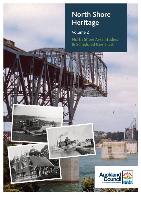
<strong>North</strong> <strong>Shore</strong><br />
<strong>Heritage</strong><br />
Volume 2<br />
<strong>North</strong> <strong>Shore</strong> Area Studies<br />
& Scheduled Items List<br />
TR2011/010
<strong>Auckland</strong> <strong>Council</strong><br />
TR2011/010, 1 July 2011<br />
ISSN 2230-‐4525 (Print)<br />
ISSN 2230-‐4533 (Online)<br />
Volume 1<br />
ISBN 978-‐1-‐927169-‐20-‐9 (Print)<br />
ISBN 978-‐1-‐927169-‐21-‐6 (PDF)<br />
Volume 2<br />
ISBN 978-‐1-‐927169-‐22-‐3 (Print)<br />
ISBN 978-‐1-‐927169-‐23-‐0 (PDF)<br />
2-‐volume set<br />
ISBN 978-‐1-‐927169-‐24-‐7 (Print)<br />
ISBN 978-‐1-‐927169-‐25-‐4 (PDF)<br />
<strong>Review</strong>ed by: Approved for AC Publication by:<br />
Name: Leslie Vyfhuis Name: Noel Reardon<br />
Position: Principal Specialist, Built <strong>Heritage</strong> Position: Manager, <strong>Heritage</strong><br />
Organisation: <strong>Auckland</strong> <strong>Council</strong> Organisation: <strong>Auckland</strong> <strong>Council</strong><br />
Date: 1 July 2011 Date: 1 July 2011<br />
Recommended Citation:<br />
<strong>North</strong> <strong>Shore</strong> <strong>Heritage</strong> - <strong>Thematic</strong> <strong>Review</strong> <strong>Report</strong>. Compiled by <strong>Heritage</strong> Consultancy Services for<br />
<strong>Auckland</strong> <strong>Council</strong>. 1 July 2011. <strong>Auckland</strong> <strong>Council</strong> Document TR 2011/010.<br />
© 2011 <strong>Auckland</strong> <strong>Council</strong><br />
This publication is provided strictly subject to <strong>Auckland</strong> <strong>Council</strong>'s (AC) copyright and other intellectual property rights (if<br />
any) in the publication. Users of the publication may only access, reproduce and use the publication, in a secure digital<br />
medium or hard copy, for responsible genuine non-commercial purposes relating to personal, public service or<br />
educational purposes, provided that the publication is only ever accurately reproduced and proper attribution of its<br />
source, publication date and authorship is attached to any use or reproduction. This publication must not be used in any<br />
way for any commercial purpose without the prior written consent of AC. AC does not give any warranty whatsoever,<br />
including without limitation, as to the availability, accuracy, completeness, currency or reliability of the information or<br />
data (including third party data) made available via the publication and expressly disclaim (to the maximum extent<br />
permitted in law) all liability for any damage or loss resulting from your use of, or reliance on the publication or the<br />
information and data provided via the publication. The publication and information and data contained within it are<br />
provided on an "as is" basis.<br />
Title page images:<br />
Background: Moving the pick-a-back section of <strong>Auckland</strong> Harbour Bridge into place, November 1958. Photographer: Ron<br />
Clark. <strong>North</strong> <strong>Shore</strong> Libraries, T7213.<br />
Inserts, top to bottom: The camp ground at Long Bay, c.1930s. <strong>North</strong> <strong>Shore</strong> Libraries, E0018.<br />
The Chelsea Sugar Refinery, c.1910-15. <strong>Auckland</strong> War Memorial Museum, C26310.<br />
St Francis de Sales and All Souls’ Catholic Church in Albert Street, Devonport. <strong>North</strong> <strong>Shore</strong> Libraries, D_GBC_0001.
Contents<br />
Volume 1<br />
Introduction 4<br />
Authorship 5<br />
Acknowledgements 5<br />
<strong>Thematic</strong> Assessment Framework 6<br />
Section A A <strong>Thematic</strong> History of the <strong>North</strong> <strong>Shore</strong> 7<br />
1 Land and People 8<br />
2 Infrastructure 16<br />
3 Building the City 31<br />
4 Work 43<br />
5 Government 68<br />
6 Ways of Life 87<br />
7 Into the Future 115<br />
8 Bibliography 116<br />
9 <strong>Thematic</strong> <strong>Heritage</strong> Overview Maps i-xxi<br />
Volume 2<br />
Section B <strong>North</strong> <strong>Shore</strong> Area Studies 125<br />
1 Devonport 127<br />
2 Takapuna 194<br />
3 <strong>North</strong>cote 249<br />
4 Birkenhead 300<br />
5 Birkdale – Beach Haven 343<br />
6 Glenfield 368<br />
7 Albany 392<br />
8 East Coast Bays 413<br />
Section C Places of Historic <strong>Heritage</strong> Significance on the <strong>North</strong> <strong>Shore</strong> 439<br />
1 <strong>North</strong> <strong>Shore</strong> City District Plan Scheduled Items 441<br />
<strong>North</strong> <strong>Shore</strong> <strong>Heritage</strong> - <strong>Thematic</strong> <strong>Review</strong> <strong>Report</strong><br />
3
Introduction<br />
This review was commissioned by <strong>North</strong> <strong>Shore</strong> City <strong>Council</strong> (now <strong>Auckland</strong> <strong>Council</strong>) in 2009. It<br />
represents the successful completion of actions contained in the <strong>North</strong> <strong>Shore</strong> City Historic <strong>Heritage</strong><br />
Strategy [2009] to carry out a thematic assessment framework review of the existing District Plan<br />
schedule and systematically identify additional historic heritage items and areas for scheduling.<br />
The review had a number of broad objectives. These are:<br />
To prepare a thematic overview of the historical development of the <strong>North</strong> <strong>Shore</strong>. While a number<br />
of local area histories have been written, until very recently, no general history of the <strong>North</strong> <strong>Shore</strong><br />
was available to assist those seeking to better understand and appreciate the development of the<br />
area as a whole. The overview collates information gathered from a number of secondary sources,<br />
but also introduces new information obtained from an examination of primary materials.<br />
To review the range of buildings, objects and places currently identified in the District Plan, and<br />
identify any potential heritage resources (buildings, objects and places) that have previously been<br />
overlooked.<br />
To identify areas or precincts on the <strong>North</strong> <strong>Shore</strong> of distinctive character, and evaluate their<br />
potential heritage values.<br />
To further research and assess heritage resources that embody identified themes, and make<br />
recommendations regarding their sustainable management, particularly in relation to protection<br />
under the District Plan.<br />
The thematic framework approach chosen for the review is widely used in New Zealand and<br />
internationally, and is promoted by the New Zealand Historic Places Trust as the best practice<br />
approach. It is a useful way of identifying buildings and places of heritage significance, and the people<br />
and events associated with them, in an historical context. Such an approach is also helpful when<br />
locating heritage resources within a local, regional, national and even an international context,<br />
determining the comparative significance of resources, and thereby facilitating decisions about<br />
statutory protection and management.<br />
The thematic overview should not be considered as a comprehensive history of the <strong>North</strong> <strong>Shore</strong>;<br />
neither should the lists of places that represent themes be considered exhaustive. For example, the<br />
project team recognise that there are likely to be gaps in the narrative relating to Maori association<br />
with this area, and this will be reflected in the identification of places relating to specific themes. In<br />
part, this gap is due to the lack of robust information about the history of Maori on the <strong>North</strong> <strong>Shore</strong><br />
that is available in the public domain, but it is also because it has not been possible for the project team<br />
to fully engage with tangata whenua in the preparation of the review.<br />
It is important to understand that the identification and evaluation of heritage resources is a work in<br />
progress. The history of places, and the people and events associated with them, is not static; it is<br />
continuously being told and retold, in the light of new information, new perspectives, and the passage<br />
of time. Inevitably, there will be places whose stories have not been revealed through the research<br />
associated with the review. The <strong>Council</strong> will need to continue to update the information it has<br />
gathered in the course of this review, especially in relation to those places of heritage significance that<br />
warrant district plan protection.<br />
Completion of the thematic review report is the first, critical stage of an ongoing process to better<br />
identify, protect and appropriately manage the historic heritage resources of <strong>Auckland</strong>’s <strong>North</strong> <strong>Shore</strong>.<br />
The resources identified through this review as having the potential to be protected in the district plan<br />
require further analysis and assessment before recommendations for inclusion can be considered by<br />
<strong>Auckland</strong> <strong>Council</strong>, and decisions made about initiating changes to the district plan. The further<br />
analysis and assessment of specific sites and areas, and any recommendations regarding district plan<br />
protection are still under consideration, and are therefore not available for inclusion in this thematic<br />
review report.<br />
The report is comprised of three sections:<br />
Section A contains the thematic historic overview that identifies key themes in the development of the<br />
<strong>North</strong> <strong>Shore</strong> – Land and People, Infrastructure, Building the City, Work, Government and Ways of<br />
Life. Using this thematic framework (see below), the overview explores the history of the <strong>North</strong> <strong>Shore</strong>,<br />
telling the stories of important places and the people associated with them, and placing both within a<br />
regional and national context.<br />
<strong>North</strong> <strong>Shore</strong> <strong>Heritage</strong> - <strong>Thematic</strong> <strong>Review</strong> <strong>Report</strong><br />
4
The principal author of the thematic history is Tania Mace, who built upon an initial draft prepared by<br />
David Verran. Bruce Hayward and Russell Gibb contributed to the text relating to geology and Maori<br />
association with the <strong>North</strong> <strong>Shore</strong>, while Dan Davis provided graphic design input to the maps<br />
produced by the review’s project team.<br />
Section B is comprised of a number of focused area studies that use the thematic framework developed<br />
in Section A to direct more detailed investigation, and to identify structures, buildings and areas that<br />
embody the <strong>North</strong> <strong>Shore</strong>’s heritage narratives.<br />
Sections A and B of this report should be read in tandem so that the more detailed information<br />
contained in the area studies can be considered within the context of the wider sweep of the thematic<br />
history.<br />
The principal authors of the area studies are:<br />
Takapuna-Devonport - Salmond Reed Architects Ltd and Susan Yoffe<br />
<strong>North</strong>cote, Birkenhead, Birkdale-Beach Haven and Glenfield - Matthews & Matthews Architects Ltd<br />
and Lisa Truttman<br />
Albany and East Coast Bays - Archifact Ltd<br />
Section C contains the appendices from the <strong>North</strong> <strong>Shore</strong> City District Plan that itemise the heritage<br />
buildings, places and sites subject to protection under the provisions of the plan.<br />
Authorship<br />
The review report is in large part the result of the collaborative efforts of a project team composed of<br />
heritage consultants and <strong>Council</strong> officers. The team included the following people:<br />
Tania Mace, Historian<br />
David Verran, Historian<br />
Richard Bollard, Bruce Petry and Jeremy Salmond, Salmond Reed Architects Ltd<br />
Jane Matthews, Matthews & Matthews Architects Ltd<br />
Heike Lutz and Theresa Chan, Archifact Ltd<br />
Susan Yoffe, Historian<br />
Lisa Truttman, Historian<br />
Tony Barnes, <strong>Auckland</strong> <strong>Council</strong><br />
Aranne Donald, <strong>North</strong> <strong>Shore</strong> City <strong>Council</strong><br />
Russell Gibb and Dan McCurdy, Geometria<br />
Dan Davis, Graphic Artist<br />
Dr Ann McEwan, <strong>Heritage</strong> Consultancy Services<br />
Leslie Vyfhuis, <strong>Auckland</strong> <strong>Council</strong><br />
Acknowledgements<br />
The review could not have been completed without the support and assistance of many people, both<br />
within the <strong>Council</strong> and the wider community, and the report authors wish to thank all those who have<br />
assisted with its preparation. While it is not possible to acknowledge everyone, the staff at <strong>North</strong><br />
<strong>Shore</strong> Libraries, <strong>Auckland</strong> City Libraries, <strong>Auckland</strong> War Memorial Museum Library, Alexander<br />
Turnbull Library and Devonport Museum deserve special mention. We are especially grateful to Karen<br />
Gillard, Archives Officer at <strong>Auckland</strong> <strong>Council</strong>, Keith Giles in the Sir George Grey Special Collections<br />
at <strong>Auckland</strong> City Libraries, and Rod Cornelius and Peter Weeks of Devonport Museum for permission<br />
to reproduce photographs, plans and other documents, and for their ongoing support throughout the<br />
project. Special thanks also to Kirsty Webb, New Zealand Collection Librarian, Takapuna Library. We<br />
are also grateful to Mrs Margaret Field, and all <strong>North</strong> <strong>Shore</strong> residents who generously shared their<br />
knowledge of the area with the review authors. Their generous contribution of personal stories,<br />
recollections and historical information during the community workshop held in November 2009 and<br />
throughout the course of the project was invaluable to our understanding of <strong>North</strong> <strong>Shore</strong>’s<br />
development.<br />
<strong>North</strong> <strong>Shore</strong> <strong>Heritage</strong> - <strong>Thematic</strong> <strong>Review</strong> <strong>Report</strong><br />
5
<strong>Thematic</strong> Framework<br />
Chapter 1 Land and People<br />
Section 1.1 Geology<br />
Section 1.2 The People of the <strong>North</strong> <strong>Shore</strong><br />
Chapter 2 Infrastructure<br />
Section 2.1 Transport<br />
2.1.1 Water Transport<br />
2.1.2 Trams<br />
2.1.3 Buses<br />
Section 2.2 Roads<br />
Section 2.3 Communication<br />
Section 2.4 Utilities<br />
2.4.1 Water Supply<br />
2.4.2 Drainage<br />
2.4.3 Power<br />
Chapter 3 Building the City<br />
Section 3.1 Subdivision of Land<br />
Section 3.2 Commercial Architecture<br />
Section 3.3 Residential Architecture<br />
Section 3.4 Public Spaces<br />
Chapter 4 Work<br />
Section 4.1 Farming<br />
Section 4.2 Industry<br />
4.2.1 Quarrying<br />
4.2.2 Kauri Gum and Timber<br />
4.2.3 Brickmaking<br />
4.2.4 Boatbuilding<br />
4.2.5 Sugar Works<br />
Section 4.3 Commerce<br />
Section 4.4 Tourism<br />
Chapter 5 Government<br />
Section 5.1 Local Government<br />
Section 5.2 Defence<br />
Section 5.3 Justice<br />
Section 5.4 Healthcare<br />
Chapter 6 Ways of Life<br />
Section 6.1 Religion<br />
6.1.1 Anglican Church<br />
6.1.2 Catholic Church<br />
6.1.3 Methodist Church<br />
6.1.4 Presbyterian Church<br />
6.1.5 Other Denominations<br />
Section 6.2 Education<br />
6.2.1 Pre-school Education<br />
6.2.2 Primary Education<br />
6.2.3 Secondary Education<br />
6.2.4 Tertiary Education<br />
Section 6.3 The Arts<br />
Section 6.4 Cinemas and Halls<br />
Section 6.5 Local Media<br />
Section 6.6 Sport<br />
Section 6.7 Community Organisations and Facilities<br />
Section 6.8 Remembering the Past and Preserving it for the future<br />
<strong>North</strong> <strong>Shore</strong> <strong>Heritage</strong> - <strong>Thematic</strong> <strong>Review</strong> <strong>Report</strong><br />
6
Section B <strong>North</strong> <strong>Shore</strong> Area Studies<br />
Devonport and Takapuna<br />
St Francis de Sales and All Souls‟ Catholic Church, Albert Street, Devonport. <strong>North</strong> <strong>Shore</strong> Libraries, D_GBC_0001<br />
Devonport<br />
<strong>North</strong> <strong>Shore</strong> <strong>Heritage</strong> - <strong>Thematic</strong> <strong>Review</strong> <strong>Report</strong><br />
Principal Authors: Salmond Reed Architects Ltd & Susan Yoffe<br />
127
Theme 1 Land and People<br />
1.1 Geology<br />
Long known as the marine suburb, Devonport is defined by its coastal edges, its volcanic cones and its<br />
ridge and valley topography, which is typical of the <strong>Auckland</strong> isthmus generally. It is a peninsula with its<br />
eastern coastal edge of Narrow Neck and Cheltenham Beach facing Rangitoto and the Hauraki Gulf and its<br />
southern, city-facing, coast extending from <strong>North</strong> Head/Torpedo Bay to Stanley Point. Further round, the<br />
west-facing coastline is deeply indented and tidal with a number of smaller peninsula „fingers‟ extending<br />
into the water at Duder‟s Point and O‟Neill‟s Point/Bayswater Wharf. This portion includes Shoal Bay and<br />
Ngataringa Bay, where the mangrove swamps have been reclaimed in several places since the 1870s.<br />
Before the <strong>Auckland</strong> volcanic eruption 40,000 years ago, Devonport was made up of three islands. The<br />
main one was a large mass of Waitemata papa, 25 million years old, which extended from Vauxhall Road<br />
to Stanley Bay. The small islands were the cliff top of Fort Cautley military camp and the Stanley Bay<br />
block. Shoal Bay at that time formed a stream flowing into the Waitemata and Ngataringa Bay was open to<br />
the gulf.<br />
Fig. 1. Geological features of the Devonport Peninsula, Warren Wilcox, Devonport Historical and Museum Society.<br />
The eruptive period formed three volcanic cones. First was Takapuna (<strong>North</strong> Head), initially a tuff cone<br />
before its crater filled with scoria, spilled over its rim and buried it. Next came a fire mountain, Takararo<br />
<strong>North</strong> <strong>Shore</strong> <strong>Heritage</strong> - <strong>Thematic</strong> <strong>Review</strong> <strong>Report</strong><br />
128
(Mt Cambria), which formed a scoria cone. Finally, Takarunga (Mt Victoria), also a scoria cone, had its<br />
cone breached to the south east which allowed lava flows down to the sea. 1 It is believed that when it was<br />
breached the collapsed remnant of the cone was carried some distance by the lava before coming to rest<br />
much closer to the foreshore creating a hill, Takamaiwaho (Duder‟s Hill), now largely quarried away.<br />
Devonport‟s business area is sited on an old boulder bank, and this area was a ballast ground for early<br />
sailing ships. The Takapuna (<strong>North</strong> Head) cone was subsequently joined to the „main land‟ mass by a<br />
sandspit. Likewise, a sandspit formed at Kiritai (Narrow Neck), which joined the island to the peninsula.<br />
Ngataringa Bay became a saltmarsh at its eastern end.<br />
The cones would have been bush-clad before they were modified by Maori occupation for cultivation and<br />
defence. These modifications, with terraces and banks, give the cones their current distinctive silhouette.<br />
The Takapuna cone was crowned by pohutukawa that came right down to the shore. Together with<br />
karaka, mahoe, toitoi and clematis, kauri gum has been found at Ngataringa Bay and Stanley Point,<br />
indicating mixed forest of previous times. 2<br />
The arrival of European settlers in the mid-19 th century inevitably altered the landscape. The volcanic cone<br />
of Mt Cambria was quarried away for road building, as was Duder‟s Hill. The mangrove swamp where<br />
Ngataringa Bay reached Narrow Neck was reclaimed from the late 1870s to form the race course – now the<br />
golf club and Woodall Park. This reclamation enabled Lake Road to be built, thereby affording a more<br />
direct route north than the Old Lake Road around Narrow Neck. Reclamation has taken place on the<br />
Stanley Point side of Ngataringa Bay - much of it by the Navy - and the sandspit that joined Stanley Point<br />
to the rest of Devonport has been built up. 3<br />
Places that represent this theme include:<br />
The geological significance of the Mount Victoria Volcano, the <strong>North</strong> Head Volcano, the St<br />
Leonards/Narrow Neck Waitemata Sandstone Cliffs and the Narrow Neck Structural Discordance is<br />
recognised in Appendix 8B of the District Plan, Schedule of Sites of Geological and Landform Significance,<br />
and these features are protected by appropriate plan rules. The visual significance of the cones is recognised<br />
and protected by the height controls in Appendix 2 of the Planning Maps, which protects views of the<br />
cones from Lake Road and other surrounding vantage points.<br />
In addition, Appendix 8F of the District Plan contains a schedule of Significant Views from Public View<br />
Points, which includes harbour and Rangitoto views and views of the city and isthmus cones. The<br />
archaeological significance of the cones is recognised in Appendix 11B Schedule of Archaeological sites, as<br />
discussed in the following section.<br />
Duder‟s Hill Takamaiwaho, site of the Masonic Hotel, now quarried away.<br />
1.2 The People of the <strong>North</strong> <strong>Shore</strong><br />
Kupe and his crew are believed to have been the first people to see the Waitemata Harbour in about<br />
925AD. Kupe is said to have sheltered for a while in Te Haupakaua (Torpedo Bay), and the crew he left<br />
there when he returned to Hawaiki are considered the first settlers of New Zealand. Toi te Huatahi who<br />
came in about 1150, following Kupe‟s sailing directions, also landed at Te Haupakaua. He was followed by<br />
his grandson, Uika, who settled permanently at <strong>North</strong> Head Maunga Uika. At this time the people of the<br />
area were generally called Te Kawarau. Another wave of canoes arrived about 1350 and of these, the Tainui<br />
canoe is known to have anchored at Te Haupakaua (Torpedo Bay) and subsequently at Taikehu<br />
(Devonport Beach). The Tainui people named the spring on <strong>North</strong> Head, Takapuna, and this name<br />
eventually came to mean all the land northwards to Lake Pupuke. In the mid 1980s the Devonport Borough<br />
1<br />
John Morton, „The Island Borough‟, S Musgrove, ed., The Hundred of Devonport: A Centennial History, <strong>Auckland</strong>, 1986, p.15.<br />
2<br />
Devonport Historical and Museum Society.<br />
3<br />
John Morton, „The Island Borough‟, The Hundred of Devonport, p.19.<br />
<strong>North</strong> <strong>Shore</strong> <strong>Heritage</strong> - <strong>Thematic</strong> <strong>Review</strong> <strong>Report</strong><br />
129
<strong>Council</strong> erected a plaque on the King Edward Parade foreshore, near Torpedo Bay to commemorate the<br />
arrival of the Tainui canoe.<br />
Typically, the older tribes found themselves in conflict with the newcomers and fortified pa sprang up on<br />
every hill and headland. The Kawarau people generally occupied the north shore of the Waitemata<br />
Harbour and the Ngati Wai the south shore. Other tribes were the Ngati Whatua from <strong>North</strong>land and<br />
Ngati Paoa from Thames. As a result of continual warfare the area became largely depopulated by 1750, and<br />
many pa fell into disrepair. The Takapuna area had become difficult to hold because it was easy to attack<br />
and allowed little chance of retreat or escape due to its island-like shape. After a Ngati Whatua defeat at<br />
Tamaki, the Kawerau chief encouraged Ngati Paoa to refortify <strong>North</strong> Head. They were attacked by Nga<br />
Puhi from <strong>North</strong>land, who besieged the pa for several months during the winter of 1793. The occupants<br />
eventually escaped to Waiheke. Once again the area fell into disrepair, with no permanent population<br />
despite the fertility and natural resources it possessed. After Nga Puhi had withdrawn, Ngati Whatua<br />
controlled the Waitemata. 4<br />
The French explorer, D‟Urville, arrived in 1827 and anchored at Torpedo Bay. This event is commemorated<br />
by a plaque on the foreshore near the Naval Museum. The ship‟s surveyor, Lottin, climbed Mt Victoria –<br />
the first European to do so – and reported on the thick bracken and overgrown weeds. He also commented<br />
on the physical signs of warfare from collapsed fortifications, houses and agricultural fields.<br />
With the end of the musket wars a few Maori returned to settle in Devonport, and were living there when<br />
the Treaty of Waitangi was signed in 1840. Until 1863 a small group of Maori lived near the swamp at<br />
Torpedo Bay, in an area between Cambridge Terrace and Cheltenham Road. The meeting house was on the<br />
second section east of Cambridge Terrace. 5<br />
An early purchase of Devonport land was that of Lot 8, on the northwest side of Mt Victoria, which was<br />
sold to Te Rangi, a former constable in the Armed Police Force. It was sold six years later to a Pakeha and<br />
it is not known if he occupied the land himself. 6<br />
In the 20 th century, it was not until Maori joined the New Zealand Navy in numbers after WWII that any<br />
significant number of Maori lived in Devonport again. The Navy marae, Te Taua Moana, was opened in<br />
2000 and remains the only marae in Devonport.<br />
The famous Nga Puhi chief, Eruera Maihi Patuone, from Hokianga, lived in Devonport and Takapuna in his<br />
later years and is buried in the cemetery at the foot of Mt Victoria. His life spanned from the early<br />
European visits through to the arrival of missionaries, land wars and settlement. With his brother, Tamati<br />
Waka Nene, he was involved in the musket wars, joining up with Hongi Hika. In 1819 they were allied<br />
with Te Rauparaha in a raiding party (taua) that ranged all the way down to Wellington. Later he<br />
recognised the potential of colonisation and the advantages that trade with Europeans would bring. In<br />
1826 and the early 1830s he visited Sydney to arrange for shipments of spars. 7 In 1840 he was baptised by<br />
the Rev. Henry Williams and was an early signatory to the Treaty of Waitangi. On the <strong>North</strong> <strong>Shore</strong> he first<br />
lived on the northern slopes of Mt Victoria and his kainga (compound) was known as Riria, after his late<br />
wife. 8 In 1851 Governor Grey granted him 110 acres between Takapuna Beach and the lagoon by Barry‟s<br />
Point Road. His kainga, Waiwharariki was on the small hill presently occupied by the Assembly of God<br />
church. Eruera Maihi Patuone died in 1872 aged 108. 9 He is remembered in a Devonport street of this name.<br />
4<br />
Devonport Historical & Museum Society.<br />
5<br />
Thomas Walsh, An illustrated story of Devonport and the old <strong>North</strong> <strong>Shore</strong> from 1841 to 1924: with an outline of Maori occupation to<br />
1841, <strong>Auckland</strong>, 1924, 1986 facsimile, p.15.<br />
6<br />
David Verran, The <strong>North</strong> <strong>Shore</strong>: An Illustrated History, <strong>Auckland</strong>, 2010, p.53.<br />
7<br />
Angela Ballara, 'Patuone, Eruera Maihi ?-1872', Dictionary of New Zealand Biography, www.dnzb.govt.nz, updated 22 June<br />
2007.<br />
8 Verran, p.22.<br />
9 Devonport Historical & Museum Society.<br />
<strong>North</strong> <strong>Shore</strong> <strong>Heritage</strong> - <strong>Thematic</strong> <strong>Review</strong> <strong>Report</strong><br />
130
Pakeha settlement overlaid the earlier Maori landscape with a pattern of roads, building lots, houses, shops<br />
and other necessary facilities. The first European building on the Devonport foreshore was a powder<br />
magazine built in 1840, on the sandspit that is now Windsor Reserve. The following year Captain Snow<br />
was employed as signal master on the top of Mt Victoria, and he and his family were the first permanent<br />
residents of Devonport. By the time of the first police census in 1842 Snow had been joined by Thomas<br />
Duder and William Brown. 10<br />
Devonport was bought from Ngati Paoa as part of the Mahurangi block in 1840-41. For the first ten years<br />
the area was administered by the Crown and occupied by naval personnel looking after stores and<br />
ammunition. 11 Known as Flagstaff, it was important to <strong>Auckland</strong> harbour for the signal station that was set<br />
up in 1841 on Mt Victoria. The area was surveyed and subdivided for farms and town sections in the early<br />
1850s. Many of those who took up the Crown Grants became leaders in Devonport governance and<br />
commerce, and are remembered in places and streets: Alex Alison, Thomas Duder, RH Wynyard, JW<br />
Williamson, James Burgess and AH Russell.<br />
Devonport grew with the arrival of the first shipbuilders, farmers, churchmen, teachers, and shopkeepers,<br />
and a fledgling community emerged. The population in Lake Road increased enough for the first<br />
school/Anglican church to open in 1856 on the site of the present Holy Trinity Church in Church Street.<br />
These early residents were the ones who continued to influence the growth of Devonport even when the<br />
population had risen in the 1880s and 1890s.<br />
The initial growth of Devonport saw intense rivalry between two „ends‟, one at Victoria Road and the other<br />
further along the waterfront at Church Street. It also involved prominent citizens whose contribution to<br />
the economic development of the area is significant even today.<br />
In the young settlement the acquisition of, and speculation in, land provided wealth for some, and<br />
government control could be influenced or manipulated by men of means who jostled for position. From<br />
the outset the settlers were determined that the main road north should be from Lake Road (Church<br />
Street) and not from Stoke‟s Point (<strong>North</strong>cote). The road north via Church Street had already been<br />
surveyed. It went directly north to Narrow Neck beach across the sandspit, and up the gentle slope of Old<br />
Lake Road.<br />
George Beddoes began shipbuilding at Torpedo Bay in 1858, and in 1859 he was joined in this enterprise by<br />
the Holmes brothers. In 1863, however, the Beddoes-Holmes partnership broke up, and the Holmes<br />
brothers moved to the bottom of Victoria Road where they built a slipway adjacent to Windsor Reserve.<br />
Their plan was to develop Victoria Road as the centre of the settlement rather than Lake Road (Church<br />
Street). 12 They built the Flagstaff Hotel in 1864 at the bottom of Victoria Road and set up ferry services<br />
from Victoria wharf.<br />
However, Thomas Duder, signal master and settler, and William Cobley, who had made money in the<br />
goldrush, were determined that the economic and social centre should remain at Lake (Church) Road. To<br />
this end, Thomas Duder leased part of Lot 18A to George Beddoes to build the Masonic Hotel, which was<br />
designed by leading architect Richard Keals and opened to great acclaim in September 1866. 13<br />
The Holmes Brothers‟ ferry service, using the Enterprise from the Victoria wharf, was successful. In 1866,<br />
Beddoes approached the harbour board with the proposition to build a wharf at the end of Lake Road<br />
opposite the Masonic Hotel, and offered to pay half the cost. 14<br />
The Beddoes, Duder and Cobley faction then proposed to run a ferry service from their wharf.<br />
On hearing this, Holmes Bros applied to the Superintendent of the Provincial <strong>Council</strong> for a three-year<br />
10 Verran, p.48<br />
11 Gael Ferguson, „The Borough‟, The Hundred of Devonport, p.30.<br />
12 Ibid.<br />
13 Deed 28810.<br />
14 Walsh, p.12.<br />
<strong>North</strong> <strong>Shore</strong> <strong>Heritage</strong> - <strong>Thematic</strong> <strong>Review</strong> <strong>Report</strong><br />
131
monopoly for their ferry service. Howls of protest issued from a meeting at the Masonic in November 1866<br />
- „it was unsound and unjust … and now forsooth, not content with large returns for all their outlay, they<br />
must ask for a monopoly for three years!‟ 15 All to no avail.<br />
Thus it was not until April 1869 that the <strong>Auckland</strong> & <strong>North</strong> <strong>Shore</strong> Steam Ferry Company, headed by<br />
William Cobley, was inaugurated with the ship Lallah Rookh. 16 Cobley also obtained permission to sink a<br />
well across the street from the Masonic in order to have water for the steamer. Cobley had even persuaded<br />
the Holmes‟ captain to join his enterprise. Holmes Bros in turn countered by running horse buses to carry<br />
passengers to and from Victoria wharf free of charge. William Cobley then offered free ferry trips for<br />
Devonport residents! This ludicrous situation lasted just six months. Cobley, tiring of it all, finally sold the<br />
ferry to the Holmes brothers. 17<br />
Victoria Road developed as the commercial centre but East Devonport continued to flourish. The Duder<br />
brothers, Richard and Robert, opened their shop on the corner opposite the Masonic Hotel in 1874 and the<br />
store behind in 1881. They built a wharf for the shipping of their goods and coal for their brickworks in<br />
Ngataringa Bay.<br />
Devonport grew in the 1880s due to the arrival of the military and the construction of defence works on<br />
<strong>North</strong> Head, coupled with the efficient and reliable ferry service of the newly formed Devonport Steam<br />
Ferry Company in 1885. Commuting was now possible and businessmen from the city began to settle and<br />
build large residences. Over the next 20 years Devonport began to develop as a „marine suburb‟. Farming<br />
continued – supplying fruit, vegetables and milk – but was becoming less important.<br />
By the turn of the 20 th century, clerks, bank officials and other professionals who worked in the city were<br />
coming to live in Devonport. Builders and tradesmen were in demand and the usual services of<br />
dressmakers, tailors, milliners, midwives, and photographers were all on offer. 18<br />
Chinese vegetable gardens were situated at the top of Victoria Road on the east side and also on the north<br />
side near the Albert Road roundabout in the 1870s. 19 Along Bayswater Avenue there were Chinese and<br />
Indian vegetable growers into the 1930s. No other ethnic group has had a significant presence in the area.<br />
Places that represent this theme include:<br />
Appendix 11B contains a Schedule of Archaeological sites, of Maori and European origin, 18 of which are in<br />
the Devonport Ward and are identified numerically by their New Zealand Archaeological Association<br />
(NZAA) Site Record number:<br />
97 Pa (Volcanic Hill) <strong>North</strong> Head<br />
109 Pa (Volcanic Hill) Mount Victoria<br />
110 Pa (Volcanic Hill) Mount Cambria, Vauxhall Rd, Takararo<br />
203 Midden Shell/Cultivation/Findspot<br />
(Adze)<br />
916 Midden (Shell, Fish-bone, Glass and<br />
Metal) (Historic)<br />
<strong>North</strong> <strong>Shore</strong> <strong>Heritage</strong> - <strong>Thematic</strong> <strong>Review</strong> <strong>Report</strong><br />
Vauxhall Rd, Narrow Neck Beach end<br />
<strong>North</strong> Head, Cheltenham Beach side<br />
968 Middens (Shell) end of Aramoana Avenue, Duders Point<br />
969 Middens (Shell) end of Aramoana Avenue, Duders Point<br />
970 Midden (Shell and fish-bone) Norwood Road, Bayswater<br />
15<br />
„The Proposed Steam Monopoly‟, Daily Southern Cross, Vol. XXII, 22 November 1866, p. 5<br />
16<br />
Walsh, p.8.<br />
17<br />
Paul Titchener, Beginnings: A History of the <strong>North</strong> <strong>Shore</strong> of <strong>Auckland</strong>, Vol. 5 p.4.<br />
18<br />
Ibid.<br />
19<br />
Gael Ferguson, „Industry and Commerce‟, The Hundred of Devonport, p.60.<br />
132
971 Midden (Shell) end of Beresford Street, Bayswater<br />
1701 Stone wall (Historic) Kapai Road Devonport<br />
1721 Fortification (Military) (Historic) Mount Victoria Takarunga<br />
1722 Fortification Military) (Historic) <strong>North</strong> Head, Takapuna<br />
1723 Fortification Military) (Historic) Vauxhall Road Fort Takapuna<br />
1795 Brickworks Jetty Ngataringa Bay, near Lake Road<br />
1809 Brickworks (Historic) Ngataringa Bay by end of Victoria Road<br />
1817 Naval Station Windsor Reserve Windsor Reserve<br />
1890 Working Floor King Edward Parade<br />
1820 Wharf Tillers Wharf King Edward Parade, near Buchanan Street<br />
Fig. 2. Cheltenham Beach c.1910, <strong>North</strong> <strong>Shore</strong> Libraries, D GBCHC 0007.<br />
<strong>North</strong> <strong>Shore</strong> <strong>Heritage</strong> - <strong>Thematic</strong> <strong>Review</strong> <strong>Report</strong><br />
133
Theme 2 Infrastructure<br />
2.1 Transport<br />
2.1.1 Water Transport<br />
From the earliest days of settlement people relied on private dinghies and larger vessels to get themselves<br />
and the goods they produced to <strong>Auckland</strong> city. When the ferries became regular and reliable this was no<br />
longer necessary.<br />
There was no regular transport linking Flagstaff (Devonport) to <strong>Auckland</strong> until 1854 when the <strong>Auckland</strong><br />
Provincial <strong>Council</strong> contracted the services of an open ferryboat, which carried 20 passengers. In 1860 the<br />
<strong>Council</strong> accepted a tender from Captain Kreft for a ferry service in the small ship Emu, which sank off<br />
Motutapu Island in the same year. In 1864 Holmes Bros built the Flagstaff Hotel and wharf at the bottom<br />
of Victoria Road, and applied to run a cutter service. Their vessel, Enterprise, began the first scheduled ferry<br />
service in 1865.<br />
g. 3. Ferry Enterprise. T. Walsh, Wherry to Steam Ferry, 1932, facing p.25.<br />
Battles raged for some years between rival companies, as noted previously. In 1885 the Devonport Steam<br />
Ferry Company (DSFC) was formed by Ewen Alison and others. The DSFC fleet began with the paddle<br />
steamers, Tongariro and Tainui. They were followed by the Victoria, Alexandra, Eagle, Britannia and Osprey. The<br />
ferry commute became part of the social fabric of Devonport as people formed friendships and business<br />
connections during the 30-minute crossings. Thanks to the ferries, Devonport also became a favourite<br />
destination for weekend outings. 20<br />
In 1911 a vehicular ferry service began, with the Goshawk landing vehicles on a pontoon at the end of<br />
Victoria wharf. The new specially engineered wharf for the vehicular ferry was built in 1927, and<br />
guaranteed that Devonport would remain an important transit point for goods and traffic for the next 30<br />
years. With the opening of the <strong>Auckland</strong> Harbour Bridge, traffic by-passed Devonport and the <strong>North</strong> <strong>Shore</strong><br />
Ferry Company, formed in 1959, scrapped most of the old ferries, retaining only the Kestrel.<br />
20 John Morton, „The Island Borough‟, The Hundred of Devonport, p.24.<br />
<strong>North</strong> <strong>Shore</strong> <strong>Heritage</strong> - <strong>Thematic</strong> <strong>Review</strong> <strong>Report</strong><br />
Fi<br />
134
Fig. 4. PS Eagle leaving <strong>Auckland</strong> Wharf for Devonport, 1907. <strong>North</strong> <strong>Shore</strong> Libraries, NO110023.<br />
Devonport (Victoria) wharf was roofed and enclosed in 1926, and rebuilt in 1988 when Fullers Ferry<br />
Company introduced the faster two-hulled Kea, which cut the harbour crossing down to ten minutes.<br />
There has been a wharf at Stanley Bay since 1863 but it wasn‟t until 1899 that a wharf long enough for a<br />
ferry to berth at was built. The ferry service, via Devonport, began the following year. A direct ferry service<br />
to the city began in 1924. 21<br />
Ferries also ran to the Bayswater wharf at the end of O‟Neill‟s Point, with the Takapuna Tramways &<br />
Ferry Company commencing ferry service from here in 1910 to serve the Belmont to Milford area. This<br />
service connected with the steam tram route to Takapuna and around the Lake, and in 1927 the route and<br />
ferries were bought by the Devonport Ferry Company.<br />
Goods for local consumption and manufacture were shipped by scow and other vessels to the wharves<br />
along the foreshore. The Duder Brothers, who had a wharf at Torpedo Bay for coal for their brickworks,<br />
also ran a horse drawn cartage business.<br />
Places that represent this theme include:<br />
Site of original Devonport Wharf, King Edward Parade / Church Street<br />
Duder‟s Wharf<br />
Victoria Wharf<br />
21 Verran, p.181.<br />
<strong>North</strong> <strong>Shore</strong> <strong>Heritage</strong> - <strong>Thematic</strong> <strong>Review</strong> <strong>Report</strong><br />
135
Fig. 5. Unloading scows into carts at Duder‟s Wharf, Torpedo Bay. Sir George Grey Special Collections, <strong>Auckland</strong> City<br />
Libraries 4-3039<br />
2.1.2 Trams<br />
In 1885 the Devonport and Lake Takapuna Tramways Company Ltd obtained a concession for an<br />
ambitious project to run horse trams through various routes in Devonport and as far afield as Lake<br />
Takapuna (Pupuke).<br />
Tracks were laid, and from September 1886 they operated from Devonport to Cheltenham with the idea of<br />
transporting ferry passengers to Cheltenham Beach for outings. It was never a financial success, no further<br />
tracks were laid and the company was sold to the Duder Brothers after just six months. They too gave up<br />
on it in 1894. A passenger service with horse coaches ran to Takapuna from the 1880s and further north<br />
from 1895. 22<br />
Various attempts to operate trams in Devonport were made in 1898 and 1907 but these did not succeed. By<br />
1908, the Takapuna Tramways and Ferry Company Ltd had been formed by Edwin Mitchelson, whose<br />
steam trams are credited with opening up the Bayswater / Belmont and Takapuna areas for settlement.<br />
Tracks were laid from Bayswater Wharf up King Edward Avenue (Bayswater Avenue), and northward<br />
along Lake and Hurstmere roads to Shakespeare Road, around Lake Pupuke and back to Hall‟s Corner in<br />
Takapuna. The steam-driven trams proved very popular. However, opposition came from the Alison family<br />
who owned the Devonport Steam Ferry Co. but were denied a license to run their buses further north than<br />
Belmont. However, Ewen Alison found a loophole by buying a fleet of seven-seater Hudson cars, which<br />
were not classed as buses and were more comfortable than the tram, to bring passengers to his ferries at<br />
Devonport. The Tramways and Ferry Co. Ltd folded in 1927, selling its ferries to the Devonport Steam<br />
22 Devonport Historical and Museum Society.<br />
<strong>North</strong> <strong>Shore</strong> <strong>Heritage</strong> - <strong>Thematic</strong> <strong>Review</strong> <strong>Report</strong><br />
136
Ferry Company. 23 Any structures associated with the trams, such as the tram barns at Takapuna and the<br />
repair shop at Bayswater, no longer exist and the rails on which they ran have largely been removed during<br />
later road works. Some remnant rails may remain buried on the Bayswater reclamation and under<br />
Bayswater Avenue.<br />
Fig. 6. Tram tracks on King Edward Parade, 1886. <strong>North</strong> <strong>Shore</strong> Libraries, D GSK 0009.<br />
Places that represent this theme include:<br />
None identified.<br />
2.1.3 Buses<br />
For the first four decades horseback and horse-drawn vehicles were used for private and commercial<br />
transport within the local area and further north.<br />
The earliest road transport was Parson‟s Coaches, which in the 1880s ran a horse-drawn coach service to<br />
the north from stables in Clarence Street. Paterson Brothers, who had stables in Takapuna, also ran a<br />
service north from Devonport. After the collapse of Alison‟s Takapuna Tramways and Ferry Co. in 1927,<br />
EW Alison‟s <strong>North</strong> <strong>Shore</strong> Transport Co. introduced buses to Belmont, Takapuna and Milford that ran to<br />
the ferry service at Devonport and Bayswater. From the mid-1930s this service was extended to Castor and<br />
Brown‟s Bays. During the 1920s a local service, the Bluebell, ran from Victoria Wharf to Narrow Neck and<br />
Victoria Park (Ngataringa), and the Stanley Bay Bus Co. serviced the western peninsula until 1947. 24<br />
For more distant journeys further north, the Orewa to Waiwera White Star Service operated from Anne<br />
Street. 25<br />
23<br />
„Trams put Takapuna on the right track‟, <strong>North</strong> <strong>Shore</strong> Times Advertiser, 6 November 1975, reprinted in Beginnings, Vol. 1,<br />
p.30<br />
24<br />
Verran, p.196.<br />
25<br />
Gael Ferguson, „Industry and Commerce‟, The Hundred of Devonport, p.56.<br />
<strong>North</strong> <strong>Shore</strong> <strong>Heritage</strong> - <strong>Thematic</strong> <strong>Review</strong> <strong>Report</strong><br />
137
F<br />
ig. 7. Special dispersion auction of teams and equipment by Mr. W. Parsons, 1899, <strong>North</strong> <strong>Shore</strong> Libraries, D GSV 0010 0.<br />
Fig. 8. Buses at Victoria wharf, c1913. <strong>North</strong> <strong>Shore</strong> Libraries, T2311.<br />
<strong>North</strong> <strong>Shore</strong> <strong>Heritage</strong> - <strong>Thematic</strong> <strong>Review</strong> <strong>Report</strong><br />
138
In the mid-1930s Devonport Borough <strong>Council</strong> built a number of timber bus shelters with clay-tiled roofs<br />
costing £40 each, to which the bus company contributed £5.<br />
Places that represent this theme include:<br />
Bus shelters: (9 in total)<br />
Lake Road near Clifton Road intersection (1) and between Hanlon and Seabreeze Road (1)<br />
Old Lake Road, near Lake Road intersection (2), by Hamana Street (1), by the Wakatere Yacht Club (1)<br />
Wicklow Road (1)<br />
Vauxhall Road (footpath by Fort Takapuna) (1)<br />
By 67 Vauxhall Road (by Albert Street corner) (1)<br />
2.2 Roads<br />
The first roads in Devonport extended along the waterfront, following King Edward Parade (Beach Road)<br />
and then up Church Street. These were built with roading material sourced from nearby Mt Cambria. The<br />
route north led away from Torpedo Bay, and followed the line of Church Street and Vauxhall Road across<br />
the sandspit at Narrow Neck, up the hill of Old Lake Road to Lake Road itself. The Borough <strong>Council</strong><br />
Minutes record the constant struggle to keep the roads passable.<br />
Fig. 9. Stanley Point Road 1907. <strong>North</strong> <strong>Shore</strong> Libraries, D GSS 0003.<br />
Ngataringa Bay was drained and filled in the late 1870s, and Lake Road built to provide a more direct route<br />
north. This was influential in Victoria Road becoming the commercial centre. Roads generally followed<br />
natural contours with minimal earthworks, but in some locations extensive bluestone retaining walls were<br />
used.<br />
The growing popularity of the private automobile necessitated the improvement of roads, and concrete<br />
roads such as Calliope Road were some of the first in New Zealand. Many concrete roads were built in<br />
Devonport in the interwar period. Of these, only one fragment remains, a strip of Old Lake Road along<br />
<strong>North</strong> <strong>Shore</strong> <strong>Heritage</strong> - <strong>Thematic</strong> <strong>Review</strong> <strong>Report</strong><br />
139
Narrow Neck Beach. Concrete was originally thought to be more durable and long lasting than asphalt,<br />
but it does not respond well to underlying earth movements and is difficult to maintain when services such<br />
as water, gas and sewers are located underneath.<br />
Many of the schemes that were periodically presented for a harbour crossing suggested Stanley Bay as the<br />
terminus. Devonport residents were divided at the prospect. Finally the Harbour Bridge bypassed<br />
Devonport altogether and the decision to situate it at <strong>North</strong>cote Point, although contested at the time, has<br />
contributed to the conservation of Devonport‟s unique character and „maritime village‟ ambiance.<br />
Fig. 10. Jack Paterson in his 1920s „The Up-to the Minute Car‟, promoting Paterson‟s Motor Garage in Devonport.<br />
Photographer C.F. Bell. <strong>North</strong> <strong>Shore</strong> Libraries, D TR 0008 0<br />
Places that represent this theme include:<br />
Tudor Street Cobbled bluestone street and kerbs, visible at Church St vehicle crossing and<br />
outside No 8, now asphalted over.<br />
Old Lake Road Fragment of concrete road by Narrow Neck Beach and Wakatere Yacht Club<br />
Lake Road Bluestone boundary retaining walls, vicinity of Aramoana and Ngataringa<br />
Road<br />
66 & 74 Victoria Road Bluestone retaining walls and pedestrian access way<br />
18 Kerr Street Bluestone retaining wall by Devonport Primary School<br />
Clarence Street Pedestrian walkway<br />
Glen Road Pedestrian walkway to Stanley Bay Park used by Stanley Bay Primary<br />
2.3 Communication<br />
<strong>North</strong> <strong>Shore</strong> <strong>Heritage</strong> - <strong>Thematic</strong> <strong>Review</strong> <strong>Report</strong><br />
140
In the early days of the colony, communication between <strong>Auckland</strong> and the outside world was by ship. The<br />
signal station on the summit of Mount Victoria was important as flags were raised on the signal mast to<br />
indicate the arrival of various ships to the Port of <strong>Auckland</strong>, and to instruct ships waiting to enter the<br />
harbour. Until the 1860s Devonport was named after the signal station and known as Flagstaff.<br />
The original signal station was constructed in 1842, but the signalman had to wait until 1898 for the<br />
Harbour Board to build him a house on the southern slope. This dwelling is now the Michael King Writers‟<br />
Centre, and the relocated signal mast can be seen in the Windsor Reserve.<br />
In 1863 Oliver Mays, a schoolteacher, was appointed as the first postmaster. Two years later he opened a<br />
store/post-office on the corner of Tudor and Church Streets. 26 He then moved it to a site beside the<br />
Masonic Hotel on Beach Road (King Edward Parade). 27 In 1873 Mays again moved his store to Victoria<br />
Road and the post office went with him. Until 1885 people called at Mays‟ store to collect their mail, but<br />
thereafter postmen were employed to deliver the mail.<br />
Flagstaff was also the communication centre for settlements to the north. A regular mail coach service was<br />
started in the 1870s by Mr Dodd, and in 1885 Tom Butler began a thrice-weekly service with a four-horse<br />
team to Puhoi and Warkworth. He received £600 a year from the Post Office as a mail contractor.<br />
This lasted until 1908, when a purpose built Post Office was erected beside the Esplanade Hotel at a cost of<br />
£2,159, and opened by Premier Sir Joseph Ward. In 1940 it was remodelled in the „Moderne‟ Style to<br />
become the Devonport Borough <strong>Council</strong>, and now houses the Devonport iSite Visitor Centre.<br />
In 1882 an underwater telephone cable was laid across the harbour to <strong>North</strong>cote Point and carried over to<br />
Lake Takapuna and to Oliver May‟s store and post office in Victoria Road. A manual telephone exchange<br />
opened in Clarence Street in 1902. From 1908 it was possible to send telegrams by Morse code, and the<br />
telephone exchange became automatic in 1926. 28 The Devonport Automatic Telephone Exchange building<br />
is now the Stone Oven Café.<br />
The importance of Devonport as the contact point for the <strong>North</strong> <strong>Shore</strong> and communities further north<br />
grew with the introduction of the vehicular ferry in 1911 and the construction of a vehicular wharf in 1927.<br />
This necessitated a bigger and more imposing Post Office, and a site was chosen further up Victoria Road<br />
on the eastern side. The building that opened on 19 October 1938 had a large public area, offices and a<br />
manager‟s flat on the upper floor. It was sold in 1989 and became the Jackson Museum of Memorabilia.<br />
Subsequently it was converted to a shopping arcade. The current Post Office service operates from the<br />
Clarence Building, located behind the main shopping centre.<br />
Services from the main Devonport Post Office were augmented in 1963 by the Vauxhall Road Post Office,<br />
located in the small group of shops that had been constructed there in the 1920s to serve the Cheltenham<br />
Beach area. In 1987, despite a petition and protest from local residents, this small Post Office closed, along<br />
with the many other smaller post offices throughout the country considered „uneconomic‟ by the<br />
government of the time.<br />
26 Titchener, Beginnings, Vol.5 p.40.<br />
27 Walsh, p.23.<br />
28 <strong>North</strong> <strong>Shore</strong> Times Advertiser, 28 November 1974 p.15. Verran, p.152.<br />
<strong>North</strong> <strong>Shore</strong> <strong>Heritage</strong> - <strong>Thematic</strong> <strong>Review</strong> <strong>Report</strong><br />
141
Fig. 11. Post & Telegraph Office c1910. <strong>North</strong> <strong>Shore</strong> Libraries, D GSV 0021.<br />
Places that represent this theme include:<br />
Signalman‟s House Mount Victoria Reserve<br />
Mount Victoria Signal Station Mount Victoria Reserve<br />
Hydrographic Survey Station and Mast (Mast relocated to Windsor Reserve in 1928)<br />
Former Post Office, then the Devonport Borough <strong>Council</strong> Chambers and now iSite 3 Victoria Road<br />
Former Post Office, „art deco‟ style 1938 10 Victoria Road<br />
Former Telephone Exchange, now the Stone Oven café 5 Clarence Street<br />
Vauxhall Rd shops, former Post Office, now an Interior Design Consultancy 89 Vauxhall Road<br />
2.4 Utilities<br />
2.4.1 Water supply<br />
Originally, Devonport homes were supplied with water from a series of wells and by rain collected from<br />
roofs. An aquifer running the length of Church Street was tapped, and William Cobley sank two wells<br />
opposite the Masonic Hotel in 1864, one for his ferry and one for the town.<br />
Devonport Borough <strong>Council</strong> first suggested that water be obtained from Lake Pupuke in 1887, but it wasn‟t<br />
until 1894 that the water pumping station opened. Water was pumped to Mt Victoria, where it was stored<br />
in a reservoir. Pipes made at Duder Bros brickworks were laid to every street and dwelling. The reservoir,<br />
one of the earliest constructed in <strong>Auckland</strong>, is vented by 20 cast iron „mushroom‟ vents.<br />
<strong>North</strong> <strong>Shore</strong> <strong>Heritage</strong> - <strong>Thematic</strong> <strong>Review</strong> <strong>Report</strong><br />
142
Ten years later a more sophisticated plant was required, and in 1905, a four-acre block was purchased from<br />
Mr Shakespeare and a new pumphouse beside Lake Pupuke in Takapuna was constructed from brick<br />
sourced from the Duders‟ brickworks.<br />
Places that represent this theme include:<br />
Mount Victoria reservoir mushroom vents<br />
2.4.2 Drainage<br />
Concerns over drainage appear in <strong>Council</strong> minutes from the earliest days. The first real attempt at drainage<br />
was the proposal to lay iron pipes in Anne Street in 1872, but this was not followed through due to cost.<br />
For a large part of Devonport the disposal of waste and storm water was not an issue as it mostly drained<br />
away in the volcanic soil. 29<br />
Earth closets or outside privies, as they were known, were common and located well away from the house.<br />
By 1877 Devonport had a sanitary inspector who was responsible for recommendations on drainage and<br />
enforcing an earth closet system, but it was not until 1880 that a weekly rate was levied for the removal of<br />
night soil.<br />
The Borough <strong>Council</strong> called for designs for a drainage scheme in 1895. In August 1897 discussions of the<br />
plans came to a head when WJ Napier objected to the <strong>Council</strong> giving permission to residents to construct<br />
a drain outlet on Cheltenham Beach. 30 The piping of sewage into the sea began in the early-1900s in the<br />
southern parts of Devonport. Despite the Harbour Board notifying the <strong>Council</strong> in 1903 that no sewage was<br />
to be drained into the harbour, plans were made for a sewage pumping system. 31 The 1909 plan to locate<br />
the pumping station on Admiralty Reserve (Windsor Reserve) drew objection from the public. It was then<br />
decided in 1910 to pump the sewage through a tunnel under <strong>North</strong> Head, with the entrance near the gates<br />
at the Torpedo Bay Naval Museum and the outlet, still visible at low tide, is on the seaward side. It was<br />
known as Perfume Point. The pumps were electrified in 1917 from the Power Station in Church Street (see<br />
below). In 1937 a new scheme was proposed for the whole of <strong>Auckland</strong>, with Brown‟s Island being the<br />
outfall point. This met with so much opposition that the scheme was dropped and raw sewage was still<br />
being discharged off Narrow Neck in 1939. 32<br />
The <strong>North</strong> <strong>Shore</strong> Drainage Board, composed of all five <strong>North</strong> <strong>Shore</strong> boroughs, was formed in 1951. After<br />
some years of deliberation the site at Rosedale Road, Albany was chosen for the sewage ponds, which<br />
opened in 1962. 33<br />
Places that represent this theme include:<br />
Stanley Bay Park pumping station (c1930s)<br />
2.4.3 Power<br />
In 1898 P Hansen sought a concession from the Devonport Borough <strong>Council</strong> to run electric trams and to<br />
supply electric lighting to the borough, but terms could not be agreed on. In 1907 another scheme to<br />
electrify Devonport also failed. In 1912 the <strong>Council</strong> called tenders for electricity supply, but nothing<br />
happened until 1915 when the Electricity Supply Corporation (NZ) Ltd. built a coal-fired power station in<br />
Church Street. The <strong>Council</strong> took over the business in 1922, just before Devonport transferred to the<br />
national grid and electricity was drawn from the public works supply. The station was closed due to<br />
complaints over pollution from the coal smoke, and in 1924 the Takapuna and Devonport <strong>Council</strong>s formed<br />
the Waitemata Electric Power Board to distribute and sell electricity. The power station building was used<br />
29 Verran, p.137.<br />
30 „A chronology of the Borough <strong>Council</strong>‟, The Hundred of Devonport, p.142.<br />
31 Ibid, p.144.<br />
32 Ibid, pp.148,152.<br />
33 Verran, p.138<br />
<strong>North</strong> <strong>Shore</strong> <strong>Heritage</strong> - <strong>Thematic</strong> <strong>Review</strong> <strong>Report</strong><br />
143
y the Devonport Welfare League for depression relief work in 1932, and subsequently became Devonport<br />
Bag Wash. In the 1980s it was converted into dwellings.<br />
Fig. 12. Devonport Gasworks 1884, <strong>North</strong> <strong>Shore</strong> Libraries D GBB 0003<br />
Before the advent of electricity, gas was widely used for lighting, heating and cooking. In 1882 the<br />
<strong>Auckland</strong> Gas Company bought land on Lake Road and was producing gas from coal two years later. By<br />
the 1930s it was the largest industrial plant on the <strong>North</strong> <strong>Shore</strong>, supplying 100 million cubic feet to 6,000<br />
consumers. Gas was produced in vertical chamber ovens, with metallurgical coke, roading tar and<br />
ammonia for the freezing industry. 34 The works also made clay products such as pipes and bricks. 35 The<br />
gasworks closed in the early 1960s and the gasometers, a distinctive feature along Lake Road, were<br />
dismantled in 1993. Part of the complex is now used as a community workshop known as The Claystore,<br />
with facilities for wood and metal working.<br />
Places that represent this theme include:<br />
Former Devonport Power Station 47-49 Church Street<br />
Former Gas Co Building 81 Victoria Road<br />
Former Gasworks, claystore and concrete wall 27 Lake Road<br />
Theme 3 Building the City<br />
34 Fifty Years a-growing: Devonport celebrates its Jubilee, 1936.<br />
35 Bruce Petry [Salmond Reed], „Claystore, General Assessment of Cultural <strong>Heritage</strong> Significance‟, 1992, p. 4.<br />
<strong>North</strong> <strong>Shore</strong> <strong>Heritage</strong> - <strong>Thematic</strong> <strong>Review</strong> <strong>Report</strong><br />
144
3.1 Subdivision of Land<br />
Large tracts of land were initially bought by a small number of investors, including James O‟Neill, Thomas<br />
Outhwaite, RH Wynyard, J Williamson & WC Wilson, John Logan Campbell, Thomas Duder, J<br />
Hammond and WL Thorburn. Lot 8 was bought by Te Rangi, a Maori who had been in the Armed<br />
Constabulary.<br />
Following the first sale of Crown Grants in the 1850s, King Edward Parade and Queen‟s Parade (originally<br />
Beach Road) were surveyed, as were Victoria, Cheltenham, Albert and Calliope Roads. The subdivision of<br />
the original lots dictated later roading as landowners subdivided and sold their land. Thus Duders Avenue<br />
lies between the sections owned by Thomas Duder and Alex Alison. 36<br />
Fig. 13. Crown Grants Section 2 and part Section 1, Parish of Takapuna, <strong>North</strong> <strong>Shore</strong> Libraries, T2297<br />
Subdivision occurred in a piecemeal fashion as individual owners sold their land, often by auction. During<br />
the 1860s there was considerable speculation in land subdivision based on the proximity to the ferry. The<br />
„Village of Devonport‟ at the foot of Mt Victoria was advertised in 1859, the <strong>North</strong> Devonport Estate and<br />
the Township of <strong>North</strong> Cheltenham in 1864, and the Holmes Brothers‟ „<strong>North</strong> Fleet‟ subdivision (Anne and<br />
Wynyard Streets and Victoria Road) in 1865. 37 Other subdivisions were „Sunnyside‟ (Waterview Road,<br />
Summer Street, Bond Street and Calliope Road) and „Victoria Park‟ (Kawerau Avenue, Aramoana Avenue,<br />
Ngataringa Road) in 1882, „Calliope Dock Estate‟ (Huia Street) in 1884, and the „Rosebank Estate‟ (Albert /<br />
Church Street) in 1885. Development was slow however, and it was not until the 1870s and 1880s that<br />
individual sections were bought and built upon.<br />
36 Gael Ferguson, „The Borough‟, The Hundred of Devonport, p.31.<br />
37 Ibid, p.33.<br />
<strong>North</strong> <strong>Shore</strong> <strong>Heritage</strong> - <strong>Thematic</strong> <strong>Review</strong> <strong>Report</strong><br />
145
Fig. 14. <strong>North</strong> Fleet subdivision, Devonport Sir George Grey Special Collections <strong>Auckland</strong> City Libraries 4496-2<br />
Fig. 15. Victoria Park, Devonport <strong>North</strong> Sir George Grey Special Collections <strong>Auckland</strong> City Libraries 4554<br />
A 1900 Borough of Devonport map shows most of the suburb subdivided into residential sections, but<br />
some large tracts remain undeveloped, notably in north Devonport, Cheltenham and Stanley Bay. Some<br />
large lots close to Stanley Bay were advertised for auction in 1889 as part of the Stanley Point and<br />
Sunnyside subdivision, and the area today contains a number of villas built around the turn of the century.<br />
<strong>North</strong> <strong>Shore</strong> <strong>Heritage</strong> - <strong>Thematic</strong> <strong>Review</strong> <strong>Report</strong><br />
146
Ferry services to Stanley Bay began in 1900. Although this service was less frequent and used smaller boats,<br />
it encouraged further residential development. A 1924 map shows the area fully subdivided into residential<br />
lots of varying size, and the wharf with its ‘Ferry to <strong>Auckland</strong>’ is clearly shown.<br />
Fig. 16. Borough of Devonport, prepared by Harrison & Foster Authorised Surveyors. C.1900, <strong>North</strong> <strong>Shore</strong> Libraries,<br />
T2295.<br />
By 1916 the waterfront was fully built up, as was most of the land each side of Calliope Road and on the<br />
slopes of Mt Victoria and <strong>North</strong> Head. Remaining large tracts of land in <strong>North</strong> Devonport were developed<br />
between the world wars, and the land at Narrow Neck was subdivided in the 1920s.<br />
The Bayswater peninsula (known as O‟Neill‟s Point) was subdivided in 1910 and named as the Town of<br />
Bayswater on early plans. It extended to the east beyond Balfour Road and included Lansdowne Road,<br />
Beresford Street, Marine Terrace, Bayswater Avenue (then King Edward Parade) and Norwood Road.<br />
Bayswater and Belmont developed with the advent of the Bayswater wharf, the ferry service, and the steam<br />
tram, which ran the length of Bayswater Avenue from 1910. Dwellings sprang up on both sides of Lake<br />
Road from Belmont north towards Takapuna.<br />
In 1935 the eastern part of O‟Neill‟s Point, or Bayswater, was still in farmland, and was later developed for<br />
state housing, including Bardia Street, Philomel Crescent, Diomede Street, Leander Road and Plymouth<br />
Crescent. Further around Shoal Bay other state housing areas included Marsden Street and Hillary<br />
Crescent. The design of many of these areas varied from the traditional piecemeal development<br />
characterised by a grid layout and rectangular sections. Instead, a more integrated development was<br />
planned, with cul-de-sacs and crescents were frequently used, houses were oriented to the north and were<br />
well linked to nearby coastal reserves with pedestrian paths. The hammer and sickle road layout of<br />
Philomel Crescent and Diomede Street, with its illusion to communist symbolism, has occasioned<br />
comment over the years.<br />
<strong>North</strong> <strong>Shore</strong> <strong>Heritage</strong> - <strong>Thematic</strong> <strong>Review</strong> <strong>Report</strong><br />
147
Other state house areas include Achilles Crescent. The first state house on the <strong>North</strong> <strong>Shore</strong> was opened at<br />
27 Niccol Avenue by John A Lee on 26 September 1938.<br />
Places that represent this theme include:<br />
Hydrographic Survey Station & Mast Windsor Reserve<br />
First State House on the <strong>North</strong> <strong>Shore</strong> 27 Niccol Avenue<br />
3.2 Commercial Architecture<br />
Devonport‟s main shopping strip, Victoria Road, has been called <strong>Auckland</strong>‟s best suburban street, with its<br />
two storeyed brick and plaster facades, shops below, living accommodation above and generous sheltering<br />
verandas. These buildings were erected in the late 1880s after a disastrous fire that destroyed many of the<br />
earlier wooden buildings.<br />
Fig. 17. Victoria Road, west side looking south c.1890. <strong>North</strong> <strong>Shore</strong> Libraries, D GSV 0006.<br />
The main shops were supplemented with small groups of shops at the King Edward Parade / Church Street<br />
intersection, at Church Street, Vauxhall Road, and at King Store or Parks Store at the Lake Road & Old<br />
Lake Road intersection, and at Belmont. Even smaller „corner shops‟ were found along Calliope, Vauxhall<br />
and Victoria Roads. Sited within walking distance of many homes, these butchers, grocers, dairies,<br />
stationers and fruiterers sold a range of basic commodities at a time when few owned cars and perishables<br />
were bought daily. Cheltenham also had several shops and dairies, which served both the resident<br />
community and summer beach goers.<br />
<strong>North</strong> <strong>Shore</strong> <strong>Heritage</strong> - <strong>Thematic</strong> <strong>Review</strong> <strong>Report</strong><br />
148
Fig. 18. Victoria Road, west side looking north 1905, <strong>North</strong> <strong>Shore</strong> Libraries, D GSV 0007.<br />
The oldest commercial building in Devonport, the Masonic Tavern, is located away from the Victoria Road<br />
shops at the intersection of Church Street & King Edward Parade. Built in 1866 and extended in 1883, its<br />
façades have been altered over the years, obscuring the first floor verandas<br />
Devonport has a number of architecturally designed commercial and public buildings, including some by<br />
resident architect Edward Bartley. His design signature can be seen on Holy Trinity Church and Vicarage<br />
in Church Street, the Presbyterian Church in Victoria Road and the Signalman‟s House on Mount Victoria.<br />
Edward Bartley‟s home „Orpheus Lodge‟ is located at 117 Victoria Road. A plaque erected by the Devonport<br />
Library Associates and the <strong>North</strong> <strong>Shore</strong> City <strong>Council</strong> in 2006 to the rear of his house reads:<br />
Edward Bartley (1839-1919) Architect, Early Colonist, Builder, Member of the first Devonport<br />
Borough <strong>Council</strong> and the <strong>Auckland</strong> Choral Society. Founder of the Society of Arts and the <strong>Auckland</strong><br />
Technical School. Designed and lived in this house from the 1880s to 1919.<br />
Other notable Devonport commercial buildings include the Esplanade Hotel, on the Queen‟s Parade/<br />
Victoria Road corner, which is an iconic Devonport building, built in 1901, in the style of the Brighton<br />
seaside hotel.<br />
In King Edward Parade, the 1920s Ventnor Hotel was a private establishment that later became the Naval<br />
Wren‟s accommodation, Elizabeth House, and is now converted to private apartments. Today, the Art<br />
Deco style is seen in the 1929 Victoria Theatre, and the 1938 former Post Office building, while the<br />
„Moderne‟ style is represented in the Devonport Ward Service Centre. Formerly the Borough <strong>Council</strong><br />
office, it was rebuilt in 1939 from the original 1908 Post Office.<br />
Many purpose-designed Devonport buildings have been modified and adapted for residential and office<br />
use. These include the Masonic Hall in Victoria Road, the Fire Station in Calliope Road, the Devonport<br />
Power Station in Church Street, a former shop (now Salmond Reed Architects building) in Calliope Road,<br />
the former AMC butcher‟s shop in Calliope Road, and, as previously mentioned, the Ventnor Hotel/Wrens‟<br />
Hostel (Elizabeth House) on King Edward Parade. The former Borough <strong>Council</strong> workshop has become the<br />
Depot Artspace, a community art gallery. Part of the former Presbyterian Church and Hall (corner Church<br />
Street and Cracroft Street) is now a private house while the other half was moved to Mount Cambria in<br />
1978 and is now the Devonport Museum.<br />
<strong>North</strong> <strong>Shore</strong> <strong>Heritage</strong> - <strong>Thematic</strong> <strong>Review</strong> <strong>Report</strong><br />
149
Places that represent this theme include:<br />
31 Calliope Road<br />
58 Calliope Road Salmond Reed Architects Ltd Office<br />
70 Calliope Road Beeline Leather<br />
86 Calliope Road Former AMC butchers‟ shop<br />
35R/36 Cheltenham Road McHughs of Cheltenham, kiosk / restaurant<br />
44 Cheltenham Road Shop/ house, now used for residential purposes<br />
7 Tainui Road Former Domain Dairy, now used for residential purposes<br />
29 King Edward Parade & 3A<br />
Church Street<br />
<strong>North</strong> <strong>Shore</strong> <strong>Heritage</strong> - <strong>Thematic</strong> <strong>Review</strong> <strong>Report</strong><br />
Masonic Tavern<br />
30-33 King Edward Parade „The Works‟<br />
1 Victoria Road Esplanade Hotel<br />
3 Victoria Road Old Post Office/ <strong>Council</strong> Building<br />
5-19 Victoria Road Mays Building<br />
10 Victoria Road Former „Art Deco‟ Post Office, 1938<br />
14 Victoria Road Former BNZ<br />
16-18 Victoria Road Commercial Block<br />
25 Victoria Road Commercial Block<br />
37-39 Victoria Road Commercial Block<br />
38 Victoria Road Commercial Block<br />
41-32 Victoria Road Buchanan‟s Building<br />
49 Victoria Road Johnstone and Noble Building<br />
53-55 Victoria Road Verran‟s Building<br />
57-59 Victoria Road Victoria Arcade<br />
61-67 Victoria Road Devonia Building<br />
71 Victoria Road Commercial Block<br />
73-79 Victoria Road Allison‟s buildings<br />
81 Victoria Road Former <strong>Auckland</strong> Gas Co building<br />
83-85 Victoria Road Watkin‟s Building<br />
95-103 Victoria Road Princess Buildings<br />
151 Victoria Road Shops<br />
20 Wynyard Road Chiasso Coffee Co<br />
2 Calliope Road Former Devonport Dairy / <strong>Auckland</strong> Milk Co Ltd<br />
116 Calliope Road corner William Bond Street, former shop<br />
150 Calliope Road corner Glen Road, former IGA<br />
27 Cheltenham Road corner Oxford Terrace, former dairy?<br />
22-24 Church Street opposite café, housing duplex, former shops<br />
29 Church Street former shop, Auburn Street corner<br />
8 Vauxhall Road corner Domain Street, the Old Blacksmiths<br />
16 Vauxhall Road Burgess St corner, White‟s Dairy<br />
64 Vauxhall Road shops, modern block on Tainui Road corner<br />
150
87 Vauxhall Road Vauxhall Road shops, former AMC butchers shop, now<br />
Pyrenees and BEMA Café<br />
89 Vauxhall Road Vauxhall Road shops, former Post office, now shop with<br />
house behind<br />
91a Vauxhall Road Vauxhall Road shops, The Attic Gift Shop, villa behind<br />
29 King Edward Parade Masonic Hotel Boarding house and Boiler House<br />
35-36 King Edward Parade former dairy<br />
24 Victoria Road Premium Real Estate office<br />
161 Victoria Road Victoria Superette, corner Ewen Alison Avenue. Area<br />
originally known as Melrose.<br />
Lake Road /Old Lake Road: Intersection area (Kings Store) All shops<br />
3.3 Residential Architecture<br />
Pre-1860s dwellings, of which a few remain, were of necessity simple and practical. In addition to these,<br />
the suburb has a range of later housing types including simple cottages, villas, transitional villas,<br />
bungalows, state houses, English cottage style houses, Spanish Mission, Moderne, and post-WWII brick<br />
and tile, and more recent construction styles. The housing style reflects the era in which the land was<br />
subdivided, so cottages and villas predominate in Devonport south, while bungalows, state houses and<br />
post-war examples are generally found in the later settled parts of north Devonport, Narrow Neck,<br />
Belmont and Bayswater.<br />
Fig. 19. 1870s cottage, Buchanan Street, Salmond Reed Architects.<br />
As elsewhere, Devonport‟s houses reflected the colonial boom and bust cycle, and the suburb contains<br />
some fine merchants‟ houses in Cheltenham, Stanley Bay, Stanley Point and other areas, where good sea<br />
views and a favourable orientation could be found.<br />
<strong>North</strong> <strong>Shore</strong> <strong>Heritage</strong> - <strong>Thematic</strong> <strong>Review</strong> <strong>Report</strong><br />
151
The earliest period of marked growth was the 1870s when timber was a major export and the main housing<br />
types were the cottage and villa, including the bay villa. These houses were designed to be seen from the<br />
street, set behind their picket fences and gardens. The floor plan orientated the main rooms towards the<br />
street frontage and the houses were bisected by a passage running from front to back, terminating with the<br />
kitchen and other service rooms, housed under a rear lean-to. Most of these houses were built from stock<br />
plans supplied by the timber companies. Some speculative builders bought neighbouring sections and built<br />
nearly identical villas.<br />
While the late 1880s-1890s recession saw slow residential growth, the first decades of the 20 th century<br />
showed a marked increase in house building. The Californian bungalow became popular, as well as the<br />
English Cottage and Spanish Mission styles. 38 Most bungalows were constructed after WWI, but some<br />
early pre-war examples exist. In this period the villa influence began to wane, and the transitional villa<br />
style emerged, having elements common to both styles, often mixed.<br />
Fig. 20. Clarence Street bungalow, Salmond Reed Architects.<br />
The bungalow style generally saw high villa ceilings lowered, casement windows replaced double hung,<br />
simplified roof forms and lowered roof pitches as well as porches in place of verandas. The Californian<br />
bungalow, with its relaxed floor plan, carefully planned kitchens and bathrooms, and good<br />
interior/exterior connections with porches suited the informal New Zealand lifestyle, and was justifiably<br />
popular with the general public. Architects, however, preferred the English Cottage style, which reflected<br />
New Zealand‟s British origins, rather than the „imported‟ American or Spanish styles.<br />
Although plan book housing was common, recognised architects such as Edward Bartley, JM Walker, WA<br />
Cumming, Fred Souster, HL Bates, Daniel B Patterson, J Sholto Smith, T Coulthard Mullions, Cecil<br />
Trevithick, RW Kibblewhite, RA Abbot, MK Draffin and H Rhodes Robinson also designed buildings in<br />
Devonport.<br />
Several reports on housing in Devonport in the late 1920s and 1930s deplored the abominable conditions<br />
and overcrowding. 39 A new Government housing policy led to land being bought in the Narrow Neck area<br />
for public housing. The first State house on the <strong>North</strong> <strong>Shore</strong> was tenanted in September 1936 at 27 Niccol<br />
38 Jeremy Salmond, „Architecture‟, The Hundred of Devonport, p103.<br />
39 „A Chronology of the Borough <strong>Council</strong>‟, The Hundred of Devonport, p.152.<br />
<strong>North</strong> <strong>Shore</strong> <strong>Heritage</strong> - <strong>Thematic</strong> <strong>Review</strong> <strong>Report</strong><br />
152
Avenue. Its gabled and hipped roof, minimal overhang and small windows were influenced by the English<br />
Cottage style. This style is also used in nearby Achilles Crescent, and is intermixed with the Moderne or<br />
International Style as seen in the two duplex units on opposite corners of the Old Lake Road/Lake Road<br />
intersection. These houses have plastered walls, „flat‟ roofs concealed by parapets, and minimal decoration.<br />
After WWII, building restrictions limited the size of houses, and architect designed dwellings emphasised<br />
simple structures, tight efficient plans, open plan living, use of large areas of north facing glass and doors to<br />
enhance the indoor/outdoor relationship, with wide sheltering roofs and verandas. Leading the way were<br />
the Group Architects who designed a number of houses on the <strong>North</strong> <strong>Shore</strong>, including the Rotherham<br />
House in Rutland Road (1950-51) and the Juriss House in Second Avenue (1954-56), as well as several<br />
kindergartens.<br />
After WWII Navy housing was built in Bayswater of solid timber on large sections in Philomel Crescent,<br />
Portsmouth Road, Plymouth Crescent and Roberts Road.<br />
Places that represent this theme include:<br />
28 Albert Road<br />
41 Albert Road<br />
24 Allenby Ave<br />
7 Anne Street<br />
21 Aramoana Ave<br />
14 Bayswater Ave<br />
21 Bayswater Ave<br />
16 Beresford Street<br />
14 Birkley Road ‘Ngataringa’<br />
13 Buchanan Street<br />
18 Buchanan Street<br />
4 Burgess Road<br />
2 Cambria Road<br />
26 Cheltenham Road<br />
28 Cheltenham Road<br />
33 Cheltenham Road<br />
44 Cheltenham Road, shop/house<br />
11 Church Street, Duder House<br />
28 Church Street<br />
64 Church Street<br />
23 Clarence Street<br />
41 Clarence Street<br />
24 Ewen Alison Ave<br />
26 Ewen Alison Ave<br />
28 Ewen Alison Ave<br />
4 Flagstaff Terrace<br />
6 Flagstaff Terrace<br />
14 Glen Road<br />
1 Grove Road<br />
<strong>North</strong> <strong>Shore</strong> <strong>Heritage</strong> - <strong>Thematic</strong> <strong>Review</strong> <strong>Report</strong><br />
153
16 Hastings Parade<br />
14 Huia Street<br />
18 Huia Street<br />
5 Jubilee Ave<br />
15 Jubilee Ave<br />
17 Jubilee Ave<br />
3 Kerr Street<br />
4 Kerr Street<br />
21 Kerr Street<br />
25 Kerr Street<br />
6a King Edward Parade<br />
36-39 King Edward Parade<br />
44 King Edward Parade<br />
55 King Edward Parade<br />
56 King Edward Parade<br />
60 King Edward Parade<br />
62 King Edward Parade<br />
9 Matai Road<br />
15 Matai Road<br />
9 Mays Street<br />
34 Mays Street<br />
15 Mozeley Avenue<br />
26 Norwood Road<br />
42 Norwood Road<br />
57 Norwood Road<br />
63 Norwood Road<br />
18 Queens Parade<br />
8 Rata Road<br />
10 Rata Road<br />
12 Rata Road<br />
14 Rata Road<br />
30 Seacliffe Avenue<br />
27 Stanley Point Rd<br />
39 Stanley Point Rd<br />
41 Stanley Point Rd<br />
19 St Aubyn Street<br />
6 Summer Street<br />
7 Tainui Road, former Domain Dairy<br />
47 Tainui Road<br />
14 Takarunga Road<br />
11 Tudor Street<br />
<strong>North</strong> <strong>Shore</strong> <strong>Heritage</strong> - <strong>Thematic</strong> <strong>Review</strong> <strong>Report</strong><br />
154
47 Vauxhall Road<br />
51-53 Vauxhall Road<br />
57 Vauxhall Road<br />
126 Vauxhall Road<br />
143 Vauxhall Road<br />
60 Victoria Road<br />
90 Victoria Road<br />
112 Victoria Road<br />
157 Victoria Road, Dr Bennett‟s House<br />
27 William Bond St<br />
44 Williamson Ave, „Earnscliffe‟<br />
126 Calliope Road<br />
152A Calliope Road<br />
13 Bardia Street includes houses at 177, 179 & 181 Lake Road (state houses)<br />
9a, 9b, 9c, 9D, 9e and 9f Kerr Street (state houses)<br />
53 & 55 Old Lake Road listed as 51-57 Old Lake Road (state houses)<br />
27a Rutland Road Rotherham House<br />
15a Second Ave Juriss House<br />
15b Second Ave, Manning House<br />
1C Rosyth Avenue, Belmont Kindergarten<br />
Navy Houses Calliope Road:<br />
45 Calliope Road 103 Calliope Road<br />
49 Calliope Road 105 Calliope Road<br />
59 Calliope Road 107 Calliope Road<br />
61 Calliope Road 107A Calliope Road<br />
63 Calliope Road 109 Calliope Road<br />
65 Calliope Road 111 Calliope Road<br />
73 Calliope Road 113 Calliope Road<br />
75 Calliope Road 115 Calliope Road<br />
77 Calliope Road 117-119 Calliope Road, ‘Moerangi’<br />
97A Calliope Road 141 Calliope Road<br />
99 Calliope Road 143 Calliope Road<br />
101 Calliope Road 145 Calliope Road<br />
Other Houses:<br />
9 Bardia Street<br />
13 Beresford Street<br />
19 Beresford Street, ‘Goleen’<br />
28 Beresford Street<br />
37 Beresford Street, Peter Blake‟s House<br />
10 Buchanan Street<br />
<strong>North</strong> <strong>Shore</strong> <strong>Heritage</strong> - <strong>Thematic</strong> <strong>Review</strong> <strong>Report</strong><br />
155
17 Calliope Road, Rob Wynyard‟s House, Devonport Borough <strong>Council</strong>lor 1893<br />
30 Calliope Road<br />
4 Cheltenham Road, Charles C. Dacre‟s House, sportsman and businessman<br />
25 Cheltenham Road Hugh H. Browns House, Bean Rock lighthouse keeper<br />
27 Cheltenham Road, corner Oxford Terrace Former Dairy<br />
22-24 Church Street, house duplex opposite café<br />
15 Domain Street Captain Burgess House<br />
18 Domain Street<br />
19 Francis Street Belmont<br />
5 Garden Terrace<br />
7 Garden Terrace, Charles Bailey Jnr (boat builder) house<br />
29a Glen Road, Alpers‟ House<br />
12 Jubilee Ave<br />
55 Jutland Road<br />
72 Jutland Road<br />
7 King Edward Parade, Oliver May‟s House<br />
52 King Edward Parade<br />
48 Lake Road, Robert Muldoon‟s first House<br />
253 Lake Road / 2 Eversleigh Road<br />
3 Landsdowne Road, Bayswater<br />
33 Mays Street, corner May and Kerr Streets Mount Victoria<br />
Kerr Street Artspace , Mt Victoria<br />
15 Norwood Road Bayswater<br />
17 Norwood Road<br />
23 Norwood Road<br />
27 Norwood Road<br />
65 Norwood, boatshed<br />
26 Oxford Terrace, Canavan House<br />
36 Oxford Terrace<br />
2 Seabreeze Road<br />
17 Second Avenue<br />
18 Stanley Point Road (Logan Family House (boat builders)<br />
37 Stanley Point Road<br />
37A Stanley Point Road<br />
52 Stanley Point Road<br />
70 Stanley Point Road<br />
78 Stanley Point Road<br />
9 St Aubyn Street<br />
2 Tui Street<br />
8 Vauxhall Road, corner Domain Street, the Old Blacksmiths<br />
129 Vauxhall Road<br />
<strong>North</strong> <strong>Shore</strong> <strong>Heritage</strong> - <strong>Thematic</strong> <strong>Review</strong> <strong>Report</strong><br />
156
141 Vauxhall Road<br />
86 Victoria Road, Adam Henderson house (boat builder)<br />
117 Victoria Road, Edward Bartley‟s House<br />
145 Victoria Road Former Masonic Hall, now in apartments<br />
7 Waterview Road<br />
21 William Bond Street, Bert Wolacott House (boat builder)<br />
22 Winscombe Street<br />
45 Stanley Point Road, Devon Park Apartments<br />
37 Stanley Point Road by Ivan Juriss<br />
37a Stanley Point Road by Ivan Juriss<br />
Groups of houses:<br />
End of Aramoana Avenue<br />
3,5 and 7 Arawa Ave, Cheltenham<br />
Allenby Avenue, Beresford Street Bayswater<br />
28-38 Church Street and entire street<br />
1, 2, 3 and 4 First Avenue<br />
Grahame Street<br />
3, 5 & 7 Matai Street<br />
15 Matai Road upgrade to A<br />
Niccol Ave bungalows<br />
14,16,17,18 &19 Summer Street<br />
14 & 18 Waterview Road<br />
State Houses:<br />
Achilles Crescent including Ajax Street<br />
Bardia Road Belmont including Tui and Moa Streets<br />
Hillary Crescent /Lowe Street Belmont<br />
Philomel Crescent Belmont including<br />
Diomede and Leander Streets<br />
Plymouth Crescent Bayswater<br />
Ngataringa Road RNZN Housing<br />
3.4 Public Spaces<br />
Access to the beaches and the creation of waterfront reserves has always been important in Devonport, and<br />
reserves are found along the coast, including George Gair Lookout by Takapuna Grammar School, the<br />
coastal walkway and footbridge along the Shoal Bay coast, which extends through to Duder‟s Point,<br />
Quinton Park (Bayswater Wharf), Stanley Bay, King Edward and Queen‟s Parades, Fort Takapuna and<br />
Narrow Neck beach.<br />
<strong>North</strong> <strong>Shore</strong> <strong>Heritage</strong> - <strong>Thematic</strong> <strong>Review</strong> <strong>Report</strong><br />
157
The volcanic cones of <strong>North</strong> Head, Mt Cambria and Mount Victoria are also major recreational spaces, and<br />
many others have been established on reclaimed land, including Stanley Bay Park and the Naval Sports<br />
ground, Woodall Park, Waitemata Golf Course and Ngataringa and Dacre Parks.<br />
Few new parks have been created in recent years, an exception being the Mary Barrett Glade. This native<br />
bush area extends from Lake Road along the coast of Ngataringa Bay on the site of the old Duders‟<br />
Brickworks. It is known locally as Polly‟s Park since it was the personal efforts of Mabel Pollock (Polly)<br />
that led to the land, belonging now to the New Zealand Navy, being gradually replanted over the years<br />
since 1993 as a haven for New Zealand native flora and fauna.<br />
As early as 1878 the Flagstaff Highway Board identified three foreshore reserves for bathing.<br />
In 1881 the control of Flagstaff Hill (Mt Victoria) and Devonport Domain came under the jurisdiction of the<br />
Devonport and Mt Victoria Domain Board, later to become the Devonport and Rangitoto Domain Board.<br />
Fig. 21. Narrow Neck Parade Ground Fort Cautley, <strong>North</strong> Head. The Price Photo Co., Devonport Historical Society and<br />
Museum.<br />
Much of the public land in Devonport used by the military for defence has become public recreation<br />
reserve when no longer required by the military. Windsor Reserve, the first naval ammunition store, was<br />
given to the Borough in 1911. 40<br />
Mt Victoria was made a public reserve in 1881, but used for defence purposes during the Russian scare and<br />
both world wars. <strong>North</strong> Head was designated a defence reserve in 1878 and returned to the public in 1994.<br />
Narrow Neck (Fort Takapuna) was used for various defence purposes from 1880s but is now mainly given<br />
over to recreational use (see Section 5.2). In these locations, the gun emplacements, barracks, searchlight<br />
positions and other artefacts have been conserved.<br />
40 „A Chronology of the Borough <strong>Council</strong>‟, The Hundred of Devonport, p. 149.<br />
<strong>North</strong> <strong>Shore</strong> <strong>Heritage</strong> - <strong>Thematic</strong> <strong>Review</strong> <strong>Report</strong><br />
158
Another volcanic cone, Mt Cambria, was developed as a passive recreation space by Devonport Borough<br />
<strong>Council</strong> before amalgamation in 1989, and now also contains the Devonport Museum. This area, previously<br />
quarried away for road-building scoria, was used as the Borough <strong>Council</strong> Depot for many years.<br />
The land that the Waitemata Golf Club now occupies was originally reclaimed for the Takapuna Race<br />
Course, which opened in 1881. At the Narrow Neck end, Woodall Park is an open recreational space used<br />
for activities such as the circus and Krikiti (Samoan cricket), and as a start and finish venue for sporting<br />
events such as triathlon.<br />
To the west of Lake Road lies Dacre Park soccer field, located on the site of the former Gas Works. The<br />
Gas Works building is now a community workshop. Ngataringa Park is on site of the former<br />
landfill/recycling facility set up the Devonport Borough <strong>Council</strong> in 1964. The landfill was closed after the<br />
1989 amalgamation of <strong>North</strong> <strong>Shore</strong> local governments, and the park developed to provide a maze garden,<br />
walking and cycle path and skateboard facility.<br />
Tree planting in public spaces has always been an important responsibility for the local authority. In 1874<br />
the Provincial Treasurer granted £50 for trees on Victoria Road near the Naval Reserve (Windsor<br />
Reserve). The magnificent Moreton Bay fig near the Devonport Library was planted in 1883, and <strong>Council</strong><br />
records show more trees were planted on Windsor Reserve in 1896.<br />
Street plantings include the line of pohutukawa trees along King Edward Parade, planted in the early 1930s<br />
when the seawall and railing were constructed, and the Memorial Drive of Norfolk Pines in Lake Road,<br />
planted on Arbor Day 1952 to commemorate people lost in World War II.<br />
Places that represent this theme include:<br />
Mount Victoria, including Fort Victoria and the Mount Victoria Mushroom Vents<br />
<strong>North</strong> Head, including fortifications<br />
Devonport Domain<br />
Mount Cambria Reserve, including Devonport Museum<br />
Lake Road Memorial Drive<br />
Dacre Park, former gasworks site<br />
Waitemata Golf Club, former Takapuna Racecourse<br />
Windsor Reserve, including the “Nothing Happened” Plaque, Hydrographic Survey Station and Mast,<br />
WW1 Memorial, Fountain Memorial to JP Mays and H Frankham<br />
Marine Square including the EW Alison Memorial and Clock<br />
Reserves around the waterfront, including Magazine Rock, King Edward Parade commemorative seawall<br />
and shell path, plaque recording boat building industry, the Watson Memorial clock, site of original<br />
Devonport Wharf, Calliope Sea Scouts Hall, Tainui Landing Monument and the Torpedo Bay Plaque to<br />
D‟Urville of the Astrolabe<br />
Fort Takapuna Historic Reserve, Vauxhall Road, including Fort Takapuna<br />
<strong>North</strong> <strong>Shore</strong> <strong>Heritage</strong> - <strong>Thematic</strong> <strong>Review</strong> <strong>Report</strong><br />
159
Theme 4: Work<br />
4.1 Farming<br />
The first economic activity in Devonport was farming. Cattle and grazing permits were issued by the<br />
Flagstaff Highway Board on wasteland such as Mt Victoria. By the early 1900s small farms were located to<br />
the north along Bayswater Avenue, some supplying milk to the Takapuna Dairy Company in Victoria<br />
Road.<br />
In addition to the pastoral use of land, small market gardens growing vegetables for local consumption<br />
were established, including some on the lower slopes of Mount Victoria. Later other market gardens were<br />
established at Bayswater.<br />
The Alison family established strawberry gardens on King Edward Parade (Beach Road). A visit to the<br />
Alison strawberry garden for strawberry teas was a favourite Sunday outing for locals and city visitors who<br />
came on the ferry – also owned by the Alison family.<br />
The residential subdivisions of the late 1920s and 1930s took over many of the small farms, and by the 1950s<br />
there was no horticulture or agriculture remaining in the borough.<br />
Places that represent this theme include:<br />
197-199 Victoria Road, corner Victoria Road and Mozeley Ave, former Takapuna Dairy Company<br />
2 Calliope Road, former Devonport Dairy/<strong>Auckland</strong> Milk Co Ltd<br />
4.2 Industry<br />
Devonport was once a hive of boatbuilding activity but there is little industry in Devonport today and<br />
what remains is concentrated in Wynyard and Fleet Streets. Here, there is a panel beater, manufacturers of<br />
coffee and chocolate, a glasscutter, a home decorator and one lone remaining boat builder.<br />
There is no heavy industry in Devonport apart from that carried out by the Navy, which has two „yards‟ in<br />
Devonport, the <strong>North</strong> Yard at Patuone Place/Jim Titchener Drive and the South Yard at Queen‟s<br />
Parade/Calliope Road.<br />
Some large scale manufacturing still existed in Devonport until the early 1970s, for example BE Haywood<br />
& Co, which was the largest specialist babywear and childswear manufacturer in the southern<br />
hemisphere. 41 It was located at 30 King Edward Parade in the former Duder Bros. store, which is now the<br />
Art of this World and Duder reception rooms.<br />
Places that represent this theme include:<br />
20 Wynyard Street, Chiasso Coffee Co<br />
319 Queens Parade, Calliope Dry dock and Pumphouse<br />
Industry/warehousing in the <strong>North</strong> Yard of the Naval Base.<br />
4.2.1 Quarrying<br />
The scoria cones of Mt Cambria (Takararo) and Duder‟s Hill were quarried for roading for Devonport.<br />
These proved a money-earner for the Flagstaff Highway Board, which also sold this essential material to<br />
other Highway Boards on the <strong>North</strong> <strong>Shore</strong>.<br />
Places that represent this theme include:<br />
Pa, Tokaroro Volcanic Hill, Mount Cambria, Vauxhall Road.<br />
Mount Cambria Reserve, Devonport Museum.<br />
41 <strong>North</strong> <strong>Shore</strong> Times Advertiser, 13 April 1972, p.15<br />
<strong>North</strong> <strong>Shore</strong> <strong>Heritage</strong> - <strong>Thematic</strong> <strong>Review</strong> <strong>Report</strong><br />
160
4.2.2 Kauri Gum and Timber<br />
Kauri gum digging was a profitable sideline for farmers breaking in the land on O‟Neill‟s Point and Stanley<br />
Point. In times of need, itinerant men living precariously in temporary shacks could earn a little money<br />
from digging gum on wasteland and selling it in the city.<br />
The New Zealand Timber Co. operated in Pilot Bay (Torpedo Bay) from the 1880s to serve the shipbuilding<br />
and house building industries. Kauri logs were rafted or brought by scow from Thames and Great Barrier<br />
Island, and milled for the neighbouring local shipyards. The NZ Timber Co. sawmill was described as<br />
having the most up-to-date machinery powered by steam. 42<br />
The Kauri Timber Company Office and its associated timber yard once stood on the site currently<br />
occupied by the New World Supermarket. This company also had its own wharf in the vicinity of<br />
Wynyard Street 43 .<br />
Places that represent this theme include:<br />
None identified.<br />
Fig. 22. New Zealand Timber Company, Torpedo Bay, 1880s. Sir George Grey Special Collections, <strong>Auckland</strong> City<br />
Libraries 4-3001.<br />
4.2.3 Brickmaking<br />
The layer of clay that lies under the volcanic topsoil in Devonport made the area most suitable for<br />
brickmaking. The earliest brickworks were built by James Hammond at Brick Bay (Stanley Bay), and were<br />
in operation from 1844 until the early 1850s. The brickworks of Tiller & King were built on the north side<br />
of Ngataringa Bay by the Tiller family in 1852. The firm produced a high quality product but the business<br />
closed in 1863. Part of the brick house still standing on the corner of Hanlon Crescent and Lake Road is<br />
thought to be the brickworks manager‟s house. Other early brick works (1859 to early 1860s) were those of<br />
John Andrews at what is now Bardia Reserve, and Beach and J Willet at the Philomel Reserve, Bayswater,<br />
42 „Timber a mainstay of early Devonport‟, Flagstaff 28 March 2002, p16.<br />
43 <strong>Auckland</strong> Regional <strong>Council</strong> Cultural <strong>Heritage</strong> Inventory, No 217.<br />
<strong>North</strong> <strong>Shore</strong> <strong>Heritage</strong> - <strong>Thematic</strong> <strong>Review</strong> <strong>Report</strong><br />
161
operating in the early 1860s. 44 After the disastrous fire in Victoria Road in 1888, the Borough <strong>Council</strong><br />
decreed that buildings in the main shopping area were to be constructed from bricks only. Such bricks<br />
were presumably sourced from the many local brickworks, including the one operating in 1888 in Garden<br />
Terrace. 45<br />
Another brickworks was established at Stanley Bay for building the Calliope dry dock in 1880s. It was<br />
located at the base of the cliffs behind the wharf, and the kilns were dug into the cliffs. They remained<br />
visible for many years until they were covered by slips. 46 It was on account of these brickworks that<br />
Stanley Bay was sometimes referred to as Brick Bay.<br />
The Duder Bros Pottery Brick and Tile works at Ngataringa Bay was a major employer in Devonport in the<br />
1890s through to the 1920s. The clay was dug on site to produce ornamental and common bricks, sanitary<br />
pipes, chimney heads and tiles for bakers‟ ovens. Coal used in production was brought in the company‟s<br />
cutter and unloaded at their wharf at the end of Church Street. A canal dug out of the Ngataringa Bay mud<br />
enabled the bricks to be loaded directly on to scows for delivery anywhere on the Waitemata. 47<br />
In 1942 the works were leased to the Avondale firm, Crum Brick, Tile & Pottery Co. However they did not<br />
take up operation there, and the facility was dismantled to make way for navy housing in the 1950s.<br />
Fig. 23. Duder Bros.‟ Brickworks, Ngataringa Bay. 1924. Photographer H. Duder, <strong>North</strong> <strong>Shore</strong> Libraries, D GBB 0016.<br />
The third brickworks in the bay was built by the <strong>Auckland</strong> Gas Co., which bought land on the south side<br />
of Ngataringa Bay in 1894 to manufacture bricks for their furnace chambers. This factory also produced<br />
other clay objects such as drainage pipes. Of the many buildings once located on this site only the claystore<br />
(used for brick manufacture and now a community workshop) and a concrete wall remain.<br />
Places that represent this theme include:<br />
Duders‟ Brickworks Manager‟s House 38 Lake Road, corner Hanlon Crescent<br />
Former Gasworks, claystore and concrete wall, part of the former gasworks, 27 Lake Road, Devonport<br />
4.2.4 Boatbuilding<br />
44 Verran, p.90.<br />
45 Ibid, p.93.<br />
46 „Stanley Bay Stood for Bricks‟, Beginnings, Vol. 2 p.15.<br />
47 „Bricks Helped Build Borough‟, Beginnings, Vol.3 p.11.<br />
<strong>North</strong> <strong>Shore</strong> <strong>Heritage</strong> - <strong>Thematic</strong> <strong>Review</strong> <strong>Report</strong><br />
162
Boatbuilding was the principal industry in early Devonport, with a number of businesses filling the<br />
colony‟s need for all types and sizes of boats, and greatly influencing the development of Devonport. From<br />
1850 to 1880 the foreshore from Torpedo Bay to the foot of Huia Street was the busiest shipbuilding area in<br />
New Zealand. 48 In fact, the foreshore between King Edward and Queen‟s Parades was known as the<br />
“Belfast of the South” and a plaque located near the Devonport Yacht Club commemorates Devonport‟s<br />
shipbuilders and their contribution to New Zealand shipping. 49 Between 1859 and 1890 Devonport‟s ship<br />
building industry launched the largest tonnage of shipping in New Zealand. 50<br />
The first shipbuilder, Alex Alison & Sons, moved to Flagstaff in 1852 from Mechanics Bay, which was<br />
undergoing reclamation. Other boatbuilders included George Beddoes (1858), the Holmes Brothers (1863),<br />
Sims and Brown, Henry Niccol & Son (1864), Charles Bailey snr (1876), Robert Logan snr (1878) and Le<br />
Huquet (1918).<br />
Fig. 24. Boatbuilding at Torpedo Bay, Sir George Grey Special Collections, <strong>Auckland</strong> City Libraries, 4-3095.<br />
The largest of these companies was Henry Niccol & Son (1864-78), whose shipyard covered most of the<br />
land at the foot of Garden Terrace. 51<br />
In February 1898 the Devonport Borough <strong>Council</strong> passed a motion that all waterfront buildings between<br />
Stanley Bay and <strong>North</strong> Head be removed. As a consequence the majority of shipbuilding moved to<br />
Freeman‟s Bay, freeing up some of the waterfront area from industry. Well after the Devonport foreshore<br />
had been cleared of shipbuilding (1890s), the Darroch family moved their shipyard from Mahurangi to<br />
Stanley Bay in 1921. Today a slipway at the yacht club provides facilities for repair and maintenance for<br />
private yachts and one boatbuilder, Kevin Johnson, carries on the tradition in Wynyard Street.<br />
Places that represent this theme include:<br />
Plaque recording boat building industry, King Edward Parade<br />
48 <strong>North</strong> <strong>Shore</strong> Times Advertiser, 26 June 1975, p.11.<br />
49 „The End of an Era‟, Beginnings, Vol.2, p.36.<br />
50 Inscription on plaque located near the Devonport Yacht Club.<br />
51 <strong>North</strong> <strong>Shore</strong> Times Advertiser, 12 June1975, p.10 and Devonport Historical and Museum Society.<br />
<strong>North</strong> <strong>Shore</strong> <strong>Heritage</strong> - <strong>Thematic</strong> <strong>Review</strong> <strong>Report</strong><br />
163
4.3 Commerce<br />
The earliest mode of transport to Devonport for both people and goods was by sea. It followed naturally<br />
that the first areas of commerce were adjacent to the water, with the initial settlement being opposite the<br />
foreshore at the bottom of Church Street. Oliver Mays opened his store in 1863 in Church Street, moving in<br />
1874 to Beach Road (King Edward Parade), next to the Masonic Hotel.<br />
From 1863 when the Holmes Bros moved to the bottom of Victoria Road and built the Flagstaff Hotel,<br />
trade began to develop along Victoria Road. With the introduction of a regular ferry service and later the<br />
vehicular ferry, Victoria Road became the suburb‟s premier commercial centre. The shops built on the<br />
western side followed the model of retail at footpath level, with residential accommodation above and a<br />
goods‟ yard behind. 52<br />
Fig. 25. E. Ford‟s Irresistible Tearooms, Victoria Road, 1920, <strong>North</strong> <strong>Shore</strong> Libraries, D PB 0002.<br />
From 1880 to 1920 Devonport was the commercial centre of the <strong>North</strong> <strong>Shore</strong>. As the main point of<br />
communication with <strong>Auckland</strong>, it was a centre for goods and services to outlying areas such as Takapuna<br />
and Milford, and country settlements further to the north. Many stores and local businessmen served large<br />
areas with orders for foodstuffs, tools, clothing and medicines. 53 The Duder Bros enterprise was so large<br />
that it imported its own goods from overseas and had its own wharf across the road from its store.<br />
52 Note: Devonport Historical and Museum has an excellent pictorial record of the ownership of these shops.<br />
53 B. J. Griffiths, „The <strong>North</strong> <strong>Shore</strong>, Its Character and Functions in 1888, 1913, 1936‟. MA Thesis, <strong>Auckland</strong> College,<br />
University of New Zealand, 1959, p. 14.<br />
<strong>North</strong> <strong>Shore</strong> <strong>Heritage</strong> - <strong>Thematic</strong> <strong>Review</strong> <strong>Report</strong><br />
164
Fig. 26. Duder Bros. Shop & Store, cnr. King Edward Parade and Church St. 1880s. Sir George Grey Special Collections,<br />
<strong>Auckland</strong> City Libraries 4-3033.<br />
Hotels provided accommodation for travellers and stabling for their horses while they did business in the<br />
city. The nearby blacksmith shop attended to the horses and made and repaired equipment for industry<br />
and farming. Horse transport, discussed elsewhere, was also a thriving business.<br />
The effects of the 1890s depression were somewhat mitigated by the presence of essential services like the<br />
army, navy and the Calliope Dock. The subsequent recovery was helped by the fact that Devonport was<br />
already an established and well-appointed community. 54<br />
As Devonport grew and developed northward, small groups of shops were built at crossroads and near bus<br />
stops, including shops at Vauxhall Road, Calliope Road and Kings (Park‟s) Store at the corner of Lake and<br />
Old Lake Roads. Some of these were built in the 1920s, though in some cases additional buildings were<br />
added to existing shops.<br />
Also at Melrose, in the Victoria Road/Mozeley Avenue area, was the Takapuna Dairy Co. established in<br />
1902. It later became the Eldora Icecream Factory, which thrived until the 1960s.<br />
Places that represent this theme include:<br />
See Section 3.2 above.<br />
54 Susan Yoffe, „Devonport Borough 1886‟, Research Essay, University of <strong>Auckland</strong>, 1990, p. 19.<br />
<strong>North</strong> <strong>Shore</strong> <strong>Heritage</strong> - <strong>Thematic</strong> <strong>Review</strong> <strong>Report</strong><br />
165
Fig. 27. Buchanan‟s horse drawn bread delivery in Devonport c1930s, <strong>North</strong> <strong>Shore</strong> Libraries D TR 0003.<br />
4.4 Tourism<br />
As a marine suburb with three beautiful beaches, Devonport was always an attractive destination, and<br />
guest accommodation developed to service the influx of visitors.<br />
The Flagstaff Hotel (1864) and the Masonic Hotel (1866) were the earliest of the Devonport<br />
accommodation houses. The Masonic Hotel advertised its facilities as follows:<br />
Families and gentlemen seeking a temporary retirement from the turmoil of commercial life,<br />
will here find attractions unequalled within so short a distance of the city: while to invalids<br />
it offers especial advantages. 55<br />
The opening of the Esplanade Hotel, in 1901, and later the Ventnor Hotel, in 1920, provided more holiday<br />
accommodation and facilities for day visitors also continued to flourish.<br />
From the earliest times a number of attractions sprang up to service and attract tourists.<br />
The Alison Strawberry Gardens on Beach Road were well patronised and Stark and Quick‟s Bear Gardens<br />
on Queen‟s Parade provided entertainment for a brief period. The latter attraction, originally known as<br />
Victoria Gardens, was intended as a private zoo and gardens, but it is uncertain whether it ever contained<br />
the circus bears that gave rise to its more popular „Bear Gardens‟ name. It opened briefly for less than a<br />
year before closing in 1883. Tearooms, such as Ford‟s Tearooms on King Edward Parade and others in<br />
Victoria Road were also popular.<br />
55 Daily Southern Cross, 10 February1866, p4.<br />
<strong>North</strong> <strong>Shore</strong> <strong>Heritage</strong> - <strong>Thematic</strong> <strong>Review</strong> <strong>Report</strong><br />
166
Fig. 28. Pearce‟s Masonic Hotel, King Edward Parade c.1900. <strong>North</strong> <strong>Shore</strong> Libraries, T2217.<br />
People came across from the city on the Devonport Steam Ferry and were taken to Cheltenham Beach by<br />
the short-lived tram service. The Cheltenham Beach kiosk, now McHughs of Cheltenham (1913), famous at<br />
the turn of the century, is still popular today.<br />
Race days at the Takapuna Race Course from 1881 until its closure in 1934 were especially busy for those<br />
involved in the tourist enterprises such as transport companies and hotels.<br />
Devonport continues to be a favourite destination for overseas tourists who enjoy the village atmosphere,<br />
cafés and restaurants. Today the Esplanade offers quality accommodation while the numerous bed and<br />
breakfast establishments in Victorian villas are popular for their old world charm.<br />
Places that represent this theme include:<br />
Esplanade Hotel 1 Victoria Road,<br />
Ventnor Hotel/„Elizabeth House‟, former seaside boarding house, 5 King Edward Parade<br />
Masonic Hotel, 29 King Edward Parade and 3A Church Street<br />
Bear Garden Wall, Queens Parade, Garden Terrace, Kapai Road, Clarence Street<br />
McHughs of Cheltenham, 35R/36 Cheltenham Road<br />
Theme 5: Government<br />
<strong>North</strong> <strong>Shore</strong> <strong>Heritage</strong> - <strong>Thematic</strong> <strong>Review</strong> <strong>Report</strong><br />
167
5.1 Local Government<br />
Following the establishment of the signal station in 1841, Flagstaff was included in the Parish of Takapuna,<br />
one of the six parishes for land registration in the First Territorial District, County of Eden, in 1842. 56 In<br />
1848 the Hundred of Pupuke was created and wardens appointed to control the use of Crown „waste land‟<br />
through the licensing of animal grazing rights. (The term „hundred‟ is an English unit of local government.<br />
It was a subdivision of a shire and existed from medieval times until the 19 th century.) In 1853, as a result of<br />
the Crown subdividing and selling off most of the Crown land in Devonport, the Hundred of Pupuke was<br />
dissolved. For the next 15 years the administration was taken over by the Provincial Government.<br />
The Flagstaff District Highway Board, formed in 1866, was the first true local government elected by<br />
citizens. The board‟s initial tasks were to form roads and provide drainage. Efforts to designate some<br />
remaining Crown Land for public reserves were at first turned down, but in 1873 the Minister of Crown<br />
Lands gave Flagstaff Hill (Mt Victoria) to the citizens for recreational use. In 1876 the Board also took on<br />
the duties of a Board of Health. The Flagstaff District Highway Board opened the first library in the<br />
<strong>Auckland</strong> Provincial District in 1878, and achieved another milestone in 1882 with the installation of gas<br />
street lighting.<br />
The formation of Devonport Borough in 1886 was the result of an increase in population and reflected the<br />
growing importance of Devonport as a military, naval and commercial centre on the <strong>North</strong> <strong>Shore</strong>. As early<br />
as 1927 Devonport Borough <strong>Council</strong> resisted attempts at a forced amalgamation with the four other<br />
boroughs on the <strong>North</strong> <strong>Shore</strong>. It also resisted joining schemes for sharing electricity and water supply.<br />
Devonport residents believed that their interests in both social and commercial development were with<br />
<strong>Auckland</strong> City and not with the more rural boroughs of <strong>North</strong>cote, Birkenhead and Takapuna. It was as<br />
much a suburb of <strong>Auckland</strong> City as Mt Eden or Remuera. Further amalgamation proposals were resisted in<br />
1958 and again in 1967. 57<br />
The opening of the Harbour Bridge in 1959 affected Devonport immensely. Development and population<br />
moved north to the „bays‟, the suburb began to decline, and the <strong>Council</strong> considered various schemes in the<br />
1960s to bring people and tourism to the Borough. Proposed projects aimed at increasing the population<br />
included: a high-rise housing development on Devonport Domain (1962); a 12-storeyed block of flats with<br />
100 units at Torpedo Bay (1964); houses in Alison Park and high-density housing on <strong>North</strong> Head.<br />
Windsor Reserve, immediately adjacent the shopping area and convenient to both road and ferry<br />
transport, was seen as particularly appropriate for commercial attractions. Some projects proposed for the<br />
area were a miniature railway, a swimming pool, a marineland park and stage or soundshell.<br />
At Narrow Neck it was suggested that the beach was most suitable for a motorcamp, a hotel and skating<br />
rink (1963). The most bizarre proposal, however, was a restaurant on top of Mt Victoria reached by a<br />
gondola cable-car from the wharf. 58<br />
In 1968 <strong>Council</strong> approached Fletcher Holdings to undertake a feasibility study for a marina in Ngataringa<br />
Bay. The resulting proposal was approved by the <strong>Auckland</strong> Harbour Board and supported by the <strong>Auckland</strong><br />
Regional Authority in 1969. The development was to reclaim 24 acres and provide berthing for yachts and<br />
launches. The Ngataringa Bay Protection Society was formed and successfully fought the proposal. In 1971<br />
fierce public opposition voted out the „old guard‟ on <strong>Council</strong>, and the decision was reversed by the<br />
incoming <strong>Council</strong>. The subsequent compensation paid by <strong>Council</strong> to the developer raised Devonport‟s<br />
rates for many years.<br />
Opposition to local government reform and the amalgamation of <strong>North</strong> <strong>Shore</strong>‟s five Boroughs in 1988 was<br />
also opposed strongly, and Independent Devonport waged a long campaign against the legislation, even<br />
taking the matter to court. The cause was lost and <strong>North</strong> <strong>Shore</strong> City was formed in 1989. Devonport<br />
56 „A Chronology of the Borough <strong>Council</strong>‟, The Hundred of Devonport p.139; Verran, p.119.<br />
57 „A Chronology of the Borough <strong>Council</strong>‟, The Hundred of Devonport, pp.155-157.<br />
58 Ibid.<br />
<strong>North</strong> <strong>Shore</strong> <strong>Heritage</strong> - <strong>Thematic</strong> <strong>Review</strong> <strong>Report</strong><br />
168
Borough <strong>Council</strong> was the first to lay asphalt footpaths, lay concrete roads, give the vote to women, open all<br />
its meetings to the public, employ women on the staff, declare itself nuclear free, take positive steps to<br />
reduce the use of toxic spray, introduce a public forum at the beginning of all meetings, become a corporate<br />
member of the New Zealand Historic Places Trust, and to establish a comprehensive recycling scheme. 59<br />
Devonport was represented on the new <strong>North</strong> <strong>Shore</strong> City <strong>Council</strong> by two councillors and by the<br />
Devonport Community Board.<br />
Fig. 29. No Amalgamation Banner, Devonport Historical and Museum Society<br />
Fig. 30. Independent Devonport poster, Devonport Historical and Museum Society<br />
Local body reform has continued and following a 2009 Royal Commission on <strong>Auckland</strong> governance, seven<br />
existing city and district councils and the <strong>Auckland</strong> Regional <strong>Council</strong> were abolished to form a single new<br />
unitary authority, the <strong>Auckland</strong> <strong>Council</strong>. The <strong>North</strong> <strong>Shore</strong> is represented on <strong>Auckland</strong> <strong>Council</strong> by two<br />
councillors, and at the community level the Devonport-Takapuna Local Board has 6 members.<br />
The Devonport Borough <strong>Council</strong> building now houses the Devonport Service Centre and tourist<br />
information centre. The former Devonport Borough <strong>Council</strong> depot in the old quarry on Mt Cambria has<br />
been transformed into a park for passive recreation, and in 1978 the Devonport Museum established itself<br />
here in the former Church Street Presbyterian Church. The former works depot in Clarence Street is now<br />
The Depot Artspace.<br />
59 Devonport Historical & Museum Society.<br />
<strong>North</strong> <strong>Shore</strong> <strong>Heritage</strong> - <strong>Thematic</strong> <strong>Review</strong> <strong>Report</strong><br />
169
Places that represent this theme include:<br />
Former Devonport Borough <strong>Council</strong> offices / former Post Office, 3 Victoria Road<br />
Mount Cambria Reserve, Devonport Museum<br />
Pa, Tokaroro Volcanic Hill<br />
Mount Cambria, Vauxhall Road<br />
5.2 Defence<br />
The volcanic cones of Devonport were used for defence purposes by the earliest Maori inhabitants and the<br />
occupying iwi groups fortified both Takapuna (<strong>North</strong> Head) and Takarunga (Mt Victoria) multiple times.<br />
The remains of these fortifications were evident when the first European ship, the Astrolabe, visited in 1827.<br />
New Zealand‟s defence forces have had a long and close association with the Devonport community and<br />
the civilian and military populations have mixed and grown side by side.<br />
When the imperial troops were withdrawn after the 1860s, a succession of militia and volunteer units were<br />
raised to defend the harbor, including the Armed Constabulary, <strong>Auckland</strong> Volunteer Coastguard,<br />
<strong>Auckland</strong> Artillery Volunteers, and the Devonport Naval Artillery Volunteers.<br />
Fig. 31. Artillery Volunteers 1910 Garrison, Fort Cautley. W.L. Ruffell, Devonport Historical Society and Museum.<br />
The geographical suitability of the Flagstaff foreshore for naval operations was noted by Governor Hobson<br />
in 1840 and the following year an ammunition store was built on the „Naval Reserve‟ (Windsor Reserve).<br />
The naval presence grew until, by 1886 and during the time of the „Russian scare‟, there was blacksmith‟s<br />
shop, two storey barracks and a carpenter‟s shop with a capstan for hauling up small vessels, a boatshed<br />
<strong>North</strong> <strong>Shore</strong> <strong>Heritage</strong> - <strong>Thematic</strong> <strong>Review</strong> <strong>Report</strong><br />
170
and a launching ramp for the torpedo boat. A jetty and torpedo storage facilities had also been built at<br />
Torpedo Bay. 60<br />
The close proximity of the Navy and the commercial centre brought moves from the <strong>Council</strong> to shift the<br />
Naval presence elsewhere and in 1890 the Admiralty accepted the offer of four acres of reclaimed land near<br />
the newly opened Calliope Dock. This then became the Naval Base.<br />
In 1921 the New Zealand Division of the Royal Navy was formed. HMS Philomel, an old cruiser, was tied<br />
up beside the deepwater jetty to become the training centre and HMS Chatham was based in Devonport as<br />
its first service ship.<br />
Facilities at the naval base grew so that repairs of New Zealand and allied naval ships could be undertaken.<br />
Permanent barracks, the Naval Hospital (1941) and Philomel Wardroom (1942) were built, as were a stores<br />
depot, and oil and ammunition storage facilities. 61<br />
In 1963 the HMNZS Tamaki, the naval training centre, was moved from Motuihe Island to Fort Takapuna<br />
at Narrow Neck. It then moved in the late 1990s to HMNZS Philomel, although the Officer School and<br />
Trade training remained. The land was returned to reserve status as the Fort Takapuna Historic Reserve<br />
(see Army below).<br />
Work to various vessels was carried out at the Calliope Dry Dock built by the <strong>Auckland</strong> Harbour Board<br />
and opened in February 1888. At the time it was the largest dock in the Southern Hemisphere, capable of<br />
refitting both naval and merchant vessels. It brought craftsmen and labourers to the Devonport area and<br />
continues today to attract a labour force of skilled craftsmen and engineers. Calliope Dry Dock has been<br />
under private management since 1994 when it was leased to Babcock & Co. In 2004 Vosper Thornycroft<br />
Fitzroy won the contract and since July 2010 the dock has been operated by Babcock Fitzroy Ltd.<br />
The Torpedo Bay yard, designed by Major Tudor Boddam, no longer required for its built purpose, is<br />
currently used for small craft training and as a band rehearsal facility. The 19 th century submarine mining<br />
station on the site has been refurbished and restored to house the Naval Museum, which shifted from its<br />
previous Spring Street home. The new museum opened in October 2010.<br />
Seeking to expand the Navy began reclaiming land at Ngataringa Bay from the 1940s to form the „north<br />
yard‟. A tunnel was bored through the Stanley Bay peninsula to provide access between the Southern and<br />
<strong>North</strong> Yards. The substantial warehouses of the <strong>North</strong> Yard are currently used as supply and maintenance<br />
depots. The western end of the Yard has sports fields and a pavilion, the Tamaki Damage Control School<br />
and the Te Taua Moana Marae.<br />
Today the Navy remains an important part of the Devonport community, participating in civic functions<br />
with guards, Charter Parades and brass band concerts. Public open days, including ship visiting days, are<br />
also held at the Naval yards. Navy personnel living in the naval housing estates along Calliope Road and in<br />
Roberts Road, Plymouth Crescent and Portsmouth Road contribute fully in the suburb‟s social and<br />
economic life. It has however not always been a harmonious relationship. In the 1880s the Borough <strong>Council</strong><br />
appealed to the Provincial <strong>Council</strong> for compensation for not being able to charge rates on the military land,<br />
and in 1954 the <strong>Council</strong> demanded £4,000 from the Government for lost rates on defence lands and people<br />
protested against live gun practice at Narrow Neck in 1950. 62<br />
60<br />
David Barrat, „The Garrison‟, The Hundred of Devonport, pp.64-72.<br />
61<br />
Barrat, p. 71.<br />
62<br />
„A Chronology of the Borough <strong>Council</strong>‟, The Hundred of Devonport, pp.154,155.<br />
<strong>North</strong> <strong>Shore</strong> <strong>Heritage</strong> - <strong>Thematic</strong> <strong>Review</strong> <strong>Report</strong><br />
171
Fig. 32. Spar torpedo board 1884. Courtesy Navy Museum Torpedo Bay Neg. GN 913/85.<br />
Fig. 33. <strong>Auckland</strong> Naval Artillery Volunteers on parade 1885 at Windsor Reserve. In the background is the original twostorey<br />
wooden barracks built to the orders of Commodore Sir William Wiseman in 1864. The barracks burnt down.<br />
Courtesy Navy Museum Torpedo Bay, Neg. GN 596/85.<br />
<strong>North</strong> <strong>Shore</strong> <strong>Heritage</strong> - <strong>Thematic</strong> <strong>Review</strong> <strong>Report</strong><br />
172
Fig. 34. Calliope Dock under construction 1887 Sir George Grey Special Collections <strong>Auckland</strong> City Libraries Neg.<br />
No.3144.<br />
As mentioned previously, the volcanic cones of Mt Victoria and <strong>North</strong> Head were ideal sites for defence<br />
from the 1840s. In 1885, amid rumours of the Russians invading the Pacific, <strong>Auckland</strong> Harbour was<br />
prepared for assault. Plans were produced by Major H Cautley of the Royal Engineers for fortifications<br />
around the harbour, including the three Devonport promontories, Fort Takapuna at Narrow Neck, Mount<br />
Victoria and <strong>North</strong> Head. 63<br />
Although it was a false alarm, the fortifications remained and were modernised to meet defence needs in<br />
both the 1914-18 and 1939-45 world wars. In times of tension and during wartime the batteries were fully<br />
manned, but at other times they were simply maintained.<br />
During the Russian war scare, work started on building an earthwork redoubt on the summit of Mt<br />
Victoria, traces of which can still be seen on the eastern side of the summit. Four 64-pounder guns were<br />
also placed on the northern side of the mountain. Later, in 1899, the latest of the 8-inch disappearing guns<br />
was emplaced on the summit, where it can still be seen.<br />
During WWII part of the southern flank of Mount Victoria, next to Devonport Primary School, became<br />
the Mount Victoria Camp, and about a dozen or so buildings were constructed there, including barracks,<br />
stores and a combined mess building. Following an acute housing shortage after WWII they were altered<br />
to become transit or temporary housing. Of the original camp, two buildings now remain: the Kerr St<br />
Artspace and the Takarunga Playcentre. 64<br />
63 D Veart, DoC <strong>Heritage</strong> Officer, pers. comm.<br />
64 D Holman & J Adam, NSCC Parks <strong>Heritage</strong> Inventory Buildings and Structures, 2001.<br />
<strong>North</strong> <strong>Shore</strong> <strong>Heritage</strong> - <strong>Thematic</strong> <strong>Review</strong> <strong>Report</strong><br />
173
Part of the 1880s fortification programme was the construction of Fort Takapuna on the Narrow Neck<br />
headland in 1886, to the design of Major Tudor-Boddam. This subterranean fort had two 6-inch<br />
disappearing guns and two quick firing Nordenfelt guns. In 1922 it was deemed that the guns were too old,<br />
and the fort was converted to store ammunition in 1926-27.<br />
The extensive site has been occupied by both the army and navy for over 120 years. The Narrow Neck<br />
Military Camp was used in both world wars to prepare soldiers for overseas duty. The 1940 Officers‟ Mess<br />
was known by the army as Officers‟ Mess Fort Cautley and, when the navy took over after moving the<br />
naval training station from Motuihe Island in 1963, as Wardroom Mess HMNZS Tamaki.<br />
When the navy decided in 1997 to move the training establishment, HMNZS Tamaki, to HMNZS Philomel<br />
at the Naval Dockyard, thus vacating a large part of the site, the legal status of the land was disputed. A<br />
local group, the Tamaki Reserve Protection Trust, took the Government to the High Court to have the land<br />
returned to reserve status rather than be sold by the Defence Department. 65<br />
The Fort Takapuna Historic Reserve, extending along the entire cliff-line with extensive views of the<br />
islands and the Gulf, is managed by the Department of Conservation. The land was cleared of buildings but<br />
the Officers‟ Mess and Fort Cautley remain and have been restored. Two of the WWII barracks have also<br />
been retained and two have been transported to the Lake House Art Centre in Takapuna where they are<br />
now used as workshops. The navy still occupies the southern portion as the Officer and Trade Training<br />
School of HMNZS Philomel Base (NZ Defence Force).<br />
Fig. 35. 13-ton disappearing gun being hauled into position on Mt. Victoria 1899. David Barrett, APL A582.<br />
<strong>North</strong> Head was the site of the first pilot station for guiding ships into the harbour from 1840. In 1878 it<br />
was set aside as a public reserve, available for defence purposes if required. Under Major Cautley‟s 1885-86<br />
65 <strong>North</strong> <strong>Shore</strong> Times Advertiser, 30 March 1999, p.3; 8 June 1999 p.3.<br />
<strong>North</strong> <strong>Shore</strong> <strong>Heritage</strong> - <strong>Thematic</strong> <strong>Review</strong> <strong>Report</strong><br />
174
defence fortification plan three large gun batteries were built; <strong>North</strong> Battery to defend the Rangitoto<br />
Channel; South Battery to defend the inner harbour; and Summit or Cautley Battery on the top. Hastily<br />
built and never put in to action the <strong>North</strong> Head defences, collectively known as Fort Cautley, were under<br />
repair for the next 25 years and substantially rebuilt to the designs of Major Tudor-Boddam. Up to 40<br />
prisoners were employed rebuilding the fortifications, digging tunnels, laying bricks and pouring concrete.<br />
Most of the tunnels, searchlights and underground spaces existing today were built at this time. Other gun<br />
emplacements were added in preparation for the two world wars, and parts of the old fort were<br />
modernised including more searchlights. 66<br />
<strong>North</strong> Head became the headquarters for the 9 th Coast Regiment, Royal New Zealand Artillery during<br />
WWII and was the administrative centre for <strong>Auckland</strong>‟s coastal defences. Over 30 new buildings were<br />
erected to provide accommodation for both men and women in the Army and for administration of the<br />
defences. After 1945 the Army presence was reduced and guns and other equipment were sold for scrap.<br />
The regiment was disbanded in 1958 and the last of the army marched out of the site in 1979. When the<br />
army transferred to Narrow Neck in 1956-7 they took the Fort Cautley name with them. Thus Fort<br />
Takapuna became Fort Cautley and is commonly referred to by that name.<br />
Today only six buildings remain on <strong>North</strong> Head; a barracks building and a stone kitchen that date from<br />
1885, a storeroom from 1910 and three from WWII. 67 The buildings are now the offices of the Department<br />
of Conservation‟s <strong>Auckland</strong> Area Office.<br />
Places that represent this theme include:<br />
Naval Base, Calliope Dry dock and Pumphouse, 319 Queens Parade<br />
Elizabeth House, converted to an Officers‟ Mess in the 1980s, now private apartments, 5 King<br />
Edward Parade<br />
Torpedo Bay, Boat Repair Yards<br />
Torpedo Bay, Te Puna Springs Site<br />
King Edward Parade, Magazine Rock<br />
Fort Victoria Mount Victoria<br />
Fort Cautley and Gun Emplacement and Tunnel System 128 Vauxhall Road<br />
HMNZS Philomel, two canons<br />
Naval Base <strong>North</strong> Yard, Patuone Place / Jim Titchener Drive<br />
HMNZS Philomel Wardroom 89 Calliope Road<br />
RNZN Hospital 91 Calliope Road<br />
Mt Victoria, The Bunker, Part of Fort Victoria<br />
Philomel Quarterdeck Queen‟s Parade<br />
Torpedo Bay Wharf, saltwater pool, former loaded mine store and test room<br />
Fort Takapuna buildings and parade ground<br />
<strong>North</strong> Head<br />
66 www.doc.govt.nz/conservation/historic<br />
67 Ibid.<br />
<strong>North</strong> <strong>Shore</strong> <strong>Heritage</strong> - <strong>Thematic</strong> <strong>Review</strong> <strong>Report</strong><br />
175
Fig. 36. Maori Soldiers marching towards Narrow Neck Camp, at the corner of Vauxhall Road and Ascot Avenue, 1917.<br />
E. Colman, Devonport Historical Society & Museum.<br />
5.3 Justice<br />
In 1847 the murder of the first signalman Lieutenant Robert Snow at Devonport was one of the earliest<br />
murders in New Zealand‟s colonial history. Thomas Duder was arrested and condemned for the crime, but<br />
fortunately for the future of Devonport, he was found innocent days before the execution of the real<br />
perpetrator, John Burns. This crime was investigated by the Armed Police Force from <strong>Auckland</strong>.<br />
It was not until 1869 that Flagstaff got its first constable. 68 His area of responsibility extended north to<br />
Albany, and his duties included the collection of dog and cattle taxes and the role of sanitary inspector.<br />
The first home of the Devonport police appears to have been in Victoria Road and later in a Clarence Street<br />
house that served as both police residence and office.<br />
By 1899 Devonport had a sergeant and three constables who were responsible for Takapuna and further<br />
north. By 1912 the population of Takapuna had increased enough to warrant its own police station, but the<br />
headquarters remained in Devonport. 69<br />
68 Beginnings, Vol.1, pp.37-38.<br />
69 „Takapuna H.Q. <strong>North</strong>ern Police Division: Souvenir Programme of 61 st Anniversary of Station Opening, 29 May 1912‟,<br />
Vertical File, Police, Takapuna Library, p.19.<br />
<strong>North</strong> <strong>Shore</strong> <strong>Heritage</strong> - <strong>Thematic</strong> <strong>Review</strong> <strong>Report</strong><br />
176
With the outbreak of war in 1914 police were given additional duties, including the supervision of people<br />
of „alien‟ nationalities, and an internment camp was set up by the military at <strong>North</strong> Head for the duration<br />
of WWI. 70<br />
In 1923 the first purpose-built police station comprising an office, sergeant‟s residence, shed and two cell<br />
lock-up was built in Rattray Street. This remained the centre of policing for the next fifty years until the<br />
late 1970s when this office was closed down and Devonport lost its police station. Policing in Devonport is<br />
today administered from Takapuna with a community constable on day duty.<br />
Until the <strong>North</strong> <strong>Shore</strong> Magistrates, and later Takapuna District Court, was opened in Huron Street in<br />
1970, court proceedings were held in <strong>Auckland</strong> City. The court was moved to Albany in 2001.<br />
Places that represent this theme include:<br />
Execution site near Mays Street, King Edward Parade<br />
Former Policeman‟s house, station and cell 7-9 Rattray Street<br />
5.4 Healthcare<br />
In 1876, following a case of typhoid in Devonport, a local Board of Health was formed and the following<br />
year a sanitary inspector was appointed. He was responsible for recommendations on drainage and<br />
enforcing an earth closet system in all dwellings.<br />
As there were no hospitals in Devonport, residents were treated at <strong>Auckland</strong> Hospital and later at the<br />
Infectious Disease Hospital at Point Chevalier. The Borough‟s financial contribution to those hospitals was<br />
a continual matter of discussion. 71<br />
In the 1890s Devonport residents trained in emergency first aid at the St John Ambulance Corps in<br />
<strong>Auckland</strong>. In the event of a serious accident or illness patients were taken to the wharf on a litter and<br />
transported by ferry to <strong>Auckland</strong> Hospital. In 1908 a nursing division of St John‟s was established in the<br />
borough. 72<br />
Dr HC Bennett is recorded as being resident in Devonport in 1904, and by 1920 there were three doctors in<br />
the Borough. 73 Dr Bennett‟s imposing double storey timber house and surgery still stands in Victoria Road<br />
close to the Hastings Parade intersection.<br />
Local hospital care was provided by two private hospitals that existed in Buchanan Street in the early 20 th<br />
century. Greenhall, at No. 4, operated from 1913-19, and Pentlands, at No. 18, from 1920-25. In 1926<br />
Pentlands moved across the road to No. 19. and was run by nurse Jessie Milne. Many of today‟s Devonport<br />
residents can claim to have begun life there. In 1951 the <strong>Auckland</strong> Hospital Board took over Pentlands and<br />
installed facilities to perform minor surgery as well as maternity services. Those facilities closed in 1975,<br />
and it became a psychiatric outpatients clinic. 74<br />
Naval medical care was provided on base, a new hospital in Calliope Road replacing the outdated „sick<br />
quarters‟ in 1941. A military hospital also existed at the Narrow Neck base (Fort Takapuna). This was used<br />
by the Army, and latterly the Navy, and was taken over by the <strong>Auckland</strong> Hospital Board for urgent cases in<br />
1946. 75<br />
70<br />
Richard S Hill, The Iron Hand in the Velvet Glove: The Modernisation of Policing in New Zealand 1886-1917, Palmerston <strong>North</strong>,<br />
1995 p.350.<br />
71<br />
Devonport Scrapbook, <strong>Auckland</strong> Libraries, Devonport, Vol.12.<br />
72<br />
Christie, Vol. 11, p.20 and Rex Wright-St Clair, ed., St John in New Zealand 1885-1985, Wellington 1985.<br />
73<br />
HC Bennett, surgeon is listed as a resident of Devonport in the Wises Street directory of 1904. Wises Street Directory,<br />
1904, p. 86. Cleaves <strong>Auckland</strong> Provincial Directory,1920, p. 321.<br />
74<br />
„Pentlands: where babies were born in Devonport‟, „Ramblings with Rod‟, Flagstaff, 12 June 2006, p.12.<br />
75<br />
„A Chronology of the Borough <strong>Council</strong>‟, The Hundred of Devonport, p.153.<br />
<strong>North</strong> <strong>Shore</strong> <strong>Heritage</strong> - <strong>Thematic</strong> <strong>Review</strong> <strong>Report</strong><br />
177
Finally, in 1958, <strong>North</strong> <strong>Shore</strong> Hospital opened to provide medical facilities for all <strong>North</strong> <strong>Shore</strong> residents<br />
including those at Devonport. Since then it has been expanded to include a range of medical services and is<br />
administered by Waitemata District Health Board.<br />
In addition to the range of general medical facilities provided on the <strong>Shore</strong>, specialist disability care is<br />
provided in Devonport at the Wilson Home. In 1937 this house and gardens were gifted by the Wilson<br />
family to the <strong>Auckland</strong> Hospital Board together with an endowment for the care for disabled children.<br />
During and after the polio epidemic of 1948 child victims of polio received physical therapy and education<br />
there, and today the facility caters to children with many physical disabilities.<br />
Places that represent this theme include:<br />
Oliver Mays‟ house, 18 Buchanan Street<br />
Former Pentlands Maternity Hospital, 19 Buchanan Street<br />
RNZN Hospital, 91 Calliope Road<br />
<strong>North</strong> <strong>Shore</strong> <strong>Heritage</strong> - <strong>Thematic</strong> <strong>Review</strong> <strong>Report</strong><br />
178
Theme 6 Ways of life<br />
Early settlers were skilled tradesmen: shipbuilders, sawmillers, farmers and those in the military. Many of<br />
them foresaw the advantages of the development of a town close to the city and speculated in land. They<br />
founded businesses that prospered and became influential in the development of the community. In the<br />
1880s, with the advent of a reliable ferry service, wealthy prominent <strong>Auckland</strong> citizens built houses in<br />
Devonport. This group formed an „elite‟ and the organisation of community affairs was closely intertwined<br />
with the commercial interests of these men.<br />
Fig. 37. View of Torpedo Bay from <strong>North</strong> Head showing the Watson house 1903, Empire Postcard, <strong>North</strong> <strong>Shore</strong><br />
Libraries, D GSK 0005.<br />
Although the contribution of other groups in society is more difficult to identify, there is ample evidence of<br />
their involvement in community affairs and recreation. Devonport was an integrated society with common<br />
aims and the welfare of all sections was taken in to account. 76<br />
By the mid-1880s, the building of the Calliope Dock and the fortifications on Mt Victoria, <strong>North</strong> Head, and<br />
Narrow Neck brought people of all social classes and religious adherence to the Borough. Military<br />
personnel were transient and confined in camps so contributed little to local society, but other skilled<br />
craftsmen settled in Devonport.<br />
By the 1940s, Devonport was in decline. The affluence of the older families was still there but it masked a<br />
community which obtained its living from very ordinary occupations and basic shop-keeping. 77<br />
In the mid-70s, the renovation of older houses in Devonport gained popularity and young couples with<br />
school aged families moved into the area. This trend has continued, with a resultant rise in property values.<br />
6.1 Religion<br />
76 Yoffe, p.18.<br />
77 Ferguson, „The Borough‟, The Hundred of Devonport, p.45.<br />
<strong>North</strong> <strong>Shore</strong> <strong>Heritage</strong> - <strong>Thematic</strong> <strong>Review</strong> <strong>Report</strong><br />
179
A number of Christian denominations arrived with the settlers and, as was usual, they also undertook the<br />
education of the children. In the early days, church groups shared facilities for their services or met in one<br />
of the larger homes. Land was eventually assigned by the Crown for each denomination for buildings and<br />
cemeteries.<br />
In former times churches provided a major focal point in the social life in the community through the choir,<br />
fund raising fetes, women‟s and men‟s groups and education, and they provided halls for these groups to<br />
meet. Today, reflecting national and international trends, the influence of the churches has waned to some<br />
extent.<br />
6.1.1 Anglican Church<br />
In 1854 fifteen Anglican families petitioned Bishop Selwyn for help to build their first church, and a small<br />
weatherboard building, serving as church and school, was erected within less than a year on the site of the<br />
present Holy Trinity Church in Church Street. This building was later replaced with a larger church, still<br />
standing, which was consecrated in March 1881. As a result of the increasing population and expansion of<br />
settlement northwards, Devonport Parish was divided in 1924 to form two other parishes, St Michael‟s at<br />
Belmont and St Augustine‟s at Stanley Bay. St Michael‟s already had a church, but St Augustine‟s waited<br />
until 1930 for its building, which was dedicated as a memorial to those who died in WW1. The original St<br />
Michaels in Bayswater Avenue, built in 1865, burnt down around the turn of the 20 th century. A new<br />
church was consecrated in 1910, with the new hall incorporating a portion of the old Sunday School<br />
building from the Devonport parish. 78<br />
6.1.2 Catholic Church<br />
Bishop Pompallier received a Crown Grant for land on the north side of Mt Victoria in 1862. Despite the<br />
number of Irish Catholics in Devonport who arrived with the military to work in the shipbuilding<br />
industry, a church was not built for over 30 years. Devonport‟s first Roman Catholic chapel was the<br />
mortuary chapel from the Symonds Street cemetery, which was transported across the harbour in 1893.<br />
The present church, St Francis de Sales in Albert Road, was designed by Richard Mahoney and opened in<br />
March 1919. St Luke‟s Catholic Church in Bayswater Avenue dates from April 1960 and is part of the Parish<br />
of Takapuna.<br />
6.1.3 Methodist Church<br />
Methodist settlers opened a chapel on the side of Mt Victoria in August 1865. However, two years later the<br />
congregation had dwindled and the chapel was closed. The remaining Methodists met in homes for ten<br />
years before building another church, which opened in March 1877 on Beach Road (King Edward Parade).<br />
This building was later moved to a site in Church Street and then enlarged.<br />
In 1971, having sold properties in Church Street, Stanley Bay and Vauxhall Road, the Methodist<br />
congregation built a modern church and meeting centre on the corner of Lake Road and Owens Road,<br />
where many community activities still take place.<br />
6.1.4 Presbyterian Church<br />
Presbyterians led by Rev. John Wallace raised money and erected a church on the corner of Church and<br />
Cracroft Streets in time for Christmas services in 1866. In 1889 this building was moved back on the site<br />
and a larger church was built in front, facing Church Street. In 1978 the church was cut in two, the front<br />
portion moving to Mt Cambria, to be refurbished and become the Devonport Historical and Museum<br />
Society. The remaining part, facing Cracroft Street, has been converted to a dwelling.<br />
78 www.takpunaanglican.co.nz<br />
<strong>North</strong> <strong>Shore</strong> <strong>Heritage</strong> - <strong>Thematic</strong> <strong>Review</strong> <strong>Report</strong><br />
180
In 1916 the new St Paul‟s Church was built in Victoria Road to the design of architects Grierson and Aimer.<br />
It stands on a site granted by the Crown some 26 years earlier, next to St Francis de Sales and All Saints.<br />
St Margaret‟s Church at 151 Lake Road was opened in 1910. The church hall was briefly used as the first<br />
Belmont Primary School in 1912 while the school was being built.<br />
6.1.5 Other Denominations<br />
In 1883 the Salvation Army held its first meeting in Devonport in the Assembly Hall on Beach Road. In 1909<br />
the Salvation Army Hall was built in Hastings Parade and served the community for nearly 90 years. The<br />
building is now in private ownership, and is used as a residence.<br />
New churches came in the mid 20 th century. The Four Square Gospel Church began holding meetings in<br />
the Buffalo Hall in the late 1940s and built their church at 90 Victoria Road in 1952. The name was later<br />
changed to the Christian Revival Crusade and the building is now occupied by the Canaan Church. 79<br />
Other churches which have had a presence in Devonport include the Congregational Church, whose<br />
spacious wooden building was built about 1890 on the west side of Mt Victoria at 96 Victoria Road. 80 The<br />
Plymouth Brethren met in the Gospel Hall in Calliope Road, and the Baptists in the 1949 Baptist Church<br />
on the corner of Lake and Westwell Roads. Brethren and the Jehovah Witnesses bought the State Theatre<br />
in 1978, but left again in 1983. 81 The State Theatre was later demolished and apartments built on the site.<br />
Places that represent this theme include:<br />
St Michael‟s and All Angels‟ Anglican Church 159 Bayswater Avenue<br />
St Augustine‟s Anglican Church 95a Calliope Road<br />
Holy Trinity Anglican Church 18-20 Church Street<br />
St Francis de Sales‟ Catholic Church and Graveyard 2b Albert Road<br />
St Paul‟s Presbyterian Church, Hall and Graveyard 100a Victoria Road<br />
Salvation Army Hall 1 Hastings Parade<br />
Public Graveyard Victoria Road<br />
O‟Neills Point Cemetery, Bayswater Ave<br />
Former Mission Hall 10 Calliope Road, corner High Street<br />
6.2 Education<br />
6.2.1 Pre-school education<br />
An early preschool operated in Devonport from the 1920s and the first play centre started during WWII. 82<br />
In the mid-1960s the Takarunga Playcentre was established in one of the former transit houses on the side<br />
of Mount Victoria in Kerr Street and it was joined later by another Playcentre in Narrow Neck. The<br />
<strong>Auckland</strong> Kindergarten Association has two kindergartens in the Devonport area, one in Vauxhall Road,<br />
the other in Rosyth Avenue Bayswater, this later building being designed by the influential Group<br />
Architects and Wilson and Juriss in 1959-60. Devonport also has a number of child care centres, a<br />
Montessori School and the Te Hau Kapua Te Kohanga Reo in Bayswater.<br />
79<br />
Lois Westwood, „The Schools and Churches‟, The Hundred of Devonport, p.81; Wises NZPO Directory 1955.<br />
80<br />
Wises NZPO Directory 1955, p.215.<br />
81<br />
Verran, p.111<br />
82<br />
Devonport Flagstaff, 4 May 2000, pp.14-15 and the <strong>North</strong> <strong>Shore</strong> Times Advertiser, 5 September 1972, p5.<br />
<strong>North</strong> <strong>Shore</strong> <strong>Heritage</strong> - <strong>Thematic</strong> <strong>Review</strong> <strong>Report</strong><br />
181
Places that represent this theme include:<br />
Takarunga Playcentre Kerr St, Mt Victoria<br />
Narrow Neck Playcentre, Handley Cres<br />
Devonport Kindergarten Vauxhall Rd<br />
Bayswater Kindergarten Rosyth Ave Bayswater<br />
Acorn Montessori School Kawerau Avenue<br />
6.2.2 Primary Education<br />
The first school on the <strong>North</strong> <strong>Shore</strong> was St Mary‟s College at Shoal Bay, run by the Catholic Diocese.<br />
However, it proved too far away for children from Flagstaff to attend, so in 1854 the Anglican families of<br />
the area asked Bishop Selwyn to assist them in setting up a school and church. Messrs Duder, Alison,<br />
Wiles, Burgess, O‟Neill and others set up a committee to raise the money required. As a result of this fund<br />
raising a wooden building was erected in 1855 on land leased from Mr Burgess. The Rev. Hayward was<br />
appointed vicar and headmaster for 19 pupils in May 1856, and the school was known as St Mary‟s or<br />
Flagstaff school.<br />
In 1869 the education authorities asked the Flagstaff Highway Board if they would consider setting up a<br />
common school for boys. This was to become the Devonport District School, opened in 1870, its first school<br />
building being the Methodist Chapel already on site.<br />
Fig. 38. Devonport School 1910, <strong>North</strong> <strong>Shore</strong> Libraries, D GBS 0002.<br />
By 1909 Devonport School (as it became known) was the second largest in New Zealand and Stanley Bay<br />
School opened as a side school under its control in the same year. Further population growth in the<br />
Narrow Neck area saw the opening of Vauxhall School in 1920.<br />
With the opening of the Roman Catholic Church in the relocated mortuary chapel in 1893,<br />
St Leo‟s Convent was established on the opposite side of Victoria Road. The primary school, staffed by<br />
nuns, was originally held in the church hall, which still exists in the school grounds.<br />
<strong>North</strong> <strong>Shore</strong> <strong>Heritage</strong> - <strong>Thematic</strong> <strong>Review</strong> <strong>Report</strong><br />
182
Many girls received their primary education at small private schools in Devonport including at Miss<br />
Mathews‟ Ladies College (1902-1909) located in Jubilee Avenue, which catered for boarders and day girls,<br />
and ‟Castlereagh‟ Cheltenham College for Girls (1903-1919), located in a large house in Vauxhall Road that<br />
was demolished in 1972. Another school for girls and boys was Cheltenham Collegiate near Holy Trinity<br />
Church. It operated for three years from 1918 and was closed when the headmistress left and a suitable<br />
replacement could not be found.<br />
As a result of the steam tram service, the population at Belmont increased and the first Belmont primary<br />
school opened in June 1912 in St Margaret‟s Presbyterian Church hall in Lake Road. The school building<br />
was ready for occupation the following year. Belmont Intermediate School, neighbouring Takapuna<br />
Grammar School, was built in 1952. 83<br />
Places that represent this theme include:<br />
Devonport Primary School Kerr Street<br />
St Leo‟s Catholic School 2a Albert Road<br />
Stanley Point Primary School Russell Street / Glen Road<br />
Former Cheltenham Collegiate (private girls‟ school) 16 Jubilee Ave<br />
Vauxhall Primary School Morrison Avenue<br />
Bayswater Primary School Bayswater Avenue<br />
Belmont Primary School and Belmont Intermediate Lake Road<br />
Hauraki Primary School Jutland Road<br />
6.2.3 Secondary Education<br />
Until Takapuna Grammar School opened in 1927, secondary school aged pupils made the daily trip across<br />
the harbour to attend schools in the City, either one of the Grammar Schools, a private school or Seddon<br />
Memorial Technical College.<br />
Takapuna Garrmar‟s main school building, with its distinctive „collegiate gothic‟ style, was designed by<br />
WA Cumming, an architect who had a long association with the design of other grammar schools in<br />
<strong>Auckland</strong>. It included an extensive technical section to prepare pupils for work at the Calliope dock and<br />
naval base. 84<br />
Places that represent this theme include:<br />
Takapuna Grammar School 210 Lake Road (corner St Leonards Road)<br />
6.3 The Arts<br />
The Devonport promontory with its distinctive volcanic hills appears in many early <strong>Auckland</strong> landscapes<br />
by prominent colonial artists, although none appear to have lived in Devonport.<br />
In the 1950s the Devonport Festival Society was formed by a group of amateurs who ran an annual arts<br />
festival which, among other innovative ideas, recognised Maori art. In 1965 it offered a prize for kete<br />
(baskets) made entirely from traditional materials and using traditional designs. 85 Nationally recognised<br />
artists who also exhibited or judged work at these annual festivals included painters Ralph Hotere and Jan<br />
Nigro, and potter Barry Brickell. The festivals continued until 1973 when a major sponsor disagreed with<br />
the judge„s choice for the year‟s art award. This discord spelled a death warrant for the event, which<br />
thereafter continued only until 1975.<br />
83 Verran, p. 82.<br />
84 Ibid.<br />
85 Cheryl Sotheran, „Art‟, The Hundred of Devonport, p.87.<br />
<strong>North</strong> <strong>Shore</strong> <strong>Heritage</strong> - <strong>Thematic</strong> <strong>Review</strong> <strong>Report</strong><br />
183
Also in the 1970s, people of artistic talent were attracted to the quiet and affordable village atmosphere in<br />
Devonport. Some established their own studios, usually at home. In this period others grouped together to<br />
form „The Works‟, an artisan centre located in the former Duder store at the bottom of Church Street.<br />
Glass blowing, a pottery kiln, fine furniture and a crafts co-operative occupied the building. Devonport<br />
potters Andy Barrett and Campbell Hegan were located at The Works, while potter Sally Vinson<br />
maintained her own studio.<br />
Devonport has a number of private dealer galleries in the Victoria Road shops and also the Depot Artspace,<br />
which has two galleries, a recording studio and two rehearsal rooms. Additional artists‟ studios are also<br />
available in the Kerr Street Artspace, a former military building on Mount Victoria.<br />
Literature has flourished in Devonport and houses where writers have lived are identified in the booklet<br />
<strong>North</strong> <strong>Shore</strong> Literary Walks produced by <strong>North</strong> <strong>Shore</strong> City <strong>Council</strong>. One of the most famous is ARD Fairburn,<br />
the visual art and literary critic, who lived at 7 King Edward Parade. He is remembered by a plaque in front<br />
of his house, erected by the Devonport Library Associates.<br />
Contemporary writers are catered for with the Michael King Writers Centre in the Signalman‟s House on<br />
Mount Victoria. The performing arts are centred at the Rose Centre in Belmont, an intimate theatre for<br />
concerts and live performances.<br />
Places that represent this theme include:<br />
„The Works‟ Commercial Block 30-33 King Edward Parade<br />
ARD Fairburn house, 7 King Edward Parade<br />
Mount Victoria Reserve, Signalman‟s House<br />
Kerr Street Artspace Mount Victoria<br />
The Depot Artspace, Clarence Street<br />
The Rose Centre, Belmont<br />
6.4 Cinemas and Halls<br />
In the latter half of the 19 th century entertainment and social events took place in the largest buildings in a<br />
community, which were frequently the hotels. Devonport had two hotels from the 1860s onwards, the<br />
Masonic Hotel (1866) and the Flagstaff Hotel (1864), which was replaced by the Esplanade Hotel in 1902-<br />
03. Later, concerts, dances, fetes and meetings were held in church halls. Devonport Hall, the first public<br />
hall in Devonport, was built on King Edward Parade in 1867 by subscription and quickly became the centre<br />
for meetings, dances and public events.<br />
By the first decade of the 20 th century Devonport was a thriving retail and commercial centre and in 1910,<br />
with the population of over 7,000, Devonport was well able to support the growing entertainment trend of<br />
moving pictures.<br />
The first cinema on the <strong>North</strong> <strong>Shore</strong>, „Benwell‟s Picture Palace‟ named after its American owner, opened in<br />
a draughty old hall in Clarence Street. It was a short-lived curiosity, as it burnt down within a few<br />
months. 86 Later, in 1922, the telephone exchange was built here and the site is now the Stone Oven Café.<br />
Undaunted by his loss, Benwell decided to build a purpose-built theatre. With only £25 to invest, he<br />
borrowed heavily to build the Victoria Theatre in 1912. The interior décor echoed the elaborate theatres of<br />
an earlier period, such as His Majesty‟s in <strong>Auckland</strong> (1902), having moulded plaster ornamentation on the<br />
ceiling, walls, and a circle balcony. In 1929 the theatre underwent a major renovation of the façade and the<br />
interior, incorporating the Art Deco style of the time.<br />
The Victoria Picture Palace enjoyed commercial success through the heyday of cinema in New Zealand.<br />
Since its inception in 1912 it has been a focal point for the people of Devonport. Fondly remembered as the<br />
86 Salmond Reed Architects, The Victoria Theatre Conservation Plan, Devonport, 2006, p. 6.<br />
<strong>North</strong> <strong>Shore</strong> <strong>Heritage</strong> - <strong>Thematic</strong> <strong>Review</strong> <strong>Report</strong><br />
184
centre for fun, fantasy and romance it is close to the hearts of Devonport residents but fell on hard times in<br />
the 1980s and was closed.<br />
Fig. 39. Victoria Theatre 1915, <strong>North</strong> <strong>Shore</strong> Libraries, BGG-0011.<br />
<strong>North</strong> <strong>Shore</strong> City <strong>Council</strong> bought the building in 2004 and the Victoria Theatre Trust has recently taken<br />
on the lease. Funds have been raised for refurbishment and the building has just reopened to begin a new<br />
life as a cinema and live performance venue.<br />
Devonport‟s other cinema, the State Theatre, directly across the road from the Victoria, was of later<br />
construction. It was briefly the home of the Jehovah‟s Witness Church in the late 1970s and early 1980s.<br />
The building was sold and demolished thereafter, and has been replaced by apartments.<br />
Places that represent this theme include:<br />
56 Victoria Road, Victoria Theatre<br />
6.5 Local media<br />
Before the advent of radio, newspapers were the only means of broadcasting news and <strong>Auckland</strong> often had<br />
several concurrent morning and afternoon publications during the 19 th century.<br />
Newspapers for the <strong>North</strong> <strong>Shore</strong> began to appear in the early 1880s. The first was the weekly Waitemata<br />
Messenger, which covered the area from Devonport north to the Wade River and westwards to Riverhead.<br />
Proprietor and editor GE Alderton published the first issue on 7 June 1885 from his offices at the bottom of<br />
Queen Street. The circulation increased to 3,000 before he sold it to James Sibben in 1896. The new owner<br />
transferred the paper to Devonport, but the publication ceased on the death of Mr Sibben in 1901.<br />
The Waitemata Times, also a weekly, which began in 1910 was printed in Clarence Street. The name changed<br />
to the Waitemata Post the following year and then to the Waitemata News in 1912 before it ceased publication<br />
in October 1913.<br />
The News‟ demise could be attributed to the publication of another weekly The County Standard, the first<br />
issue of which appeared in August 1913. It was printed by the Walsh Printing Co. in Albert Street. Tom<br />
<strong>North</strong> <strong>Shore</strong> <strong>Heritage</strong> - <strong>Thematic</strong> <strong>Review</strong> <strong>Report</strong><br />
185
Walsh, the proprietor, collected and published newspaper reports of the history of <strong>North</strong> <strong>Shore</strong> much<br />
appreciated by researchers today. The shortage of newsprint due to WWI closed this publication in 1916.<br />
It had developed from a paper called the News, which circulated in <strong>North</strong>cote and Birkenhead.<br />
No other paper was published on the <strong>Shore</strong> until 1949 when RA Ryan of Stanley Point brought out the<br />
first issue of the <strong>North</strong> <strong>Shore</strong> Times, published in Fleet Street. In 1954 a rival free paper, <strong>North</strong> <strong>Shore</strong> Advertiser<br />
began publication from Takapuna. In June 1966 the two papers merged to become the <strong>North</strong> <strong>Shore</strong> Times<br />
Advertiser and became a free publication, reporting on community issues and news. In 2004 the Times was<br />
taken over by Fairfax and belongs in its stable of community newspapers. 87<br />
For the past two decades Devonport has enjoyed The Flagstaff, a fortnightly issue with a focus on<br />
community events and local news. A local radio station The flea 88.2fm has operated from Devonport wharf<br />
since 1999.<br />
Places that represent this theme include:<br />
None identified.<br />
6.6 Sport<br />
Devonport could be called the „cradle of sport‟ in New Zealand, being able to claim many sporting firsts.<br />
Sport was a significant factor in community life including all levels of society and provided opportunity for<br />
community interaction.<br />
Fig. 40. Takapuna Jockey Club Racecourse, 1928-29. <strong>North</strong> <strong>Shore</strong> Libraries D GPA 0006 0 1.<br />
Some Devonport sporting clubs, past and present include:<br />
87 Beginnings, Vol. I, p.25; Verran, p. 264.<br />
<strong>North</strong> <strong>Shore</strong> <strong>Heritage</strong> - <strong>Thematic</strong> <strong>Review</strong> <strong>Report</strong><br />
186
Association Football Club, formed in 1886, and New Zealand‟s oldest soccer club. The first pitch was<br />
at the former Bear Gardens on Queen‟s Parade, but the club moved to the Domain in 1897, a decade after<br />
the first competition game had been played. In 1982 the club moved again to Dacre Park, on the site of<br />
the former gas works at Ngataringa Bay. 88<br />
Belmont Park Racquets Club, tennis and squash, located on Bayswater Ave.<br />
Devonport Bowling Club, founded in 1895, is the third oldest bowling club in <strong>Auckland</strong>, and operates<br />
from Devonport Domain.<br />
Former Devonport Tennis Club, founded in 1880, and located on the Devonport Domain, near<br />
Vauxhall Road. Initially one court was formed and a pavilion built in the late 19 th century. As the club<br />
expanded three courts were constructed, and this increased to six grass courts by the 1930s. However, it<br />
closed in the face of the competition from the two hard courts at Vauxhall Road, and the Ngataringa<br />
Tennis Club at Stanley Bay. The pavilion is now used by the Masonic Cricket Club.<br />
Former Devonport Women’s Bowling Club, formed in 1947. Its clubhouse, located in Wairoa Road, is<br />
now occupied by Plunket rooms.<br />
Devonport Yacht Club formed in 1905, and located on King Edward Parade. When the old Victoria<br />
Wharf was demolished, the former ferry waiting room was relocated to the site by floating crane for use<br />
as storage.<br />
Motorcycle racing promoted by the <strong>Auckland</strong> Provincial Motorcycle Club occurred between 1920 and<br />
1929, using the Takapuna Jockey Club course, now the Waitemata Golf course.<br />
Former <strong>North</strong> <strong>Shore</strong> Amateur Swimming Club, formed in 1897 – organised swims along Cheltenham<br />
Beach but is no more.<br />
The <strong>North</strong> <strong>Shore</strong> Cricket Club formed in 1864, is the oldest cricket club in New Zealand. The first<br />
games were played on a pitch between Albert Road and the Waitemata Golf Club, but the Club has<br />
played on Devonport Domain [Cambridge Terrace] since 1896. New clubrooms were built in the 1960s<br />
replacing the earlier turn of last century facilities, which were demolished.<br />
Masonic Cricket Club (see Devonport Tennis Club)<br />
<strong>North</strong> <strong>Shore</strong> Croquet Club founded in 1905 and shifted to its Wairoa Reserve location in 1930,<br />
continues to function from a clubhouse and greens here. The clubhouse is a workman‟s cottage, acquired<br />
from the Takapuna Jockey Club in 1932.<br />
<strong>North</strong> <strong>Shore</strong> Rugby Club esbalished 1873. The first games were played on the Cheltenham flat. The<br />
club moved to the Domain/Vauxhall Reserve and built a changing room on the southeastern corner. The<br />
clubrooms built in 1905 at Beaconsfield St bear the initials „NSAFC 1873‟ facing the reserve and „<strong>North</strong><br />
<strong>Shore</strong> Rugby Club‟ on the street facade. In 1909 the council leased the grounds to the newly formed<br />
Rugby League Club, Albion, against the NSRC‟s strong objections. A compromise was reached where<br />
both clubs shared the ground. This uncomfortable situation lasted until the early 1960s when the league<br />
club moved to Bayswater. 89<br />
<strong>North</strong> <strong>Shore</strong> Rowing Club, formed in 1874, is the oldest rowing club in <strong>Auckland</strong> .The first clubhouse<br />
on Windsor Reserve was moved to a site west of Devonport Wharf in 1892. The building was badly<br />
damaged in a storm, and the new clubhouse was built at Duder‟s beach opposite the Masonic in time for<br />
the beginning of the rowing season in 1900. The club relocated to Lake Pupuke in 1960s and was<br />
renamed the <strong>North</strong> <strong>Shore</strong> Rowing Club. The clubhouse is now the home of the Calliope Sea Scouts,<br />
which began 1923.<br />
<strong>North</strong> <strong>Shore</strong> Sailing Club, established in 1894, moved to Okahu Bay on the other side of the harbour<br />
and became the Akarana Yacht Club in 1921, and is now the Royal Akarana Yacht Club.<br />
88 Paul Titchener, „Sport‟, The Hundred of Devonport, p. 95.<br />
89 Ibid, p. 94.<br />
<strong>North</strong> <strong>Shore</strong> <strong>Heritage</strong> - <strong>Thematic</strong> <strong>Review</strong> <strong>Report</strong><br />
187
Ngataringa Tennis Club formed in 1928, continues its existence today at Stanley Bay Park.<br />
Stanley Bay Bowling Club was established in 1908, at Stanley Point Road, where it is still located,<br />
sharing its facilities with the Stanley Bay Petanque Club.<br />
Takapuna Boating Club, located at 17 Sir Peter Blake Parade, Bayswater, was established in 1914 on the<br />
shores of Shoal Bay. The clubhouse, dating from 1923, is an old Panmure tannery building, which was<br />
barged across the harbour in pieces. In the late 1960s a new purpose designed club house was built on<br />
the Gould Reserve on the edge of the business district at Takapuna Beach, and the older Bayswater<br />
building is now used for training young sailors.<br />
Wakatere Boating Club, dates from the 1930s at Narrow Neck Beach. A contemporary clubrooms, with<br />
starting tower adjacent to the beach, was built in the 1960s as a WWII memorial to club members who<br />
lost their lives.<br />
In addition to the sports clubs, Devonport had its own racecourse. Now the Waitemata Golf Course, this<br />
former swampland was reclaimed in the late 1870s and was used as the Takapuna Race Course from 1881.<br />
The second jockey club in <strong>Auckland</strong>, during the 1920s it was also used as a grass mile motorcycle-racing<br />
track. In 1929 the grass mile world record was set and retained here for 40 years. In 1905, the Takapuna<br />
Jockey Club allowed the newly formed Waitemata Golf Club to use part of its land. In 1934 the Takapuna<br />
Jockey Club went into liquidation and the land ownership was transferred to the Devonport Borough<br />
<strong>Council</strong> and leased to the Waitemata Golf Club. 90<br />
The race course once had numerous buildings - by 1900 there was a large grandstand, dining room, ladies<br />
room, a totalisator building, and a building housing offices for club officials, press representatives, course<br />
committee and secretary. Other buildings included the caretaker‟s residence and a casualty room. Today<br />
only two of the buildings remain, the former ladies and gentlemen‟s conveniences (now the Girl Guides) in<br />
Allenby Avenue, and the clubrooms of the <strong>North</strong> <strong>Shore</strong> Croquet Club, which was a former workman‟s<br />
cottage or tack room. Next to the Guides is the Scouts Den, which was constructed as a decontamination<br />
centre during WWII in c.1944.<br />
Places that represent this theme include:<br />
Bayswater, Takapuna Boating Club 17 Sir Peter Blake Parade, Bayswater<br />
Calliope Sea Scouts Hall King Edward Parade<br />
Girl Guides Hut, Former Takapuna Jockey Club changing room Allenby Avenue<br />
Scout Den (adjacent to Girl Guides Hut) Allenby Avenue<br />
Mount Victoria tennis courts<br />
Stanley Point Bowling Club 20 Stanley Point Road<br />
Ngataringa Tennis Club, Stanley Bay Park<br />
<strong>North</strong> <strong>Shore</strong> Cricket Club Pavilion, Cambridge Terrace, Devonport Domain<br />
Masonic Cricket Club pavilion, Vauxhall Road, Devonport Domain<br />
<strong>North</strong> <strong>Shore</strong> Croquet Club, Wairoa Road<br />
Plunket Rooms, Former Women‟s Bowling Club Wairoa Road<br />
Devonport Squash Club and Gym, Wairoa Road, Narrow Neck<br />
Wakatere Yacht Club, starting tower Old Lake Road<br />
6.7 Community Organisations and Facilities<br />
In addition to the sports clubs discussed above, Devonport citizens also formed branches of international<br />
groups for social welfare and service purposes. These included the Masonic and Foresters‟ Lodges, Rotary<br />
90 Devonport Historical & Museum Society.<br />
<strong>North</strong> <strong>Shore</strong> <strong>Heritage</strong> - <strong>Thematic</strong> <strong>Review</strong> <strong>Report</strong><br />
188
and the Returned Services Association. The Masonic Lodge building in Victoria Road has been converted<br />
into apartments, and the Foresters‟ Hall (Buffalo Hall/Court Victoria Hall) still stands at the corner of<br />
Albert and Victoria Roads.<br />
Women‟s groups tended to be associated with church activities, and included the Mother‟s Welfare<br />
League and Plunket. Today, community organisations catering for the young include Sea Scouts, Scouts,<br />
Girl Guides, Girls‟ Brigade and Air Cadets, which are all active in Devonport. The Orphans‟ Club, a<br />
worldwide organisation for men interested in music, met from 1910 to 1985.<br />
Devonport citizens have always taken an interest in matters that concern the development of the<br />
community. Since the water supply issues at the end of the 19 th century and the many suggestions of<br />
amalgamation with other boroughs for local governance, Devonport has maintained an independent<br />
identity. Due to the almost island-like geography and orientation across the harbour Devonport residents<br />
have often perceived themselves as a self-contained community.<br />
Special purpose lobby groups such as the Devonport Ratepayers‟ Association have long been established,<br />
and other groups have been formed over the years in response to issues as they arose. These include the<br />
Ngataringa Bay Protection Society, which fought the marina development, Independent Devonport, which<br />
fought against the amalgamation that created <strong>North</strong> <strong>Shore</strong> City, the Tamaki Reserve Protection Trust and<br />
Devonport <strong>Heritage</strong>, which lobbies on heritage issues. The most recent group is the Masonic Friendly<br />
Society, formed to protect the Masonic Tavern and its site from townhouse development.<br />
Another community facility is the Devonport Historical and Museum Society. Funds for the establishment<br />
of the museum were bequeathed in the Watson will in 1911 but it wasn‟t until 1982 that the Museum was<br />
established in the former Presbyterian church, moved from the corner of Church and Cracroft Streets to<br />
the present Mount Cambria site.<br />
In the early days of Devonport, community facilities were provided by the residents themselves, who<br />
tirelessly raised funds to build halls and clubrooms. The first community facility was the Devonport Hall,<br />
built in 1867, and followed twenty years later by the 1887 Devonport library. The library was a reading<br />
room attached to the Municipal Chambers constructed on the site of the present library. This timber<br />
structure was demolished and replaced with a brick library and Plunket rooms in 1954. It was enlarged in<br />
1970, and plans have recently been prepared for further extensive renovations to this building. Plunket has<br />
relocated to the former Devonport Women‟s Bowling Club in Wairoa Road.<br />
More recently, several existing buildings have been adapted for community purposes. In 1979 a community<br />
centre known as Wikitoria opened in the former WWII headquarters of the 15 th AA Regiment in Kerr<br />
Street. It is now the Kerr Street Artspace associated with the Depot Artspace in Clarence Street.<br />
In addition to the setting up of halls and meeting places, the establishment of a Fire Brigade was an early<br />
priority for the area, given the vulnerability of timber buildings to fire from contemporary lighting, cooking<br />
and heating methods. The fire brigade was established in 1885, just before the fire of 1888, which destroyed<br />
nine buildings on Victoria Road. The brigade first operated with a hose reel mounted on wheels stored in<br />
the hut underneath the bell tower on Windsor Reserve. Three fire bell towers were built, and the number<br />
of times the fire bell was rung indicated the area of the borough in which the fire had broken out. The fire<br />
bell on the Church Street tower was salvaged from the ship Aeon that was wrecked on Christmas Island.<br />
In 1888 a shed to house the fire equipment was built behind Devonport school and another fire bell was<br />
installed at Melrose. When piped water from Lake Pupuke arrived in Devonport in 1894 hoses and other<br />
equipment were bought. 91 In 1916, a Model T Ford was purchased to carry the firefighters and hoses and<br />
one or two permanent firemen were employed. 92 In 1921, a site on the corner of Calliope Road and High<br />
Street was purchased for the construction of a new fire station, designed by architects Wade and Bartley.<br />
Four years later the first motorized fire truck, the Firefly, added greatly to the efficiency of the brigade.<br />
91 Beginnings, Vol.1, p.14.<br />
92 Devonport Flagstaff, 26 November 2010, p.17.<br />
<strong>North</strong> <strong>Shore</strong> <strong>Heritage</strong> - <strong>Thematic</strong> <strong>Review</strong> <strong>Report</strong><br />
189
Devonport was incorporated into the <strong>North</strong> <strong>Shore</strong> Fire Board in 1948 with its headquarters in Killarney<br />
Street. In 1994 the fire station relocated to new premises in Lake Road and the Calliope Road building was<br />
converted into dwellings. 93<br />
Fig. 41. Fire Tower on Windsor Reserve, c1890s. <strong>North</strong> <strong>Shore</strong> Libraries, D GPW 0011.<br />
Places that represent this theme include:<br />
Salvation Army Hall 1 Hastings Parade<br />
Calliope Sea Scouts Hall King Edward Parade<br />
Buffalo Hall / Court Victoria Hall 2 Lake Road<br />
Devonport Museum Mt Cambria Reserve<br />
Bayswater Kindergarten 1C Rosyth Avenue<br />
Former Devonport Fire Station, corner Calliope Road and High Street 4-6 Calliope Road<br />
Kerr Street Artspace, Mount Victoria<br />
Balmain Park Public Lavatories, 1937<br />
Walkways; Clarence Street, Glen Road, walkway to Stanley Bay Park<br />
Victoria Road clock in berm to Victoria Rd / Albert St corner<br />
All other Devonport Borough Jubilee clocks<br />
Girl Guides Hut, former Takapuna Jockey Club changing room Allenby Avenue<br />
Scout Den (adjacent to Girl Guides Hut) Allenby Avenue<br />
Wakatere Yacht Club Starting Tower Old Lake Road<br />
Girl Guide Club Rooms Stanley Bay Park<br />
93 „Early fire engine slow off the mark‟, „Ramblings with Rod‟, Flagstaff, 8 March 2001, p14.<br />
<strong>North</strong> <strong>Shore</strong> <strong>Heritage</strong> - <strong>Thematic</strong> <strong>Review</strong> <strong>Report</strong><br />
190
Ngataringa Tennis Club Stanley Bay Park<br />
Fig. 42. Devonport Fire Brigade, c.1917. Photographer: Harold Silvertson, <strong>North</strong> <strong>Shore</strong> Libraries PG_0024_0.<br />
6.8 Remembering the Past and Preserving it for the Future<br />
As part of the 1850 subdivision and sale of Crown land two acres of land on the northern slope of Mt<br />
Victoria were reserved for a cemetery. By 1882 it was becoming overcrowded and this led to public demand<br />
for its closure to non-Devonport residents. A new location was required, and the Devonport Roads Board<br />
and Waitemata County <strong>Council</strong> bought over 15 acres of Mr Hammond‟s land at Narrow Neck on Old Lake<br />
Road in 1884. However, it was found that under the Municipal Corporations Act it was illegal to use it as a<br />
cemetery. A committee was formed to find another piece of land and the most suitable was O‟Neill‟s land at<br />
Bayswater, which extended from Bayswater Avenue to the Shoal Bay foreshore, but was outside the<br />
borough boundary. The Mt Victoria Cemetery was closed by gazette notice in 1890 and O‟Neill‟s Point<br />
Cemetery opened that year. The <strong>Council</strong> held on to the Old Lake Road land until it was eventually<br />
subdivided into seventy-five sections in 1923. 94<br />
Prominent figures from Devonport‟s past are remembered in the names of streets, among them: Ewen<br />
Alison Ave, Duders Avenue, Niccol Avenue, Mays Street and Patuone Avenue. The Watson Memorial clock<br />
erected in 1936 acknowledges the generosity of Alexander Richardson Dickey Watson, who left funds for<br />
the building of the seawall and the foundation of a Devonport Museum. The EW Alison clock, designed by<br />
Roy Lippincott for the foreshore near Victoria Wharf, is dated 17 October 1928, and commemorates<br />
Alison‟s 50 years of service to the Borough. More recent Devonport civil servants are also commemorated<br />
by plaques. Former Mayor Pat Sheehan (1973-1980) is remembered by a plaque on the cast iron fountain in<br />
the Windsor Reserve, and another Mayor, CF Woodall (1950-59), has a park in Narrow Neck named after<br />
him. Joe McDermott, the last town clerk, is remembered by a Mt Cambria lookout named for him.<br />
94 Beginnings, Vol. 2 p.5.<br />
<strong>North</strong> <strong>Shore</strong> <strong>Heritage</strong> - <strong>Thematic</strong> <strong>Review</strong> <strong>Report</strong><br />
191
Events are also remembered. The landing of the Tainui canoe was marked in 1959 near Torpedo Bay. At<br />
Windsor Reserve, a plaque describes the history of the Naval Triangle, which was there for the first 50<br />
years, and the original signal mast from Mt Victoria is on display. Nearby an amusing plaque announces<br />
that in 1987 „nothing happened on this site‟.<br />
The first women to vote in New Zealand in September 1893 are commemorated by a plaque on the wall of<br />
the library, formerly the site of the Municipal Chambers where they cast their votes.<br />
The first war heroes to leave these shores from Devonport are remembered by the cast iron fountain on the<br />
corner of Victoria and Flagstaff Roads. They were John Peard, Percy Mays and Harold Franklin, who died<br />
in the South African Boer War. The war memorial with its soldier statue created by P Lynch outside<br />
Devonport Library remembers those who died in World Wars I and II, the Korean war and later conflicts.<br />
Those who died in the two World Wars are also remembered in the flower crosses at the base of the<br />
Norfolk pines that line the Lake Road Memorial Drive.<br />
Residents of note in the literature and arts fields are remembered through plaques placed on the houses<br />
where they lived. There is an explanatory heritage walk guide, which is very popular with visitors and<br />
residents alike.<br />
Devonport Borough <strong>Council</strong> was the first council to become a corporate member of the New Zealand<br />
Historic Places Trust in 1956. A <strong>Council</strong> programme to identify and register historic sites and buildings in<br />
the borough was initiated in 1974, and the <strong>North</strong> <strong>Shore</strong> District Plan contains many buildings listed for<br />
protection in Appendix 11A Schedule of Buildings, Objects and Places of <strong>Heritage</strong> Significance. Appendix<br />
11B contains a Schedule of Archaeological Sites and Appendix 8C a Schedule of Notable Trees.<br />
These <strong>Council</strong> initiatives are complemented by the Devonport Historical & Museum Society collections,<br />
including their vast photographic collection and oral histories, all of which are well used by homeowners<br />
and genealogists. Community groups such as Devonport <strong>Heritage</strong> also plays an important role in the<br />
identification and retention of Devonport‟s historic buildings and sites.<br />
Devonport residents value objects of significance that link them with the past: the wooden bus shelters,<br />
the blue stone kerbing, the waterfront wall handrail and dry stone walls.<br />
Places that represent this theme include:<br />
Waterfront shell path King Edward Parade<br />
King Edward Parade Commemorative Sea Wall, includes that part extending along the frontage of<br />
Queens Parade, including King Edward V11 Coronation Memorial, Commemoration Stone of Peace in<br />
the South African War<br />
Windsor Reserve fountain<br />
St Francis de Sales‟ Catholic Church and Graveyard 2B Albert Road<br />
St Paul‟s Presbyterian Church and Graveyard 100a Victoria Road<br />
Tainui Landing Monument King Edward Parade<br />
E.W. Alison Memorial Clock Marine Square<br />
Execution Site near Mays Street King Edward Parade,<br />
Plaque recording Boat Building Industry King Edward Parade<br />
Watson Memorial Clock King Edward Parade<br />
Lake Road (War) Memorial Drive, planting of Norfolk Pines (1952) and Pohutukawas (1954-55)<br />
O‟Neills Cemetery, Bayswater Avenue<br />
Plaque to D‟Urville of the Astrolabe Torpedo Bay<br />
Devonport Pubic Graveyard Victoria Road<br />
<strong>North</strong> <strong>Shore</strong> <strong>Heritage</strong> - <strong>Thematic</strong> <strong>Review</strong> <strong>Report</strong><br />
192
Windsor Reserve, Memorial to JP Mays and H Frankham<br />
Windsor Reserve, „Nothing Happened Here‟ plaque<br />
Windsor Reserve, War Memorial<br />
<strong>North</strong> <strong>Shore</strong> <strong>Heritage</strong> - <strong>Thematic</strong> <strong>Review</strong> <strong>Report</strong><br />
193
Takapuna<br />
Theme 1 Land and People<br />
1.1 Geology<br />
The oldest parts of Takapuna are the high sandstone and mudstone cliffs facing the Rangitoto Channel,<br />
extending from Hauraki Road, at the south end of Takapuna Beach, to the north at Milford Beach and<br />
Castor Bay. These strata were laid down under the sea beginning 26 million years ago and the ‘papa’<br />
rock, or the ‘Waitemata Series’, is typical of most of <strong>Auckland</strong>’s shoreline. They continued to accumulate<br />
until some 12 million years ago when there was an uplift of the Waitemata seabed to form dry land.<br />
From Shoal Bay a broad plain ran north-east to Milford after the Waitemata sediments had been<br />
eroded. Over this peat and silts, the ‘Whau Formation’, was laid down a million years ago. Luxuriant<br />
kauri forest grew on this landform, producing the kauri gum so keenly sought by early gum diggers and<br />
farmers.<br />
Fig. 1. A cast of a kauri tree formed by the basalt flow. Professor J.E. Morton, ‘Takapuna’s natural history’, Takapuna<br />
Jubilee 1913-1963, Ross Sayers ed., Takapuna Borough <strong>Council</strong>, p. 115.<br />
Kauri forest must have dominated central Takapuna 40,000 years ago when the volcanic eruptions<br />
began, creating first the Onepoto Basin and, shortly afterwards, the Tank Farm lagoon. These eruptions<br />
buried large kauri trees whose impressions were found when excavations were undertaken for the bridge<br />
approaches. The third eruption produced Lake Pupuke and the lava flows from it are now the black reefs<br />
on the coast. Tuff deposits from these eruptions covered the surrounding land with volcanic ash, which<br />
forms today’s fertile soil of mid-Takapuna.<br />
At Smale’s Quarry the volcanic sequence can be seen. At the bottom are the vertical columns of basalt<br />
or bluestone standing in prisms with the joint planes that appeared as the lava cooled. Above this is a<br />
fine scoria produced by a shower of lapilli and then a lighter volcanic ash.<br />
Along the coastline there are many places where impressions of large kauri, nikau and smaller shrubs<br />
form round pipes and tunnels. The northernmost edge of the lava flow is where the Wairau Creek runs<br />
over a waterfall and the basalt ends in the softer mudstone. 1<br />
1 Takapuna Jubilee 1913-1973, Ross Sayers ed., Takapuna, 1973, p.115.<br />
<strong>North</strong> <strong>Shore</strong> <strong>Heritage</strong> - <strong>Thematic</strong> <strong>Review</strong> <strong>Report</strong><br />
194
Fig. 2. Section through the volcanic formation at Smale’s Quarry. Professor JE Morton, ‘Takapuna’s natural history’,<br />
Takapuna Jubilee 1913-1963, Ross Sayers ed., Takapuna Borough <strong>Council</strong>, p. 116.<br />
Places that represent this theme include:<br />
The geological significance of the Lake Pupuke Explosion Crater and Tuff Ring, the Takapuna Reef fossil<br />
forest, the Tank Farm Explosion Crater and Tuff Ring (Te Kopua O Matakamokamo), and the <strong>North</strong><br />
<strong>Shore</strong> Rowing Club Volcaniclastic Exposure (Smale’s Quarry) are recognised in Appendix 8B of the<br />
District Plan, Schedule of Sites of Geological and Landform Significance, and these features are<br />
protected by appropriate plan rules.<br />
In addition, Appendix 8F (District Plan text) and Appendix 6 (District Plan maps) contain a schedule and<br />
map of Significant Views from Public View Points and this includes views of the geological features<br />
listed above.<br />
1.2 The People of the <strong>North</strong> <strong>Shore</strong><br />
Little evidence survives of permanent Maori occupation in the Takapuna area. The existence of many<br />
middens indicates that a transient population used the available natural resources. Lake Pupuke was a<br />
source of fresh water, food - for example, eels and mussels - and the flax growing on its banks was used<br />
for clothing and kete (baskets). There was an abundance of shellfish on the beaches and mudflats at<br />
Shoal Bay, and access to good fishing grounds. Some areas were suitable for gardening, although the<br />
heavy clays were not good for kumara.<br />
<strong>North</strong> <strong>Shore</strong> <strong>Heritage</strong> - <strong>Thematic</strong> <strong>Review</strong> <strong>Report</strong><br />
195
One of the few Maori pa sites in the Takapuna area is Rahopara Pa at Castor Bay, now the Rahopara<br />
Historic Reserve. In its earliest form the pa sprawled over the entire headland and extended down to the<br />
gully, which runs down from the cliff edge to Castor Bay beach. An archaeological excavation was<br />
conducted in 1971 and hut sites, postholes, kumara and hangi pits were identified. 2 A later occupation<br />
of the pa was concentrated at the southern tip of the headland and the last occupants were Te Kawerau.<br />
The prominence of the adjoining area, now JF Kennedy Memorial Park, was later recognised during WWII<br />
and it became the site of the Castor Bay Battery and Camp with guns to protect the <strong>Auckland</strong> harbour<br />
from attack.<br />
Fig. 3. A map of Rahopara Pa showing the sites of whare (houses) and kumara storage pits from Takapuna People &<br />
Places, Jean Bartlett ed., Takapuna City <strong>Council</strong>, 1989, p. 13.<br />
In 1852, Eurera Maihi Patuone, an eminent Ngapuhi chief from Hokianga, received a Crown Grant of<br />
110 acres, being Lots 29 to 32. This was in recognition of the influence he could exercise to protect<br />
<strong>Auckland</strong>’s northern border from events unfolding in <strong>North</strong>land. The kainga (compound) known as<br />
Waiwharariki stretched from Shoal Bay to Takapuna Beach. Patuone, his family and followers lived there<br />
until he died in 1872 and a few old Maori continued to live in the whare until the late 1890s. This land<br />
later became the Beacholm and Napier Estates.<br />
Maori continued to live on the Catholic endowment around the Awataha site, a situation that was<br />
problematic. In 1916 a lessor of Catholic land charged two Maori with trespass. The men claimed that<br />
Awataha was an ancestral site and that the Mahurangi Purchase had not specifically included it. They<br />
also claimed a moral title as long-term residents. In 1920 Eruera Patariki (Patrick) petitioned Parliament<br />
to protect the urupa on the point at Awataha. In April 1924 the Patricks were granted a lifetime lease of<br />
2 RC Green, ‘Investigations at Castor Bay Point Pa’, Takapuna: People and Places, Jean Bartlett, ed., <strong>Auckland</strong>, 1989,<br />
p.14.<br />
<strong>North</strong> <strong>Shore</strong> <strong>Heritage</strong> - <strong>Thematic</strong> <strong>Review</strong> <strong>Report</strong><br />
196
1.75 acres on Barry’s Point on the eastern side below the site of the current Progressive Enterprises<br />
supermarket. As a result Chinese strawberry growers leasing the site were evicted. 3<br />
In 1942 the land at Awataha was taken by the Public Works Department to build fuel oil storage tanks<br />
for the US Navy. Maori were requested to remove their graves in secret for fear of causing upset. In<br />
preparation for the tanks a large amount of soil was removed and circular concrete bases built for the<br />
tanks. However, the following year, as the war in the Pacific moved away from New Zealand, the project<br />
was abandoned. The area became known as Tank Farm, even though the tanks were never built. 4 <strong>North</strong><br />
<strong>Shore</strong> Teacher’s College was built on Tank Farm in 1966 and the facilities were taken over by ATI (now<br />
AUT) in 1981 for their Akoranga campus. 5<br />
The Awataha Marae was established in 1986 in <strong>North</strong>cote as an urban marae, cultural and learning<br />
resource centre that caters for many iwi. The magnificent totem pole, Nuu-chah-nulth, was presented to<br />
the marae in 2003 by the Canadian Indians of Hesquith village on Vancouver Island as a symbol of unity<br />
between first nation peoples. 6<br />
Some relevant Maori place names are:<br />
Awataha The river flowing at the side<br />
Ngamahanga Twins or snares. Two rocks south of Takapuna Beach<br />
Pa-tuna-rua Two eel weirs, just south of Esmonde Road in the bay<br />
Pupukemoana Rising water. Lake Pupuke<br />
Takapuna The spring at the bottom of <strong>North</strong> Head.<br />
Te puna wai a tene “Tene’s spring”. A natural spring at Awataha / Shoal Bay, Catholic Native<br />
Reserve. Tene was the younger brother of Patuone.<br />
Te Rao O Pero Peretu “The fern tubers of Peretu”. The headland at Milford Beach by the Wairau<br />
Creek. Peretu was the chief who lived at Narrow Neck in ancient times.<br />
Te Urutapa Burial place. Trees at north end of Takapuna Beach<br />
Waikutu Rush creek. South end of Takapuna Beach<br />
Waiwharariki A mat of water. Takapuna Beach 7<br />
Pakeha settlement overlaid the earlier Maori landscape with a pattern of roads, building lots, houses,<br />
shops and other necessary facilities. The first settlers came in 1845 and took up the volcanic land from<br />
Barry’s Point all round the lake. They were farmers from England and Scotland who introduced<br />
traditional farming methods. Early farms included that of Mr Poynton (where the <strong>North</strong> <strong>Shore</strong> Hospital<br />
now stands), while Mr O’Connor, another Irish farmer, farmed across the lake behind the pumping<br />
station. Mr Hurst (Hurstmere Road) farmed all the land on both sides of the road bearing his name, from<br />
the lake to sea. Scotsman, Alexander Mackay, farmed all the land on the Wairau side of Shakespeare<br />
Road. 8<br />
A large ti-tree covered area called ‘The Run’ stretched from the Strand to Hauraki corner. Here cows and<br />
cattle ran wild and it was not until 1895 that Messrs Blomfield and Geddes built the first two homes on<br />
the beach front.<br />
Towards the end of the 19 th century wealthy businessmen built houses as permanent residences or for<br />
holidays. These estates boasted beautiful gardens, orchards and racing stables. Servants were employed<br />
to maintain these labour intensive establishments. Parties, fetes, sporting contests and regattas were<br />
organised on both the lake and the beach.<br />
3<br />
David Verran, The <strong>North</strong> <strong>Shore</strong>: an illustrated history, <strong>Auckland</strong>, 2010, p. 25.<br />
4<br />
Verran, p.25.<br />
5<br />
Ibid, p.87.<br />
6<br />
Awataha Marae. Available at http://www.maraedirectory.com/index.php?/marae/awataha_marae/<br />
7<br />
Takapuna Jubilee, p.13.<br />
8<br />
J Mackay and JC Ross et al, ‘Early Takapuna: 1840/50 to 1900’, typescript, undated, p.10.<br />
<strong>North</strong> <strong>Shore</strong> <strong>Heritage</strong> - <strong>Thematic</strong> <strong>Review</strong> <strong>Report</strong><br />
197
Takapuna remained sparsely populated, however, and as late as 1908, fewer than 20 houses could be<br />
seen looking south from Crown Hill, with the Lake Hotel and Mr Brett’s house being outstanding<br />
landmarks. 9<br />
Fig. 4. Alexander Mackay’s Home, 1888. <strong>North</strong> <strong>Shore</strong> Libraries, T0149.<br />
It was the steam tram service established in 1910 by the Takapuna Tramways and Ferry Company that<br />
opened up the land from O’Neill’s Point to Hauraki Corner and around the lake. This brought people<br />
who worked in the city and then shops to service them. The modest homes built in the subdivisions at<br />
this time attest to a growing working class population. As business and industry grew, people engaged in<br />
a range of trades and professions were attracted to Takapuna.<br />
European Names associated with Takapuna include:<br />
Brett after Henry Brett, owner of the <strong>Auckland</strong> Star<br />
Earnoch after John Roberton’s estate (He came from Earnock, Larnarkshire)<br />
Ewen after Ewen William Alison, Lochaber estate, first Mayor of Takapuna Borough<br />
Hurstmere after William J Hurst, Mayor of <strong>Auckland</strong> 1876-77<br />
O’Neill after Allen O’Neill, who with Dr John Logan Campbell first surveyed Takapuna for the<br />
Government in 1841<br />
Thorne after William Thorne, barrister and solicitor, who owned land at Minnehaha Ave.<br />
Serving the growing population, Chinese vegetable and strawberry growers leased Catholic endowment<br />
land around the Barry’s Point area before the early 1920s. Some were also produce vendors, selling<br />
either door to door or from shops. Wong Mor had a shop at Jutland Road in 1931 and Jung Chong is<br />
recorded as having a fruit and vegetable store on the west side of Lake Road between Byron Ave and<br />
9 ‘Early Takapuna: 1840/50 to 1900’, p.12.<br />
<strong>North</strong> <strong>Shore</strong> <strong>Heritage</strong> - <strong>Thematic</strong> <strong>Review</strong> <strong>Report</strong><br />
198
<strong>North</strong>croft Street in 1941. 10 Recent immigration has seen an increase in the numbers of Chinese and<br />
other Asian residents who have established their own organisations and churches. There has never been<br />
a large Polynesian population in the area.<br />
Places that represent this theme include:<br />
Appendix 11B contains a Schedule of Archaeological sites, 20 of which are in the Takapuna Ward and<br />
identified numerically by their New Zealand Archaeological Association (NZAA) Site Record number:<br />
13 Pa (Headland) Beach Road Milford<br />
21 Pa (Headland) Rahopara<br />
253 Midden (Shell) Rahopara Bluff Castor Bay<br />
131 Burial Ground / Midden (Shell), Cecil Road Takapuna<br />
261 Fireplace (Gumdigger)/ Hut Site (Historic) Centennial Park, Takapuna<br />
384 Midden (Shell) / Hangi Stones / Post Holes, Kitchener Road opposite Ocean View Road intersection<br />
700 Midden (Shell and Bone) / Burial, Audrey Road Takapuna<br />
718 Midden (Shell) edge of Lake Pupuke / Fenwick Avenue<br />
719 Midden (Shell), edge of Lake Pupuke / Dodson Avenue<br />
913 Findspot (Adzes), by Herbert Street Takapuna<br />
914 Ditch and Bank (European) (Historic) / Midden (Shell), end of Jutland Road Takapuna<br />
922 Midden (Shell) Herbert Street Takapuna<br />
923 Middens (Shell) Marsden Street Takapuna<br />
963 Middens (Shell) St Leonards Beach Takapuna<br />
964 Middens (Shell) Winscombe Street Takapuna<br />
965 Middens (Shell) St Leonards Beach Takapuna<br />
966 Middens (Shell) end of Winscombe Street Takapuna<br />
972 Terrace, Killarney Park, edge of Lake Pupuke<br />
1256 Middens (Shell) by George Gair Lookout, St Leonards Beach<br />
1304 Terraces / Midden (Shell), Hangi Stones, Clifton Road north of Lake Road intersection<br />
Kennedy Park Cliffs Pillbox<br />
Kennedy Park Gun Emplacements and Tunnel System<br />
Castor Bay Battery and Camp (NZHPT Category II Reg No 7265)<br />
Fig. 5. 16 Byron Ave in 1914. <strong>North</strong> <strong>Shore</strong> Libraries, T1517.<br />
10 Verran, p.61.<br />
<strong>North</strong> <strong>Shore</strong> <strong>Heritage</strong> - <strong>Thematic</strong> <strong>Review</strong> <strong>Report</strong><br />
199
Theme 2 Infrastructure<br />
2.1 Transport<br />
Until the opening of the Harbour Bridge in 1959, transport by ferry to Bayswater and Devonport was the<br />
only way to cross the harbour. The early Takapuna ferries ran from Barry’s Point. However the shallow<br />
mudflats of Shoal Bay prevented landings there at low water. Ferries and roads were essential to<br />
development of the area and a lack of public transport impeded early land development. Some<br />
residential blocks were advertised for sale in the 1860s but it would be many years before they were<br />
built upon. The introduction in 1910 of the steam tram, which connected with the Bayswater ferries and<br />
ran from the wharf there to Takapuna, provided reliable and affordable public transport and this led to a<br />
rapid increase in population and suburban development.<br />
Another early public transport hub was Smale’s Farm, where from the late 1890s a horse drawn coach<br />
service was based at the corner of Shakespeare and Taharoto Roads, known as Smale’s Corner. Later the<br />
steam tram service, which encircled the lake, erected a shelter and stop at this point, and subsequent<br />
bus services also used this location. In the mid 1950s much of the Smale’s Farm land was taken for the<br />
motorway approaches. Today Smale’s Farm Station, which opened in November 2005 as part of the<br />
<strong>North</strong>ern Busway, stands where horses and cows once grazed. 11<br />
2.1.1 Water Transport<br />
Whale boats with sails and oars, either privately owned or publicly operated, ran from Shoal Bay as<br />
‘Takapuna Ferries’ from the 1840s until the 1870s. In 1854 tenders were called for a waterman’s ferry<br />
service from <strong>Auckland</strong> to Barry’s Point at Shoal Bay. 12 What was in place for landing is not known, but in<br />
March 1857 tenders were accepted for two jetties in Shoal Bay, a wooden jetty at Heath’s Beach<br />
(<strong>North</strong>cote) and a stone jetty at Barry’s Point.<br />
Transport to <strong>Auckland</strong> from Takapuna was essential and obviously quite profitable. In 1862 Daniel<br />
O’Connor’s tender was accepted to run a ferry service once each way on every Saturday and Tuesday.<br />
Messrs O’Connor and Nicholson ran the service, but they quarrelled after a few years and Nicholson<br />
began his own ferry in opposition. Protestant residents patronised Nicholson’s boat while the Catholics<br />
went with O’Connor.<br />
The Thames gold rush in the late 1860s drew many men away from the area, thus depleting the regular<br />
Takapuna-<strong>Auckland</strong> passengers from Shoal Bay (Barry’s Point) so that the ferries were discontinued in<br />
1873. People then walked to Devonport or Bayswater to take the ferry. 13<br />
At the end of the 1890s excursions by the Devonport Steam Ferry Company to Takapuna beach became<br />
popular and the company built a landing stage on the rocks with railway-iron piles. The landing could<br />
only be used at half tide, so the Harbour Board was persuaded to build a wharf. When the steam tram<br />
arrived in 1910 these trips ceased. 14 Takapuna wharf was never used for a regular ferry service due to<br />
the longer trip around <strong>North</strong> Head and its exposed position.<br />
Scows were also used for delivering various cargoes to Takapuna. Coal for the Lake Pupuke water<br />
pumping station and other cargo such as building materials was brought by scows to Takapuna beach at<br />
high tide. Coal for the pumphouse was then loaded onto drays and pulled by horses over the hill to the<br />
pumphouse. 15 When the vehicular ferry, Goshawk, began service in 1909 at Devonport, trucks took over<br />
cargo transport. From 1926 until the advent of the <strong>Auckland</strong> Harbour Bridge in 1959, the Devonport<br />
11<br />
‘Smale’s Farm - A transport hub since 1898’. Available at<br />
http://www.smalesfarm.co.nz/files/docs/sf%20transport%20story_online%20version.pdf<br />
12<br />
‘Early Takapuna’, p.14.<br />
13<br />
Takapuna Jubilee, p. 94.<br />
14<br />
‘Early Takapuna’, p. 8.<br />
15<br />
Takapuna Jubilee, p. 82.<br />
<strong>North</strong> <strong>Shore</strong> <strong>Heritage</strong> - <strong>Thematic</strong> <strong>Review</strong> <strong>Report</strong><br />
200
Steam Ferry Company expanded its operations to cater for both passengers and vehicles from the <strong>North</strong><br />
<strong>Shore</strong>.<br />
Places that represent this theme include:<br />
Barry’s Point jetty site<br />
Takapuna wharf site<br />
2.1.2. Trams<br />
September 1886 saw the official opening of the Devonport and Lake Tramways Company with<br />
ambitious plans to provide Takapuna and Devonport with public transport. The proposed route for the<br />
horse tram service went along the now formed Lake Road to Hall’s Corner, along Hurstmere Road as far<br />
as the Promenade and around the west side of the lake. Unfortunately the enterprise failed before rails<br />
were laid further than Cheltenham.<br />
In 1909 the Takapuna Tramways and Ferry Company Ltd. was formed to operate a ferry and steam<br />
tramway from <strong>Auckland</strong> to Takapuna via Bayswater. The tram route ran along King Edward Parade (now<br />
Bayswater Avenue) then turned northward along Lake Road to Hall’s Corner, where the track divided to<br />
encircle Lake Pupuke. This service began on 22 December 1910 and proved very popular.<br />
The trip from Bayswater to Milford took about 30 minutes. Stops were about a quarter mile apart, with<br />
repair shops and barns at the Bayswater Wharf and at Takapuna. 16<br />
Fig. 6. Tram Barns Takapuna, 1910. <strong>North</strong> <strong>Shore</strong> Libraries, TO269.<br />
Takapuna and Milford were served, and united, by the steam tram. People could now easily commute to<br />
work in <strong>Auckland</strong>, the tram running hourly and more frequently at rush hour. Practically the whole of<br />
the working and secondary school population used the ferry to the city. 17<br />
16<br />
Takapuna Jubilee, p.106.<br />
17<br />
Ibid, p. 82.<br />
<strong>North</strong> <strong>Shore</strong> <strong>Heritage</strong> - <strong>Thematic</strong> <strong>Review</strong> <strong>Report</strong><br />
201
The Takapuna Tramways and Ferry Company was anxious to maintain its monopoly on public transport<br />
from Belmont to Hall’s Corner and around the lake, and used its influence to push a Bill through<br />
Parliament under the newly passed Licensing Act. This prevented buses operating from Belmont<br />
northwards on roads then maintained by the company.<br />
Thus the operations of the Takapuna Bus Company, which had been formed in 1904 to run from<br />
Takapuna to Devonport, were restricted to the southern portion of the peninsula. When Milford<br />
residents complained about the reduction of the steam tram service, EW Alison imported six Hudson<br />
Super Six limousines to run a public car service from Milford to Devonport. They were not buses and<br />
thus were not restricted by the Licensing Act. This, coupled with the Depression, saw the demise of the<br />
Tramways and Ferry Company, which was bought out by Alison’s Devonport Steam Ferry Co. The steam<br />
trams were discontinued and the tram barns at Takapuna were used by the bus company until they<br />
were demolished in 1964 to become the Takapuna carpark. A plaque commemorating the tram barns is<br />
in the Rose Garden on the corner of Anzac and Lake Road.<br />
Places that represent this theme include:<br />
None identified.<br />
Fig. 7. Borough of Takapuna in 1927, showing steam tram route. Sir George Grey Collection, <strong>Auckland</strong> Public<br />
Libraries.<br />
<strong>North</strong> <strong>Shore</strong> <strong>Heritage</strong> - <strong>Thematic</strong> <strong>Review</strong> <strong>Report</strong><br />
202
Fig. 8. Steam Tram at Kitchener Road, 1920s. <strong>North</strong> <strong>Shore</strong> Libraries, TO134.<br />
2.1.3 Buses<br />
The mail coach from Devonport to Albany, Dairy Flat and the Wade began in the 1880s and ran through<br />
Takapuna three times a week. The roads were little more than clay tracks, and in wet weather it was<br />
difficult to keep to the timetable, even with two teams of horses. The service became so unreliable that<br />
when a coastal steamer service from <strong>Auckland</strong> to Albany and Warkworth began, the mail contract was<br />
transferred to the steamers. 18<br />
Wealthier residents of Takapuna and Milford drove their horse drawn buggies to connect with the<br />
Devonport ferries. The horses and buggies were left at stables in Devonport, and were collected by their<br />
owners on their return. A daily stable fee of 1s 6d, which included a meal of chaff, was charged.<br />
In 1898 Paterson & Co. began a horse drawn coach service from Bayswater Wharf, through Takapuna<br />
and around the lake. The two-horse coach could take six passengers and the service ran between 7am<br />
and 7pm each day except Sundays. The route came up King Edward (Bayswater) Avenue, turned into<br />
Lake Road and then to Hall’s Corner, along Hurstmere Road and into Shakespeare Road. The stables<br />
were situated at Smale’s Farm, where horses were changed before the return trip around the Lake and<br />
back to Hall’s Corner and Bayswater. 19<br />
Horsepower gradually gave way to the combustion engine and in 1904 the Takapuna Motor Bus<br />
Company was formed to run buses from Takapuna to the Devonport ferry wharf. The Takapuna service<br />
was short lived as in 1910 the Takapuna Tramways & Ferry Company won exclusive licence for steam<br />
tram transport between Belmont and Takapuna.<br />
The <strong>North</strong> <strong>Shore</strong> Transport Company was formed in 1927 by Ewen Alison to run both the buses and<br />
ferries. 20 It was a successful enterprise introducing new feeder routes from the northern bays. It was sold<br />
in 1972 and passed into <strong>Auckland</strong> Regional Authority control.<br />
Places that represent this theme include:<br />
Timber bus shelters: Hurstmere Road by Brett Avenue intersection and near the Clifton Road<br />
intersection.<br />
18 Takapuna Jubilee, p. 94.<br />
19 ‘Smale’s Farm – A transport hub since 1898’. Available at<br />
http://www.smalesfarm.co.nz/files/docs/sf%20transport%20story_online%20version.pdf<br />
20 Takapuna Jubilee, p.75.<br />
<strong>North</strong> <strong>Shore</strong> <strong>Heritage</strong> - <strong>Thematic</strong> <strong>Review</strong> <strong>Report</strong><br />
203
2.2 Roads<br />
Road building started early and District Road Boards were set up in 1848 for the express purpose of<br />
forming and maintaining roads. The clay soil along the ridges on which the roads were formed was<br />
almost impassable in winter when wheels and horse hooves made deep ruts. Scoria and metal was only<br />
available from Devonport, and unfortunately the drays’ heavy wheels caused even more damage when<br />
delivering it to the site.<br />
By the 1890s Lake Road (including Old Lake Road) to Takapuna was well formed – though still muddy.<br />
With the laying of the tracks for the steam tram in 1909, Lake Road and those roads around Lake<br />
Pupuke became the responsibility of the Takapuna Ferry and Tramway Company and were greatly<br />
improved. The company was responsible for the maintenance of both the rails and the road.<br />
In 1924 Takapuna’s first concrete road was formed from Milford to Bayswater using ‘relief labour’. 21<br />
Concrete roads were thought to be long lasting but problems with differential settlement, cracking and<br />
difficulties in providing services underneath has meant that most of them were eventually removed and<br />
replaced with bitumen.<br />
At the turn of the 20 th century private cars were becoming popular and a traffic inspector, WCF<br />
Wheeler, was appointed to prosecute speedsters. He was known for his rather pompous, officiating<br />
manner. It is told that he had peepholes drilled in the Clifton Road bus shelter to spy on errant drivers. 22<br />
Car ownership increased when the roads improved and the introduction, in 1911, of the vehicular ferry<br />
service from Devonport gave easier access to the city. Routes from outlying areas were developed to<br />
make Takapuna the centre of the <strong>North</strong> <strong>Shore</strong>, while Devonport remained the link to the city via the<br />
ferry.<br />
Fig. 9. Road in front to Geo. Dudding’s Store, Hauraki Road, c.1915. <strong>North</strong> <strong>Shore</strong> Libraries, TO341.<br />
21 Takapuna, People & Places, p. 117.<br />
22 Takapuna Jubilee, p. 82.<br />
<strong>North</strong> <strong>Shore</strong> <strong>Heritage</strong> - <strong>Thematic</strong> <strong>Review</strong> <strong>Report</strong><br />
204
Fig. 10. Concrete road building, 1924. <strong>North</strong> <strong>Shore</strong> Libraries, TO264.<br />
As road transport increased, a harbour crossing became imperative and the harbour bridge, which had<br />
been discussed for 30 or more years, finally opened in May 1959. However, the Harbour Bridge planners<br />
had underestimated the popularity of private transport, which increased so rapidly that it was estimated<br />
in 1963 that the bridge would reach capacity by 1970. The solution to this congestion was the<br />
construction of two outer lanes either side of the main structure, popularly referred to as ’Nippon clipons’,<br />
which opened in 1969.<br />
The Harbour Bridge was a boon for the <strong>North</strong> <strong>Shore</strong>, and the pattern of daily living was greatly<br />
improved. It was anticipated as early as 1963 that the increase in traffic would cause congestion, and<br />
traffic planning with the <strong>Auckland</strong> authorities was essential. The <strong>North</strong> <strong>Shore</strong> was mainly a residential<br />
area, with a growing network of commercial centres, and it was imperative to get the commuter to work<br />
or business by fast and reliable bus transport. It was feared however that lowering or abolishing the toll<br />
to use the harbour bridge would induce more people to take a private car, thus making the bus company<br />
unviable. 23 The tolls were, however, removed in 1984.<br />
Before the advent of the Bridge the various boroughs were linked with arterial roads which drew<br />
commuter traffic to the Devonport ferries, but following the completion of the Bridge and the<br />
construction of the northern motorway in sections, this fast and efficient transport corridor opened the<br />
<strong>North</strong> <strong>Shore</strong> to suburban development and provided commuter access to the City.<br />
Residentially, Takapuna developed rapidly, and the commercial centre and industrial area in Barry’s Point<br />
Road and the Wairau Valley expanded considerably with this population growth. Harbour Bridge<br />
congestion continued to rise and in February 2008 the <strong>North</strong>ern Busway was opened. This currently<br />
provides a dedicated bus lane alongside the motorway, linked into five new ‘stations’ at Albany,<br />
Constellation, Sunnynook, Smale’s Farm and Akoranga, which are in turn linked to local bus services.<br />
Places that represent this theme include:<br />
None identified.<br />
2.3 Communication<br />
23 John Lynne, ‘Transport on the <strong>Shore</strong>’, <strong>North</strong> <strong>Shore</strong> Expands, DF Manley ed., <strong>Auckland</strong>, 1963, p. 59.<br />
<strong>North</strong> <strong>Shore</strong> <strong>Heritage</strong> - <strong>Thematic</strong> <strong>Review</strong> <strong>Report</strong><br />
205
The post-Harbour Bridge expansion of the <strong>North</strong> <strong>Shore</strong> made demands upon local infrastructure and<br />
public services. The <strong>Council</strong> was responsible, with central government, for co-ordinating the planning<br />
and provision of public amenities, utilities and services. A manifold increase in the demand for roads, gas<br />
and electric power, telephone, water and sanitation occurred. 24<br />
Takapuna’s first post office was in David Robertson’s general store at Barry’s Point, thought to have<br />
been at the corner of Anzac Street (then Katrine Street) and Pupuke Road. 25 Postmasters were Mr<br />
Patrick, Miss Kelly and Mrs Dakin. As the settlement developed towards the sea, the buildings were<br />
moved to the corner of Anzac Street and Hurstmere Road around 1880. 26 By this time Takapuna had<br />
acquired its own mail service, mail being conveyed 3 times a week each way by the Devonport-Waiwera<br />
Coach.<br />
Delivery to homes began in 1907, and increased settlement resulting from the steam tram service in<br />
1910 created a need for more post offices. A part-time post office opened in Milford in 1913, but did<br />
not operate full time until 1946. At Hauraki Corner a post office was opened in 1915, possibly in George<br />
Dudding’s store.<br />
The first purpose-built post office was opened on the corner of Hurstmere Road and Earnoch Avenue in<br />
1914. This later became known as Takapuna <strong>North</strong> post office when the new Hall’s Corner post office,<br />
built in 1964, was named Takapuna South. This latter structure was designed by GF Dawson of the<br />
Government Architect’s Division. 27<br />
In 1987 New Zealand Post Office was split into three separate state-owned enterprises – New Zealand<br />
Post Ltd., Telecom Corporation of New Zealand Ltd and Postbank Ltd. Postal service agencies replaced<br />
post offices as franchises in dairies and other shops and former post offices were sold, often for other<br />
commercial uses. Deregulation of the telecommunications industry has seen a number of other ‘telcos’<br />
enter the New Zealand market and in 1999 Telstra Clear built its corporate headquarters at the Smale’s<br />
Farm Technology Office Park.<br />
In 1882 an underwater telegraph cable was laid from <strong>Auckland</strong> City to <strong>North</strong>cote Point to serve the<br />
areas of the <strong>North</strong> <strong>Shore</strong>. 28 The first telephone bureau began in January 1891 in the post office on the<br />
corner of Hurstmere Road and Katrine (Anzac) Street. However, it wasn’t until July 1908 that a proper<br />
telephone exchange was opened at Takapuna with 12 subscribers, the first being Sir Henry Brett. The<br />
Takapuna Automatic Telephone Exchange was constructed behind the Hurstmere Road Post Office<br />
between 1920 and 1922 to the design of John Campbell, Government Architect. A larger exchange,<br />
serving 3000 lines, was opened here in June 1955.<br />
Places that represent this theme include:<br />
Former Post Office and outbuildings, 187a Hurstmere Road, corner Earnoch Avenue<br />
Takapuna Automatic Telephone Exchange, 1 Earnoch Avenue<br />
2.4 Utilities<br />
2.4.1 Water Supply<br />
Water supply came from wells and roof collection during the early days of the sparsely populated area.<br />
A municipal supply from Lake Pupuke was first suggested by the Devonport Borough <strong>Council</strong> in 1887,<br />
but it wasn’t until 1894 that the water pumping station began. Water was pumped to Devonport and<br />
stored in a reservoir on Mt Victoria. Takapuna residents benefited from this as a ¾ inch pipe was laid to<br />
all permanent residences in the area. By 1926 metering was introduced all over the <strong>North</strong> <strong>Shore</strong>.<br />
24<br />
Ibid, p.28.<br />
25<br />
‘Early Takapuna’, p.6<br />
26<br />
Ibid, p. 8.<br />
27<br />
Takapuna, People & Places, p.150.<br />
28<br />
Verran, p. 151.<br />
<strong>North</strong> <strong>Shore</strong> <strong>Heritage</strong> - <strong>Thematic</strong> <strong>Review</strong> <strong>Report</strong><br />
206
After a decade it became evident that a more sophisticated plant was required. In 1905, a four-acre<br />
block was purchased from Mr Shakespeare on the eastern shore of the lake. A new brick pumphouse<br />
designed by H Metcalfe was built by Mays and Gordon. The machinery was provided by J Chambers and<br />
Son.<br />
Water was taken from Lake Pupuke not only to supply Devonport and Takapuna but also the growing<br />
areas of Birkenhead and <strong>North</strong>cote. The lake was not able to refill from local run-off, and with the influx<br />
of holidaymakers in the summer it was reduced to dangerous levels. The Waikato Water Company<br />
offered to pump water from the Waikato River while <strong>Auckland</strong> City offered water from Western Springs<br />
in an underwater pipe. This latter proposal was accepted. 29 The pumping machinery was removed in<br />
1931, and in 1933 the water purification plant was installed and water from Wairau Valley investigated<br />
to augment the supply. 30<br />
In 1941 the Pumphouse closed. The pumphouse building was abandoned and by the 1960s it was in a<br />
dilapidated state. Fund-raising began in 1968 to convert it into a theatre and gallery to the design of<br />
architect Harry Turbott. The first performance in the appropriately named Pumphouse Theatre, was held<br />
in 1977, and the theatre, along with the outdoor arena serves as an entertainment venue to the present<br />
day. Since 1941 water has been pumped to Takapuna from reservoirs in the Waitakere Ranges through<br />
Birkenhead. 31<br />
Places that represent this theme include:<br />
Pumphouse, 37 Killarney Street<br />
Pumphouse residence, 26 Killarney Street<br />
Fig. 11. Pumphouse opening in 1906. <strong>North</strong> <strong>Shore</strong> Libraries, TO839.<br />
29<br />
Ibid, p. 132.<br />
30<br />
Takapuna Jubilee, p. 63.<br />
31<br />
Paul Titchener, ‘Water turned on in 1894’, Beginnings: a history of the <strong>North</strong> <strong>Shore</strong> in <strong>Auckland</strong>, <strong>Auckland</strong>, 1980,<br />
Vol. 4, p.31.<br />
<strong>North</strong> <strong>Shore</strong> <strong>Heritage</strong> - <strong>Thematic</strong> <strong>Review</strong> <strong>Report</strong><br />
207
2.4.2 Drainage<br />
Night soil collection, septic tanks and direct discharge into the Rangitoto Channel still operated in<br />
Takapuna until 1926. 32 Despite much debate about discharge of waste directly into the sea, the sewage<br />
outfall at Black Rock, Milford was installed in mid-1920s. 33 In 1931 the <strong>Auckland</strong> and Suburban Drainage<br />
Board proposed that a treatment plant for the <strong>North</strong> <strong>Shore</strong> be built north of Castor Bay, along with the<br />
one for <strong>Auckland</strong> at Brown’s Island. Considerable opposition and debate about this scheme delayed any<br />
action and eventually it was dropped.<br />
The 1949 Local Government Commission recommended a single metropolitan water, sewage and<br />
drainage board for <strong>Auckland</strong>. The Devonport and Takapuna boroughs resisted incorporation into the<br />
Drainage Board District, and together with the Birkenhead and <strong>North</strong>cote Boroughs and the Waitemata<br />
County <strong>Council</strong>, formed the <strong>North</strong> <strong>Shore</strong> Drainage Board in 1951. 34 After many years of deliberation,<br />
the Board approved a scheme in 1957 and the Treatment Plant at Rosedale Road, Albany was officially<br />
opened in September 1962. 35<br />
Places that represent this theme include:<br />
None identified.<br />
2.4.3 Power<br />
The first proposal to bring electricity to Takapuna was made in 1909 when the Takapuna Tramways and<br />
Ferry Company planned electric trams on their route. The idea was dropped when the authorities made<br />
the use of electricity conditional on the company providing electricity to all private dwellings at cost<br />
price.<br />
Takapuna and Devonport Borough <strong>Council</strong>s formed the Waitemata Electric Power Board in November<br />
1924. Electricity was drawn from the public works supply at Hora Hora and ultimately from Arapuni. 36<br />
The Waitemata Electric Power Board had an office in Taharoto Road, which was later substantially<br />
remodelled for the Waitemata Health Board.<br />
The <strong>Auckland</strong> Gas Company built its Takapuna office on the corner of Lake Road and <strong>North</strong>croft Street<br />
in 1925. The building was remodelled in 1953 and it is currently occupied by the National Bank.<br />
Places that represent this theme include:<br />
Waitemata Health Board, 44 Taharoto Road (Nyall Coleman Gibson and Associates, 1964)<br />
32<br />
Titchener, Beginnings, p. 14.<br />
33<br />
Takapuna, People & Places, p. 84.<br />
34<br />
History of Wastewater Treatment in <strong>North</strong> <strong>Shore</strong> City NSCC, availalable at<br />
http://www.northshorecity.govt.nz/Services/WaterServices/Wastewater<br />
35<br />
Takapuna Jubilee, p. 73.<br />
36<br />
Titchener, Beginnings, Vol. 1, p. 43.<br />
<strong>North</strong> <strong>Shore</strong> <strong>Heritage</strong> - <strong>Thematic</strong> <strong>Review</strong> <strong>Report</strong><br />
208
Theme 3 Building the City<br />
3.1 Subdivision of Land<br />
Takapuna was first surveyed in 1843 by Allan O’Neill and John Logan Campbell. All the main arterial<br />
roads were laid out, and land cut up in areas suitable for farming. The wide belt of fertile volcanic soil<br />
around Lake Pupuke was advertised at a price of £2 per acre but proved so popular that they sold for<br />
£12 and £20 at auction in 1844-45. Land to the west of Wairau creek and the East Coast Bays was gum<br />
country and it took a lot of hard work to turn it into farms. 37<br />
Fig. 12. Map of the original subdivision of Takapuna by Allen O’Neill and John Logan Campbell, 1841, from Takapuna<br />
Jubilee 1913-1973, Takapuna City <strong>Council</strong>, 1973, p.22.<br />
Land investors speculated and encouraged sales based on the proximity to <strong>Auckland</strong> City, but had not<br />
realised that the lack of transport would hamper development. A block between Jutland Road and Shoal<br />
Bay (called Laketown) was subdivided for residential blocks in 1865. Beautiful sea views and access from<br />
37 Early Takapuna, p. 2.<br />
<strong>North</strong> <strong>Shore</strong> <strong>Heritage</strong> - <strong>Thematic</strong> <strong>Review</strong> <strong>Report</strong><br />
209
the sea by jetty were advertised – but all was lost when it was realised that it was impossible to land at<br />
any time other than high tide. Another disappointed buyer was Logan Campbell. He bought Lot 190 of<br />
over 1000 acres, speculating that coal could be found there. However, when this proved not to be so, his<br />
lot was subdivided for farms.<br />
A better investment was made by entrepreneur Michael Woods. He advertised the auction of villa sites<br />
in ‘Takapuna Village’ by ferrying nearly 1000 pleasure seekers to a special sports day held at ‘Lake<br />
Takapuna’ in late January 1863. Whaleboat races were held on the lake, horse races on the beach, music<br />
and Maori dances entertained the crowd. 38 The lakeside sections were taken up by <strong>Auckland</strong><br />
businessmen who built magnificent houses with park-like grounds including orchards as well as boating<br />
and bathing sheds on the lake.<br />
Fig. 13. ‘Takapuna Villa Sites’, 1863. Sir George Grey Special Collections, <strong>Auckland</strong> Public Libraries, NZ Map 4496-16.<br />
The land was cut up in areas according to position and suitability, mostly in 40, 60 and 80-acre farm<br />
blocks. Thomas Poynton took Lot 89, which is today’s <strong>North</strong> <strong>Shore</strong> Hospital site; his daughter married<br />
Michael Shea and the farm was known by that name for many years. Poynton also bought Lot 104. Lot<br />
91 of 60 acres was first bought by James Kelly who sold to William Nicholson. Lots 82, 83, 85 and 86<br />
were owned by William Hurst, on both sides of the road from Earnoch Avenue to Sheriff’s Hill.<br />
38 Matthews & Matthews Architects, Takapuna Central Area <strong>Heritage</strong> Overview, Takapuna, 2007, p.16.<br />
<strong>North</strong> <strong>Shore</strong> <strong>Heritage</strong> - <strong>Thematic</strong> <strong>Review</strong> <strong>Report</strong><br />
210
Stretching around the lakeside from Shakespeare Road to Killarney Street, were three 60-acre farms.<br />
From there, around the lake and back to Shea’s farm were mostly 5-acre farmlets, all fronting the main<br />
road and lakeside. These settlers were farmers from England, Scotland and Ireland who spent many years<br />
developing their properties, and a number of these farms remained until the 1920s. Later as further<br />
settlers arrived land was taken up and farmed from Old Lake Road to Takapuna, and on the west side of<br />
the Wairau Creek.<br />
Fig. 14. ‘Takapuna Village’. Sir George Grey Special Collections, <strong>Auckland</strong> Public Libraries, NZ Map 4496-17.<br />
The bays were mostly named after the families who farmed them, often changing with change of<br />
ownership. Campbell’s Bay (Waipapa – water worn stones) was bought by Alexander Mackay from<br />
Logan Campbell in 1850 and was farmed by his brother Donald MacKay until 1882. Robert Johnston<br />
stayed for the next fifteen years, and the bay was then known as Johnston’s Bay. Duncan Campbell then<br />
bought it and the name reverted to Campbell’s Bay. In 1913 it was bought by a syndicate and<br />
subdivided for sections following the steam tram service that reached the bottom of Crown Hill. Castor<br />
<strong>North</strong> <strong>Shore</strong> <strong>Heritage</strong> - <strong>Thematic</strong> <strong>Review</strong> <strong>Report</strong><br />
211
Bay, until relatively recently known as Castor Oil Bay, was so named because of the entire hillsides of<br />
castor oil plants planted by an early settler hoping to sell the oil commercially. 39<br />
Takapuna was predominantly a fertile farming area until the steam tram provided transport to the city<br />
in 1910. Farms along the route were then subdivided, land sales boomed and the population increased.<br />
When the unimproved rating system was introduced in 1927, farming rates rose to the extent that<br />
farming was no longer profitable. 40 Large farms were subdivided as the demand for house lots grew and<br />
subdivisions were given appropriate titles, befitting their location such as Lakelands, Lake View Estate<br />
and the Shakespeare Estate<br />
Fig. 15. ’Lakelands’ – the Eye of Takapuna - Harley Road, Napier Avenue and Esmonde Road, 1910. <strong>North</strong> <strong>Shore</strong><br />
Libraries, TO790.<br />
39 ‘Early Takapuna’, pp.17 and 102.<br />
40 Takapuna Jubilee, p. 21.<br />
<strong>North</strong> <strong>Shore</strong> <strong>Heritage</strong> - <strong>Thematic</strong> <strong>Review</strong> <strong>Report</strong><br />
212
Fig. 16. Lake View Estate – north of the lake in the Nile Road area, 1916. <strong>North</strong> <strong>Shore</strong> Libraries, TO789.<br />
<strong>North</strong> <strong>Shore</strong> <strong>Heritage</strong> - <strong>Thematic</strong> <strong>Review</strong> <strong>Report</strong><br />
Fig. 17. Shakespeare Estate, c1910. <strong>North</strong> <strong>Shore</strong> Libraries, T1510.<br />
Two stories exist about the name Milford. One holds that Edwin Harrow from Milford Haven in Wales<br />
built his house on the beach front in 1881 where the Milford Reserve now is. He called it Sandhurst. 41<br />
41 Takapuna, People & Places, p. 40.<br />
213
The other says that Edwin Harrow built his house named Milford on the sand dunes at the Wairau<br />
Estuary against advice, and that it was washed away in a storm the following year. He then went on to<br />
build the Lake Hotel at Lake Pupuke. 42<br />
Places that represent this theme include:<br />
The subdivision of land is implicit in all of the following themes and subthemes.<br />
3.2 Commercial Architecture<br />
Very little remains of the Victorian architecture that once graced the lake and beach side hotels of the<br />
late 19 th century. Gone is the beautifully turreted and verandaed Lake Hotel overlooking Lake Pupuke on<br />
the site of today’s Aquatic Centre. This very popular holiday destination and drinking establishment<br />
burnt down in 1909.<br />
Following the tradition of grand houses built around the lake or facing the sea, the Mon Desir Hotel<br />
began as a beachside villa, Rose Cottage, built in 1906 by Paul Hansen, managing director of the<br />
<strong>Auckland</strong> Electric Tramway Company. In 1909 it passed to JA Raynes who saw an opportunity to take up<br />
the Lake Hotel licence following the destruction of those premises, and transfer it to the Mon Desir. The<br />
building was extended throughout the first half of the 20 th century to become a very fashionable resort.<br />
A complete refurbishment in the mid-1960s left little of the original villa. In 1996 it was demolished and<br />
replaced by the Mon Desir Apartments built by property developer Ted Mason.<br />
Fig. 18. Lake Hotel, Killarney Street, c 1890. <strong>North</strong> <strong>Shore</strong> Libraries, T6288.<br />
42 Titchener, Beginnings, Vol. 6, p. 36.<br />
<strong>North</strong> <strong>Shore</strong> <strong>Heritage</strong> - <strong>Thematic</strong> <strong>Review</strong> <strong>Report</strong><br />
214
Fig. 19. Mon Desir Hotel in 1930. <strong>North</strong> <strong>Shore</strong> Libraries , T5383.<br />
One Victorian hotel that does remain, albeit in a new location, is the Lake House, which originally stood<br />
on the beachfront at 127 Hurstmere Road. It was enlarged through the addition of a second storey in<br />
1909, to become a 17-room boarding house. In 1996 an apartment complex (The Sands) was proposed<br />
for the site and the old building was saved from demolition by the Lake House Trust. Funds were raised<br />
and the entire house moved to Fred Thomas Drive, Barry’s Point, where it was restored and is now the<br />
Lake House Arts Centre.<br />
Fig. 20. Lake House Arts Centre, 2001. <strong>North</strong> <strong>Shore</strong> Libraries, T6109.<br />
<strong>North</strong> <strong>Shore</strong> <strong>Heritage</strong> - <strong>Thematic</strong> <strong>Review</strong> <strong>Report</strong><br />
215
No public or civic buildings survive in Takapuna from the early days and only a handful of single storey<br />
timber or brick shops remain. Most buildings were demolished and replaced in the rush to ‘modernise’<br />
after the construction of the bridge brought a flurry of commercial activity and the erection of<br />
significant buildings in the Takapuna business centre. The architectural trends of the 1960s and 1970s<br />
are reflected in such buildings as the Government Life Building (1964, Nyall Coleman Architects), South<br />
British Insurance Co. (1973, Fletcher Design), State Insurance Building (Hoadley Budge and Partners) and<br />
the <strong>Shore</strong> City Shopping Centre (Walkers Co. Partnership), constructed in the early 1970s. In the 1980s<br />
and 1990s development extended along the northern end of Hurstmere Road from Anzac Street and<br />
included the Bruce Mason Theatre, opened in 1996. 43<br />
Outside the Takapuna commercial area, development occurred on a more modest scale as clusters of<br />
small, single-storey shops sprang up along the steam tram route from Belmont, Hauraki Corner, Hall’s<br />
Corner (Takapuna) and on towards Milford. These were typical of the commercial strip development,<br />
which existed until the construction of the American styled ‘malls’ in Takapuna and Milford. Some<br />
individual shops, such as those at 360 Lake Road (former AMC Butchers’ shop, 1924) and the nearby<br />
385 Lake Road (now an orthodontist’s rooms), were also constructed. As the <strong>Shore</strong> expanded after the<br />
bridge opened, small functional groups of convenience stores were built in the newer suburban areas<br />
including Sunnynook, Forrest Hill and Castor Bay. This type of post-war suburban retail development<br />
mirrored that happening elsewhere in New Zealand as cities expanded to cater for new households and<br />
the ‘baby boom’.<br />
Takapuna was gradually transformed into a major commercial, retail and regional centre with <strong>Council</strong><br />
provision of new facilities such as a library, Plunket rooms, council offices, halls and war memorials. In<br />
the late 20 th and early 21 st centuries national and international business was attracted to the area, their<br />
buildings reflecting the style of the time. Some, such as the Sovereign Building at Smale’s Farm, have<br />
been recognised as examples of innovative design in their use of new technologies.<br />
Commercial development in Milford has not attracted investment in large buildings, with the exception<br />
of the Milford Mall. The shops along Kitchener Road are single or double storeyed and are of little<br />
heritage significance.<br />
Places that represent this theme include:<br />
Westfield <strong>Shore</strong> City Shopping Centre Takapuna<br />
Milford Mall Kitchener Road<br />
Smale’s Farm Technology Office Park<br />
Takapuna Shopping Centre including:<br />
Michael Hill and NZ Drycleaners, 1/3 Hurstmere Road<br />
Hall’s Corner building, 2/4 Hurstmere Road<br />
Urban Beat , 5 Hurstmere Road<br />
Hall’s Building , 6/12 Hurstmere Road<br />
Ladies’ Restroom, 47 Hurstmere Road<br />
Monona Buildings, 469-479 Lake Road<br />
National Bank, Corner Lake Road / <strong>North</strong>croft Street<br />
former AMC Butchers, 360 Lake Road (corner of Cameron Street, 1924)<br />
Orthodontists, 385 Lake Road (by Ewen Street)<br />
Dudding’s Hauraki Store, 335 Lake Road<br />
former AMC Butchers, 360 Lake Road (corner of Cameron Street, 1924)<br />
Orthodontists, 385 Lake Road (by Ewen Street)<br />
3.3 Residential Architecture<br />
43 Takapuna Central Area <strong>Heritage</strong> Overview, pp. 30-31.<br />
<strong>North</strong> <strong>Shore</strong> <strong>Heritage</strong> - <strong>Thematic</strong> <strong>Review</strong> <strong>Report</strong><br />
216
Some of the first houses in the area, particularly those of the gumdiggers, were built of sod with raupo<br />
roofs. Farmers built simple timber houses of pit-sawn kauri with shingle roofs, which were later replaced<br />
with corrugated iron.<br />
Little remains of the grand Victorian houses that lined the shore of Lake Pupuke and the Takapuna<br />
Beach front in the latter part of the 19 th century. Te Kiteroa next to the Lake Hotel, built by Henry Brett,<br />
proprietor of the <strong>Auckland</strong> Star, stood tall on high ground with extensive gardens and orchards. On<br />
Brett’s death it became the Brett Memorial Home for children and was demolished in 1973. 44<br />
Other substantial houses were Locaber, on the corner of Hurstmere Road and the Promenade, owned by<br />
EW Alison, and Maratea in Milford, built by timber merchant David Goldie, father of Charles, the famous<br />
Maori portrait painter. Maratea was demolished in 1968 to make way for the Circle apartments.<br />
Greydene, near Taharoto Road was also renowned for its gardens. This home was built by Dr Fischer,<br />
principal of St Joseph’s School.<br />
Some of the early grand houses still stand. Hurstmere, the home of John Hurst, was built of heart kauri<br />
and the pit-saw marks and handmade nails can still be seen. Hurst’s estate extended from Killarney<br />
Street to the Wairau creek at Milford. He planted an avenue of Norfolk Pines along Hurstmere and<br />
Kitchener Roads. This part of the estate was subdivided in 1887.<br />
Further along Hurstmere Road is The Stables built by George Pierce in 1886 and Merksworth Castle, built<br />
by Captain John Alexander Algie between 1924 and 1926. It is a local landmark built of stone, with a<br />
rock pool and a distinctive stone ‘throne’ on the foreshore.<br />
Fig. 21. Algie’s Castle, Hurstmere Road, 1931. <strong>North</strong> <strong>Shore</strong> Libraries, T5515.<br />
In Lake Road, newspaper owner William Robert Wilson built his house around the turn of the 20 th<br />
century, and the house together with its gardens and outbuildings was gifted by the family to the<br />
<strong>Auckland</strong> Hospital Board in 1937 and became the Wilson Home for disabled children<br />
44<br />
Louise Anderson, Pupuke: a tour of the gentlemen and their resdences on historic Lake Pupuke, Takapuna, c.1997,<br />
unpaginated.<br />
<strong>North</strong> <strong>Shore</strong> <strong>Heritage</strong> - <strong>Thematic</strong> <strong>Review</strong> <strong>Report</strong><br />
217
Baches, farm houses and magnificent villas were all that was to be seen until the 1920s and baches<br />
dominated the early development in the bays and Takapuna. These simple structures offered affordable<br />
accommodation to struggling writers and some, such as that of Frank Sargeson House in Esmonde Road,<br />
still remain. Built in 1948, it replaced an even earlier bach. From its beginning the shore was a holiday<br />
destination a ‘haven away from the city’ and this ethos continues to exist in these communities.<br />
Fig. 22. Houses at Castor Bay, 1920s. <strong>North</strong> <strong>Shore</strong> Libraries, T0 O33.<br />
As the large estates were subdivided, beach and lakeside locations with their expansive views were<br />
favoured by the well-to-do, and many architecturally designed houses were constructed on those roads<br />
running down to the water or Lake Pupuke, including Lake View Road, Manurere Avenue, Earnoch, Brett,<br />
O’Neill’s and Minnehaha Avenues in Takapuna, and Kitchener Road, Ocean View, Muritai, Tiri and<br />
Audrey Roads in Milford. In other parts of Takapuna, as the population grew, more modest homes were<br />
built in the popular bungalow style.<br />
A number of houses in Takapuna were designed by noted <strong>Auckland</strong> architects such as Holman and<br />
Moses, Chilwell and Trevithick, RGS Beatson, Reginald Ford, Hoggard Prouse and Gummer, Chapman<br />
Taylor, Horace Massey, Massey Beatson Rix-Trott and Carter.<br />
Post-war architects include Vernon Brown, Peter Middleton, Mike Austin, Nyall Coleman, Rigby Mullan,<br />
Ian Burrow, John Goldwater, Ivan Juriss, Price Adams Dodd, Mark-Brown Fairhead and Sang, Neville H<br />
Price and Hill Manning Mitchell. Special mention should be made of houses designed by the Group<br />
Architects, including the First & Second houses in <strong>North</strong>boro Road, Takapuna and the Catley House in<br />
Quebec Road.<br />
In many parts of Takapuna, the original lots have been subdivided and used for ‘infill’ development,<br />
although there is often an occasional villa or bungalow remaining as a reminder of the original<br />
subdivision. There is now no dominant housing style in the area and it is marked by a variety of<br />
residential architecture from modest state houses to grand beachfront properties. A major<br />
redevelopment of beachfront/lakeside sites began in the 1980s and an emergence of a new wave of<br />
grand residential architecture occurred here including the Mirror Glass house in Milford.<br />
Places that represent this theme include:<br />
Fireplace (Gumdigger)/ Hut Site (Historic) Centennial Park, Takapuna.<br />
8 Bayview Road, ‘Tiro Nui’<br />
14 Bayview Road<br />
14a Esmonde Road, Frank Sargeson’s Cottage<br />
<strong>North</strong> <strong>Shore</strong> <strong>Heritage</strong> - <strong>Thematic</strong> <strong>Review</strong> <strong>Report</strong><br />
218
14 Eversleigh Road<br />
9 Frater Avenue, Alfred Hanson House<br />
24 Hauraki Road, Charles Allen House<br />
194-196 Hurstmere Road, ‘Earnoch’<br />
200 Hurstmere Road, Macguire House<br />
253 Hurstmere Road, Merksworth Castle / Algie's Castle<br />
288 Hurstmere Road, ‘Hurstmere’<br />
5 Jutland Road, Hester and David Geddis house<br />
26 Killarney Street, Pumphouse residence,<br />
1 Kitchener Road, Chapple House, 1 Kitchener Road (NZHPT <strong>Heritage</strong> Covenant, 2002)<br />
17 Kitchener Road, The Stables (Black Rock)<br />
68 Kitchener Road, Halling Homestead<br />
212 Lake Road Wilson Home<br />
415 Lake Road, Grace Abbott House<br />
437 Lake Road, ‘Silverton’<br />
7-9 Lake View Road, Becroft house<br />
8 Minnehaha Avenue, ‘Minnehaha’ Thorne Estate Dairy<br />
14 Muritai Road, ‘Porthcurnow East’<br />
18 <strong>North</strong>boro Road, ‘The Second House’<br />
20 <strong>North</strong>boro Road, ’The First House’<br />
30 Onepoto Road<br />
46 Quebec Road, Catley House<br />
14 Rewiti Avenue, Rueben Watts House / Golder House<br />
6 Allison Avenue, flats<br />
6 & 15 Audrey Road, Milford<br />
6 & 12 Beach Road, Castor Bay<br />
61 Beach Road, Castor Bay<br />
101 Beach Road, Castor Bay, Flyger House<br />
1 Beacholm Road<br />
Black Rock Milford, Mirror Glass House<br />
25 & 27 Blomfield Spa<br />
1, 2a,16 &19 Brett Ave<br />
16 Campbell Road, Thorne George House<br />
5 Castor Bay Road<br />
Cecil Road ‘Carrisbrooke’, Milford Beach<br />
20 Clifton Road<br />
21a Clifton Road, Nathan House<br />
25,27,29,32 &45 Clifton Road<br />
5 East Coast Road, Old Mill House<br />
16 Earnoch Avenue<br />
7 & 27 East Coast Road<br />
33 Ewen Street<br />
17A Fenwick Avenue, Milford<br />
45 Hauraki Road<br />
13 Holiday Road, Carisbrooke<br />
6 Hororata Road<br />
195, 201, 203, 205, 207, 208, 209, 223 Hurstmere Road<br />
252 Hurstmere Road, garden flats by Neville H Price<br />
55 Jutland Road<br />
72 Jutland Road<br />
Killarney Street, Lawson house<br />
1 Killarney Street<br />
19 Killarney Street<br />
5 Kitchener Road, Residence for Dr and Mrs Fergus Taylor<br />
9 Kitchener Road, Clifton Firth House<br />
11 Kitchener Road, Black Rock House<br />
33 Kitchener Road<br />
<strong>North</strong> <strong>Shore</strong> <strong>Heritage</strong> - <strong>Thematic</strong> <strong>Review</strong> <strong>Report</strong><br />
219
45 Kitchener Road<br />
90 Kitchener Road, Milford, The Circle Apartments<br />
96 Kitchener Road Milford, Roberts House<br />
220 Lake Road<br />
397 Lake Road<br />
411 Lake Road, Harrison house<br />
421 Lake Road<br />
423 Lake Road<br />
439 Lake Road<br />
29 Lake View Road, Stoupe House<br />
18 Manurere Road, Hubble House<br />
22 Manurere Road, Wall House<br />
35 Manurere Road, Were House<br />
5 Marsh Ave Milford<br />
39 Milford Road<br />
2,9 &13 Minnehaha Avenue<br />
29 Minnehaha Avenue, ‘Whistlewind’<br />
12 & 12a Muritai Road<br />
7, 8 & 16 Ocean View Road, Milford<br />
19 Ocean View Road, Milford, ‘Braemoray’<br />
39 Ocean View Road, Milford<br />
2 O’Neill’s Avenue, Lady Jones House<br />
4-6, 8, 10, 12, 13 & 16 O’Neill’s Avenue<br />
4,14, 20, 23, 24a (Loe House) & 30 Park Avenue<br />
21 Red Bluff Rise, Gubay House<br />
9 Rangatira Ave, Coleman House<br />
15 Rewiti Road<br />
6, 7a, 11, 31, 34, 39 and 41 Saltburn Road<br />
12 Sandford Street, Campbell’s Bay, Davis House<br />
14 Sandford Street, Campbell’s Bay, Peryer House<br />
16 Sandford Street, Campbell’s Bay, Owens House<br />
2a St Leonards Road, Whitcombe House<br />
Taharoto Road, St Joseph’s Convent, Thomas Poynton House<br />
11 Taumata Road, Castor Bay, Thompson House<br />
2 Tennyson Avenue<br />
12 The Esplanade, Sumpter house<br />
17 The Terrace<br />
13 & 17 Tiri Road, Milford<br />
13 View Road, Campbell’s Bay, Mitchell House<br />
5,6,14a,19 houses William Street<br />
21 William Street, Winstone House and boatshed on Takapuna Beach<br />
Areas/Precincts<br />
Anzac Street West Precinct (Killarney St / Auburn St / Anzac St / Pupuke Rd / Barry’s Point Rd)<br />
Marsden Street State Houses<br />
Area east of Taharoto Road, Rangatira Rd / Ngaio St / Pupuke Road / Lake View Road area<br />
3.4 Public Spaces<br />
Until Takapuna Borough was formed in 1913 there were no designated parks in the area. Recreational<br />
activities such as horse racing, ball games and bathing took place on the beaches, and picnics, fetes and<br />
festivals were often held in private fields or gardens. Henry Brett was particularly generous in providing<br />
his gardens at Te Kiteroa for such occasions.<br />
Both Takapuna and Milford beaches are important public spaces, used for a multitude of leisure<br />
activities including boating, surfing, windsurfing and walking. Takapuna Beach became a temporary<br />
<strong>North</strong> <strong>Shore</strong> <strong>Heritage</strong> - <strong>Thematic</strong> <strong>Review</strong> <strong>Report</strong><br />
220
airfield for air pageants and in 1932 Charles Kingsford-Smith landed his Fokker Monoplane Southern<br />
Cross there. 45<br />
Green space has been reserved by the beaches. At Takapuna, houses in Channel View Road were bought<br />
and removed to make way for Gould Reserve in 1994, which created a beachfront park behind the<br />
shopping centre. Other coastal reserves include the Milford reserve to the north of Milford Beach, which<br />
is the site of the former Pirate Shippe.<br />
<strong>North</strong> <strong>Shore</strong> City <strong>Council</strong> and its predecessors, Takapuna Borough <strong>Council</strong> and Takapuna City <strong>Council</strong>,<br />
have set aside areas for historic reserves, passive recreation and sports fields.<br />
It was the first of Mayor of Takapuna Borough, Ewen Alison, who in 1914 insisted that that the <strong>Council</strong><br />
buy land in the Byron Avenue area to be set aside for sports clubs. Bowling, croquet and tennis clubs still<br />
occupy these sites today.<br />
Sports fields are also located at Barry’s Point Reserve, Taharoto Park and Onewa Domain, and Takapuna<br />
has two private golf courses, Takapuna and Pupuke Golf Clubs.<br />
Small areas have been reserved around Lake Pupuke – Kitchener Park, Sylvan Park, Henderson Park and<br />
Killarney Park. In the Takapuna business area itself pocket parks, such as Potters Park and Hurstmere<br />
Reserve, provide the public with relaxation spaces.<br />
At Castor Bay, Rahopara Historic Reserve on the headland above Milford Beach, is one of the few<br />
remaining examples of headland pa along the Waitemata Harbour coastline. It is contiguous with<br />
Kennedy Park, which contains the restored WWII defence buildings.<br />
Sylvan Park, on the northern shores of Lake Pupuke at Milford, was bought in 1924 at the<br />
encouragement of Norman Hutchinson. It is an area of much modified northland coastal forest with fine<br />
well-grown trees of karaka, puriri, taraire and kowhai.<br />
A different type of native vegetation is found at Smith’s Bush, in the vicinity of <strong>North</strong>cote Road /<br />
Akoranga Drive / Karaka Street. Originally circular and about 14 acres in area, it is a fine example of the<br />
kahikatea swamp forest that must have covered much of the periodically inundated lowlands of<br />
<strong>Auckland</strong>. The bush was purchased in 1943 by the <strong>Auckland</strong> Botanical Society and the <strong>Auckland</strong> Institute<br />
and Museum for the public, and later became a scenic reserve. It is now bisected by the northern<br />
motorway, which was constructed through a portion of it in 1953. 46<br />
At Campbell’s Bay and within the Takapuna Ward boundary is Centennial Park, originally gazetted as<br />
Takapuna Domain in 1884. 100 acres of it was cleared for the Pupuke Golf Course in 1914 and it was<br />
subsequently renamed Centennial Park in 1940, at which time extensive native planting was undertaken.<br />
It passed to the care of the East Coast Bays Borough <strong>Council</strong> in 1955 and thence to <strong>North</strong> <strong>Shore</strong> City<br />
following the local body amalgamation in 1989.<br />
The first settlers planted familiar northern hemisphere trees and quick growing Australian gums. Farmers<br />
planted hawthorn for shelter and field hedges, and pines, propagated by Mr Whitaker at his nursery by<br />
the lake, were planted on boundaries and as shelterbelts within a short time of farm establishment.<br />
John Hurst, who came to the area in 1860s and lived at 288 Hurstmere Road, imported the first blue<br />
gums, pine and macrocarpa. The avenue of pines he planted along Kitchener Road to Milford was<br />
destroyed by subdivision in 1887, but the large oak trees down Minnehaha Avenue have survived. The<br />
Victorian interest in the natural world led local wealthy businessmen to plant wonderful gardens and<br />
experimental nurseries in their lakeside estates.<br />
45 Takapuna, People & Places, p.104.<br />
46 Takapuna Jubilee, p.120.<br />
<strong>North</strong> <strong>Shore</strong> <strong>Heritage</strong> - <strong>Thematic</strong> <strong>Review</strong> <strong>Report</strong><br />
221
At the corner of Hurstmere Road and Anzac Street, and at Hall’s Corner, Norfolk pines were planted as<br />
landmarks. Circular benches were built around these trees and became meeting points for the<br />
community. There was also a Norfolk pine at the Barry’s Point Road intersection with Taharoto Road.<br />
These trees were removed to make way for the steam tram tracks in 1909.<br />
Places that represent this theme include:<br />
Barry’s Point Reserve<br />
Taharoto Park including the old band rooms<br />
Onewa Domain<br />
Smith’s Bush<br />
Reserves by the Takapuna shopping area (Potters Park, Hurstmere Reserve)<br />
Reserves around Lake Pupuke (Killarney, Henderson, Sylvan and Kitchener parks)<br />
Milford Reserve, JF Kennedy Memorial Park and Rahopara Historic Reserve<br />
Centennial Park<br />
Greville Reserve<br />
Becroft Park<br />
288 Hurstmere Road ‘Hurstmere’<br />
Stone walls between Thorne’s Bay and Takapuna Beach<br />
Parks owned and administered by <strong>Council</strong> may contain archaeological sites, buildings and trees listed for<br />
protection in the District Plan.<br />
Theme 4 Work<br />
4.1 Farming<br />
The Takapuna and Milford area was initially subdivided into small farms, with the area around Lake<br />
Pupuke being the most fertile, due to its volcanic ash deposits. Most of the farms were small - about<br />
two acres - and were fenced off with ditches and hawthorn hedges for shelter, with about 1 ½ acres set<br />
aside for house, garden and other farm buildings. The first task was to clear the ti-tree, which<br />
predominated in this area. Cereal crops of wheat, maize and barley and root crops of potatoes and<br />
kumara were raised, and orchards of plums, apples and other fruit were established. 47<br />
Sheep farming was conducted on a small scale. Before shearing, sheep were driven into pens by the Lake<br />
to be washed. Pigs were raised for bacon and a house cow was generally kept for milk. Butter was also<br />
made on these small farms, and up to the first decade of the 20 th century the farms supplied local<br />
grocers with eggs, butter, fruit and meat. Any surplus produce was marketed in the city at some distance<br />
and cost. 48<br />
The first cows in Takapuna were of a large red Shorthorn breed, ideal for milk and butterfat. They<br />
supplied milk locally and to the growing village of Devonport. 49 Mr Johnston at Campbell’s Bay (at the<br />
time known as Johnston’s Bay) acquired the first separator in the mid 1890s. 50<br />
47<br />
‘Early Takapuna’, p. 9.<br />
48<br />
Ibid, p. 4<br />
49<br />
Ibid.<br />
<strong>North</strong> <strong>Shore</strong> <strong>Heritage</strong> - <strong>Thematic</strong> <strong>Review</strong> <strong>Report</strong><br />
222
Fig. 23. Father of Jack Wallace, 1900s. <strong>North</strong> <strong>Shore</strong> Libraries, TO994.<br />
Farms began to be subdivided for residential sections from 1910 in anticipation of the steam tram<br />
providing transport to the city and opening up the district. However, some farming carried on<br />
throughout the 20th century, and the last cows could be seen on Smale’s farm in the late 1990s. This<br />
area is now the Smale’s Farm Technology Office Park, providing company offices for Telstra Clear, Air<br />
New Zealand, Sovereign and others.<br />
Places that represent this theme include:<br />
8 Minnehaha Avenue ‘Minnehaha’ Thorne Estate Dairy<br />
4.2 Industry<br />
Takapuna was principally a farming area until 1910, when the steam tram opened up land for<br />
settlement. Early industries such as sawmilling and brickmaking served the immediate requirements of<br />
the settlers and, due to transport difficulties, there was little industrial development in Takapuna until<br />
the bridge was built.<br />
In the 1950s, 400 acres in the Wairau Valley were zoned for industrial activity as it was anticipated that<br />
the opening of the <strong>Auckland</strong> Harbour Bridge would attract industry to the area. Growth was slower than<br />
anticipated, however, the reasons for this included the bridge toll, lack of railway lines and a small<br />
working population.<br />
Barry’s Point Road on the route to the Harbour Bridge was designated for light industry such as<br />
panelbeating, fibreglass and sporting equipment. Other areas of light industry are Smale’s Quarry on the<br />
west side of Lake Pupuke and the Sunnybrae Road area. 51<br />
Places that represent this theme include:<br />
Smale’s Quarry, <strong>North</strong>cote Rd, Takapuna<br />
Barry’s Point Rd, Takapuna<br />
4.2.1 Quarrying<br />
50 Ibid, p. 8.<br />
51 <strong>North</strong> <strong>Shore</strong> Expands, pp. 11, 41.<br />
<strong>North</strong> <strong>Shore</strong> <strong>Heritage</strong> - <strong>Thematic</strong> <strong>Review</strong> <strong>Report</strong><br />
223
In preparation for the steam tram the roads had to be improved. The ballast for road and track<br />
formation was sourced from the quarry on the corner of <strong>North</strong>cote and Taharoto Roads At that time it<br />
was owned by MHH Adams but William Smale, his son-in-law, took over the quarrying operation in<br />
1928. Known as Smale’s Quarry, it was in operation until recently. 52<br />
Stone for Calliope Dock and for the Bank of New Zealand in Queen Street was taken from Sheriff’s<br />
Quarry on the Wairau Creek and scowed to its city destination. 53<br />
Places that represent this theme include:<br />
Smale’s Quarry, <strong>North</strong>cote Rd, Takapuna<br />
4.2.2 Kauri Gum and Timber<br />
Between 1870 and 1875 new settlers took up land west of Wairau Road, between Crown Hill (Old Wade<br />
Road) and Archers Road, which was known as clay gum country. They dug and cleaned the gum for sale,<br />
and the revenue from this paid for seed and fertilizer to establish crops and apple orchards. 54<br />
The wastelands became known as the Takapuna gumfields, where itinerant older men dug for a day or<br />
two and returned to <strong>Auckland</strong> to sell their gum. 55 Gum could also be sold at the first shop in Milford,<br />
that of ‘J Sherrif – Gum Buyer’. Sherrif set off on his horse every Saturday laden with provisions for the<br />
gumdiggers and a weighing scale to measure gum. He bought the gum by weight and it is said that gum<br />
diggers took their earnings to the Lake Hotel. Many were seen the next morning sleeping under the<br />
avenue of trees along Hurstmere Road. 56<br />
Timber was essential for settlement; it was abundant and easily used in the construction of houses and<br />
other structures. Sawmilling was established at Barry’s Point with the Takapuna Sawmilling Company<br />
and later on the Takapuna Rimu Timber Company was built in Bracken Avenue.<br />
One of the last sawmills to exist within the Takapuna area was George Nick’s, established in 1926 in<br />
<strong>North</strong>croft Street. Its tall smoke stack was a local landmark. However, the noise and the smoke were<br />
unsuitable in a growing residential and commercial area, and the sawmill was moved to Wairau Road in<br />
1973. 57<br />
52<br />
‘Smale’s Farm – A transport hub since 1898’. Available at<br />
http://www.smalesfarm.co.nz/files/docs/sf%20transport%20story_online%20version.pdf<br />
53<br />
‘Early Takapuna’, p. 15.<br />
54<br />
Ibid, p. 8.<br />
55<br />
‘Early Takapuna’, p. 9.<br />
56<br />
Titchener, Beginnings, Vol. 2, p. 33.<br />
57<br />
Takapuna, People & Places, p. 134.<br />
<strong>North</strong> <strong>Shore</strong> <strong>Heritage</strong> - <strong>Thematic</strong> <strong>Review</strong> <strong>Report</strong><br />
224
Fig. 24. Nicks Timber Yard, 1960s. <strong>North</strong> <strong>Shore</strong> Libraries, T1548.<br />
Places that represent this theme include:<br />
Site No. 261 Fireplace (Gumdigger)/ Hut Site (Historic) Centennial Park, Takapuna<br />
4.2.3 Brickmaking<br />
The first bricks made in Takapuna were hand-moulded by the Irishman, Mr Menary, at the head of the<br />
tidal creek at Smith’s Bush in about 1855. Menary then moved his operation to the O’Neill’s side of Lake<br />
Road where the remains of brickbats and the horse pugging machine could be seen until the 1950s. The<br />
bricks were shipped to <strong>Auckland</strong> but when Duder Brothers’ Pottery Brick and Tileworks started in<br />
Devonport, the small enterprise became unprofitable and folded. 58 Other brick makers include Bradley<br />
and J Dunning, who both had brickworks near the Marsden Reserve, off Jutland Road.<br />
Places that represent this theme include:<br />
None identified.<br />
4.2.4 Boatbuilding<br />
Lacking the necessary sheltered bays with hard bottoms, Takapuna, unlike Devonport, was not suitable<br />
for boatbuilding. When the Milford Marina was created in the early 1970s following the demolition of<br />
the Milford Swimming Pool, a small boatbuilding industry developed there.<br />
Places that represent this theme include:<br />
None identified. The boatbuilding structures around the Marina are considered too recent to have<br />
heritage value.<br />
4.3 Commerce<br />
The earliest commercial development in Takapuna was around Barry’s Point, where the wharf, hotel and<br />
store with post office formed a small nucleus.<br />
58 ‘Early Takapuna’, p. 12.<br />
<strong>North</strong> <strong>Shore</strong> <strong>Heritage</strong> - <strong>Thematic</strong> <strong>Review</strong> <strong>Report</strong><br />
225
The first hotel, run by Roger Barry in 1858, occupied an ordinary house at Shoal Bay, and Barry had a<br />
bush licence to distil his own liquor. As the ferry service to the city could only run at half tide there were<br />
many patrons with time on their hands waiting for the boat.<br />
In the 1860s, when the tide suited, the ferry would take passengers to the theatre in town, and visitors<br />
from <strong>Auckland</strong> would attend the occasional concerts and dances held during the summer at the Catholic<br />
Orphanage. These were organised for a full moon when the high tide was about 7pm so that artists and<br />
visitors from town could make the trip.<br />
Sparsely populated Takapuna did not have its own hotel until 1867 when James Gratten was granted a<br />
licence for Coplands Inn at ‘Lake Takapuna’. This was joined by the Lake Hotel, which opened in Killarney<br />
Street in the early 1890s, despite opposition from its neighbour, Henry Brett. It operated for barely 18<br />
years before burning down in 1909, after which time the licence was transferred to Paul Hansen’s Mon<br />
Desir Hotel, with the original house enlarged to accommodate guests. This hotel was later taken over by<br />
Mr Raynes and had a long history as an elegant gentlemen’s retreat, where patrons could play tennis or<br />
sit under the trees in gardens sloping to the water’s edge.<br />
Takapuna residents relied on the store at Barry’s Point or on occasional trips to <strong>Auckland</strong> for supplies,<br />
and did not get their own store until 1896, when Mr Robertson built his house and general store at what<br />
is now Hall’s Corner. Mr Hall, from whom the corner gets its name, bought the building in 1907 and<br />
added a bakery to the establishment.<br />
Fig. 25. Lake General Store Takapuna, 1907. <strong>North</strong> <strong>Shore</strong> Libraries, T1482.<br />
Shops and services grew in response to the increasing population. Individual shops and small groups of<br />
shops were built along Lake Road from Belmont to Hauraki Corner, Hall’s Corner and Milford. The tram<br />
tracks divided at Hall’s Corner and shops clustered around this crossroad formed the commercial centre<br />
seen today.<br />
<strong>North</strong> <strong>Shore</strong> <strong>Heritage</strong> - <strong>Thematic</strong> <strong>Review</strong> <strong>Report</strong><br />
226
Fig. 26. Hall’s Corner in 1912. <strong>North</strong> <strong>Shore</strong> Libraries, T1505.<br />
At Milford, Mr Sheriff built his store at the bottom of the hill where the tram stopped before turning<br />
into Shakespeare Road. By the 1920s there were three shops including the tearooms on the corner of<br />
Milford and Kitchener Roads, but other services came slowly to Milford. The nearest post office was at<br />
Takapuna and the only bank on the <strong>North</strong> <strong>Shore</strong> was the <strong>Auckland</strong> Savings Bank at Devonport. 59<br />
Fig. 27. Milford Shops, 1920s. <strong>North</strong> <strong>Shore</strong> Libraries, TO385.<br />
59 Takapuna, People & Places, p.81.<br />
<strong>North</strong> <strong>Shore</strong> <strong>Heritage</strong> - <strong>Thematic</strong> <strong>Review</strong> <strong>Report</strong><br />
227
From the early 1920s Hutchinson Brothers’ grocery chain operated two stores on the <strong>North</strong> <strong>Shore</strong> - in<br />
Takapuna and Milford. They served their local areas as well as Albany, Brown’s Bay and <strong>North</strong>cote. The<br />
stores stocked all requirements for the rural population including animal feed and fertiliser, which were<br />
delivered by horse and cart. Butter, eggs and fruit was bought from the farmers and credited against<br />
their accounts. Within a few years the two branches employed 23 people. 60<br />
At Hauraki Corner, George Dudding built his general store at the corner of Lake and Jutland Roads in<br />
1914, to the design of architect Daniel Boys Patterson. This crossroads and tram stop developed and by<br />
1920 a tobacconist and a bootmaker had also opened. The <strong>Auckland</strong> Directory of 1925 records Rose Tea<br />
Rooms on the diagonally opposite seaward corner, and a draper, stationer and fruiterer opposite<br />
Dudding’s Store.<br />
Fig. 28. George Dudding’s Store in 1923. <strong>North</strong> <strong>Shore</strong> Libraries, T2676.<br />
In the 1920s and 30s many household goods were brought to the front door for sale. Milk was delivered<br />
in the early hours of the morning from a milk float drawn by a horse; the baker came to the back door<br />
with a basket of bread; groceries were delivered by bicycle and the Chinese greengrocer from Belmont<br />
made calls too. Other itinerant vendors were the clothesline prop man with his cry ‘clo-othes pre-ops’<br />
and the recycle man calling ‘rags, bags, bones and bottles’ from his open cart. Other sales cries came<br />
from the fish-o, the man who sold rabbits and the iceman. 61<br />
After WWII Takapuna grew into a commercial and retail centre attracting the banks and branches of<br />
national chains, such as Woolworths. The Bank of Australia (ANZ) set up a branch in Takapuna in 1947,<br />
in Milford in 1965 and, in response to the growing industry, one in Wairau Road later that year. 62<br />
Post-Harbour Bridge, when the population had topped 20,000, many of the area’s old commercial<br />
wooden structures were replaced with the buildings we see today. However the areas behind Lake Road<br />
60<br />
Takapuna, People & Places, p.104.<br />
61<br />
Ibid, p.106<br />
62<br />
Titchener, Beginnings, Vol. 3, p. 5.<br />
<strong>North</strong> <strong>Shore</strong> <strong>Heritage</strong> - <strong>Thematic</strong> <strong>Review</strong> <strong>Report</strong><br />
228
and by the beach remained residential. The Takapuna commercial centre endeavoured to become the<br />
hub of the <strong>North</strong> <strong>Shore</strong>, but as the populations spread north to the bays and westward to <strong>North</strong>cote<br />
and Birkenhead, small centres grew up there as well. Unfortunately Takapuna did not achieve the growth<br />
and status it desired, principally due to the lack of efficient public transport.<br />
Today, other shopping centres in Takapuna include the Milford Mall and the Wairau Park Shopping<br />
Centre, while contemporary commercial development has occurred in the Smale’s Farm Technology<br />
Office Park (Taharoto / <strong>North</strong>cote Road).<br />
Fig. 29. Mr Riga delivering milk Otakau Road, 1917. <strong>North</strong> <strong>Shore</strong> Libraries, T0157.<br />
Places that represent this theme include:<br />
Dudding’s Hauraki Store, 335 Lake Road<br />
Donald Melville Antiques, 360 Lake Rd, Takapuna<br />
Former shop, 385 Lake Rd, Takapuna<br />
4.4 Tourism<br />
From the beginning, Takapuna was a popular natural playground. The 1864 <strong>Auckland</strong> Anniversary<br />
celebrations were held at Lake Takapuna (Lake Pupuke) with sports, a dance and horse races. 63 Regular<br />
horse races were held on Takapuna Beach from the early 1860s and as there was as yet no wharf,<br />
cutters and lighters brought visitors to the beach. In 1865 John Logan Campbell made a pleasure garden<br />
for excursionists on the Brett estate leading down to the lake, and sports were held in the paddock<br />
opposite. Another venue was Mr Coupland’s barn at the corner of the Promenade and Hurstmere Roads,<br />
where luncheons and dances were held.<br />
The Takapuna Wharf was built in 1892 in the vicinity of the existing boat ramp at the end of the<br />
Promenade, to which the ferry company ran Sunday and holiday trips from the city. At about the same<br />
time Raynes of the Mon Desir Hotel was granted permission by the Takapuna Borough <strong>Council</strong> to erect<br />
six bathing houses in front of his premises.. 64<br />
As transport became easier, holidaymakers built baches at Milford, Castor and Campbell’s Bays. Some of<br />
these would later become affordable housing for writers who lived there from the 1920s onwards, and<br />
would go on to become prominent in New Zealand and international literary circles. The Lake Hotel,<br />
built in the 1880s, catered to both day visitors and resident guests. The Mon Desir Hotel, built on<br />
Takapuna beach in 1909, had a long history as a holiday resort and operated a popular beer garden it<br />
became in the 1960s.<br />
63 ‘Always a Playground’, Takapuna Jubilee 1913-1973, p.25.<br />
64 ‘Administration 1840-1913’, Takapuna Jubilee 1913-1973, p. 61.<br />
<strong>North</strong> <strong>Shore</strong> <strong>Heritage</strong> - <strong>Thematic</strong> <strong>Review</strong> <strong>Report</strong><br />
229
Campers were also catered for, and the Takapuna Holiday Camp at the north end of the beach<br />
continues as a popular holiday place for visitors to the <strong>North</strong> <strong>Shore</strong>.<br />
Milford too became a popular destination after the steam tram began service in 1910. The land by the<br />
Wairau stream and beach was empty and ideal for picnic parties. It belonged to JJ Craig, who owned a<br />
shipping company and forwarding agents. He lived nearby and offered to donate the land to Takapuna<br />
Borough on condition that a short road was named for the family, thus the origin of Craig Road, Milford.<br />
Fig. 30. Te Kiteroa Gardens, 1911. <strong>North</strong> <strong>Shore</strong> Libraries, T0301.<br />
Craig’s land was bought by the Milford Amusement Ltd syndicate in October 1928 and Ye Old Pirate<br />
Shippe was built and opened in 1929. It was a large building shaped like a Spanish galleon, with two<br />
dance floors. Milford attracted large crowds both during the day and for evening dances, cabaret and<br />
balls. 65 Adjacent to the Pirate Shippe the Devonport Ferry Company built a seawater swimming pool in<br />
1936 with high diving platforms and chutes. People came from all over <strong>Auckland</strong>, attracted by its large<br />
size and the opportunity to compete for long-distance swimming certificates. The pool was taken over<br />
by the Takapuna Borough <strong>Council</strong> in 1945 but was later closed down by the Health Department. 66<br />
A mini-golf course in Craig Road was an attraction until the mid-1960s when the Milford Marina Hotel<br />
opened. The opening of the bridge, along with better roads and transport, transformed Milford from a<br />
popular holiday destination to a desirable marine suburb with accessible beaches on <strong>Auckland</strong>’s<br />
doorstep.<br />
Takapuna, Milford and the beaches of <strong>North</strong> <strong>Shore</strong>’s east coast continue to attract daytrippers and<br />
international tourists, who also enjoy the many cafes and restaurants in the adjoining business areas.<br />
The numerous motels and the Spencer on Byron Hotel, constructed in the early years of the 21st<br />
century, offer accommodation for longer stay visitors.<br />
Places that represent this theme include:<br />
Frank Sargeson’s House, 14a Esmonde Road<br />
Lake House Arts Centre, Fred Thomas Drive<br />
65<br />
Titchener, Beginnings, Vol. 1, p. 44.<br />
66<br />
Ibid, Vol. 6, p. 4.<br />
<strong>North</strong> <strong>Shore</strong> <strong>Heritage</strong> - <strong>Thematic</strong> <strong>Review</strong> <strong>Report</strong><br />
230
Poenamo Hotel, 31 <strong>North</strong>cote Road<br />
Changing sheds on Takapuna Beach, 19 William Street<br />
Theme 5 Government<br />
5.1 Local Government<br />
The earliest unit of local government, the Hundred of Pupuke, was created in November 1848. 67 It<br />
encompassed the whole of the <strong>North</strong> <strong>Shore</strong> from Hellyer’s Creek across to the sea at Mairangi Bay, and<br />
southwards. Sir George Grey’s intention was that settlers would take responsibility for roads and waste<br />
land grazing. Constant conflict over the dispersal of available funds led to a petition to the Provincial<br />
Government to dissolve the Hundred and create three separate Hundreds. Early in 1855 the Hundred of<br />
Pupuke was abolished and the whole of the <strong>North</strong> <strong>Shore</strong> came under the direction of the <strong>Auckland</strong><br />
Provincial Government for the next decade. 68<br />
The Lake (Takapuna) Highway District Board was formed in 1866 at the same time as the Flagstaff and<br />
<strong>North</strong> <strong>Shore</strong> Highway District Boards (<strong>North</strong>cote and Birkenhead). Their main concern was the building<br />
of roads and bridges. At this time the first bridge over the Wairau Creek, called Seaman’s Bridge, was<br />
built, and scoria was laid around the lake and on Lake Road.<br />
By 1874 the Lake Highway District Board was responsible for 10,450 acres with an estimated population<br />
of only 180 people. The area had 44 dwellings, 80 ratepayers and 132 rateable properties. Four years<br />
later the population had increased to 261. 69<br />
In 1876 the Waitemata County <strong>Council</strong> was established, its area encompassing the whole of the <strong>North</strong><br />
<strong>Shore</strong>, Waitakere, and as far south as Manukau. The Lake Roads Board came under this new <strong>Council</strong>, and<br />
EW Alison, then only 24, was elected representative for the Takapuna Riding. 70 This arrangement lasted<br />
until 1889 when Lake Roads Board was dissolved. Takapuna was then administered directly by the<br />
Waitemata County <strong>Council</strong> until the Takapuna Borough <strong>Council</strong> was formed in 1913.<br />
Scoria and metal for roads was sought from Devonport, particularly from Mt. Cambria. In April 1883 the<br />
Board was told that it would need to cart all scoria required before 1 st May or the Flagstaff Highway<br />
Board (Devonport) would erect a toll gate to cover costs of road repair. Carting metal and scoria<br />
damaged the road and it needed to be done before the winter rains. 71<br />
Following the formation of the Devonport Steam Ferry Company in 1885, the introduction of paddle<br />
steamers and the improved services to <strong>Auckland</strong> that followed, the 1886 census showed a growth of<br />
population centres along Lake Road. There were now 439 houses: Lake Town (near Hauraki Corner) had<br />
6, Lake Beach 11, Lake Road 116 and Lake District 218.<br />
In 1900 conflict arose when Takapuna residents claimed ownership of the waters of Lake Pupuke and<br />
sought compensation for the pumping of water from Lake Pupuke to supply Devonport. To solve this<br />
problem the Mayor of Devonport suggested that Devonport boundaries be extended to the northern<br />
side of Lake Pupuke. 72 Although this proposal received Prime Ministerial consideration, it was not taken<br />
up.<br />
Takapuna Borough was born of dissatisfaction with the amenities and services provided by the<br />
Waitemata County <strong>Council</strong>, and in July 1911 a meeting of citizens urged Takapuna to become a<br />
borough. Although the Waitemata County <strong>Council</strong> made no objection, it was not until June 1913 that<br />
Takapuna Borough actually came into existence.<br />
67<br />
The term ‘Hundred’ was an English term for an area to support a Lord and 100 retainers.<br />
68<br />
Takapuna Jubilee 1913-1973, p.55.<br />
69<br />
Takapuna Central Area <strong>Heritage</strong> Overview, p.14.<br />
70<br />
Takapuna Jubilee 1913-1973, p.51.<br />
71<br />
Ibid, pp.62, 63.<br />
72<br />
Ibid, p.65.<br />
<strong>North</strong> <strong>Shore</strong> <strong>Heritage</strong> - <strong>Thematic</strong> <strong>Review</strong> <strong>Report</strong><br />
231
E.W Alison was elected the first Mayor. In his inaugural address he described the area as mud, mangrove<br />
swamp, a few farms and large areas of wilderness. He added:<br />
The affairs of Takapuna have been shockingly administered. The roads are in a deplorable<br />
condition; … and the general requirements of the people have been badly neglected. 73<br />
After the first year, and the end of his mayoralty, Alison’s report was positive about the future of the<br />
town. He listed the achievements of the past year and added that as building and settlement<br />
progressed, the <strong>Council</strong> must make provision for a complete system of water supply and drainage, form<br />
a fire brigade, build council chambers, define areas for recreation and park purposes and, most<br />
importantly, acquire permanent sources of metal and scoria.<br />
Takapuna Borough <strong>Council</strong> Chambers were built in 1915 on the site of the present <strong>North</strong> <strong>Shore</strong> <strong>Council</strong><br />
buildings at the corner of Lake Road and the Strand. In 1927 the unimproved rating system led to the<br />
subdivision of farms for settlement. Summer cottages gave way to family homes and Takapuna became<br />
increasingly popular as a place to live. Houses had begun to ribbon along Lake Road as Takapuna<br />
developed from a farming and holiday area into a town.<br />
With the development of larger communities came a demand for urban amenities, and boards were<br />
formed to administer electricity, drainage and improve roads on a <strong>North</strong> <strong>Shore</strong> basis. 74 During this<br />
period Takapuna houses became less self-sufficient as they readily availed themselves of civic amenities<br />
such as water, gas, streetlights and metalled roads.<br />
Takapuna was granted city status in 1961 when the population was over 20,000. In 1973 there were<br />
two women councillors and the first woman mayor, Wyn Hoadley, was elected in 1986. 75<br />
In 1989 Takapuna City was amalgamated with Devonport, <strong>North</strong>cote, Birkenhead and East Coast Bays<br />
to become <strong>North</strong> <strong>Shore</strong> City. In November 2010 <strong>North</strong> <strong>Shore</strong> City was absorbed into the new <strong>Auckland</strong><br />
<strong>Council</strong>.<br />
Notable Mayors of Takapuna include Ewen Alison (1913), founder of the Devonport Steam Ferry Co. and<br />
a Member of Parliament who lived at ‘ Lochaber’ on the corner of Hurstmere Road and the Promenade<br />
from 1894-1945. 76 Mayor John Guiniven (1931-50) was also on the Waitemata Power Board and the<br />
<strong>Auckland</strong> Hospital Board, and was known for stormy <strong>Council</strong> meetings where he used bad language and<br />
insulted fellow councillors. He advocated the amalgamation of the <strong>North</strong> <strong>Shore</strong> Boroughs and a railway<br />
system over the yet-to-be built Harbour Bridge.<br />
Places that represent this theme include:<br />
<strong>Auckland</strong> <strong>Council</strong> Offices (former <strong>North</strong> <strong>Shore</strong> City <strong>Council</strong> Head Office) 1 The Strand, Takapuna<br />
<strong>Auckland</strong> <strong>Council</strong> Offices (former Takapuna Public Library), 2 The Strand, Takapuna<br />
5.2 Defence<br />
The strategic importance of <strong>North</strong> <strong>Shore</strong>’s East Coast was recognised by Maori from the earliest times.<br />
Not only was the Takapuna/Lake Pupuke area resource-laden, and on an easy transport route from the<br />
Hauraki Gulf to the inner Waitemata Harbour, but promontories, such as the one above Castor Bay were<br />
prime defensive positions. At Castor Bay, Rahopara Pa was a Te Kawerau stronghold.<br />
The strategic importance of these beaches and headlands was not lost on later inhabitants. During WWII<br />
as the country made preparations to secure its vulnerable coastline from attack, a defensive system was<br />
established along the eastern coast of the <strong>North</strong> <strong>Shore</strong>.<br />
73<br />
Takapuna, People & Places, p.52.<br />
74<br />
Takapuna Jubilee, 1913-1973, p.72.<br />
75<br />
Ibid, p.73.<br />
76<br />
Ibid, p.74.<br />
<strong>North</strong> <strong>Shore</strong> <strong>Heritage</strong> - <strong>Thematic</strong> <strong>Review</strong> <strong>Report</strong><br />
232
Military Reserves were established in 1939 and the New Zealand Home Guard the following year. Men<br />
were encouraged to build up their fitness by carrying full sandbags along Takapuna beach. 77 Women<br />
volunteered for the Emergency Precautions Scheme, which supervised the blackout, air raid shelters and<br />
the provision of sand buckets to households in case of fire. 78<br />
Pillboxes and searchlight were dug into the cliffs at the southern end of Takapuna Beach and<br />
camouflaged with shrubs. Barbed wire entanglements fitted with rubber insulation to enable them to be<br />
electrified, protected the beaches and on Beach Road tank traps were erected. 79<br />
Fig. 31. Takapuna Beach, 1942 [photograph of barbed wire]. <strong>North</strong> <strong>Shore</strong> Libraries, T1172.<br />
On the headland at Castor Bay a defensive complex camouflaged as a state housing area was installed,<br />
including an ordinary house outfitted as a Battery Observation Post, and another that served as barracks.<br />
There were 6-inch gun pits connected by a tunnel. Today, the remains of this complex are still evident at<br />
Kennedy Park, and in the pillboxes located along the coastline.<br />
Places that represent this theme include:<br />
Kennedy Park Cliffs Pillbox<br />
Kennedy Park Gun Emplacements and Tunnel System<br />
Castor Bay Battery and Camp (NZHPT Category II Reg No 7265)<br />
Pa (Headland) Rahopara Historic Reserve.<br />
Midden(Shell) Rahopara Bluff Castor Bay.<br />
77 Titchener, Beginnings, Vol. 6, pp.10, 11.<br />
78 Dr John. M. Ross, ‘The <strong>North</strong> <strong>Shore</strong> In Wartime’, Takapuna People & Places, p.122.<br />
79 Ibid.<br />
<strong>North</strong> <strong>Shore</strong> <strong>Heritage</strong> - <strong>Thematic</strong> <strong>Review</strong> <strong>Report</strong><br />
233
117 /139 Beach Road, Castor Bay, JF Kennedy Memorial Park, searchlight emplacement<br />
5.3 Justice<br />
Until 1910 Takapuna was policed by a constable stationed in Devonport. His responsibility extended<br />
north to Albany, and duties included sanitary inspection and the collection of dog and cattle taxes. By<br />
1899 there was a sergeant plus three constables and a lock-up in Devonport.<br />
Takapuna got its first constable, Henry Steere, in 1912. Steere’s was a sole charge position supervised<br />
from Devonport. The police station was housed in part of the veranda of the police residence. Constable<br />
McCarthy, the next incumbent, had a horse to ride around his large area. 80 His successor, Constable<br />
Wood, progressed to a bicycle. The first purpose-built police station for the area was in Rattray Street,<br />
Devonport (1923) and included a sergeant’s residence, a separate office, 2 cell lock-up and an outhouse.<br />
In 1927 the Takapuna police lock-up was moved and one of the cells converted into an office. This<br />
served as the Takapuna Police station until 1948 when a purpose-built police station of six rooms was<br />
erected in Anzac Ave. 81<br />
The <strong>North</strong>ern Police Division was established in 1966 with the headquarters situated in Takapuna. 82 This<br />
led to an increase in staff, which, by 1973, numbered 70. A new station was built on the same site to<br />
house them and 10 vehicles were provided. 83<br />
The <strong>North</strong> <strong>Shore</strong> Magistrates and later District Court was opened in Huron Street in 1970 and since<br />
2001 the court has been in Albany, located in a new Court House.<br />
Places that represent this theme include:<br />
None identified.<br />
5.4 Healthcare<br />
Early Takapuna residents had to travel to the city and, later, to Devonport for medical care. When Mr<br />
Rees-George established the first chemist shop in Hurstmere Road in the 1920s, an expansion of his<br />
Devonport business, people sought medical advice from him, as doctors were expensive and not easily<br />
accessible. The Rees-George Family continued to serve Takapuna residents from this location until<br />
recently.<br />
Emergency measures to limit the spread of infection during the 1918 influenza epidemic saw the Lake<br />
House became a temporary hospital and the Borough <strong>Council</strong> depot a fumigation centre. Only essential<br />
services from shops were permitted and interaction between people was limited. 84<br />
As the population increased with the subdivision of land around the lake after 1910, doctors’ surgeries<br />
and nursing facilities were established. In 1920 there were two doctors in Takapuna and a private<br />
hospital run by the Misses Kelly. 85<br />
80<br />
Takapuna, People & Places, p.74.<br />
81 st<br />
‘Takapuna H.Q. <strong>North</strong>ern Police Division: Souvenir Programme of 61 Anniversary of Station Opening, 29 May<br />
1912’, Vertical File, Police, Takapuna Library, p.27.<br />
82<br />
Susan Butterworth, More than Law and Order: Policing a Changing Society 1945-1992, Dunedin, 2005, p.108.<br />
83<br />
<strong>North</strong> <strong>Shore</strong> Times Advertiser, 10 April 1973, p.4.<br />
84<br />
Takapuna Jubilee, p.81.<br />
85<br />
Cleaves <strong>Auckland</strong> Provincial Directory, 1920, p.321.<br />
<strong>North</strong> <strong>Shore</strong> <strong>Heritage</strong> - <strong>Thematic</strong> <strong>Review</strong> <strong>Report</strong><br />
234
Another privately run health facility was the Wilson Home for Children, established in the cliff top<br />
property in Lake Road given by the Wilson family. During and after the polio epidemic of 1947 many<br />
children were treated and schooled here. It continues its work under the auspices of the Waitemata<br />
Health Board and its interdenominational chapel was designed by Denis Hewson of Haughey Fox and<br />
Partners.<br />
By the mid-1950s Takapuna had become the centre for medical care on the <strong>North</strong> <strong>Shore</strong>. The Lister<br />
Hospital in Anzac Street provided private surgical care from the 1960s until it was demolished in 1994,<br />
when services were transferred to the Southern Cross Hospital in Wairau Road. 86<br />
The growth of the <strong>North</strong> <strong>Shore</strong> and the need to decentralise health facilities led to the construction of<br />
the <strong>North</strong> <strong>Shore</strong> Hospital, which opened in 1958 on a large site by Lake Pupuke on the corner of<br />
Shakespeare and Taharoto Roads. The hospital reduced the need for Takapuna residents to travel to the<br />
city for medical care, although most specialist facilities were still in <strong>Auckland</strong> City. Since then, the<br />
hospital has expanded to include the whole range of medical services and is now administered by the<br />
Waitemata District Health Board.<br />
At a local level, medical care has long been provided by doctors, initially from ‘surgeries’ in their own<br />
homes, then from rooms with other doctors, and latterly from medical centres, which offer a very wide<br />
range of support services. Specialist care for babies and young children continues to be provided for by<br />
the Royal Plunket Society, often from purpose-designed buildings.<br />
Places that represent this theme include:<br />
Waitemata Health Board, 44 Taharoto Road (Nyall Coleman Gibson and Associates 1964, formerly the<br />
Waitemata Electric Power Board)<br />
<strong>North</strong> <strong>Shore</strong> Hospital<br />
Hauraki Medical Centre, 308 Lake Road, Hauraki Corner<br />
Wilson Home 212 Lake Road<br />
86 NSTA 23.09.1994.<br />
<strong>North</strong> <strong>Shore</strong> <strong>Heritage</strong> - <strong>Thematic</strong> <strong>Review</strong> <strong>Report</strong><br />
235
Theme 6 Ways of Life<br />
6.1 Religious Belief<br />
Many of the early settlers were Catholics, including the Poynton and O’Connor families who came from<br />
the Bay of Islands to avoid the conflict there. They settled near the Catholic Endowment land at<br />
<strong>North</strong>cote and elsewhere. Later arrivals who took up subsistence farming and gum digging were also<br />
Catholics from Ireland and Scotland.<br />
The wealthy <strong>Auckland</strong> businessmen who came at the end of the 19 th century and the influx of settlers in<br />
the second decade of the 20 th century were of the traditional Christian denominations including<br />
Catholic, Anglican, Presbyterian and Methodists. They formed congregations and built churches. Asian<br />
immigration in the late 20 th century brought other Christian sects.<br />
Many of the churches in both Takapuna and Milford post-date the bridge. They were built to replace<br />
earlier timber buildings, designed by leading architects of the period. The investment in new buildings of<br />
innovative design, attests to the belief that Takapuna would grow and prosper.<br />
6.1.1 Anglican Church<br />
The first St Peter’s Anglican Church in Takapuna was built in Katrine Street (Anzac Street) in 1883. The<br />
timber building seated 200 people and sometime later a hall and a vicarage were built nearby. This<br />
building was moved to another site in Anzac Street in 1917 after Takapuna had been created as a<br />
parochial district in 1900. In 1911 Takapuna became an independent parochial district and was given<br />
parish status in 1930. 87<br />
The foundation stone of the present church on Killarney Street was laid in 1958 and dedicated by Bishop<br />
Gowing in March 1962. It was designed by Owen McKenzie & Foote Architects. The organ, which was<br />
donated by Sir Henry Brett in 1921, was relocated to the church in 1982 and since 1993 a Korean<br />
Church has shared the church and hall with the parish. 88<br />
Anglican services in Milford were held in the St Paul’s Anglican Hall from 1914 but the congregation had<br />
to wait till 1927 for a church building. 89 St Paul’s by the Sea moved to the present site in Otakau Road<br />
in 1954. Services were held in the hall for the first five years before the present church was built,<br />
adjoining the hall, in 1959.<br />
As settlement moved northwards as a result of the steam tram, the need for churches grew, and St<br />
John’s Anglican Church at Campbell’s Bay dates from the 1920s.<br />
Places that represent this theme include:<br />
St Peter’s Anglican Church, Killarney Street<br />
St Paul’s by the Sea Anglican Church, Milford<br />
St John’s Anglican Church, Milford<br />
6.1.2 Catholic Church<br />
Until 1894 the <strong>North</strong> <strong>Shore</strong> diocese was administered from St Patrick’s Church in <strong>Auckland</strong>. The first<br />
Catholic church services were held in 1893 in a small chapel on the second floor of St Joseph’s School<br />
for Boys, established by the Sisters of Mercy. This stone building was formerly St Mary’s Industrial<br />
School for Maori and Pakeha boys, which opened in 1849. Also known as an orphanage, this building<br />
was used for accommodation and recreation and was partially burnt down in 1923, after which time<br />
services were held for a brief period in the former farm manager’s cottage.<br />
87<br />
www.takapunaanglican.co.nz<br />
88<br />
Takapuna Central Area <strong>Heritage</strong> Overview, p.39.<br />
89<br />
Verran, p.232.<br />
<strong>North</strong> <strong>Shore</strong> <strong>Heritage</strong> - <strong>Thematic</strong> <strong>Review</strong> <strong>Report</strong><br />
236
In the early 20 th century a large building was erected in front of St Joseph’s School, which had two<br />
classrooms and a chapel where services were held. The Catholic Parish of Takapuna was established in<br />
1919 and in 1923 the chapel building was moved to the present church site. When the new St Joseph’s<br />
Church was built in 1966 the old wooden building was moved back to be used as a hall by the school<br />
and church. It has since been demolished. 90 St Joseph’s Church stands in a precinct with the St. Joseph’s<br />
Primary School and Rosmini Boys’ College. The church was designed by Nyall Coleman Gibson and<br />
Associates, who also designed the Rosmini College buildings.<br />
The Catholic Church of St Vincent de Paul in Milford, a brick building with a clay tile roof on the corner<br />
of Fenwick and Shakespeare Roads, dates from 1949.<br />
Places that represent this theme include:<br />
St Joseph’s Convent and Catholic Church, Taharoto Road, Takapuna<br />
Catholic Church of St Vincent de Paul, corner Fenwick Avenue and Shakespeare Road<br />
6.1.3 Methodist Church<br />
The first Methodist church in Takapuna was built at 429 Lake Road in 1883. It was a wooden structure,<br />
which was replaced in 1923 by a church designed by Fred Souster in the Spanish Mission style. This is<br />
now used as the hall. The present Church, opened in 1959, was designed by Wilson Moodie and Gillespie<br />
Architects and is connected to the earlier hall. 91 All Hallows’ at Campbell’s Bay was built in 1951.<br />
Fig. 32. Takapuna Methodist Church, 1905. <strong>North</strong> <strong>Shore</strong> Libraries, T0917.<br />
Places that represent this theme include:<br />
Methodist Church, 429 Lake Road Takapuna<br />
All Hallows Methodist Church, 218 Beach Road Campbell’s Bay<br />
90<br />
Takapuna Central Area <strong>Heritage</strong> Overview, p. 38.<br />
91<br />
Ibid, p. 39.<br />
<strong>North</strong> <strong>Shore</strong> <strong>Heritage</strong> - <strong>Thematic</strong> <strong>Review</strong> <strong>Report</strong><br />
237
6.1.4 Presbyterian Church<br />
Presbyterian services began at the interdenominational chapel-cum-school room built on Mr Menary’s<br />
land in <strong>North</strong>cote Road. Regular services for <strong>North</strong> <strong>Shore</strong> Presbyterians began in Devonport in 1892.<br />
Fig. 33. St George’s Presbyterian Church. <strong>North</strong> <strong>Shore</strong> Libraries, T6896.<br />
The first St George’s Church, Takapuna, was built in 1902 on the corner of Anzac Street and The Terrace.<br />
The present church, built on the same site in 1965, was designed by Thorpe Cutter Pickmere Douglas<br />
and Partners and the older church was used as hall until its demolition in 1974. It was replaced by the<br />
Kernohan Hall in 1980. The church retains its Manse on the Collins Street / The Terrace corner, designed<br />
by <strong>Auckland</strong> architects Holman and Moses in 1920.<br />
Places that represent this theme include:<br />
St George’s Church, 2 The Terrace / corner Anzac Street<br />
St George’s Manse, 2a The Terrace / corner Collins Street<br />
6.1.5 Other Denominations<br />
Other denominations represented in Takapuna include the Baptist Church, Milford (1914, now<br />
demolished and replaced with a larger church), the Church of Jesus Christ of Latter Day Saints (1958),<br />
First Church of Christ Scientist (1952), Takapuna Bible Chapel, Christian Brethren at Hauraki Corner<br />
(1930s), <strong>North</strong> <strong>Shore</strong> New Life Christian Fellowship on the corner of Akoranga Drive and Kitawao<br />
Streets, and Church of the <strong>North</strong> <strong>Shore</strong>, on the corner of Taharoto and <strong>North</strong>cote Roads.<br />
Religious observation was not always confined to a church building or was the exclusive concern of a<br />
particular denomination. Missions for Children were held on Takapuna Beach in the 1920s by the Rev.<br />
Palgrave Davy, a retired missionary from China. 92 He told jokes and riddles and encouraged children to<br />
build sand castles, enter competitions and sing hymns.<br />
92 Takapuna, People & Places, p. 103.<br />
<strong>North</strong> <strong>Shore</strong> <strong>Heritage</strong> - <strong>Thematic</strong> <strong>Review</strong> <strong>Report</strong><br />
238
Fig. 34. Milford Baptist Church, c.1914. <strong>North</strong> <strong>Shore</strong> Libraries, T0398.<br />
Places that represent this theme include:<br />
Baptist Church Milford<br />
Christian Brethren, Hauraki Corner<br />
Christian Science Church<br />
Church of Jesus Christ of the Latter Day Saints<br />
6.2 Education<br />
6.2.1 Preschool Education<br />
St Anne’s Kindergarten, established by the Takapuna Anglican community in Gibbons Road (behind the<br />
current library) in 1932 to provide preschool education, grew to become a private primary school with<br />
boarding facilities, but closed in 1971. 93<br />
In Milford, the <strong>Auckland</strong> Kindergarten Association opened the Milford kindergarten in Pierce Road in<br />
1959. The building was designed by the influential Group Architects and Wilson and Juriss, who also<br />
designed kindergartens in Bayswater and Torbay.<br />
6.2.2 Primary Education<br />
Primary education in Takapuna began with St Mary’s Roman Catholic College, established in 1849 at the<br />
head of Shoal Bay. It was also known as Shoal Bay School.<br />
In the mid-1850s B Menary gave one acre from his farm in <strong>North</strong>cote Road for an Undenominational<br />
church and school. Timber for the building was pit sawn on Waiheke, towed to Barry’s Point and carted<br />
to the site where the school and a schoolmaster’s house were built. This was a half-time school with<br />
children from <strong>North</strong>cote and Takapuna attending on alternate days. Catholic children attended St<br />
Mary’s, but even when settlement spread beyond a comfortable walking distance they were not<br />
permitted to attend the Undenominational Church school.<br />
The first Government primary school, known as the Lake School, was built on the corner of Taharoto and<br />
<strong>North</strong>cote Roads in 1879. This building was moved to a more central site in Anzac Avenue in 1900, and<br />
93 St Anne’s School, see http://en.wikipedia.org/wiki/Kristin_School<br />
<strong>North</strong> <strong>Shore</strong> <strong>Heritage</strong> - <strong>Thematic</strong> <strong>Review</strong> <strong>Report</strong><br />
239
is the present Takapuna Primary School. 94 The teacher’s house was on the south-west Taharoto/<br />
<strong>North</strong>cote Road corner, where the Church of <strong>North</strong> <strong>Shore</strong> now stands.<br />
Fig. 35. Takapuna Primary School, 1902. <strong>North</strong> <strong>Shore</strong> Libraries, T0432.<br />
In response to the growing population, the Education Board bought a site for a side school at Milford in<br />
1920. 95 The original building was replaced in 1943 with the existing block of ‘open air’ primary school<br />
classrooms designed by AB Millar. These ‘healthy’ classrooms were an Education Department<br />
innovation, which was adopted throughout the country.<br />
Hauraki Primary School opened in 1954 in Jutland Road and Sunnybrae Normal Intermediate and<br />
Takapuna Normal Intermediate opened in 1970. The private St Anne’s primary school and secondary<br />
school in Takapuna closed in 1971. 96<br />
6.2.3 Secondary education<br />
Secondary education was originally available only in <strong>Auckland</strong> City. Many <strong>North</strong> <strong>Shore</strong> children boarded<br />
in the city during their school years. With the introduction of the more efficient steam tram service a<br />
daily journey from the <strong>Shore</strong> became possible. In 1927 Takapuna Grammar School opened in Lake Road,<br />
to provide more convenient local secondary schooling. Built to the design of architect WA Cumming,<br />
who had a long association with other <strong>Auckland</strong> Grammar Schools, it included an extensive technical<br />
section to prepare pupils for work at the naval base and Calliope dock.<br />
In the mid-1950s, in anticipation of a population influx resulting from the construction of the harbour<br />
bridge, the Education Department bought two sites for Westlake Boys’ and Girls’ High Schools. At first<br />
Westlake Co-educational High School opened in 1957 with 117 pupils on the site set aside for Westlake<br />
Girls’ High. The separation of the two schools occurred in 1962 when the boys moved to the Forrest Hill<br />
site. 97<br />
Catholic secondary education is provided by Carmel College for girls (1957) administered by the Sisters<br />
of Mercy and Rosmini College for boys (1966), the latter sharing the Taharoto Road site with St Joseph’s<br />
Church and the primary school of the same name.<br />
94<br />
Titchener, Beginnings, Vol. 3, p.18.<br />
95<br />
Ibid.<br />
96<br />
Verran, p.82.<br />
97<br />
<strong>North</strong> <strong>Shore</strong> Expands, p. 70.<br />
<strong>North</strong> <strong>Shore</strong> <strong>Heritage</strong> - <strong>Thematic</strong> <strong>Review</strong> <strong>Report</strong><br />
240
6.2.4 Tertiary Education<br />
At the tertiary level, <strong>Auckland</strong> University and Seddon Memorial Technical College both in <strong>Auckland</strong> City,<br />
provided education for Takapuna students until the mid-1960s. In 1966 <strong>North</strong> <strong>Shore</strong> Teachers’ College<br />
was built on the Tank Farm (Akoranga) site as an extension of <strong>Auckland</strong> Teachers’ College. This facility<br />
was later taken over by <strong>Auckland</strong> University of Technology (formerly Seddon Memorial Technical<br />
College and <strong>Auckland</strong> Technical Institute) for their Akoranga Health Sciences Campus.<br />
Places that represent this theme include:<br />
Kindergarten, 14 Pierce Road.<br />
Takapuna Primary School, Auburn Street, corner Auburn, Anzac and Killarney Streets<br />
War Memorial Gates, Takapuna Primary School, Anzac Street<br />
Takapuna Grammar School, Lake Road.<br />
St Joseph’s Convent, 2 Taharoto Road.<br />
Hauraki Primary School, Jutland Rd, Takapuna<br />
Milford Primary School, Shakespeare Road, Milford<br />
Takapuna Normal Intermediate School, Taharoto Road<br />
Westlake Girls High School, Wairau Road<br />
Westlake Boys High School, Forrest Hill Road<br />
Rosmini College, Dominion Street<br />
6.3 The Arts<br />
In the 1920s Takapuna was still a seaside holiday destination and had many simple baches, which<br />
provided cheap accommodation for aspiring writers. They were attracted to the community with its<br />
informal lifestyle and relative proximity to ‘town’, by ferry from Devonport.<br />
What could be described as the first <strong>North</strong> <strong>Shore</strong> literary centre was a small bach at Castor Bay. Author<br />
Jane Stronach, then in her 80s, made her garden bach available to poets D’Arcy Cresswell, RAK Mason<br />
and novelist Jane Mander. Roderick Finlayson and Robin Hyde were frequent visitors.<br />
Frank Sargeson’s little bach in Esmonde Road became another literary nucleus for New Zealand writers<br />
who came from all over the country for the best literary conversation in <strong>Auckland</strong>. Many, including Janet<br />
Frame, stayed in the army hut (long since demolished) in his back yard.<br />
Other writers include CK Stead, who lived for a while in Takapuna, set his novel All Visitors Ashore at the<br />
northern end of the beach.<br />
Bruce Mason, perhaps New Zealand’s best-known playwright, grew up at the bottom of Ewen St. His<br />
coming-of-age experiences on Takapuna beach are portrayed in his play, The End of the Golden Weather.<br />
The Bruce Mason Centre theatre complex , opened in 1996, is a lasting tribute to his memory.<br />
Notable poets have also lived on the <strong>Shore</strong>. Allan Curnow, the elder statesman of NZ poets, lived at the<br />
bottom of Jutland Road, and his poet son Wystan grew up there. Poet Sam Hunt was brought up at<br />
Castor Bay. 98<br />
A member of this literary circle was portrait photographer and graphic designer Clifton Firth, known for<br />
his portraits of Eric Lee Johnson, ARD Fairburn and Ngaio Marsh. His house at 9 Kitchener Road still<br />
stands.<br />
Another Takapuna resident who enjoyed popular acclaim in the arts was Gordon Minhinnick or ‘Min’,<br />
cartoonist for the New Zealand Herald. His satire and wit delighted readers and he was particularly apt<br />
at showing the machinations of politicians over the building and funding of the harbour bridge.<br />
98 Takapuna Jubilee, p. 144.<br />
<strong>North</strong> <strong>Shore</strong> <strong>Heritage</strong> - <strong>Thematic</strong> <strong>Review</strong> <strong>Report</strong><br />
241
Fig. 36. Frank Sargeson’s bach, Esmonde Road. Salmond Reed Architects.<br />
The contribution of writers and their place in the cultural life of the <strong>North</strong> <strong>Shore</strong> is described in a<br />
booklet <strong>North</strong> <strong>Shore</strong> Literary Walks, a heritage trail through Devonport and Takapuna. 99<br />
Places that represent this theme include:<br />
Frank Sargeson’s Cottage, 14a Esmonde Road, (NZHPT Category I Reg No 7540)<br />
Bruce Mason Centre, Hurstmere Road / The Promenade<br />
Lake House Community Arts Centre, Fred Thomas Drive<br />
Clifton Firth House, 9 Kitchener Road Milford<br />
6.4 Cinemas and Halls<br />
In the 1920s the arrival of ‘motion pictures’ saw the construction of many suburban picture theatres.<br />
The Picturedrome cinema, in Milford Road opened on 22 December 1922. At that time films were<br />
followed by dancing with a live band, and in 1928 the theatre was promoted as: ‘4000 square feet of<br />
perfect floor with pretty decorations, hundreds of coloured lights and an air of gaiety’. 100 It was<br />
reportedly the largest dance floor in New Zealand.<br />
Competition for the Picturedrome soon arrived with the Bridgeway Cinema at the bottom of Sheriff’s<br />
Hill. This was built with the idea of generating electricity by means of a water-wheel in the Wairau<br />
Creek. The enterprise lost out to the bigger Picturedrome and was taken over by them. It was renamed<br />
the Green Mill, and besides showing films became a roller skating rink on Saturdays. The Green Mill was<br />
also used as a boxing gym and for meetings of community groups, including the Harbour Bridge<br />
Association in February 1928. It burnt down a few years later. 101<br />
99 <strong>North</strong> <strong>Shore</strong> Literary Walks, <strong>North</strong> <strong>Shore</strong> City <strong>Council</strong>, April 2002.<br />
100 ‘The Picturedrome, Fun Merchant’, Takapuna, People & Places, p. 90.<br />
101 Ibid.<br />
<strong>North</strong> <strong>Shore</strong> <strong>Heritage</strong> - <strong>Thematic</strong> <strong>Review</strong> <strong>Report</strong><br />
242
Fig. 37. Bridgeway Theatre, Milford, 1925. <strong>North</strong> <strong>Shore</strong> Libraries, T1591.<br />
As the movies became more and more popular, additional cinemas were built, such as the Gaiety in<br />
Anzac Street, which is now the Berkley Cinema and still operating as a movie theatre.<br />
Other popular entertainment was provided by Ye Olde Pirate Shippe at Milford, <strong>Auckland</strong>’s most<br />
swinging nightspot from the late 1920s until WWII, whose big brass bands playing on two floors were<br />
immensely popular. 102 There was a sweet shop, tearooms and a penny arcade with slot machines.<br />
However, the Depression and WWII took their toll and after a short post-war revival it was demolished<br />
in 1957. The area became Milford Reserve.<br />
Live performances can now be seen in the Pumphouse Theatre, formerly the area’s reticulated water<br />
pump house at Lake Pupuke, which opened in 1977. It is available for amateur performances and an<br />
open air amphitheatre nearby hosts the annual summer Shakespeare play.<br />
On a larger scale, the Bruce Mason Theatre was built by the <strong>North</strong> <strong>Shore</strong> City <strong>Council</strong> and opened in<br />
1996. It is used as a centre for performing arts, exhibitions and theatre with both national and<br />
international events being held there. Complementing such entertainment venues are the community<br />
and church halls, the latter being provided by the churches for their respective congregations, usually on<br />
the church site itself.<br />
After WWII a large number of community war memorial halls were built with a government subsidy. In<br />
this category is the Takapuna War Memorial Hall, which is part of the council precinct in The Strand,<br />
Takapuna.<br />
Places that represent this theme include:<br />
Pumphouse, 37 Killarney Street, Killarney Park<br />
Bruce Mason Centre, Hurstmere Road / The Promenade<br />
102 Takapuna, People & Places, p. 93.<br />
<strong>North</strong> <strong>Shore</strong> <strong>Heritage</strong> - <strong>Thematic</strong> <strong>Review</strong> <strong>Report</strong><br />
243
6.5 Local Media<br />
Early European settlers eagerly sought news from ‘home’ as well as from local sources. The <strong>Auckland</strong><br />
newspapers The Southern Cross and the New Zealand Herald employed journalists to board incoming<br />
vessels while still offshore to get the news first for their publication. Henry Brett, who later began The<br />
<strong>Auckland</strong> Star, began his career this way.<br />
Newspapers for the <strong>North</strong> <strong>Shore</strong> began to appear in the early 1880s. The first was the weekly<br />
Waitemata Messenger, which covered the area from Devonport north to the Wade River, and westwards<br />
to Riverhead. Proprietor and editor GE Alderton published the first issue on 7 June 1885 from his offices<br />
at the bottom of Queen Street. The circulation increased to 3,000 before he sold it to James Sibben in<br />
1896. The new owner transferred the publication to Devonport but it ceased upon his death in 1901.<br />
The Waitemata Times, also a weekly, began in 1910, and was printed in Clarence Street, Devonport. The<br />
name changed to the Waitemata Post the following year and then to the Waitemata News in 1912<br />
before it ceased publication in October 1913.<br />
The News’ demise could be attributed to the publication of another weekly, The County Standard, the<br />
first issue of which appeared in August 1913. It was printed by the Walsh Printing Co. in Albert Street.<br />
The shortage of newsprint during WWI brought an end to this publication in 1916. It had developed<br />
from a paper called The News, which circulated in <strong>North</strong>cote and Birkenhead. At the same time, between<br />
1912 and 1914, JC Blomfield published the weekly Victoria Mirror in Takapuna.<br />
No other paper was published on the <strong>Shore</strong> until the 1949 when RA Ryan of Stanley Point brought out<br />
the first issue of the <strong>North</strong> <strong>Shore</strong> Times published in Fleet Street Devonport. In 1954 a rival free paper,<br />
the <strong>North</strong> <strong>Shore</strong> Advertiser began publication from Takapuna. In June 1966 the two papers merged to<br />
become the <strong>North</strong> <strong>Shore</strong> Times Advertiser. This became a free publication reporting on community issues<br />
and news. In 2004 it was taken over by Fairfax and belongs in its stable of community newspapers. 103<br />
Places that represent this theme include:<br />
None identified.<br />
6.6 Sport<br />
Organised recreation is centred on the numerous sports clubs, their grounds and clubrooms that exist in<br />
Takapuna. In Victorian times tennis and croquet were popular sports for both genders. Many of the fine<br />
homes around the lake had their own tennis courts, and summer tennis parties were a popular form of<br />
entertainment. The first tennis club was organised by Mrs Shakespeare, who invited holidaymakers to<br />
play on the court at her Milford home (now Mt Carmel Convent). Club members had two additional<br />
courts built and named themselves the Round the Lake Club.<br />
The forerunner of the Takapuna Tennis Club was on O’Neill property and hence was called the O’Neill’s<br />
Avenue Club. When the Takapuna Tennis Club was established in 1912 most of the players moved over<br />
to the new club in Bracken Avenue. 104 The Lake Pupuke Tennis Club was formed somewhat later in 1934<br />
and has courts at Taharoto Park.<br />
The Takapuna Tennis Club shared land with the Takapuna Bowling Club and also catered for croquet. EW<br />
Alison, as Mayor of Takapuna Borough <strong>Council</strong>, set aside land in Byron Avenue / Bracken Avenue in 1913<br />
for these clubs, and they remain there today. The first few meetings of the newly elected <strong>Council</strong> were<br />
held in the club pavilion. Other bowling clubs include the Takapuna Returned Services Bowling Club<br />
formed in 1947 in Mary Poynton Crescent. 105<br />
103<br />
Titchener, Beginnings, Vol. I, p. 25. Verran, p. 264.<br />
104<br />
Titchener, Beginnings, Vol. 4, pp.13, 14.<br />
105<br />
Ibid, p.11.<br />
<strong>North</strong> <strong>Shore</strong> <strong>Heritage</strong> - <strong>Thematic</strong> <strong>Review</strong> <strong>Report</strong><br />
244
Fig. 38. Kitchener Park Tennis Club, 1934. <strong>North</strong> <strong>Shore</strong> Libraries, T0548.<br />
Informal recreation is provided by easy access to good swimming beaches and to Lake Pupuke, both<br />
features that residents have enjoyed since the earliest days of settlement. By 1926 the popularity of<br />
Milford as a swimming beach for both residents and visitors, led to the formation of the Milford Surf Life<br />
Saving Club, and this male-only club was followed by the Milford Girls Surf Club in 1937. 106<br />
The Devonport Steam Ferry Company built a seawater swimming pool in 1936 at Milford next to the<br />
Olde Pirate Shippe with high diving platforms and chutes. People came from all over <strong>Auckland</strong><br />
particularly for its length, as long-distance certificates could be swum for. The pool was taken over by<br />
the Takapuna Borough <strong>Council</strong> in 1945, but was closed down by the Health Department and then<br />
demolished in 1973. Indoor swimming facilities are now available at the Takapuna Leisure Centre.<br />
Sailing and boating have always been popular, and the Takapuna Boating Club was established in 1914<br />
on the shores of Shoal Bay, Bayswater. In the late 1960s a new purpose designed clubhouse was built on<br />
the Gould Reserve on the edge of the business district at Takapuna Beach. The older Bayswater building<br />
is now used for training young sailors.<br />
Lake Pupuke is home to several clubs. The <strong>North</strong> <strong>Shore</strong> Rowing Club, founded in 1874 is one of the<br />
country’s oldest and largest clubs, and the more recent Pupuke Boating Club in Sylvan Park was founded<br />
in 1958. At Milford the first group of boating enthusiasts, the Wairau Boat Club, decided to remove the<br />
rock and sand bar at the entrance to the creek. They worked every weekend over the summer of 1921.<br />
Smale’s Quarry provided the gelignite to break up the rock, which used to form the channel for the<br />
stream. Disaster struck the following year when north-easterly gales piled the rock and sand into the<br />
entrance and the group disbanded. 107 The Milford Cruising Club, headquartered at the Milford Marina,<br />
was formed in the 1960s.<br />
As an alternative summer sport to tennis, yachting and swimming, the original Takapuna Cricket Club<br />
was founded in the 1920s and re-established in 1950 as the Takapuna District Cricket Club. The club<br />
106<br />
Titchener, Beginnings, Vol. 4, p.44. Takapuna, People & Places, p.118.<br />
107<br />
Titchener, Beginnings, Vol. 1, p.43.<br />
<strong>North</strong> <strong>Shore</strong> <strong>Heritage</strong> - <strong>Thematic</strong> <strong>Review</strong> <strong>Report</strong><br />
245
plays at the Taharoto Park grounds, which are owned and administered by the <strong>Auckland</strong> <strong>Council</strong>. Other<br />
sporting organisations in Takapuna include the Takapuna Rugby Football Club, which was established in<br />
1934 and relocated to the Onewa Domain in 1973. This park is also home to the Netball Complex.<br />
Fig. 39. Croquet at E.W. Alison’s home Lochaber, c 1900. <strong>North</strong> <strong>Shore</strong> Libraries, T1490.<br />
Places that represent this theme include:<br />
Carmel College, 116 Shakespeare Road Milford<br />
Takapuna Bowling Club, 9 Bracken Avenue<br />
Takapuna Aquatic Centre (<strong>North</strong> <strong>Shore</strong> Leisure), 37Killarney Road<br />
Milford Tennis Club, 18 Dodson Ave, Milford<br />
Castor Bay Tennis Club, 15 Midway Ave, Castor Bay<br />
6.7 Community Organisations and Facilities<br />
Historically, community facilities were often funded by local residents. One example of this was the<br />
Takapuna Subscription Library, established in 1879. A site was purchased for a new library in 1913, but<br />
due to lack of funds nothing was built, and the library moved into a room in the Strand Chambers in<br />
1923, where it was run by voluntary labour until it closed in 1955. Land at the Strand was gifted by R &<br />
W Hellaby, and with the assistance of two bequests, the <strong>Council</strong> was able to build a new library, which<br />
opened in 1956. Miss Fanny Trimble’s bequest is commemorated by a plaque on the wall. The building<br />
was designed by Bartlett and Bartlett Architects, with a second storey designed by Sargent Smith and<br />
Partners added in 1962.<br />
In the 19 th century, before the advent of the welfare state, a number of friendly societies such as<br />
freemasons lodges existed to provide a welfare network for members and their families. These<br />
organisations continue today, with many other not-for-profit volunteer groups working in the<br />
community with the disabled, elderly, migrants and youth. Such groups often work in partnership with<br />
local and central government.<br />
Fire fighting for the <strong>Shore</strong> fell to the <strong>North</strong> <strong>Shore</strong> Fire Board which had responsibility for four Boroughs;<br />
Devonport, Takapuna, Birkenhead and <strong>North</strong>cote, and was constituted in March 1948. A six-acre block<br />
<strong>North</strong> <strong>Shore</strong> <strong>Heritage</strong> - <strong>Thematic</strong> <strong>Review</strong> <strong>Report</strong><br />
246
was bought in Killarney Street for headquarters and the <strong>North</strong> <strong>Shore</strong> Fire Station was opened there in<br />
1959. 108 The building was designed by architects Walker, Hillary and Swan and built by Neil Dougan Ltd.<br />
Other community facilities include the former Takapuna Plunket Clinic, now the Information Centre in<br />
Hurstmere Road, designed by AN Goldwater. In addition, a number of service clubs and special interest<br />
clubs and societies, such as the Takapuna RSA (1936) also exist as an essential part of civil society.<br />
<strong>Council</strong> funding is provided for a number of community houses and centres, as well as the Citizens’<br />
Advice Bureau [CAB] and the Mary Thomas Centre, which is a venue for various community assistance<br />
organisations.<br />
Places that represent this theme include:<br />
Ladies Restroom, 47 Hurstmere Road<br />
<strong>North</strong> <strong>Shore</strong> Bridge Club, 39 Killarney Street<br />
Takapuna Fire Station, 41 Killarney Street<br />
Mary Thomas Centre, 3 Gibbons Rd, Takapuna<br />
6.8 Remembering the Past and Preserving it for the Future.<br />
Tangible reminders of the past are seen in the built heritage of Takapuna, which has been passed to us<br />
by previous generations.<br />
Most communities have memorials and plaques to commemorate significant local and national events<br />
and many have WWI and WWII memorials.<br />
In Takapuna, the War Memorial Gates at Takapuna Primary School were dedicated by Governor General<br />
Lord Jellicoe, in 1923, in memory of 107 men and one nursing sister who served in WWI and 16 expupils<br />
who died in the conflict. The gates were restored and rededicated in 1988 by Governor General<br />
Sir Paul Reeves.<br />
Until 2002, Takapuna had no official war memorial. The Roll of Honour near the <strong>North</strong> <strong>Shore</strong> City<br />
<strong>Council</strong> buildings was dedicated at that time and is the focus for the present-day Anzac Day activities. In<br />
addition, a plaque at the entrance to the library remembers those who served in Korea, Malaya, Borneo<br />
and South Vietnam.<br />
Other memorials include the Kate Sheppard Plaque in Hurstmere Road, which commemorates women’s<br />
suffrage in 1893, a plaque on the former tram barn site in Potters Park (Anzac Avenue/Lake Road)<br />
commemorating transport on the <strong>North</strong> <strong>Shore</strong>, and a commemorative sign in the front garden of Frank<br />
Sargeson’s house in Esmonde Road.<br />
The past is also remembered through repositories of historical information such as the Local History<br />
Collection of the Takapuna Public Library and the <strong>North</strong> <strong>Shore</strong> Historical Society. Local history is also<br />
celebrated each year by the <strong>Heritage</strong> Festival co-ordinated by <strong>North</strong> <strong>Shore</strong> City <strong>Council</strong> (now the<br />
<strong>Auckland</strong> <strong>Council</strong>).<br />
Places that represent this theme include:<br />
War Memorial Gates (WWI), Takapuna Primary School, Anzac Street<br />
Takapuna War Memorial Hall, 5 The Strand, Takapuna<br />
Kate Sheppard plaque, Hurstmere Rd, Takapuna<br />
108 Takapuna Jubilee, p.72.<br />
<strong>North</strong> <strong>Shore</strong> <strong>Heritage</strong> - <strong>Thematic</strong> <strong>Review</strong> <strong>Report</strong><br />
247
Section B <strong>North</strong> <strong>Shore</strong> Area Studies<br />
<strong>North</strong>cote, Birkenhead, Birkdale – Beach Haven and Glenfield<br />
Chelsea Sugar Factory. <strong>North</strong> <strong>Shore</strong> Libraries, C26310.<br />
Principal Authors: Matthews & Matthews Architects Ltd & Lisa Truttman<br />
<strong>North</strong> <strong>Shore</strong> <strong>Heritage</strong> – <strong>Thematic</strong> <strong>Review</strong> <strong>Report</strong><br />
248
<strong>North</strong>cote<br />
Theme 1 Land and People<br />
1.1 Geology<br />
Pupuke volcano and <strong>North</strong>cote’s Tank Farm and Onepoto volcanoes are three of the oldest volcanoes<br />
(about 200,000-250,000 years old) in the young <strong>Auckland</strong> basalt field. 1 The landforms of the <strong>North</strong><br />
<strong>Shore</strong>, and indeed all of coastal <strong>Auckland</strong> and <strong>North</strong>land, have been strongly influenced by stream erosion<br />
during glacial periods over the last several million years. During these cooler times, sea level was low and the<br />
coast was way out past Great Barrier Island. The present Waitemata Harbour was then a forested river<br />
valley flowing east and then north out beneath present day Rangitoto (which was not present). At these<br />
times the <strong>North</strong> <strong>Shore</strong> formed a prominent divide or ridge on the northern flank of the Waitemata Valley.<br />
A major tributary to the Waitemata River occupied a deep valley in Shoal Bay, with a smaller tributary in<br />
Ngataringa Bay. These tributaries wore back the divides, isolating low hills in the higher areas of Takapuna<br />
and Devonport. The hills stood about 60 metres above the saddles that separated them. Eastwards, beyond<br />
the present Milford - Cheltenham coast, the high land extended some distance and the surface then fell to a<br />
broad low plain extending out past Tiritiri. Along the low divide there were peaks at Stanley Point,<br />
Devonport, Narrow Neck and Takapuna, and between these higher areas streams were entrenched in deeply<br />
incised valleys. The Shoal Bay stream drained a large shallow basin extending north into the Birkdale and<br />
Wairau Valleys and beneath where present day Lake Pupuke sits.<br />
All of <strong>North</strong> <strong>Shore</strong>'s volcanoes erupted during the last Ice Age, when the sea level was well below the<br />
present and the Waitemata Valley and its tributaries were clothed in forest, with the heads of many kauris<br />
towering above the dense canopy of smaller podocarps and broadleaves. The explosive eruptions and lava<br />
flows from Pupuke devastated the forest in the vicinity, and the eruptions of Onepoto and Tank Farm had a<br />
similar effect. The moulds of some of these trees were preserved beneath the ash or in the lava flows.<br />
The eruption of so much volcanic material in the middle part of Shoal Bay valley had lasting effects on the<br />
landscape. The headwaters of the stream were dammed and a lake was formed that stretched well back into<br />
Wairau Valley. The lakebed slowly built up with silt, mud and vegetation to form the flat area now occupied<br />
by Wairau Valley industrial and commercial enterprises. Overflow from the Wairau Valley lake was diverted<br />
around the edge of the Pupuke lava flows, spilt over it in a small waterfall (beside Milford shopping centre)<br />
and escaped through Wairau estuary at the northern end of Milford Beach.<br />
The <strong>Auckland</strong> basalt field extends from Lake Pupuke in the north to Wiri Mountain in the south, and<br />
from Mt Albert in the west to Pigeon Mountain in the east. The <strong>Auckland</strong> volcanic field has erupted from<br />
approximately 50 different centres at various times over the last 250,000 years. The youngest eruptions<br />
formed Rangitoto volcanic island approximately 600 years ago. Geological evidence suggests that each<br />
centre has only erupted once, spanning only a matter of weeks to months, before the supply of magma<br />
ceased and that in the plumbing beneath cooled and blocked its conduit forever. Each new centre has<br />
erupted in a fresh place.<br />
Six of <strong>Auckland</strong>’s volcanoes occur on the <strong>North</strong> <strong>Shore</strong> in two groups of three. The Devonport group<br />
comprises three scoria cones (Mt Victoria, <strong>North</strong> Head, and the quarried away Mt Cambria). The<br />
Takapuna group comprises three explosion craters with surrounding tuff ring cones (Onepoto, Tank<br />
Farm, Pupuke).<br />
With the rising sea level since the end of the last ice age (between 15,000 and 7000 years ago), the<br />
Waitemata Valley flooded to become the harbour, and the <strong>North</strong> <strong>Shore</strong> ridge became a peninsula and series<br />
of islands. Sand and shell built up to link the islands together to form the <strong>North</strong> <strong>Shore</strong> Peninsula we know<br />
today. Mud and other sediment also filled the deep entrenched valleys of the Waitemata Harbour, Shoal and<br />
Ngataringa Bays. Onepoto and Tank Farm craters, which were originally freshwater lakes, were breached by<br />
the sea and became tidal inlets filled with mangroves and salt marsh. Marine erosion on the exposed north-<br />
1 This information was prepared by Bruce Hayward for Matthews & Matthews Architects Ltd, Central Takapuna<br />
Preliminary <strong>Heritage</strong> Study (Takapuna, May 2007) and provides an overview of Tank Farm and Onepoto.<br />
<strong>North</strong> <strong>Shore</strong> <strong>Heritage</strong> – <strong>Thematic</strong> <strong>Review</strong> <strong>Report</strong><br />
249
eastern side of the peninsula continues to bite deeply into the cliffs and is eroding away at some of the<br />
basalt flows that prevent Lake Pupuke from also being breached.<br />
Places that represent this theme include:<br />
Tank Farm Explosion Crater and Tuff Ring (Te Kopua O Matakamokamo)<br />
Onepoto Explosion Crater and Tuff Ring (Te Kopua O Matakerepo)<br />
The <strong>North</strong> <strong>Shore</strong> District Plan’s Appendix 8B includes sites of geological and landform significance.<br />
1.2 The People of the <strong>North</strong> <strong>Shore</strong><br />
Prior to 1841, Maori knew the <strong>North</strong>cote Point area as Te Onewa. The point itself was Totaratahi, or one<br />
totara tree, while the small beach to the west was Onepoto. Okawau, the ‘home of the shag’, was at the<br />
southern most tip of the point. Te Onewa was the name of a fortification ditch, or ‘divided earth’, on the<br />
southern most part of the point. The pa protected local kainga in the vicinity, and inhabitants relied on<br />
local shellfish, roots, berries, kumara cultivation and the nearby fishing grounds, which were especially<br />
rich in shark. 2<br />
Te Kawerau's Maruroa returned to nearby Kauri Point around about 1835, while Ngai Tai returned to Te<br />
Onewa around the same time. Simultaneously Ngati Whatua were also re-asserting their control of the<br />
<strong>Auckland</strong> isthmus. Maruroa died in 1840 at Te Onewa, and after the Mahurangi Purchase, Pakeha<br />
surveyed Te Onewa, which became known as Point Rough from 1841.<br />
The Callan family lived in a whare in the area from at least 1843, and may well have come to some<br />
arrangement with local Maori until Philip Callan senior bought land there in July 1851 and 1856. Not all<br />
Maori moved out of the area following the Mahurangi Purchase from 1841. St Patrick's Catholic Church<br />
in <strong>Auckland</strong> (now St Patrick’s Cathedral) lists six Maori marriages for ‘Onewa’ families from 1846 to<br />
1849. 3<br />
From 1850 to 1862, Maori Catholic marriages with a <strong>North</strong> <strong>Shore</strong> connection cite the Awataha Mission<br />
as their place of residence, and there are no Maori Catholic marriages with a <strong>North</strong> <strong>Shore</strong> connection<br />
recorded from 1863 to 1880. This is not conclusive proof of continued Maori residency at Point Rough,<br />
or from 1848 at Stokes Point, but indicates at least a connection until the early 1860s. 4<br />
In 1908, celebrating its new Borough status, the <strong>North</strong>cote Borough <strong>Council</strong> proclaimed <strong>North</strong>cote Point<br />
a Domain. Stokes Point had been renamed <strong>North</strong>cote in 1880. The visit of the American fleet in 1908<br />
provided a further sense of occasion, and Maori showed their connection with the site by participating in<br />
a presentation ceremony of the New Zealand Ensign to the <strong>Council</strong> on 8 August 1908, at the point<br />
itself. Local Maori had purchased the 15-foot flag and contributed to the cost of the 75-foot high<br />
flagpole. Pataka Hapi of Waikato led Maori in a haka, and has been photographed staring wistfully<br />
towards Kauri Point, the other important site for local Maori. A totara tree was planted, and a picket<br />
fence installed. Later some Pakeha claimed a Maori chief was buried there, but there is no evidence of<br />
this.<br />
The Awataha Catholic Mission and St Mary's College (St Joseph’s Convent) are of exceptional<br />
significance in demonstrating the establishment of the Catholic mission on the <strong>North</strong> <strong>Shore</strong>, early<br />
relationships between the Catholic mission settlement and the Maori settlement at Awataha in the<br />
1840s, as well as illuminating ongoing ownership issues. St Mary’s School was established in 1848 at<br />
Takapuna, and part of the original stone building remains incorporated into the present St. Joseph's<br />
Orphanage building (1923-4). The site, which now also encompasses St Joseph’s Church and St Joseph’s<br />
Primary School, has been in almost constant use for education since 1848.<br />
In 1844, the New Zealand Company purchased a large part of what is now <strong>North</strong>cote, when the Crown<br />
first auctioned it. In 1847, the New Zealand Company was wound up and was able to sell that land back<br />
to the Crown. In 1848 40 acres was instead purchased by the Catholic Church, with Government<br />
assistance, and a two-storied stone building erected soon after to house St Mary's School, at the head of<br />
2<br />
Refer to ‘Section A – A <strong>Thematic</strong> History of the <strong>North</strong> <strong>Shore</strong>’. See also David Verran, The <strong>North</strong> <strong>Shore</strong>: An<br />
Illustrated History, <strong>Auckland</strong>, 2010.<br />
3<br />
Verran, p.18.<br />
4 Ibid.<br />
<strong>North</strong> <strong>Shore</strong> <strong>Heritage</strong> – <strong>Thematic</strong> <strong>Review</strong> <strong>Report</strong><br />
250
a tidal inlet at Shoal Bay. An additional 376 acres, 2 roods and 2 perches of adjacent former New<br />
Zealand Company land was granted to the Church on 19 August 1850, ‘for the education of children of<br />
our subjects of both races and of children of other poor and destitute persons (by setting) apart certain<br />
pieces or parcels of land in the immediate neighbourhood thereof and for the use and towards the<br />
support and maintenance of the same’. 5 Later, there were additional land purchases and a donation of<br />
land in the St Joseph's and Barry’s Point areas.<br />
In 1851, the newly opened St Mary’s School enrolled 20 Maori boys, with 17 in 1852. They had come<br />
from the Hokianga, the Bay of Islands and the Bay of Plenty to be educated. In 1853 and 1854 all tuition<br />
took place instead at Freeman’s Bay, with the land at Awataha given over solely to farming. The wives<br />
and daughters of those working at St Mary's were also educated at Freeman’s Bay. In 1855, 20 Maori<br />
were educated at St Mary's, but in 1856, the school site again reverted to farming. In the early 1860's it<br />
was used as a school once more, and in 1867 it was officially known as St Mary's College and Industrial<br />
School, with between 10 and 17 Maori pupils. Schooling ceased sometime after that and in 1893, the<br />
Sisters of Mercy moved on to the site to set up St Joseph’s Industrial School and Orphanage for Boys.<br />
After an incident on Kawau in 1856, when a large amount of gunpowder was stolen, Te Tawera and his<br />
Hauraki people sought refuge at Awataha, and from 1856 to 1858 there were ‘about 120 (Maori) living<br />
on the Glebe of the college’. 6 Some were still there in March 1863, when their teacher William Coveney<br />
confirmed most of his pupils were from Manaia and had converted to Catholicism. 7<br />
On 9 July 1863 Maori near <strong>Auckland</strong> were put under a curfew, and those in Mangere and surrounding<br />
areas ordered to swear an oath of allegiance to the Queen and hand in any weapons, or depart for the<br />
Waikato. On 11 July a curfew was introduced on Maori vessels on the Waitemata and Manukau<br />
harbours outside the hours of daylight. Consequently, all but 6 out of 500 Maori in the Mangere area<br />
left and around 50 left the Devonport area. Some at Awataha may have also left, but others remained.<br />
From 1863 to the 1880s, there were six different Pakeha lessors of different parts of the property. In<br />
1869, the remaining 55 to 60 acres were leased to Maori at £10 per annum. There is no mention of<br />
Maori here at the 1878 Census, but George Graham claims Maori were at Awataha from at least 1882. 8<br />
After the death of Te Hemera Tauhia in October 1891, and the sale of his lands at Puhoi in 1893, some<br />
of his Hauraki followers were allowed by the Church to reside at Awataha. This was a time of great<br />
distress for Hauraki generally. Between 1885 and 1912, they lost 235,000 acres of land, and the<br />
remaining 171,000 acres suffered from poor soil, mountainous terrain or flooding.<br />
In 1903 Aterea Petera and 80 others pressed for more land and petitioned the government complaining<br />
‘that the trusts in connection with certain lands in the Waitemata Parish, <strong>Auckland</strong>, vested in the Bishop<br />
of the Roman Catholic Church, are not being carried out, and they pray for investigation with a view to<br />
having the land used for the benefit of the Maoris (sic)’. 9 This impressed the Native Affairs Committee<br />
sufficiently to recommend a further enquiry in 1904.<br />
In 1908, it was claimed that Maori were living in that area now known as the Warehouse Way, and<br />
farming on the area from the corner of Lake Road and Tonar Street, up Tonar and along College Road. In<br />
1911, there were 69 men, women and children living in the area. Some were important kaumatua and<br />
kuia, mainly Hauraki, who were later buried in the Awataha urupa at least until the early 1920's. This<br />
included Noka Hukanui and his wife Waiti Noka. 10<br />
By September 1914, two separate groups had emerged. In that month, Nanaoka (Noka) Tukamui and<br />
Patariki Wiripo Mo Paki made a joint plea for assistance to Bishop Cleary. Cleary, however, was engaged<br />
in promoting Empowering Bills in Parliament allowing the Church to properly lease and, from 1924, sell<br />
Catholic land. He regarded this as the only way the purposes of the original grant could be fulfilled.<br />
5<br />
Crown Grant of 19 August 1850.<br />
6<br />
St Mary’s College, ‘Financial Returns 1850 – 1858’.<br />
7<br />
Central Takapuna Preliminary <strong>Heritage</strong> Study.<br />
8<br />
Ibid.<br />
9<br />
Petition to Parliament 475/1903, Appendix to the Journals of the House of Representatives [AJHR], 1904, I 3, page 8.<br />
10<br />
Central Takapuna Preliminary <strong>Heritage</strong> Study.<br />
<strong>North</strong> <strong>Shore</strong> <strong>Heritage</strong> – <strong>Thematic</strong> <strong>Review</strong> <strong>Report</strong><br />
251
On 31 March 1916 a lessor of Catholic land, Harry Hopper Adams, charged Rawiri Pahuta and Wirepa<br />
Heteraka with trespass. Maori claimed Awataha was an ancestral site, and that the Mahurangi Purchase<br />
hadn't specifically included Awataha. They also claimed a moral title to the land as long-term residents.<br />
Maori had earlier paid rent for the land.<br />
In 1919 and 1920 negotiations continued, with offers to the separate groups of life tenancies elsewhere<br />
on the Catholic endowment. An ejection notice in late 1919 was held over to allow Maori to harvest<br />
their strawberry crop, but in October 1920 ‘shanties were torn down (and those remaining erected) …<br />
tents’. 11 In that same year a second petition to Parliament was made by Eruera Patariki (also known as<br />
Patrick and a son of Paki) and others concerning the main urupa site on the point at Awataha.<br />
There eventually was an agreement dated 14 March 1921, but not carried out until around September<br />
1921, when Noka's group of over 20 people left the lagoon area, for a lifetime lease of just over nine<br />
acres between Ocean View and Raleigh Roads. Noka's relatives, the Ngahuripoke family (Anglicised to<br />
Peters), lived there until the 1950s.<br />
From 7 April 1924, another group of Maori, the Patricks, were given a lifetime lease of 1.75 acres of<br />
Catholic land at Barry’s Point, just down from the current Foodtown supermarket on the eastern side.<br />
Chinese strawberry growers who had leased land there for horticulture from the Church were moved off<br />
the site and money made available for housing the Patricks.<br />
What remained of Paki's group stayed at Awataha on the ‘point of land where the old cemetery is<br />
located’. 12 Eruera Patrick had already agreed that remains in a smaller cemetery, containing influenza<br />
victims, be reburied in that larger cemetery. Part of his agreement was that the urupa be ‘cut off and<br />
reserved’. 13<br />
From late 1924, there were successive threats of legal injunctions to force the remaining group to leave<br />
the area. In 1925 Wiha Rawiri Puhuta and 76 others repeated their claim, in a third parliamentary<br />
petition, that ‘the land they now occupy known as Awataha in Takapuna, <strong>Auckland</strong>, was never included<br />
in the sale to the Crown of the Mahurangi Block, and therefore the Crown Grant issued to the Roman<br />
Catholic Bishop in 1850 was invalid’. 14 Parliament recommended no action, and passed a further<br />
enabling Act to assist the Catholic Church to sell some of the land. The lease income was insufficient<br />
and land sales were deemed necessary to finance St Peter's College or Hato Petera, which opened in<br />
1928.<br />
The end of the ‘trespassing’ came between July and September 1925. On 23 March 1925, eight people<br />
had been arrested. Paki personally agreed in July not to further ‘trespass’, and he left for Thames. In early<br />
September, Takapuna Police executed an eviction order, and the remaining shacks were pulled down.<br />
Tents were erected as before, but on 30 September, an interim injunction forced a final agreement to<br />
depart.<br />
One of the removed, Manea Parata, made a claim to the government for hardship, but was instead<br />
offered government employment. Waipaia Makateau was still pursuing the matter with politicians into<br />
the 1930's. Adams, who had made the major push for removing local Maori, died on 14 May 1928.<br />
Awataha remained empty until 1942 when the remains in the urupa were disinterred to make way for a<br />
fuel oil storage depot for the United States Navy. Both Ngati Paoa and Tainui, but possibly not Te<br />
Arawa, were asked to remove their graves in secret because of wartime considerations. Some may have<br />
been re-interred in the Pompallier cemetery. Hone Tuwhare described the removal of one grave in his<br />
moving poem Burial.<br />
The site was then significantly altered, with 200,000 cubic yards excavated, and 60 feet diameter<br />
concrete foundations laid for 25 fuel oil tanks. Further construction was cancelled in early 1943. From<br />
the late 1950's part of the site was taken for northern exit lanes from the <strong>Auckland</strong> Harbour Bridge, and<br />
11<br />
Archives New Zealand, MA 1 1925/197, letter 6 September 1911.<br />
12<br />
Catholic Archives, Cleary Papers, 98 2, 3 – letter of 13 April 1920.<br />
13<br />
Archives New Zealand, MA 1 1925/197, letter 11 April 1924.<br />
14<br />
Petition to Parliament 126/1925, AJHR, I 1 p. 10. See also LE 1 1925/12 and MA 1, 1925/197 at Archives New<br />
Zealand Wellington.<br />
<strong>North</strong> <strong>Shore</strong> <strong>Heritage</strong> – <strong>Thematic</strong> <strong>Review</strong> <strong>Report</strong><br />
252
still later the remainder became residential housing, commercial development and educational facilities.<br />
There is now the Awataha marae and the <strong>Auckland</strong> University of Technology <strong>North</strong> <strong>Shore</strong> campus at<br />
this location.<br />
By the 1951 Census, there were still just 244 Maori living in <strong>North</strong>cote, Takapuna and Devonport<br />
Boroughs combined, while Birkenhead Borough reported no Maori at all. Also, males far outnumbered<br />
females in <strong>North</strong>cote Borough, likely Hato Petera students as most were aged between 10 and 20, and<br />
similarly in Devonport Borough, likely at the Naval Base as most were aged between 16 and 29. The<br />
post-war migration of Maori into the cities was not witnessed on the <strong>North</strong> <strong>Shore</strong> at this time. There<br />
were no factories close at hand and transport to such work wasn’t easy from the <strong>North</strong> <strong>Shore</strong>.<br />
The development of Maori Affairs housing in the newly developed areas of Birkdale, Beach Haven and<br />
<strong>North</strong>cote was evident by the 1971 Census. There were 770 Maori in Birkenhead Borough, most in<br />
Beach Haven and Birkdale, and they equalled the total combined Maori population of East Coast Bays<br />
Borough, Takapuna City and Devonport Borough. <strong>North</strong>cote Borough also had Maori Affairs housing<br />
around Tonar and Fraser Streets, and with the Maori pupils at Hato Petera, the Borough’s total Maori<br />
population was 376. The total in 1971 was just over 2,000 Maori in the whole of the <strong>North</strong> <strong>Shore</strong>, and<br />
by the 2006 Census, Maori were still only 6% of the total <strong>North</strong> <strong>Shore</strong> population. 15<br />
By the 1991 Census the recently created <strong>North</strong> <strong>Shore</strong> City <strong>Council</strong> area reported just 8,454 who<br />
identified themselves as Maori, and 15 years later in 2006, there were 12,519 – that is twice as many<br />
who identified themselves as Pacifica. This was despite the massive population growth in the <strong>North</strong><br />
<strong>Shore</strong> area. Again, the lack of work opportunities and the relatively expensive housing limited the<br />
number of Maori.<br />
In 2006 <strong>North</strong> <strong>Shore</strong> Maori who chose to be on the East Coast Bays electoral roll made up just 4.6% of<br />
the total enrolled, with a large number identifying as Ngapuhi and a much smaller number as Ngati<br />
Porou, Ngai Tahu or Kai Tahu. There were similar figures for the <strong>North</strong> <strong>Shore</strong> electorate, but those who<br />
chose to be on the <strong>North</strong>cote electoral roll (including Birkdale, Beach Haven and <strong>North</strong>cote Central)<br />
made up 9% of the total enrolled. While Ngapuhi were the largest number, there were also numbers of<br />
Ngati Porou, Te Rarawa and Ngati Maniapoto. The bulk of Maori who chose to be on the Te Tai Tokerau<br />
electoral roll were Ngapuhi, with lesser numbers of Te Rawara, Ngati Whatua and Ngati Porou. 16<br />
Currently, Ngati Whatua o Orakei include the <strong>North</strong> <strong>Shore</strong> area as one where they seek ‘right of first<br />
refusal’ to government assets, particularly the Naval properties. Te Kawerau a Maki regard the area as<br />
one of ‘wider shared ancestral interest’ of interest, and Marutuahu and Ngai Tai regard the area as one<br />
with customary land interests. 17<br />
Pakeha settled <strong>Auckland</strong> from September 1840. On 18 September 1843, the government offered for<br />
auction land including 70 newly surveyed lots for ‘suburban farms on the <strong>North</strong> <strong>Shore</strong> of the<br />
Waitemata, County of Eden’. 18 The size of the lots varied from around 10 acres to 33, with an upset<br />
price of £2 per acre. Only five were sold at that auction, making them the first Crown land sales on the<br />
<strong>North</strong> <strong>Shore</strong>. The purchase of land did not mean residence on that land, or even leasing it to others for<br />
use, but the 1843 Police Census showed an increase in the number of households. 19<br />
Large parts of what is now Birkenhead Point and most of <strong>North</strong>cote were collectively sold on credit of<br />
£2614, four shillings and five pence to William Smellie Grahame, the agent for the New Zealand<br />
Company. Grahame also bought for the Company £8,125 worth of land in the town of <strong>Auckland</strong>, and<br />
another £1,817, 14 shillings and five pence of suburban lands on the central isthmus. However, he<br />
complained that land was too expensive in <strong>Auckland</strong>, and suggested to the Company that the Thames<br />
area would be better for any Company settlement in <strong>Auckland</strong>. 20 The New Zealand Company decided to<br />
concentrate on their settlements elsewhere in New Zealand, and the land reverted to government<br />
15 Verran, p.29.<br />
16 Ibid, p.282.<br />
17 Ibid.<br />
18 New Zealand Gazette, 13 September 1843, pp.233-4.<br />
19 Verran, p.50.<br />
20 ‘New Zealand Company <strong>Report</strong>s’, 1844, pp.206-13, and 1845 pp.158-60.<br />
<strong>North</strong> <strong>Shore</strong> <strong>Heritage</strong> – <strong>Thematic</strong> <strong>Review</strong> <strong>Report</strong><br />
253
ownership in 1847. The individual lots were placed for auction again from 1850, with the Catholic<br />
Church being given a large number. 21<br />
Fig. 1. Map of <strong>North</strong> <strong>Shore</strong> in 1866, showing original allotments. Sir George Grey Special Collections, <strong>Auckland</strong> City<br />
Libraries, NZ Map No 4180.<br />
Fig. 2. Map of <strong>North</strong>cote area in 1860s, showing Roman Catholic School and hospital land. Sir George Grey Special<br />
Collections, <strong>Auckland</strong> City Libraries, NZ Map 4265.<br />
21 Verran, p.50.<br />
<strong>North</strong> <strong>Shore</strong> <strong>Heritage</strong> – <strong>Thematic</strong> <strong>Review</strong> <strong>Report</strong><br />
254
Fig. 3. Land within the Roman Catholic Endowment advertised for lease in 1884. Sir George Grey Special Collections,<br />
<strong>Auckland</strong> City Libraries, NZ Map 4538.<br />
There are very few buildings in <strong>North</strong>cote that survive from this early period of European settlement<br />
(1840s-1860s). Soon after 1848, on land purchased by the Catholic Church with Government assistance,<br />
a two-storied stone building was erected to house St Mary's College. Part of this building remains<br />
incorporated into St Joseph’s convent at Takapuna.<br />
St John the Baptist Church at 49 Church Street, <strong>North</strong>cote was opened in 1860. It is the only surviving<br />
Selwyn Church on the <strong>North</strong> <strong>Shore</strong> and demonstrates the development of Anglicanism in <strong>Auckland</strong> and<br />
New Zealand. It provides evidence of the growth of the local population in <strong>North</strong>cote by the late 1850s.<br />
Fig. 4 [left]. St John the Baptist Church, Church Road <strong>North</strong>cote was built in 1860.<br />
Fig. 5 [right]. View of St John the Baptist Church in 1929. Sir George Grey Special Collections, <strong>Auckland</strong> City<br />
Libraries, 4-6173.<br />
In the 1870s the main centre of population on the <strong>North</strong> <strong>Shore</strong> was Devonport, followed by the<br />
<strong>North</strong>cote Point area. Other areas on the <strong>North</strong> <strong>Shore</strong> were very sparsely populated. There was a<br />
combined population of 969 people in the whole area incorporating the Lake Highway District (Lake and<br />
O'Neill's Point), Devonport, Stokes Point and the Lucas Creek area. 22<br />
22 1 March 1874 census.<br />
<strong>North</strong> <strong>Shore</strong> <strong>Heritage</strong> – <strong>Thematic</strong> <strong>Review</strong> <strong>Report</strong><br />
255
By the mid-1880s the effects of improved ferry services, as well as employment opportunities with the<br />
opening of the Chelsea Sugar Works in 1884, were evident. At the 28 March 1886 Census, the<br />
Birkenhead Road Board had a population of 668. Balmain Township, centred around Balmain Road and<br />
originally laid out in the 1860’s, had a population of 12, Birkenhead itself had 334, Chelsea Township<br />
had 189, Greenhithe had 38, Hellyer’s Creek 18, Lucas Creek 26, Mayfield (around Mayfield Road in<br />
Glenfield) 13, and Roseberry (around Roseberry Avenue) a population of 21. The dramatic population<br />
growth was matched by Devonport, which had virtually doubled to 2,650. In the 1890s on the other<br />
hand there weren't the significant gains of the previous decade. 23<br />
<strong>North</strong>cote Point had been almost completely subdivided for residential allotments by the late 1880s.<br />
Birkenhead Point was subdivided throughout the 1880s to 1890s. 24 Within the Birkenhead-<strong>North</strong>cote<br />
Ward there are a large number of houses, early commercial buildings, churches, community and service<br />
buildings that relate to this period of development. In addition, as parts of <strong>North</strong>cote remained largely<br />
undeveloped until after World War II and the opening of the <strong>Auckland</strong> Harbour Bridge, there is also a<br />
substantial stock of post-WWII residential development.<br />
<strong>North</strong>cote Shopping centre opened in June 1959. The site was on land contained within Church and<br />
Hospital Board endowments. Release of these endowments in the 1950s accelerated development in<br />
this part of <strong>North</strong>cote, including a large state housing development. 25<br />
Places that represent this theme include:<br />
Site No. 54, Map 30 Pa (Headland)<br />
Site No. 975, Map 30 Pits<br />
Site No. 1797, Map 30 Midden<br />
Site No. 1799, Map 30 Midden<br />
23<br />
Verran, p.55.<br />
24<br />
Refer to maps showing the pattern of subdivision in <strong>North</strong>cote and Birkenhead, figs. 14-17.<br />
25<br />
<strong>North</strong>cote Borough Golden Jubilee, page 26-27<br />
<strong>North</strong> <strong>Shore</strong> <strong>Heritage</strong> – <strong>Thematic</strong> <strong>Review</strong> <strong>Report</strong><br />
256
Theme Two Infrastructure<br />
2.1 Transport<br />
2.1.1 Water Transport<br />
Phillip Callan, who had bought Lots 30 and 31, erected a landing stage at Stokes Point for £328 in the<br />
early 1850s. 26 On 5 January 1854 the <strong>Auckland</strong> Provincial Government called for tenders for an open<br />
ferryboat service to include <strong>North</strong>cote Point, Shoal Bay (via the tidal creek by Barry’s Point) and<br />
Devonport (via the sandspit at the bottom of Victoria Road), and subsidised this service to 1865. The<br />
boats used were four oared whaleboats, but a cargo boat could also be hired as necessary. The<br />
subsidized ferry service from Stokes Point was operated by James Reed, and could accommodate about<br />
20 passengers. 27 John Reed lived in a whare on land adjacent to Little Shoal Bay (next to the gas works).<br />
In Shoal Bay D O’Connor and William Nicholson operated a ferry. Nicholson took people by punt from<br />
College Creek and Barry’s Creek to where his boat was moored in Shoal Bay. Later the ferry left from a<br />
wharf erected at Paddy Heath’s Point on Lots 24 & 25. 28<br />
When the paddle steamer ferry Emu began service from Stokes Point in 1864, Mr Reed was one of the<br />
crew. This little vessel was wrecked on Motutapu, and Mr Reed was reinstated by the Government in the<br />
open boat ferry. 29 The steam ferry Waitemata came into service in 1873 and from then on <strong>North</strong>cote<br />
was serviced by a series of ferry companies; <strong>North</strong>cote and Ponsonby Ferry Company Ltd.; Devonport<br />
Steam Ferry Company; and the <strong>North</strong> <strong>Shore</strong> Ferry Company. 30<br />
The <strong>North</strong>cote Wharf was built in 1875, extended and repaired in 1884, and completely replaced in<br />
1898. A vehicular landing was built nearby in 1904. In March 1965 the 1898 <strong>North</strong>cote ferry wharf was<br />
completely demolished and the present smaller wharf built. In 1970 with a lease secured from the<br />
<strong>Auckland</strong> Harbour Board, the Fisherman’s Wharf restaurant was built above the stonework of the old<br />
wharf. 31 Other ferry jetties at <strong>North</strong>cote were located at Shoal Bay, near the Birkenhead and <strong>North</strong>cote<br />
Gas Company gas works.<br />
Places that represent this theme include:<br />
<strong>North</strong>cote Point Seawall<br />
Fig. 6. <strong>North</strong>cote Wharf in 1923, looking back toward lower Queen Street. <strong>North</strong> <strong>Shore</strong> Libraries, N0110015.<br />
26<br />
Muriel Fisher and Wenman J Hilder, Birkenhead, The Kauri Suburb, 1969, p.12.<br />
27<br />
Item No. 62, <strong>North</strong> <strong>Shore</strong> City <strong>Heritage</strong> Inventory.<br />
28<br />
Judith Christmas, A History of <strong>North</strong>cote, 1981, p.10.<br />
29<br />
Two Reed brothers owned and farmed Motutapu and the homestead at Home Bay was a popular outing for<br />
groups from <strong>Auckland</strong>.<br />
30<br />
Item No. 62, <strong>North</strong> <strong>Shore</strong> City <strong>Heritage</strong> Inventory.<br />
31<br />
Item No. 82, <strong>North</strong> <strong>Shore</strong> <strong>Heritage</strong> Inventory.<br />
<strong>North</strong> <strong>Shore</strong> <strong>Heritage</strong> – <strong>Thematic</strong> <strong>Review</strong> <strong>Report</strong><br />
257
2.1.3 Buses<br />
The provision of bus services played an important role in the development of <strong>North</strong>cote and Birkenhead,<br />
and was associated with residential expansion and commercial development. An early horse-drawn bus<br />
service operated in <strong>North</strong>cote from the wharf. By 1936 there were five bus companies operating on the<br />
<strong>North</strong> <strong>Shore</strong>. The Waitemata Bus and Transport Company Ltd, operating from what is now the Brideway<br />
Theatre complex, covered the routes from <strong>North</strong>cote wharf to Onewa Road (but only as far as Calliope<br />
Road, now Wernham Place) and offered an irregular service to Milford from its depot in Clarence Street<br />
in <strong>North</strong>cote. In 1954, the Waitemata Bus and Transport Company was bought out by <strong>North</strong> <strong>Shore</strong><br />
Transport. Arrangements were made with Birkenhead Transport, who took over the <strong>North</strong>cote routes<br />
and expanded out to the intersection of Wairau and Glenfield Roads. Eventually the <strong>Auckland</strong> Regional<br />
Authority bought out the <strong>North</strong> <strong>Shore</strong> Transport Company in 1971.<br />
Fig. 7a & Fig. 7b. Bridgeway Theatre, Queen Street <strong>North</strong>cote, and view of the bus garages at the rear. Photo<br />
Matthews & Matthews Architects Ltd, 2010.<br />
Places that represent this theme include:<br />
Former garage and service station for the Waitemata Bus and Transport Company / the Bridgeway<br />
Theatre Complex, Queen Street, <strong>North</strong>cote<br />
2.2 Roads<br />
Historic maps show the limited road network in <strong>North</strong>cote in the 1860s. Queen Street appears to have<br />
initially extended from Onewa Road to Hall’s Beach, and then down to the end of the point to the jetty.<br />
Other roads on <strong>North</strong>cote Point were established as part of subdivisions during the 1880s and later.<br />
Queen Street was the main road leading north, and is shown as Great <strong>North</strong> Road on early maps.<br />
Access to the wharf down the muddy track was difficult and dangerous. In 1880 the western side of the<br />
point was excavated to form a road at a gentle gradient leading down to an open space for carts, horses<br />
and horse buses. A new wharf was built on the present site. A footpath was paved for pedestrians and in<br />
the late 1920s the length of Queen Street was concreted as it was the main thoroughfare.<br />
Street names in <strong>North</strong>cote reflect families and people who have been important in the development of<br />
the area, as well as the names typical of the era in which they were formed. For example Princes Street<br />
on <strong>North</strong>cote Point was named prior to 1885 while King Street was named in 1914. Queen Street was<br />
originally known as the Great <strong>North</strong> Road. Bartley Street is named after the Hon. T Bartley, Speaker of<br />
the <strong>Auckland</strong> Provincial <strong>Council</strong>, and later the Legislative <strong>Council</strong>, and Richmond Avenue is named after<br />
Christopher Richmond, Colonial Secretary and Treasurer. Stafford Park is named for Sir Edward William<br />
Stafford, who became Premier. 32<br />
32 Syd. T Carter, ed., <strong>North</strong>cote Borough Golden Jubilee 1908-1958, p.7.<br />
<strong>North</strong> <strong>Shore</strong> <strong>Heritage</strong> – <strong>Thematic</strong> <strong>Review</strong> <strong>Report</strong><br />
258
Fig. 8. 1866 Map of <strong>North</strong>cote and Birkenhead shows the limited early roading network and the jetty at <strong>North</strong>cote<br />
Point. Sir George Grey Special Collections, <strong>Auckland</strong> City Libraries, NZ Map 4180.<br />
Fig. 9. The <strong>Auckland</strong> Harbour Bridge. Photo Matthews & Matthews Architects Ltd, 2010.<br />
<strong>North</strong> <strong>Shore</strong> <strong>Heritage</strong> – <strong>Thematic</strong> <strong>Review</strong> <strong>Report</strong><br />
259
The <strong>Auckland</strong> Harbour Bridge was opened on 30 May 1959. It had an enormous effect on the way of life<br />
on the <strong>North</strong> <strong>Shore</strong>, which changed rapidly from a semi-rural area to expanding suburbs with urban<br />
centres. It had a particularly significant physical effect on <strong>North</strong>cote Point, altering the way it<br />
functioned. Queen Street was no longer the main thoroughfare. The population expanded and filled<br />
areas of new housing, the ferries were no longer the primary means of transport, bus services expanded<br />
along with increased car ownership.<br />
Fig. 10. Onepoto Bridge. Photo Matthews & Matthews Architects Ltd, 2010.<br />
Designed by Beca Architects the Onepoto Bridge won the Urban Design Category in the New Zealand<br />
Institute of Architects Awards in 2008, and also won the Outdoor Infrastructure award in the New<br />
Zealand Wood Timber Design Awards in 2008. 33<br />
Places that represent this theme include:<br />
Concrete roadway, Queen Street<br />
<strong>Auckland</strong> Harbour Bridge, including <strong>Auckland</strong> Harbour Bridge Memorial & Harbour Bridge Authority Toll<br />
Plaza<br />
2.3 Communication<br />
A postal service started in <strong>North</strong>cote in mid-1867, and <strong>North</strong>cote Point had a post office from 1874. 34<br />
The first postmaster was John Grant Denby, who ran a shop and post office from the building at 55<br />
Queen Street until 1893. 35 Henry Lepper became <strong>North</strong>cote’s postmaster in 1893, and his wife Edith<br />
continued after his death in 1906 until 1929. Their first house near the wharf burnt down in 1902 and<br />
their new home at 60 Queen Street became the post and telephone office. The <strong>North</strong>cote telephone<br />
and telegraph exchange was combined in 1897 and combined with the Birkenhead exchange in 1925.<br />
The manual exchange went automatic from 1930.<br />
33 Beca News, January 2009, p. 9.<br />
34 <strong>North</strong>cote Point <strong>Heritage</strong> Walk, item 2.<br />
35 Ibid.<br />
<strong>North</strong> <strong>Shore</strong> <strong>Heritage</strong> – <strong>Thematic</strong> <strong>Review</strong> <strong>Report</strong><br />
260
A purpose-built <strong>North</strong>cote post office was opened in 1929 at the corner of Queen and Bartley Streets<br />
(119 Queen Street, now the Engine Room restaurant). The <strong>North</strong>cote Post Office was closed in 1988.<br />
Another element in <strong>North</strong>cote related to the theme of communication is an early timber telephone box,<br />
located in Queen Street. <strong>North</strong>cote’s early post offices and the telephone box are featured in the<br />
existing heritage walk for <strong>North</strong>cote Point.<br />
Fig. 11. 55 Queen Street, <strong>North</strong>cote was the location of an early <strong>North</strong>cote Post Office. Photo Matthews &<br />
Matthews Architects Ltd, 2010.<br />
Fig. 12. Former <strong>North</strong>cote Post Office, opened 1929. Photo Matthews & Matthews Architects Ltd, 2010.<br />
Places that represent this theme include:<br />
55 Queen Street Former Post Office/ Bakery/House<br />
60 Queen Street Former Post Office/ Lepper House 1902<br />
115 Queen Street Former Post Office 1929<br />
Corner Queen Street and Stafford Road Public telephone box 1935<br />
2.4 Utilities<br />
2.4.1 Water Supply<br />
The Onepoto and Tank Farm craters were originally freshwater lakes, which were later breached by the<br />
sea and became tidal inlets filled with mangroves and salt marsh. Maori and early Pakeha settlers relied<br />
on local streams, Lake Pupuke and other local sources of fresh water. With increasing populations of<br />
Pakeha came the drilling of wells. 36<br />
36 Verran, p.132.<br />
<strong>North</strong> <strong>Shore</strong> <strong>Heritage</strong> – <strong>Thematic</strong> <strong>Review</strong> <strong>Report</strong><br />
261
From the 1890s, water for residents of Devonport and Birkenhead Boroughs was taken from Lake<br />
Pupuke, with <strong>North</strong>cote and then Takapuna (using Devonport's pumping station) later joining the<br />
scheme. By the 1930s, demand was estimated to be double that required to refill the lake naturally from<br />
local run off, and the quality of the water was increasingly under question. The four boroughs<br />
approached <strong>Auckland</strong> City, which had long sourced fresh water from catchment lakes in both the<br />
Waitakere and Hunua ranges for its expanding water supply needs.<br />
From 30 October 1933, work began on a pipeline from Western Springs via the Point Chevalier reef and<br />
Kauri Point Reserve to the existing Birkenhead Borough reservoir near Verran's Corner. It was the first<br />
large underwater pipeline to be constructed in New Zealand, the work took nine months, and the new<br />
Birkenhead water supply switched over from January 1934.<br />
The other three boroughs continued relying on Lake Pupuke water and Devonport Borough built a new<br />
water treatment station at Lake Pupuke in 1934. Finally, in 1941 the Board of Health forced the other<br />
<strong>North</strong> <strong>Shore</strong> boroughs into accepting <strong>Auckland</strong> City <strong>Council</strong> water, supplied directly via a new pipeline<br />
from the Waitakere Ranges into the Birkenhead reservoir.<br />
A further new connection across the harbour was up and running by December 1948. From the 1960s<br />
the provision of bulk fresh water came a responsibility of the <strong>Auckland</strong> Regional Authority, and then<br />
from the late 1980s of Watercare.<br />
Places that represent this theme include:<br />
None identified.<br />
2.4.2 Drainage<br />
The piping of sewage started around 1908 in the southern parts of Devonport – the most densely<br />
populated area – and soon followed in the new Borough of <strong>North</strong>cote, where there was easy access to<br />
Shoal Bay in order to dispose of its waste.<br />
From 1908 the <strong>Auckland</strong> and Suburban Drainage Board oversaw the development of drainage in the<br />
greater <strong>Auckland</strong> area, and eventually a separate <strong>North</strong> <strong>Shore</strong> Drainage Board was created in 1951,<br />
supported by all the <strong>North</strong> <strong>Shore</strong> Boroughs, who resolved to develop a filter and oxidation pond based<br />
drainage system.<br />
It was eventually decided there should be just one treatment plant at Rosedale Road. The plant was<br />
opened in September 1962, with effluent discharged offshore between Campbell’s and Castor Bays.<br />
From 1989 responsibility for drainage on the <strong>North</strong> <strong>Shore</strong> moved from the stately brick building, at the<br />
corner of Esmonde and Lake Roads, to the new <strong>North</strong> <strong>Shore</strong> City <strong>Council</strong>.<br />
Places that represent this theme include:<br />
Grassed swales [see <strong>North</strong>cote Historic Residential Neighbourhood report 2005]<br />
2.4.3 Power<br />
Following the completion of the hydro-electric station at the Arapuni Rapids on the Waikato River in the<br />
1920s, a combined Waitemata Electric Power Board was formed by the Minister of Public Works on 19<br />
December 1924. <strong>North</strong>cote Borough was wired for electricity in 1926. 37<br />
After the opening of the <strong>Auckland</strong> Harbour Bridge the head office of the Waitemata Power Board was<br />
moved to a new architect-designed building on Taharoto Road, Takapuna. The 1992 Energy Companies<br />
Act required the corporatisation of various electric power boards and the municipal electricity<br />
departments of local authorities.<br />
37 Ibid, p.140.<br />
<strong>North</strong> <strong>Shore</strong> <strong>Heritage</strong> – <strong>Thematic</strong> <strong>Review</strong> <strong>Report</strong><br />
262
Fig. 13. View of <strong>North</strong>cote and Little Shoal Bay. The <strong>North</strong>cote and Birkenhead Gas Company works and gasometers<br />
are in the centre of the image, March 1946. <strong>North</strong> <strong>Shore</strong> Libraries, NO113228.<br />
The Birkenhead and <strong>North</strong>cote Gas Company was formed in April 1902. It operated at Little Shoal Bay,<br />
servicing at first just <strong>North</strong>cote, but also Birkenhead from 1906 and, later, parts of Glenfield. In 1952 it<br />
was taken over the <strong>Auckland</strong> Gas Company, with all the <strong>North</strong> <strong>Shore</strong>'s gas requirements supplied from<br />
Devonport and later Takapuna. The wharf is all that remains now of the gas works. The former<br />
Manager’s house is located in <strong>Council</strong> Terrace.<br />
Places that represent this theme include:<br />
Gas Company wharf remains, Little Shoal Bay<br />
Birkenhead and <strong>North</strong>cote Gas Company Manager’s house, possibly 2 or 9 <strong>Council</strong> Terrace.<br />
<strong>North</strong> <strong>Shore</strong> <strong>Heritage</strong> – <strong>Thematic</strong> <strong>Review</strong> <strong>Report</strong><br />
263
Theme 3 Building the City<br />
3.1 Subdivision of Land<br />
A summary of the subdivision of land in the <strong>North</strong>cote and Birkenhead area is shown on the following<br />
series of maps. By 1880 most of <strong>North</strong>cote Point had been subdivided for residential sites. The<br />
population in <strong>North</strong>cote increased steadily to 2400 in 1925, but there was little further increase until<br />
1945, when land endowed to the Hospital Board and Catholic Church became available for<br />
development. The 1928 Survey Map shows that in parts of <strong>North</strong>cote beyond the Point land still<br />
remained in larger farm allotments. Many of these areas were not subdivided until after the opening of<br />
the <strong>Auckland</strong> Harbour Bridge.<br />
Fig. 14. Summary map showing the original large allotments in <strong>North</strong>cote and Birkenhead and the very few<br />
residential subdivisions proposed in the 1869s. Map taken from <strong>North</strong>cote Historic Residential Neighbourhoods<br />
Character <strong>Heritage</strong> Study, 2005.<br />
<strong>North</strong> <strong>Shore</strong> <strong>Heritage</strong> – <strong>Thematic</strong> <strong>Review</strong> <strong>Report</strong><br />
264
Fig. 15. Summary map showing the subdivisions for residential development from 1870 -1889. <strong>North</strong>cote Historic<br />
Residential Neighbourhoods Character <strong>Heritage</strong> Study, 2005.<br />
Fig. 16. Summary map showing the extent of residential subdivisions in <strong>North</strong>cote and Birkenhead from 1885 to<br />
1902. <strong>North</strong>cote Historic Residential Neighbourhoods Character <strong>Heritage</strong> Study, 2005.<br />
<strong>North</strong> <strong>Shore</strong> <strong>Heritage</strong> – <strong>Thematic</strong> <strong>Review</strong> <strong>Report</strong><br />
265
Fig. 17. Summary map showing the extent of residential subdivisions in <strong>North</strong>cote and Birkenhead by 1928 based on<br />
the survey map. <strong>North</strong>cote Historic Residential Neighbourhoods Character <strong>Heritage</strong> Study, 2005.<br />
Places that represent this theme include:<br />
A large number of late 19 th and early 20 th century houses on <strong>North</strong>cote Point and Birkenhead Points are<br />
scheduled in the district plan. In addition, historic housing and the pattern of urban development related<br />
to this period has been included in the Residential 3 zone.<br />
3.2. Commercial Architecture<br />
As the main road north from the <strong>North</strong>cote Wharf, Queen Street is where most of the early commercial<br />
and public buildings in <strong>North</strong>cote are clustered. These include the 1889 <strong>North</strong>cote Tavern as well as a<br />
number of late 19 th and early 20th century shops.<br />
In the early 1900s the Ormrod shops (1911) were built at the intersection of Queen Street and Stafford<br />
Roads. The Borough <strong>Council</strong> Chambers (1912) were built at the corner of Queen Street and Rodney<br />
Road, and the Masonic Lodge was built in Rodney Road the same year. The Clarence Road Police station<br />
was built in 1913.<br />
In 1927 the Bridgeway Theatre and Waitemata Bus Depot was built and the new Post Office opened in<br />
1929.<br />
Places that represent this theme include:<br />
26 Queen Street Former Shops<br />
37 Queen Street <strong>North</strong>cote Tavern 1889<br />
55 Queen Street Former Shop/House<br />
120-128 Queen Street Bridgeway Theatre and shops 1927<br />
130 Queen Street Former shop for Hilditch 1902<br />
Ormrod shops Corner of Queen Street and Stafford Roads 1911<br />
141-143 Queen Street Shops designed by architect Peter Middleton 1951<br />
<strong>North</strong> <strong>Shore</strong> <strong>Heritage</strong> – <strong>Thematic</strong> <strong>Review</strong> <strong>Report</strong><br />
266
3.3. Residential Architecture<br />
Subdivisions of the larger rural allotments for residential subdivision in <strong>North</strong>cote began around the<br />
1860s and steadily progressed during the period 1870 to 1910 (refer to summary maps Figures 14-17).<br />
<strong>North</strong>cote retains significant numbers of early housing types, predominantly villas as well as bungalows.<br />
A small number of houses are associated with early farming in <strong>North</strong>cote. An example is the house at 18<br />
Raleigh Road in <strong>North</strong>cote. It is a Victorian farmhouse in villa style and thought to be the house of<br />
Captain Slattery. The house at 55 Ocean View Road may also be an early farmhouse.<br />
Fig. 18. Early farm residence at 18 Raleigh Road, <strong>North</strong>cote. Photo Matthews & Matthews Architects Ltd, 2010.<br />
Fig 19. View of <strong>North</strong>cote Point from northeast 5 November 1947. <strong>North</strong> <strong>Shore</strong> City Archives, AL10463.<br />
<strong>North</strong> <strong>Shore</strong> <strong>Heritage</strong> – <strong>Thematic</strong> <strong>Review</strong> <strong>Report</strong><br />
267
Fig. 20. Aerial photo of the northern part of <strong>North</strong>cote Point, c.1950. Sir George Grey Special Collections, <strong>Auckland</strong><br />
City Libraries, AHB 110.<br />
Sites that fronted Sulphur Beach contained holiday, ‘bach’ type dwellings, but this part of <strong>North</strong>cote was<br />
significantly changed with the construction of the Harbour Bridge and motorways and is now<br />
predominantly characterised by more recent housing.<br />
Small groups of state houses were built in <strong>North</strong>cote between Onewa Road and Belle Vue Avenue<br />
around the 1950s. In the 1960s a “Parade of Houses” was constructed on Tonar Street, extending in a<br />
strip from the junction with Lake Road eastwards. Eighteen houses were featured - all variations of low<br />
cost, single-level free-standing houses set on full sections. As well as these houses, which were privately<br />
built, the area between Lake Road and College Road was developed by the Housing Construction<br />
Division as a new state housing area. Here both free-standing and medium density housing was<br />
constructed, and the concentration of a variety of housing types served to promote state housing and<br />
medium density housing in the <strong>North</strong>cote area. 38<br />
Fig. 21 [left]. ‘Star–block’ state houses in Lake Road.<br />
Fig. 22 [right]. Semi-detached state houses in Lake Road. Photos Matthews & Matthews Architects Ltd, 2010.<br />
With the introduction of the first District Town Planning scheme for <strong>North</strong>cote in the mid-1950s higher<br />
density housing was envisaged to replace older housing stock. Development based on overseas models<br />
was to include apartment buildings set in open park-like grounds. High-rise buildings were permitted<br />
along the central spine of <strong>North</strong>cote Point, with low-rise buildings on the outer slopes.<br />
38 Information supplied by Christine Chong, Principal Planner, Housing New Zealand Corporation.<br />
<strong>North</strong> <strong>Shore</strong> <strong>Heritage</strong> – <strong>Thematic</strong> <strong>Review</strong> <strong>Report</strong><br />
268
At 67 Princes Street a three-storey apartment block is the only part built of a planned development<br />
named Princes Park, which was to include two 12- and 14-storey towers. A four-level apartment<br />
building was built in Bruce Street around a similar time.<br />
As a result of objections, the Town and Country Planning Appeal Board ruled in 1969 that high-rise<br />
apartments should be a conditional rather than predominant use. Due to concern about old houses and<br />
empty shops on very small lots, studies of the existing housing were undertaken, and ways of<br />
encouraging redevelopment were investigated. 39<br />
The review of the District Scheme in 1974 saw a change in approach with support for retaining the<br />
historic character of the area. 40 Developers at the time were busy converting some of the early shops<br />
into residential units, including those at 43 Queen Street.<br />
A number of important builders and building firms in <strong>North</strong>cote are associated with notable buildings<br />
Hall and Broady constructed a number of buildings in <strong>North</strong>cote, including a house at 119 Queen Street,<br />
a house at 85 Queen Street, as well as the Onewa Picturedrome / Bridgeway Theatre. They also added<br />
verandas to a house at 119 Queen Street and made furniture for St Aidan’s Presbyterian Church.<br />
Fig. 23 [left]. Apartment building in Bruce Street<br />
Fig. 24 [right]. 67 Princes Street at right, designed under planning controls in the 1960s, which encouraged high-rise<br />
development. Photos Matthews & Matthews Architects Ltd, 2010.<br />
Places that represent this theme include:<br />
28 Church Street Late Victorian Villa<br />
30 Church Street Transitional villa<br />
4 Clarence Road Late Victorian Villa<br />
6 Clarence Road Edwardian corner bay villa<br />
7 Clarence Road c 1908 transitional villa<br />
19 Clarence Road Victorian Bay villa<br />
25 Clarence Road Late Victorian-Edwardian villa<br />
2/59 Gladstone Road Victorian flat fronted villa<br />
2 Milton Road c 1903 villa<br />
17 Onewa Road Late Victorian double gabled cottage<br />
95 Onewa Road Presbyterian Manse 1904-5<br />
7 Princes Street Late Victorian villa<br />
25 Princes Street Late Victorian villa<br />
27 Princes Street Late Victorian villa<br />
48 Princes Street Late Victorian or Edwardian 2-storeyed villa<br />
49 Princes Street Edwardian bay villa<br />
51 Princes Street 1922 Californian Bungalow<br />
55 Princes Street Victorian Bay villa<br />
61 Princes Street 2-storeyed Late Victorian or Edwardian villa<br />
1 Queen Street Former Trounsen House 1904<br />
39<br />
<strong>Report</strong> by <strong>Auckland</strong> Regional Planning Authority for <strong>North</strong>cote Borough <strong>Council</strong> in 1970, copy at NSCC Archives.<br />
See also Sunday Herald 17 November 1974.<br />
40<br />
<strong>Report</strong> by <strong>Auckland</strong> Regional Planning Authority for <strong>North</strong>cote Borough <strong>Council</strong> in 1970.<br />
<strong>North</strong> <strong>Shore</strong> <strong>Heritage</strong> – <strong>Thematic</strong> <strong>Review</strong> <strong>Report</strong><br />
269
9 Queen Street Late Victorian Villa<br />
15 Queen Street Two storeyed Californian bungalow 1923-4<br />
17 Queen Street 1922 Bungalow<br />
18 Queen Street Late Victorian villa c.1885, Captain Slattery<br />
43 - 45 Queen Street 2-storeyed combined shops/dwellings 1926-27<br />
46 Queen Street Victorian bay cottage<br />
50 Queen Street Flat fronted Victorian cottage<br />
59 Queen Street Duder house 1966<br />
65 Queen Street Victorian Bay villa<br />
69 Queen Street Victorian Bay villa<br />
71 Queen Street Late Victorian flat fronted villa<br />
72 Queen Street Late Victorian- Edwardian villa with shop<br />
79 Queen Street Transitional villa<br />
85 Queen Street Late Victorian Edwardian cottage c 1902<br />
87 Queen Street Victorian/Edwardian square fronted villa<br />
89 Queen Street Edwardian villa<br />
90 Queen Street Late Victorian or Edwardian Bay villa<br />
94 Queen Street Late Victorian or Edwardian Bay villa<br />
96 Queen Street Edwardian brick villa<br />
95-97 Queen Street Late Victorian or Edwardian villa<br />
102 Queen Street Villa<br />
109 Queen Street Edwardian bay villa<br />
119 Queen Street <strong>North</strong>cote Senior Citizens<br />
131 Queen Street Late Victorian or Edwardian villa<br />
133 Queen Street Late Victorian or Edwardian villa<br />
138 Queen Street House<br />
144 Queen Street House<br />
149 Queen Street Latch house 1953<br />
208 Queen Street 1890-1902 Transitional villa<br />
18 Raleigh Road Victorian farmhouse<br />
6 Richmond Avenue Square-fronted villa<br />
8 Richmond Avenue 1930 house designed by Grierson Aimer & Draffin<br />
10 Richmond Avenue Square fronted late Victorian/Edwardian villa<br />
37 Richmond Avenue Late Victorian or Edwardian corner bay villa<br />
38 Richmond Avenue Edwardian villa 1907<br />
39 Richmond Avenue Late Victorian or Edwardian villa<br />
7 Rodney Road Colonial cottage<br />
12 Rodney Road Victorian flat-fronted or square villa.<br />
10 Stafford Road Edwardian styled villa<br />
6 Vincent Road Flat fronted or square villa<br />
11 Vincent Road Late Victorian or Edwardian double-bay villa.<br />
12 Vincent Road Late Victorian or Edwardian bay villa<br />
18 Vincent Road Transitional villa<br />
6 Waimana Road Late Victorian or Edwardian villa<br />
29 Waimana Avenue Transitional villa<br />
103 College Road House for Mill Hill Fathers, Hato Petera College<br />
7, 7a, 9 and 9a Cobblestone Lane Houses<br />
Fig. 25 [left]. Latch House 149 Queen Street.<br />
Fig. 26 [right]. Duder House, 59 Queen Street. Photos Matthews & Matthews Architects Ltd, 2010.<br />
<strong>North</strong> <strong>Shore</strong> <strong>Heritage</strong> – <strong>Thematic</strong> <strong>Review</strong> <strong>Report</strong><br />
270
Fig. 27. Houses at 7, 7a, 9 and 9a Cobblestone Lane, designed as a group by architect Ian Burrows. Photo Matthews<br />
& Matthews Architects Ltd, 2010.<br />
3.4. Public Spaces<br />
<strong>North</strong>cote has a number of areas of well-established regenerating native bush including Stancich<br />
Reserve, Smith’s Bush and smaller pockets such as that in Cobblestone Lane, and close to Stanaway<br />
Road.<br />
Places that represent this theme include:<br />
AF Thomas Park<br />
Onepoto Domain 41<br />
Tuff Crater Reserve<br />
Smith’s Bush Scenic Reserve 1942 ['Mackay's puriri bush']<br />
Onewa Domain 1942<br />
Stafford Park 1928 42<br />
Stancich Reserve<br />
Raleigh Road Reserve<br />
Jean Sampson Reserve<br />
Monarch Park<br />
Rotary Reserve<br />
Fig. 28 [left]. Sign at Stafford Park in <strong>North</strong>cote.<br />
Fig. 29 [right]. Sign for Tuff Crater, <strong>North</strong>cote. Photos Matthews & Matthews Architects Ltd, 2010.<br />
41 A History of <strong>North</strong>cote, p. 41.<br />
42 <strong>North</strong>cote Golden Jubilee, p. 7.<br />
<strong>North</strong> <strong>Shore</strong> <strong>Heritage</strong> – <strong>Thematic</strong> <strong>Review</strong> <strong>Report</strong><br />
271
Theme 4 Work<br />
4.1. Farming<br />
In the <strong>North</strong>cote area training Maori to be farmers was one of the goals of Catholic schooling at<br />
Awataha. This goal was however restricted by the lack of Maori access to funds to buy or even lease<br />
local land. Working for others rather than for themselves was the only option for Patuone’s kainga, given<br />
their relatively small settlement around what is now the Esmonde Road area. Those at Awataha could<br />
grow strawberries and other crops on the extensive Catholic Church owned land. 43<br />
When Pakeha farmers started to work their newly surveyed 40 to 80 acre plots, self-sufficiency was the<br />
immediate aim. In 1849, both Patrick Heath and P McLaren were pasturing cattle in the Stokes Point<br />
area, which from 1880 was renamed <strong>North</strong>cote. There would also have been pigs and poultry for the<br />
farm’s bacon, ham and eggs. 44<br />
Much of the work on the land in 19 th century <strong>North</strong> <strong>Shore</strong> was hard and labour intensive. From at least<br />
1844 wheat, maize corn and barley were grown, in part as fodder for horses and cattle. Local farmers<br />
also milled grains for their own flour. Potatoes were grown, and growers soon noted from previous<br />
Maori occupations that kumara would also grow here. Horses were used both as means of transport and<br />
for working the land, although bullocks would also later be used. It wasn’t until the early 20 th century<br />
that farmers introduced mechanical reapers and binders. 45<br />
Although not offering an immediate crop, fruit trees soon became a vital part of agriculture, and some<br />
commercial horticulture in various parts of the <strong>North</strong> <strong>Shore</strong> was evident from the 1860s. In 1879, it was<br />
noted that ‘the near settlement of Stokes Point, as the place is now called, has an air of pleasant repose<br />
over it: its fields and orchards, moreover, add grace and beauty to interesting pictures of industry. We<br />
may add that early strawberries, peas, and cucumbers are sent into the city by the growers of this<br />
district’. 46<br />
The clay soil types predominant on the <strong>North</strong> <strong>Shore</strong> were not suitable for large-scale dairying. However,<br />
a downturn in the fruit market in <strong>Auckland</strong> in the 1890s led orchardists all over the area to grass at least<br />
part of their orchards, and turn to dairying. This was risky as transport links to the ferries were weaker<br />
the further out one farmed, at least until the 1920’s. In the late 19 th century the first cream separator<br />
arrived, enabling the establishment of a more extensive dairy industry on the <strong>North</strong> <strong>Shore</strong>.<br />
Smallholdings in <strong>North</strong>cote, Takapuna, Glenfield and Crown Hill produced town milk supplies. Larger<br />
farms north of Glenfield were more likely to be cream producers. 47<br />
In 1913 the Takapuna Dairy Company was incorporated, selling milk produced by local farmers, who had<br />
previously sold directly to local customers. Most <strong>North</strong> <strong>Shore</strong> milk providers continued to sell to their<br />
local customers directly, or to independent sellers until 1934 when the <strong>Auckland</strong> Metropolitan Milk<br />
<strong>Council</strong> took over the inspection, distribution and vending of milk in the four <strong>North</strong> <strong>Shore</strong> boroughs.<br />
From 1946 the <strong>North</strong> <strong>Shore</strong> became part of the <strong>Auckland</strong> Milk District until the abolition of milk boards<br />
in 1968. 48<br />
The first strawberries in New Zealand were grown in the 1860’s near Lake Pupuke by Frederick<br />
Whittaker, who later became Premier and was knighted for his services to New Zealand. The first<br />
commercial scale strawberry growing was by William McFetridge in the Sunnybrae Road area.<br />
McFetridge had arrived in <strong>Auckland</strong> in 1863, and was both a dairy farmer and horticulturalist, exhibiting<br />
at agricultural and horticultural shows. By 1879 the <strong>North</strong>cote area was renowned for its orchards,<br />
strawberries, peas and cucumbers. Apple orchardists in the Birkenhead area soon followed their<br />
<strong>North</strong>cote neighbours in diversifying their crops to include the growing of strawberries, particularly<br />
Robert Wilson and William Thompson. 49<br />
43<br />
Verran, p.32.<br />
44<br />
Ibid, p.33.<br />
45<br />
Ibid, p.45.<br />
46<br />
Brett’s <strong>Auckland</strong> Almanac, 1879, p. 113.<br />
47<br />
Verran, p.39.<br />
48<br />
Ibid, p.43.<br />
49<br />
Ibid, p.45.<br />
<strong>North</strong> <strong>Shore</strong> <strong>Heritage</strong> – <strong>Thematic</strong> <strong>Review</strong> <strong>Report</strong><br />
272
The <strong>North</strong>cote Point <strong>Heritage</strong> Walk notes there were strawberry gardens in the Belle Vue Avenue area,<br />
but most of <strong>North</strong>cote Point had been subdivided for residential development by 1880.<br />
The Birkenhead and <strong>North</strong>cote Fruitgrowers’ Association was formed in 1886, and by 1888 was holding<br />
annual shows displaying locally grown produce. By 1900 there were around 40 distinct strawberry farms<br />
in the <strong>North</strong>cote area alone. James Mackay recalls standing at the top of Ocean View Road and gazing<br />
out at the extensive strawberry farms in the <strong>North</strong>cote area, noting the wafting smell from the ripening<br />
fruit. 50<br />
Places that represent this theme include:<br />
House 18 Raleigh Road, <strong>North</strong>cote<br />
House 55 Ocean View Road<br />
4.2. Industry<br />
Early industries in <strong>North</strong>cote included Philip Callan’s brick works on the southern end of Sulphur Beach,<br />
which operated from 1845 until about 1860. Another early industrial endeavour in <strong>North</strong>cote was the<br />
<strong>Auckland</strong> Chemical Works at Stokes Point, established in 1878 with a 350-foot long wharf to process<br />
sulphur mined on Whale Island in the Bay of Plenty. 51<br />
Clarke’s Soap and Candle Works was established in 1848 selling products through Brown & Campbell of<br />
<strong>Auckland</strong>. 52 Advertisements for Clark’s Soap and Candles indicate that they had a factory at Sulphur<br />
Beach in 1848. 53 No structures remain from these industrial activities.<br />
While kauri gum was an export commodity, gum digging was carried out in <strong>North</strong>cote as in other parts<br />
of the <strong>North</strong> <strong>Shore</strong>. In 1873 a Mr Howard sought to establish a varnish factory near Callan’s Point on<br />
the <strong>North</strong> <strong>Shore</strong>, but despite some success with making varnish, the factory never eventuated. 54<br />
Fig. 30. View from <strong>North</strong>cote Point to Sulphur Bay showing premises of Bailey & Lowe boat builders, 4 July 1914. Sir<br />
George Grey Special Collections, <strong>Auckland</strong> City Libraries, W-231.<br />
Shipbuilding was an essential industry for the sea-bound colony and shipyards developed in bays around<br />
Waitemata Harbour, especially those close to the city. Sulphur Beach provided an alternative locale for<br />
50 Verran, p.45.<br />
51 <strong>North</strong> Otago Times, 8 April 1878, p.4.<br />
52 <strong>North</strong>cote Borough: Golden Jubilee 1908-1958, <strong>Auckland</strong>, 1958, p.5.<br />
53 J Christmas, A History of <strong>North</strong>cote, p. 13.<br />
54 Southern Cross, 7 August 1873, p.2 & 27 August 1873, p.3.<br />
<strong>North</strong> <strong>Shore</strong> <strong>Heritage</strong> – <strong>Thematic</strong> <strong>Review</strong> <strong>Report</strong><br />
273
the boat builders outside of the Devonport waterfront. 55 In 1925 Bailey and Lowe, Lidgard Brothers and<br />
James Reid were all operating boatbuilding enterprises at Sulphur Beach. On the other side of the<br />
peninsula at Hall’s Beach was Brown and Sons, which had a big hauling out winch, evidence of which<br />
can still be seen today.<br />
Hall’s Beach was named after Peter Hall who bought several acres adjacent to the beach in the 1870s.<br />
Land in this area was bought by the Fraser family in 1900. Boat builders operated to the south of Hall’s<br />
Beach from about 1911 until the 1960s. Evidence of the early hauling out rails remain, together with a<br />
boat shed.<br />
Prior to the development of the first town planning scheme for <strong>North</strong>cote, light industries would have<br />
been spread throughout the area, located close to transport routes. With the introduction of the first<br />
scheme in the mid-1950s, however, land for industrial use was zoned.<br />
From the 1960s the Wairau Valley was developed as the main light industrial and distribution area on<br />
the <strong>North</strong> <strong>Shore</strong>. However, other small areas were set aside for commercial and industrial uses. An<br />
example in <strong>North</strong>cote is Kawana Street, where the former Collins Bros, offices and factory-warehouses,<br />
designed by architects Beatson Rix Trot Carter & Co. in 1964 are located. 56 It was one of the largest<br />
buildings in <strong>North</strong>cote at the time it was built. 57<br />
Fig. 31 [left]. The former Collins Bros. Factory and Offices, now Sealy NZ Ltd at the corner of Kawana Street and<br />
Lake Road.<br />
Fig. 32 [right]. View of other light industrial and commercial buildings in Kawana Street. Photos Matthews &<br />
Matthews Architects Ltd. 2010.<br />
Places that represent this theme include:<br />
Boat shed and remains of the hauling-out rails at Hall’s Beach<br />
Sealy New Zealand Ltd 24-30 Lake Road <strong>North</strong>cote.<br />
4.3 Commerce<br />
The steam ferry service to <strong>North</strong>cote was running by 1873 and <strong>North</strong>cote Wharf was built in 1875.<br />
Thereafter <strong>North</strong>cote Point became the centre of the surrounding community. In 1874 John Groat<br />
Denby established the first store close to the wharf, and Stokes Point Post office opened there on 1<br />
March of that year. As the main thoroughfare linking the wharf to adjacent areas, Queen Street<br />
contained a number of modest commercial buildings, which still remain.<br />
The site of the <strong>North</strong>cote Hotel was purchased by settler Phillip Callan, who opened the first hotel on<br />
this site in 1859 in a small brick building known as the Ferry Hotel. The first hotel was demolished in<br />
1882, and the existing substantial building constructed.<br />
55 Verran, p.96.<br />
56 New Zealand Tender Gazette 28/1/1964. New Zealand<br />
57 Colin Couch, interview with J Matthews, 2010.<br />
<strong>North</strong> <strong>Shore</strong> <strong>Heritage</strong> – <strong>Thematic</strong> <strong>Review</strong> <strong>Report</strong><br />
274
Fig. 33. Queen Street <strong>North</strong>cote, looking towards <strong>North</strong>cote Point. Alexander Turnbull Library, Wellington, 1/2-<br />
001702-G.<br />
Another early <strong>North</strong>cote shop was built between 1907-1914 for Thomas Hilditch at 130 Queen Street.<br />
As in other parts of <strong>Auckland</strong> many of <strong>North</strong>cote’s early shops were built as additions to houses and<br />
were typically modest, single level timber structures. At 60 Queen Street is a villa with shop attached.<br />
This was the home of Edith and Henry Lepper, who ran the post and telephone office, lending library,<br />
stationers and haberdashery from here, after their earlier house close to the wharf burned down in 1902.<br />
The purpose-built Post Office on the corner of Bartley Street opened in 1929. 58<br />
Fig. 34. 130 Queen Street<br />
Fig. 35. 60 Queen Street. Photos Matthews & Matthews Architects Ltd, 2010.<br />
Fig. 36 [left]. 55 Queen Street, corner of Duke Street.<br />
Fig. 37 [right]. 43-45 Queen Street. Photo Matthews & Matthews Architects Ltd, 2010.<br />
58 <strong>North</strong>cote <strong>Heritage</strong> Walk.<br />
<strong>North</strong> <strong>Shore</strong> <strong>Heritage</strong> – <strong>Thematic</strong> <strong>Review</strong> <strong>Report</strong><br />
275
Fig. 38 [left]. Ormrod's Shop at the corner of Queen Street and Stafford Road.<br />
Fig. 39 [right]. Shops at 143B Queen Street designed by Peter Middleton for Salthill and Slater, 1951. Photos<br />
Matthews & Matthews Architects Ltd, 2010.<br />
The two storied timber building on the corner of Queen and Duke Streets was built as a bakery and shop<br />
around 1900. 59 Built right up to the street boundaries, it defines this corner (Figure 36). Two storied<br />
brick shops and dwellings were built at 43-45 Queen Street in 1926-7 designed by architects John<br />
Farrell Son and Glover. 60 A former billiard saloon at 45-49 Queen Street is adjacent. In 1911, William<br />
Henry Ormrod purchased the site on the corner of Stafford Road and Queen Street, 61 where he<br />
operated a grocer’s shop. Shops in the block adjacent at 143B Queen Street were designed by architect<br />
Peter Middleton. 62<br />
Fig. 40. Drawings for alterations to a shop for the estate of the late Mrs Mowbray, <strong>North</strong>cote. <strong>Auckland</strong> Architecture<br />
Archive.<br />
59<br />
Item No. 72, <strong>North</strong> <strong>Shore</strong> City <strong>Council</strong> <strong>Heritage</strong> Inventory.<br />
60<br />
Item No. 159, <strong>North</strong> <strong>Shore</strong> City <strong>Council</strong> <strong>Heritage</strong> Inventory.<br />
61<br />
NA178/164, LINZ records.<br />
62<br />
Drawings at the <strong>Auckland</strong> Architecture Archive.<br />
<strong>North</strong> <strong>Shore</strong> <strong>Heritage</strong> – <strong>Thematic</strong> <strong>Review</strong> <strong>Report</strong><br />
276
Architectural drawings for additions to the premises of the late Mrs Mowbray, show a modest shop built<br />
at the street edge in front of a house (Fig. 40). This shop was on the corner of Vincent Road and Queen<br />
Street, directly opposite the Methodist Church. The 1911 census shows it as Ormrod’s Grocery Store. In<br />
the 1940s it was used by the <strong>North</strong>cote Scouts. It was later used as a workshop by a local electrician,<br />
Mervyn Jillings. 63 It has since been replaced by a brick house.<br />
With the growth of population further shops and community facilities were built at the intersections of<br />
Queen and Bartley Streets, as well as at the corner of Stafford Road. The Onewa Picturedrome (now the<br />
Bridgeway Theatre) was built as a dance hall and picture theatre in 1927 on the corner of Clarence and<br />
Queen Streets. In 1929 a purpose built post office was constructed opposite, on the corner of Queen<br />
and Bartley Streets, and it survives today as a restaurant. 64<br />
Fig. 41. View down Queen Street, toward the <strong>North</strong>cote Hotel, around 1910s. Alexander Turnbull Library,<br />
Wellington, New Zealand, 1/2-001704-G. The two-storey building at left (55 Queen Street) remains on the corner<br />
of Duke Street but it no longer has a veranda.<br />
The first District Town Planning scheme for <strong>North</strong>cote, introduced in the mid-1950s, included zoning for<br />
a new shopping centre between Lake Road and College Road, along with new residential sections in the<br />
area to the north of the established residential suburb. 65 The opening of the <strong>Auckland</strong> Harbour Bridge<br />
also had an effect, with <strong>North</strong>cote Point suffering from the redirection of traffic. Queen Street, formerly<br />
the most important road in the district with all the shops, council offices, post office and houses,<br />
consequently became a side street.<br />
<strong>North</strong>cote Shopping Centre was the first municipally owned shopping and community centre in New<br />
Zealand. It was built on 11 acres of land purchased by <strong>North</strong>cote Borough <strong>Council</strong> in 1956. The<br />
shopping centre officially opened on Friday 19 June 1959. The site was on land contained within Church<br />
and Hospital Board endowments. Release of these endowments in the 1950s accelerated development<br />
in this part of <strong>North</strong>cote. 66<br />
63<br />
Information supplied by Peter Aspden, email to Jane Matthews, 21 October 2010.<br />
64<br />
Items No. 76 (Bridgeway Theatre) & No.75 (Former Post Office), <strong>North</strong> <strong>Shore</strong> City <strong>Council</strong> <strong>Heritage</strong> Inventory.<br />
65<br />
‘First District Town Planning Scheme for <strong>North</strong>cote’, <strong>North</strong> <strong>Shore</strong> City Archives.<br />
66<br />
<strong>North</strong>cote Borough Golden Jubilee, page 26-27<br />
<strong>North</strong> <strong>Shore</strong> <strong>Heritage</strong> – <strong>Thematic</strong> <strong>Review</strong> <strong>Report</strong><br />
277
Fig. 42. Drawing dated 1958 made for <strong>North</strong>cote Town Clerk Gordon Kilham showing the proposed design for the<br />
<strong>North</strong>cote Shopping Centre on the corner of Lake and College Roads, <strong>North</strong>cote in 1958. Houses surrounding the<br />
site have been added. <strong>North</strong> <strong>Shore</strong> City Libraries, N0117012.<br />
Places that represent this theme include:<br />
26 Queen Street Former Shops<br />
37 Queen Street <strong>North</strong>cote Tavern 1889<br />
55 Queen Street Former Shop/House<br />
60 Queen Street Former Post Office/ Lepper House 1902<br />
115 Queen Street Former Post Office 1929<br />
120-128 Queen Street Bridgeway Theatre and shops 1927<br />
130 Queen Street Former shop for Hilditch 1902<br />
Ormrod shops (1911) at the intersection of Queen Street and Stafford Roads.<br />
Shops adjacent at 141-143 Queen Street<br />
<strong>North</strong>cote Shopping Centre 1959<br />
4.4 Tourism<br />
The first licensed premises in the <strong>North</strong>cote area were run by John O’Brien, who bought Allotment 19 in<br />
1843, on the banks of the Onepoto Stream. His publican’s licence covered two sleeping rooms and<br />
noted that the proprietor owned a boat. 67<br />
Fig. 43. <strong>North</strong>cote Hotel in the 1890s. Sir George Grey Special Collections, <strong>Auckland</strong> City Libraries, A611.<br />
67 Birkenhead M. Fisher p.15<br />
<strong>North</strong> <strong>Shore</strong> <strong>Heritage</strong> – <strong>Thematic</strong> <strong>Review</strong> <strong>Report</strong><br />
278
The <strong>North</strong>cote Hotel is one of the most substantial and significant buildings in the area. The site was<br />
purchased by settler Phillip Callan, who opened the first hotel on this site in 1859, in a small brick<br />
building known as the Ferry Hotel. It would have been a convenient place to stay, located close to the<br />
wharf and on the main road north of <strong>Auckland</strong>. The current hotel was built in 1882.<br />
<strong>North</strong>cote became a popular seaside resort. Day trippers were regarded as such a nuisance by 1899 that<br />
the County asked to have a ‘constable stationed at <strong>North</strong>cote Point’. 68 On Sulphur Beach, holiday<br />
cottages were built and a camping ground with large white tents was located on Stafford Park. Some of<br />
the baches can still be seen on the original waterfront lane, adjacent to the motorway. It was a popular<br />
holiday destination for strawberry picking, picnicking, swimming and boating.<br />
The Poenamo Motor Inn was a new development for <strong>North</strong>cote, designed by George Tole in 1964. 69 In<br />
1970, with a lease secured from the <strong>Auckland</strong> Harbour Board, the Fisherman’s Wharf restaurant was<br />
built above the stonework of the old wharf. 70 Designed by architects Lewis Walker, Glossop and Co. it<br />
was developed by restaurateur Bob Sell and opened in 1971. 71<br />
Places that represent this theme include:<br />
37 Queen Street <strong>North</strong>cote Tavern 1889<br />
120-128 Queen Street Bridgeway Theatre and shops 1927<br />
Poenamo Motor Inn<br />
Former Fisherman’s Wharf restaurant<br />
Fig. 44. Former Fisherman’s Wharf Restaurant, now The Wharf. Photo Matthews & Matthews Architects Ltd, 2010.<br />
68 Waitemata County <strong>Council</strong> Minutes (ACCN 201/90, 7.8.1899)<br />
69 NZ Index Cards, Sheppard Collection, Architecture Library, University of <strong>Auckland</strong>.<br />
70 Item No. 82 Category A, <strong>North</strong> <strong>Shore</strong> City <strong>Council</strong> <strong>Heritage</strong> Inventory.<br />
71 <strong>North</strong>cote Point <strong>Heritage</strong> Walk Brochure, item 13.<br />
<strong>North</strong> <strong>Shore</strong> <strong>Heritage</strong> – <strong>Thematic</strong> <strong>Review</strong> <strong>Report</strong><br />
279
Theme 5 Government<br />
5.1 Local Government<br />
In 1849 Stokes Point was included in the Hundred of Pupuke, which encompassed the area from<br />
Hellyer’s Creek to Mairangi Bay, and down to <strong>North</strong> Head. Holders of Crown Grants, soldier pensioners<br />
enrolled for service in New Zealand, and persons paying licence fees to the Waste Lands Office for the<br />
running of cattle on waste lands were eligible to elect wardens.<br />
Cooper, Hawkins and Heath were elected Wardens for Stokes Point. From 1856 to 1866, the <strong>Auckland</strong><br />
Provincial Government administered the roads, and the <strong>North</strong>ern Division, which included the <strong>North</strong><br />
<strong>Shore</strong> area, had initially four out of the 24 representatives on the Provincial <strong>Council</strong>. 72<br />
On 12 March 1864, the Provincial Government established a <strong>North</strong> <strong>Shore</strong> Highway District. The Board<br />
did not formally commence work until 1868, and covered the area now known as <strong>North</strong>cote,<br />
Birkenhead, most of Glenfield and Albany. 73 The Waitemata County, formed in 1876, gradually took<br />
over control from the <strong>North</strong> <strong>Shore</strong> road boards.<br />
<strong>North</strong>cote became a borough in 1908 with a population of around 1,500. To celebrate the new Borough<br />
status <strong>North</strong>cote Point, which up until this time had been a defence reserve, was declared a Domain,<br />
and on 8 August 1908 there was a ceremony there to present the New Zealand Ensign to the <strong>Council</strong>. A<br />
75ft flagstaff was erected and the ensign presented by Maori was hoisted. 74 A memorial totara tree was<br />
planted and named Tainui after the canoe, and Hapi-Ti-Pataka was a guest at the ceremony. A picket<br />
fence was later built around the totara, and the location subsequently mistaken as the grave of a Maori<br />
chief. The tree, and a landmark stand of pine trees on the Point were felled for the construction of the<br />
Harbour Bridge during the 1950s. The Flagstaff is thought to have been repositioned at this time to its<br />
present location adjacent to the Harbour Bridge.<br />
The first <strong>North</strong>cote Mayor was Alexander Bruce who had represented the area on the Waitemata<br />
County <strong>Council</strong>. The longest serving Mayor was Frank Pearn (1945-56), although long serving Mayors<br />
were not common in the Borough. As with the rest of the <strong>North</strong> <strong>Shore</strong>, the provision of fresh water,<br />
sewage and roading were major issues, but any attempts at amalgamation to better address them were<br />
soundly defeated.<br />
The former <strong>North</strong>cote Borough <strong>Council</strong> Chambers and Town Clerk's Office at 152 Queen Street,<br />
<strong>North</strong>cote, was officially opened on 27 February 1912. The architect of the original building was WH<br />
Glover, and the builder was R Shepherd. Before the <strong>Auckland</strong> Harbour Bridge was built the old chambers<br />
were centrally situated on the roadway to the wharf and ferries. With the opening of the Harbour Bridge<br />
Rodney Road became a backwater, and the centre of the borough moved to the <strong>North</strong>cote shopping<br />
centre. As the population greatly increased and with it the <strong>Council</strong> administration, the old <strong>Council</strong><br />
Chambers became too small for the needs of the Borough. 75<br />
By 1967 the <strong>Council</strong>'s offices comprised three buildings, the old <strong>Council</strong> Chamber and Offices in Queen<br />
Street, the <strong>North</strong>cote War Memorial building in Rodney Road, and a pre-fabricated building used as<br />
offices for the engineers' department. 76<br />
72 Verran, p.119.<br />
73 Ibid, p.120.<br />
74 Item No. 88, <strong>North</strong> <strong>Shore</strong> City <strong>Council</strong> <strong>Heritage</strong> Inventory.<br />
75 Item No. 181, <strong>North</strong> <strong>Shore</strong> City <strong>Council</strong> <strong>Heritage</strong> Inventory.<br />
76 Ibid, containing reference to <strong>Auckland</strong> Star, 26 January1967.<br />
<strong>North</strong> <strong>Shore</strong> <strong>Heritage</strong> – <strong>Thematic</strong> <strong>Review</strong> <strong>Report</strong><br />
280
Fig. 45. The flagpole erected on <strong>North</strong>cote Point to celebrate its new Borough status in 1908. Alexander Turnbull<br />
Library, Wellington, 1/2-000234-G.<br />
The <strong>Council</strong> offices in Rodney Road were closed in 1967 when the <strong>North</strong>cote Borough <strong>Council</strong> moved to<br />
Kilham Avenue. The former Chambers were altered in 1978 to convert the building for use as a branch<br />
library. There were also alterations in 1985 for conversion into a crèche. The building is presently leased<br />
by the <strong>North</strong>cote Point Community Crèche.<br />
The building at 2 Rodney Road was built as the <strong>North</strong>cote War Memorial building containing a hall,<br />
library and reading room, and Plunket offices. It was designed by architects Thorpe Cutter Pickmere and<br />
Douglas, and opened in 1956.<br />
The new <strong>North</strong>cote Borough <strong>Council</strong> Chambers offices and library in Kilham Avenue opened in February<br />
1967. 77 Kilham Avenue is named for <strong>North</strong>cote Town Clerk Gordon Kilham. Shortly before<br />
amalgamation in 1989 another building was designed for the Borough <strong>Council</strong> in the <strong>North</strong>cote<br />
Shopping Centre by architect Michael Bolt of the practice Crookes and Galway. 78 The building now<br />
houses the <strong>North</strong>Art Community Arts Centre, the Citizens’ Advice Bureau and offices.<br />
Local boroughs were amalgamated to form <strong>North</strong> <strong>Shore</strong> City in 1989. The main administrative offices<br />
and <strong>Council</strong> chambers are located in The Strand in Takapuna. In 2010 the <strong>North</strong> <strong>Shore</strong> was itself<br />
amalgamated into <strong>Auckland</strong> <strong>Council</strong>.<br />
Places that represent this theme include:<br />
R1 Queen Street <strong>North</strong>cote Point flagstaff 1908<br />
152 Queen Street Former <strong>North</strong>cote Borough <strong>Council</strong> Chambers and Office 1912<br />
2 Rodney Road <strong>North</strong>cote War Memorial Hall<br />
6-10 Kilham Ave Former <strong>North</strong>cote Borough <strong>Council</strong> building<br />
77<br />
<strong>North</strong> <strong>Shore</strong> Libraries have photographs of the exterior and interior of the former <strong>Council</strong> Chambers including<br />
N0101002 and N0101003.<br />
78<br />
Information supplied by Colin Couch to Jane Matthews in 2010.<br />
<strong>North</strong> <strong>Shore</strong> <strong>Heritage</strong> – <strong>Thematic</strong> <strong>Review</strong> <strong>Report</strong><br />
281
Fig. 46. The first <strong>North</strong>cote Borough <strong>Council</strong> Chambers and offices at the corner of Rodney Road and Queen Street.<br />
<strong>North</strong> <strong>Shore</strong> Libraries. N0101001.<br />
Fig. 47 [left]. <strong>North</strong>cote War Memorial Hall.<br />
Fig. 48 [right]. Former <strong>North</strong>cote Borough <strong>Council</strong> building in Kilham Ave. Photos Matthews & Matthews Architects<br />
Ltd, 2010.<br />
Fig. 49. <strong>North</strong>cote Borough <strong>Council</strong> Building in <strong>North</strong>cote Shopping Centre. Photo Matthews & Matthews Architects<br />
Ltd, 2010.<br />
<strong>North</strong> <strong>Shore</strong> <strong>Heritage</strong> – <strong>Thematic</strong> <strong>Review</strong> <strong>Report</strong><br />
282
5.2 Defence<br />
Fig 50 [left] & Fig. 51 [right]. Views of the Hillcrest Reserve and the memorial stone, commemorating the site of<br />
Camp Hillcrest. Photos Matthews & Matthews Architects Ltd, 2010.<br />
During World War Two, there were numerous gun emplacements, observation sites and even United<br />
States Army camps in the <strong>North</strong> <strong>Shore</strong> area. Hillcrest Reserve in Hillcrest Avenue in Glenfield-<br />
<strong>North</strong>cote is on the site of Camp Hillcrest. Until 1942 the area had been leased as a training ground for<br />
the home guard and then became a US Military Camp. 79 Soldiers at Camp Hillcrest included members of<br />
the 950 th AAA Battalion and the 250 th Searchlight Group. The camp extended to Holland Road on the<br />
north, Cobblestone Lane to the south, Hillcrest Avenue to the west and the McFetridge Farm to the east.<br />
Places that represent this theme include:<br />
Camp Hillcrest Reserve<br />
5.3 Justice<br />
The <strong>North</strong> <strong>Shore</strong> was policed from <strong>Auckland</strong> until 1869 when the first local policeman was appointed by<br />
the Flagstaff Highway Board. 80 In 1873 a special constable was appointed at Devonport to take over<br />
some of the duties of the existing policeman, including keeping the local pound and dealing with the<br />
rabbit nuisance on Mt Victoria. 81<br />
A police station was opened at 11 Clarence Street, <strong>North</strong>cote, at the turn of the century and this was<br />
followed by one at 110 Hinemoa Street, Birkenhead, in 1905-6. 82 The late 1960s national survey of the<br />
police department resulted in restructuring of the organisation, and the closure of many smaller<br />
stations. 83 In 1969 the <strong>North</strong>cote police station was closed and responsibility for the area was given to<br />
the Birkenhead mobile patrol with afterhours cover provided by Takapuna. 84<br />
Places that represent this theme include:<br />
11 Clarence St, <strong>North</strong>cote.<br />
79<br />
Information on site signage panel in Hillcrest Reserve.<br />
80<br />
<strong>North</strong> <strong>Shore</strong> Times Advertiser, 28 January 1975, p.17.<br />
81 nd<br />
‘Takapuna H.Q. <strong>North</strong>ern Police Division: Souvenir Programme of 62 Anniversary of Station Opening, 29 May<br />
1912’, Vertical File, Police, Takapuna Library, p.12.<br />
82<br />
AJHR, 1900, H-16, p.1 and 1906, H-16, p.8.<br />
83<br />
Susan Butterworth, More than Law and Order: Policing a Changing Society 1945-1992, Dunedin, 2005, pp.132, 135,<br />
136.<br />
84<br />
<strong>North</strong> <strong>Shore</strong> Times Advertiser, 3 July 1969, p.3.<br />
<strong>North</strong> <strong>Shore</strong> <strong>Heritage</strong> – <strong>Thematic</strong> <strong>Review</strong> <strong>Report</strong><br />
283
Fig. 52. Former policeman’s house at 11 Clarence Street, <strong>North</strong>cote. Photo Matthews & Matthews Architects Ltd,<br />
2010.<br />
5.4 Healthcare<br />
Early <strong>North</strong>cote was served by a very small number of medical practitioners. From about 1930 Dr<br />
Dudding established his surgery at 208 Queen Street, and continued to serve the community there for<br />
several decades, becoming a local institution. He was known for his role in recognising the poisoning of a<br />
woman leading to the conviction and execution of the woman's husband, Arthur Thomas Munn, in<br />
1930.<br />
Nurse Harding had a small nursing home, thought to be at 109 Onewa Road, not far from Dr Dudding’s<br />
house on <strong>North</strong>cote Point. 85 In the 1960s the house at 18 Raleigh Road was used a surgery by Dr M<br />
Tait. 86 ‘The Gables’ maternity home in Hinemoa Street was also used by <strong>North</strong>cote residents. 87<br />
Nutsey Avenue off Onewa Road is named after Nurse Emily Nutsey MBE (1887-1953). Nutsey trained<br />
as a nurse at <strong>Auckland</strong> Hospital. In 1915 she volunteered for war service as a staff nurse, and was one of<br />
the first contingent of 50 nurses to leave for the Middle East. She completed one tour on transport duty<br />
while based in Egypt, and spent a period in England. She was made an Associate of the Royal Red Cross<br />
in 1918 and was mentioned in dispatches for bravery. 88<br />
After her return to New Zealand in 1919, Nutsey was a sister in the New Zealand Army Nursing Service<br />
and had experience in increasingly senior positions. In 1928 she became lady superintendent of<br />
<strong>Auckland</strong> Hospital, a position she held for 12 years. 89 The Dictionary of New Zealand Biography notes: ’As<br />
lady superintendent of the largest hospital in the country, Nutsey also contributed to nursing<br />
developments nationally. She was a member of the New Zealand Registered Nurses' Association, the<br />
85<br />
Birkenhead Historical Society website, Members stories: Early Days in <strong>North</strong>cote 1936-1957 available at<br />
www.historicbirkenhead.com/membersstories.htm<br />
86<br />
Information supplied by Colin Couch, 2010.<br />
87<br />
Interview with Colin Couch, whose sister was born there in 1944.<br />
88<br />
Deborah Dunsford, ‘Nutsey, Emily May’, Dictionary of New Zealand Biography available at www.teara.govt.nz<br />
89 Ibid.<br />
<strong>North</strong> <strong>Shore</strong> <strong>Heritage</strong> – <strong>Thematic</strong> <strong>Review</strong> <strong>Report</strong><br />
284
<strong>Council</strong> of New Zealand Hospital Matrons, and the Nurses and Midwives Registration Board. Nutsey<br />
continued her links with army nursing as a member of the New Zealand Army Nursing Service, holding<br />
the rank of matron from 1934. She was one of 10 prominent nurses appointed MBEs in the 1937<br />
coronation honours.’ 90<br />
Nutsey volunteered for service again during the Second World War, supervising New Zealand’s nursing<br />
operation from Egypt. She was honoured by the army with the award of the Efficiency Decoration, and<br />
in 1949 the <strong>North</strong>cote Borough <strong>Council</strong> named Nutsey Avenue in her honour. 91<br />
Fig. 53. Nurse Harding’s nursing home [?] at 109 Onewa Road. Photo Matthews & Matthews Architects Ltd, 2010.<br />
Places that represent this theme include:<br />
208 Queen Street Former home of Dr Dudding<br />
109 Onewa Road Nurse Harding’s nursing home ?<br />
18 Raleigh Rd Dr Tait’s surgery<br />
90 Dunsford, ‘Nutsey’ biography.<br />
91 Ibid.<br />
<strong>North</strong> <strong>Shore</strong> <strong>Heritage</strong> – <strong>Thematic</strong> <strong>Review</strong> <strong>Report</strong><br />
285
Theme 6 Ways of Life<br />
6.1 Religion<br />
6.1.1 Anglican Church<br />
In 1854, the only Anglicans identified on the <strong>North</strong> <strong>Shore</strong> were 15 families who were supporters of the<br />
Anglican church and school in Devonport. Previously services were held in private homes, sometimes by<br />
the early Bishops Selwyn and Patterson. 92<br />
In 1853 one acre of land was given to Archbishop Selwyn as a site for an Anglican Church at Stokes<br />
Point (<strong>North</strong>cote) to serve the spiritual needs of the <strong>North</strong> <strong>Shore</strong>. The ground was consecrated by<br />
Selwyn in 1859, and St John the Baptist Church dedicated on Sunday, 24 June 1860. The architect for<br />
the building, working under Selwyn’s direction, was likely either Rev. Frederick Thatcher, Dr. Purchas or<br />
Reader Wood.<br />
Fig. 54. Rev. Wilkes outside St John the Baptist Church around 1930. <strong>North</strong> <strong>Shore</strong> Libraries, N0114006.<br />
Reverend Heywood from Holy Trinity in Devonport also ministered in <strong>North</strong>cote, as did succeeding<br />
ministers from Holy Trinity until January 1882, when Reverend Frank George Evans became Vicar at St<br />
John’s. In July 1881 the Church had gained a cemetery at the top of Pupuke Road and Birkenhead<br />
Avenue. Although the Church was based in <strong>North</strong>cote, as at the time that is where the population was<br />
for the western parts of the <strong>North</strong> <strong>Shore</strong>, with the opening of the Chelsea Sugar Works in 1884 the<br />
population base began to shift.<br />
In 1919, although there were two parochial districts on the <strong>North</strong> <strong>Shore</strong>, the sole administrative parish<br />
was based at the Church of the Holy Trinity in Devonport. <strong>North</strong>cote Parochial District was based at St<br />
John the Baptist, and included All Saint’s in Birkenhead and St Peter’s in Birkdale. In 1959, parochial<br />
districts within the Archdeaconry included Birkenhead, East Coast Bays and <strong>North</strong>cote. <strong>North</strong>cote<br />
included St John the Baptist along with the Glenfield and Albany parishes.<br />
92 Verran, p.228.<br />
<strong>North</strong> <strong>Shore</strong> <strong>Heritage</strong> – <strong>Thematic</strong> <strong>Review</strong> <strong>Report</strong><br />
286
Fig. 55 [left]. St John the Baptist Church, 49 Church Road.<br />
Fig. 56 [right]. The church hall. Photos Matthews & Matthews Architects Ltd, 2010.<br />
6.1.2 Catholic Church<br />
Until 1894, St Patrick’s in the centre of <strong>Auckland</strong> served <strong>North</strong> <strong>Shore</strong> Catholics, but from 1902/03<br />
Father Joseph Loughlin Ahern at Devonport included the <strong>North</strong>cote area in his parish. From 1923 to<br />
1928, Father Eugene O'Connor was the Takapuna assistant priest, and included the Birkenhead and<br />
<strong>North</strong>cote area in his parish. There had been a church in the grounds of St Mary’s College, Takapuna<br />
from at least 1869 and this church was part of the Puhoi Parish between 1880 and 1903. From 1903 to<br />
1919 it was part of Devonport, before becoming a separate Parish based at St Joseph’s. 93<br />
From around 1905 local Catholics attended services at the rented Gladstone Hall in <strong>North</strong>cote. In 1916,<br />
they finally bought the hall, and the surrounding 4.5 acres, for ₤500. In the 1930s the Presbytery was a<br />
rented house in nearby Fairfax Avenue, and the Fathers served a vast area including Puhoi.<br />
The other important Catholic institution on Onewa Road originated in December 1933 with the<br />
establishment of the Dominican nuns and their parish school on the south side. Through all this period,<br />
the former Gladstone Hall was still being used as the local Catholic Church, but by the early 1960's the<br />
increasing population of the Birkenhead, Glenfield and <strong>North</strong>cote area required the building of a new<br />
Catholic church.<br />
A six-sided 85-feet diameter building was decided upon, with the 500 seats arranged in a semicircle to<br />
encourage a closer relationship with the priest. The church installed 16 mosaic panels designed by<br />
<strong>Auckland</strong> artist James Turkington, and made in Japan. The mosaic panels have since been removed from<br />
the church. The church was formally blessed by Archbishop Liston on 11 July 1962. 94 It was designed by<br />
Thorpe Cutter Pickmere Douglas & Partners, registered engineers and architects. 95 As well as Birkenhead,<br />
<strong>North</strong>cote and Glenfield, it also became for a time the ‘mother church’ for Beach Haven, Albany and<br />
Hato Petera The old hall was shifted back to become a parish hall, but has since been replaced by a new<br />
parish centre built to the north west of the church.<br />
The Chapel at Hato Petera College at 103 College Road was built in 1956, to a design by architects<br />
Nyall Coleman. 96 Nyall Coleman Gibson and Associates also designed St Joseph’s Church in Takapuna<br />
opened in 1966 and buildings at Rosmini College.<br />
93<br />
Verran, pp.233, 234.<br />
94<br />
Foundation stone at the church.<br />
95<br />
Ibid.<br />
96<br />
NZ Index Cards, Sheppard Collection , Architecture Library, University of <strong>Auckland</strong><br />
<strong>North</strong> <strong>Shore</strong> <strong>Heritage</strong> – <strong>Thematic</strong> <strong>Review</strong> <strong>Report</strong><br />
287
Fig. 57. De Paul House, 92-96 Onewa Road designed by architect George Tole and opened in 1933. Photo Matthews<br />
& Matthews Architects Ltd, 2010.<br />
Fig. 58 [left]. St Mary’s Catholic Church, 115 Onewa Road.<br />
Fig. 59 [right]. Interior view. Photos Matthews & Matthews Architects Ltd, 2010.<br />
Fig. 60. Chapel at Hato Petera College, College Road. Photo Matthews & Matthews Architects Ltd, 2010.<br />
<strong>North</strong> <strong>Shore</strong> <strong>Heritage</strong> – <strong>Thematic</strong> <strong>Review</strong> <strong>Report</strong><br />
288
6.1.3 Methodist Church<br />
The first Methodist services were held at Shoal Bay and <strong>North</strong> Head, and from 1855 were organised<br />
from the Pitt Street Church in <strong>Auckland</strong>. Some local Maori were Wesleyan, as a result of the active work<br />
of missionaries in various parts of New Zealand. The first Wesleyan baptisms were held in 1846. They<br />
were two babies of the Hunt and Nicholson families who were refugees from fighting in the Hokianga.<br />
The officiating ministers were rowed across the harbour on Saturday night and back on Monday<br />
morning. 97<br />
The first resident Minister was Reverend George WJ Spence (1852-1917) who arrived in 1882 and<br />
ministered to the new <strong>North</strong> <strong>Shore</strong> Circuit of <strong>North</strong>cote, Birkenhead and Takapuna, from the Devonport<br />
Church. In <strong>North</strong>cote, the foundation stone for that Wesleyan Church had already been laid in January<br />
1901, the land having been given by Thomas Buddle in 1887 or 1888. Robert Souster had started<br />
Wesleyan services in <strong>North</strong>cote at his own home in 1892, moving to a small mission hall when that was<br />
constructed in November 1895. In 1898, the hall was moved to the current church site, and additional<br />
services also held in Glenfield, Albany and Birkdale.<br />
Fig. 61. <strong>North</strong>cote Methodist Church, 139 Queen Street. Photo Matthews & Matthews Architects Ltd, 2010.<br />
6.1.4 Presbyterian Church<br />
As with all the other denominations, the first Presbyterian services were held in private homes, before<br />
Reverend John Wallace was appointed to the <strong>North</strong> <strong>Shore</strong> on 18 March 1866. A Church was built in<br />
Church Street, Devonport in 1867, and the second in 1890. The current Church at the corner of Albert<br />
and Victoria Roads dates from 1916. 98<br />
Anglicans, Methodists and Presbyterians all at different times used Menary’s combined protestant<br />
church and school building on <strong>North</strong>cote Road. There were regular services from 1892, with the<br />
Takapuna area served from Devonport. On 20 July 1902, the foundation stone for St George’s Church,<br />
Takapuna was laid by the Governor Lord Ranfurly, while the current Takapuna building had its first<br />
service on 21 February 1965. There was also a Church and Church hall in Belmont from May 1910.<br />
On 13 December 1914, Birkenhead became a separate Parish with opening of St Andrew's Church, in<br />
Mariposa Crescent off Hinemoa Street. Up until 1914, the <strong>North</strong>cote Parish had included Birkenhead,<br />
Birkdale, Glenfield, Albany, Greenhithe and reached as far north as Dairy Flat. The Church was moved to<br />
its present site in December 1928.<br />
97 Verran, p.238.<br />
98 Ibid.<br />
<strong>North</strong> <strong>Shore</strong> <strong>Heritage</strong> – <strong>Thematic</strong> <strong>Review</strong> <strong>Report</strong><br />
289
St Aidan’s Church in <strong>North</strong>cote started in the Gladstone Hall on Onewa Road in September 1888, with a<br />
new Church opening on 20 October 1889. That was replaced on 12 March 1932 by the present Church<br />
building.<br />
Fig. 62. St Aidan’s Presbyterian Church, 97 Onewa Road. Photo Matthews & Matthews Architects Ltd, 2010.<br />
6.1.5 Other Denominations<br />
<strong>North</strong>cote Baptist Church commenced as a Sunday school in the home of Mr and Mrs Thompson,<br />
thought to be at 7 Hillcrest Avenue. In 1959 the church transferred to a new hall built a few sections<br />
away the same street, opposite the existing Simply Fresh retail store. The original hall was shifted to the<br />
present site at the corner of Sylvia Road and Eban Avenue in 1963. Additional land was acquired and a<br />
youth block to the south east of the hall built in 1967. The new church building, comprising an<br />
auditorium, lounge, additional youth and service rooms, was dedicated on 5 August 1973, and built to<br />
the design of Miller Houston. 99 It is currently proposed that the 1959 church hall be removed and a new<br />
development is planned for that part of the site. In 2010 members of the <strong>North</strong>cote Baptist Church,<br />
including Chinese church members travelled to China to visit the area where Mr Thompson worked. 100<br />
Fig. 63 [left]. <strong>North</strong>cote Baptist Church, 1971 at 67 Eban Avenue.<br />
Fig. 64 [right]. The first Baptist Hall remains at the rear at 10 Sylvia Road. Photos Matthews & Matthews Architects<br />
Ltd, 2010.<br />
99<br />
NZ Index Cards at the Sheppard Collection, Architecture Library, University of <strong>Auckland</strong>. Information plaque<br />
inside the Baptist Church.<br />
100<br />
Information supplied by Jane Gillcress to Jane Matthews, 4 February 2010.<br />
<strong>North</strong> <strong>Shore</strong> <strong>Heritage</strong> – <strong>Thematic</strong> <strong>Review</strong> <strong>Report</strong><br />
290
Places that represent this theme include:<br />
St John the Baptist Church and Hall 49 Church Street<br />
St John the Baptist Parsonage [1885] 43 Church Street<br />
St John the Baptist Parsonage [1929] 47 Church Street<br />
<strong>North</strong>cote Methodist Church<br />
Methodist Church Hall Queen Street<br />
St Aidan’s Presbyterian Church<br />
St Vincent de Paul House<br />
Catholic Dominican Convent Onewa Road<br />
Hato Petra College<br />
Anglican Cemetery Pupuke Road & Birkenhead Avenue (1881)<br />
Catholic Cemetery 2 Glenfield Road<br />
Catholic Church Onewa Road 1962<br />
<strong>North</strong>cote Baptist Church<br />
Fig. 65 [left]. 1885 Parsonage associated with St John the Baptist Church<br />
Fig. 66 [right]. 1929 parsonage. Photos Matthews & Matthews Architects Ltd, 2010.<br />
6.2 Education<br />
Church and school were inevitably linked on the <strong>North</strong> <strong>Shore</strong> in the mid-19 th century, although there<br />
were also tutors teaching privately. In 1873, 14 years after the consecration of St John the Baptist<br />
Church, there was a petition by 13 residents asking for a local school for the 39 children living within 2<br />
miles of the church. The <strong>Auckland</strong> Education Board then created a school district for the area extending<br />
to Hellyer’s Creek, Birkdale and Lake Pupuke, but excluding Devonport. The local school opened in 1873<br />
for the Shoal Bay School District, and was called the ‘Vicarage School’ as classes were run in the<br />
unoccupied Vicarage. The schools were run on a half-time basis, with the teacher Thomas Seaman<br />
shared with the Lake School in Takapuna, despite protests from those who wanted full time and<br />
separate schools.<br />
In 1877 a separate Stokes Point School District was formed, with a full time schoolteacher. In mid 1878,<br />
land was part donated and part purchased, and at the end of that year a new building had been erected<br />
where <strong>North</strong>cote College now stands, with a separate teacher’s residence built in 1879. In 1905, a new<br />
building for infants was built.<br />
The growing population in the area led to the purchase of a new site for the school, at the corner of<br />
Onewa Road and Kauri Glen Road, from the <strong>Auckland</strong> Hospital Board estate. By 1917, <strong>North</strong>cote had<br />
550 pupils, with Birkenhead another 90. The new building was completed in 1918, with the infant block<br />
at the old site being used for manual training rooms from 1919.<br />
In 1925, <strong>North</strong>cote became a junior high school, for Standards Five and Six. It drew pupils from<br />
<strong>North</strong>cote, Birkenhead, Birkdale, Glenfield and Albany. <strong>North</strong>cote District High School dates from 1931,<br />
but Standards Five and Six were still being taught at Birkenhead in 1934. In 1936, the secondary school<br />
roll at <strong>North</strong>cote was 100, but by 1946 it was 300, a sign of the local growth in population. From 1947<br />
<strong>North</strong>cote College became a full post-primary secondary school.<br />
<strong>North</strong> <strong>Shore</strong> <strong>Heritage</strong> – <strong>Thematic</strong> <strong>Review</strong> <strong>Report</strong><br />
291
Fig. 67. Early school buildings (which no longer remain) at <strong>North</strong>cote Primary School, corner of Onewa and Lake<br />
Road, <strong>North</strong>cote, 1938 showing the first Headmaster, Roy Kelly, standing in front of the Infant Department building.<br />
<strong>North</strong> <strong>Shore</strong> City Libraries, N0105002.<br />
St Mary’s Convent School opened in 1933 with some 80 pupils; more classrooms were added in 1953<br />
and 1964. The school was staffed by sisters from the Dominican order. St Dominic’s College opened in<br />
1953 with 60 girl pupils, and was also staffed by the Sisters of St Dominic. By 1967, it had 150 pupils.<br />
The current <strong>North</strong>cote District High School’s Secondary & Intermediate Blocks were designed as part of<br />
a 1937 school replacement scheme prepared by the <strong>Auckland</strong> Education Board Architect, Alan B Miller.<br />
The new wooden secondary block was constructed in 1937-38 by the contractor Alfred Allen at a total<br />
cost of £7,108.9.6. It comprised four classrooms, an art room, commercial and sewing room, library, a<br />
science laboratory, and cloakrooms. The intermediate building, on the far corner of Onewa Road and<br />
Kauri Glen Road was constructed in 1943-44, again by Allen and his son Leslie. It consisted of six<br />
classrooms and teachers' rooms together with two classrooms that were added to the end of the new<br />
Secondary Department Block.<br />
Fig. 68. <strong>North</strong>bridge Kindergarten at 34 College Road, was designed in 1970 by architect TK Donner, <strong>Auckland</strong> City<br />
Architect, who designed the Parnell Baths.<br />
<strong>North</strong> <strong>Shore</strong> <strong>Heritage</strong> – <strong>Thematic</strong> <strong>Review</strong> <strong>Report</strong><br />
292
The site of Hato Petera College was set aside by Bishop Cleary for development as a Catechist School to<br />
be conducted by the Mill Hill Fathers. Hato Petera was officially opened on Sunday, 3 June 1928 as an<br />
industrial school for Maori boys who had passed Standard VI or were past school age. It consisted of a<br />
chapel, sanctuary, reception hall, classroom, recreation room, dining room, scullery, laundry, kitchen,<br />
wash room, shower room and dormitory joined to an pre-existing two-storey house. The architect for<br />
the buildings was Joseph Osborne Owen of Messrs. Owen & Morgan.<br />
The Catholic college continues to cater for students from all parts of New Zealand, as well as some who<br />
have come from Australia and even South Africa. It was a boys’ college until 1994-95 when girls were<br />
admitted. It is open to students of all ethnicities and provides education within a framework of Catholic<br />
values and Maori culture. The Chapel was designed by Nyall Coleman architects in 1956. 101 It contains a<br />
mural behind the altar by Para Matchitt, an Old Boy of the college. Tukutuku panels inside the chapel<br />
were donated by a marae at Otara.<br />
Fig. 69 [left]. House built in 1905-6 for Mill Hill fathers.<br />
Fig. 70 [right]. Buildings erected in 1928 as an industrial school for Maori boys. Photos Matthews & Matthews<br />
Architects Ltd, 2010.<br />
Fig. 71 [left]. Hato Petera College Chapel.<br />
Fig. 72 [right]. Marae. Photos Matthews & Matthews Architects Ltd, 2010.<br />
Hato Petera kaumatua Pouro Kanara notes that the marae at Hato Petera is now the focal point for<br />
gatherings and ceremonies at the College. The building was adapted from the college recreation hall in<br />
1987. The carvings on the porch were made by master carver Eric Korewha, an ex-student who trained<br />
at the Rotorua Carving Institute. Carvings inside the porch relate mostly to northern tribes from<br />
<strong>Auckland</strong> to Cape Reinga. The name of the wharenui is Te Kamaka, based on the scripture where Jesus<br />
told Peter ‘you shall be the rock on which I shall build my church’. The carved pole to the right was<br />
donated to the marae in 1987 by the people of Taumarunui, from whence many students have come.<br />
Carvings inside the whare were made by former Hato Petera students. Many of these carvings tell<br />
stories of the canoes that migrated to New Zealand. The tukutuku panels were made by a group at<br />
Aronui Kokiri school, a Maori arts and craft school and cultural resource centre, which opened in<br />
Lovegrove Crescent, Otara in 1980. 102<br />
101 <strong>Auckland</strong> Architecture Archive records for <strong>North</strong>cote, id. 17.<br />
102 Interview Jane Matthews with Pouro Kanara, Kaumatua at Hato Petera, 10 February 2010.<br />
<strong>North</strong> <strong>Shore</strong> <strong>Heritage</strong> – <strong>Thematic</strong> <strong>Review</strong> <strong>Report</strong><br />
293
Other buildings at the college were designed by Nyall Coleman & Associates in 1964, with the<br />
dormitory & ablutions block designed in 1971. 103 The library was designed by James Hackshaw in<br />
1983. 104 The college has a museum within a room of the 1928 classroom block, with an excellent<br />
display of historic photos of the fathers and students at the college over time.<br />
Places that represent this theme include:<br />
St John the Baptist Parsonage and ‘Vicarage School’ [1885] 43 Church Street<br />
<strong>North</strong>bridge Kindergarten 34 College Road<br />
Former <strong>North</strong>cote Public School Infant Department<br />
<strong>North</strong>cote District High School (<strong>North</strong>cote College)<br />
St. Peter's Maori College (Hato Petera) 103 College Road<br />
<strong>North</strong>cote Primary School corner of Onewa and Lake Roads<br />
Onepoto Primary School near Lake Road and Fraser Avenue<br />
St Mary’s School between Onewa and Gladstone Roads<br />
<strong>North</strong>cote Intermediate School Lake Road<br />
6.2.4 Tertiary Education<br />
From 1963 to 1981 the <strong>North</strong> <strong>Shore</strong> Teachers’ College campus was developed. In 1981 College staff and<br />
students began to transfer to Epsom and <strong>North</strong> <strong>Shore</strong> Teachers’ College was subsequently closed 1983.<br />
The large campus in Akoranga Drive is now used by the <strong>Auckland</strong> University of Technology, and contains<br />
a number of award-winning buildings. A new lecture theatre complex designed by RTA Studio opened in<br />
July 2009. It won an NZIA <strong>Auckland</strong> Architecture Award in the category of public architecture in that<br />
year. 105 The AUT Akoranga Learning Centre, designed by JASMAX Ltd as an adaptation of the existing<br />
library building won a NZIA Local Architecture Award in 2005, and the Auditorium Conversion designed<br />
by RTA Studio won a Local Architecture Award in 2003. 106<br />
Fig. 73. AUT Campus Information sheet<br />
103<br />
NZ Index Cards, Sheppard Collection, Architecture Library <strong>Auckland</strong> University: Home & Building, July 1964.<br />
104<br />
<strong>Auckland</strong> Architecture Archive, records for <strong>North</strong>cote, BLOCK Guide to work by James Hackshaw.<br />
105<br />
NZIA website, Awards 2009. Available at http://www.nzia.co.nz/awards/new-zealand-architecture-awards/nzarchitecture-medal.aspx?activeYear=2009<br />
106<br />
NZIA Website, Local Architecture Awards, <strong>Auckland</strong> 2005 and 2003. Available at<br />
http://www.nzia.co.nz/awards/new-zealand-architecture-awards/local-architecture-awards.aspx?activeLocation=-<br />
1&activeYear=2003&activeType=Winners<br />
<strong>North</strong> <strong>Shore</strong> <strong>Heritage</strong> – <strong>Thematic</strong> <strong>Review</strong> <strong>Report</strong><br />
294
Places that represent this theme include:<br />
None identified.<br />
Fig. 74A [left]. New award winning lecture theatre complex at AUT campus in Akoranga Drive.<br />
Fig. 74B [right]. interior view of lecture theatre. Photos Matthews & Matthews Architects Ltd, 2010.<br />
6.3 The Arts<br />
The <strong>North</strong> Art Community Arts Centre, currently located in the former <strong>Council</strong>-built building in Pearn<br />
Place, regularly features exhibitions and art classes.<br />
Fig. 75. <strong>North</strong>Art Community Arts centre in Pearn Place. Photos Matthews & Matthews Architects Ltd, 2010.<br />
Places that represent this theme include:<br />
<strong>North</strong> Arts Community Centre Pearn Place.<br />
6.4 Cinemas and Halls<br />
The Onewa Picturedrome opened on 28 June 1927 in the EJ Fraser building complex in <strong>North</strong>cote,<br />
which also accommodated three shops and the Waitemata Bus and Transport Company garages and<br />
workshops. Ernest John Fraser owned the bus company as well, and the theatre was used for dances.<br />
Fraser died in an accident on 26 July 1930, and in 1932 the cinema was taken over by Amalgamated<br />
Theatres and renamed ‘Kings’, and then the ‘Palais’. It eventually closed in July 1947, lacking the solid<br />
population base necessary to support it. After substantial renovations and expansions, the cinema<br />
reopened on 13 November 1954 as the ‘Bridgeway’. There was a special competition to name the<br />
cinema; much local media publicity and specially designated buses to and from Birkenhead, Sylvan<br />
Avenue and Hillcrest were put on for cinema-goers. 107<br />
107 Item No. 76, <strong>North</strong> <strong>Shore</strong> City <strong>Council</strong> <strong>Heritage</strong> Inventory.<br />
<strong>North</strong> <strong>Shore</strong> <strong>Heritage</strong> – <strong>Thematic</strong> <strong>Review</strong> <strong>Report</strong><br />
295
Places that represent this theme include:<br />
The Bridgeway Theatre 120-128 Queen Street 1927<br />
6.5 Local Media<br />
Two early newspapers on the <strong>North</strong> <strong>Shore</strong> were focused on <strong>North</strong>cote. These were The <strong>North</strong>cote<br />
Athenaeum Meteor, published from September 1905 to December 1915, and the <strong>North</strong>cote Advocate,<br />
published from 3 July 1926 to 21 September 1929. 108<br />
The <strong>North</strong> <strong>Shore</strong> Times began on 30 March 1949, and circulated in Devonport, Takapuna, Milford, East<br />
Coast Bays, <strong>North</strong>cote, Birkenhead and Albany, initially as a three pence weekly. The first issue of the<br />
<strong>North</strong> <strong>Shore</strong> Advertiser was dated 4 May 1954. The Advertiser was a free, fortnightly paper, circulated at<br />
first in Bayswater, Belmont, Takapuna, Milford and Castor Bay. It was later expanded into the East Coast<br />
Bays and Devonport.<br />
In June 1966, the two merged to become the <strong>North</strong> <strong>Shore</strong> Times Advertiser, and in March 2004 the <strong>North</strong><br />
<strong>Shore</strong> Times Advertiser was renamed the <strong>North</strong> <strong>Shore</strong> Times: your place, your paper. It is still being<br />
published.<br />
Places that represent this theme include:<br />
None identified.<br />
6.6 Sport<br />
Many of the sports facilities in <strong>North</strong>cote are located at Onewa Domain and AF Thomas Park. There are<br />
also playing fields at Stafford Park and former rugby league clubrooms.<br />
Places that represent this theme include:<br />
None identified.<br />
6.7 Community Organisations and Facilities<br />
Church halls, including Gladstone Hall, the hall at St John the Baptist and the Methodist Church Hall<br />
provided early community facilities in <strong>North</strong>cote, as did the <strong>North</strong>cote College Hall. 109 The <strong>North</strong>cote<br />
War Memorial Hall included a library with a Reading Room to be used for lectures and community<br />
meetings. It also included a Plunket consulting room. After World War II the government matched local<br />
fund raising to encourage the construction of community facilities as functional war memorials, and the<br />
<strong>North</strong>cote War Memorial Hall was opened in March 1956.<br />
Buildings associated with community organisations in <strong>North</strong>cote include the Masonic Lodge at 14<br />
Rodney Road. Lodge Onewa was established 1911 and the lodge erected in 1912. The building continues<br />
to be used as a lodge and can also be hired. 110<br />
108<br />
Verran, p.264.<br />
109<br />
Inventory Record Form No. 79 notes that fundraising for the war memorial hall was aided by Performances by<br />
the Onewa Players at the <strong>North</strong>cote College Hall.<br />
110<br />
<strong>North</strong>cote Point <strong>Heritage</strong> Walk. A history of Lodge Onewa is being written currently by Peter Aston.<br />
<strong>North</strong> <strong>Shore</strong> <strong>Heritage</strong> – <strong>Thematic</strong> <strong>Review</strong> <strong>Report</strong><br />
296
Fig. 76. Original drawings for the Masonic Hall show that it was designed with the hall to the right side. Drawings in<br />
the collection of Goode Couch and Christie Architects Ltd, now held by Matthews & Matthews Architects Ltd,<br />
<strong>Auckland</strong>.<br />
Fig. 77. Masonic Lodge. Photos Matthews & Matthews Architects Ltd, 2010.<br />
In 1910 the first Boy Scouts’ Hall built in New Zealand was located on <strong>North</strong>cote Point close to the<br />
Flagstaff. While it no longer exists, a later <strong>North</strong>cote Scouts’ hall is located in Stancich Reserve on<br />
Ocean View Road.<br />
Other community organisations are located in the <strong>North</strong>cote shopping centre, including the <strong>North</strong>cote<br />
Rotary Club at 34 College Road, on the corner of Ernie May Street. The <strong>North</strong>cote Plunket Offices are<br />
located in the <strong>North</strong>cote Library building. The former IHC Centre in Tonar Street was designed by<br />
architect Noel Bierre in 1964, and is now used as the <strong>North</strong>cote Preschool Education centre. 111<br />
<strong>North</strong>cote Community House-Onepoto Awhina is located in Pearn Crescent where it incorporates an<br />
early childhood education centre and provides services to support whanau, youth, aged and others in the<br />
<strong>North</strong>cote community.<br />
111 NZ Index Cards Sheppard Collection Architecture Library, University of <strong>Auckland</strong>.<br />
<strong>North</strong> <strong>Shore</strong> <strong>Heritage</strong> – <strong>Thematic</strong> <strong>Review</strong> <strong>Report</strong><br />
297
Fig. 78. Boy Scouts Hall, Stancich Reserve, Ocean View Road, <strong>North</strong>cote. Photo Matthews & Matthews Architects<br />
Ltd, 2010.<br />
Fig. 79. <strong>North</strong>cote Rotary Club at the corner of Ernie May Street, at 34 College Road. Photo Matthews & Matthews<br />
Architects Ltd, 2010.<br />
Fig. 80. The former IHC Centre in Tonar Street. Photo Matthews & Matthews Architects Ltd, 2010.<br />
Between 1879 and 1919, public libraries could register under the Public Libraries Powers Act of 1875 to<br />
receive financial assistance from the Education Department. There were three such registered libraries<br />
on the <strong>North</strong> <strong>Shore</strong>. In July 1879 Major Benton enthusiastically advocated for a <strong>North</strong>cote library, to be<br />
based at the local school, and eventually the <strong>North</strong>cote Library’s registration was filed on 16 December<br />
1883. However, as with Takapuna, the library only received the government subsidy to 1887, and the<br />
library appears to have disappeared by 1899. It is unlikely that Waitemata County provided any funding<br />
after 1887, and it took <strong>North</strong>cote Borough <strong>Council</strong> until 1956 before it created a library service.<br />
The <strong>North</strong>cote Library was housed in the <strong>North</strong>cote War Memorial hall building in Rodney Road. The<br />
first Borough <strong>Council</strong> Building was altered to provide a branch library in 1978. 112 The new <strong>North</strong>cote<br />
Borough <strong>Council</strong> Chambers offices and library in Kilham Avenue opened in February 1967. A separate<br />
112 Item No 181, <strong>North</strong> <strong>Shore</strong> City <strong>Council</strong> <strong>Heritage</strong> Inventory.<br />
<strong>North</strong> <strong>Shore</strong> <strong>Heritage</strong> – <strong>Thematic</strong> <strong>Review</strong> <strong>Report</strong><br />
298
purpose-designed library was designed by architect David Mitchell of Hill Manning Mitchell in 1982. 113<br />
The building incorporates the <strong>North</strong>cote Plunket office to the right of the main entrance.<br />
Fig. 81 [left]. <strong>North</strong>cote Library.<br />
Fig. 82 [right]. Interior of <strong>North</strong>cote Library. Photos Matthews & Matthews Architects Ltd, 2010.<br />
Places that represent this theme include:<br />
14 Rodney Road Onewa Masonic Lodge<br />
152 Queen Street Former <strong>North</strong>cote Borough <strong>Council</strong> Chambers and Office 1912<br />
2 Rodney Road <strong>North</strong>cote War Memorial Hall<br />
49 Church Street St John the Baptist Church and Hall<br />
Queen Street Methodist Church Hall<br />
Stancich Reserve Scouts Hall<br />
Tonar Street Former IHC Centre<br />
<strong>North</strong>cote Library<br />
Former <strong>North</strong>cote Borough <strong>Council</strong> building in Kilham Avenue built in 1967, which included the<br />
<strong>North</strong>cote Library<br />
<strong>North</strong>cote Shopping Centre meeting place of the Rotary Club and Plunket<br />
6.8 Remembering the Past and Preserving it for the Future<br />
Many of <strong>North</strong>cote’s early settlers are buried in the Catholic Cemetery in Glenfield Road and the<br />
Birkenhead Cemetery. The life histories of people buried there reflect the development of the area.<br />
The <strong>North</strong>cote War Memorial is located at the corner of Lake Road and Onewa Road. The <strong>North</strong>cote<br />
War Memorial shrine was officially unveiled on 14 February 1926 following fundraising by the<br />
<strong>North</strong>cote Women's Progressive League. It forms an entranceway to the <strong>North</strong>cote Primary School. The<br />
architects were Grierson, Aimer & Draffin. 114<br />
The <strong>North</strong>cote War Memorial Hall opened in Rodney Road in 1959, designed by architects Thorpe,<br />
Cutter, Pickmere and Douglas. The roll of honour inside records the names of <strong>North</strong>cote servicemen who<br />
died in both world wars.<br />
Places that represent this theme include:<br />
14 Rodney Road Onewa Masonic Lodge<br />
2 Rodney Road <strong>North</strong>cote War Memorial Hall 1955-56<br />
Onewa and Lake Road corner War Memorial 1926<br />
113<br />
Photo from 1982 at <strong>North</strong> <strong>Shore</strong> Libraries, N0103022. BLOCK Architecture guide to works by Manning Mitchell/<br />
Mitchell& Stout.<br />
114<br />
Item No. 81, <strong>North</strong> <strong>Shore</strong> City <strong>Council</strong> <strong>Heritage</strong> Inventory.<br />
<strong>North</strong> <strong>Shore</strong> <strong>Heritage</strong> – <strong>Thematic</strong> <strong>Review</strong> <strong>Report</strong><br />
299
Birkenhead<br />
Theme 1 Land and People<br />
1.1 Geology<br />
Refer to discussion in <strong>North</strong>cote chapter.<br />
Places that represent this theme include:<br />
None identified.<br />
1.2 The People of the <strong>North</strong> <strong>Shore</strong><br />
The Mahurangi Purchase provided the means for Pakeha purchase of the land. This purchase by the<br />
Crown of land, which included the area of the current <strong>North</strong> <strong>Shore</strong> City, was in fact a series of purchases<br />
from 1841 to 1854. This was due to the number of interested parties involved. On 13 April 1841, 22<br />
Maori signed on behalf of the Marutuahu or Hauraki Confederacy. This included Ngati Tamatera, Ngati<br />
Whanaunga, Ngati Maru and Ngati Paoa. On 31 May 1841 Patuone of Ngapuhi, whose wife was Ngati<br />
Paoa, signed a separate settlement, while on 29 June 1841 Na Tautari and five others began the<br />
settlement of Ngati Whatua interests in the area. On 3 January 1842 four other Ngati Whatua chiefs<br />
settled. There were further settlements into the early 1850's for particular parcels of land north of the<br />
<strong>North</strong> <strong>Shore</strong>, and included Te Kawerau, Ngati Whatua, Ngati Paoa and Ngai Tai (specifically Rangitoto). 1<br />
By the 1951 Census, there were still just 244 Maori living in <strong>North</strong>cote, Takapuna and Devonport<br />
Boroughs combined, while Birkenhead Borough reported no Maori at all. The post-war migration of<br />
Maori into the cities was not reflected on the <strong>North</strong> <strong>Shore</strong> at this time. There were no factories close at<br />
hand and transport to such work wasn’t easy from the <strong>North</strong> <strong>Shore</strong>. 2<br />
By the 1971 Census, the effect of the development of Maori Affairs housing in the newly developed<br />
areas of Birkdale, Beach Haven and <strong>North</strong>cote was becoming evident. There were now 770 Maori in<br />
Birkenhead Borough, mostly in Beach Haven and Birkdale, and they now equalled the total combined<br />
Maori population of East Coast Bays Borough, Takapuna City and Devonport Borough. 3<br />
By the 1991 Census, despite the massive population growth in the <strong>North</strong> <strong>Shore</strong> area, the recently<br />
created <strong>North</strong> <strong>Shore</strong> City <strong>Council</strong> area reported 8,454 who identified themselves as Maori, and 15 years<br />
later in 2006, there were 12,519 – twice as many who identified themselves as Pacifica. Again, the lack<br />
of work opportunities and the relatively expensive housing available limited the number of Maori. 4<br />
In 2006 <strong>North</strong> <strong>Shore</strong> Maori who chose to be on the East Coast Bays electoral roll made up just 4.6% of<br />
the total enrolled, with a large number identifying as Ngapuhi and a far smaller number as Ngati Porou,<br />
Ngai Tahu or Kai Tahu. There were similar figures for the <strong>North</strong> <strong>Shore</strong> electorate, but those who chose<br />
to be on the <strong>North</strong>cote electoral roll (including Birkdale, Beach Haven and <strong>North</strong>cote Central) made up<br />
9% of the total enrolled. While Ngapuhi were the largest number, there were also numbers of Ngati<br />
Porou, Te Rarawa and Ngati Maniapoto. The bulk of Maori who chose to be on the Te Tai Tokerau<br />
electoral roll were Ngapuhi, with lesser numbers of Te Rawara, Ngati Whatua and Ngati Porou. 5<br />
Currently, Ngati Whatua o Orakei include the <strong>North</strong> <strong>Shore</strong> area as one where they seek ‘right of first<br />
refusal’ to government assets, particularly Naval properties located there. Te Kawerau a Maki regard the<br />
area as one of ‘wider shared ancestral interest’, and Marutuahu and Ngai Tai view it as one with<br />
customary land interests. 6<br />
1<br />
David Verran, The <strong>North</strong> <strong>Shore</strong>: An Illustrated History, <strong>Auckland</strong>, 2010, p.17.<br />
2<br />
Ibid, pp.28-9.<br />
3<br />
Ibid, p.29.<br />
4<br />
Ibid, p.282.<br />
5<br />
Ibid.<br />
6<br />
Ibid.<br />
<strong>North</strong> <strong>Shore</strong> <strong>Heritage</strong> - <strong>Thematic</strong> <strong>Review</strong> <strong>Report</strong><br />
300
Pakeha settled <strong>Auckland</strong> from September 1840. On 18 September 1843, the government offered for<br />
auction land that included 70 newly surveyed lots for ‘suburban farms on the <strong>North</strong> <strong>Shore</strong> of the<br />
Waitemata, County of Eden’. 7 The size of the lots varied from around 10 acres to 33, with an upset price<br />
of £2 per acre. Only five were sold at that auction, making them the first Crown land sales on the <strong>North</strong><br />
<strong>Shore</strong>. Purchase of land did not indicate residence on it, or even its lease to others for use, but the 1843<br />
Police Census showed an increase in households.<br />
Large parts of what is now Birkenhead Point and most of <strong>North</strong>cote were collectively sold on credit of<br />
£2614.4.3 to William Smellie Grahame, the agent for the New Zealand Company. Grahame also bought<br />
for the Company £8,125 worth of land in the town of <strong>Auckland</strong>, and another £1,817.14.5 of suburban<br />
lands on the central isthmus. However, he complained that land was too expensive in <strong>Auckland</strong>, and<br />
suggested that the Thames area would be better for any Company settlement in the region. 8 The New<br />
Zealand Company decided to concentrate on their settlements elsewhere in New Zealand, and the land<br />
reverted to government ownership in 1847. The individual lots were placed for auction again from 1850,<br />
with the Catholic Church being given a large number of them.<br />
In the early days of European settlement at Birkenhead seamen from visiting sailing ships would row to<br />
Hellyer’s Creek into a little bush-fringed inlet known as the ‘Lagoon’ to collect fresh water from a<br />
waterfall. A further attraction was Mr Hellyer’s beer, which he sold for £4.10.0 a hogshead. He was the<br />
first settler in Birkenhead to set up his sawmill at the end of 1840. He was found dead at his home, ‘The<br />
Retreat’, in December 1841. 9<br />
The land sales of 1843 were mostly to speculators investing in land throughout the <strong>North</strong> <strong>Shore</strong> and<br />
around <strong>Auckland</strong>, and included the New Zealand Company. These purchasers did not intend to settle so<br />
far away from the business and government centre of the new colony.<br />
Fig. 1. Property of Major Collings de Jersey Grut, in Birkenhead near Chelsea, to be sold at auction in 1866. Sir<br />
George Grey Special Collections, <strong>Auckland</strong> City Libraries, NZ Map 4133.<br />
There were therefore very few European settlers in Birkenhead before 1870. Major Collings de Jersey<br />
Grut brought his wife and three children to Wawaroa (Chelsea) in 1856 with the intention of farming.<br />
They brought with them five servants, the latest farm machinery, two cows and three horses, as well as<br />
the furniture, silver, china and other necessities of upper-class life. The animals wandered off into the<br />
7 New Zealand Gazette, 13 September 1843, pp. 233-34.<br />
8 New Zealand Company <strong>Report</strong>s, 1844, pp. 206-13, and 1845 pp. 158-60.<br />
9 Margaret McClure, The Story of Birkenhead, <strong>Auckland</strong>, 1987, p.17.<br />
<strong>North</strong> <strong>Shore</strong> <strong>Heritage</strong> - <strong>Thematic</strong> <strong>Review</strong> <strong>Report</strong><br />
301
ush, the servants left to get married and the house cow died of tutu poisoning. In 1865 the struggle<br />
was too much and the house was shipped to land they had bought at Orewa. 10<br />
In contrast, Henry Hawkins was very successful. In 1849 he established an orchard at the top of the<br />
ridge near Birkenhead Avenue, and was one of the first Europeans to successfully grow fruit trees on clay<br />
soil. By 1860 he had developed a leading nursery in <strong>Auckland</strong>. 11 He was assisted by his sons Henry J<br />
Hawkins, who suffered from mental illness, and Benjamin Tapscott Hawkins, who continued the family<br />
business. 12 Alexander Wilson bought a neighbouring farm in 1867 and joined Hawkins in successfully<br />
growing fruit. The house he built, ‘Betsland’, was a local landmark. 13 This was the beginning of the fruit<br />
growing activity for which Birkenhead later became famous.<br />
In 1857 William Brassey bought land where Palmerston and Brassey Roads are now, and his<br />
granddaughters ran a small school in a tin shed behind their home. 14 Other early names associated with<br />
the area were Hugh McCrum, John Creamer, Joseph Hill, James Fitzpatrick and William Bradney.<br />
The Township of Birkenhead was one of many <strong>North</strong> <strong>Shore</strong> subdivisions surveyed by Charles Heaphy for<br />
villa lots and promoted in the early 1860s. Close by were the Allandale and Balmain subdivisions. The<br />
plans of these subdivisions show a layout of neat rectilinear blocks that have little regard to the<br />
landscape and natural features.<br />
Birkenhead is likely to have been given its name in 1862-63, when it was surveyed. It is believed that the<br />
name came from the township across the water from Liverpool, just as Birkenhead is across the harbour<br />
from <strong>Auckland</strong>. 15 On 23 June 1863 Samuel Cochrane, Land Agent, Broker and Auctioneer, registered this<br />
district as ‘Birkenhead’ in the office of auctioneers Ridings and Dowden of <strong>Auckland</strong>. One hundred and<br />
thirty villa sites were offered for auction the following Friday: ‘One third cash, balance by promissory<br />
note at 10%’ (refer Fig 2). This land, Allotments 58, 59 & 60, had been bought by Mr Wynyard in 1853<br />
and is named on the poster as near Callan’s Point.<br />
The Birkenhead subdivision did not sell immediately. For almost another two decades the district around<br />
Birkenhead Point retained its rural character with little to provide a focus. Before 1870 it had no village<br />
centre, no church or school, no factory or public wharf. People with their own boat rowed to <strong>Auckland</strong> to<br />
sell wares and buy supplies. The bush track to Stokes Point was muddy and difficult; Birkenhead settlers<br />
walked or rode there to access its wharf, John Reid’s ferry and Callan’s hotel. 16 <strong>North</strong>cote’s St John the<br />
Baptist church, built in 1860, was the only Anglican Church north of Devonport.<br />
Early subdivisions were not always successful. Allotment 158 Balmain was advertised in November 1865<br />
but did not sell completely (Fig. 3). A similar process occurred in other parts of <strong>Auckland</strong>. The suburban<br />
development of <strong>Auckland</strong> depended on the availability of land, affordable transport, opportunities for<br />
employment and the desire of the middle class to move out of the crowded inner city. The population<br />
of <strong>Auckland</strong> increased by around 25% from 1874 to 1881. Suburban subdivisions were proposed around<br />
<strong>Auckland</strong> city from the 1860s to 1880s in areas like Mt Eden and Grey Lynn, offering larger sites by<br />
contrast with the small allotments and crowded conditions in the inner city. Many of these subdivisions<br />
were not, however, intensively developed until the 1880s or later, when there were even greater<br />
population increases.<br />
Another early settler family in Birkenhead, the Thompsons, bought land close to the Wilsons in 1871<br />
and became famous for fruit trees, strawberries and eventually strawberry jam. 17 By the 1880s Zion Hill<br />
was ringed by thirty orchards. By the 1890s small farms, market gardens and orchards had replaced the<br />
manuka.<br />
10<br />
McClure, pp. 23-26.<br />
11<br />
Ibid, pp. 26-27.<br />
12<br />
Ibid, pp. 28-29.<br />
13<br />
Ibid, p. 29.<br />
14<br />
Ibid.<br />
15<br />
Ibbid, p.31.<br />
16<br />
Ibid, p.32.<br />
17<br />
Ibid, pp. 36-37.<br />
<strong>North</strong> <strong>Shore</strong> <strong>Heritage</strong> - <strong>Thematic</strong> <strong>Review</strong> <strong>Report</strong><br />
302
Fig. 2. Subdivision plans for villa sites in Birkenhead, advertised in 1863. Sir George Grey Special Collections,<br />
<strong>Auckland</strong> City Libraries, NZ Map 4496-12.<br />
Fig. 3. The proposed Balmain subdivision advertised in 1865. Roads in this area remain just as shown on this plan. Sir<br />
George Grey Special Collections, <strong>Auckland</strong> City Libraries, NZ Map 4496-19.<br />
<strong>North</strong> <strong>Shore</strong> <strong>Heritage</strong> - <strong>Thematic</strong> <strong>Review</strong> <strong>Report</strong><br />
303
Developments in local government, bringing roads and infrastructure, and the establishment of the<br />
Colonial Sugar Refinery in the early 1880s all had a major effect on Birkenhead’s growth. This period<br />
saw significant change from rural character to greater suburban development, with the sugar refinery<br />
being the major local industry requiring a local working population.<br />
Birkenhead was the home of pioneer farmers and orchardists until the arrival of two wealthy city<br />
professional men: WF Hammond, surveyor and architect, in 1879, and Charles E Button, lawyer, in 1883.<br />
Like others who had come to Devonport, Cheltenham, or the Lake, they set up grand households on<br />
Birkenhead Point. Charles Button, a leading lawyer and later Member of the House of Representatives,<br />
brought his political initiative and later led the borough as its first Mayor.<br />
William Francis Hammond’s estate, ‘Raven Hill’, is drawn on his subdivision plan with sweeping<br />
driveways and plantings. Hammond played a significant role in the development of the Birkenhead area<br />
after he and his family shifted from Ponsonby to Birkenhead in 1879. He undertook the survey of the<br />
entire <strong>North</strong>cote and Birkenhead area, drew up many subdivision plans, instigated the provision of roads,<br />
negotiated with the Board of Waste Lands for the provision of land for a park and cemetery, and with<br />
the Harbour Board for the construction of the Birkenhead Wharf. Hammond’s planning soon made the<br />
district more attractive and accessible to the city. 18<br />
Despite the depression that affected the country during the 1880s, Birkenhead became more established<br />
as a community around this time. Within a few years it gained a school, a large church, a fruit growers’<br />
association, a blacksmith and store, a public wharf and cemetery. 19 Even though it was gazetted as the<br />
Borough of Birkenhead in 1888, development of the area remained very much in a pioneering stage for<br />
some time. The population in Birkenhead increased gradually in the first half of the 20 th century from<br />
1266 in 1906 to 5644 in 1956, and with this increase came the need for more housing and a range of<br />
new civic and community facilities.<br />
Birkenhead’s non-Maori population was for a long time predominantly a European one. That said,<br />
Clement Wragge’s Indian wife was a ‘lady of considerable grace and charm, reputed to be an Indian<br />
Princess [who] looked most regal, dressed always in bright Indian apparel’. Louisa Wragge would read tea<br />
cups for those who wished, as part of their visit to the Waiata Tropical Gardens in Awanui Street. 20<br />
Henry Hayward formed a singing group with his own family and the Italian Martinengo sisters, touring<br />
England for five years in the early 1900s. He married Domenica Martinengo and they hosted many<br />
events in the music room of their Hinemoa Street home, ‘The Cliffs’. Hayward introduced moving<br />
pictures to Birkenhead in the 1920s. 21<br />
Places that represent this theme include:<br />
Site No.918, Map 30 Pa headland, burial ground<br />
Site No. 975, Map 30 Pits<br />
Site 35, Map 29 Pa Kauri Point headland<br />
8-12 and R14 Awanui Street ‘Waiata’, Wragge Tropical Gardens<br />
25 Hinemoa Street Henry Hayward’s House<br />
18 McClure, pp. 48-49.<br />
19 Ibid, p. 57.<br />
20 Item No. 59, <strong>North</strong> <strong>Shore</strong> City <strong>Council</strong> <strong>Heritage</strong> Inventory.<br />
21 McClure, p.127. Item No. 432, <strong>North</strong> <strong>Shore</strong> City <strong>Council</strong> <strong>Heritage</strong> Inventory.<br />
<strong>North</strong> <strong>Shore</strong> <strong>Heritage</strong> - <strong>Thematic</strong> <strong>Review</strong> <strong>Report</strong><br />
304
Theme 2 Infrastructure<br />
2.1 Transport<br />
2.1.1 Water Transport<br />
Under the 1908 Borough of Birkenhead Enabling Act work was jointly undertaken by the <strong>Auckland</strong><br />
Harbour Board and Birkenhead Borough <strong>Council</strong> to provide a satisfactory ferry terminal at Birkenhead.<br />
The <strong>Auckland</strong> Harbour Board constructed the necessary retaining wall and built the new reinforced<br />
concrete wharf, which replaced an old timber jetty to the east. Relocation of the wharf site was to<br />
enable a better gradient for the road approach, and involved the reclamation of an area of land, which<br />
was subsequently leased to the Borough <strong>Council</strong>. 22<br />
The Birkenhead Point Stone Embankment (seawall), adjacent to Birkenhead Wharf was constructed by<br />
the <strong>Auckland</strong> Harbour Board from 1907-09 with the Birkenhead Borough <strong>Council</strong> responsible for the<br />
reclamation in between. This was formed from spoil obtained by cutting down the adjacent cliff. Later<br />
the reclamation was properly formed and landscaped as a waterfront park, together with a bandstand<br />
and changing sheds. Officially opened on 23 December 1928, it was known as ‘Hinemoa Park’. Following<br />
the opening of the <strong>Auckland</strong> Harbour Bridge, ferry services to Birkenhead ceased, but these have<br />
resumed in the last decade.<br />
Fig. 4 A & B. View of the Birkenhead Wharf in 1904. Sir George Grey Special Collections, <strong>Auckland</strong> City Libraries, 1-<br />
W1127 and 1-W1128.<br />
As part of the development of the Chelsea Sugar Refinery in 1883-84 two long wharves were built for<br />
coal supplies, sugar lighters and ferries. 23 The northern part of the jetty to the main sugar wharf was<br />
rebuilt in 1927 using steel girders and pairs of concrete piers. The remains of earlier timber piles<br />
associated with an 1880s wharf survive beneath its northern end. Concrete piers are visible above the<br />
high water mark marking the location of an enclosed sack carrier that transported sugar to the wharf.<br />
Remains of a boat slip are located at the east end, as are the remains of a passenger wharf and<br />
connecting footbridge. 24<br />
The provision of the wharf was crucial to the development of Birkenhead and a major catalyst for<br />
residential expansion and commercial development after 1882. After the construction of the <strong>Auckland</strong><br />
Harbour Bridge in 1959,however, land routes overtook water transport to central <strong>Auckland</strong>.<br />
Places that represent this theme include:<br />
Birkenhead Point Seawall<br />
Little Shoal Bay wharf remains<br />
Chelsea Sugar Refinery wharf remains<br />
22<br />
<strong>Auckland</strong> Harbour Board Memorandum, 20 October 1944. <strong>Auckland</strong> Harbour Board Files 119/7, <strong>Auckland</strong><br />
Maritime Museum Library.<br />
23<br />
NZHPT Registration <strong>Report</strong> for the Chelsea Sugar Refinery and Estate, 10 June 2009.<br />
24 Ibid.<br />
<strong>North</strong> <strong>Shore</strong> <strong>Heritage</strong> - <strong>Thematic</strong> <strong>Review</strong> <strong>Report</strong><br />
305
2.1.3 Buses<br />
The provision of bus services played an important role in the development of Birkenhead and was<br />
associated with residential expansion and commercial development. The first bus in the area was a sixpassenger<br />
horse cart run by Thomas Horton between the wharf and Chelsea village. From 1910 the<br />
Oldham brothers and William Goodall were running buses in the area. Goodall took the run from the<br />
wharf to Highbury and then to Coronation Road, while the Oldhams went to Verran’s Corner. They were<br />
later replaced by Millar and Dunn.<br />
By 1915 Mayor Wallace favoured a <strong>Council</strong> run motor bus service, but the rest of the <strong>Council</strong> preferred<br />
not to use ratepayer’s money for this, and instead the privately run Birkenhead Motor Bus and Transit<br />
Company started a service in October 1915. 25 This ran from the wharf to Verran’s Corner in the west,<br />
and north to Glenfield Road. In 1922, this company became the Marine Suburbs Bus Company, running<br />
as far out as Verran’s Corner from its service station at the top of Onewa Road and what is now<br />
Birkenhead Avenue. From 1927 it faced rivalry from Blue Star Motor Service Ltd, which also added an<br />
additional service to the Beach Haven wharf. Blue Star won the battle in early 1928, but not the<br />
financial war, and was bought out by Charles Inwards, who also bought out another three drivers who<br />
had formed Birkenhead Transport and who covered Highbury, Pupuke Road and the wharf. Inwards then<br />
formed a new Birkenhead Transport Company in 1933. <strong>North</strong>cote also had a motorbus company from<br />
1920. 26<br />
Fig. 5. Birkenhead Transport Bus depot at Verran’s Corner. Photo Matthews & Matthews Architects Ltd, 2010.<br />
By 1936 there were five bus companies operating on the <strong>North</strong> <strong>Shore</strong>. Birkenhead Transport Ltd covered<br />
the routes between the Birkenhead and Beach Haven wharves from its depot at Verran's Corner in<br />
Birkdale. As the Birkenhead Borough <strong>Council</strong> only tar sealed the main road to Verran's Corner in 1947,<br />
with successive extensions further out to Beach Haven Wharf, this would have been a very rough ride<br />
for many years.<br />
25 Verran, p.193.<br />
26 Ibid.<br />
<strong>North</strong> <strong>Shore</strong> <strong>Heritage</strong> - <strong>Thematic</strong> <strong>Review</strong> <strong>Report</strong><br />
306
In 1954 the Waitemata Bus and Transport Company was bought out by <strong>North</strong> <strong>Shore</strong> Transport, and<br />
arrangements made with Birkenhead Transport for them to take over the <strong>North</strong>cote routes and expand<br />
out to the intersection of Wairau and Glenfield Roads. The <strong>North</strong> <strong>Shore</strong> Transport Company moved out<br />
of its Hall’s Corner depot in 1963, in favour of the new depot in Diana Drive, off Wairau Road. In 1971<br />
the <strong>Auckland</strong> Regional Authority bought out the <strong>North</strong> <strong>Shore</strong> Transport Company.<br />
Currently <strong>North</strong> Star (bought from Stagecoach by Infratil), Ritchies and long serving Birkenhead<br />
Transport offer bus services on the <strong>North</strong> <strong>Shore</strong>.<br />
Places that represent this theme include:<br />
Birkenhead Transport Ltd depot Verran’s Corner<br />
2.2 Roads<br />
From the 1840s to the 1880s Birkenhead’s roads were muddy tracks, and as there was no wharf,<br />
transport for people and goods was by rowboat or ferry from Stoke’s Point after a long uncomfortable<br />
horse ride or walk. A map dating from 1868 shows the few roads that were in place (at least on paper)<br />
by that time. These included those now known as Queen Street in <strong>North</strong>cote, Onewa Road, Hinemoa<br />
Street, Mokoia Road, Rawene Road, and Colonial Road (Refer Fig. 1). All of Birkenhead however<br />
remained in large allotments, with no other roads formed, and no wharf at Birkenhead. Apart from the<br />
main arterial routes, other roads were generally planned and formed as part of proposed subdivisions.<br />
About 1880 WF Hammond had a footbridge built over the creek in Little Shoal Bay, cutting a mile off<br />
the journey to Stoke’s Point wharf. At the same time the new Lake Road from <strong>North</strong>cote was built.<br />
Hammond surveyed the entire Birkenhead and <strong>North</strong>cote district, producing a detailed map. 27<br />
Further roads in Birkenhead followed as part of subdivisions, many between the 1880s and 1900. (See<br />
Figs. 10-13 below which show progressive subdivisions and associated roads.)<br />
The first car in the Birkenhead borough was a Citroen housed in Balmain Road. Albert Hadfield bought<br />
the fifth car in Birkenhead in 1920, a model T Ford, which he and his family took to the outskirts of<br />
Birkdale to learn to drive. Right into the 1930s cars remained a rare sight on Birkenhead roads. 28<br />
Increasing car ownership led to purpose built buildings such as garages and service stations as well as car<br />
showrooms.<br />
Fig. 6 [left]. Sutcliffe’s Garage in the background in a photograph by G Jasper of the unveiling ceremony for the<br />
Birkenhead War Memorial on April 24 1927. Birkenhead Gazette 2 May1927, p. 3.<br />
Fig. 7 [right]. Former Sutcliffe’s Garage building at 200-202 Hinemoa Street. Photo Matthews & Matthews<br />
Architects Ltd, 2010.<br />
The <strong>Auckland</strong> Harbour Bridge was opened on 30 May 1959. It had an enormous effect on the way of life<br />
on the <strong>North</strong> <strong>Shore</strong>, which changed rapidly from a semi-rural area to expanding suburbs with urban<br />
centres. The bridge was the catalyst for numerous changes; the population expanded and filled extensive<br />
areas of new housing, the ferries were no longer the primary means of transport; and bus services<br />
expanded along with increased car ownership.<br />
27<br />
NZ Map 3728 dated 1902, Sir George Grey Special Collections, <strong>Auckland</strong> City Libraries.<br />
28<br />
McClure, p.130.<br />
<strong>North</strong> <strong>Shore</strong> <strong>Heritage</strong> - <strong>Thematic</strong> <strong>Review</strong> <strong>Report</strong><br />
307
In 1960, following the opening of the <strong>Auckland</strong> Harbour Bridge, ferry services to Birkenhead ceased. By<br />
1962 the Birkenhead Transport Company’s fleet of five buses had grown to 32 large buses. At peak<br />
times 30 buses would be in service. 29<br />
Construction of the bridge also had an effect on transportation from Chelsea. Prior to the bridge 90% of<br />
Chelsea’s output was transported by lighters across to King’s Wharf. This mode was then replaced by<br />
road transport, with Chelsea’s wharf used only for bulk cargo vessels delivering raw sugar.<br />
Places that represent this theme include:<br />
200-202 Hinemoa Street Former Sutcliffe’s garage 1926<br />
<strong>Auckland</strong> Harbour Bridge, including Memorial and Toll Plaza<br />
2.3 Communication<br />
The first postal service in Birkenhead operated from a house near the wharf in 1884, until Tom Smith<br />
became postmaster in 1890, operating the post office from his general store near the wharf. In 1908 a<br />
purpose-built post office and postmaster’s residence was opened in Hinemoa Street, opposite Marama<br />
(now Maritime) Terrace and next door to S Roberts’ grocery. This also offered Post Office Savings Bank<br />
facilities. 30<br />
As the population increased the Borough <strong>Council</strong> urged the Postmaster General to build a new post<br />
office at Highbury. The borough’s development continued to move westwards, and a small post office<br />
with banking facilities was opened at Highbury in 1935. However, the original Birkenhead South post<br />
office remained until 1988. 31<br />
The post office at Highbury was finally housed in its own building in 1964, when the Postmaster General<br />
opened the new building at 20-20A Mokoia Road on 6 November 1964. The architects were Mark<br />
Brown and Fairhead, and it was built by Campbell Construction Limited of <strong>North</strong>cote. 32 It is located on<br />
the same site as the earlier Highbury Branch Post Office.<br />
Fig. 8 [left]. 1964 Post Office designed by Fairhead and Brown.<br />
Fig. 9 [right]. Adjacent Telephone Exchange dating from 1952. Photos Matthews & Matthews Architects Ltd, 2010.<br />
To assist with the growth of industry on the <strong>North</strong> <strong>Shore</strong>, an underwater telephone cable was laid across<br />
the harbour to May’s Devonport Post Office, and overland cables erected to Lake Takapuna and<br />
<strong>North</strong>cote. The new telephone service started on 15 May 1882, with two other underwater cables laid<br />
later. There was also the Kauri Point to Sydney telegraph line laid in 1912. 33<br />
The telegraph cable for the Birkenhead area landed at what was originally Telephone Road, before it was<br />
renamed Rugby Road around 1913, and additional submarine cables were laid in 1929 to boost the<br />
availability of telephone lines. For some time Birkenhead was on the Ponsonby exchange. The <strong>North</strong>cote<br />
telephone and telegraph exchange was combined in 1897, and then combined with the Birkenhead<br />
29<br />
McClure, p.182.<br />
30<br />
Item No. 437, <strong>North</strong> <strong>Shore</strong> City <strong>Council</strong> <strong>Heritage</strong> Inventory.<br />
31<br />
Ibid.<br />
32<br />
<strong>North</strong> <strong>Shore</strong> Times, 4 November 1964, p.12; 17 November 1981, p.5.<br />
33<br />
Verran, p.152.<br />
<strong>North</strong> <strong>Shore</strong> <strong>Heritage</strong> - <strong>Thematic</strong> <strong>Review</strong> <strong>Report</strong><br />
308
exchange in 1925. That manual exchange went automatic from 1930. 34 The telephone exchange<br />
adjacent to the Post Office in Mokoia Road dates from 1952.<br />
Places that represent this theme include:<br />
74 Hinemoa Street Birkenhead Post Office<br />
20a Mokoia Road Highbury Post Office<br />
2.4 Utilities<br />
2.4.1 Water Supply<br />
Early supply of water for residences in Birkenhead would have come from wells and rainwater tanks.<br />
One brick well has been located on a site in Hinemoa Street on the boundary behind the Stott’s<br />
building. 35<br />
From the 1890s, water for residents of Devonport and Birkenhead Boroughs was taken from Lake<br />
Pupuke, with <strong>North</strong>cote and then Takapuna (using Devonport's pumping station) later joining the<br />
scheme. In 1912 the <strong>Council</strong> raised a £24,000 water loan to buy property at Lake Pupuke for<br />
construction of a pumping station there and waterworks near Verran’s Corner. In 1913 the water for<br />
Birkenhead was turned on. 36<br />
In 1934 Birkenhead became the first <strong>North</strong> <strong>Shore</strong> borough to be connected to <strong>Auckland</strong> city’s Waitakere<br />
water supply. 37 In 1941 the Board of Health forced the other <strong>North</strong> <strong>Shore</strong> Boroughs into accepting<br />
<strong>Auckland</strong> City <strong>Council</strong>-supplied water via a new pipeline from the Waitakere Ranges into the Birkenhead<br />
reservoir. The <strong>North</strong> <strong>Shore</strong> boroughs’ Water Board was abolished by Parliament, and bulk water supply<br />
vested in <strong>Auckland</strong> City, which was contracted to supply 365 million gallons a year. Lake Pupuke was to<br />
be kept in reserve, but due to a lack of local filtration there were renewed complaints about water<br />
quality on the occasions when it was used. The Lake Pupuke pump houses were eventually abandoned<br />
and machinery removed. 38<br />
A further new connection across the harbour was up and running by December 1948. From the 1960s<br />
the provision of bulk fresh water became the responsibility of the <strong>Auckland</strong> Regional Authority, and was<br />
subsequently transferred in the late 1980s to Watercare. 39<br />
Places that represent this theme include:<br />
Any remaining evidence of the well located in the vicinity of 136-140 Hinemoa Street<br />
Water reservoir near Verran’s Corner<br />
2.4.2 Drainage<br />
Birkenhead Borough started to reticulate both stormwater and sewage in 1936 from the foreshore at<br />
the bottom of Brassey Road on Birkenhead Point. However, there were still parts of the Borough in the<br />
1960s that were yet to be linked to the sewage system. 40<br />
A separate <strong>North</strong> <strong>Shore</strong> Drainage Board was created in 1951, supported by all the <strong>North</strong> <strong>Shore</strong><br />
boroughs, which resolved to develop a filter and oxidation pond based drainage system. 41<br />
The treatment plant located at Rosedale Road opened in September 1962, with effluent discharged<br />
offshore between Campbell’s and Castor Bays. From 1989 responsibility for drainage on the <strong>North</strong> <strong>Shore</strong><br />
34<br />
Verran, p.152.<br />
35<br />
Jane Matthews interview with Barbara Lewis, 28 January 2010 and information provided at the <strong>Heritage</strong><br />
Workshop 15 September 2009. Lewis believes the well was behind the Stott’s old shop, right on the boundary, with<br />
house adjacent, near a pohutukawa tree.<br />
36<br />
McClure, pp. 107-8<br />
37<br />
Verran, p.135.<br />
38<br />
Ibid, pp.135, 136.<br />
39<br />
Ibid, p.136.<br />
40<br />
Ibid, p.137.<br />
41 Ibid.<br />
<strong>North</strong> <strong>Shore</strong> <strong>Heritage</strong> - <strong>Thematic</strong> <strong>Review</strong> <strong>Report</strong><br />
309
moved from the <strong>North</strong> <strong>Shore</strong> Drainage Board, in the stately brick building at the corner of Esmonde and<br />
Lake Roads, to the new <strong>North</strong> <strong>Shore</strong> City <strong>Council</strong>. 42<br />
Places that represent this theme include:<br />
None identified.<br />
2.4.3 Power<br />
The Birkenhead and <strong>North</strong>cote Gas Company was formed in April 1902 and operated at Little Shoal Bay,<br />
servicing at first just <strong>North</strong>cote, but also Birkenhead from 1906 and later, parts of Glenfield. In 1952 it<br />
was taken over the <strong>Auckland</strong> Gas Company, with all the <strong>North</strong> <strong>Shore</strong>'s gas requirements supplied from<br />
Devonport and later Takapuna. 43<br />
The Manager’s House at the Colonial Sugar Refinery at Chelsea in Birkenhead was built in 1907 and<br />
wired for electricity in that year. The previous Manager’s House had also been provided with electrical<br />
lighting. It is thought to be the earliest residence on the <strong>North</strong> <strong>Shore</strong> and potentially in the wider<br />
<strong>Auckland</strong> region to have been supplied with electricity from a special electrical generator on the Chelsea<br />
site. 44<br />
The completion in the 1920s of the massive hydroelectric generation station at the Arapuni Rapids on<br />
the Waikato River offered an opportunity for the inhabitants of the <strong>North</strong> <strong>Shore</strong>. Electricity was<br />
consequently supplied to Birkenhead for the first time from December 1926 by the <strong>Auckland</strong> Electric<br />
Power Board. This supply was not without its problems for those living in the Highbury area, as initially<br />
some streetlights didn’t switch on until midnight, and remained on during early daylight hours. 45<br />
Places that represent this theme include:<br />
Manager’s House, Colonial Sugar Refinery at Chelsea<br />
Birkenhead and <strong>North</strong>cote Gas Company wharf remains at Little Shoal Bay<br />
42 Verran, p.138.<br />
43 Ibid, pp.141, 142.<br />
44 Information supplied by Tania Mace from records at the Chelsea Archive at Birkenhead Library for the Manager’s<br />
house. Refinery Manager’s Letterbook June 1892 - February 1898, Box 145, Chelsea Archive, Birkenhead Public<br />
Library, 12 May 1896 and 20 May 1896.<br />
45 Birkenhead Gazette, 1 April 1927, p. 3 & 6.<br />
<strong>North</strong> <strong>Shore</strong> <strong>Heritage</strong> - <strong>Thematic</strong> <strong>Review</strong> <strong>Report</strong><br />
310
Theme 3 Building the City<br />
3.1 Subdivision of Land<br />
A summary of the late 19th and early 20th century subdivision of land in the <strong>North</strong>cote and Birkenhead<br />
area is shown on the following series of maps. Although some subdivisions were auctioned in the 1860s,<br />
much of Birkenhead Point was subdivided for residential sites after 1880, following the opening of the<br />
Chelsea Sugar refinery. The 1928 Survey Map (Fig. 13) shows that beyond Birkenhead Point large areas<br />
of land still remained in larger farm allotments. Many of these areas were not subdivided until after the<br />
opening of the <strong>Auckland</strong> Harbour Bridge.<br />
Fig. 10. Map showing subdivisions in Birkenhead in the 1860s. Birkenhead Historic Residential Neighbourhood report<br />
2005, prepared by Matthews & Matthews Architects Ltd.<br />
Fig. 11. Map showing subdivisions in Birkenhead in 1870-1889. Birkenhead Historic Residential Neighbourhood report<br />
2005, prepared by Matthews & Matthews Architects Ltd.<br />
<strong>North</strong> <strong>Shore</strong> <strong>Heritage</strong> - <strong>Thematic</strong> <strong>Review</strong> <strong>Report</strong><br />
311
Fig. 12. Map showing subdivisions in Birkenhead in 1885-1902. Birkenhead Historic Residential Neighbourhood<br />
report 2005, prepared by Matthews & Matthews Architects Ltd.<br />
Fig. 13. Map showing subdivisions in Birkenhead and surrounding areas in 1928. Birkenhead Historic Residential<br />
Neighbourhood report 2005, prepared by Matthews & Matthews Architects Ltd.<br />
<strong>North</strong> <strong>Shore</strong> <strong>Heritage</strong> - <strong>Thematic</strong> <strong>Review</strong> <strong>Report</strong><br />
312
In Birkenhead, one of the largest and most expensive residential subdivisions following the opening of<br />
the <strong>Auckland</strong> Harbour Bridge was the Chatswood Estate. The area had been a large watershed located<br />
behind the sugar works, which was no longer needed once water was supplied from the Waitakere dams.<br />
In 1966 106.05 hectares was sold to the Tse Development Company, a Wellington based company with<br />
experience in developing steep hillsides. 1000 sections with bush or harbour views were created. Sites<br />
were sold on Mokoia Road for the new fire station, Birkenhead Trust Hotel and Foodtown, to help<br />
finance the first stage of work. 46<br />
Fig. 14. Map showing the C.S.R Estate, Chelsea, shows the large land area south of Mokoia Road that was later<br />
developed as the Chatswood Estate after 1966. Album 4, NZ Sugar Company Ltd Photographic Archive, Chelsea.<br />
Places that represent this theme include:<br />
A large number of late 19 th and early 20 th century houses on <strong>North</strong>cote Point and Birkenhead Points are<br />
scheduled in the district plan. In addition historic housing and the pattern of urban development related<br />
to this period has been identified through the Residential 3 zone.<br />
3.2 Commercial Architecture<br />
Tom Smith operated the first general store in Birkenhead on the hillside above the wharf in the 1890s. 47<br />
Another two-storied timber store building, operated by S Roberts, General Provider, opened on Hinemoa<br />
Street near the junction of Harbour View road around 1904. It burnt down in 1922. 48 The most<br />
substantial building in lower Hinemoa Street was the R & W Hellaby Butchers’ building, constructed in<br />
1912. The architect was Fred Souster and the builders were Pattison & Brookes. Hellaby's operated a<br />
butcher's shop from the site from 1907 until 1911 when the old building was shifted to the rear. The<br />
building, today named the Marinovic Building, at 96-98 Hinemoa Street, was opened around Christmas<br />
1912. 49<br />
46<br />
McClure, pp.185-186.<br />
47<br />
Kathy Haddon, Birkenhead, the Way We Were, <strong>North</strong> <strong>Shore</strong> City <strong>Council</strong>, 1993, p.56.<br />
48<br />
Ibid, p.59.<br />
49<br />
Item No. 52, <strong>North</strong> <strong>Shore</strong> City <strong>Council</strong> <strong>Heritage</strong> Inventory.<br />
<strong>North</strong> <strong>Shore</strong> <strong>Heritage</strong> - <strong>Thematic</strong> <strong>Review</strong> <strong>Report</strong><br />
313
Fig. 15 [left]. Views down Hinemoa Street showing cluster of shops near the intersection of Maritime Terrace, with S.<br />
Roberts’ first general store built in 1904. Sir George Grey Special Collections, <strong>Auckland</strong> City Libraries, 35-R99,<br />
Fig. 16 [right]. View down Hinemoa Street c late 1910s, showing Hellaby’s Building on the corner of Rugby Road. Sir<br />
George Grey Special Collections, <strong>Auckland</strong> City Libraries, 35 R227.<br />
The site for the municipal chambers was purchased in 1902 and the Borough met for the first time in<br />
1906 in the modest building near Highbury, facing Hinemoa Street. 50<br />
Birkenhead’s business centre moved further north to the crossroads of Mokoia and Hinemoa Streets<br />
after World War I when regular motorised bus transportation began to operate from the wharf up to<br />
Birkdale and Zion Hill.<br />
The earliest known surviving retail building in the Highbury area dates from about 1915, and is that built<br />
for the grocery business of Stephen F Roberts at what is now 243 Hinemoa Street. 51 This was originally<br />
part of a property owned by Henry Medland Shepherd that was subdivided in late 1913. 52 A billiard<br />
saloon run by Hawkins opened next door at 245 Hinemoa Street around 1920.<br />
Fig. 17. Highbury corner around 1946. Shows proximity of houses to corner shops, Roberts’ Store at left, near top of<br />
Hinemoa Street, the Borough <strong>Council</strong> Offices opposite, with Sutcliffe’s Garage adjacent in Hinemoa Street. <strong>North</strong><br />
<strong>Shore</strong> City Archives.<br />
50 Haddon, p.14.<br />
51 McClure, p.101, refers to Roberts, ‘near Highbury at the top of Hauraki Street’, advertising in the 1913 publication<br />
Beautiful Birkenhead, <strong>Auckland</strong>’s Most Healthful Marine Suburb. On page 118 of McClure, a photograph is featured<br />
(1918) showing a building matching that at 243 Hinemoa Street, with ‘S. Roberts, General Provider’ on the front. In<br />
1914 William Charles Wallace of Birkenhead, a grocer, formally purchased the site, and owned it through to 1920<br />
(NA 217/241). Perhaps Roberts leased the store for a time.<br />
52 DP 8981, LINZ records.<br />
<strong>North</strong> <strong>Shore</strong> <strong>Heritage</strong> - <strong>Thematic</strong> <strong>Review</strong> <strong>Report</strong><br />
314
Fig. 18. Former SF Roberts’ grocery, Hinemoa Street.<br />
The Highbury shopping centre developed predominantly during the 1920s and ‘30s with buildings such<br />
as:<br />
<strong>North</strong> <strong>Shore</strong> <strong>Heritage</strong> - <strong>Thematic</strong> <strong>Review</strong> <strong>Report</strong><br />
Fig. 19. Morris’s Block built in 1923 at 1-15 Birkenhead Ave 53<br />
Fig. 20. Payne’s Building at 1-5 Mokoia Road built in 1928 54<br />
Fig. 21. G W Sutcliffe’s garage, 200 Hinemoa Street 1926 55<br />
Fig. 22. Highbury Buildings, 14-20 Mokoia Road, built in 1934<br />
Apart from these developments, much of the rest of the shopping centre area was to remain residential<br />
until the 1950s. A new Post Office designed by Mark Fairhead Brown architects was built at Highbury in<br />
1964.<br />
53 ‘Obituary’, New Zealand Herald, 18 September 1934, p. 12.<br />
54 Birkenhead Gazette, 1 May 1928, p. 1.<br />
55 NZ Building Record, 15 January 1926, p. 16.<br />
315
Fig. 23. Perspective drawing for the Highbury Post Office dated 1963 by Mark Brown Fairhead Architects. Copy held<br />
in Goode Couch Christie collection (who carried out work on the Highbury branch for NZ Post) now held at<br />
Matthews & Matthews Architects Ltd.<br />
Other commercial buildings included the Bank of New Zealand built in 1964. 56 The Highbury shopping<br />
centre rapidly developed after the opening of the <strong>Auckland</strong> Harbour Bridge in 1959. Between 1959 and<br />
1967 the population of Birkenhead grew from 6000 to over 12,000, and a number of commercial<br />
buildings were built in Hinemoa Street and Rawene Road.<br />
Another significant period of development occurred between 1971-1981 with the development of the<br />
nearby Chatswood estate. 57 Through traffic was diverted by the construction of the Highbury Bypass in<br />
the 1970s, and the Highpoint (later Highbury) shopping complex was built in 1994-95.<br />
The new Birkenhead Library and Area Office, opened in 2010, is a well-designed public building, which is<br />
today one of the most substantial buildings in Highbury.<br />
The relationship of the historic commercial hubs of both <strong>North</strong>cote and Birkenhead to the surrounding<br />
historic neighbourhoods is an important feature of these areas. The survival of early commercial and<br />
public buildings contributes to the diversity of the area and demonstrates how these local hubs served<br />
the everyday needs of nearby residents in the late 19 th and early 20th centuries.<br />
Places that represent this theme include:<br />
96-98 Hinemoa Street Marinovic Building<br />
100 Hinemoa Street Two storey commercial building<br />
128-130 Hinemoa Street Gumdiggers restaurant<br />
74 Hinemoa Street 1908 Post Office<br />
243 Hinemoa Street Roberts Store<br />
245 Hinemoa Street Former Store<br />
14-20 Mokoia Road Highbury Buildings<br />
1-5 Mokoia Road Payne’s Building<br />
56<br />
Wises Post Office Directories, 1960-1, p.282; 1962-3, p.288; 1964-5, p.296.<br />
57<br />
McClure, pp.185-186.<br />
<strong>North</strong> <strong>Shore</strong> <strong>Heritage</strong> - <strong>Thematic</strong> <strong>Review</strong> <strong>Report</strong><br />
316
3.3 Residential Architecture<br />
Fig. 24. View down Hinemoa Street toward Birkenhead Point in 1950s. <strong>North</strong> <strong>Shore</strong> City Archives.<br />
The surviving built fabric in Birkenhead Point reflects the way in which it was subdivided and developed,<br />
as well as the practicalities of the more sloping and varied topography on the eastern side of Hinemoa<br />
Street and along the coastal edge. The area close to the Point contains some of the more substantial<br />
early villas, particularly those on the higher, south-western side of Hinemoa St as it heads down to the<br />
wharf.<br />
The area between Tizard Road and Hinemoa Street contains a reasonable core of villas, transitional villas<br />
and bungalow type houses, giving a predominantly traditional built character, although more recent<br />
development is interspersed with the older housing stock.<br />
Most sites around the coastal edge have all been more recently developed, and are much more varied in<br />
character. Post-1970 residential development tends to be more substantial, and two storeyed.<br />
Numerous houses in Birkenhead were once lived in by workers at the Chelsea Sugar Refinery or built<br />
with loans from the company. 58 Some of the currently scheduled houses in Palmerston Road and Huka<br />
Road are associated with Chelsea workers. The Manager’s House and co-joined workers’ houses built on<br />
the estate are also scheduled in the <strong>North</strong> <strong>Shore</strong> District Plan. Other houses in Birkenhead have been<br />
lived in by refinery chemists, for example the house at 13 Bridgeview Road. Another manager lived in a<br />
villa at the top of Maritime Terrace. 59<br />
Unlike other parts of <strong>Auckland</strong>, state housing came to the <strong>North</strong> <strong>Shore</strong> in small clusters, and until the<br />
early-1960s was located predominantly around Belmont, <strong>North</strong>cote Central and Birkdale. 60 In<br />
58 Refer to photograph of map showing houses that were mortgaged by CSR to employees, ex-employees or those<br />
that had passed out of CSR ownership. Chelsea Estate Documents from the CSR records at the Noel Butlin Archives<br />
Centre, Australian National University. <strong>Report</strong> Part 3 prepared by Mike Saclier for <strong>North</strong> <strong>Shore</strong> City <strong>Council</strong> 2010.<br />
59 Jane Matthews interview with Barbara Lewis, 28 January 2010.<br />
60 Rachel Jackson, ‘State housing in <strong>Auckland</strong>’, University of <strong>Auckland</strong> Thesis, 1965.<br />
<strong>North</strong> <strong>Shore</strong> <strong>Heritage</strong> - <strong>Thematic</strong> <strong>Review</strong> <strong>Report</strong><br />
317
Birkenhead small areas of state housing were built in Le Roy Terrace and Hammond Place, now largely<br />
taken over by the Birkenhead Shopping Centre complex.<br />
The Chatswood Development required a high quality of housing. Plans had to be submitted for approval,<br />
and all services had to be underground. Langstone Place was developed as a ‘Mediterranean Village’<br />
parade of show-homes, with houses in a range of styles such as Sicilian, Corsican, Moroccan, Persian,<br />
and Roman. The final of seven stages was carried out in 1987, with the extension of Onetaunga Road<br />
and the creation of Thalsa Place. 61<br />
Places that represent this theme include:<br />
6 Awanui Street Taylor residence<br />
9 Awanui Street Keyes residence (Mayor of Birkenhead)<br />
10 Awanui Street Clement Wragge house and gardens<br />
12 Bridge View Road Villa<br />
18 Bridge View Road Late Victorian – Edwardian villa<br />
12 Colonial Road Villa<br />
9/60 Colonial Road Colonial Sugar Refinery Manager’s House<br />
1-8/60 Colonial Road Colonial Sugar Refinery Workers’ Houses<br />
3 Glade Place ‘Eversleigh’, Le Roy house<br />
6 Glade Place Villa<br />
9 Hinemoa Street ‘Gilderdale’, Thompson Residence<br />
24 Hinemoa Street Former P.Hayward house<br />
25 Hinemoa Street Former Henry Hayward House<br />
38a Hinemoa Street Villa<br />
43 Hinemoa Street Villa<br />
52 Hinemoa Street Skeates' house? (Mayor of Birkenhead)<br />
58 Hinemoa Street ‘The Knoll’, Souster residence<br />
73 Hinemoa Street Villa<br />
77 Hinemoa Street George Dickson residence<br />
93 Hinemoa Street Villa<br />
110 Hinemoa Street Former Birkenhead Policeman's house<br />
120 Hinemoa Street Hawkins’ house<br />
160 Hinemoa Street Transitional villa<br />
166 Hinemoa Street Joseph Steel residence<br />
251 Hinemoa Street Hattersley house<br />
22 Huka Road George Goodall house<br />
25 Huka Road House<br />
29 Huka Road Aubrey Fitzgerald house<br />
33 Huka Road William Grant house<br />
45 Huka Road House<br />
55 Huka Road Charles James Stevens house<br />
11 Maritime Terrace Chambers house<br />
24 Maritime Terrace Jenkinson villa<br />
114 Mokoia Road Late Victorian or Edwardian villa<br />
235 Onewa Road Zion Hill Methodist Church parsonage<br />
50 Palmerston Road English Cottage style house<br />
66 Palmerston Road Villa<br />
68 Palmerston Road Villa<br />
70 Palmerston Road Villa<br />
72 Palmerston Road Frances residence<br />
30 Rawene Road Villa<br />
38 Rawene Road Edwardian villa<br />
8 Rosebury Avenue House<br />
11 Tui Glen Road Edwardian bay villa<br />
146 Hinemoa Street House<br />
92 Hinemoa Street Brick villa at rear of Dill’s Funeral parlour<br />
82 Hinemoa Street House with shop attached<br />
61 McClure, pp. 185-86.<br />
<strong>North</strong> <strong>Shore</strong> <strong>Heritage</strong> - <strong>Thematic</strong> <strong>Review</strong> <strong>Report</strong><br />
318
115 Mokoia Road Swindale farmhouse 62<br />
Additional houses associated with the Colonial Sugar Refinery 63<br />
Corner of Niagara Place and Hinemoa Street Former Boarding house<br />
Langstone Place, Chatswood Estate ‘Parade of Homes’<br />
Balmain Road houses<br />
Fig. 25. House (Roger Walker architect?), 143 Porrit Ave. Photo Matthews & Matthews Architects Ltd, 2010.<br />
Figs. 26 [left] & 27 [right]. Langstone Place in the Chatswood Estate. Photo Matthews & Matthews Architects Ltd,<br />
2010.<br />
Figs. 28 [left] & 29 [right]. Villas at 21 Balmain Road at left and 25 Balmain Road at right. Photo Matthews &<br />
Matthews Architects Ltd, 2010.<br />
62 <strong>North</strong> <strong>Shore</strong> <strong>Heritage</strong> <strong>Review</strong> workshop, 15 September 2009.<br />
63 Refer to photograph of map showing houses that were mortgaged by CSR to employees, ex-employees or those<br />
that had passed out of CSR ownership. Chelsea Estate Documents from the CSR records at the Noel Butlin Archives<br />
Centre, Australian National University. <strong>Report</strong> Part 3 prepared by Mike Saclier for <strong>North</strong> <strong>Shore</strong> City <strong>Council</strong> 2010.<br />
<strong>North</strong> <strong>Shore</strong> <strong>Heritage</strong> - <strong>Thematic</strong> <strong>Review</strong> <strong>Report</strong><br />
319
3.4 Public Spaces<br />
Public parks and spaces in Birkenhead include:<br />
• Birkenhead Domain (now Eskdale Park), which links reserve land with the Kaipatiki Creek, and<br />
was formed in 1881.<br />
• Kauri Park dates from 1922.<br />
• Centennial Park was established by the Crown as Takapuna Domain in 1884.<br />
• Chelsea Estate <strong>Heritage</strong> Park established 2009 on part of the Chelsea Estate now owned by<br />
<strong>North</strong> <strong>Shore</strong> City <strong>Council</strong>.<br />
• Le Roy’s Bush Reserve.<br />
• Little Shoal Bay Reserve.<br />
• Osborne Memorial Park. Earnest Osborne was Mayor of Birkenhead for 17 years and was<br />
responsible for initiating Osborne Memorial Park, located on what was formerly farm land<br />
owned by Cliff Utting and John Court.<br />
• Nell Fisher Reserve in Hinemoa Street was formed with the construction of the <strong>Council</strong><br />
Chambers in 1906. It is named after <strong>Council</strong>’s first paid librarian, Nell Fisher. 64<br />
• Rangatira Reserve.<br />
• Hinemoa Park. Close to the wharf, this park opened on 23 December 1928. It was formed on<br />
reclaimed land and landscaped as a waterfront park complete with a bandstand and changing<br />
sheds.<br />
Places that represent this theme include:<br />
See above.<br />
Fig. 30. Base of band rotunda in Hinemoa Park. Photo Matthews & Matthews Architects Ltd 2010.<br />
64 Photograph reproduced in Birkenhead The Way We Were, p. 45.<br />
<strong>North</strong> <strong>Shore</strong> <strong>Heritage</strong> - <strong>Thematic</strong> <strong>Review</strong> <strong>Report</strong><br />
320
Theme 4 Work<br />
4.1 Farming<br />
From the mid-1850s Major Collings de Jersey Grut and family attempted to farm in the Duck Creek<br />
area, near the Chelsea sugar works site, but the farm failed. In the same period Henry James Hawkins<br />
established a farm in the Highbury area, near where Zion Hill Methodist Church is situated. By 1860 he<br />
had demonstrated his horticultural ability to grow fruit trees on clay soil, and had one of the three<br />
leading nurseries in <strong>Auckland</strong>. William Brassey was also farming in the lower Birkenhead Point area from<br />
1857. Brassey Road is named after him.<br />
In the early 1900s fruit farms in <strong>North</strong>cote, Birkenhead, Glenfield and Birkdale varied from five to 15<br />
acres in size, while most in Albany were less than 25 acres. From Bayswater to Birkdale 200 acres were<br />
in strawberries, primarily in Birkenhead and <strong>North</strong>cote.<br />
Thompson’s, later Thompson and Hill’s, fruit canning factory, established the local ability to grow fruit in<br />
sufficient quantities to preserve for year-round consumption. At first based near Birkenhead wharf,<br />
Thompson’s canned apples, plums, pears, peaches, quinces and tomatoes in Freemans Bay from 1897 to<br />
1899 when the factory was moved to Nelson Street in <strong>Auckland</strong>. Thompson and Hills (Frank M Hills was<br />
the firm’s accountant) was incorporated in 1911, and was eventually incorporated into Watties’<br />
Industries. In the 1920s the company specialised in preserving locally grown orange marmalade,<br />
strawberry jam and tomatoes.<br />
In 1967 the Birkenhead Borough <strong>Council</strong>, which included the Birkdale area, noted there were now seven<br />
people running just six ‘urban farms’.<br />
Places that represent this theme include:<br />
12 Colonial Road Thomas Church’s former home<br />
9 Hinemoa Street Thompson’s former home<br />
6 Glade Place Wilson house<br />
120 Hinemoa Street Hawkins house<br />
115 Mokoia Road Swindale farmhouse<br />
Fig. 31. Swindale farmhouse at 115 Mokoia Road. Photo Matthews & Matthews Architects Ltd, 2010.<br />
<strong>North</strong> <strong>Shore</strong> <strong>Heritage</strong> - <strong>Thematic</strong> <strong>Review</strong> <strong>Report</strong><br />
321
4.2 Industry<br />
4.2.2 Kauri Gum and Timber<br />
Gum digging was carried out in Birkenhead as well as other parts of the <strong>North</strong> <strong>Shore</strong> as early as the<br />
1860s. 65 When work was scarce in <strong>Auckland</strong>, men would come daily from the city to dig gum at<br />
<strong>North</strong>cote, Birkenhead and Devonport; in 1887 up to 130 men were making the daily trip across the<br />
harbour. 66 Gumdiggers would sometimes create problems by trespassing on private land, extracting<br />
gum, and leaving holes to be fixed by local landowners. 67 The Chelsea Sugar Refinery considered<br />
employing a watchman in the early 20 th century to stop people gum-digging on their property. 68 The<br />
gum-digging industry went into decline by around 1910 due to reducing demand although during the<br />
Great Depression some unemployed men resumed digging for gum on the <strong>North</strong> <strong>Shore</strong>.<br />
Places that represent this theme include:<br />
None identified.<br />
4.2.3 Brickmaking<br />
Early industries in Birkenhead included William Parker’s brickworks dating from 1866, which was located<br />
in Chelsea Bay. 69 Bricks were also made on site at Chelsea for the construction of the sugar refinery<br />
buildings. 70<br />
Places that represent this theme include:<br />
None identified.<br />
4.2.5 Sugar Works<br />
The Chelsea Sugar Works remains the major industrial plant on the <strong>North</strong> <strong>Shore</strong>. In 1883, the New<br />
Zealand Sugar Company Ltd was registered in <strong>Auckland</strong>, with equal shares owned by the Colonial Sugar<br />
Refining Company (based in Sydney), the Victoria Sugar Company and a group of New Zealand<br />
investors. The company bought the land previously owned by Major de Jersey Grut, which with its deep<br />
water for ships and a large water catchment area, was ideal for refining sugar grown in Fiji.<br />
The building of the sugar refinery during 1883-84 was a huge enterprise. One hundred and fifty men<br />
were employed to remove the high headland and level five acres for the factory buildings. One and half<br />
million bricks were moulded from the clay that had been moved in the excavations. Two long wharves<br />
were built for coal supplies, sugar lighters and ferries. The company also built its own village of 35<br />
identical wooden cottages up a spur, at the bottom of Colonial Road. When manufacturing began in<br />
September 1884 there was a schoolroom, reading-room and store. The shop, run independently by Mr<br />
Hubble, became an asset to the district and was signalled as an advantage to buyers of nearby<br />
subdivisions. The first Anglican church, St. Peter’s, was built at the top of the village in 1885. 71<br />
The opening of the refinery at Chelsea boosted the growth of Birkenhead. Not only had the refinery<br />
brought work and people to the area, property values throughout the district rose 100%. Local farms<br />
also benefited from the presence of the refinery. Some orchardists worked full-time at Chelsea; others<br />
worked unloading the sugar lighters when the opportunity came. The possibility of supplementary<br />
income kept many families from selling up in poor seasons and this relationship between fruit farms and<br />
industry had a positive effect on Birkenhead for many decades. 72<br />
The company’s workers’ cottages at the bottom of Colonial Road were condemned by health authorities<br />
in 1905 and families had to be relocated, either to rental housing in nearby streets or they were helped<br />
by the Company to buy houses. The cottages were sold for £5 each, dismantled and shifted to sunnier<br />
65 rd<br />
A.H. Reed, The Gumdiggers: The Story of Kauri Gum, 3 Ed., <strong>Auckland</strong>, 2006, p.42.<br />
66<br />
Muriel Fisher and Wenman J. Hilder, Birkenhead: The Kauri Suburb, 1969, 15.<br />
67<br />
McClure, p.13 and Weekly News, 3 September 1887, p.9.<br />
68<br />
Sydney-<strong>Auckland</strong> Letterbook January 1905-December 1906, Box 151, Chelsea Archive, 2 August 1905.<br />
69<br />
Information supplied by Brian Potter at the <strong>North</strong> <strong>Shore</strong> <strong>Heritage</strong> Workshop, 15 September 2009.<br />
70<br />
Chelsea <strong>Heritage</strong> Estate Conservation Plan 2010, prepared for <strong>North</strong> <strong>Shore</strong> City <strong>Council</strong>.<br />
71<br />
McClure, p. 44.<br />
72<br />
Ibid. p. 46.<br />
<strong>North</strong> <strong>Shore</strong> <strong>Heritage</strong> - <strong>Thematic</strong> <strong>Review</strong> <strong>Report</strong><br />
322
sites. In 1909 the four existing two storied brick semi-detached houses were built. 73 A substantial<br />
Manager’s house built in 1907 also remains within the estate. 74<br />
Fig. 32. Chelsea Sugar Refinery, Alexander Turnbull Library, Wellington, New Zealand Neg. No. 1/2-000291-G.<br />
By 1956 the Chelsea workforce had grown to 430, and even after the introduction of bulk handling in<br />
1961 the workforce was still around 350 in 1965 and 250 in 1970. In 1959 the present day New<br />
Zealand Sugar Company Ltd was set up as wholly owned subsidiary of the Colonial Sugar Refinery<br />
Company Ltd, and by 1965 it was producing around 500 tons of sugar a day.<br />
In 2008 the Chelsea Estate <strong>Heritage</strong> Park was formed when 36.7 hectares to the west and north of the<br />
refinery was purchased for $20 million. The purchase of the land was funded by <strong>North</strong> <strong>Shore</strong> City<br />
<strong>Council</strong>, <strong>Auckland</strong> Regional <strong>Council</strong>, Department of Conservation, Department of Internal Affairs and<br />
ASB Community Trust. This was the result of several years’ effort from a community group, the Chelsea<br />
Park Trust, which sought to ensure continued public access to the land. <strong>North</strong> <strong>Shore</strong> City <strong>Council</strong> is<br />
responsible for the upkeep of the park and buildings. 75<br />
Places that represent this theme include:<br />
24 Huka Road Chelsea Sugar Refinery, Manager’s House & Workers’ houses<br />
Figs. 33 [left] & 34 [right]. The Manager’s House at Chelsea built in 1907 and one of the four semi-detached houses<br />
built in 1909. Photos Matthews & Matthews Architects Ltd, 2010.<br />
73<br />
Chelsea Archives, Birkenhead Library, Box 5, Sydney Letterbooks No 35, December 1908-July 1909; 24 March<br />
1909 (359), Acceptance of tender for construction of the houses.<br />
74<br />
Chelsea Archives Birkenhead Library Box 24 <strong>Auckland</strong> Letterbooks January 1907-March 1908, 30 September<br />
1907. Letter noting house practically complete.<br />
75<br />
New Zealand Herald, 3 September 2008, Sec.1, p.3.<br />
<strong>North</strong> <strong>Shore</strong> <strong>Heritage</strong> - <strong>Thematic</strong> <strong>Review</strong> <strong>Report</strong><br />
323
4.3 Commerce<br />
The construction of the Birkenhead wharf in 1882 led to the first basic business centre formed close to<br />
the wharf at the bottom of Hinemoa Street. 76 The earliest general store in Birkenhead was located down<br />
near the wharf. In 1890 it was taken over by Tom Smith who expanded the business with a blacksmith’s<br />
shop, wheelwright stables and a delivery service.<br />
New businesses and shops further up Hinemoa Street began to open in the early 1900s. A two-storeyed<br />
timber store, operated by S Roberts, opened near the junction of Harbour View Road around 1904. 77<br />
The Post Office opened nearby in 1908. Verran’s carriers, Mr Ellis Chemist, and Clow’s bakery were some<br />
of the other businesses to open in this vicinity. 78 The most substantial building in lower Hinemoa Street<br />
was Hellaby’s butchery, constructed in 1912. 79 On the opposite side of Rugby Road the two-storeyed<br />
plastered brick building at 100 Hinemoa Street was built around 1910.<br />
What is now the Gum Diggers Restaurant at 128-130 Hinemoa Street is likely to have been built around<br />
the 1890s and was once a draper’s store. It was later used as a leather goods shop before becoming a<br />
restaurant in 1977. 80<br />
The Birkenhead housewife was also called upon by vendors of foods and goods. A Chinese peddler<br />
brought vegetables over on the ferry and walked the district with two baskets on a pole over his<br />
shoulder. Mr Jeffries walked around with a tray of iced buns to sell door to door. Large families mailordered<br />
for bulk goods such as tea and soap from Farmers, and children collected the goods from the<br />
wharf in their trolleys. 81<br />
Fig. 35. View down Hinemoa Street showing cluster of shops near the intersection of Maritime Terrace, with S<br />
Roberts first general store built in 1904. Sir George Grey Special Collections, <strong>Auckland</strong> City Libraries, 35-R99.<br />
76<br />
McClure, p. 49.<br />
77<br />
Haddon, p.59.<br />
78<br />
Ibid, p.60.<br />
79<br />
Item No. 52 <strong>North</strong> <strong>Shore</strong> City <strong>Council</strong> <strong>Heritage</strong> Inventory.<br />
80<br />
Item No. 441, <strong>North</strong> <strong>Shore</strong> City <strong>Council</strong> <strong>Heritage</strong> Inventory.<br />
81<br />
McClure, p.103.<br />
<strong>North</strong> <strong>Shore</strong> <strong>Heritage</strong> - <strong>Thematic</strong> <strong>Review</strong> <strong>Report</strong><br />
324
Fig. 36. View down Hinemoa Street c late 1910s, showing Hellaby’s Building on the corner of Rugby Road. Sir<br />
George Grey Special Collections, <strong>Auckland</strong> City Libraries, 35 R227.<br />
Stott’s Butchers were one Birkenhead business that made deliveries, initially by horse and cart and later<br />
by van. The Stott’s first small timber shop was located at 136 Hinemoa Street. It was later replaced by<br />
the existing premises, incorporating the butcher’s and another shop adjacent. 82<br />
Robert E Stott came to New Zealand in 1902. He got a job initially with Hellaby’s in Devonport, shifting<br />
in 1905 to the company’s shop in Birkenhead. This had been an old bake house at what was to become<br />
Birkenhead South, and was used by Hellaby’s before the firm built their own building at the corner with<br />
Rugby Road in 1913. After this, Stott worked at the Hellaby’s branch in Karangahape Road, before<br />
another shift to <strong>North</strong>cote, and a final one to Birkenhead again. 83 He ran his own business from a shop<br />
built by his brother at Birkenhead South, but opened a branch at Highbury Corner in Morris’ new<br />
buildings, at 15 Glenfield Road/Birkenhead Avenue. This branch was to be run by his son Hector. 84 The<br />
shop survives as Ashore Fine Foods, isolated from the remainder of the original block after a two-storey<br />
development was undertaken at some point.<br />
Fig. 37 [left] & Fig. 38 [right]. Stott’s delivery cart and later delivery van. Photos held by Barbara Lewis (nee Stott)<br />
82<br />
Information supplied by Barbara Lewis in interview with Jane Matthews, February 2010.<br />
83<br />
Hector Stott, Back Then, Vol. 1, pp. 83-96.<br />
84<br />
Stott, pp. 83-96.<br />
<strong>North</strong> <strong>Shore</strong> <strong>Heritage</strong> - <strong>Thematic</strong> <strong>Review</strong> <strong>Report</strong><br />
325
Fig. 39 [left]. R. E. Stott’s first small butcher’s shop at 136 Hinemoa Street.<br />
Fig. 40 [right]. Interior view of the shop. Photos courtesy of Barbara Lewis (nee Stott).<br />
Fig. 41. View down Hinemoa Street, with house and shop at 146 Hinemoa Street at right, and other commercial<br />
buildings near the centre, including Stott’s first modest butchers’ shop. Birkenhead Library.<br />
Fig. 42. View of early shops in Hinemoa Street. Newspaper clipping courtesy of Barbara Lewis (nee Stott).<br />
Until the 1920s Birkenhead remained a quiet end of the <strong>North</strong> <strong>Shore</strong>; it had twelve stores while<br />
Devonport boasted 42. Highbury corner was still a stretch of fields with the small Borough <strong>Council</strong><br />
Chambers on the lower corner.<br />
S Robert’s second General Providers’ Store at the top of Hinemoa Street opened in 1913. Business<br />
moved further north, to the crossroads of Mokoia and Hinemoa Streets after World War I when regular<br />
motorised bus transport began from the wharf leading up to Birkdale and Zion Hill.<br />
<strong>North</strong> <strong>Shore</strong> <strong>Heritage</strong> - <strong>Thematic</strong> <strong>Review</strong> <strong>Report</strong><br />
326
In January 1924, local builder Frederick Morris subdivided his property fronting onto Glenfield Road<br />
(Birkenhead Avenue) into eight lots, and built the first block of businesses at Highbury Corner, 1-15<br />
Birkenhead Avenue. 85 This development was followed in 1926 by GW Sutcliffe’s garage at 200 Hinemoa<br />
Street alongside the council reserve, and in 1928 by Payne’s Building at 1-5 Mokoia Road. 86<br />
Apart from these developments, much of the rest of the shopping centre area was to remain residential<br />
until the 1950s. By about 1955, Green’s and Noad’s buildings had appeared at 257 Hinemoa Street and<br />
261 Hinemoa Street respectively. 87 In November 1964, Highbury’s first purpose-built post office was<br />
opened at 20-20A Mokoia Road. 88 In 1963, Payne’s Buildings were added to with shops fronting Mokoia<br />
Road, and the Bank of New Zealand building was constructed at 8-10 Birkenhead Avenue in 1964. 89<br />
Highbury shopping centre rapidly developed after the opening of the <strong>Auckland</strong> Harbour Bridge in 1959.<br />
Between 1959 and 1967 the population of Birkenhead grew from 6000 to over 12,000. Another<br />
significant period of development occurred between 1971-1981 with the development of the nearby<br />
Chatswood estate. 90 Through traffic was diverted by the construction of the Highbury Bypass in the<br />
1970s, and the Highpoint (later Highbury) shopping complex was built in 1994-1995.<br />
Places that represent this theme include:<br />
Fig. 43 [left]. 96-98 Hinemoa Street. Matthews and Matthews Architects Ltd, 2010.<br />
Fig. 44 [right]. 100 Hinemoa Street. Photo Matthews and Matthews Architects Ltd, 2010.<br />
Fig. 45 [left]. 128-130 Hinemoa Street. Photo Matthews and Matthews Architects Ltd, 2010.<br />
Fig. 46 [right]. 74 Hinemoa Street. Photo Matthews and Matthews Architects Ltd, 2010.<br />
85<br />
DP 17099, LINZ records. ‘Obituary’, New Zealand Herald, 18 September 1934, p. 12.<br />
86<br />
NZ Building Record, 15 January 1926, p. 16. Birkenhead Gazette, 1 May 1928, p. 1.<br />
87<br />
Wises Directories.<br />
88<br />
<strong>North</strong> <strong>Shore</strong> Times, 4 November 1964.<br />
89<br />
Wises Directories.<br />
90<br />
McClure, pp.185-186.<br />
<strong>North</strong> <strong>Shore</strong> <strong>Heritage</strong> - <strong>Thematic</strong> <strong>Review</strong> <strong>Report</strong><br />
327
Fig. 47. 144a-146 Hinemoa Street. Photo Matthews<br />
and Matthews Architects Ltd, 2010.<br />
Fig. 48. 142a Hinemoa Street. Photo Matthews and<br />
Matthews Architects Ltd, 2010.<br />
Fig. 49. 136-140 Hinemoa Street. Photo Matthews<br />
and Matthews Architects Ltd, 2010.<br />
Fig. 50. 134 Hinemoa Street. Photo Matthews and<br />
Matthews Architects Ltd 2010.<br />
<strong>North</strong> <strong>Shore</strong> <strong>Heritage</strong> - <strong>Thematic</strong> <strong>Review</strong> <strong>Report</strong><br />
Fig. 51. 130 Hinemoa Street. Photo Matthews and<br />
Matthews Architects Ltd 2010.<br />
Fig. 52. 124 Hinemoa Street. Photo Matthews and<br />
Matthews Architects Ltd, 2010.<br />
Fig. 53. 104 Hinemoa Street, Fishers Building. Photo<br />
Matthews and Matthews Architects Ltd, 2010.<br />
Fig. 54. 100 Hinemoa Street. Photo Matthews and<br />
Matthews Architects Ltd, 2010.<br />
328
Fig. 55. 92-94 Hinemoa Street. Dills Funeral Parlour.<br />
Photo Matthews and Matthews Architects Ltd, 2010.<br />
<strong>North</strong> <strong>Shore</strong> <strong>Heritage</strong> - <strong>Thematic</strong> <strong>Review</strong> <strong>Report</strong><br />
Fig. 56. 92 Hinemoa Street. Photo Matthews and<br />
Matthews Architects Ltd, 2010.<br />
Fig. 57. McGovern’s Store on Mokoia Road. Photo Matthews and Matthews Architects Ltd, 2010.<br />
4.4 Tourism<br />
During the late 19 th century Birkenhead and <strong>North</strong>cote became popular destinations for visitors during<br />
the strawberry season. Arriving by ferry, visitors could walk to strawberry farms and be served with<br />
strawberries, scones, cake and tea, take walks on the beach or dance in the local hall, which also<br />
provided other entertainments. 91<br />
One of Birkenhead’s early tourist attractions from 1910 to the early 1920s was Clement Wragge’s<br />
Institute and Museum, Observatory and Waiata Tropical Gardens in Awanui Street. Visitors could<br />
explore the gardens, which featured different types of palms, as well as a variety of exotic edible plants<br />
including bananas and ginger. Visitors were hosted by Wragge dressed in a turban assisted by his wife<br />
who would tell fortunes for tourists. Wragge, a meteorologist, also provided lectures and lantern slide<br />
shows on a wide range of subjects. The home and gardens were kept open to visitors by Wragge’s son<br />
Kismet after Wragge senior’s death in 1922. 92<br />
The Zion Hill Methodist church was a leader in the Temperance movement and played a significant role<br />
in keeping hotels out of Birkenhead. Birkenhead didn’t have a liquor outlet until 1970 when the<br />
Birkenhead Licensing Trust opened a hotel in Mokoia Road near the new Chatswood suburb. The idea of<br />
a hotel was first put forward in 1964, and a local trust licence was granted in 1966, and in 1967<br />
architect Ivan Mercep of Jasmad prepared a design to be approved by the Licensing Control Commission.<br />
The Mokoia Road hotel wasn’t a success, however, and the Trust instead opened a more modest<br />
tavern. 93<br />
A restaurant has been operating from the Gum Diggers building at 128-130 Hinemoa Street since 1977,<br />
and in 2006 a villa at 82 Hinemoa Street was altered for re-use as ‘8.2’ restaurant.<br />
91 McClure, p.74.<br />
92 Ibid, p.134.<br />
93 Ibid, pp.187-188.<br />
329
Some of Birkenhead’s historic houses have more recently been adapted for visitor accommodation. An<br />
example is Stafford Villa, the former Hayman home at 2 Awanui Street.<br />
Places that represent this theme include:<br />
8-12 and R 14 Awanui Street Clement Wragge’s Waiata Tropical Gardens<br />
128-130 Hinemoa Street The Gum Diggers Restaurant building,<br />
2 Awanui Street Stafford Villa<br />
162 Mokoia Road Former Birkenhead Licensed Trust Hotel<br />
<strong>North</strong> <strong>Shore</strong> <strong>Heritage</strong> - <strong>Thematic</strong> <strong>Review</strong> <strong>Report</strong><br />
330
Theme 5 Government<br />
5.1 Local Government<br />
The boundaries of the Hundred of Pupuke established in 1848 took in all the <strong>North</strong> <strong>Shore</strong> south of a line<br />
from Hellyer's Creek to Taiotahi Creek, in what is now Murray’s Bay. From 1856 to 1866, the <strong>Auckland</strong><br />
Provincial Government administered the roads, and the <strong>North</strong>ern Division, which included the <strong>North</strong><br />
<strong>Shore</strong> area, had initially four out of the 24 representatives on the Provincial <strong>Council</strong>. 94 Following this,<br />
the 1866 <strong>North</strong> <strong>Shore</strong> Highway District Board formally commenced work in 1868, and covered the area<br />
now known as <strong>North</strong>cote, Birkenhead, most of Glenfield and Albany.<br />
The 1876 Counties Act provided for four <strong>Auckland</strong> area counties: Eden, Rodney, Waitemata and<br />
Manukau. At a meeting on 27 July 1877 both the <strong>North</strong> <strong>Shore</strong> and Lake Highway Boards urged the<br />
County to provide assistance for road improvements, for the cutting leading to the Stokes' Point wharf<br />
and for the main road to the north from the Lake area. However, problems remained in trying to get the<br />
non-<strong>North</strong> <strong>Shore</strong> County representatives to fund <strong>North</strong> <strong>Shore</strong> roads and bridges. 95<br />
In 1882 Birkenhead was included in the <strong>North</strong>cote and Greenhithe Roads Board, but by 1884 <strong>North</strong>cote<br />
had become a separate Board. In 1886 the Birkenhead Roads Board boundaries were nearly the same<br />
boundaries as the later borough. 96 The area was gazetted as the Borough of Birkenhead in 1888, and the<br />
first Mayor, Charles Button, served from 1888 to 1901. He was a leading <strong>Auckland</strong> lawyer and later a<br />
Member of the House of Representatives.<br />
The first meetings of the Birkenhead Borough <strong>Council</strong> were held in the original octagonal Zion Hill<br />
church. The site for the municipal chambers was purchased in 1902 and the Borough met for the first<br />
time in 1906, in the modest building near Highbury, facing Hinemoa Street. 97 (Refer Fig. 6, which shows<br />
the Borough <strong>Council</strong> Chambers on the right.)<br />
Birkenhead was more open than other Boroughs to the concept of amalgamation, particularly with<br />
<strong>North</strong>cote Borough, but continued to be unsuccessful in this area. Ernest (Ernie) Osborne served through<br />
some difficult years from 1936 to 1953, but it was probably local manufacturer A Cyril Crocombe who<br />
most developed the roads and facilities of the Borough, following his election in 1959. Crocombe was<br />
elected with the support of new residents in the Birkdale and Beach Haven areas who felt they were not<br />
getting the facilities they were paying for in their rates. 98<br />
In 1978, with a population of 20,000, Birkenhead was officially pronounced a city, with Graham Stott<br />
the first Mayor. Birkenhead Borough became part of <strong>North</strong> <strong>Shore</strong> City <strong>Council</strong> in 1989 following local<br />
government amalgamation. The Birkenhead Civic Centre is now located in a new building together with<br />
the Birkenhead library, which opened in December 2009 on the same site as the first Borough <strong>Council</strong><br />
chambers, adjacent to Nell Fisher reserve.<br />
Fig. 58. The Birkenhead Civic Centre and Birkenhead Library opened in December 2009. Photo Matthews and<br />
Matthews Architects Ltd, 2010.<br />
94 Verran, p.115.<br />
95 Ibid, p.120.<br />
96 Ibid, p.125.<br />
97 Haddon, p.14.<br />
98 Verran, p.125.<br />
<strong>North</strong> <strong>Shore</strong> <strong>Heritage</strong> - <strong>Thematic</strong> <strong>Review</strong> <strong>Report</strong><br />
331
Places that represent this theme include:<br />
6 Awanui Street Former home of Robert Taylor, member of Birkenhead Borough <strong>Council</strong><br />
73 Hinemoa Street House of Charles Edward Button, first Mayor of Birkenhead<br />
52 Hinemoa Street Former Skeates' House, a Mayor of Birkenhead<br />
237 Onewa Road Zion Hill Church and Sunday School Hall<br />
5.2 Defence<br />
The broad headland to the west of Kauri Point in Birkenhead is used for the NZ Navy armament depot<br />
and was developed between 1935 and 1937. 99 The depot employed a large number of technical, trades,<br />
trades apprentices, stores and clerical staff, including shipwrights, fitters and sheet metal workers. The<br />
extensive base included 23 buildings and a 95-foot concrete wharf. In 1941 21 additional magazines<br />
were built for American forces stationed in New Zealand during the war. 100<br />
During World War II dug-out air raid shelters were made in back gardens and in paddocks in what is now<br />
Le Roy Terrace. 101 Air raid shelters were also cut into the cliff at Birkenhead Point above Hinemoa<br />
Terrace. 102<br />
Places that represent this theme include:<br />
Kauri Point<br />
5.3 Justice<br />
The <strong>North</strong> <strong>Shore</strong> was policed from <strong>Auckland</strong> until 1869 when the first local policeman was appointed by<br />
the Flagstaff Highway Board. 103 In 1873 a special constable was appointed at Devonport and took over<br />
some of the duties of the existing policeman, including keeping the local pound and dealing with the<br />
rabbit nuisance on Mt Victoria. 104<br />
A police station was opened at 11 Clarence Street, <strong>North</strong>cote, at the turn of the century and this was<br />
followed by one at 110 Hinemoa Street, Birkenhead, in 1905-6. 105 Birkenhead Borough’s first constable<br />
was Mr McGilp, and the Birkenhead Police Station was located in Hinemoa Street roughly opposite<br />
Glade Place, with ‘lock-ups’ at the rear. 106<br />
Fig. 59. Former Birkenhead Policeman’s House, 110 Hinemoa Street. Photo Matthews and Matthews Architects Ltd,<br />
2010.<br />
99<br />
Verran, p.104.<br />
100<br />
McClure, p.163.<br />
101<br />
Jane Matthews interview with Barbara Lewis, 28 January 2010.<br />
102<br />
Information supplied at the <strong>North</strong> <strong>Shore</strong> <strong>Heritage</strong> Workshop, 15 September 2009.<br />
103<br />
<strong>North</strong> <strong>Shore</strong> Times Advertiser, 28 January 1975, p.17.<br />
104 nd<br />
‘Takapuna H.Q. <strong>North</strong>ern Police Division: Souvenir Programme of 62 Anniversary of Station Opening, 29 May<br />
1912’, Vertical File, Police, Takapuna Library, p.12.<br />
105<br />
Appendices to the Journals of the House of Representatives, 1900, H-16, p.1 and 1906, H-16, p.8.<br />
106<br />
McClure, p.103.<br />
<strong>North</strong> <strong>Shore</strong> <strong>Heritage</strong> - <strong>Thematic</strong> <strong>Review</strong> <strong>Report</strong><br />
332
During the late-1960s a national survey of the police department was carried out that resulted in<br />
restructuring of the organisation. In an effort to improve efficiency, many smaller stations were<br />
closed. 107 Glenfield and Birkenhead police stations were closed and replaced with patrol bases, which<br />
provided a daytime service only. 108 In 1969 the <strong>North</strong>cote police station was closed and responsibility<br />
for the area was given to the Birkenhead mobile patrol, with afterhours cover provided by Takapuna. 109<br />
Places that represent this theme include:<br />
110 Hinemoa Street Former Police station<br />
5.4 Healthcare<br />
Formerly known as ‘The Gables’, the large house at 32 Hinemoa Street was built at the turn of the 20 th<br />
century. It was owned by the Campbell family for over thirty years before being bought and used as a<br />
maternity hospital in the 1940s and 50s. Later it was used as children’s hospital and then as a rest<br />
home. 110 Additions were designed by MK Draffin. 111 The house is surrounded by mature trees and palms.<br />
Miss McKenzie’s nursing home, located near the corner of Mokoia and Rawene Roads, no longer remains.<br />
It catered for births and for children with tuberculosis. 112<br />
Places that represent this theme include:<br />
32 Hinemoa Street ‘The Gables’<br />
107<br />
McClure, p.137.<br />
108<br />
Ibid.<br />
109<br />
<strong>North</strong> <strong>Shore</strong> Times Advertiser, 3 July 1969, p.3.<br />
110<br />
Haddon, p. 111.<br />
111<br />
Drawings held at <strong>Auckland</strong> Architecture Archive, id. 1553.<br />
112<br />
Jane Matthews interview with Barbara Lewis, 28 January 2010.<br />
<strong>North</strong> <strong>Shore</strong> <strong>Heritage</strong> - <strong>Thematic</strong> <strong>Review</strong> <strong>Report</strong><br />
333
Theme 6 Ways of Life<br />
6.1 Religion<br />
6.1.1 Anglican Church<br />
Anglicans in Birkenhead were initially served by St John the Baptist Church in <strong>North</strong>cote, which opened<br />
in 1860. A cemetery at the top of Pupuke Road and Birkenhead Avenue was established in 1881. 113 With<br />
the opening of the Chelsea Sugar works in 1884 the population base began to shift however, and St.<br />
Peter’s, the first Anglican Church in Birkenhead, was built at the top of the Chelsea village in 1885. In<br />
June 1885 St Peter’s Mission Hall was added to the building. The chapel was later moved to Birkdale<br />
Road and re-dedicated on 29 December 1907. In 1958 the Chapel was moved slightly to allow for the<br />
construction of a Sunday school hall, and on 3 November 2000 it was physically moved again to<br />
Tramway Road in Beach Haven. 114<br />
In 1908 Birkenhead Anglican services commenced at Highbury in a wooden building known as the<br />
Foresters' Hall (built 1906). The hall was purchased by the church in 1911 and enlarged. In 1923 All<br />
Saints Church was relocated to its current site on the opposite side of Hinemoa Street and altered. 115<br />
Fig. 60. All Saints Church 187 Hinemoa Street. Photo Matthews and Matthews Architects Ltd, 2010.<br />
6.1.2 Catholic Church<br />
Until 1894, St Patrick’s Cathedral in the centre of <strong>Auckland</strong> served <strong>North</strong> <strong>Shore</strong> Catholics, but in 1902-<br />
1903, a Devonport priest, Father Joseph Loughlin Ahern, included the <strong>North</strong>cote area in his parish. From<br />
1923 to 1928, Father Eugene O'Connor was the Takapuna assistant priest who included the Birkenhead<br />
and <strong>North</strong>cote area in his parish. 116 From about 1905, local Catholics attended services at the Gladstone<br />
Hall in <strong>North</strong>cote, which they rented. In 1916, they finally bought it and the surrounding 4.5 acres for<br />
₤500. In the 1930s the presbytery was a rented house in nearby Fairfax Avenue, and the priests covered<br />
a vast area including Puhoi.<br />
The other important Catholic institution on Onewa Road originated in December 1933 when Dominican<br />
nuns established their parish school. Through all this period, the former Gladstone Hall was still being<br />
used as the local Catholic Church, but by the early 1960's the increasing population of the Birkenhead,<br />
Glenfield and <strong>North</strong>cote area required the building of a new Catholic church. 117<br />
A six-sided 85-feet diameter building was decided upon, with the 500 seats arranged in a semicircle to<br />
encourage a closer relationship with the priest. 16 mosaic panels were designed by <strong>Auckland</strong> artist<br />
James Turkington and made in Japan. These have since been removed. The old hall was shifted back to<br />
become a parish hall. The church, formally blessed by Archbishop Liston on 11 July 1962, was designed<br />
by Thorpe Cutter Pickmere Douglas & Partners, registered engineers and architects. As well as serving<br />
113<br />
Verran, p.230.<br />
114<br />
Ibid.<br />
115<br />
Item No. 54, <strong>North</strong> <strong>Shore</strong> City <strong>Council</strong> <strong>Heritage</strong> Inventory.<br />
116<br />
Verran, pp.233-34.<br />
117 Ibid.<br />
<strong>North</strong> <strong>Shore</strong> <strong>Heritage</strong> - <strong>Thematic</strong> <strong>Review</strong> <strong>Report</strong><br />
334
Birkenhead, <strong>North</strong>cote and Glenfield, it also became for a time the ‘mother church’ for Beach Haven,<br />
Albany and Hato Petera.<br />
Figs. 61 [left] & 62 [right]. Exterior and interior views of St Mary’s Catholic Church at 115 Onewa Road. Photo<br />
Matthews and Matthews Architects Ltd, 2010.<br />
6.1.3 Methodist Church<br />
The first Methodist services were held at Shoal Bay and <strong>North</strong> Head and from 1855 were organised from<br />
the Pitt Street Church in <strong>Auckland</strong>. Some local Maori were Wesleyan as a result of the active work of<br />
missionaries in various parts of New Zealand. Reverend George WJ Spence (1852–1917) arrived in<br />
Devonport to serve the Methodist church there in 1882. Spence also ministered to the new <strong>North</strong> <strong>Shore</strong><br />
Circuit of <strong>North</strong>cote, Birkenhead and Takapuna, from the Devonport Church.<br />
Fig. 63. The 1885 Zion Hill Methodist Church. Photo Matthews and Matthews Architects Ltd, 2010.<br />
The first octagonal Zion Hill Birkenhead Wesleyan Church, designed by WF Hammond, opened in 1881.<br />
The 1881 Church was later moved to the rear of the site and the present Gothic style church was<br />
opened on 29 March 29 1885. The architect was Edward Bartley. The Birkenhead Borough <strong>Council</strong> and<br />
other public groups used the old Church schoolroom for meetings. The present Sunday School/Hall<br />
behind the Church was officially opened on 17 November 1901, and was built by Fred Souster.<br />
An abundance of committees devoted to the purposes of the church kept members busy. Zion Hill<br />
Sunday School had 150 members and 15 teachers. Out-stations operated at <strong>North</strong>cote under John<br />
Court’s leadership, at Birkdale under James Levesque, and also ran at Albany and Mayfield (Glenfield).<br />
The Sunday School Anniversary held in the hall on three successive Sundays in November was the<br />
biggest musical show on the <strong>North</strong> <strong>Shore</strong>. 118<br />
118 McClure, p. 96.<br />
<strong>North</strong> <strong>Shore</strong> <strong>Heritage</strong> - <strong>Thematic</strong> <strong>Review</strong> <strong>Report</strong><br />
335
6.1.4 Presbyterian Church<br />
As with many other denominations, the first Presbyterian services were held in private homes before<br />
Reverend John Wallace was appointed to the <strong>North</strong> <strong>Shore</strong> on 18 March 1866. A church was built in<br />
Church Street, Devonport in 1867, and the second in 1890. 119<br />
Anglicans, Methodists and Presbyterians in the area north of Devonport all at different times used<br />
Menary’s combined protestant church and school building on <strong>North</strong>cote Road. There were regular<br />
services from 1892, with the Takapuna area served from Devonport.<br />
Birkenhead became a separate parish with the opening of St Andrew's Church in Mariposa Crescent on<br />
13 December 1914. Before this, the <strong>North</strong>cote Parish had included Birkenhead, Birkdale, Glenfield,<br />
Albany, Greenhithe, and reached as far north as Dairy Flat. The Church was moved to its present site at<br />
172 Hinemoa St in December 1928. Additions were designed by architects Owen McKenzie & Foote in<br />
1964. 120<br />
Fig. 64. St Andrew’s Presbyterian Church, 172 Hinemoa Street. Photo Matthews and Matthews Architects Ltd, 2010.<br />
6.1.5 Other denominations<br />
The Birkenhead Gospel Hall opened in what is now lower Hinemoa Street in October 1929. 121<br />
Places that represent this theme include:<br />
181 Hinemoa Street All Saints Church No. 054, Category A<br />
237 Onewa Road Zion Hill Church and Sunday School Hall No. 055, Category A<br />
235 Onewa Road Parsonage for Zion Hill Methodist Church No.123, Category B<br />
172 Hinemoa Street St Andrews Presbyterian Church<br />
115 Onewa Road St Mary’s Catholic Church<br />
6.2 Education<br />
The parsonage at St John the Baptist church in <strong>North</strong>cote was used as an early school for Birkenhead<br />
pupils. It wasn’t until 1918 that there was a separate school at Birkenhead, although local residents had<br />
been petitioning for this facility since at least 1903, noting the fact that there were more people in the<br />
Birkenhead area than in <strong>North</strong>cote. It followed the pattern with the local Anglican Church also being<br />
administered from <strong>North</strong>cote, and Birkenhead eventually getting separate status. <strong>North</strong>cote School<br />
didn’t want to lose pupils, and the appropriate grants. 122<br />
119<br />
Verran, p.238.<br />
120<br />
NZTG 1/3/66, Star 12/12/64, NZ Index Cards, Sheppard Collection Architecture Library, University of <strong>Auckland</strong>.<br />
121<br />
Refer photo showing the Gospel Hall in McClure, p. 142.<br />
122<br />
Verran, pp.80, 81.<br />
<strong>North</strong> <strong>Shore</strong> <strong>Heritage</strong> - <strong>Thematic</strong> <strong>Review</strong> <strong>Report</strong><br />
336
In 1912 the Birkenhead Borough <strong>Council</strong> was finally successful in winning a separate school. From 1913<br />
a ‘side school’ ran from the Foresters’ Hall on the east side of what is now Hinemoa Street, catering for<br />
the primer classes and Standards One and Two. The latter were later housed at the Zion Hill Methodist<br />
Hall, with Standard Three and Four at the <strong>North</strong>cote School.<br />
Land for a separate school at Birkenhead was bought in Mokoia Road, and a new building constructed in<br />
1918. Birkenhead Primary School opened in 1919 with 174 pupils on the roll. Initially the new school<br />
buildings at Lake and Mokoia Roads were used as ‘side schools’ to the old Onewa Road School, but<br />
Birkenhead’s claim for a separate ‘Main School’ was successful, and in April 1925 another building was<br />
built at Birkenhead. The new Main School boasted 275 children on its roll. 123 Site drawings for<br />
Birkenhead School prepared by architect MK Draffin are held at the <strong>Auckland</strong> Architecture Archive. 124<br />
By 1949, the school roll was 335, and in 1956 a new infants’ block was opened. Birkenhead Primary<br />
School is still on Mokoia Road, while Chelsea Primary School at the corner of Balmain and Onetaunga<br />
Roads draws pupils from the Chatswood area. 125 Birkenhead Kindergarten is located close to Birkenhead<br />
Primary School at 97a Mokoia Road.<br />
Places that represent this theme include:<br />
237 Onewa Road Zion Hill Church and Sunday School Hall<br />
43 Church Street The Parsonage at St John the Baptist church<br />
Mokoia Road Birkenhead Primary School<br />
97A Mokoia Road Birkenhead Kindergarten<br />
6.3 The Arts<br />
Rawene Road in Birkenhead is the location of a number of publishing houses including David Ling<br />
Publishing, Reed Publishing (NZ) Ltd and McLaren Brown Publishing. Sculptor James Dubignon designed<br />
his own modernist house in the suburb in 1971.<br />
Places that represent this theme include:<br />
25 Hinemoa Street Henry Hayward and family residence1890-1905<br />
132 Hinemoa Street Art gallery<br />
126 Park Hill Road Dubignon House, 1971<br />
<strong>North</strong> <strong>Shore</strong> <strong>Heritage</strong> - <strong>Thematic</strong> <strong>Review</strong> <strong>Report</strong><br />
Fig. 65. Dubignon House, 126 Park Hill Road. Weekend Herald Homes, 21 November 2009, p. F4.<br />
123<br />
Verran.<br />
124<br />
<strong>Auckland</strong> Architecture Archive Id. No. 1559, not dated.<br />
125<br />
Verran, p.81.<br />
337
6.4 Cinemas and Halls<br />
At one time, dances and cinema going were prime ways of social interaction. Today, organised<br />
entertainment through clubs and societies has largely taken over these social functions. 126<br />
The Martinengo Sisters from Italy joined with the Hayward Brothers to form a travelling musical troupe<br />
called the Brescians, who travelled around Britain for 15 years performing opera and theatre. In 1905<br />
they travelled to Australia and New Zealand. Henry Hayward decided to stay in New Zealand, settling<br />
at Birkenhead. Here, he and his wife Dominica hosted musical evenings at their home, ‘The Cliffs’.<br />
Hayward started cinema shows of his own in Birkenhead and <strong>North</strong>cote in 1908, and developed a chain<br />
of 68 picture theatres throughout New Zealand. In 1929 the Fullers Hayward Company went bankrupt.<br />
Hayward thereafter started another business known as <strong>Auckland</strong> Cinemas Ltd. 127<br />
In Birkenhead, the local members of the Birkenhead Court of the Ancient Order of Foresters opened a<br />
new hall on 12 July 1911. The first hall had been on the west side of what is now Hinemoa Street, and<br />
had been sold to the Anglican Church. Films were shown at the new hall on the eastern side of Hinemoa<br />
Street from 1912. The hall also had an additional community function, as Birkenhead Primary School ran<br />
classes there from 1913 to 1918. The Foresters’ Hall operated together with Hayward’s Picture Theatre,<br />
although from early 1940 the cinema was renamed the ‘Kiwi’, and was run by <strong>Auckland</strong> Cinemas Ltd.<br />
From March 1960, it was the ‘New Kiwi’, and then on Christmas 1963 renamed ‘Highbury’. From<br />
January 1964, it was the ‘Birkenhead Theatre’ and linked with the ‘Bridgeway’ in <strong>North</strong>cote. However,<br />
the rise of television as a rival for family entertainment spelled its demise on 31 October 1964. The hall<br />
then became a second hand shop and was later demolished. 128<br />
Places that represent this theme include:<br />
25 Hinemoa Street Hayward residence<br />
6.6 Sport<br />
Osborne Memorial Park and Recreation Drive in Birkenhead are where numerous sporting clubs are<br />
based. Osborne Memorial Swimming Pool was designed by Lewis, Walker, Glossop & Co. <strong>North</strong>cote<br />
Birkenhead Rugby Union & Sports Club is located in Recreation Drive. 129<br />
Places that represent this theme include:<br />
None identified.<br />
6.7 Community Organisations and Facilities<br />
Zion Methodist Church and Hall have played an important role as a community facility over time. The<br />
Foresters’ Hall in Birkenhead was also a significant venue for movies, dances and family Saturday night<br />
socials throughout the 1920s, together with halls at All Saints’ Church in Hinemoa Street and Victoria<br />
Hall (also known as the Buffalo Hall) in Mariposa Crescent. The former Victoria Hall is now used as a<br />
crèche, while All Saints’ Church incorporates part of the first Foresters’ Hall.<br />
A number of Birkenhead’s community facilities are grouped in Recreation Drive, including the <strong>North</strong>cote<br />
Club, All Saints’ Scout Hall, the Birkenhead Returned Servicemen’s Association (RSA), <strong>North</strong> <strong>Shore</strong> Model<br />
Railway Club Clubrooms (NSMRC), <strong>North</strong> <strong>Shore</strong> Music Trust, and Theatre Works.<br />
126 Verran, p.268.<br />
127 Haddon, p.49.<br />
128 Verran, p.268.<br />
129 NZTG, 2/10/68, NZ Index cards, Sheppard Collection, Architecture Library, University of <strong>Auckland</strong>.<br />
<strong>North</strong> <strong>Shore</strong> <strong>Heritage</strong> - <strong>Thematic</strong> <strong>Review</strong> <strong>Report</strong><br />
338
Fig. 66. Former Victoria Hall at 17 Mariposa Cres. Photo Matthews and Matthews Architects Ltd, 2010.<br />
Fig. 67 [left]. All Saints’ Scout Hall, Recreation Drive.<br />
Fig 68 [right]. <strong>North</strong>cote Club, Recreation Drive. Photos Matthews and Matthews Architects Ltd, 2010.<br />
Fig. 69 [left]. NSMRC Clubrooms, Recreation Drive.<br />
Fig. 70 [right]. <strong>North</strong> <strong>Shore</strong> Music Trust, Recreation Drive. Photos Matthews and Matthews Architects Ltd, 2010.<br />
<strong>North</strong> <strong>Shore</strong> <strong>Heritage</strong> - <strong>Thematic</strong> <strong>Review</strong> <strong>Report</strong><br />
339
Fig. 71 [left]. Theatre Works, Recreation Drive<br />
Fig. 72 [right]. Birkenhead RSA, Recreation Drive. Photos Matthews and Matthews Architects Ltd, 2010.<br />
The fire station in Birkenhead was erected in 1931 for the Birkenhead Fire Board on a site in Mokoia<br />
Road, approximately where Highpoint shopping centre is now. 130 A new fire station was designed by SE<br />
Alleman in 1961, with the site at 154 Mokoia Road sold by the Chatswood Development Company to<br />
help fund the first stage of the Chatswood development. 131<br />
Fig. 73. Birkenhead Fire Station. Photo Matthews and Matthews Architects Ltd, 2010.<br />
Between 1879 and 1919, public libraries could register under the Public Libraries Powers Act of 1875 to<br />
receive financial assistance from the Education Department. Three libraries were registered on the <strong>North</strong><br />
<strong>Shore</strong>: Takapuna, <strong>North</strong>cote and Albany. Devonport’s first library dates from 1930, while Glenfield had<br />
to wait until 1974, when it was incorporated into Takapuna City. Waitemata County ran no library<br />
service for <strong>North</strong> <strong>Shore</strong> residents, only for Titirangi and Te Atatu <strong>North</strong> and South. 132<br />
In 1989, all the various public libraries in the area became part of <strong>North</strong> <strong>Shore</strong> Libraries. Takapuna,<br />
Albany and Glenfield had been operating as one system from 1974, following Waitemata County ceased<br />
to operate on the <strong>North</strong> <strong>Shore</strong>.<br />
An early library at Birkenhead was run by the Zion Hill Methodist Church. Founded in 1949, the first<br />
Birkenhead Public Library was located in a small room beneath the old council chambers. Nell Fisher was<br />
the <strong>Council</strong>’s first paid librarian. A new library opened in 1968 on the site of the old council chambers. 133<br />
It has recently been demolished and replaced by a new library and civic centre that opened on 17<br />
December 2009.<br />
130<br />
<strong>North</strong> <strong>Shore</strong> City <strong>Heritage</strong> Workshop. Haddon, pp. 64-65.<br />
131<br />
NZ Building Register, Index Cards, Sheppard Collection, Architecture Library, University of <strong>Auckland</strong>. McClure,<br />
p.185.<br />
132<br />
Verran, pp.143, 144, 145.<br />
133<br />
Refer photograph in Haddon, p. 45.<br />
<strong>North</strong> <strong>Shore</strong> <strong>Heritage</strong> - <strong>Thematic</strong> <strong>Review</strong> <strong>Report</strong><br />
340
Fig. 74 A & 74B. Birkenhead Library opened December 2009. Photo Matthews and Matthews Architects Ltd, 2010.<br />
Libraries are significant community facilities, a specialised building type, typically prestigious<br />
architectural commissions and located in central positions within town centres. The new Birkenhead<br />
Library is likely to be a part of Birkenhead’s future heritage. Librarian Nell Fisher is commemorated by a<br />
reserve in her name adjacent to the library.<br />
Places that represent this theme include:<br />
181 Hinemoa Street All Saints’ Church<br />
237 Onewa Road Zion Hill Church and Sunday School Hall<br />
Nell Fisher Reserve Birkenhead Library<br />
17 Mariposa Cres Victoria Hall<br />
6.8 Remembering the Past and Preserving it for the Future<br />
The Birkenhead War Memorial was proposed in 1919 and unveiled on 27 April 1927. It was designed by<br />
Borough Engineer Frank Finch and made by McNab and Mason, with cast bronze work by Millar<br />
Patterson and Lees. The Nell Fisher Reserve and landscaping was implemented at the same time and this<br />
cultural landscape reinforces the significance of the War Memorial. The memorial itself is significant for<br />
its design and use of polished red granite columns and bronze panels, making it distinctive amongst<br />
other regional war memorials.<br />
Fig. 75. Birkenhead War Memorial, Photo Matthews and Matthews Architects Ltd, 2010.<br />
<strong>North</strong> <strong>Shore</strong> <strong>Heritage</strong> - <strong>Thematic</strong> <strong>Review</strong> <strong>Report</strong><br />
341
At the annual meeting of Stoke’s Point Ratepayers held in 1880, a resolution was passed authorising the<br />
Chairman of the Road Board, WF Hammond, to make an application to the Commissioners of Waste<br />
Lands for an allotment of 122 acres for a Public Cemetery and Park.<br />
Hammond announced at a public meeting held on 23 August 1880 that the Government<br />
Commissioners of the Board of Waste Lands had readily ‘complied with the wishes of the residents to<br />
set aside a valuable site for a cemetery of ten acres and the remainder for recreation purposes.’ 134 A<br />
committee was to be established to oversee the development of the park and cemetery, and a vote was<br />
held determining the location of the cemetery in the southern corner of the site. A Cemetery<br />
Committee and Trustees were elected at the same meeting, including Messrs Buddle, Hilditch, Wilson,<br />
Johnson and Hammond. A separate committee was elected to organise development of the park.<br />
Hammond described the importance of public reserves, giving examples from ancient Greece and<br />
America as well as the parks around London.<br />
In 1894 the Birkenhead Borough <strong>Council</strong> were appointed as the Domain Board to administer the park<br />
under the Public Domains Act 1881. The inaugural meeting of the Birkenhead Domain Board was held<br />
on 6 September 1900. At this time the Birkenhead Borough was a riding of the Waitemata County<br />
<strong>Council</strong>. 135 Around this time the Board also advertised the possible granting of gum-digging rights in the<br />
Domain.<br />
In 1920 control of the cemetery was vested in the Birkenhead Borough <strong>Council</strong>. During the Depression<br />
years extensive milling occurred in the Birkenhead Domain, following which portions were leased for<br />
grazing, market gardening and bulb growing. 136 The cemetery is now managed by <strong>North</strong> <strong>Shore</strong> City<br />
<strong>Council</strong> as part of the Eskdale Reserve Network. The cemetery continued to supply plots until 1974<br />
when the Schnapper Rock Cemetery was opened. Burials are still carried out occasionally in prepurchased<br />
plots.<br />
The Roman Catholic Cemetery in Birkenhead, located in Birkenhead Avenue opposite Pupuke Road, is<br />
one of the oldest Catholic Cemeteries in <strong>Auckland</strong>. Ownership of the three-acre plot was transferred in<br />
1861 from Phillip Callan to the first Roman Catholic Bishop of <strong>Auckland</strong>, Bishop Pompallier, for a token<br />
amount of 10 shillings sterling.<br />
Phillip Callan had received a crown grant for 67 acres of land in Birkenhead in 1853 comprising<br />
Allotment No.152. Callan was greatly involved in the establishment of St Patrick’s Roman Catholic<br />
Church in <strong>Auckland</strong>, and was well known as a prominent benefactor of the early Catholic Church in<br />
<strong>Auckland</strong>. No records of burials can be found until the death of John O’Neil on 18 August 1898 in what<br />
from that time was to become Birkenhead Catholic Cemetery.<br />
In 1987 the Cemetery was gifted by Bishop Dennis Browne to the Birkenhead City <strong>Council</strong> with the<br />
unused portion of the land to be developed as a reserve named after Bishop Pompallier. Members of St<br />
Mary’s Parish led a group called Friends of the Cemetery, and were instrumental in organising the<br />
handing over. 137<br />
In 1996 an area of Maori grave sites located within the original graveyard were rediscovered following<br />
maintenance by the <strong>Council</strong> and Friends of the Cemetery. A special ceremony was held at the site to<br />
unveil a memorial plaque, which was blessed by Father Peter Ryan of Hato Petera College. 138<br />
Places that represent this theme include:<br />
R 204 Hinemoa Street Birkenhead War Memorial 1927<br />
? Glenfield Road Glenfield Road cemetery 1881<br />
4 Glenfield Road <strong>North</strong>cote Protestant (Anglican) Cemetery 1865<br />
R2 Glenfield Road Birkenhead Catholic Cemetery (Pompallier Reserve) 1861<br />
134<br />
Newspaper article contained in Birkenhead Domain Cemetery Minute Book, NSCC Archives BCC562/1 G7.<br />
135<br />
Draft Management Plan for the Eskdale Reserve Network, May 1999, p.15.<br />
136<br />
Ibid, p.16.<br />
137<br />
The New Zealand Tablet, 25 October 1989, p.9.<br />
138<br />
<strong>North</strong> <strong>Shore</strong> Times Advertiser, 25 June 1996, p.5.<br />
<strong>North</strong> <strong>Shore</strong> <strong>Heritage</strong> - <strong>Thematic</strong> <strong>Review</strong> <strong>Report</strong><br />
342
Birkdale – Beach Haven<br />
Theme 1 Land and People<br />
1.1 Geology<br />
Refer to discussion in thematic review document and <strong>North</strong>cote chapter.<br />
Places that represent this theme include:<br />
None identified.<br />
1.2 The People of the <strong>North</strong> <strong>Shore</strong><br />
Before the 1820s, there were a number of kainga and protective pa in the Greenhithe and Paremoremo<br />
areas. As with the rest of the <strong>North</strong> <strong>Shore</strong>, the Ngapuhi invasion in 1821 led to the area being<br />
abandoned. In the 1830s some Maori did return, and prior to the Treaty of Waitangi there were some<br />
land sales, mainly by Ngati Whatua, in the Okura, Paremoremo, Lucas and Oruamo/Hellyer's Creek<br />
areas. Some of these old land claims were disallowed, and that land then included in the Crown's<br />
Mahurangi Purchase. On 16 April 1860, a Crown Grant for Lot 173 was issued to Pero Tuwerowero for<br />
126 acres in the area that is now part of the suburb of Witherford Heights, at the upper reaches of<br />
Hellyer's Creek. On Tuwerowero’s death, there followed a succession dispute in 1884 and a confirmation<br />
in 1890 that the then owner, Matui Miru, had recently sold the land to Thomas Campbell. Little is<br />
known how many Maori actually lived on this site, as it was ignored at the 1878 Census of Maori. 1<br />
The Mahurangi Purchase provided the means for Pakeha purchase of the land. This land purchase by the<br />
Crown, which included the <strong>North</strong> <strong>Shore</strong>, was in fact a series of purchases from 1841 to 1854. This was<br />
due to the number of interested parties involved. On 13 April 1841, 22 Maori signed on behalf of the<br />
Marutuahu or Hauraki Confederacy. This included Ngati Tamatera, Ngati Whanaunga, Ngati Maru and<br />
Ngati Paoa. On 31 May 1841 Patuone of Ngapuhi, whose wife was of Ngati Paoa, signed a separate<br />
settlement, while on 29 June 1841 Na Tautari and five others began the settlement of Ngati Whatua<br />
interests in the area. On 3 January 1842 four other Ngati Whatua chiefs settled. There were further<br />
settlements into the early 1850's for particular parcels of land north of the <strong>North</strong> <strong>Shore</strong>, and included Te<br />
Kawerau, Ngati Whatua, Ngati Paoa and Ngai Tai (specifically Rangitoto). 2<br />
Birkdale and Beach Haven were rural areas with a small population in the late 19 th century. In 1886<br />
settlers petitioned the <strong>Auckland</strong> Harbour Board for provision of a wharf at Hellyer’s Creek, and in 1888<br />
Hellyer’s Creek wharf, known later as the Birkdale and then Beach Haven wharf, was built to serve a<br />
growing number of settlers in the area. Water transport was then the easiest means of travel. Launches<br />
and steamers served the Upper Harbour route, transporting passengers and goods from the growing<br />
number of local industries, which included kauri gum, paper, timber, pottery and, above all, fruitgrowing.<br />
The Birkdale/Beach Haven area was first named ‘Parkview’ by early European settlers, and the name was<br />
adopted for the area which extended from Balmain Road to Hellyer’s Creek. On 8 August 1889 the<br />
Birkenhead Borough <strong>Council</strong> resolved to call that part of the Borough from Rendall’s Creek to Hellyer’s<br />
Creek ‘Birkdale’, with the Hellyer’s Creek wharf then to be known as ‘Birkdale’. By this time, the area<br />
supported a significant strawberry and fruit-growing industry. The Birkenhead Historical Society<br />
publication Life, Laughter & Love in the Early Years. Remembering Earlier Times in Birkenhead & Birkdale<br />
notes that:<br />
Transport was a major problem until well after the turn of the century. A lot of orchards were<br />
developed with a water frontage and most had their own jetty. The old Birkdale wharf was a lot<br />
bigger than today with a large good’s shed, waiting room and crane. The horses and carts used to<br />
drive right down and onto the wharf. Bradney and Binns had a regular steamer service and when the<br />
tide was right, used to run right up to Riverhead. Hunter Bros. from Greenhithe later started a more<br />
reliable launch service (not being so dependent upon the tide) and proved very popular with the<br />
1<br />
David Verran, The <strong>North</strong> <strong>Shore</strong>: An Illustrated History, <strong>Auckland</strong>, 2010, p.19.<br />
2<br />
Ibid, p.17.<br />
<strong>North</strong> <strong>Shore</strong> <strong>Heritage</strong> - <strong>Thematic</strong> <strong>Review</strong> <strong>Report</strong> 343
strawberry growers, enabling them to catch the morning market. Apart from fruit, a lot of other<br />
freight was carried as well as quite a number of passengers. 3<br />
Not long after the construction of the wharf, Birkdale Primary School opened in 1894. 4 There was no<br />
central school at Birkenhead at the time. Birkenhead pupils had to choose between Birkdale Primary and<br />
<strong>North</strong>cote Primary. The original 1894 school building was removed in 1967 to allow for new school<br />
buildings.<br />
In 1923 the Birkdale Land Company advertised the Beach Haven subdivision for sale. Roads, including<br />
Pohutukawa, Puriri and Kauri Avenues were formed by horse teams. Until that time a small number of<br />
baches that provided a weekend retreat for <strong>Auckland</strong> yachtsmen were among the few buildings located<br />
in this area. Land agents chartered launches to take prospective buyers over to view the sections at<br />
weekends. The sections cost between £40-200 and sold quickly. Construction of houses, typically in the<br />
bungalow style, followed more slowly. 5<br />
In 1924 the Hilders arrived in Beach Haven and opened a store, which became a community meeting<br />
place. 6 The family’s return bay villa had been built at the corner of Beach Haven and Rangatira Roads in<br />
1910. It was occupied by the Hilder family from 1924 until 1947. In 1925 the shop was opened in the<br />
house, which also functioned as the Post Office until after the end of WWII. The house was relocated to<br />
its current site in Rangatira Road in 1994. Alterations have been made to the shop windows and<br />
doorway, which were later replaced in 2007. 7<br />
Growth in the local population was the catalyst for the construction of the Birkdale Community Hall in<br />
1925. It was an important community facility used for dances, films, meetings of the Birkdale Literary<br />
Society, the Women’s Institute, religious worship, annual shows and Rowland Bentley’s YMCA<br />
gymnastic displays. 8<br />
In the 20 th century Birkdale and Beach Haven were predominantly fruit growing areas and remained so<br />
until after the opening of the harbour bridge. 9 Along with Hilder’s Store, early local shops built in the<br />
1920s included Bright’s store at Verran’s Corner. A limited number of houses dating from the early 20 th<br />
century have been identified for protection in the <strong>North</strong> <strong>Shore</strong> District Plan.<br />
By the 1951 Census, there were still just 244 Maori living in <strong>North</strong>cote, Takapuna and Devonport<br />
Boroughs combined, but Birkenhead Borough reported no Maori at all. By the 1971 Census, the presence<br />
of Maori Affairs housing in the newly developed areas of Birkdale, Beach Haven and <strong>North</strong>cote was<br />
becoming evident, with 770 Maori reported in Birkenhead Borough, most residing in Beach Haven and<br />
Birkdale. 10<br />
After the opening of the <strong>Auckland</strong> Harbour Bridge the area changed dramatically as numerous orchards<br />
were subdivided for residential development. Between 1936 and 1946 Birkenhead’s population grew by<br />
only 400, but the population more than doubled from 6000 in 1961 to 13,000 in 1967. The range of<br />
new subdivisions brought diversity to the area and was the catalyst for new schools, commercial<br />
development and community facilities. 11<br />
Places that represent this theme include:<br />
In the Birkdale-Beach Haven area the following sites are included in Appendix 11B of the District Plan,<br />
providing evidence of Maori settlement:<br />
3<br />
No. 56, <strong>North</strong> <strong>Shore</strong> City <strong>Council</strong> <strong>Heritage</strong> Inventory.<br />
4<br />
No. 99, <strong>North</strong> <strong>Shore</strong> City <strong>Council</strong> <strong>Heritage</strong> Inventory.<br />
5<br />
Margaret McClure, The Story of Birkenhead, <strong>Auckland</strong>, 1987, p.137.<br />
6<br />
Ibid.<br />
7<br />
No. 90, <strong>North</strong> <strong>Shore</strong> City <strong>Council</strong> <strong>Heritage</strong> Inventory.<br />
8<br />
McClure, pp. 136-7.<br />
9<br />
Comments by Mr Glad Durham, <strong>North</strong> <strong>Shore</strong> <strong>Heritage</strong> Workshop, 15 September 2009.<br />
10<br />
Verran, pp.28, 29.<br />
11<br />
McClure, p.184.<br />
<strong>North</strong> <strong>Shore</strong> <strong>Heritage</strong> - <strong>Thematic</strong> <strong>Review</strong> <strong>Report</strong> 344
Map 23<br />
Site 37 Pa, Island<br />
Site 48 Midden, settlement, headland<br />
Site 50 settlement, headland<br />
Site 285 Clifftop pa<br />
Site 287 Clifftop pa<br />
Site 919 Midden, mound depression<br />
Site 920 Midden<br />
Site 921 Midden<br />
Site 926 Midden<br />
Site 974 Midden<br />
Site 976 Midden<br />
Site 978 Midden<br />
Site 979 Midden<br />
Site 980 Midden<br />
Site 1257 Ditches<br />
Map 28<br />
Site 52 Headland pa<br />
Site 925 Midden<br />
Site 977 Midden<br />
<strong>North</strong> <strong>Shore</strong> <strong>Heritage</strong> - <strong>Thematic</strong> <strong>Review</strong> <strong>Report</strong> 345
Theme 2 Infrastructure<br />
2.1 Transport<br />
2.1.1 Water Transport<br />
Larger orchardists in Birkdale such as John Kay and the Gummer Brothers built small jetties on Hellyer’s<br />
Creek below their orchards, and transported their own fruit in rowboats. Although the Birkdale Wharf<br />
was built in 1888, until Bradney & Binns’ steamers began a regular service from Riverhead to transport<br />
strawberries to town, most Birkdale farmers had to transport strawberries to the Birkenhead wharf,<br />
usually by wheelbarrow. 12<br />
Fig. 1. Part of the 1887 Hammond & Sons map of <strong>North</strong>cote and Birkenhead, which shows a jetty at Hellyer’s Creek<br />
at far left. Sir George Grey Special Collections, <strong>Auckland</strong> City Libraries, NZ Map 3728.<br />
Given the state of local roads, water transport was then the easiest means of travel, with launches and<br />
steamers along the Upper Harbour route transporting passengers and locally produced goods. Following<br />
a fire on 26 December 1937 the Birkdale wharf was rebuilt as a launch landing only on the line of the<br />
original wharf by the <strong>Auckland</strong> Harbour Board. In 2000 the wharf was completely rebuilt by <strong>North</strong> <strong>Shore</strong><br />
City <strong>Council</strong> with construction replicating as far as possible the former structure. 13<br />
Another wharf was located at Island Bay but the original structure is no longer there; it was run over by<br />
a vessel during WWII, when the structure was not lit. It was later replaced with one of half the size,<br />
which was opened by George Wood. 14<br />
Places that represent this theme include:<br />
Hilder’s Reserve Beach Haven (Hellyer’s Creek) Wharf<br />
12 McClure, p.70.<br />
13 Item No. 56, <strong>North</strong> <strong>Shore</strong> City <strong>Council</strong> <strong>Heritage</strong> Inventory.<br />
14 Information supplied at the <strong>North</strong> <strong>Shore</strong> <strong>Heritage</strong> Workshop, 15 September 2009.<br />
<strong>North</strong> <strong>Shore</strong> <strong>Heritage</strong> - <strong>Thematic</strong> <strong>Review</strong> <strong>Report</strong> 346
Fig. 2. Island Bay Wharf. Photo Matthews & Matthews Architects Ltd, 2010.<br />
2.1.2 Trams<br />
There is a Tramway Road in Beach Haven, where the River Plate Company constructed a mill and bush<br />
tramway as part of its kauri logging operation. Passengers were not provided for. The Takapuna<br />
Tramways and Ferry Company later discussed running trams to Birkenhead from Takapuna, but this was<br />
not pursued. 15<br />
Places that represent this theme include:<br />
None identified.<br />
2.1.3 Buses<br />
The first bus in the Birkenhead area was Thomas Horton’s horse and 6-passenger cart, which ran<br />
between Birkenhead wharf and Chelsea village. From 1910 the Oldham brothers ran a bus service from<br />
the wharf to Verran’s Corner, while William Goodall took the route to Highbury and then to Coronation<br />
Road. They were later replaced by Millar and Dunn.<br />
By 1915 Mayor Wallace favoured a <strong>Council</strong> run motor bus service but the rest of the <strong>Council</strong> preferred<br />
not to use ratepayer’s money for this. 16 Instead the privately run Birkenhead Motor Bus and Transit<br />
Company started a service from October 1915. This ran from the wharf to Verran's Corner in the west<br />
and Glenfield Road to the north. In 1922, the company changed its name to the Marine Suburbs Bus<br />
Company, and operated from its own service station at the top of Onewa Road (now Birkenhead<br />
Avenue), to Verran’s Corner. 17<br />
From 1927, Marine Suburbs faced rivalry from Blue Star Motor Service Ltd, which also added an<br />
additional service to the Beach Haven wharf. Blue Star won the battle in early 1928, but not the<br />
financial war, and was bought out by Charles Inwards, who also bought out another three drivers who<br />
had formed Birkenhead Transport, serving Highbury, Pupuke Road and the wharf. Inwards then formed a<br />
new Birkenhead Transport Company in 1933. 18 The roads would often have been in a very poor state, as<br />
the Birkenhead Borough <strong>Council</strong> only tar sealed the main road to Verran's Corner in 1947, with<br />
successive extensions further out to Beach Haven Wharf. 19<br />
15<br />
Verran, p.193.<br />
16<br />
Ibid, p.192.<br />
17<br />
Ibid, p.195.<br />
18<br />
Ibid.<br />
19<br />
Ibid, p.196.<br />
<strong>North</strong> <strong>Shore</strong> <strong>Heritage</strong> - <strong>Thematic</strong> <strong>Review</strong> <strong>Report</strong> 347
Fig. 3. Birkenhead Transport Bus depot at Verran’s Corner. Photo Matthews & Matthews Architects Ltd, 2010.<br />
There were also separate Albany and Stanley Bay bus companies. The Albany bus company had its depot<br />
off Rugby Road in Birkenhead and ran from the wharf via Glenfield Road to Albany, doing mail and<br />
general deliveries along the way. 20<br />
In 1954 the <strong>North</strong>cote-based Waitemata Bus and Transport Company was bought out by the<br />
Devonport/Takapuna-based <strong>North</strong> <strong>Shore</strong> Transport, and arrangements made with Birkenhead Transport<br />
for their takeover of the <strong>North</strong>cote routes, which also expanded out to the intersection of Wairau and<br />
Glenfield Roads. The <strong>North</strong> <strong>Shore</strong> Transport Company moved out of its Hall’s Corner depot in 1963 in<br />
favour of the new depot in Diana Drive off Wairau Road. Eventually the <strong>Auckland</strong> Regional Authority<br />
bought out the <strong>North</strong> <strong>Shore</strong> Transport Company in 1971. 21<br />
Places that represent this theme include:<br />
Verran’s Corner Birkenhead Transport Ltd depot<br />
2.2 Roads<br />
By the 1880s settlement extended sparsely to Hellyer’s Creek where cheap land had been bought by the<br />
Shepherds, F Hayman, James Levesque, the Gummer Brothers, the Hayfields and John G Kay. At a<br />
council meeting in 1889 John Kay resolved that ‘the portion of the Borough between Rendell’s Hill and<br />
Hellyer’s Creek be called Birkdale and that the roads be named as follows - From Lot 132 to the wharf<br />
’Pine Avenue’, from the eastern corner of Bagot’s Lot 138 to Hellyer’s Creek ‘Tramway’ and from the<br />
Tramway Road to Kaipatiki, ‘Birkdale’. 22 Maps such as the Hammond & Sons’ map of 1887 show the<br />
limited number of roads in the area at that time. 23<br />
During the 1920s the quietness of Birkdale Road made it popular for those learning to drive cars. In the<br />
early decades of the 20 th century the Birkdale and Beach Haven areas had poor clay roads, which<br />
became almost impassable in winter. The Birkenhead Borough <strong>Council</strong> tar sealed the main road to<br />
Verran's Corner in 1947, with successive extensions further out to Beach Haven Wharf. Roads were<br />
formed as part of the numerous subdivisions that were created in Birkdale and Beach Haven in the<br />
1960s and 1970s. In 1962 <strong>Council</strong> was granted a loan of £280,000 from the Local Authority Loans<br />
Board to upgrade the main roads that led to the new subdivisions in Birkdale and Beach Haven. 24<br />
The <strong>Auckland</strong> Harbour Bridge opened on 30 May 1959, and to an even greater degree than elsewhere on<br />
the <strong>North</strong> <strong>Shore</strong>, this event had an enormous effect on the way of life in Birkdale and Beach Haven.<br />
20<br />
Verran, p.196.<br />
21<br />
Ibid, p.198.<br />
22<br />
Quoted in McClure, p. 70.<br />
23<br />
NZ Map 3728, Sir George Grey Special Collections, <strong>Auckland</strong> City Libraries.<br />
24<br />
McClure, p. 185.<br />
<strong>North</strong> <strong>Shore</strong> <strong>Heritage</strong> - <strong>Thematic</strong> <strong>Review</strong> <strong>Report</strong> 348
These rural suburbs changed rapidly from an area of predominantly orchards to residential suburbs with<br />
local shops and schools.<br />
The first car in the Birkenhead borough was a Citroen in Balmain Road. Albert Hadfield bought the fifth<br />
car in Birkenhead in 1920, a model T Ford, which he and his family took to the outskirts of Birkdale to<br />
learn to drive. Right into the 1930s cars remained a rare sight on Birkenhead roads. 25 Increasing car<br />
ownership has led to purpose built buildings such as garages and service stations as well as car<br />
showrooms.<br />
Places that represent this theme include:<br />
None identified.<br />
2.3 Communication<br />
To assist with the growth of industry on the <strong>North</strong> <strong>Shore</strong>, an underwater telephone cable was laid across<br />
the harbour to May’s Devonport Post Office, and overland cables erected to Lake Takapuna and<br />
<strong>North</strong>cote. The new telephone service commenced on 15 May 1882, with two more underwater cables<br />
laid later. There was also a Kauri Point to Sydney telegraph line laid in 1912. 26<br />
The telegraph cable for the Birkenhead area landed at what was originally Telephone Road, before it was<br />
renamed Rugby Road in around 1913. Additional submarine cables were laid from 1929 to boost the<br />
availability of telephone lines. For some time Birkenhead was on the Ponsonby exchange. The <strong>North</strong>cote<br />
telephone and telegraph exchange was combined in 1897 and combined with the Birkenhead exchange<br />
in 1925. That manual exchange went automatic from 1930. Albany received a telephone service from<br />
1924. 27<br />
A postal service started in Birkenhead on 15 February 1884, in Albany on 1 December 1890 and in<br />
Birkdale on 1 December 1894. 28 Hilder’s Store in Birkdale also served as the local Post Office from 1925<br />
until shortly after WWII. 29<br />
Places that represent this theme include:<br />
Rangatira Road Hilder’s Cottage<br />
2.4 Utilities<br />
2.4.1 Water Supply<br />
Early supply of water for residences in Birkdale and Beach Haven would have come from wells and<br />
rainwater collected in tanks. From the 1890s, water for residents of Devonport and Birkenhead Boroughs<br />
was taken from Lake Pupuke, with <strong>North</strong>cote and then Takapuna (using Devonport's pumping station)<br />
later joining the scheme. 30<br />
In 1912 the Birkenhead Borough <strong>Council</strong> raised a £24,000 loan to buy property at Lake Pupuke and build<br />
a pumping station there and waterworks by Verran's Corner. In 1913 the water for Birkenhead was first<br />
turned on. 31 In 1934 Birkenhead became the first <strong>North</strong> <strong>Shore</strong> borough to be connected to <strong>Auckland</strong><br />
city’s Waitakere water supply. 32<br />
In 1941 the Board of Health forced the other <strong>North</strong> <strong>Shore</strong> boroughs into accepting <strong>Auckland</strong> City<br />
<strong>Council</strong> water directly via a new pipeline from the Waitakere Ranges into the Birkenhead reservoir. The<br />
<strong>North</strong> <strong>Shore</strong> Boroughs Water Board was abolished by Parliament and bulk water supply vested in<br />
25<br />
McClure, p. 130.<br />
26<br />
Verran, pp.151-3.<br />
27<br />
Ibid, p.151.<br />
28<br />
Ibid.<br />
29<br />
No. 90, <strong>North</strong> <strong>Shore</strong> City <strong>Council</strong> <strong>Heritage</strong> Inventory.<br />
30<br />
Verran, p.132.<br />
31<br />
McClure, pp. 107-8<br />
32<br />
Verran, p.135.<br />
<strong>North</strong> <strong>Shore</strong> <strong>Heritage</strong> - <strong>Thematic</strong> <strong>Review</strong> <strong>Report</strong> 349
<strong>Auckland</strong> City, who were contracted to supply 365 million gallons a year. Lake Pupuke was to be kept in<br />
reserve, but due to a lack of local filtration complaints about water quality returned on the occasions<br />
when it was used. The Lake Pupuke pump houses were eventually abandoned and the machinery<br />
removed. 33<br />
A further new connection across the harbour was up and running by December 1948. From the 1960s<br />
the provision of bulk fresh water became the responsibility of the <strong>Auckland</strong> Regional Authority, and then<br />
from the late 1980s of Watercare. In September 2009 Birkenhead's largest water treatment reservoir at<br />
Verran’s Corner was cleaned by divers, using vacuum hoses to suck sediment from the reservoir floor. 34<br />
Fig. 4. Water reservoir near Verran’s Corner. Photo Matthews & Matthews Architects Ltd, 2010.<br />
Places that represent this theme include:<br />
Water reservoir Verran’s Corner<br />
2.4.2 Drainage<br />
A separate <strong>North</strong> <strong>Shore</strong> Drainage Board was created in 1951, supported by all the <strong>North</strong> <strong>Shore</strong><br />
boroughs, which resolved to develop a filter and oxidation pond based drainage system. The treatment<br />
plant was located at Rosedale Road and opened in September 1962, with effluent discharged offshore<br />
between Campbell’s and Castor Bays. 35 From 1989 responsibility for drainage on the <strong>North</strong> <strong>Shore</strong><br />
moved from the <strong>North</strong> <strong>Shore</strong> Drainage Board to the new <strong>North</strong> <strong>Shore</strong> City <strong>Council</strong>. 36 Sewage<br />
reticulation was provided to Birkdale and Beach Haven in 1963. 37<br />
Places that represent this theme include:<br />
None identified.<br />
2.4.3 Power<br />
The completion in the 1920s of the massive Arapuni hydroelectric generation station on the Waikato<br />
River benefitted the inhabitants of the <strong>North</strong> <strong>Shore</strong>. Electricity was supplied to Birkenhead for the first<br />
time in December 1926 by the <strong>Auckland</strong> Electric Power Board. 38 Birkdale and Beach Haven both shared<br />
in the provision of service to Birkenhead.<br />
Places that represent this theme include:<br />
None identified.<br />
33<br />
Verran, pp.135-36.<br />
34<br />
<strong>North</strong> <strong>Shore</strong> Times, 17 September 2009, p.2<br />
35<br />
Verran, p.137.<br />
36<br />
Ibid, p.129.<br />
37<br />
McClure, p. 185.<br />
38<br />
Birkenhead Gazette, 1April 1927, p. 3.<br />
<strong>North</strong> <strong>Shore</strong> <strong>Heritage</strong> - <strong>Thematic</strong> <strong>Review</strong> <strong>Report</strong> 350
Theme 3 Building the City<br />
3.1 Subdivision of Land<br />
Fig. 5. This 1928 survey map shows the contrast between the patterns of residential subdivision on Birkenhead<br />
Point with the larger allotments in Birkdale, where agricultural and horticultural uses continued. Sir George Grey<br />
Special Collections, <strong>Auckland</strong> City Libraries, NZ Map 75.<br />
In 1923 the Birkdale Land Company offered the Beach Haven Estate Subdivision for sale. Pohutukawa,<br />
Kauri and Puriri Avenues were formed and an area of modest bungalows built. Up until then the main<br />
development had been a few small baches used as a weekend retreat for <strong>Auckland</strong> yachtsmen. Real<br />
estate agents attracted potential city-living buyers by chartering launches at weekends to view the<br />
sections. While the sections sold quickly, houses on them developed more slowly. 39<br />
The Herald in 1956 described the area between Birkenhead and Beach Haven as ‘an area of farmlets,<br />
some 2000 acres carrying only 500 people’ and predicted the enormous changes to come with new<br />
subdivisions for housing. 40<br />
39 McClure, p.137.<br />
40 Ibid, p.182.<br />
<strong>North</strong> <strong>Shore</strong> <strong>Heritage</strong> - <strong>Thematic</strong> <strong>Review</strong> <strong>Report</strong> 351
Post-Harbour Bridge, residential subdivisions steadily replaced the area’s strawberry farms. In 1960 the<br />
Birkenhead <strong>Council</strong> and the Housing Corporation of New Zealand promoted a ‘parade of homes’ to<br />
showcase low-cost modern housing. Land was allocated by the Minister of Housing in Levesque Street<br />
and Chippendale Crescent in Birkdale. The Mayor, Mr Crocombe, headed a committee to organise the<br />
display of model houses by a variety of builders, which could be built for less than £3000. 41 The<br />
Jacaranda Estate (between Jacaranda Avenue and Hadfield Street) was developed at a similar time on<br />
what had been Ernie Anderson’s strawberry gardens. 42 Land in the area from Levesque Street to Kaipatiki<br />
Creek was developed by Universal Homes, who also developed land between Rangatira Road and<br />
Tramway Road, on former strawberry farms. 43 The former peach, apple and pear orchards of early settler<br />
John G Kay and the Lancaster family became Lancaster Court and Melba and Frizell Streets. 44<br />
<strong>Council</strong> was granted a loan of £280,000 from the Local Authority Loans Board in 1962 to improve the<br />
condition of the main roads leading out to the new subdivisions and in 1963 sewerage reticulation was<br />
provided for Birkdale and Beach Haven. 45 In the 1970s the steeper ground above Island Bay were<br />
developed.<br />
Places that represent this theme include:<br />
Parade of Homes Levesque Street subdivision<br />
3.2 Commercial Architecture<br />
Hilder’s Store became one of the first community meeting places in Beach Haven. Growth of the<br />
surrounding area was the catalyst for the construction of the Birkdale Hall in 1925. 46 It was the local<br />
venue for dances, films, meetings of the Women’s Institute and Birkdale Literary Society, worship annual<br />
shows and Rowland Bentley’s YMCA gymnastic displays. 47<br />
Fig. 6. Bright’s Store at Verran’s Corner. Photo Matthews & Matthews Architects Ltd, 2010.<br />
The Verran’s Corner shops were established in the 1920s. Bright’s Store was built in 1926 by John Bright.<br />
The Presland–Tack shops at Verran's Corner, at the bend of Mokoia Road and Waipa Street, were also<br />
built in the 1920s. Brighton Hall was located on the north side of the road at Verran's Corner, built by<br />
John Bright in c.1926. 48 The Beach Haven shops appear to have been developed in the 1960s.<br />
41<br />
McClure, p. 184 and information supplied by Glad Durham, 15 September 2009.<br />
42<br />
Information supplied by Glad Durham, 15 September 2009.<br />
43<br />
McClure, p.184.<br />
44<br />
Ibid.<br />
45<br />
Ibid, p. 185.<br />
46<br />
Ibid p.137.<br />
47<br />
Ibid.<br />
48<br />
Information supplied at <strong>North</strong> <strong>Shore</strong> <strong>Heritage</strong> Wokshop, 15 September 2009.<br />
<strong>North</strong> <strong>Shore</strong> <strong>Heritage</strong> - <strong>Thematic</strong> <strong>Review</strong> <strong>Report</strong> 352
Fig. 7 [left] & Fig. 8 [right]. Beach Haven Shops. Photos Matthews & Matthews Architects Ltd, 2010.<br />
Places that represent this theme include:<br />
Rangatira Road Hilder’s Cottage<br />
Verran’s Corner Bright’s Store<br />
3.3 Residential Architecture<br />
A small number of early farmhouses remain in Birkdale and Beach Haven. Charlie Levesque’s house at<br />
205 Birkdale Road is a relatively early survivor, and it has associations with the Levesque family who<br />
were significant local horticulturalists. The Levesques grew strawberries as well as other fruit. 49 They had<br />
a cannery and in Levesque Street there was a homestead, farmhouse and sawmill, though today nothing<br />
remains of the latter. 50<br />
Bungalows built in Beach Haven in the 1920s were typically modest four-roomed houses, with small<br />
verandas and little decoration. 51<br />
During the 1960s orchard land from Levesque Street to Kaipatiki Creek was developed by Universal<br />
Homes, as was the area between Rangatira and Tramway Roads. Particularly in the 1960s and 1970s,<br />
large-scale residential building firms focussed on particular sectors of the growth areas of greater<br />
<strong>Auckland</strong>. For example, Reidbuilt Homes started off in a small way building houses in their yard in Beach<br />
Haven and then transporting them across <strong>Auckland</strong>, sometimes by barge. They later moved to Wairau<br />
Road. Sunline Homes concentrated on the Milford area, Paramount Homes, WG Archer and Dempsey<br />
Morton built all over the <strong>North</strong> <strong>Shore</strong>, and Universal Homes and John Senior, focused on Beach Haven. 52<br />
Amongst other builders were Franchi and Iron, Keith Hay, Neil and Beazley Homes. 53<br />
The Levesque Street Parade of Homes was created in 1961 to display low-cost modern housing that<br />
could be built for less than £3000. 54 Unlike other parts of <strong>Auckland</strong>, state housing came to the <strong>North</strong><br />
<strong>Shore</strong> in small clusters, and until the early 1960s it was located predominantly around Belmont,<br />
<strong>North</strong>cote Central and Birkdale. Comparatively large numbers of Maori Affairs state housing in the<br />
Beach Haven and <strong>North</strong>cote areas were built from the 1960s. 55<br />
After the opening of the <strong>Auckland</strong> Harbour Bridge, an area around Beach Haven Road was one of the<br />
first to be cleared for a state housing development in Doris Street. A small pocket of state housing was<br />
also built in Hammond Place. 56 In Birkdale state houses were built in Rangatira Road and its<br />
neighbouring streets, including Hayman Place and Lysander Crescent. 57<br />
49<br />
McClure, pp. 70-75.<br />
50<br />
Ibid, p.76. Information supplied by Glad Durham, 15 September 2009.<br />
51<br />
McClure, p. 137.<br />
52<br />
Ibid, p. 184.<br />
53<br />
Verran, pp.277-78.<br />
54<br />
McClure, p.184.<br />
55<br />
Rachel Jackson, ‘State housing in <strong>Auckland</strong>’, University of <strong>Auckland</strong> thesis, 1965.<br />
56<br />
McClure p.184<br />
57<br />
Information supplied by Glad Durham, 15 September 2009.<br />
<strong>North</strong> <strong>Shore</strong> <strong>Heritage</strong> - <strong>Thematic</strong> <strong>Review</strong> <strong>Report</strong> 353
One of the most unusual houses on the <strong>North</strong> <strong>Shore</strong> is located in Birkdale. Lymington Castle was built in<br />
Verbena Road by Esme Castleton and her husband Ron Reid on land owned and farmed by Esme's<br />
parents. 58 It replaced an earlier timber homestead. The castle was built by Ron on weekends over a 15year<br />
period.<br />
Fig. 9. Charlie Levesque’s house at 205 Birkdale Road. Photo Matthews & Matthews Architects Ltd 2010<br />
Places that represent this theme include:<br />
39 Birkdale Road Villa<br />
53 Birkdale Road Late Victorian villa<br />
134 Birkdale Road Bay Villa<br />
191a Birkdale Road Victorian villa<br />
8 Fordham Street Fordham cottage<br />
Rangatira Road Hilder’s cottage<br />
47 Verbena Road Lymington Castle<br />
48 Eskdale Road Villa<br />
54 Eskdale Road House<br />
3 Rangatira Road Cottage<br />
Levesque Street 1961 Parade of Homes<br />
205 Birkdale Road Former home of Charlie Levesque<br />
A number of houses were designed by Group Architects in Birkdale but their existence and exact<br />
location would need to be confirmed through further research. 59<br />
Fig. 10. House at 48 Eskdale Road, a centre gutter villa. Photo Matthews & Matthews Architects Ltd, 2010<br />
58<br />
Refer photograph of Lymington Castle during construction, included in Birkenhead The Way We Were, p. 113.<br />
59<br />
Drawings at the <strong>Auckland</strong> Architecture Archive.<br />
<strong>North</strong> <strong>Shore</strong> <strong>Heritage</strong> - <strong>Thematic</strong> <strong>Review</strong> <strong>Report</strong> 354
Fig. 11. House at 54 Eskdale Road. Photo Matthews & Matthews Architects Ltd, 2010.<br />
Fig. 12. Cottage at 3 Rangatira Road near Verran's Corner. Photo Matthews & Matthews Architects Ltd, 2010.<br />
Fig. 13. Houses in Levesque Street. Photo Matthews & Matthews Architects Ltd, 2010.<br />
3.4 Public Spaces<br />
Public Parks in Birkdale and Beach Haven include Osborne Park, which was built with Relief Scheme<br />
labour, Tui Park, at the end of Rambler Crescent, Rangatira Reserve, Hilders Reserve, Birkenhead Domain,<br />
John G Kay Park and Gretel Scenic Reserve. 60 Tui Park was donated as part of the planned Witherford<br />
estate. 61<br />
Places that represent this theme include:<br />
See above.<br />
60 Information supplied at <strong>North</strong> <strong>Shore</strong> <strong>Heritage</strong> Workshop, 15 September 2009.<br />
61 Ibid.<br />
<strong>North</strong> <strong>Shore</strong> <strong>Heritage</strong> - <strong>Thematic</strong> <strong>Review</strong> <strong>Report</strong> 355
Theme 4 Work<br />
4.1 Farming<br />
Wheat, maize corn and barley were grown from at least 1844, in part as fodder for horses and cattle.<br />
Local farmers also milled grains for their own flour. As well as sheep and cattle grazing, fruit trees soon<br />
became a vital part of agriculture on the <strong>North</strong> <strong>Shore</strong>, with commercial horticulture in various parts of<br />
the <strong>North</strong> <strong>Shore</strong> evident from the 1860s. Plum, apple and peach trees were particularly noticeable, as<br />
well as floriculture. Table grapes also grew well in the area, and the Beere family in Birkdale cultivated<br />
grapes near the current location of Birkdale Intermediate School. 62 The Birkenhead and <strong>North</strong>cote<br />
Fruitgrowers’ Association held annual shows at which were displayed locally grown apples, pears,<br />
peaches, plums, grapes, water and rock melons, cape gooseberries, lemons, quinces, prunes and<br />
vegetables. There were also examples of locally produced jams, jellies, butter, honey and hams. 63<br />
James Levesque has been described as the most experimental and self-sufficient of the Birkdale fruit<br />
growers. 64 He had experience as a nurseryman and in sawmilling. At ‘Roseneath’, his home in Birkdale,<br />
he set up a forge, sawmill and canning factory, employing women in his family as well as from the local<br />
area. He had four acres planted in strawberries and developed an innovative irrigation system. 65<br />
The predominantly clay soil in the area was not well suited for large-scale dairy farming. Nevertheless a<br />
downturn in the <strong>Auckland</strong> fruit market in the 1890s led orchardists all over the <strong>North</strong> <strong>Shore</strong> to grass at<br />
least part of their orchards, and turn to dairying. By the early 20 th century, much of the scrub had been<br />
cleared with the help of new technologies. The majority of farms were less than 100 acres. Birkdale and<br />
Albany were seen as the best areas for strawberry fruit, and for tomatoes as well. In the early 1900s fruit<br />
farms in <strong>North</strong>cote, Birkenhead, Glenfield and Birkdale varied from five to 15 acres in size, while most in<br />
Albany were less than 25 acres. From Bayswater to Birkdale 200 acres were in strawberries, primarily in<br />
Birkenhead and <strong>North</strong>cote. 66<br />
The strawberries grown in Birkdale were regarded as the best, and were also the first on the market. To<br />
retain the vitality of each species, Birkdale growers commissioned farmers out of <strong>Auckland</strong> to grow new<br />
plants ready for annual planting. Tom Sheppard commissioned Maori at Te Paa on the Kaipara to do this,<br />
while James Levesque used growers in the Waikato. 67 In 1904 there were over 100 strawberry growers<br />
in Birkenhead, Birkdale, Glenfield and <strong>North</strong>cote. There were also smaller plots of strawberries growing<br />
in Torbay, Milford and Takapuna. Canning of surplus fruit was carried out by Thompson and Hill’s fruit<br />
canning factory, first located near the Birkenhead Wharf and later moved to Nelson Street in <strong>Auckland</strong>.<br />
In Birkdale fruit canning was also undertaken by the Levesque family at Birkdale and, from the 1920s, by<br />
the Jonkers family at Greenhithe. The Hopkins and Shepherd families in Birkdale ran other smaller family<br />
businesses.<br />
In the 20 th century Birkdale and Beach Haven were predominantly fruit growing areas until the opening<br />
of the Harbour Bridge in 1959. 68 This predominantly rural agricultural pattern is evident in an aerial<br />
photograph dating from 1963. 69 In 1967 the Birkenhead Borough <strong>Council</strong>, which included the Birkdale<br />
area, noted there were now seven people running just six ‘urban farms’. 70<br />
Places that represent this theme include:<br />
Site of the Levesque’s cannery 179 Birkdale Road<br />
Charlie Levesque’s house 205 Birkdale Road<br />
62<br />
Verran, p.36.<br />
63<br />
Ibid, p.38.<br />
64<br />
McClure, p. 78.<br />
65<br />
Ibid.<br />
66<br />
Verran, p.45.<br />
67<br />
McClure, p. 72.<br />
68<br />
Comments by Glad Durham, 15 September 2009.<br />
69<br />
<strong>North</strong> <strong>Shore</strong> City <strong>Council</strong>, aerial photograph taken in 1963.<br />
70<br />
Verran, p.46.<br />
<strong>North</strong> <strong>Shore</strong> <strong>Heritage</strong> - <strong>Thematic</strong> <strong>Review</strong> <strong>Report</strong> 356
Fig. 14 [left] & Fig. 15 [right]. Charlie Levesque’s House at 205 Birkdale Road. Site of Levesque cannery at 179<br />
Birkdale Road. Photos Matthews and Matthews Architects Ltd, 2010.<br />
4.2 Industry<br />
From the 1960s the Wairau Valley was developed as the main light industrial and distribution area on<br />
the <strong>North</strong> <strong>Shore</strong>. Small areas of industrial development are located in Birkdale including in Bay Park<br />
Place and Kahika Road.<br />
4.2.5 Colonial Sugar Refinery at Chelsea<br />
Built in 1883-1884, the Chelsea sugar works remains the most significant industrial plant on the <strong>North</strong><br />
<strong>Shore</strong>. A building in Birkdale associated with the refinery is St Peter’s Anglican Church, built in 1885 as a<br />
Mission Hall for Chelsea Sugar Refinery employees. The church was relocated to Birkdale in 1907 after<br />
the removal of the original workers’ village at Chelsea. The church was designed by WF Hammond.<br />
Following its relocation in 1907 to Birkdale Road, extensions were made for a Sunday school hall in<br />
1958. In 2000 the church was relocated again to 56a Tramway Road after the Parishes of St Peter and St<br />
Nicholas combined. 71<br />
Fig. 16. St Peter’s Anglican Church, originally located near the Chelsea sugar refinery worker’s village, now at 56a<br />
Tramway Road, Birkdale. Photo Matthews and Matthews Architects Ltd, 2010.<br />
Places that represent this theme include:<br />
56a Tramway Road St Peter's Anglican Church<br />
71 Item No. 91, <strong>North</strong> <strong>Shore</strong> City <strong>Council</strong> <strong>Heritage</strong> Inventory.<br />
<strong>North</strong> <strong>Shore</strong> <strong>Heritage</strong> - <strong>Thematic</strong> <strong>Review</strong> <strong>Report</strong> 357
4.3 Commerce<br />
Refer to section 3.2 Commercial Architecture.<br />
Fig. 17 [left]. Dairy at the corner of Rangatira and Island Bay Roads. Fig. 18 [right]. The Beach Haven Shops, developed<br />
c.1960s. Photos Matthews and Matthews Architects Ltd, 2010.<br />
Places that represent this theme include:<br />
Rangatira Road Hilder’s Cottage<br />
Verran’s Corner Bright’s Store<br />
4.4 Tourism<br />
At the end of Island Bay Road, near the wharf, was a Cabaret built in the 1920s. It still remains and is the<br />
last building on the left side. 72 Fernz Lodge, Conference Centre and Restaurant are located at 2 Rangatira<br />
Road at Verran's Corner.<br />
Fig. 19. Former cabaret, 132 Island Bay Road. Photo Matthews and Matthews Architects Ltd, 2010.<br />
Places that represent this theme include:<br />
Former Cabaret 132 Island Bay Road<br />
72 Information supplied by Glad Durham, 15 September 2009.<br />
<strong>North</strong> <strong>Shore</strong> <strong>Heritage</strong> - <strong>Thematic</strong> <strong>Review</strong> <strong>Report</strong> 358
Theme 5 Government<br />
5.1 Local Government<br />
The boundaries of the Hundred of Pupuke established in 1848 took in all the <strong>North</strong> <strong>Shore</strong>, from south of<br />
a line from Hellyer's Creek to Taiotahi Creek in what is now Murray’s Bay. 73 From 1856 to 1866, the<br />
<strong>Auckland</strong> Provincial Government administered the <strong>North</strong>ern Division, which included the <strong>North</strong> <strong>Shore</strong><br />
area. 74<br />
Following this the 1866 <strong>North</strong> <strong>Shore</strong> Highway District Board formally commenced work in 1868,<br />
administering <strong>North</strong>cote, Birkenhead, most of Glenfield and Albany. The 1876 Counties Act provided for<br />
four <strong>Auckland</strong> area counties: Eden, Rodney, Waitemata and Manukau. 75 Birkdale and Beach Haven, like<br />
the rest of the <strong>North</strong> <strong>Shore</strong>, was part of Waitemata County.<br />
Birkenhead Borough <strong>Council</strong> was established in 1888. The first Mayor was Charles Button, who served<br />
from 1888 to 1901. 76 The first meetings of the Birkenhead Borough <strong>Council</strong> were held in the first Zion<br />
Hill church. The site for the municipal chambers was purchased in 1902, and the Borough met for the<br />
first time in a modest building facing Hinemoa Street near Highbury in 1905.<br />
Local manufacturer A Cyril Crocombe is credited with developing the roads and facilities of the Borough<br />
following his election in 1959, particularly for new residents in the Birkdale and Beach Haven areas. 77<br />
In 1978, with a population of 20,000, Birkenhead was officially pronounced a city, with Graham Stott<br />
the first Mayor. Birkenhead Borough became part of <strong>North</strong> <strong>Shore</strong> City <strong>Council</strong> in 1989 following local<br />
government amalgamation.<br />
The Birkenhead Civic Centre is now located in a new building together with the Birkenhead library,<br />
which opened in December 2009 on the same site as the first Borough <strong>Council</strong> chambers adjacent to<br />
Nell Fisher reserve.<br />
Places that represent this theme include:<br />
John G Kay Monument (see section 6.8)<br />
5.3 Justice<br />
There was no police station in early Birkdale; the closest policeman was based in Birkenhead. 78<br />
Places that represent this theme include:<br />
None identified.<br />
73<br />
Verran, pp.116-19.<br />
74<br />
Ibid, p.119.<br />
75<br />
Ibid.<br />
76<br />
Ibid, p.125.<br />
77<br />
Ibid.<br />
78<br />
Information supplied by Glad Durham, 15 September 2009.<br />
<strong>North</strong> <strong>Shore</strong> <strong>Heritage</strong> - <strong>Thematic</strong> <strong>Review</strong> <strong>Report</strong> 359
Theme 6 Ways of Life<br />
There was a significant change in the social structure of Birkdale and Beach Haven after the opening of<br />
the Harbour Bridge and the consequent proliferation of new subdivisions, which brought new people<br />
with diverse cultural and religious backgrounds to the area. The area, with its ‘traditional groupings of<br />
Birkdale orchardists, Chelsea sugar workers and city businessmen living on the point’, was infilled with a<br />
wide variety of new residents and their houses. 79<br />
6.1 Religion<br />
6.1.1 Anglican Church<br />
Anglicans were initially served by St John the Baptist Church in <strong>North</strong>cote, which opened in 1860. In July<br />
1881 the Anglican Church gained a cemetery at the top of Pupuke Road and Birkenhead Avenue.<br />
With the opening of the Chelsea Sugar works in 1884 the population base began to shift and the first<br />
Anglican Church in Birkenhead was St Peter’s, built at the top of the Chelsea village in 1885. In June<br />
1885 St Peter’s Mission Hall was added to the building. The chapel was later moved to Birkdale Road<br />
and re-dedicated on 29 December 1907. In 1958 the Chapel was moved slightly to allow for the<br />
construction of a Sunday school hall, and on 3 November 2000 it was relocated again to Tramway Road<br />
in Beach Haven.<br />
The Anglican Parishes of St Peter’s and St Nicholas combined and St Peter’s was again relocated in<br />
November 2000 from 55 Birkdale Road to a site at 56A Tramway Road. Here it was restored before<br />
being re-dedicated by Bishop Paterson on October 14, 2001. 80<br />
Fig. 20 [left] & 21 [right]. St Peter’s Chapel, 56a Tramway Road, Birkdale. A new Anglican church opened on an<br />
adjacent site in August 2010. Photos Matthews and Matthews Architects Ltd, 2010.<br />
Fig. 22. The former Sunday School hall associated with St Peter’s Church at 55 Birkdale Road. Photo Matthews and<br />
Matthews Architects Ltd, 2010.<br />
79 McClure, p. 184.<br />
80 Item No. 91, <strong>North</strong> <strong>Shore</strong> City <strong>Council</strong> <strong>Heritage</strong> Inventory.<br />
<strong>North</strong> <strong>Shore</strong> <strong>Heritage</strong> - <strong>Thematic</strong> <strong>Review</strong> <strong>Report</strong> 360
6.1.2 Catholic Church<br />
Until 1894, St Patrick’s in the centre of <strong>Auckland</strong> served <strong>North</strong> <strong>Shore</strong> Catholics, but from 1902-03,<br />
Devonport-based Father Joseph Loughlin Ahern included the <strong>North</strong>cote area in his parish. From at least<br />
1905, local Catholics attended services at the Gladstone Hall in <strong>North</strong>cote. St Mary’s Catholic Church at<br />
115 Onewa Road opened in 1962. As well as Birkenhead, <strong>North</strong>cote and Glenfield, it also became for a<br />
time the ‘mother church’ for Beach Haven, Albany and Hato Petera. 81<br />
To cater to the needs of the growing population, Beach Haven had a church hall built in 1959, and a<br />
new church blessed in 1967. It was still part of the <strong>North</strong>cote Parish until 1972 when it became the<br />
separate Parish of Maria Assumpta, located at 198 Beachhaven Road. 82<br />
Fig. 23. Church of Maria Assumpta at 198 Beachhaven Road. Photo Matthews and Matthews Architects Ltd, 2010.<br />
6.1.3 Methodist Church<br />
Methodists in Birkdale started services in their homes about 1890, and from 1894 until 1908, met<br />
regularly in the Birkdale School. In 1907 a section in Birkdale Road (where the Presbyterian Church is<br />
now located) was bought from the River Plate Land Company for £7.10 and a church was built later that<br />
year by Mr Langsford. It was opened in 1908. 83<br />
In 1916 a Sunday school hall was built. The Sunday School Superintendent, George WL Fordham, took<br />
responsibility for raising most of the money required. Frederic Clement Utting supervised the building of<br />
a Sunday school hall using labour from the church. Many local groups used the buildings. YMCA classes<br />
were held there by Cliff Utting.<br />
The Beach Haven Methodist Church was built in 1939, and following this the congregation at the<br />
Birkdale church reduced. The Hall was sold for removal in 1942 for £150, and the Church was sold in<br />
1944. Much of the timber was used to build a parsonage at 107 Glenfield Road. In 1956 the land was<br />
bought by the Presbyterians and they erected St Philip’s on the site. 84<br />
81 Verran, pp.233, 234.<br />
82 Ibid, p.235.<br />
83 Alec Utting, ‘A History of Early Methodist Worship in Birkenhead’. Available at<br />
http://www.historicbirkenhead.com/membersstories56.htm<br />
84 Ibid.<br />
<strong>North</strong> <strong>Shore</strong> <strong>Heritage</strong> - <strong>Thematic</strong> <strong>Review</strong> <strong>Report</strong> 361
Fig. 24 [left] & 25 [right]. Beachhaven Methodist Church, built in 1939, and Hall at 100 Beach Haven Road. Photos<br />
Matthews and Matthews Architects Ltd, 2010.<br />
6.1.4 Presbyterian Church<br />
The new St Philip’s Presbyterian Church & Hall was opened in Birkdale on 18 November 1962, and<br />
within eighteen months an extension was made to add a toilet block, Sunday school room and to<br />
enlarge the kitchen. 85<br />
Fig. 26. St Philip’s Presbyterian Church at 136 Birkdale Road. Photo Matthews and Matthews Architects Ltd, 2010.<br />
6.1.5 Other Denominations<br />
Other religious denominations have churches located at the following locations: Birkenhead Baptist<br />
Church at 25 Birkdale Road; St Mark’s Coptic Orthodox Church located 258 Beach Haven Road; Birkdale<br />
Bible Class at 245 Birkdale Road, and the Church of Jesus Christ of the Latter Day Saints, 2 Aeroview<br />
Road.<br />
Fig. 27. Birkenhead Baptist Church 25 Birkdale Road. Photo Matthews and Matthews Architects Ltd, 2010.<br />
85 Birkenhead Historical Society website.<br />
<strong>North</strong> <strong>Shore</strong> <strong>Heritage</strong> - <strong>Thematic</strong> <strong>Review</strong> <strong>Report</strong> 362
Fig. 28. St Mark’s Coptic Orthodox Church, 258 Beach Haven Road. Photo Matthews and Matthews Architects Ltd,<br />
2010.<br />
Fig. 29. Birkdale Bible Class 245 Birkdale Road. Photo Matthews and Matthews Architects Ltd, 2010.<br />
Fig. 30. Church of Jesus Christ of the Latter Day Saints, 2 Aeroview Road. Photo Matthews and Matthews Architects<br />
Ltd, 2010.<br />
Places that represent this theme include:<br />
56a Tramway Road St Peter's Anglican Church<br />
198 Beachhaven Road Church of Maria Assumpta<br />
100 Beach Haven Road Beachhaven Methodist Church and Hall<br />
136 Birkdale Road St Philip’s Presbyterian Church<br />
25 Birkdale Road Birkenhead Baptist Church<br />
245 Birkdale Road Birkdale Bible Class<br />
2 Aeroview Road Church of Jesus Christ of the Latter Day Saints,<br />
258 Beach Haven Road St Mark’s Coptic Orthodox Church<br />
<strong>North</strong> <strong>Shore</strong> <strong>Heritage</strong> - <strong>Thematic</strong> <strong>Review</strong> <strong>Report</strong> 363
6.2 Education<br />
Birkdale Primary School predates the Birkenhead school, and was built in response to requests for a<br />
separate school made from the early 1890s. The new school opened on 1 October 1894, and included<br />
night classes for teaching adult literacy. A separate teacher’s house was added in 1897 and it remained<br />
to 1953. 86<br />
In 1939 when the roll stood at 125 the four teachers on the staff had only three rooms. For a short<br />
while the local hall was rented to provide additional accommodation. The Board then erected an openair<br />
classroom. This was completed in June 1940. The Birkdale School open-air classroom was designed<br />
by Alan Miller, a pioneer of school design who spent 36 years as the <strong>Auckland</strong> Education Board<br />
architect. 87<br />
Fig. 31. 1939 Open–air classroom at Birkdale Primary School, 10 Salisbury Road. Photo Matthews and Matthews<br />
Architects Ltd, 2010.<br />
In 1954 a prefabricated building was added to the existing classrooms, together with a swimming pool.<br />
In 1967 the original 1894 school building was demolished to make way for newer classrooms. Several<br />
recent prefabs and classrooms are now on the site. The open-air classroom is now known as 'Durham<br />
Hall', named after Birkdale resident Glad Durham, a member of the Board of Trustees and former pupil<br />
who started at the school in 1924. 88<br />
Fig. 32. Birkdale College, 136 Birkdale Road. Photo Matthews and Matthews Architects Ltd, 2010.<br />
In 1972 Birkdale College opened as the first secondary school in the district. By the late 1970s Maori<br />
families who had come to new homes in the area made up 12% of the Birkdale College roll. While<br />
comparable with the national average, it was the largest Maori community on the <strong>North</strong> <strong>Shore</strong>.<br />
86 Verran, p.81.<br />
87 Item No. 99, <strong>North</strong> <strong>Shore</strong> City <strong>Council</strong> <strong>Heritage</strong> Inventory.<br />
88 Ibid.<br />
<strong>North</strong> <strong>Shore</strong> <strong>Heritage</strong> - <strong>Thematic</strong> <strong>Review</strong> <strong>Report</strong> 364
Principal of Birkdale College Brian Gerard, together with leaders such as Arnold and Rangi Wilson<br />
promoted the idea of building a small marae beside Birkdale College to provide a meeting place in the<br />
community. By 1980 pre-fabricated buildings were moved to the site to provide a carving house and<br />
whare whananga. The marae, named Te Purapura Pai (the Good Seed), has involved the college and<br />
community in Maoritanga as well as a wide range of skills and activities. In 1983 the first kohanga reo<br />
on the <strong>North</strong> <strong>Shore</strong> was established within the Birkdale Marae. Maori language teaching followed at<br />
Birkdale Primary School, where in 1986 the first bi-lingual unit on the <strong>North</strong> <strong>Shore</strong> was provided. 89<br />
Maori community programmes were developed at a similar time including the introduction of the Maori<br />
warden system in 1978. Teao Wiremu was the first Warden, followed in 1979 by Peggy Hughes. 90<br />
Places that represent this theme include:<br />
Beach Haven Primary School<br />
Birkdale <strong>North</strong> Primary School<br />
Birkdale Primary School & Kohanga Reo (including open-air classroom)<br />
Kauri Park Primary School<br />
Verran Primary School Verran Road<br />
Birkdale Intermediate School opposite Eskdale Rd on Birkdale Road<br />
Birkdale College (including Te Purapura Pai marae) 136 Birkdale Road<br />
6.4 Cinemas and Halls<br />
Birkdale Primary School was an early community gathering place, as was the hall built in the 1920s. 91 At<br />
the end of Island Bay Road near the wharf was a Cabaret built in 1920s. 92<br />
Places that represent this theme include:<br />
Former cabaret 132 Island Bay Road<br />
6.7 Community Organisations and Facilities<br />
The growth of population in the Birkdale and Beach Haven areas was the catalyst for the building of the<br />
Birkdale Hall in 1925. The location of this hall has not been confirmed. It was used for dances and films,<br />
Women’s Institute and the Birkdale Literary Society, worship, annual shows and Rowland Bentley’s<br />
gymnastic displays. 93 The Birkdale Beach Haven Ratepayer's Association Hall dates from 1960.<br />
Fig. 33. Birkdale Community House, 134 Birkdale Road. Photo Matthews and Matthews Architects Ltd, 2010.<br />
During the 1970s the 15,000 people in new subdivisions in Birkdale and Beach Haven had very few<br />
community services. Concerned local school principals joined clinical psychologist Dr John Raeburn in<br />
89<br />
McClure, pp.193-194.<br />
90<br />
Ibid.<br />
91<br />
No. 99 <strong>North</strong> <strong>Shore</strong> City <strong>Council</strong> <strong>Heritage</strong> Inventory.<br />
92<br />
Information supplied at <strong>North</strong> <strong>Shore</strong> <strong>Heritage</strong> Workshop, 15 September 2009.<br />
93<br />
McClure, p.137.<br />
<strong>North</strong> <strong>Shore</strong> <strong>Heritage</strong> - <strong>Thematic</strong> <strong>Review</strong> <strong>Report</strong> 365
proposing a community-led project to address concerns about the breakdown of community<br />
neighbourliness. 94<br />
A survey of Birkdale and Beach Haven revealed a dormitory suburb, where men left the area for work<br />
and women were left at home often quite isolated. There were problems with teenage behaviour and<br />
with a lack of pre-school facilities. A network of small community houses was subsequently founded to<br />
be a focal point for local activity and community life. 95<br />
Established in the 1970s, Birkdale Community House was the first ‘community house’ in New Zealand.<br />
It established a model that was successfully used in other centres. 96 The house was set up with the<br />
involvement of the local community to provide a focus for community activities and services in a newly<br />
created suburb that was lacking in facilities and the neighbourly connections that linked established<br />
areas.<br />
The Birkdale Community House provided a crèche, and hosted classes in crafts, yoga, self-defence, and<br />
drama. By 1977 <strong>Council</strong> had employed Ann Hartley (later mayor) as the first full-time co-ordinator of<br />
the scheme. By 1981 it had been extended to include a Community House at Beach Haven and one at<br />
Highbury. 97<br />
Fig. 34 [left] & 35 [right]. Beach Haven Community House in Shepherds Park, off Beach Haven Road and Highbury<br />
Community House at 110 Hinemoa Street. Photos Matthews and Matthews Architects Ltd, 2010.<br />
Places that represent this theme include:<br />
134 Birkdale Road Birkdale Community House<br />
6.8 Remembering the Past and Preserving it for the Future<br />
Birkdale Primary School planted remembrance trees to former pupils who died in World War I. On 15<br />
November 1926 the <strong>Auckland</strong> Star reported:<br />
Birkdale War Heroes. School Armistice Service. Work Of League Of Nations. In the Birkdale School ground<br />
are twelve memorial trees, planted with the object of preserving evergreen the memories of a like number<br />
of ex-pupils of the school who lost their lives while serving in the Great War. At the foot of each is a<br />
tablet bearing the name of the soldier whose memory the planting of the tree was designed to<br />
perpetuate, viz., Donald Treacher, d. June, 1915; E. McCarthy, August, 1915; G. Lowe, February, 1917;<br />
Bertram Fair, April, 1917; Joseph Moor, June, 1917; S. Hadfield, October, 1917; L. Collins, December, 1917;<br />
F. Beer, July, 1918; R. Wolstenholme, August, 1918; J.C. Brook, September, 1918; and A. Speedy,<br />
November, 1918. In accordance with the custom observed annually, twelve girl pupils yesterday<br />
afternoon placed wreaths on the tablets, the flag at the school flagstaff being dipped, and "The Last Post"<br />
was sounded by Mr. C. Patten. The Girl Guides and Brownies, who held an official parade, under Mrs. R.<br />
Usher (district commissioner) and Misses Doris Hayden (captain), and Nellie Fisher (lieutenant), formed<br />
94<br />
Ibid.<br />
95<br />
In 2011 Birkdale Community House is located at 134 Birkdale Road although Margaret McClure records it at 135a<br />
Birkdale Road, see McClure, p. 190.<br />
96<br />
McClure, p. 190-191<br />
97<br />
Ibid, pp. 190-191.<br />
<strong>North</strong> <strong>Shore</strong> <strong>Heritage</strong> - <strong>Thematic</strong> <strong>Review</strong> <strong>Report</strong> 366
the guard of honour for the girl wreath bearers. Prior to this an armistice service was held in the<br />
Methodist Hall. 98<br />
It is believed that many of these memorial trees have since been removed from the school grounds.<br />
Memorials to those who lost their lives in World War I were also installed at St Peter’s Anglican Church.<br />
The Church Gazette 1 October 1919 reported:<br />
MEMORIALS - On August 3 the Vicar dedicated a new bell placed in the church of St. Peter, Birkdale, to<br />
the glory of God and in memory of Laurence Collins, killed in action in France. The bell was presented by<br />
his mother. A pulpit of beautiful workmanship and appropriate design was dedicated on September 7 by<br />
the Bishop to the glory of God and in memory of William John Smaile, who died of wounds received in<br />
action. The Bishop preached a most helpful sermon from the text ‘I am not ashamed of the Gospel of<br />
Christ.’ The donors, who had not wished their names known, were close friends of the departed soldier. 99<br />
At the corner of Waipa Street and Verran Road is a stone monument commemorating John G. Kay, who<br />
was elected to the Birkenhead Borough <strong>Council</strong> in 1888 and served almost continuously from then until<br />
1912, including a period as mayor (1911-12). 100<br />
Places that represent this theme include:<br />
Birkdale Primary School 10 Salisbury Road<br />
St Peter's Anglican Church 56a Tramway Road<br />
John G Kay Monument adjacent to John G Kay Park<br />
Fig. 36. Monument to John G Kay at the corner of Waipa Street and Verran Road. Photo Matthews and Matthews<br />
Architects Ltd, 2010.<br />
98 No. 99, <strong>North</strong> <strong>Shore</strong> City <strong>Council</strong> <strong>Heritage</strong> Inventory.<br />
99 No. 91, <strong>North</strong> <strong>Shore</strong> City <strong>Council</strong> <strong>Heritage</strong> Inventory.<br />
100 Information on plaque.<br />
<strong>North</strong> <strong>Shore</strong> <strong>Heritage</strong> - <strong>Thematic</strong> <strong>Review</strong> <strong>Report</strong> 367
GLENFIELD<br />
Theme 1 Land and People<br />
1.1 Geology<br />
Refer to discussion in thematic history and <strong>North</strong>cote area study.<br />
Places that represent this theme include:<br />
None identified.<br />
1.2 The People of the <strong>North</strong> <strong>Shore</strong><br />
Valerie Rounthwaite records in The Story of Rural Glenfield that the district’s only access to the sea is by<br />
Manukau and Kaipatiki Roads and that it was in these areas that evidence of early Maori occupation was<br />
noted by early residents. 1 Rounthwaite also writes that evidence of pre-European occupation has been<br />
largely lost because of farming and later subdivision. Maori occupation is likely to have been in the form<br />
of campsites for seasonal collection of shellfish and netting of fish in the upper part of Hellyer’s Creek.<br />
An important site is Tauhinu Pa on the Greenhithe headland at the entrance to Nga-Ngutu-Ko of<br />
Oruamo inlet. Oruamo, meaning concerning two, relates to the converging of the Kaipatiki Stream and<br />
the Waikahikatoa, or Lignite, Stream. 2<br />
The purchase of an area of land in the Bayview section of Glenfield from Maori is believed to be the one<br />
of the earliest in the <strong>Auckland</strong> isthmus. William Webster purchased 320 acres of land at Te Pukapuka<br />
from Ngati Whatua chiefs Nanihi and Tuire on 17 April 1837. 3 Webster was involved in the kauri trade<br />
and operated a trading store on Whanganui Island in the Coromandel harbour. Webster sold Te<br />
Pukapuka to Thomas Hellyer, who renamed it ‘The Retreat’ and set up a sawpit, hut, workshop and brew<br />
house on the property. Located at the head of Hellyer’s Creek, ‘The Retreat’ was well known by visiting<br />
sailors who would row up the creek to obtain fresh water and to buy Hellyer’s beer. 4 Hellyer was found<br />
dead in 1841, and conflicting claims over ownership were not resolved until 1846. 5<br />
The Mahurangi Purchase, which was in fact a series of purchases from 1841 to 1854, provided the<br />
means for Pakeha purchase of the <strong>North</strong> <strong>Shore</strong>. On 13 April 1841, 22 Maori signed on behalf of the<br />
Marutuahu or Hauraki Confederacy, including Ngati Tamatera, Ngati Whanaunga, Ngati Maru and Ngati<br />
Paoa. On 31 May 1841 Patuone of Ngapuhi, whose wife was Ngati Paoa, signed a separate settlement,<br />
while on 29 June 1841 Na Tautari and five others began the settlement of Ngati Whatua interests in the<br />
area. On 3 January 1842 four other Ngati Whatua chiefs settled. There were further settlements into<br />
the early 1850's for particular parcels of land north of the <strong>North</strong> <strong>Shore</strong>, involving Te Kawerau, Ngati<br />
Whatua, Ngati Paoa and Ngai Tai (specifically Rangitoto). 6<br />
After ownership of ‘The Retreat’ was resolved in 1846 the property was sold to William Crush Daldy,<br />
who with the assistance of Maori labour cut scrub to supply firewood and contracted to supply timber<br />
for building in <strong>Auckland</strong>. Daldy built a modest house on the property. 7 In 1850 the Pulmans, Daldy’s<br />
wife Frances’ family, immigrated to <strong>Auckland</strong> and resided at ‘The Retreat’. The property was sold in<br />
1889 to commission agent George Cozens who purchased a further 172 acres, thereby extending the<br />
property along Manukau Road.<br />
1<br />
Valerie Rounthwaite, The Story of Rural Glenfield, Takapuna, 1989, p.5.<br />
2<br />
Ibid, p.5.<br />
3<br />
Ibid, pp.11, 12.<br />
4<br />
Ibid, p.15.<br />
5<br />
Refer to map of Te Pukapuka, near the head of Hellyer’s Creek, in Rounthwaite, p.12.<br />
6<br />
David Verran, The <strong>North</strong> <strong>Shore</strong>: an Illustrated History, <strong>Auckland</strong>, 2010, p.17.<br />
7<br />
Rounthwaite, p. 22.<br />
<strong>North</strong> <strong>Shore</strong> <strong>Heritage</strong> - <strong>Thematic</strong> <strong>Review</strong> <strong>Report</strong><br />
368
Other early landowners and settlers in Glenfield were MacKays and Nicholsons. Mr Nicholson purchased<br />
128 acres of land in 1844, naming the property Sunnybrae, and gradually developed the land for dairy<br />
farming. 8 His descendents are the McFetridge family.<br />
Another earlier landowner was Alexander Wilson who bought 100 acres in 1867 east of the main route<br />
north, roughly between what is now Moore Street and Coronation Road. His home ‘Betsland’ was<br />
located opposite Park Hill Road. The land was developed for fruit growing and later dairy farming. 9<br />
In 1858 William Dawson received a crown grant of 40 acres at the end of Manuka Road and built a very<br />
large house, which included a ballroom. The house was later destroyed by fire. The property was cleared<br />
and sheep and dairy farming established. A concrete dam was built behind the farm manager’s<br />
cottage. 10<br />
The Glenfield area developed as a community in the 1880s and, centred as it was upon Mayfield Road,<br />
was known as Mayfield until 1912 when it was renamed to avoid confusion with Mayfield in the South<br />
Island. The first post office opened in Freeman’s home at the corner of Glenfield and Kaipatiki Roads in<br />
1888, and in 1891 Mayfield Primary School opened with a roll of 33 children. 11<br />
The population in Glenfield remained very small prior to 1900. At the March 1886 Census Mayfield’s<br />
population was just 13. Settlers during the 1880s included Terrance and Elizabeth Crooks who bought<br />
59 acres north of Coronation Road. The Crooks cleared the property, selling kanuka as firewood. Their<br />
house was demolished and the land subdivided in the late 1960s. 12<br />
James and Ellen Freem immigrated to New Zealand in the 1870s and settled in 1888 on a 12-acre block<br />
close to what is now Kaipatiki Reserve. James Freem established a large orchard and also worked as a<br />
builder, constructing the first Mayfield School and teacher’s residence. 13<br />
Mr and Mrs Edmonds settled in the Kaipatiki area and in the 1870s or 1880s built a house that still<br />
stands at 73 Stanley Road. The house was later used as a local Sunday school. Of the four Edmonds’<br />
sons, only one returned from WWI; Bill Edmonds spent the rest of his life in Glenfield as the local<br />
carrier. 14<br />
Glenfield remained a largely rural area until the 1960s when much of the land was subdivided after the<br />
opening of the <strong>Auckland</strong> Harbour Bridge. The Glenfield community was consolidated in the early 20 th<br />
century with the construction of its earliest public buildings, including the 1915 Mission Hall at 411<br />
Glenfield Road, which was built in one day, and the Glenfield Hall, built in 1934.<br />
Rapid change occurred in Glenfield following the opening of the <strong>Auckland</strong> Harbour Bridge. Expanding<br />
residential areas were supported by new commercial and community facilities located around the<br />
intersection of Glenfield Road and Bentley Avenue. The construction of the Glenfield Mall commenced<br />
in 1968 and the complex has been periodically extended. A new library for Glenfield opened in 1975,<br />
and the Glenfield Recreation Centre opened in 1986.<br />
Places that represent this theme include:<br />
497-519 Glenfield Road Glenfield Community Hall<br />
411 Glenfield Road Glenfield Mission Hall<br />
8<br />
Rounthwaite, p. 22.<br />
9<br />
Ibid.<br />
10<br />
Ibid, p. 25 for a photograph of the farm manager’s cottage, which may or may not be extant today.<br />
11<br />
Glenfield Historical Society, Old Glenfield - A Portrait in Photographs, Takapuna, 2005, pp. 17, 20.<br />
12<br />
Rounthwaite, p. 23.<br />
13<br />
Ibid, p. 29.<br />
14<br />
Ibid, p. 32.<br />
<strong>North</strong> <strong>Shore</strong> <strong>Heritage</strong> - <strong>Thematic</strong> <strong>Review</strong> <strong>Report</strong><br />
369
Theme 2 Infrastructure<br />
2.1 Transport<br />
Early means of transport in Glenfield included horse and carts, or walking and use of handcarts. Many<br />
people walked to and from the wharves at Birkenhead and Lucas Creek. 15 A number of Glenfield<br />
residents were employed at the Chelsea Sugar Refinery and walked four miles to and from work each<br />
day. 16<br />
2.1.1 Water Transport<br />
In 1916 a wharf was proposed at the Kaipatiki inlet, but was never developed. 17 The ferries at<br />
Birkenhead wharf served the Glenfield community.<br />
Places that represent this theme include:<br />
None identified.<br />
2.1.3 Buses<br />
Bill Goodall obtained a license in 1910 for the first horse-drawn buses, which ran from the Birkenhead<br />
wharf to Coronation Road. 18 Jack McFetridge was the driver. In 1915 the Birkenhead Motor Transport<br />
Company was subsidised to provide one trip a day for Glenfield residents to Coronation Road. During<br />
the 1920s Glenfield was served by Len Foley’s ‘Model T’ Albany Bus, which linked to the harbour ferries<br />
at Birkenhead Wharf and carried passengers and mail.<br />
In 1930 the main road was metalled as far as Cut Hill and a bus service from Birkenhead to Albany was<br />
run by Russell Ingham and Len Donaghue. 19 In 1945 Inwards took over the Albany Bus Company and<br />
subsequently Birkenhead Transport provided services to Glenfield.<br />
Places that represent this theme include:<br />
None identified.<br />
2.2 Roads<br />
Maori trails along ridges were often followed by Europeans, becoming the line of the main<br />
thoroughfares, such as the link from Birkenhead to Glenfield, or along the ridge of Manuka Road to the<br />
sea. Around 1885 workmen made a cut through the hill on Greenhithe corner and a few miles of roading<br />
were formed north, increasing the value of adjacent land. 20<br />
Early roads in the Glenfield area were limited and notoriously bad, particularly in winter. People often<br />
chose to walk to and from the ferry wharf at Birkenhead or west to the Lucas Creek wharf. Road<br />
connections to and from Hellyer’s Creek and the Birkenhead ferry wharf were the primary early routes<br />
(See Figs. 2 and 3). Around 1900 the road linking Glenfield to <strong>North</strong>cote and Takapuna was formed<br />
through the Chandlers’ property and named Chivalry Road by Mrs Chandler. 21<br />
Wairau Road began as a farm track around the early-1900s through John Knight’s farm. In 1938 it was<br />
sealed and became the main highway north from Takapuna and Devonport. 22 The names of roads in<br />
Glenfield relate to early families in the area, for example when the McFetridge family farm was<br />
subdivided, a number of roads were given the names of family members, including Nicholson, Evelyn,<br />
15 Rounthwaite, p. 44.<br />
16 Ibid, p. 71.<br />
17 Ibid, p. 75.<br />
18 Ibid, pp. 70-71.<br />
19 Ibid, p. 71.<br />
20 Ibid, p. 73.<br />
21 Ibid, p. 75.<br />
22 Ibid, p. 77.<br />
<strong>North</strong> <strong>Shore</strong> <strong>Heritage</strong> - <strong>Thematic</strong> <strong>Review</strong> <strong>Report</strong><br />
370
Ellen, Jessie, Mary, Terry-Lyn, Phillip, Keith and Ellis. Target Road was named after a shooting range<br />
established by a group called ‘The Seddon Horse’, many of whom served in the First World War. 23<br />
Fig. 1. Foley’s Bus avoids a muddy Glenfield Road. Sir George Grey Special Collections, <strong>Auckland</strong> City Libraries, 7-<br />
A11043.<br />
Between 1925-7 Glenfield was connected to Takapuna by Chivalry Road, a metalled road that ran<br />
through the properties of the Chandler and Mackay families. 24 During the Great Depression in the 1930s<br />
unemployed labour was used to build and metal roads in Glenfield, and in the late 1930s sealing was<br />
undertaken. 25<br />
The first petrol pump in Glenfield was established by Frank Wilson in 1928. He built a small shed and<br />
installed petrol pumps where the current Shell Service Station is at 241 Glenfield Road, on what had<br />
been the Wilson’s property. 26 The Pughs also installed a petrol pump in the 1930s at 552 Glenfield Road,<br />
where Mrs Pugh and her children hand pumped the petrol. 27<br />
The <strong>Auckland</strong> Harbour Bridge was opened on 30 May 1959 and was the catalyst for significant change in<br />
Glenfield as land was subdivided for residential development.<br />
Places that represent this theme include:<br />
Chivalry Road, Glenfield<br />
Petrol station 241 Glenfield Rd.<br />
23<br />
Rounthwaite, p.77.<br />
24<br />
Old Glenfield, p. 30.<br />
25<br />
Ibid.<br />
26<br />
Information supplied by Philippa Templeton at the <strong>North</strong> <strong>Shore</strong> <strong>Heritage</strong> Meeting, 15 September 2009. See<br />
Rounthwaite, p. 98.<br />
27<br />
<strong>North</strong> <strong>Shore</strong> City <strong>Council</strong>, Glenfield <strong>Heritage</strong>, walking brochure, 203, Item No. 13.<br />
<strong>North</strong> <strong>Shore</strong> <strong>Heritage</strong> - <strong>Thematic</strong> <strong>Review</strong> <strong>Report</strong><br />
371
2.3 Communication<br />
In 1888 John Freeman established a post office bureau in his home on the corner of Glenfield and<br />
Kaipatiki Roads. 28 In 1897 the postal service transferred to the home of Jacob Marshall. The Marshall<br />
property included land in the area of Camelot Place. Early deliveries of mail on horseback were carried<br />
out by Thomas Horton, who owned a block of land running from Pupuke Road to Moore Street,<br />
extending back to Bank Street. Thomas Horton and his wife lived in a house at the corner of Moore<br />
Street and Glenfield Road. Despite having lost both legs in a saw pit accident, Horton made himself<br />
crude artificial legs which enabled him to undertake almost any normal activity, including riding a horse<br />
and managing the work on his small farm. If he couldn’t make the mail delivery, it was done by his wife<br />
who was a skilled equestrian. As roads were developed, Horton used a horse drawn cart. 29 Horton served<br />
on the Waitemata County <strong>Council</strong> for 12 years between 1899 and 1911 and he died in 1931. John and<br />
Thomas Horton and the Runcieman family donated land for the Oruamo Domain.<br />
In 1918 Len Foley, who operated the local bus service, secured the postal contract. The postal depot was<br />
located in a number of private homes.<br />
A telephone exchange is located at the corner of Mayfield and Glenfield Roads. The Wairau Mail Centre<br />
dates from 1989, designed by Roberts Mitchell Architects. 30<br />
Places that represent this theme include:<br />
Telephone Exchange corner of Mayfield and Glenfield Roads<br />
Wairau mail centre 3-5 Croftfield Lane, Forrest Hill<br />
2.4 Utilities<br />
2.4.1 Water Supply<br />
Maori and early Pakeha relied on local streams, Lake Pupuke and other nearby natural sources of fresh<br />
water. Early supply of water for residences in Glenfield would have come from wells and rainwater<br />
collected in tanks. 31<br />
Two wells were dug by Andy Gillespie on his properties. 32 One was located approximately at the centre<br />
of Glenfield College’s playing fields and was 20 feet deep, while the other was where Kings Nursery is<br />
and was about 60 feet deep.<br />
A mains water supply was provided as far as Coronation Road in the 1920s. From 30 October 1933,<br />
work began on a pipeline from Western Springs via the Point Chevalier reef and the Kauri Point reserve<br />
to the existing Birkenhead Borough reservoir near Verran's Corner. The first large underwater pipeline to<br />
be constructed in New Zealand, the work took nine months and enabled the new Birkenhead water<br />
supply to be switched over in January 1934. The additional fresh water provided by this project was a<br />
boon to local horticulture, ensuring security of supply. 33<br />
In 1941 the Board of Health forced the other <strong>North</strong> <strong>Shore</strong> Boroughs into accepting <strong>Auckland</strong> City<br />
<strong>Council</strong> water supplied via a new pipeline from the Waitakere Ranges into the Birkenhead reservoir. The<br />
<strong>North</strong> <strong>Shore</strong> Boroughs Water Board was abolished by Parliament and bulk water supply vested in<br />
<strong>Auckland</strong> City, who were contracted to supply 365 million gallons a year. A further new connection<br />
across the harbour was up and running by December 1948. From the 1960s the provision of bulk fresh<br />
water became a responsibility of the <strong>Auckland</strong> Regional Authority, and then from the late 1980s of<br />
Watercare. 34<br />
28<br />
Old Glenfield, p. 17 includes a watercolour showing Freeman’s house.<br />
29<br />
Rounthwaite, p. 87.<br />
30<br />
NZ Index cards, Sheppard Collection, <strong>Auckland</strong> Architecture School Library, University of <strong>Auckland</strong>.<br />
31 Verran, p.132.<br />
32 Two wells are described by Rounthwaite, p.31.<br />
33 Ibid.<br />
34 Ibid.<br />
<strong>North</strong> <strong>Shore</strong> <strong>Heritage</strong> - <strong>Thematic</strong> <strong>Review</strong> <strong>Report</strong><br />
372
Places that represent this theme include:<br />
61 Seaview Road Gillespie cottage<br />
Water reservoir John G Kay Park, Corner Waipa Road and Verran Road<br />
2.4.2 Drainage<br />
Glenfield and the East Coast Bays were two of the last areas on the <strong>North</strong> <strong>Shore</strong> to have reticulated<br />
sewer drainage. Prior to its availability, there was no night soil collection in the Waitemata County area,<br />
and dwellings had either outside toilets or septic tanks. 35<br />
The <strong>North</strong> <strong>Shore</strong> Drainage Board was created in 1951, supported by all the <strong>North</strong> <strong>Shore</strong> Boroughs who<br />
resolved to develop a filter and oxidation pond based drainage system. It was eventually decided there<br />
should be just one treatment plant and, eventually, that it should be developed at Rosedale Road. This<br />
also encouraged development in the northern part of the <strong>North</strong> <strong>Shore</strong>. The plant was opened in<br />
September 1962, with effluent discharged offshore between Campbell’s and Castor Bays. 36<br />
Although roads and other infrastructure were developed in Glenfield after WWII, parts of the area were<br />
not reticulated with drainage until the mid 1970s. For example, in 1959 Manuka Road was widened,<br />
realigned and metalled, and in 1965 water supply was provided, but drainage reticulation was not<br />
completed until 1974. 37 After 1989 responsibility for drainage on the <strong>North</strong> <strong>Shore</strong> moved to the new<br />
<strong>North</strong> <strong>Shore</strong> City <strong>Council</strong>.<br />
Places that represent this theme include:<br />
None identified.<br />
2.4.3 Power<br />
The completion in the 1920s of the massive Arapuni hydro-electric generation station on the Waikato<br />
River benefitted the inhabitants of the <strong>North</strong> <strong>Shore</strong>, including Glenfield residents who had previously<br />
relied on wood, coal and gas for heating and cooking, and candles and kerosene lamps for lighting. In<br />
1927 power reticulation reached Glenfield, and was a major boost for local dairy farms in particular,<br />
which used the new power source to run their milking machines.<br />
Places that represent this theme include:<br />
None identified.<br />
35 Rounthwaite, p. 78.<br />
36 Verran, pp.137-38.<br />
37 Rounthwaite, p. 114.<br />
<strong>North</strong> <strong>Shore</strong> <strong>Heritage</strong> - <strong>Thematic</strong> <strong>Review</strong> <strong>Report</strong><br />
373
Theme 3 Building the City<br />
3.1 Subdivision of Land<br />
Land at the top of Hellyer’s Creek had the advantage of access by sea or overland track and was where<br />
the earliest land transactions in Glenfield occurred. The Glenfield area generally remained in quite large<br />
rural allotments until the 1960s, when subdivision occurred more intensively. The following maps (Figs.<br />
2 & 3) show the original crown grant allotments. A map by GF Hammond and Sons in 1887 shows that<br />
unlike <strong>North</strong>cote and parts of Birkenhead, Glenfield remained in large allotments at that stage.<br />
A substantial subdivision was advertised in the 1920s by Joseph Witherford. 38 He owned a 200-acre<br />
property bounded by Manuka Road, Kaipatiki Stream and the Kaipatiki inlet. Around 1897 he built a<br />
substantial house there and a bridge over the Kaipatiki Stream at the end of Stanley Road. In the 1920s<br />
Witherford commissioned an English firm to survey the property and prepare a plan for residential<br />
subdivision. However, apart from one 10-acre block, the land didn’t sell. Witherford was eventually<br />
bankrupted and the <strong>Auckland</strong> Savings Bank took possession of the property. Witherford’s house was<br />
subsequently destroyed by fire.<br />
Fig. 2. Part of Waitemata County Roll, showing the crown grant allotments in the Glenfield area. Lot 177, top left of<br />
centre, is Te Pukapuka where William Webster and then Thomas Hellyer purchased land. LINZ, map 30b sheet 2/2.<br />
The 1928 survey map of the <strong>North</strong> <strong>Shore</strong> continues to show a rural pattern of subdivision. In the early<br />
1950s small areas of land near the main road were subdivided for residential lots. Sunnyfield Crescent<br />
and Neal Avenue became new residential roads. A short road was formed into Bentley’s farm and six<br />
38 ‘Plan of Witherford’s proposed 1920s subdivision around Manuka Road’ in Rounthwaite, p. 27.<br />
<strong>North</strong> <strong>Shore</strong> <strong>Heritage</strong> - <strong>Thematic</strong> <strong>Review</strong> <strong>Report</strong><br />
374
esidential lots formed in the area where Glenfield Mall is located. 39 Elliot Avenue and James Street, on<br />
the Elliott family’s property on the lower north side of Manuka Road, were formed in 1952. Subdivisions<br />
such as the Monarch Estate around Monarch Avenue were advertised in the 1950s in anticipation of the<br />
completion of the harbour bridge. 40<br />
Fig. 3. Hammond & Sons’ map dated 1887 shows large allotments in the Glenfield area. Sir George Grey Special<br />
Collections, <strong>Auckland</strong> City Libraries, NZ Map 3728.<br />
Following the opening of the <strong>Auckland</strong> Harbour Bridge the population grew rapidly from 6000 people in<br />
1961 to 22,000 in 1971. Extensive areas of Glenfield were subdivided during this period. The<br />
Marlborough Estate was one of the larger estates developed together with the subdivision of the<br />
McFetridge’s land. 41<br />
The western part of Glenfield remained largely rural for another ten years due to distance from the main<br />
road and lack of services. In 1959 Manuka Road was widened, realigned and metalled. 42 In 1965 water<br />
supply was provided but drainage reticulation was not completed until 1974.<br />
Places that represent this theme include:<br />
None identified.<br />
39<br />
Rounthwaite, p. 78.<br />
40<br />
‘Advertisement for the Monarch Estate’ in Old Glenfield, p. 72.<br />
41<br />
Information supplied on the Glenfield <strong>Heritage</strong> Bus tour, <strong>Heritage</strong> Week 2009.<br />
42<br />
Rounthwaite, p. 114.<br />
<strong>North</strong> <strong>Shore</strong> <strong>Heritage</strong> - <strong>Thematic</strong> <strong>Review</strong> <strong>Report</strong><br />
375
Fig. 4. View of the Marlborough Estate in Glenfield in 1961 shows the largely rural character of the area up until that<br />
time. <strong>North</strong> <strong>Shore</strong> Libraries, T1491.<br />
3.2 Commercial Architecture<br />
The most substantial commercial building in Glenfield is Glenfield Mall, which was built on the<br />
Edmonds’ property in Bentley Avenue and opened on 9 December 1971. 43 It was the first shopping mall<br />
on the <strong>North</strong> <strong>Shore</strong>, and thought to be one of the earliest in the country. It was designed by DT McGee<br />
for Fletcher Group Services in 1970. 44 The mall was extended in 1986, 1991 and 2000.<br />
Fig. 5. Glenfield Shopping Centre. Photo Matthews and Matthews Architects Ltd, 2010<br />
43<br />
Glenfield <strong>Heritage</strong> brochure, Item No. 1.<br />
44<br />
Information provided by Glenfield Librarian Philippa Templeton on the Glenfield <strong>Heritage</strong> Bus Tour, 2009. NZ<br />
Index cards, Sheppard Collection.<br />
<strong>North</strong> <strong>Shore</strong> <strong>Heritage</strong> - <strong>Thematic</strong> <strong>Review</strong> <strong>Report</strong><br />
376
Places that represent this theme include:<br />
Glenfield Mall.<br />
3.3 Residential Architecture<br />
While a limited number of early farmhouses, typically villas, survive in Glenfield, its residential character<br />
is defined by the extensive numbers of 1960s houses built as comprehensive residential subdivisions<br />
after the opening of the <strong>Auckland</strong> Harbour Bridge. This pattern of development is described in Old<br />
Glenfield as giving Glenfield a uniform character; ‘solid sixties housing, well-built, wooden or brick each<br />
on a fair sized section when New Zealand was considered a quarter acre paradise.’ 45<br />
Particularly in the 1960s and 1970s, large-scale residential building firms focussed on particular parts of<br />
the growth areas in the greater <strong>Auckland</strong> area. For example, Reidbuilt Homes started off in a small way<br />
building houses on site in their yard in Beach Haven and having them transported elsewhere in<br />
<strong>Auckland</strong>, sometimes on barges. They later moved to Wairau Road. Other firms were Sunline Homes,<br />
which concentrated on the Milford area, Paramount Homes, WG Archer and Dempsey Morton, which<br />
built all over the <strong>North</strong> <strong>Shore</strong>, and Universal Homes and John Senior, which focused on Beach Haven.<br />
Others were Franchi and Iron, Keith Hay, Neil and Beazley Homes - the latter referred to by some as<br />
'Beazley packaged homes'. 46<br />
Places that represent this theme include:<br />
61 Seaview Road Gillespie cottage<br />
6-12 Bayview Road Morriggia house<br />
23 Valley View Road Gracie house<br />
64/73? Stanley Road Edmonds’ house<br />
123 Stanley Road Cox house and barn<br />
151 Glenfield Road Thomas Horton’s house[?]<br />
259 Glenfield Road Villa c. 1900<br />
528 Glenfield Road Pugh house<br />
36 Kaipatiki Road Relocated sugar workers’ cottages<br />
10 Clare Place Sims’ Homestead<br />
8 Chivalry Road Chandler house<br />
54 Chivalry Road Wild house<br />
475 Glenfield Road, Timmins’ house, ‘Earslwood’ (Knowle)<br />
Megson House [Archive id. 2398]<br />
11 Wyvern Place Philips house [Archive id. 2494]<br />
Glen Vista Place Two small houses designed by Claude Megson [Archive id. 2452]<br />
Robertson House [Archive id. 2423]<br />
Two small houses designed by Claude Megson [Archive id. 2434]<br />
corner Archers Road and Agincourt Street Mildon House [Archive id. 2480]<br />
Sunnybrae Road Goldson House [Archive id. 1969]<br />
Sunset Road Dozzi House [Archive id. 898]<br />
3.4. Public Spaces<br />
Eskdale Reserve is the oldest public space in Glenfield. Phillip Callan bought 76 acres bordering Glenfield<br />
and Eskdale Roads in 1853. In 1881 three acres were given to Bishop Pompallier for the Catholic<br />
cemetery, and at a later date the whole parcel of land was proclaimed a reserve including a further 10<br />
acres set aside as cemetery. In the 1920s one acre blocks were leased along the road frontage for market<br />
gardening and fruit trees are still evident. In 1975 administration of Eskdale Reserve was transferred to<br />
Takapuna City <strong>Council</strong>.<br />
Places that represent this theme include:<br />
Manuka Reserve<br />
Pemberton Scenic Reserve<br />
Kaipatiki Park<br />
45 Old Glenfield, p. 11.<br />
46 Verran, pp.277, 278.<br />
<strong>North</strong> <strong>Shore</strong> <strong>Heritage</strong> - <strong>Thematic</strong> <strong>Review</strong> <strong>Report</strong><br />
377
Powrie Reserve<br />
Tamahere Reserve<br />
Oruamo Park<br />
Camelot Reserve<br />
Diana Reserve<br />
Locket Reserve<br />
Normanton Reserve<br />
Marlborough Park<br />
Elliot Reserve<br />
Glendhu Scenic Reserve<br />
Adah Reserve<br />
McFetridge Park<br />
Eskdale Reserve<br />
<strong>North</strong> <strong>Shore</strong> <strong>Heritage</strong> - <strong>Thematic</strong> <strong>Review</strong> <strong>Report</strong><br />
378
Theme 4 Work<br />
4.1 Farming<br />
Wheat, maize, corn and barley were grown from at least 1844, in part as fodder for horses and cattle.<br />
Local farmers also milled grains for their own flour. As well as sheep and cattle grazing, fruit trees soon<br />
became a vital part of agriculture on the <strong>North</strong> <strong>Shore</strong>, with commercial horticulture in various parts of<br />
the <strong>North</strong> <strong>Shore</strong> evident from the 1860s. 47 The Charnley and Vuletic families were able to produce wine<br />
in the Glenfield area, where table grapes also grew well. 48<br />
The predominantly clay soil in the area was not well suited for large-scale dairy farming. However, a<br />
downturn in the fruit market in <strong>Auckland</strong> in the 1890s led orchardists all over the <strong>North</strong> <strong>Shore</strong> to grass<br />
at least part of their orchards, and turn to dairying.<br />
By the early 20 th century, much of the scrub had largely been cleared with the help of new technologies.<br />
The majority of farms were less than 100 acres. In the early 1900s fruit farms in <strong>North</strong>cote, Birkenhead,<br />
Glenfield and Birkdale varied from five to 15 acres in size, while most in Albany were less than 25<br />
acres. 49<br />
<strong>North</strong>cote, Takapuna, Glenfield and Crown Hill were noted for town milk supplies on their smallholdings.<br />
Cream producers were more likely to have larger farms and were mainly north of Glenfield, although<br />
there were some exceptions. Anderson’s milk supply farm in Glenfield was located adjacent to Archers<br />
Road. 50 The Anderson family’s home is at 106 Archers Road. 51<br />
As the largest population centre on the <strong>North</strong> <strong>Shore</strong>, until at least the mid-1920s, Devonport was the<br />
biggest local market for milk, cream and butter, followed by <strong>North</strong>cote and Birkenhead. Until 1934 most<br />
<strong>North</strong> <strong>Shore</strong> based milk providers still sold to their local customers directly, or sold their milk to<br />
independent sellers. From 1934 the <strong>Auckland</strong> Metropolitan Milk <strong>Council</strong> took over the inspection,<br />
distribution and vending of milk in the Birkenhead, <strong>North</strong>cote, Takapuna and Devonport Borough areas.<br />
From 1946 that area and the remainder of the <strong>North</strong> <strong>Shore</strong> became part of the <strong>Auckland</strong> Milk District.<br />
The milk boards were abolished in 1968.<br />
Glenfield retains a limited number of early houses associated with farming and horticulture such as<br />
Cox’s house and barn in Stanley Road.<br />
Fig. 6 [left] & Fig. 7 [right] Cox’s barn at 123 Stanley Road Glenfield is a rare example of a surviving farm building. It is<br />
scheduled <strong>Heritage</strong> inventory no. 29. Cox’s house is also scheduled. Photo Matthews and Matthews Architects Ltd,<br />
2010.<br />
47<br />
Verran, p.36.<br />
48<br />
Ibid.<br />
49<br />
Ibid.<br />
50<br />
Information supplied by Philippa Templeton on Glenfield <strong>Heritage</strong> Bus Tour, <strong>Heritage</strong> Week 2009<br />
51 Ibid.<br />
<strong>North</strong> <strong>Shore</strong> <strong>Heritage</strong> - <strong>Thematic</strong> <strong>Review</strong> <strong>Report</strong><br />
379
Fred and Elizabeth Chandler settled in Glenfield around 1908, initially living in the former Freemans’<br />
house at the corner of Kaipatiki and Glenfield roads. They were both trained milliners, but in Glenfield<br />
purchased land and grew fruit and flowers for the <strong>Auckland</strong> market. Fred was killed in action in World<br />
War I. Their son Charlie married Edith Norris and their house at 8 Chivalry Road, which was formed<br />
through the Chandler property, was built in 1928. During the Depression Charlie worked at the Chelsea<br />
Sugar Works. Charlie was active in the union movement and was awarded a Queen’s Service Medal in<br />
1986 for his involvement in local government and industrial activities. 52<br />
Places that represent this theme include:<br />
61 Seaview Road Gillespie cottage<br />
6-12 Bayview Road Morriggia house<br />
23 Valley View Road Gracie house<br />
64/73? Stanley Road Edmonds house<br />
123 Stanley Road Cox house and barn<br />
151 Glenfield Road Villa. Thomas Horton’s house [?]<br />
259 Glenfield Road Villa c. 1900<br />
528 Glenfield Road Pugh house<br />
36 Kaipatiki Road Relocated sugar workers’ cottages<br />
10 Clare Place Sims Homestead<br />
8 Chivalry Road Chandler house<br />
4.2 Industry<br />
4.2.2 Kauri Gum and Timber<br />
Kauri gum was a major export from <strong>Auckland</strong> province from 1850-1900. It was used in the manufacture<br />
of varnish, paints, glue, calico dressing, sealing wax and candles. The Glenfield area was well known as a<br />
significant gum field. Gum diggers lived here in temporary huts and sold their gum to buyers who set up<br />
more permanent stores to sell supplies to the diggers.<br />
Places that represent this theme include:<br />
None identified.<br />
4.2.3 Brickmaking<br />
Two brickworks were established In Glenfield in the 1920s. One was established by Charlie Smart in<br />
Wairau Road, opposite Archers Road. James Mackay’s brickworks began operation in 1927 in Porana<br />
Road, roughly opposite the vehicle testing station. 53 Assisted by Jimmy Atherton, Mackay operated it for<br />
many years, producing quality building bricks and field tiles, many of which would be utilised in the<br />
drainage of local land being subdivided for residential purposes. The Mackay works continued until 1975<br />
when the field tiles and solid bricks they produced were superseded by new types of bricks and<br />
drainpipes. 54<br />
Places that represent this theme include:<br />
None identified.<br />
4.2.4 Boatbuilding<br />
Boatbuilding was a major industry on the <strong>North</strong> <strong>Shore</strong> from the 1860s. Colin Wild began boatbuilding at<br />
Ngataringa Bay in Devonport and continued until his business premises were destroyed by fire in 1951.<br />
He was not granted a permit to rebuild as the Devonport Borough <strong>Council</strong> considered it an inappropriate<br />
activity within the surrounding residential area. 55<br />
52<br />
Rounthwaite, pp.56-7.<br />
53<br />
Ibid, p. 94.<br />
54<br />
Ibid, p.95.<br />
55<br />
Paul Titchener, Beginnings: A History of the <strong>North</strong> <strong>Shore</strong> of <strong>Auckland</strong>, Vol. 3, <strong>Auckland</strong>, 1983, pp.21 and 22.<br />
<strong>North</strong> <strong>Shore</strong> <strong>Heritage</strong> - <strong>Thematic</strong> <strong>Review</strong> <strong>Report</strong><br />
380
Wild therefore moved to Glenfield, building a house at 54 Chivalry Road, using timber from his boat<br />
building business and bricks from the Mackay brickworks in Porana Road. 56 Colin Wild Place is named<br />
after him.<br />
In the 1950s boatbuilding yards were opened in the Wairau Valley, where industrial land was available<br />
and, as local roads meant that boatyards no longer needed a waterfront location, this area continues to<br />
be associated with the industry. 57<br />
Places that represent this theme include:<br />
None identified.<br />
4.2.5 Sugar Works<br />
As the major industrial operation on the <strong>North</strong> <strong>Shore</strong>, the Chelsea Colonial Sugar Refinery Company had<br />
a number of workers’ houses in Birkenhead, <strong>North</strong>cote, Glenfield and Birkdale. The Company provided<br />
workers’ loans, and it is thought that the company held the mortgage until the worker paid it off and<br />
gained title. A number of Chelsea sugar workers lived in Glenfield, mostly walking the four kilometres<br />
there and back to work each day. Up to the 1950s the team of ten Clydesdale horses that were used at<br />
the Chelsea Sugar works were walked each weekend up Glenfield Road to their stables off Roberts<br />
Road. 58<br />
From the 1960s the Wairau Valley was developed as the main light industrial and distribution area on<br />
the <strong>North</strong> <strong>Shore</strong>. Land in this part of Glenfield had previously been farmland and was swampy and prone<br />
to flooding. 59 Around 1930 an Australian syndicate, the Burk Organisation, purchased the Wairau Valley<br />
and advertised ten-acre lots for £200. James Elliot, one of few who took up the land on offer, made a<br />
fortune later when it was zoned for industrial development. 60 With the introduction of the first District<br />
Town Planning Schemes in the mid-1950s land for industrial use was zoned, with Wairau Valley being<br />
the main centre for industrial activities. By 1970 industrial development had begun and the Wairau<br />
Stream was piped to minimise risk of flooding. 61<br />
Places that represent this theme include:<br />
36 Kaipatiki Road Relocated sugar workers’ cottages<br />
54 Chivalry Road Wild house<br />
4.3 Commerce<br />
In the 1890s, Tom Smith, the grocer and produce merchant who had stables behind his premises at the<br />
Birkenhead wharf, delivered goods to Glenfield. Roberts from Birkenhead also provided a regular delivery<br />
service to Glenfield for many years, also carrying parcels from Stott’s Butchers or Brown’s Chemist in<br />
Birkenhead. Goods were also ordered from Farmers’ Trading Company by catalogue and delivered by<br />
Billy Edmonds.<br />
Around 1920 a slaughterhouse and butcher shop were set up on the Watkins’ property in Chivalry<br />
Road. 62 In the 1920s three small shops were located on Glenfield Road, one near Chivalry Road, one<br />
opposite Manuka Road and one where Camelot Place is now. Birkenhead remained the nearest shopping<br />
centre.<br />
Shops in Glenfield included those at 436-444 Glenfield Road. One block was built in 1957 by Speedy<br />
Estate Agents and Land Developers. An IGA store was opened in 1960 by Ted Gruebner. Other shops in<br />
the block have included a barber’s shop, video store and hair salon.<br />
56<br />
Information provided by Glenfield Librarian Philippa Templeton on the Glenfield <strong>Heritage</strong> Bus Tour, 2009.<br />
57<br />
PJ McDermott, ‘Evolution of the Wairau Valley Industrial Area: Man’s Changing Role in the Physiographic<br />
Environment’, research essay, University of <strong>Auckland</strong>, 1970, p.30.<br />
58<br />
Rounthwaite, p. 90.<br />
59<br />
Information provided on the Glenfield <strong>Heritage</strong> Bus Tour, <strong>Heritage</strong> Week 2009<br />
60<br />
Rounthwaite, p. 77.<br />
61<br />
Ibid, p. 84. Refer photo included in Old Glenfield, p. 83: View over Glenfield in 1995 showing the extensive<br />
industrial area in Wairau Valley. (Geosmart, White’s Aviation 5310).<br />
62<br />
Rounthwaite, p. 91.<br />
<strong>North</strong> <strong>Shore</strong> <strong>Heritage</strong> - <strong>Thematic</strong> <strong>Review</strong> <strong>Report</strong><br />
381
The shops at 573-575 Glenfield Road were established in an old army hut by Mick Malmo and included<br />
a grocery store and post office. The property was sold in 1952 to John Perkins who also made local<br />
deliveries, and in 1957 the existing building was built. 63 In the late 1950s Morrie Davis built a dairy and<br />
Four Square shop at 111 Bentley Avenue.<br />
Glenfield’s population grew from 5,683 in 1961 to 13,335 in 1966. In 1964 Glenfield County <strong>Council</strong><br />
purchased 18 acres for a proposed Glenfield community centre and shopping mall. The intention was to<br />
provide a planned alternative to the commercial ribbon development along the main road. 64 The<br />
Glenfield Mall was the most substantial retail development in the area. 65<br />
In the 1970s new hotels, among them the 1973 Glenfield Tavern, opened. 66<br />
Fig. 8. Upper floor inside Glenfield Mall, 1990. <strong>North</strong> <strong>Shore</strong> Libraries, T1813.<br />
Places that represent this theme include:<br />
Glenfield Mall Corner Glenfield Road and Downing Street<br />
Shops 111 Bentley Avenue<br />
Shops 436-444 Glenfield Rd<br />
Shops 573-575 Glenfield Rd<br />
63<br />
Glenfield <strong>Heritage</strong> brochure No.14, Rounthwaite, p.102.<br />
64<br />
Rounthwaite, p.79.<br />
65<br />
Glenfield <strong>Heritage</strong> brochure, No. 1.<br />
66<br />
NZ Index cards, Sheppard Collection.<br />
<strong>North</strong> <strong>Shore</strong> <strong>Heritage</strong> - <strong>Thematic</strong> <strong>Review</strong> <strong>Report</strong><br />
382
Theme 5 Government<br />
5.1 Local Government<br />
The 1876 Counties Act provided for four <strong>Auckland</strong> counties: Eden, Rodney, Waitemata and Manukau.<br />
Thomas Horton served on the Waitemata County <strong>Council</strong> for 12 years between 1899 and 1911. He died<br />
in 1931. John and Thomas Horton and the Runcieman family donated land for the Oruamo Domain.<br />
Glenfield remained part of Waitemata County until after World War II, and as residential development<br />
spread in the 1960s, suburban district offices were established in Glenfield and other suburbs. In 1961<br />
Glenfield became a county town, with Stan Compton as chairman of the County Town Committee. He<br />
died in 1965 and was followed by Arthur Gibbons. 67<br />
In 1965, following the closure of Glenfield School, <strong>Council</strong> purchased the school site and the former<br />
teacher’s residence and used this as the Glenfield District <strong>Council</strong> Office. A new office replaced these<br />
facilities two years later, and served as the <strong>Council</strong> offices until Glenfield became part of <strong>North</strong> <strong>Shore</strong><br />
City in 1989, when new <strong>Council</strong> offices were opened in Bentley Avenue. 68<br />
In 1974 Waitemata County <strong>Council</strong> was dismantled by the Local Government Commission. Land north<br />
of Albany Hill became part of Rodney County, while land in the west became part of Takapuna City,<br />
whose boundaries were extended to include both Glenfield and Albany.<br />
Amalgamation of the various local authorities on the <strong>North</strong> <strong>Shore</strong> to form <strong>North</strong> <strong>Shore</strong> City <strong>Council</strong><br />
occurred in 1989. The Glenfield <strong>North</strong> <strong>Shore</strong> City <strong>Council</strong> District Office was designed in 1989 by<br />
architects Pepper & Dixon. 69<br />
Fig. 9. <strong>Council</strong>’s Glenfield District Office in Bentley Avenue. Photo Matthews and Matthews Architects Ltd, 2010.<br />
Places that represent this theme include:<br />
<strong>Council</strong> Offices 90 Bentley Avenue<br />
5.2 Defence<br />
During World War II, there were a number of gun emplacements, observation sites and United States<br />
Army camps established on the <strong>North</strong> <strong>Shore</strong>. Hillcrest Reserve in Hillcrest Avenue was the site of Camp<br />
Hillcrest. Until 1942 this area had been leased as a training ground for the home guard before it became<br />
a US Military Camp. Soldiers at Camp Hillcrest included members of the 950 th AAA Battalion and the<br />
250 th Searchlight Group. The camp extended from Holland Road on the north, Cobblestone Lane to the<br />
south, Hillcrest Avenue to the west and the McFetridge Farm to the east. 70 Former WWII serviceman<br />
67<br />
Rounthwaite, p. 79.<br />
68<br />
Ibid.<br />
69<br />
NZ Index Cards, Sheppard Collection, University of <strong>Auckland</strong>.<br />
70<br />
<strong>North</strong> <strong>Shore</strong> Times, 19 October 2007, p.5 and also information on site signage panel prepared by Deane Woodall<br />
and the Glenfield Historical Society.<br />
<strong>North</strong> <strong>Shore</strong> <strong>Heritage</strong> - <strong>Thematic</strong> <strong>Review</strong> <strong>Report</strong><br />
383
and mayor of East Coast Bays Jack Hinton and his wife June instigated the provision of the memorial<br />
plaque and rock.<br />
Fig. 10 & Fig. 11. Hillcrest Reserve and stone with plaque within it commemorating the site of Camp Hillcrest. Photos<br />
Matthews and Matthews Architects Ltd, 2010.<br />
Places that represent this theme include:<br />
Hillcrest Reserve Camp Hillcrest<br />
5.4 Healthcare<br />
During the late 19 th century Catherine Holland of Sunny Brae Road served as the local nurse and<br />
midwife. 71 Bernard and Catherine Hollands’ house ‘Sunny Brae’ was later occupied by their daughter<br />
Eliza. Widowed in 1876, Eliza remarried John Warmoll in 1877 and together they established the New<br />
Zealand Hydropathic, Dietetic, Hygienic and Wallace Institute in the homestead. ‘Sunny Brae’ was used<br />
as a private hospital from 1889 until the retirement of the Warmolls. The house was destroyed by fire in<br />
1912. A house built in 1913 on the site is thought to still exist. 72<br />
The Sunshine Health Farm was located on the corner of Chivalry Road and Archers Road in Glenfield<br />
during 1950s. Run by Lillian Smith, it was said to be ahead of its time in promoting fresh fruit and<br />
sunshine to support children’s health. 73 In 1964 Dr Stuart opened a clinic in Glenfield, which operated<br />
for one or two days a week, with his main clinic in Birkenhead. It was taken over in around 1966 by Dr<br />
Stevens and another clinic opened by Dr Grieve at a similar time. 74 Both doctors were still operating in<br />
1988. 75<br />
Places that represent this theme include:<br />
Site of Sunny Brae Sunny Brae Road<br />
Site of Sunshine Health Farm Corner of Chivalry Road and Archers Road<br />
71<br />
Takapuna: Heart of the <strong>North</strong> <strong>Shore</strong> Golden Jubilee 1913-1963, <strong>North</strong> <strong>Shore</strong> Vertical File, Takapuna Library, p. 39.<br />
72<br />
Old Glenfield, p. 52.<br />
73<br />
Information supplied by Philippa Templeton on Glenfield <strong>Heritage</strong> Bus Tour, <strong>Heritage</strong> Week 2009.<br />
74<br />
Rounthwaite, p. 104.<br />
75 Ibid.<br />
<strong>North</strong> <strong>Shore</strong> <strong>Heritage</strong> - <strong>Thematic</strong> <strong>Review</strong> <strong>Report</strong><br />
384
Theme 6 Ways of Life<br />
6.1 Religion<br />
In 1888 the first Sunday school classes were held at the home of Mrs Edmonds at 73 Stanley Road. After<br />
1891 the classes were transferred to the school and then in 1915 to the Mission Hall. 76<br />
Around 1904 Glenfield residents could attend two Presbyterian services in Glenfield every month, one<br />
Wesleyan and one Anglican. The Anglican Minister Rev Moncton travelled from Takapuna to Glenfield<br />
on a white horse. 77 The Glenfield Mission Hall built in 1915 provided for Anglican, Methodist and<br />
Presbyterian services.<br />
In Glenfield, James Runcieman was active in affairs of the community including teaching Methodist bible<br />
classes. The Wilson family had also been active supporters of the Methodist Church in Birkenhead. As<br />
the population grew they looked to provide a church in Glenfield. The Wilson, Runcieman, Edmonds and<br />
Geddes families organised the district to support the construction of a mission hall on part of the<br />
Douglas property.<br />
Fig. 12. Glenfield Mission Hall at 411 Glenfield Road. Photo Matthews and Matthews Architects Ltd, 2010.<br />
At 5.00am on 4 September 1915 work began on the assembled piles of building materials. The<br />
ceremony of laying the foundation stone took place at 3pm. By 6.00pm that evening the nondenominational<br />
Mission Hall was complete. With many young, able-bodied men of the district serving<br />
overseas it was a remarkable feat.<br />
According to the NZ Herald, the architect was Marmaduke Souster, who had gathered around him nearly<br />
100 carpenters, bricklayers, plumbers, painters and cabinetmakers in addition to much local help<br />
together with a crowd of about 200 onlookers. The cost of the building was £402, exclusive of the site.<br />
Labour and materials valued at £100 had been given for free. The Mission Hall opened with a credit<br />
balance as a result of collections the next day.<br />
From this date onwards services and Sunday school could be held within Glenfield. Anglican, Methodist<br />
and Presbyterian services were held on successive weeks but on the last Sunday of the month each<br />
denomination took individual services through the day. For some time during the latter half of the 20 th<br />
century the old building was left largely unused, but in 1975 it took on a whole new lease of life, serving<br />
the community as part of the Glenfield Community Centre.’ 78<br />
76 Rounthwaite, p. 122.<br />
77 Ibid.<br />
78 No. 23, <strong>North</strong> <strong>Shore</strong> City <strong>Council</strong> <strong>Heritage</strong> Inventory.<br />
<strong>North</strong> <strong>Shore</strong> <strong>Heritage</strong> - <strong>Thematic</strong> <strong>Review</strong> <strong>Report</strong><br />
385
Archie Wilson was a trustee for the Mission Hall for over 50 years. The Mission Hall was available for all<br />
denominations but as Glenfield’s population expanded, various denominations established their own<br />
separate churches.<br />
6.1.1 Anglican Church<br />
In 1959, Parochial Districts within the Archdeaconry included Birkenhead, East Coast Bays and<br />
<strong>North</strong>cote. <strong>North</strong>cote included St John the Baptist, along with Glenfield and Albany. St Barnabas’<br />
Anglican Church at 470 Glenfield Road was dedicated on 10 June 1962, the land itself having been<br />
gifted in parts from 1954 to 1961, as was customary in so many small New Zealand communities. 79<br />
Fig. 13. St Barnabas Anglican Church at 470 Glenfield Road. Photo Matthews and Matthews Architects Ltd, 2010<br />
6.1.2 Catholic Church<br />
From at least 1905, Glenfield Catholics had attended services at the Gladstone Hall in <strong>North</strong>cote, but by<br />
the early 1960's the increasing population of the Birkenhead, Glenfield and <strong>North</strong>cote area required the<br />
erection of a new Catholic church.<br />
St Mary’s Church at 115 Onewa Road was formally blessed by Archbishop Liston on 7 June 1964. As<br />
well as Birkenhead, <strong>North</strong>cote and Glenfield, it also became for a time the ‘mother church’ for Beach<br />
Haven, Albany and Hato Petera.<br />
The Catholic Church in Glenfield, St. Thomas More, was dedicated by the Most Rev. John H.M Rodgers,<br />
Administrator of <strong>Auckland</strong> Diocese on Sunday, 1 May 1983.<br />
Fig. 14 [left] & Fig. 15 [right]. St Thomas More Church exterior and interior views. Photos Matthews and Matthews<br />
Architects Ltd, 2010.<br />
79 Verran, pp.232, 233.<br />
<strong>North</strong> <strong>Shore</strong> <strong>Heritage</strong> - <strong>Thematic</strong> <strong>Review</strong> <strong>Report</strong><br />
386
6.1.3 Methodist Church<br />
Prior to the construction of the Mission Hall in 1915, Methodist Bible classes were taught in Glenfield by<br />
Mr and Mrs Runcieman, and members of the Glenfield Methodist community were served by the<br />
Birkenhead and <strong>North</strong>cote churches.<br />
Once the Mission Hall opened in 1915 Methodist services were held there every three weeks. 80 On the<br />
last Sunday of the month each denomination held a service.<br />
6.1.4 Presbyterian Church<br />
The Mission Hall catered for Presbyterian services in Glenfield after 1915. The Glenfield Presbyterian<br />
Church, at 82 Chartwell Avenue on the corner of Chivalry Road, is part of the Glenfield – Forrest Hill<br />
Parish.<br />
6.1.5 Other Denominations<br />
The Salvation Army Church in Glenfield is located at 430 Glenfield Road.<br />
Fig. 16. The Salvation Army Church at 430 Glenfield Road. Photo Matthews and Matthews Architects Ltd, 2010.<br />
Places that represent this theme include:<br />
411 Glenfield Road Glenfield Mission Hall<br />
64/73? Stanley Road Edmonds house<br />
411 Glenfield Road Glenfield Mission Hall<br />
St. Thomas More Lane Glenfield Catholic Church<br />
470 Glenfield Road St Barnabas Anglican Church<br />
82 Chartwell Avenue Glenfield Presbyterian Church<br />
430 Glenfield Road Salvation Army Church<br />
6.2 Education<br />
Glenfield Primary School originally opened in early 1891, and was also used for church services. 81 The<br />
school was located on the corner of Mayfield and Glenfield Roads, on what is now Mayfield Reserve. The<br />
school and teacher’s residence were built by James Freem, and the Waitemata County <strong>Council</strong> office in<br />
Glenfield was for a time housed in a room in the teacher’s residence. 82 The school was closed 10 July<br />
1963 and a new school built.<br />
A kauri tree that stands in a group of trees beyond the Telephone Exchange at the corner of Mayfield<br />
and Glenfield Roads was planted by Glenfield pupils on 12 May 1937 to celebrate the coronation of King<br />
George VI.<br />
80 Item No. 23, <strong>North</strong> <strong>Shore</strong> City <strong>Council</strong> <strong>Heritage</strong> Inventory.<br />
81 See image included in Old Glenfield, p. 20 (Alexander Turnbull Library TPL 876).<br />
82 Information supplied at the <strong>North</strong> <strong>Shore</strong> <strong>Heritage</strong> workshop, 15 September 2009.<br />
<strong>North</strong> <strong>Shore</strong> <strong>Heritage</strong> - <strong>Thematic</strong> <strong>Review</strong> <strong>Report</strong><br />
387
Other schools in Glenfield were built in the 1960s and ‘70s as the residential population rapidly<br />
expanded.<br />
Places that represent this theme include:<br />
Glenfield Primary school<br />
Wairau Valley Primary School<br />
Bayview Primary School<br />
Manuka Primary School<br />
Target Road Primary School<br />
Willowpark Primary School<br />
Windy Ridge Primary School<br />
Westminster Christian School<br />
Glenfield Intermediate School<br />
Glenfield College<br />
6.4 Cinemas and Halls<br />
The Glenfield Recreation Centre built adjacent to Glenfield Mall in 1986 included a cinema until 1992. 83<br />
Now cinemas in Glenfield are provided at the Hoyts Cinema complex in Wairau Park Complex, designed<br />
in 1992 by architects Roberts Mitchell. 84<br />
Places that represent this theme include:<br />
Hoyts Cinema Complex Link Drive, Wairau Park<br />
6.6 Sport<br />
Glenfield Recreation Centre, which opened in 1986, incorporates a gymnasium, swimming pool, squash<br />
courts and rifle range. 85<br />
Places that represent this theme include:<br />
Glenfield Recreation Centre Bentley Avenue<br />
6.7 Community Organisations and Facilities<br />
In Glenfield the Mayfield School, built in 1891, provided makeshift accommodation for community<br />
events. School desks were cleared for dances and socials, and the school hosted fundraising events for<br />
the war effort as well as local fairs. However from the early 1900s there was general acknowledgement<br />
of the need for a purpose-built facility for social functions, entirely separate from the school. The<br />
Glenfield Mission Hall, built in a single day in September 1915, was an important community facility<br />
that continues to fill this role.<br />
Fig. 17 [left] & Fig. 18 [right]. Exterior and interior views of Glenfield War Memorial Hall, at Hall Road, Glenfield.<br />
Photos Matthews and Matthews Architects Ltd, 2010.<br />
83<br />
Old Glenfield, p. 92.<br />
84<br />
NZ Index Cards, Sheppard Collection.<br />
85<br />
Old Glenfield, p. 92.<br />
<strong>North</strong> <strong>Shore</strong> <strong>Heritage</strong> - <strong>Thematic</strong> <strong>Review</strong> <strong>Report</strong><br />
388
A Glenfield Hall Association was formed in 1915, but the land itself was only bought in 1932 by local<br />
families. The hall constructed by local labour in 1933-34 at a cost of £855. The builder was SK<br />
Alexander, of <strong>North</strong>cote, and the architect was TC Mullions. Mullions was in practice with Sholto Smith<br />
& F McDonald, who were responsible for designing the Albany Memorial Library, amongst other projects.<br />
The main hall was 50ft long and 30ft wide. The stage was 16ft deep and 30ft wide, with anterooms,<br />
including a kitchen and committee room.<br />
The hall opened on 10 February 1934. A Harris, the local Member of Parliament, officiated. On opening<br />
day, stalls operated inside the building to raise funds to repay the loan, and later that evening a grand<br />
ball was held to celebrate the momentous occasion. The Mayall Dance Band provided the music. 86<br />
During its lifetime the Glenfield Hall has been the venue for many organisations holding weekly,<br />
monthly or occasional events, among them:<br />
Order of the Buffalo<br />
Senior Citizens organisations of all kinds<br />
Pre-school groups of various nationalities<br />
NZ Labour Party<br />
NZ Government as a polling booth<br />
Social Credit Political League<br />
Glenfield Jaycees<br />
Dancing classes of many types<br />
Martial Arts groups<br />
NZ Girl Guides<br />
Community facilities were greatly extended with the opening of Glenfield Recreation Centre in 1986<br />
designed by architect Don Bidwell. 87<br />
In 1971 a Senior Citizens’ Club was formed in Glenfield. <strong>Council</strong> provided a site next to the <strong>Council</strong><br />
office, near the corner of Mayfield and Glenfield Roads on what is now Mayfield Reserve, and a small<br />
Reidbuilt clubroom erected. 88<br />
A library for Glenfield had to wait until incorporation with Takapuna City in 1974, as Waitemata County<br />
ran no library service for <strong>North</strong> <strong>Shore</strong> residents. From 1989, all the various public libraries on the <strong>North</strong><br />
<strong>Shore</strong>, including Glenfield, became part of <strong>North</strong> <strong>Shore</strong> Libraries. 89<br />
The Glenfield Library was designed by architect Ian Reynolds and opened on 22 May 1975. It was<br />
opened by Mr Gibbons, Chairman of Glenfield County <strong>Council</strong>. 90 The library started with limited funds<br />
and a limited numbers of books. Helen Collins, a resident of the new Marlborough Estate, formed the<br />
‘Friends of the Library’ to involve the community in raising funds for the library. The Friends also<br />
initiated the collection of local history information. 91<br />
86<br />
No.19, Glenfield Hall, <strong>North</strong> <strong>Shore</strong> City <strong>Council</strong> <strong>Heritage</strong> Inventory.<br />
87<br />
NZ Index Cards, Sheppard Collection.<br />
88<br />
Rounthwaite, p.128.<br />
89<br />
Verran, p.145.<br />
90<br />
Information provided by Philippa Templeton during the Glenfield <strong>Heritage</strong> Bus Tour, 15 September 2009. NZ<br />
Index cards for Glenfield, Sheppard Collection.<br />
91<br />
Rounthwaite, p. 85.<br />
<strong>North</strong> <strong>Shore</strong> <strong>Heritage</strong> - <strong>Thematic</strong> <strong>Review</strong> <strong>Report</strong><br />
389
Fig. 19 [left] & Fig. 20 [right]. Glenfield Library, which opened in 1975, designed by architect Ian Reynolds. Photos<br />
Matthews and Matthews Architects Ltd, 2010<br />
Places that represent this theme include:<br />
497-519 Glenfield Road Glenfield War Memorial Hall<br />
411 Glenfield Road Glenfield Mission Hall<br />
90 Bentley Avenue Glenfield Library<br />
6.8 Remembering the Past and Preserving it for the Future<br />
The Glenfield Memorial Hall was built in 1934 after a committee had been set up to provide the local<br />
community with facilities for recreation. In 1947 the NZ government decided to subsidise pound for<br />
pound any money for the building of venues or grounds set aside for the remembrance of those who<br />
died in the World Wars. With this in mind, the Reserve Committee voted to rename the park and hall<br />
complex. The latter became Glenfield War Memorial Hall and the land was thereafter known as the<br />
Glenfield War Memorial Domain. 92<br />
Inside the Hall a Roll of Honour commemorates local men who lost their lives during the first and<br />
second world wars.<br />
Places that represent this theme include:<br />
497-519 Glenfield Road Glenfield War Memorial Hall<br />
92 Item No. 19, <strong>North</strong> <strong>Shore</strong> City <strong>Council</strong> <strong>Heritage</strong> Inventory.<br />
<strong>North</strong> <strong>Shore</strong> <strong>Heritage</strong> - <strong>Thematic</strong> <strong>Review</strong> <strong>Report</strong><br />
390
Section B <strong>North</strong> <strong>Shore</strong> Area Studies<br />
Albany and East Coast Bays<br />
The camp ground at Long Bay, c.1930s. <strong>North</strong> <strong>Shore</strong> Libraries, E0018<br />
<strong>North</strong> <strong>Shore</strong> <strong>Heritage</strong> - <strong>Thematic</strong> <strong>Review</strong> <strong>Report</strong><br />
Principal Authors: Heike Lutz & Theresa Chan<br />
391
Albany<br />
Theme 1 Land and People<br />
1.2 The People of the <strong>North</strong> <strong>Shore</strong><br />
There is little record of Maori occupation in the area before the arrival of Pakeha settlers. The Maori<br />
name for the place is believed to be Kaipatiki, meaning ‘to eat flounder, or the feeding ground of the<br />
flounder’. 1 A small pa is recorded on the bank to the north of Lucas Creek and it is likely that local Maori<br />
relied on the creek as a source of eel, trout, crayfish and flounder.<br />
William Webster is the first Pakeha associated with a land purchase in the Albany area, although it is<br />
Daniel Clucas, arriving in the early 1840s, whose modified name was adopted to describe the area now<br />
known as Lucas Creek. Clucas is recorded as a flax miller and a landholder between the creek and<br />
Riverhead. 2 Some other settler names associated with the area between the 1840s and the 1860s are:<br />
Gardiner, Langford, Maxwell, Kelly, Fair and Hellyer.<br />
In the mid-1860s, Thomas and Mary Forgham arrived in <strong>Auckland</strong> from Birmingham with an ambition to<br />
establish a self-sustaining community in Greenhithe. Since this area was only accessible by boat, few<br />
others were excited by the idea of living in isolation, but the Forghams remained. The Forgham house,<br />
known as Grey Oaks, is still standing on its original site. 3 The following two decades saw the arrival of<br />
more Pakeha settlers, who together turned Greenhithe into a fruit growing area and by the late 1880s<br />
began shipping various types of fruit to <strong>Auckland</strong> including apples, pears and lemons.<br />
Amongst the early settlers was a Norwegian family, the Monstedts, who arrived at Lucas Creek in 1877.<br />
Martin and Anna Monstedt had three children and lived in the old school building before they relocated<br />
to Greenhithe. The family had to rebuild twice after fires destroyed their home. The third Monstedt<br />
house survives, and is now a scheduled building on Upper Harbour Drive.<br />
The population at Greenhithe remained small at the beginning of the 20 th century with a count of 40,<br />
including Frederick Collins, a prominent name in the area whose property is now recognised as Collins<br />
house in the middle of Greenhithe Village. 4 It was not until after WWI that the local population<br />
flourished.<br />
The greater Albany area was occupied by many settlers who became fruit growers in the 20 th century,<br />
including Stevenson, Battersby, Bass, Cowley, Ingham, Foley, Boyd and McArthur. Some descendants of<br />
these early pioneers remain in the area today.<br />
The Tauhinu Historical Reserve, associated with the Irwin family, has been described to some extent in<br />
Tauhinu – A History of Greenhithe by RE King. King describes how Mrs. Madeleine Irwin contributed to<br />
the first Women’s Institute of the <strong>North</strong> <strong>Shore</strong> by making available to members a range of facilities on<br />
her family property including the Irwin house itself, the tennis court and clubhouse, croquet lawn and<br />
outdoor amphitheatre.<br />
Places that represent this theme include:<br />
22 Rame Road Grey Oaks<br />
273 Upper Harbour Drive Monstedt House<br />
12 The Avenue Stevenson House<br />
5 Burnside Court Bonny Doon<br />
20 Greenhithe Road Collins House<br />
8 Stevensons Crescent ‘Islington’<br />
1<br />
Alison Harris & Robert Stevenson, Once there were Green Fields – The Story of Albany, <strong>Auckland</strong>, 2002, p.9.<br />
2<br />
Ibid, p.15.<br />
3<br />
John Dunmore, Greenhithe Today & Yesterday, <strong>Auckland</strong>, 2001, p.5.<br />
4<br />
Ibid, p. 7.<br />
<strong>North</strong> <strong>Shore</strong> <strong>Heritage</strong> - <strong>Thematic</strong> <strong>Review</strong> <strong>Report</strong><br />
392
Fig. 1. Map of Pakeha settlers in Albany in the early twentieth century. J Welsford & P Welsford, The Station – A<br />
Concise History of the Albany Basin 1840-1940, <strong>Auckland</strong>, 1986, reference map.<br />
<strong>North</strong> <strong>Shore</strong> <strong>Heritage</strong> - <strong>Thematic</strong> <strong>Review</strong> <strong>Report</strong><br />
393
Theme 2 Infrastructure<br />
2.1 Transport<br />
In the early days the most popular means of transport from Greenhithe, Albany and Paremoremo to<br />
other areas whether on the <strong>North</strong> <strong>Shore</strong> or in <strong>Auckland</strong> was by water. Many wharves were built on both<br />
sides of the banks of Lucas Creek and Hellyer’s Creek. Rowboats were common for travelling the short<br />
distance between Paremoremo and Greenhithe, while launches shipped passengers and goods to and<br />
from <strong>Auckland</strong>. Regular shipping services became very important to settlers in the area who relied on<br />
sales of their fruit and dairy farming products in <strong>Auckland</strong> to make a living.<br />
The Landing was an area that served as a terminus for the transportation of passengers and goods by<br />
water. It was demolished in the 1930s and has since been redeveloped for residential use.<br />
Fig. 2. Upper Albany Wharf in 1920. Courtesy Joan Friedrichs in Harris & Stevenson, Once there were Green Fields –<br />
The Story of Albany, <strong>Auckland</strong>, 2002, image inserted between pp. 64 & 65.<br />
Travelling within the <strong>North</strong> <strong>Shore</strong> was difficult as very few owned a private car. Les Donaghue and<br />
Russell Ingham were amongst the first to establish a passenger and delivery service in Albany. This was<br />
followed by the Stevenson Brothers’ freight business that began in 1920 with a dray and horses before<br />
they advanced to using a truck. Public transport became common with the Foley Bus service that ran<br />
between Albany and Birkenhead around the same time. The first benzene pump in <strong>North</strong> <strong>Shore</strong> was<br />
owned by Stevenson Brothers, and theirs is considered to be the first service station in the city. The<br />
pump structure stood until 1988. 5<br />
Places that represent this theme include:<br />
State Highway 17 Upper Albany Wharf Remnants (1907-12)<br />
Attwood Road Paremoremo Wharf (1908)<br />
End of Rame Rd Rame Rd slipway & jetty<br />
5 Harris & Stevenson, p.80.<br />
<strong>North</strong> <strong>Shore</strong> <strong>Heritage</strong> - <strong>Thematic</strong> <strong>Review</strong> <strong>Report</strong><br />
394
Fig. 3. Foley’s bus service in the 1920s. Harris & Stevenson, image inserted between pp.80 & 81.<br />
2.2 Roads<br />
The earliest roads were clay tracks, including the Main Highway and Greenhithe Roads. Many roads<br />
passed through ti-tree bush and gum fields. One of the earliest wooden bridges in the area was built<br />
near the end of the 19 th century over a gully on Greenhithe Road. It was known as Blyth’s Bridge, as its<br />
construction was initiated by Henry Blyth.<br />
Places that represent this theme include:<br />
None identified.<br />
Fig. 4. Albany store that provided the local postal service from 1910 to 1923 with Margaret Stevenson standing on<br />
the steps. Courtesy Thom family, Harris & Stevenson, image inserted between pp.64 & 65.<br />
<strong>North</strong> <strong>Shore</strong> <strong>Heritage</strong> - <strong>Thematic</strong> <strong>Review</strong> <strong>Report</strong><br />
395
2.3 Communication<br />
Although a postal service was available in the area in the 19 th century, it was provided as a secondary<br />
service from other shops. From 1910 onwards Margaret Stevenson was the post-mistress and the post<br />
office was located near The Landing. It was not until 1923 that a dedicated post office was established<br />
in Albany, when Gladys Spencer took over the position of the post-mistress. The post office stood on<br />
Oteha Valley Road. Two years later a telephone service became available, but it was a long wait until<br />
the 1950s before telephone boxes were installed in the area.<br />
Places that represent this theme include:<br />
None identified.<br />
2.4 Utilities<br />
Before the opening of the wastewater treatment facilities on Rosedale Road in 1962, amenities were<br />
managed locally. Residents relied on private water tanks.<br />
Electricity became available in Albany from the late-1920s, first reaching the Albany Community Hall in<br />
1928 and the school in 1934. Its arrival was a huge asset to the farming community, as it eliminated the<br />
need for many time consuming manual chores.<br />
The wastewater treatment facilities (1962), located on the southern side of Rosedale Road, serve not<br />
only Albany but also the whole of the <strong>North</strong> <strong>Shore</strong>.<br />
Places that represent this theme include:<br />
Wastewater Treatment Plant Rosedale Road, Albany<br />
<strong>North</strong> <strong>Shore</strong> <strong>Heritage</strong> - <strong>Thematic</strong> <strong>Review</strong> <strong>Report</strong><br />
396
Theme 3 Building the City<br />
3.1 Subdivision of Land<br />
The earliest subdivision maps focused specifically upon the Albany area date back to the early 1860s.<br />
These show that by 1862 very large lots along Lucas and Hellyer’s Creeks had already found private<br />
buyers.<br />
Fig. 5. Parish of Paremoremo in 1862. <strong>Auckland</strong> City Libraries, Map 4139.<br />
In 1864 the inland area between the creeks was subdivided into smaller lots and made available for sale<br />
as villa sites. The poster advertising the 1864 land auction shows narrower and probably more valuable<br />
lots closer to the water.<br />
<strong>North</strong> <strong>Shore</strong> <strong>Heritage</strong> - <strong>Thematic</strong> <strong>Review</strong> <strong>Report</strong><br />
397
Fig. 6. Villa sites – suburban farms on the Waitemata to be sold at auction by Samuel Cochrane on June 13th 1864.<br />
<strong>Auckland</strong> City Libraries, Map 4496-18.<br />
For most of the 19 th century, however, and until the 1950s, Albany remained undeveloped, with land<br />
held in large rural lots, either in bush or as farm holdings.<br />
The major trigger for the further subdivision of farmland was the construction of the <strong>Auckland</strong> Harbour<br />
Bridge in the late 1950s. The bridge, the construction of the <strong>North</strong>ern Motorway, and the availability of<br />
land encouraged the subdivision of farms for residential and commercial development.<br />
Through the late 1970s and 1980s growth slowed, but the creep of suburban subdivisions continued to<br />
edge out farming on the borders of existing residential areas. Nevertheless, some parts of the <strong>North</strong><br />
<strong>Shore</strong>, including Albany, were still dominated by farms, and retained their rural character. These areas<br />
would be transformed in the late 20 th and early 21 st centuries, when land in existing commercial and<br />
industrial zones in other parts of <strong>Auckland</strong> became scarce, and an improved roading network made the<br />
rural <strong>North</strong> <strong>Shore</strong> more accessible and attractive to growing business enterprises.<br />
In the 1980s and 1990s the availability of large tracts of farmland combined with local planning<br />
decisions and central and local government land sales in the Albany area attracted commercial<br />
enterprises and manufacturers seeking substantial sites to relocate to. The growing availability of jobs on<br />
the <strong>North</strong> <strong>Shore</strong> encouraged subdivision for residential purposes, so that by the early 21 st century<br />
Albany, like other parts of the <strong>North</strong> <strong>Shore</strong>, had evolved from a rural locale to a sub-urban landscape.<br />
There do remain pockets of semi-rural areas in Albany. For example, at Greenhithe, while many of the<br />
early large lots have been subdivided for residential activity, the current lots remain relatively large, with<br />
some still retaining their original simple bach-style dwellings. Original road patterns that follow the<br />
landforms remain, as does a relatively informal level of building and other development.<br />
Places that represent this theme include:<br />
22 Rame Road Grey Oaks<br />
<strong>North</strong> <strong>Shore</strong> <strong>Heritage</strong> - <strong>Thematic</strong> <strong>Review</strong> <strong>Report</strong><br />
398
3.2 Commercial Architecture<br />
The earliest form of commercial buildings were general stores, hotels and public houses run by local<br />
families. These were often simple single-storey timber buildings with weatherboard and corrugated iron<br />
cladding, and were commonly built on a corner site or very close to the street boundary. Very few of<br />
these early commercial buildings remain in the area, although in Albany Village an historic scale and<br />
form of commercial architecture is still evident.<br />
The late 20 th century transformation of the northern area of the <strong>North</strong> <strong>Shore</strong>, including Albany, saw the<br />
construction of a large amount of commercial development of a style that can be found in similar<br />
recently developed commercial areas across New Zealand.<br />
Today, Albany is a substantial shopping and retail area within the north-western sector of greater<br />
<strong>Auckland</strong>. The Town Centre is a major shopping centre that opened in the late 1990s and has since<br />
expanded, with Westfield Albany becoming one of New Zealand's largest shopping centres. The socalled<br />
‘supermall’ opened in August 2007 on Don McKinnon Drive, costing $210 million, with 142 shops<br />
built. It features 1800 cinema seats and an indoor area of 7ha. 6<br />
Places that represent this theme include:<br />
247 SH17 Hillinds Building<br />
4 Greenhithe Rd Commercial building<br />
Don McKinnon Drive Westfield Albany<br />
3.3 Residential Architecture<br />
Early residential buildings were of timber construction as this material was the most readily available.<br />
They were either located on elevated land along Lucas and Hellyer’s Creeks, often with a view to the<br />
sea, or along the main roads of the time. Due to the availability of land, a number of the more wealthy<br />
early settlers had large homes surrounded by a generous amount of open space. However, the lack of<br />
capable builders in this isolated part of <strong>North</strong> <strong>Shore</strong> meant that it was uncommon for these homes to<br />
feature elaborate embellishment. Many early residential buildings were in the form of cottages with the<br />
occasional bungalow. There are a few rare examples of Arts and Crafts houses that have survived from<br />
the 1930s.<br />
Fig. 7. Monstedt House, 273 Upper Harbour Drive. Photo Archifact.<br />
6 http://www.nzherald.co.nz/shopping/news/article.cfm?c_id=318&objectid=10459307<br />
<strong>North</strong> <strong>Shore</strong> <strong>Heritage</strong> - <strong>Thematic</strong> <strong>Review</strong> <strong>Report</strong><br />
399
Places that represent this theme include:<br />
273 Upper Harbour Drive Monstedt house<br />
20 Greenhithe Road Collins house<br />
62 Hobson Road Bayley house<br />
5 Burnside Court Bonny Doon<br />
2 Jack Hinton Drive House<br />
26 Bass Road House<br />
182 Gills Road House<br />
1 Waipuia Place House<br />
73 Rame Road House<br />
60 Churchouse Road House<br />
25 Marae Road House<br />
18 Marae Road House<br />
7 Outlook Road House<br />
37 Waipuia Place House<br />
31 Marae Road House<br />
33 Rahui Road House<br />
6 Marae Road House<br />
22 Marae Road House<br />
1 Greenhithe Road House<br />
164 Tauhinu Road House<br />
3a Roland Road House<br />
1 Churchouse Road House<br />
4 Churchouse Road House<br />
39 Isobel Road House<br />
21 Outlook Road House<br />
27 Outlook Road House<br />
24 Bass Road House<br />
7 Wharf Road House<br />
9 Wharf Road House<br />
19 Wharf Road House<br />
147 Paremoremo Road House<br />
480 Paremoremo Road House<br />
401 Paremoremo Road House<br />
36 Albany Heights Road House<br />
99 Albany Heights Road House<br />
220 Albany Heights Road House<br />
38 Rame Road ‘Inverness’ house<br />
3 Awatahi Road House<br />
23 Outlook Road House<br />
3.4 Public Spaces<br />
There are many public spaces in Albany, including scenic, memorial and historical reserves. Some of<br />
these reserves accommodate local club activities, for example rugby, tennis and cricket, while other<br />
provide grounds for cemeteries.<br />
Located near the Albany Village Library is Kell Park Reserve, known for its playground, equipped with a<br />
pirate ship and flying fox, and its free-range Bantam chicken population that occupied the park for more<br />
than 30 years. The bantams were the inspiration for the rooster on the Albany Village logo and the<br />
bronze rooster sculpture at Albany Village Square. As Albany became increasingly urbanised, the<br />
chickens were increasingly unpopular, and became the victims of ongoing cruelty, and plans were made<br />
for their removal. The Albany Village Business Association was disappointed by the removal of the<br />
chickens as they had been seen as an attraction to the area. The Association has since worked on a<br />
proposal to reintroduce poultry to the Centre, but this has not happened to date. 7<br />
7 http://www.nzherald.co.nz/spca/news/article.cfm?o_id=356&objectid=10502872<br />
<strong>North</strong> <strong>Shore</strong> <strong>Heritage</strong> - <strong>Thematic</strong> <strong>Review</strong> <strong>Report</strong><br />
400
The Paremoremo Scenic Reserve is the largest bush reserve on the <strong>North</strong> <strong>Shore</strong>, and is a site of<br />
ecological significance. 8<br />
Places that represent this theme include:<br />
539 Albany Highway Albany Village Cemetery<br />
Paremoremo Te Wharau Reserve<br />
Tauhinu Road Tauhinu Historical Reserve<br />
257 State Highway 17 Kell Park<br />
75 Iona Ave, Albany Paremoremo Scenic Reserve<br />
Fig. 8. Albany Village Cemetery. Photo Archifact.<br />
8<br />
http://www.aucklandcouncil.govt.nz/EN/ABOUTCOUNCIL/LOCALBOARDS/UPPERHARBO<br />
URLOCALBOARD/Pages/About.aspx<br />
<strong>North</strong> <strong>Shore</strong> <strong>Heritage</strong> - <strong>Thematic</strong> <strong>Review</strong> <strong>Report</strong><br />
401
Theme 4 Work<br />
4.1 Farming<br />
The poor clay soils in Albany were suitable for fruit growing, and this very quickly became an important<br />
local industry. Albany became associated with farming innovations and new fruit varieties, such as the<br />
famous Albany Beauty apple and Albany Surprise grape varieties. It was home to an experimental farm<br />
established by central government in the early 20 th century. Mark Phillips, the son of Matthew Phillips<br />
who settled in Albany in 1856, is credited with the discovery of the Albany Beauty apple in about 1900,<br />
at his family orchard in Gills Road. The Phillips family built a house and store and, later, a bakery near<br />
Gills Park. The Phillips’ orchard is probably where the Albany Fruitgrowers’ Association was established. 9<br />
The Albany Surprise grape was for decades was the most widely grown table grape in New Zealand.<br />
Originating from Isabella, an American variety, it was selected and propagated by George Pannill around<br />
1900. It is a prolific producer of large black berries with a sweet taste and tough skin. 10<br />
Strawberry farming was most popular in Albany, particularly around Bush Road where there were many<br />
strawberry beds and orchards. There were also many attempts to establish fruit processing businesses in<br />
the area, with a canning factory run by Phillips and Legges operating in Gills Road for two years. 11<br />
Fig. 9. Bush Road with early orchards. Harris & Stevenson, image inserted between pp.32 & 33.<br />
The explosion of growth in Albany over the last generation has seen the loss of most of the area’s<br />
productive land to urban development, though evidence of farming activities can still be found in the<br />
names of streets, such as Clemows Lane, and places, such as at Kell Park, where fruit bearing pear trees<br />
survive.<br />
Places that represent this theme include:<br />
18 Albany Heights Rd Farm buildings [2]<br />
Kell Park Albany Orchards<br />
9 http://www.northshorecity.govt.nz/Services/CemeteriesCrematorium/CemeteryLocations/<br />
Pages/AlbanyVillageCemetery.aspx<br />
10 http://www.teara.govt.nz/en/viticulture/2<br />
11 Harris & Stevenson, p.70.<br />
<strong>North</strong> <strong>Shore</strong> <strong>Heritage</strong> - <strong>Thematic</strong> <strong>Review</strong> <strong>Report</strong><br />
402
Fig.10. Bush Road in the 1950s. Harris & Stevenson, image inserted between pp.112 & 113.<br />
4.2 Industry<br />
Gum was often found when land was being broken in for farming, and gum digging, along with kauri<br />
logging, were two of the major occupations for early Albany residents. Kauri gum attracted a large<br />
number of people from the late 1840s, with most gum diggers living in simple tents or in more stable<br />
sod huts with an earthen floor and thatched roof. Diggers often had no money to begin with, so gum<br />
storeowners would provide them with a week’s supply of essentials and tools to start at the gum fields.<br />
There were two major gum digging camps in Albany located at Schnapper Rock, on the banks of Lucas<br />
Creek, and Cuthill, at the head of Hellyer’s Creek. In the 1890s a gum store was established at Cuthill in<br />
the vicinity of Sunset Road and the Albany Highway. While the store’s exact location has never been<br />
ascertained, the original owner of the store is believed to be Dave Heron, who later sold it to Alexander<br />
Stevenson.<br />
Boat building and repairs was another industrial activity in Albany, and developed in response to<br />
residents’ need for water transport. The boatyard at the end of Rame Road is a facility established by<br />
Colin Wild in the early 1950s. The business passed, upon Wild’s death, to John Salthouse in 1955. It<br />
continues to exist as Salthouse Boatbuilders Ltd, and employs around 30 people.<br />
Places that represent this theme include:<br />
84 Rame Rd Salthouse Boatyard<br />
<strong>North</strong> <strong>Shore</strong> <strong>Heritage</strong> - <strong>Thematic</strong> <strong>Review</strong> <strong>Report</strong><br />
403
Fig. 11. Salthouse Boatyard at the end of Rame Road. Photo Archifact.<br />
4.3 Commerce<br />
Historically retail businesses in Albany catered for the local community only. Near the Landing were a<br />
butchery, bakery and a gum and grain store established by Matthew Phillips in 1863. Remnants of the<br />
gum and grain store still stand today. At Greenhithe, the original general store opened in 1917 at the<br />
corner of Rame and Greenhithe Roads. In 1934 a new general store, which also provided a postal service,<br />
was built a few lots down the road at 8 Greenhithe Road. The general store together with surrounding<br />
commercial and retail premises transformed the western end of Greenhithe Road into a hub that is now<br />
known as the Greenhithe Village. The general store was demolished in March 2009.<br />
Fig. 12. Greenhithe general store. Photo Gareth Wallis, Linda Pickstock & Michelle Keller, 2009.<br />
<strong>North</strong> <strong>Shore</strong> <strong>Heritage</strong> - <strong>Thematic</strong> <strong>Review</strong> <strong>Report</strong><br />
404
While other parts of the <strong>North</strong> <strong>Shore</strong> grew after World War II, Albany remained largely a farming area.<br />
There were however signs, from about the early 1960s, that it would not always be so. In 1963 the<br />
government purchased about 1500 acres of land at Albany under the Public Works Act, earmarking it for<br />
state housing. Earthworks were carried out, but in 1969 the work stopped and for the next two decades<br />
the formerly productive land lay idle. While the abandonment of the planned state housing<br />
development left the land open to other uses, various plans for the area stagnated, and it was only after<br />
the formation of <strong>North</strong> <strong>Shore</strong> City <strong>Council</strong> in 1989 that development of the area was advanced. In the<br />
last two decades Albany has been dramatically transformed into a major retail and commercial centre<br />
for north-western <strong>Auckland</strong>. The Town Centre is a major shopping centre that opened in the late 1990s<br />
and has since expanded, with Westfield Albany now one of the largest shopping centres in the<br />
country. 12<br />
Places that represent this theme include:<br />
Kell Park Phillips’ Gum and Grain Store Remnants<br />
4.4 Tourism<br />
The first hotel in Albany was the Wharfside Inn built by William Montgomery at The Landing. It burned<br />
down in 1886, and was replaced in the same year by the Bridge Inn. Around 1890, the Bridge Inn was<br />
renovated, and the shingle roof was replaced with a corrugated iron roof. The Bridge Inn was located<br />
near the present-day Albany Hotel. Sly grogging, particularly in the Hellyer’s Creek area, is also part of<br />
the history of the locality.<br />
The Albany Hotel, now known as The Albany Restaurant and Bar, was constructed in 1936 and run by<br />
Neil Norton. The Albany Hotel has been referred to as the Wayside Inn in the past.<br />
Fig. 13. The Bridge Inn ca.1900. Courtesy Joan Friedrichs, Harris & Stevenson, image inserted between pp.32 & 33.<br />
Places that represent this theme include:<br />
276 SH17 Albany Hotel<br />
12 http://www.nzherald.co.nz/business/news/article.cfm?c_id=3&objectid=10457764<br />
<strong>North</strong> <strong>Shore</strong> <strong>Heritage</strong> - <strong>Thematic</strong> <strong>Review</strong> <strong>Report</strong><br />
405
Theme 5 Government<br />
5.1 Local Government<br />
The administration of the Albany area, along with the rest of the <strong>North</strong> <strong>Shore</strong>, was the responsibility of<br />
the <strong>Auckland</strong> Provincial <strong>Council</strong> after the abolition of the Hundred of Pupuke in 1856. It became part of<br />
the <strong>North</strong> <strong>Shore</strong> Highway District as defined in 1864. The highway board formed at Greenhithe in 1886<br />
was as unsuccessful as its counterparts elsewhere on the <strong>North</strong> <strong>Shore</strong>, and disbanded after two years.<br />
Albany thereafter came under the jurisdiction of the Waitemata County <strong>Council</strong>, which was formed in<br />
1877. The County covered a large area, much of it undeveloped, and struggled to find the funds needed<br />
for local roading and other improvements.<br />
The first local MP was Thomas Henderson. Greenhithe fell briefly into the boundary of the Kaipara<br />
electorate (1922-28) but was returned to the Waitemata electorate in 1928. For a number of years,<br />
between the 1940s and 1970s, Greenhithe fell in and out of the Rodney electorate. The Albany<br />
electorate was not formed until the 1970s and along with Glenfield became part of the Takapuna City<br />
<strong>Council</strong>, which in turn was amalgamated into the <strong>North</strong> <strong>Shore</strong> City <strong>Council</strong> in 1989. Today, Albany is<br />
part of the <strong>Auckland</strong> <strong>Council</strong> created in 2010, and has local representation on the Upper Harbour Local<br />
Board. In addition to infrastructure – roads, water and waste disposal – local government provides a<br />
wealth of services, including libraries and other community facilities.<br />
Places that represent this theme include:<br />
None identified.<br />
5.2 Defence<br />
The threat of invasion with the entry of Japan into World War II saw the construction of field defence<br />
works to delay and hinder possible attacks. In early 1942, a number of defence works were constructed<br />
in tactical locations in the Albany area. Although defence of the beaches was seen as the priority, inland<br />
defence lines were also established to prevent enemy movement south toward <strong>Auckland</strong>.<br />
One such defence line was the Puketua-Tirohanga Line, the ridge that runs along Foley’s Quarry Road<br />
(at the top of Albany Hill) through to Lonely Track Road, Torbay. It was the main position to be<br />
occupied by mounted troops to oppose any advance to both the south and west. Defence mechanisms<br />
included pillboxes, road blocks and ditches, including four pillboxes that covered a ditch which started at<br />
Redvale, passed through East Coast Road and continued south-west to Albany Hill where it linked with<br />
the stream and four other pillboxes. Today, remnants of these defence structures are still evident.<br />
Places that represent this theme include:<br />
Foley’s Quarry Road and State Highway 17 Pillboxes (4)<br />
Oscar Road Air force beacon<br />
East Coast Road Pillboxes (4)<br />
5.3 Justice<br />
Around the 1860s liquor smugglers supplied alcohol to the settlers of Albany, in particular to the gum<br />
diggers. Smuggled goods were hidden in ships transporting timber between <strong>Auckland</strong> and <strong>North</strong> <strong>Shore</strong>.<br />
Customs raids were common between 1865 and 1885 along Lucas Creek, where goods were sometimes<br />
hidden in the bush along the banks.<br />
It is unclear when and where the first police station was established in the area and due to a shortage of<br />
police staff, it was not uncommon for the police station to be unmanned. The present-day Albany police<br />
station was previously located on Library Lane and has been relocated to the Massey University campus.<br />
In 1968, the <strong>Auckland</strong> Prison complex was established in Paremoremo. The original East Division was at<br />
the time of its construction one of the most modern institutions of its kind in the world. The West<br />
Division was added in 1981 to relieve overcrowding at other prisons. The facility now employs 313 staff<br />
<strong>North</strong> <strong>Shore</strong> <strong>Heritage</strong> - <strong>Thematic</strong> <strong>Review</strong> <strong>Report</strong><br />
406
and accommodates 681 prisoners. It contains New Zealand’s only specialist maximum-security prison<br />
unit, designed to house the majority of New Zealand’s highest risk offenders. 13<br />
Also located within the Albany ward is the <strong>North</strong> <strong>Shore</strong> District Court House in Corinthian Drive. The<br />
Albany courthouse opened in 2001, replacing the old District Court premises in Takapuna.<br />
Fig. 14. <strong>Auckland</strong> Prison, surrounded by the large green space that separates it from the public. Photo Archifact.<br />
Places that represent this theme include:<br />
<strong>Auckland</strong> Prison Paremoremo Road, Paremoremo.<br />
13 http://www.corrections.govt.nz/utility-navigation/find-a-facility-orsite/find_a_corrections_facility/auckland_prison.html<br />
<strong>North</strong> <strong>Shore</strong> <strong>Heritage</strong> - <strong>Thematic</strong> <strong>Review</strong> <strong>Report</strong><br />
407
Theme 6 Ways of Life<br />
6.1 Religion<br />
Before church buildings were constructed, many church services were held at a local school or<br />
community hall, with some conducted at private homes.<br />
6.1.1 Anglican Church<br />
At Greenhithe the construction of St Michael’s Anglican Church was initiated in the 1950s by the<br />
Jonkers family, who donated money towards the project following their son’s death. Although it was to<br />
be an Anglican church, volunteers who were Methodists, Salvationists, Catholics, Seventh Day Adventists<br />
and other non-Anglicans helped with the construction. 14 Along with St Michael’s, Holy Cross Church on<br />
State Highway 17 currently serves the Anglican community in the Albany area.<br />
6.1.4 Presbyterian Church<br />
In 1903, plans were prepared and approved for the first Presbyterian church in the area to be built. This<br />
was a small timber building, on the site of the current Presbyterian church, was constructed by local<br />
residents George Battersby, Alex McArthur and Martin Monstedt, among others. The church had a foyer<br />
for coats and hats, and a shallow platform that supported a central pulpit in the old Scottish style. 15 In<br />
1991, a freak tornado demolished the church and damaged the adjacent Albany (Lucas Creek) Cemetery,<br />
which recorded its first interment in December 1879.<br />
Fig. 15. Original Presbyterian church in Albany, date unknown. Harris & Stevenson, image inserted between pp.80 &<br />
81.<br />
Places that represent this theme include:<br />
St Michael’s Anglican Church 12 Greenhithe Road<br />
Holy Cross Church SH17, Albany<br />
14<br />
R. E. King, Tauhinu – A History of Greenhithe, <strong>Auckland</strong>, 1984, p.125.<br />
15<br />
Harris & Stevenson, p.71.<br />
<strong>North</strong> <strong>Shore</strong> <strong>Heritage</strong> - <strong>Thematic</strong> <strong>Review</strong> <strong>Report</strong><br />
408
6.2 Education<br />
The first school in the area was opened in 1876 at the northern end of Lucas Creek, on the site of what<br />
is currently the Albany Senior High School (536 Albany Highway). Due to the time and distance involved<br />
in travelling to school, however, many children were home taught. The first school building burned to<br />
the ground in 1897, together with the contents of a valuable public library. The current school building<br />
on the site was constructed in 1897, and continued, with alterations and additions, as a school until<br />
1975, when the bell was rung for the last time by Mrs M Stevenson, a pupil from 1901-1910. The<br />
building was then used by the Outdoor Education Centre before the site was chosen for the Albany<br />
Senior High School. Today, the building, restored to its 1938 appearance, is one of the oldest school<br />
buildings on the <strong>North</strong> <strong>Shore</strong>. 16<br />
In 1892, a temporary school started at Mr Henry Blyth’s house in Greenhithe with an initial roll of 14<br />
pupils. 17 The following year a permanent school building was constructed in the area, which became<br />
known as the Greenhithe School.<br />
The expansion of urban development and the population boom in Albany, following the opening of the<br />
Harbour Bridge and the extension of the <strong>North</strong>ern Motorway, triggered the establishment of more<br />
schools. Schools established in the latter half of the 20 th century include Albany Primary, Kristin and<br />
Pinehurst Schools.<br />
In the 1990s, the expansion of Massey University resulted in a large new campus in Albany. The design<br />
of campus buildings is based on a Mediterranean hillside concept. 18 The campus has expanded since it<br />
first opened, and now exists in three separate areas: the East Precinct, off State Highway 17; the Oteha<br />
Rohe, on the Albany Highway; and the Albany Village precinct, at Kell Drive.<br />
Places that represent this theme include:<br />
Old School Building Collins Park<br />
Old Albany School 536 Albany Highway<br />
Albany Primary School 6 Bass Rd, Albany<br />
Pinehurst School 75 Bush Rd, Albany<br />
Albany Junior High School Appleby Rd, Albany<br />
Albany Senior High School 536 Albany Highway<br />
Massey University Albany Hwy<br />
6.3 The Arts<br />
The drama club at Greenhithe was founded by Mr and Mrs Tate. Plays written by Mrs Tate and Mrs Irwin<br />
were performed at the outdoor amphitheatre at Tauhinu Park owned by the Irwin family. Another<br />
location where drama club activities took place was at the garden of Grey Oaks. The money raised by<br />
drama club activities, such as plays and dances, was donated to charitable organisations and worthy<br />
causes. 19<br />
For three decades towards the end of the 20 th century, the Albany Village Pottery Shop and Gallery at<br />
239 Main Highway, in Albany Village operated as a cooperative outlet for many of New Zealand’s best<br />
ceramic artists. Founded by Howard Williams, the great-grandson of landscape painter Charles<br />
Blomfield, the cooperative included such outstanding potters as Peter Oxborough and Robyn Stewart,<br />
and gained an international reputation, bringing many visitors to Albany Village. 20<br />
Places that represent this theme include:<br />
Former Albany Village Pottery Shop & Gallery 239 Main Hwy, Albany Village<br />
16 <strong>North</strong> <strong>Shore</strong> <strong>Heritage</strong> Inventory, Item No. 1 in the Albany Ward.<br />
17<br />
Harris & Stevenson, p.113.<br />
18<br />
http://www.massey.ac.nz/massey/prospective/wherestudy/auckland/auckland_home.cfm<br />
19<br />
King, p. 140.<br />
20<br />
http://www.craftinfo.org.nz/community/moreinfo/dealer_albany_pottery.htm<br />
http://www.downtoearthre.co.nz/wp-content/uploads/Howard-Williams-a-Brief-History.pdf<br />
<strong>North</strong> <strong>Shore</strong> <strong>Heritage</strong> - <strong>Thematic</strong> <strong>Review</strong> <strong>Report</strong><br />
409
6.4 Cinemas and Halls<br />
The Albany Coronation Hall is believed to be the first purpose-built community building in the area. It<br />
was constructed in 1911 to serve the local community, house indoor displays at the annual Albany<br />
Agricultural Show and also to commemorate the coronation of King George V. The construction of the<br />
hall was largely due to the efforts of the Albany Fruitgrowers’ Association, and that group’s need for a<br />
suitable showground and hall for its fruit and flower shows. The hall was designed by architect Thomas<br />
Holder, one of the pioneers of <strong>Auckland</strong> province, who lived at <strong>North</strong>cote. 21<br />
In 1914 the Greenhithe Hall was completed, and became the centre of village meetings, church services<br />
and social activities, which previously had been held at the Greenhithe School, 2 kilometres away. The<br />
hall, designed by Eric Craig, measured 12.2m by 7.6m. Extensive alterations and additions were carried<br />
out in 1958.<br />
Today, one of places that provides entertainment facilities in the area is the Events multiplex cinema in<br />
the Westfield’s Albany Mall.<br />
Places that represent this theme include:<br />
Albany Coronation Hall 21 Library Lane<br />
Greenhithe Village Hall 7 Greenhithe Road, Greenhithe<br />
6.5 Local Media<br />
The local newspaper, the Greenhithe News, ran from 1960 to around 1963 as a four-page monthly<br />
publication. Due to financial constraints, the paper later became a quarterly publication.<br />
Places that represent this theme include:<br />
None identified.<br />
6.6 Sport<br />
In the early 20 th century, the Tauhinu Park property, which was owned by Mr and Mrs Irwin and had<br />
private tennis counts and croquet lawns, were generously provided for club members’ use. Other<br />
established sports clubs with an early presence in the area included the indoor bowling club (1946).<br />
As has been the case across the <strong>North</strong> <strong>Shore</strong>, the population growth and the development of new<br />
communities since the 1970s has resulted in the formation of a number of new sports organisations.<br />
These include the <strong>North</strong> Harbour Golf Association, Marist <strong>North</strong> Harbour Rugby & Sports Club and the<br />
Albany United Football Club. Many of these are located adjacent to the <strong>North</strong> Harbour Stadium, and use<br />
the Stadium’s grounds and facilities.<br />
In recent years Albany has become the sporting headquarters of the <strong>North</strong> <strong>Shore</strong>. Tennis <strong>North</strong>ern in<br />
Oteha Valley Road promotes and manages tennis from the harbour bridge to Cape Reinga, and caters<br />
for 75,000 visitors a year. 22 The <strong>North</strong> Harbour Stadium, a major project for <strong>North</strong> <strong>Shore</strong> City <strong>Council</strong>,<br />
opened in 1997, and hosts major sports and entertainment events. 23<br />
While Albany has seen a general increase in sporting facilities, the demand for local land for housing has<br />
seen the departure of two of the local pony clubs. In 1996 the Albany Pony Club relocated to Stillwater<br />
and two years later the Oteha Pony Club closed. 24<br />
21 <strong>North</strong> <strong>Shore</strong> <strong>Heritage</strong> Inventory, Item No. 11 in the Albany Ward<br />
22 www.tennisnorthern.co.nz/article.aspx?ID=4079.<br />
23 www.stadium.co.nz/?s1=who we are&s2=Ownership and Purpose<br />
24 <strong>North</strong> <strong>Shore</strong> Times Advertiser, 1 October 1996, p.8 and 2 April 1998, p.32.<br />
<strong>North</strong> <strong>Shore</strong> <strong>Heritage</strong> - <strong>Thematic</strong> <strong>Review</strong> <strong>Report</strong><br />
410
Places that represent this theme include:<br />
<strong>North</strong> Harbour Golf Association Sports House, Stadium Drive, Albany<br />
Touch <strong>North</strong> Harbour Sports House, Stadium Drive, Albany<br />
United Soccer 1 Stadium Drive, Albany<br />
Marist <strong>North</strong> Harbour Rugby & Sports Club Stadium Drive, Albany<br />
Albany United Football Club Jack Hinton Drive, Albany<br />
6.7 Community Organisations and Facilities<br />
One of the earliest community organisations formed in the area was the Greenhithe Progressive<br />
Association, founded in the 1920s with the aim of looking after the local interests. Improvement of<br />
roads and footpaths was one of the priority issues addressed by the group, and sub-committees, such as<br />
the Green Recreation Reserve Committee were formed.<br />
In 1947, the Greenhithe Ratepayers’ and Residents’ Association was formed with 35 members, replacing<br />
the Greenhithe Progressive Association. Ratepayers’ and Residents’ Associations continue to represent<br />
residents in Albany, Greenhithe and Paremoremo.<br />
Currently, both the Albany Village Business Association and the <strong>North</strong> Harbour Business Associations<br />
represent the local business community.<br />
A growing population and rates base has brought with it improved community facilities in the form of<br />
public library services, sportsgrounds and community facilities.<br />
Places that represent this theme include:<br />
21 Library Lane Albany Memorial Library and Stone Wall<br />
Rahui Road Tauhinu Sea Scouts<br />
40 Masons Road Vintage Car Club<br />
Kell Drive Albany Library<br />
Fig. 16. Albany Memorial Library and Stone Wall. Photo Archifact.<br />
<strong>North</strong> <strong>Shore</strong> <strong>Heritage</strong> - <strong>Thematic</strong> <strong>Review</strong> <strong>Report</strong><br />
411
6.8 Remembering the Past and Preserving it for the Future<br />
The Albany Memorial Library and stone wall were completed in 1922 to commemorate the men of<br />
Albany, Dairy Flat, Greenhithe and Oneroa who were sacrificed in WWI. The construction cost of the<br />
memorial library and stone wall was £438 and was funded by donations. In front of the Albany<br />
Community Hall was originally an arch mounted with brass plaques bearing the names of the fallen men<br />
of WWI. After WWII Greenhithe War Memorial Park was developed and memorial gates were installed<br />
at the Roland Road entrance. The brass plaques on the Albany Community Hall arch were transferred to<br />
the new memorial gates and an additional plaque for those who were killed in WWII was added. The<br />
Albany Community Hall arch was later demolished. 25<br />
Places that represent this theme include:<br />
21 Library Lane Albany Memorial Library and Stone Wall<br />
25 King, p.145.<br />
<strong>North</strong> <strong>Shore</strong> <strong>Heritage</strong> - <strong>Thematic</strong> <strong>Review</strong> <strong>Report</strong><br />
412
East Coast Bays<br />
Theme 1 Land and People<br />
1.1 Geology<br />
Underlying most of the <strong>North</strong> <strong>Shore</strong> is a geologic formation called the Waitemata Formation; a series of<br />
alternating sandstones, siltstones and mudstones that accumulated on the seabed during the early<br />
Miocene Period (16-22 million years ago), and were then uplifted and have weathered to form the<br />
present landforms. Today, Waitemata sandstones and mudstones can be seen in many of the cliffs<br />
around the East Coast Bays, and also appear in a weathered form as the clay-rich soils that cover the<br />
majority of the <strong>North</strong> <strong>Shore</strong>. Many of the headlands around the East Coast Bays also contain deposits of<br />
coarser Parnell Grit, produced by lahars during the Miocene Period.<br />
The Tor, which is located just off Waiake Beach at Torbay, is protected as a site of geological<br />
significance in the <strong>North</strong> <strong>Shore</strong> District Plan. It is an excellent example of a small coastal stack formed<br />
by the erosion of relatively soft Waitemata sandstone.<br />
Places that represent this theme include:<br />
Cliffs at Long Bay, Torbay, Campbells Bay<br />
The Tor, Torbay<br />
Berm and bathing enclosure, Whitby Crescent, Mairangi Bay<br />
Flat rock floor, Brighton Terrace, Mairangi Bay<br />
1.2 The People of the <strong>North</strong> <strong>Shore</strong><br />
The eastern coast of the <strong>North</strong> <strong>Shore</strong> became popular very early with Maori due to the richness of food<br />
and other resources available on the land, in freshwater streams like the Okura River, and in the Hauraki<br />
Gulf. Along the coast there were also end points for several ara (pathways) that linked the Gulf with the<br />
Manukau and Kaipara Harbours, and the Waitakere Ranges. The earliest evidence of Maori occupation<br />
dates from about the 15 th century, and at places like Long Bay there is archaeological evidence that<br />
demonstrates continuing occupation and use of the area at least until the time of European contact and<br />
settlement.<br />
There is evidence of a trail from Te Oneroa o Kahu (Long Bay beach), over the cliffs to Okura. The trails<br />
from Long Bay connected with the Oteha Valley and continuous ridgeways such as the one along Lonely<br />
Track Road, and with the Okura River and Lucas Creek. They were important routes between the Hauraki<br />
Gulf, the Waitakere Ranges, the shores of the Manukau Harbour, and the eastern side of the Kaipara,<br />
and were used for seasonal fishing excursions, as communication links and by iwi groups exercising their<br />
ahi kaa (occupation rights) over the lands and waters. 1<br />
A number of pa and kainga sites, as well as numerous midden sites, have been identified along the<br />
Okura River and the eastern coastline. The Gulf waters out from Te Oneroa o Kahu were renowned for<br />
shark fishing and for the frequency of whale strandings. On these important occasions whales would be<br />
hauled ashore and in a ceremonial manner divided between the gathered whanau and hapu.<br />
While some people believe that Long Bay got its English name from either Alfred or Arthur Long, this is<br />
disputed, and others believe the name is a simple a descriptor of its length. Some of the most well<br />
known families associated with Long Bay are the Pannill, Cholmondeley-Smith and Vaughan families.<br />
From 1863, the Vaughans occupied the land behind the beach, and started farming with a flock of ewes.<br />
By 1879, George Vaughan junior had three allotments totalling 757 acres, and the farm’s animal stock<br />
had expanded, providing not only wool for sale, but dairy products and butchery supplies. The family<br />
was also involved with transporting gum from the gum fields, and had a reputation for providing<br />
hospitality and assistance to gum diggers and holidaymakers visiting the area. In 1929 Tom Vaughan<br />
1 Marie Gray & Jennifer Sturm, … and then Came the Bridge – A History of Long Bay and Torbay, <strong>Auckland</strong>, 2008, p.12.<br />
See also Caroline Phillips and Geometria, Archaeological Assessment of the Long Bay Structure Plan Area at The<br />
Oneroa o Kahu, unpublished report prepared for Landco Okura Limited, 2007, pp. 19-20.<br />
<strong>North</strong><strong>Shore</strong> <strong>Heritage</strong> - <strong>Thematic</strong> <strong>Review</strong> <strong>Report</strong><br />
413
opened a campground on the southern end of the beach by Awaruku Creek. After 1974, most of the<br />
Vaughan property was purchased by the <strong>Auckland</strong> Regional <strong>Council</strong>, except for the southern-most<br />
section, which was bequeathed to the Anglican Church.<br />
Alexander Pannill farmed Lot 11 at Long Bay, and built a house, barn and other outbuildings close to the<br />
beach, just north of the Awaruku Stream. By the mid-1950s the house no longer existed, but the<br />
evidence of the Pannill farm remains on the land in the extensive ditch and bank structures that served<br />
as livestock fences. 2<br />
Captain Charles Ross Cholmondeley-Smith emigrated from Australia in the 1850s, and in 1874 took up<br />
Allotment 32 on Glenvar Road, where he built a pit-sawn kauri homestead overlooking Long Bay.<br />
Finding farming unprofitable, he turned to teaching, then to tobacco growing - for some time he had a<br />
contract with the American Tobacco Company - and finally, to wine growing. In the 1880s he was<br />
producing three to four thousand gallons of wine annually, and marketing it under the name Glen Var<br />
Wine Co. The company had a depot in Fort Street, <strong>Auckland</strong>, and later merged with the Vinelands Wine<br />
Company of Remuera. The old homestead was demolished in 1962, but a redwood tree planted by the<br />
Captain still stands, and the entrance to the property can still identified. 3<br />
Further south is Waiake Bay (now Torbay), where a pa site is located on the cliff above the bay.<br />
Sometimes referred to as Te Toroa, this location was considered a secure port. Waiake means ‘water<br />
from below’ or ‘spring’. There is a myth associated with Waiake:<br />
The island at Waiake is tapu to Maoris according to a legend about a beautiful girl called Moeora.<br />
Her father was a very old chieftain and Moeora used to sit on the edge of the cliff to sing with<br />
the tuis and the Korimako (bell birds) and to weave mats for her father. One sad day the edge of<br />
the cliff fell from beneath her, she fell to the rocks below and her soul took its fight from her<br />
body as willed by the gods. 4<br />
Fig. 1. Map of pre-European times from 1450 to 1850. Courtesy David Gray. Marie Gray & Jennifer Sturm, … and<br />
then Came the Bridge – A History of Long Bay and Torbay, <strong>Auckland</strong>, 2008, p.7.<br />
2<br />
Phillips and Geometria, pp.25-26.<br />
3<br />
Ibid, p.29<br />
4<br />
Julie Parmee & Phyl Butterworth, Torbay – Past and Present, <strong>Auckland</strong>, 1992, unpaginated.<br />
<strong>North</strong><strong>Shore</strong> <strong>Heritage</strong> - <strong>Thematic</strong> <strong>Review</strong> <strong>Report</strong><br />
414
Some of the bays in the area were named after early settlers. As the first Pakeha settler who arrived in<br />
1880, Joseph Murray purchased two blocks of ti-tree and gum land totalling an area of 120 acres.<br />
Murray built himself a shelter made of sod walls with a thatched roof. He later lived in a kauri cottage<br />
located on the eastern side of the access way between Brighton and Montrose Terraces. After the land<br />
was cleared of ti-tree, Murray converted his property to farmland, running sheep, cattle and horses,<br />
growing corn and grain crops. 5 Big Murray’s Bay and Little Murray’s Bay were both named after Joseph<br />
Murray, with Little Murray’s Bay later renamed Mairangi Bay. 6<br />
Brown’s Bay was named after the area’s earliest settlers, Peter and Mary Brown, who purchased 136<br />
acres of land in 1876, which they developed into a farm, complete with orchard and apiary. The Browns<br />
also offered accommodation to holidaymakers at their residence, and in 1916 subdivided their property<br />
into residential sites, which were bought initially for holiday baches. The Brown homestead burned<br />
down in the late 1920s, and the land was used as a campground before being redeveloped. A<br />
supermarket is currently located on the site. 7<br />
Other notable early settler families in the bays were the Smythemans, the McGowans and the Knights.<br />
The early directories record the occupation of the male settler residents to be primarily farmer, labourer,<br />
settler or vigneron, with the exception of the schoolmaster and a few female residents as nurses. 8<br />
Fig. 2. Map of pioneer period from 1850 to 1930. Courtesy David Gray. Gray & Sturm, p.24.<br />
Places that represent this theme include:<br />
Archaeological sites along the Okura River and East Coast Bays identified in the New Zealand<br />
Archaeological Association Site Record File, including those scheduled for protection in Appendix 11B of<br />
the <strong>North</strong> <strong>Shore</strong> District Plan.<br />
These include:<br />
Site No. 90 Pa (Clifftop)<br />
Site No. 94 Pa (Headland)<br />
5<br />
RG Wilson & RA Smith, Exploring the East Coast Bays, <strong>Auckland</strong>, 1983, p. 8.<br />
6<br />
It is noted that the name Thomas Murray appears in some research sources as the first Pakeha settler instead of<br />
Joseph Murray.<br />
7<br />
Tania Mace, ‘Browns Bay <strong>Heritage</strong> Walk’, <strong>North</strong> <strong>Shore</strong> City <strong>Council</strong>, 200, Item 12.<br />
8<br />
Gray & Sturm, p. 117.<br />
<strong>North</strong><strong>Shore</strong> <strong>Heritage</strong> - <strong>Thematic</strong> <strong>Review</strong> <strong>Report</strong><br />
415
Site No. 201 Middens (Shell) /Terraces/Ditch (Historic) / Botanical (Figs)<br />
Site No. 290 Pa (Clifftop)<br />
Site No. 1002 Settlement<br />
Site R10/1074 Historic house<br />
Site R10/1138 Cholmondeley House and Winery<br />
Site R10/1139 Pannill’s house<br />
Site R10/1140 Gum Digger’s holes<br />
Long Bay Regional Reserve<br />
Vaughan Homestead Long Bay Regional Reserve<br />
954 Beach Road Former mill manager’s house<br />
28 View Road Cave House<br />
1019 Beach Road Matthews Bach<br />
11c(?) Waiake Street Bosuns’ Locker House<br />
15 Ellangowan Road ‘Ellangowan’ house<br />
Fig. 3.Vaughan Homestead, Long Bay Regional Park. Photo Archifact.<br />
Fig. 4. Cave house, View Road. Photo Archifact.<br />
<strong>North</strong><strong>Shore</strong> <strong>Heritage</strong> - <strong>Thematic</strong> <strong>Review</strong> <strong>Report</strong><br />
416
Theme 2 Infrastructure<br />
2.1 Transport<br />
From the earliest times, Maori saw the transport and communication benefits of the ridgelines, inland<br />
waterways and sheltered bays along the <strong>North</strong> <strong>Shore</strong>’s east coast. Ridgelines like Lonely Track Road and<br />
rivers like the Okura offered easy access to the Hauraki Gulf, the Waitemata and Kaipara Harbours, and<br />
to the north, and were well used by both Maori and early European settlers.<br />
Before the construction of roads north of Takapuna, the main transport mode, other than via the<br />
walking tracks, was by boat. In addition to the traffic on the inland waterways, boats would land<br />
passengers and cargo on the eastern beaches, although this was dependent on the tide. Wharves were<br />
constructed at Brown’s Bay soon after the turn of the 20 th century, at Murray’s Bay about 1916 and at<br />
Torbay in 1925. The Brown’s Bay wharf was demolished in 1936 after it was badly damaged in a storm.<br />
Even with wharves, when the tide was out, passengers would have to use lifeboats to access the shore.<br />
Once bus and tram services were established between the southern ferry wharves and Takapuna and<br />
Milford, those who wished to shorten the sea trip, had the option of travelling from <strong>Auckland</strong> on a ferry<br />
to the Bayswater, Devonport or Birkenhead, and then taking a bus. Later, the Milford steam trams<br />
provided another connection between the East Coast Bays and the ferries.<br />
In the 1920s and ‘30s regular bus services emerged running both within the East Coast Bays area and to<br />
the ferries. A number of individuals known to have provided bus services during that time are: Cyril<br />
Wheeler, Bud Smith, Nick Silich, Harry Bailey, Nyberg, Selych, Aitkin and Lloyd. Buses carried a<br />
combination of passengers and goods. In 1933 the <strong>North</strong> <strong>Shore</strong> Transport Company was established and<br />
it ran buses between Brown’s Bay and Bayswater Ferries. 9<br />
Places that represent this theme include:<br />
None identified.<br />
Fig. 5. Murray’s Bay Wharf at an unknown date. RG Wilson & RA Smith, Exploring the East Coast Bays, <strong>Auckland</strong>,<br />
1983, p.11.<br />
9 Gray & Sturm, p. 92.<br />
<strong>North</strong><strong>Shore</strong> <strong>Heritage</strong> - <strong>Thematic</strong> <strong>Review</strong> <strong>Report</strong><br />
417
2.2 Roads<br />
Before European settlement, Maori travelled by foot along the ridges in East Coast Bays, including those<br />
that were later known as Glenvar Ridge, Lonely Track Road and East Coast Road. By 1900 early roads in<br />
the area included Beach Road, County Road (now Kowhai Road), East Coast Road, Sidmouth Terrace and<br />
part of Hastings Road. 10 These were powdered clay roads that became very muddy on rainy days when<br />
cars travelling on them need to be fitted with chains. In 1925 Beach Road was metalled and in 1954<br />
East Coast Road was tar sealed.<br />
Between 1876 and 1954, when the East Coast Bays fell within the ambit of the poorly resourced and<br />
geographically extensive Waitemata County <strong>Council</strong>, there was little money for road construction in the<br />
area. One of the top priorities for the East Coast Bays Borough that was created in 1954 was a<br />
programme of road upgrading including tarsealing and guttering, paving footpaths and the installation<br />
of stormwater drainage. The engineering firm of Worley Downey Muir and Associates were contracted<br />
by the Borough to carry out the necessary work. 11 Responsibility for road infrastructure passed to the<br />
<strong>North</strong> <strong>Shore</strong> City <strong>Council</strong> with the amalgamation of the <strong>North</strong> <strong>Shore</strong>’s local bodies in 1989, and has<br />
recently been taken up by the new <strong>Auckland</strong> <strong>Council</strong> created in 2010.<br />
Places that represent this theme include:<br />
Glenvar Road<br />
Lonely Track Road<br />
Beach Road<br />
Kowhai Road<br />
East Coast Road<br />
2.3 Communication<br />
As an area isolated from <strong>Auckland</strong> in the early days, post was the only form of communication with the<br />
outside world, although not always a reliable one. The first post office in the bays opened at Oneroa<br />
(Torbay) in 1897 at Captain Cholmondeley-Smith’s home with Kate, Cholmondeley-Smith’s daughter,<br />
as the first post-mistress. By 1911, mail delivery was made weekly. The post office was a very small<br />
wooden building, known as the Oneroapo Post Office until its name changed to Torbay in 1930. Postal<br />
services were moved to Lopes’ general store in 1938. Lopes’ later became Morgan’s Four Square Post<br />
Office Store following a change of ownership in 1946.<br />
Before a telephone service became available to individual households, phone calls were prearranged and<br />
made or received at the post office with the use of telegrams for urgent matters. It was not until the<br />
late 1950s that private phone lines became common.<br />
Places that represent this theme include:<br />
None identified.<br />
2.4 Utilities<br />
2.4.1 Water Supply<br />
The earliest form of water supply required householders to carry or pump water from rainwater storage<br />
tanks located outside the house. When water ran out, tedious labour was needed to draw it from below<br />
ground springs. Water required for animal stock was obtained from wells dug beside livestock sheds in<br />
the paddock and fed into a trough with the use of a windmill. 12<br />
Water continued to be sourced in this way right up until the 1950s, with the Waitemata County <strong>Council</strong><br />
supplementing private collections with trucked water when supplies ran out in the hot, dry summer<br />
months. During the 1950s residents of the East Coast Bays had to draw water from tanks provided by<br />
council when household water supplies ran out in summer. In the late-1950s construction of the<br />
infrastructure needed to provide piped water to the people of the East Coast Bays began. A reservoir<br />
10<br />
Mairangi Venturer Unit, History of Three Bays, <strong>Auckland</strong>, 1970.<br />
11<br />
David Verran, The <strong>North</strong> <strong>Shore</strong>: An Illustrated History, <strong>Auckland</strong>, 2010, p,129.<br />
12<br />
Gray & Sturm, p. 30.<br />
<strong>North</strong><strong>Shore</strong> <strong>Heritage</strong> - <strong>Thematic</strong> <strong>Review</strong> <strong>Report</strong><br />
418
was built at the corner of Kowhai and East Coast Roads, followed by another at Pine Hill. By early 1964<br />
more than half the residents of the borough were connected to the new water supply.<br />
In the 1970s water reservoirs were built in Forrest Hill and Albany, further extending water reticulation<br />
on the <strong>North</strong> <strong>Shore</strong>. Since the 1960s the <strong>Auckland</strong> Regional Authority had been given responsibility for<br />
providing bulk fresh water to the <strong>North</strong> <strong>Shore</strong>, and then from the late 1980s Watercare took on this<br />
role.<br />
2.4.2 Drainage<br />
As with other <strong>North</strong> <strong>Shore</strong> communities, the backyard ‘long drop’ was the most common waste disposal<br />
method for people in the East Coast Bays. The ‘dunny’ in the backyard, with regular removal by the<br />
‘night soil man’, was common into the middle of the 20 th century.<br />
After the <strong>North</strong> <strong>Shore</strong> Drainage Board was established in 1951 various options for the treatment of<br />
sewage were explored. Eventually, in 1962, a sewage treatment plant was opened at Rosedale, with the<br />
treated waste discharged into the sea between Campbell’s Bay and Castor Bay. The proximity of this<br />
infrastructure made it possible for the homes and businesses of Brown’s Bay, Rothesay Bay and Murray’s<br />
Bay to be connected to a sewage system for the first time in the mid-1960s. 13<br />
Places that represent this theme include:<br />
Reservoir 192 Browns Bay Rd<br />
Fig. 6. Windmill operating in 1938. Credited to Smytheman Collection, Gray & Sturm, p. 30.<br />
13 Verran, The <strong>North</strong> <strong>Shore</strong>, pp. 136-8.<br />
<strong>North</strong><strong>Shore</strong> <strong>Heritage</strong> - <strong>Thematic</strong> <strong>Review</strong> <strong>Report</strong><br />
419
Theme 3 Building the City<br />
3.1 Subdivision of Land<br />
East Coast Bays was originally part of the Mahurangi Block acquired by the Crown in a series of land<br />
purchases negotiated between 1840 and 1854 that resulted in the initial subdivision of land on the<br />
<strong>North</strong> <strong>Shore</strong>. Most of the land adjacent to the East Coast Bays was cut up into blocks suitable for<br />
farming. Poor transport links with the more populous parts of the <strong>North</strong> <strong>Shore</strong> and the wider <strong>Auckland</strong><br />
region resulted in these blocks remaining as farmland, or left undeveloped until the early 20 th century.<br />
Large farms were held by families like the Vaughans at Long Bay, the Browns at Brown’s Bay, and the<br />
Murrays at Murray’s Bay. The beaches attracted daytrippers and holidaymakers, but few settled in the<br />
early period.<br />
Tourism blossomed in the bays once regular bus services from Takapuna and Birkenhead were<br />
introduced. Along with the ferry services, these provided a link to <strong>Auckland</strong>. In turn, this motivated<br />
farming families in the area to subdivide their beachside land into sites for baches, especially after World<br />
War II. At Campbell’s Bay, seaside residential lots were offered for sale in 1908 as part of the Campbell’s<br />
Beach Estate subdivision. Similarly, at Brown’s Bay, the Browns subdivided their property into residential<br />
sites in 1916, and most of these were bought for holiday baches. While summer homes dotted the coast<br />
from Takapuna north, the inland areas retained their rural character.<br />
The major trigger for subdivision in the bays was the construction of the <strong>Auckland</strong> Harbour Bridge in the<br />
late-1950s. The bridge provided a fast and efficient transport link to and from jobs on the south side of<br />
the harbour. It also encouraged the development of local industry in new industrial zones in the Wairau<br />
Valley and at Barry’s Point, and brought employment opportunities for people wanting to live in the<br />
bays and other parts of the <strong>North</strong> <strong>Shore</strong>.<br />
Subdivision patterns in the East Coast Bays often did not follow a grid pattern, instead responding to the<br />
sometimes unstable ridges and steep gullies that characterise much of the land, and drawing on current<br />
international trends in urban design and town planning. Defining characteristics of these new<br />
subdivisions were the use of crescents and cul-de-sacs, large, irregular lot profiles and sizes, buildings<br />
addressing the street, but set well back, with unfenced street boundaries, and substantial front lawns,<br />
landscaping and driveways.<br />
The availability of low interest housing finance through the State Advances Corporation allowed many<br />
New Zealand families to build new homes in the post-war era, and new subdivisions on the <strong>North</strong> <strong>Shore</strong><br />
benefited from this initiative. State sponsored Parades of Homes were held in <strong>North</strong>cote and Mairangi<br />
Bay in the 1950s and ‘60s, fuelling the hopes of prospective homeowners, and attracting public interest<br />
to these areas. The 1963 Maxwelton Braes Parade of Homes, constructed on LS Maxwell’s former dairy<br />
farm, offered the public ‘Eleven Luxury Homes on an Exclusive Estate’. Many of the builders exhibiting<br />
homes in the Parade were based on the <strong>North</strong> <strong>Shore</strong>, and included Noel Harrison Ltd, from Sunnybrae<br />
Road, in Takapuna, John Senior Ltd, based in Porana Road, and WG Archer Ltd, who had their base in<br />
Birkenhead. 14<br />
Today, the East Coast Bays is almost fully developed as a series of residential suburbs, each with its own<br />
small town centre, located at their historical and cultural hearts, by the beach. It is anticipated that the<br />
last remaining undeveloped area, west of the beach at Long Bay and south of Vaughans Road, will be<br />
comprehensively developed over the next decade.<br />
Places that represent this theme include:<br />
Okura Village East<br />
Maxwelton Braes subdivision Maxwelton Drive, Mayfair Crescent<br />
14 <strong>North</strong> <strong>Shore</strong> Advertiser, 25 June 1963, p.9<br />
<strong>North</strong><strong>Shore</strong> <strong>Heritage</strong> - <strong>Thematic</strong> <strong>Review</strong> <strong>Report</strong><br />
420
3.2 Commercial Architecture<br />
Historically commercial buildings in the Bays have tended to be simple and utilitarian. Many of the early<br />
shops, such as the one at Brown’s Bay run by Mrs Wilkinson, were one-storeyed timber or concrete<br />
structures, like the 555 Theatre and Cabaret, or Lopes’ Torbay butchery. The same was true of public<br />
buildings, such as the library and municipal offices constructed by the local council, reflecting a perennial<br />
lack of funds. As the permanent population increased, and the east coast became increasingly popular as<br />
an <strong>Auckland</strong> holiday destination, the small grouping of shops servicing each bay grew. Brown’s Bay<br />
became the largest commercial centre, with shops, churches, halls and gas stations serving the needs of<br />
the community.<br />
Many of the early buildings were extended and altered, or demolished to make way for bigger<br />
developments, from the 1960s onwards, but their replacements also tended to be architecturally<br />
undistinguished. One of the more interesting public buildings is the 1982 East Coast Bays Library, which<br />
was designed by Dodd Patterson Architects and won a New Zealand Institute of Architects’ national<br />
award.<br />
Places that represent this theme include:<br />
Moore’s Building 2 Toroa St, Torbay<br />
Venture Buildings 83 – 88 Clyde Road<br />
3.3 Residential Architecture<br />
Very few of the original farmhouses built for settler families remain today. These houses were of timber,<br />
often kauri, construction, and tended to be comfortable, rather than architecturally pretentious<br />
homesteads, capable of accommodating large families and visitors. The Vaughan and Brown family<br />
homes were well known as holiday spots for tourists to the bays, and the Brown home did in fact<br />
become a guest house before it burned down in the late 1920s.<br />
By that time, the shoreline along the East Coast Bays was already occupied by many holiday baches, and<br />
these continued to be built well into the 1950s. Unlike the southern part of the <strong>North</strong> <strong>Shore</strong>, villas were<br />
uncommon, although the style and quality of the homes in the bays varied according to the wealth of<br />
the property owner. While many baches were simple one- and two-roomed wooden structures, such as<br />
those still existing at Okura Village and along many of the area’s ridgelines, others were solid<br />
bungalows. Some, like the Rothesay Bay holiday home built by James Chapman-Taylor for the Spicer<br />
family, were innovative in their design and construction.<br />
One of the main developments brought about by the opening of harbour bridge was the influx of a<br />
permanent population to the East Coast Bays, and a related burst of residential construction. The<br />
architecture of these 1960s residential developments is evident in many of the Bays today, particularly<br />
on the seaward side of East Coast Road, for example around Mayfair Crescent and Wisteria Way in<br />
Mairangi Bay, and around Waiau Street, in Torbay. While some were built with traditional weatherboard<br />
and timber joinery, many of these houses utilised brick, concrete and concrete block, and aluminium<br />
joinery, and their designs reflected the international influence on post-WWII modern New Zealand<br />
architecture.<br />
The last few decades of the 20 th century saw increasing infill on many of the large sections of the East<br />
Coast Bays, and the redevelopment of many coastal properties with grand architecturally designed<br />
homes.<br />
Places that represent this theme include:<br />
Long Bay Regional Park Vaughan Homestead<br />
59 Knights Road Spicer House<br />
5 Ringwood Street Cove Cottage<br />
691 East Coast Road Sydney sandstone cottage<br />
973 Beach Road House<br />
39 Beechwood Road House<br />
27a Glenvar Road House<br />
21 Glenvar Road House<br />
11 Cliff Road House<br />
<strong>North</strong><strong>Shore</strong> <strong>Heritage</strong> - <strong>Thematic</strong> <strong>Review</strong> <strong>Report</strong><br />
421
15 Cliff Road ‘Taumata’ house<br />
121 Deep Creek Road House<br />
4 Gulf View Road House<br />
78 Mayfair Crescent House<br />
959 Beach Road House<br />
30 Okura River Rd House<br />
312 Okura River Road House<br />
3 Ashcraig Court Allnutt house<br />
Fig. 7. Mayfair Crescent home. Photo Archifact.<br />
3.4 Public Spaces<br />
From very early on, the beaches were important public spaces for East Coast Bays residents and visitors.<br />
They were safe for swimming, had a wealth of shady picnic spots, and were ideal for a wide variety of<br />
activities, including horse racing, picnicking and bathing.<br />
The poorly resourced Waitemata County <strong>Council</strong>, responsible for local governance of the East Coast<br />
Bays after 1876, had few resources to build basic infrastructure like roads, much less to spend on parks<br />
and reserves.<br />
Until the creation of the East Coast Bays Borough <strong>Council</strong> in 1954, many of the public halls and parks at<br />
Brown’s Bay were built thanks to the efforts of the active and civic-minded Brown’s Bay Progressive and<br />
Ratepayers’ Association. It was this organisation that purchased Freyberg Park in 1945, and gifted it to<br />
the Crown in 1952. Today bowls, rugby league and tennis facilities are located in the park, which is<br />
managed by <strong>Auckland</strong> <strong>Council</strong>.<br />
As residential areas expanded through the latter half of the 20 th century there was an increased need for<br />
reserves, parks and sportsgrounds, and the council acquired a number of reserves and parks for public<br />
use and recreation. For example, the Sherwood Reserve adjacent to Freyberg Park was formed during the<br />
1970s when the surrounding land was subdivided for residential use.<br />
In recognition of the high natural and recreational values of the East Coast Bays beach areas local and<br />
regional governments began to acquire and develop beachfront land for public recreation and<br />
enjoyment. In 1965 the <strong>Auckland</strong> Regional <strong>Council</strong> purchased land adjacent to Long Bay from the<br />
<strong>North</strong><strong>Shore</strong> <strong>Heritage</strong> - <strong>Thematic</strong> <strong>Review</strong> <strong>Report</strong><br />
422
Vaughan family, creating the Long Bay Regional Park. This is a favourite place for many <strong>Auckland</strong>ers,<br />
attracting well over one million visitors a year. The sweeping beach adjoins a marine reserve while the<br />
park itself features stands of native bush, the historic Vaughan Homestead and a restaurant. At Brown’s<br />
Bay a beachfront esplanade was completed in the early 21 st century after the purchase and removal of<br />
beachfront houses.<br />
Centennial Park is one of <strong>Auckland</strong>’s largest metropolitan parks. It was gazetted as a recreation reserve<br />
in 1884 and was originally called the Takapuna Domain. The park was mainly covered in low scrub when<br />
European settlers came to the area in the 1920s. Located in the park are two distinctive gumdiggers’ hut<br />
sites, evidence of the diggers who continued to live in the area as late as the 1920s. In 1914, Pupuke<br />
Golf Club was incorporated and 100 acres of this reserve was eventually cleared for the golf course. The<br />
park was renamed in 1940 at the time of the New Zealand centennial celebrations, and extensive<br />
planting was undertaken. The pohutukawa avenue along the southern boundary between Beach and Rae<br />
Roads was planted by local volunteers, including men going off to fight in World War II. Today, pillboxes<br />
and other structures associated with the WWII defence system that operated along the eastern bays are<br />
also located in the park.<br />
The park passed into the care of the East Coast Bays Borough <strong>Council</strong> in 1955, but was not well<br />
maintained, and the extensive bush cover was allowed to become overgrown. When the bush was<br />
threatened with being felled, local opposition led to the formation of the Centennial Park Bush Society<br />
in the 1970s, and a better management regime. Recent decades have seen the planting of trees such as<br />
nikau, kawakawa, taraire, tawa and rewarewa. Earlier plantings include totara, rimu, miro and kowhai.<br />
Many native birds, as well as introduced species, make their home here and birdsong is rich and varied.<br />
In Awaruku Bush Reserve features a 600-year-old kahikatea tree and other significant pre-European<br />
natural heritage. The Reserve’s existence is due to the Glenvar Bush Preservation Society, who<br />
successfully prevented three hectares of unique forest from being cleared as part of a residential<br />
subdivision development. In 1979 a citation was presented to the society by the Native Conservation<br />
<strong>Council</strong> for its contribution to conservation in New Zealand.<br />
Places that represent this theme include:<br />
Long Bay Regional Park Long Bay<br />
Pioneer Cemetery 168 Deep Creek Road, Torbay<br />
Saddleback Reserve Saddleback Rise, Murrays Bay<br />
Freyburg Park Glencoe Road, Woodlands Crescent, Browns Bay<br />
Sherwood Reserve Glencoe Road, Stapleford Crescent, Browns Bay<br />
Awaruku Bush Reserve Awaruku Road, Torbay<br />
Centennial Park East Coast Road, Campbells Bay<br />
<strong>North</strong><strong>Shore</strong> <strong>Heritage</strong> - <strong>Thematic</strong> <strong>Review</strong> <strong>Report</strong><br />
423
Theme 4 Work<br />
4.1 Farming<br />
Most of the early European settler families to the East Coast Bays farmed for a living, and their isolation<br />
required them to become self-sufficient fairly quickly. While gradually clearing their land of the existing<br />
bracken, fern, kanuka, gorse and manuka scrub cover, they established orchards and vegetable gardens,<br />
and experimented with winemaking and beekeeping, in addition to cultivating crops and livestock for<br />
sale.<br />
By the early years of the 20 th century, the farms close to the beaches had begun to be subdivided for<br />
holiday homes, but away from these areas, mixed farming, including fruit growing, continued to be the<br />
dominant working activity for residents of the bays. This remained the case until the 1960s, when the<br />
Harbour Bridge and the advance of the motorway north transformed these quiet agriculturally based<br />
communities.<br />
Places that represent this theme include:<br />
Long Bay Regional Park Vaughan Homestead<br />
4.2 Industry<br />
The Smith brothers established the first flax and timber mill in the area near the end of Rock Isle Road,<br />
Torbay. There was a consistent demand and supply of flax when the industry was first developed, but it<br />
eventually dwindled, became exhausted, and the Smith brothers turned to timber milling at Deep Creek.<br />
The timber produced from their mill was used for the construction of many early buildings in Brown’s<br />
Bay, including the house owned by the Brown family. The mill continued to operate into the 20 th<br />
century.<br />
Captain Cholmondeley-Smith formed the Glenvar Wine Company in the 1880s, producing three to four<br />
thousand gallons of wine per year using grapes from his own vineyard at Glenvar and later purchasing<br />
grapes from others. 15 It was advertised that the extreme purity of Glenvar wine was such that it was<br />
suitable for church purposes. 16 Cholmondeley-Smith also cultivated tobacco for a brief period.<br />
At Awaruku Bush Reserve is a quarry site that was operated during the 1930s by the Waitemata County<br />
<strong>Council</strong>. As rock from the quarry was found to be powdery, it was used for filling rather than for roads.<br />
There is a surviving magazine near the quarry that was used to store explosives for mining the quarry. 17<br />
By the early 1950s a number of manufacturing concerns operated in the Bays. Concrete roof tiles were<br />
in production at Brown’s Bay using local sand, as well as a number of clothing manufacturers including<br />
Ambler & Co. who produced the well-known Summit brand of shirts.<br />
The 1960s were a transformational period for all of the <strong>North</strong> <strong>Shore</strong>, and the Bays were no exception.<br />
The march of development into the northern area of the <strong>North</strong> <strong>Shore</strong> that resulted from the<br />
construction of the Harbour Bridge and the motorway, combined with local governments’ new planning<br />
initiatives, encouraged new businesses to the area. During the latter years of the 1970s, after the land<br />
was zoned for industry, work began on a 70-acre industrial estate off Sunset Road in Mairangi Bay. Neil<br />
Construction, who spearheaded the development, originally planned to build housing on the site, but the<br />
Takapuna City <strong>Council</strong> felt that the land was better suited to industry. With land for such activity now<br />
scarce at Barry’s Point Road and Wairau Valley, there was a clear need for the development of a new<br />
industrial area. The Sunset Road location was considered well suited to this purpose, being close to the<br />
motorway. Development of the estate continued through the 1980s and the planned motorway linking<br />
the area to West <strong>Auckland</strong> no doubt added to its attractions.<br />
Places that represent this theme include:<br />
Awaruku Road Awaruku Bush Reserve<br />
15<br />
Observer, Volume XV, Issue 894, 15 February 1896, p.9.<br />
16<br />
Bay of Plenty Times, Volume XXII, Issue 3209, 19 December 1894, p.6.<br />
17<br />
Torbay Newsletter, March 2007, p.3.<br />
<strong>North</strong><strong>Shore</strong> <strong>Heritage</strong> - <strong>Thematic</strong> <strong>Review</strong> <strong>Report</strong><br />
424
4.2.2 Kauri Gum and Timber<br />
Kauri gum, the hardened resin from kauri trees, was one of the three biggest export earners for the<br />
<strong>Auckland</strong> province from the 1860s through to the 1890s, and was used mainly in the manufacture of<br />
linoleum and varnish.<br />
The <strong>North</strong> <strong>Shore</strong> was located at the southern end of the northern gumlands, which were highly regarded<br />
for the quality of the product. Prior to the 1860s gum was dug almost entirely by Maori who worked the<br />
gumfields seasonally, but rising returns attracted immigrants to the trade. From the late-1860s settlers,<br />
including farmers breaking in their land, dominated the industry.<br />
While gum was dug by the unemployed in times of hardship, it was a full-time occupation for others. In<br />
the bays, each of the gullies between Campbell’s Bay and Okura had a gumdiggers’ camp until around<br />
1910. When Joseph Murray of Murray’s Bay broke in his ti-tree covered land, considerable gum was<br />
unearthed through ploughing, and this provided funds for improving the land. Takapuna storekeeper Joe<br />
Sheriff would make a weekly trip to the bays to deliver provisions to the camps and collect the<br />
gumdiggers’ harvest. Gum digging also occurred in the area farmed by the Vaughan family, who were<br />
known to open their home to itinerant gum diggers.<br />
Many farms were improved with funds provided in this way, however the presence of easily found gum<br />
coupled with high prices could also delay the improvement of land for farming. In these circumstances<br />
making a living from gumdigging required far less effort than breaking in the land. In times of low yields<br />
and prices, this pattern would be reversed.<br />
Places that represent this theme include:<br />
Centennial Park Gumdiggers Five: Hearth & Foundation Outline<br />
4.2.4 Boatbuilding<br />
Brown’s Bay became a centre for boatbuilding and repair in the 1950s. From a workshop on Bute Road,<br />
boat designer and builder John Spencer pioneered lightweight construction of small boats and later<br />
developed larger yachts from his successful small boat designs. These ‘lightweight flyers’ changed the<br />
basics of keelboat design internationally. Spencer designed popular small boats that were cheap and<br />
relatively easy to build, bringing sailing within the reach of a larger (and very appreciative) proportion of<br />
the population. His designs included the Flying Ant, Javelin, Jollyboat, Firebug and Frostply, and a<br />
number of larger racing yachts, including Infidel, New World, Sirius, Frederick and Buccaneer. Spencer’s<br />
Cherub class yachts became New Zealand’s only fully fledged international class.<br />
Keith Atkinson, another respected figure in the boatbuilding industry, also set up his own boatyard in<br />
Bute Road after completing his apprenticeship and gaining experience at various boatyards. Atkinson’s<br />
Boatyard produced a number of award winning boats and Atkinson was the key figure in the revival of<br />
M-Class yachts. His contribution to the success of these yachts is remembered when vessels of this type<br />
compete for two Keith Atkinson Memorial Cups at the Victoria Cruising Club regatta.<br />
Places that represent this theme include:<br />
Bute Road Spencer’s Boatshed<br />
Bute Road Atkinson’s Boatshed<br />
4.3 Commerce<br />
In the 1920s many stores opened to cater for the increasing number of holidaymakers visiting the bays.<br />
Around the Long Bay and Torbay areas were Crumpe’s Central Store on Rock Isle Road, Dutchie’s store<br />
on the corner of Tipau Street, Aston’s Kiosk at Long Bay Beach and Lopes’ butchery on Beach Road.<br />
<strong>North</strong><strong>Shore</strong> <strong>Heritage</strong> - <strong>Thematic</strong> <strong>Review</strong> <strong>Report</strong><br />
425
Fig. 8. Lopes’ butchery and library on Beach Road. East Coast Bays Library, 0124A.<br />
Further south, Clyde Road in Brown’s Bay became a shopping hub with Mrs Wilkinson’s store opening in<br />
1921 and the adjacent 555 Cabaret and Cinema opening in 1925. The 555 Cabaret and Cinema was<br />
named after a well known cigarette brand. It was a venue for Saturday night dances and, sometimes,<br />
Catholic masses until it was demolished in 1985.<br />
In Mairangi Bay the first store was opened near the bottom of County Road (now Kowhai Road) in 1925<br />
by a Mr Pond. It was a prefabricated building shipped from <strong>Auckland</strong> in parts and assembled on site.<br />
Later a Mr Wheeler opened another store on Scarboro Terrace, followed by Thornton Smith’s grocery<br />
shop and Webb’s general store.<br />
Fig. 9. 555 Cabaret and Cinema on Clyde Road in 1946. East Coast Bays Library.<br />
<strong>North</strong><strong>Shore</strong> <strong>Heritage</strong> - <strong>Thematic</strong> <strong>Review</strong> <strong>Report</strong><br />
426
All the established commercial centres within each bay, located just back from the beaches that first<br />
drew people to the area, grew with the expansion of suburban development north from Takapuna.<br />
Brown’s Bay developed at a greater pace than the others. By 1963 it had attracted major retail outlets,<br />
such as the Farmers’ Trading Company, which in that year brought department store shopping to the<br />
bay. Brown’s Bay became the major northern commercial centre in the <strong>Auckland</strong> area until the<br />
development of the Albany commercial area in the 1980s. Today, commercial town centres in the bays<br />
continue to thrive, with a wide variety of specialty stores catering to the needs of visitors and the<br />
resident population.<br />
Places that represent this theme include:<br />
Venture Buildings 83 – 88 Clyde Road<br />
Farmers Trading Co Cnr Clyde & Inverness Roads, Browns Bay<br />
4.4 Tourism<br />
Although more remote from <strong>Auckland</strong> than Takapuna and Devonport, the safe, pristine beaches of the<br />
east coast bays were nevertheless attractive holiday destinations very early in the development of the<br />
<strong>North</strong> <strong>Shore</strong>. The original farming families at Long Bay, Brown’s Bay and Murray’s Bay all offered<br />
accommodation and hospitality to tourists. The Brown family established a boarding house and store in<br />
the 1880s, and then opened a campground. After their homestead burned down in the 1920s, the<br />
property was subdivided for beachside homes. This pattern of subdivision of former coastal farmland for<br />
holiday residences was mirrored elsewhere in the bays. Much of the early development in the bays was<br />
to provide accommodation and services for tourists and summer homes for families, with baches<br />
common, not only on the beachfronts, but also nestled in the bush-clad hillsides, from which wide views<br />
could be obtained.<br />
Fig. 10. Browns’ guest house. East Coast Bays Library.<br />
<strong>North</strong><strong>Shore</strong> <strong>Heritage</strong> - <strong>Thematic</strong> <strong>Review</strong> <strong>Report</strong><br />
427
In 1929 Tom Vaughan opened a camp ground at the southern end of the beach near the Awaruku Creek.<br />
Later bach accommodation at Long Bay also attracted visitors to the area. The development of Long Bay<br />
Regional Park in the 1960s created a perennially popular seaside destination for <strong>Auckland</strong>ers.<br />
As occurred in other coastal communities on the <strong>North</strong> <strong>Shore</strong>, East Coast Bays' baches were gradually<br />
swallowed up by the boom in permanent residential development, following the opening of the harbour<br />
bridge. While today the East Coast Bays are no longer a place to get away from the hustle and bustle of<br />
city life, their beaches and beachfront areas continue to attract large numbers of day visitors.<br />
Places that represent this theme include:<br />
11/13 Waiake Street Bach<br />
Long Bay Regional Park Long Bay<br />
Browns Bay Olive Tree Motel Glencoe Road<br />
Fig. 11. Brown’s Bay Camp Ground in 1953. Browns Bay Walk leaflet, <strong>North</strong> <strong>Shore</strong> City <strong>Council</strong>, 2006. Courtesy of Geosmart, neg.<br />
32323.<br />
<strong>North</strong><strong>Shore</strong> <strong>Heritage</strong> - <strong>Thematic</strong> <strong>Review</strong> <strong>Report</strong><br />
428
Theme 5 Government<br />
5.1 Local Government<br />
The first local government structure for the East Coast Bays was the Hundred of Pupuke, established in<br />
1848, which took in all of the <strong>North</strong> <strong>Shore</strong> from a line south of Hellyer’s Creek to Taiotahi Creek in what<br />
is now Murray’s Bay. These boundaries were mirrored in those of the Takapuna Survey Parish, formed in<br />
1865. Charged mainly with providing roading and associated infrastructure, the Hundred was never<br />
effective, having little revenue, and being continually paralysed by the politics of local rivalries. It was<br />
dissolved in 1856, and from 1856-1866 the <strong>Auckland</strong> Provincial <strong>Council</strong> administered the roads of the<br />
<strong>North</strong>ern Division, which included the <strong>North</strong> <strong>Shore</strong> area.<br />
In March 1864 the provincial council established a <strong>North</strong> <strong>Shore</strong> Highway District, which encompassed<br />
the area south of a line between the Okura River and Lucas Creek. This district did not eventuate,<br />
however, and it was replaced in 1866 by three <strong>North</strong> <strong>Shore</strong> Highway Districts – Lake, <strong>North</strong> <strong>Shore</strong> and<br />
Flagstaff. The east coast bays were part of the Lake District, and one of the first wardens was George<br />
Vaughan.<br />
The Waitemata County <strong>Council</strong>, under the Counties Act of 1877, slowly took over from the highway<br />
districts. Its jurisdiction extended from the Kaipara to the Manukau and from Waiwera to Devonport,<br />
and roads remained the focus of its work. In 1886, it acknowledged three county-funded roads: Lake and<br />
East Coast roads from Devonport to Takapuna, and on to the Okura Bridge; the road from <strong>North</strong>cote<br />
wharf to the junction with East Coast Rd; and from Birkenhead Wharf via Cut Hill to the Lucas Creek<br />
Bridge. Due to the low population and rating base, and the physical spread of the County, the <strong>Council</strong><br />
was never able to keep up with the needs and demands of local communities, including those of the<br />
East Coast Bays. As these communities grew, there was growing pressure for a more responsive local<br />
government for the area, evidenced by a petition to the Ministry of Internal Affairs signed by nearly half<br />
of all eligible voters. 18<br />
The East Coast Borough, formed in 1954 with a population of 6100, and led by Mayor Henry Greville,<br />
after whom Greville Road is named, faced huge challenges. The population in the bays was exploding,<br />
tripling by the mid-1970s, (the Borough achieved city status in 1975) and road, water and other<br />
infrastructure resources were needed. The Borough <strong>Council</strong> immediately embarked on a programme of<br />
infrastructure construction that continued after the 1989 amalgamation of East Coast Bays into the<br />
<strong>North</strong> <strong>Shore</strong> City <strong>Council</strong>. Prominent local government leaders have included Henry Greville, the first<br />
Mayor of the Borough <strong>Council</strong>, who also served a later term, Alan McCulloch, who served as Mayor from<br />
1974-1983, and Jack Hinton, the borough’s last Mayor. Both Hinton and McCulloch went on to<br />
represent the community as councillors on the <strong>North</strong> <strong>Shore</strong> City <strong>Council</strong>.<br />
The East Coast Bays area is now part of the Albany Ward of the new <strong>Auckland</strong> <strong>Council</strong>, which was<br />
formed by the 2010 reorganisation of <strong>Auckland</strong>’s regional and local government. Today Albany is<br />
represented on the <strong>Auckland</strong> <strong>Council</strong> by <strong>Council</strong>lors Michael Goudie and Wayne Walker. The cogovernance<br />
structure of the new <strong>Council</strong> has also created Local Boards, and East Coast Bays is part of<br />
the Hibiscus and Bays Local Board.<br />
In the early 1970s, a purpose-built building was constructed at 2 Glen Road, Brown’s Bay to<br />
accommodate the East Coast Bays Borough <strong>Council</strong> offices. When East Coast Bays became part of the<br />
<strong>North</strong> <strong>Shore</strong> City in 1989, the building was used as a <strong>Council</strong> Area office, and for the meetings of the<br />
East Coast Bays Community Board. It continues to function as a <strong>Council</strong> office, hosting meetings of the<br />
Hibiscus and Bays Local Board.<br />
Places that represent this theme include:<br />
<strong>Council</strong> Building 2 Glen Road, Browns Bay<br />
18 Verran, pp.116-121.<br />
<strong>North</strong><strong>Shore</strong> <strong>Heritage</strong> - <strong>Thematic</strong> <strong>Review</strong> <strong>Report</strong><br />
429
5.2 Defence<br />
The <strong>North</strong> <strong>Shore</strong> has a long history as a place of defence. Pre-European Maori defended themselves at<br />
headland pa sites, and the district has been utilised for defence purposes since the early years of the<br />
colony, well before the formation of any local permanent armed forces.<br />
The attraction of the East Coast Bays headlands for Maori lay not only in their suitability for adaptation<br />
to defensive units but also in their proximity to traditional areas of occupation, natural resources, and<br />
customary travel routes. Not all the headlands were transformed in to pa however, nor were all <strong>North</strong><br />
<strong>Shore</strong> pa as large or heavily terraced as some on the <strong>Auckland</strong> isthmus. This reflected the distribution of<br />
smaller iwi and hapu units around the coastal margins in pre-European times, with groups from a<br />
number of hapu occupying different areas. When conflict arose, the coastal pa offered protection to the<br />
local kainga. At various points in time the occupants of these pa included Ngai Tai, Te Kawerau, Ngati<br />
Whatua, Ngati Paoa, or hapu of these. 19<br />
Along the east coast, Rahopara Pa at Castor Bay was a Te Kawerau stronghold that provided direct<br />
access to the Hauraki Gulf and beyond, and a bastion to invading northern forces. There were also pa<br />
sites at Waiake, at Piripiri Point, and along the Okura River.<br />
Fig.12. Rothesay Bay Pillbox. Photo Archifact.<br />
The strategic importance of the east coast was again recognised early in World War II. At that time, it<br />
became apparent that it would not be possible to defend the entire coastline of New Zealand from<br />
enemy landings, due to the impossibility of defending such a large area and the limited availability of<br />
troops to assist in local defence. 20<br />
The threat of invasion became a distinct possibility in December 1941, with the entry of Japan into the<br />
war. To meet this threat, military resources, by way of both manpower and the construction of works<br />
that would aid in defence, were increased. The areas considered to be under greatest threat were the Far<br />
19 David Verran, ‘Maori and Pakeha on the <strong>North</strong> <strong>Shore</strong> 1840 – 1926’, accessed 17 March 2011, available at<br />
http://www.historicbirkenhead.com/membersstories43.htm<br />
20 PD Corbett, A First Class Defended Port: The History of the Coast Defences of <strong>Auckland</strong>, its Harbour and Approaches,<br />
2003, p.163.<br />
<strong>North</strong><strong>Shore</strong> <strong>Heritage</strong> - <strong>Thematic</strong> <strong>Review</strong> <strong>Report</strong><br />
430
<strong>North</strong>, Bay of Islands, <strong>Auckland</strong>, <strong>North</strong> <strong>Shore</strong>, Eastern Beaches and Marlborough Sounds (from which to<br />
attack Wellington). 21<br />
In early 1942, when invasion seemed imminent, the construction of ‘Field Defence Works’ adjacent to<br />
ports, beaches and other tactical locations was considered essential. 22 Although it was accepted that<br />
they could not be provided in quantities to prevent enemy landings, the purpose of the works was to<br />
delay and hinder incoming forces until the nature of the attack could be established.<br />
The east coast line of defence ran from Takapuna to Long Bay, with positions established at Long Bay,<br />
Tirohanga (Torbay Heights), Torbay, Brown’s Bay, Rothesay Bay, Pinehill, Murray’s Bay, Mairangi Bay,<br />
Campbell’s Bay, Castor Bay, Milford and Takapuna beaches. 23 Defence mechanisms included pillboxes,<br />
roadblocks, wire and ditches. At Castor Bay, there was a major installation of defence structures,<br />
including gun emplacements and an observation tower, all camouflaged as residential development.<br />
Great effort went into the construction of roadblocks and anti-tank defences whereby dry ditches and<br />
moats were enlarged to act as tank traps. However, it was the beach defences that were given the<br />
highest priority. 24 These included the erection of barbed wire entanglements above high water mark,<br />
and beyond the beach, the construction of pillboxes and the mounting of searchlights. Behind the<br />
beaches, anti-tank ditches were excavated and streams leading into beaches were often scarped into<br />
these ditches. 25<br />
At least 44 pillboxes were located from <strong>North</strong> Head to Long Bay and a further 20 installed between<br />
Long Bay and Orewa. 26 Others were built inland, offering cover to roadblocks and ditches. Examples<br />
included three pillboxes in Pinehill where the reservoir now stands. The north-facing structures were still<br />
in place in 1980. 27 Two pillboxes were located on Kowhai Road, covering the roadblock on Beach Road<br />
near St. John’s Church. 28<br />
Three pillboxes to the west of Mairangi Bay covered the valley leading up to East Coast Road. Two were<br />
located at the present Elizabeth Place while the third was positioned in the corner of the Mairangi Bay<br />
School grounds, disguised as a farm shed with water tank. 29 Four pillboxes covered a ditch that started<br />
at Redvale, passed through East Coast Road and continued south-west to Albany Hill, where it linked<br />
with the stream and where four further pillboxes were located. 30 A number of these structures remain as<br />
a physical reminder of the threat of invasion during World War II.<br />
Places that represent this theme include:<br />
The following archaeological sites, are listed in Appendix 11B Schedule of Archaeological Sites:<br />
Site No. 90 Site Pa (Clifftop)<br />
Site No. 94 Pa (Headland)<br />
Site No. 290 Pa (Clifftop)<br />
Pillbox Gillberd Place<br />
Pillboxes (2) Long Bay Regional Reserve<br />
Pillbox Rothesay Bay Esplanade Reserve<br />
Pillbox Cnr Torquay and Gulf View Road<br />
Pillboxes (2) Browns Bay Esplanade Reserve<br />
Pillbox Cnr Beach Road and Long Bay Drive<br />
21<br />
CR Hooton, ‘Pillboxes on the New Zealand <strong>Shore</strong>’, The Volunteers: The Journal of the New Zealand Military<br />
Historical Society, Vol. 22 (2), October 1996, p.91.<br />
22<br />
C R Hooton, ‘The Defence of <strong>Auckland</strong> City – 1942’, The Volunteers: The Journal of the New Zealand Military<br />
Historical Society, Vol. 22 (3), March 1997, p.163.<br />
23<br />
Corbett, p.166.<br />
24<br />
Ibid, pp.163-7.<br />
25<br />
Ibid, p.164.<br />
26<br />
Gray & Strum, p.106.<br />
27<br />
J Ross, ‘Defence Works of East Coast Bays 1942’, The Volunteers: The Journal of the New Zealand Military<br />
Historical Society, Vol. 7 (3), December 1980, p.23.<br />
28<br />
Hooton, ‘The Defence of <strong>Auckland</strong> City – 1942’, p.168.<br />
29<br />
Ibid.<br />
30<br />
CR Hooton, ‘Road Blocks and Anti-Tank Defence New Zealand 1942’, The Volunteers: The Journal of the New<br />
Zealand Military Historical Society, Vol. 27 (1), July 2001, p.62.<br />
<strong>North</strong><strong>Shore</strong> <strong>Heritage</strong> - <strong>Thematic</strong> <strong>Review</strong> <strong>Report</strong><br />
431
Pillbox Nigel Road<br />
Pillbox Browns Bay Road<br />
Pillbox Crows Nest Rise Walk<br />
Pillbox Mairangi Bay<br />
Pillbox 40 Whitby Crescent<br />
Searchlight emplacement 44 Whitby Crescent<br />
Anti-tank stone wall Whitby Crescent<br />
Pillbox Mairangi Bay School grounds<br />
Pillboxes (2) Elizabeth Place<br />
Pillboxes (2) Kowhai Road<br />
5.3 Justice<br />
The <strong>North</strong> <strong>Shore</strong> was policed from <strong>Auckland</strong> until 1869, when the first local cop was appointed by the<br />
Flagstaff Highway Board. By the late 1870s the Devonport policeman was tasked with keeping order as<br />
far north as the Wade River and Lucas Creek.<br />
In May 1912 a station was opened in Takapuna with Constable Henry Steere as the sole charge<br />
policeman. He was responsible for policing the area north of Roberts Avenue in Belmont all the way to<br />
Hatfields Beach in the north and to Riverhead in the west. Transport used by the police around the<br />
extensive Takapuna district was varied. Police horses were grazed in a vacant section at the corner of<br />
Anzac Street and The Terrace and the police also used bicycles and public transport. Things improved in<br />
1927 when Constable Maloney acquired a second hand Model T Ford. Around this time Brown’s Bay<br />
became a haven for boaties, where illicit drinking and rowdy behaviour earned it the moniker ‘Naughty<br />
Bay’, prompting Constable Maloney to visit the area on weekends and holidays.<br />
In the mid 1940s steps were taken to establish a permanent local police presence at Brown’s Bay, and<br />
soon a local cop was on the beat. The present station is the third on this site and was opened in January<br />
1992. 31<br />
Places that represent this theme include:<br />
Police Station Corner Clyde and Bayview Roads, Browns Bay<br />
Fig. 13. Brown’s Bay Police Station. Photo Archifact.<br />
31 Tania Mace, ‘Browns Bay <strong>Heritage</strong> Walk’, Item 26.<br />
<strong>North</strong><strong>Shore</strong> <strong>Heritage</strong> - <strong>Thematic</strong> <strong>Review</strong> <strong>Report</strong><br />
432
Theme 6 Ways of Life<br />
6.1 Religion<br />
According to the 2009 electorate profile, 55.2% of the East Coast Bays population identify themselves<br />
as Christian, followed by 34.7% who state that they hold no religion beliefs. 32<br />
6.1.1 Anglican Church<br />
In 1885, five acres of land at the corner of Deep Creek and Beach Roads with a view to the <strong>Auckland</strong><br />
Harbour, was set aside for religious, educational and charitable purposes. A kauri church was completed<br />
in the following year at a cost of £100 and initially served about 30 churchgoers, among them local<br />
gumdiggers. After the death of the Rev. Cross, there was no regular minister for some time and Captain<br />
Charles Ross Cholmondeley-Smith, one of the founding members of the church, led the congregation as<br />
a lay reader. For about ten years during this time, St Mary’s by the Sea was also used as a school, the<br />
early teachers being Miss FH Cholmondeley-Smith, Miss Cameron and Miss Hill.<br />
A church hall was constructed nearby in the 1950s to accommodate the growing number of<br />
churchgoers. Between 1955 and 1978 it was used for Sunday services as the old church had become too<br />
small for comfort. The hall is very much in use today, both by the church and by a number of<br />
community groups.<br />
The original St Mary’s was relocated to Awaruku Bush Reserve in 1978, but unfortunately it was<br />
destroyed by arson in 1988. The building that is now on the St Mary’s by the Sea site is a new church<br />
completed in 1980, which was used by both the Anglican and Presbyterian congregations until 1992. 33<br />
The church's original graveyard still exists next to the new church in Deep Creek Road. While the<br />
cemetery was formally closed in September 1972, interments occurred until December 1979.<br />
Fig. 14. First church service at Mairangi Bay, 1923. <strong>North</strong> <strong>Shore</strong> Libraries, T2304.<br />
32 ‘East Coast Bays Electorate Profile’, July2009. Available at http://www.parliament.nz/NR/rdonlyres/CC77E9EB-<br />
7743-47CE-A929-6049C1D15C29/111839/EastCoastBays_profile_3.pdf<br />
33 Gray & Sturm, p. 95.<br />
<strong>North</strong><strong>Shore</strong> <strong>Heritage</strong> - <strong>Thematic</strong> <strong>Review</strong> <strong>Report</strong><br />
433
6.1.2 Catholic Church<br />
Before 1930, when the first Catholic mass in the East Coast Bays was celebrated in a private residence<br />
at Brown’s Bay by Fr M Kennedy of Takapuna, Catholics in the area had to travel to Takapuna,<br />
Devonport or <strong>North</strong>cote to attend services. In 1938, St John the Baptist church opened on the corner of<br />
Inverness and Glen Roads in Brown’s Bay, the site of the present Village Green, with Father JJ Kelly, from<br />
Takapuna, as the priest. Brown’s Bay became a separate parish in 1949, and Fr JC Pierce was appointed<br />
as the first parish priest. A growing population led to the opening of St John the Baptist School and St<br />
Joseph’s Convent in Mairangi Bay in 1961, staffed by the Sisters of St Joseph of Nazareth. Mass was<br />
offered in various local halls in Mairangi Bay and, after 1966, in the school hall.<br />
In 1977 St Francis De Sales’ Church opened in Finchely Road, Torbay. This replaced St John the Baptist<br />
Church at Brown’s Bay, which was sold for removal after the site was purchased by the East Coast Bays<br />
City <strong>Council</strong> for a village green development. St John’s School was integrated with the state school<br />
system in 1982, and a new Church of St John The Baptist opened at Mairangi Bay in 1994. 34<br />
6.1.3 Methodist Church<br />
The Methodists did not have their own place of worship until the establishment of the Trinity at Waiake<br />
Church in 1992.<br />
6.1.4 Presbyterian Church<br />
The first Presbyterian church opened in 1952 at 1046 Beach Road, Torbay. This church stood for nearly<br />
30 years until the final service was held in 1980. In Brown’s Bay St Cuthbert’s Presbyterian Church,<br />
which was originally in Bute Road, was later relocated to Anzac Road.<br />
6.1.5 Other Denominations<br />
During the 1910s the Salvation Army established a holiday camp in Brown’s Bay for children living at<br />
Salvation Army homes. Initially tents provided accommodation but more permanent structures were<br />
subsequently built including a well-used Salvation Army hall. The site is now occupied by a rest home,<br />
which was officially opened in March 1984 by Sir Robert Muldoon, and named after Maureen Plowman,<br />
the wife of <strong>Auckland</strong> businessman and benefactor Jack Plowman. 35<br />
In the late 1970s local Baptists acquired their own building, with the purchase of a disused threebedroom<br />
Brown’s Bay house, which was then relocated and rebuilt in Glenvar Road. This became the<br />
Long Bay Baptist Church and was first occupied in 1978. 36<br />
Places that represent this theme include:<br />
Pioneer Cemetery 168 Deep Creek Rd, Torbay<br />
St Francis’ Catholic Church 8 Finchley Road, Torbay<br />
St Cuthbert’s Presbyterian Church 45 Anzac Road, Browns Bay<br />
Maureen Plowman Home 2 Valley Road, Browns Bay<br />
6.2 Education<br />
Before the late 1880s, there were no schools for children living in the East Coast Bays. As the closest<br />
school was at Albany, too far away to make the daily trip, the Brown children of Brown’s Bay boarded in<br />
<strong>Auckland</strong> and attended the Parnell School. The Johnson children of Campbell’s Bay attended school in<br />
Takapuna in the 1880s and ‘90s. Their journey to school involved a seven mile round trip on foot. 37 The<br />
lack of attention being given by the Education Board to the needs of children living in the area became<br />
an increasing concern to many parents, who lobbied for a school for their area.<br />
34 http://www.ecbparish.org.nz/Aboutus/ParishHistory/tabid/5139/language/en-US/Default.aspx<br />
35<br />
Mace, ‘Browns Bay <strong>Heritage</strong> Walk’, Item 27.<br />
36<br />
Gray & Sturm, p.104.<br />
37<br />
JA Mackay, ‘The East Coast Bays on <strong>Auckland</strong>’s <strong>North</strong> <strong>Shore</strong>’, <strong>Auckland</strong>-Waikato Historical Journal, pp. 3-4.<br />
<strong>North</strong><strong>Shore</strong> <strong>Heritage</strong> - <strong>Thematic</strong> <strong>Review</strong> <strong>Report</strong><br />
434
The first educational facility became available in 1887 when George Woolley, who had three children,<br />
offered a building in Hyde Road, Brown’s Bay for the purpose, and Miss M Henry was appointed teacher.<br />
In the following year Long Bay School was established, and classes were held at St Mary’s by the Sea<br />
Church. There were eight children recorded on the register, Woolley’s three and five from the<br />
Cholmondeley-Smith family. As the school roll increased, the Education Board recognised that the<br />
construction of a dedicated school building had become necessary. A single-room school was<br />
consequently built in timber near St Mary’s. This building is believed to have been relocated to<br />
Paremoremo, where it serves as the Scout Den.<br />
In 1940 a new school building was completed in Brown’s Bay featuring three classrooms and a<br />
headmaster’s house. Torbay School opened in 1956. The influx of new residents to East Coast Bays<br />
following the opening of the <strong>Auckland</strong> Harbour Bridge in 1959 encouraged the establishment of more,<br />
and more varied, educational facilities, including kindergartens and specialised schools.<br />
In response to the growing numbers of secondary school-aged children living in the bays, Rangitoto<br />
College, originally named Murray’s Bay High School, opened its doors in 1956 with 10 teachers and 180<br />
students. The school has grown to become New Zealand's largest secondary school, and is recognised<br />
for its academic excellence, sporting achievements and performing arts curriculum. 38<br />
Today, a number of schools provide educational opportunities in the Bays, including Long Bay College,<br />
which opened in 1975, and the Corelli School of the Arts, a private school that offers specialist programs<br />
in visual arts, music, drama and dance, in addition to the general curriculum.<br />
Places that represent this theme include:<br />
Brown’s Bay Primary School Masterton Road, Browns Bay<br />
Murray’s Bay Primary School Clematis Avenue, Murrays Bay<br />
Glamorgan Primary School 145 Glamorgan Drive, Torbay<br />
Torbay Primary School Deep Creek Road, Torbay<br />
Long Bay Primary School Ralph Eagles Place, Long Bay<br />
Mairangi Bay School Galaxy Drive, Mairangi Bay<br />
<strong>North</strong>cross Intermediate School 10 Sartors Avenue, Browns Bay<br />
Rangitoto College 564 East Coast Road, Mairangi Bay<br />
Long Bay College Ashley Avenue, Long Bay<br />
The Corelli School of the Arts 50 Anzac Road, Browns Bay<br />
6.3 The Arts<br />
The Torbay Dramatic Society was formed in 1952 by Arthur and Miri Boswell, Ray and Eve Marsen,<br />
Paula Hines, Esme Ferguson, Dorothy Lethbridge, Mary Roberts, Una Mosely and Johnny Scott. 39 Group<br />
activities originally took place at members’ homes. In 1953 the group performed Corinth House at the<br />
Torbay Hall, at the corner of Beach and Rock Isle Roads, which was demolished in 1973. In 1974, they<br />
took part in the New Zealand Theatre Federation’s <strong>Auckland</strong> Area Festival and were awarded second<br />
place with their performance of Anastasia. The group has undergone a change of name twice, first in<br />
1967 to ‘The Torbay Dramatic & Operatic Society Incorporated’, then in 1975 to ‘The Torbay Dramatic<br />
Society Incorporated’ due to the lack of musical performances. The group now operates from the Torbay<br />
Community Hall.<br />
The Mairangi Arts Centre (MAC) was initiated after a group of East Coast Bays' residents saw the need<br />
for an arts centre in their area. After more than ten years of fund raising the centre was opened in May<br />
1991. Today, MAC is a strong, community-based visual arts education centre. It is located in the 1953<br />
Mairangi War Memorial Hall, which was also, among other things, used for many years as the<br />
headquarters for a local soccer club.<br />
Places that represent this theme include:<br />
Torbay Community Hall 35 Watea Road, Torbay<br />
Mairangi Bay Arts Centre 20 Hastings Road, Mairangi Bay<br />
38<br />
Genevieve Abbott, Circumspice: A Pictorial History of Rangitoto College, <strong>Auckland</strong>, 2006, pp.10 and 17.<br />
39<br />
Gray & Sturm, p. 131.<br />
<strong>North</strong><strong>Shore</strong> <strong>Heritage</strong> - <strong>Thematic</strong> <strong>Review</strong> <strong>Report</strong><br />
435
6.4 Cinemas and Halls<br />
The Torbay Community Hall was built by volunteers in the 1970s. Until then, the Torbay Citizens’ and<br />
Ratepayers’ Association, established in 1954, operated in an old WWII army hut on the corner of Beach<br />
and Rock Isle Roads. Extensions and additions to the current Torbay Hall were completed by 1984. It<br />
now features a main hall, function rooms, kitchen and toilet facilities.<br />
Two other community halls available in the area are St Anne’s Hall in Beach Road, and <strong>North</strong>cross Hall<br />
in East Coast Road. Originally built as a dwelling, the former was converted into an Anglican church in<br />
1943 and retained this role until the early 1970s. St Anne’s Hall now serves as a venue for hire and is<br />
used by a wide variety of community groups. 40<br />
The Returned Services Association built their first hall in Brown’s Bay in 1951, following substantial<br />
fundraising efforts. Over the years, this building has been used by a number of other organisations, and<br />
for important civic functions, such as the swearing in ceremony for the first East Coast Bays Borough<br />
<strong>Council</strong> in 1954. The present building was erected in the mid-1990s.<br />
Places that represent this theme include:<br />
Torbay Community Hall 35 Watea Rd, Torbay<br />
St Anne’s Hall 756 Beach Road<br />
<strong>North</strong>cross Hall 877 East Coast Road<br />
Browns Bay Community Centre 2 Glen Rd, Browns Bay<br />
Returned Services Association Hall 13-15 Bute Road, Browns Bay<br />
6.5 Local Media<br />
The first local newspaper in Browns Bay was The Bays News. It was a fortnightly free newspaper that was<br />
first published in 1960. The newspaper operation was based in a 1950s building on 7 Anzac Road where<br />
it survived for a decade.<br />
Places that represent this theme include:<br />
None identified.<br />
6.6 Sport<br />
There has always been a strong sporting tradition in the bays, especially in relation to sailing and athletic<br />
sports. Even before sports clubs were established, informal games of beach cricket, tug of war, carnivals<br />
and summer sports days on the beach were important events in the social calendar of local residents.<br />
A number of sports clubs appeared in the area after World War II including the Torbay Tennis Club and<br />
the Torbay Boating Club. Originally a number of residents owned private tennis counts, which were<br />
available for hire. While the Torbay Tennis Club was formed sometime around the late 1940s it was not<br />
until 1955 that the club became affiliated to <strong>North</strong> <strong>Shore</strong> Tennis.<br />
Today, the area boasts an array of sporting organisations and facilities, including the Mairangi Bay Surf<br />
Lifesaving Club, one of the top competitive clubs in New Zealand surf lifesaving, the Bays Cougars, New<br />
Zealand’s premier athletics club, and the East Coast Bays Rugby League.<br />
Since 1990 the Sir Peter Blake Marine Education & Recreation (MERC) Centre has offered marine and<br />
outdoor based activity programmes for schools and corporate groups. The Centre was renamed for Sir<br />
Peter Blake, the <strong>North</strong> <strong>Shore</strong> and New Zealand’s most famous sailor, following his death. 41<br />
The Millennium Institute of Sport and Health in Mairangi Bay offers public swimming and sporting<br />
facilities. Completed in February 2002, the $32 million Institute was established as a national training<br />
institute to help New Zealanders excel in sport. 42<br />
40<br />
Mace, ‘Browns Bay <strong>Heritage</strong> Walk’, Item 16.<br />
41<br />
http://www.merc.org.nz/<br />
42<br />
http://www.mish.org.nz/<br />
<strong>North</strong><strong>Shore</strong> <strong>Heritage</strong> - <strong>Thematic</strong> <strong>Review</strong> <strong>Report</strong><br />
436
<strong>North</strong> <strong>Shore</strong> Leisure – East Coast Bays, a facility run by <strong>Auckland</strong> <strong>Council</strong>, provides indoor sports and<br />
fitness programmes.<br />
Places that represent this theme include:<br />
Bays Cougars 17 Antares Pl, Mairangi Bay<br />
MERC 1045 Beach Rd, Long Bay<br />
<strong>North</strong> <strong>Shore</strong> Leisure – East Coast Bays Bute Rd, Browns Bay<br />
East Coast Bays Rugby League Club Inc. Freyberg Park, Browns Bay<br />
Pupuke Golf Club East Coast Road, Campbells Bay<br />
6.7 Community Organisations and Facilities<br />
In the absence of locally provided government services before the 1950s, the East Coast Bays developed<br />
strong, self-sufficient community organisations that worked cooperatively to bring needed services and<br />
facilities to the area.<br />
Many community groups originally met in the homes of group members, or in churches, schools, or<br />
other buildings of any size, as they were built. Over time, organisations like the Brown’s Bay Progressive<br />
and Ratepayers’ Association and the Returned Services Association worked tirelessly to raise funds and<br />
lobby to obtain land and construct buildings for community, sporting and recreational purposes. It is a<br />
testament to the strength of community spirit in the bays that by 1902 Torbay had a boating club, and<br />
by the 1930s the Brown’s Bay Progressive and Ratepayers’ Association was actively engaged with<br />
providing facilities like the Progress Hall and the Brown’s Bay Surf Club building in Browns Bay. 43 The<br />
same group would later obtain the land for Freyberg Park.<br />
Fig. 15. Progress Hall, Anzac Road, Brown’s Bay. <strong>North</strong> <strong>Shore</strong> Libraries, E0341.<br />
The Returned Services Association, active in Brown’s Bay from 1925, built its first hall in Brown’s Bay<br />
following substantial fundraising efforts. The design of the original hall featured high windows to make<br />
the hall private enough for the Freemasons who rented the building for their meetings. The hall was the<br />
venue for the swearing in ceremony for the first East Coast Bays Borough <strong>Council</strong> in 1954. The present<br />
building was erected in the mid 1990s. 44<br />
The local library is the East Coast Bays Library on Bute Road. Built in the early 1980s, to the design of<br />
Dodd Paterson, the library received a NZIA award in 1984.<br />
43 Mace, ‘Browns Bay <strong>Heritage</strong> Walk’, Items 7, 8 and 17.<br />
44 Mace, ‘Browns Bay <strong>Heritage</strong> Walk’, Item 21.<br />
<strong>North</strong><strong>Shore</strong> <strong>Heritage</strong> - <strong>Thematic</strong> <strong>Review</strong> <strong>Report</strong><br />
437
Places that represent this theme include:<br />
East Coast Bays Library 8 Bute Road<br />
Senior Citizens’ Hall 9 Inverness Road<br />
Sir Peter Blake Marine Education & Recreation Centre 1045 Beach Road<br />
Returned Services Association Hall 13-15 Bute Road, Browns Bay<br />
Progress Hall 6 Anzac Road, Browns Bay<br />
Salvation Army East Coast Bays Hall 5 Bayview Road, Browns Bay<br />
Maureen Plowman Home 2 Valley Road, Browns Bay<br />
6.8 Remembering the Past and Preserving it for the Future<br />
The war memorial in Brown’s Bay was dedicated on Anzac Day in 1968. The stone was donated by<br />
Smale’s Quarry with the Returned Services Association and the East Coast Bays Borough <strong>Council</strong><br />
funding the installation. The monument provides an assembly point at the annual Anzac parade and the<br />
adjacent row of Norfolk Pines planted in the 1930s enhances the landmark value of the monument.<br />
Places that represent this theme include:<br />
Manly Esplanade World War II Memorial<br />
Fig.16. Stone of Remembrance. Photo Archifact.<br />
<strong>North</strong><strong>Shore</strong> <strong>Heritage</strong> - <strong>Thematic</strong> <strong>Review</strong> <strong>Report</strong><br />
438
Section C<br />
<strong>North</strong> <strong>Shore</strong> City <strong>Council</strong> District Plan Scheduled Items<br />
<strong>North</strong> <strong>Shore</strong> <strong>Heritage</strong> – <strong>Thematic</strong> <strong>Review</strong> <strong>Report</strong><br />
439
Stage I of the <strong>North</strong> <strong>Shore</strong> <strong>Heritage</strong> <strong>Thematic</strong> <strong>Review</strong> project involved the preparation of ‘A <strong>Thematic</strong><br />
History of the <strong>North</strong> <strong>Shore</strong>’ and the compilation of a number of focused <strong>North</strong> <strong>Shore</strong> area studies.<br />
Within the latter, places that represent specific themes relevant to the heritage of the <strong>North</strong> <strong>Shore</strong> were<br />
identified.<br />
Stage 2 of the project involved further research and analysis to determine if the places identified in the<br />
area studies embody heritage values and meet the stated district plan criteria for assessing places of<br />
heritage significance.<br />
Based on the analysis of the project team, not all identified places were found to have sufficient historic<br />
heritage significance to warrant district plan protection. Further review of the current schedule also<br />
identified some properties that no longer merit District Plan protection. The list that follows shows the<br />
heritage items currently scheduled on the <strong>North</strong> <strong>Shore</strong> City District Plan.<br />
Cover page images [top to bottom]:<br />
Frank Sargeson’s bach, Esmonde Road, Takapuna. Salmond Reed Architects.<br />
<strong>North</strong>cote Hotel. Matthews & Matthews Architects.<br />
Albany Library. Archifact.<br />
<strong>North</strong> <strong>Shore</strong> <strong>Heritage</strong> – <strong>Thematic</strong> <strong>Review</strong> <strong>Report</strong><br />
440
<strong>North</strong> <strong>Shore</strong> District Plan Section 11 Cultural <strong>Heritage</strong><br />
Appendix 11A: Schedule of Buildings, Objects and Places of <strong>Heritage</strong> Significance<br />
Note: Classification by 1993 Ward Boundaries<br />
1 Albany Ward - Category A<br />
No. Location Name Type Map<br />
No.<br />
1 536 Albany Highway Old Albany School/Outdoor<br />
Education Centre<br />
2 Library Lane Albany Memorial Library and<br />
Stone Wall<br />
(exterior and interior)<br />
School 12<br />
Library 12<br />
3 5 Burnside Court Pannill House House 13<br />
4 273 Upper Harbour Drive Monstedt House House 18<br />
5 Collins Park Old School Building<br />
(exterior and interior)<br />
School/hall 17<br />
6 22 Rame Road Grey Oaks House 17<br />
7 Albany Highway Albany Cemetery Cemetery 12<br />
8 State Highway - Landing<br />
Reserve<br />
Albany Wharf remnants Wharf remnants 12<br />
10 Attwood Road Paremoremo Wharf Wharf 17<br />
430 Te Wharau Reserve Arch. Site 12<br />
2 Albany Ward - Category B<br />
No. Location Name Type Map<br />
No.<br />
11 Library Lane Albany Community Hall Hall 12<br />
12 62 Hobson Road Bayley House House 12<br />
13 12 The Avenue Stevenson House House 12<br />
16 276 State Highway 17 Albany Hotel Hotel 12<br />
18 20 Greenhithe Road House/Restaurant 17<br />
3 Glenfield Ward - Category A<br />
No. Location Name Type Map<br />
No.<br />
19 497-519 Glenfield Road Glenfield Community Hall Community Hall 19<br />
<strong>North</strong> <strong>Shore</strong> <strong>Heritage</strong> – <strong>Thematic</strong> <strong>Review</strong> <strong>Report</strong> 440
22 59 Seaview Road Gillespie House House 24<br />
23 411 Glenfield Road Mission Hall Hall 24<br />
4 Glenfield Ward - Category B<br />
No. Location Name Type Map<br />
No.<br />
25 350 Glenfield Road House 24<br />
26 6-12 Bay View Road Morriggia House House 19<br />
27 23 Valley View Road Gracie House House 24<br />
28 73 Stanley Road House 24<br />
29 123 Stanley Road Cox House House 24<br />
30 151 Glenfield Road House 24<br />
31 259 Glenfield Road House 24<br />
32 528 Glenfield Road MacElwain House House 19<br />
33 36 Kaipatiki Road House 24<br />
5 East Coast Bays Ward - Category A<br />
No. Location Name Type Map<br />
No.<br />
34 Long Bay Reserve, Long<br />
Bay Drive<br />
35 28 View Road, Campbells<br />
Bay<br />
Vaughan Homestead House 8<br />
Cave House House 14<br />
36 59 Knights Road House 14<br />
37 Gilberd Place, Torbay Pillbox Pillbox 8<br />
38 Long Bay Regional<br />
Reserve and Hinterland<br />
39 Rothesay Bay Esplanade<br />
Reserve<br />
2 Pillboxes Pillboxes 8<br />
Pillbox Pillbox 14<br />
40 Murrays Bay Pillbox Pillbox 14<br />
<strong>North</strong> <strong>Shore</strong> <strong>Heritage</strong> – <strong>Thematic</strong> <strong>Review</strong> <strong>Report</strong> 441
41 Browns Bay Esplanade<br />
Reserve<br />
42 Corner Beach Road &<br />
Long Bay Drive<br />
43 Centennial Park Gumdiggers Five: Hearth &<br />
Foundation Outline<br />
2 Pillboxes Pillboxes 14<br />
Pillbox Pillbox 8<br />
Hut remnants 20<br />
44 Manly Esplanade War Memorial Memorial 14<br />
451 168 Deep Creek Road Pioneer Cemetery Cemetery 8<br />
East Coast Bays Ward - Category B<br />
No. Location Name Type Map<br />
No.<br />
45 954 Beach Road House 8<br />
Birkenhead Ward (Birkenhead) - Category A<br />
No. Location Name Type Map<br />
No.<br />
46 6 Awanui Street House 30<br />
47 Colonial Road Chelsea<br />
Estate<br />
48 Colonial Road Chelsea<br />
Estate<br />
Chelsea Sugar Refinery<br />
Refer to Sections 11.3.4 and<br />
11.4.3, and Appendices 11C,<br />
11D and 11E. Refer also to<br />
Section 15.4.7 (policy 9) and<br />
Rule 15.5.1.1.<br />
49 60 Colonial Road Chelsea Estate Refinery<br />
Cottages<br />
Industrial 29<br />
Manager’s House House 29<br />
House 29<br />
50 3 Glade Place LeRoy Homestead House 29<br />
51 9 Hinemoa Street "Gilderdale" Thompson<br />
Residence<br />
52 94-98 Hinemoa Street Hellaby’s Building (Marinovic<br />
Building)<br />
Commercial<br />
Building<br />
Commercial<br />
Building<br />
53 100 Hinemoa Street Commercial<br />
Building<br />
54 181 Hinemoa Street All Saints<br />
55 237 Onewa Road,<br />
corner Onewa Road &<br />
Birkenhead Avenue<br />
(exterior and interior)<br />
Zion Hill Wesleyan Church<br />
(exterior and interior)<br />
<strong>North</strong> <strong>Shore</strong> <strong>Heritage</strong> – <strong>Thematic</strong> <strong>Review</strong> <strong>Report</strong> 442<br />
29<br />
29<br />
29<br />
Church 24A<br />
Church 24A
56 Hilders Reserve Beachhaven Wharf Wharf 23<br />
57 4 Glenfield Road Anglican Cemetery Cemetery 24A<br />
58 2 Glenfield Road Roman Catholic Cemetery Cemetery 24A<br />
59 Awanui Street Clement Wragge<br />
Gardens/Palm Gardens<br />
Gardens 30<br />
60 Hinemoa Street Birkenhead Point Sea Wall Sea Wall 30<br />
61 Hinemoa Street - Nell<br />
Fisher Reserve<br />
24 Corner Glenfield and<br />
Eskdale Roads<br />
War Memorial Monument Memorial 24A<br />
Glenfield Road Cemetery Cemetery 24<br />
8 Birkenhead Ward (<strong>North</strong>cote) - Category A<br />
No. Location Name Type Map<br />
No.<br />
62 49 Church Street St John The Baptist<br />
(Exterior: Belfry from 1913<br />
alterations, windows to east<br />
wall of chancel, repositioned<br />
windows in foyer. Interior:<br />
Original roof structure, chancel<br />
windows, 1913 aisles, organ<br />
console, timber panelling,<br />
memorial plaques, pulpit and<br />
lecturn)<br />
63 103 College Road Hato Petera<br />
House/Administration<br />
Church 25<br />
School 25<br />
64 103 College Road Hato Petera School Building School 25<br />
67 97 Onewa Road St Aidan’s Presbyterian Church 25<br />
68 1 Kauri Glen Road,<br />
corner Onewa and Kauri<br />
Glen Roads<br />
69 1 Kauri Glen Road,<br />
corner Onewa and Kauri<br />
Glen Roads<br />
<strong>North</strong>cote College C Block School 25<br />
<strong>North</strong>cote College Old<br />
Gymnasium<br />
70 26 Queen Street Former Shops<br />
(facade only)<br />
School<br />
Gymnasium<br />
<strong>North</strong> <strong>Shore</strong> <strong>Heritage</strong> – <strong>Thematic</strong> <strong>Review</strong> <strong>Report</strong> 443<br />
25<br />
Shop/House 30<br />
71 37 Queen Street <strong>North</strong>cote Tavern Hotel 30<br />
72 55 Queen Street Shop/House 30<br />
73 60 Queen Street Former Lepper’s Post<br />
Office/Shop<br />
75 115 Queen Street Former <strong>North</strong>cote Post Office<br />
(1929 building exterior only)<br />
Post<br />
Office/Shop<br />
30<br />
Post Office 30
76 120-128 Queen Street Bridgeway Cinema & Shops Commercial<br />
Block<br />
77 130 Queen Street Shop 30<br />
78 139 Queen Street <strong>North</strong>cote Methodist Church Church 30<br />
79 2 Rodney Road War Memorial Hall Hall 30<br />
80 14 Rodney Road Onewa Masonic Lodge Hall 30<br />
81 Corner Onewa & Lake<br />
Road<br />
82 Queen Street and<br />
Princes Street<br />
84 Corner Queen and<br />
Stafford Streets<br />
86 <strong>North</strong>cote Point, Princes<br />
Street<br />
War Memorial Monument Memorial 25<br />
<strong>North</strong>cote Point Seawall<br />
(including Sea Wall at "The<br />
Gold Hole")<br />
<strong>North</strong> <strong>Shore</strong> <strong>Heritage</strong> – <strong>Thematic</strong> <strong>Review</strong> <strong>Report</strong> 444<br />
30<br />
Sea Wall 30<br />
Octagonal Telephone Box Telephone Box 30<br />
<strong>Auckland</strong> Harbour Bridge<br />
Memorial<br />
Memorial 30<br />
87 Little Shoal Bay Wharf Remnants Wharf 30<br />
88 <strong>North</strong>cote Point, Princes<br />
Street<br />
<strong>North</strong>cote Point Flagpole Flagpole 30<br />
9 Birkenhead Ward (Birkdale/Beach Haven) - Category B<br />
No. Location Name Type Map<br />
No.<br />
89 47 Verbena Road Lymington Castle House/Folly 24<br />
90 2A John Bracken Way Hilder’s Cottage House 23<br />
91 55 Birkdale Road St Peters Anglican Church 23<br />
92 8 Fordham Street Fordham Cottage House 23<br />
93 39 Birkdale Road House 23<br />
94 53 Birkdale Road House 23<br />
98 134 Birkdale Road House 23<br />
99 10 Salisbury Road,<br />
corner Birkdale and<br />
Salisbury Roads<br />
Birkdale Primary School 23<br />
10 Birkenhead Ward (Birkenhead) - Category B<br />
No. Location Name Type Map<br />
No.<br />
100 9 Awanui Street House 30<br />
101 12 Bridge View Road House 30
102 18 Bridge View Road House 30<br />
103 12 Colonial Road<br />
(Church House)<br />
House 24A<br />
104 6 Glade Place House 29<br />
105 19 Hinemoa Street House 30<br />
431 24 Hinemoa Street House 30<br />
432 25 Hinemoa Street The Cliffs House 30<br />
433 38A Hinemoa Street House 30<br />
434 43 Hinemoa Street House 30<br />
106 52 Hinemoa Street House 30<br />
435 58 Hinemoa Street House 30<br />
437 74 Hinemoa Street Post Office 30<br />
438 77 Hinemoa Street House 30<br />
107 93 Hinemoa Street House 30<br />
439 110 Hinemoa Street House 29<br />
440 120 Hinemoa Street House 29<br />
441 128-130 Hinemoa<br />
Street<br />
Commercial<br />
Block<br />
442 154 Hinemoa Street House 29<br />
108 160 Hinemoa Street House 24A<br />
109 164 Hinemoa Street House 24A<br />
110 166 Hinemoa Street House 24A<br />
111 243 Hinemoa Street House 24A<br />
112 251 Hinemoa Street Hattersley House Commercial<br />
Block<br />
113 22 Huka Road House 24A<br />
114 25 Huka Road House 24A<br />
115 29 Huka Road House 24A<br />
116 33 Huka Road House 24A<br />
<strong>North</strong> <strong>Shore</strong> <strong>Heritage</strong> – <strong>Thematic</strong> <strong>Review</strong> <strong>Report</strong> 445<br />
29<br />
24A
10 Birkenhead Ward (Birkenhead) - Category B continued<br />
No. Location Name Type Map<br />
No.<br />
117 45 Huka Road House 24A<br />
118 55 Huka Road House 24A<br />
119 11 Maritime Terrace Waldergrave House 30<br />
120 24 Maritime Terrace House 30<br />
122 114 Mokoia Road House 24A<br />
123 235 Onewa Road House 24A<br />
124 50 Palmerston Road House 29<br />
125 66 Palmerston Road House 24A<br />
126 68 Palmerston Road House 24A<br />
127 70 Palmerston Road House 24A<br />
128 72 Palmerston Road House 24A<br />
129 30 Rawene Road House 24A<br />
130 38 Rawene Road House 29<br />
131 8 Roseberry Avenue House 24<br />
132 9 Tui Glen Road House 24A<br />
133 11 Tui Glen Road House 24A<br />
500 237 Onewa Road, corner<br />
Onewa Road and<br />
Birkenhead Avenue<br />
Former 1880 Zion Hill Church 24A<br />
11 Birkenhead Ward (<strong>North</strong>cote) - Category B<br />
No. Location Name Type Map<br />
No.<br />
66 92 Onewa Road St Vincent De Paul House<br />
(1939 building only)<br />
Religious/Social 25<br />
136 4 Clarence Road House 30<br />
137 6 Clarence Road House 30<br />
138 7 Clarence Road House 30<br />
139 19 Clarence Road House 30<br />
140 25 Clarence Road House 30<br />
141 2/59 Gladstone Road House 25<br />
<strong>North</strong> <strong>Shore</strong> <strong>Heritage</strong> – <strong>Thematic</strong> <strong>Review</strong> <strong>Report</strong> 446
143 2 Milton Road House 30<br />
144 17 Onewa Road House 25<br />
11 Birkenhead Ward (<strong>North</strong>cote) - Category B<br />
No. Location Name Type Map<br />
No.<br />
145 95 Onewa Road House 30<br />
146 7 Princes Street House 30<br />
147 25 Princes Street House 30<br />
148 27 Princes Street House 30<br />
149 48 Princes Street House 30<br />
150 49 Princes Street House 30<br />
151 51 Princes Street House 30<br />
152 55 Princes Street House 30<br />
153 61 princes Street House 30<br />
154 1 Queen Street House 30<br />
155 9 Queen Street House 30<br />
156 15 Queen Street House 30<br />
157 17 Queen Street Te Arotai House 30<br />
158 18 Queen Street House 30<br />
159 43 & 45 Queen Street House 30<br />
160 46 Queen Street House 30<br />
161 50 Queen Street House 30<br />
162 65 Queen Street House 30<br />
163 69 Queen Street House 30<br />
164 71 Queen Street House 30<br />
165 72 Queen Street House 30<br />
166 79 Queen Street House 30<br />
167 85 Queen Street House 30<br />
168 87 Queen Street House 30<br />
169 89 Queen Street House 30<br />
170 90 Queen Street House 30<br />
<strong>North</strong> <strong>Shore</strong> <strong>Heritage</strong> – <strong>Thematic</strong> <strong>Review</strong> <strong>Report</strong> 447
171 94 Queen Street House 30<br />
172 96A Queen Street House 30<br />
173 97 Queen Street House 30<br />
174 102 Queen Street House 30<br />
175 109 Queen Street House 30<br />
11 Birkenhead Ward (<strong>North</strong>cote) - Category B continued<br />
Location Name Type Map<br />
No.<br />
176 119 Queen Street House 30<br />
177 131 Queen Street House 30<br />
178 133 Queen Street House 30<br />
179 138 Queen Street House 30<br />
180 144 Queen Street House 30<br />
181 152 Queen Street Old <strong>Council</strong> Chambers <strong>Council</strong>/House 30<br />
182 208 Queen Street<br />
(including street wall)<br />
House 30<br />
183 18 Raleigh Road House 25<br />
184 6 Richmond Avenue House 30<br />
185 8 Richmond Avenue House 30<br />
186 10 Richmond Avenue House 30<br />
187 37 Richmond Avenue House 30<br />
188 38 Richmond Avenue House 30<br />
189 39 Richmond Avenue House 30<br />
190 5 Rodney Road House 30<br />
191 7 Rodney Road House 30<br />
192 12 Rodney Road House 30<br />
193 139 Queen Street,<br />
corner Stafford Road<br />
and Queen Street<br />
Methodist Church Hall Hall 30<br />
194 10 Stafford Road House 30<br />
195 6 Vincent Road House 30<br />
196 11 Vincent Road House 30<br />
<strong>North</strong> <strong>Shore</strong> <strong>Heritage</strong> – <strong>Thematic</strong> <strong>Review</strong> <strong>Report</strong> 448
197 12 Vincent Road House 30<br />
198 18 Vincent Road House 30<br />
199 6 Waimana Avenue House 30<br />
200 29 Waimana Avenue House 30<br />
12 Takapuna Ward - Category A<br />
No. Location Name Type Map<br />
No.<br />
201 14A Esmonde Road Frank Sargeson’s Cottage<br />
(exterior and interior)<br />
202 187A Hurstmere Road Old Post Office and<br />
Outbuildings<br />
Cottage 26<br />
Post<br />
Office/Gallery<br />
203 Fred Thomas Drive Lake House House 26<br />
204 194 -196 Hurstmere<br />
Road<br />
205 Killarney Park, 37<br />
Killarney Street<br />
<strong>North</strong> <strong>Shore</strong> <strong>Heritage</strong> – <strong>Thematic</strong> <strong>Review</strong> <strong>Report</strong> 449<br />
26A<br />
Earnoch House 26A<br />
Pumphouse Pumphouse 26<br />
207 335 Lake Road Belvedere Commercial<br />
Building<br />
208 8 Minnehaha Avenue Thorne Estate Dairy Dairy/House 26A<br />
209 14 Muritai Road ‘Porthcurnow’ East House 21<br />
211 2 Taharoto Road St Joseph’s Convent Convent School 26<br />
212 14 Rewiti Avenue Golder House<br />
(exterior and interior)<br />
26<br />
House 26<br />
213 Kennedy Park Cliffs Pillbox Pillbox 21<br />
214 Kennedy Park Gun Emplacements and Tunnel<br />
System<br />
215 Anzac Street - Takapuna<br />
Primary School<br />
Military 21<br />
War Memorial Gates Memorial 26A<br />
13 Takapuna Ward - Category B<br />
No. Location Name Type Map<br />
No.<br />
216 23, Auburn Street,<br />
corner Auburn, Anzac<br />
and Killarney Streets<br />
Takapuna Primary School School 26A<br />
218 8 Bayview Road House 26<br />
219 14 Bayview Road House 26
224 1 Earnoch Avenue Exchange/<br />
Creche<br />
225 14 Eversleigh Road House 26<br />
226 Corner Fenwick &<br />
Shakespeare<br />
Catholic Church of St Vincent<br />
de Paul<br />
<strong>North</strong> <strong>Shore</strong> <strong>Heritage</strong> – <strong>Thematic</strong> <strong>Review</strong> <strong>Report</strong> 450<br />
26A<br />
Church 21<br />
228 9 Frater Avenue House 21<br />
13 Takapuna Ward - Category B continued<br />
No. Location Name Type Map<br />
No.<br />
229 24 Hauraki Road House 26<br />
232 200 Hurstmere Road House 26A<br />
233 253 Hurstmere Road Merkesworth Castle House/Folly 21<br />
234 288 Hurstmere Road Hurstmere House 26A<br />
235 5 Jutland Road House 26<br />
236 26 Killarney Street Pumphouse Residence House 26A<br />
237 17 Kitchener Road The Stables (Black Rock) House &<br />
Stables<br />
238 68 Kitchener Road House 21<br />
239 429 Lake Road Methodist Church Church 26<br />
240 212 Lake Road Wilson Homestead House/Home<br />
CCS<br />
241 415 Lake Road House 26<br />
242 437 Lake Road House 26A<br />
243 7 & 9 Lakeview Road Becroft House House 26<br />
245 18 <strong>North</strong>boro Road House 26<br />
246 20 <strong>North</strong>boro Road House 26<br />
247 30 Onepoto Road House 26<br />
249 14 Pierce Road Kindergarten 21<br />
250 46 Quebec Road House 20<br />
253 116 Shakespeare Road Old House, Carmel College House/School 25<br />
256 2 The Strand Former Takapuna Library Library/Office 26A<br />
21<br />
26
14 Devonport Ward - Category A<br />
No. Location Name Type Map<br />
No.<br />
259 28 Albert Road House 32A<br />
260 41 Albert Road House 32A<br />
261 21 Aramoana Avenue House 32<br />
262 14 Birkley Road Ngateringa House 31<br />
264 58 Calliope Road Shop/Restaura<br />
nt<br />
266 26 Cheltenham Road House 32<br />
267 28 Cheltenham Road House 32<br />
268 11 Church Street Duder House House 32<br />
269 18-20 Church Street Holy Trinity Church (exterior<br />
and interior)<br />
<strong>North</strong> <strong>Shore</strong> <strong>Heritage</strong> – <strong>Thematic</strong> <strong>Review</strong> <strong>Report</strong> 451<br />
32A<br />
Church 32<br />
270 47-49 Church Street Devonport Power Station Power Station 32A<br />
271 41 Clarence Street House 32A<br />
272 16 Hastings Parade House 32A<br />
273 17 Sir Peter Blake<br />
Parade<br />
274 159 Bayswater Avenue St Michael’s and All Angels’<br />
Church<br />
Takapuna Boating Club Boating Club 31<br />
(exterior and interior)<br />
Church 26<br />
275 King Edward Parade Calliope Sea Scouts’ Hall Hall 32<br />
276 5 King Edward Parade Elizabeth House<br />
(exterior of building, and also<br />
main staircase and original<br />
dining room ceiling only)<br />
Hostel/Hotel 32A<br />
277 6A King Edward Parade House 32A<br />
278 29 King Edward Parade<br />
& 3A Church Street.<br />
Masonic Tavern<br />
(Scheduling only relates to<br />
those parts described in<br />
Appendix 11A1)<br />
Tavern 32<br />
279 60 King Edward Parade House 32<br />
280 62 King Edward Parade House 32<br />
281 210 Lake Road Takapuna Grammar School 27<br />
282 2 Lake Road Buffalo Hall/Court Victoria Hall Hall 32A<br />
283 9 Mays Street House 32A<br />
284 Mt Cambria Reserve Devonport Museum Fmr Church 32
14 Devonport Ward - Category A<br />
No. Location Name Type Map<br />
No.<br />
285 27 Niccol Avenue First State house on the <strong>North</strong><br />
<strong>Shore</strong><br />
House 32<br />
286 14 Takarunga Road House 32<br />
287 128 Vauxhall Road Fort Cautley and Gun<br />
Emplacement & Tunnel<br />
System<br />
288 100A Victoria Road St Paul’s Presbyterian Church<br />
and Graveyard<br />
(exterior and interior)<br />
289 2B Albert Road St Francis de Sales Catholic<br />
Church and Graveyard<br />
(exterior and interior)<br />
Military 32<br />
Church 32A<br />
Church 32A<br />
290 1 Victoria Road The Esplanade Hotel Hotel 32A<br />
291 3 Victoria Road Old Post Office/<strong>Council</strong> Building<br />
(exterior and interior: main stair,<br />
upstairs Victoria Road frontage<br />
offices, <strong>Council</strong> Chamber and<br />
public foyer, back stairs)<br />
Office 32A<br />
292 5-19 Victoria Road May’s Building Commercial<br />
Block<br />
293 10 Victoria Road Old Post Office Post<br />
Office/Museum<br />
294 14 Victoria Road Former Bank of New Zealand Bank/Restauran<br />
t<br />
295 16-18 Victoria Road (facade, tiled roof and<br />
sidewalls only)<br />
Commercial<br />
Block<br />
296 25 Victoria Road Commercial<br />
Block<br />
297 37-39 Victoria Road Commercial<br />
Block<br />
298 38 Victoria Road Commercial<br />
Block<br />
299 41-32 Victoria Road Buchanan’s Building Commercial<br />
Block<br />
300 49 Victoria Road Johnstone & Noble Building Commercial<br />
Block<br />
301 53-55 Victoria Road Verran’s Building Commercial<br />
Block<br />
302 56 Victoria Road Victoria Theatre Cinema Block 32A<br />
<strong>North</strong> <strong>Shore</strong> <strong>Heritage</strong> – <strong>Thematic</strong> <strong>Review</strong> <strong>Report</strong> 452<br />
32A<br />
32A<br />
32A<br />
32A<br />
32A<br />
32A<br />
32A<br />
32A<br />
32A<br />
32A
14 Devonport Ward - Category A<br />
No. Location Name Type Map<br />
No.<br />
303 57-59 Victoria Road Victoria Arcade Commercial<br />
Block<br />
304 61-67 Victoria Road Devonia Building Commercial<br />
Block<br />
305 71 Victoria Road Commercial<br />
Block<br />
306 73-79 Victoria Road Allisons’ Buildings Commercial<br />
Block<br />
307 81 Victoria Road Former <strong>Auckland</strong> Gas Co.<br />
Building<br />
(facade only)<br />
308 83-85 Victoria Road Watkin’s Buildings<br />
(exterior only)<br />
Commercial<br />
Block<br />
Commercial<br />
Block<br />
309 90 Victoria Road House 32A<br />
310 95-103 Victoria Road Princess Buildings Commercial<br />
Block<br />
312 112 Victoria Road House 32A<br />
314 197-199 Victoria Road Former Takapuna Dairy<br />
Company<br />
<strong>North</strong> <strong>Shore</strong> <strong>Heritage</strong> – <strong>Thematic</strong> <strong>Review</strong> <strong>Report</strong> 453<br />
32A<br />
32A<br />
32A<br />
32A<br />
32A<br />
32A<br />
32A<br />
Dairy Company 32A<br />
315 44 Williamson Avenue Earnscliffe House 27<br />
317 Bayswater Avenue O’Neill’s Cemetery Cemetery 31<br />
319 Queens Parade Drydock and Pumphouse<br />
(Pumphouse exterior - and<br />
those parts of the drydock that<br />
are above Mean High Water<br />
Springs)<br />
Dockyard 32<br />
320 Lake Road Memorial Drive Memorial 32<br />
321 King Edward Parade,<br />
Devonport Waterfront<br />
322 Mount Victoria Mount Victoria Mushroom<br />
Vents<br />
323 King Edward Parade,<br />
Marine Square<br />
Shell Path Path 32A<br />
E.W. Allison Memorial and<br />
Clock<br />
324 Windsor Reserve Hydrographic Survey Station<br />
and Mast<br />
Military 32A<br />
Memorial &<br />
Clock<br />
32A<br />
Mark & Mast 32A<br />
325 Windsor Reserve World War 1 Memorial Memorial 32A<br />
326 Windsor Reserve Fountain Fountain 32A<br />
327 King Edward Parade Tainui Landing Monument Monument 32A
14 Devonport Ward - Category A<br />
No. Location Name Type Map<br />
No.<br />
328 Windsor Reserve Memorial to J.P. Mays and H.<br />
Frankham<br />
329 King Edward Parade Commemorative Sea Wall<br />
(the seawall includes that part<br />
extending along the frontage of<br />
Queen’s Parade including: King<br />
Edward VII Coronation<br />
Memorial, Commemoration<br />
Stone of Peace in the South<br />
African War)<br />
Memorial 32A<br />
Sea Wall 32A<br />
320 Lake Road Memorial Drive Memorial 32A<br />
445 King Edward Parade Magazine Rock 32A<br />
330 King Edward Parade Watson Memorial Memorial/Cloc<br />
k<br />
331 Mount Victoria Fort Victoria Military 32A<br />
332 King Edward Parade Site of original Devonport<br />
Wharf<br />
333 King Edward Parade Execution Site near Mays<br />
Street<br />
334 King Edward Parade Plaque recording Boat Building<br />
Industry<br />
336 Torpedo Bay Plaque to D’Urville of the<br />
Astrolabe<br />
<strong>North</strong> <strong>Shore</strong> <strong>Heritage</strong> – <strong>Thematic</strong> <strong>Review</strong> <strong>Report</strong> 454<br />
32<br />
Wharf Site 32<br />
Execution Site 32A<br />
Plaque 32<br />
Plaque 32<br />
337 Torpedo Bay Te Puna Springs Site Springs 32<br />
338 Victoria Road Public Graveyard Cemetery 32A<br />
347 95A Calliope Road St Augustine’s Church Church 31<br />
443 Queen’s Parade, Garden<br />
Terrace, Kapai Road,<br />
Clarence Street<br />
Bear Garden Wall Wall 32A<br />
450 Windsor Reserve Nothing Happened Plaque Plaque 32A<br />
15 Devonport Ward - Category B<br />
No. Location Name Type Map<br />
No.<br />
335 Torpedo Bay Boat Repair Yards Military 32<br />
339 24 Allenby Avenue House 32A<br />
340 7 Anne Street House 32A<br />
341 13 Bardia Street House 26
14 Devonport Ward - Category A<br />
No. Location Name Type Map<br />
No.<br />
342 16 Beresford Street House 31<br />
343 13 Buchanan Street House 32A<br />
344 18 Buchanan Street House 32A<br />
345 4 Burgess Road House 32<br />
346 31 Calliope Road,<br />
corner Calliope Road<br />
and Huia Street<br />
Dairy Shop 32A<br />
348 70 Calliope Road Shop 32<br />
349 86 Calliope Road Shop 31<br />
350 126 Calliope Road House 31<br />
351 115 Calliope Road House 31<br />
352 152A Calliope Road House 31<br />
353 2 Cambria Road House 32<br />
354 33 Cheltenham Road Former Oceanside Rest Home Rest Home 32<br />
355 44 Cheltenham Road Shop/House 32<br />
356 36 Cheltenham Road Kiosk/Restaura<br />
nt<br />
357 28 Church Street House 32<br />
358 64 Church Street House 32A<br />
359 5 Clarence Street Former Telephone Building Exchange/Cafe 32A<br />
360 23 Clarence Street House 32A<br />
361 24 Ewen Alison Avenue House 32A<br />
362 26 Ewen Alison Avenue House 32A<br />
363 28 Ewen Alison Avenue House 32A<br />
365 4 Flagstaff Terrace House 32A<br />
366 6 Flagstaff Terrace House 32A<br />
368 14 Glen Road House 31<br />
369 1 Grove Road House 32<br />
371 1 Hastings Parade Salvation Army Hall Hall 32A<br />
<strong>North</strong> <strong>Shore</strong> <strong>Heritage</strong> – <strong>Thematic</strong> <strong>Review</strong> <strong>Report</strong> 455<br />
32
14 Devonport Ward - Category A<br />
No. Location Name Type Map<br />
No.<br />
372 14 Huia Street House 32A<br />
373 18 Huia Street House 32A<br />
374 5 Jubilee Avenue House 32<br />
375 15 Jubilee Avenue House 32<br />
376 17 Jubilee Avenue House 32<br />
377 3 Kerr Street House 32<br />
378 4 Kerr Street House 32<br />
379 9A, 9B, 9C, 9D, 9E, 9F<br />
Kerr Street<br />
State Houses House 32<br />
380 21 Kerr Street House 32A<br />
381 25 Kerr Street House 32A<br />
382 21 Bayswater Avenue House 31<br />
383 14 Bayswater Avenue House 32<br />
384 30-33 King Edward<br />
Parade<br />
385 36-39 King Edward<br />
Parade<br />
The Works Commercial<br />
Block<br />
<strong>North</strong> <strong>Shore</strong> <strong>Heritage</strong> – <strong>Thematic</strong> <strong>Review</strong> <strong>Report</strong> 456<br />
32<br />
House 32<br />
386 44 King Edward Parade House 32<br />
446 55 King Edward Parade House 32<br />
447 56 King Edward Parade House 32<br />
388 177, 179 and 181 Lake<br />
Road<br />
State Houses House 26/27<br />
389 9 Matai Road House 32<br />
390 15 Matai Road House 32<br />
391 34 Mays Street House 32A<br />
448 Mt Victoria Reserve,<br />
Kerr Street<br />
Signalman’s House House 32A<br />
392 15 Mozeley Avenue House 32A<br />
393 26 Norwood Road House 31<br />
394 42 Norwood Road House 31
14 Devonport Ward - Category A<br />
No. Location Name Type Map<br />
No.<br />
395 57 Norwood Road House 31<br />
396 63 Norwood Road House 31<br />
397 51-57 Old Lake Road State Houses Houses 32<br />
399 18 Queen’s Parade House 32A<br />
400 8 Rata Road House 32<br />
401 10 Rata Road House 32<br />
402 12 Rata Road House 32<br />
403 14 Rata Road House 32<br />
404 1C Rosyth Avenue Kindergarten Kindergarten 31<br />
405 27A Rutland Road Rotheram House House 31<br />
406 19 St Aubyn Street Post<br />
Office/House<br />
407 30 Seacliffe Avenue House 27<br />
408 15A Second Avenue Juriss House House 31<br />
409 15B Second Avenue House 31<br />
410 27 Stanley Point Road House 31<br />
411 39 Stanley Point Road House 31<br />
412 41 Stanley Point Road House 31<br />
413 6 Summer Street House 31<br />
414 7 Tainui Road Domain Dairy Shop 32<br />
415 47 Tainui Road House 32<br />
416 11 Tudor Street House 32<br />
417 47 Vauxhall Road House 32<br />
418 51- 53 Vauxhall Road House 32<br />
419 57 Vauxhall Road House<br />
420 126 Vauxhall Road House 32<br />
421 143 Vauxhall Road House 32<br />
422 60 Victoria Road House/Flats 32A<br />
<strong>North</strong> <strong>Shore</strong> <strong>Heritage</strong> – <strong>Thematic</strong> <strong>Review</strong> <strong>Report</strong> 457<br />
32
14 Devonport Ward - Category A<br />
No. Location Name Type Map<br />
No.<br />
423 151 Victoria Road Shops 32A<br />
424 157 Victoria Road House 32A<br />
426 27 William Bond Street House 31<br />
429 20 Wynyard Street Business 32A<br />
<strong>North</strong> <strong>Shore</strong> <strong>Heritage</strong> – <strong>Thematic</strong> <strong>Review</strong> <strong>Report</strong> 458
Appendix 11B: Schedule of Archaeological Sites<br />
The site reference numbers are derived from New Zealand Archaeological Association Site Record<br />
numbers.<br />
Site Number Site Description Map No.<br />
3 Pa (Headland) 17<br />
13 Pa (Headland) 21<br />
14 Settlement 17<br />
21 Pa (Headland) 21<br />
35 Pa (Headland) 29<br />
37 Pa (Island) 23<br />
49 Midden (Shell)/Settlement (Headland) 23<br />
50 Settlement (Headland) 23<br />
52 Pa (Headland) 28<br />
54 Pa (Headland) 30<br />
94 Pa (Headland) 8<br />
96 Pits/Midden (Shell)/Drain 7,8<br />
97 Pa (Volcanic Hill) 32<br />
109 Pa (Volcanic Hill) 32A<br />
110 Pa (Volcanic Hill) 32<br />
131 Burial Ground/Midden (Shell) 21<br />
163 Village 16<br />
188 Midden (Shell) 4<br />
189 Midden (Shell) 4<br />
190 Middens (Shell) 4<br />
191 Middens (Shell)/Terraces/Pit 4<br />
<strong>North</strong> <strong>Shore</strong> <strong>Heritage</strong> – <strong>Thematic</strong> <strong>Review</strong> <strong>Report</strong> 459
Site Number Site Description Map No.<br />
192 Midden (Shell) 4<br />
193 Midden (Shell) 4<br />
199 Midden (Shell) 8<br />
200 Midden (Shell) 8<br />
201 Middens (Shell)/Terraces/Ditch (Historic)/Botanical (Figs) 8<br />
203 Midden (Shell/Cultivation/Findspot (Adze)) 32<br />
232 Middens (Shell and Bone) 18<br />
239 Pit/Findspot (Adze) 18<br />
249 Midden (Shell)/Hangi Stones 8<br />
250 Midden (Shell) 8<br />
251 Midden (Shell) 8<br />
252 Midden (Shell)/Fires 8<br />
253 Midden (Shell) 21<br />
255 Pits/Terraces/Mounds 17<br />
256 Pit/Midden (Shell) 17<br />
257 Middens (Shell) 17<br />
258 Midden (Shell) 17<br />
259 Pits 17<br />
260 Midden (Shell) 17<br />
261 Fireplace (Gumdigger)/Hut Site (Historic) 20<br />
285 Pa (Clifftop)/Findspot (Bricks, Glass, Pipes) (Historic) 23<br />
287 Pa (Clifftop) 23<br />
288 Midden (Glass, Metal, Ceramics, Shell) (Historic)/House<br />
(Historic)<br />
289 Midden (Shell) 8<br />
<strong>North</strong> <strong>Shore</strong> <strong>Heritage</strong> – <strong>Thematic</strong> <strong>Review</strong> <strong>Report</strong> 460<br />
8
Site Number Site Description Map No.<br />
290 Pa (Clifftop) 8<br />
292 Terraces (<strong>Report</strong>ed) 4<br />
295 Midden (Shell) 4<br />
321 Midden (Shell) 4<br />
384 Midden (Shell)/Hangi Stones/Post holes 21<br />
392 Terrace/Pit 8<br />
529 Pa (Ridge) 29<br />
672 Pits 7<br />
673 Terrace/Midden (Shell) 7<br />
674 Terrace/Midden (Shell) 7<br />
675 Pits 7<br />
676 Midden (Shell) 3<br />
677 Terrace/Midden (Shell) 3<br />
678 Terrace/Midden (Shell) 7<br />
681 Midden (Shell) 3<br />
682 Midden (Shell) 7<br />
700 Midden (Shell and Bone)/Burial 21<br />
718 Midden (Shell) 21<br />
719 Midden (Shell) 21<br />
720 Middens (Shell and Bone) 8<br />
831 Midden (Shell, Ceramics, Glass, Plastic) (Historic)<br />
(<strong>Report</strong>ed)<br />
912 Middens (Shell) 25<br />
913 Findspot (Adzes) 26<br />
914 Ditch and Bank (European) (Historic)/Midden (Shell) 26<br />
<strong>North</strong> <strong>Shore</strong> <strong>Heritage</strong> – <strong>Thematic</strong> <strong>Review</strong> <strong>Report</strong> 461<br />
24A
Site Number Site Description Map No.<br />
916 Midden (Shell, Fish-bone, Glass and Metal) (Historic) 32<br />
917 Middens (Shell) Hangi Stones 23<br />
918 Pa (Headland)/Burial 30<br />
919 Midden (Shell)/Mound/Depressions 23<br />
920 Middens (Shell) 23<br />
921 Middens (Shell) 23<br />
922 Midden (Shell) 26<br />
923 Middens (Shell) 26<br />
924 Midden (Shell) 24<br />
925 Middens (Shell) 28<br />
926 Middens (Shell) 23<br />
963 Middens (Shell) 27<br />
964 Middens (Shell) 27<br />
965 Middens (Shell) 27<br />
966 Middens (Shell) 27<br />
967 Middens (Shell) 25<br />
968 Middens (Shell) 31<br />
969 Middens (Shell) 31<br />
970 Midden (Shell and Fish-bone) 31<br />
971 Midden (Shell) 26<br />
972 Terrace 26<br />
974 Midden (Shell) 23<br />
975 Pits 30<br />
976 Middens (Shell) 23<br />
977 Middens (Shell) 28<br />
<strong>North</strong> <strong>Shore</strong> <strong>Heritage</strong> – <strong>Thematic</strong> <strong>Review</strong> <strong>Report</strong> 462
Site Number Site Description Map No.<br />
978 Middens (Shell) 23<br />
979 Middens (Shell)/Pits 23<br />
980<br />
Findspot (Adze)/Terrace/Middens (Shell)<br />
998 Midden/Terrace 4<br />
999 Midden 4<br />
1000 Midden 4<br />
1001 Midden 4<br />
1002 Settlement 4<br />
1003 Midden 3<br />
1004 Midden/Terrace 3<br />
1005 Midden/Terrace 3<br />
1006 Midden 3<br />
1007 Historic Midden 7<br />
1008 Midden 7<br />
1009 Midden 7<br />
1010 Midden 7<br />
1011<br />
Midden<br />
1256 Middens (Shell) 27<br />
1257 Ditches 23<br />
1304 Terraces/Midden (Shell), Hangi Stones 26<br />
<strong>North</strong> <strong>Shore</strong> <strong>Heritage</strong> – <strong>Thematic</strong> <strong>Review</strong> <strong>Report</strong> 463<br />
23<br />
3
Site Number Site Description Map No.<br />
1701 Stone Wall (Historic) 32A<br />
1721 Fortification (Military) (Historic) 32A<br />
1722 Fortification (Military) (Historic) 32<br />
1723 Fortification (Military) (Historic) 32<br />
1795 Brickworks/Jetty 32<br />
1797 Midden 30<br />
1799 Midden (Shell) (?Historic) 30<br />
1809 Brickworks (Historic) 32<br />
1817 Naval Station 32A<br />
1819 Working Floor 32<br />
1820 Wharf - Tiller’s Wharf 32A<br />
<strong>North</strong> <strong>Shore</strong> <strong>Heritage</strong> – <strong>Thematic</strong> <strong>Review</strong> <strong>Report</strong> 464