Parks & Recreation Five Year Recreation Plan ... - City of Marquette
Parks & Recreation Five Year Recreation Plan ... - City of Marquette
Parks & Recreation Five Year Recreation Plan ... - City of Marquette

Create successful ePaper yourself
Turn your PDF publications into a flip-book with our unique Google optimized e-Paper software.
<strong>Parks</strong> and <strong>Recreation</strong> Master <strong>Plan</strong> Update 2011<br />
<strong>City</strong> <strong>of</strong> <strong>Marquette</strong><br />
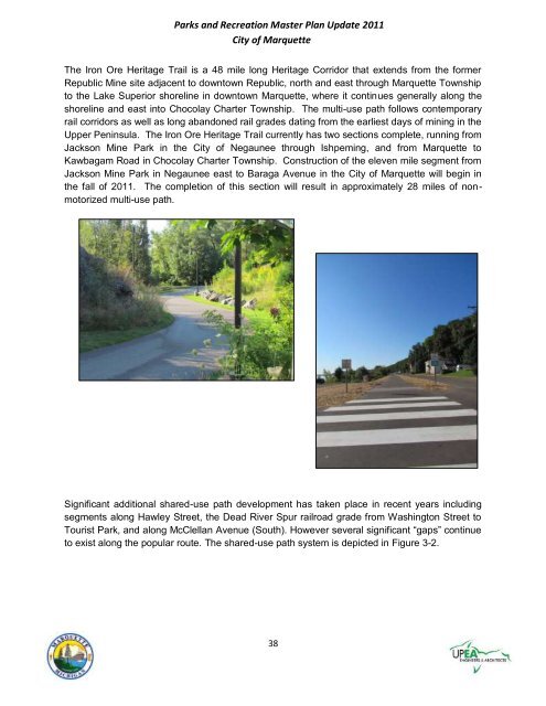
The Iron Ore Heritage Trail is a 48 mile long Heritage Corridor that extends from the former<br />
Republic Mine site adjacent to downtown Republic, north and east through <strong>Marquette</strong> Township<br />
to the Lake Superior shoreline in downtown <strong>Marquette</strong>, where it continues generally along the<br />
shoreline and east into Chocolay Charter Township. The multi-use path follows contemporary<br />
rail corridors as well as long abandoned rail grades dating from the earliest days <strong>of</strong> mining in the<br />
Upper Peninsula. The Iron Ore Heritage Trail currently has two sections complete, running from<br />
Jackson Mine Park in the <strong>City</strong> <strong>of</strong> Negaunee through Ishpeming, and from <strong>Marquette</strong> to<br />
Kawbagam Road in Chocolay Charter Township. Construction <strong>of</strong> the eleven mile segment from<br />
Jackson Mine Park in Negaunee east to Baraga Avenue in the <strong>City</strong> <strong>of</strong> <strong>Marquette</strong> will begin in<br />
the fall <strong>of</strong> 2011. The completion <strong>of</strong> this section will result in approximately 28 miles <strong>of</strong> nonmotorized<br />
multi-use path.<br />
Significant additional shared-use path development has taken place in recent years including<br />
segments along Hawley Street, the Dead River Spur railroad grade from Washington Street to<br />
Tourist Park, and along McClellan Avenue (South). However several significant ―gaps‖ continue<br />
to exist along the popular route. The shared-use path system is depicted in Figure 3-2.<br />
38