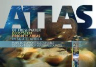
Mpumalanga Biodiversity Conservation Plan Handbook - bgis-sanbi
Mpumalanga Biodiversity Conservation Plan Handbook - bgis-sanbi
Mpumalanga Biodiversity Conservation Plan Handbook - bgis-sanbi

Create successful ePaper yourself
Turn your PDF publications into a flip-book with our unique Google optimized e-Paper software.
MPUMALANGA BIODIVERSITY CONSERVATION PLAN HANDBOOK<br />
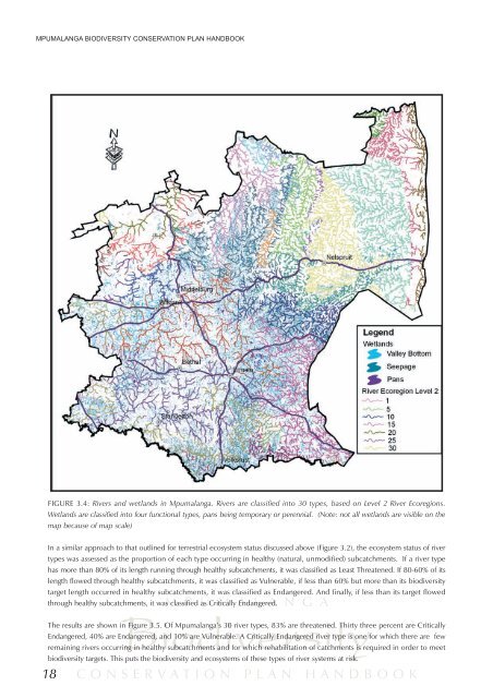
FIGURE 3.4: Rivers and wetlands in <strong>Mpumalanga</strong>. Rivers are classified into 30 types, based on Level 2 River Ecoregions.<br />
Wetlands are classified into four functional types, pans being temporary or perennial. (Note: not all wetlands are visible on the<br />
map because of map scale)<br />
In a similar approach to that outlined for terrestrial ecosystem status discussed above (Figure 3.2), the ecosystem status of river<br />
types was assessed as the proportion of each type occurring in healthy (natural, unmodified) subcatchments. If a river type<br />
has more than 80% of its length running through healthy subcatchments, it was classified as Least Threatened. If 80-60% of its<br />
length flowed through healthy subcatchments, it was classified as Vulnerable, if less than 60% but more than its biodiversity<br />
target length occurred in healthy subcatchments, it was classified as Endangered. And finally, if less than its target flowed<br />
18<br />
M P U M A L A N G A<br />
through healthy subcatchments, it was classified as Critically Endangered.<br />
<strong>Biodiversity</strong><br />
The results are shown in Figure 3.5. Of <strong>Mpumalanga</strong>’s 30 river types, 83% are threatened. Thirty three percent are Critically<br />
Endangered, 40% are Endangered, and 10% are Vulnerable. A Critically Endangered river type is one for which there are few<br />
remaining rivers occurring in healthy subcatchments and for which rehabilitation of catchments is required in order to meet<br />
biodiversity targets. This puts the biodiversity and ecosystems of these types of river systems at risk.<br />
CONSERVATION PLAN HANDBOOK