Mpumalanga Biodiversity Conservation Plan Handbook - bgis-sanbi
Mpumalanga Biodiversity Conservation Plan Handbook - bgis-sanbi
Mpumalanga Biodiversity Conservation Plan Handbook - bgis-sanbi

Create successful ePaper yourself
Turn your PDF publications into a flip-book with our unique Google optimized e-Paper software.
MPUMALANGA BIODIVERSITY CONSERVATION PLAN HANDBOOK<br />
42<br />
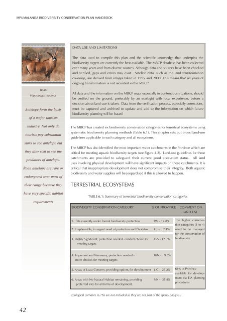
Roan<br />
Hippotragus equinus<br />
Antelope form the basis<br />
of a major tourism<br />
industry. Not only do<br />
tourists pay substantial<br />
sums to see antelope but<br />
they also visit to see the<br />
predators of antelope.<br />
Roan antelope are rare or<br />
endangered over most of<br />
their range because they<br />
have very specific habitat<br />
requirements<br />
DATA USE AND LIMITATIONS<br />
The data used to compile this plan and the scientific knowledge that underpins the<br />
biodiversity targets are currently the best available. The MBCP database has been collected<br />
over many years and from diverse sources. Although data and sources have been checked<br />
and verified, gaps and errors may exist. Satellite data, such as the land transformation<br />
coverage, are derived from images taken in 1995 and 2000. This means that six years of<br />
ongoing transformation is not recorded in the MBCP.<br />
All data and the information on the MBCP map, especially in contentious situations, should<br />
be verified on the ground, preferably by an ecologist with local experience, before a<br />
.<br />
decision about land-use is taken. Data from the verification process, especially corrections,<br />
must be captured and archived to update and add to the information on which future<br />
biodiversity planning will be based<br />
The MBCP has created six biodiversity conservation categories for terrestrial ecosystems using<br />
systematic biodiversity planning methods (Table 6.1). This chapter sets out broad land-use<br />
guidelines applicable to each category and all ecosystems.<br />
The MBCP has also identified the most important water catchments in the Province which are<br />
critical for meeting aquatic biodiversity targets (see Figure 4.2). Land-use guidelines for these<br />
catchments are provided to safeguard their current good ecosystem status. All land<br />
uses involving physical development will have significant impacts on these catchments. It is<br />
critical that inappropriate development does not compromise their integrity. Both aquatic<br />
biodiversity and water supplies will be jeopardised if this is allowed to happen.<br />
TERRESTRIAL ECOSYSTEMS<br />
TABLE 6.1: Summary of terrestrial biodiversity conservation categories<br />
BIODIVERSITY CONSERVATION CATEGORY % OF PROVINCE COMMENT ON<br />
LAND USE<br />
1. PAs currently under formal biodiversity protection PAs - 14.8%<br />
2. Irreplaceable, in urgent need of protection and PA status Irrp - 2.4%<br />
3. Highly Significant, protection needed - limited choice for H-S - 12.3%<br />
meeting targets<br />
4. Important and Necessary, protection needed - I&N - 9.5%<br />
more choices for meeting targets<br />
5. Areas of Least Concern, providing options for development L-C - 25.2%<br />
6. Areas with No Natural Habitat remaining, providing NN - 35.8%<br />
preferred sites for all forms of development.<br />
(Ecological corridors (6.7%) are not included as they are not part of the spatial analysis.)<br />
The higher conservation<br />
categories (1 to 4)<br />
need to be managed<br />
for the conservation of<br />
biodiversity.<br />
61% of Province<br />
available for development<br />
via EIA planning<br />
procedures.