- Page 1 and 2: PROPOSED RETAIL STORE DEVELOPMENT A
- Page 3 and 4: Goodson Associates 1.0 INTRODUCTION
- Page 5 and 6: Goodson Associates 4.0 SITE DESCRIP
- Page 7 and 8: Goodson Associates 5.2 Summary of S
- Page 9 and 10: Goodson Associates 7.2 Drift (Super
- Page 11 and 12: Goodson Associates 7.6 Hydrology (c
- Page 13 and 14: Goodson Associates 7.9 Third Party
- Page 15 and 16: Goodson Associates 8.1 Sources (con
- Page 17 and 18: Goodson Associates Proposed Store D
- Page 19 and 20: Goodson Associates Proposed Store D
- Page 21 and 22: APPENDIX 1 PAN 33 REQUIREMENTS
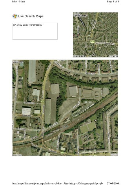
- Page 23: APPENDIX 2 SITE LOCATION PLAN
- Page 38 and 39: Historical Aerial Photography Publi
- Page 40 and 41: Ordnance Survey County Series and O
- Page 42 and 43: Renfrewshire Published 1897 Source
- Page 44 and 45: Renfrewshire Published 1938 Source
- Page 46 and 47: Ordnance Survey Plan Published 1951
- Page 48 and 49: Ordnance Survey Plan Published 1955
- Page 50 and 51: Ordnance Survey Plan Published 1967
- Page 52 and 53: Ordnance Survey Plan Published 1971
- Page 54 and 55: Additional SIMs Published 1988 - 19
- Page 56 and 57: Large-Scale National Grid Data Publ
- Page 58 and 59: Large-Scale National Grid Data Publ
- Page 60 and 61: Renfrewshire Published 1864 Source
- Page 62 and 63: Lanarkshire Published 1864 Source m
- Page 64 and 65: Renfrewshire Published 1898 - 1899
- Page 66 and 67: Dumbartonshire Published 1924 Sourc
- Page 68 and 69: Renfrewshire Published 1938 - 1939
- Page 70 and 71: Ordnance Survey Plan Published 1966
- Page 72 and 73: Ordnance Survey Plan Published 1979
- Page 74 and 75:
10K Raster Mapping Published 1999 S
- Page 76:
APPENDIX 4 DEVELOPMENT PLAN
- Page 79 and 80:
Geological Assessment - Basic Steph
- Page 81 and 82:
Geological Assessment - Basic Secti
- Page 83 and 84:
Geological Assessment - Basic Boreh
- Page 85 and 86:
Geological Assessment - Basic Memoi
- Page 87 and 88:
Geological Assessment - Basic • D
- Page 89 and 90:
Issued by: The Coal Authority, Mini
- Page 91 and 92:
Working Facilities Orders The prope
- Page 93 and 94:
® Envirocheck Report: Mining and G
- Page 95 and 96:
Data Type Mining and Natural Caviti
- Page 97 and 98:
Map ID 7 8 9 10 11 BGS Recorded Min
- Page 99 and 100:
Map ID 15 16 17 18 19 20 21 22 23 2
- Page 101 and 102:
Map ID 28 29 30 31 32 33 34 35 36 3
- Page 103 and 104:
Map ID 70 71 72 73 74 75 76 77 78 7
- Page 105 and 106:
Mining Data BGS Recorded Mineral Si
- Page 107 and 108:
Useful Contacts Contact Name and Ad
- Page 109 and 110:
Ground Stability Data (1:50,000) Mi
- Page 111 and 112:
Ground Stability Data (1:50,000) Mi
- Page 113 and 114:
APPENDIX 6 ENVIROCHECK® REPORT
- Page 115 and 116:
Definitions Terms & Conditions Serv
- Page 117 and 118:
Source Protection Zones Site Sensit
- Page 119 and 120:
® Envirocheck Report: Datasheet Or
- Page 121 and 122:
Data Type Agency & Hydrological Con
- Page 123 and 124:
Map ID 1 2 3 4 Discharge Consents O
- Page 125 and 126:
Map ID 8 8 9 9 Discharge Consents O
- Page 127 and 128:
Map ID 13 14 15 16 Discharge Consen
- Page 129 and 130:
Map ID 19 19 20 21 Discharge Consen
- Page 131 and 132:
Map ID 28 29 30 31 31 32 33 Details
- Page 133 and 134:
Map ID 35 Registered Radioactive Su
- Page 135 and 136:
Map ID 38 39 40 Registered Waste Tr
- Page 137 and 138:
Map ID 43 43 43 Registered Waste Tr
- Page 139 and 140:
Map ID 51 52 53 54 55 56 BGS Record
- Page 141 and 142:
Map ID Details Potential for Collap
- Page 143 and 144:
Map ID 62 63 64 65 66 66 66 67 68 6
- Page 145 and 146:
Map ID 75 75 75 75 75 75 75 76 77 7
- Page 147 and 148:
Map ID 85 86 86 86 87 87 88 88 88 8
- Page 149 and 150:
Map ID 94 95 95 95 96 96 96 97 97 9
- Page 151 and 152:
Map ID 106 106 106 107 108 109 110
- Page 153 and 154:
Map ID 116 117 118 119 120 121 121
- Page 155 and 156:
Map ID 128 128 128 129 130 131 132
- Page 157 and 158:
Map ID 136 136 136 136 136 136 137
- Page 159 and 160:
Map ID 146 147 147 147 148 148 148
- Page 161 and 162:
Map ID 157 158 159 160 160 161 162
- Page 163 and 164:
Map ID 174 174 174 175 176 177 178
- Page 165 and 166:
Map ID 187 Areas of Adopted Green B
- Page 167 and 168:
Waste BGS Recorded Landfill Sites B
- Page 169 and 170:
Data Currency Sensitive Land Use Ve
- Page 171 and 172:
Useful Contacts Contact Name and Ad
- Page 173 and 174:
Site Sensitivity Map - Segment A13
- Page 175 and 176:
For Borehole information please ref
- Page 177 and 178:
Data Type Page Number BGS Boreholes
- Page 179 and 180:
Map ID 195 195 195 195 196 196 196
- Page 181 and 182:
Map ID 209 209 210 210 210 210 210
- Page 183 and 184:
Map ID 220 220 221 222 222 222 223
- Page 185 and 186:
Map ID 234 235 235 235 235 235 236
- Page 187 and 188:
Map ID 247 247 247 247 247 248 249
- Page 189 and 190:
Map ID 257 258 258 259 259 259 259
- Page 191 and 192:
Map ID 274 274 274 274 275 276 277
- Page 193 and 194:
Map ID 293 294 295 295 295 296 297
- Page 195 and 196:
Map ID 306 306 306 306 306 307 307
- Page 197 and 198:
Map ID 316 316 317 317 318 319 320
- Page 199 and 200:
Map ID 330 330 330 330 330 330 330
- Page 201 and 202:
Map ID 338 338 338 338 338 339 339
- Page 203 and 204:
Map ID 357 358 359 360 361 362 363
- Page 205:
APPENDIX 7 THIRD PARTY INFORMATION
- Page 213 and 214:
APPENDIX 8 Contained within in CLR
- Page 215 and 216:
PROPOSED RETAIL STORE DEVELOPMENT 1