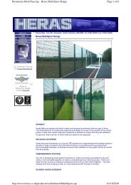
Supporting documents - Renfrewshire Council
Supporting documents - Renfrewshire Council
Supporting documents - Renfrewshire Council

You also want an ePaper? Increase the reach of your titles
YUMPU automatically turns print PDFs into web optimized ePapers that Google loves.
Goodson Associates<br />
5.0 HISTORICAL LAND USE<br />
Proposed Store Development, Wallneuk Road, Paisley - 9692<br />
The history of land use within the site boundary, and surrounding areas, has<br />
been investigated by reviewing a succession of historic maps 9 . The previous<br />
land use within and out with the site assists in the formulation of the<br />
preliminary CSM, by assessing potential contaminative activities and there<br />
relation to the proposed development and the wider environment. Presented<br />
as (Appendix 3) and summarised below are the key points relating to the site<br />
and surrounding land use.<br />
5.1 Summary of Land Use- within Site Boundary<br />
A combination of the 1:10,560 and 1:2,500 scale maps provides the most<br />
accurate use of the and within the site boundary and surrounding area. The<br />
earliest map edition with complete coverage of the site boundary is the<br />
1:10,560 of 1845. The site is occupied by early signs of industrial<br />
development with a goods shed, railway sidings and an engineering works on<br />
the western boundary. The remainder of the site is largely open undeveloped<br />
land used for allotments. By 1897, approximately 80% of the site is occupied<br />
by railway sidings, cranes, goods station and an iron foundry. A starch works<br />
is located in the north western corner with a branch line leading to the factory.<br />
The Gallowhill branch railway line bounds the north of the site, whilst the main<br />
Paisley-Glasgow branch line bounds the south of the site. The map edition of<br />
1913 indicates that the former starch works has been removed and the area<br />
now occupied by a tramway and cranes.<br />
By 1938, the site is occupied by the Vulcan Engineering works (formerly the<br />
Iron foundry) and there is a reduction in the number of railway sidings within<br />
the boundary. No appreciable changes are depicted in the map edition of<br />
1951, the majority of the land use within the site boundary. In the vicinity of<br />
the Vulcan engineering works a tank and boiler house are noted. A refuse tip<br />
is noted in the northeast of the site. The land use with the site boundary<br />
remains relatively unchanged until the early 1980’s.<br />
By 1983, the majority of the former railway sidings and goods storage shed(s)<br />
have been removed and Wallneuk Road is established in the south of the site.<br />
New warehousing and a factory are located in the area of the former Vulcan<br />
Engineering works in the west and north western portions of the site. An<br />
indoor bowling club is present in the northeast, with a petrol filling station<br />
occupying the extreme North West boundary.<br />
The map edition of 1992 depicts that the former factory in the northwest of the<br />
site is now a warehouse, with the southern portion used as lorry/car park. The<br />
PFS on the north western boundary is no longer annotated although<br />
structures remain. No major changes occur until the present day, although the<br />
warehouse in the northwest of the site has been used as an indoor 10 pin<br />
bowling alley. This however appeared disused during the site reconnaissance<br />
survey.<br />
There are no other changes evident in the map edition of 2008, and up to the<br />
present day (September 2008). The PFS has been remediated.<br />
9 Historic maps provided by Landmark.<br />
Page 4