- Page 1 and 2: PROPOSED RETAIL STORE DEVELOPMENT A
- Page 3 and 4: Goodson Associates 1.0 INTRODUCTION
- Page 5 and 6: Goodson Associates 4.0 SITE DESCRIP
- Page 7 and 8: Goodson Associates 5.2 Summary of S
- Page 9 and 10: Goodson Associates 7.2 Drift (Super
- Page 11 and 12: Goodson Associates 7.6 Hydrology (c
- Page 13 and 14: Goodson Associates 7.9 Third Party
- Page 15 and 16: Goodson Associates 8.1 Sources (con
- Page 17 and 18: Goodson Associates Proposed Store D
- Page 19 and 20: Goodson Associates Proposed Store D
- Page 21 and 22: APPENDIX 1 PAN 33 REQUIREMENTS
- Page 23 and 24: APPENDIX 2 SITE LOCATION PLAN
- Page 37 and 38: APPENDIX 3 HISTORICAL MAP EXTRACTS
- Page 39 and 40: Ordnance Survey County Series and O
- Page 41 and 42: Renfrewshire Published 1895 Source
- Page 43 and 44: Renfrewshire Published 1913 Source
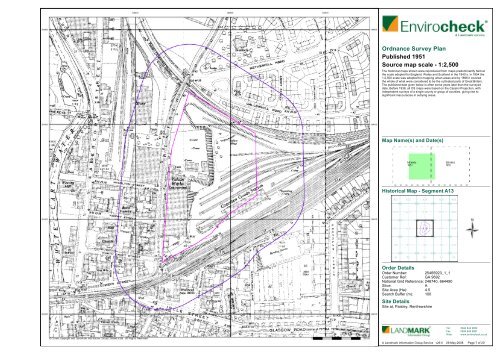
- Page 45: Ordnance Survey Plan Published 1950
- Page 49 and 50: Ordnance Survey Plan Published 1960
- Page 51 and 52: Additional SIMs Published 1967 Sour
- Page 53 and 54: Additional SIMs Published 1983 - 19
- Page 55 and 56: Large-Scale National Grid Data Publ
- Page 57 and 58: Additional SIMs Published 1992 Sour
- Page 59 and 60: Large-Scale National Grid Data Publ
- Page 61 and 62: Dumbartonshire Published 1864 Sourc
- Page 63 and 64: Lanarkshire Published 1898 Source m
- Page 65 and 66: Renfrewshire Published 1914 - 1916
- Page 67 and 68: Lanarkshire Published 1934 Source m
- Page 69 and 70: Ordnance Survey Plan Published 1956
- Page 71 and 72: Ordnance Survey Plan Published 1973
- Page 73 and 74: Ordnance Survey Plan Published 1985
- Page 75 and 76: 10K Raster Mapping Published 2008 S
- Page 78 and 79: APPENDIX 5 BGS/MINERAL STABILITY an
- Page 80 and 81: Geological Assessment - Basic Secti
- Page 82 and 83: Geological Assessment - Basic Secti
- Page 84 and 85: Geological Assessment - Basic Map T
- Page 86 and 87: Geological Assessment - Basic BGS E
- Page 88 and 89: Geological Assessment - Basic GEOLO
- Page 90 and 91: © The Coal Authority The property
- Page 92 and 93: Location map Approximate position o
- Page 94 and 95: Summary Mining and Natural Cavities
- Page 96 and 97:
Map ID 1 2 3 4 5 6 BGS Recorded Min
- Page 98 and 99:
Map ID 12 13 14 Potential Mining Ar
- Page 100 and 101:
Map ID 25 26 27 Extractive Industri
- Page 102 and 103:
Map ID 49 50 51 52 53 54 55 56 57 5
- Page 104 and 105:
The following mapping has been anal
- Page 106 and 107:
A selection of organisations who pr
- Page 108 and 109:
Historical Land Use Information (1:
- Page 110 and 111:
Ground Stability Data (1:50,000) Mi
- Page 112 and 113:
Historical Land Use Information (1:
- Page 114 and 115:
Index Map For ease of identificatio
- Page 116 and 117:
Groundwater Vulnerability Site Sens
- Page 118 and 119:
Sensitive Land Uses Site Sensitivit
- Page 120 and 121:
Report Section Page Number Summary
- Page 122 and 123:
Data Type Geological BGS Recorded M
- Page 124 and 125:
Map ID 5 6 7 8 Discharge Consents O
- Page 126 and 127:
Map ID 10 11 12 13 Discharge Consen
- Page 128 and 129:
Map ID 16 17 17 18 Discharge Consen
- Page 130 and 131:
Map ID 22 23 24 25 25 26 27 Dischar
- Page 132 and 133:
Map ID 34 34 34 34 34 34 Registered
- Page 134 and 135:
Map ID 36 37 37 Local Authority Lan
- Page 136 and 137:
Map ID 41 42 Registered Waste Treat
- Page 138 and 139:
Map ID 44 45 46 47 48 48 49 50 Deta
- Page 140 and 141:
Map ID 57 58 59 60 61 BGS Recorded
- Page 142 and 143:
Map ID Shallow Mining Hazards Risk:
- Page 144 and 145:
Map ID 70 71 72 72 72 73 73 74 74 7
- Page 146 and 147:
Map ID 79 80 81 82 83 83 83 83 84 8
- Page 148 and 149:
Map ID 90 90 91 92 92 92 92 93 93 9
- Page 150 and 151:
Map ID 98 98 99 100 101 101 102 102
- Page 152 and 153:
Map ID 110 110 111 112 112 112 112
- Page 154 and 155:
Map ID 124 124 125 125 125 126 127
- Page 156 and 157:
Map ID 133 133 134 134 135 135 136
- Page 158 and 159:
Map ID 141 142 142 142 142 143 144
- Page 160 and 161:
Map ID 150 151 152 152 153 154 154
- Page 162 and 163:
Map ID 166 167 167 167 168 169 169
- Page 164 and 165:
Map ID 183 184 185 186 Fuel Station
- Page 166 and 167:
Data Currency Agency & Hydrological
- Page 168 and 169:
Geological BGS Recorded Mineral Sit
- Page 170 and 171:
A selection of organisations who pr
- Page 172 and 173:
Site Sensitivity Map - Slice A Orde
- Page 174 and 175:
Flood Map - Slice A Order Details O
- Page 176 and 177:
® Envirocheck Report: BGS Borehole
- Page 178 and 179:
Map ID 188 188 189 189 189 189 190
- Page 180 and 181:
Map ID 200 201 202 202 202 203 204
- Page 182 and 183:
Map ID 214 214 214 215 215 215 216
- Page 184 and 185:
Map ID 226 227 228 228 228 229 230
- Page 186 and 187:
Map ID 240 240 240 240 240 240 241
- Page 188 and 189:
Map ID 253 253 253 253 253 253 253
- Page 190 and 191:
Map ID 265 265 265 265 266 267 268
- Page 192 and 193:
Map ID 284 284 284 284 284 285 286
- Page 194 and 195:
Map ID 299 299 299 299 300 301 301
- Page 196 and 197:
Map ID 311 311 311 311 311 312 313
- Page 198 and 199:
Map ID 324 324 324 324 324 325 326
- Page 200 and 201:
Map ID 330 331 332 332 332 332 332
- Page 202 and 203:
Map ID 350 351 351 351 351 352 353
- Page 204 and 205:
Data Currency and Contact Details B
- Page 212 and 213:
APPENDIX 8 CLR6 RISK CATEGORISATION
- Page 214 and 215:
APPENDIX 9 CONCEPTUAL SITE MODEL SU
- Page 216:
APPENDIX 10 INDICATIVE BOREHOLE LOC