- Page 1 and 2: CORIO NORLANE STRUCTURE PLAN BACKGR
- Page 3 and 4: 6.5 Active Transport ..............
- Page 5 and 6: Table 14 - City of Greater Geelong
- Page 7 and 8: PART C 1.0 Introduction 1.1 Backgro
- Page 9 and 10: The City of Greater Geelong has mad
- Page 11 and 12: Map 1- Locality Plan Corio Norlane
- Page 13 and 14: Map 3 - Study Area Corio Norlane St
- Page 15 and 16: partnership with David Stead, but i
- Page 17 and 18: 2.0 Policy and Strategy Context The
- Page 19 and 20: egion, and particularly in identifi
- Page 21 and 22: 2.3.4 Freight Futures - the Victori
- Page 23 and 24: • North Geelong Precinct: to enco
- Page 25 and 26: childhood services. It articulates
- Page 27 and 28: 2.8 Planning Scheme Policy, Zones a
- Page 29 and 30: 2.8.1 Zones The area is subject to
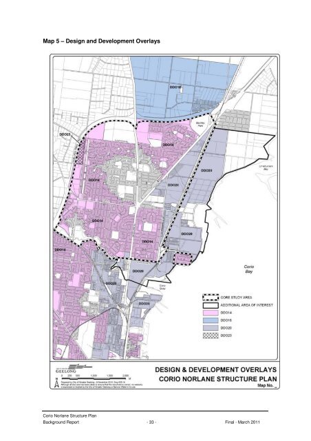
- Page 31: 2.8.2 Overlays The area is subject
- Page 35 and 36: 2.9 Planning Provisions requiring r
- Page 37 and 38: 3.0 Demographic and Social Profile
- Page 39 and 40: accounting for 18% of the total pop
- Page 41 and 42: 3.6 Labour Force Suburbs in Time de
- Page 43 and 44: Figure 11 - Household Income Corio
- Page 45 and 46: 3.10 Key Influences - Demographics
- Page 47 and 48: Engineering Services Unit generally
- Page 49 and 50: Park and Recreation Zone - PPRZ) pa
- Page 51 and 52: 4.5 Key Influences - Physical Infra
- Page 53 and 54: Map 8 - Residential Character and I
- Page 55 and 56: Norlane Precinct 1 The streetscapes
- Page 57 and 58: 5.2 Increased Housing Diversity Are
- Page 59 and 60: Corio Distillery) at 23A-35 Lowe St
- Page 61 and 62: Map 9 - Vacant Residential Land Cor
- Page 63 and 64: een earmarked to house the Corio Co
- Page 65 and 66: Table 8 - Summary of Residential De
- Page 67 and 68: 6.0 Movement and Transport 6.1 Demo
- Page 69 and 70: Photo 4 - Interstate Platform, Nort
- Page 71 and 72: The study indicated that large port
- Page 73 and 74: 6.4 Road and Freight The transport
- Page 75 and 76: Figure 16 - Geelong Port Linkages S
- Page 77 and 78: 6.5 Active Transport Active transpo
- Page 79 and 80: Figure 18 - North Geelong Cycling R
- Page 81 and 82: Directions and actions from the Gee
- Page 83 and 84:
7.0 Economic Development The sub re
- Page 85 and 86:
Data on the number and value of bui
- Page 87 and 88:
centres are shown in Map 11 and des
- Page 89 and 90:
Table 13 - Summary of Retail Centre
- Page 91 and 92:
Robin Avenue, Norlane Fully tenante
- Page 93 and 94:
7.4.1 Key Issues for Retail Sector
- Page 95 and 96:
This may involve locating community
- Page 97 and 98:
The core design elements of the con
- Page 99 and 100:
The Industrial 1 zoned land bounded
- Page 101 and 102:
7.6 Key Influences - Economic Devel
- Page 103 and 104:
Map 12 - Key Community Services and
- Page 105 and 106:
• Strategic footpath development.
- Page 107 and 108:
Theme/Issue Summary Recommendations
- Page 109 and 110:
policy initiatives, which includes
- Page 111 and 112:
Map 13 - School Facilities Corio No
- Page 113 and 114:
Flinders Peak Secondary College is
- Page 115 and 116:
8.4 Key Influences - Social Infrast
- Page 117 and 118:
9.1.2 Cuthbertson Creek Cuthbertson
- Page 119 and 120:
The City of Greater Geelong has und
- Page 121 and 122:
Map 14 - Bio Sites Corio Norlane St
- Page 123 and 124:
9.4 Air Quality The Study Area is a
- Page 125 and 126:
9.6 Key Influences - Natural Enviro
- Page 127 and 128:
Map 15 - Recreation and Open Space
- Page 129 and 130:
Master Plans Stead Park: Stead Park
- Page 131 and 132:
this precinct is to improve the ove
- Page 133 and 134:
10.2.6 Norlane Reserve Address Size
- Page 135 and 136:
The centre contains the following f
- Page 137 and 138:
10.4 Walking Study The ‘Walking M
- Page 139 and 140:
10.6 Key Influences - Recreation an
- Page 141 and 142:
Economic Independence and Social In