

Report PDF (3.7 MB) - USGS
Report PDF (3.7 MB) - USGS
Report PDF (3.7 MB) - USGS

Create successful ePaper yourself
Turn your PDF publications into a flip-book with our unique Google optimized e-Paper software.
6 Surrogate Technologies to Estimate Suspended Sediment, Clearwater River, Idaho, and Snake River, Wash., 2008–10<br />
The ADVMs average measurements collected over<br />
2 min out of every 15 min. The water-quality sonde measures<br />
turbidity adjacent to the instrument every 15 min and is<br />
equipped with an automated wiper mechanism to reduce<br />
biological fouling on the face of the probe. The LISST-<br />
StreamSide measures volumetric SSC and grain-size<br />
distribution every 30 min. The sampling line for the LISST-<br />
StreamSide is flushed for 2–5 min prior to each measurement<br />
(duration changed during study period), and measurements are<br />
then averaged over 30 sec.<br />
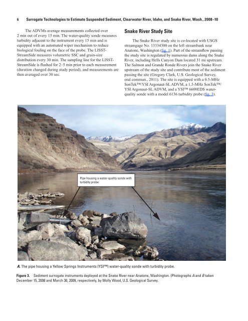
Snake River Study Site<br />
The Snake River study site is co-located with <strong>USGS</strong><br />
streamgage No. 13334300 on the left streambank near<br />
Anatone, Washington (fig. 1). Part of the streamflow passing<br />
the study site is regulated by numerous dams along the Snake<br />
River, including Hells Canyon Dam located 31 mi upstream.<br />
The Salmon and Grande Ronde Rivers join the Snake River<br />
upstream of the study site and contribute most of the sediment<br />
passing the site (Gregory Clark, U.S. Geological Survey,<br />
oral commun., 2011). The site is equipped with a 0.5-MHz<br />
SonTek/YSI Argonaut-SL ADVM, a 1.5-MHz SonTek/<br />
YSI Argonaut-SL ADVM, and a YSI 6600EDS waterquality<br />
sonde with a model 6136 turbidity probe (fig. 3).<br />
Pipe housing a water-quality sonde with<br />
turbidity probe<br />
A. The pipe housing a Yellow Springs Instruments (YSI) water-quality sonde with turbidity probe.<br />
Figure 3. Sediment surrogate instruments deployed at the Snake River near Anatone, Washington. (Photographs A and B taken<br />
December 15, 2008 and March 30, 2009, respectively, by Molly Wood, U.S. Geological Survey.


