geothermal resource potential of the safford-san simon basin, arizona
geothermal resource potential of the safford-san simon basin, arizona
geothermal resource potential of the safford-san simon basin, arizona
You also want an ePaper? Increase the reach of your titles
YUMPU automatically turns print PDFs into web optimized ePapers that Google loves.
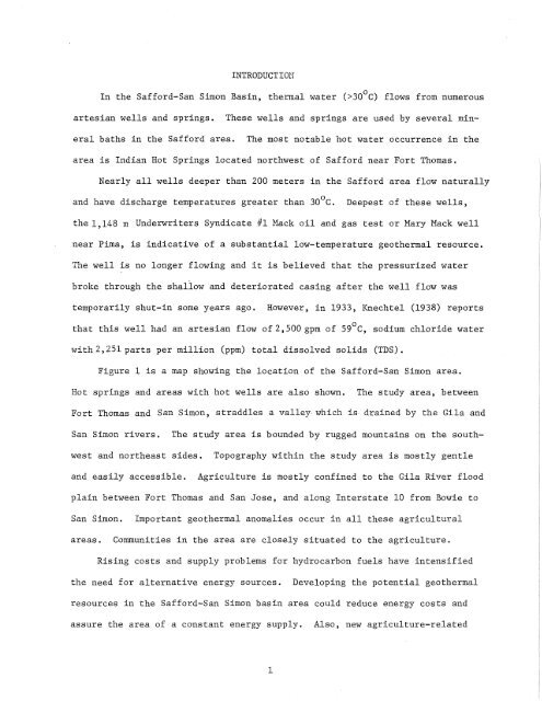
INTRODUCTION<br />
o<br />
In <strong>the</strong> Safford-San Simon Basin, <strong>the</strong>rmal water (>30 C)<br />
flows from numerous<br />
artesian wells and springs.<br />
These wells and springs are used by several mineral<br />
baths in <strong>the</strong> Safford area.<br />
The most notable hot water occurrence in <strong>the</strong><br />
area is Indian Hot Springs located northwest <strong>of</strong> Safford near Fort Thomas.<br />
Nearly all wells deeper than 200 meters in <strong>the</strong> Safford area flow naturally<br />
and have discharge temperatures greater than 30 o C.<br />
Deepest <strong>of</strong> <strong>the</strong>se wells,<br />
<strong>the</strong> 1,148 m Underwriters Syndicate #1 Mack oil and gas test or Mary Mack well<br />
near Pima, is indicative <strong>of</strong> a substantial low-temperature <strong>geo<strong>the</strong>rmal</strong> <strong>resource</strong>.<br />
The well is no longer flowing and it is believed that <strong>the</strong> pressurized water<br />
broke through <strong>the</strong> shallow and deteriorated casing after <strong>the</strong> well flow was<br />
temporarily shut-in some years ago. However, in 1933, Knechtel (1938) reports<br />
o<br />
that this well had an artesian flow <strong>of</strong>2,500 gpm <strong>of</strong> 59 C,<br />
sodium chloride water<br />
with 2,251 parts per million (ppm)<br />
total dissolved solids (TDS).<br />
Figure 1 is a map showing <strong>the</strong> location <strong>of</strong> <strong>the</strong> Safford-San Simon area.<br />
Hot springs and areas with hot wells are also shown.<br />
The study area, between<br />
Fort Thomas and San Simon, straddles a valley which is drained by <strong>the</strong> Gila and<br />
San Simon rivers.<br />
The study area is bounded by rugged mountains on <strong>the</strong> southwest<br />
and nor<strong>the</strong>ast sides.<br />
Topography within <strong>the</strong> study area is mostly gentle<br />
and easily accessible.<br />
Agriculture is mostly confined to <strong>the</strong> Gila River flood<br />
plain between Fort Thomas and San Jose, and along Interstate 10 from Bowie to<br />
San Simon.<br />
Important <strong>geo<strong>the</strong>rmal</strong> anomalies occur in all <strong>the</strong>se agricultural<br />
areas.<br />
Communities in <strong>the</strong> area are closely situated to <strong>the</strong> agriculture.<br />
Rising costs and supply problems for hydrocarbon fuels have intensified<br />
<strong>the</strong> need for alternative energy sources.<br />
Developing <strong>the</strong> <strong>potential</strong> <strong>geo<strong>the</strong>rmal</strong><br />
<strong>resource</strong>s in <strong>the</strong> Safford-San Simon <strong>basin</strong> area could reduce energy costs and<br />
assure <strong>the</strong> area <strong>of</strong> a constant energy supply.<br />
Also, new agriculture-related<br />
1


