March 2004 - Society for California Archaeology
March 2004 - Society for California Archaeology
March 2004 - Society for California Archaeology

You also want an ePaper? Increase the reach of your titles
YUMPU automatically turns print PDFs into web optimized ePapers that Google loves.
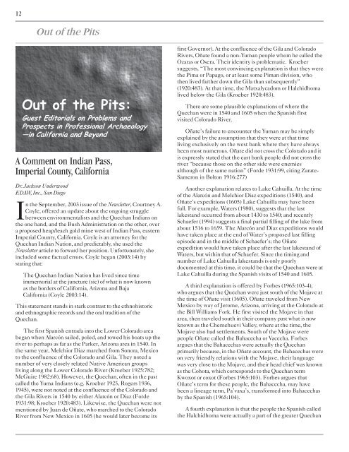
12<br />
Out of the Pits<br />
Out of the Pits:<br />
Guest Editorials on Problems and<br />
Prospects in Professional <strong>Archaeology</strong><br />
—in Cali<strong>for</strong>nia and Beyond<br />
A Comment on Indian Pass,<br />
Imperial County, Cali<strong>for</strong>nia<br />
Dr. Jackson Underwood<br />
EDAW, Inc., San Diego<br />
In the September, 2003 issue of the Newsletter, Courtney A.<br />
Coyle, offered an update about the ongoing struggle<br />
between environmentalists and the Quechan Indians on<br />
the one hand, and the Bush Administration on the other, over<br />
a proposed heap/leach gold mine west of Indian Pass, eastern<br />
Imperial County, Cali<strong>for</strong>nia. Coyle is an attorney <strong>for</strong> the<br />
Quechan Indian Nation, and predictably, she used the<br />
Newsletter article to <strong>for</strong>ward her position. Un<strong>for</strong>tunately, she<br />
included some factual errors. Coyle began (2003:14) by<br />
stating that:<br />
The Quechan Indian Nation has lived since time<br />
immemorial at the juncture (sic) of what is now known<br />
as the borders of Cali<strong>for</strong>nia, Arizona and Baja<br />
Cali<strong>for</strong>nia (Coyle 2003:14).<br />
This statement stands in stark contrast to the ethnohistoric<br />
and ethnographic records and the oral tradition of the<br />
Quechan.<br />
The first Spanish entrada into the Lower Colorado area<br />
began when Alarcón sailed, poled, and rowed his boats up the<br />
river to perhaps as far as the Parker, Arizona area in 1540. In<br />
the same year, Melchior Diaz marched from Sonora, Mexico<br />
to the confluence of the Colorado and Gila. They noted a<br />
number of very closely related Native American groups<br />
living along the Lower Colorado River (Kroeber 1925:782;<br />
McGuire 1982:68). However, the Quechan, often in the past<br />
called the Yuma Indians (e.g. Kroeber 1925, Rogers 1936,<br />
1945), were not noted at the confluence of the Colorado and<br />
the Gila Rivers in 1540 by either Alarcón or Diaz (Forde<br />
1931:98; Kroeber 1920:483). Likewise, the Quechan were not<br />
mentioned by Juan de Oñate, who marched to the Colorado<br />
River from New Mexico in 1605 (he would later become its<br />
first Governor). At the confluence of the Gila and Colorado<br />
Rivers, Oñate found a non-Yuman people whom he called the<br />
Ozaras or Osera. Their identity is problematic. Kroeber<br />
suggests, “The most convincing explanation is that they were<br />
the Pima or Papago, or at least some Piman division, who<br />
then lived farther down the Gila than subsequently”<br />
(1920:483). At that time, the Matxalycadom or Halchidhoma<br />
lived below the Gila (Kroeber 1920:483).<br />
There are some plausible explanations of where the<br />
Quechan were in 1540 and 1605 when the Spanish first<br />
visited Colorado River.<br />
Oñate’s failure to encounter the Yuman may be simply<br />
explained by the assumption that they were at that time<br />
living exclusively on the west bank where they have always<br />
been most numerous. Oñate did not cross the Colorado and it<br />
is expressly stated that the east bank people did not cross the<br />
river “because those on the other side were enemies<br />
although of the same nation” (Forde 1931:99, citing Zarate-<br />
Sameron in Bolton 1916:277)<br />
Another explanation relates to Lake Cahuilla. At the time<br />
of the Alarcón and Melchior Diaz expeditions (1540), and<br />
Oñate’s expeditions (1605) Lake Cahuilla may have been<br />
full. For example, Waters (1980), suggests that the last<br />
lakestand occurred from about 1430 to 1540; and recently<br />
Schaefer (1994) suggests a final partial filling of the lake from<br />
about 1516 to 1659. The Alarcón and Diaz expeditions would<br />
have taken place at the end of Water’s proposed last filling<br />
episode and in the middle of Schaefer’s; the Oñate<br />
expedition would have taken place after the last lakestand of<br />
Waters, but within that of Schaefer. Since the timing and<br />
number of Lake Cahuilla lakestands is only poorly<br />
documented at this time, it could be that the Quechan were at<br />
Lake Cahuilla during the Spanish visits of 1540 and 1605.<br />
A third explanation is offered by Forbes (1965:103-4),<br />
who argues that the Quechan were just south of the Mojave at<br />
the time of Oñate visit (1605). Oñate traveled from New<br />
Mexico by way of Jerome, Arizona, arriving at the Colorado at<br />
the Bill Williams Fork. He first visited the Mojave in that<br />
area, then traveled south in their company past what is now<br />
known as the Chemehuevi Valley, where at the time, the<br />
Mojave also had settlements. South of the Mojave were<br />
people Oñate called the Bahacecha or Vacecha. Forbes<br />
argues that the Bahacechas were actually the Quechan<br />
primarily because, in the Oñate account, the Bahacechas were<br />
on very friendly relations with the Mojave, their language<br />
was very close to the Mojave, and their head chief was known<br />
as the Cohota, which corresponds to the Quechan term<br />
Kwoxot or coxot (Forbes 1965:103). Forbes argues that<br />
Oñate’s term <strong>for</strong> these people, the Bahacecha, may have<br />
been a lineage term, Pa’vaxa’s, trans<strong>for</strong>med into Bahacechas<br />
by the Spanish (1965:104).<br />
A fourth explanation is that the people the Spanish called<br />
the Halchidhoma were actually a part of the greater Quechan