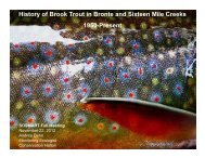
Royal Rouge Trail Erosion Control Project - Toronto and Region ...
Royal Rouge Trail Erosion Control Project - Toronto and Region ...
Royal Rouge Trail Erosion Control Project - Toronto and Region ...

Create successful ePaper yourself
Turn your PDF publications into a flip-book with our unique Google optimized e-Paper software.
The primary purpose of the Stage 3 investigation was to determine the limits of the site<br />
encountered during Stage 2 assessment where four lithic flakes were located in four separate<br />
test pits along the western boundary of 36 <strong>Royal</strong> <strong>Rouge</strong> <strong>Trail</strong>. Because the artifacts were<br />
found along the fence line, the Stage 3 assessment was targeted for both 34 <strong>and</strong> 36 <strong>Royal</strong><br />
<strong>Rouge</strong> <strong>Trail</strong>. A second objective of the investigation was to determine the cultural affiliation of<br />
the site <strong>and</strong> determine if it was associated with the Seneca Village located nearby. This<br />
seemed possible despite the fact that no Woodl<strong>and</strong> artifacts had been encountered in this<br />
yard during Stage 2, however a single body sherd had been recovered in a test pit at 32<br />
<strong>Royal</strong> <strong>Rouge</strong> <strong>Trail</strong> during the same Stage 2 assessment (TRCA 2010a). Due to the sensitive<br />
nature of the Bead Hill site nearby, <strong>and</strong> because a Woodl<strong>and</strong> artifact was found during the<br />
Stage 2 assessment, First Nations Liaison Corrine Hill was retained to work at this site during<br />
the Stage 3 investigation <strong>and</strong> to remain during the Stage 4 excavation if required. The third<br />
<strong>and</strong> final objective of the Stage 3 investigation was to determine the soil profile <strong>and</strong> the<br />
degree of disturbance at the site.<br />
Stage 3 investigative units were h<strong>and</strong> excavated in 1m² units according to current technical<br />
st<strong>and</strong>ards on a five meter grid until units contained no artifacts, or until areas of severe<br />
disturbance or obstacles were reached, or until a property with a registered site was reached<br />
that was to be assessed independently. Occasionally, units were slightly relocated if trees,<br />
shrubs or other immovable objects were in the way. The TRCA restoration/erosion control<br />
staff responsible for the slope remediation advised that excavations within the drip line of<br />
trees on the properties be avoided <strong>and</strong> that any plantings that contributed to the stability of<br />
the adjacent slope be avoided. However, it was determined that individual units, as opposed<br />
to block excavations, would do minimal harm to the plantings if the roots were left intact <strong>and</strong><br />
would still provide a clear assessment of the site limits. Units were excavated in stratigraphic<br />
layers to five centimetres below subsoil. Once the limits of the site were identified, additional<br />
units comprising at least 20% of the grid unit total were excavated in areas of dense artifact<br />
concentrations or where positive test pits were encountered during the Stage 2 assessment.<br />
All soil was screened through 6mm mesh to facilitate artifact recovery <strong>and</strong> all artifacts were<br />
collected <strong>and</strong> retained.<br />
Twenty-seven 1m² units were excavated during the Stage 3 investigation. Twenty-one units<br />
were excavated on a five metre grid across the two properties. An additional six units were<br />
excavated in areas of dense artifact concentrations or in locations where positive Stage 2 test<br />
pits were encountered. No diagnostic Woodl<strong>and</strong> artifacts such as body sherds were<br />
encountered; instead all artifacts found were lithics <strong>and</strong> the single diagnostic projectile point<br />
which dated to the Late Archaic (3500-2800 BP). A total of 355 artifacts were collected from<br />
the 27 1m 2 units. This included 347 flakes, 4 chipped stone tools or tool fragments, 3 soil<br />
stained faunal fragments, <strong>and</strong> 1 calcined bone. The Stage 3 investigation concluded that the<br />
Jhuman site contained far more cultural information than was indicated during the Stage 2<br />
assessment <strong>and</strong> appears to be a high-density multi-component Middle <strong>and</strong> Late Archaic<br />
campsite. Due to the threat of erosion <strong>and</strong> the proposed erosion control measures to be<br />
implemented, it was determined that avoidance <strong>and</strong> protection was not a viable option for<br />
this sensitive resource <strong>and</strong> that Stage 4 excavation was required.<br />
The purpose of the Stage 4 excavation of the Jhuman site was to document <strong>and</strong> remove the<br />
site data as completely as possible given the constraints of working in a subdivision with<br />
fences, decks, swimming pools, gardens <strong>and</strong> disturbed soils <strong>and</strong> also with the inherent risks<br />
of moving large quantities of soil in an area at risk of severe erosion. In accordance with<br />
27<br />
<strong>Project</strong> Plan<br />
<strong>Toronto</strong> <strong>and</strong> <strong>Region</strong> Conservation Authority<br />
<strong>Royal</strong> <strong>Rouge</strong> <strong>Trail</strong> <strong>Erosion</strong> <strong>Control</strong> <strong>Project</strong> January 2010