Activities & Events
Activities & Events
Activities & Events

You also want an ePaper? Increase the reach of your titles
YUMPU automatically turns print PDFs into web optimized ePapers that Google loves.
the lumparland trail<br />
Walk through an ever-changing landscape where<br />
fields give way to mountains, forests and country<br />
lanes and every so often a glimpse of the sea. The<br />
trail takes in Lumparland’s church and beach. Start<br />
at Lumparsund to Långnäs or Svinö or vice versa.<br />
Length: approx. 18 km.<br />
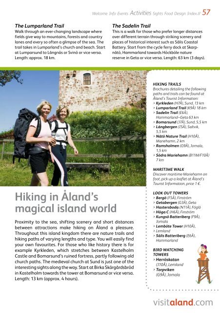
hiking in Åland’s<br />
magical island world<br />
Proximity to the sea, shifting scenery and short distances<br />
between attractions make hiking on Åland a pleasure.<br />
Throughout this island kingdom there are nature trails and<br />
hiking paths of varying lengths and type. You will easily find<br />
your own favourites. For those who like history there is for<br />
example Kyrkleden, which stretches between Kastelholm<br />
Castle and Bomarsund’s ruined fortress, partly following old<br />
church paths. The medieval church at Sund is just one of the<br />
interesting sights along the way. Start at Birka Skärgårdsbröd<br />
in Kastelholm towards the tower at Bomarsund or vice versa.<br />
Length: 13 km (approx. 4 hours).<br />
Welcome Info <strong>Events</strong> <strong>Activities</strong> Sights Food Design Index<br />
//<br />
the sadelin trail<br />
This is a walk for those who prefer longer distances<br />
over different terrain through striking scenery and<br />
places of historical interest such as Sålis Coastal<br />
Battery. Start from the cycle ferry dock at Skarpnåtö,<br />
Hammarland towards Höckböle nature<br />
reserve in Geta or vice versa. Length: 63 km (3 days).<br />
hIKINg tRAIls<br />
Brochures detailing the following<br />
paths and trails can be found at<br />
Åland’s Tourist Information:<br />
> Kyrkleden (H7Å), Sund, 13 km<br />
> lumparland trail (K9Å) 18 km<br />
> sadelin trail (E6Å),<br />
Hammarland–Geta 63 km<br />
> Bomarsund (J7Å), Sund, 5,5 km<br />
> långbergen (I5Å), Saltvik,<br />
5,5 km<br />
> Nåtö Nature trail (H10Å),<br />
Mariehamn, 2 km<br />
> Ramsholmen (G9Å), Jomala,<br />
1,5 km<br />
> södra Mariehamn (B11M/F10Å)<br />
7 km<br />
MARItIME wAlK<br />
Discover maritime Mariehamn on<br />
foot, pick up a leaflet at Åland’s<br />
Tourist Information, price 1 €.<br />
lOOK Out tOwERs<br />
> Bergö (F5Å), Finström<br />
> getabergen (G3Å), Geta<br />
> hastersboda (N11Å), Föglö<br />
> höga c (H6Å), Finström<br />
> Kungsö Batteriberg (F9Å),<br />
Jomala<br />
> lemböte tower (H10Å),<br />
> Lemland<br />
> sålis Batteriberg (E6Å),<br />
Hammarland<br />
BIRd wAtchINg<br />
tOwERs<br />
> herröskatan<br />
(J10Å), Lemland<br />
> torpviken<br />
(G9Å), Jomala