teaching - Earth Science Teachers' Association
teaching - Earth Science Teachers' Association
teaching - Earth Science Teachers' Association

Create successful ePaper yourself
Turn your PDF publications into a flip-book with our unique Google optimized e-Paper software.
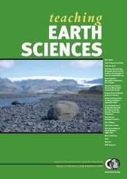
TEACHING EARTH SCIENCES ● Volume 31 ● Number 4, 2006<br />
Blakeney Esker<br />
ANNA JARROW<br />
Blakeney Esker, on the north Norfolk coast, provides a fascinating glimpse into the region’s glacial<br />
past. With an aim of improving the public’s understanding of the esker and the local landscape, the<br />
British Geological Survey (BGS), Norfolk County Council, and Murray Gray of Queen Mary, University<br />
of London, have collaborated to produce a website for teachers and the general public. The website<br />
(www.bgs.ac.uk/blakeney) provides editable and printable <strong>teaching</strong> aids aimed at the A level<br />
Geography syllabuses, and supporting Microsoft PowerPoint presentations.<br />
The esker:<br />
BGS is currently mapping the geology of north Norfolk,<br />
a region that has been shaped by glacial<br />
processes. Glacial-interglacial cycles have controlled<br />
the <strong>Earth</strong>’s climate during the last 800,000 years.<br />
Norfolk has therefore experienced alternating periods<br />
of cold and warm environments during this time,<br />
each with differing landscapes, ecosystems and<br />
deposits. Ice sheets have advanced into the region<br />
during the cold periods, on at least five occasions,<br />
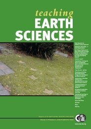
each depositing fresh material. The esker (Figure 1) is<br />
a meandering ridge of sand and gravel that started life<br />
as a tunnel beneath one of these glaciers. A river of<br />
water flowed through this, carrying large amounts of<br />
sediment, which were gradually deposited and eventually<br />
filled the tunnel. Although the glaciers have<br />
long since retreated, the esker remains as a prominent<br />
ridge on the coastal landscape, 3.5km long and up to<br />
30m high, near the village of Blakeney. During the<br />
last hundred years, sand and gravel extraction from<br />
the esker has produced some useful exposures, providing<br />
further information about how the esker<br />
formed. The route of the esker is now highlighted on<br />
the landscape by the gorse that covers the ridge,<br />
attracted by its well drained sandy soil.<br />
The <strong>teaching</strong> aids:<br />
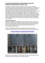
The first stage of this collaborative project, which<br />
started in November 2005, was a consultation phase<br />
with local school teachers. Following this, it was clear<br />
that teachers required not only <strong>teaching</strong> aids on the<br />
esker’s formation, but also the bigger picture of climate<br />
change, the geology of the region, and how glacial features<br />
such as the Cromer Ridge, a glacial moraine, are<br />
related to Blakeney Esker. All teachers agree that field<br />
visits are the best way to learn, but for various reasons<br />
such as inclement weather, finance or health & safety<br />
issues, they aren’t always possible.<br />
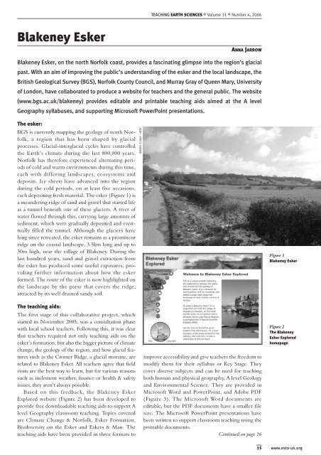
Based on this feedback, the Blakeney Esker<br />
Explored website (Figure 2) has been developed to<br />
provide free downloadable <strong>teaching</strong> aids to support A<br />
level Geography classroom <strong>teaching</strong>. Topics covered<br />
are Climate Change & Norfolk, Esker Formation,<br />
Biodiversity on the Esker and Eskers & Man. The<br />
<strong>teaching</strong> aids have been provided in three formats to<br />
IMAGES © BGS – NERC<br />
improve accessibility and give teachers the freedom to<br />
modify them for their syllabus or Key Stage. They<br />
cover diverse subjects and can be used for <strong>teaching</strong><br />
both human and physical geography, A level Geology<br />
and Environmental <strong>Science</strong>. They are provided in<br />
Microsoft Word and PowerPoint, and Adobe PDF<br />
(Figure 3). The Microsoft Word documents are<br />
editable, but the PDF documents have a smaller file<br />
size. The Microsoft PowerPoint presentations have<br />
been written to support classroom <strong>teaching</strong> using the<br />
printable documents.<br />
Continued on page 16<br />
Figure 1<br />
Blakeney Esker<br />
Figure 2<br />
The Blakeney<br />
Esker Explored<br />
homepage<br />
15 www.esta-uk.org