teaching - Earth Science Teachers' Association
teaching - Earth Science Teachers' Association
teaching - Earth Science Teachers' Association

Create successful ePaper yourself
Turn your PDF publications into a flip-book with our unique Google optimized e-Paper software.
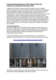
TEACHING EARTH SCIENCES ● Volume 31 ● Number 4, 2006<br />
Reviews<br />
Inventing the <strong>Earth</strong>: ideas on Landscape Development Since 1740. by Barbara A.Kennedy.<br />
Blackwell Publishing Ltd. Oxford, 2006. 160pp. ISBN-13: 978-1-4051-0187-5 (Hardback),<br />
ISBN-10: 1-4051-0188-1(Paperback)<br />
In her Preface the author stresses that<br />
this is not a text-book on the History<br />
of <strong>Earth</strong> <strong>Science</strong>, but rather forms a<br />
series of essays giving a personal<br />
impression of the importance of key<br />
episodes in the development of<br />
geomorphology within an Anglo-<br />
American perspective. Much of the<br />
material is drawn from lectures,<br />
seminars and tutorials given in the<br />
Universities of Manchester and Oxford<br />
towards the end of the twentieth century.<br />
Nearly one third of the 126 pages of<br />
text is devoted to examination of the<br />
precepts by which scientific paradigms<br />
are tested, exploring the impacts of the<br />
Ruling Hypothesis and the Method of<br />
Multiple Working Hypotheses. She<br />
identifies four key constraints under<br />
which the emerging eighteenth century<br />
geomorphologists were forced to work.<br />
First that the Bible contained Divine<br />
Authority, second that the time<br />
framework since creation as calculated<br />
by Ussher was very limited, third that<br />
the only major change to the <strong>Earth</strong>’s<br />
surface since creation was due to the<br />
divinely inspired Noachian flood of<br />
2348BC, and fourth that the Almighty<br />
followed the laws of Newtonian<br />
mechanics.<br />
After Buffon (1749) was heavily<br />
criticized by theologians for stating that<br />
there was a need for an increased<br />
timescale to permit landscape<br />
development, it was not until the work<br />
of Hutton (1785) and later Playfair<br />
(1805) who demanded indefinite time<br />
scale to permit lithification, erosion and<br />
later tilting before further burial by<br />
sediments to allow for the development<br />
of unconformities. Although initially<br />
disputed by Cuvier and Lyell,the latter<br />
came to recognise to need for vast<br />
periods of time to allow many observed<br />
phenomena to develop. Interestingly<br />
Darwin (1859) entered the fray,<br />
estimating the need for the passage of<br />
300Ma for formation of the topography<br />
of the Weald. Later Holmes (1913)<br />
estimated the need for 2000Ma and the<br />
latest figure of 4550Ma is from Patterson<br />
(1953).<br />
The third chapter is devoted to the<br />
influence of Lyell on developing<br />
acceptable ‘modern’ scientific methods<br />
of assessing the main elements of<br />
geology in the nineteenth century.<br />
To the British geologist/<br />
geopmorphologist the in-depth<br />
assessment of the contributions of<br />
French, German, Italian and Swiss<br />
workers gives a welcome historical<br />
context, for any advances in the science<br />
must be seen within the framework of<br />
knowledge of the time. Conflicting<br />
views of the presence of polymict gravels<br />
between lava flows and their relationship<br />
to the biblical deluge or repeated<br />
catastrophic events are presented with<br />
valuable comments. The need for<br />
mechanisms to produce landforms and<br />
their distributions is introduced with<br />
questions such as ‘Are the highest<br />
mountains the oldest or the youngest?’<br />
Kennedy points out development of<br />
concepts through the eleven editions of<br />
Lyell’s Principles of Geology which provide<br />
insights into active processes. Although<br />
essentially uniformitarian at heart, Lyell<br />
collected evidence of earthquake impacts<br />
and sea-level changes as at Serapis. It is<br />
instructive to learn that Lyell not only<br />
identified that climate change in one area<br />
was accompanied by climate change<br />
elsewhere, but also believed that the<br />
distribution of mountain ranges also<br />
exerted some controls on climate.<br />
The fourth chapter opens with a list<br />
of factors by which Huttonian concepts<br />
failed to satisfy conditions in many<br />
upland areas. In the Alps both<br />
Charpentier and Saussure had identified<br />
such problems before Agassiz provided<br />
his comprehensive analysis of glacial<br />
phenomena, suggesting interpretations<br />
which Lyell initially found difficult to<br />
accept, but later espoused.<br />
The fifth chapter addresses advances<br />
resulting from the increasing possibility<br />
of scientists taking part in the major<br />
exploratory expeditions, of which<br />
Darwin on the Beagle is perhaps the<br />
most familiar example. Although armed<br />
with a copy of Lyell, Darwin made his<br />
own observations of geomorphological<br />
processes and products in many areas.<br />
His original contributions in the study of<br />
coral reefs, volcanic islands, and<br />
extensive geological observations along<br />
the coasts of south America have been<br />
highly praised. His genius would have<br />
been recognised for those works alone<br />
irrespective of his evolutionary concepts.<br />
It took over 180 years of investigation<br />
before it was accepted that rain and<br />
rivers are important in earth sculpture,<br />
with wind, ice and the sea playing minor<br />
or local supporting roles on landscape<br />
development. Outside Europe, until the<br />
end of the American Civil War, virtually<br />
only the landscapes of the north and<br />
north-east of America had been<br />
examined. From his observations on the<br />
U.S. Government Expedition of 1838-43<br />
Dana believed that all major river<br />
systems were post-Tertiary in origin,<br />
largely on the basis of rapid fluvial<br />
incision into Pacific volcanic islands.<br />
In terms of landscape development<br />
Kennedy identifies the problem facing<br />
these geomorphologists, namely how a<br />
narrow gorge or steep-sided valley could<br />
open up to a shallow cross-section with<br />
gently inclined slopes. It was the<br />
pioneering work of Powell in the Grand<br />
Canyon which showed the connection<br />
between vertical and horizontal<br />
denudation. His inspirational<br />
recognition of the base level concept<br />
linked uplift to valley development and<br />
the role of tectonism in stimulating<br />
subaerial denudation. Elevation above<br />
base level, induration of the rocks, and<br />
the amount of rainfall were identified as<br />
principal factors, with vegetation cover a<br />
further contributor. Like Gilbert, later,<br />
www.esta-uk.org<br />
36