teaching - Earth Science Teachers' Association
teaching - Earth Science Teachers' Association
teaching - Earth Science Teachers' Association

Create successful ePaper yourself
Turn your PDF publications into a flip-book with our unique Google optimized e-Paper software.
TEACHING EARTH SCIENCES ● Volume 31 ● Number 4, 2006<br />
ESTA Conference Field Report 2<br />
Tedbury Camp / Vallis Vale, Sunday September 17th 2006<br />
RICK RAMSDALE<br />
We were able to take advantage of the<br />
small group to split the transport<br />
between both ends of the vale and<br />
extend the route to include the full distance<br />
between Hapsford Bridge and Mells – and still<br />
get back in time for a leisurely lunch outside the<br />
Frome pigeon fanciers Flying HQ before the rain<br />
started. As is usual with good field experiences<br />
we raised and debated more questions than we<br />
answered. Many thanks to Martin Whiteley, our<br />
guide and chauffeur, and others for providing<br />
the additional input. Briefly, the main field<br />
activities were:<br />
● Inspecting the erosion surface between the folded<br />
Carboniferous Limestone and the Inferior Oolite an<br />
extensive, more-or-less planar junction dipping gently<br />
southwards. It clearly had an extensive erosional<br />
history before the onset of Bajocian deposition, and<br />
was examined at two localities.<br />
● Inspecting the Jurassic colonisation sequence of the<br />
erosion surface which can be deduced using crosscutting<br />
relationships, (after the work of Copp). The<br />
fossils are Jurassic boring worms and molluscs.<br />
● The Triassic / Carboniferous contact was examined<br />
and the nature of its relationship to the Carboniferous<br />
discussed. These ‘fossil’ scree and valley fill<br />
deposits are commonly developed on the steeply<br />
dipping flanks of the Mendips. The enigmatic “fissure<br />
deposits” at Spleenwort Shelter were observed:<br />
are they pre-Triassic, post-Triassic, post-Jurassic or<br />
more recent? The jury is still out.<br />
● We observed the karst features of the Carboniferous<br />
Limestone, which are poorly developed here compared<br />
with other parts of the country. They are similar<br />
to most other parts of Mendip, having developed<br />
in a periglacial setting rather than the glacial conditions<br />
that affected Carboniferous Limestone successions<br />
further north.<br />
● The influence of the large (and getting deeper) quarries<br />
on the water table was reviewed. Here we had<br />
the advantage of some very recent research and<br />
hydrology maps. Thanks to a cunning groundwater<br />
engineering scheme by Hanson, which drains the<br />
quarry and also recharges the groundwater, the draw<br />
down, which is considerable immediately adjacent<br />
to the quarry, is almost nil elsewhere.<br />
Geological cross-sections showing the explored underground<br />
sections of the area between the quarry and the<br />
surface drainage demonstrate the groundwater flow<br />
zig-zags, alternating between the bedding and joint<br />
planes, until it reaches the rivers. Also there are a series<br />
of limestone sinks which drain and feed the River<br />
Mells, depending on the season.<br />
And finally, two questions for the next pub trivia<br />
quiz:<br />
What is the most unlikely site for an iron works on<br />
the planet?<br />
Answer: the Fussells iron works just east of Mells, and<br />
Why are the crayfish in the Mells River so large?<br />
Answer: they’re American.<br />
Notes: Keep a look out next spring for Andy Farrant’s<br />
(BGS) publication called Foundations of Mendip. It will<br />
contain two specially modified geology maps at<br />
1: 25,000 which allow the topography to show through,<br />
along with a guide book that describes a number of<br />
spectacular geological locations throughout the<br />
Mendips. This publication will be linked to a website<br />
containing much more detailed information on certain<br />
localities, such as Martin’s recently completed structural<br />
map of the Tedbury Camp erosional surface.<br />
The ESO-S Primary material for Vallis Vale and Tedbury<br />
Camp will be posted up on the UKRIGS website<br />
in the next month or so. (www.ukrigs.org.uk click<br />
; click ).<br />
Rick Ramsdale<br />
Email: rick.ramsdale@btinternet.com<br />
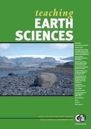
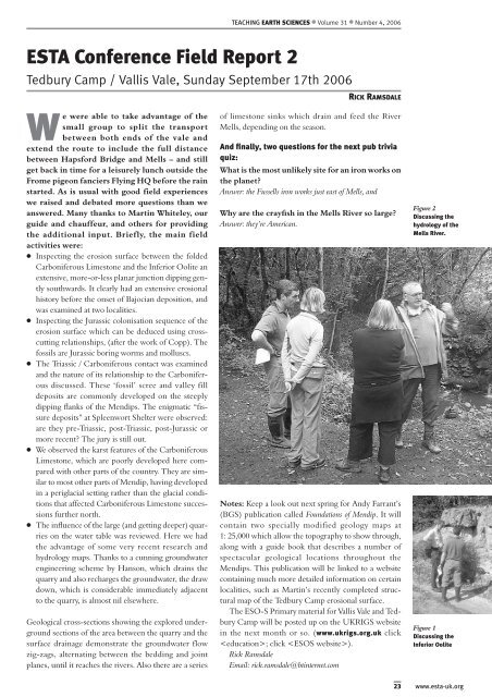
Figure 2<br />
Discussing the<br />
hydrology of the<br />
Mells River.<br />
Figure 1<br />
Discussing the<br />
Inferior Oolite<br />
23 www.esta-uk.org