

Appendix 11 - Basingstoke and Deane Borough Council
Appendix 11 - Basingstoke and Deane Borough Council
Appendix 11 - Basingstoke and Deane Borough Council

You also want an ePaper? Increase the reach of your titles
YUMPU automatically turns print PDFs into web optimized ePapers that Google loves.
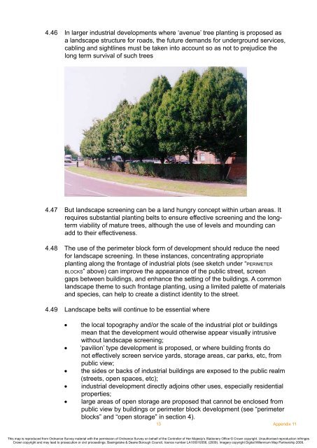
4.46 In larger industrial developments where ‘avenue’ tree planting is proposed as<br />
a l<strong>and</strong>scape structure for roads, the future dem<strong>and</strong>s for underground services,<br />
cabling <strong>and</strong> sightlines must be taken into account so as not to prejudice the<br />
long term survival of such trees<br />
4.47 But l<strong>and</strong>scape screening can be a l<strong>and</strong> hungry concept within urban areas. It<br />
requires substantial planting belts to ensure effective screening <strong>and</strong> the longterm<br />
viability of mature trees, although the use of levels <strong>and</strong> mounding can<br />
add to their effectiveness.<br />
4.48 The use of the perimeter block form of development should reduce the need<br />
for l<strong>and</strong>scape screening. In these instances, concentrating appropriate<br />
planting along the frontage of industrial plots (see sketch under “p e r i m e t e r<br />
b l o c k s” above) can improve the appearance of the public street, screen<br />
gaps between buildings, <strong>and</strong> enhance the setting of the buildings. A common<br />
l<strong>and</strong>scape theme to such frontage planting, using a limited palette of materials<br />
<strong>and</strong> species, can help to create a distinct identity to the street.<br />
4.49 L<strong>and</strong>scape belts will continue to be essential where<br />
•<br />
•<br />
•<br />
•<br />
•<br />
the local topography <strong>and</strong>/or the scale of the industrial plot or buildings<br />
mean that the development would otherwise appear visually intrusive<br />
without l<strong>and</strong>scape screening;<br />
‘pavilion’ type development is proposed, or where building fronts do<br />
not effectively screen service yards, storage areas, car parks, etc, from<br />
public view;<br />
the sides or backs of industrial buildings are exposed to the public realm<br />
(streets, open spaces, etc);<br />
industrial development directly adjoins other uses, especially residential<br />
properties;<br />
large areas of open storage are proposed that cannot be enclosed from<br />
public view by buildings or perimeter block development (see “perimeter<br />
blocks” <strong>and</strong> “open storage” in section 4).<br />
13<br />
<strong>Appendix</strong> <strong>11</strong><br />
This map is reproduced from Ordnance Survey material with the permission of Ordnance Survey on behalf of the Controller of Her Majesty’s Stationery Office © Crown copyright. Unauthorised reproduction infringes<br />
Crown copyright <strong>and</strong> may lead to prosecution or civil proceedings. <strong>Basingstoke</strong> & <strong>Deane</strong> <strong>Borough</strong> <strong>Council</strong>, licence number LA100019356, (2009). Imagery copyright Digital Millennium Map Partnership 2009.


