Watershed Protection Plan - Lower Rio Grande Valley Development ...
Watershed Protection Plan - Lower Rio Grande Valley Development ...
Watershed Protection Plan - Lower Rio Grande Valley Development ...

You also want an ePaper? Increase the reach of your titles
YUMPU automatically turns print PDFs into web optimized ePapers that Google loves.
THE ARROYO COLORADO WATERSHED<br />
origin, abuts the northern and western banks of the<br />
Arroyo Colorado (Brown et. al., 1980).<br />
The geologic age of the sediments in the region<br />
increase in age from east to west. The Pleistocene<br />
sediments, otherwise called the Beaumont Formation,<br />
were deposited after the last interglacial period about<br />
70,000 years ago. This formation is composed mostly<br />
of clay with some fi ne sand and silt. The Holocene<br />
sediments (approximately 10,000 years old) consist<br />
of sands and silts and are both open marine and<br />
meandering fl uvial (Figure 7).<br />
The <strong>Lower</strong> <strong>Rio</strong> <strong>Grande</strong> <strong>Valley</strong> region is characterized<br />
by its unconsolidated soil substrate. The soils in the<br />
Arroyo Colorado watershed are clays, clay loams and<br />
sandy loams (Figure 8). Most soil depths range from<br />
about 63-78 inches. The Harlingen, Mercedes and<br />
Raymondville soil series consist predominantly of clay<br />
soils with low permeability. A representative soil profi le<br />
consists of about 71-78 inches of clay. The Hidalgo, <strong>Rio</strong><br />
<strong>Grande</strong> and Willacy soil series consist predominantly<br />
of sandy loam and sandy clay loam soils with moderate<br />
permeability. A representative soil profi le consists of<br />
about 14-15 inches of sandy loam overlying 48-60<br />
inches of sandy clay loam.<br />
The Arroyo Colorado fl ows over the fl uvio-deltaic<br />
plain of the <strong>Rio</strong> <strong>Grande</strong>. Fluvio-deltaic plains are large<br />
geographic features that form in coastal areas near<br />
the outlet of large rivers. Fluvio-deltaic sediments are<br />
typically composed of interwoven lenses of sands, silts<br />
and clays deposited by rivers as they reach the coast<br />
and distribute their load of fi ne, organic-rich sediment<br />
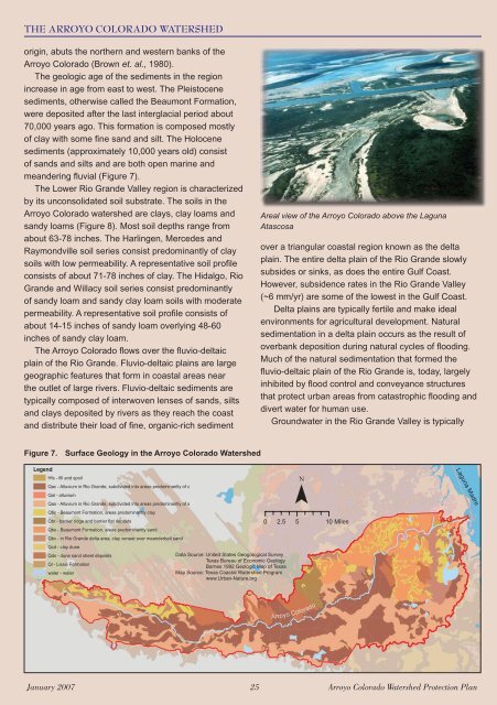
Areal view of the Arroyo Colorado above the Laguna<br />
Atascosa<br />
over a triangular coastal region known as the delta<br />
plain. The entire delta plain of the <strong>Rio</strong> <strong>Grande</strong> slowly<br />
subsides or sinks, as does the entire Gulf Coast.<br />
However, subsidence rates in the <strong>Rio</strong> <strong>Grande</strong> <strong>Valley</strong><br />
(~6 mm/yr) are some of the lowest in the Gulf Coast.<br />
Delta plains are typically fertile and make ideal<br />
environments for agricultural development. Natural<br />
sedimentation in a delta plain occurs as the result of<br />
overbank deposition during natural cycles of fl ooding.<br />
Much of the natural sedimentation that formed the<br />
fl uvio-deltaic plain of the <strong>Rio</strong> <strong>Grande</strong> is, today, largely<br />
inhibited by fl ood control and conveyance structures<br />
that protect urban areas from catastrophic fl ooding and<br />
divert water for human use.<br />
Groundwater in the <strong>Rio</strong> <strong>Grande</strong> <strong>Valley</strong> is typically<br />
Figure 7. Surface Geology in the Arroyo Colorado <strong>Watershed</strong><br />
Legend<br />
Hfs - fill and spoil<br />
Qac - Alluvium in <strong>Rio</strong> <strong>Grande</strong>, subdivided into areas predominantly of c<br />
Qal - alluvium<br />
Qas - Alluvium in <strong>Rio</strong> <strong>Grande</strong>, subdivided into areas predominantly of s<br />
Qbc - Beaumont Formation, areas predominantly clay<br />
Qbr - barrier ridge and barrier flat deposts<br />
Qbs - Beaumont Formation, areas predominantly sand<br />
Qbv - in <strong>Rio</strong> <strong>Grande</strong> delta area, clay veneer over meanderbelt sand<br />
Qcd - clay dune<br />
Qds - dune sand sheet deposits<br />
Ql - Lissie Formation<br />
water - water<br />
Data Source: United States Geogological Survey<br />
Texas Bureau of Economic Geology<br />
Barnes 1992 Geologic Map of Texas<br />
Map Source: Texas Coastal <strong>Watershed</strong> Program<br />
www.Urban-Nature.org<br />
¯<br />
0 2.5 5 10 Miles<br />
Laguna Madre<br />
Arroyo Colorado<br />
January 2007 25 Arroyo Colorado <strong>Watershed</strong> <strong>Protection</strong> <strong>Plan</strong>