Montgomery County Law Reporter - Montgomery Bar Association
Montgomery County Law Reporter - Montgomery Bar Association
Montgomery County Law Reporter - Montgomery Bar Association

You also want an ePaper? Increase the reach of your titles
YUMPU automatically turns print PDFs into web optimized ePapers that Google loves.
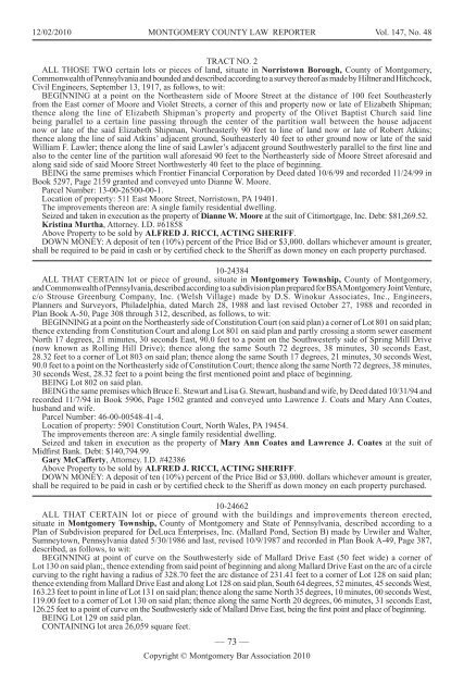
12/02/2010 MONTGOMERY COUNTY LAW REPORTER Vol. 147, No. 48<br />
TRACT NO. 2<br />
ALL THOSE TWO certain lots or pieces of land, situate in Norristown Borough, <strong>County</strong> of <strong>Montgomery</strong>,<br />
Commonwealth of Pennsylvania and bounded and described according to a survey thereof as made by Hiltner and Hitchcock,<br />
Civil Engineers, September 13, 1917, as follows, to wit:<br />
BEGINNING at a point on the Northeastern side of Moore Street at the distance of 100 feet Southeasterly<br />
from the East corner of Moore and Violet Streets, a corner of this and property now or late of Elizabeth Shipman;<br />
thence along the line of Elizabeth Shipman’s property and property of the Olivet Baptist Church said line<br />
being parallel to a certain line passing through the center of the partition wall between the house adjacent<br />
now or late of the said Elizabeth Shipman, Northeasterly 90 feet to line of land now or late of Robert Atkins;<br />
thence along the line of said Atkins’ adjacent ground, Southeasterly 40 feet to other ground now or late of the said<br />
William F. <strong>Law</strong>ler; thence along the line of said <strong>Law</strong>ler’s adjacent ground Southwesterly parallel to the first line and<br />
also to the center line of the partition wall aforesaid 90 feet to the Northeasterly side of Moore Street aforesaid and<br />
along said side of said Moore Street Northwesterly 40 feet to the place of beginning.<br />
BEING the same premises which Frontier Financial Corporation by Deed dated 10/6/99 and recorded 11/24/99 in<br />
Book 5297, Page 2159 granted and conveyed unto Dianne W. Moore.<br />
Parcel Number: 13-00-26500-00-1.<br />
Location of property: 511 East Moore Street, Norristown, PA 19401.<br />
The improvements thereon are: A single family residential dwelling.<br />
Seized and taken in execution as the property of Dianne W. Moore at the suit of Citimortgage, Inc. Debt: $81,269.52.<br />
Kristina Murtha, Attorney. I.D. #61858<br />
Above Property to be sold by ALFRED J. RICCI, ACTING SHERIFF.<br />
DOWN MONEY: A deposit of ten (10%) percent of the Price Bid or $3,000. dollars whichever amount is greater,<br />
shall be required to be paid in cash or by certified check to the Sheriff as down money on each property purchased.<br />
10-24384<br />
ALL THAT CERTAIN lot or piece of ground, situate in <strong>Montgomery</strong> Township, <strong>County</strong> of <strong>Montgomery</strong>,<br />
and Commonwealth of Pennsylvania, described according to a subdivision plan prepared for BSA <strong>Montgomery</strong> Joint Venture,<br />
c/o Strouse Greenburg Company, Inc. (Welsh Village) made by D.S. Winokur Associates, Inc., Engineers,<br />
Planners and Surveyors, Philadelphia, dated March 28, 1988 and last revised October 27, 1988 and recorded in<br />
Plan Book A-50, Page 308 through 312, described, as follows, to wit:<br />
BEGINNING at a point on the Northeasterly side of Constitution Court (on said plan) a corner of Lot 801 on said plan;<br />
thence extending from Constitution Court and along Lot 801 on said plan and partly crossing a storm sewer easement<br />
North 17 degrees, 21 minutes, 30 seconds East, 90.0 feet to a point on the Southwesterly side of Spring Mill Drive<br />
(now known as Rolling Hill Drive); thence along the same South 72 degrees, 38 minutes, 30 seconds East,<br />
28.32 feet to a corner of Lot 803 on said plan; thence along the same South 17 degrees, 21 minutes, 30 seconds West,<br />
90.0 feet to a point on the Northeasterly side of Constitution Court; thence along the same North 72 degrees, 38 minutes,<br />
30 seconds West, 28.32 feet to a point being the first mentioned point and place of beginning.<br />
BEING Lot 802 on said plan.<br />
BEING the same premises which Bruce E. Stewart and Lisa G. Stewart, husband and wife, by Deed dated 10/31/94 and<br />
recorded 11/7/94 in Book 5906, Page 1502 granted and conveyed unto <strong>Law</strong>rence J. Coats and Mary Ann Coates,<br />
husband and wife.<br />
Parcel Number: 46-00-00548-41-4.<br />
Location of property: 5901 Constitution Court, North Wales, PA 19454.<br />
The improvements thereon are: A single family residential dwelling.<br />
Seized and taken in execution as the property of Mary Ann Coates and <strong>Law</strong>rence J. Coates at the suit of<br />
Midfirst Bank. Debt: $140,794.99.<br />
Gary McCafferty, Attorney. I.D. #42386<br />
Above Property to be sold by ALFRED J. RICCI, ACTING SHERIFF.<br />
DOWN MONEY: A deposit of ten (10%) percent of the Price Bid or $3,000. dollars whichever amount is greater,<br />
shall be required to be paid in cash or by certified check to the Sheriff as down money on each property purchased.<br />
10-24662<br />
ALL THAT CERTAIN lot or piece of ground with the buildings and improvements thereon erected,<br />
situate in <strong>Montgomery</strong> Township, <strong>County</strong> of <strong>Montgomery</strong> and State of Pennsylvania, described according to a<br />
Plan of Subdivision prepared for DeLuca Enterprises, Inc. (Mallard Pond, Section B) made by Urwiler and Walter,<br />
Sumneytown, Pennsylvania dated 5/30/1986 and last, revised 10/9/1987 and recorded in Plan Book A-49, Page 387,<br />
described, as follows, to wit:<br />
BEGINNING at point of curve on the Southwesterly side of Mallard Drive East (50 feet wide) a corner of<br />
Lot 130 on said plan;, thence extending from said point of beginning and along Mallard Drive East on the arc of a circle<br />
curving to the right having a radius of 328.70 feet the arc distance of 231.41 feet to a corner of Lot 128 on said plan;<br />
thence extending from Mallard Drive East and along Lot 128 on said plan, South 64 degrees, 52 minutes, 45 seconds West,<br />
163.23 feet to point in line of Lot 131 on said plan; thence along the same North 35 degrees, 10 minutes, 00 seconds West,<br />
119.00 feet to a corner of Lot 130 on said plan; thence along the same North 20 degrees, 06 minutes, 31 seconds East,<br />
126.25 feet to a point of curve on the Southwesterly side of Mallard Drive East, being the first point and place of beginning.<br />
BEING Lot 129 on said plan.<br />
CONTAINING lot area 26,059 square feet.<br />
— 73 —<br />
Copyright © <strong>Montgomery</strong> <strong>Bar</strong> <strong>Association</strong> 2010