

Practical Manual - Malareo
Practical Manual - Malareo
Practical Manual - Malareo

You also want an ePaper? Increase the reach of your titles
YUMPU automatically turns print PDFs into web optimized ePapers that Google loves.
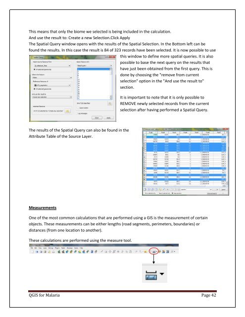
This means that only the biome we selected is being included in the calculation.<br />
And use the result to: Create a new Selection.Click Apply<br />
The Spatial Query window opens with the results of the Spatial Selection. In the Bottom left can be<br />
found the results. In this case the result is 84 of 323 records have been selected. It is now possible to use<br />
this window to define more spatial queries. It is also<br />
possible to base the next query on the results that<br />
have just been obtained from the first query. This is<br />
done by choosing the "remove from current<br />
selection" option in the "And use the result to"<br />
section.<br />
It is important to note that it is only possible to<br />
REMOVE newly selected records from the current<br />
selection after having performed a Spatial Query.<br />
The results of the Spatial Query can also be found in the<br />
Attribute Table of the Source Layer.<br />
Measurements<br />
One of the most common calculations that are performed using a GIS is the measurement of certain<br />
objects. These measurements can be either lengths (road segments, perimeters, boundaries) or<br />
distances (from one location to another).<br />
These calculations are performed using the measure tool.<br />
QGIS for Malaria Page 42

