

Practical Manual - Malareo
Practical Manual - Malareo
Practical Manual - Malareo

You also want an ePaper? Increase the reach of your titles
YUMPU automatically turns print PDFs into web optimized ePapers that Google loves.
Now to measure along the length of a line. The example for this is to measure a part of a road. Before<br />
starting this exercise it is important to remove all our selections. To do this use the Deselect Features<br />
from All Layers Button.<br />
<br />
<br />
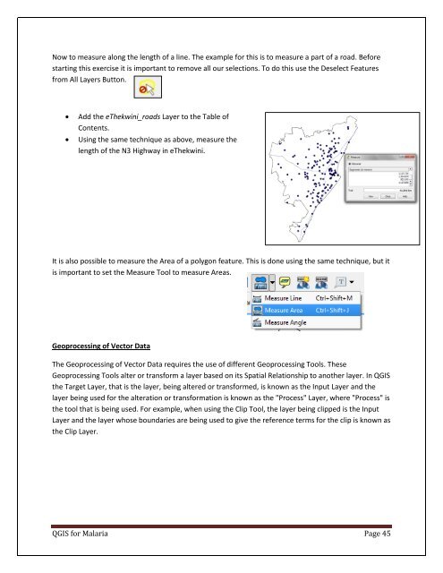
Add the eThekwini_roads Layer to the Table of<br />
Contents.<br />
Using the same technique as above, measure the<br />
length of the N3 Highway in eThekwini.<br />
It is also possible to measure the Area of a polygon feature. This is done using the same technique, but it<br />
is important to set the Measure Tool to measure Areas.<br />
Geoprocessing of Vector Data<br />
The Geoprocessing of Vector Data requires the use of different Geoprocessing Tools. These<br />
Geoprocessing Tools alter or transform a layer based on its Spatial Relationship to another layer. In QGIS<br />
the Target Layer, that is the layer, being altered or transformed, is known as the Input Layer and the<br />
layer being used for the alteration or transformation is known as the "Process" Layer, where "Process" is<br />
the tool that is being used. For example, when using the Clip Tool, the layer being clipped is the Input<br />
Layer and the layer whose boundaries are being used to give the reference terms for the clip is known as<br />
the Clip Layer.<br />
QGIS for Malaria Page 45

