development control board agenda - Borough Council of King's ...
development control board agenda - Borough Council of King's ...
development control board agenda - Borough Council of King's ...

Create successful ePaper yourself
Turn your PDF publications into a flip-book with our unique Google optimized e-Paper software.
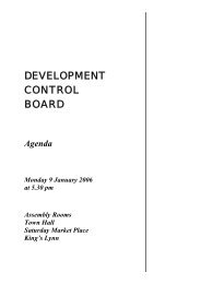
DEVELOPMENT<br />
CONTROL BOARD<br />
AGENDA<br />
Monday 6 July 2009<br />
at 10.00 am<br />
(Please note the time <strong>of</strong> the meeting)<br />
Committee Suite<br />
King’s Court<br />
Chapel Street<br />
King’s Lynn<br />
Norfolk<br />
PE30 1EX
If you require parts <strong>of</strong> this document in another language, large print, audio, Braille<br />
or any alternative format please contact the <strong>Council</strong> Information Centre on 01553<br />
616200 and we will do our best to help.<br />
LATVIAN<br />
Ja Jums nepieciešamas daļas no šī dokumenta citā valodā, lielā drukā, audio, Braila<br />
rakstā vai alternatīvā formātā, lūdzu, sazinieties ar Padomes informācijas centru<br />
(<strong>Council</strong> Information Centre) pa 01553 616200 un mēs centīsimies Jums palīdzēt.<br />
RUSSIAN<br />
Если вам нужны части этого документа на другом языке, крупным шрифтом,<br />
шрифтом Брайля, в аудио- или ином формате, обращайтесь в<br />
Информационный Центр Совета по тел.: 01553 616200, и мы постараемся вам<br />
помочь.<br />
LITHUANIAN<br />
Jei pageidaujate tam tikros šio dokumento dalies kita kalba, dideliu šriftu, Brailio<br />
raštu, kitu formatu ar norite užsisakyti garso įrašą, susisiekite su Savivaldybės<br />
informacijos centru (<strong>Council</strong> Information Centre) telefonu 01553 616200 ir mes<br />
pasistengsime jums kiek įmanoma padėti.<br />
POLISH<br />
Jeśli pragną Państwo otrzymać fragmenty niniejszego dokumentu w innym języku, w<br />
dużym druku, w formie nagrania audio, alfabetem Braille’a lub w jakimkolwiek innym<br />
alternatywnym formacie, prosimy o kontakt z Centrum Informacji Rady pod numerem<br />
01553 616200, zaś my zrobimy, co możemy, by Państwu pomóc.<br />
PORTUGUESE<br />
Se necessitar de partes deste documento em outro idioma, impressão grande, áudio,<br />
Braille ou qualquer outro formato alternativo, por favor contacte o Centro de<br />
Informações do Município pelo 01553 616200, e faremos o nosso melhor para<br />
ajudar.
King’s Court, Chapel Street, King’s Lynn, Norfolk, PE30 1EX<br />
Telephone: 01553 616200<br />
Fax: 01553 616758<br />
DEVELOPMENT CONTROL BOARD<br />
Please note that due to the number <strong>of</strong> applications to be considered it is<br />
proposed that the Board will adjourn for lunch at 12.30 pm and reconvene at<br />
1.10 pm.<br />
DATE: 6 JULY 2009<br />
VENUE: COMMITTEE SUITE, KING’S COURT, CHAPEL STREET, KING’S<br />
LYNN<br />
TIME: 10.00 AM<br />
1 APOLOGIES<br />
To receive any apologies for absence.<br />
2 MINUTES<br />
To confirm as a correct record the Minutes <strong>of</strong> the Meeting held on 15 June<br />
2009 and the Reconvened Meeting held on 18 June 2009 (to follow).<br />
3 DECLARATIONS OF INTEREST<br />
Members must indicate whether the interest is a personal one only or one<br />
which is also prejudicial. A declaration <strong>of</strong> a personal interest should indicate<br />
the nature <strong>of</strong> the interest and the <strong>agenda</strong> item to which it relates. In the case<br />
<strong>of</strong> a personal interest, the Member may speak and vote on the matter. Please<br />
note that Members who are exempt from declaring a personal interest<br />
because it arises solely from their position on a body to which they were<br />
nominated by the <strong>Council</strong> or a body exercising functions <strong>of</strong> a public nature (eg.<br />
another local authority), need only declare their interest if and when they<br />
intend to speak on a matter.<br />
Development Control Board<br />
6 July 2009
If a prejudicial interest is declared, the Member should withdraw from the room<br />
whilst the matter is discussed unless the Member has registered to speak in<br />
accordance with the adopted Public Speaking Protocol, in which case the<br />
Member may attend the meeting for that purpose. The Member must<br />
immediately leave the room when they have finished or the meeting decides<br />
they have finished, if earlier.<br />
These declarations apply to all those Members present, whether the Member<br />
is part <strong>of</strong> the meeting, attending to speak as a local member on an item or<br />
simply observing the meeting from the public seating area.<br />
4 URGENT BUSINESS UNDER STANDING ORDER 7<br />
To consider any business, which by reason <strong>of</strong> special circumstances, the<br />
Chairman proposes to accept, under Section 100(b)(4)(b) <strong>of</strong> the Local<br />
Government Act, 1972.<br />
5 MEMBERS ATTENDING UNDER STANDING ORDER 34<br />
Members wishing to speak pursuant to Standing Order 34 should inform the<br />
Chairman <strong>of</strong> their intention to do so and on what items they wish to be heard<br />
before the meeting commences.<br />
6 CHAIRMAN’S CORRESPONDENCE<br />
7 RECEIPT OF LATE CORRESPONDENCE ON APPLICATIONS<br />
8 DECISIONS ON APPLICATIONS<br />
To consider and determine the attached Schedule <strong>of</strong> Planning Applications<br />
submitted by the Head <strong>of</strong> Development Services (pages 8-187)<br />
9 DELEGATED DECISIONS<br />
To receive the Schedule <strong>of</strong> Planning Applications determined by the Head <strong>of</strong><br />
Development Services (attached at pages 188-204)<br />
Development Control Board<br />
6 July 2009
To: Members <strong>of</strong> the Development Control Board:<br />
<strong>Council</strong>lors Mrs V M Spikings (Chairman), M J Peake (Vice-Chairman), Mrs Z<br />
Christopher, D Collis, C Cr<strong>of</strong>ts, W Daws, R W Groom, D Johnson, J Loveless,<br />
T C Manley, D Markinson, Mrs J Mickleburgh, A Morrison, M Pitcher, M S<br />
Storey, H C Symington, G Wareham and A White<br />
Press<br />
Site Visit Arrangements<br />
Please note that any site inspections will be held 3 days after the scheduled meeting<br />
<strong>of</strong> the Board (ie. on a Thursday following a Monday meeting). When a decision for a<br />
site inspection is made, consideration <strong>of</strong> the application will be adjourned, the site<br />
visited, and the meeting reconvened on the same day for a decision to be made.<br />
Timings for the site inspections will be announced at the meeting.<br />
If there are any site inspections arising from this Meeting, these will be held on<br />
Thursday 9 July 2009 (time to be confirmed) and the meeting reconvened on the<br />
same day (time to be agreed).<br />
Please note:<br />
(1) At the discretion <strong>of</strong> the Chairman, items may not necessarily be taken in the<br />
order in which they appear in the Agenda.<br />
(2) An Agenda summarising late correspondence received by 5.15 pm on the<br />
Wednesday before the Meeting will be emailed (usually the Friday), and tabled<br />
one hour before the Meeting commences. Correspondence received after that<br />
time will not be specifically reported during the Meeting.<br />
(3) Relevant plans will be available for inspection in the Committee Suite, King’s<br />
Court from 8.45 am on the day <strong>of</strong> the Meeting. Any Member wishing specific<br />
application plans to be displayed on the wall for the Meeting should contact<br />
Lee Osler in the Planning Control Section before 12 noon on the working day<br />
before the Meeting (usually the Friday).<br />
For further information please contact:<br />
Kathy Wagg<br />
Democratic Services Officer<br />
King’s Court<br />
Chapel Street<br />
King’s Lynn PE30 1EX<br />
Telephone: 01553 616276<br />
Email: kathy.wagg@west-norfolk.gov.uk<br />
Development Control Board<br />
6 July 2009
Item<br />
No.<br />
INDEX OF APPLICATIONS TO BE DETERMINED BY THE<br />
DEVELOPMENT CONTROL BOARD AT THE MEETING<br />
TO BE HELD ON MONDAY 6 JULY 2009<br />
Application No.<br />
Location and Description <strong>of</strong> Site<br />
Development<br />
8/1 DEFERRED ITEMS<br />
8/1(a) 09/00609/F<br />
5 Lynn Road<br />
External alterations and conversion <strong>of</strong> first<br />
floor to 2 apartments<br />
8/1(b) 09/00498/O<br />
116 Wisbech Road<br />
Outline Application: Construction <strong>of</strong> two<br />
dwellings<br />
8/2 MAJORS<br />
8/2(a) 09/00558/FM<br />
Land Off Lancaster Crescent<br />
Erection <strong>of</strong> 11 new dwellings with<br />
associated site works<br />
8/2(b) 09/00699/RMM<br />
Land West Of Wheatfields<br />
Wheatfields<br />
Parish Recommendation Page<br />
No.<br />
HEACHAM APPROVE 8<br />
OUTWELL APPROVE 20<br />
DOWNHAM<br />
MARKET<br />
APPROVE 30<br />
HILLINGTON APPROVE 42<br />
8/3 OTHER APPLICATIONS / APPLICATIONS REQUIRING REFERENCE TO THE BOARD<br />
8/3(a) 09/00810/F<br />
Cornerways Cottage Main Road<br />
Conversion <strong>of</strong> house into two dwellings<br />
8/3(b) 09/00767/F<br />
The Arboretum East Harbour Way<br />
Burnham Overy Staithe<br />
Construction <strong>of</strong> 6 bedroom detached<br />
dwelling<br />
8/3(c) 09/00591/F<br />
50 Stocks Green<br />
Change <strong>of</strong> use from post <strong>of</strong>fice and part<br />
residential to residential only, refurbishment,<br />
alterations and extension on first floor plus<br />
new garden shed and wall<br />
BRANCASTER APPROVE 54<br />
BURNHAM<br />
OVERY<br />
APPROVE 66<br />
CASTLE ACRE APPROVE 82<br />
Development Control Board<br />
6 th July 2009
Item<br />
No.<br />
INDEX OF APPLICATIONS TO BE DETERMINED BY THE<br />
DEVELOPMENT CONTROL BOARD AT THE MEETING<br />
TO BE HELD ON MONDAY 6 JULY 2009<br />
Application No.<br />
Location and Description <strong>of</strong> Site<br />
Development<br />
8/3(d) 09/00284/F<br />
46-48 Bridge Street<br />
Conversion <strong>of</strong> single first floor flat into 3 flats<br />
including extension and conversion <strong>of</strong><br />
ground floor from single retail unit into 3<br />
separate retail units.<br />
8/3(e) 09/00819/O<br />
8 Crow Hall Estate<br />
Outline Application: construction <strong>of</strong> dwelling<br />
8/3(f) 09/00560/F<br />
Sunset View 55 The South Beach<br />
New dwelling to replace existing static<br />
caravan<br />
8/3(g) 09/00871/F<br />
4 Westgate<br />
Refurbishment and subdivision <strong>of</strong> 3 storey<br />
dwelling to 4No flats<br />
8/3(h) 09/00601/CU<br />
31 Tennyson Avenue<br />
Sub-division <strong>of</strong> existing shop with hot food<br />
take-away facilities into two separate units,<br />
grocery and news agency (A1) at the front<br />
and a hot food takeaway (A5) premises at<br />
the rear<br />
8/3(i) 09/00824/O<br />
Land Adjacent To 10 Eldens Lane<br />
Outline Application: construction <strong>of</strong><br />
bungalow with garage<br />
8/3(j) 08/00874/F<br />
Jacaranda 65 New Road<br />
Permanent change <strong>of</strong> use from domestic<br />
dwelling to place <strong>of</strong> worship<br />
8/3(k) 09/00801/F<br />
The Old Mill Whittington Hill Whittington<br />
Proposed amended design only to Unit 21<br />
for the conversion <strong>of</strong> existing <strong>of</strong>fice to<br />
dwelling Approved scheme ref -<br />
2/02/1752/CU for 22 Dwellings<br />
Parish Recommendation Page<br />
No.<br />
DOWNHAM<br />
MARKET<br />
DOWNHAM<br />
MARKET<br />
APPROVE 90<br />
REFUSE 98<br />
HEACHAM APPROVE 106<br />
HUNSTANTON APPROVE 112<br />
KING’S LYNN APPROVE 126<br />
METHWOLD REFUSE 134<br />
NORTH<br />
RUNCTON<br />
APPROVE 142<br />
NORTHWOLD APPROVE 154<br />
Development Control Board<br />
6 th July 2009
Item<br />
No.<br />
INDEX OF APPLICATIONS TO BE DETERMINED BY THE<br />
DEVELOPMENT CONTROL BOARD AT THE MEETING<br />
TO BE HELD ON MONDAY 6 JULY 2009<br />
Application No.<br />
Location and Description <strong>of</strong> Site<br />
Development<br />
8/3(l) 08/01751/O<br />
34 Isle Bridge Road<br />
Outline Application: 5 detached bungalows<br />
with attached single garages.<br />
8/3(m) 09/00719/F<br />
40 Common Road<br />
Installation <strong>of</strong> mobile home for carer use<br />
8/3(n) 09/00769/F<br />
58 The Beach<br />
Siting <strong>of</strong> a cut down shipping container for<br />
storage <strong>of</strong> boats and sail<strong>board</strong>s<br />
8/3(o) 09/00648/F<br />
2 Westgate Street<br />
New Store Building<br />
Parish Recommendation Page<br />
No.<br />
OUTWELL REFUSE 160<br />
SNETTISHAM APPROVE 168<br />
SNETTISHAM REFUSE 176<br />
SOUTHERY REFUSE 182<br />
Development Control Board<br />
6 th July 2009
Parish:<br />
Proposal:<br />
Location:<br />
Applicant:<br />
Case No:<br />
Heacham<br />
AGENDA ITEM NO: 8/1(a)<br />
External alterations and conversion <strong>of</strong> first floor to 2 apartments<br />
and creation <strong>of</strong> parking area.<br />
5 Lynn Road Heacham <strong>King's</strong> Lynn PE31 7HU<br />
Tesco Stores Ltd<br />
09/00609/F (Full Application)<br />
Case Officer: Miss G Richardson<br />
Tel: 01553 616457<br />
Date for Determination:<br />
16th June 2009<br />
Reason for Referral to DCB – Referral to the Board by the Executive Director <strong>of</strong><br />
Development Services.<br />
Case Summary<br />
The site is located <strong>of</strong>f Lynn Road, Heacham and within Built Environment type 'D' and<br />
adjacent to the Conservation Area. Planning consent is sought for the extension to the<br />
former pub for convenience food store and two residential apartments and external<br />
alterations, and for the creation <strong>of</strong> an extended parking area.<br />
This application was deferred by Members at the Development Control Board meeting on<br />
the 15th June. Members resolved to defer the application to allow for further consideration <strong>of</strong><br />
the highway issues.<br />
Key Issues<br />
Planning history;<br />
Development requiring consent;<br />
Alterations to the building;<br />
Acceptability <strong>of</strong> residential units at first floor;<br />
Noise implications;<br />
Highway implications;<br />
Crime and disorder; and<br />
Other material considerations.<br />
Recommendation<br />
APPROVE<br />
THE APPLICATION<br />
The application relates to a two storey building which is constructed in a Tudor style with red<br />
bricks. The building was used as the Wheatsheaf Public House. To the front <strong>of</strong> the building<br />
is a hard standing area, which would have been used for parking this is enclosed to the<br />
street frontage by a wall, allowing for an 'in and out' access arrangement. To the rear <strong>of</strong> the<br />
building is a grassed area, with some planting and trees in situ. In addition there is also a<br />
single storey carrstone outbuilding to the rear. An external fire escape is located on the<br />
western elevation.<br />
09/00609/F Development Control Board<br />
6 th July 2009
The site is adjacent to the Conservation Area boundary, which runs along the opposite side<br />
<strong>of</strong> the road.<br />
Heacham library lies to the west <strong>of</strong> the site and residential properties lie to the east and<br />
south.<br />
Planning consent is sought for the extension to former public house to help facilitate the<br />
convenience food store and two residential apartments, external alterations and alterations<br />
to site layout. The actual change <strong>of</strong> use; a public house to a retail use is permitted though<br />
the conversion <strong>of</strong> the upper floor into two self contained flats and external alterations,<br />
including formation <strong>of</strong> parking area requires consent.<br />
Members deferred the application from the 15th June DCB meeting to get clarification on<br />
highway matters. There will be a highway <strong>of</strong>ficer available at the meeting to explain their<br />
concerns.<br />
SUPPORTING CASE<br />
This is a re-submission <strong>of</strong> an application, which was refused by the <strong>Council</strong>. Since the<br />
refusal further discussions have be held and these changes have now been incorporated<br />
into the new scheme.<br />
The site is approximately 0.22ha in area and comprises an existing two storey public house<br />
(use class A4), with restaurant, manager's flat and 2 guest rooms. A single storey out<br />
building lies to the east, which is used for storage.<br />
The proposed two flats would have three car parking spaces, including one visitor space.<br />
These are located to the rear <strong>of</strong> the site. Access to the flats is gained by stairs to the rear <strong>of</strong><br />
the building. A communal area for the flats is provided to the rear <strong>of</strong> the site, in an area that<br />
is easily accessible from the flats.<br />
There would be provision <strong>of</strong> a cycle stand and two motorcycle parking spaces for users <strong>of</strong><br />
the food store. The front <strong>of</strong> the site would be used for car parking for the food store together<br />
with the area created by the demolition <strong>of</strong> the outbuilding and hard surfacing <strong>of</strong> some <strong>of</strong> the<br />
existing grass area.<br />
The existing front elevation <strong>of</strong> the building is recessed with a central bay window. The<br />
previous application proposed a glass shop front which created a flush frontage from one<br />
side to the other. The re-submission removes the existing bay but retains the recessed<br />
section. A glass and aluminium frame shop front will be inserted. The ground floor window to<br />
the eastern gable end will be removed and replaced with a glass shop front with vertical<br />
glazing bar. New columns with timber facing to match existing will be inserted to the left and<br />
right <strong>of</strong> the new shop front and the existing feature columns either side <strong>of</strong> the proposed<br />
central entrance/exit will be retained. The ATM unit will be set within a glazed surround with<br />
lowered cill. The path surrounding the building will have a raised kerb and will be constructed<br />
with natural colour paving.<br />
The landscaped area would be maintained by the applicant and access would be gained via<br />
the communal garden area.<br />
The application is supported by a:<br />
• Design and Access Statement<br />
• Pre Development Tree Survey (October 2008)<br />
09/00609/F Development Control Board<br />
6 th July 2009
• Environmental Noise Assessment (November 2008) - this concludes that noise<br />
emissions from the refrigeration and air conditioning equipment will not have an<br />
adverse effect on the nearby residential properties.<br />
• Transport Statement (November 2008) - this concludes that the number <strong>of</strong> vehicular<br />
movements associated with the proposals is not expected to have any detrimental<br />
effect upon the local highway network, especially given that a significant proportion <strong>of</strong><br />
vehicles entering the site will have already been present on the highway network.<br />
PLANNING HISTORY<br />
08/02726/F External alterations and conversion <strong>of</strong> first floor to 2 apartments. Refused by the<br />
Development Control Board 13.03.09<br />
RESPONSE TO CONSULTATION<br />
Heacham Parish <strong>Council</strong>: OBJECTION The PC has queried the accuracy <strong>of</strong> the traffic<br />
table purporting to relate to previous pub traffic. The figures quoted do not relate to the<br />
previous traffic on and <strong>of</strong>f the site and the <strong>Council</strong> repeats that the level has been seriously<br />
over estimated. The projected increase in traffic on and <strong>of</strong>f the site does represent a major<br />
change and will add unacceptable pressure on the junction <strong>of</strong> Hunstanton and Lynn Road.<br />
Lynn Road is the primary route in and out <strong>of</strong> the village since the closure <strong>of</strong> Broadway and<br />
the creation <strong>of</strong> the traffic signals at Lavender junction. It is now the safest and quickest way<br />
to exit and enter the village and as a result has seen increased traffic levels which in turn<br />
has seen increased pressure on the Hunstanton and Lynn Road junction. The <strong>Council</strong> has<br />
already raised concerns about pedestrian safety at this junction with the County, before it<br />
was aware <strong>of</strong> any change <strong>of</strong> use.<br />
The transport plan takes no account <strong>of</strong> the seasonal nature <strong>of</strong> the local businesses and the<br />
effect on the junction when volumes <strong>of</strong> traffic along Lynn Road are at their highest, it is<br />
therefore not prudent to accept that a vehicle will be entering or leaving the site at a rate <strong>of</strong><br />
around one per minute during the busy summer season. The <strong>Council</strong> disputes the<br />
projections that the peak shopping will be in the evening when there is less traffic.<br />
In relation to deliveries the PC has no confidence that this plan would work in practice, as<br />
there are too many variables. The consequences <strong>of</strong> forgetting to phone ahead, traffic delays,<br />
arriving head <strong>of</strong> time, problems with putting bollards out having staff available at the right<br />
time to supervise deliveries, correct size lorries being available affect the success or failure<br />
<strong>of</strong> the delivery plan. The consequences <strong>of</strong> one or any variables not being carried out are that<br />
a large lorry is waiting in Lynn Road or driving around the village. The PC consider that the<br />
10 metre size lorries would be the largest able to get on and <strong>of</strong>f the site and would not want<br />
to see the enormous lorries that deliver to Hunstanton coming into the village. There will still<br />
be other deliveries not mentioned in the delivery schedule, therefore if minded to approve<br />
there should be a condition relating to a delivery plan.<br />
The PC note the improvement on the previous application, however it is still considered that<br />
the proposed changes to the building, will look at odds with its surroundings and cannot<br />
support changes which will detract from the conservation area.<br />
There seems to be confusion over the old stable at the rear. The planning application does<br />
not refer to the demolition <strong>of</strong> this building and the <strong>Council</strong> are concerned given the age <strong>of</strong><br />
this building as to why the applicant does not require permission to demolish.<br />
09/00609/F Development Control Board<br />
6 th July 2009
Highways Authority: Following the submission <strong>of</strong> a revised drawing Norfolk County <strong>Council</strong><br />
Highways have made the following comments. It is noted that Highways have strong<br />
concerns as detailed in previous correspondence. However it is minded that the permitted<br />
uses <strong>of</strong> the site and the context for which the application can be considered. It is believed<br />
that the applicants’ revised amendments as detailed would be <strong>of</strong> an arrangement that would<br />
have the lead impact on the operation and safety <strong>of</strong> the public highway. Conditions are<br />
recommended.<br />
Internal Drainage Board: N/A<br />
Environmental Health & Housing – Environmental Quality: NO OBJECTION The noise<br />
survey conducted by the applicant included BS4142 calculations that show that the<br />
assessment levels for the refrigeration and air conditioning units are in minus figures which<br />
are indicative that these pieces <strong>of</strong> equipment will not cause any disturbance or dis-amenity<br />
and that complaints are unlikely.<br />
The issue <strong>of</strong> insulation between the Tesco express and the flats and the issue <strong>of</strong> lighting<br />
scheme is recommended to be <strong>control</strong>led by a general noise condition requiring details <strong>of</strong><br />
attenuation values for materials used in the structure <strong>of</strong> the building, delivery times and<br />
hours <strong>of</strong> use.<br />
Additional areas for car parking mean that there is the potential for increased noise levels<br />
associated with engine noise/ car doors slamming/ people noise which may cause disamenity<br />
or disturbance to future residents. There is no provision for closing the car park<br />
outside shop opening times. Car park areas have the potential to attract people who use<br />
these spaces to rev engines and skid cars which can cause a lot <strong>of</strong> disturbance to near by<br />
residential properties, especially during late evening and night time hours. Although there is<br />
no evidence that this would occur an informative is recommended.<br />
Norfolk Constabulary: The design and layout should provide a secure segregation <strong>of</strong><br />
'public' and 'staffing' areas. A site perimeter that has a robust fence or wall without footholds<br />
to a minimum height <strong>of</strong> 2 metres. In between the properties at the rear 1.8 metre fencing is<br />
adequate with any access gates having anti lift hinges and key operated locks with slam shut<br />
mechanisms. These measures will help to prevent unauthorised persons gaining access to<br />
the rear <strong>of</strong> properties.<br />
Internal measures to prevent authorised persons entering staff areas should also be<br />
considered.<br />
The front <strong>of</strong> the proposed venue should be neat, tidy and ideally provide a flush frontage to<br />
support increased levels <strong>of</strong> 'natural surveillance’. A gated access should, be flush with the<br />
front elevation so as not to provide a recessed area that a potential <strong>of</strong>fender could exploit<br />
adjacent to the proposed ATM. Well positioned 'white' lighting with a uniform spread should<br />
also be provided. In addition hard surfacing should be securely fixed to prevent removal,<br />
vandalism or use as potential ammunition.<br />
It is noted that having residential uses above a commercial provides enhanced guardianship<br />
and this is <strong>of</strong> course better if there is a connection between the occupier and business. Door<br />
and window openings should meet The Loss Prevention Standards Security Rating level 3<br />
and an alarm system fitted to British Standards.<br />
The use <strong>of</strong> the premises is not a 24 hour, 7 days a week operation and therefore the ATM<br />
does not have a capable guardian to overview the ATM during the night time period. Due to<br />
its vulnerable location we would require the approaches to the ATM being protected by PAS<br />
069 anti ram bollards. It should also be alarmed and monitored by remote signalling. The<br />
09/00609/F Development Control Board<br />
6 th July 2009
use <strong>of</strong> painted or surface treatment would also create a privacy zone, to give some personal<br />
space to customers. It is stated that a landscaping plan should provide a clear field <strong>of</strong> vision<br />
across the venue and the use <strong>of</strong> CCTV should be utilised.<br />
Conservation Officer: The building is on the edge <strong>of</strong> the Conservation Area and has a<br />
solid, vernacular appearance. These revised alterations to the front elevation are an<br />
improvement over the previous submission and follow guidance given. It is felt that the<br />
proposed alteration to the front can only be properly assessed with information such as hard<br />
landscaping, signs and illumination, as clutter and over-sized signs, excessive illumination<br />
and poor quality treatment <strong>of</strong> the hard landscaping will have a major effect on the building's<br />
appearance and its relationship with the Conservation Area. However it is recognised that<br />
the hard landscaping can be <strong>control</strong>led by conditions and the signs and illumination will form<br />
a future application.<br />
REPRESENTATIONS<br />
57 letters <strong>of</strong> representation have been received in respect <strong>of</strong> this application; this includes<br />
one letter from Cllr Smeaton and the Tiles and Architectural Ceramics Society and ONE<br />
letter <strong>of</strong> support. The main issues raised include:<br />
• No room for Tesco in Heacham;<br />
• Increase in traffic (through deliveries, customers) and associated dangers on a<br />
notoriously busy road, reference is made to 3 recent accidents;<br />
• Site is close to the main bus route through the village;<br />
• Owners <strong>of</strong> Victoria Cottages should be allocated parking spaces on the redeveloped<br />
site;<br />
• Alterations proposed will not fit in with the conservation area;<br />
• Increased noise and disturbances to residents;<br />
• Impact upon local businesses;<br />
• Impact on saleability <strong>of</strong> adjacent properties;<br />
• Concern <strong>of</strong> resident who has access over the roadway leading to the car-park area<br />
about vehicular access to her gates and bin access;<br />
• Concern that the proposal does not consider the four sets <strong>of</strong> ceramic directional<br />
signs (for example tradesmen's entrance, private entrance) on the exterior <strong>of</strong> the<br />
building;<br />
• The Wheatsheaf building is a part <strong>of</strong> Heacham's history and to change any part <strong>of</strong> it<br />
would be a loss to the village; and<br />
• The building shall stay as a village inn.<br />
• Heacham already has two quick stop shops with two garages;<br />
• Questions raised about the accuracy <strong>of</strong> the submitted Transport Statement;<br />
• Adequate facilities and nearby Tesco’s in Hunstanton, Gaywood and Hardwick Road,<br />
<strong>King's</strong> Lynn;<br />
• 'Wheatsheaf' hanging sign will be replaced by a standard Tesco sign and will be<br />
dominant;<br />
• Concerns raised in relation to light pollution;<br />
• Lynn Road is the road that the emergency services will use; and<br />
• There should be a first-aider on site.<br />
Henry Bellingham MP, has made comments raising strong objections to the proposal on<br />
the grounds <strong>of</strong> the <strong>development</strong> is totally inappropriate and out <strong>of</strong> keeping with this part <strong>of</strong><br />
Heacham. It will undoubtedly have a hugely adverse impact on the character <strong>of</strong> this very<br />
special village and the Conservation Area.<br />
09/00609/F Development Control Board<br />
6 th July 2009
NATIONAL GUIDANCE<br />
PPS3 – Housing (2006) sets out the national planning policy framework for delivering the<br />
Government’s housing objectives.<br />
PPS6 - “Planning for Town Centres” (2005) aims to sustain and enhance the vitality and<br />
viability <strong>of</strong> town centres and contains advice on the consideration <strong>of</strong> shopping and leisure<br />
proposals.<br />
PPG13 - “Transport” (2001) aims to integrate planning and transport, promote sustainable<br />
forms <strong>of</strong> <strong>development</strong>, improve accessibility by public transport, walking and cycling, and<br />
reduce the need to travel, especially by car.<br />
PPG15 - “Planning and the Historic Environment” (1994) provides advice on <strong>development</strong> in<br />
Conservation Areas and that involving Listed Buildings.<br />
PPG24 - “Planning and Noise” (1994) provides guidance on the considerations to be taken<br />
into account when determining planning applications for noise sensitive <strong>development</strong> and<br />
those activities which generate noise.<br />
PPS1 - “Delivering Sustainable Development” (2005) sets out overarching policies on the<br />
delivery <strong>of</strong> sustainable <strong>development</strong> through the operation <strong>of</strong> the planning system and<br />
contains advice on design considerations.<br />
Safer Places: The Planning System and Crime Prevention (2004) ODPM provides guidance<br />
on the way in which good quality design can contribute to making places safer and secure.<br />
EAST OF ENGLAND PLAN<br />
Policy ENV6: The Historic Environment - Local planning authorities should identify, protect,<br />
conserve and, where appropriate, enhance the historic environment <strong>of</strong> the region, its<br />
archaeology, historic buildings, places and landscapes, including historic parks and gardens<br />
and those features and sites (and their settings) especially significant in the East <strong>of</strong> England.<br />
Policy ENV7: Quality in the Built Environment - Local Development Documents should<br />
require new <strong>development</strong> to be <strong>of</strong> high quality which complements the distinctive character<br />
and best qualities <strong>of</strong> the local area and promotes urban renaissance and regeneration.<br />
PLANNING POLICIES<br />
The King’s Lynn and West Norfolk Local Plan (1998) contains the following saved policies<br />
that are relevant to the proposal:<br />
4/7 - aims to protect and enhance important landscape features such as trees and<br />
woodlands.<br />
4/14 - requires that <strong>development</strong> proposals within the vicinity <strong>of</strong> Conservation Areas should<br />
have regard for views into and out <strong>of</strong> the areas.<br />
4/21 - indicates that in built-up areas <strong>of</strong> towns or villages identified on the Proposals Map as<br />
Built Environment Type C or D <strong>development</strong> will be permitted where it is in character with the<br />
locality.<br />
09/00609/F Development Control Board<br />
6 th July 2009
PLANNING CONSIDERATIONS<br />
The key planning considerations relevant to the determination <strong>of</strong> this application are:<br />
• Planning history;<br />
• Development requiring consent;<br />
• Alterations to the building;<br />
• Acceptability <strong>of</strong> residential units at first floor;<br />
• Noise implications;<br />
• Highway implications;<br />
• Crime and disorder; and<br />
• Other material considerations<br />
Planning History<br />
The application is submitted further to the refusal <strong>of</strong> the original scheme by Members at the<br />
reconvened meeting <strong>of</strong> the Development Control Board (following a site visit) on 5th March<br />
2009. The proposal was refused planning consent on the basis <strong>of</strong> the proposed front<br />
elevation, particularly the design <strong>of</strong> the proposed new shop front, which would impact upon<br />
views out <strong>of</strong> the Conservation Area. Since this refusal the scheme has been amended to try<br />
and overcome the previous reason for refusal.<br />
Development Requiring Consent<br />
The existing use <strong>of</strong> the premises as a public house falls within Class A4 <strong>of</strong> the Use Classes<br />
Order 2005, whilst the proposed use as a convenience food store falls within Class A1. The<br />
Use Classes Order allows for change <strong>of</strong> use from A4 to A1 without requiring a formal<br />
planning application to be made. The change <strong>of</strong> use <strong>of</strong> the premises to a convenience food<br />
store is therefore permitted <strong>development</strong> and does not require planning permission. Issues<br />
<strong>of</strong> principle such as the need <strong>of</strong> a further food retail shop, loss <strong>of</strong> a public house, and indeed<br />
highway issues relating to this use, therefore cannot be considered as part <strong>of</strong> this<br />
application. In addition, the demarcation <strong>of</strong> parking spaces is not held to constitute<br />
<strong>development</strong> requiring consent.<br />
Development which does require consent includes the conversion <strong>of</strong> the upper floor into two<br />
self contained flats, external alterations including the insertion <strong>of</strong> a cash dispenser,<br />
installation <strong>of</strong> shop front, rear canopy, access to flats and refrigeration and air conditioning<br />
units, and the extension <strong>of</strong> the parking area.<br />
Alterations to the Building<br />
The building at present has a certain symmetry to its front elevation, this is however not the<br />
case on any other elevation. The proposal will involve the removal <strong>of</strong> the existing front<br />
external staircase, insertion <strong>of</strong> ro<strong>of</strong> lights and ground floor window with ATM access door on<br />
the western elevation, installation <strong>of</strong> new shop front and ATM to front elevation. Alterations<br />
to the east elevation involve bricking up <strong>of</strong> a doorway and window. The alterations to the rear<br />
elevation involve a new external stair case to the two flats, canopy over part <strong>of</strong> the rear yard<br />
and bin area enclosed by close <strong>board</strong>ed fence and a metal security fence. In addition some<br />
<strong>of</strong> the area currently laid to grass will be hard surfaced for use as a parking area.<br />
The conservation <strong>of</strong>ficer contended the alterations to the front elevation on the original<br />
submission would detract from the appearance <strong>of</strong> the building, as it introduced a brash,<br />
modern shop front that unbalanced the front elevation and further degraded the forecourt.<br />
This element <strong>of</strong> the scheme, which formed the only reason for refusal has been amended<br />
and now retains many <strong>of</strong> the features <strong>of</strong> this building.<br />
09/00609/F Development Control Board<br />
6 th July 2009
The improvements to the design include the retention <strong>of</strong> the feature columns, the reduction<br />
in glazing to the shop front, the glazed area being further set back, reduction in size <strong>of</strong> the<br />
ATM surround and material, and reduction in the size and position <strong>of</strong> the fascia signage to<br />
allow for more <strong>of</strong> the features <strong>of</strong> the building to be retained.<br />
The insertion <strong>of</strong> windows where doors are currently located, infilling doorways and bricking<br />
up <strong>of</strong> a window within the site elevation are in themselves considered acceptable.<br />
The proposed ATM would be located in the front <strong>of</strong> the building, close to the front entrance; it<br />
would be <strong>of</strong> standard size and scale within a glazed surround. It is considered that this ATM<br />
has been sympathetically integrated into the shop frontage and as such there would be<br />
minimal visual impact on the street scene.<br />
The rear elevation again involves external works to allow for the two new residential units<br />
and rear yard area. This would be visible from the parking area for the store, but not from a<br />
publicly visible location outside <strong>of</strong> the site. The rear yard area would be screened by the<br />
proposed means <strong>of</strong> enclosure, and whilst a relatively harsh feature, it would serve the<br />
purpose <strong>of</strong> containing the chiller cabinet, condenser, air conditioning units and bin storage<br />
area. On balance it is considered that this element is acceptable.<br />
The proposal would also result in the partial loss <strong>of</strong> an existing area laid to grass and<br />
outbuildings to make sufficient space for the car parking area. The outbuildings referred to<br />
are constructed in carrstone. As the site does not fall within the confines <strong>of</strong> the Conservation<br />
Area and the outbuildings in themselves are not listed or in the grounds <strong>of</strong> a listed building,<br />
they do not require consent for their removal. The layout <strong>of</strong> the parking area remains as the<br />
previous scheme and is considered acceptable.<br />
Acceptability <strong>of</strong> Residential Units at First Floor<br />
The site lies within the confines <strong>of</strong> Heacham, where the principle <strong>of</strong> new residential<br />
<strong>development</strong> is acceptable in land use terms. Residential accommodation was previously<br />
provided at first floor level (managers flat and two guest rooms). Access to the new flats is<br />
provided to the rear and across a flat ro<strong>of</strong> paved area which is enclosed to three sides by the<br />
u-shape <strong>of</strong> the building. Both units have their own respective entrances. Rooms to flat 2 are<br />
largely similar to the previous residential layout; no additional openings are therefore<br />
required. It is considered that no material harm would result. With regard to flat 1 a doorway<br />
served by the fire escape is replaced by a window serving a kitchen. Ro<strong>of</strong> lights are also<br />
proposed to the second bedroom and shower room. No increased overlooking would result<br />
to properties in the High Street as they serve a shower room and wardrobe area. The<br />
residential units have access to a communal garden area; this level <strong>of</strong> amenity space is<br />
considered satisfactory. This element <strong>of</strong> the scheme has not changed.<br />
Noise Implications<br />
Whilst no objection is raised by Community Safety and Neighbourhood Nuisance (CSNN)<br />
they do have some concerns. In particular concern is raised about noise protection between<br />
the commercial unit and the two proposed flats above.However sound resistance would be<br />
covered by Part E <strong>of</strong> the Building Regulations. As the use has changed and the residential<br />
units above would no longer be ancillary to the use at ground floor the <strong>Council</strong>'s Building<br />
Control <strong>of</strong>ficers are <strong>of</strong> the view that there would be a need for increased sound resistance,<br />
but this would be covered by the Building Regulations, and does not involve late night uses<br />
requiring a specific scheme for sound pro<strong>of</strong>ing.<br />
After consideration <strong>of</strong> the submitted noise report it has been shown that no dis-amenity will<br />
result from the proposed refrigeration and air conditioning units.<br />
09/00609/F Development Control Board<br />
6 th July 2009
It is recognised that the use <strong>of</strong> the car parking after the close <strong>of</strong> business (between 10pm<br />
and 7am) may lead to some disturbance, but this is similar to the previous pub use, and the<br />
new residents will provide an on-site presence. Notwithstanding this, the applicant has also<br />
been asked to comment what steps they propose to limit this concern.<br />
It is considered that the general noise condition suggested by CSNN, requiring details <strong>of</strong><br />
delivery times and hours <strong>of</strong> use <strong>of</strong> the commercial element is unreasonable, as that does not<br />
require planning consent in its own right.<br />
Whilst the creation <strong>of</strong> a hard standing for car parking would take vehicles further into the<br />
back <strong>of</strong> the site and closer to residential properties it is considered that noise disturbance<br />
resulting from car doors closing and general noise in association with people parking and<br />
walking to the store would be reasonable given the proposed hours <strong>of</strong> use. Due to the<br />
proposed hours <strong>of</strong> use it is likely that car lights would be used, and it is appreciated that the<br />
shining <strong>of</strong> car lights can cause harm. However, given the hours <strong>of</strong> use and current boundary<br />
treatments, this harm is not considered to be material.<br />
Highway Implications<br />
The parking layout provides three spaces for the two residential units accessed by lockable<br />
posts and thirteen spaces for the retail unit. In addition there are two motorbike bays and a<br />
cycle park (uncovered). The entrance and egress to the site is the same as the original<br />
submission, although two parking spaces to the shop frontage have been removed.<br />
The Highway Authority asks that the cycle area is covered; a revised plan has annotated this<br />
requirement. However more details <strong>of</strong> its appearance would be required, and is considered<br />
that this can be satisfactorily <strong>control</strong>led by the use <strong>of</strong> a condition. Whilst reference is made to<br />
advertisement this would form part <strong>of</strong> a separate application and considered at that time.<br />
The agent has been advised <strong>of</strong> NCC Highways comments and submitted a further plan to<br />
address the issues raised. In response to this amended plan NCC Highways have stated<br />
that they still question the appropriateness <strong>of</strong> the collision protection around the telegraph<br />
pole but note that this is on private land and not a direct highway concern. The applicant has<br />
stated that the removal <strong>of</strong> the telegraph pole is something that they will look at in the future.<br />
Concern is expressed in relation to the relocated bollards at the western access given the<br />
position <strong>of</strong> the ATM. It is believed by NCC highways that this arrangement would have the<br />
potential to create an area where people would park to use the machine or store and then<br />
reverse onto the highway at this point. It is considered by your <strong>of</strong>ficers that the use <strong>of</strong> the<br />
lockable bollards to the western frontage to prevent access with the exception <strong>of</strong> deliveries<br />
to the store and the removal <strong>of</strong> the 3 droppable bollards to allow for turning would prevent<br />
this. This was the arrangement on the previous submission. The applicant has submitted this<br />
arrangement on a revised plan and Norfolk County Highway have not raised any objection.<br />
Crime and Disorder<br />
It is recognised that the building is set back from Lynn Road however; it would be readily<br />
visible from the public highway. The use would mean that the site would be active during<br />
working hours and in addition with the use <strong>of</strong> the first floor as residential there would be<br />
activity during the evenings. In order to mitigate the risk <strong>of</strong> ram raids Norfolk Constabulary<br />
have suggest the use <strong>of</strong> anti ram bollards, this aspect can be secured by condition. In<br />
addition it is considered that the lighting issue and refuse storage could also be satisfactorily<br />
secured by condition.<br />
09/00609/F Development Control Board<br />
6 th July 2009
Other Material Considerations<br />
Whilst the formal comments <strong>of</strong> the <strong>Council</strong>'s Landscape Officer have not been received no<br />
objection was raised to the original application. It was requested that a condition is imposed<br />
requiring a scheme for landscaping planting, in order to mitigate the impact <strong>of</strong> the car<br />
parking.<br />
Third party representations raise concerns that the proposal will affect their respective rights<br />
<strong>of</strong> way over the application site. The agent has verbally confirmed that these residents have<br />
no legal right over the application site. However the proposal will not take away access<br />
currently enjoyed in the event there is a right <strong>of</strong> way.<br />
CONCLUSION<br />
This application deal with the physical alterations and change <strong>of</strong> use creating two flats at the<br />
former Wheatsheaf Inn. The change <strong>of</strong> use <strong>of</strong> the ground floor from a pub to a shop is<br />
permitted through the Use Classes (Amendment) Order 2005, and the General Permitted<br />
Development (Amendment) Order 2005. This therefore deals with many issues <strong>of</strong> principle.<br />
Taking into account the above it is considered that the revised plans address the previous<br />
reason for refusal and that the proposal will not result in any harm to the adjacent<br />
Conservation Area. The remaining issues were not objected to previously, and as before can<br />
be adequately addressed by condition or by a further submission for items such as<br />
advertisements. The application is therefore recommended for approval.<br />
RECOMMENDATION:<br />
APPROVE subject to the imposition <strong>of</strong> the following condition(s):<br />
1 Condition The <strong>development</strong> hereby permitted shall be begun before the expiration <strong>of</strong><br />
three years from the date <strong>of</strong> this permission.<br />
1 Reason To comply with Section 91 <strong>of</strong> the Town and Country Planning Act, 1990, as<br />
amended by Section 51 <strong>of</strong> the Planning and Compulsory Purchase Act, 2004.<br />
2 Condition Prior to the first occupation detail <strong>of</strong> the location <strong>of</strong> the refuse storage<br />
facilities for the two residential units shall be submitted to and agreed in writing with the<br />
Local Planning Authority. The <strong>development</strong> shall be carried out in accordance with the<br />
approved plan.<br />
2 Reason To secure a satisfactory standard <strong>of</strong> <strong>development</strong> and in the interests <strong>of</strong> the<br />
visual amenities <strong>of</strong> the locality.<br />
3 Condition No <strong>development</strong> shall take place until a drawing showing anti-ram raid<br />
bollards to the front <strong>of</strong> the ATM and CCTV cameras coving the machine and immediate<br />
pavement area has been submitted to, and approved in writing by, the Local Planning<br />
Authority and the <strong>development</strong> shall thereafter be carried out in accordance with the<br />
approved details.<br />
3 Reason In the interests <strong>of</strong> visual amenities and crime prevention.<br />
4 Condition Prior to the installation <strong>of</strong> any outdoor lighting, a detailed scheme shall be<br />
submitted to and approved in writing by the Local Planning Authority. The scheme<br />
shall include details <strong>of</strong> the type <strong>of</strong> lights, the orientation/angle <strong>of</strong> the luminaries, the<br />
09/00609/F Development Control Board<br />
6 th July 2009
spacing and height <strong>of</strong> the lighting columns, the extent/levels <strong>of</strong> illumination over the site<br />
and on adjacent land and the measures to contain light within the curtilage <strong>of</strong> the site.<br />
The scheme shall be implemented in accordance with approved scheme and thereafter<br />
maintained.<br />
4 Reason In the interests <strong>of</strong> crime prevention and to protect the amenities <strong>of</strong> adjacent<br />
residential occupiers.<br />
5 Condition The <strong>development</strong> shall not be brought into use until a covered cycle storage<br />
area has been provided in accordance with a detailed scheme to be submitted to and<br />
approved in writing by the Local Planning Authority. The cycle storage area shall be<br />
constructed in accordance with the approved scheme and thereafter used for no other<br />
purpose.<br />
5 Reason To ensure that cycle storage facilities will be available to serve the<br />
<strong>development</strong>.<br />
6 Condition Prior to the first occupation <strong>of</strong> the <strong>development</strong> hereby permitted the<br />
vehicular access alterations, detailed on plan 1718/04V shall be constructed in<br />
accordance with the Norfolk County <strong>Council</strong> residential access construction<br />
specification.<br />
6 Reason To ensure satisfactory access into the site.<br />
7 Condition Prior to the first occupation <strong>of</strong> the <strong>development</strong> hereby permitted the<br />
proposed access / on-site parking / servicing / loading, unloading / turning / waiting<br />
area shall be laid out, demarcated, levelled, surfaced and drained in accordance with<br />
the approved plan and retained thereafter available for that specific use.<br />
7 Reason To ensure the permanent availability <strong>of</strong> the parking / manoeuvring area, in the<br />
interests <strong>of</strong> highway safety.<br />
BACKGROUND PAPERS<br />
Application file reference: 09/00609/F<br />
Norfolk Structure Plan (1999)<br />
King’s Lynn and West Norfolk Local Plan (1998)<br />
09/00609/F Development Control Board<br />
6 th July 2009
Parish:<br />
Proposal:<br />
Location:<br />
Applicant:<br />
Case No:<br />
Outwell<br />
AGENDA ITEM NO: 8/1(b)<br />
Outline Application: Construction <strong>of</strong> two dwellings<br />
116 Wisbech Road Outwell Wisbech Norfolk<br />
Mr John Jordan<br />
09/00498/O (Outline Application)<br />
Case Officer: Mr K Wilkinson<br />
Tel: 01553 616794<br />
Date for Determination:<br />
30th June 2009<br />
Reason for Referral to DCB – The Parish <strong>Council</strong>’s views are at variance with the Officer’s<br />
recommendation.<br />
Case Summary<br />
The site is that <strong>of</strong> 116 Wisbech Road, which is a large bungalow set in expansive grounds<br />
(0.3Ha), on the eastern corner <strong>of</strong> the mini-roundabout junction <strong>of</strong> Wisbech Road<br />
(A1122)/Hall Road/A1101. The site is bounded to the rear by agricultural land, with<br />
bungalows to the south-east fronting the A1122 and houses fronting Hall Road to the north.<br />
It is contained by boundary walls and railings onto Wisbech Road and mostly fencing to Hall<br />
Road, and contains several mature trees alongside the A1122.<br />
Outline permission is sought for two building plots for bungalows – one either side <strong>of</strong> the<br />
existing dwelling No.116. Access and layout are to be considered at this stage with all other<br />
matters reserved for future consideration. In order to accommodate a dwelling to the southeast<br />
<strong>of</strong> No.116, a sun room extension on the side <strong>of</strong> the existing property will be removed.<br />
Members chose to defer determination <strong>of</strong> this application at the 15th June 2009 DC Board<br />
meeting, to inquire why County Highways had not sought improvements to visibility from Hall<br />
Road at the mini-roundabout. A response from County Highways is awaited at the time <strong>of</strong><br />
compiling this report and is expected to be reported in late correspondence. The highway<br />
engineer is expected to attend the forthcoming meeting and will be available to discuss this<br />
matter more fully.<br />
Key Issues<br />
Principle <strong>of</strong> <strong>development</strong><br />
Impact upon form and character<br />
Impact upon trees<br />
Access and highway safety<br />
Impact upon neighbouring properties<br />
Crime and disorder<br />
Any other material considerations<br />
Recommendation<br />
APPROVE<br />
09/00498/O Development Control Board<br />
6 th July 2009
THE APPLICATION<br />
The site is that <strong>of</strong> 116 Wisbech Road, which is a large bungalow set in expansive grounds<br />
(0.3Ha), on the eastern corner <strong>of</strong> the mini-roundabout junction <strong>of</strong> Wisbech Road<br />
(A1122)/Hall Road/A1101. The site is bounded to the rear by agricultural land, with<br />
bungalows to the south-east fronting the A1122 and houses fronting Hall Road to the north.<br />
It is contained by boundary walls and railings onto Wisbech Road and fencing to Hall Road,<br />
and contains several mature trees alongside the A1122.<br />
Outline permission is sought for two building plots for bungalows – one either side <strong>of</strong> the<br />
existing dwelling No.116. Access and layout are to be considered at this stage with all other<br />
matters reserved for future consideration. Access is proposed to serve Plot 1 <strong>of</strong>f Hall Road<br />
and Plot 2 by a modification to the existing access <strong>of</strong>f the A1122 serving both the new<br />
property and No.116. In order to accommodate a dwelling to the south-east <strong>of</strong> No.116 (Plot<br />
2), a sun room extension on the side <strong>of</strong> the existing property will be removed. The layout <strong>of</strong><br />
the new dwellings is consistent with the front elevation <strong>of</strong> the existing bungalow.<br />
SUPPORTING CASE<br />
A Design and Access Statement accompanies the application which raises the following<br />
points:<br />
The site is currently used by the owners <strong>of</strong> 116 Wisbech Road as garden land. The site<br />
currently has one main access point <strong>of</strong>f Wisbech Road (A1122). The proposed <strong>development</strong><br />
has been located to ensure continuity <strong>of</strong> the street scene in respect <strong>of</strong> adjacent dwellings i.e.<br />
‘Ruindus’ to the north-west and No.1 to the south-east.<br />
The application site is 0.29 hectares. The proposed dwellings are designed to be single<br />
storey with a maximum height <strong>of</strong> 6.5 metres, a maximum width <strong>of</strong> 11 metres and maximum<br />
length <strong>of</strong> 17.9 metres. Proposed floor areas are as follows: Units 1 & 2 – 3 bed bungalows<br />
115m² each.<br />
Although landscaping is not part <strong>of</strong> this outline application and the exact details will be<br />
determined on the submission <strong>of</strong> a reserved matters application, we would envisage the<br />
landscaping scheme to be a harmonious mix <strong>of</strong> both hard and s<strong>of</strong>t landscaping both for the<br />
enjoyment <strong>of</strong> the occupants <strong>of</strong> the proposed bungalows and to s<strong>of</strong>ten the visual impact on<br />
the surrounding area.<br />
The exact details <strong>of</strong> the materials will be dealt with under a separate reserved matters<br />
application; however they would complement the neighbouring properties so as to blend into<br />
the street scene.<br />
Vehicular and pedestrian access to Plot 2 is to be provided via Wisbech Road, and Plot 1<br />
provided via Hall Road.<br />
A Tree Survey, Arboricultural Implication Assessment, Arboricultural Method Statement,<br />
Sensitive Development Questionnaire and a Flood Risk Assessment also accompany the<br />
application.<br />
PLANNING HISTORY<br />
None recent<br />
09/00498/O Development Control Board<br />
6 th July 2009
RESPONSE TO CONSULTATION<br />
Parish <strong>Council</strong>: OBJECTION – Not in keeping with the street scene; highways issue as<br />
entrance onto A1122 is so close to the mini-roundabout; and identifies incorrect and<br />
misleading information submitted with the application details relating to land contamination.<br />
Highways Authority: NO OBJECTION subject to conditions.<br />
Internal Drainage Board: No response received at the time <strong>of</strong> writing this report.<br />
Environment Agency: NO OBJECTION<br />
Environmental Health & Housing – Environmental Quality: NO OBJECTION subject to<br />
conditions and informatives.<br />
Norfolk Constabulary: NO OBJECTION<br />
KLWNBC Landscape Officer: NO OBJECTION subject to retention <strong>of</strong> trees as shown on<br />
submitted plans; and protection <strong>of</strong> retained trees during construction as per the arboricultural<br />
method statement.<br />
REPRESENTATIONS<br />
ONE letter <strong>of</strong> objection received raising the following grounds:<br />
• The mini-roundabout is a very busy junction; it would be a mistake to add new<br />
accesses so close to it. Vehicles back up on the A1122 and there is a restricted<br />
sight-line into Hall Road; there have been several collisions at this junction;<br />
• Disturbed to see the loss <strong>of</strong> mature trees which should be protected; and<br />
• There has been a lot <strong>of</strong> <strong>development</strong> in Outwell and Upwell in recent years and must<br />
be putting a strain on services, particularly the Upwell Medical Centre. There are a<br />
number <strong>of</strong> new/nearly new houses for sale in the two villages; surely there is no need<br />
for more.<br />
NATIONAL GUIDANCE<br />
PPS1 - “Delivering Sustainable Development” (2005) sets out overarching policies on the<br />
delivery <strong>of</strong> sustainable <strong>development</strong> through the operation <strong>of</strong> the planning system and<br />
contains advice on design considerations.<br />
PPS3 – Housing (2006) sets out the national planning policy framework for delivering the<br />
Government’s housing objectives.<br />
PPG13 - “Transport” (2001) aims to integrate planning and transport, promote sustainable<br />
forms <strong>of</strong> <strong>development</strong>, improve accessibility by public transport, walking and cycling, and<br />
reduce the need to travel, especially by car.<br />
PPS23 - “Planning and Pollution Control” (2004) contains guidance on the consideration <strong>of</strong><br />
land, air and water quality issues, the pollution <strong>control</strong> regime, and the <strong>development</strong> <strong>of</strong><br />
contaminated land.<br />
PPS25 - “Development and Flood Risk” (2006) provides advice on land-use planning and<br />
flooding considerations.<br />
09/00498/O Development Control Board<br />
6 th July 2009
EAST OF ENGLAND PLAN<br />
Policy SS1: Achieving Sustainable Development - The strategy seeks to bring about<br />
sustainable <strong>development</strong> by applying the guiding principles <strong>of</strong> the UK Sustainable<br />
Development Strategy 2005, the elements contributing to the creation <strong>of</strong> sustainable<br />
communities described in Sustainable Communities: Homes for All:<br />
Policy ENV7: Quality in the Built Environment - Local Development Documents should<br />
require new <strong>development</strong> to be <strong>of</strong> high quality which complements the distinctive character<br />
and best qualities <strong>of</strong> the local area and promotes urban renaissance and regeneration.<br />
PLANNING POLICIES<br />
The Norfolk Structure Plan (1999) contains the following policies that are relevant to this<br />
application:<br />
T.2 - requires that the traffic implications <strong>of</strong> new <strong>development</strong> are assessed.<br />
The King’s Lynn and West Norfolk Local Plan (1998) contains the following saved policies<br />
that are relevant to the proposal:<br />
4/7 - aims to protect and enhance important landscape features such as trees and<br />
woodlands.<br />
4/21 - indicates that in built-up areas <strong>of</strong> towns or villages identified on the Proposals Map as<br />
Built Environment Type C or D <strong>development</strong> will be permitted where it is in character with the<br />
locality.<br />
8/1 - indicates that individual and small groups <strong>of</strong> dwellings will be permitted in settled or<br />
built-up areas <strong>of</strong> villages defined as Built Environment Types C and D.<br />
PLANNING CONSIDERATIONS<br />
In assessing this application the key issues are considered to be as follows:<br />
• Principle <strong>of</strong> <strong>development</strong><br />
• Impact upon form and character<br />
• Impact upon trees<br />
• Access and highway safety<br />
• Impact upon neighbouring properties<br />
• Crime and disorder<br />
• Any other material considerations<br />
Principle <strong>of</strong> <strong>development</strong><br />
The application site lies within Built Environment Type D as defined by the King’s Lynn and<br />
West Norfolk Local Plan (1998); policies 4/21 and 8/1 would therefore apply. The proposal<br />
for residential <strong>development</strong> is acceptable in principle in this location, provided it has regard<br />
for and is in harmony with the building characteristics <strong>of</strong> the locality. PPS1 and 3 encourage<br />
the <strong>development</strong> <strong>of</strong> brownfield sites within built-up areas to make efficient and effective use<br />
<strong>of</strong> the land.<br />
09/00498/O Development Control Board<br />
6 th July 2009
Impact upon form and character<br />
One <strong>of</strong> the main issues to consider when determining this application is whether the<br />
proposed dwellings would be in character with the surrounding area. A layout plan shows<br />
how the site would be developed, with bungalows either side <strong>of</strong> that existing and on the<br />
same building line. The plot sizes are similar to those containing bungalows on Wisbech<br />
Road.<br />
Impact upon trees<br />
The site contains a mix <strong>of</strong> eight mature, semi-mature and young significant trees along its<br />
frontage to the A1122 which contribute to the street scene but are not subject to a Tree<br />
Preservation Order (the line <strong>of</strong> trees along Hall Road in the field to the rear <strong>of</strong> the site are<br />
protected). There are some smaller trees within the site and adjacent the existing access<br />
that are proposed to be removed. The application is accompanied by an arboricultural report,<br />
which contains a tree survey, method statement and tree protection plan. This defines the<br />
health <strong>of</strong> the trees, those to be retained and protected and the methods <strong>of</strong> protection during<br />
construction works. The report states that the closest retained trees to the proposed<br />
dwellings is an oak at a distance <strong>of</strong> at least 14 metres. The new dwellings are positioned to<br />
the north and north-east <strong>of</strong> the trees, at a distance that does not allow significant shadows <strong>of</strong><br />
the trees at full mature height to be cast upon the buildings. This will allow adequate<br />
sunlight during the summer and winter months to reach all the windows.<br />
This assessment has been viewed by our Landscape Officer, who agrees with the content<br />
and requests that the implementations <strong>of</strong> the recommendations <strong>of</strong> the report are adhered to.<br />
This may be <strong>control</strong>led via condition.<br />
There is however a TPO oak close to, but beyond the rear boundary <strong>of</strong> the site on the<br />
southern side <strong>of</strong> Hall Road, but this was not covered by the tree survey. Additional<br />
information regarding this has been requested from the agent and will be reported as late<br />
correspondence, however given the separation distances involved this is not likely to be<br />
adversely affected by the proposed bungalow and access driveway on Plot 1.<br />
Access and highway safety<br />
As stated earlier in this report the access is to be determined at this stage with a layout plan<br />
showing access to Plot 1 <strong>of</strong>f Hall Road and to Plot 2 modifying the existing access to No.116<br />
<strong>of</strong>f Wisbech Road/A1122. The layout plan also shows parking and turning areas within the<br />
curtilages <strong>of</strong> all three dwellings. Whilst the Parish <strong>Council</strong> and a local resident have raised<br />
concerns regarding the suitability <strong>of</strong> the access arrangements and the impact on the<br />
highway, County Highways were consulted prior to the application being submitted and raise<br />
no objection to the proposal. This is on the basis that certain conditions are attached to any<br />
permission relating to the provision <strong>of</strong> the parking and turning areas, no gates and<br />
specification <strong>of</strong> construction.<br />
Impact upon neighbouring properties<br />
Whilst this proposal is in outline form and details <strong>of</strong> the proposed dwellings would be the<br />
subject <strong>of</strong> further planning applications, the separation distances identified on the layout plan<br />
(combined with the existing trees to be retained and new boundary treatments) would not<br />
likely infringe upon the amenities <strong>of</strong> adjoining residential properties. The only property<br />
directly affected by the proposal would be the donor property itself, and that would be<br />
protected by definition <strong>of</strong> the common boundary treatments that could be <strong>control</strong>led by<br />
condition.<br />
09/00498/O Development Control Board<br />
6 th July 2009
Crime and Disorder<br />
The proposed <strong>development</strong> does not raise any significant issues regarding crime and<br />
disorder. Norfolk Constabulary ALO has viewed the application and raised no objection to<br />
the proposal, and indeed has <strong>of</strong>fered advice as to pursuing Secure by Design accreditation.<br />
Other material considerations<br />
The application site lies within Flood Zone 1 <strong>of</strong> the <strong>Council</strong>’s adopted Strategic Flood Risk<br />
Assessment and there are no objections to the scheme from the Environment Agency.<br />
The site lies close to the former Wisbech Canal which was missed on the application<br />
questionnaire (identified by the Parish <strong>Council</strong>) but recognised by our Environmental Quality<br />
team. This has been redressed and there is no objection to the proposal subject to certain<br />
conditions to be attached to any permission.<br />
The introduction <strong>of</strong> two additional dwellings on a ‘windfall site’ will not significantly affect the<br />
service provision <strong>of</strong> the village.<br />
CONCLUSION<br />
The proposal involves two additional plots on a large, well landscaped site. There are no<br />
objections in principle, and provided conditions are imposed covering highway issues,<br />
contamination issues and the protection <strong>of</strong> trees, the proposal is acceptable.<br />
Overall, the proposal therefore complies with PPS1 and PPS3, Policies 4/7, 4/21 and 8/1 <strong>of</strong><br />
the King’s Lynn and West Norfolk Local Plan (1998) and Policies SS1 and ENV7 <strong>of</strong> the East<br />
<strong>of</strong> England Plan (2008).<br />
In light <strong>of</strong> National Guidance, Development Plan Policies and other material considerations<br />
outline planning permission may be granted for the <strong>development</strong> as proposed.<br />
RECOMMENDATION:<br />
APPROVE subject to the imposition <strong>of</strong> the following condition(s):<br />
1 Condition Approval <strong>of</strong> the details <strong>of</strong> the scale, appearance and landscaping <strong>of</strong> the site<br />
(hereinafter called ‘the reserved matters’) shall be obtained from the Local Planning<br />
Authority before any <strong>development</strong> is commenced.<br />
1 Reason To comply with Section 92 <strong>of</strong> the Town and Country Planning Act, 1990, as<br />
amended by Section 51 <strong>of</strong> the Planning and Compulsory Purchase Act, 2004.<br />
2 Condition Plans and particulars <strong>of</strong> the reserved matters referred to in Condition 1<br />
above shall be submitted to the Local Planning Authority in writing and shall be carried<br />
out as approved.<br />
2 Reason To comply with Section 92 <strong>of</strong> the Town and Country Planning Act, 1990, as<br />
amended by Section 51 <strong>of</strong> the Planning and Compulsory Purchase Act, 2004.<br />
3 Condition Application for the approval <strong>of</strong> reserved matters shall be made to the Local<br />
Planning Authority before the expiration <strong>of</strong> three years from the date <strong>of</strong> this permission.<br />
09/00498/O Development Control Board<br />
6 th July 2009
3 Reason To comply with Section 92 <strong>of</strong> the Town and Country Planning Act, 1990, as<br />
amended by Section 51 <strong>of</strong> the Planning and Compulsory Purchase Act, 2004.<br />
4 Condition The <strong>development</strong> hereby permitted shall be begun not later than the<br />
expiration <strong>of</strong> two years from the final approval <strong>of</strong> the reserved matters or, in the case <strong>of</strong><br />
approval on different dates, the final approval <strong>of</strong> the latest such matter to be approved.<br />
4 Reason To comply with Section 92 <strong>of</strong> the Town and Country Planning Act, 1990, as<br />
amended by Section 51 <strong>of</strong> the Planning and Compulsory Purchase Act, 2004.<br />
5 Condition Prior to the commencement <strong>of</strong> the <strong>development</strong>, an investigation and risk<br />
assessment, in addition to any assessment provided with the planning application,<br />
must be completed in accordance with a scheme to assess the nature and extent <strong>of</strong><br />
any contamination on the site, whether or not it originates on the site. The contents <strong>of</strong><br />
the scheme are subject to the approval in writing <strong>of</strong> the Local Planning Authority. The<br />
investigation and risk assessment must be undertaken by competent persons and a<br />
written report <strong>of</strong> the findings must be produced. The written report is subject to the<br />
approval in writing <strong>of</strong> the Local Planning Authority. The report <strong>of</strong> the findings must<br />
include:<br />
(i) A survey <strong>of</strong> the extent, scale and nature <strong>of</strong> contamination;<br />
(ii) an assessment <strong>of</strong> the potential risks to:<br />
• human health,<br />
• property (existing or proposed) including buildings, crops, livestock, pets,<br />
• woodland and service lines and pipes,<br />
• adjoining land,<br />
• groundwaters and surface waters,<br />
• ecological systems,<br />
• archaeological sites and ancient monuments;<br />
(iii) An appraisal <strong>of</strong> remedial options, and proposal <strong>of</strong> the preferred option(s).<br />
This must be conducted in accordance with DEFRA and the Environment Agency’s<br />
‘Model Procedures for the Management <strong>of</strong> Land Contamination, CLR 11’.<br />
5 Reason To ensure that risks from land contamination to the future users <strong>of</strong> the land<br />
and neighbouring land are minimised, together with those to <strong>control</strong>led waters,<br />
property and ecological systems, and to ensure that the <strong>development</strong> can be carried<br />
out safely without unacceptable risks to workers, neighbours and other <strong>of</strong>fsite<br />
receptors in accordance with PPS23 Planning and Pollution Control.<br />
6 Condition Prior to the commencement <strong>of</strong> the <strong>development</strong>, a detailed remediation<br />
scheme to bring the site to a condition suitable for the intended use by removing<br />
unacceptable risks to human health, buildings and other property and the natural and<br />
historical environment must be prepared, and is subject to the approval in writing <strong>of</strong> the<br />
Local Planning Authority. The scheme must include all works to be undertaken,<br />
proposed remediation objectives and remediation criteria, timetable <strong>of</strong> works and site<br />
management procedures. The scheme must ensure that the site will not qualify as<br />
contaminated land under Part 2A <strong>of</strong> the Environmental Protection Act 1990 in relation<br />
to the intended use <strong>of</strong> the land after remediation.<br />
6 Reason To ensure that risks from land contamination to the future users <strong>of</strong> the land<br />
and neighbouring land are minimised, together with those to <strong>control</strong>led waters,<br />
09/00498/O Development Control Board<br />
6 th July 2009
property and ecological systems, and to ensure that the <strong>development</strong> can be carried<br />
out safely without unacceptable risks to workers, neighbours and other <strong>of</strong>fsite<br />
receptors in accordance with PPS23 Planning and Pollution Control.<br />
7 Condition The approved remediation scheme must be carried out in accordance with<br />
its terms prior to the commencement <strong>of</strong> <strong>development</strong> other than that required to carry<br />
out remediation, unless otherwise agreed in writing by the Local Planning Authority.<br />
The Local Planning Authority must be given two weeks written notification <strong>of</strong><br />
commencement <strong>of</strong> the remediation scheme works.<br />
Following completion <strong>of</strong> measures identified in the approved remediation scheme, a<br />
verification report (referred to in PPS23 as a validation report) that demonstrates the<br />
effectiveness <strong>of</strong> the remediation carried out must be produced, and is subject to the<br />
approval in writing <strong>of</strong> the Local Planning Authority.<br />
7 Reason To ensure that risks from land contamination to the future users <strong>of</strong> the land<br />
and neighbouring land are minimised, together with those to <strong>control</strong>led waters,<br />
property and ecological systems, and to ensure that the <strong>development</strong> can be carried<br />
out safely without unacceptable risks to workers, neighbours and other <strong>of</strong>fsite<br />
receptors in accordance with PPS23 Planning and Pollution Control.<br />
8 Condition Prior to the first occupation <strong>of</strong> the <strong>development</strong> on Plot 1 hereby permitted, a<br />
visibility splay measuring 2.4m x 24m shall be provided to the south-west <strong>of</strong> its access<br />
where it meets the highway and such splay shall thereafter be maintained free <strong>of</strong> any<br />
obstruction exceeding 0.225m above the level <strong>of</strong> the adjacent highway carriageway.<br />
8 Reason To ensure that a safe means <strong>of</strong> access is available to serve the <strong>development</strong><br />
in accordance with the principles <strong>of</strong> PPG13.<br />
9 Condition Prior to the first occupation or use <strong>of</strong> the <strong>development</strong> hereby permitted the<br />
vehicular accesses shall be constructed in accordance with the Norfolk County <strong>Council</strong><br />
residential access construction specification, and additionally to accord with details to<br />
be approved in writing by the Local Planning Authority, for the first 5 metres into the<br />
site as measured back from the near edge <strong>of</strong> the adjacent carriageway. The shared<br />
access onto Wisbech Road shall be a minimum width <strong>of</strong> 4.5 metres.<br />
9 Reason To ensure that a safe means <strong>of</strong> access is available to serve the <strong>development</strong><br />
in accordance with the principles <strong>of</strong> PPG13.<br />
10 Condition Notwithstanding the provision <strong>of</strong> Class A <strong>of</strong> Schedule 2, Part 2 <strong>of</strong> the Town<br />
and Country Planning (General Permitted Development) Order 1995, (or any Order<br />
revoking, amending or re-enacting that Order) no gates shall be erected across the<br />
approved accesses unless details have first been submitted to and approved in writing<br />
by the Local Planning Authority.<br />
10 Reason In the interests <strong>of</strong> highway safety in accordance with the principles <strong>of</strong> PPG13.<br />
11 Condition Prior to the first occupation <strong>of</strong> the <strong>development</strong> hereby permitted the<br />
proposed associated access, on-site parking and turning areas shall be laid out,<br />
levelled, surfaced and drained in accordance with the approved plans and retained<br />
thereafter available for that specific use.<br />
11 Reason To ensure that parking and servicing facilities will be available to serve the<br />
<strong>development</strong> in accordance with the principles <strong>of</strong> PPG13.<br />
09/00498/O Development Control Board<br />
6 th July 2009
12 Condition The proposed <strong>development</strong> shall be implemented in accordance with the<br />
details <strong>of</strong> the Arboricultural Report submitted with the application, retaining the trees<br />
identified and protecting them during construction as per the method statement and<br />
protection plan.<br />
12 Reason In order to secure the retention and protection during construction <strong>of</strong><br />
significant trees on and adjoining the site in the interests <strong>of</strong> visual amenities and to<br />
accord with Local Plan Policy 4/7.<br />
BACKGROUND PAPERS<br />
Application file reference: 09/00498/O<br />
Norfolk Structure Plan (1999)<br />
King’s Lynn and West Norfolk Local Plan (1998)<br />
09/00498/O Development Control Board<br />
6 th July 2009
Parish:<br />
Proposal:<br />
Location:<br />
Applicant:<br />
Case No:<br />
Downham Market<br />
AGENDA ITEM NO: 8/2(a)<br />
Erection <strong>of</strong> 11 new dwellings with associated site works<br />
Land Off Lancaster Crescent Downham Market Norfolk<br />
Wherry Housing Association<br />
Case Officer: Mr K Wilkinson<br />
Tel: 01553 616794<br />
09/00558/FM (Full Application - Major Development)<br />
Date for Determination:<br />
17th August 2009<br />
Reason for Referral to DCB – This application requires a Section 106 legal agreement to<br />
ensure that the dwellings are retained as affordable housing.<br />
Case Summary:<br />
Full permission is sought for the erection <strong>of</strong> 11 affordable dwellings with associated roads<br />
and infrastructure. The application site covers an area <strong>of</strong> 0.35 Ha <strong>of</strong> <strong>Council</strong>-owned land,<br />
currently containing a parking area and redundant scrubland. Access is from Lancaster<br />
Crescent to the west with residential <strong>development</strong> to the north (Rosemary Way) and east<br />
(Basil Drive).<br />
The dwellings comprise a bungalow for wheelchair access, 6 No. two bedroom houses, 3<br />
No. four bedroom houses and a five bedroom house. The dwellings are intended to be<br />
developed by Wherry Housing Association a Registered Social Landlord.<br />
Members will recall an earlier application ref: 08/02063/FM which was refused by the DC<br />
Board at its meeting on 1st December 2008. This is a further application seeking to address<br />
members’ previous concerns.<br />
Key Issues:<br />
Principle <strong>of</strong> the <strong>development</strong><br />
Housing need<br />
Design and layout<br />
Highway issues<br />
Impact on residential amenities<br />
Crime and disorder<br />
Other material considerations<br />
Building for Life Score- 16<br />
Scores out <strong>of</strong> 20:<br />
Very Good – 16 or more positive answers<br />
Good – 14 or more positive answers<br />
Average – 10 or more positive answers<br />
Poor – less than 10 positive answers<br />
Recommendation:<br />
APPROVE subject to a S.106 agreement ensuring the provision <strong>of</strong> affordable housing<br />
09/00558/FM Development Control Board<br />
6 th July 2009
THE APPLICATION<br />
Full permission is sought for the erection <strong>of</strong> 11 affordable dwellings with associated roads<br />
and infrastructure. The application site covers an area <strong>of</strong> 0.35 Ha <strong>of</strong> <strong>Borough</strong> <strong>Council</strong>-owned<br />
land, currently containing a parking area and redundant scrubland. Access is from Lancaster<br />
Crescent to the west with residential <strong>development</strong> to the north (Rosemary Way) and east<br />
(Basil Drive).<br />
The dwellings comprise a bungalow for wheelchair access, 6 No. two bedroom houses, 3<br />
No. four bedroom houses and a five bedroom house. The dwellings are intended to be<br />
developed by Wherry Housing Association a Registered Social Landlord.<br />
SUPPORTING CASE<br />
A Design and Access Statement accompanies the application and states that:<br />
The site is fairly level with no significant vegetation within the site boundaries; the site layout<br />
has resulted from considerable consultation with the planning <strong>of</strong>ficer. A footpath has been<br />
incorporated to run through the site to link existing footpath networks, which terminate at the<br />
site boundaries to the north and south. The dwellings will be 100% affordable and for rent.<br />
Vehicular access is maintained via the existing access <strong>of</strong> Lancaster Crescent, and parking<br />
spaces are provided to meet County <strong>Council</strong> standards. Parking spaces have been kept<br />
away from the western boundary to avoid disturbance to existing properties. Since the<br />
previous application additional general use parking spaces have been provided close to the<br />
site entrance. Research and consultation has shown the existing car park, which forms part<br />
<strong>of</strong> the application site, to be used very little. The occupants to No.60, adjacent to the site<br />
entrance appear to be the only regular users <strong>of</strong> this facility. Their use is accommodated by<br />
the additional space provision. A survey in the immediate vicinity shows that the majority <strong>of</strong><br />
occupants <strong>of</strong> Lancaster Crescent park within the curtilage <strong>of</strong> their property or use<br />
immediately adjacent garages or parking spaces. The dwellings have been located to fit in<br />
with the surrounding existing properties, avoiding overlooking and minimising inconvenience<br />
to existing neighbours. The proposed bungalow has been located adjacent to an existing<br />
bungalow. Windows have been provided in gable elevations where appropriate to overlook<br />
the cycle path and parking areas for security purposes. All dwellings will comply with the<br />
Wherry Housing Association Design Brief, meet the requirements <strong>of</strong> Lifetime Homes and be<br />
to Sustainable Code 3. Since the previous application elevations have been amended to<br />
incorporate variations in the ro<strong>of</strong> line and brickwork features taking a lead from the Local<br />
Design Guide. Additional ro<strong>of</strong> gables have been introduced with brick quoins and features.<br />
To feature gables, panels <strong>of</strong> darker brickwork are proposed to simulate the carrstone feature<br />
<strong>of</strong> traditional buildings in the town.<br />
A desk study summary investigation relating to contamination and a Code for Sustainable<br />
Homes report also accompany the application.<br />
PLANNING HISTORY<br />
08/02063/FM – Construction <strong>of</strong> 11 dwellings – Refused 01.12.2008<br />
2/99/0477/O – Adjacent Site - Site for residential <strong>development</strong> 14.9 Ha – Approved July<br />
2000.<br />
09/00558/FM Development Control Board<br />
6 th July 2009
RESPONSE TO CONSULTATION<br />
Town <strong>Council</strong>: CONTENT WITH THE PROPOSED DEVELOPMENT – In approving the<br />
application the following reasons were identified: 1. In accordance with PPS3 and Policy H2<br />
<strong>of</strong> the East <strong>of</strong> England Plan – the proposed <strong>development</strong> will enhance the area and fulfil the<br />
need for affordable housing in Downham Market. Members wished to note the following: It is<br />
understood that the footpath (currently not accessible) is to be reinstated across the site.<br />
Residents in the area are unhappy at the increased volume <strong>of</strong> traffic which will be generated<br />
using Retreat Estate as an access road. It is hoped that consideration was given to access<br />
via the new <strong>development</strong> to the east.<br />
Local Highway Authority (NCC): NO OBJECTION subject to conditions.<br />
Norfolk Constabulary (ALO): NO OBJECTION but raises concerns in relation to the<br />
footpath links through the site making the area too permeable; also surveillance and lighting<br />
to the footpaths and parking areas. It is not likely that an award <strong>of</strong> Secure by Design will be<br />
made on the scheme as submitted.<br />
KLWN – Environmental Health & Housing – Environmental Quality: NO OBJECTION<br />
subject to conditions and informatives added to any permission.<br />
KLWN Environmental Planning: NO OBJECTION – as there is little biodiversity interest on<br />
site, enhancement in line with the report recommendations should be carried out. This<br />
includes the provision <strong>of</strong> bat boxes, native shrub planting to create ecological corridors,<br />
healthy native trees to be retained and no clearance <strong>of</strong> vegetation during the bird breeding<br />
season (March-July inclusive).<br />
Internal Drainage Board: NO OBJECTION<br />
Anglian Water Services Ltd: NO OBJECTION<br />
KLWN – Housing Enabling Officer: Supports the proposal and confirms that the mix<br />
provided will meet an identified housing need in Downham Market.<br />
KLWN Landscape Officer: NO OBJECTION subject to landscaping scheme including<br />
native and non-native trees to be submitted prior to <strong>development</strong>.<br />
Environment Agency: Application site lies within Flood Zone 1 and standing advice applies.<br />
REPRESENTATIONS<br />
Downham Market Amenity Society: NO OBJECTIONS<br />
A 128 signature PETITION received objecting on the grounds <strong>of</strong> inappropriate access<br />
through Retreat Estate.<br />
TEN letters <strong>of</strong> OBJECTION from Third Parties raising the following grounds <strong>of</strong> objection:<br />
• loss <strong>of</strong> the existing car parking area , resulting in congestion on the streets from onstreet<br />
parking<br />
• flooding<br />
• disturbance during construction<br />
• damage to boundary fences during construction<br />
• increased number <strong>of</strong> children and impact on schools<br />
09/00558/FM Development Control Board<br />
6 th July 2009
• loss <strong>of</strong> trees<br />
• effect on wildlife<br />
• overlooking<br />
• devaluation <strong>of</strong> property<br />
NATIONAL GUIDANCE<br />
PPS1 - “Delivering Sustainable Development” (2005) sets out overarching policies on the<br />
delivery <strong>of</strong> sustainable <strong>development</strong> through the operation <strong>of</strong> the planning system and<br />
contains advice on design considerations.<br />
PPS3 – Housing (2006) sets out the national planning policy framework for delivering the<br />
Government’s housing objectives.<br />
PPG13 - “Transport” (2001) aims to integrate planning and transport, promote sustainable<br />
forms <strong>of</strong> <strong>development</strong>, improve accessibility by public transport, walking and cycling, and<br />
reduce the need to travel, especially by car.<br />
PPS25 - “Development and Flood Risk” (2006) provides advice on land-use planning and<br />
flooding considerations.<br />
EAST OF ENGLAND PLAN<br />
Policy SS1: Achieving Sustainable Development - The strategy seeks to bring about<br />
sustainable <strong>development</strong> by applying the guiding principles <strong>of</strong> the UK Sustainable<br />
Development Strategy 2005, the elements contributing to the creation <strong>of</strong> sustainable<br />
communities described in Sustainable Communities: Homes for All:<br />
Policy SS2: Overall Spatial Strategy - The spatial strategy directs most strategically<br />
significant growth to the region’s major urban areas.<br />
Policy SS4: Towns other than Key Centres and Rural Areas - Local Development<br />
Documents should define the approach to <strong>development</strong> in towns other than those listed in<br />
Policy SS3 and in rural areas.<br />
Policy ENV7: Quality in the Built Environment - Local Development Documents should<br />
require new <strong>development</strong> to be <strong>of</strong> high quality which complements the distinctive character<br />
and best qualities <strong>of</strong> the local area and promotes urban renaissance and regeneration.<br />
Policy H2: Affordable Housing - Identifies targets for setting the amount <strong>of</strong> affordable<br />
housing within housing requirements <strong>of</strong> Policy H1 for Development Plan Documents. Sets an<br />
overall regional target <strong>of</strong> 35% <strong>of</strong> affordable housing being provided through planning<br />
permissions.<br />
PLANNING POLICIES<br />
The Norfolk Structure Plan (1999) contains the following policies that are relevant to this<br />
application:<br />
T.2 - requires that the traffic implications <strong>of</strong> new <strong>development</strong> are assessed.<br />
09/00558/FM Development Control Board<br />
6 th July 2009
The King’s Lynn and West Norfolk Local Plan (1998) contains the following saved policies<br />
that are relevant to the proposal:<br />
4/21 - indicates that in built-up areas <strong>of</strong> towns or villages identified on the Proposals Map as<br />
Built Environment Type C or D <strong>development</strong> will be permitted where it is in character with the<br />
locality.<br />
OTHER GUIDANCE<br />
Downham Market: By Design.<br />
PLANNING CONSIDERATIONS<br />
Members will recall a previous application for <strong>development</strong> <strong>of</strong> this site which was refused at<br />
the DC Board on 1st December 2008. The reasons for refusal were:<br />
1. The proposed <strong>development</strong> would result in the loss <strong>of</strong> parking facilities that serve the<br />
existing dwellings in the vicinity, therefore potentially causing an increase in on-street<br />
parking to the detriment <strong>of</strong> both visual amenity and highway safety.<br />
2. The design and layout <strong>of</strong> the <strong>development</strong> proposed fails to take the opportunities<br />
available for improving the character and quality <strong>of</strong> the locality and adversely affects<br />
the form and character <strong>of</strong> the area. The proposal fails to accord with the guidance<br />
contained in Planning Policy Statement 1 and Planning Policy Statement 3.<br />
The scheme has been reviewed and amended and seeks to address those concerns and<br />
these issues will be expanded upon within this report.<br />
The issues to be addressed in this instance are:-<br />
• Principle <strong>of</strong> the <strong>development</strong><br />
• Housing need<br />
• Design and layout<br />
• Highways issues<br />
• Impact on residential amenities<br />
• Crime and disorder<br />
• Other material considerations<br />
Principle <strong>of</strong> <strong>development</strong><br />
This area <strong>of</strong> land lies within the defined area <strong>of</strong> the town in a Built Environment Type D as<br />
shown on the Local Plan inset map for Downham Market. The eastern half <strong>of</strong> the site lies<br />
within the Downham North East allocation for estate <strong>development</strong>. The adjoining land has<br />
progressively been developed – Rosemary Way to the north and Basil Drive to the east. It is<br />
therefore surrounded by residential <strong>development</strong> and the proposal is acceptable in land use<br />
terms.<br />
On the master plan related to the previous outline application for the Downham NE<br />
<strong>development</strong> this parcel <strong>of</strong> land was indicated as taking affordable housing, the principle <strong>of</strong><br />
residential <strong>development</strong> on the site has therefore been previously established.<br />
09/00558/FM Development Control Board<br />
6 th July 2009
Housing need<br />
Notwithstanding the construction <strong>of</strong> affordable dwellings on the adjoining site to the east <strong>of</strong>f<br />
Basil Drive (Members will recall approval for 78 dwellings on 4 tranches <strong>of</strong> land within the<br />
estate by Persimmon/Longhurst HA last year), there is still a need for affordable dwellings in<br />
the town. The flats and houses to the immediate east <strong>of</strong> the application site are now<br />
completed and occupied.<br />
The Housing Needs Survey identified that an additional 64 dwellings each year were<br />
required in Downham Market. Our Housing Enabling Officer is in full support <strong>of</strong> this<br />
application.<br />
In addition this area was shown as being made available for affordable housing in the<br />
masterplan on the adjacent estate approval, although technically it was not part <strong>of</strong> that<br />
consent.<br />
In order to secure the tenure <strong>of</strong> these units in perpetuity a Section 106 legal agreement is<br />
necessary. The applicants are aware <strong>of</strong> this and the S.106 agreement is being<br />
produced/finalised.<br />
Design and layout<br />
This is an L-shaped site which has certain constraints which seriously affect the<br />
configuration <strong>of</strong> new <strong>development</strong> in terms <strong>of</strong> layout and siting <strong>of</strong> the dwellings. The access<br />
point is fixed from Lancaster Crescent, which presents a continuation <strong>of</strong> the built form<br />
parallel to the northern boundary <strong>of</strong> the site. A bungalow is positioned adjacent to the<br />
existing bungalow to the west, and there is a progression with a pair <strong>of</strong> semi-detached<br />
houses and subsequently a terrace <strong>of</strong> 4 houses towards the east. In street scene terms, this<br />
presents a natural progression from single storey up to two storey, which relates to the<br />
adjoining <strong>development</strong> to the east <strong>of</strong> the site.<br />
A terrace block <strong>of</strong> three houses lies parallel to the southern boundary <strong>of</strong> the site, which is<br />
situated adjacent to the adjoining block <strong>of</strong> apartments which has been constructed on Basil<br />
Drive. In terms <strong>of</strong> physical massing this relates to the properties to the immediate south and<br />
a terrace <strong>of</strong> houses to the west <strong>of</strong> the site, which relate to Lancaster Crescent. The private<br />
amenity spaces related to these houses are to the immediate north with parking facilities<br />
beyond served <strong>of</strong>f the cul-de-sac estate road. In the centre <strong>of</strong> the site between the two rows<br />
<strong>of</strong> <strong>development</strong> is a five bedroomed house - two storey with accommodation in the ro<strong>of</strong>. This<br />
is positioned to achieve surveillance along the new access road, parking areas and<br />
footpath/cycle paths.<br />
Another factor that influences layout is the requirement to link the existing footpath from<br />
Rosemary Way (north) to Chervil Walk (south). This linkage was identified in the Local Plan<br />
and masterplan for the estate, and presents a more direct route for children to travel to<br />
school. Property owners in the Stamford Homes part <strong>of</strong> the estate will expect this linkage to<br />
be formed as originally planned.<br />
In design terms the elevational treatment <strong>of</strong> the dwellings has been reviewed and more brick<br />
detailing has been added, and the different coloured brick panelling takes a lead from<br />
Downham ‘By Design’. Modifications to incorporate variations in the ro<strong>of</strong>line <strong>of</strong> the blocks<br />
have also been undertaken. Additional ro<strong>of</strong> gables have been introduced with brick quoins<br />
and features. To feature gables, panels <strong>of</strong> darker brickwork are proposed to simulate the<br />
‘carrstone’ features <strong>of</strong> traditional buildings within the town. Taking into consideration that the<br />
adjoining <strong>development</strong> to the west <strong>of</strong> the site is 1950s <strong>Council</strong> housing and to the east more<br />
09/00558/FM Development Control Board<br />
6 th July 2009
contemporary estate <strong>development</strong>, this proposal now bridges the gap between the two<br />
styles, and as proposed is a good quality scheme.<br />
Given the physical constraints <strong>of</strong> the site, the design and appearance <strong>of</strong> the new dwellings<br />
are considered to be compatible with those adjoining the site. It is considered that the new<br />
<strong>development</strong> will respect the building characteristics <strong>of</strong> the locality and therefore meet the<br />
requirements <strong>of</strong> Local Plan Policy 4/21 and Policy ENV7 <strong>of</strong> the East <strong>of</strong> England Plan.<br />
The construction <strong>of</strong> 11 units on the site equates to 32 dwellings per Hectare, which is in line<br />
with advice contained within PPS3.<br />
Highway issues<br />
Concerns have once again been expressed locally regarding the suitability <strong>of</strong> the highway<br />
network to accept the increased number <strong>of</strong> vehicular movements associated with this<br />
<strong>development</strong>. The principle <strong>of</strong> the road network serving this additional <strong>development</strong> is<br />
considered to be acceptable from the highway perspective; indeed County Highways once<br />
again raise no objection to the proposal. Any concerns over construction traffic are noted<br />
but this is only a short-term impact whilst the houses are being built.<br />
The site currently contains a parking area associated with the former council houses on<br />
Lancaster Crescent. It would appear that the parking area is not the subject <strong>of</strong> natural<br />
surveillance and as a consequence is not greatly used. Properties within the vicinity have<br />
created their own parking provision within their sites. Additional work has been undertaken<br />
by the agents identifying in plan form that the majority <strong>of</strong> properties on Lancaster Crescent<br />
have on-plot parking or served by garages. People naturally wish to park close to their<br />
residences in order to look after their vehicles and for convenience.<br />
It is not considered that the loss <strong>of</strong> the existing parking area would have such a significant<br />
impact likely as to warrant concern, and in the absence <strong>of</strong> any objection from County<br />
Highways a refusal on this ground would not be sustained at appeal.<br />
In addition, it should be noted that further spaces, to compensate for the loss <strong>of</strong> this area,<br />
are now proposed. Five spaces are available (previously it was two), including provision for<br />
the adjacent resident.<br />
Impact on residential amenities<br />
The spatial relationships between the new dwellings and those adjoining the site are<br />
considered to be acceptable. There are separation distances <strong>of</strong> 9-11m rear gardens from the<br />
side elevations/gardens <strong>of</strong> the properties on Rosemary Way, with common boundaries<br />
comprising substantial fencing.<br />
These separation distances and window positions are considered to be acceptable with<br />
regard to potential impact on amenity caused through overlooking. The same applies to<br />
impacts relating to overshadowing given separation distances and building orientation.<br />
There are no other building to building relationships that would warrant an objection on the<br />
grounds <strong>of</strong> overlooking, overshadowing or being overbearing.<br />
Crime and disorder<br />
Government guidance states that community safety must form an integral part <strong>of</strong> the design<br />
<strong>agenda</strong> and that design and layouts should take account <strong>of</strong> public health, crime prevention<br />
and community safety. The scheme has been considered by the Norfolk Constabulary<br />
09/00558/FM Development Control Board<br />
6 th July 2009
Architectural Liaison Officer (ALO), who raises no objection but identifies certain areas for<br />
improvement should Secure by Design accreditation be pursued. The site has constraints<br />
given the design brief requirements for connectivity <strong>of</strong> the existing cycle/footpath network.<br />
These conflicting requirements may result in Secure by Design not being fully achieved, but<br />
a balance has to be struck in terms <strong>of</strong> practicality and other requirements (e.g. links to play<br />
areas). Improved surveillance is achieved along both footpaths and cycle path and the<br />
parking areas are considered to be adequately overlooked from gable windows. Lighting <strong>of</strong><br />
parking areas and footpaths/cycleways can be conditioned.<br />
Building for Life<br />
The proposal is now rated as achieving a score <strong>of</strong> 16 using the ‘Building for Life’ criteria.<br />
This equates to ‘very good’ and the scheme scores especially well in relation to community<br />
issues and sustainability, aiming to achieve Code 3 sustainable homes.<br />
Other material considerations<br />
Queries have been raised about the lack <strong>of</strong> infrastructure provision and contributions from<br />
this <strong>development</strong>. However, the size <strong>of</strong> the <strong>development</strong> is under the threshold limit for<br />
requiring County contributions towards education and library books. The same applies to the<br />
provision <strong>of</strong> play areas.<br />
Noise and disturbance during clearing and construction works are usually covered by S.60 &<br />
61 <strong>of</strong> the Control <strong>of</strong> Pollution Act 1974 and the British Code <strong>of</strong> Practice BS5228:1984, and<br />
falls within the remit <strong>of</strong> Environmental Health rather than Planning Control. However in some<br />
circumstances conditions <strong>control</strong>ling this in some way can be attached, although<br />
consultation with Environmental Health has indicated that <strong>control</strong> by condition is not<br />
necessary in this case as the sites lie within an existing estate where building operations<br />
would not be unexpected. An informative may be attached to any consent.<br />
It has been alleged by objectors that the trees and bushes on the site are a haven for<br />
wildlife. An ecological survey has been undertaken in response to these concerns and it has<br />
been found that the trees and bushes do not provide a roost for bats, and if they are present<br />
in the area they will be merely foraging. The trees and bushes on the scrubland are not<br />
protected, and their removal is acceptable. Structured landscaping can be accommodated<br />
within the new <strong>development</strong> to mitigate any loss along with the recommendations <strong>of</strong> a report<br />
undertaken by Norfolk Wildlife Services. This may be <strong>control</strong>led via condition.<br />
With regards to reported surface water drainage problems, the IDB have raised no objection<br />
to the proposal subject to the indicated soakaway system being adequate to serve the<br />
<strong>development</strong>. Should that method change to a positive piped system then full details would<br />
have to be agreed with the IDB given recent problems in the town. Anglian Water Services<br />
Ltd indicates adequate capacity in the foul water sewer to serve the scheme.<br />
Members will be aware that the impact <strong>of</strong> <strong>development</strong> on property values, either increases<br />
or decreases, is not a material planning consideration.<br />
CONCLUSION<br />
The principle <strong>of</strong> housing is fully acceptable in this urban location. This area <strong>of</strong> land forms the<br />
remaining part <strong>of</strong> affordable housing always envisaged for the adjacent estate. The modified<br />
details submitted as part <strong>of</strong> this full application are now considered to be acceptable when<br />
judged against the Development Plan, Central Government guidance and other material<br />
considerations, and are considered to address the previous objections to the scheme. It is<br />
09/00558/FM Development Control Board<br />
6 th July 2009
therefore recommended that full permission be granted subject to a S.106 agreement being<br />
completed to ensure the provision and retention <strong>of</strong> these units as affordable housing.<br />
RECOMMENDATION:<br />
APPROVE subject to the imposition <strong>of</strong> the following condition(s):<br />
1 Condition The <strong>development</strong> hereby permitted shall be begun before the expiration <strong>of</strong><br />
three years from the date <strong>of</strong> this permission.<br />
1 Reason To comply with Section 92 <strong>of</strong> the Town and Country Planning Act, 1990, as<br />
amended by Section 51 <strong>of</strong> the Planning and Compulsory Purchase Act, 2004.<br />
2 Condition No <strong>development</strong> shall take place until samples <strong>of</strong> the materials to be used in<br />
the construction <strong>of</strong> the external surfaces <strong>of</strong> the building(s) hereby permitted have been<br />
submitted to and approved in writing by the Local Planning Authority. The<br />
<strong>development</strong> shall be carried out in accordance with the approved details.<br />
2 Reason To ensure a satisfactory external appearance and grouping <strong>of</strong> materials in<br />
accordance with the principles <strong>of</strong> PPS1.<br />
3 Condition Prior to the commencement <strong>of</strong> the <strong>development</strong>, an investigation and risk<br />
assessment, in addition to any assessment provided with the planning application,<br />
must be completed in accordance with a scheme to assess the nature and extent <strong>of</strong><br />
any contamination on the site, whether or not it originates on the site. The contents <strong>of</strong><br />
the scheme are subject to the approval in writing <strong>of</strong> the Local Planning Authority. The<br />
investigation and risk assessment must be undertaken by competent persons and a<br />
written report <strong>of</strong> the findings must be produced. The written report is subject to the<br />
approval in writing <strong>of</strong> the Local Planning Authority. The report <strong>of</strong> the findings must<br />
include:<br />
(i) a survey <strong>of</strong> the extent, scale and nature <strong>of</strong> contamination;<br />
(ii) an assessment <strong>of</strong> the potential risks to:<br />
• human health,<br />
• property (existing or proposed) including buildings, crops, livestock, pets,<br />
• woodland and service lines and pipes,<br />
• adjoining land,<br />
• groundwaters and surface waters,<br />
• ecological systems,<br />
• archaeological sites and ancient monuments;<br />
(iii) an appraisal <strong>of</strong> remedial options, and proposal <strong>of</strong> the preferred option(s).<br />
This must be conducted in accordance with DEFRA and the Environment Agency’s<br />
‘Model Procedures for the Management <strong>of</strong> Land Contamination, CLR 11’.<br />
3 Reason To ensure that risks from land contamination to the future users <strong>of</strong> the land<br />
and neighbouring land are minimised, together with those to <strong>control</strong>led waters,<br />
property and ecological systems, and to ensure that the <strong>development</strong> can be carried<br />
out safely without unacceptable risks to workers, neighbours and other <strong>of</strong>fsite<br />
receptors in accordance with PPS23 Planning and Pollution Control.<br />
09/00558/FM Development Control Board<br />
6 th July 2009
4 Condition Prior to the commencement <strong>of</strong> the <strong>development</strong>, a detailed remediation<br />
scheme to bring the site to a condition suitable for the intended use by removing<br />
unacceptable risks to human health, buildings and other property and the natural and<br />
historical environment must be prepared, and is subject to the approval in writing <strong>of</strong> the<br />
Local Planning Authority. The scheme must include all works to be undertaken,<br />
proposed remediation objectives and remediation criteria, timetable <strong>of</strong> works and site<br />
management procedures. The scheme must ensure that the site will not qualify as<br />
contaminated land under Part 2A <strong>of</strong> the Environmental Protection Act 1990 in relation<br />
to the intended use <strong>of</strong> the land after remediation.<br />
4 Reason To ensure that risks from land contamination to the future users <strong>of</strong> the land<br />
and neighbouring land are minimised, together with those to <strong>control</strong>led waters,<br />
property and ecological systems, and to ensure that the <strong>development</strong> can be carried<br />
out safely without unacceptable risks to workers, neighbours and other <strong>of</strong>fsite<br />
receptors in accordance with PPS23 Planning and Pollution Control.<br />
5 Condition The approved remediation scheme must be carried out in accordance with<br />
its terms prior to the commencement <strong>of</strong> <strong>development</strong> other than that required to carry<br />
out remediation, unless otherwise agreed in writing by the Local Planning Authority.<br />
The Local Planning Authority must be given two weeks written notification <strong>of</strong><br />
commencement <strong>of</strong> the remediation scheme works.<br />
Following completion <strong>of</strong> measures identified in the approved remediation scheme, a<br />
verification report (referred to in PPS23 as a validation report) that demonstrates the<br />
effectiveness <strong>of</strong> the remediation carried out must be produced, and is subject to the<br />
approval in writing <strong>of</strong> the Local Planning Authority.<br />
5 Reason To ensure that risks from land contamination to the future users <strong>of</strong> the land<br />
and neighbouring land are minimised, together with those to <strong>control</strong>led waters,<br />
property and ecological systems, and to ensure that the <strong>development</strong> can be carried<br />
out safely without unacceptable risks to workers, neighbours and other <strong>of</strong>fsite<br />
receptors in accordance with PPS23 Planning and Pollution Control.<br />
6 Condition No <strong>development</strong> shall take place until full details <strong>of</strong> both hard and s<strong>of</strong>t<br />
landscape works have been submitted to and approved in writing by the Local<br />
Planning Authority. These details shall include finished levels or contours, hard<br />
surface materials, boundary treatments, refuse or other storage units, street furniture,<br />
structures and other minor artefacts. S<strong>of</strong>t landscape works shall include planting<br />
plans, written specifications (including cultivation and other operations associated with<br />
plant and grass establishment) schedules <strong>of</strong> plants noting species, plant sizes and<br />
proposed numbers and densities where appropriate.<br />
6 Reason To ensure that the <strong>development</strong> is properly landscaped in the interests <strong>of</strong> the<br />
visual amenities <strong>of</strong> the locality.<br />
7 Condition All hard and s<strong>of</strong>t landscape works shall be carried out in accordance with the<br />
approved details. The works shall be carried out prior to the occupation or use <strong>of</strong> any<br />
part <strong>of</strong> the <strong>development</strong> or in accordance with a programme to be agreed in writing<br />
with the Local Planning Authority. Any trees or plants that within a period <strong>of</strong> 5 years<br />
from the completion <strong>of</strong> the <strong>development</strong> die, are removed or become seriously<br />
damaged or diseased, shall be replaced in the next planting season with others <strong>of</strong><br />
similar size and species as those originally planted, unless the Local Planning<br />
Authority gives written approval to any variation.<br />
7 Reason To ensure that the work is carried out within a reasonable period.<br />
09/00558/FM Development Control Board<br />
6 th July 2009
8 Condition No <strong>development</strong> shall commence on site until details <strong>of</strong> the method <strong>of</strong><br />
lighting and extent <strong>of</strong> illumination to the parking court(s) and footpath/cycleways has<br />
been submitted to and approved in writing by the Local Planning Authority. The<br />
lighting scheme shall be implemented as approved prior to the occupation <strong>of</strong> the<br />
dwelling(s) to which it relates, or another timescale to be agreed in writing by the<br />
<strong>Borough</strong> Planning Authority.<br />
8 Reason In the interests <strong>of</strong> the residential amenities <strong>of</strong> the future occupants <strong>of</strong> the<br />
<strong>development</strong>.<br />
9 Condition No <strong>development</strong> shall commence on the site until such time as detailed<br />
plans and specifications <strong>of</strong> the roads, footways, cycleways, foul and surface water<br />
drainage have been submitted to and approved in writing by the Local Planning<br />
Authority. The <strong>development</strong> shall be implemented in accordance with the approved<br />
plans and specifications.<br />
9 Reason To ensure a satisfactory standard <strong>of</strong> highway design and construction in<br />
accordance with the principles <strong>of</strong> PPG13.<br />
10 Condition No works shall be carried out on roads, footways, cycleways, foul and<br />
surface water sewers otherwise than in accordance with the approved plans and<br />
specifications.<br />
10 Reason To ensure a satisfactory standard <strong>of</strong> highway design and construction in<br />
accordance with the principles <strong>of</strong> PPG13.<br />
11 Condition Before the <strong>development</strong> is first occupied the road(s), footway(s) and<br />
cycleway(s) shall be constructed to Base Course surfacing level from the <strong>development</strong><br />
to the adjoining adopted highway in accordance with the details to be submitted to and<br />
approved in writing by the Local Planning Authority.<br />
11 Reason To ensure that access is available to serve the <strong>development</strong> in accordance<br />
with the principles <strong>of</strong> PPG13.<br />
12 Condition The recommendations <strong>of</strong> the submitted report compiled by Norfolk Wildlife<br />
Services Ltd dated November 2008 shall be implemented prior to the occupation <strong>of</strong> the<br />
dwellings hereby approved or other such time as may be agreed in writing with the<br />
Local Planning Authority. The mitigation measures as agreed shall be retained and<br />
maintained thereafter.<br />
12 Reason To define the terms <strong>of</strong> the consent in the interests <strong>of</strong> the ecology <strong>of</strong> the site<br />
and its surroundings.<br />
BACKGROUND PAPERS<br />
Application file reference: 09/00558/FM<br />
Norfolk Structure Plan (1999)<br />
King’s Lynn and West Norfolk Local Plan (1998)<br />
09/00558/FM Development Control Board<br />
6 th July 2009
Parish:<br />
Proposal:<br />
Location:<br />
Applicant:<br />
Case No:<br />
Hillington<br />
AGENDA ITEM NO: 8/2(b)<br />
Construction <strong>of</strong> new Norfolk Hospice with associated facilities and<br />
car parking<br />
Land West Of Wheatfields Wheatfields Hillington Norfolk<br />
Mrs J Doyle<br />
09/00699/RMM (Reserved Matters Application)<br />
Case Officer: Miss G Richardson<br />
Tel: 01553 616457<br />
Date for Determination:<br />
27th July 2009<br />
Reason for Referral to DCB – Referred to the Board by the Executive Director –<br />
Development Services.<br />
Case Summary<br />
The reserved matters application relates to a field outside Hillington that covers 1.71<br />
hectares. Outline consent was approved in April 2008 with all matters reserved with the<br />
exception <strong>of</strong> access. The current reserved matters application seeks to gain approval for the<br />
outstanding matters; appearance, landscaping, layout and scale.<br />
Key Issues<br />
Appearance;<br />
Landscaping;<br />
Layout;<br />
Scale;<br />
Impact Upon Local Amenity; and<br />
Other Material Considerations.<br />
Recommendation<br />
APPROVE<br />
THE APPLICATION<br />
The application relates to a field currently in agricultural use to the west <strong>of</strong> Wheatfields, a<br />
residential street in the village <strong>of</strong> Hillington. The site is roughly square and covers just over<br />
1.7 hectares; it has a slight fall with land in the north-western corner being about 0.5m lower<br />
than in the southeast.<br />
To the east are large, detached properties on Wheatfields with a mixture <strong>of</strong> domestic fencing<br />
and hedging along the border <strong>of</strong> the site. To the north is an area <strong>of</strong> rough scrub and tree<br />
planting with a horse paddock beyond. A more substantial tree belt lies on the western<br />
boundary with a field drain beyond. To the northwest lies a <strong>development</strong> <strong>of</strong> bungalows on<br />
Pastures Close. There is more scrub and low tree planting on the southern boundary, which<br />
has an irregular line and is also marked by field drains. Beyond the planting belts are fields<br />
to the south and west whilst a former County <strong>Council</strong> depot lies to the southeast.<br />
09/00699/RMM Development Control Board<br />
6 th July 2009
This application is a reserved matters application for the construction <strong>of</strong> a hospice. It is<br />
proposed to construct a hospice building covering around 2800 square metres providing 10<br />
bed spaces for in-patient care as well as out-patient care, day care, a chapel and associated<br />
staff and administration facilities. The layout plans show the building having a horseshoe<br />
layout around 65m wide and 65m deep. Accommodation would be predominantly single<br />
storey along the curve <strong>of</strong> the horseshoe in a building with a maximum height <strong>of</strong> around 7.2m<br />
although most is shown as being no more than 5m high. The two ends <strong>of</strong> the horseshoe are<br />
joined by a two-storey element, with the first floor set back above the ground floor with a<br />
maximum height <strong>of</strong> 8.4m.<br />
The site layout shows an earth bund adjacent to the eastern boundary with screen planting<br />
along the top which would be constructed from materials resulting from excavations<br />
associated with the construction <strong>of</strong> the hospice. More planting is proposed to the north and<br />
east around service areas and car parking respectively. The site would provide parking for<br />
70 cars. The plans also indicate that the existing planting around the site would be<br />
reinforced, although these lie outside the site boundary.<br />
Access to the site, would be via a 4.8m wide road <strong>of</strong>f an existing hammerhead on<br />
Wheatfields. Parking spaces are provided for just fewer than 70 vehicles, which includes<br />
provision for two disabled spaces. There is also a vehicle drop-<strong>of</strong>f point.<br />
SUPPORTING CASE<br />
The application is supported by a Design and Access Statement, Drainage Design Strategy<br />
Statement, External Lighting Strategy, Acoustic and Environmental Service Report and<br />
Contamination Phase 1 Environmental Risk Assessment.<br />
It is stated that the building retains a clear and logical distinction between different elements.<br />
The building is laid out with clearly identifiable departments. The entrance foyer acts as the<br />
hub <strong>of</strong> activity during the day. From the foyer, the closest department is the Out Patients,<br />
who may only come for a short period for assessment or appointments, the Day Patients<br />
who spend the day here and beyond this there is the in-patient wing that may stay several<br />
weeks. The In-Patient wing is the only part <strong>of</strong> the building which is occupied 24 hours a day.<br />
This wing faces west and is not visible from any <strong>of</strong> the adjacent neighbouring properties. The<br />
approach reduces unnecessary pedestrian traffic through the building, facilitates zoning for<br />
security and services.<br />
The staff wing completes the landscaped courtyard garden with the administration <strong>of</strong>fices at<br />
first floor above this wing.<br />
Hard landscaping has been designed to allow water to permeate into the ground below in<br />
accordance with SUD's approach. The building is partly cut into the ground on the south east<br />
corner and partly out <strong>of</strong> the ground on the north west corner. A plateau at finished floor level<br />
has been introduced to ensure level wheelchair access wherever possible.<br />
The courtyard garden is set just below finished floor level and would be drained via a system<br />
<strong>of</strong> French drains which discharge through the gap between the buildings on the south west<br />
corner and into the balancing pond.<br />
Secure by Design issues have been incorporated into the scheme and it is the applicant’s<br />
intention to pursue this further when reserved matters approval has been granted.<br />
Within the Drainage Design Statement it is confirmed that the applicant is pursing two<br />
options to resolve the issue in relation to foul water. In relation to surface water it is stated<br />
09/00699/RMM Development Control Board<br />
6 th July 2009
that rainwater run<strong>of</strong>f from the ro<strong>of</strong>s will be piped to a large capacity underground storage<br />
tank for rainwater harvesting, excess rainwater will discharge into the balancing pond. This<br />
will then be slowly released into the ditch system. It is stated that the rainwater system will<br />
not cause any flooding to adjacent properties and will help to relieve any surface water<br />
ponding that occurs. It is noted that there is an existing problem with saturated<br />
ground/surface water ponding that occurs. A soil mound is proposed running between 7 and<br />
9 metres from the eastern boundary; this mound will have irrigation pipes running through to<br />
prevent storm water build up on the eastern side. To alleviate concerns <strong>of</strong> the residents a<br />
French Drain will be located approximately 1.5 metres from the eastern boundary. This will<br />
fall to the south east where it will discharge into the existing ditch. The effect <strong>of</strong> the drain will<br />
be to lower the water table alleviating surface water ponding.<br />
PLANNING HISTORY<br />
07/02568/OM Construction <strong>of</strong> new Norfolk Hospice Tapping House with associated facilities<br />
& car parking. Approved 14/04/08<br />
RESPONSE TO CONSULTATION<br />
Parish <strong>Council</strong>: OBJECTION the building is much larger than any other in Hillington, and is<br />
therefore inappropriate in scale for a small village. The materials proposed and the general<br />
design, being very modern and industrial in nature, are not in harmony with either village<br />
architecture or the surrounding houses.<br />
Concern is expressed in relation to the Drainage Engineer's assertions that the existing<br />
system <strong>of</strong> ditches around the site are adequate to cope with additional surface and foul<br />
water which will be generated by the Hospice, especially because the ditches are not in the<br />
ownership or <strong>control</strong> <strong>of</strong> the applicant, but also because there is a long history <strong>of</strong> drainage<br />
problems throughout the village. If the connection cannot be established with the Pasture<br />
Close sewage plant, then in order to protect parishioners and the applicant from potential<br />
problems, the PC will consider seeking permission to obtain an independent drainage<br />
survey. A condition is requested that the applicant has legal agreements in place with the<br />
land owners regarding the maintenance <strong>of</strong> the ditches, and that the provision <strong>of</strong> a French<br />
drain and newt corridor along the whole length <strong>of</strong> the eastern boundary, including<br />
underneath the entrance roadway.<br />
The design does not include the provision <strong>of</strong> the use <strong>of</strong> solar and wind power. Whilst<br />
rainwater will be harvestered it will be used for the gardens only. This is not compatible with<br />
sustainability policies.<br />
The lighting proposed for the car parking areas contravenes NCC Environmental Lighting<br />
Zones Rural Dark Landscape policy.<br />
Parishioner’s feel that the proposals have not taken full account <strong>of</strong> their concerns. This is<br />
highlighted by the presence <strong>of</strong> a footpath between the earth bund and the rear boundaries <strong>of</strong><br />
the adjacent properties situated on Wheatfields. Residents feel that this area could become<br />
a magnet for undesirable activity. The security for residents adjacent the site has also been<br />
raised as an issue, it is requested that security fencing and planting is used together with<br />
semi-mature and mature planting across the 3 metre wildlife habitat strip and over the bund.<br />
It is requested that the building is rotated so that the two storey element overlooks fields<br />
instead <strong>of</strong> adjoining gardens. A condition is requested regarding the future use <strong>of</strong> the site<br />
should the Hospice fail to be built for any reason or fail to succeed once operational due to<br />
09/00699/RMM Development Control Board<br />
6 th July 2009
lack <strong>of</strong> funds in the future, and to <strong>control</strong> possible future <strong>development</strong> and extension <strong>of</strong> the<br />
site. A 20mph speed limit should be applied to Wheatfield’s and Wheatfield’s Close from the<br />
commencement <strong>of</strong> construction and in perpetuity. Any traffic calming measures at the<br />
entrance to the Hospice should be silent in nature. Construction activity should be limited to<br />
8am to 6pm and there should be no parking on Wheatfield’s for construction or site staff<br />
vehicles, no queuing <strong>of</strong> delivery vehicles on Wheatfield’s, and the access roadways to the<br />
site should be cleared twice daily as is the practice on residential <strong>development</strong> sites, with<br />
care not to block the storm drain with detritus.<br />
Highways Authority: The level <strong>of</strong> car parking proposed for the site is considered<br />
satisfactory. However it is noted that the site will be subject to lighting <strong>of</strong> the access and the<br />
parking areas and whilst it is not anticipated that there would be any issue in relation to this,<br />
before recommending conditions it is requested that the applicant be asked to provide<br />
details <strong>of</strong> the lighting design, so that any adverse highway impact can be assessed.<br />
Environmental Health & Housing – Environmental Quality: Following a review <strong>of</strong> the<br />
RPS Environmental Risk Assessment report, no further comments are required from a<br />
contaminated land perspective.<br />
Environmental Health- Community Safety and Neighbourhood Nuisance: NO<br />
OBJECTION As there is going to be an externally located generator it is requested that a<br />
condition is imposed relating to <strong>control</strong> <strong>of</strong> noise emanating from the site. There is mention <strong>of</strong><br />
an acoustic fence for the generator but full details would be required <strong>of</strong> predicted noise<br />
levels from the generator. The condition would require the applicant to identify al possible<br />
sources <strong>of</strong> noise and establish any methods/<strong>control</strong>s that could be put in place to ensure that<br />
the noise source does not cause any disturbance to neighbouring residents; this would<br />
include any external plant and machinery. When considering whether attenuation methods<br />
are required it would be necessary to look at different sound power levels or sound pressure<br />
levels at prescribed distances and take account <strong>of</strong> the average background noise levels <strong>of</strong><br />
the area.<br />
Norfolk Constabulary: The applicant's intention to pursue a Secured by Design Award for<br />
this <strong>development</strong> is welcomed. However it is considered that a rumble strip or change <strong>of</strong><br />
surface together with brick pillars be incorporated at the road entrance <strong>of</strong> the site to create a<br />
symbolic barrier. Planting should have a maximum growth height <strong>of</strong> 1 metre; trees should be<br />
pruned to a minimum height <strong>of</strong> 2 metres, which maintains a clear field <strong>of</strong> vision around the<br />
site. Trees should not provide climbing aids.<br />
A carefully designed lighting scheme should cover all vulnerable areas. White light to British<br />
Standard BS5489 is advisable.<br />
Common entrances to the units should have opaque, vandal resistant, compact fluorescent<br />
bulkhead lights operated by photo electric cells fixed above them at high accessible points.<br />
The storage area for the mini-bus would be more secure if it was a garage as opposed to a<br />
canopy to provide complete protection to the vehicle, although it is acknowledged the<br />
intention to enhance the potential target areas with motion sensors.<br />
Natural England: No comment to make in respect <strong>of</strong> this application<br />
Environment Agency: No comment to make upon the specific reserved matters<br />
submission.<br />
Landscape Officer: Concern is expressed about the effect <strong>of</strong> the proposed French drain<br />
along the eastern boundary on the very significant oak tree growing just within the garden <strong>of</strong><br />
a Wheatfield’s property. This will effectively sever the roots <strong>of</strong> this tree which contributes to<br />
09/00699/RMM Development Control Board<br />
6 th July 2009
the landscape, the screening and the bio-diversity <strong>of</strong> both the houses and the new site. The<br />
tree is likely to die from both root loss and loss <strong>of</strong> the ground water that currently supplies it.<br />
The tree is shown in the photos on drawing 2025/P25 (<strong>of</strong> the eastern boundary and more<br />
clearly along the northern boundary to Wheatfield’s). The tree also may be affected by site<br />
works including constructing the tree lined walk and mounding.<br />
It is therefore recommended that this proposed drainage is amended so that any drains or<br />
other site works are outside the root protection area <strong>of</strong> this tree, as defined by BS5837:2005<br />
and that the tree is also protected by fencing designed to this standard. It is also<br />
recommended that all trees retained around the site are protected to this standard. Thus an<br />
Arboricultural implication assessment, method statement and root protection plan to BS<br />
5837 are recommended, and that the drainage plan is revised to ensure the protection and<br />
retention <strong>of</strong> boundary trees. The tree is currently helping to drain the site around it because<br />
<strong>of</strong> its relatively high water uptake due to its species and size.<br />
The <strong>development</strong> also requires a detailed landscape scheme to address the issues <strong>of</strong><br />
<strong>development</strong> in the countryside, and the amenity <strong>of</strong> both site users and existing residents, so<br />
a condition is needed for this.<br />
Campaign to Protect Rural England: Concern is expressed in relation to the effect the<br />
<strong>development</strong> will have on the quality <strong>of</strong> life <strong>of</strong> residents who adjoin the site. In particular<br />
concern is expressed in relation to over-looking and noise generation activities which are<br />
located towards the properties in Wheatfield’s.<br />
In relation to lighting it is confirmed that this will certainly change the character and<br />
appearance <strong>of</strong> this dark skies area. The External Lighting Report says that the lighting will be<br />
<strong>control</strong>led by time switches and photocells but does not specify the time periods over which<br />
lights will be switched on and what proportion <strong>of</strong> the lights will be 'dusk to dawn'. The<br />
proposed 70 watt high pressure sodium lamps will produce a very urbanising effect on<br />
surrounding rural landscapes. There are more energy efficient white light sources currently<br />
available, these should be used. The report refers to the shielding <strong>of</strong> lights it does not specify<br />
the use <strong>of</strong> the full cut <strong>of</strong>f flat glass fitments. Such lights not only minimise upward light spill<br />
but they also reduce the horizontal light spill over the surrounding areas.<br />
REPRESENTATIONS<br />
Twenty-one letters <strong>of</strong> representation have been received. Fourteen <strong>of</strong> these letters support<br />
the application. The letters <strong>of</strong> objection raise the following concerns:<br />
• Consultation exercise carried out by the applicant was just a 'tick box' exercise;<br />
• Two storey element is much closer towards gardens resulting in over-looking;<br />
• Drainage measures are too vague;<br />
• Should be responsibility for the maintenance <strong>of</strong> adjoining ditches and an undertaking<br />
by the Environment Agency to investigate the aquifer on site;<br />
• Footpath on the eastern side <strong>of</strong> the site should be deleted;<br />
• Concern in relation to light pollution from the building and adjoining car parking<br />
areas;<br />
• Substantial landscaping should be incorporated and be in place before work in<br />
commenced;<br />
• The earth mound should be in the order <strong>of</strong> 3 metres in height along the eastern<br />
fringes <strong>of</strong> the site;<br />
• Impact on wildlife needs to be fully assessed;<br />
• Time limits should be imposed relating to hours <strong>of</strong> construction;<br />
• Concern in relation to traffic assess and parking;<br />
09/00699/RMM Development Control Board<br />
6 th July 2009
• Request that there is a clause to say that the if the project cannot be started until<br />
there is a guarantee <strong>of</strong> adequate funding for completion and maintenance;<br />
• Concern in relation to noise generated from the site;<br />
• French Drain should be sited further away from boundary <strong>of</strong> Wheatfield’s, vegetation<br />
roots would be less likely to intrude upon the house gardens;<br />
• The strip <strong>of</strong> land to the north <strong>of</strong> the site had not been shown on previous coloured<br />
plans, has this land now been acquired?<br />
• No parking should be allowed in Wheatfield’s or Wheatfield’s Close;<br />
• Bund should be located as close to the boundary <strong>of</strong> gardens in Wheatfield’s as is<br />
sensibly possible;<br />
• Construction detritus should be removed daily;<br />
• French drain promised to residents at the meeting with Tapping House will not be a<br />
priority and may not come to fruition;<br />
• Use <strong>of</strong> the site as hospice will open the way up for future commercial/industrial use;<br />
• Service area to close to resident <strong>of</strong> Wheatfield’s;<br />
• General style <strong>of</strong> building has no regard for form and character <strong>of</strong> the village; and<br />
• No provision for green energy.<br />
• The letters <strong>of</strong> support raise the following points:<br />
• A desperate need for a hospice to provide care for people from Norfolk and beyond;<br />
• The design and layout have been conceived in a sympathetic manner; and<br />
• An increasing aged population will benefit from the hospice facilities.<br />
NATIONAL GUIDANCE<br />
PPS1 - “Delivering Sustainable Development” (2005) sets out overarching policies on the<br />
delivery <strong>of</strong> sustainable <strong>development</strong> through the operation <strong>of</strong> the planning system and<br />
contains advice on design considerations.<br />
PPS9 - “Biodiversity and Geological Conservation” (2005) aims to promote sustainable<br />
<strong>development</strong>, to conserve, enhance and restore the diversity <strong>of</strong> England’s wildlife and<br />
geology, and to contribute to rural renewal and urban renaissance.<br />
PPG13 - “Transport” (2001) aims to integrate planning and transport, promote sustainable<br />
forms <strong>of</strong> <strong>development</strong>, improve accessibility by public transport, walking and cycling, and<br />
reduce the need to travel, especially by car.<br />
PPS23 - “Planning and Pollution Control” (2004) contains guidance on the consideration <strong>of</strong><br />
land, air and water quality issues, the pollution <strong>control</strong> regime, and the <strong>development</strong> <strong>of</strong><br />
contaminated land.<br />
PPS25 - “Development and Flood Risk” (2006) provides advice on land-use planning and<br />
flooding considerations.<br />
EAST OF ENGLAND PLAN<br />
Policy SS1: Achieving Sustainable Development - The strategy seeks to bring about<br />
sustainable <strong>development</strong> by applying the guiding principles <strong>of</strong> the UK Sustainable<br />
Development Strategy 2005, the elements contributing to the creation <strong>of</strong> sustainable<br />
communities described in Sustainable Communities: Homes for All:<br />
09/00699/RMM Development Control Board<br />
6 th July 2009
Policy ENV7: Quality in the Built Environment - Local Development Documents should<br />
require new <strong>development</strong> to be <strong>of</strong> high quality which complements the distinctive character<br />
and best qualities <strong>of</strong> the local area and promotes urban renaissance and regeneration.<br />
Policy WAT4: Flood Risk Management - States that the priorities are to defend existing<br />
properties from flooding and locate new <strong>development</strong> where there is little or no risk <strong>of</strong><br />
flooding.<br />
PLANNING POLICIES<br />
The Norfolk Structure Plan (1999) contains the following policies that are relevant to this<br />
application:<br />
T.2 - requires that the traffic implications <strong>of</strong> new <strong>development</strong> are assessed.<br />
The King’s Lynn and West Norfolk Local Plan (1998) contains the following saved policies<br />
that are relevant to the proposal:<br />
4/6 - aims to protect areas <strong>of</strong> important landscape quality from inappropriate <strong>development</strong>.<br />
PLANNING CONSIDERATIONS<br />
The application seeks approval <strong>of</strong> reserved matters following the original grant <strong>of</strong> outline<br />
permission in 2008. The principle <strong>of</strong> the construction <strong>of</strong> a hospice and associated facilities on<br />
this site is therefore established.<br />
The key issues for consideration in relation to this application are:<br />
• Appearance;<br />
• Landscaping;<br />
• Layout;<br />
• Scale;<br />
• Impact on Local Amenity; and<br />
• Other Material Considerations.<br />
Issues relating to the principal <strong>of</strong> <strong>development</strong>, and access were dealt with at outline stage.<br />
Appearance<br />
The site is located within defined countryside as depicted within the <strong>King's</strong> Lynn and West<br />
Norfolk Local Plan. The core principle <strong>of</strong> PPS7 'Sustainable Development in Rural Areas’, is<br />
making decisions using the principles <strong>of</strong> sustainable <strong>development</strong>. Alongside protection <strong>of</strong><br />
the environment and maintaining high and stable levels <strong>of</strong> economic growth and employment<br />
is social inclusion, recognising the needs <strong>of</strong> everyone.<br />
PPS1, which encourages all new <strong>development</strong>s to be <strong>of</strong> a high standard <strong>of</strong> design,<br />
establishes the design <strong>of</strong> new <strong>development</strong> to be an important material consideration in the<br />
determination <strong>of</strong> all planning applications.<br />
The building proposed does not seek to replicate any existing buildings within the vicinity,<br />
and a design has been put forward for a modern building to house the facility which is quite<br />
different and unique to the area. The layout plans show the building having a horseshoe<br />
layout around 65m wide and 65m deep. Accommodation would be predominantly single<br />
09/00699/RMM Development Control Board<br />
6 th July 2009
storey along the curve <strong>of</strong> the horseshoe in a building with a maximum height <strong>of</strong> around 7.2m<br />
although most is shown as being no more than 5m high. The two ends <strong>of</strong> the horseshoe are<br />
joined by a two-storey element, with the first floor set back above the ground floor with a<br />
maximum height <strong>of</strong> 8.4m.<br />
The types <strong>of</strong> materials to be used include carrstone/Sandringham stone on key building<br />
features together with local character bricks. Three different ro<strong>of</strong> finishes are proposed<br />
including blue/black slate, particularly over the single storey element, terracotta colour<br />
pantiles on the two storey ro<strong>of</strong>s and a small amount <strong>of</strong> copper on key features. Cedar<br />
cladding is also used in horizontal <strong>board</strong>s which are designed to weather to a natural silver<br />
colour.<br />
It is, however, considered that the success <strong>of</strong> this particular building depends upon a high<br />
quality <strong>of</strong> construction and material finishes. The specifics <strong>of</strong> this can be <strong>control</strong>led by<br />
condition in order to ensure an appropriate palette <strong>of</strong> materials and location there<strong>of</strong>.<br />
Landscaping<br />
Large areas <strong>of</strong> landscaping have been shown on the submitted plans. A precise planting<br />
scheme including details <strong>of</strong> species and planting densities has not been submitted. In<br />
addition precise details <strong>of</strong> the hard surfacing and other structures for example seating, and<br />
the garden pavilion have not been included, however this could all be <strong>control</strong>led by<br />
condition.<br />
The landscape <strong>of</strong>ficer raises concern in relation to an existing oak tree in an adjacent<br />
properties and the impact <strong>of</strong> a French drain. He recommends that an Arboricultural<br />
implication assessment, method statement and root protection plan to BS 5837 are provided<br />
for the <strong>development</strong> and that the drainage plan is revised to ensure the protection and<br />
retention <strong>of</strong> boundary trees.<br />
It is considered that this can be suitably addressed under the original drainage condition and<br />
it is suggested that an informative is added stating notwithstanding the information submitted<br />
the drainage scheme shall take into account the Oak tree which the Landscape Officer refers<br />
to. When a scheme is submitted under condition 8 <strong>of</strong> the outline consent the impact upon<br />
this tree shall be fully taken into account in order to ensure its retention.<br />
Layout<br />
The building location is located fairly centrally within the application site. The building is<br />
based around a central court-yard feature. Surrounding the building are areas for car parking<br />
and landscaped areas. Car-parking is located to the east <strong>of</strong> the building in close proximity to<br />
the front entrance foyer. In terms <strong>of</strong> internal layout the second floor area is used for<br />
administration/<strong>of</strong>fice accommodation for staff; no patient accommodation is located in this<br />
area.<br />
The ground floor area is separated into four distinct zones; in patient area, day care, outpatient<br />
and service area. These zones are defined for the most part by glazed areas<br />
sections with the exception the transfer from service area to in patient area.<br />
Scale<br />
The building proposed is largely single storey in nature with a two storey element to the east<br />
facing elevation. The design <strong>of</strong> the building incorporates a shallow pitch in order to keep the<br />
level <strong>of</strong> the ridge height as low as possible. In addition it is noted that the proposal is<br />
09/00699/RMM Development Control Board<br />
6 th July 2009
designed as a series <strong>of</strong> connected buildings to assist in the break up <strong>of</strong> the massing and<br />
bulk.<br />
The two storey element is located on the east facing elevation and forms the front elevation,<br />
which would be seen on arrival into the site, this element has a maximum height <strong>of</strong><br />
approximately 7.5 metres. This height is comparable with the scale <strong>of</strong> two storey dwelling<br />
houses.<br />
Impact on Local Amenity<br />
The nearest properties affected by this <strong>development</strong> are located on Wheatfields to the east<br />
<strong>of</strong> the site. All vehicles visiting the site would access from Station Road and onto Wheatfields<br />
and the car parking on site.<br />
The nearest property at number 3 Wheatfields (two-storey) is situated approximately 67<br />
metres from the proposed <strong>development</strong>. A two-storey Hospice building is proposed in this<br />
area which has an out patients area on the ground floor and a staff training room first floor. It<br />
is therefore considered that the proposal is sufficiently far away from local residential<br />
properties not to have a detrimental impact on their amenity.<br />
A gravel path is proposed to run adjacent to Wheatfields. However, in order to limit concerns<br />
in relation to overlooking into the gardens <strong>of</strong> properties in Wheatfields the applicant has been<br />
asked to realign this path and an amended plan/comment is outstanding on this issue.<br />
In relation to noise Community Safety and Neighbourhood Nuisance have confirmed that<br />
they have no objection, subject to the condition.<br />
Other Material Considerations<br />
Issues have been raised in respect <strong>of</strong> lighting to the site; it is considered that a suitable<br />
scheme can be secured by a condition. Environmental Health has requested conditions<br />
relating to noise, and whilst a condition has been imposed relating to the detail <strong>of</strong> an<br />
acoustic fence around a generator, a general noise survey cannot be requested at this<br />
reserved matters stage.<br />
An issue has been raised in relation to construction activity from the consultation process<br />
carried out. This has already been secured by condition on the outline consent. Condition 17<br />
states that site clearance works and or construction including the delivery <strong>of</strong> personnel and<br />
materials shall only take place during the period 0700 and 1900 Monday to Fridays and 0800<br />
and 1300 on Saturdays. The condition precludes activity on Sundays and bank holidays.<br />
This condition would therefore limit the noise generated from the site during the construction<br />
period. Concern is raised by third party objectors in relation to light pollution and landscaping<br />
conditions have been attached to the this submission in order that these aspects can be<br />
<strong>control</strong>led.<br />
It is not considered reasonable for the Local Planning Authority to impose a condition stating<br />
that the works cannot be started until there is adequate funding in place for completion and<br />
maintenance. It is also confirmed that the site area <strong>of</strong> the outline and reserved matters<br />
application are the same.<br />
Some residents <strong>of</strong> Wheatfield and Wheatfields Close have raised concern in relation to<br />
parking <strong>of</strong> vehicles in these residential streets. A condition could not be reasonably imposed<br />
to restrict such activity and in addition it would be difficult to enforce. It is also acknowledged<br />
that cars can be parked there presently.<br />
09/00699/RMM Development Control Board<br />
6 th July 2009
The Parish <strong>Council</strong> make reference that only water capture will be used and the water will<br />
only be recycled in watering the garden areas. However, the plans submitted also indicate<br />
that solar panels will be incorporated into an area on the southern elevation <strong>of</strong> the building.<br />
In addition concerns are also raised in relation to drainage issues and wildlife issues; these<br />
aspects were secured in the form <strong>of</strong> conditions 7, 8 and 9 on the outline consent and will still<br />
need to be fully met and complied with.<br />
Concern is raised that in allowing a hospice on this site will open the way up for future<br />
commercial and industrial uses, however, it is confirmed that each application is treated on<br />
its own merits.<br />
The bunding shown on the scheme will help to mitigate against noise generated from the site<br />
and in addition a condition has been appended to this consent to make provision for an<br />
acoustic fence around the externally located generator.<br />
CONCLUSION<br />
The principle <strong>of</strong> developing a hospice has already been accepted by the approval <strong>of</strong><br />
07/02568/OM. Only the remaining reserved maters are to be approved, and the proposed<br />
<strong>development</strong> is satisfactory in terms <strong>of</strong> its design, scale, layout, locational relationship to<br />
existing <strong>development</strong> adjacent to the site, and impact upon the locality in general.<br />
RECOMMENDATION:<br />
APPROVE subject to the imposition <strong>of</strong> the following condition(s):<br />
1 Condition No <strong>development</strong> shall take place until samples <strong>of</strong> the materials to be used in<br />
the construction <strong>of</strong> the external surfaces <strong>of</strong> the building(s) hereby permitted have been<br />
submitted to and approved in writing by the Local Planning Authority. The<br />
<strong>development</strong> shall be carried out in accordance with the approved details.<br />
1 Reason To ensure a satisfactory external appearance and grouping <strong>of</strong> materials in<br />
accordance with the principles <strong>of</strong> PPS1.<br />
2 Condition Notwithstanding the details submitted with the application, no <strong>development</strong><br />
shall take place until full details <strong>of</strong> both hard and s<strong>of</strong>t landscape works have been<br />
submitted to and approved in writing by the Local Planning Authority. These details<br />
shall include finished levels or contours, hard surface materials, refuse or other storage<br />
units, street furniture, structures and other minor artefacts. S<strong>of</strong>t landscape works shall<br />
include planting plans, written specifications (including cultivation and other operations<br />
associated with plant and grass establishment) schedules <strong>of</strong> plants noting species,<br />
plant sizes and proposed numbers and densities where appropriate.<br />
2 Reason To ensure that the <strong>development</strong> is properly landscaped in the interests <strong>of</strong> the<br />
visual amenities <strong>of</strong> the locality.<br />
3 Condition All hard and s<strong>of</strong>t landscape works shall be carried out in accordance with the<br />
approved details. The works shall be carried out prior to the occupation or use <strong>of</strong> any<br />
part <strong>of</strong> the <strong>development</strong> or in accordance with a programme to be agreed in writing<br />
with the Local Planning Authority. Any trees or plants that within a period <strong>of</strong> 5 years<br />
from the completion <strong>of</strong> the <strong>development</strong> die, are removed or become seriously<br />
damaged or diseased, shall be replaced in the next planting season with others <strong>of</strong><br />
09/00699/RMM Development Control Board<br />
6 th July 2009
similar size and species as those originally planted, unless the Local Planning<br />
Authority gives written approval to any variation.<br />
3 Reason To ensure that the work is carried out within a reasonable period.<br />
4 Condition Prior to the commencement <strong>of</strong> the <strong>development</strong> a detailed outdoor lighting<br />
scheme shall be submitted to and approved in writing by the Local Planning Authority.<br />
The scheme shall include details <strong>of</strong> the type <strong>of</strong> lights, the orientation/angle <strong>of</strong> the<br />
luminaries, the spacing and height <strong>of</strong> the lighting columns, the extent/levels <strong>of</strong><br />
illumination over the site and on adjacent land and the measures to contain light within<br />
the curtilage <strong>of</strong> the site. The scheme shall be implemented in accordance with<br />
approved scheme and thereafter maintained.<br />
4 Reason In the interests <strong>of</strong> minimising light pollution and to safeguard the amenities <strong>of</strong><br />
the locality.<br />
5 Condition Prior to the erection <strong>of</strong> any walls and fences precise details <strong>of</strong> the siting,<br />
design and materials shall be submitted to and approved in writing by the Local<br />
Planning Authority. The approved walls and fences shall be erected prior to the<br />
hospice to which they relate being first occupied in the approved form.<br />
5 Reason To ensure a satisfactory external appearance.<br />
6 Condition Full detail <strong>of</strong> the acoustic fence to be erected around the externally located<br />
generator shall be submitted to and approved in writing by the Local Planning Authority<br />
to prior to the first use <strong>of</strong> the generator. The approved detail shall be erected and<br />
installed prior to the first use <strong>of</strong> the generator.<br />
6 Reason In order to protect the amenities <strong>of</strong> adjacent residential properties and in the<br />
interests <strong>of</strong> visual amenity in accordance with PPS1 and PPG24.<br />
BACKGROUND PAPERS<br />
Application file reference: 09/00699/RMM<br />
Norfolk Structure Plan (1999)<br />
King’s Lynn and West Norfolk Local Plan (1998)<br />
09/00699/RMM Development Control Board<br />
6 th July 2009
Parish:<br />
Proposal:<br />
Location:<br />
Applicant:<br />
Case No:<br />
Brancaster<br />
Conversion <strong>of</strong> house into two dwellings<br />
AGENDA ITEM NO: 8/3(a)<br />
Cornerways Cottage Main Road Brancaster <strong>King's</strong> Lynn<br />
Client Of R C F Waite<br />
09/00810/F (Full Application)<br />
Case Officer: Mrs K Lawty<br />
Tel: 01553 616403<br />
Date for Determination:<br />
15th July 2009<br />
Reason for Referral to DCB – The Parish <strong>Council</strong> object to over<strong>development</strong> <strong>of</strong> the site.<br />
Case Summary<br />
The site comprises Cornerways Cottage, a two storey semi-detached dwelling with private<br />
walled garden. The property adjoins Brancaster House to the west, which has recently been<br />
converted into three smaller residential units. The site is bounded to the north, north east<br />
and east by detached dwellings and their gardens. To the south on the opposite side <strong>of</strong> the<br />
road are other residential properties.<br />
This application seeks full planning permission for the conversion and extension <strong>of</strong> the<br />
existing property to create two separate dwellings with associated parking, following the<br />
demolition <strong>of</strong> the existing garage and fascia <strong>of</strong> the house.<br />
The site is within the Conservation Area and the AONB.<br />
Key Issues<br />
Principle <strong>of</strong> <strong>development</strong><br />
The design, form and character <strong>of</strong> the <strong>development</strong><br />
The impact <strong>of</strong> the <strong>development</strong> upon the Conservation Area<br />
Impact upon the AONB<br />
Highway implications<br />
Residential amenity<br />
Recommendation<br />
APPROVE<br />
THE APPLICATION<br />
This application seeks full planning permission for the conversion and extension <strong>of</strong> the<br />
existing property to create two separate dwellings with associated parking, following the<br />
demolition <strong>of</strong> the existing garage and fascia <strong>of</strong> the house.<br />
The site is within the Conservation Area and the AONB.<br />
09/00810/F Development Control Board<br />
6 th July 2009
Previously planning permission was refused under delegated powers for the conversion <strong>of</strong><br />
the house into two dwellings (LPA Ref: 08/02330/F) for the following reasons:-<br />
1 The proposed severance <strong>of</strong> the site and extensions to the building to create two<br />
dwellings would lead to a cramped and contrived form <strong>of</strong> <strong>development</strong>, at odds<br />
with and not in harmony with the form and character <strong>of</strong> the building<br />
characteristics <strong>of</strong> the locality contrary to Policy 4/21 <strong>of</strong> the <strong>King's</strong> Lynn and West<br />
Norfolk Local Plan, 1998.<br />
2 The proposed extensions to the building required to create two dwellings would<br />
result in the loss <strong>of</strong> the articulation <strong>of</strong> the differing ro<strong>of</strong> heights and the character<br />
<strong>of</strong> the building. As the building is prominent in the streetscene this would have a<br />
harmful effect upon the character <strong>of</strong> the Conservation Area, contrary to the<br />
provisions <strong>of</strong> PPG15 - Planning and the Historic Environment.<br />
3 The layout <strong>of</strong> the proposed <strong>development</strong> would result in a poor relationship<br />
between the communal parking area and the principal living room <strong>of</strong> Unit 1 and<br />
have a significantly detrimental impact upon the amenity <strong>of</strong> the residents there<strong>of</strong>.<br />
The proposed <strong>development</strong>, therefore, is considered to be contrary to the aims<br />
and objectives <strong>of</strong> PPS1 and PPG3 which seeks to provide high quality new<br />
<strong>development</strong> and improve the well being for communities.<br />
This application has been amended so that the site has been divided in a way that Unit 1<br />
has more amenity space and the proposed communal parking area is no longer immediately<br />
adjacent to its living room windows. The revised design has now incorporated more<br />
articulation and variation into the ro<strong>of</strong> formation.<br />
SUPPORTING CASE<br />
The application has been supported by a Design and Access Statement. This states that the<br />
existing property consists <strong>of</strong> a large two-storey dwelling, incorporating Kitchen, Dining Room,<br />
Sitting Room, Utility, and Study at Ground Floor with four Bedrooms and Bathroom at First<br />
Floor. The property also contains, within its site, a large Garage Outbuilding, all as illustrated<br />
on Drawing No 2/275/4B.<br />
The proposal is to convert this building into two smaller properties which can be carefully<br />
achieved with alterations internally, together with an extension <strong>of</strong> the existing property to the<br />
north <strong>of</strong> the site.<br />
The site <strong>of</strong> the existing property will allow conversion, maintaining the existing building to the<br />
south (fronting on to the main road) with an extension <strong>of</strong> the building, as illustrated on<br />
Drawing No 2/275/2F.<br />
The proposals will create two units <strong>of</strong> the following floor areas: Unit 1 (north) 107 sq. metres<br />
total floor area and Unit 2 (south) 109 sq. metres total floor area. Both units will create a two<br />
bedroom property, each with Kitchen, Dining Room, Sitting Room and WC at Ground Floor<br />
and with en-suite(s) and Bathroom at First Floor, as shown on Drawing No 2/275/2F.<br />
Following initial consultation with the Planning Officer, the proposed <strong>development</strong> is planned<br />
to make best use <strong>of</strong> the existing buildings and to be in keeping with the local area in terms <strong>of</strong><br />
size <strong>of</strong> property and amenity space and would be comparable to the adjoining site<br />
(Brancaster House to which this is attached).<br />
09/00810/F Development Control Board<br />
6 th July 2009
The existing property is sheltered within the masonry boundary wall to all sides and the<br />
nature <strong>of</strong> the site provides private spaces which it is proposed to maintain by carefully<br />
arranging the site and segregation <strong>of</strong> the land to provide each unit with sufficient individual<br />
space, whilst minimising the impact <strong>of</strong> overlooking and retaining the village essence <strong>of</strong> the<br />
<strong>development</strong>.<br />
The proposal for the site includes for the adjustment <strong>of</strong> the existing access slightly to the<br />
east to allow provision for parking spaces to each property (two spaces each) and allow for<br />
vehicles to turn to exit the site in forward gear. The nature <strong>of</strong> the site <strong>of</strong>fers good accessibility<br />
directly on to the A149 and we indicate on Drawing No 2/275/I, the visibility along this road in<br />
both directions, exceeding 100 metres. This provides a good link into the village transport<br />
network, with the village being provided with good local bus services.<br />
The scale <strong>of</strong> the <strong>development</strong> will be limited in terms <strong>of</strong> changing the street scene with the<br />
majority <strong>of</strong> new works being located within the site and not affecting the elevation fronting on<br />
to the main road hidden behind a high wall.<br />
The landscaping for the <strong>development</strong> is proposed to provide walls in brick and flint for<br />
segregation between the individual properties and provide amenity space for each unit.<br />
It is proposed to construct the parking areas, rearranging the existing drive and turning area<br />
and continuing with the gravelled finish with the construction <strong>of</strong> flint/brick walls, indicating the<br />
boundary to this area to provide both security and screening.<br />
It is proposed to lay the gardens to the properties with a mixture <strong>of</strong> grass and paved areas<br />
with mixed planting, in order to maintain gardens within the two individual properties.<br />
The proposed materials for the new build will be <strong>of</strong> brick with flint infill panels to match local<br />
buildings within the village and with clay pantile ro<strong>of</strong> to match the existing with the removal <strong>of</strong><br />
the existing flat ro<strong>of</strong> building and the painted brick walls which are currently present,<br />
windows and doors will be painted timber, all <strong>of</strong> which provides a consistent appearance<br />
replacing the slightly ad-hoc present arrangement.<br />
The site currently has access through double gates, providing access to and from the main<br />
road. This access currently allows for vehicles to access and leave the site in a forward gear<br />
and it is proposed, with the new <strong>development</strong>, to maintain this. It is proposed to move the<br />
access slightly, to enlarge the opening width and provide the visibility as stated above to<br />
both the east and the west.<br />
Four car parking spaces in total are proposed adjacent to the eastern boundary wall in the<br />
location <strong>of</strong> the existing garage.<br />
The turning area has been maintained and enlarged to allow the turning <strong>of</strong> vehicles to<br />
maintain the forward gear exit from the site and to allow passing space to come into and out<br />
<strong>of</strong> the site.<br />
The scope <strong>of</strong> the present house is such that significant numbers <strong>of</strong> cars might be generated<br />
as it stands and the car movements generated by two smaller units would not result in a<br />
major potential traffic increase over the existing property.<br />
The current gated main access arrangement would be done away with, with individual gate<br />
accesses to both properties, thus removing the need for a gate on the boundary from<br />
swinging across the existing path/road as it does at present.<br />
09/00810/F Development Control Board<br />
6 th July 2009
PLANNING HISTORY<br />
09/00811/CA – Conversion <strong>of</strong> house into two dwellings - Conservation Area consent not<br />
required<br />
09/00809/F – Construction <strong>of</strong> new dwelling – refused<br />
08/02332/CA – - Demolition <strong>of</strong> existing garage and house facia – approved conditionally<br />
08/02330/F - Conversion <strong>of</strong> house into two dwellings following demolition <strong>of</strong> existing garage<br />
and house facia - Refused<br />
08/02328/F - Construction <strong>of</strong> new dwelling - refused<br />
RESPONSE TO CONSULTATION<br />
Parish <strong>Council</strong>: OBJECT – over<strong>development</strong> <strong>of</strong> site<br />
Highways Authority: NO OBJECTION - conditionally<br />
Environmental Health & Housing – Community Safety and Neighbourhood Nuisance:<br />
Queried surface material <strong>of</strong> parking area and surface water run-<strong>of</strong>f<br />
Norfolk Constabulary: made comments regarding crime prevention measures<br />
Environment Agency: No comment<br />
REPRESENTATIONS<br />
Five third party letters received referring to the following:-<br />
• Brancaster House is already being converted into 3 units and this proposal is<br />
inappropriate for this area <strong>of</strong> the village<br />
• Additional cars will be required in relation to the proposal which will park on a very<br />
busy and dangerous road.<br />
• This corner will be overdeveloped if 7 units are proposed, akin to a small estate<br />
rather than village cottages<br />
• The size <strong>of</strong> the units is far too large and will increase both the noise level and the<br />
number <strong>of</strong> cars accessing the busy A149<br />
• Reversing onto the A149 will be very dangerous with fast moving traffic<br />
• Will exacerbate existing parking problems in the area particularly during holiday and<br />
school time; cars already park along London Street and this will make matters worse<br />
• The mains drainage is already overloaded, with raw sewage backing up and entering<br />
private households<br />
• Concerns over the encroachment <strong>of</strong> the northerly dwelling at ground and first floor<br />
level towards our property increasing overlooking<br />
• The dwelling would enjoy a reasonable amount <strong>of</strong> amenity space<br />
• Concerned that application 09/00809/F assumes that application 09/00810/F will be<br />
approved<br />
• The access is obscured by the bus stop. This wonderful bus service and provision <strong>of</strong><br />
a school are vital to the life <strong>of</strong> the village; don’t let the over<strong>development</strong> compromise<br />
the rural amenities further.<br />
09/00810/F Development Control Board<br />
6 th July 2009
• The site is close to the area where children are being taken to school and collected<br />
and it is already quite dangerous as it is, this will add to the danger.<br />
NATIONAL GUIDANCE<br />
PPS1 - “Delivering Sustainable Development” (2005) sets out overarching policies on the<br />
delivery <strong>of</strong> sustainable <strong>development</strong> through the operation <strong>of</strong> the planning system and<br />
contains advice on design considerations.<br />
PPS3 – Housing (2006) sets out the national planning policy framework for delivering the<br />
Government’s housing objectives.<br />
PPS7 - “Sustainable Development in Rural Areas” (2004) aims to promote sustainable<br />
patterns <strong>of</strong> <strong>development</strong> in rural areas and contains specific advice on the consideration <strong>of</strong><br />
applications for agricultural dwellings.<br />
PPG15 - “Planning and the Historic Environment” (1994) provides advice on <strong>development</strong> in<br />
Conservation Areas and that involving Listed Buildings.<br />
PPS25 - “Development and Flood Risk” (2006) provides advice on land-use planning and<br />
flooding considerations.<br />
EAST OF ENGLAND PLAN<br />
Policy SS1: Achieving Sustainable Development - The strategy seeks to bring about<br />
sustainable <strong>development</strong> by applying the guiding principles <strong>of</strong> the UK Sustainable<br />
Development Strategy 2005, the elements contributing to the creation <strong>of</strong> sustainable<br />
communities described in Sustainable Communities: Homes for All:<br />
Policy ENV2: Landscape Conservation - Planning authorities and other agencies should, in<br />
accordance with statutory requirements, afford the highest level <strong>of</strong> protection to the East <strong>of</strong><br />
England’s nationally designated landscapes and in particularly in Areas <strong>of</strong> Outstanding<br />
Natural Beauty (AONB), priority over other considerations should be given to conserving the<br />
natural beauty, wildlife and cultural heritage <strong>of</strong> the area.<br />
Policy ENV6: The Historic Environment - Local planning authorities should identify, protect,<br />
conserve and, where appropriate, enhance the historic environment <strong>of</strong> the region, its<br />
archaeology, historic buildings, places and landscapes, including historic parks and gardens<br />
and those features and sites (and their settings) especially significant in the East <strong>of</strong> England.<br />
Policy ENV7: Quality in the Built Environment - Local Development Documents should<br />
require new <strong>development</strong> to be <strong>of</strong> high quality which complements the distinctive character<br />
and best qualities <strong>of</strong> the local area and promotes urban renaissance and regeneration.<br />
Policy WAT4: Flood Risk Management - States that the priorities are to defend existing<br />
properties from flooding and locate new <strong>development</strong> where there is little or no risk <strong>of</strong><br />
flooding.<br />
09/00810/F Development Control Board<br />
6 th July 2009
PLANNING POLICIES<br />
The King’s Lynn and West Norfolk Local Plan (1998) contains the following saved policies<br />
that are relevant to the proposal:<br />
4/21 - indicates that in built-up areas <strong>of</strong> towns or villages identified on the Proposals Map as<br />
Built Environment Type C or D <strong>development</strong> will be permitted where it is in character with the<br />
locality.<br />
8/1 - indicates that individual and small groups <strong>of</strong> dwellings will be permitted in settled or<br />
built-up areas <strong>of</strong> villages defined as Built Environment Types C and D.<br />
OTHER GUIDANCE<br />
Parish Plans<br />
PLANNING CONSIDERATIONS<br />
The principle issues for consideration for this application are:-<br />
• Principle <strong>of</strong> <strong>development</strong><br />
• The design, form and character <strong>of</strong> the <strong>development</strong><br />
• The impact <strong>of</strong> the <strong>development</strong> upon the Conservation Area<br />
• Impact upon the AONB<br />
• Highway implications<br />
• Residential amenity<br />
Principle <strong>of</strong> <strong>development</strong> and design, form and character <strong>of</strong> the <strong>development</strong><br />
The site is within the village <strong>of</strong> Brancaster and within the Built Environment Type C where, in<br />
principle, new <strong>development</strong> will be permitted provided it has regard for and is in harmony<br />
with the building characteristics <strong>of</strong> the locality. The site is within the AONB, where<br />
<strong>development</strong> which has a significantly detrimental impact upon the natural beauty <strong>of</strong> the<br />
landscape will not be permitted.<br />
The site currently functions as a single dwelling with garden land to the east. Access to the<br />
site is currently directly onto the main A149 with garaging to the south east corner <strong>of</strong> the site.<br />
Cornerways Cottage backs onto the adjoining Brancaster House so that all its windows face<br />
east over its own site. This adjoining property, Brancaster House to the west is currently<br />
being converted into three units.<br />
This proposal shows the reinstatement and extension <strong>of</strong> the house outwards to the west and<br />
its conversion into two, 2 bedroom dwellings.<br />
The proposed extension simplifies the detailing to the east elevation and proposes two<br />
projecting two storey gables. It is proposed to be constructed <strong>of</strong> traditional, local materials<br />
including flint and brick.<br />
Unit 1 is shown to have a small courtyard providing private amenity space on the northern<br />
and eastern side <strong>of</strong> the projecting gable. Unit 2 also has associated garden land to the east<br />
<strong>of</strong> the projecting gable. However, a planning application has been submitted to construct a<br />
dwelling on the most easterly part <strong>of</strong> this proposed amenity land to Unit 2. This has recently<br />
been refused planning permission under delegated powers due to the resulting cramped<br />
09/00810/F Development Control Board<br />
6 th July 2009
form <strong>of</strong> <strong>development</strong>, being out <strong>of</strong> keeping with the building characteristics <strong>of</strong> the locality and<br />
the detrimental impact upon the character <strong>of</strong> the Conservation Area. The two applications<br />
are separate, however, and each must be considered on its individual merits.<br />
Parking for both units is shown to be in a communal car parking area at the south eastern<br />
corner <strong>of</strong> the site. Access to the site has been improved by widening the existing access and<br />
moving it eastwards which improves visibility along the main road.<br />
The proposed sub division <strong>of</strong> the site has been amended since the previous application.<br />
The amount <strong>of</strong> private amenity space for each unit is more appropriate to the scale <strong>of</strong> the<br />
dwellings and the revised layout has allowed for provision <strong>of</strong> parking and bin storage<br />
facilities without resulting in a cramped <strong>development</strong>. The proposal no longer results in<br />
parked vehicles directly adjacent to windows serving principal living rooms.<br />
With this regard the proposal is now considered to accord with the aims and objectives <strong>of</strong><br />
saved Local Plan Policy 4/21 as the proposal is in harmony with the building characteristics<br />
<strong>of</strong> the locality. The proposal accords with the fundamental aims and objectives <strong>of</strong> PPS1 and<br />
PPS3 with regard to the promotion <strong>of</strong> good quality [urban and] rural regeneration to improve<br />
the well being <strong>of</strong> communities, improve facilities, promote high quality and safe <strong>development</strong><br />
and create new opportunities for the people living in those communities.<br />
Parish <strong>Council</strong> and third party concern has been raised regarding over<strong>development</strong> <strong>of</strong> this<br />
part <strong>of</strong> Brancaster, particularly given the recent conversion <strong>of</strong> the adjoining property,<br />
Brancaster House, into three separate units. As stated above, however, each application is<br />
considered on its individual merits and this application would result in only one additional<br />
dwelling. It is not considered that this application would result in over<strong>development</strong> <strong>of</strong> the<br />
site.<br />
The impact <strong>of</strong> the <strong>development</strong> upon the Conservation Area<br />
PPG15 seeks to ensure that any proposed building preserves or enhances the character <strong>of</strong><br />
the Conservation Area.<br />
The dwelling is set behind a boundary wall but mostly visible from the main coastal road.<br />
The Conservation Officer raised concern regarding the previous planning application for the<br />
conversion <strong>of</strong> this building to achieve the two dwellings. However, this revised scheme now<br />
incorporates an element <strong>of</strong> articulation with the proposed differing ro<strong>of</strong> heights and<br />
staggered walls along the eastern elevation. The Conservation Officer welcomes the ro<strong>of</strong><br />
articulation but comments that the excessively large windows on the first floor reduce the<br />
flintwork to narrow strips in places. It is suggested that a render could be used instead,<br />
which would be in keeping with local building materials.<br />
Since the submission <strong>of</strong> these comments, however, and in response to them, the applicant<br />
has agreed to submit an amended plan which reduces the width <strong>of</strong> the windows, increasing<br />
the amount <strong>of</strong> walling. At the time <strong>of</strong> writing this report, however, the amended plan had not<br />
arrived. If this amended plan is not received prior to the meeting it is therefore<br />
recommended that a condition be imposed seeking full details <strong>of</strong> the first floor windows and<br />
their dimensions to be submitted prior to commencement <strong>of</strong> the <strong>development</strong>. The applicant<br />
has also agreed that a mixture <strong>of</strong> external building materials be used to reflect those found<br />
locally. A condition is recommended to be imposed allowing for the full details <strong>of</strong> the external<br />
materials to be submitted prior to commencement <strong>of</strong> any <strong>development</strong>.<br />
It is considered that the proposal will now preserve the character <strong>of</strong> the Conservation Area<br />
and accords with the provisions <strong>of</strong> PPG15.<br />
09/00810/F Development Control Board<br />
6 th July 2009
Impact upon the AONB<br />
The site is within the AONB, where <strong>development</strong> which has a significantly detrimental impact<br />
upon the natural beauty <strong>of</strong> the landscape will not be permitted. In terms <strong>of</strong> the design and<br />
scale, PPS7 discusses the need for dwellings in the countryside and AONB to be <strong>of</strong> an<br />
appropriate design and scale for their location. PPS7 emphasises the importance <strong>of</strong><br />
protecting the appearance <strong>of</strong> areas designated as AONB and states that great weight should<br />
be placed on their conservation.<br />
The proposed works will be visible from beyond the site along the main coastal road.<br />
However, the site is surrounded by other buildings and as it does not have an open ‘rural’<br />
setting it is not considered that the proposal will be detrimental to the appearance <strong>of</strong> the<br />
AONB.<br />
Highway implications<br />
There is no objection to the proposal in terms <strong>of</strong> highway safety. Third party objectors have<br />
raised concerns about the potential dangers <strong>of</strong> parking on the highway outside the property<br />
in London Street which they say would not be satisfactory and could be dangerous to<br />
pedestrians. However, the level <strong>of</strong> <strong>of</strong>f-street parking provision proposed accords with the<br />
recently adopted parking standards and the site can provide sufficient parking for its own<br />
needs. The application would not likely result in additional on-street parking and the<br />
Highways Authority has raised no concerns over this aspect.<br />
Residential amenity<br />
Concern is raised regarding the overlooking <strong>of</strong> neighbouring property by the occupants <strong>of</strong><br />
proposed Unit 2. The relationship between the proposed <strong>development</strong> and the existing<br />
surrounding <strong>development</strong> to the north has been examined. Although the <strong>development</strong> will<br />
be seen from beyond the site, it is not considered there would be a significantly detrimental<br />
impact upon the amenity <strong>of</strong> the occupants <strong>of</strong> adjoining properties through overlooking.<br />
There will be some overshadowing caused by the two storey extension but this will<br />
principally be to garden land and not to adjoining properties. Similarly, the increase in noise<br />
and activity is unlikely to be significant or cause a significantly detrimental impact upon the<br />
amenity <strong>of</strong> the occupants <strong>of</strong> adjoining properties.<br />
Crime and Disorder Act 1998<br />
Section 17 <strong>of</strong> the above act requires Local Authorities to consider the implications for crime<br />
and disorder in the carrying out <strong>of</strong> their duties. The application will not have a material<br />
impact upon crime and disorder.<br />
Other considerations<br />
Concern has been raised regarding inadequate sewage and drainage facilities impact <strong>of</strong> the<br />
proposal upon the sewage system. There have been previous incidents reported <strong>of</strong><br />
blockages to the system and concern is raised about their increased usage. The application<br />
states that the proposed dwelling would link into the existing mains drainage system to<br />
London Road. Connecting into mains drainage is in line with government advice and there<br />
has been no objection received from the utilities company. It is not considered that an<br />
increase <strong>of</strong> one additional dwelling would have any significant impact upon the mains<br />
drainage system sufficient to warrant refusal <strong>of</strong> the application.<br />
09/00810/F Development Control Board<br />
6 th July 2009
CONCLUSION<br />
The application as amended now results in an acceptable proposal in terms <strong>of</strong> design and<br />
amenity <strong>of</strong> occupants and neighbours. The increase in density can be achieved without<br />
harm to the form and character <strong>of</strong> this part <strong>of</strong> Brancaster or the Conservation Area.<br />
Adequate parking facilities can be provided within the site and there are no outstanding<br />
highways concerns.<br />
In the light <strong>of</strong> National Guidance, saved Development Plan Policies and other material<br />
considerations it is recommended that planning permission be approved for the <strong>development</strong><br />
as proposed subject for the following conditions.<br />
RECOMMENDATION:<br />
APPROVE subject to the imposition <strong>of</strong> the following condition(s):<br />
1 Condition The <strong>development</strong> hereby permitted shall be begun before the expiration <strong>of</strong><br />
three years from the date <strong>of</strong> this permission.<br />
1 Reason To comply with Section 91 <strong>of</strong> the Town and Country Planning Act, 1990, as<br />
amended by Section 51 <strong>of</strong> the Planning and Compulsory Purchase Act, 2004.<br />
2 Condition Notwithstanding the details that accompanied the application hereby<br />
permitted, the type, colour and texture <strong>of</strong> all materials to be used for the external<br />
surfaces <strong>of</strong> the building(s) shall be submitted to and approved in writing by the Local<br />
Planning Authority prior to the commencement <strong>of</strong> the <strong>development</strong>. The <strong>development</strong><br />
shall be carried out in accordance with the approved details.<br />
2 Reason To ensure a satisfactory external appearance and grouping <strong>of</strong> materials in<br />
accordance with the principles <strong>of</strong> PPS1.<br />
3 Condition No <strong>development</strong> shall take place until samples <strong>of</strong> the materials to be used in<br />
the construction <strong>of</strong> the external surfaces <strong>of</strong> the building(s) hereby permitted have been<br />
submitted to and approved in writing by the Local Planning Authority. The<br />
<strong>development</strong> shall be carried out in accordance with the approved details.<br />
3 Reason To ensure a satisfactory external appearance and grouping <strong>of</strong> materials in<br />
accordance with the principles <strong>of</strong> PPS1.<br />
4 Condition Prior to the first occupation <strong>of</strong> the <strong>development</strong> hereby permitted the<br />
vehicular access shall be constructed in accordance with the Norfolk County <strong>Council</strong><br />
residential access construction specification, and additionally to accord with details to<br />
be approved in writing by the Local Planning Authority, for the first 4m into the site as<br />
measured back from the near edge <strong>of</strong> the adjacent carriageway.<br />
4 Reason To ensure satisfactory access into the site<br />
5 Condition Vehicular and pedestrian access to and egress from the adjoining highway<br />
shall be limited to the access shown on drawing No 2/275/2F only. Any other access or<br />
egresses shall be permanently closed, and the footway shall be reinstated in<br />
accordance the Norfolk County <strong>Council</strong> Footway construction and additionally to<br />
accord with details to be approved in writing by the Local Planning Authority,<br />
concurrently with the bringing into use <strong>of</strong> the new access.<br />
09/00810/F Development Control Board<br />
6 th July 2009
5 Reason In the interests <strong>of</strong> highway safety.<br />
6 Condition Prior to the first occupation <strong>of</strong> the <strong>development</strong> hereby permitted a visibility<br />
splay shall be provided in full accordance with the details indicated on the approved<br />
plan. The splay shall thereafter be maintained free from any obstruction exceeding<br />
1.05 metres above the level <strong>of</strong> the adjacent highway carriageway.<br />
6 Reason In the interests <strong>of</strong> highway safety.<br />
7 Condition Prior to the first use <strong>of</strong> the <strong>development</strong> hereby permitted the proposed<br />
access / on-site parking and turning areas shall be laid out, in accordance with the<br />
approved plan and retained thereafter available for that specific use.<br />
7 Reason To ensure the permanent availability <strong>of</strong> the parking / manoeuvring area, in the<br />
interests <strong>of</strong> highway safety.<br />
8 Condition Notwithstanding the provisions <strong>of</strong> the Town and Country Planning (General<br />
Permitted Development) Order 1995 (or any order revoking and re-enacting that Order<br />
with or without modification), no new windows/dormer windows (other than those<br />
expressly authorised by this permission), shall be allowed without the granting <strong>of</strong><br />
specific planning permission.<br />
8 Reason In order that the Local Planning Authority may retain <strong>control</strong> <strong>of</strong> <strong>development</strong><br />
which might be detrimental to the amenities <strong>of</strong> the locality if otherwise allowed by the<br />
mentioned Order.<br />
9 Condition Prior to the commencement <strong>of</strong> the <strong>development</strong> full details <strong>of</strong> the first floor<br />
windows shall be submitted to and approved in writing by the Local Planning Authority.<br />
The plans shall detail the dimensions, joinery details and opening arrangements. The<br />
<strong>development</strong> shall be implemented in accordance with the approved details.<br />
9 Reason To ensure that the design and appearance <strong>of</strong> the <strong>development</strong> is appropriate<br />
in accordance with the principles <strong>of</strong> PPS1.<br />
BACKGROUND PAPERS<br />
Application file reference: 09/00810/F<br />
Norfolk Structure Plan (1999)<br />
King’s Lynn and West Norfolk Local Plan (1998)<br />
09/00810/F Development Control Board<br />
6 th July 2009
Parish:<br />
Proposal:<br />
Location:<br />
Applicant:<br />
Case No:<br />
Burnham Overy<br />
Construction <strong>of</strong> 6 bedroom detached dwelling<br />
AGENDA ITEM NO: 8/3(b)<br />
The Arboretum East Harbour Way Burnham Overy Staithe Norfolk<br />
Mr J Danziger<br />
09/00767/F (Full Application)<br />
Case Officer: Mrs K Lawty<br />
Tel: 01553 616403<br />
Date for Determination:<br />
2nd July 2009<br />
Reason for Referral to DCB – Parish <strong>Council</strong> object as the proposal is not in keeping with<br />
the village.<br />
Case Summary<br />
The site is on the northern side <strong>of</strong> Wells Road, Burnham Overy Staithe. It is vacant land with<br />
a large number <strong>of</strong> trees on the southern half <strong>of</strong> the site. It is surrounded by residential<br />
properties <strong>of</strong> a variety <strong>of</strong> sizes and types, ranging from large, detached traditional houses to<br />
terraced cottages. The site boundaries are defined by a variety <strong>of</strong> walls and fences <strong>of</strong><br />
around 2m in height. Access is via a track <strong>of</strong>f East Harbour Way.<br />
The proposal is to construct a two storey house with accommodation in the ro<strong>of</strong> in the centre<br />
<strong>of</strong> the site and a detached one-and-a-half storey garage/boat store on the western boundary.<br />
The design <strong>of</strong> the house is traditional for the most part but it will have a more contemporarylooking<br />
wing to the west. Access will be via the existing track.<br />
The southern half <strong>of</strong> the site is BEA and the northern is BEC. The whole is in the<br />
Conservation Area and the AONB.<br />
Key Issues<br />
Principle <strong>of</strong> the <strong>development</strong><br />
Impact on form and character, including Conservation Area and AONB<br />
Flood risk<br />
Impact on Trees;<br />
Impact on Residential Amenity;<br />
Crime & Disorder<br />
Other Issues<br />
Recommendation<br />
APPROVE<br />
THE APPLICATION<br />
This application for full planning permission seeks consent for the construction <strong>of</strong> a 6<br />
bedroom detached dwelling. The site already has planning permission for a detached<br />
09/00767/F Development Control Board<br />
6 th July 2009
dwelling and a detached garage/boat store, which expires in May 2010. The principal <strong>of</strong> a<br />
large single dwelling on this site has therefore already been established.<br />
Earlier this year an application for full planning permission was submitted for a dwelling <strong>of</strong><br />
similar design, but was withdrawn to allow further consideration <strong>of</strong> outstanding flood risk<br />
issues and to consider <strong>of</strong>ficer concerns regarding the lack <strong>of</strong> local distinctiveness <strong>of</strong> the<br />
design <strong>of</strong> the dwelling.<br />
This application is for an individually designed, contemporary dwelling set in a ‘T’ shaped<br />
layout. The dwelling has been specifically designed to respond to the opportunities and<br />
constraints peculiar to this site, particularly with regard to flood risk issues, trees,<br />
overlooking, its location in the Conservation Area and the AONB. Since the last application<br />
the flood risk issues have been addressed. External materials proposed to be used for the<br />
dwelling have been amended to better reflect those found in the village. This follows a study<br />
by the applicant <strong>of</strong> properties in the village and their external material <strong>of</strong> construction.<br />
The southern half <strong>of</strong> the site is denoted as Built Environment Type A where <strong>development</strong> is<br />
strictly <strong>control</strong>led and the northern is Built Environment Type C where <strong>development</strong> is<br />
permitted provided it is in harmony with the building characteristics <strong>of</strong> the area.<br />
The site is within the Conservation Area and also within the AONB.<br />
The site shares a common boundary with Staithe House, a Grade II listed building to the<br />
west <strong>of</strong> the main site.<br />
SUPPORTING CASE<br />
The application has been supported by a comprehensive Design and Access Statement,<br />
Planning Statement and a Flood Risk Assessment.<br />
The Design and Access Statement summarises the key points <strong>of</strong> the document thus:-<br />
• The Arboretum site has Planning Consent for a large family house and separate<br />
garage that occupies a greater footprint on the land, than this proposal. The extant<br />
planning consent will be built by the Applicant should this application; fail to retain the<br />
full value <strong>of</strong> the land.<br />
• The planning consent dwelling has a ridge height higher than the proposal in this<br />
application.<br />
• The Planning consent ridge height is 15.0m AOD. The Application ridge height is<br />
14.75m AOD. The application design is therefore 250mm (10”) lower.<br />
• The Arboretum site is the largest ‘single house’ building plot in the village.<br />
• A survey <strong>of</strong> the largest houses in the village shows that this proposal is both mid<br />
range in terms <strong>of</strong> footprint size, and density/plot ratio.<br />
• By placing a <strong>development</strong> in the centre <strong>of</strong> the site, there will be no overlooking into<br />
adjacent properties.<br />
• It will be very difficult to see the new house, except aver a 1 .8m (6’) fence from the<br />
public footpath. No view will be possible from a public highway once the south<br />
boundary close-<strong>board</strong>ed fencing is repaired. These boundary treatments add to the<br />
overall secluded nature <strong>of</strong> the site.<br />
• The properties surrounding the site are all <strong>of</strong> red brick construction, with the<br />
exception <strong>of</strong> a low domestic range <strong>of</strong> flint masonry, and a large timber clad garage /<br />
studio.<br />
• A detailed visual survey has been carried out, accurately logging the actual materials<br />
that are ‘typical’ to the village.<br />
09/00767/F Development Control Board<br />
6 th July 2009
• The timber cladding and the flint masonry proposed in this application are both<br />
chosen from the identified generic group <strong>of</strong> materials used in the village. A large part<br />
<strong>of</strong> the proposed building is constructed <strong>of</strong> flint work in lime mortar.<br />
• The highest floor <strong>of</strong> the house in the existing planning consent is at 11 .75m AOD<br />
and the highest floor <strong>of</strong> the proposed house in this application is 10.2m AOD. The<br />
potential overlooking to neighbours is therefore greatly reduced by the fact that the<br />
living accommodation in this proposal is 1 .55m (52”) lower than the top floor <strong>of</strong> the<br />
existing consent.<br />
• A survey and drawings show that this proposal will not overlook adjacent properties<br />
or Fishers to the North. The existing consent will overlook Fishers however, since it<br />
has floors that are higher (as above), and substantially more windows directly facing<br />
north.<br />
• There are no objections from the Highways Authority to the use <strong>of</strong> the existing<br />
vehicular access from East Harbour Way.<br />
• The northern half <strong>of</strong> the site is the only area identified in the local plan for the<br />
construction <strong>of</strong> the house, the southern half remains as a ‘green’ space for trees and<br />
landscaping.<br />
• The northern half <strong>of</strong> the site is partly in an area liable to tidal flooding, and the design<br />
<strong>of</strong> the building has been prepared in consultation with the Environment Agency, and<br />
addresses this issue.<br />
• In order to explain the three-dimensional appearance, both a physical model <strong>of</strong> the<br />
house and its site, and a 3D computer model have been prepared. The models show<br />
that the building sits comfortably within the village built form, is in scale with the<br />
surrounding buildings, is the right size for the large plot, and is simple in concept and<br />
siting.<br />
The Planning Statement concludes the following:-<br />
The proposed <strong>development</strong> is considered to provide a high quality form <strong>of</strong> <strong>development</strong><br />
which will, through its sympathetic design, scale and massing, and through the proposed<br />
landscaped treatment <strong>of</strong> the site, preserve and to a certain degree enhance the character<br />
and appearance <strong>of</strong> the designated Conservation Area. The proposed <strong>development</strong> will sit<br />
comfortably within its landscaped setting and will not adversely affect any <strong>of</strong> the adjacent<br />
residential properties. In relation to flood risk, the detailed design ensures that the<br />
<strong>development</strong> is not at risk from flooding nor will it increase the risk <strong>of</strong> flooding elsewhere.<br />
Indeed that which is proposed will <strong>of</strong>fer significant flood risk benefits in relation to that<br />
approved in 2007 and would deliver a more sustainable form <strong>of</strong> <strong>development</strong> that will be<br />
protected from flooding for the lifetime <strong>of</strong> the <strong>development</strong>.<br />
The principle <strong>of</strong> erecting a dwelling on this site has already been established and this<br />
amended form <strong>of</strong> <strong>development</strong> is found to positively respond to all relevant national, regional<br />
and local planning policies. It is therefore the applicant’s opinion that this revised application<br />
should be supported.<br />
The Flood Risk Assessment concludes:-<br />
The Kings Lynn & West Norfolk Local Plan divides The Arboretum site into two parts across<br />
the centre <strong>of</strong> the site. Built <strong>development</strong> is allowed in the northern “coastal” half <strong>of</strong> the site<br />
(Type C allocation) whereas no <strong>development</strong> is allowed in the southern part <strong>of</strong> the site up to<br />
the A149 coast road. (Type A allocation). This single factor limits the application <strong>of</strong> the<br />
flooding sequential test approach at a site level.<br />
The Arboretum site has an extant and implementable planning consent for a large family<br />
house and separate garage. This planning consent is a material consideration in the flooding<br />
sequential test undertaken by the Local Planning Authority. Similarly the string <strong>of</strong> residential<br />
09/00767/F Development Control Board<br />
6 th July 2009
planning consents for four different schemes since 1999 highlights the intention <strong>of</strong> the local<br />
planning authority for this site.<br />
• This planning application proposes a dwelling with improved flood resilience and a<br />
reduced footprint from that within the extant permission.<br />
• The minimum finished floor level for habitable accommodation in this location is<br />
6.6Om AOD. The <strong>development</strong> proposal has no habitable accommodation below<br />
7.50m AOD. The lower ground floor, which is set at 5.0Dm AOD, comprises parking<br />
for boats/cars and a WC only.<br />
• The design includes a permanent dry access/egress route to Flood Zone 1 land to<br />
the south. From here the local highway network provides access to potential places<br />
<strong>of</strong> refuge and surrounding villages.<br />
• The design includes a permanent driveway to higher ground within the southern part<br />
<strong>of</strong> the site, to provide a dry refuge for cars in the event <strong>of</strong> a flood.<br />
• There will be no flood water displaced under the <strong>development</strong> proposals as the site is<br />
partly affected by a tidal flood plain as opposed to a fluvial flood plain.<br />
• Surface water run<strong>of</strong>f will be managed via infiltration techniques in accordance with<br />
best practice sustainable drainage systems.<br />
PLANNING HISTORY<br />
09/00268/F - Construction <strong>of</strong> 6 bed dwelling and associated works - Application Withdrawn<br />
06/02402/F - Construction <strong>of</strong> one dwelling and detached garage/boat store - Application<br />
Permitted - 03.05.2007<br />
2/02/00128/F – Construction <strong>of</strong> dwelling house at ‘The Arboretum’ – permitted 2002<br />
2/00/00279/F – Construction <strong>of</strong> house and garage at ‘The Arboretum’, East Harbour Way,<br />
Brancaster – permitted April 2000<br />
CONSULTATIONS<br />
Town/Parish <strong>Council</strong>: OBJECT - this proposal is not in keeping with the village<br />
Local Highway Authority (NCC): NO OBJECTION - subject to conditions<br />
Environment Agency: NO OBJECTION - subject to conditions<br />
BCKLWN - Environmental Health & Housing – Environmental Quality: NO COMMENT<br />
on contaminated land perspective<br />
BCKLWN – Conservation Team: NO OBJECTION whilst this is very different from the<br />
approved scheme, it provides a striking modern house <strong>of</strong> some style. Views into the site are<br />
limited; it makes no impact on the street scene and views from the coastal path are<br />
restricted. So it must be considered within its own ‘woodland’ setting. The siting, choice <strong>of</strong><br />
timber and flint seem appropriate. The principle <strong>of</strong> a large house has been accepted and<br />
this is an unusual site where <strong>development</strong> will have little impact on the wider Conservation<br />
Area, but a strong impact on the site itself, creating a pleasant setting for a C21 large house<br />
within the trees.<br />
BCKLWN – Landscape Officer: NO OBJECTION provided the preparation <strong>of</strong> and<br />
adherence to a scheme <strong>of</strong> tree protection for those trees and hedges shown to be retained<br />
09/00767/F Development Control Board<br />
6 th July 2009
to the recommended standards <strong>of</strong> BS5837:2005. Separately under Conservation Area S211<br />
rules there is no objection to the felling <strong>of</strong> trees shown on the submitted plan, including the<br />
laying <strong>of</strong> the hedge on the eastern boundary, some <strong>of</strong> which has been done.<br />
REPRESENTATIONS<br />
Four representations have been received raising the following issues: -<br />
• the proposed building will present a frontage both high and wide which will clearly<br />
change the look <strong>of</strong> the line <strong>of</strong> houses from the popular sea walk north <strong>of</strong> the site<br />
• No guarantee this will be screened from view by planting<br />
• It would not matter if part <strong>of</strong> the dwelling was visible if it was in keeping but this is a<br />
box shaped design, totally inconsistent with the adjoining properties<br />
• The large north facing picture window is shown to be partially hidden by trees, but<br />
this is not guaranteed and the illustration could be misleading<br />
• A large north facing window to ‘Fishers’ was not permitted and had to be replaced<br />
• When we sold the site in 2000 we did so with planning consent for a totally different<br />
design <strong>of</strong> house which we felt was in keeping with the area; this design bears no<br />
relation to this approved house<br />
• Object to the height <strong>of</strong> the building and it will be a blot on the landscape<br />
• This view from the north has scarcely changed for decades despite some new<br />
houses which have fitted in reasonably well. The whole first floor will be visible at a<br />
height similar to the ro<strong>of</strong> s <strong>of</strong> neighbouring houses<br />
• Concerns about drainage which is already subject to occasional overflow and should<br />
not be used for additional houses<br />
• The house is directly to the south <strong>of</strong> ours and needs to ‘dominate’ our southern<br />
aspect in order to gain a sea view<br />
• The building has potentially dipped beneath the water table to provide the<br />
accommodation and keep a low ro<strong>of</strong> height. The ro<strong>of</strong> is copper to gain as much<br />
height for the new first floor living area.<br />
• The chimney is industrial looking and will be visible form the sea wall and its<br />
thousands <strong>of</strong> visitors<br />
• There is a 3m high frosted glass panel facing north in an effort to provide privacy<br />
between our first floor windows and their proposed living area<br />
• Noise pollution has not been considered<br />
• The proposal is entirely out <strong>of</strong> keeping with its neighbours, created in a ‘modern’<br />
fashion to circumvent restrictions imposed on its predecessor as to overall height and<br />
north facing balconies<br />
• Burnham Overy Staithe is a traditional linear village with ancient port, classed as a<br />
place <strong>of</strong> outstanding beauty. The potential set by allowing such a radical departure<br />
from all other buildings in the village or area is potentially damaging and will change<br />
the unique character<br />
• This modern proposal still remains a sophisticated vehicle for gaining unnaturally<br />
high living space and open terraces/balconies at ro<strong>of</strong> top heights to the detriment <strong>of</strong><br />
its neighbours, their privacy and peaceful enjoyment <strong>of</strong> their properties<br />
• The principles <strong>of</strong> the Conservation Area are compromised by this unique design<br />
• The materials used do not reflect those found locally; the detailed report into local<br />
materials does not reflect the percentage <strong>of</strong> total area coverage. Tar/pitch was used<br />
locally to seal old brickwork as it was readily available in the port and was a remedy<br />
not a feature<br />
• Red brick with flint or chalk relief typifies the village which is what thousands <strong>of</strong><br />
people flock to the village to enjoy its unique historic charm<br />
09/00767/F Development Control Board<br />
6 th July 2009
• The large windows <strong>of</strong> the open plan living cannot be compared to overlooking from<br />
the dormer windows <strong>of</strong> the previously approved scheme<br />
• The artist’s drawing appears misleading and appears to show the ro<strong>of</strong> height lower in<br />
comparison to its neighbour, the Granary<br />
• The desirability <strong>of</strong> an oxidised bronze metal ro<strong>of</strong> shaped like the keel <strong>of</strong> a boat is<br />
dubious<br />
• The view from the Hard where most people park has not been mentioned<br />
• Sound and ambient light pollution from open terraces and balconied has not been<br />
properly addressed; at night you can hear sound at great distances<br />
• There are no streetlights and the view at night is spectacular and should be<br />
preserved<br />
• The site was not called the Arboretum and had half its site protected without reason<br />
NATIONAL GUIDANCE<br />
PPS1 - “Delivering Sustainable Development” (2005) sets out overarching policies on the<br />
delivery <strong>of</strong> sustainable <strong>development</strong> through the operation <strong>of</strong> the planning system and<br />
contains advice on design considerations.<br />
PPS3 – Housing (2006) sets out the national planning policy framework for delivering the<br />
Government’s housing objectives.<br />
PPS9 - “Biodiversity and Geological Conservation” (2005) aims to promote sustainable<br />
<strong>development</strong>, to conserve, enhance and restore the diversity <strong>of</strong> England’s wildlife and<br />
geology, and to contribute to rural renewal and urban renaissance.<br />
PPG13 - “Transport” (2001) aims to integrate planning and transport, promote sustainable<br />
forms <strong>of</strong> <strong>development</strong>, improve accessibility by public transport, walking and cycling, and<br />
reduce the need to travel, especially by car.<br />
PPG15 - “Planning and the Historic Environment” (1994) provides advice on <strong>development</strong> in<br />
Conservation Areas and that involving Listed Buildings.<br />
PPS25 - “Development and Flood Risk” (2006) provides advice on land-use planning and<br />
flooding considerations.<br />
EAST OF ENGLAND PLAN<br />
Policy SS1: Achieving Sustainable Development - The strategy seeks to bring about<br />
sustainable <strong>development</strong> by applying the guiding principles <strong>of</strong> the UK Sustainable<br />
Development Strategy 2005, the elements contributing to the creation <strong>of</strong> sustainable<br />
communities described in Sustainable Communities: Homes for All:<br />
Policy H1: Regional Housing Provision 2001 – 2021 - Identifies key principles for the<br />
facilitation <strong>of</strong> delivery <strong>of</strong> targeted additional dwellings over the period. In King’s Lynn and<br />
West Norfolk, the minimum number <strong>of</strong> additional dwellings to be built is 12,000.<br />
Policy ENV2: Landscape Conservation - Planning authorities and other agencies should, in<br />
accordance with statutory requirements, afford the highest level <strong>of</strong> protection to the East <strong>of</strong><br />
England’s nationally designated landscapes and in particularly in Areas <strong>of</strong> Outstanding<br />
Natural Beauty (AONB), priority over other considerations should be given to conserving the<br />
natural beauty, wildlife and cultural heritage <strong>of</strong> the area.<br />
09/00767/F Development Control Board<br />
6 th July 2009
Policy ENV6: The Historic Environment - Local planning authorities should identify, protect,<br />
conserve and, where appropriate, enhance the historic environment <strong>of</strong> the region, its<br />
archaeology, historic buildings, places and landscapes, including historic parks and gardens<br />
and those features and sites (and their settings) especially significant in the East <strong>of</strong> England.<br />
Policy ENV7: Quality in the Built Environment - Local Development Documents should<br />
require new <strong>development</strong> to be <strong>of</strong> high quality which complements the distinctive character<br />
and best qualities <strong>of</strong> the local area and promotes urban renaissance and regeneration.<br />
Policy ENV3: Biodiversity and Earth Heritage - Planning authorities and other agencies<br />
should ensure that internationally and nationally designated sites are given the strongest<br />
level <strong>of</strong> protection and that <strong>development</strong> does not have adverse effects on the integrity <strong>of</strong><br />
sites <strong>of</strong> European or international importance for nature conservation.<br />
Policy WAT4: Flood Risk Management - States that the priorities are to defend existing<br />
properties from flooding and locate new <strong>development</strong> where there is little or no risk <strong>of</strong><br />
flooding.<br />
PLANNING POLICIES<br />
The King’s Lynn and West Norfolk Local Plan (1998) contains the following saved policies<br />
that are relevant to the proposal:<br />
4/21 - indicates that in built-up areas <strong>of</strong> towns or villages identified on the Proposals Map as<br />
Built Environment Type C or D <strong>development</strong> will be permitted where it is in character with the<br />
locality.<br />
OTHER GUIDANCE<br />
None<br />
PLANNING CONSIDERATIONS<br />
The <strong>development</strong> plan comprises the King’s Lynn and West Norfolk Local Plan 1998 and the<br />
Norfolk Structure Plan 1999. The application must be assessed against the policies <strong>of</strong> the<br />
<strong>development</strong> plan unless other material planning considerations indicate otherwise.<br />
The issues to be addressed in this instance are: -<br />
• Principle <strong>of</strong> <strong>development</strong>;<br />
• Impact upon form and character <strong>of</strong> area, including Conservation Area and AONB;<br />
• Flood Risk<br />
• Impact upon trees; and<br />
• Impact upon residential amenity.<br />
Principle <strong>of</strong> Development<br />
The northern half <strong>of</strong> the site is within Built Environment Type C whilst the southern half,<br />
closest to the road is within Built Environment Type A. There is no physical feature on site to<br />
define the break between the two character areas, which are covered by very different<br />
policies. Development in Built Environment Type A is strictly <strong>control</strong>led, but within Built<br />
09/00767/F Development Control Board<br />
6 th July 2009
Environment Type C <strong>development</strong> can be permitted provided it is in harmony with the<br />
building characteristics <strong>of</strong> the area.<br />
However, planning permission has already been approved for a dwelling on this site and<br />
there is an extant consent for a large, detached house in a similar position. The principle <strong>of</strong><br />
<strong>development</strong> on this site has, therefore, already been established.<br />
Since the previous consent was granted there have been local plan policy changes, new<br />
Regional Planning Policies and a Strategic Flood Risk Assessment <strong>of</strong> the <strong>Borough</strong>. The<br />
extant planning permission is, however, a material consideration.<br />
Impact upon form and character, including Conservation Area and AONB<br />
At 0.42 ha the site is a large plot. A large detached dwelling has already been approved on<br />
the site and could still be constructed.<br />
With regard to national planning guidance, Paragraph 33 <strong>of</strong> PPS1 states that ‘Good design<br />
ensures attractive usable, durable and adaptable places and is a key element in achieving<br />
sustainable <strong>development</strong>. Good design is indivisible from good planning.’ Paragraph 34 <strong>of</strong><br />
the same document states that design ‘which is inappropriate in its context, or which fails to<br />
take the opportunities available for improving the character and quality <strong>of</strong> an area and the<br />
way it functions, should not be accepted.’ Paragraph 35 states that ‘High quality and<br />
inclusive design should be the aim <strong>of</strong> all those involved in the <strong>development</strong> process. ..This<br />
requires carefully planned, high quality buildings and spaces that support the efficient use <strong>of</strong><br />
resources.’ Whilst paragraph 38 says ‘It is, however, proper to seek to promote or reinforce<br />
local distinctiveness’ and states that Local Planning Authorities should not attempt to stifle<br />
innovation, originality or initiative.’<br />
This site is unique within the village due not only to its size but also to the dense planting<br />
across the southern part <strong>of</strong> the site and the boundaries. It’s siting, behind other dwellings to<br />
the north and between other residential properties east and west, combined with the existing<br />
tree planting mean that the site is secluded and there are no long views <strong>of</strong> the centre <strong>of</strong> the<br />
site.<br />
The size <strong>of</strong> the plot means that it can accommodate a dwelling with a large footprint.<br />
However, the scale and mass <strong>of</strong> the building and materials for construction are all important<br />
elements which determine whether the dwelling is suitably in keeping with the characteristics<br />
<strong>of</strong> the area.<br />
This dwelling has been specifically designed to respond to the planning issues <strong>of</strong> the site. It<br />
has responded to the flood risk constraints as well as respecting the characteristics <strong>of</strong> the<br />
Conservation Area and the existing planting across the site. The result is a bespoke,<br />
contemporary dwelling.<br />
This proposed dwelling is a modern, contemporary dwelling proposed to be constructed <strong>of</strong> a<br />
mixture <strong>of</strong> external building materials including timber <strong>board</strong>ing, bronze metal, galvanised<br />
steelwork, flintwork walling and large glazed panelling. The ro<strong>of</strong> is proposed to be<br />
constructed <strong>of</strong> pre oxidised bronze metal and incorporates solar thermal collectors and<br />
glazed ro<strong>of</strong>lights.<br />
Previously <strong>of</strong>ficers raised concern over the design <strong>of</strong> the dwelling particularly regarding the<br />
lack <strong>of</strong> local distinctiveness and failure to make sufficient reference to the existing<br />
characteristics <strong>of</strong> the village. The applicant has completed a survey <strong>of</strong> building materials in<br />
the village which shows there is a range <strong>of</strong> materials including red brick, render, flint, chalk,<br />
timber <strong>board</strong>ing and black painted brickwork. The majority <strong>of</strong> dwellings in the village are<br />
09/00767/F Development Control Board<br />
6 th July 2009
constructed <strong>of</strong> either brick or block and flint or chalk. However, there are examples <strong>of</strong> timber<br />
cladding and black brickwork throughout the village. As a direct response to these concerns,<br />
this amended application has introduced traditional, local building material and incorporated<br />
elements <strong>of</strong> flint walling with lime mortar to approximately a third <strong>of</strong> the house.<br />
The proposed house is large but will sit in a large plot. The size <strong>of</strong> the dwelling is considered<br />
to be acceptable. The <strong>Council</strong>’s Conservation Officer has no objections to the design,<br />
stating that whilst this is very different from the approved scheme, it provides a striking<br />
modern house <strong>of</strong> some style. Views into the site are limited; it makes no impact on the street<br />
scene and views from the coastal path are restricted. So it must be considered within its own<br />
‘woodland’ setting. The siting, choice <strong>of</strong> timber and flint seem appropriate. The principle <strong>of</strong> a<br />
large house has been accepted and this is an unusual site where <strong>development</strong> will have little<br />
impact on the wider Conservation Area, but a strong impact on the site itself, creating a<br />
pleasant setting <strong>of</strong> a C21 large house within the trees.<br />
The house has been raised out <strong>of</strong> the ground in response to flood risk constraints. However,<br />
the applicant has provided detailed levels <strong>of</strong> this proposal which compare it to the previously<br />
approved dwelling. These show that the overall ridge height is lower than the approved<br />
scheme. The applicant has also provided a photo montage and street scene from the<br />
coastal path to the north showing how the ro<strong>of</strong> <strong>of</strong> the proposed dwelling will sit amongst<br />
other existing <strong>development</strong>. Views from the south will be limited due to the siting and existing<br />
tree planting.<br />
Whilst the house is higher than those around it, the distances between the buildings and its<br />
position set back mean that it will not be unduly out <strong>of</strong> keeping with the character <strong>of</strong> the area.<br />
The bronze metal ro<strong>of</strong> will not be unduly out <strong>of</strong> keeping with more traditional clay pantile and<br />
slate ro<strong>of</strong>s as the colour will be within the same palette and will be seen from a distance<br />
when viewed from the north.<br />
Overall the impact <strong>of</strong> the proposed dwelling on the character <strong>of</strong> the village, the Conservation<br />
Area and the AONB is not considered to be unduly significant or out <strong>of</strong> keeping.<br />
Flood risk<br />
The application has been supported by a Flood Risk Assessment. All residential<br />
accommodation on this northern part <strong>of</strong> the site must be above a minimum level <strong>of</strong> 6.6m<br />
AOD. Accordingly the floor levels <strong>of</strong> the proposed dwelling have been raised to 7.5 AOD<br />
allowing for the parking <strong>of</strong> vehicles and boats beneath. This removes the need for a<br />
separate building on the site for vehicles/storage etc. and also avoids the need for a solid<br />
mass or plinth on which to raise the building out <strong>of</strong> the ground.<br />
The design also incorporates a permanent dry access/egress route linking the dwelling to<br />
Wells Road which is in Flood Zone 1. From here the local highway network provides access<br />
to potential places <strong>of</strong> refuge in the event <strong>of</strong> a flood. Surface water run<strong>of</strong>f will be managed by<br />
infiltration techniques in accordance with best practise sustainable drainage systems.<br />
The Environment Agency has raised no objection subject to conditions. They confirm that<br />
the exception test has been adequately passed and the proposed <strong>development</strong> can be<br />
considered to be safe. They state, however, that no evidence has been provided that a<br />
sequential test has been properly carried out.<br />
The sequential test aims is to steer new <strong>development</strong> to areas at the lowest probability <strong>of</strong><br />
flooding (Zone 1). In undertaking the test other ‘reasonably available sites’ should be<br />
compared to the application site in terms <strong>of</strong> flood risk. In this case the northern part <strong>of</strong> the<br />
site only is within Flood Zone 3.<br />
09/00767/F Development Control Board<br />
6 th July 2009
The applicant has identified no other sites which are ‘reasonably available’ to the applicant.<br />
Although there are sites identified within the Strategic Housing Land Availability Assessment<br />
(SHLAA) throughout the <strong>Borough</strong>, the Local Planning Authority cannot identify other sites<br />
which would be realistically available to the applicant.<br />
In this case, however, the planning history is a material consideration. There is an extant<br />
permission; however, the applicant has demonstrated that in terms <strong>of</strong> flood resilience this<br />
new proposal is an improvement on the approved scheme. Also, this current proposal has a<br />
reduced footprint than the scheme already approved and therefore there is less<br />
displacement.<br />
The applicant has demonstrated that within the site itself there are policy constraints which<br />
prevent the house being re-sited southwards towards Wells Road. In flood risk zone terms<br />
this might be an improvement, but in terms <strong>of</strong> impact upon the character <strong>of</strong> the Conservation<br />
Area, through the loss <strong>of</strong> trees, this approach would not be supported. Other policy<br />
constraints outweigh any need to re-site the dwelling within the plot.<br />
That said the application has passed the Exception Test and demonstrated that the dwelling<br />
can be constructed safely without risk to the occupants or the neighbouring population.<br />
There are, therefore, no outstanding flood risk concerns.<br />
Impact on Trees<br />
The southern half <strong>of</strong> the site was designated as Built Environment Type A because <strong>of</strong> its well<br />
treed character which is either visually prominent or forms an essential element <strong>of</strong> the<br />
character <strong>of</strong> the village. Most <strong>of</strong> these will be retained.<br />
The <strong>Borough</strong> <strong>Council</strong>’s Landscape Officer has been consulted with regard to the application<br />
and confirms he has no objection subject to the preparation <strong>of</strong>, and adherence to a scheme<br />
<strong>of</strong> tree protection for those trees and hedges shown to be retained, to the recommended<br />
standards <strong>of</strong> BS5837:2005. Separately under conservation area rules the landscape <strong>of</strong>ficer<br />
has confirmed there is no objection to the felling <strong>of</strong> trees shown on the submitted plan,<br />
including the laying <strong>of</strong> the hedge on the eastern boundary. Some <strong>of</strong> this work has already<br />
been undertaken.<br />
Impact upon Residential Amenity<br />
The application proposes a north facing terrace which has the potential for overlooking <strong>of</strong><br />
and noise issues to properties to the north. However, a bronze clad housing for the stairs up<br />
to the terrace has been placed at the northern end <strong>of</strong> the terrace preventing direct<br />
overlooking and glass screens have been introduced to the sides <strong>of</strong> the terrace which will<br />
partially enclose the users as well as reduce any associated noise.<br />
Overlooking from windows facing north, east and west has been assessed and also<br />
compared to the already approved scheme. The applicant has also provided a diagram<br />
showing overlooking from north facing windows <strong>of</strong> the previously approved scheme<br />
compared to this current application. This indicates that the degree <strong>of</strong> overlooking from north<br />
facing windows is less than that <strong>of</strong> the approved scheme.<br />
The relationship between the dwelling as proposed and existing dwellings has been<br />
examined. The distances between windows combined with the mitigating measures<br />
incorporated by the architect to minimise overlooking mean that there will be no significantly<br />
detrimental impact upon the amenity <strong>of</strong> the occupants <strong>of</strong> neighbouring properties in terms <strong>of</strong><br />
overlooking, being overshadowed or the proposed dwelling being over bearing. Similarly<br />
noise issues are those associated with the use <strong>of</strong> a single dwelling and not considered to be<br />
09/00767/F Development Control Board<br />
6 th July 2009
significant enough to warrant refusal <strong>of</strong> the application. Mitigation measures have been<br />
incorporated into the design to ensure that the travel <strong>of</strong> noise is restricted.<br />
Crime and Disorder Act 1998<br />
Section 17 <strong>of</strong> the above act requires Local Authorities to consider the implications for crime<br />
and disorder in the carrying out <strong>of</strong> their duties. The application before the Board will not<br />
have a material impact upon crime and disorder.<br />
Other issues<br />
Staithe House, a Grade II listed building borders the site to the west although has no<br />
windows in the flank wall facing it. There are no concerns over harm to the historic setting <strong>of</strong><br />
this Grade II listed building.<br />
Third party concern has been raised regarding drainage issues in the area. However, the<br />
applicant proposes to link into the existing main drainage system and no objection to this has<br />
been raised by the relevant public utility company.<br />
Third party concern has been raised regarding light pollution and light spillage given there is<br />
no street lighting in the area and the property has large areas <strong>of</strong> glazing. However, the site<br />
has more tree coverage than most sites, so light spillage beyond the site will likely be less on<br />
this site despite the large windows. The applicant has acknowledged that external lighting<br />
will be carefully <strong>control</strong>led and downward directed to prevent light pollution.<br />
CONCLUSION<br />
The proposed dwelling can be constructed with no flood risk concerns, no significant harm to<br />
the character <strong>of</strong> the character <strong>of</strong> the village, the Conservation Area or the AONB. In many<br />
ways this proposal will have less impact than the dwelling already approved. The building<br />
materials and design introduce a contemporary characteristic to this part <strong>of</strong> the village, but<br />
due to the existing landscaping across the site it will not be conspicuous in its setting. The<br />
proposed dwelling now makes sufficient reference to its location to accord with the<br />
requirements <strong>of</strong> PPS1 to promote local distinctiveness. The quality <strong>of</strong> the design and<br />
materials accords with the provisions <strong>of</strong> PPG15 to preserve or enhance the character <strong>of</strong> the<br />
Conservation Area.<br />
In the light <strong>of</strong> national and local policies and other material planning considerations, planning<br />
permission for the proposal may be granted.<br />
RECOMMENDATION:<br />
APPROVE subject to the imposition <strong>of</strong> the following condition(s):<br />
1 Condition The <strong>development</strong> hereby permitted shall be begun before the expiration <strong>of</strong><br />
three years from the date <strong>of</strong> this permission.<br />
1 Reason To comply with Section 91 <strong>of</strong> the Town and Country Planning Act, 1990, as<br />
amended by Section 51 <strong>of</strong> the Planning and Compulsory Purchase Act, 2004.<br />
2 Condition No <strong>development</strong> shall take place on site until a plan has been submitted to<br />
and approved in writing by the Local Planning Authority indicating the positions,<br />
heights, design, materials and type <strong>of</strong> boundary treatment to be erected. The<br />
09/00767/F Development Control Board<br />
6 th July 2009
oundary treatment shall be completed before the use hereby permitted is commenced<br />
or before the building(s) are occupied or in accordance with a timetable to be approved<br />
in writing by the Local Planning Authority. The <strong>development</strong> shall be carried out in<br />
accordance with the approved details.<br />
2 Reason To ensure that the <strong>development</strong> does not adversely affect the visual and<br />
residential amenities <strong>of</strong> the locality.<br />
3 Condition No <strong>development</strong> shall take place until full details <strong>of</strong> both hard and s<strong>of</strong>t<br />
landscape works have been submitted to and approved in writing by the Local<br />
Planning Authority. These details shall include finished levels or contours, hard<br />
surface materials, refuse or other storage units, street furniture, structures and other<br />
minor artefacts. S<strong>of</strong>t landscape works shall include planting plans, written<br />
specifications (including cultivation and other operations associated with plant and<br />
grass establishment) schedules <strong>of</strong> plants noting species, plant sizes and proposed<br />
numbers and densities where appropriate.<br />
3 Reason To ensure that the <strong>development</strong> is properly landscaped in the interests <strong>of</strong> the<br />
visual amenities <strong>of</strong> the locality.<br />
4 Condition All hard and s<strong>of</strong>t landscape works shall be carried out in accordance with the<br />
approved details. The works shall be carried out prior to the occupation or use <strong>of</strong> any<br />
part <strong>of</strong> the <strong>development</strong> or in accordance with a programme to be agreed in writing<br />
with the Local Planning Authority. Any trees or plants that within a period <strong>of</strong> 5 years<br />
from the completion <strong>of</strong> the <strong>development</strong> die, are removed or become seriously<br />
damaged or diseased, shall be replaced in the next planting season with others <strong>of</strong><br />
similar size and species as those originally planted, unless the Local Planning<br />
Authority gives written approval to any variation.<br />
4 Reason To ensure that the work is carried out within a reasonable period.<br />
5 Condition No <strong>development</strong> or other operations shall commence on site until the<br />
existing trees and/or hedgerows to be retained have been protected in accordance with<br />
a scheme that has been submitted to and approved in writing by the Local Planning<br />
Authority. The scheme shall provide for the erection <strong>of</strong> fencing for the protection <strong>of</strong> any<br />
retained tree or hedge before any equipment, machinery, or materials are brought on<br />
to the site for the purposes <strong>of</strong> <strong>development</strong> or other operations. The fencing shall be<br />
retained intact for the full duration <strong>of</strong> the <strong>development</strong> until all equipment, materials and<br />
surplus materials have been removed from the site. If the fencing is damaged all<br />
operations shall cease until it is repaired in accordance with the approved details.<br />
Nothing shall be stored or placed in any fenced area in accordance with this condition<br />
and the ground levels within those areas shall not be altered, nor shall any excavations<br />
be made without the written approval <strong>of</strong> the Local Planning Authority.<br />
5 Reason To ensure that existing trees and hedgerows are properly protected in<br />
accordance with Policy 4/7 <strong>of</strong> the King’s Lynn and West Norfolk Local Plan, 1998.<br />
6 Condition No existing trees, shrubs or hedges within the site that are shown as being<br />
retained on the approved plans shall be felled, uprooted, willfully damaged or<br />
destroyed, cut back in any way or removed without the prior written approval <strong>of</strong> the<br />
Local Planning Authority. Any trees, shrubs or hedges removed without such approval<br />
or that die or become severely damaged or seriously diseased within 5 years from the<br />
completion <strong>of</strong> the <strong>development</strong> hereby permitted shall be replaced with trees, shrubs or<br />
hedge plants <strong>of</strong> a similar size and species in the next available planting season, unless<br />
the Local Planning Authority gives written approval to any variation.<br />
09/00767/F Development Control Board<br />
6 th July 2009
6 Reason To ensure that the <strong>development</strong> does not adversely affect the visual and<br />
residential amenities <strong>of</strong> the locality.<br />
7 Condition No <strong>development</strong> shall commence on site until a sample panel <strong>of</strong> the<br />
materials to be used for the external surfaces <strong>of</strong> the building(s) and/or extension(s)<br />
hereby permitted has been erected on site for the inspection and written approval <strong>of</strong><br />
the Local Planning Authority. The sample panel shall measure at least 1 metre x 1<br />
metre using the proposed materials, mortar type, bond, and pointing technique. The<br />
<strong>development</strong> shall be constructed in accordance with the approved details.<br />
7 Reason To ensure a satisfactory external appearance and grouping <strong>of</strong> materials in<br />
accordance with the principles <strong>of</strong> PPS1.<br />
8 Condition Notwithstanding the provisions <strong>of</strong> Schedule 2, Part 1, Class A <strong>of</strong> the Town<br />
and Country Planning (General Permitted Development) Order 1995 (or any order<br />
revoking and re-enacting that Order with or without modification), the enlargement,<br />
improvement or other alteration to the dwelling house shall not be allowed without the<br />
granting <strong>of</strong> specific planning permission.<br />
8 Reason In order that the Local Planning Authority may retain <strong>control</strong> <strong>of</strong> <strong>development</strong><br />
which might be detrimental to the amenities <strong>of</strong> the locality if otherwise allowed by the<br />
mentioned Order.<br />
9 Condition Notwithstanding the provisions <strong>of</strong> Schedule 2, Part 1, Class E <strong>of</strong> the Town<br />
and Country Planning (General Permitted Development) Order 1995 (or any order<br />
revoking and re-enacting that Order with or without modification), the provision within<br />
the curtilage <strong>of</strong> the dwelling house <strong>of</strong> any building or enclosure, swimming or other pool<br />
shall not be allowed without the granting <strong>of</strong> specific planning permission.<br />
9 Reason In order that the Local Planning Authority may retain <strong>control</strong> <strong>of</strong> <strong>development</strong><br />
which might be detrimental to the amenities <strong>of</strong> the locality if otherwise allowed by the<br />
mentioned Order.<br />
10 Condition Notwithstanding the provisions <strong>of</strong> Schedule 2, Part 1, Class F <strong>of</strong> the Town<br />
and Country Planning (General Permitted Development) Order 1995 (or any order<br />
revoking and re-enacting that Order with or without modification), the provision within<br />
the curtilage <strong>of</strong> the dwelling house <strong>of</strong> a hard surface for any purpose incidental to the<br />
enjoyment <strong>of</strong> the dwelling house, shall not be allowed without the granting <strong>of</strong> specific<br />
planning permission.<br />
10 Reason In order that the Local Planning Authority may retain <strong>control</strong> <strong>of</strong> <strong>development</strong><br />
which might be detrimental to the amenities <strong>of</strong> the locality if otherwise allowed by the<br />
mentioned Order.<br />
11 Condition The <strong>development</strong> permitted by this planning permission shall only be carried<br />
out in accordance with the approved Flood Risk Assessment (FRA), prepared by<br />
Cowper Griffith Architects & Cannon Consulting Engineers and dated April 2009, and<br />
the following mitigation measures detailed within the FRA:<br />
a). Finished ground floor levels shall be set no lower than 7.5m above Ordnance<br />
Datum (AOD).<br />
b). A raised walkway shall be provided at a minimum level <strong>of</strong> 7.25mAOD into and out<br />
<strong>of</strong> the site to an appropriate safe haven.<br />
09/00767/F Development Control Board<br />
6 th July 2009
c). Flood-pro<strong>of</strong>ing measures, as detailed on section 6.4 <strong>of</strong> the FRA, shall be<br />
incorporated into the proposed <strong>development</strong>, in accordance with the<br />
recommendations <strong>of</strong> CLG guidance ‘Improving the flood performance <strong>of</strong> new buildings<br />
— Flood Resilient Construction’.<br />
11 Reason a). To reduce the risk <strong>of</strong> flooding to the proposed <strong>development</strong> and future<br />
occupants.<br />
b). To provide safe access/egress during flood events and to reduce reliance on<br />
emergency services, as set out in paragraph E.3 <strong>of</strong> PPS25.<br />
c). To minimise the damage to the <strong>development</strong> in the event <strong>of</strong> flooding and to enable<br />
a faster recovery once floodwaters have subsided, as set out in paragraph G8 <strong>of</strong><br />
PPS25.<br />
12 Condition Prior to the commencement <strong>of</strong> any <strong>development</strong>, a surface water drainage<br />
scheme for the site, based on sustainable drainage principles and an assessment <strong>of</strong><br />
the hydrological and hydro-geological context <strong>of</strong> the <strong>development</strong>, shall be submitted<br />
to and approved in writing by the local planning authority. The scheme shall ensure<br />
that there is no increase in <strong>of</strong>f-site flood risk or flooding <strong>of</strong> buildings in the 1 in 100 year<br />
rainfall event, including climate change. The scheme shall also include details <strong>of</strong> how<br />
the system shall be managed and maintained after completion, in accordance with the<br />
recommendations <strong>of</strong> CIRIA guidance C697 ‘The SUDS Manual’. The scheme shall<br />
subsequently be implemented in accordance with the approved details before the<br />
<strong>development</strong> is completed.<br />
12 Reason To prevent flooding by ensuring the satisfactory storage and disposal <strong>of</strong><br />
surface water from the site, in accordance with paragraph F6 <strong>of</strong> PPS25, and to prevent<br />
the pollution <strong>of</strong> <strong>control</strong>led waters.<br />
13 Condition Prior to the first occupation <strong>of</strong> the <strong>development</strong> hereby permitted the<br />
proposed on- site parking and turning areas shall be laid out, demarcated, levelled and<br />
surfaced in accordance with the approved plan and retained thereafter available for<br />
that specific use.<br />
13 Reason To ensure the permanent availability <strong>of</strong> the parking / manoeuvring area, in the<br />
interests <strong>of</strong> highway safety.<br />
BACKGROUND PAPERS<br />
Application file reference: 09/00767/F<br />
Norfolk Structure Plan (1999)<br />
King’s Lynn and West Norfolk Local Plan (1998)<br />
09/00767/F Development Control Board<br />
6 th July 2009
Parish:<br />
Proposal:<br />
Location:<br />
Applicant:<br />
Case No:<br />
Castle Acre<br />
AGENDA ITEM NO: 8/3(c)<br />
Change <strong>of</strong> use from post <strong>of</strong>fice and part residential to residential<br />
only, refurbishment, alterations and extension on first floor plus<br />
new garden shed and wall<br />
50 Stocks Green Castle Acre <strong>King's</strong> Lynn Norfolk<br />
Mr & Mrs Moore<br />
09/00591/F (Full Application)<br />
Case Officer: Ms J-A Rasmussen<br />
Tel: 01553 616226<br />
Date for Determination:<br />
10th June 2009<br />
Reason for Referral to DCB – The Parish council’s views are at variance with the Officer’s<br />
recommendation.<br />
Case Summary<br />
The site is the Post Office for Castle Acre and is situated in an attractive row <strong>of</strong> two storey<br />
flint terraces south east <strong>of</strong> Stocks Green. It is within the Built Environment Type C and<br />
within Castle Acre’s Conservation Area.<br />
Planning permission is being sought for the change <strong>of</strong> use from a mixed Residential & Post<br />
Office/Retail use to Residential with associated refurbishment, alterations and two storey<br />
rear extension.<br />
The relevant policies in relation to this application are PPS1, PPS3, PPG15, East <strong>of</strong> England<br />
Plan Policies ENV6, ENV7, SS1 and King’s Lynn and West Norfolk Local Plan Policy 4/21.<br />
Key Issues<br />
Principle <strong>of</strong> change <strong>of</strong> use;<br />
Impact upon the character <strong>of</strong> the Conservation Area; and<br />
Impact upon residential amenity<br />
Recommendation<br />
APPROVE<br />
THE APPLICATION<br />
The application seeks full planning permission for the change <strong>of</strong> use <strong>of</strong> the mixed residential<br />
Post Office/retail use to a residential use with associated refurbishment, alterations and two<br />
storey rear extension.<br />
The application site can be found on the south east side <strong>of</strong> Stocks Green, Castle Acre<br />
approximately 71 metres south west from its junction with High Street. The site comprises <strong>of</strong><br />
a former Post Office retail unit with a floor area <strong>of</strong> approximately 30.25sq.m, the remainder <strong>of</strong><br />
the property is used as a residential dwelling located within a terrace <strong>of</strong> cottages.<br />
09/00591/F Development Control Board<br />
6 th July 2009
Planning permission 07/01337/CU was granted by delegated decision last year for change <strong>of</strong><br />
use <strong>of</strong> the Post Office/retail to a residential use, therefore, the principle <strong>of</strong> the change <strong>of</strong> use<br />
has already been established.<br />
This application differs from the previously approved change <strong>of</strong> use application by virtue <strong>of</strong><br />
the proposed refurbishment, alterations and two storey rear extension. The alterations<br />
proposed include refurbishment and some aesthetic changes to the ground floor front<br />
elevation which currently consists <strong>of</strong> glass panels within a wooden frame which has since<br />
been painted white. The application also proposes a two storey pitched ro<strong>of</strong> extension to the<br />
rear elevation which will provide an additional bedroom on the first floor. There will be an<br />
additional set <strong>of</strong> French doors on the ground floor and a new flue for a stove. The chimney<br />
on the existing building ridge will also be re-instated. The rear elevation currently consists <strong>of</strong><br />
a single storey flat ro<strong>of</strong> extension.<br />
SUPPORTING CASE<br />
The applicant confirms that the property was until recently, the Post Office for Castle Acre.<br />
The application seeks to use the whole building as a dwelling and to extend the first floor to<br />
provide an additional bedroom, thus converting the property in to a three bedroom dwelling.<br />
The front elevation will be altered by the introduction <strong>of</strong> traditional wooden sliding sash<br />
windows in a pattern which would more closely represent the original fenestration. The<br />
property is at present rendered and painted which is not original this would be removed to<br />
reveal the original flint if possible without causing damage.<br />
The rear extension which would provide the additional bedroom on the first floor has been<br />
designed to minimise any impact on neighbouring properties. Traditional materials will be<br />
used throughout. There will be alterations and improvements to the rear garden.<br />
Accessibility will be improved by raising the ground floor level to bring it closer to the level <strong>of</strong><br />
the street level.<br />
PLANNING HISTORY<br />
07/01337/CU – Change <strong>of</strong> use <strong>of</strong> Post Office to residential – Approved.<br />
RESPONSE TO CONSULTATION<br />
Parish <strong>Council</strong>: OBJECT – The <strong>development</strong> does not conform with the guidelines for the<br />
Conservation Area. The proposed alterations to the front <strong>of</strong> the property in design terms and<br />
choice <strong>of</strong> materials are not sympathetic to nor do they enhance the character <strong>of</strong> the area.<br />
The Parish <strong>Council</strong> would like to see the re-instatement <strong>of</strong> the flint, removal <strong>of</strong> the shop front<br />
and restoration to its original terraced cottage style, by replacing the large (shop) windows,<br />
with smaller windows and no timber cladding.<br />
Highways Authority: NO OBJECTION<br />
Internal Drainage Board: N/A<br />
Environmental Health & Housing – Environmental Quality: N/A<br />
Norfolk Constabulary: N/A<br />
09/00591/F Development Control Board<br />
6 th July 2009
BCKLWN Conservation Officer: NO OBJECTION How best to improve the appearance <strong>of</strong><br />
the front <strong>of</strong> this building and successfully extend the back was the subject <strong>of</strong> extensive preapplication<br />
discussions but this scheme works well and will enhance the character and<br />
appearance <strong>of</strong> the conservation area. The front retains a traditional appearance in<br />
accordance with the other properties around the green. The proposed back extension is<br />
much more modern in appearance but will be a huge improvement to the existing rear<br />
elevation which is very unattractive and quite difficult to work with. Details <strong>of</strong> materials<br />
joinery will be required.<br />
REPRESENTATIONS<br />
ONE letter <strong>of</strong> correspondence from a neighbouring property objecting to the proposal<br />
stating:-<br />
That they are content with the principle <strong>of</strong> the two-storey extension provided it is kept to a<br />
minimum, however the proposed ro<strong>of</strong> heights and projection to the rear will have significant<br />
consequences for the amenity <strong>of</strong> their neighbouring yard. A shorter projection is preferred.<br />
There are wheelchair access issues with the existing arrangements which could be resolved<br />
if the application is amended.<br />
NATIONAL GUIDANCE<br />
PPG15 - “Planning and the Historic Environment” (1994) provides advice on <strong>development</strong> in<br />
Conservation Areas and that involving Listed Buildings.<br />
PPS1 - “Delivering Sustainable Development” (2005) sets out overarching policies on the<br />
delivery <strong>of</strong> sustainable <strong>development</strong> through the operation <strong>of</strong> the planning system and<br />
contains advice on design considerations.<br />
PPS3 – Housing (2006) sets out the national planning policy framework for delivering the<br />
Government’s housing objectives.<br />
EAST OF ENGLAND PLAN<br />
Policy ENV6: The Historic Environment - Local planning authorities should identify, protect,<br />
conserve and, where appropriate, enhance the historic environment <strong>of</strong> the region, its<br />
archaeology, historic buildings, places and landscapes, including historic parks and gardens<br />
and those features and sites (and their settings) especially significant in the East <strong>of</strong> England.<br />
Policy ENV7: Quality in the Built Environment - Local Development Documents should<br />
require new <strong>development</strong> to be <strong>of</strong> high quality which complements the distinctive character<br />
and best qualities <strong>of</strong> the local area and promotes urban renaissance and regeneration.<br />
Policy SS1: Achieving Sustainable Development - The strategy seeks to bring about<br />
sustainable <strong>development</strong> by applying the guiding principles <strong>of</strong> the UK Sustainable<br />
Development Strategy 2005, the elements contributing to the creation <strong>of</strong> sustainable<br />
communities described in Sustainable Communities: Homes for All:<br />
09/00591/F Development Control Board<br />
6 th July 2009
PLANNING POLICIES<br />
The King’s Lynn and West Norfolk Local Plan (1998) contains the following saved policies<br />
that are relevant to the proposal:<br />
4/21 - indicates that in built-up areas <strong>of</strong> towns or villages identified on the Proposals Map as<br />
Built Environment Type C or D <strong>development</strong> will be permitted where it is in character with the<br />
locality.<br />
PLANNING CONSIDERATIONS<br />
The <strong>development</strong> plan comprises the saved policies from the King’s Lynn and West Norfolk<br />
Local Plan 1998 and the Norfolk Structure Plan 1999, and the East <strong>of</strong> England Plan. The<br />
application should be determined in accordance with these policies unless there are other<br />
material planning considerations, particularly Central Government policy that indicates<br />
otherwise.<br />
The main issues in relation to the determination <strong>of</strong> this application are:<br />
• Principle <strong>of</strong> change <strong>of</strong> use;<br />
• Impact upon conservation area;<br />
• Impact upon residential amenity;<br />
Principle <strong>of</strong> Change <strong>of</strong> Use<br />
The principle <strong>of</strong> the change <strong>of</strong> use has been established when the <strong>Council</strong> granted<br />
permission 07/01337/CU for the change <strong>of</strong> use <strong>of</strong> the Post Office/retail to residential in<br />
January 2008. At that time in considering this issue the <strong>Council</strong> noted that no evidence had<br />
been provided as to why the retail unit was no longer economically viable at this location,<br />
this remains the case. However there were alternative retail uses within the village which<br />
satisfy the need in the locality therefore it was not considered appropriate to refuse the<br />
application on these grounds. The situation remains the same in Castle Acre therefore<br />
Officers see no reason to alter this view and refuse the application on these grounds.<br />
Impact upon Conservation Area<br />
PPG15 requires that <strong>development</strong> within a Conservation Area at least preserves the existing<br />
character <strong>of</strong> the area.<br />
The <strong>Council</strong>’s Conservation Officer has expressed support for the application and considers<br />
that the scheme would benefit and enhance the character and appearance <strong>of</strong> the<br />
conservation area subject to the selection <strong>of</strong> suitable materials. Therefore subject to a<br />
condition requiring approval <strong>of</strong> materials by the <strong>Council</strong> prior to commencement Officers<br />
consider that the proposal would have an acceptable and positive impact upon the<br />
conservation area.<br />
Impact upon Residential Amenity<br />
In terms <strong>of</strong> national policy, PPS1 states that good design is indivisible from good planning<br />
and that design that ensures attractive usable, durable and adaptable places is a key<br />
element in achieving sustainable <strong>development</strong>.<br />
09/00591/F Development Control Board<br />
6 th July 2009
The site lies within Built Environment Type C and saved Local Plan Policy 4/21 requires<br />
<strong>development</strong> to have regard for and be in harmony with the building characteristics <strong>of</strong> the<br />
locality.<br />
The refurbishment, alterations and 2 storey rear extension has been designed with care in<br />
terms <strong>of</strong> overlooking and respecting the character <strong>of</strong> the existing property. The increase in<br />
height between the existing and proposed is considered acceptable. There are no habitable<br />
to habitable rooms overlooking between the proposed extension and existing neighbouring<br />
properties. Overlooking into private amenity space is no more than would be expected from<br />
a row <strong>of</strong> terrace houses.<br />
The proposed amount <strong>of</strong> amenity space retained for the user is <strong>of</strong> a level that would be<br />
reasonably expected in this locality for the size <strong>of</strong> dwelling proposed. The proposed<br />
boundary treatment and garden improvements are <strong>of</strong> benefit and are suitable in terms <strong>of</strong><br />
privacy and material.<br />
The Parish <strong>Council</strong>’s concern relates to the impact upon the Conservation Area this is a view<br />
not shared with the <strong>Council</strong>’s Conservation Officer. The Parish <strong>Council</strong>’s concerns relating to<br />
the choice <strong>of</strong> materials are re-iterated by the Conservation Officer and as previously stated<br />
suitable materials can be secured by condition.<br />
The neighbour’s objections are set out earlier in the report, and are dealt with below.<br />
The comments relating to the proposed ro<strong>of</strong> heights and projection to the rear have been<br />
noted and amendments made to the scheme, which have successfully reduced the impact<br />
upon amenity in Officers opinion to an acceptable level.<br />
The issue relating to wheelchair access <strong>of</strong>f site do not form part <strong>of</strong> this application and<br />
agreement should be reached between the applicant and neighbour.<br />
Officers therefore conclude that the proposal would not have an unacceptable impact upon<br />
the neighbouring residential amenity.<br />
CONCLUSION<br />
The application proposes the change <strong>of</strong> use, alterations and extension <strong>of</strong> a Post Office/retail<br />
use.<br />
Your <strong>of</strong>ficers consider that the proposal is a good quality scheme which accords with the<br />
main objectives <strong>of</strong> National Policy, but in coming to its decision the Board needs to consider<br />
the weight it gives to the reasons for objections raised by the Parish <strong>Council</strong> and neighbour.<br />
Officer’s views are that the principle <strong>of</strong> the change <strong>of</strong> use has already been established by<br />
virtue <strong>of</strong> consent 07/01337/CU, there are no amenity issues warranting a refusal, and the<br />
scheme is considered to enhance the character and appearance <strong>of</strong> the Conservation Area.<br />
RECOMMENDATION:<br />
APPROVE subject to the imposition <strong>of</strong> the following condition(s):<br />
1 Condition The <strong>development</strong> hereby permitted shall be begun before the expiration <strong>of</strong><br />
three years from the date <strong>of</strong> this permission.<br />
09/00591/F Development Control Board<br />
6 th July 2009
1 Reason To comply with Section 91 <strong>of</strong> the Town and Country Planning Act, 1990, as<br />
amended by Section 51 <strong>of</strong> the Planning and Compulsory Purchase Act, 2004.<br />
2 Condition Details <strong>of</strong> the type, colour and texture <strong>of</strong> all materials to be used for the<br />
external surfaces <strong>of</strong> the building(s) shall be submitted to and approved in writing by the<br />
Local Planning Authority prior to the commencement <strong>of</strong> the <strong>development</strong> to which this<br />
permission relates. The <strong>development</strong> shall be carried out in accordance with the<br />
approved details.<br />
2 Reason To ensure a satisfactory external appearance and grouping <strong>of</strong> materials in<br />
accordance with the principles <strong>of</strong> PPS1.<br />
3 Condition No <strong>development</strong> shall commence on site until full details <strong>of</strong> the window style,<br />
reveal, cill and header treatment has been submitted to and approved in writing by the<br />
Local Planning Authority. The <strong>development</strong> shall be carried out in accordance with the<br />
approved details.<br />
3 Reason To ensure that the design and appearance <strong>of</strong> the <strong>development</strong> is appropriate<br />
in accordance with the principles <strong>of</strong> PPS1.<br />
BACKGROUND PAPERS<br />
Application file reference: 09/00591/F<br />
Norfolk Structure Plan (1999)<br />
King’s Lynn and West Norfolk Local Plan (1998)<br />
09/00591/F Development Control Board<br />
6 th July 2009
Parish:<br />
Proposal:<br />
Location:<br />
Applicant:<br />
Case No:<br />
Downham Market<br />
AGENDA ITEM NO: 8/3(d)<br />
Conversion <strong>of</strong> single first floor flat into 3 flats including extension<br />
and conversion <strong>of</strong> ground floor from single retail unit into 3<br />
separate retail units.<br />
46-48 Bridge Street Downham Market Norfolk PE38 9DL<br />
Client <strong>of</strong> Ian J M Cable<br />
09/00284/F (Full Application)<br />
Case Officer: Ms C Tomkin<br />
Tel: 01553 616318<br />
Date for Determination:<br />
22nd May 2009<br />
Reason for Referral to DCB – The Officer recommendation is at variance with the Town<br />
<strong>Council</strong> who object to the application.<br />
Case Summary<br />
The application is for full planning permission to convert the existing single first floor flat into<br />
three flats which includes an extension on the East elevation and also the conversion <strong>of</strong> the<br />
existing ground floor from a single retail unit into three separate retail units.<br />
The site is located within the town centre <strong>of</strong> Downham Market, the conservation area and it<br />
is also adjacent to some Listed Buildings. The application is not considered to detract from<br />
the conservation area or the adjacent Listed Buildings and complies with planning policy.<br />
Key Issues<br />
The principle <strong>of</strong> separating the retail space into three units<br />
The impact <strong>of</strong> the changes on local amenity<br />
The impact <strong>of</strong> the proposal on the conservation area<br />
Other material considerations<br />
Recommendation<br />
APPROVE<br />
THE APPLICATION<br />
The application site is currently a hardware store (A T Johnson) with one residential three<br />
bedroom unit <strong>of</strong> accommodation on the first floor. The site is located to the North <strong>of</strong> Bridge<br />
Street within the Town Centre Zone and is <strong>of</strong> a 1960’s design which includes a flat ro<strong>of</strong>.<br />
The area is characterised by more traditional buildings incorporating small shop units, with<br />
some residential accommodation, within the Conservation Area <strong>of</strong> Downham Market Town<br />
Centre. The site is also adjacent to a number <strong>of</strong> Listed Buildings including 42/44 which is<br />
immediately West and 55 and 51/53 which are immediately opposite, all <strong>of</strong> which are Grade<br />
II Listed Buildings.<br />
09/00284/F Development Control Board<br />
6 th July 2009
The application relates to the separation <strong>of</strong> the ground floor retail unit into three separate<br />
retail units and the conversion <strong>of</strong> the single first floor flat into three flats including an<br />
extension.<br />
Planning permission for a similar proposal was refused in April 2008 as it did not serve to<br />
preserve or enhance the conservation area or the adjacent Listed Building (08/00216/F).<br />
SUPPORTING CASE<br />
The following supporting case was submitted with the application:<br />
• The shop frontage has been reviewed following consultation with the Conservation<br />
Officer to improve the street frontage.<br />
• The street frontage has been sub-divided to windows <strong>of</strong> similar width with top lights<br />
and continuous fascia. The window surrounds have been reviewed to incorporate a<br />
plinth and stooled pilasters to provide definition and relief in more traditional<br />
proportions.<br />
• The site fronts onto Bridge Street and comprises a large single retail unit which has<br />
industrial type warehousing to the rear (within the ownership <strong>of</strong> the applicant). On the<br />
first floor is a large three-bed flat.<br />
• The site already has a business and residential use and seeks to separate these<br />
three smaller units <strong>of</strong> residential accommodation (dividing the building in the best<br />
locations for division) and three shop units.<br />
• The residential units have benefit <strong>of</strong> an existing rear ro<strong>of</strong> terrace.<br />
• No car parking is available (none available with current use) and the shop units will<br />
have front access only so deliveries will be from Bridge Street. The shop units are <strong>of</strong><br />
modest size and are likely to be small in nature. The building is within the town centre<br />
and within walking distance <strong>of</strong> amenities and public transport.<br />
• The final design for the shop fronts and associated signage would be subject to<br />
individual applications by future tenants to reflect their own business image.<br />
• The extension to the rear reflects the current building and would not have any major<br />
visible impact to the surrounding area.<br />
PLANNING HISTORY<br />
08/00216/F Conversion <strong>of</strong> single first floor flat into 3 flats including and extension and<br />
conversion <strong>of</strong> ground floor from single retail unit into 3 separate retail units – refused April<br />
2008<br />
RESPONSE TO CONSULTATION<br />
Town <strong>Council</strong>: OBJECT for the following reasons:<br />
1. The application was made purposefully with a lack <strong>of</strong> car parking for any residents.<br />
The loss <strong>of</strong> existing parking in this area coupled with an increase in residents<br />
potentially requiring parking provisions would create <strong>of</strong>f-site parking problems and is<br />
contrary to the general principles <strong>of</strong> sustainable <strong>development</strong> set out in PPS1.<br />
2. The proposal does not incorporate adequate on-site vehicular parking facilities to the<br />
standard required by the Local Planning Authority.<br />
Highways Authority: NO OBJECTION This application is submitted with no parking<br />
allocation. However, as the site is centrally situated within Downham Market and has the<br />
09/00284/F Development Control Board<br />
6 th July 2009
enefit <strong>of</strong> alternative public parking and access to public transport services it is difficult to<br />
substantiate an objection on the basis <strong>of</strong> insufficient parking allocation. Would recommend<br />
that the applicant seeks to provide covered cycle parking facilities within the site for staff<br />
members and occupants <strong>of</strong> the flats.<br />
Internal Drainage Board: Comment the application indicates that surface water disposal is<br />
to a positive system and so it will not adversely affect drainage operations.<br />
Environmental Health & Housing – Environmental Quality: No comment from a<br />
contaminated land perspective.<br />
Environmental Health & Housing – CSNN: NO OBJECTION Bridge Street is a busy road,<br />
especially during the day and therefore conditions are recommended in order to protect the<br />
amenity <strong>of</strong> the three residential flats from potential noise and disturbance from the retail<br />
units.<br />
BCKLWN Conservation Officer: NO OBJECTION This is reasonable and it is noted that a<br />
separate application will be submitted for the shop fronts.<br />
REPRESENTATIONS<br />
No letters <strong>of</strong> representation received.<br />
NATIONAL GUIDANCE<br />
PPS1 - “Delivering Sustainable Development” (2005) sets out overarching policies on the<br />
delivery <strong>of</strong> sustainable <strong>development</strong> through the operation <strong>of</strong> the planning system and<br />
contains advice on design considerations.<br />
PPS3 – Housing (2006) sets out the national planning policy framework for delivering the<br />
Government’s housing objectives.<br />
PPS6 - “Planning for Town Centres” (2005) aims to sustain and enhance the vitality and<br />
viability <strong>of</strong> town centres and contains advice on the consideration <strong>of</strong> shopping and leisure<br />
proposals.<br />
PPG15 - “Planning and the Historic Environment” (1994) provides advice on <strong>development</strong> in<br />
Conservation Areas and that involving Listed Buildings.<br />
PPG13 - “Transport” (2001) aims to integrate planning and transport, promote sustainable<br />
forms <strong>of</strong> <strong>development</strong>, improve accessibility by public transport, walking and cycling, and<br />
reduce the need to travel, especially by car.<br />
EAST OF ENGLAND PLAN<br />
Policy SS1: Achieving Sustainable Development - The strategy seeks to bring about<br />
sustainable <strong>development</strong> by applying the guiding principles <strong>of</strong> the UK Sustainable<br />
Development Strategy 2005, the elements contributing to the creation <strong>of</strong> sustainable<br />
communities described in Sustainable Communities: Homes for All:<br />
Policy ENV6: The Historic Environment - Local planning authorities should identify, protect,<br />
conserve and, where appropriate, enhance the historic environment <strong>of</strong> the region, its<br />
09/00284/F Development Control Board<br />
6 th July 2009
archaeology, historic buildings, places and landscapes, including historic parks and gardens<br />
and those features and sites (and their settings) especially significant in the East <strong>of</strong> England.<br />
Policy ENV7: Quality in the Built Environment - Local Development Documents should<br />
require new <strong>development</strong> to be <strong>of</strong> high quality which complements the distinctive character<br />
and best qualities <strong>of</strong> the local area and promotes urban renaissance and regeneration.<br />
PLANNING POLICIES<br />
The Norfolk Structure Plan (1999) contains the following policies that are relevant to this<br />
application:<br />
T.2 - requires that the traffic implications <strong>of</strong> new <strong>development</strong> are assessed.<br />
The King’s Lynn and West Norfolk Local Plan (1998) contains the following saved policies<br />
that are relevant to the proposal:<br />
4/21 - indicates that in built-up areas <strong>of</strong> towns or villages identified on the Proposals Map as<br />
Built Environment Type C or D <strong>development</strong> will be permitted where it is in character with the<br />
locality.<br />
PLANNING CONSIDERATIONS<br />
The application site lies within Built Environment Type C (with the rear <strong>of</strong> the site which<br />
would not be affected by this application being located in Built Environment Type D), the<br />
Conservation Area and the Town Centre Zone as defined by the King’s Lynn and West<br />
Norfolk Local Plan (1998). The site is also immediately adjacent to a number <strong>of</strong> Listed<br />
Buildings.<br />
The main issues to consider when determining the application are as follows:<br />
• The principle <strong>of</strong> separating the retail space into three units<br />
• The impact <strong>of</strong> the changes on local amenity<br />
• The impact <strong>of</strong> the proposal on the conservation area<br />
• Other material considerations<br />
The principle <strong>of</strong> separating the retail space into three units<br />
The separation <strong>of</strong> the existing single retail unit into three separate retail units is acceptable in<br />
principle; as is the conversion <strong>of</strong> the single first floor flat into three separate residential units<br />
including an extension, provided the <strong>development</strong> serves to preserve or enhance the<br />
character and appearance <strong>of</strong> the conservation area and does not adversely affect the setting<br />
<strong>of</strong> the adjacent Listed Buildings.<br />
The existing retail unit measures approximately 216 square metres and it is proposed to<br />
separate this into three retail units <strong>of</strong> approximately the same size. Planning Policy<br />
Statement 6 states it is a key objective to promote the vitality and viability <strong>of</strong> town centres. It<br />
is acceptable in principle to separate the existing single unit into three separate units in this<br />
Town Centre location. There is no policy objection to the separation <strong>of</strong> the retail space into<br />
smaller units.<br />
09/00284/F Development Control Board<br />
6 th July 2009
The impact <strong>of</strong> the changes on local amenity<br />
The impact <strong>of</strong> the changes on the amenity <strong>of</strong> the area would be in relation to parking and the<br />
possible impact <strong>of</strong> the first floor extension on the neighbouring property to the East.<br />
The proposal does not include any parking facilities, neither for the three residential flats, nor<br />
for the staff within the three proposed retail units. Whilst this would cause additional parking<br />
problems within the town centre as noted by the Town <strong>Council</strong> there are no formal objections<br />
to the proposal from the Highways Officer.<br />
‘Manual for Streets’ states that provision below demand is acceptable and can work<br />
successfully when other options are available in the proposal’s location. The application site<br />
is in the town centre, on a bus route and within walking distance <strong>of</strong> the railway station, as<br />
well as close to the town car parks. With these factors taken into consideration the highways<br />
<strong>of</strong>ficer has raised no objection, although would have like to see the inclusion <strong>of</strong> covered<br />
cycle parking within the site for staff members and the occupants <strong>of</strong> the flats. These have not<br />
been provided as there is limited space within the site.<br />
The fact that deliveries to the shops would be to the front <strong>of</strong> the shops served by Bridge<br />
Street is not ideal, as this is a busy road, however this is the situation that currently exists for<br />
many <strong>of</strong> the shops located in Bridge Street and does not create a reason for refusal.<br />
The proposed first floor extension is located on the East elevation. It would not be visible<br />
from Bridge Street. It would have a limited impact on the property to the East as it is located<br />
North-West <strong>of</strong> the adjacent property which is already overshadowed by the existing two<br />
storey element <strong>of</strong> the application site located directly to the West. Notwithstanding this fact<br />
the windows to the neighbouring property serve an existing financial business and not a<br />
residential dwelling.<br />
There is evidence that construction has begun on new dwellings located to the North-East <strong>of</strong><br />
the proposed extension (application reference 07/01964/F). It is considered that the<br />
orientation <strong>of</strong> the proposal (South-East) and the fact that there is existing large scale<br />
<strong>development</strong> to the rear <strong>of</strong> the site (including substantial warehousing) mean that the small<br />
first floor extension would not have a significant impact on this <strong>development</strong> and would not<br />
warrant a refusal on the basis <strong>of</strong> being overlooking or overbearing.<br />
The impact <strong>of</strong> the proposal on the conservation area<br />
The existing building is a 1960’s <strong>development</strong> and is not <strong>of</strong> great architectural merit. The<br />
previous application to separate the existing first floor flat into three residential units<br />
including an extension and the conversion <strong>of</strong> the single retail unit into three separate retail<br />
units (08/00216/F) was refused on the basis that the large expanse <strong>of</strong> plate glass, elevated<br />
position <strong>of</strong> the fascia and lack <strong>of</strong> stall risers would neither enhance nor preserve the<br />
character and appearance <strong>of</strong> the conservation area or the setting <strong>of</strong> the adjacent Listed<br />
Buildings.<br />
Planning Policy Guidance 15 defines a conservation area as “areas <strong>of</strong> special architectural<br />
or historic interest the character or appearance <strong>of</strong> which it is desirable to preserve or<br />
enhance.” The appearance <strong>of</strong> town centre shopping streets is shaped by the design and<br />
quality <strong>of</strong> the shopfronts and advertisements as much as the variety and style <strong>of</strong> the<br />
buildings themselves. A jumble <strong>of</strong> mixed designs, with low or non existent stall risers, overlarge<br />
fascias and large expanses <strong>of</strong> plate glass detract from the character <strong>of</strong> the<br />
conservation area.<br />
09/00284/F Development Control Board<br />
6 th July 2009
Planning Policy Statement 1 backs up this argument by stating that high quality design<br />
should be the aim <strong>of</strong> all those involved in the <strong>development</strong> process. Design which is<br />
inappropriate in its context should not be accepted.<br />
This application has sought to redress the previous reason for refusal by reducing the<br />
expanse <strong>of</strong> unbroken plate glass with the inclusion <strong>of</strong> vertical mullions and fan lights at the<br />
top <strong>of</strong> the windows. In addition the fascia panels have been reduced in size and depth.<br />
There are no objections from the Conservation Officer as the design marks an improvement<br />
above the existing frontage. Consequently it is considered that the previous reason for<br />
refusal has been overcome.<br />
Other material considerations<br />
Environmental Health have requested that conditions be placed no any approval regarding<br />
sound insulation to protect the future occupiers <strong>of</strong> the proposed three residential flats from<br />
noise generated by the proposed three retail units. In addition they have also requested that<br />
the front entrance doors to the shops have self closing doors to reduce the potential<br />
emission <strong>of</strong> noise.<br />
Crime and Disorder<br />
No crime and disorder issues were raised by this application.<br />
CONCLUSION<br />
The division <strong>of</strong> the existing single retail space into three shop units and the division <strong>of</strong> the<br />
single first floor residential flat into three residential flats which include a first floor extension<br />
on the Eastern elevation is acceptable and complies with planning policy. The proposal is<br />
not considered to have a detrimental impact on the surrounding conservation area, nor the<br />
adjacent Listed Buildings. The lack <strong>of</strong> parking provision in this central town location and<br />
close to town services and other modes <strong>of</strong> public transport means that a refusal is not<br />
warranted on this basis and consequently the application complies with national policies<br />
PPS1, PPS3, PPS6, PPG13 and PPG15, Policies SS1, ENV6 and ENV7 <strong>of</strong> the East <strong>of</strong><br />
England Plan 2008 and Policy 4/21 <strong>of</strong> the King’s Lynn and West Norfolk Local Plan (1998).<br />
RECOMMENDATION:<br />
APPROVE subject to the imposition <strong>of</strong> the following condition(s):<br />
1 Condition The <strong>development</strong> hereby permitted shall be begun before the expiration <strong>of</strong><br />
three years from the date <strong>of</strong> this permission.<br />
1 Reason To comply with Section 91 <strong>of</strong> the Town and Country Planning Act, 1990, as<br />
amended by Section 51 <strong>of</strong> the Planning and Compulsory Purchase Act, 2004.<br />
2 Condition Prior to the conversion <strong>of</strong> the existing building into three flats a detailed<br />
scheme for the protection <strong>of</strong> the <strong>development</strong> from noise (traffic and noise caused by<br />
the three retail units) shall be submitted to and approved in writing by the Local<br />
Planning Authority. The scheme shall include works which are necessary to ensure<br />
noise insulation in compliance with Planning Policy Guidance 24. The accommodation<br />
shall not be occupied until the conversion has been completed in full accordance with<br />
the approved scheme.<br />
09/00284/F Development Control Board<br />
6 th July 2009
2 Reason In the interests <strong>of</strong> the amenities <strong>of</strong> the residential flats in accordance with the<br />
principles <strong>of</strong> PPG24.<br />
3 Condition The front entrance doors to the three retail units shall be made self closing to<br />
minimise the emission <strong>of</strong> noise from the premises.<br />
3 Reason In the interests <strong>of</strong> the amenities <strong>of</strong> the locality in accordance with the principles<br />
<strong>of</strong> PPG24.<br />
4 Condition Notwithstanding the submitted details, full and precise details <strong>of</strong> the<br />
proposed shop fronts, to include details <strong>of</strong> all materials, shall be submitted, and<br />
approved in writing by the Local Planning Authority prior to the commencement <strong>of</strong> the<br />
conversion <strong>of</strong> the retail unit. The proposed conversion <strong>of</strong> the retail units shall be carried<br />
out in accordance with the agreed details.<br />
4 Reason To ensure that the design and appearance <strong>of</strong> the <strong>development</strong> is appropriate<br />
in accordance with the principles <strong>of</strong> PPS1 and PPG15.<br />
BACKGROUND PAPERS<br />
Application file reference: 09/00284/F<br />
Norfolk Structure Plan (1999)<br />
King’s Lynn and West Norfolk Local Plan (1998)<br />
09/00284/F Development Control Board<br />
6 th July 2009
Parish:<br />
Proposal:<br />
Location:<br />
Applicant:<br />
Case No:<br />
Downham Market<br />
Outline Application: construction <strong>of</strong> dwelling<br />
AGENDA ITEM NO: 8/3(e)<br />
8 Crow Hall Estate Downham Market Norfolk PE38 0DG<br />
Mr C Clark<br />
09/00819/O (Outline Application)<br />
Case Officer: Ms C Tomkin<br />
Tel: 01553 616318<br />
Date for Determination:<br />
17th July 2009<br />
Reason for Referral to DCB – The Officer recommendation is at variance with the Town<br />
<strong>Council</strong> who support the application.<br />
Case Summary<br />
The application site can be found on the southern side <strong>of</strong> Crow Hall Estate, Downham<br />
Market approximately 92 metres north east from its junction with London Road. The site is<br />
bounded by domestic boundaries and established foliage. It is open adjacent to the highway.<br />
The application seeks outline planning permission for the construction <strong>of</strong> a single dwelling.<br />
Access is to be the only matter considered at this stage with all other matters reserved for<br />
future consideration. A previous application under planning reference 08/00882/O was<br />
refused.<br />
Key Issues<br />
Access and Highway Safety; and<br />
Other material considerations<br />
Recommendation<br />
REFUSE<br />
THE APPLICATION<br />
The application site can be found on the southern side <strong>of</strong> Crow Hall Estate, Downham<br />
Market approximately 92 metres north east from its junction with London Road. The site is<br />
bounded by domestic boundaries and established foliage, it is open adjacent to the highway.<br />
The application seeks outline planning permission for the construction <strong>of</strong> a single dwelling.<br />
Access is to be the only matter considered at this stage with all other matters reserved for<br />
future consideration.<br />
The submitted plans show the outline <strong>of</strong> a previously demolished dwelling. This application is<br />
not for a replacement dwelling as a replacement for this demolished dwelling was approved<br />
under planning application 07/01217/F under which this application site was the curtilage.<br />
09/00819/O Development Control Board<br />
6 th July 2009
The previous application (08/00882/O) was refused on the grounds <strong>of</strong> highway safety as the<br />
addition <strong>of</strong> a new dwelling would intensify the use <strong>of</strong> the junction with London Road which<br />
has inadequate levels <strong>of</strong> visibility.<br />
SUPPORTING CASE<br />
A Design and Access Statement accompanies the application which raises the following<br />
points:<br />
The scheme aims to provide a single residential dwelling on a garden plot within an<br />
established residential area. The application is a re-submission including revised details <strong>of</strong><br />
proposed highways access improvements. The applicant states that he has recognised a<br />
demand for residential dwellings in the locality and notes that the proposed density would be<br />
appropriate.<br />
Although layout, scale landscaping and appearance do not form part <strong>of</strong> this application these<br />
points are briefly covered. The applicant also provides basic dimensions for the proposed<br />
dwelling.<br />
Vehicular and pedestrian access to Crow Hall Estate is to be provided via London Road. The<br />
applicant states that the existing junction does not meet current highway standards such as<br />
those set out in Manual for Streets guidance. However they feel that the lack <strong>of</strong> width at the<br />
access is more detrimental than the actual visibility.<br />
The applicant feels that the proposal presents the opportunity to make improvements to the<br />
access in terms <strong>of</strong> width and visibility to benefit all users and reduce congestion. The<br />
existing access measures 5 metres wide 5 metres from London Road carriageway and<br />
measures 3.3 metres wide 10 metres from the carriageway. It is proposed to widen the<br />
access to a minimum <strong>of</strong> 5.5 metres to the first 10 metres to a minimum <strong>of</strong> 3.5 metres, with<br />
markings to the access to define the centre line.<br />
The applicant feels that the access benefits proposed by the <strong>development</strong> by far outweigh<br />
any increased risk by the nominal additional traffic. Any improvements would be<br />
implemented prior to occupation <strong>of</strong> the dwelling.<br />
PLANNING HISTORY<br />
08/00882/O - Construction <strong>of</strong> a dwelling at 8 Crow Hall Estate – Refused.<br />
07/01217/F – Construction <strong>of</strong> a replacement dwelling at 8 Crow Hall Estate - Approved.<br />
06/01610/O – Construction <strong>of</strong> a dwelling at 8 Crow Hall Estate - Approved.<br />
RESPONSE TO CONSULTATION<br />
Parish <strong>Council</strong>: NO OBJECTION. The Parish <strong>Council</strong> state that they are content with the<br />
proposed <strong>development</strong>. They state that in approving the application the proposal would<br />
enhance the existing street scene and amenity <strong>of</strong> the area and in their opinion the wider<br />
access and enhanced visibility splays will benefit all residents <strong>of</strong> Crow Hall Estate.<br />
Highways Authority: OBJECTION. The Highways Authority has grave concerns that the<br />
existing access would not be appropriate for the proposed <strong>development</strong>. The Highways<br />
09/00819/O Development Control Board<br />
6 th July 2009
Officer notes that the visibility to the trafficked direction would be marginally improved to<br />
achieve a splay <strong>of</strong> approximately 21 metres. Visibility in the non trafficked direction is<br />
assumed to be similar.<br />
The Highway’s Officer accepts the view that the increased width proposed would help to aid<br />
efficiency and flow on London Road. He does not believe that this benefit to highway<br />
efficiency would be <strong>of</strong> such weight, that the safety concerns <strong>of</strong> insufficient visibility to the<br />
trafficked direction on the Crow Hall access could be overlooked given the site will create<br />
additional traffic <strong>of</strong> between 8-10 movements per day, through an access with a splay <strong>of</strong> just<br />
49% <strong>of</strong> the standard required.<br />
Therefore the Highway’s Officer believes that an approval <strong>of</strong> the application would result in<br />
conditions to the detriment <strong>of</strong> highway safety.<br />
Internal Drainage Board: NO OBJECTION. If Surface water disposal is to be to soakaways<br />
the proposed <strong>development</strong> would not adversely affect drainage operations in the<br />
District. If the method <strong>of</strong> surface water disposal is to be changed in anyway the Board must<br />
be notified.<br />
Environmental Health & Housing – Environmental Quality: NO OBJECTION. No<br />
comments to make from a contaminated land perspective.<br />
Norfolk Constabulary: NO OBJECTION.<br />
REPRESENTATIONS<br />
No letters <strong>of</strong> representation have been received.<br />
NATIONAL GUIDANCE<br />
PPS1 - “Delivering Sustainable Development” (2005) sets out overarching policies on the<br />
delivery <strong>of</strong> sustainable <strong>development</strong> through the operation <strong>of</strong> the planning system and<br />
contains advice on design considerations.<br />
PPS3 – Housing (2006) sets out the national planning policy framework for delivering the<br />
Government’s housing objectives.<br />
PPG13 - “Transport” (2001) aims to integrate planning and transport, promote sustainable<br />
forms <strong>of</strong> <strong>development</strong>, improve accessibility by public transport, walking and cycling, and<br />
reduce the need to travel, especially by car.<br />
EAST OF ENGLAND PLAN<br />
Policy T8: Local Roads - Local Authorities should manage the local road network in<br />
accordance with their local transport plan objectives to complement the aims <strong>of</strong> Policies T2<br />
to T7 and in accordance with set priorities.<br />
Policy ENV7: Quality in the Built Environment - Local Development Documents should<br />
require new <strong>development</strong> to be <strong>of</strong> high quality which complements the distinctive character<br />
and best qualities <strong>of</strong> the local area and promotes urban renaissance and regeneration.<br />
09/00819/O Development Control Board<br />
6 th July 2009
PLANNING POLICIES<br />
The Norfolk Structure Plan (1999) contains the following policies that are relevant to this<br />
application:<br />
T.2 - requires that the traffic implications <strong>of</strong> new <strong>development</strong> are assessed.<br />
The King’s Lynn and West Norfolk Local Plan (1998) contains the following saved policies<br />
that are relevant to the proposal:<br />
4/21 - indicates that in built-up areas <strong>of</strong> towns or villages identified on the Proposals Map as<br />
Built Environment Type C or D <strong>development</strong> will be permitted where it is in character with the<br />
locality.<br />
PLANNING CONSIDERATIONS<br />
In assessing this application the key issues are considered to be as follows:<br />
• Access and Highway Safety;<br />
• Other material considerations; and<br />
• Crime and disorder.<br />
Access and Highway Safety<br />
The application site is within Built Environment Type D as specified within the proposals map<br />
accompanying the Kings Lynn and West Norfolk Local Plan (1998). A new dwelling on this<br />
site is acceptable in principle providing that it is <strong>of</strong> a high quality design and has regard for<br />
and is in harmony with the building characteristics <strong>of</strong> the locality, and subject <strong>of</strong> course to<br />
other material considerations.<br />
This application requires the subdivision <strong>of</strong> the curtilage <strong>of</strong> the approved bungalow under<br />
planning reference 07/01217/F, to provide outline planning permission for a detached<br />
dwelling.<br />
The application is for outline permission with the access only integral to the decision.<br />
Therefore the main consideration with this application is the impact a new dwelling at this<br />
location would have on highway safety.<br />
The highways authority has raised an objection. London Road is subject to speed restriction<br />
<strong>of</strong> 30mph and for such a limit the Department for Transports Document ‘Manual for Streets’<br />
requires visibility splays <strong>of</strong> 43m to both directions from a 2.4m set back distance to the<br />
nearside edges <strong>of</strong> the carriageway.<br />
At the proposed access, visibility to the trafficked direction is very restricted by a boundary<br />
wall <strong>of</strong> an adjacent property to just 21m. In the non critical direction visibility is again severely<br />
restricted by another boundary wall although it is noted that the applicant has <strong>control</strong> over<br />
this land and improvement to achieve the required standard could be achieved.<br />
The highway’s <strong>of</strong>ficer considers that approval <strong>of</strong> this application would create between 8-10<br />
additional vehicle trips through an access with substandard levels <strong>of</strong> visibility. It is<br />
considered that the proposed <strong>development</strong> would increase conditions to the detriment <strong>of</strong><br />
highway safety and therefore should be refused.<br />
09/00819/O Development Control Board<br />
6 th July 2009
Other material considerations<br />
To achieve the access as proposed by the application the applicant would need to relocate a<br />
wall, which is a continuation <strong>of</strong> the wall <strong>of</strong> a grade II listed building (Crow Hall) and a number<br />
<strong>of</strong> trees from land under his <strong>control</strong>.<br />
The <strong>Council</strong>’s Conservation Officer has viewed the proposal and visited site. The wall which<br />
is proposed for re-siting is not listed as it forms the separate curtilage <strong>of</strong> Crow Hall Farm and<br />
not Crow Hall which is to the South. She has verbally stated that she would be reluctant to<br />
see the wall removed and stressed that care would be needed should the wall be removed.<br />
She feels that a suitably worded condition could be imposed requiring re-instatement <strong>of</strong> the<br />
wall if the application were to be approved.<br />
The <strong>Council</strong>’s Tree Officer has also visited the site and whilst considering the loss <strong>of</strong> any<br />
trees to be regrettable is satisfied that the trees are not sufficiently significant to warrant<br />
protection. There are no trees within the curtilage <strong>of</strong> Crow Hall Farm which have a Tree<br />
Preservation Order and no trees within the adjacent Crow Hall would be affected by the<br />
proposal.<br />
It is noted that the Town <strong>Council</strong> support the application and the proposed widening <strong>of</strong> the<br />
road at the junction with London Road. However, notwithstanding this widening which has<br />
been considered by the Highways Officer, the inadequate visibility at the junction raises<br />
issues <strong>of</strong> highway safety and an objection relating to this still applies.<br />
Crime and Disorder<br />
The proposed <strong>development</strong> does not raise any significant issues regarding crime and<br />
disorder. Norfolk Constabulary Area Liaison Officer has viewed the application and raised<br />
no objection to the proposal, and indeed has <strong>of</strong>fered advice as to pursuing Secure by Design<br />
accreditation.<br />
CONCLUSION<br />
The application represents an additional dwelling along Crow Hall Estate which would be<br />
accessed via an inadequate junction with London Road. Notwithstanding the proposed<br />
widening <strong>of</strong> this access in proximity to the junction, the visibility is restricted to less than half<br />
the required distance which is required under the ‘Manual for Streets’ and would create a<br />
danger and inconvenience to users <strong>of</strong> the public highway. Therefore the proposal fails to<br />
accord with PPG13, saved Policy T2 <strong>of</strong> the Norfolk Structure Plan 1999 and Policy T8 <strong>of</strong> the<br />
East <strong>of</strong> England Plan 2008.<br />
RECOMMENDATION:<br />
REFUSE for the following reason(s):<br />
1 Inadequate visibility splays are provided at the junction <strong>of</strong> the private access road with<br />
the county highway and this would cause danger and inconvenience to users <strong>of</strong> the<br />
adjoining public highway. Accordingly the proposal fails to comply with Planning Policy<br />
Guidance note 13, Policy T8 <strong>of</strong> the East <strong>of</strong> England Plan 2008 and Policy T2 <strong>of</strong> the<br />
Norfolk Structure Plan, 1998.<br />
09/00819/O Development Control Board<br />
6 th July 2009
BACKGROUND PAPERS<br />
Application file reference: 09/00819/O<br />
Norfolk Structure Plan (1999)<br />
King’s Lynn and West Norfolk Local Plan (1998)<br />
09/00819/O Development Control Board<br />
6 th July 2009
Parish:<br />
Proposal:<br />
Location:<br />
Applicant:<br />
Case No:<br />
Heacham<br />
New dwelling to replace existing static caravan<br />
AGENDA ITEM NO: 8/3(f)<br />
Sunset View 55 The South Beach Heacham <strong>King's</strong> Lynn<br />
Mr Andrew Finding<br />
09/00560/F (Full Application)<br />
Case Officer: Mr D Parkin<br />
Tel: 01553 616468<br />
Date for Determination:<br />
1st June 2009<br />
Reason for Referral to DCB – Parish <strong>Council</strong> objects to the proposal.<br />
Case Summary<br />
The application is to replace a static caravan at 55 The South Beach, Heacham with a<br />
chalet-style dwelling.<br />
Key Issues<br />
Planning history;<br />
Form and character;<br />
Neighbour amenity; and<br />
Flood risk<br />
Recommendation<br />
APPROVE<br />
THE APPLICATION<br />
The application relates to a rectangular plot immediately east <strong>of</strong> the sea defence bank at<br />
South Beach, Heacham. It is currently occupied by a static caravan to the western end <strong>of</strong><br />
the plot with decking to its seaward end and a shed. Parking is to the west <strong>of</strong> the caravan<br />
with additional caravan/chalet plots on the opposite side <strong>of</strong> the adjacent un-adopted road.<br />
The area is residential in nature with most <strong>of</strong> the dwellings and caravans being used as<br />
holiday accommodation. There is a wide range <strong>of</strong> different designs and sizes <strong>of</strong> properties.<br />
Immediately north <strong>of</strong> the application site is a dwelling with a similar footprint to that proposed<br />
with dormer windows in the ro<strong>of</strong>. This property has its ridge running at 90 degrees to the<br />
sea defence bank and presents gables to the sea and to the road. The dormer windows<br />
therefore look south towards the application site and north to the neighbouring property. To<br />
the south <strong>of</strong> the application site, by contrast, is a single-storey property with decking to the<br />
seaward end <strong>of</strong> the plot.<br />
The site is in flood zone 3.<br />
The application seeks consent to replace the existing caravan with a larger, two storey<br />
dwelling. The majority <strong>of</strong> the accommodation would be on the first floor with the ground floor<br />
09/00260/F Development Control Board<br />
6 th July 2009
eing used for a garage/storage area and wet room. Access to the first floor would be via an<br />
external staircase on the southern elevation leading on to a balcony terrace. This terraced<br />
area originally extended 2.7m from the south side <strong>of</strong> the building but amended plans show<br />
its width reduced to 1.2m in response to concerns raised during consultation. First floor<br />
accommodation would consist <strong>of</strong> 3 bedrooms to the rear (east) and a combined<br />
dining/lounge/kitchen at the front (west) end facing the sea.<br />
The dwelling would have a gable at the western and eastern ends, similar to the property to<br />
the north. There would be 3 dormer windows in the southern elevation, cutting through the<br />
eaves line; one to a bathroom, one to a bedroom and one to the living area. There would be<br />
four similar windows on the north elevation, two to bedrooms and two to the living area. The<br />
site rises from the road towards the sea defences giving the dwelling a maximum ridge<br />
height <strong>of</strong> 6.4m at the landward end and a minimum height <strong>of</strong> 5.9m at the seaward end. The<br />
bottom <strong>of</strong> the decked area would be level with the top <strong>of</strong> the sea defence bank.<br />
SUPPORTING CASE<br />
The application is accompanied by a Design and Access Statement (DAS) that concludes<br />
the proposal is for a two-storey building, which would be one <strong>of</strong> the more prominent buildings<br />
along the beach. However, the DAS advises that there are much larger buildings, one<br />
approximately 500m south <strong>of</strong> the site that have a larger footprint and are a full two-storey<br />
high. The neighbour at 56 The Beach has recently constructed a similar structure which<br />
matches the footprint and general scale <strong>of</strong> the current application. The building is, according<br />
to the DAS, designed to reflect the local vernacular with render to the walls and green sheet<br />
ro<strong>of</strong>ing.<br />
PLANNING HISTORY<br />
00/0946/F – Retention <strong>of</strong> caravan – approved<br />
07/00826/F – Construction <strong>of</strong> replacement holiday home – refused under delegated powers<br />
– adverse impact upon sea defences<br />
08/00260/F – New dwelling – refused under delegated powers – flood risk only<br />
RESPONSE TO CONSULTATION<br />
Parish <strong>Council</strong>: OBJECT Development is overly large for the plot<br />
Highways Authority: No response received but no objections to previous submissions.<br />
Environment Agency: NO OBJECTION subject to seasonal occupancy condition.<br />
Norfolk Constabulary: NO OBJECTION Comments <strong>of</strong>fered on crime reduction measures.<br />
REPRESENTATIONS<br />
TWO letters <strong>of</strong> OBJECTION received raising the following issues:-<br />
• Proposal to raise decking would result in loss <strong>of</strong> privacy to bedroom and decking<br />
area at 55 The South Beach; and<br />
• Loss <strong>of</strong> light to side decking and living area to decking and living area at 56 South<br />
Beach.<br />
09/00260/F Development Control Board<br />
6 th July 2009
NATIONAL GUIDANCE<br />
PPS1 - “Delivering Sustainable Development” (2005) sets out overarching policies on the<br />
delivery <strong>of</strong> sustainable <strong>development</strong> through the operation <strong>of</strong> the planning system and<br />
contains advice on design considerations.<br />
PPS25 - “Development and Flood Risk” (2006) provides advice on land-use planning and<br />
flooding considerations.<br />
PLANNING CONSIDERATIONS<br />
The application raises the following issues:-<br />
• Planning history;<br />
• Form and character;<br />
• Impact on neighbour amenity; and<br />
• Flood risk.<br />
Planning history<br />
Although there is no permission for a replacement dwelling on the site, the previous<br />
applications and the reasons for which they were refused remain a material consideration in<br />
determining this application. Permission for a replacement dwelling has been refused on 2<br />
occasions; in June 2007 and in April 2008. The reasons for refusal related to the impact <strong>of</strong><br />
the <strong>development</strong> on the sea defence bank in the first case and flood risk generally in the<br />
second.<br />
Circular 03/2009 ‘Costs Awards in Appeals and Other Planning Proceedings’ advises at<br />
paragraph B.29 that like applications should be dealt with in a like manner and that<br />
introducing additional ‘spurious’ reasons for refusal may result in an award <strong>of</strong> costs against<br />
the Local Planning Authority at appeal.<br />
There were no objections from neighbours on either <strong>of</strong> the two previous applications for<br />
replacement dwellings and whilst the Parish <strong>Council</strong> objected on grounds <strong>of</strong> form and<br />
character to the first application no objection was raised on the second.<br />
Form and Character<br />
The South Beach is characterized by a wide variety <strong>of</strong> residential dwellings and caravans,<br />
many <strong>of</strong> which are used as holiday accommodation. The setting <strong>of</strong> the site has already been<br />
described above in ‘The Application’ and ‘Supporting Statement’. Whilst the Design and<br />
Access Statement acknowledges that the proposed dwelling would be one <strong>of</strong> the larger<br />
properties in the area, it would be by no means the largest. It measures 12m by 6.8m, the<br />
same as the proposal refused in 2008, and is almost identical to the dimensions <strong>of</strong> the<br />
property to the north (no. 56).<br />
The ridge height <strong>of</strong> the proposed dwelling (6.4m at the eastern end) would be very slightly<br />
lower than that <strong>of</strong> the property to the north, which stands at 6.5m although the eaves <strong>of</strong> the<br />
proposed dwelling would be slightly higher as it has a shallower ro<strong>of</strong> pitch. It would also<br />
make use <strong>of</strong> dormer windows as does no. 56 although the dormers in the proposed dwelling<br />
would be set in the eaves line rather than entirely in the ro<strong>of</strong>.<br />
The scale and mass <strong>of</strong> the application that is the subject <strong>of</strong> this application is the same as<br />
that which was refused (on flood risk grounds) in 2008. The two designs differ in detail, most<br />
09/00260/F Development Control Board<br />
6 th July 2009
noticeably in that the current design lacks an external stair on the eastern elevation and has<br />
an additional dormer window on the north elevation. The current scheme has a smaller<br />
decked area than previous designs.<br />
Impact upon Neighbour Amenity<br />
Four dormer windows look north towards 56 The South Beach and three look south towards<br />
no. 54, as described in ‘The Application’ section <strong>of</strong> this report. There would be some intervisbility<br />
between the north facing windows in the proposed dwelling and those facing south in<br />
No. 56 but the approved plans for no. 56 show the two affected windows as being to a<br />
kitchen area and a hall way. The south facing windows would look out over the ro<strong>of</strong> <strong>of</strong> no.<br />
54, which is an older, single storey property, and would not result in a material loss <strong>of</strong><br />
privacy.<br />
Concerns have been expressed by both neighbours regarding loss <strong>of</strong> light to no. 56 and loss<br />
<strong>of</strong> privacy to both nos. 56 and 54 as a result <strong>of</strong> the decked area at the western end <strong>of</strong> the<br />
proposed dwelling. In terms <strong>of</strong> loss <strong>of</strong> light to 56, those windows affected are to nonhabitable<br />
areas within the dwelling and the decked area at the western end <strong>of</strong> no. 56 would<br />
not be materially affected when it is most likely to be used, i.e. in the afternoon and evening,<br />
when the sun is predominantly in the west.<br />
Regarding the decked area and loss <strong>of</strong> privacy, the applicant has reduced the area <strong>of</strong> the<br />
deck to the south, which will help reduce any loss <strong>of</strong> privacy to no. 54 although it will not<br />
eliminate it entirely. However, any loss <strong>of</strong> privacy has to be set in the context <strong>of</strong> the area.<br />
Key in this consideration is the presence <strong>of</strong> the sea defence bank to the west and the beach<br />
beyond. The bank affords public access right up to the edge <strong>of</strong> all three sites affected and<br />
the decked area at no. 56 is level with the top <strong>of</strong> the bank whilst that at no. 54 is actually<br />
below it. Another consideration is that both the affected neighbours are subject to seasonal<br />
occupancy conditions.<br />
Flood Risk<br />
An amended and up-dated flood risk assessment has been submitted with the application.<br />
The Environment Agency does not object to the application, subject to a seasonal<br />
occupancy condition.<br />
Crime and Disorder<br />
The application has no material implications for criminal and anti-social behaviour issues.<br />
CONCLUSION<br />
The reason for refusal <strong>of</strong> the previous application in 2008 is a material consideration in<br />
determining this submission. The 2008 application was refused for one reason only, namely<br />
flood risk. The applicant has addressed this issue and there is no objection to the proposal<br />
from the Environment Agency.<br />
With regard to other issues regarding scale, intensity <strong>of</strong> <strong>development</strong> and privacy, the<br />
submission is fundamentally the same as the scheme that was refused in 2008. These<br />
issues did not form part <strong>of</strong> the reason for refusal <strong>of</strong> that application as they were judged to<br />
be acceptable. It is your <strong>of</strong>ficers’ view that the scheme has not changed sufficiently to<br />
warrant refusal on these grounds now, for the reasons set out above.<br />
09/00260/F Development Control Board<br />
6 th July 2009
RECOMMENDATION:<br />
APPROVE subject to the imposition <strong>of</strong> the following condition(s):<br />
1 Condition The <strong>development</strong> hereby permitted shall be begun before the expiration <strong>of</strong><br />
three years from the date <strong>of</strong> this permission.<br />
1 Reason To comply with Section 91 <strong>of</strong> the Town and Country Planning Act, 1990, as<br />
amended by Section 51 <strong>of</strong> the Planning and Compulsory Purchase Act, 2004.<br />
2 Condition The dwelling hereby approved shall only be occupied during the period<br />
between 1st April and 30th September in any calendar year.<br />
2 Reason To minimise the risk to occupants posed by flooding in accordance with<br />
PPS25<br />
BACKGROUND PAPERS<br />
Application file reference: 09/00560/F<br />
Norfolk Structure Plan (1999)<br />
King’s Lynn and West Norfolk Local Plan (1998)<br />
09/00260/F Development Control Board<br />
6 th July 2009
Parish:<br />
Proposal:<br />
Location:<br />
Applicant:<br />
Case No:<br />
Hunstanton<br />
AGENDA ITEM NO: 8/3(g)<br />
Refurbishment and subdivision <strong>of</strong> 3 storey dwelling to 4No flats<br />
4 Westgate Hunstanton Norfolk PE36 5AL<br />
Mr Michael Cant<br />
09/00871/F (Full Application)<br />
Case Officer: Mrs K Lawty<br />
Tel: 01553 616403<br />
Date for Determination:<br />
21st July 2009<br />
Reason for Referral to DCB – The Town <strong>Council</strong> objects as they consider this is overintensive<br />
<strong>development</strong>.<br />
Case Summary<br />
The application seeks full planning permission for the conversion <strong>of</strong> a 6 bedroom single<br />
dwelling into 4 flats at 4 Westgate, Hunstanton. A series <strong>of</strong> minor amendments and<br />
improvements are proposed to the external appearance <strong>of</strong> the building and a rearrangement<br />
<strong>of</strong> the internal floor layouts is required to achieve the accommodation.<br />
The property is one <strong>of</strong> a row <strong>of</strong> terraced properties along Westgate which provide a mixture<br />
<strong>of</strong> uses, including residential, flats, hotel and retail.<br />
The site is within the town <strong>of</strong> Hunstanton and within the Built Environment ‘C’ as depicted on<br />
the Local Plan Proposals Map. It is also within the Conservation Area.<br />
Key Issues<br />
Principle <strong>of</strong> <strong>development</strong><br />
Form and layout and Impact on Conservation Area<br />
Use <strong>of</strong> building<br />
Other material considerations<br />
Recommendation<br />
APPROVE<br />
THE APPLICATION<br />
The site comprises a part three storey, part two storey and part single storey terraced<br />
property. The building fronts onto Westgate and also has an access at the rear onto Chapel<br />
Lane. The rear <strong>of</strong> the building is two storeys and single storey in height.<br />
The property is one <strong>of</strong> a row <strong>of</strong> similar terraced properties which run from the south west to<br />
north east along Westgate. The properties along Westgate are principally residential with<br />
some retail use at ground floor. The area is generally a mixture <strong>of</strong> predominantly residential<br />
with retail and hotel/guest houses.<br />
09/00871/F Development Control Board<br />
6 th July 2009
This application seeks full planning permission for the conversion <strong>of</strong> the existing 6 bedroom<br />
dwelling to 2 x 2 bedroom flats and 2 x 1 bedroom flats. Three <strong>of</strong>f street parking spaces are<br />
provided at the rear <strong>of</strong> the property.<br />
SUPPORTING CASE<br />
The application has been supported by a Design and Access Statement. This states that the<br />
dwelling has been empty for about 9 months and suffered from previous sub-standard<br />
workmanship with an attempt to form a number <strong>of</strong> internal units all <strong>of</strong> which was carried out<br />
with out planning permission. The current application proposes to renovate the dwelling<br />
while creating 4 independently accessed units, three within the main body <strong>of</strong> the house and<br />
an Annex accessed from the garden.<br />
The proposed <strong>development</strong> is an acceptable use for the property, with neighbouring<br />
properties having similar types <strong>of</strong> accommodation; a guesthouse at No 2 and hotel at No 6 -<br />
8, the latter was awarded planning permission to be converted into 11 residential units on 2<br />
March 2009, via an appeal to the Secretary <strong>of</strong> State. There are also other similar properties<br />
along the length <strong>of</strong> Westgate. The new property will have dual access via the front,<br />
Westgate (North-west) and via the unadopted Chapel Lane at the rear (South-east), where<br />
there is provision for three <strong>of</strong>f street parking spaces, additional on street parking is available<br />
on Westgate in front <strong>of</strong> the property or in the public pay and display car park on the opposite<br />
site <strong>of</strong> the street. It is worth noting that the previously mentioned approved scheme at No. 6 -<br />
8 Westgate for 11 units had no provision for <strong>of</strong>f-street parking.<br />
The existing building is on three floors with 6 bedrooms and a number <strong>of</strong> partly complete<br />
bathrooms. Without significant increase in floor area the proposal will provide 4<br />
independently accessed units; two from the ground floor and one each from the first and<br />
second floors, with a total <strong>of</strong> 6 bedrooms.<br />
The total site area is 0.0254 hectares (254sqm) and does not change with the <strong>development</strong>.<br />
The current existing floor area in total is 265.6sqm and the new floor area including the l<strong>of</strong>t<br />
space above 1500mm height is 274.9sqm an increase <strong>of</strong> 9.3sqm. The rear ground floor<br />
porch in the proposal is reduced in size and access is made available through the property<br />
and an internal window reappears on the outside again.<br />
The annex has an incongruous flat ro<strong>of</strong>ed dormer which is proposed to be replaced with a<br />
brick faced gabled dormer similar to the existing rear second floor dormer, although taller in<br />
height than the flat ro<strong>of</strong>ed original it is replacing, it is overall 500mm narrower than the<br />
existing, the gain in space being between the dormer cheek and the external wall <strong>of</strong> No.6-8<br />
Westgate.<br />
The layout <strong>of</strong> the flats in the main building seeks to utilize the original layout while gaining<br />
lobbies into each flat. The lounges and kitchen all have North-west sea views; the bedrooms<br />
have South-east aspect. The Annex, accessed from the garden has a predominantly single<br />
aspect to the South-west, with the exception <strong>of</strong> the new dormer window and ground floor<br />
window facing South-east into Chapel Lane.<br />
The ground floor units (flat 1 <strong>of</strong> the Main house and the Annex) will have level entrance<br />
thresholds with accessible ground floor toilet.<br />
Cream brickwork quoining and Carstone panelling with gable ro<strong>of</strong> dormers characterise the<br />
existing stepped terrace <strong>of</strong> Westgate. The front windows are wood grain effect UPVC and<br />
the rear windows are white UPVC. The existing front porch is to be removed and the brick<br />
quoining repaired.<br />
09/00871/F Development Control Board<br />
6 th July 2009
The ro<strong>of</strong> lights proposed for the attic conversion are also a characteristic <strong>of</strong> the properties <strong>of</strong><br />
Westgate on both North-west and South-east elevations. The new first floor gabled dormer<br />
to the annex at the rear picks up on the existing dormers when it replaces a wide flat ro<strong>of</strong>ed<br />
dormer; the image with superimposed dormer on the previous page demonstrates the scale<br />
and proportion in relation to the original dormer and adjacent windows.<br />
A smaller window at ground floor in new quoining replaces the existing large brown finished<br />
wood window unequally positioned within the brick quoining. The pitch <strong>of</strong> the ro<strong>of</strong> over the<br />
single storey section has been raised to 17.5 degrees; the minimum that concrete tiles will<br />
accommodate, the new abutment with the external wail to No.6-8 Westgate accordingly will<br />
be raised, while still being significantly below the existing windows, approximately 750mm.<br />
New doors will be white finished UPVC or Wood, new or replacement windows will also be<br />
white UPVC.<br />
Due to the dual front/ rear access all units will have access and use <strong>of</strong> the rear-enclosed<br />
garden with hard and s<strong>of</strong>t landscaping containing planted beds, with low-level shrubs and<br />
climbing plants. The garden is accessed from the rear via from the hard paved parking area<br />
sufficient for 3 <strong>of</strong>f-street car spaces. The parking to the rear is accessible via the un-adopted<br />
road, Chapel Lane.<br />
All entrance doors would have level thresholds with ramped approach greater than 1:20.<br />
It is felt that the proposal <strong>development</strong> is in character with the existing uses and that the<br />
minor modifications proposed would enhance the appearance <strong>of</strong> the existing building and<br />
add to the local amenity. The density and scale are the same as already established in the<br />
area.<br />
PLANNING HISTORY<br />
None.<br />
RESPONSE TO CONSULTATION<br />
Town <strong>Council</strong>: OBJECT – over intensive <strong>development</strong> <strong>of</strong> the site<br />
Highways Authority: NO OBJECTION – Conditionally<br />
Environmental Health & Housing – Environmental Quality: no response received<br />
Norfolk Constabulary: no comments, but gave crime prevention advice<br />
B.C.K.L.W.N. Conservation Officer: NO OBJECTION<br />
REPRESENTATIONS<br />
No third party comments received<br />
09/00871/F Development Control Board<br />
6 th July 2009
NATIONAL GUIDANCE<br />
PPS1 - “Delivering Sustainable Development” (2005) sets out overarching policies on the<br />
delivery <strong>of</strong> sustainable <strong>development</strong> through the operation <strong>of</strong> the planning system and<br />
contains advice on design considerations.<br />
PPS3 – Housing (2006) sets out the national planning policy framework for delivering the<br />
Government’s housing objectives.<br />
PPG15 - “Planning and the Historic Environment” (1994) provides advice on <strong>development</strong> in<br />
Conservation Areas and that involving Listed Buildings.<br />
EAST OF ENGLAND PLAN<br />
Policy SS1: Achieving Sustainable Development - The strategy seeks to bring about<br />
sustainable <strong>development</strong> by applying the guiding principles <strong>of</strong> the UK Sustainable<br />
Development Strategy 2005, the elements contributing to the creation <strong>of</strong> sustainable<br />
communities described in Sustainable Communities: Homes for All:<br />
Policy ENV6: The Historic Environment - Local planning authorities should identify, protect,<br />
conserve and, where appropriate, enhance the historic environment <strong>of</strong> the region, its<br />
archaeology, historic buildings, places and landscapes, including historic parks and gardens<br />
and those features and sites (and their settings) especially significant in the East <strong>of</strong> England.<br />
Policy ENV7: Quality in the Built Environment - Local Development Documents should<br />
require new <strong>development</strong> to be <strong>of</strong> high quality which complements the distinctive character<br />
and best qualities <strong>of</strong> the local area and promotes urban renaissance and regeneration.<br />
PLANNING POLICIES<br />
The King’s Lynn and West Norfolk Local Plan (1998) contains the following saved policies<br />
that are relevant to the proposal:<br />
4/21 - indicates that in built-up areas <strong>of</strong> towns or villages identified on the Proposals Map as<br />
Built Environment Type C or D <strong>development</strong> will be permitted where it is in character with the<br />
locality.<br />
PLANNING CONSIDERATIONS<br />
The main issues for consideration are:-<br />
• Principle <strong>of</strong> <strong>development</strong><br />
• Form and layout and Impact on Conservation Area<br />
• Use <strong>of</strong> building<br />
• Other material considerations<br />
Principle <strong>of</strong> <strong>development</strong><br />
The site is located within the town <strong>of</strong> Hunstanton and within the Built Environment Type C as<br />
depicted on the Local Plan Proposals Map and also within the Conservation Area. In<br />
principle new <strong>development</strong> will be permitted provided it has regard for and is in harmony with<br />
the building characteristics <strong>of</strong> the locality and preserves or enhances the Conservation Area.<br />
09/00871/F Development Control Board<br />
6 th July 2009
Form and layout and Impact on Conservation Area<br />
The application proposes a series <strong>of</strong> amendments and improvements to the building to<br />
achieve the <strong>development</strong> <strong>of</strong> four flats. The proposed modifications represent relatively minor<br />
amendments to the appearance <strong>of</strong> the building from Westgate and make improvements to<br />
the rear <strong>of</strong> the building which has previously been extended in an unsympathetic manner.<br />
The <strong>Borough</strong> <strong>Council</strong>’s Conservation Team has raised no objection to the proposal other<br />
than to suggest the ro<strong>of</strong> light to the front elevation be removed as it will be prominent in its<br />
setting. However, the applicant has confirmed that the ro<strong>of</strong>light is required for building<br />
regulation purposes as it provides a secondary means <strong>of</strong> escape from the second floor flat.<br />
The applicant also states that the ro<strong>of</strong> light can be <strong>of</strong> a slim pr<strong>of</strong>ile suitable for conservation<br />
areas and comments that being north-west in orientation there should not be any issues <strong>of</strong><br />
reflection from the sun on the street scene below. The applicant also claims that the ro<strong>of</strong><br />
light in the ro<strong>of</strong> space <strong>of</strong> the second floor would also be desirable to enjoy the sea views<br />
from the second bedroom.<br />
Overall the scheme will improve the visual appearance <strong>of</strong> the building. Currently the<br />
extensions to the rear <strong>of</strong> the building are <strong>of</strong> poor quality design and build. This application<br />
sees the introduction <strong>of</strong> more appropriate ro<strong>of</strong> pitches and the removal <strong>of</strong> inappropriate<br />
extensions.<br />
In terms <strong>of</strong> the physical changes to the building the scheme is considered acceptable and<br />
will be in harmony with the building characteristics <strong>of</strong> the locality and will enhance the<br />
character <strong>of</strong> the Conservation Area.<br />
In terms <strong>of</strong> form and layout the proposal is now considered acceptable and in harmony with<br />
the character <strong>of</strong> the area. It will not now have a harmful effect upon this part <strong>of</strong> the<br />
Conservation Area. With this regard the proposal now accords with the principles <strong>of</strong> Local<br />
Plan Policy 4/21 and national policy in the form <strong>of</strong> PPS1 PPS3 and PPG15.<br />
Use <strong>of</strong> building<br />
The Town <strong>Council</strong> has objected to the over intensive use <strong>of</strong> the site for four residential units.<br />
Members may recall a recent planning application for the conversion <strong>of</strong> 12 hotel units into 7<br />
flats at Richmond House Hotel at the adjoining site at 6-8 Westgate (08/02137/F). There<br />
were also four existing self contained flats which were proposed to be upgraded, resulting in<br />
a total <strong>of</strong> 11 units on the site. This planning application was refused planning permission as it<br />
was considered the number <strong>of</strong> units proposed represented an over-intensive use <strong>of</strong> the<br />
building that would lead to an adverse impact upon occupants <strong>of</strong> adjoining buildings in terms<br />
<strong>of</strong> noise and disturbance caused by the occupants <strong>of</strong> the proposed <strong>development</strong>. The<br />
proposal was therefore considered contrary to central government policies expressed in<br />
PPS1 and PPS3.<br />
However, the application was subsequently allowed following an appeal. The Appeal<br />
Inspector did not consider that this proposal represented an intensification <strong>of</strong> use <strong>of</strong> the<br />
property and had no reason to believe that permanent residents would cause more noise or<br />
disturbance than hotel guests.<br />
He concluded that the proposal would not have a material, harmful effect on the living<br />
conditions <strong>of</strong> neighbours. He also considered that the proposal represented an appropriate<br />
use <strong>of</strong> the property in planning terms and found no conflict with either Planning Policy<br />
Statement 1 Delivering Sustainable Development (PPS1) or Planning Policy Statement 3<br />
Housing (PPS3).<br />
09/00871/F Development Control Board<br />
6 th July 2009
Although the circumstances are slightly different in this case as the building was already in<br />
use as a hotel with restaurant and bar, the appeal decision has established that the use <strong>of</strong><br />
the building for flats is appropriate in this location in terms <strong>of</strong> national policy. This view is<br />
further supported by a second appeal for conversion <strong>of</strong> a disused retail store/store unit<br />
(Local Planning Authority Reference 08/00549/F) adjacent to Elm Cottage to 2 flats on the<br />
opposite side <strong>of</strong> Chapel Lane. This too was refused on over-<strong>development</strong> but was allowed<br />
at appeal. Copies <strong>of</strong> both decision letters are appended.<br />
Planning permission has also been granted for other conversion schemes along Westgate in<br />
recent years, including a change <strong>of</strong> use from shop with flat over to 10 residential apartments<br />
at No. 24 (LPA ref: 07/00174/FM) and change <strong>of</strong> use <strong>of</strong> a single dwelling to 5 self contained<br />
flats and alterations at No.16 (LPA ref: 06/00350/CU).<br />
This proposal is therefore compatible with other uses in the terrace.<br />
Other material considerations<br />
The relationship between the building as proposed to be altered and existing dwellings has<br />
been examined and there will be no significantly detrimental impact upon the amenity <strong>of</strong> the<br />
occupants <strong>of</strong> neighbouring properties in terms <strong>of</strong> overlooking as a result <strong>of</strong> this proposal. The<br />
number <strong>of</strong> windows and ro<strong>of</strong>lights will increase, but will not result in a significant degree <strong>of</strong><br />
overlooking <strong>of</strong> neighbouring properties. The proposed dormer window to the rear <strong>of</strong> the<br />
property is in line with a window <strong>of</strong> No 6 – 8 Westgate but will not block a significant amount<br />
<strong>of</strong> light as it is set <strong>of</strong>f the boundary.<br />
Crime and Disorder Act 1998<br />
Section 17 <strong>of</strong> the above act requires Local Authorities to consider the implications for crime<br />
and disorder in the carrying out <strong>of</strong> their duties. The application before the Board will not<br />
have a material impact upon crime and disorder.<br />
CONCLUSION<br />
This application for the refurbishment <strong>of</strong> the building and its conversion into four flats can be<br />
achieved without harm to the character <strong>of</strong> the area or the Conservation Area. There will be<br />
visual improvements to the rear <strong>of</strong> the building as a result <strong>of</strong> the application. There are no<br />
significant amenity issues.<br />
Given the above, a recommendation <strong>of</strong> approval is made.<br />
RECOMMENDATION:<br />
APPROVE subject to the imposition <strong>of</strong> the following condition(s):<br />
1 Condition The <strong>development</strong> hereby permitted shall be begun before the expiration <strong>of</strong><br />
three years from the date <strong>of</strong> this permission.<br />
1 Reason To comply with Section 91 <strong>of</strong> the Town and Country Planning Act, 1990, as<br />
amended by Section 51 <strong>of</strong> the Planning and Compulsory Purchase Act, 2004.<br />
09/00871/F Development Control Board<br />
6 th July 2009
2 Condition The ro<strong>of</strong>lights shown on the approved plans shall be Conservation style, low<br />
pr<strong>of</strong>ile. The <strong>development</strong> shall be implemented as approved and thereafter maintained<br />
as such.<br />
2 Reason To ensure a satisfactory external appearance and grouping <strong>of</strong> materials in<br />
accordance with the principles <strong>of</strong> PPS1 - Delivering Sustainable Development and<br />
PPG15 - Planning and the Historic Environment.<br />
3 Condition Notwithstanding the provision <strong>of</strong> Class A <strong>of</strong> Schedule 2, Part 2<br />
<strong>of</strong> the Town and Country Planning (General Permitted Development) Order 1995, (or<br />
any Order revoking, amending or re-enacting that Order) no gates shall be erected<br />
across the approved vehicular access unless details have first been submitted to and<br />
approved in writing by the Local Planning Authority.<br />
3 Reason In the interests <strong>of</strong> highway safety.<br />
4 Condition Prior to the commencement <strong>of</strong> the use hereby permitted the proposed onsite<br />
car parking shall be laid out, demarcated, levelled, surfaced and drained in<br />
accordance with the approved plan and retained thereafter available for that specific<br />
use.<br />
4 Reason To ensure the permanent availability <strong>of</strong> the parking / manoeuvring area, in the<br />
interests <strong>of</strong> highway safety.<br />
BACKGROUND PAPERS<br />
Application file reference: 09/00871/F<br />
Norfolk Structure Plan (1999)<br />
King’s Lynn and West Norfolk Local Plan (1998)<br />
09/00871/F Development Control Board<br />
6 th July 2009
Parish:<br />
Proposal:<br />
Location:<br />
Applicant:<br />
Case No:<br />
<strong>King's</strong> Lynn<br />
AGENDA ITEM NO: 8/3(h)<br />
Sub-division <strong>of</strong> existing shop with hot food take-away facilities into<br />
two separate units, grocery and news agency (A1) at the front and a<br />
hot food takeaway (A5) premises at the rear<br />
31 Tennyson Avenue <strong>King's</strong> Lynn Norfolk PE30 2QG<br />
Tennyson Avenue Stores<br />
09/00601/CU (Change <strong>of</strong> Use Application)<br />
Case Officer: Miss G Richardson<br />
Tel: 01553 616457<br />
Date for Determination:<br />
1st June 2009<br />
Reason for Referral to DCB – Referred to the Board at the request <strong>of</strong> <strong>Council</strong>lor D Murphy.<br />
Case Summary<br />
The site is located on the eastern side <strong>of</strong> Tennyson Avenue, King’s Lynn. The unit is<br />
currently used for A1 (retail) and former Use Class A3 (now A5- hot food takeaway). The site<br />
is located within Built Environment type ‘C’. Consent is sought for the sub-division <strong>of</strong> existing<br />
shop with hot food take-away facilities into two separate units; grocery and news agency at<br />
the front and hot food takeaway premises at the rear.<br />
Key Issues<br />
Principle <strong>of</strong> Development<br />
Planning History<br />
Noise and Odour;<br />
Highway Implications;<br />
Other Material Considerations; and<br />
Crime and Disorder Act 1998.<br />
Recommendation<br />
APPROVE<br />
THE APPLICATION<br />
The application site is located in Tennyson Avenue, <strong>King's</strong> Lynn and is currently used as a<br />
general convenience store (Use Class A1 with hot food premises at the rear (Use Class A5).<br />
The building is two storey; at first floor level is residential accommodation. The building is<br />
located amongst residential properties, although it is within close distance to the College<br />
site.<br />
Planning consent is sought to sub-divide the existing unit into two, retail in the front portion<br />
and the rear section being used for a hot food take-away.<br />
09/00601/CU Development Control Board<br />
6 th July 2009
SUPPORTING CASE<br />
A Design and Access Statement has been submitted with this application. It is confirmed<br />
within this document that the building is to remain as its current size and footprint. In terms <strong>of</strong><br />
access the retail element will be accessed via the existing entrance <strong>of</strong>f Tennyson Avenue<br />
and the hot food takeaway will be accessed via an existing doorway from the adjacent side<br />
road.<br />
PLANNING HISTORY<br />
05/01026/A 2 non-illuminated shop signs. Permitted 22/07/05<br />
05/01025/F Installation <strong>of</strong> a flue. Permitted 07/10/05<br />
04/02558/A Shop signs. Permitted 20/01/05<br />
04/01224/LDE Use <strong>of</strong> premises for A1 and A3 use - for hot and cold food takeaway-<br />
newsagents-shop-post <strong>of</strong>fice and <strong>of</strong>f-licence. Lawful 03/08/04<br />
RESPONSE TO CONSULTATION<br />
Parish <strong>Council</strong>: N/A<br />
Highways Authority: The ground floor area would not alter and the uses <strong>of</strong> the site would<br />
essentially remain the same. Therefore it is not anticipated that new traffic movements will<br />
be generated in respect <strong>of</strong> this application.<br />
Internal Drainage Board: N/A<br />
Environmental Health & Housing – Environmental Quality: The proposal is located in a<br />
predominantly residential area and therefore it is believed that the proposal has the potential<br />
to cause disturbance and dis-amenity to the closest residents. The use <strong>of</strong> the side door as<br />
the main entrance to the takeaway will result in noise and odour break out which will have a<br />
direct impact on the closest residents. For this reason conditions are requested in relation to<br />
self-closing doors and hours <strong>of</strong> use.<br />
A planning application for a flue was submitted and approved in 2005, it is understood that<br />
the flue was not installed. The residents have raised objections based on odour from the<br />
takeaway. It is therefore requested that a condition be placed upon any permission in order<br />
to protect he closest residents from any disturbance or disseminate in relation to details <strong>of</strong> a<br />
ventilation system.<br />
Norfolk Constabulary: Verbally confirmed that as the use is there, no comment to make.<br />
REPRESENTATIONS<br />
Twelve letters <strong>of</strong> representation have been received. Concerns raised relate to the following:<br />
• Criminal activity, congregation <strong>of</strong> youths and anti social behaviour;<br />
• Poor standard <strong>of</strong> hygiene- litter and general appearance;<br />
• Where would bins be sited?<br />
• Shop element is poorly stocked;<br />
• Potential for increased traffic;<br />
• Proximity <strong>of</strong> unit in relation to educational establishments;<br />
• Noise associated with late night opening and car movements;<br />
09/00601/CU Development Control Board<br />
6 th July 2009
• Concern that roadway to the side is owned by 4 properties but properties on the<br />
eastern side <strong>of</strong> Tennyson Avenue and the west side <strong>of</strong> King George V Avenue have<br />
a legal right <strong>of</strong> way. The road way has to be kept clear at all times and no one had<br />
the right to park;<br />
• Concern in relation to advertisements; and<br />
• Reference is made to premises in Leytonstone that was closed down due to its<br />
proximity to schools.<br />
Henry Bellingham MP, requests that when making a decision the objectors concerns are<br />
fully considered.<br />
NATIONAL GUIDANCE<br />
PPS1 - “Delivering Sustainable Development” (2005) sets out overarching policies on the<br />
delivery <strong>of</strong> sustainable <strong>development</strong> through the operation <strong>of</strong> the planning system and<br />
contains advice on design considerations.<br />
PPS6 - “Planning for Town Centres” (2005) aims to sustain and enhance the vitality and<br />
viability <strong>of</strong> town centres and contains advice on the consideration <strong>of</strong> shopping and leisure<br />
proposals.<br />
PPG13 - “Transport” (2001) aims to integrate planning and transport, promote sustainable<br />
forms <strong>of</strong> <strong>development</strong>, improve accessibility by public transport, walking and cycling, and<br />
reduce the need to travel, especially by car.<br />
PPG24 - “Planning and Noise” (1994) provides guidance on the considerations to be taken<br />
into account when determining planning applications for noise sensitive <strong>development</strong> and<br />
those activities which generate noise.<br />
Safer Places: The Planning System and Crime Prevention (2004) ODPM provides guidance<br />
on the way in which good quality design can contribute to making places safer and secure.<br />
EAST OF ENGLAND PLAN<br />
Policy ENV7: Quality in the Built Environment - Local Development Documents should<br />
require new <strong>development</strong> to be <strong>of</strong> high quality which complements the distinctive character<br />
and best qualities <strong>of</strong> the local area and promotes urban renaissance and regeneration.<br />
PLANNING POLICIES<br />
The Norfolk Structure Plan (1999) contains the following policies that are relevant to this<br />
application:<br />
T.2 - requires that the traffic implications <strong>of</strong> new <strong>development</strong> are assessed.<br />
The King’s Lynn and West Norfolk Local Plan (1998) contains the following saved policies<br />
that are relevant to the proposal:<br />
4/21 - indicates that in built-up areas <strong>of</strong> towns or villages identified on the Proposals Map as<br />
Built Environment Type C or D <strong>development</strong> will be permitted where it is in character with the<br />
locality.<br />
09/00601/CU Development Control Board<br />
6 th July 2009
PLANNING CONSIDERATIONS<br />
The key planning considerations relevant to the determination <strong>of</strong> this application are:<br />
• Principle <strong>of</strong> Development<br />
• Planning History;<br />
• Noise and Odour;<br />
• Highway Implications;<br />
• Crime and Disorder; and<br />
• Other Material Considerations<br />
Principle <strong>of</strong> Development<br />
The site is located within the urban area and in a predominately residential area and within<br />
the Built Environment Type C as depicted on the Local Plan Proposals Map. In principle new<br />
<strong>development</strong> will be permitted subject to other material considerations.<br />
The application is for the sub division <strong>of</strong> the unit into two separate planning units at ground<br />
floor. The uses currently exist together (lawfully) but in the same planning unit. The proposal<br />
would therefore not be introducing a new use. The history <strong>of</strong> the premises use is discussed<br />
below.<br />
Planning History<br />
Of particular relevance to this current application are applications 04/01224/LDE and<br />
05/01025/F. Firstly with regard to the use, this was considered under a certificate <strong>of</strong> lawful<br />
use. These applications are a legal determination as to whether a particular use is lawful.<br />
Evidence was submitted proving the use over the 10 year period in this case and accordingly<br />
a certificate was issued on the 3rd August 2004 for the use <strong>of</strong> the premises for A1 and A3<br />
use- for hot food and cold food takeaway, newsagents, shop, post <strong>of</strong>fice and <strong>of</strong>f-licence. The<br />
principle <strong>of</strong> the uses has therefore already been established and it is the subdivision that is<br />
the key difference in this instance.<br />
Subsequent to this application, Members approved an application in October 2005 for the<br />
installation <strong>of</strong> a flue at the premises. However it appears that this was never installed.<br />
Noise and Odour<br />
As stated above, whilst details <strong>of</strong> a flue were submitted to and approved in 2005, the flue<br />
was not installed. Community Safety and Neighbourhood Nuisance (CSNN) have received<br />
complaints based on odours from the takeaway. The applicant has not provided details <strong>of</strong> a<br />
proposed extraction duct to establish whether the noise and odour from the system will have<br />
a detrimental impact on neighbour amenity, and it is assumed that the existing ventilation will<br />
continue to be used.<br />
The hours <strong>of</strong> operation have not been indicated on the application form. CSNN have<br />
recommended that a condition be imposed relating to hours <strong>of</strong> use in relation to the<br />
takeaway element restricting use between 11am and 10pm Monday to Thursdays, 11am and<br />
10.30 pm Fridays and Saturdays. Bearing in mind the use <strong>of</strong> hot food takeaway exists<br />
currently, and there is no <strong>control</strong> over hours <strong>of</strong> operation it is not considered reasonable to<br />
impose such a condition.<br />
09/00601/CU Development Control Board<br />
6 th July 2009
Community Safety and Neighbourhood Nuisance have enforcement powers under the<br />
Environmental Protection Act 1990 Part 3 Section 79. 1D (odour) and Section 79. 1G (noise)<br />
under their statutory nuisance legislation, if these matters become an issue <strong>of</strong> complaint.<br />
Highway Implications<br />
Norfolk County <strong>Council</strong> commented on this application and has no objection to the proposal.<br />
Crime and Disorder<br />
The nature <strong>of</strong> a hot food takeaway may potentially cause activity outside <strong>of</strong> normal business<br />
hours and act as a collection point for youth leading to disturbance, littering and anti-social<br />
behaviour.<br />
It is noted that an Anti-Social Behaviour Order is current at the site and concerns have been<br />
raised regarding the potential for the proposal to exacerbate this issue. Despite this,<br />
planning permission cannot be restricted because <strong>of</strong> an existing problem at the site,<br />
especially as; this application is unlikely to create more opportunities for crime than existing<br />
at present given the lawful existing use <strong>of</strong> the site. Further, the issue <strong>of</strong> anti-social behaviour<br />
is outside the planning remit and is covered by separate legislation.<br />
Other Material Considerations<br />
Litter and refuse associated with the nature <strong>of</strong> a takeaway shop is a material planning issue<br />
and it is considered that the existing bin, located on the shop forecourt area is adequate to<br />
cater for litter associated with the take-away.<br />
Reference has been made to a take-away in Leytonstone, which was given three days to<br />
cease trading. The Waltham Forest Local Authority banned new fast food outlets from<br />
opening within 400 metres <strong>of</strong> schools, parks and leisure centres. However in this instance<br />
the takeaway was operating without planning permission and it was stated that planning<br />
permission would not be granted under the new guidelines. It is confirmed that the <strong>Borough</strong><br />
<strong>Council</strong> does not have such a policy, and therefore would not seek to preclude A5 uses<br />
within a set distance <strong>of</strong> schools, parks or leisure centres.<br />
If advertisements were erected and displayed in connection with the uses these would be<br />
dealt with under separate submission.<br />
The road to the side is a private road and occupants enjoy rights <strong>of</strong> way over this. However it<br />
is to be kept clear and this is a civil issue and not a matter for the Local Planning Authority.<br />
CONCLUSION<br />
The application to separate the existing mixed-use to two separate units is recommended for<br />
approval. A Certificate <strong>of</strong> Existing Lawful use was deemed lawful in 2004 and therefore the<br />
issue <strong>of</strong> separating the unit into two separate planning units is a technical issue and weight<br />
must be placed on the fact that the uses <strong>of</strong> retail and hot food take-away are lawful, and can<br />
be continued even without this sub-division. It is not considered reasonable for a condition to<br />
be imposed to restrict hours <strong>of</strong> use bearing in mind the business currently can operate with<br />
unrestricted hours <strong>of</strong> operation. Taking into account the above it is recommended that this<br />
application is approved subject to condition relating to the use <strong>of</strong> self closing doors to the<br />
entrance and egress doors <strong>of</strong> the hot food take-away.<br />
09/00601/CU Development Control Board<br />
6 th July 2009
RECOMMENDATION:<br />
APPROVE subject to the imposition <strong>of</strong> the following condition(s):<br />
1 Condition The <strong>development</strong> hereby permitted shall be begun before the expiration <strong>of</strong><br />
three years from the date <strong>of</strong> this permission.<br />
1 Reason To comply with Section 91 <strong>of</strong> the Town and Country Planning Act, 1990, as<br />
amended by Section 51 <strong>of</strong> the Planning and Compulsory Purchase Act, 2004.<br />
2 Condition The entrance doors to the hot food take-away shall be self-closing to<br />
minimise the emission <strong>of</strong> odours and/or noise from the premises.<br />
2 Reason In the interests <strong>of</strong> the amenities <strong>of</strong> the locality in accordance with PPG24.<br />
BACKGROUND PAPERS<br />
Application file reference: 09/00601/CU<br />
Norfolk Structure Plan (1999)<br />
King’s Lynn and West Norfolk Local Plan (1998)<br />
09/00601/CU Development Control Board<br />
6 th July 2009
Parish:<br />
Proposal:<br />
Location:<br />
Applicant:<br />
Case No:<br />
Methwold<br />
AGENDA ITEM NO: 8/3(i)<br />
Outline Application: construction <strong>of</strong> bungalow with garage<br />
Land Adjacent To 10 Eldens Lane Methwold Norfolk<br />
Mr Colin Neville<br />
09/00824/O (Outline Application)<br />
Case Officer: Ms C Tomkin<br />
Tel: 01553 616318<br />
Date for Determination:<br />
10th July 2009<br />
Reason for Referral to DCB – <strong>Council</strong>lor Mick Peake requested that the application be<br />
determined by the Development Control Board, the Parish support the application although<br />
no planning reasons were given.<br />
Case Summary<br />
The application is for outline planning permission for the construction <strong>of</strong> a bungalow. The<br />
application site lies within the conservation area <strong>of</strong> Methwold, the countryside and an area <strong>of</strong><br />
important landscape quality. New dwellings in the countryside are only permitted in<br />
exceptional circumstances as outlined within PPS7, and no such justification has been<br />
provided.<br />
In addition, the application raises highway safety concerns, adversely affects the<br />
conservation area and impacts upon archaeological remains.<br />
The application remains in essence the same as that refused under planning permission<br />
reference 08/02433/O. Officers consider that the proposal does not accord with a number <strong>of</strong><br />
aspects <strong>of</strong> planning policy.<br />
Key Issue<br />
The principle <strong>of</strong> <strong>development</strong><br />
Impact upon Neighbour Amenity<br />
Impact upon the conservation area and important area <strong>of</strong> landscape quality<br />
Highway Safety and Public Rights <strong>of</strong> Way<br />
Other Material considerations<br />
Recommendation<br />
REFUSE<br />
THE APPLICATION<br />
The application site lies within the countryside, an important area <strong>of</strong> landscape quality and<br />
the Methwold conservation area. It is approximately 100m north <strong>of</strong> Hythe Road and on the<br />
Eastern side <strong>of</strong> Eldens Lane. The site is grassed with an established hedgerow on the<br />
western boundary. The southern boundary separating number 10 from the site is a close<br />
09/00824/O Development Control Board<br />
6 th July 2009
oard 1.5m fence with trellis work. There is no formal boundary to the north or to the east.<br />
These open aspects extend across open fields and the church to the east.<br />
The site is adjacent to a public footpath to the North (shown on plan reference 9224-1A) and<br />
the site also dissects a public footpath which heads East towards the Primary School<br />
between 14 and 18 Hythe Road.<br />
The character <strong>of</strong> the adjacent built up area consists <strong>of</strong> traditional two storey semi detached<br />
properties on the Western side <strong>of</strong> the road with narrow and deep private amenity spaces.<br />
These properties appear to be constructed during an earlier time period compared to the<br />
bungalows on the Eastern side <strong>of</strong> the road. Their amenity spaces are slightly larger at the<br />
rear compared to the front. The bungalows are stepped back from the road incrementally.<br />
The application proposes outline planning permission, with some matters reserved, for a<br />
detached bungalow with detached garage to its North and adjacent to one <strong>of</strong> the footpaths.<br />
The indicative layout shows the bungalow is stepped back from the highway by 10m and<br />
would be parallel to the road, with a detached garage to the North. Access is considered as<br />
an integral part <strong>of</strong> this Outline application.<br />
Although full details have not been provided, enough detail is considered to be provided with<br />
the application to allow an assessment <strong>of</strong> its impact on the conservation area.<br />
SUPPORTING CASE<br />
The case put forward in support <strong>of</strong> this application is as follows:<br />
• The site is at the end <strong>of</strong> a row <strong>of</strong> residential bungalows, opposite existing houses and<br />
is within the conservation area.<br />
• The adjacent footpath would preclude further <strong>development</strong> and is a natural boundary.<br />
• The site is allegedly on earthwork remains but there has been two houses and one<br />
bungalow built within 200 yards <strong>of</strong> the site within the last seven years. The applicants<br />
are happy to accept a condition stating that prior to commencement an<br />
archaeological assessment, desk top study and excavation be carried out in<br />
accordance with <strong>Council</strong> requirements.<br />
• The application would enhance the character and form <strong>of</strong> the area and provide an<br />
additional dwelling <strong>of</strong> a size and design appropriate to the locality.<br />
• Has been sited to maintain the spatial qualities and not to disturb or cause nuisance<br />
to neighbour amenity.<br />
• The plot is an unusual shape so is difficult to farm.<br />
• The dwelling would be constructed from red brick, clay pantiles and timber windows.<br />
• The access from Elden’s Lane to Hythe Road is used by 10 residential dwellings and<br />
a sewage treatment plant which necessitates the use <strong>of</strong> heavy goods vehicles.<br />
• It is considered that the traffic generated by an additional new dwelling would be<br />
inconsequential and visibility is the same for other road users.<br />
• It is proposed to retain the existing hedgerow to the front <strong>of</strong> the dwelling other than<br />
where the access is required.<br />
• The Parish <strong>Council</strong> have no objections to the proposal as they do not wish to see<br />
parishioners moving out <strong>of</strong> the village to find retirement dwellings.<br />
The bungalow indicative size is as follows:-<br />
• Width: - 12.2m<br />
• Depth: - 7.5m – 11.0m<br />
• Eaves Height: - 2.45m<br />
09/00824/O Development Control Board<br />
6 th July 2009
• Ridge Height: - 5.5m<br />
PLANNING HISTORY<br />
08/02433/O Erection <strong>of</strong> bungalow and garage – refused December 2008<br />
RESPONSE TO CONSULTATION<br />
Parish <strong>Council</strong>: NO OBJECTION<br />
Highways Authority: OBJECT<br />
Eldens Lane is a private road however its junction with the C871 (Hythe Road) has been<br />
considered. The existing junction <strong>of</strong> the private access road (Eldens Lane) with Hythe Road<br />
would not be appropriate to serve the additional traffic that this application would generate.<br />
Hythe Road is restricted to 30mph and for such a limit visibility splays <strong>of</strong> 59m are required to<br />
both directions, from a 2.4m setback distance.<br />
At the junction, visibility to the trafficked direction is restricted by a boundary wall providing<br />
just 13m visibility when setback 2.5m. To the non-trafficked direction visibility is again<br />
restricted by a boundary wall, providing 15m <strong>of</strong> visibility. These levels <strong>of</strong> visibility are only<br />
22% and 25% <strong>of</strong> the recommended standard.<br />
Approval <strong>of</strong> this application will intensify the use <strong>of</strong> an existing private access with dangerous<br />
levels <strong>of</strong> visibility, by an anticipated 8-10 movement per day (based on TRICS database<br />
information). I therefore recommend the application be refused in the interests <strong>of</strong> highway<br />
safety.<br />
NCC Public Rights <strong>of</strong> Way: OBJECT This application obstructs Footpath No.7 Methwold,<br />
which crosses through the application site. Please see the previous letter <strong>of</strong> objection dated<br />
18th November 2008, detailing this fact. This revised application has not taken any <strong>of</strong> this<br />
into consideration, so we have no option but to maintain our objection.<br />
Internal Drainage Board: No comment as will not adversely affect drainage operations.<br />
Environmental Health & Housing – Environmental Quality: No comment from a<br />
contaminated land perspective.<br />
Environmental Health & Housing – CSNN: NO OBJECTION soakaways may not be<br />
suitable and percolation tests would be required. The applicant states that foul water will be<br />
disposed <strong>of</strong> in the mains sewer, no mains sewer is available in Methwold and this has been<br />
checked with Anglian Water data on sewers. Therefore a condition requesting further detail<br />
<strong>of</strong> foul and surface water drainage is requested.<br />
Norfolk Landscape Archaeology: OBJECT<br />
The proposed site lies directly on earthwork remains relating to medieval settlement<br />
remains. These extant earthworks form part <strong>of</strong> a larger group and merit preservation in situ.<br />
Our recommendation remains the same as for the previous application at this site. In view <strong>of</strong><br />
this we would recommend the present application is refused planning permission.<br />
BCKLWN – Building Control: Comment Due to the relatively small plot, it may be difficult<br />
to locate soakaways for the storm drainage system. This will need to be determined<br />
following percolation tests.<br />
BCKLWN – Conservation Team: OBJECT another bungalow along Eldens Lane will not<br />
enhance the character <strong>of</strong> the conservation area, the boundary <strong>of</strong> which was carefully drawn<br />
09/00824/O Development Control Board<br />
6 th July 2009
to exclude the existing bungalows but include the meadow because <strong>of</strong> its contribution to the<br />
setting <strong>of</strong> the Hall Farm complex (all Listed) and to preserve views <strong>of</strong> the Church.<br />
REPRESENTATIONS<br />
THREE letters <strong>of</strong> OBJECTION:<br />
• Will obscure views <strong>of</strong> meadow and church.<br />
• Impact upon value and selling feature <strong>of</strong> objectors dwelling.<br />
• Lane is small and will cause disruption and a hazard.<br />
• Eldens Lane is peaceful and quiet and this will change the character <strong>of</strong> the Lane.<br />
• If approved this will cause ‘creeping’ <strong>development</strong> over the whole meadow.<br />
• The meadowland is part <strong>of</strong> the conservation area and not brownfield land which<br />
should be considered first.<br />
• The garage has been moved to the other side <strong>of</strong> the dwelling and the proposed<br />
bungalow is nearer the neighbouring dwelling. This will cause disturbance which<br />
does not currently exist as there is nothing there.<br />
• The neighbouring bungalow was built 38 years ago and not 20 years ago as<br />
mentioned within the design and access statement, nor was the other recent<br />
<strong>development</strong> in the same field, nor in close proximity to the site.<br />
• The footpath should preclude further <strong>development</strong>.<br />
• The site is too small.<br />
• Objector was told years ago the meadow will never be built upon because <strong>of</strong> its<br />
archaeological and historic importance.<br />
• There would be no turning head at the end <strong>of</strong> Eldens Lane which is currently in front<br />
<strong>of</strong> the site and this will result in residents’ driveways being used for turning, which is<br />
unacceptable.<br />
• Eldens Lane has problems with its entry and exit and there has already been one<br />
serious road traffic accident this year.<br />
• The application mentions the dwelling is for retirement, does this mean no one under<br />
65 could live there?<br />
• The second application does not differ from the first so why should it be approved?<br />
NATIONAL GUIDANCE<br />
PPS1 - “Delivering Sustainable Development” (2005) sets out overarching policies on the<br />
delivery <strong>of</strong> sustainable <strong>development</strong> through the operation <strong>of</strong> the planning system and<br />
contains advice on design considerations.<br />
PPS3 – Housing (2006) sets out the national planning policy framework for delivering the<br />
Government’s housing objectives.<br />
PPS7 - “Sustainable Development in Rural Areas” (2004) aims to promote sustainable<br />
patterns <strong>of</strong> <strong>development</strong> in rural areas and contains specific advice on the consideration <strong>of</strong><br />
applications for agricultural dwellings.<br />
PPG13 - “Transport” (2001) aims to integrate planning and transport, promote sustainable<br />
forms <strong>of</strong> <strong>development</strong>, improve accessibility by public transport, walking and cycling, and<br />
reduce the need to travel, especially by car.<br />
PPG15 - “Planning and the Historic Environment” (1994) provides advice on <strong>development</strong> in<br />
Conservation Areas and that involving Listed Buildings.<br />
09/00824/O Development Control Board<br />
6 th July 2009
PPG16 - “Archaeology and Planning” (1990) sets out how archaeological remains should be<br />
preserved or recorded when determining planning applications.<br />
EAST OF ENGLAND PLAN<br />
Policy SS1: Achieving Sustainable Development - The strategy seeks to bring about<br />
sustainable <strong>development</strong> by applying the guiding principles <strong>of</strong> the UK Sustainable<br />
Development Strategy 2005, the elements contributing to the creation <strong>of</strong> sustainable<br />
communities described in Sustainable Communities: Homes for All:<br />
PLANNING POLICIES<br />
The Norfolk Structure Plan (1999) contains the following policies that are relevant to this<br />
application:<br />
T.2 - requires that the traffic implications <strong>of</strong> new <strong>development</strong> are assessed.<br />
The King’s Lynn and West Norfolk Local Plan (1998) contains the following saved policies<br />
that are relevant to the proposal:<br />
4/6 - aims to protect areas <strong>of</strong> important landscape quality from inappropriate <strong>development</strong>.<br />
PLANNING CONSIDERATIONS<br />
The main considerations to consider when determining this application are as follows:-<br />
• The principle <strong>of</strong> <strong>development</strong><br />
• Impact upon Neighbour Amenity<br />
• Impact upon the conservation area and important area <strong>of</strong> landscape quality<br />
• Highway Safety and Public Rights <strong>of</strong> Way<br />
• Other Material considerations<br />
Principle <strong>of</strong> <strong>development</strong><br />
The application site is located within the Conservation Area <strong>of</strong> Methwold but outside the<br />
<strong>development</strong> boundary and within the Countryside and an Area <strong>of</strong> Important Landscape<br />
Quality as defined by the King’s Lynn and West Norfolk Local Plan 1998. Only new dwellings<br />
which meet the criteria set out in Planning Policy Statement 7, including those associated<br />
with established agricultural or forestry activities, should be allowed within the countryside.<br />
There is no justification for this proposal and consequently there is an in principle policy<br />
objection to this proposal.<br />
Impact upon Neighbour Amenity<br />
The proposal does not materially affect neighbour amenity, the dwelling is single storey in<br />
height and located to the north <strong>of</strong> 10 Eldens Lane sited behind 1.8m close <strong>board</strong>ed fencing<br />
on their northern boundary. Whilst an objection has been received from this neighbour<br />
relating to the disturbance a new dwelling would create, the proposed dwelling is not<br />
considered to have a detrimental effect on amenity to the degree that it would warrant a<br />
refusal on this basis.<br />
09/00824/O Development Control Board<br />
6 th July 2009
The nearest neighbour to the north <strong>of</strong> the site is some 70m away, with a 2m brick wall on<br />
their southern boundary.<br />
The neighbours opposite the application site would not be materially affected by the<br />
<strong>development</strong>. There are objections from these neighbours that the proposed dwelling would<br />
interrupt their view. Whilst the impact <strong>of</strong> a <strong>development</strong> on a public view is material to a<br />
planning decision, the impact on a private view is not a material consideration.<br />
Impact upon the conservation area and important area <strong>of</strong> landscape quality<br />
The proposal seeks to retain the existing hedgerow on the western boundary and only<br />
remove this in order to create an access. The proposal (indicatively) would be 5.5m to the<br />
pitch, but only 2.45m to eaves height and so it is likely that the ro<strong>of</strong> would be the<br />
predominant construction which would be visible from Eldens Lane.<br />
Notwithstanding this fact the erection <strong>of</strong> a dwelling on this site would be highly visible from<br />
the area behind the application site (Public Footpaths), which is open across the meadow.<br />
The Conservation Officer has objected to the proposal on the basis that an additional<br />
bungalow along Eldens Lane would not serve to preserve or enhance the Conservation<br />
Area. Indeed the boundary <strong>of</strong> the Conservation Area was carefully drawn to exclude the<br />
existing bungalows but to include the meadow because <strong>of</strong> its contribution to the setting <strong>of</strong><br />
the Hall Farm complex (all <strong>of</strong> which is Listed) and to preserve the views <strong>of</strong> the Church to the<br />
North-East <strong>of</strong> the site.<br />
Any <strong>development</strong> here would erode the special, open character <strong>of</strong> this part <strong>of</strong> the<br />
conservation area and therefore an objection is raised.<br />
Highway Safety and Public Rights <strong>of</strong> Way<br />
An objection has been received by the Highways Officer. The additional volume <strong>of</strong> traffic<br />
which the application would generate cannot safely emerge from Eldens lane to Hythe Road<br />
because at the junction visibility is restricted by boundary walls providing just 13m and 15m<br />
<strong>of</strong> visibility; these levels <strong>of</strong> visibility are only 22% and 25% <strong>of</strong> the recommended standard. By<br />
having another property on Eldens Lane this would intensify the use <strong>of</strong> this access, causing<br />
a highway danger.<br />
There are two public rights <strong>of</strong> way in the vicinity <strong>of</strong> the application site. One public right <strong>of</strong><br />
way runs along the north-western boundary <strong>of</strong> the site and the other dissects the application<br />
site, from west to east. An objection has been received by NCC Public Rights <strong>of</strong> Way Officer<br />
to the proposal as it does not accommodate the footpath running east from Eldens lane. In<br />
order for the objection not to stand the Local Planning Authority would have to make a<br />
diversion order for Public Footpath No. 7 under the Town and Country Planning Act 1990.<br />
OTHER MATERIAL CONSIDERATIONS<br />
Archaeology<br />
Norfolk Landscape Archaeology objects to the proposal as the <strong>development</strong> site lies directly<br />
on earthwork remains relating to medieval settlement remains; these extant earthworks form<br />
part <strong>of</strong> a larger group and merit preservation in situ.<br />
Drainage<br />
Following consultation with the Environmental Health Officer and Building Control concerns<br />
were lodged in regards to the appropriate drainage from the site. However this issue can be<br />
09/00824/O Development Control Board<br />
6 th July 2009
dealt with by the imposition <strong>of</strong> a condition requesting further drainage details prior to<br />
commencement.<br />
Crime and Disorder<br />
No crime and disorder issues were raised by this application.<br />
CONCLUSION<br />
The application site lies within an area designated as being within the countryside. Planning<br />
Policy Statement 7 states that new dwellings in the countryside are only permitted in<br />
exceptional circumstances. This application details no such justification in its purpose. In<br />
addition, the application raises highway safety concerns, adversely affects the conservation<br />
area and impacts upon archaeological remains and an existing Public Right <strong>of</strong> Way.<br />
Therefore the proposal does not accord with National Policies PPS7, PPG13, PPG15 and<br />
PPG16, Policy T2 <strong>of</strong> the Norfolk Structure Plan 1999, Policy ENV2 and ENV6 <strong>of</strong> the East <strong>of</strong><br />
England Plan 2008 or Policy 4/6 <strong>of</strong> the King’s Lynn and West Norfolk Local Plan 1998.<br />
There are no material considerations that would overcome these fundamental objections.<br />
RECOMMENDATION:<br />
REFUSE for the following reason(s):<br />
1 Inadequate visibility splays are provided at the junction <strong>of</strong> Eldens Lane with the County<br />
Highway (Hythe Road) and this would cause danger and inconvenience to users <strong>of</strong> the<br />
adjoining public highway, contrary to saved Norfolk Structure Policy T2 and Planning<br />
Policy Guidance 13.<br />
2 The proposal is contrary to Planning Policy Statement 7 as the site lies within a<br />
designated area <strong>of</strong> countryside where new house building (including single dwellings)<br />
will be strictly <strong>control</strong>led. No special justification for a dwelling as set out in Planning<br />
Policy Statement 7 is provided and no other material circumstances exist that would<br />
allow the <strong>development</strong>.<br />
3 The site lies directly on earthwork remains relating to medieval settlement remains,<br />
which form part <strong>of</strong> a larger group and merit preservation in situ. As such the<br />
<strong>development</strong> <strong>of</strong> the site would damage the historical importance <strong>of</strong> the site contrary to<br />
Planning Policy Guidance 16.<br />
4 The site lies within the Methwold conservation area where any new <strong>development</strong> must<br />
preserve or enhance the area. The introduction <strong>of</strong> <strong>development</strong> into this open<br />
undeveloped area will erode the characteristics <strong>of</strong> this part <strong>of</strong> the conservation area,<br />
contrary to PPG15.<br />
BACKGROUND PAPERS<br />
Application file reference: 09/00824/O<br />
Norfolk Structure Plan (1999)<br />
King’s Lynn and West Norfolk Local Plan (1998)<br />
09/00824/O Development Control Board<br />
6 th July 2009
Parish:<br />
Proposal:<br />
Location:<br />
Applicant:<br />
Case No:<br />
North Runcton<br />
AGENDA ITEM NO: 8/3(j)<br />
Permanent change <strong>of</strong> use from domestic dwelling to place <strong>of</strong><br />
worship<br />
Jacaranda 65 New Road North Runcton Norfolk<br />
Southgate Gospel Hall Trust<br />
09/00874/CU (Change <strong>of</strong> Use Application)<br />
Case Officer: Mrs H Wood-Handy<br />
Tel: 01553 616734<br />
Date for Determination:<br />
23rd July 2009<br />
Reason for Referral to DCB – The application raises issues <strong>of</strong> wider concern.<br />
Case Summary<br />
The site is a rectangular shaped plot which is situated to the west <strong>of</strong> New Road in the village<br />
<strong>of</strong> North Runcton. The site contains a detached bungalow and accompanying garage.<br />
Vehicular access to the site is provided via the adjacent New Road.<br />
The application is for the change <strong>of</strong> use <strong>of</strong> a domestic dwelling to a place <strong>of</strong> worship.<br />
The relevant policies in relation to this application are PPS1, PPG13, PPG24, Policy T2 <strong>of</strong><br />
the Norfolk Structure Plan 1999 and Policies 4/7 and 4/21 <strong>of</strong> the King’s Lynn and West<br />
Norfolk Local Plan<br />
Key Issues<br />
Principle <strong>of</strong> <strong>development</strong><br />
Impact on neighbour amenity<br />
Impact on highway safety<br />
Other material considerations<br />
Recommendation<br />
APPROVE<br />
THE APPLICATION<br />
Introduction<br />
Members will recall that a similar application was heard at the Development Control Board <strong>of</strong><br />
6th April 2009. Members considered the application and refused the proposal on the basis<br />
<strong>of</strong> highway concerns regarding inadequate parking/manoeuvring areas which would lead to<br />
parking on New Road. This application, although almost identical, seeks to resolve the<br />
outstanding highways concerns.<br />
Following the refusal <strong>of</strong> planning permission, an Enforcement Notice was served requiring<br />
the use <strong>of</strong> the dwelling as a place <strong>of</strong> worship to cease. A subsequent appeal has been<br />
lodged with the Planning Inspectorate.<br />
09/00874/CU Development Control Board<br />
6 th July 2009
The Application<br />
Temporary planning permission was granted for an 18 month period in February 2007 for the<br />
change <strong>of</strong> use <strong>of</strong> the dwelling, Jacaranda, to a place <strong>of</strong> worship. Permission was granted for<br />
a temporary period to assess the effect <strong>of</strong> the proposal on neighbour amenity and highway<br />
safety. The application was granted with a condition limiting the time <strong>of</strong> use from between<br />
0530 and 2200 on any day which allowed for the celebration <strong>of</strong> Holy Communion at 0600 on<br />
Sundays.<br />
The current application seeks planning permission to retain the use <strong>of</strong> the dwelling as a<br />
place <strong>of</strong> worship on a permanent basis.<br />
The hours <strong>of</strong> use would be as follows:<br />
Mondays (inc Bank Holidays): Prayer and Bible Study 1800 – 2000<br />
Sundays: Holy Communion 0545 – 0715<br />
The applicant has confirmed that the building will not be used for occasional meetings and<br />
that the maximum number <strong>of</strong> people attending the site would be 40.<br />
There would be minimal alteration to the building; the changes include the panelling <strong>of</strong><br />
windows and internal alterations.<br />
The applicant would provide 11 general parking spaces and 2 disabled parking spaces and<br />
surfaced in tarmac and block weave. The access would be via an “in” and “out”<br />
arrangement. A new entrance would be located to the south east <strong>of</strong> the site onto New Road<br />
with the “out” to the north, utilising the existing entrance. A dropping <strong>of</strong>f area is proposed to<br />
within the site between the two access points.<br />
SUPPORTING CASE<br />
The applicant has supplied supporting information in the form <strong>of</strong> a Design and Access<br />
Statement (although not required in change <strong>of</strong> uses cases), Noise data, Traffic data and<br />
Tree Report.<br />
Design<br />
The proposal relates to a change <strong>of</strong> use from existing place <strong>of</strong> worship that was formerly a<br />
single storey dwelling.<br />
The layout <strong>of</strong> the associated car parking has changed from that contained within the original<br />
permission (06/02440/CU) and application 08/02615/CU, now showing two access points to<br />
New Road.<br />
The boundary features on the southern boundary remain unchanged, including the close<br />
<strong>board</strong>ed 2 metre fence.<br />
The enclosed tree report shows the extent <strong>of</strong> landscaping all to be retained within the site.<br />
One blue pine tree would be removed which is located in the area <strong>of</strong> the new access.<br />
The changed parking layout is presented as further improvement to the previous parking<br />
layout and incorporates the provision <strong>of</strong> disabled spaces, all parking remaining fully<br />
screened so as to be invisible from outside the site (even with the new entrance).<br />
09/00874/CU Development Control Board<br />
6 th July 2009
By retaining the existing built structure on site, and making no external changes, and<br />
retaining all screening and boundary features, the <strong>development</strong> does not alter the street<br />
scene.<br />
The site remains fully accessible for visitors to the site, who predominantly are locally based,<br />
arriving on foot.<br />
Assessment<br />
The approval granted by the local planning authority allowing an initial 18 months use, has<br />
allowed the assessment <strong>of</strong> the site by the applicants, users, neighbours and local planning<br />
authority.<br />
The application seeks to reiterate issues <strong>of</strong> the previous application and addresses the<br />
highways concerns.<br />
The purpose <strong>of</strong> Condition 1 <strong>of</strong> the planning permission granted, was, as the “reason” makes<br />
clear, to allow the monitoring, by the local planning authority <strong>of</strong> traffic movements associated<br />
with the site, in the interests <strong>of</strong> Highway safety. It must be noted that the use itself is an<br />
acceptable use and all considerations relating to hours <strong>of</strong> use were fully considered in<br />
Condition 5 <strong>of</strong> the existing consent.<br />
The applicants have taken account <strong>of</strong> the concerns that have been raised by objectors to the<br />
proposals and have restricted the use <strong>of</strong> the building to two occasions per week only. Other<br />
areas that have been addressed are:<br />
1. Excessive parking on New Road.<br />
2. Noise and disturbance early on Sunday mornings from vehicle users to the premises.<br />
3. Breach <strong>of</strong> existing planning conditions.<br />
4. Availability <strong>of</strong> alternative worship premises at West Winch.<br />
5. No. <strong>of</strong> worshippers<br />
The applicants have <strong>of</strong> course taken note <strong>of</strong> these expressed concerns, and have where<br />
appropriate and possible, sought to take account <strong>of</strong> these concerns, without at the same<br />
time losing sight <strong>of</strong> the support for the proposal, and the reason for the temporary nature <strong>of</strong><br />
the earlier consent.<br />
Parking on New Road:<br />
The applicants have revised the on site parking layout, which now provides for 11 parking<br />
spaces plus 2 additional disabled spaces as well as providing the circulation space to enable<br />
any car entering or leaving the site to do so in forward gear.<br />
The applicants have committed to a travel plan which requires their membership to avoid the<br />
use <strong>of</strong> cars where possible, reserving the parking spaces for those requiring disabled car<br />
parking spaces and those members <strong>of</strong> the congregation travelling furthest to the Hall.<br />
The applicants have set out clear guidance to all vehicular users <strong>of</strong> the Hall to enter and<br />
leave the site as quietly as possible via the designated entry and exit routes.<br />
Breach <strong>of</strong> conditions:<br />
The applicants have considered the concerns expressed about “breach <strong>of</strong> planning<br />
conditions”. They would reiterate at this stage as is made clear by all communication with<br />
09/00874/CU Development Control Board<br />
6 th July 2009
local planning authority <strong>of</strong>ficers, that no concerns have been raised other than the response<br />
<strong>of</strong> the Environmental Health and Housing Team to complaints from local residents.<br />
Availability <strong>of</strong> alternative Place <strong>of</strong> Worship:<br />
The suggestion made by some <strong>of</strong> the representations that the applicants should use other<br />
facilities elsewhere does not reflect the requirements <strong>of</strong> planning legislation where each<br />
planning application must be considered on its merits. The availability <strong>of</strong> locally based<br />
community facilities is firmly in accordance with the Government’s adopted sustainability<br />
approach to planning and this is clear in PPS1 and reinforced in PPS7 which seeks the<br />
retention and enhancement <strong>of</strong> community facilities in villages and rural settlements.<br />
Number <strong>of</strong> Worshippers:<br />
It has been confirmed that the number <strong>of</strong> Worshippers will be limited to 40 people.<br />
The Environmental Health Department’s letter <strong>of</strong> lst August seeks to suggest that the<br />
assessment <strong>of</strong> this planning application relates to the balance between respect for religious<br />
belief and alleged dis-amenity to neighbouring residents. With due respect however, the EH<br />
suggestion <strong>of</strong> the required assessment for planning purposes is incorrect. Reason 1 <strong>of</strong><br />
application 06/02440/CU makes clear that the local planning authority’s reason for the<br />
temporary use was to assess issues <strong>of</strong> Highway safety. Matters <strong>of</strong> amenity were <strong>of</strong> course<br />
fully considered when the <strong>development</strong> was approved, and addressed by the hours <strong>of</strong> use<br />
condition - which has not been the subject <strong>of</strong> any allegations <strong>of</strong> breach from the local<br />
planning authority.<br />
The travel plan, guidance to vehicular users <strong>of</strong> the premises, the creation <strong>of</strong> a hard surface<br />
accessway and the undertaking <strong>of</strong> traffic surveys have all showed the careful consideration<br />
given by the applicants to the apparent concerns <strong>of</strong> objectors.<br />
Within the application bundle is the summary <strong>of</strong> vehicle movements for the week 31st July to<br />
6th August 2008. The survey shows vehicle movements along New Road between the<br />
hour’s <strong>of</strong>4am and 7am. The very limited traffic on Sunday morning must be noted which<br />
cannot on any reasonable basis give rise to concerns <strong>of</strong> Highway safety bearing in mind the<br />
level <strong>of</strong> uses at all other times <strong>of</strong> the week.<br />
No concerns have been raised by the County <strong>Council</strong>’s Highway Authority over the period <strong>of</strong><br />
use <strong>of</strong> the facilities pursuant to the existing consent.<br />
CONCLUSION<br />
The applicants have taken a positive approach to the temporary permission granted and<br />
have through the revised parking layout, surfacing, travel plan, criteria to members <strong>of</strong> the<br />
congregation, and all other aspects, shown that there are no planning reasons why<br />
permanent use <strong>of</strong> the premises should not now be granted.<br />
PLANNING HISTORY<br />
08/02615/CU – Change <strong>of</strong> use from domestic dwelling to place <strong>of</strong> worship – Refused – 6th<br />
April 2009 – Committee decision.<br />
08/01928/CU – Continued change <strong>of</strong> use to place <strong>of</strong> worship – Application withdrawn 19th<br />
September 2008.<br />
09/00874/CU Development Control Board<br />
6 th July 2009
06/02440/CU - Temporary planning permission was granted on 5th February 2007 for the<br />
change <strong>of</strong> use from domestic dwelling to place <strong>of</strong> worship (18 month permission) (Committee<br />
decision 05.02.07)<br />
RESPONSE TO CONSULTATION<br />
Parish <strong>Council</strong>: NO RESPONSE to date.<br />
Highways Authority: NO OBJECTION subject to conditions regarding provision <strong>of</strong><br />
accesses, on site parking and turning areas and Travel Plan.<br />
The application seeks to address concerns raised on the previous applications by providing<br />
two points <strong>of</strong> access, a dropping <strong>of</strong>f area and increased levels <strong>of</strong> parking on site.<br />
Environmental Health & Housing – CSNN: Conducted noise recordings on 15th March<br />
2009 during the consideration <strong>of</strong> the previous application 08/02615/CU. When using PPG24<br />
to provide guidance, the noise levels calculated fell into Noise Exposure Category (NEC) B<br />
for night time noise (2300 hrs to 0700 hrs) based on mixed sources which advises noise<br />
should be taken into account and where appropriate, conditions imposed to ensure an<br />
adequate level <strong>of</strong> protection against noise. For this reason, recommend that a condition be<br />
imposed regarding a scheme for noise protection to be submitted within 3 months.<br />
Development Services – Landscape Officer: NO OBJECTION: subject to a condition<br />
requiring no-dig construction for the parking area around the cedar tree on the south<br />
boundary. Does not consider that the loss <strong>of</strong> the conifer (blue pine) on the road frontage will<br />
have a serious impact on visual amenity because <strong>of</strong> the tree cover remaining on the site and<br />
the surrounding land to the south and west.<br />
REPRESENTATIONS<br />
72 letters <strong>of</strong> OBJECTION regarding:<br />
• Restricted width <strong>of</strong> highway and therefore difficult to pass cars parked on road;<br />
• Acceptable as temporary use only whilst church at West Winch/Setchey was<br />
constructed<br />
• Unacceptable noise and disturbance early in the morning and late at night (as a<br />
result <strong>of</strong> traffic noise and car doors banging) in a quiet residential area<br />
• Additional entrance will cause hazard to other road users.<br />
• Increased traffic to site – 13 parking spaces and bus drop <strong>of</strong>f point<br />
• No objections to original application as times proposed were 8am – 10pm. NO<br />
consultation on amended hours (5.30am – 10pm)<br />
• Building is not suitable for purpose – unsightly with further removal <strong>of</strong> hedge<br />
• Suitable alternative place <strong>of</strong> worship at Setchey/West Winch<br />
• Set a precedent for further changes <strong>of</strong> use to commercial properties<br />
• Should utilise existing facilities in North Runcton (3 other venues)<br />
• Enforcement Notice – why is the building still being used?<br />
09/00874/CU Development Control Board<br />
6 th July 2009
NATIONAL GUIDANCE<br />
PPS1 - “Delivering Sustainable Development” (2005) sets out overarching policies on the<br />
delivery <strong>of</strong> sustainable <strong>development</strong> through the operation <strong>of</strong> the planning system and<br />
contains advice on design considerations.<br />
PPS7 - “Sustainable Development in Rural Areas” (2004) aims to promote sustainable<br />
patterns <strong>of</strong> <strong>development</strong> in rural areas and contains specific advice on the consideration <strong>of</strong><br />
applications for agricultural dwellings.<br />
PPG13 - “Transport” (2001) aims to integrate planning and transport, promote sustainable<br />
forms <strong>of</strong> <strong>development</strong>, improve accessibility by public transport, walking and cycling, and<br />
reduce the need to travel, especially by car.<br />
PPG24 - “Planning and Noise” (1994) provides guidance on the considerations to be taken<br />
into account when determining planning applications for noise sensitive <strong>development</strong> and<br />
those activities which generate noise.<br />
PLANNING POLICIES<br />
The Norfolk Structure Plan (1999) contains the following policies that are relevant to this<br />
application:<br />
T.2 - requires that the traffic implications <strong>of</strong> new <strong>development</strong> are assessed.<br />
The King’s Lynn and West Norfolk Local Plan (1998) contains the following saved policies<br />
that are relevant to the proposal:<br />
4/7 - aims to protect and enhance important landscape features such as trees and<br />
woodlands.<br />
4/21 - indicates that in built-up areas <strong>of</strong> towns or villages identified on the Proposals Map as<br />
Built Environment Type C or D <strong>development</strong> will be permitted where it is in character with the<br />
locality.<br />
PLANNING CONSIDERATIONS<br />
The Development Plan comprises the East <strong>of</strong> England Plan 2008, and the saved policies <strong>of</strong><br />
the Norfolk Structure Plan 1999 and the King’s Lynn and West Norfolk Local Plan 1998.<br />
Decisions should be made in accordance with the Development Plan unless material<br />
considerations indicate otherwise.<br />
In this case the main issues are:<br />
• Principle <strong>of</strong> <strong>development</strong><br />
• Impact upon neighbour amenity<br />
• Impact upon highway safety<br />
• Other material considerations<br />
Principle <strong>of</strong> <strong>development</strong><br />
In policy terms, a change <strong>of</strong> use <strong>of</strong> a dwelling in a village location to a place <strong>of</strong> worship is<br />
acceptable. At the time <strong>of</strong> the previous application (February 2007), supporting<br />
09/00874/CU Development Control Board<br />
6 th July 2009
documentation stated that the site would serve between 4 – 5 families with 6 parking spaces<br />
provided. The full impact <strong>of</strong> the proposal was unknown at that time and despite being a<br />
relatively low key use, it was considered appropriate to grant a temporary consent for an 18<br />
month period to assess the full impact <strong>of</strong> the proposal on the highway network in the locality.<br />
In the latter part <strong>of</strong> the 18 month period, a complaint was made to the Enforcement Service<br />
that hours <strong>of</strong> use were not being adhered to; the complainant did not know that the hours <strong>of</strong><br />
use had been amended to allow for Holy Communion at 0600 and therefore was informed<br />
that no breach had occurred and the case closed. Further complaints were made to the<br />
Environmental Health Service on noise and disturbance grounds.<br />
An application for the permanent use <strong>of</strong> the dwelling as a place <strong>of</strong> worship was made in<br />
August 2008 just prior to the expiration <strong>of</strong> the temporary consent. This application attracted<br />
considerable objection from local residents on highway safety and residential amenity<br />
grounds (noise and disturbance). The application however was withdrawn in September<br />
2008 on the basis that there was insufficient information on file to be able to assess the<br />
impact <strong>of</strong> the <strong>development</strong> on both the highway network and neighbour amenity. The<br />
applicant was given until 14th November 2008 to submit an application for the <strong>development</strong><br />
and during that period the dwelling continued to be used as a place <strong>of</strong> worship. A further<br />
application was then submitted but refused on highway safety grounds at the Development<br />
Control Board <strong>of</strong> 6th April 2009.<br />
Whilst the permanent use <strong>of</strong> the building as a place <strong>of</strong> worship would be acceptable in<br />
principle, there has been a material change in circumstances in terms <strong>of</strong> the increase in<br />
numbers <strong>of</strong> church members visiting the site and the number <strong>of</strong> vehicles present. Further, a<br />
significant number <strong>of</strong> complaints from local residents have been received with regard to<br />
noise and disturbance and traffic generation which will be addressed below.<br />
Impact on neighbour amenity<br />
PPG 24 is the relevant guidance for planning and noise and it states that ‘Local planning<br />
authorities must ensure that <strong>development</strong> does not cause an un-acceptable degree <strong>of</strong><br />
disturbance.’ It also states that ‘Sudden impulses, irregular noise or noise which contains a<br />
distinguishable continuous tone will require special consideration’ and if noise levels exceed<br />
82dB several times in any one hour should be considered as Noise Exposure Category C.<br />
PPG 24 also refers to night time as 23.00 to 07.00. In this case, the noisy activity would be<br />
taking place between 05.45 and 07.00 on Sunday mornings and is therefore night time<br />
noise.<br />
Planning permission 06/02440/CU was granted subject to a condition regarding hours <strong>of</strong><br />
use. The <strong>of</strong>ficer report suggested the hours 0800 to 2200 however representation was<br />
made at Development Control Board that Church members practise Holy Communion at<br />
0600 on Sunday mornings and the aforementioned hours would not allow for worship to take<br />
place. As a result, the condition was amended to allow the use <strong>of</strong> the building on any day<br />
between the hours <strong>of</strong> 0530 and 2200. There was no condition attached to the permission<br />
limiting the number <strong>of</strong> people attending meetings.<br />
In the following 18 months, the applicant states that the building has been used on Sunday<br />
mornings for Holy Communion and on Monday evenings for prayer and bible study even<br />
though the aforementioned condition allows for meetings to be held on any day between<br />
0530 and 2200. The room has been regularly used by 30 – 40 people (Holy Communion and<br />
meetings for prayer) and for occasional meetings (gospel preachings and bible readings)<br />
where there would be an increased number <strong>of</strong> people present. Even though the number <strong>of</strong><br />
meetings per week is limited in number, a significant level <strong>of</strong> objection has arisen from local<br />
09/00874/CU Development Control Board<br />
6 th July 2009
esidents regarding noise and disturbance from car doors banging and cars being driven <strong>of</strong>f<br />
early in the morning and late at night.<br />
At the DCB <strong>of</strong> 2nd February 2009 to consider application 08/02615/CU, Members requested<br />
that an independent noise survey was undertaken prior to a decision being made on the<br />
application. The applicant made available the raw data from the original survey and CSNN<br />
undertook its own survey.<br />
The applicant’s survey (also submitted with the current application) showed a difference <strong>of</strong><br />
5dB between background noise and noise emanating from the site and CSNN’s survey<br />
showed a difference <strong>of</strong> 14.7dB. BS4142 (methodology used for assessing noise) states that<br />
a difference in excess <strong>of</strong> 10dB is more likely to cause complaint. The applicants have<br />
stated that they intend to surface the car park with tarmac which would further reduce noise<br />
from vehicular movements and a condition could be imposed limiting the building to the<br />
prescribed times <strong>of</strong> use. CSNN considered that whilst the difference exceeds the threshold,<br />
given the limited use (on two occasions per week) a scheme for noise protection could be<br />
put in place which would reduce the impact <strong>of</strong> the <strong>development</strong> for the adjacent residents.<br />
With regard to this proposal, the applicant states that the building will be used on Sunday<br />
mornings and Monday evenings only and will not be used for occasional meetings. The<br />
applicant has also confirmed that the maximum number <strong>of</strong> people attending the site would<br />
be 40. There has been a material change in circumstances with regard to the provision <strong>of</strong><br />
an additional 3 parking spaces. However, CSNN consider that the aforementioned<br />
comments still stand and that no objection is raised subject to a condition regarding a<br />
scheme for noise protection to be submitted within 3 months.<br />
Impact on highway safety<br />
Parking is currently located to the south <strong>of</strong> the dwelling on a gravel car park and there is<br />
currently provision for 6 cars on site. The applicant has increased the provision for parking<br />
from 8 (as proposed under application 08/02615/CU) to 13 (inc two disabled parking spaces)<br />
spaces. A dropping <strong>of</strong>f space would be provided along with the addition <strong>of</strong> a new access to<br />
the south east <strong>of</strong> the site onto New Road creating an “entry” and “exit” arrangement. The<br />
car park would be hard surfaced to minimise noise and disturbance. The applicant has<br />
confirmed that the “dropping <strong>of</strong>f” area would not be used for minibuses (as objectors assert)<br />
and that it is purely for dropping <strong>of</strong>f people to the site. The applicant has produced a traffic<br />
survey showing vehicle movements between 4am and 7am on the week <strong>of</strong> 31st July 2008 –<br />
6th August 2008 which concludes that there is very limited traffic on a Sunday morning and<br />
therefore no basis for a highway objection to this proposal. A travel plan has also been<br />
produced which requires members <strong>of</strong> the congregation to avoid using cars as much as<br />
possible, reserve parking spaces for those people with disabilities and those travelling from<br />
further afield, to enter and leave the site as quietly as possible and minimise parking on New<br />
Road.<br />
The Local Highway Authority considers that the two access points along with the provision <strong>of</strong><br />
additional parking and dropping <strong>of</strong>f area would resolve the previous highways concerns <strong>of</strong><br />
inadequate on-site parking leading to parking on New Road (and the reason for refusal <strong>of</strong><br />
08/02615/CU). Therefore, it raises no objection to the scheme subject to conditions<br />
(parking/turning, access details and Travel Plan). The Local Highway Authority still<br />
considers that a more robust Travel Plan is required and hence the condition.<br />
09/00874/CU Development Control Board<br />
6 th July 2009
Other material considerations<br />
The applicant has submitted a tree survey due to the established trees within and<br />
surrounding the site. The Landscape Officer states that excavation for the proposed hard<br />
surfacing <strong>of</strong> the car park would be likely to harm the root systems <strong>of</strong> the Cedar tree and<br />
therefore recommends conditions are imposed with regard to a method <strong>of</strong> no dig<br />
construction around the tree. No objection is raised to the removal <strong>of</strong> the road frontage<br />
conifer which is located in the area <strong>of</strong> the proposed access. Further, substantial screening<br />
(hedge and planting to road frontage) would remain limiting the impact <strong>of</strong> the <strong>development</strong><br />
on the visual amenities <strong>of</strong> the locality.<br />
Objectors assert that the dwelling is not fit for purpose and that church members should<br />
attend meetings at the facility at West Winch/Setchey. It is also stated that there are 3<br />
further venues within North Runcton that would be open for the applicant to use. Clearly,<br />
there is a place <strong>of</strong> worship nearby and possible other venues, however the applicant is<br />
entitled to apply for this <strong>development</strong> and to practise religious beliefs in places other than a<br />
purpose built church such as that at West Winch/Setchey. In this case, the principle <strong>of</strong> a<br />
place <strong>of</strong> worship is acceptable but it is the noise and disturbance created by car movements<br />
and the impact on highway safety as a result <strong>of</strong> on-road parking that requires consideration.<br />
Objectors have commented that the building is still being used despite an Enforcement<br />
Notice being issued. This notice, which is the subject <strong>of</strong> an appeal, does not preclude the<br />
applicant from using the building; neither does it preclude the applicant from submitting a<br />
further planning application.<br />
Crime and Disorder<br />
The application does not raise any crime and disorder issues.<br />
CONCLUSION<br />
Whilst this proposal involves a relatively low key use and the Members <strong>of</strong> the Plymouth<br />
Brethren are entitled to practise their beliefs, the right to religious freedom has to be<br />
balanced against amenity issues. The noise and disturbance issue clearly relates to the use<br />
<strong>of</strong> the building on Sunday mornings only and the service that takes place at this time is<br />
critical to the beliefs <strong>of</strong> the Plymouth Brethren. However, CSNN believe that residents can<br />
be protected against noise and disturbance at these times through a suitably worded<br />
condition. The only outstanding matter relates to highway safety issues and the Local<br />
Highway Authority considers that the amended access arrangements, dropping <strong>of</strong>f area and<br />
additional parking satisfies its requirements and therefore the proposal would not be<br />
detrimental to highway safety. On this basis, the application is recommended for approval.<br />
RECOMMENDATION:<br />
APPROVE subject to the imposition <strong>of</strong> the following condition(s):<br />
1 Condition Within 1 month <strong>of</strong> the date <strong>of</strong> this permission, a scheme to protect<br />
neighbours from noise emanating from the site shall be submitted to and agreed in<br />
writing with the Local Planning Authority. The scheme shall be implemented in<br />
accordance with agreed details within 2 months <strong>of</strong> the date <strong>of</strong> the approval <strong>of</strong> those<br />
details.<br />
09/00874/CU Development Control Board<br />
6 th July 2009
1 Reason To ensure that the amenities <strong>of</strong> the occupants <strong>of</strong> neighbouring properties are<br />
safeguarded in accordance with PPG24.<br />
2 Condition Prior to the first occupation or use <strong>of</strong> the <strong>development</strong> hereby permitted the<br />
vehicular accesses shall be constructed in accordance with the Norfolk County <strong>Council</strong><br />
residential access construction specification over the highway verge shown within the<br />
application site.<br />
2 Reason To ensure that a safe means <strong>of</strong> access is available to serve the <strong>development</strong><br />
in accordance with the principles <strong>of</strong> PPG13.<br />
3 Condition Prior to the first occupation or use <strong>of</strong> the <strong>development</strong> hereby permitted any<br />
access gate or gates, shall be hung to open inwards and shall be set back a minimum<br />
distance <strong>of</strong> 5 metres from the near edge <strong>of</strong> the adjoining highway carriageway.<br />
3 Reason In the interests <strong>of</strong> highway safety in accordance with the principles <strong>of</strong> PPG13.<br />
4 Condition Prior to the first occupation or use <strong>of</strong> the <strong>development</strong> hereby permitted the<br />
proposed access, on-site parking and turning area shall be laid out, demarcated,<br />
leveled, surfaced and drained in accordance with the approved plans and retained<br />
thereafter available for that specific use.<br />
4 Reason To ensure that parking and servicing facilities will be available to serve the<br />
<strong>development</strong> in accordance with the principles <strong>of</strong> PPG13.<br />
5 Condition No <strong>development</strong> shall commence on site until a Travel Plan has been<br />
submitted to and approved in writing by the Local Planning Authority. The Travel Plan<br />
shall be prepared in accordance with the ‘Guidance Notes for the Submission <strong>of</strong> Travel<br />
Plans’ produced by Norfolk County <strong>Council</strong> and include a timetable for implementation<br />
upon the first occupation or use <strong>of</strong> the <strong>development</strong> hereby approved.<br />
5 Reason To ensure that the <strong>development</strong> is sustainable in accordance with the<br />
principles <strong>of</strong> PPS1 and PPG15.<br />
6 Condition The Travel Plan shall be implemented in accordance with the approved<br />
timetable and monitored in accordance with details to be agreed in writing by the Local<br />
Planning Authority so long as any part <strong>of</strong> the <strong>development</strong> is occupied.<br />
6 Reason To ensure that the <strong>development</strong> is sustainable in accordance with the<br />
principles <strong>of</strong> PPS1 and PPG15.<br />
7 Condition Notwithstanding details shown on the approved plans, within 1 month <strong>of</strong> the<br />
date <strong>of</strong> this permission, full details <strong>of</strong> the construction <strong>of</strong> the parking area shall be<br />
submitted to and agreed in writing with the Local Planning Authority. The details shall<br />
include a no-dig method <strong>of</strong> construction in proximity to the cedar tree located on the<br />
south boundary on <strong>of</strong> the site. The parking area shall be constructed in accordance<br />
with the agreed details within 2 months <strong>of</strong> the date <strong>of</strong> the approval <strong>of</strong> those details.<br />
7 Reason To ensure that the existing cedar tree is protected in accordance with Policy<br />
4/7 <strong>of</strong> the Local Plan 1998.<br />
8 Condition The premises shall only be used on Sundays between the hours <strong>of</strong> 0545 and<br />
0715 and on Mondays (inc Bank Holidays) between the hours <strong>of</strong> 1800 and 2000 and at<br />
no other time unless otherwise approved in writing by the Local Planning Authority.<br />
09/00874/CU Development Control Board<br />
6 th July 2009
8 Reason In order that the Local Planning Authority may retain <strong>control</strong> over the<br />
<strong>development</strong> in the interests <strong>of</strong> protecting the amenities <strong>of</strong> the locality.<br />
9 Condition The premises shall be used for a place <strong>of</strong> worship and no other purpose,<br />
including any use within Class D1 <strong>of</strong> the Town and Country Planning (Use Classes)<br />
1987, as amended, or in any provision equivalent to that Class in any statutory<br />
instrument revoking and re-enacting that Order with or without modification.<br />
9 Reason In order that the Local Planning Authority may retain <strong>control</strong> over the use <strong>of</strong><br />
the premises where an alternative use otherwise permitted by the above mentioned<br />
Order would be detrimental to the amenities <strong>of</strong> the locality.<br />
10 Condition No sound reproduction equipment or address systems shall be installed that<br />
are audible outside the boundaries <strong>of</strong> the site.<br />
10 Reason In the interests <strong>of</strong> the amenities <strong>of</strong> the locality in accordance with the principles<br />
<strong>of</strong> PPG24.<br />
BACKGROUND PAPERS<br />
Application file reference: 09/00874/CU<br />
Norfolk Structure Plan (1999)<br />
King’s Lynn and West Norfolk Local Plan (1998)<br />
09/00874/CU Development Control Board<br />
6 th July 2009
Parish:<br />
Proposal:<br />
Location:<br />
Applicant:<br />
Case No:<br />
Northwold<br />
AGENDA ITEM NO: 8/3(k)<br />
Proposed amended design only to Unit 21 for the conversion <strong>of</strong><br />
existing <strong>of</strong>fice to dwelling Approved scheme ref - 2/02/1752/CU for<br />
22 Dwellings<br />
The Old Mill Whittington Hill Whittington <strong>King's</strong> Lynn<br />
Mr A White<br />
09/00801/F (Full Application)<br />
Case Officer: Mr K Wilkinson<br />
Tel: 01553 616794<br />
Date for Determination:<br />
30th July 2009<br />
Reason for Referral to DCB – The applicant is <strong>Council</strong>lor Tony White.<br />
Case Summary<br />
The former mill site lies within the defined village <strong>of</strong> Whittington and fronts onto the southern<br />
side <strong>of</strong> the A134 approximately 300m east <strong>of</strong> the roundabout junction with the<br />
B1106/Methwold Road. The front half <strong>of</strong> the site lies within Built Environment Type C and the<br />
rear in Type D.<br />
Planning permission was granted in January 2005 under planning reference: 2/02/1752/CU<br />
for the conversion <strong>of</strong> the former mill and associated buildings to form 14 No residential units<br />
and construction <strong>of</strong> 8 No terraced houses at Whittington Mill. The permission was granted<br />
subject to a Section 106 agreement to provide financial contributions towards education,<br />
library and playing field facilities.<br />
The original application remains valid and this current application seeks an amendment to<br />
the design <strong>of</strong> Unit 21 <strong>of</strong> the aforementioned permission, which involves the conversion <strong>of</strong> an<br />
existing <strong>of</strong>fice into a dwelling.<br />
Key Issues<br />
Principle <strong>of</strong> the <strong>development</strong><br />
Design and visual impact<br />
Impact upon amenities <strong>of</strong> adjoining properties<br />
Crime and disorder<br />
Any other material considerations<br />
Recommendation<br />
APPROVE<br />
THE APPLICATION<br />
The former mill site lies within the defined village <strong>of</strong> Whittington and fronts onto the southern<br />
side <strong>of</strong> the A134 approximately 300m east <strong>of</strong> the roundabout junction with the<br />
B1106/Methwold Road. The front half <strong>of</strong> the site lies within Built Environment Type C and the<br />
rear in Type D.<br />
09/00801/F Development Control Board<br />
6 th July 2009
Planning permission was granted in January 2005 under planning reference: 2/02/1752/CU<br />
for the conversion <strong>of</strong> the former mill and associated buildings to form 14 No residential units<br />
and construction <strong>of</strong> 8 No terraced houses at Whittington Mill. The permission was granted<br />
subject to a Section 106 agreement to provide financial contributions towards education,<br />
library and playing field facilities.<br />
The original application remains valid and this current application seeks an amendment to<br />
the design <strong>of</strong> Unit 21 <strong>of</strong> the aforementioned permission, which involves the conversion <strong>of</strong> an<br />
existing <strong>of</strong>fice into a 2 bed dwelling.<br />
SUPPORTING CASE<br />
A Design and Access Statement accompanies the application and raises the following<br />
matters:<br />
The proposed scheme differs only slightly from that originally approved because we have<br />
now corrected actual ground levels following a more detailed measured survey. These actual<br />
ground levels have been used on both drawings.<br />
The proposed scheme shows the omission <strong>of</strong> the staircase gable window and its<br />
replacement with a ro<strong>of</strong>light in the front ro<strong>of</strong> slope; and the staircase gable has been<br />
reduced in mass and height simply because it was not required to be as large as originally<br />
shown.<br />
PLANNING HISTORY<br />
2/02/1752/F - Conversion <strong>of</strong> the former mill and associated buildings to form 14 No<br />
residential units and construction <strong>of</strong> 8 No terraced houses – Approved 11.01.2005<br />
RESPONSE TO CONSULTATION<br />
Parish <strong>Council</strong>:Awaited at the time <strong>of</strong> writing this report<br />
Highways Authority: Awaited at the time <strong>of</strong> writing this report<br />
Internal Drainage Board: Awaited at the time <strong>of</strong> writing this report<br />
Environmental Health & Housing – Environmental Quality: Awaited at the time <strong>of</strong> writing<br />
this report<br />
Norfolk Constabulary: Awaited at the time <strong>of</strong> writing this report<br />
REPRESENTATIONS<br />
None received at the time <strong>of</strong> writing this report<br />
09/00801/F Development Control Board<br />
6 th July 2009
NATIONAL GUIDANCE<br />
PPS1 - “Delivering Sustainable Development” (2005) sets out overarching policies on the<br />
delivery <strong>of</strong> sustainable <strong>development</strong> through the operation <strong>of</strong> the planning system and<br />
contains advice on design considerations.<br />
PPS3 – Housing (2006) sets out the national planning policy framework for delivering the<br />
Government’s housing objectives.<br />
PPG13 - “Transport” (2001) aims to integrate planning and transport, promote sustainable<br />
forms <strong>of</strong> <strong>development</strong>, improve accessibility by public transport, walking and cycling, and<br />
reduce the need to travel, especially by car.<br />
EAST OF ENGLAND PLAN<br />
Policy SS1: Achieving Sustainable Development - The strategy seeks to bring about<br />
sustainable <strong>development</strong> by applying the guiding principles <strong>of</strong> the UK Sustainable<br />
Development Strategy 2005, the elements contributing to the creation <strong>of</strong> sustainable<br />
communities described in Sustainable Communities: Homes for All:<br />
Policy ENV7: Quality in the Built Environment - Local Development Documents should<br />
require new <strong>development</strong> to be <strong>of</strong> high quality which complements the distinctive character<br />
and best qualities <strong>of</strong> the local area and promotes urban renaissance and regeneration.<br />
PLANNING POLICIES<br />
The King’s Lynn and West Norfolk Local Plan (1998) contains the following saved policies<br />
that are relevant to the proposal:<br />
4/21 - indicates that in built-up areas <strong>of</strong> towns or villages identified on the Proposals Map as<br />
Built Environment Type C or D <strong>development</strong> will be permitted where it is in character with the<br />
locality.<br />
PLANNING CONSIDERATIONS<br />
The key issues to be considered in determination <strong>of</strong> this application are considered to be:<br />
• Principle <strong>of</strong> the <strong>development</strong><br />
• Design and visual impact<br />
• Impact upon amenities <strong>of</strong> adjoining properties<br />
• Crime and disorder<br />
• Any other material considerations<br />
Principle <strong>of</strong> <strong>development</strong><br />
The principle <strong>of</strong> the <strong>development</strong> has already been established by the earlier approval. The<br />
site lies within the defined village in Built Environment Types C and D. The extant approval<br />
had permission for a total number <strong>of</strong> 22 dwellings in a mix <strong>of</strong> conversion and new-build. This<br />
is a brownfield site that is surrounded by residential <strong>development</strong>. The proposal remains in<br />
accordance with PPS1 and PPS3.<br />
09/00801/F Development Control Board<br />
6 th July 2009
Design and visual impact<br />
This application seeks to only amend the appearance <strong>of</strong> Unit 21, which is a former <strong>of</strong>fice<br />
building situated in the south-western corner <strong>of</strong> the yard/site. These changes have come<br />
about following detailed survey work undertaken in preparation <strong>of</strong> a Building Regulations<br />
submission.<br />
All elevations <strong>of</strong> the building as extended are to be slightly altered. The stairwell addition to<br />
the west has been reduced in scale and appears more subservient than that approved. A<br />
landing window has been removed from the side elevation and replaced by a velux ro<strong>of</strong>light<br />
above the stairs. A window serving the main bedroom is now placed in the northern<br />
elevation, which is more simplistic in style and more domestic rather than industrial. The<br />
appearance is more sympathetic to the adjoining terraced housing.<br />
There are also changes to the fenestration at first floor level in the rear and east elevations<br />
serving bedroom 2. This will be expanded upon below.<br />
Impact upon amenities <strong>of</strong> adjoining properties<br />
This application has also presented an opportunity to review the original approval; as stated<br />
above, a window to the main bedroom has been repositioned into the northern gable to<br />
negate potential overlooking to the west.<br />
There is an existing window on the rear/south elevation which was approved to serve<br />
bedroom 2. This elevation lies on the common boundary to the adjoining dwelling Lancaster<br />
House. It has been negotiated to block up this window and replace it with a new opening in<br />
the eastern elevation which would not directly overlook adjoining units.<br />
The relationship with adjoining properties is improved by these changes.<br />
Crime and Disorder<br />
There are no crime and disorder issues raised by this amended scheme.<br />
Any other material considerations<br />
As mentioned earlier in this report, the approved scheme for 22 dwellings was subjected to a<br />
Section 106 agreement. This application seeks small changes to the appearance <strong>of</strong> only one<br />
<strong>of</strong> the units and its approval would not affect the triggers for financial contributions to be<br />
made.<br />
CONCLUSION<br />
The principle <strong>of</strong> the <strong>development</strong> has been established by the earlier permission and the<br />
proposal continues to be in accordance with national guidance and <strong>development</strong> plan policy.<br />
This is a minor change to the original consent that remains extant and all the associated<br />
conditions and Section 106 requirements still apply on that original approval. The application<br />
is recommended for approval subject to conditions outlined below.<br />
RECOMMENDATION:<br />
APPROVE subject to the imposition <strong>of</strong> the following condition(s):<br />
09/00801/F Development Control Board<br />
6 th July 2009
1 Condition The <strong>development</strong> hereby permitted shall be begun before the expiration <strong>of</strong><br />
three years from the date <strong>of</strong> this permission.<br />
1 Reason To comply with Section 92 <strong>of</strong> the Town and Country Planning Act, 1990, as<br />
amended by Section 51 <strong>of</strong> the Planning and Compulsory Purchase Act, 2004.<br />
2 Condition This permission relates solely to the change in design <strong>of</strong> the dwelling<br />
referred to as Unit 21 approved under planning permission ref: 2/02/1752/CU and in all<br />
other respects shall be subject to the conditions imposed under that permission and<br />
associated Section 106 agreement.<br />
2 Reason In order to define the terms <strong>of</strong> this permission in association with an earlier<br />
permission for comprehensive <strong>development</strong>.<br />
BACKGROUND PAPERS<br />
Application file reference: 09/00801/F<br />
Norfolk Structure Plan (1999)<br />
King’s Lynn and West Norfolk Local Plan (1998)<br />
09/00801/F Development Control Board<br />
6 th July 2009
Parish:<br />
Proposal:<br />
Location:<br />
Applicant:<br />
Case No:<br />
Outwell<br />
AGENDA ITEM NO: 8/3(l)<br />
Outline Application: 5 detached bungalows with attached single<br />
garages.<br />
34 Isle Bridge Road Outwell Wisbech PE14 8RB<br />
Mr D Cuckow<br />
08/01751/O (Outline Application)<br />
Case Officer: Mr K Wilkinson<br />
Tel: 01553 616794<br />
Date for Determination:<br />
3rd September 2008<br />
Reason for Referral to DCB – The Parish <strong>Council</strong>’s views are at variance to the Officer<br />
recommendation and referred to the DCB at the request <strong>of</strong> <strong>Council</strong>lor Chris Cr<strong>of</strong>ts.<br />
Case Summary<br />
The application site is an area <strong>of</strong> 0.29Ha <strong>of</strong> extensive garden land belonging to ‘Woodhall’,<br />
Robbs Chase, Outwell. It lies to the rear <strong>of</strong> existing frontage <strong>development</strong> on the northern<br />
side <strong>of</strong> Isle Bridge Road and western side <strong>of</strong> Rectory/Isle Road and Sutton Close.<br />
The site is effectively surrounded by residential <strong>development</strong> in a variety <strong>of</strong> dwelling types,<br />
although single storey dwellings are the principal form. There is a mixture <strong>of</strong> materials found<br />
in the locality; buff and red brick with a variety <strong>of</strong> concrete ro<strong>of</strong> tiles.<br />
This application seeks outline planning permission for 5 bungalows with associated garages.<br />
Only access is to be considered as part <strong>of</strong> this application (a private drive <strong>of</strong>f Isle Bridge<br />
Road); all other matters are to be reserved for future consideration.<br />
Key Issues<br />
Principle <strong>of</strong> the <strong>development</strong><br />
Impact upon form and character<br />
Relationships with adjoining properties<br />
Access and highway issues<br />
Drainage and flood risk<br />
Archaeology<br />
Any other material considerations<br />
Recommendation<br />
REFUSE<br />
THE APPLICATION<br />
The application site can be found on the northern side <strong>of</strong> Isle Bridge Road, Outwell<br />
approximately 65 metres north-west from its junction with Rectory Road.<br />
08/01751/O Development Control Board<br />
6 th July 2009
The site (0.29Ha) comprises extensive garden land to ‘Woodhall’, Robbs Chase (a grade 2<br />
listed building) and is bounded by a variety <strong>of</strong> domestic boundary treatments to the<br />
surrounding dwellings.<br />
The site is effectively surrounded by residential <strong>development</strong> in a variety <strong>of</strong> dwelling types,<br />
although single storey dwellings are the principal form. There is a mixture <strong>of</strong> materials found<br />
in the locality; buff and red brick with a variety <strong>of</strong> concrete ro<strong>of</strong> tiles.<br />
This application seeks outline planning permission for 5 bungalows with associated garages.<br />
Only access is to be considered as part <strong>of</strong> this application all other matters are to be<br />
reserved for future consideration. An indicative layout, flood risk assessment and a design<br />
and access statement accompany the application.<br />
SUPPORTING CASE<br />
A Design and Access Statement accompanies the application which raises the following<br />
issues:<br />
The reason for refusing the earlier application ref: 07/02051/O was on highways grounds –<br />
this has now been resolved through negotiation with County Highways and acquiring<br />
additional land.<br />
The proposed dwellings are to be single storey bungalows <strong>of</strong> vernacular design,<br />
incorporating details from surrounding buildings to provide a <strong>development</strong> that is<br />
sympathetic and with minimal detrimental affect upon its surroundings. The materials will be<br />
sympathetic to those <strong>of</strong> the surrounding buildings.<br />
5 No. 2/3 bedroomed bungalows are expected and illustrated on the indicative layout plan.<br />
The layout has been carefully considered to ensure that minimal impact is made to<br />
surrounding buildings and character <strong>of</strong> the area. The gardens and recreation areas are large<br />
and more than adequate to serve the dwellings.<br />
The site will be landscaped but details will be agreed at the reserved matters stage.<br />
A flood risk assessment has been prepared and submitted with the application.<br />
PLANNING HISTORY<br />
07/02051/O – Outline application refused for 5 detached bungalows with attached single<br />
garages.<br />
04/01963/F – application withdrawn for the construction <strong>of</strong> 4 pairs <strong>of</strong> bungalows, associated<br />
garages and the construction <strong>of</strong> a new access.<br />
94/0061/O – outline planning application refused for the construction <strong>of</strong> 6 dwellings.<br />
94/0061/0 - outline planning application refused for the construction <strong>of</strong> 6 dwellings.<br />
08/01751/O Development Control Board<br />
6 th July 2009
CONSULTATIONS<br />
Town/Parish <strong>Council</strong>:SUPPORT – site falls within village building envelope and all<br />
previous objections have been remedied. Applicant has gone to great lengths to appease<br />
highways.<br />
Local Highway Authority (NCC):NO OBJECTION subject to conditions and informative.<br />
Environment Agency:NO OBJECTION subject to condition relating to ground floor level.<br />
Middle Level Commissioners:OBJECTION on the grounds <strong>of</strong> insufficient detail regarding<br />
surface water disposal in the flood risk assessment.<br />
Norfolk Landscape Archaeology:NO OBJECTION subject to condition regarding<br />
archaeological investigations.<br />
Norfolk Constabulary:NO OBJECTIONS<br />
Conservation Officer:NO OBJECTION given the other buildings in the vicinity it will not<br />
adversely affect the setting <strong>of</strong> the listed building.<br />
Cllr Chris Cr<strong>of</strong>ts: Requests that the application is referred to the DC Board for<br />
determination.<br />
REPRESENTATIONS<br />
A total <strong>of</strong> 5 letters received objecting on the following grounds:<br />
• Applicant is a member <strong>of</strong> the Parish <strong>Council</strong><br />
• Increase in traffic on Isle Bridge Road which is already congested with parked<br />
vehicles and limited visibility<br />
• Agree with NLA requirement for dig<br />
• Request that trees rear <strong>of</strong> 10 Isle Bridge Road are retained<br />
• What will happen to the tree on Isle Bridge Road at the access point?<br />
• Agree with concerns <strong>of</strong> Middle Level Commissioners regarding surface water No.10<br />
Isle Bridge Road has suffered from subsidence in the past.<br />
NATIONAL GUIDANCE<br />
PPS1 - “Delivering Sustainable Development” (2005) sets out overarching policies on the<br />
delivery <strong>of</strong> sustainable <strong>development</strong> through the operation <strong>of</strong> the planning system and<br />
contains advice on design considerations.<br />
PPS3 – Housing (2006) sets out the national planning policy framework for delivering the<br />
Government’s housing objectives.<br />
PPG13 - “Transport” (2001) aims to integrate planning and transport, promote sustainable<br />
forms <strong>of</strong> <strong>development</strong>, improve accessibility by public transport, walking and cycling, and<br />
reduce the need to travel, especially by car.<br />
PPS25 - “Development and Flood Risk” (2006) provides advice on land-use planning and<br />
flooding considerations.<br />
08/01751/O Development Control Board<br />
6 th July 2009
PPG16 - “Archaeology and Planning” (1990) sets out how archaeological remains should be<br />
preserved or recorded when determining planning applications.<br />
EAST OF ENGLAND PLAN<br />
Policy SS1: Achieving Sustainable Development - The strategy seeks to bring about<br />
sustainable <strong>development</strong> by applying the guiding principles <strong>of</strong> the UK Sustainable<br />
Development Strategy 2005, the elements contributing to the creation <strong>of</strong> sustainable<br />
communities described in Sustainable Communities: Homes for All:<br />
Policy ENV7: Quality in the Built Environment - Local Development Documents should<br />
require new <strong>development</strong> to be <strong>of</strong> high quality which complements the distinctive character<br />
and best qualities <strong>of</strong> the local area and promotes urban renaissance and regeneration.<br />
Policy WAT4: Flood Risk Management - States that the priorities are to defend existing<br />
properties from flooding and locate new <strong>development</strong> where there is little or no risk <strong>of</strong><br />
flooding.<br />
PLANNING POLICIES<br />
The King’s Lynn and West Norfolk Local Plan (1998) contains the following saved policies<br />
that are relevant to the proposal:<br />
4/21 - indicates that in built-up areas <strong>of</strong> towns or villages identified on the Proposals Map as<br />
Built Environment Type C or D <strong>development</strong> will be permitted where it is in character with the<br />
locality.<br />
8/1 - indicates that individual and small groups <strong>of</strong> dwellings will be permitted in settled or<br />
built-up areas <strong>of</strong> villages defined as Built Environment Types C and D.<br />
PLANNING CONSIDERATIONS<br />
In assessing this application the key issues are considered to be as follows:<br />
• Principle <strong>of</strong> the <strong>development</strong><br />
• Impact upon form and character<br />
• Relationships with adjoining properties<br />
• Access and highway issues<br />
• Drainage and flood risk<br />
• Archaeology<br />
• Any other material considerations<br />
Principle <strong>of</strong> <strong>development</strong><br />
The application site is within Built Environment Type D as specified within the proposals map<br />
accompanying the King’s Lynn and West Norfolk Local Plan (1998). New residential<br />
<strong>development</strong> on this site is acceptable in principle providing that it is <strong>of</strong> a high quality design<br />
and has regard for and is in harmony with the building characteristics <strong>of</strong> the locality.<br />
This application seeks outline planning permission for the construction <strong>of</strong> 5 bungalows with<br />
garages; all matters except for access are reserved for future consideration.<br />
08/01751/O Development Control Board<br />
6 th July 2009
PPS3 encourages the <strong>development</strong> <strong>of</strong> sites within villages to appropriate densities that also<br />
respect the locality. 5 dwellings on an area <strong>of</strong>.29Ha equates to a density <strong>of</strong> 17 dph, which is<br />
relatively low, but is compatible to this locality.<br />
Impact upon form and character<br />
It is considered that <strong>development</strong> on this site would not be to the detriment <strong>of</strong> the existing<br />
form and character or indeed the setting <strong>of</strong> the listed building (Woodhall). There has been<br />
similar <strong>development</strong> within the locality where land has been utilised forming cul-de-sac<br />
<strong>development</strong>, for example Sutton Close and Outwell Villas.<br />
Relationships with adjoining properties<br />
An indicative layout plan, whilst not part <strong>of</strong> the application, shows that the site is sufficiently<br />
large enough to enable the <strong>development</strong> <strong>of</strong> 5 detached bungalows with integral garages with<br />
suitable separation distances from existing surrounding dwellings. The relationships between<br />
existing and proposed dwellings in terms <strong>of</strong> separation distances, window orientation and<br />
boundary treatment would however be defined at the reserved matters or detailed stage.<br />
Access and highways issues<br />
Access to the site forms part <strong>of</strong> the application for consideration at this stage. Plans show a<br />
5m wide driveway between bungalows connecting to Isle Bridge Road with visibility splays <strong>of</strong><br />
2.5m x 90m. This incorporates land required by the applicant from the borough council to<br />
provide pedestrian visibility to the west along Isle Bridge Road. County Highways now have<br />
no objection to the proposal subject to conditions.<br />
Drainage and flood risk<br />
A flood risk assessment accompanies the application as the site falls within Flood Zone 2 as<br />
defined in the Strategic Flood Risk Assessment adopted by the <strong>Council</strong>. The Environment<br />
Agency raises no objection to the proposal subject to a condition regarding floor levels <strong>of</strong> the<br />
dwellings being 300mm above the surrounding ground level.<br />
The Middle Level Commissioners (MLC) have objected to the proposal. The flood risk<br />
assessment initially submitted with the application was reviewed by the MLC who considered<br />
that it did not meet the <strong>board</strong>’s requirements or the minimum requirements <strong>of</strong> PPS25<br />
(Annexe E). Subsequent negotiations have been held between the applicants’ agents and<br />
the MLC and additional details have been submitted by a consultant engineer detailing a<br />
route <strong>of</strong> drainage connection to a drain to the rear <strong>of</strong> dwellings on the southern side <strong>of</strong> Isle<br />
Bridge Road. The MLC maintain their concerns regarding the suitability <strong>of</strong> the FRA and there<br />
is no certainty that flooding would not occur. It was suggested that the application be<br />
withdrawn or deferred until such time as the outstanding issues have been resolved and an<br />
impasse was reached between the parties involved.<br />
Over recent months the applicant has sought alternative routes for disposing <strong>of</strong> surface<br />
water without success. An instruction has been received from the agent to determine the<br />
application in its current format and requests that the drainage issue is dealt with by<br />
condition.<br />
The advice contained in PPS25 is quite specific in terms <strong>of</strong> the minimum requirements for a<br />
FRA (Annexe E) and in the absence <strong>of</strong> a proper FRA there can be no certainty that flooding<br />
would not occur. This constitutes a reason for refusal. Advice on the use <strong>of</strong> conditions is<br />
contained in Circular 11/95 – conditions should not be used if there is reasonable doubt that<br />
the issue may not be resolved, as in this case.<br />
08/01751/O Development Control Board<br />
6 th July 2009
Archaeology<br />
‘Woodhall’ to the north <strong>of</strong> the site is a grade 2 listed building, which dates back to the 16th<br />
Century; Norfolk Landscape Archaeology have indicated the possibility <strong>of</strong> an outer precinct<br />
<strong>of</strong> a manorial complex being present on site and request that a programme <strong>of</strong> archaeological<br />
work is undertaken in accordance with PPG16. This requirement could be covered by a<br />
condition attached to any approval.<br />
Any other material considerations<br />
A tree would be lost in creating the new access onto Isle Bridge Road and a row <strong>of</strong> leylandii<br />
trees forming a hedge along the southern site boundary have already been removed. The<br />
trees are <strong>of</strong> little amenity value and replacements could be sought within a landscaping<br />
scheme if the application was to be approved.<br />
CONCLUSION<br />
Overall, the proposal meets the majority <strong>of</strong> the relevant issues raised but it does however fail<br />
to comply with PPS25 and Policy WAT4 <strong>of</strong> the East <strong>of</strong> England Plan 2008. This lack <strong>of</strong> a<br />
suitable drainage scheme is a material consideration given particular weight, and the<br />
imposition <strong>of</strong> a condition should not be proposed because <strong>of</strong> the doubt over the likelihood <strong>of</strong><br />
a suitable scheme being possible. In the circumstances, a refusal <strong>of</strong> permission is<br />
recommended.<br />
RECOMMENDATION:<br />
REFUSE for the following reason(s):<br />
1 The proposal fails to adequately address the flood risk from surface water disposal in<br />
that an appropriate risk assessment has not been submitted to accompany the<br />
application, and there is doubt over the provision <strong>of</strong> a suitable drainage scheme. The<br />
proposal therefore fails to accord with the provisions <strong>of</strong> PPS25 and Policy WAT4 <strong>of</strong> the<br />
East <strong>of</strong> England Plan 2008.<br />
BACKGROUND PAPERS<br />
Application file reference: 08/01751/O<br />
Norfolk Structure Plan (1999)<br />
King’s Lynn and West Norfolk Local Plan (1998)<br />
08/01751/O Development Control Board<br />
6 th July 2009
Parish:<br />
Proposal:<br />
Location:<br />
Applicant:<br />
Case No:<br />
Snettisham<br />
Installation <strong>of</strong> mobile home for carer use<br />
AGENDA ITEM NO: 8/3(m)<br />
40 Common Road Snettisham <strong>King's</strong> Lynn PE31 7PF<br />
Mr Michael Parnell<br />
09/00719/F (Full Application)<br />
Case Officer: Mrs K Lawty<br />
Tel: 01553 616403<br />
Date for Determination:<br />
2nd July 2009<br />
Reason for Referral to DCB – The Parish <strong>Council</strong> objects to the proposal on grounds <strong>of</strong><br />
highways concerns, drainage and sewage and the precedent it would set.<br />
Case Summary<br />
The application site is currently part <strong>of</strong> the existing residential garden land <strong>of</strong> 40 Common<br />
Road, a detached bungalow to the north <strong>of</strong> the site accessed from Common Road to the<br />
west. It has been fences <strong>of</strong>f to form a building plot.<br />
This application seeks permission for siting <strong>of</strong> a detached, single storey mobile home with<br />
vehicle access onto an existing private access road to the south which links through to<br />
Common Road to the west.<br />
The site is bounded east and west by existing businesses relating to car sales. To the north<br />
is the detached bungalow, No 40 Common Road and to the south, on the opposite side <strong>of</strong><br />
the access track, is open grassed land.<br />
The site is within the Built Environment Type D.<br />
Key Issues<br />
The determining issues are:-<br />
Principle <strong>of</strong> <strong>development</strong><br />
Visual impact and form and character<br />
Other material considerations<br />
Recommendation<br />
APPROVE<br />
THE APPLICATION<br />
The application is for the installation <strong>of</strong> a mobile home for carer use in connection with the<br />
property No 40 Common Road, Snettisham. The mobile home has an independent access<br />
and its own amenity space. Vehicular access is onto a private track to the south. The only<br />
indication that there is a connection with No 40 is a pedestrian and vehicle access link<br />
through the gardens.<br />
09/00719/F Development Control Board<br />
6 th July 2009
For all intents and purposes this application is for a separate, independent residential unit<br />
and the application has been considered on that basis.<br />
The mobile home is a single storey unit <strong>of</strong> colour wash render and tiled effect ro<strong>of</strong> set on a<br />
brick plinth.<br />
The site is on the northern side <strong>of</strong> the private access track which links into Common Road to<br />
the west. This part <strong>of</strong> Common Road has a mixture <strong>of</strong> uses. To the east and west are car<br />
sales businesses, to the north is residential and to the south on the opposite side <strong>of</strong> the<br />
access track is an open grassed area.<br />
The car sales business to the west incorporates a mobile unit with flat ro<strong>of</strong>s and some<br />
temporary looking structures adjacent to the brick built building. To the east are grey metal<br />
pr<strong>of</strong>ile industrial buildings. Both sites to the east and west have cars across the frontages in<br />
relation to the car sales businesses.<br />
SUPPORTING CASE<br />
The application has been supported by a Design and Access Statement.<br />
This states that Mr Parnell and his partner have been carer’s for Mrs Brittain [40 Common<br />
Road West] for almost 14 years and the time has now come for closer living, hence the<br />
application for the Bungalow / Mobile Home.<br />
The site is not highly visible although from the A 149 [Snettisham / Dersingham by - pass] it<br />
is visible through high hedging/ gorse bushes. However vehicles travelling at 40mph will not<br />
see much and the eye is automatically drawn to the Car Sales area’s, especially to the light<br />
blue plastic <strong>of</strong> the wash bay area to the west.<br />
The temporary or permanent nature <strong>of</strong> the application cannot be commented upon due to<br />
the fact that the question <strong>of</strong> how long is a carer required cannot be answered.<br />
Tapping House Hospice [NORTH] has for several years had a mobile unit used as an <strong>of</strong>fice.<br />
The proposal blends in rather well with the existing residential properties in the area.<br />
The proposal is for carer use and is to install and erect a detached double bedroom unit<br />
mobile home. The bungalow/ unit mobile home will be on a site adjacent to No 40 Common<br />
Road West so access will be easier.<br />
The proposal will greatly improve / increase facilities and will be positioned to the SOUTH <strong>of</strong><br />
an existing Bungalow at 40 Common Road West.<br />
The site is rhomboid in shape approx 33M x 15M and will house the mobile home, fenced<br />
<strong>of</strong>f/ screened from an existing access road on the South side. The submitted drawings must<br />
be referred to for layout shape <strong>of</strong> site and for design <strong>of</strong> unit [rectangular].<br />
The proposal is single storey with a maximum ridge height <strong>of</strong> approx 4. 0 M. The overall<br />
building footprint is approx 7. 60M x 6. 80M, but drawings must be referred to for layout<br />
shape. The landscaping <strong>of</strong> the site is not affected. Existing established landscaping will be<br />
retained.<br />
The appearance is greatly improved with the new mobile unit/ bungalow positioned to the<br />
South <strong>of</strong> No 40 Common Road and between car sales areas to the East and West. Colour<br />
wash to the walls can be changed to whatever colour is appropriate.<br />
09/00719/F Development Control Board<br />
6 th July 2009
The access is as existing.<br />
PLANNING HISTORY<br />
None.<br />
RESPONSE TO CONSULTATION<br />
Parish <strong>Council</strong>: OBJECT – this will likely set a precedent for others in the area; concerns<br />
over the access and traffic issues because this is only a small road with more and more<br />
properties being built in the area; concern over drainage and especially sewage; if<br />
permission is granted would like to recommend temporary permission only.<br />
Highways Authority: NO OBJECTION<br />
REPRESENTATIONS<br />
None received.<br />
NATIONAL GUIDANCE<br />
PPS1 - “Delivering Sustainable Development” (2005) sets out overarching policies on the<br />
delivery <strong>of</strong> sustainable <strong>development</strong> through the operation <strong>of</strong> the planning system and<br />
contains advice on design considerations.<br />
PPS3 – Housing (2006) sets out the national planning policy framework for delivering the<br />
Government’s housing objectives.<br />
PPS7 - “Sustainable Development in Rural Areas” (2004) aims to promote sustainable<br />
patterns <strong>of</strong> <strong>development</strong> in rural areas and contains specific advice on the consideration <strong>of</strong><br />
applications for agricultural dwellings.<br />
PPS25 - “Development and Flood Risk” (2006) provides advice on land-use planning and<br />
flooding considerations.<br />
EAST OF ENGLAND PLAN<br />
Policy SS1: Achieving Sustainable Development - The strategy seeks to bring about<br />
sustainable <strong>development</strong> by applying the guiding principles <strong>of</strong> the UK Sustainable<br />
Development Strategy 2005, the elements contributing to the creation <strong>of</strong> sustainable<br />
communities described in Sustainable Communities: Homes for All:<br />
Policy ENV7: Quality in the Built Environment - Local Development Documents should<br />
require new <strong>development</strong> to be <strong>of</strong> high quality which complements the distinctive character<br />
and best qualities <strong>of</strong> the local area and promotes urban renaissance and regeneration.<br />
Policy WAT4: Flood Risk Management - States that the priorities are to defend existing<br />
properties from flooding and locate new <strong>development</strong> where there is little or no risk <strong>of</strong><br />
flooding.<br />
09/00719/F Development Control Board<br />
6 th July 2009
PLANNING POLICIES<br />
The King’s Lynn and West Norfolk Local Plan (1998) contains the following saved policies<br />
that are relevant to the proposal:<br />
4/21 - indicates that in built-up areas <strong>of</strong> towns or villages identified on the Proposals Map as<br />
Built Environment Type C or D <strong>development</strong> will be permitted where it is in character with the<br />
locality.<br />
8/1 - indicates that individual and small groups <strong>of</strong> dwellings will be permitted in settled or<br />
built-up areas <strong>of</strong> villages defined as Built Environment Types C and D.<br />
OTHER GUIDANCE<br />
None relevant<br />
PLANNING CONSIDERATIONS<br />
The key issues to be determined in this case are:-<br />
• Principle <strong>of</strong> <strong>development</strong><br />
• Visual impact and form and character<br />
• Other material considerations<br />
Acceptability <strong>of</strong> the principle <strong>of</strong> <strong>development</strong><br />
The proposed two bedroom mobile home is single storey in height. Access is to the south <strong>of</strong><br />
the site onto a private road linking into Common Road to the west. The plans show this<br />
vehicle access running across the application site and linking onto the garden <strong>of</strong> No 40<br />
Common Road. The proposal shows private amenity space around the mobile home.<br />
The application refers to the need <strong>of</strong> the mobile home for the carers <strong>of</strong> the occupant <strong>of</strong> No 40<br />
Common Road to the north. However, this has not been supported by information to claim<br />
special circumstances and no reference has been made for a temporary use. The only<br />
physical link between the properties is the vehicle and pedestrian access through the<br />
gardens. Accordingly, the application is considered as a new, independent residential unit.<br />
The site is within the village settlement and within the Built Environment Type D as defined<br />
on the Proposals Map <strong>of</strong> the <strong>King's</strong> Lynn and West Norfolk Adopted Local Plan 1998. In<br />
principle new <strong>development</strong> will be permitted provided it has regard for and is in harmony with<br />
the building characteristics <strong>of</strong> the locality.<br />
The principal <strong>of</strong> a residential use in this part <strong>of</strong> Snettisham is acceptable as it adjoins other<br />
residential uses.<br />
Visual impact and form and character<br />
This part <strong>of</strong> Common Road has a mixture <strong>of</strong> uses. To the east and west are car sales<br />
businesses, to the north is residential and to the south on the opposite side <strong>of</strong> the access<br />
track is an open grassed area.<br />
The car sales business to the west incorporates a mobile unit with flat ro<strong>of</strong>s and some<br />
temporary looking structures adjacent to the brick built building. To the east are grey metal<br />
09/00719/F Development Control Board<br />
6 th July 2009
pr<strong>of</strong>ile industrial buildings. Both sites to the east and west have cars across the frontages in<br />
relation to the car sales businesses.<br />
This application is for a mobile home. By its nature a mobile home is a moveable structure.<br />
Aesthetically, mobile homes do not <strong>of</strong>fer a degree <strong>of</strong> permanency and do not have the<br />
longevity <strong>of</strong> traditional building materials such as brick or block.<br />
However, the surrounding <strong>development</strong> <strong>of</strong> business use and their structures have elements<br />
<strong>of</strong> a temporary nature in terms <strong>of</strong> the materials (corrugated cladding etc.) and it would be<br />
difficult to state that a mobile home would not be in harmony with the building characteristics<br />
<strong>of</strong> the locality.<br />
Other material considerations<br />
Objection has been received from the Parish <strong>Council</strong> to the proposal likely to set a precedent<br />
for other similar <strong>development</strong> in the area. However, each planning application is considered<br />
on its individual merits as each case is different.<br />
The Parish <strong>Council</strong> has also objected to the impact on the road network. However, the<br />
Highways Authority has raised no objection to the proposal and no concerns about the<br />
impact upon the local highway network.<br />
The Parish <strong>Council</strong> has also raised concern over drainage and sewage. The application<br />
refers to the use <strong>of</strong> mains drainage for sewage and soakaways for disposal <strong>of</strong> surface water.<br />
However a condition can be imposed to ensure that details <strong>of</strong> the sewage and drainage<br />
system be submitted prior to commencement <strong>of</strong> the <strong>development</strong>.<br />
The Parish <strong>Council</strong> has also requested that if planning permission is approved this should be<br />
for a temporary period <strong>of</strong> time only. Although mobile homes generally have a shorter<br />
lifespan than buildings <strong>of</strong> more traditional materials <strong>of</strong> construction, it is unlikely to create<br />
problems in terms <strong>of</strong> visual appearance for many years. Although the application makes<br />
reference to the occupants being carers for the neighbouring occupant at No 40 Common<br />
Road, it is not considered necessary to limit the use <strong>of</strong> the site for a particular purpose and<br />
not necessary to condition the use for a temporary period <strong>of</strong> time only. For this reason it is<br />
not considered necessary to impose a temporary use condition.<br />
The relationship between the mobile home as proposed and the existing dwelling to the<br />
north has been examined and there will be no significantly detrimental impact upon the<br />
amenity <strong>of</strong> the occupants <strong>of</strong> this neighbouring property in terms <strong>of</strong> overlooking, being<br />
overshadowed or being over bearing. There are no outstanding amenity issues.<br />
Crime and Disorder Act 1998<br />
Section 17 <strong>of</strong> the above act requires Local Authorities to consider the implications for crime<br />
and disorder in the carrying out <strong>of</strong> their duties. The application before the Board will not<br />
have a material impact upon crime and disorder.<br />
CONCLUSION<br />
The proposal is considered acceptable in terms <strong>of</strong> form and character and accords with<br />
relevant national and local policy for this site in Snettisham. There are no outstanding<br />
highways concerns and there will be no significantly detrimental impact upon the amenity <strong>of</strong><br />
the occupants <strong>of</strong> neighbouring properties.<br />
09/00719/F Development Control Board<br />
6 th July 2009
In the light <strong>of</strong> National Guidance, Development Plan Policies and other material<br />
considerations it is recommended that planning permission be approved subject to the<br />
following conditions.<br />
RECOMMENDATION:<br />
APPROVE subject to the imposition <strong>of</strong> the following condition(s):<br />
1 Condition The <strong>development</strong> hereby permitted shall be begun before the expiration <strong>of</strong><br />
three years from the date <strong>of</strong> this permission.<br />
1 Reason To comply with Section 91 <strong>of</strong> the Town and Country Planning Act, 1990, as<br />
amended by Section 51 <strong>of</strong> the Planning and Compulsory Purchase Act, 2004.<br />
2 Condition No <strong>development</strong> shall commence until full details <strong>of</strong> the foul and surface<br />
water drainage arrangements for the site have been submitted to and approved in<br />
writing by the Local Planning Authority. The drainage details shall be constructed as<br />
approved before any part <strong>of</strong> the <strong>development</strong> hereby permitted is brought into use.<br />
2 Reason To ensure that there is a satisfactory means <strong>of</strong> drainage serving the site.<br />
BACKGROUND PAPERS<br />
Application file reference: 09/00719/F<br />
Norfolk Structure Plan (1999)<br />
King’s Lynn and West Norfolk Local Plan (1998)<br />
09/00719/F Development Control Board<br />
6 th July 2009
Parish:<br />
Proposal:<br />
Location:<br />
Applicant:<br />
Case No:<br />
Snettisham<br />
AGENDA ITEM NO: 8/3(n)<br />
Retention <strong>of</strong> a cut down shipping container for storage <strong>of</strong> boats and<br />
sail<strong>board</strong>s<br />
58 The Beach Snettisham <strong>King's</strong> Lynn Norfolk<br />
Mr Bruce Riches<br />
09/00769/F (Full Application)<br />
Case Officer: Mr C Fry<br />
Tel: 01553 616232<br />
Date for Determination:<br />
21st July 2009<br />
Reason for Referral to DCB – Called in by Executive Director <strong>of</strong> Development Services.<br />
Case Summary<br />
This is a full application relating to the siting <strong>of</strong> a cut down shipping container for storage <strong>of</strong><br />
boats and sail<strong>board</strong>s at 58 The Beach Snettisham which is a pitched ro<strong>of</strong> timber constructed<br />
dwelling, with a grassed parking area to the side <strong>of</strong> site. The site is open on all aspects and<br />
is in a holiday <strong>development</strong> consolidation zone.<br />
The site area is approximately 0.01cres.<br />
Key Issues<br />
Planning History<br />
Impact upon Visual Amenity<br />
Impact upon Neighbour Amenity<br />
Other material issues<br />
Recommendation<br />
REFUSE<br />
THE APPLICATION<br />
The application is for full planning permission for the siting <strong>of</strong> a shipping container adjacent<br />
to 58 The Beach Snettisham. Access to the site is served via Beach Road.<br />
The shipping container is already on site, constructed from steel, painted in cream measured<br />
(4.6m (length) x 2.46m (width)). The container is used is for the storage <strong>of</strong> windsurf <strong>board</strong>s,<br />
masts, sails and dinghies in association with 58 and 59 The Beach.<br />
SUPPORTING CASE<br />
The application is supported by a design and access statement:<br />
• The shipping container is needed for the urgent storage <strong>of</strong> bicycles and dinghies<br />
09/00769/F Development Control Board<br />
6 th July 2009
• There are other steel shipping containers in the vicinity<br />
• The steel shipping container would be <strong>of</strong> low maintenance.<br />
• It is a more secure form <strong>of</strong> storage<br />
• The storage is for 3 sailing dinghies, their masts, rudders, sails etc. Windsurf <strong>board</strong>s<br />
and their masts/sails, 6 Bicycles and during winter outside tables and chairs, and a<br />
small generator.<br />
• Not cause any neighbour amenity issue in this position<br />
• Painted in Cream, enables it to be accommodated with the existing hut and adjoining<br />
property.<br />
• By its own weight, it would move in the eventuality <strong>of</strong> a flood.<br />
• It will fit into the environment <strong>of</strong> chalets and caravans easily.<br />
PLANNING HISTORY<br />
09/00039/F – Siting <strong>of</strong> a cut down shipping container for storage <strong>of</strong> boats and sail<strong>board</strong>s –<br />
refused under delegated powers 17.03.09<br />
RESPONSE TO CONSULTATION<br />
Parish <strong>Council</strong>: Objection on grounds <strong>of</strong> visual amenity<br />
Highways Authority: No response received at time <strong>of</strong> writing but no objection to the<br />
previous application.<br />
Environment Agency: No objection subject to conditions<br />
REPRESENTATIONS<br />
None Received<br />
NATIONAL GUIDANCE<br />
PPS25 - “Development and Flood Risk” (2006) provides advice on land-use planning and<br />
flooding considerations.<br />
PPS1 - “Delivering Sustainable Development” (2005) sets out overarching policies on the<br />
delivery <strong>of</strong> sustainable <strong>development</strong> through the operation <strong>of</strong> the planning system and<br />
contains advice on design considerations.<br />
EAST OF ENGLAND PLAN<br />
Policy SS1: Achieving Sustainable Development - The strategy seeks to bring about<br />
sustainable <strong>development</strong> by applying the guiding principles <strong>of</strong> the UK Sustainable<br />
Development Strategy 2005, the elements contributing to the creation <strong>of</strong> sustainable<br />
communities described in Sustainable Communities: Homes for All:<br />
09/00769/F Development Control Board<br />
6 th July 2009
PLANNING POLICIES<br />
The King’s Lynn and West Norfolk Local Plan (1998) contains the following saved policies<br />
that are relevant to the proposal:<br />
4/6 - aims to protect areas <strong>of</strong> important landscape quality from inappropriate <strong>development</strong>.<br />
7/5 - states that the Holiday Development Zones shown on the Proposals Map are reserved<br />
for holiday <strong>development</strong>. New and improved holiday uses and buildings will be permitted in<br />
the Holiday Development Expansion Zone. The improvement and replacement <strong>of</strong> existing<br />
accommodation and facilities will be permitted in the Holiday Development Consolidation<br />
Zone.<br />
PLANNING CONSIDERATIONS<br />
The main planning considerations with this application are:-<br />
• Planning History<br />
• Impact upon Visual Amenity<br />
• Impact upon Neighbour Amenity<br />
• Other material issues<br />
Planning History<br />
The siting <strong>of</strong> a cut down shipping container was subject to a previous application, which was<br />
refused in March 2009 on the basis <strong>of</strong> its industrial appearance and material used causing<br />
an incongruous appearance in a residential street scene, and an adverse impact upon an<br />
Area <strong>of</strong> Outstanding Natural Beauty.<br />
Contrary to the reasons above, The container is not in the Norfolk Coast Area <strong>of</strong> Outstanding<br />
Natural Beauty. However it is sandwiched between two areas <strong>of</strong> important landscape quality<br />
with the lake to the east classified as Area <strong>of</strong> Important Landscape Quality (confined) and<br />
the beach and seascape to the west classified as AILQ (open). The words “confined” and<br />
“open” are a reference to the different qualities <strong>of</strong> the landscape.<br />
The AILQ designation is material in that saved local plan 4/6 seeks to preserve the character<br />
<strong>of</strong> the landscape. However, these local landscape designations do not carry the same weight<br />
as the AONB does.<br />
Impact upon Visual Amenity<br />
The shipping container is constructed from steel, 4.6m in length x 2.46m wide chained down<br />
into the ground. The shipping container has an industrial character by virtue <strong>of</strong> its form, scale<br />
and materials, which is not appropriate in a residential street scene. 58 The Beach is visible<br />
from across the lake to the east <strong>of</strong> the property. With no screening along the boundary to the<br />
waterfront, the steel container is very prominent. Snettisham Parish <strong>Council</strong>, object to the<br />
retention <strong>of</strong> the shipping container on the basis that the container looks unsightly and would<br />
set a precedent for other shipping containers to be sited.<br />
The neighbour to the north has a similar shipping container to the front <strong>of</strong> their caravan, but<br />
this does not have planning permission, and will be pursued through the enforcement team.<br />
09/00769/F Development Control Board<br />
6 th July 2009
The sailing club located to the south west <strong>of</strong> the site and closer to the beach, has permission<br />
for the siting <strong>of</strong> two shipping containers, but these are not apparent within the street scene<br />
and sited in front <strong>of</strong> the sailing club.<br />
Impact upon Neighbour Amenity<br />
The container is positioned to the north <strong>of</strong> 58/59 The Beach.<br />
Number 57 (as shown on the submitted plans) is located immediately north <strong>of</strong> the container<br />
is a static caravan with a conservatory and decking on its southern elevation. The container<br />
will have no impact upon privacy, or light to this property.<br />
Number 60 (as shown on the submitted plans) is located immediately south <strong>of</strong> the container<br />
and is a similar static caravan to 57. This neighbour is not materially affected by the<br />
container, as the container is screened from this neighbour by 58/59 the beach.<br />
Flood Risk<br />
The site is located within coastal flood zone 2 and 3. The Environment Agency has no<br />
objection subject to conditions restricting the length <strong>of</strong> time the container can be sited (10<br />
years) and that the container shall be anchored by secure chains to reinforced concrete<br />
ground beams.<br />
Other Material Considerations<br />
Snettisham Parish <strong>Council</strong> queries a land ownership dispute, in terms <strong>of</strong> how much <strong>of</strong> the<br />
site is owned by the applicant. However this is a civil issue and not a planning material<br />
matter.<br />
CONCLUSION<br />
The previous application for the siting <strong>of</strong> a shipping container on this site was refused by its<br />
detrimental impact on the street scene and its impact upon an area <strong>of</strong> outstanding natural<br />
beauty.<br />
Whilst the site is not in the Area <strong>of</strong> Outstanding Natural Beauty it is still considered that the<br />
container represents an industrial feature in a residential area, albeit one that has a varied<br />
character. It is also a material consideration that the site is between two locally designated<br />
areas <strong>of</strong> important landscape quality.<br />
RECOMMENDATION:<br />
REFUSE for the following reason(s):<br />
1 The container, by virtue <strong>of</strong> its industrial appearance and the material from which it is<br />
made, represents an incongruous feature in a predominantly residential street scene.<br />
The proposal is therefore contrary to PPS1.<br />
BACKGROUND PAPERS<br />
Application file reference: 09/00769/F<br />
Norfolk Structure Plan (1999)<br />
King’s Lynn and West Norfolk Local Plan (1998)<br />
09/00769/F Development Control Board<br />
6 th July 2009
09/00769/F Development Control Board<br />
6 th July 2009
Parish:<br />
Proposal:<br />
Location:<br />
Applicant:<br />
Case No:<br />
Southery<br />
New Store Building<br />
AGENDA ITEM NO: 8/3(o)<br />
2 Westgate Street Southery Downham Market Norfolk<br />
Mr J Hilton<br />
09/00648/F (Full Application)<br />
Case Officer: Ms C Tomkin<br />
Tel: 01553 616318<br />
Date for Determination:<br />
6th July 2009<br />
Reason for Referral to DCB – <strong>Council</strong>lor Mick Peake has requested that the planning<br />
application be determined by the Development Control Board. The Officer recommendation<br />
is at variance with the Parish who support the application, although give no planning<br />
reasons.<br />
Case Summary<br />
The application is for full planning permission to construct a store building to materials<br />
associated with the existing business use. The application is materially the same as that<br />
which was refused under planning application 08/00787/F. The application is contrary to<br />
planning policy on the grounds <strong>of</strong> highway safety.<br />
Key Issues<br />
Design <strong>of</strong> the proposed storage building<br />
Impact on neighbour amenity<br />
Impact on highway safety<br />
Other material considerations<br />
Recommendation<br />
REFUSE<br />
THE APPLICATION<br />
The application site is an existing steel fabrication business and associated yard. The<br />
existing workshop and <strong>of</strong>fices are constructed from red multi-brick, wooden doors, ro<strong>of</strong>-lights<br />
and flat pr<strong>of</strong>ile tiles.<br />
The site is bounded to the front (East) by a brick wall which extends around the curtilage <strong>of</strong><br />
the neighbouring site on which stands the applicants’ dwelling. Within the site the proposed<br />
<strong>development</strong> would be screened to the West by the existing workshop and to the North by a<br />
substantial building on the neighbouring depot. The site is higher than road level and is<br />
visible from the street.<br />
The area is characterised by a mix <strong>of</strong> residential <strong>development</strong> and business use.<br />
09/00648/F Development Control Board<br />
6 th July 2009
The application relates to the construction <strong>of</strong> a store building for the secure storage <strong>of</strong><br />
materials away from the main workshop and is the same as a previous application which<br />
was refused planning permission under planning permission reference 08/00787/F. There<br />
are no material differences between this application and that which was previously refused.<br />
SUPPORTING CASE<br />
The following supporting case has been submitted with the application:<br />
• The previous planning application (08/00787/F) was refused due to the new structure<br />
preventing the ability for the site to accommodate the turning head for heavy goods<br />
vehicles and that such vehicles would have to reverse <strong>of</strong>f the site.<br />
• Heavy goods vehicles do not attend the site and the business does not require them<br />
to do so.<br />
• The area designated for the proposed store does not form part <strong>of</strong> the existing turning<br />
arrangement.<br />
• Whilst it is appreciated that the above information may change for future occupants, it<br />
is felt unreasonable to burden the current business with this future pro<strong>of</strong>ing.<br />
• A condition to restrict the access to heavy goods vehicles would be a preferred<br />
option.<br />
• The proposed storage building is required for the secure storage <strong>of</strong> materials away<br />
from the main workshop.<br />
• The proposed building will single storey, constructed to match the main building and<br />
have no adverse impact on landscaping or neighbouring properties.<br />
PLANNING HISTORY<br />
2/02/0026/F Construction <strong>of</strong> workshops after substantial demolition <strong>of</strong> existing buildings -<br />
approved March 2002<br />
04/02486/F Construction <strong>of</strong> <strong>of</strong>fice and workshops - approved January 2005<br />
08/00787/F Construction <strong>of</strong> store building – refused June 2008<br />
RESPONSE TO CONSULTATION<br />
Parish <strong>Council</strong>: NO OBJECTION<br />
Highways Authority:OBJECT The principle <strong>of</strong> a store is acceptable however the position <strong>of</strong><br />
the proposed store would severely restrict the ability <strong>of</strong> larger delivery vehicles to turn on<br />
site. This could ultimately lead to reversing <strong>of</strong> such vehicles onto the public highway. This<br />
would create conditions <strong>of</strong> detriment to highway safety and therefore the application is<br />
recommended for refusal.<br />
Internal Drainage Board: NO COMMENT as surface water to soakaway so will not<br />
adversely affect drainage operations<br />
Environmental Health & Housing – Environmental Quality:NO COMMENT from a<br />
contaminated land perspective<br />
Environmental Health & Housing - CSNN: NO COMMENT<br />
09/00648/F Development Control Board<br />
6 th July 2009
REPRESENTATIONS<br />
No letters <strong>of</strong> representation received at the time <strong>of</strong> writing the report.<br />
NATIONAL GUIDANCE<br />
PPS1 - “Delivering Sustainable Development” (2005) sets out overarching policies on the<br />
delivery <strong>of</strong> sustainable <strong>development</strong> through the operation <strong>of</strong> the planning system and<br />
contains advice on design considerations.<br />
PPG4 - “Industrial and Commercial Development and Small Firms” (1992) provides advice<br />
on helping small firms through the planning process, mixed use <strong>development</strong>, the imposition<br />
<strong>of</strong> conditions and the enforcement <strong>of</strong> planning <strong>control</strong>.<br />
PPG13 - “Transport” (2001) aims to integrate planning and transport, promote sustainable<br />
forms <strong>of</strong> <strong>development</strong>, improve accessibility by public transport, walking and cycling, and<br />
reduce the need to travel, especially by car.<br />
EAST OF ENGLAND PLAN<br />
Policy ENV7: Quality in the Built Environment - Local Development Documents should<br />
require new <strong>development</strong> to be <strong>of</strong> high quality which complements the distinctive character<br />
and best qualities <strong>of</strong> the local area and promotes urban renaissance and regeneration.<br />
Policy SS1: Achieving Sustainable Development - The strategy seeks to bring about<br />
sustainable <strong>development</strong> by applying the guiding principles <strong>of</strong> the UK Sustainable<br />
Development Strategy 2005, the elements contributing to the creation <strong>of</strong> sustainable<br />
communities described in Sustainable Communities: Homes for All:<br />
PLANNING POLICIES<br />
The Norfolk Structure Plan (1999) contains the following policies that are relevant to this<br />
application:<br />
T.2 - requires that the traffic implications <strong>of</strong> new <strong>development</strong> are assessed.<br />
The King’s Lynn and West Norfolk Local Plan (1998) contains the following saved policies<br />
that are relevant to the proposal:<br />
4/21 - indicates that in built-up areas <strong>of</strong> towns or villages identified on the Proposals Map as<br />
Built Environment Type C or D <strong>development</strong> will be permitted where it is in character with the<br />
locality.<br />
PLANNING CONSIDERATIONS<br />
The application site is within Built Environment Type D as defined by the King’s Lynn and<br />
West Norfolk Local Plan (1998). The construction <strong>of</strong> a storage building within the yard <strong>of</strong> an<br />
existing business is acceptable in principle provided it is <strong>of</strong> a good design and has regard for<br />
the building characteristics <strong>of</strong> the locality.<br />
The main issues to consider when determining this application are as follows:<br />
09/00648/F Development Control Board<br />
6 th July 2009
• Design <strong>of</strong> the proposed storage building<br />
• Impact on neighbour amenity<br />
• Impact on highway safety<br />
• Other material considerations<br />
Design <strong>of</strong> the proposed storage building<br />
The proposed store building is <strong>of</strong> an acceptable scale and design and the proposed<br />
materials would be to match the existing main workshop. Therefore it would not have a<br />
detrimental impact on the character <strong>of</strong> the surrounding area.<br />
Impact on neighbour amenity<br />
There would be no impact on neighbour amenity in terms <strong>of</strong> overlooking, overshadowing or<br />
any overbearing impact. The proposed store is not located near any residential dwellings<br />
and is well screened by existing buildings to the West and North. The adjacent business site<br />
to the North has a blank wall adjacent to the proposed building and consequently it would<br />
not have any impact. The hours <strong>of</strong> business are limited to between 7.30am and 6pm Monday<br />
to Friday and between 8.00am and 4.00pm on Saturday and Environmental Health has no<br />
objections to the proposal.<br />
Impact on highway safety<br />
The highways <strong>of</strong>ficer recommends refusal due to the location <strong>of</strong> the proposed store building.<br />
Condition 4 for planning permission for the workshop (2/02/0020/F) and Condition 4 <strong>of</strong><br />
subsequent planning permission for the workshop and <strong>of</strong>fices (04/02486/F) state that the<br />
parking/turning and access shall be retained at all times for its designated use.<br />
Although within the supporting statement the agent has stated that the land designated to<br />
accommodate the store does not form part <strong>of</strong> the existing turning arrangement, the area<br />
where the proposed store is sited does form part <strong>of</strong> the turning area identified within planning<br />
permission 04/02486/F and shown on plan reference 095-09.<br />
Notwithstanding this condition the location <strong>of</strong> the proposed store on the<br />
parking/turning/manoeuvring area would severely restrict the ability <strong>of</strong> larger vehicles to<br />
manoeuvre on site. It is the opinion <strong>of</strong> the highways <strong>of</strong>ficer that this could create conditions<br />
to the detriment <strong>of</strong> highway safety as larger vehicles would have to reverse onto the public<br />
highway.<br />
The agent has stated that heavy goods vehicles have never attended the site and that a<br />
condition to restrict the access <strong>of</strong> heavy goods vehicles would be acceptable to the<br />
applicant. This is not a condition which could be enforced or <strong>control</strong>led by the Local Planning<br />
Authority and so it would fail to meet the tests applied to conditions within Circular 11/95 and<br />
therefore it should not be applied.<br />
Should the site be sold to a third party who wishes to utilise the existing use, and therefore<br />
would not require further planning permission, then there would be no way to <strong>control</strong> the size<br />
<strong>of</strong> the vehicular traffic to the site, nor would this be enforceable.<br />
Other material considerations<br />
There are no other material considerations which are pertinent to this application.<br />
09/00648/F Development Control Board<br />
6 th July 2009
Crime and Disorder<br />
There are no crime and disorder issues raised by this application.<br />
CONCLUSION<br />
The proposed store building by virtue <strong>of</strong> its location within the existing vehicular<br />
manoeuvring area would create conditions to the detriment <strong>of</strong> highway safety. The proposed<br />
<strong>development</strong> is therefore contrary to Planning Policy Guidance 13 and saved Policy T2 <strong>of</strong><br />
the Norfolk Structure Plan 1999 and should be refused.<br />
RECOMMENDATION:<br />
REFUSE for the following reason(s):<br />
1 The proposal, if permitted, would result in the loss <strong>of</strong> existing on-site turning facilities<br />
which would lead to the reversing <strong>of</strong> vehicles onto the highway which would give rise to<br />
conditions detrimental to highway safety. The proposal would therefore be contrary to<br />
Planning Policy Guidance 13 and Policy T2 <strong>of</strong> the Norfolk Structure Plan 1999.<br />
BACKGROUND PAPERS<br />
Application file reference: 09/00648/F<br />
Norfolk Structure Plan (1999)<br />
King’s Lynn and West Norfolk Local Plan (1998)<br />
09/00648/F Development Control Board<br />
6 th July 2009
DEVELOPMENT CONTROL BOARD -<br />
APPLICATIONS DETERMINED UNDER DELEGATED POWERS<br />
PURPOSE OF REPORT<br />
AGENDA ITEM: 9<br />
(1) To inform Members <strong>of</strong> the number <strong>of</strong> decisions issued between the production <strong>of</strong> the June DCB <strong>agenda</strong> and July <strong>agenda</strong>. 106<br />
decisions issued, 90 decisions issued under delegated powers with 16 decided by the Development Control Board.<br />
(2) To inform Members <strong>of</strong> those applications which have been determined under the <strong>of</strong>ficer delegation scheme since your last meeting.<br />
These decisions are made in accordance with the Authority’s powers contained in the Town and Country Planning Act 1990 and have no<br />
financial implications.<br />
RECOMMENDATION<br />
That the reports be noted.<br />
Number <strong>of</strong> decisions issued from 27/05/09 – 25/06/09<br />
Total Approved Refused Under 8<br />
weeks<br />
Under 13<br />
weeks<br />
Performance<br />
%<br />
National<br />
target %<br />
DCB decision<br />
Approved Refused<br />
Major 0 0 0 0 0 n/a 60 0 0<br />
Minor 49 42 7 34 7 69 65 12 3<br />
Other 57 53 4 53 1 93 80 1 0<br />
Total 106 95 11 87 8 13 3<br />
DCB made 16 <strong>of</strong> the 106 decisions, 15%
DEVELOPMENT CONTROL BOARD -<br />
APPLICATIONS DETERMINED UNDER DELEGATED POWERS<br />
PURPOSE OF REPORT<br />
To inform Members <strong>of</strong> those applications which have been determined under the <strong>of</strong>ficer delegation scheme since your last meeting.<br />
These decisions are made in accordance with the Authority’s powers contained in the Town and Country Planning Act 1990 and<br />
have no financial implications.<br />
RECOMMENDATION<br />
That the report be noted.<br />
DETAILS OF DECISIONS<br />
DATE<br />
RECEIVED<br />
DATE<br />
DETERMINED/<br />
DECISION<br />
23.04.2009 17.06.2009<br />
Application<br />
Permitted<br />
13.03.2009 29.05.2009<br />
Application<br />
Permitted<br />
REF NUMBER APPLICANT<br />
PROPOSED DEV<br />
09/00681/F Mrs Ruth Page<br />
3 Roman Way Brancaster <strong>King's</strong><br />
Lynn Norfolk<br />
Erection <strong>of</strong> single storey rear<br />
extension and extension at first<br />
floor level<br />
09/00467/CU Ms Alexandra Ferguson<br />
Fishes Restaurant Market Place<br />
Burnham Market <strong>King's</strong> Lynn<br />
Change <strong>of</strong> use from Sui Generis to<br />
retail<br />
PARISH/AREA<br />
Brancaster<br />
Burnham Market
02.04.2009 29.05.2009<br />
Application<br />
Permitted<br />
23.04.2009 12.06.2009<br />
Application<br />
Permitted<br />
23.04.2009 18.06.2009<br />
Application<br />
Permitted<br />
14.01.2009 29.05.2009<br />
Application<br />
Refused<br />
13.05.2009 19.06.2009<br />
Application<br />
Permitted<br />
03.04.2009 09.06.2009<br />
Application<br />
Permitted<br />
09/00580/F Mr And Mrs R Stimpson<br />
Woodview Creake Road Burnham<br />
Market Norfolk<br />
Proposed garage, wall, fence and<br />
new access<br />
09/00682/F Client Of R C F Waite<br />
Hall Farm Cottage Herrings Lane<br />
Burnham Market <strong>King's</strong> Lynn<br />
Alterations and two storey<br />
extension to dwelling<br />
09/00684/F Mr D Brown<br />
5 Mill Green Burnham Market<br />
<strong>King's</strong> Lynn Norfolk<br />
Construction <strong>of</strong> flat ro<strong>of</strong> enclosed<br />
porch to front entrance<br />
09/00065/F Mr And Mrs Dixon-Smith<br />
West Harbour House Wells Road<br />
Burnham Overy Staithe <strong>King's</strong><br />
Lynn<br />
Move position <strong>of</strong> entrance<br />
driveway<br />
09/00798/LB Mr And Mrs Middleditch<br />
Mill House Mill Road Burnham<br />
Overy Town <strong>King's</strong> Lynn<br />
Single storey ground floor<br />
extension with incorporation <strong>of</strong><br />
existing outbuilding into house,<br />
internal alterations and new front<br />
door<br />
09/00588/F Mr John Ely<br />
4 Baileygate Cottages Stocks<br />
Green Castle Acre <strong>King's</strong> Lynn<br />
Extend and renovate existing<br />
single storey rear extension<br />
Burnham Market<br />
Burnham Market<br />
Burnham Market<br />
Burnham Overy<br />
Burnham Overy<br />
Castle Acre
06.04.2009 01.06.2009<br />
Application<br />
Permitted<br />
20.04.2009 15.06.2009<br />
Application<br />
Refused<br />
01.04.2009 29.05.2009<br />
Application<br />
Permitted<br />
02.04.2009 28.05.2009<br />
Application<br />
Permitted<br />
24.04.2009 19.06.2009<br />
Application<br />
Permitted<br />
23.04.2009 22.06.2009<br />
Application<br />
Permitted<br />
09/00599/F Mr & Mrs J Redcar<br />
67 Ryston Road Denver Downham<br />
Market PE38 0DP<br />
Extension to dwelling<br />
09/00659/F Clients Of John Stephenson<br />
15 Sandy Lane Denver Downham<br />
Market Norfolk<br />
Replacement ro<strong>of</strong> in connection<br />
with l<strong>of</strong>t conversion<br />
09/00569/F Mrs L Reynolds<br />
28 Post Office Road Dersingham<br />
<strong>King's</strong> Lynn PE31 6HS<br />
Conversion and Extension to<br />
Garage to Form Residential<br />
Annexe<br />
09/00579/F Mr And Mrs John Yates<br />
Marsh Cottage 18 Brook Road<br />
Dersingham <strong>King's</strong> Lynn<br />
Single and two storey extension to<br />
form bedroom, study and dayroom<br />
with enlargement <strong>of</strong> bathroom<br />
09/00702/F Mr Alan Chapman<br />
Moss Pharmacy Jubilee Court<br />
Hunstanton Road Dersingham<br />
<strong>King's</strong> Lynn<br />
Internal shopfit inclusive <strong>of</strong> new air<br />
conditioning and associated<br />
condenser<br />
09/00683/F Mr J Raslan<br />
1 Grove Farm Barns High Street<br />
Docking <strong>King's</strong> Lynn<br />
Alterations to convert garage to<br />
residential, construct enclosed<br />
porch and detached car shelter<br />
Denver<br />
Denver<br />
Dersingham<br />
Dersingham<br />
Dersingham<br />
Docking
30.04.2009 24.06.2009<br />
Application<br />
Permitted<br />
18.03.2009 27.05.2009<br />
Application<br />
Permitted<br />
02.04.2009 15.06.2009<br />
Application<br />
Permitted<br />
14.04.2009 16.06.2009<br />
Application<br />
Permitted<br />
23.04.2009 19.06.2009<br />
Application<br />
Permitted<br />
09/00731/F Mr Goold<br />
4 Grove Farm Barns High Street<br />
Docking <strong>King's</strong> Lynn<br />
Erection <strong>of</strong> single storey<br />
conservatory<br />
09/00501/F W M Morrison Supermarkets PLC<br />
W M Morrison Supermarket<br />
Maltings Mall Bridge Street<br />
Downham Market<br />
Erection <strong>of</strong> service yard gates to<br />
Morrisons's store<br />
09/00592/F Mr Peter Fiddling<br />
34 Wingfields Downham Market<br />
Norfolk PE38 9AR<br />
Extension to boundary fences<br />
using trellis to extend fence height<br />
to 1.83 metres<br />
09/00632/F Freebridge Community Housing<br />
Land At 25 And 27 Elizabeth<br />
Avenue Downham Market Norfolk<br />
PE38 9EQ<br />
Construction <strong>of</strong> 4 affordable<br />
dwellings with associated parking<br />
09/00693/F Mr P Cross<br />
22 Wingfields Downham Market<br />
Norfolk PE38 9AR<br />
Extension to dwelling, decking and<br />
paved area to garden<br />
Docking<br />
Downham Market<br />
Downham Market<br />
Downham Market<br />
Downham Market
01.05.2009 28.05.2009<br />
NO OBJECTION<br />
TO NCC APP<br />
08.04.2009 17.06.2009<br />
Application<br />
Permitted<br />
01.04.2009 01.06.2009<br />
Application<br />
Permitted<br />
06.04.2009 22.06.2009<br />
Application<br />
Refused<br />
27.03.2009 29.05.2009<br />
Application<br />
Permitted<br />
09/00738/CM Norfolk County <strong>Council</strong> - Director<br />
Of Childrens Services<br />
Clackclose C P School Nursery<br />
Road Downham Market Norfolk<br />
Re-siting <strong>of</strong> 2 double mobile<br />
classrooms to facilitate building<br />
project<br />
09/00616/LB Flying Kiwi Inns<br />
The Crown The Green East<br />
Rudham <strong>King's</strong> Lynn<br />
Adapt existing 2 metal flues,<br />
remove one and cover the other<br />
one with brick enclosure<br />
09/00567/RM Fenland Construction<br />
129 Church Road Emneth<br />
Wisbech Norfolk<br />
Reserved Matters Application -<br />
construction <strong>of</strong> two dwellings<br />
(amended design)<br />
09/00597/O Mr Chris Matthews<br />
Land North East Of 7 Outwell<br />
Road Emneth Wisbech <strong>King's</strong><br />
Lynn<br />
Outline Application- Construction<br />
<strong>of</strong> dwelling<br />
09/00549/F Mr Charlie Smith<br />
The Brambles Vong Lane Pott<br />
Row <strong>King's</strong> Lynn<br />
Two storey side extension and<br />
single storey rear extension<br />
replacing existing conservatory<br />
Downham Market<br />
East Rudham<br />
Emneth<br />
Emneth<br />
Grimston
14.04.2009 19.06.2009<br />
Application<br />
Permitted<br />
24.04.2009 19.06.2009<br />
Application<br />
Permitted<br />
08.04.2009 29.05.2009<br />
Application<br />
Permitted<br />
16.03.2009 24.06.2009<br />
Application<br />
Permitted<br />
03.04.2009 09.06.2009<br />
Application<br />
Permitted<br />
23.03.2009 17.06.2009<br />
Application<br />
Permitted<br />
09/00630/RM Williamson Development<br />
41 Lynn Road Grimston <strong>King's</strong><br />
Lynn Norfolk<br />
Construction <strong>of</strong> dwelling<br />
09/00690/F Mr & Mrs H Rahn<br />
The Old Barn Gayton Road<br />
Grimston <strong>King's</strong> Lynn<br />
Alterations to garage block<br />
including raising rear ro<strong>of</strong> and<br />
constructing external staircase and<br />
terrace<br />
09/00614/F Mr William Radford<br />
Manor Farm House Cross Street<br />
Harpley <strong>King's</strong> Lynn<br />
Installation <strong>of</strong> solar panels and<br />
minor works to existing dwelling<br />
09/00466/F Mr Michael Coleman<br />
Foam Crest 41 The South Beach<br />
Heacham <strong>King's</strong> Lynn<br />
Erection <strong>of</strong> new timber framed<br />
garage<br />
09/00587/F Mr Arthur Massen<br />
16 Hall Close Heacham Norfolk<br />
PE31 7JT<br />
Construction <strong>of</strong> detached<br />
bungalow<br />
09/00528/F Waldersey Farms Ltd<br />
Land At Martins Farm Station<br />
Road Ten Mile Bank Downham<br />
Market<br />
Demolition <strong>of</strong> two semi-detached<br />
cottages and construction <strong>of</strong> two<br />
replacement semi-detached<br />
cottages on alternative site<br />
Grimston<br />
Grimston<br />
Harpley<br />
Heacham<br />
Heacham<br />
Hilgay
17.04.2009 12.06.2009<br />
Application<br />
Permitted<br />
08.04.2009 29.05.2009<br />
Application<br />
Permitted<br />
27.04.2009 18.06.2009<br />
Application<br />
Permitted<br />
14.03.2009 23.06.2009<br />
Application<br />
Refused<br />
18.03.2009 15.06.2009<br />
Application<br />
Permitted<br />
24.03.2009 01.06.2009<br />
Split Decision -<br />
Part<br />
approve_refuse<br />
09/00655/F Hunstanton Golf Club<br />
Hunstanton Golf Club Old<br />
Hunstanton Norfolk PE36 6LQ<br />
Erection <strong>of</strong> netting at 8th fairway<br />
on golf course<br />
09/00608/CU L And J Leisure Ltd<br />
2 To 4 Northgate Precinct<br />
Northgate Hunstanton<br />
Proposed change <strong>of</strong> use from A2<br />
to B1<br />
09/00703/F Mr R Lincoln<br />
10 Sandy Way Ingoldisthorpe<br />
<strong>King's</strong> Lynn Norfolk<br />
Rear extension to dwelling<br />
09/00457/F Mr T George<br />
Land Adjacent To 29 Church<br />
Street <strong>King's</strong> Lynn Norfolk<br />
Construction <strong>of</strong> two bedroom<br />
dwelling<br />
09/00493/F Mr Chris Munnelly<br />
44 Balmoral Road Gaywood <strong>King's</strong><br />
Lynn Norfolk<br />
Construction <strong>of</strong> conservatory<br />
(retrospective)<br />
09/00511/A McDonald's Restaurant Ltd<br />
Mc Donalds Hamburgers Ltd<br />
Campbells Meadow Hardwick<br />
Road <strong>King's</strong> Lynn Norfolk<br />
Advertisement Consent - 6 ro<strong>of</strong><br />
fascias, 4 freestanding signs,1<br />
height restrictor,2 banners,2<br />
informative/dot signs<br />
Holme next the Sea<br />
Hunstanton<br />
Ingoldisthorpe<br />
<strong>King's</strong> Lynn<br />
<strong>King's</strong> Lynn<br />
<strong>King's</strong> Lynn
25.03.2009 28.05.2009<br />
Application<br />
Permitted<br />
31.03.2009 29.05.2009<br />
Application<br />
Permitted<br />
03.04.2009 29.05.2009<br />
Application<br />
Permitted<br />
04.04.2009 29.05.2009<br />
Application<br />
Permitted<br />
05.04.2009 19.06.2009<br />
Application<br />
Permitted<br />
09/00532/A Mr Simon Holt<br />
Central Tyres Paxman Road <strong>King's</strong><br />
Lynn Norfolk<br />
Advert Consent - One freestanding<br />
sign on ro<strong>of</strong> <strong>of</strong> <strong>of</strong>fice and one<br />
freestanding sign on posts<br />
09/00563/F Germains Technology Group<br />
55 Oldmedow Road <strong>King's</strong> Lynn<br />
Norfolk PE30 4JJ<br />
Erection <strong>of</strong> dust separation system<br />
09/00586/F Home Retail Group<br />
H R G Ltd Hardwick Road <strong>King's</strong><br />
Lynn Norfolk<br />
Installation <strong>of</strong> 3No. air conditioning<br />
condensers and 3 new louvres<br />
09/00603/F Smiths The Bakers<br />
50 London Road <strong>King's</strong> Lynn<br />
Norfolk PE30 5QH<br />
Removal <strong>of</strong> one window and<br />
brickwork below and insertion <strong>of</strong><br />
door frame and stable type door<br />
09/00604/F Broadland Housing Association<br />
St James Lodge (Warden's Flat)<br />
Old Hospital Mews Hospital Walk<br />
<strong>King's</strong> Lynn<br />
Change <strong>of</strong> use from <strong>of</strong>fice (B1) to<br />
day centre/ training facility (D1),<br />
with two storey extension to gable<br />
wall in location <strong>of</strong> existing<br />
courtyard between main building<br />
and retained outbuildings.<br />
Alterations to reconfigure fall to<br />
outbuilding ro<strong>of</strong><br />
<strong>King's</strong> Lynn<br />
<strong>King's</strong> Lynn<br />
<strong>King's</strong> Lynn<br />
<strong>King's</strong> Lynn<br />
<strong>King's</strong> Lynn
09.04.2009 10.06.2009<br />
Application<br />
Permitted<br />
15.04.2009 10.06.2009<br />
Application<br />
Refused<br />
20.04.2009 12.06.2009<br />
Application<br />
Permitted<br />
20.04.2009 12.06.2009<br />
Application<br />
Permitted<br />
20.04.2009 15.06.2009<br />
Application<br />
Permitted<br />
09/00617/F Jamie Stevens<br />
48 Loke Road <strong>King's</strong> Lynn Norfolk<br />
PE30 2AB<br />
The conversion <strong>of</strong> shop with living<br />
accomodation into two individual<br />
flats<br />
09/00636/F Client<br />
Park View Hotel Blackfriars Road<br />
<strong>King's</strong> Lynn Norfolk<br />
Extension <strong>of</strong> boundary wall along<br />
Waterloo Street to close <strong>of</strong>f<br />
existing vehicular access, leaving<br />
a secured gated pedestrian access<br />
09/00658/F Mr R King<br />
52 Russett Close Gaywood <strong>King's</strong><br />
Lynn Norfolk<br />
Garage extension<br />
09/00661/A Mr Roger Duggan<br />
The Crown & Mitre Ferry Street<br />
<strong>King's</strong> Lynn Norfolk<br />
Advertisement Consent - Erection<br />
<strong>of</strong> externally illuminated hanging<br />
sign<br />
09/00662/F UBS Global Asset Management<br />
(UK) Ltd<br />
Units B & B1 Hardwick Retail<br />
ParkHardwick Road <strong>King's</strong> Lynn<br />
Norfolk<br />
External alterations to elevations<br />
and internal alterations to create<br />
three new retail units, and<br />
associated works<br />
<strong>King's</strong> Lynn<br />
<strong>King's</strong> Lynn<br />
<strong>King's</strong> Lynn<br />
<strong>King's</strong> Lynn<br />
<strong>King's</strong> Lynn
24.04.2009 15.06.2009<br />
Application<br />
Permitted<br />
29.04.2009 23.06.2009<br />
Application<br />
Permitted<br />
30.04.2009 24.06.2009<br />
Application<br />
Permitted<br />
07.05.2009 23.06.2009<br />
Application<br />
Permitted<br />
06.04.2009 09.06.2009<br />
Application<br />
Permitted<br />
06.04.2009 29.05.2009<br />
Application<br />
Permitted<br />
09/00692/F Mr A Powley<br />
46 Langley Road South Wootton<br />
<strong>King's</strong> Lynn PE30 3UB<br />
Proposed l<strong>of</strong>t conversion, including<br />
a dormer window on the front<br />
elevation and a velux ro<strong>of</strong>light on<br />
the rear elevation<br />
09/00720/A Mr D Auker<br />
125 Norfolk Street <strong>King's</strong> Lynn<br />
Norfolk PE30 1AP<br />
Advertisement Consent - 1No<br />
fascia sign<br />
09/00743/LB Mr Simon Bax<br />
The Body Shop 52 High Street<br />
<strong>King's</strong> Lynn Norfolk<br />
Listed Building Consent -<br />
Alterations and renewal <strong>of</strong> ro<strong>of</strong><br />
09/00776/F Mrs Joanne Russell<br />
58 Vancouver Avenue <strong>King's</strong> Lynn<br />
Norfolk PE30 5RD<br />
Single storey side/rear extension<br />
09/00600/F Mrs Janet Etherington<br />
408 Smeeth Road Marshland St<br />
James Wisbech PE14 8EP<br />
Erection <strong>of</strong> sectional timber framed<br />
and clad stables/storage barn<br />
09/00602/F Mrs Janet Etherington<br />
408 Smeeth Road Marshland St<br />
James Wisbech PE14 8EP<br />
Chalet extentsion to existing<br />
bungalow<br />
<strong>King's</strong> Lynn<br />
<strong>King's</strong> Lynn<br />
<strong>King's</strong> Lynn<br />
<strong>King's</strong> Lynn<br />
Marshland St James<br />
Marshland St James
08.04.2009 29.05.2009<br />
Application<br />
Permitted<br />
09.04.2009 23.06.2009<br />
Application<br />
Permitted<br />
01.04.2009 17.06.2009<br />
Application<br />
Withdrawn<br />
08.04.2009 12.06.2009<br />
Application<br />
Permitted<br />
09.04.2009 12.06.2009<br />
Application<br />
Permitted<br />
27.04.2009 18.06.2009<br />
Application<br />
Permitted<br />
09/00627/F Miss Nadine Aldis<br />
Land West Of St Peters Farm<br />
Middle Drove Marshland St James<br />
Norfolk<br />
Construction <strong>of</strong> Manege<br />
09/00624/F Mr And Mrs David McGuffog<br />
The Vicarage Church Bank<br />
Marshland St James Wisbech<br />
Proposed sunlounge and utility<br />
extension<br />
09/00574/CU Wootton Park Bowls Club<br />
Wootton Park Bowls Club West Of<br />
Cranmer Avenue North Wootton<br />
Norfolk<br />
Change <strong>of</strong> use from park land to<br />
bowling green, two classrooms to<br />
changing room/toilet and club<br />
house and erection <strong>of</strong> fence<br />
09/00613/F Mr William Swallow<br />
31 Wesley Road North Wootton<br />
<strong>King's</strong> Lynn Norfolk<br />
Proposed new kitchen/sun lounge<br />
and wash room extensions to<br />
existing dwelling house<br />
09/00625/F Mr Simon Hunter<br />
3 Sandringham Crescent North<br />
Wootton <strong>King's</strong> Lynn Norfolk<br />
Proposed dining room extension<br />
09/00704/F Mr I Winston<br />
The Spinney Marsh Road North<br />
Wootton <strong>King's</strong> Lynn<br />
Extension to dwelling<br />
Marshland St James<br />
Marshland St James<br />
North Wootton<br />
North Wootton<br />
North Wootton<br />
North Wootton
13.05.2009 23.06.2009<br />
Application<br />
Permitted<br />
02.04.2009 01.06.2009<br />
Application<br />
Permitted<br />
14.04.2009 09.06.2009<br />
Application<br />
Permitted<br />
27.03.2009 01.06.2009<br />
Application<br />
Permitted<br />
16.04.2009 09.06.2009<br />
Application<br />
Permitted<br />
30.04.2009 23.06.2009<br />
Application<br />
Permitted<br />
09/00797/F Mr Christian Manning<br />
31 Tyndale North Wootton <strong>King's</strong><br />
Lynn Norfolk<br />
Single storey rear extension to<br />
dwelling<br />
09/00585/F Mr And Mrs M Mamo<br />
1 Little London Road Northwold<br />
Thetford Norfolk<br />
Extensions to dwelling<br />
09/00631/F Mr P Morris<br />
Mandarin Golf Course Road Old<br />
Hunstanton Hunstanton<br />
Extension to garage and internal<br />
alterations<br />
09/00548/F Mr Vahap Tursucu<br />
St Cyprien The Cottons Outwell<br />
Wisbech<br />
Extension to bungalow and<br />
replacement garage following<br />
demolition <strong>of</strong> existing<br />
09/00642/LB Dr G Cowley<br />
The Old Rectory Rectory Road<br />
Outwell Wisbech<br />
Conversion <strong>of</strong> existing outbuilding<br />
to new dwelling<br />
09/00735/F Mr Colin Duke<br />
Bramley House Langhorns Lane<br />
Outwell Wisbech<br />
Extension to dwelling including<br />
corridor to existing stable block.<br />
Conversion <strong>of</strong> existing stable block<br />
to residential accommodation,<br />
construction <strong>of</strong> new stable block<br />
and extension to barn<br />
North Wootton<br />
Northwold<br />
Old Hunstanton<br />
Outwell<br />
Outwell<br />
Outwell
01.04.2009 01.06.2009<br />
Application<br />
Permitted<br />
07.04.2009 02.06.2009<br />
Application<br />
Permitted<br />
17.04.2009 29.05.2009<br />
Application<br />
Permitted<br />
16.04.2009 17.06.2009<br />
Application<br />
Permitted<br />
02.04.2009 02.06.2009<br />
Application<br />
Permitted<br />
02.04.2009 29.05.2009<br />
Application<br />
Permitted<br />
23.04.2009 18.06.2009<br />
Application<br />
Permitted<br />
09/00565/F Mr Richard King<br />
90 Pentney Lakes Common Road<br />
Pentney Norfolk<br />
Construction <strong>of</strong> log cabin<br />
09/00607/LB Mr P Bingham<br />
Walnut Tree Cottage 16 Docking<br />
Road Ringstead Hunstanton<br />
Replace existing door with window<br />
09/00652/F Mr P A Edwards<br />
19 Ffolkes Place Runcton Holme<br />
<strong>King's</strong> Lynn PE33 0AH<br />
Proposed Extensions and internal<br />
alterations<br />
09/00643/F Mr T Forecast<br />
Cart Lodges 1 West Hall Farm<br />
Barns Church Lane Sedgeford<br />
Erect a single storey, timber<br />
framed, glazed conservatory.<br />
09/00578/F Mr Edward Stanton<br />
Park Farm Bircham Road<br />
Snettisham <strong>King's</strong> Lynn<br />
Variation <strong>of</strong> condition 3 <strong>of</strong><br />
application 05/02131/FM<br />
09/00581/RM G H Owen Property Ltd<br />
Land West Of 42 The Willows<br />
Common Road Snettisham Norfolk<br />
Reserved Matters:- Construction <strong>of</strong><br />
two dwellings<br />
09/00680/F Dr A J Norman<br />
Brickfields 46 Park Lane<br />
Snettisham <strong>King's</strong> Lynn<br />
Single storey extension to dwelling<br />
Pentney<br />
Ringstead<br />
Runcton Holme<br />
Sedgeford<br />
Snettisham<br />
Snettisham<br />
Snettisham
23.03.2009 18.06.2009<br />
Application<br />
Permitted<br />
24.04.2009 17.06.2009<br />
Application<br />
Permitted<br />
29.04.2009 24.06.2009<br />
Application<br />
Permitted<br />
24.02.2009 15.06.2009<br />
Application<br />
Permitted<br />
12.03.2009 28.05.2009<br />
Application<br />
Permitted<br />
09.04.2009 22.06.2009<br />
Application<br />
Permitted<br />
09/00504/F Mr David Lake<br />
Land Adjacent To 4 Blickling<br />
Close South Wootton <strong>King's</strong> Lynn<br />
Erection <strong>of</strong> new chalet bungalow<br />
and garage (fully wheelchair<br />
compliant)<br />
09/00691/F Mr P Hunter<br />
19 Nursery Lane South Wootton<br />
<strong>King's</strong> Lynn Norfolk<br />
Domestic Extension<br />
09/00722/F Mr Michael Whiting<br />
9 The Birches South Wootton<br />
<strong>King's</strong> Lynn Norfolk<br />
Kitchen extension to dwelling<br />
including balcony over flat ro<strong>of</strong><br />
area<br />
09/00347/F Mr John S Means<br />
Land NE Of Laurels Farm Ongar<br />
Hill Road Terrington St Clement<br />
<strong>King's</strong> Lynn<br />
Construction <strong>of</strong> farm store<br />
09/00438/F Mr C Prior<br />
Land East Of 6 Lynn Road<br />
Terrington St Clement <strong>King's</strong> Lynn<br />
Norfolk<br />
Construction <strong>of</strong> detached two<br />
storey dwelling and garage<br />
09/00626/F Mr J Harrod<br />
257 Lynn Road Terrington St<br />
Clement <strong>King's</strong> Lynn Norfolk<br />
Demolition <strong>of</strong> existing garage and<br />
construction <strong>of</strong> detached annexe<br />
South Wootton<br />
South Wootton<br />
South Wootton<br />
Terrington St Clement<br />
Terrington St Clement<br />
Terrington St Clement
14.04.2009 10.06.2009<br />
Application<br />
Permitted<br />
12.02.2009 19.06.2009<br />
Application<br />
Permitted<br />
23.04.2009 23.06.2009<br />
Application<br />
Permitted<br />
15.04.2009 15.06.2009<br />
Application<br />
Permitted<br />
16.04.2009 15.06.2009<br />
Application<br />
Permitted<br />
29.04.2009 22.06.2009<br />
Application<br />
Permitted<br />
09/00628/F Mr Peter Mills<br />
Ivy Cottage High Street Thornham<br />
Hunstanton<br />
Erection <strong>of</strong> garden room,<br />
demolition <strong>of</strong> modern porch,<br />
replacement <strong>of</strong> flat ro<strong>of</strong> with<br />
pitched/tiled, replacement <strong>of</strong><br />
windows<br />
09/00292/F Lordsbridge Development Co Ltd<br />
Land At Lords Bridge Farm 11<br />
High Road Tilney Cum Islington<br />
<strong>King's</strong> Lynn<br />
Conversion <strong>of</strong> barns to 4 dwellings<br />
09/00677/F Mr S Crowson<br />
80 School Road Tilney St<br />
Lawrence <strong>King's</strong> Lynn Norfolk<br />
Construction <strong>of</strong> two storey<br />
extension and detached garage<br />
block<br />
09/00635/F Mr Terry Symonds<br />
Churchfields Green Lane<br />
Christchurch Wisbech<br />
Continued use <strong>of</strong> store building as<br />
workshop<br />
09/00646/F Mr And Mrs S Racey<br />
63 St Peters Road Upwell Wisbech<br />
Norfolk<br />
Construction <strong>of</strong> dwelling and<br />
garage<br />
09/00716/F Mr P K Chapman<br />
The Old Telephone Exchange Kirk<br />
Road Walpole St Andrew Wisbech<br />
Extension and conversion <strong>of</strong><br />
building into one dwelling<br />
Thornham<br />
Tilney St Lawrence<br />
Tilney St Lawrence<br />
Upwell<br />
Upwell<br />
Walpole
29.04.2009 22.06.2009<br />
Application<br />
Permitted<br />
17.02.2009 16.06.2009<br />
Application<br />
Refused<br />
09/00721/F Mr J Leach<br />
5 Broad End Road Walsoken<br />
Wisbech Norfolk<br />
Extension to dwelling<br />
09/00310/F Mr Garry Durrant<br />
Sunnyside Brooks Lane West<br />
Dereham <strong>King's</strong> Lynn<br />
Removal <strong>of</strong> existing tin barn and<br />
erection <strong>of</strong> a new tin barn<br />
Walsoken<br />
West Dereham