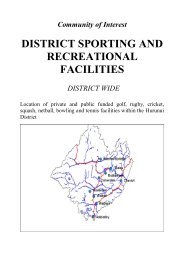
Project Hurunui Wind Construction and Project Overview
Project Hurunui Wind Construction and Project Overview
Project Hurunui Wind Construction and Project Overview

Create successful ePaper yourself
Turn your PDF publications into a flip-book with our unique Google optimized e-Paper software.
<strong>Project</strong> <strong>Hurunui</strong> <strong>Wind</strong> <strong>Construction</strong> Effects <strong>and</strong> Management Report<br />
The route between Turbines D2 <strong>and</strong> D1 is relatively flat with minor earthworks expected.<br />
Road D comprises gently undulating broad ridgelines at the northeast <strong>and</strong> southwest ends<br />
of this route but more complex <strong>and</strong> technically challenging terrain along the middle section<br />
as described above.<br />
Road D1<br />
Road D1 provides access to Turbines D6 <strong>and</strong> D7 <strong>and</strong> runs along gently undulating terrain.<br />
Minor earthworks are expected along this route which is shown on Photographs 38 <strong>and</strong> 39<br />
in Appendix B. This road is approximately 6m wide.<br />
Road D2<br />
Road D2 comprises a short section of road to access Turbine D9. This route is relatively<br />
flat <strong>and</strong> only minor earthworks are expected. Road D2 <strong>and</strong> Turbine D9 are shown on<br />
Photograph 37 in Appendix B.<br />
Road E<br />
Road E at approximately 6m wide commences at the intersection with Road D between<br />
Turbines D5 <strong>and</strong> D7 <strong>and</strong> circles around the outside of steep sided localised ridge in both<br />
sidling <strong>and</strong> box cuts to a point where both Turbines E1 <strong>and</strong> E2 can be accessed along<br />
alignments with reasonable gradients. The maximum cut height is approximately 7m with a<br />
corresponding maximum gradient of approximately 15% as Road B circles outside a steep<br />
sided ridge. Road E is shown on Photographs 34 <strong>and</strong> 35 in Appendix B.<br />
Road F<br />
Road F runs along a spur running approximately perpendicular to Road D near turbine D11.<br />
A series of moderate cuts <strong>and</strong> fills characterise Road F as it descends along moderately<br />
undulating terrain to reach turbine F1. Road F is approximately 6m wide.<br />
Road G<br />
Road G is approximately 6m wide <strong>and</strong> services turbine G1 which is located along a spur<br />
running perpendicular to the Road D ridgeline as shown on Photograph 36 in Appendix B.<br />
This route descends from Road D in a moderate sidling cut reaching a maximum down<br />
slope gradient of about 12% before leveling off in a fill embankment across a narrow<br />
saddle. Road G rises at a gentle gradient of approximately 5% from this saddle in a<br />
shallow box cut to reach turbine G1. The maximum cut height along Road G is<br />
approximately 6m.<br />
Road H<br />
Road H descends along a gently undulating spur running in a southeast direction<br />
perpendicular to Road D. The majority of the earthworks are concentrated at the latter<br />
section of this route where a maximum cut height of approximately 6m is expected. Road H<br />
is shown on Photograph 32 in Appendix B. Road H is approximately 6m wide.<br />
3.2.2 Access Road Formation<br />
Typical Cross Sections <strong>and</strong> Extent of Cuts<br />
5C-1604.02<br />
February 2011 21