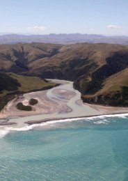
Project Hurunui Wind Construction and Project Overview
Project Hurunui Wind Construction and Project Overview
Project Hurunui Wind Construction and Project Overview

You also want an ePaper? Increase the reach of your titles
YUMPU automatically turns print PDFs into web optimized ePapers that Google loves.
<strong>Project</strong> <strong>Hurunui</strong> <strong>Wind</strong> <strong>Construction</strong> Effects <strong>and</strong> Management Report<br />
that platform areas around the basecourse hardst<strong>and</strong> areas are backfilled with top soil with<br />
a slight cross fall, <strong>and</strong> regrassed to avoid erosion.<br />
Drainage provision may be provided to the foundation excavation by way of a trench or filter<br />
drain with suitable stabilised outlet.<br />
Fill sites <strong>and</strong> lay down areas<br />
The proposed treatment for fill sites is discussed in Section 2.4. Finished ground profiles<br />
will be shaped to ensure that natural drainage paths are maintained. On completion of<br />
construction, these sites will be re-topsoiled (with material which has been removed <strong>and</strong><br />
stockpiled) <strong>and</strong> re-vegetated as appropriate with runoff direct onto grassed l<strong>and</strong> on<br />
surrounding catchments.<br />
Lay down areas will have a general crossfall, allowing stormwater run off in the direction of<br />
the general slope of the l<strong>and</strong>. Sedimentation <strong>and</strong> erosion control measures as described in<br />
Section 3.3.1 above will be applied. On completion of construction, lay down areas will be<br />
rehabilitated in the same manner as fill sites.<br />
3.3.3 New Culverts at Stream or Gully Crossings in the Core Site<br />
No stream crossings have been identified within the core site however there are locations<br />
where upper gully crossings <strong>and</strong> existing open channel drain crossings will require culverts.<br />
Table 15 below summarises the proposed culverts identified along core site access roads.<br />
Culvert sizes have been based on flows for flood return periods of 20 years with provision<br />
for secondary flow paths across purposely lowered sections of the access road (for<br />
overtopping for longer return periods).<br />
We envisage no gully crossings in addition to those tabulated given the layout of the access<br />
roads are generally close to or on ridge tops where the terrain is relatively gentle. However,<br />
where new culverts are required per the detailed design (consequent to adjusting the<br />
turbine platforms <strong>and</strong> access roads within a 100m radius placement area), culverts will be<br />
sized as described above.<br />
The approximate height of the embankment at the culvert inlet of the majority of all culverts<br />
is less than 1m apart from one culvert on Road D which has an embankment height of<br />
approximately 1.5m at the culvert inlet. Given the embankment heights at culvert inlets are<br />
not significant no locations have been identified where an embankment fill could essentially<br />
form a ‘dam’ across upper valleys. However, if a significant embankment fill arises<br />
consequent to adjusting the turbine platforms <strong>and</strong> access roads (within a 100m radius<br />
placement area) the culvert will be sized on flows for flood return periods of 100 years to<br />
address the effects of ‘heading up’ associated with culverts with significant embankment<br />
fills.<br />
Based on this design criteria, the required culvert sizes are indicated in the following table.<br />
The final size of the culvert, where required, will be determined during the detailed design<br />
stage. This table also identifies a range of characteristics associated with each culvert.<br />
5C-1604.02<br />
February 2011 44