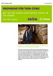
Untitled - Oxfam Blogs
Untitled - Oxfam Blogs
Untitled - Oxfam Blogs

Create successful ePaper yourself
Turn your PDF publications into a flip-book with our unique Google optimized e-Paper software.
Province/ City (Urban/rural) District Ward/Commune Residential Unit/Hamlet/Village<br />
- Poverty Rate: 0,93 percent (25<br />
households) as of end of 2007<br />
- Other features:<br />
• Net rice purchase<br />
• home to 3 industrial clusters, nearly 80<br />
agencies and enterprises<br />
Residential Unit 3:<br />
- Geographical location: Total area of 40 ha<br />
- Population and Ethnicity: 748 households with 2,638 people.<br />
- Poverty Rate: five poor households as of end of 2007<br />
- Other features: mainly simple jobs such as motorbike taxi drivers,<br />
small traders, cyclo drivers; some still grow vegetables and catching<br />
fish/prawns along the river sides<br />
An Lao District:<br />
- Geographical location: 18 km South<br />
West of Hai Phong<br />
- Population: 34360 households<br />
- Poverty Rate: 8,3 percent (2868<br />
households) as of August 2007<br />
- Other features:<br />
• 1 industrial park (An Tràng) and<br />
multiple industrial clusters by National<br />
highway 10.<br />
• mainly agriculture and handicrafts<br />
An Thái Commune:<br />
- Geographical location: at the far end<br />
of An Lao District, total area of 575.96<br />
ha<br />
- Population: 1890 households with<br />
7,865 people<br />
- Poverty Rate: 212 poor households as<br />
of end of 2007<br />
- Main jobs: paddy farming,<br />
construction, shoe-making and<br />
handicrafts<br />
Tiên Cm 1 hamlet:<br />
- Poverty Rate: 18 poor households as of end of 2007<br />
- Main sources of income: agriculture (wetland paddy, cash crops,<br />
cigarette…), rattan frames, shoe-making, construction…<br />
Tiên Cm 2 hamlet:<br />
- Population and Ethnicity: 168 households with 542 people<br />
- Poverty Rate: 12,5 percent (21 households) as of end of 2007<br />
- Main sources of income: agriculture (wetland paddy, cash crops,<br />
cigarette …), rattan frames, shoe-making, construction…<br />
Quang Tri:<br />
- Geographical location:<br />
North central coastal<br />
region, total area of 4,744<br />
km 2<br />
- Population and Ethnicity:<br />
611,000; 3 ethnic groups<br />
Vân Kiu, Pa Cô and Kinh.<br />
- Poverty Rate: 25,7<br />
percent as of end of 2006<br />
Huong Hoa District<br />
- Geographical location: border<br />
mountain district with 22 communes<br />
Population and Ethnicity: 13,335<br />
households, mainly of Vân Kiu group<br />
(56.9 percent) and Pa Cô (31.8<br />
percent).<br />
- Poverty Rate: l31.2 percent as of end<br />
of 2006<br />
Xy Commune:<br />
- Geographical location: remote area,<br />
one of the poorest communes of<br />
Huong Hoa District. Total area of<br />
2,118 ha.<br />
- Population and Ethnicity: 276<br />
households with 1,256 people. Mainly<br />
of the Vân Kiu group<br />
- Poverty Rate: very high, 70.1 percent<br />
as of end of 2006<br />
- Key features: mainly subsistence<br />
production. Main sources of income:<br />
cassava and upland crops.<br />
Troan Ô hamlet:<br />
- Geographical feature: low mountain<br />
- Population and Ethnicity: 42 households with 206 people. 97,6<br />
percent of Vân Kiu group<br />
- Distance to Commune : 1 km<br />
- Main sources of income: cassava, hired jobs (carpentry, weeding...)<br />
Xi La hamlet:<br />
- Geographical feature: low mountain<br />
- Population and Ethnicity: 27 households with 136 people. 100<br />
percent of Vân Kiu group<br />
- Distance to Commune 1 km<br />
- Main sources of income: cassava, upland paddy, hired jobs<br />
(weeding...)<br />
82