Northern San Luis Obispo County Coastal Trail Master Plan
Northern San Luis Obispo County Coastal Trail Master Plan
Northern San Luis Obispo County Coastal Trail Master Plan

You also want an ePaper? Increase the reach of your titles
YUMPU automatically turns print PDFs into web optimized ePapers that Google loves.
<strong>Northern</strong> <strong>San</strong> <strong>Luis</strong> <strong>Obispo</strong> <strong>County</strong> <strong>Coastal</strong> <strong>Trail</strong> <strong>Master</strong> <strong>Plan</strong><br />
Further south is the Fiscalini Ranch Preserve, a 439-acre park and open space area owned by the Cambria<br />
Community Services District (CCSD). The western portion of the Preserve features another developed<br />
segment of the CCT operated by the CCSD. Various residential areas surround the Preserve – Park Hill, East<br />
Lodge Hill, and West Lodge Hill. Uses at the Preserve are restricted by the East-West Ranch Public Access<br />
and Management <strong>Plan</strong> and a conservation easement held by the Friends of the Fiscalini Ranch Preserve.<br />
Several formal and informal beach access points exist along this segment, including:<br />
1-12<br />
� Parking areas at the north and south end, and boardwalk paths along the length of Moonstone Beach<br />
Drive<br />
� A parking and beach access point at Shamel Community Park<br />
� <strong>Trail</strong>s adjacent to the Park Hill residential area<br />
� Multiple viewing areas along the bluffs and boardwalk at Fiscalini Ranch Preserve<br />
� A walkway down the bluffs at Lampton Cliffs <strong>County</strong> Park<br />
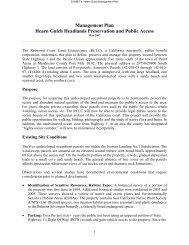
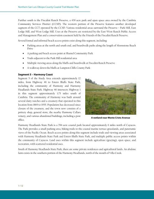
Segment 5 – Harmony Coast<br />
Segment 5 of the Study Area extends approximately 12<br />
miles, from Highway 46 to Estero Bluffs State Park,<br />
including the community of Harmony and Harmony<br />
Headlands State Park. Highway 46 intersects Highway 1<br />
in this segment approximately 1.75 miles south of<br />
Cambria. The community of Harmony was built around<br />
several dairy ranches and a creamery that operated in this<br />
location from 1869 to 1955. Population has decreased since<br />
closure of the creamery, and the town now consists of a<br />
pottery shop, general store, the nearby Harmony Cellars<br />
winery, and various abandoned buildings, including a post<br />
office.<br />
A wetland near Monte Cristo Avenue<br />
Harmony Headlands State Park is a 784-acre coastal park located approximately 6 miles north of Cayucos.<br />
The Park provides a small parking area, hiking trails to the coastal marine terrace grasslands, and panoramic<br />
views of the Pacific Ocean. Beach access points along this segment include trails and viewing areas associated<br />
with Harmony Headlands State Park and Estero Bluffs State Park, and multiple public access points within<br />
the community of Cayucos. Land uses within this segment include agriculture (grazing), open space, and<br />
recreation, with scattered residential uses.<br />
South of Harmony Headlands State Park, there are some private residences and agricultural lands. An abalone<br />
farm exists in the southern portion of the Harmony Headlands, north of the mouth of Villa Creek.