Northern San Luis Obispo County Coastal Trail Master Plan
Northern San Luis Obispo County Coastal Trail Master Plan
Northern San Luis Obispo County Coastal Trail Master Plan

You also want an ePaper? Increase the reach of your titles
YUMPU automatically turns print PDFs into web optimized ePapers that Google loves.
<strong>Northern</strong> <strong>San</strong> <strong>Luis</strong> <strong>Obispo</strong> <strong>County</strong> <strong>Coastal</strong> <strong>Trail</strong> <strong>Master</strong> <strong>Plan</strong><br />
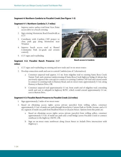
Segment 4: <strong>Northern</strong> Cambria to Fiscalini Creek (See Figure 1-5)<br />
Segment 4-1: <strong>Northern</strong> Cambria (1.7 miles)<br />
1-24<br />
1. Improve native surface trail from View Point<br />
access drive to a beach crossing<br />
2. Sign existing Moonstone Beach boardwalk as<br />
CCT<br />
3. Coordinate with Cambria CSD project to<br />
close path gap along Moonstone near<br />
Windsor<br />
4. Improve beach access road at Shamel<br />
Community Park (re-grade and erosion<br />
control)<br />
5. CCT signs and wayfinding<br />
Segment 4-2: Fiscalini Ranch Preserve (1.7<br />
miles)<br />
1. CCT signs and wayfinding on existing and new trails and /or on-street routes<br />
2. Develop connection south and east to central Cambria (one of 2 alternatives):<br />
a Construct unpaved trail approx. 0.2 mi. from ridgeline trail to existing <strong>San</strong>ta Rosa Creek<br />
Nature <strong>Trail</strong>, and construct undercrossing of <strong>San</strong>ta Rosa Creek highway bridge (Caltrans has<br />
previously opposed this concept) to connect to existing Cambria CSD trail and extend south<br />
to connect to existing trails to Ramsey Road, and on-street route approximately 0.3 mi. along<br />
Ramsey to Burton Drive, OR:<br />
b Construct unpaved trail approximately 0.3 mi. from south end of ridgeline trail, extending<br />
north and east to sidepath in highway ROW, which would extend approximately 0.4 mi.<br />
east to Burton Drive.<br />
Segment 4-3: Fiscalini Ranch Preserve to Fiscalini Creek (2.0 miles)<br />
1. Sign approximately 2 miles of on-street route<br />
Beach access in Cambria<br />
2. Based on obtaining access rights across private parcel(s) from willing sellers, construct<br />
approximately 0.3 mi. of multi-use path through Strawberry Canyon Park to Orville Avenue, and a 0.1<br />
mi. segment of multi-use path from Bradford Street to Gleason Street. Options from this point are:<br />
a Based on obtaining access rights across private parcel(s) from willing sellers, construct<br />
approximately 0.3 mi. of multi-use path and a trail bridge across Fiscalini Creek to connect<br />
southeast to the highway 1 ROW, OR;<br />
b Sign an on-street route northwest along Green Street to Ardath Drive intersection with<br />
Highway 1.