- Page 1 and 2:
ENVIRONMENTALA SSESSMENTFDIC AS REC
- Page 4 and 5:
E NVIRONMENTALA SSESSMENT102803.12R
- Page 6:
E NVIRONMENTALA SSESSMENT102803.12R
- Page 10:
E NVIRONMENTALA SSESSMENT102803.12R
- Page 17 and 18:
E NVIRONMENTALA SSESSMENT102803.12R
- Page 19 and 20:
E NVIRONMENTALA SSESSMENT102803.12R
- Page 21 and 22:
E NVIRONMENTALA SSESSMENT102803.12R
- Page 23 and 24:
E NVIRONMENTALA SSESSMENT102803.12R
- Page 25 and 26:
E NVIRONMENTALA SSESSMENT102803.12R
- Page 27 and 28:
E NVIRONMENTALA SSESSMENT102803.12R
- Page 30 and 31:
E NVIRONMENTALA SSESSMENT102803.12R
- Page 32 and 33:
E NVIRONMENTALA SSESSMENT102803.12R
- Page 34 and 35:
E NVIRONMENTALA SSESSMENT102803.12R
- Page 36 and 37:
Project No.: 102803.12R-021.051EMG
- Page 38 and 39:
Project No.: 102803.12R-021.051EMG
- Page 40 and 41:
E NVIRONMENTALA SSESSMENT102803.12R
- Page 42 and 43:
E NVIRONMENTALA SSESSMENT102803.12R
- Page 44 and 45:
Wetlands MapSource:U.S. Fish and Wi
- Page 46 and 47:
Tax MapSource:Cook County AssessorP
- Page 48 and 49:
Sanborn MapSource:Environmental Dat
- Page 50 and 51:
Sanborn MapSource:Environmental Dat
- Page 52 and 53:
Sanborn MapSource:Environmental Dat
- Page 54 and 55:
Sanborn MapSource:Environmental Dat
- Page 56 and 57:
Sanborn MapSource:Environmental Dat
- Page 58 and 59:
Historic Topographic MapSource:EDRD
- Page 60 and 61:
Historic Topographic MapSource:EDRD
- Page 62 and 63:
Historic Topographic MapSource:EDRD
- Page 64 and 65:
Aerial PhotographSource:EDRDate: 19
- Page 66 and 67:
Aerial PhotographSource:EDRDate: 19
- Page 68 and 69:
Aerial PhotographSource:EDRDate: 19
- Page 70 and 71:
Aerial PhotographSource:EDRDate: 19
- Page 72 and 73:
Aerial PhotographSource:EDRDate: 19
- Page 74 and 75:
Aerial PhotographSource:EDRDate: 20
- Page 76 and 77:
E NVIRONMENTALA SSESSMENT102803.12R
- Page 78 and 79:
E NVIRONMENTALA SSESSMENT102803.12R
- Page 80 and 81:
E NVIRONMENTALA SSESSMENT102803.12R
- Page 82 and 83:
E NVIRONMENTALA SSESSMENT102803.12R
- Page 84 and 85:
E NVIRONMENTALA SSESSMENT102803.12R
- Page 86 and 87:
E NVIRONMENTALA SSESSMENT102803.12R
- Page 88 and 89:
TABLE OF CONTENTSSECTIONPAGEExecuti
- Page 90:
EXECUTIVE SUMMARYProposed NPLNPL LI
- Page 93:
EXECUTIVE SUMMARYFederal RCRA CORRA
- Page 96 and 97:
EXECUTIVE SUMMARY________ Site_____
- Page 98 and 99:
EXECUTIVE SUMMARYDue to poor or ina
- Page 100 and 101:
EDR Inc.
- Page 102 and 103:
MAP FINDINGS SUMMARYDatabaseSearchD
- Page 104 and 105:
Map IDDirectionDistanceDistance (ft
- Page 106 and 107:
Map IDDirectionDistanceDistance (ft
- Page 108 and 109:
Map IDDirectionDistanceDistance (ft
- Page 110 and 111:
Map IDDirectionDistanceDistance (ft
- Page 112 and 113:
Map IDDirectionDistanceDistance (ft
- Page 114 and 115:
Map IDDirectionDistanceDistance (ft
- Page 116 and 117:
Map IDDirectionDistanceDistance (ft
- Page 118 and 119:
Map IDDirectionDistanceDistance (ft
- Page 120 and 121:
Map IDDirectionDistanceDistance (ft
- Page 122 and 123:
Map IDDirectionDistanceDistance (ft
- Page 124 and 125:
Map IDDirectionDistanceDistance (ft
- Page 126 and 127:
Map IDDirectionDistanceDistance (ft
- Page 128 and 129:
Map IDDirectionDistanceDistance (ft
- Page 130 and 131:
Map IDDirectionDistanceDistance (ft
- Page 132 and 133:
Map IDDirectionDistanceDistance (ft
- Page 134 and 135:
Map IDDirectionDistanceDistance (ft
- Page 136 and 137:
Map IDDirectionDistanceDistance (ft
- Page 138 and 139:
Map IDDirectionDistanceDistance (ft
- Page 140 and 141:
Map IDDirectionDistanceDistance (ft
- Page 142 and 143:
Map IDDirectionDistanceDistance (ft
- Page 144 and 145:
Map IDDirectionDistanceDistance (ft
- Page 146 and 147:
Map IDDirectionDistanceDistance (ft
- Page 148 and 149:
Map IDDirectionDistanceDistance (ft
- Page 150 and 151:
Map IDDirectionDistanceDistance (ft
- Page 152 and 153:
Map IDDirectionDistanceDistance (ft
- Page 154 and 155:
Map IDDirectionDistanceDistance (ft
- Page 156 and 157:
Map IDDirectionDistanceDistance (ft
- Page 158 and 159:
Map IDDirectionDistanceDistance (ft
- Page 160 and 161:
Map IDDirectionDistanceDistance (ft
- Page 162 and 163:
Map IDDirectionDistanceDistance (ft
- Page 164 and 165:
Map IDDirectionDistanceDistance (ft
- Page 166 and 167:
Map IDDirectionDistanceDistance (ft
- Page 168 and 169:
Map IDDirectionDistanceDistance (ft
- Page 170 and 171:
Map IDDirectionDistanceDistance (ft
- Page 172 and 173:
Map IDDirectionDistanceDistance (ft
- Page 174 and 175:
Map IDDirectionDistanceDistance (ft
- Page 176 and 177:
GOVERNMENT RECORDS SEARCHED / DATA
- Page 178 and 179:
GOVERNMENT RECORDS SEARCHED / DATA
- Page 180 and 181: GOVERNMENT RECORDS SEARCHED / DATA
- Page 182 and 183: GOVERNMENT RECORDS SEARCHED / DATA
- Page 184 and 185: GOVERNMENT RECORDS SEARCHED / DATA
- Page 186 and 187: GOVERNMENT RECORDS SEARCHED / DATA
- Page 188 and 189: GOVERNMENT RECORDS SEARCHED / DATA
- Page 190 and 191: GOVERNMENT RECORDS SEARCHED / DATA
- Page 192 and 193: GOVERNMENT RECORDS SEARCHED / DATA
- Page 194 and 195: GOVERNMENT RECORDS SEARCHED / DATA
- Page 196 and 197: GOVERNMENT RECORDS SEARCHED / DATA
- Page 198 and 199: GEOCHECK ® - PHYSICAL SETTING SOUR
- Page 200 and 201: GEOCHECK ® - PHYSICAL SETTING SOUR
- Page 202 and 203: GEOCHECK ® - PHYSICAL SETTING SOUR
- Page 204 and 205: GEOCHECK ® - PHYSICAL SETTING SOUR
- Page 206 and 207: EDR Inc.660 06060 006 0 0060 00 006
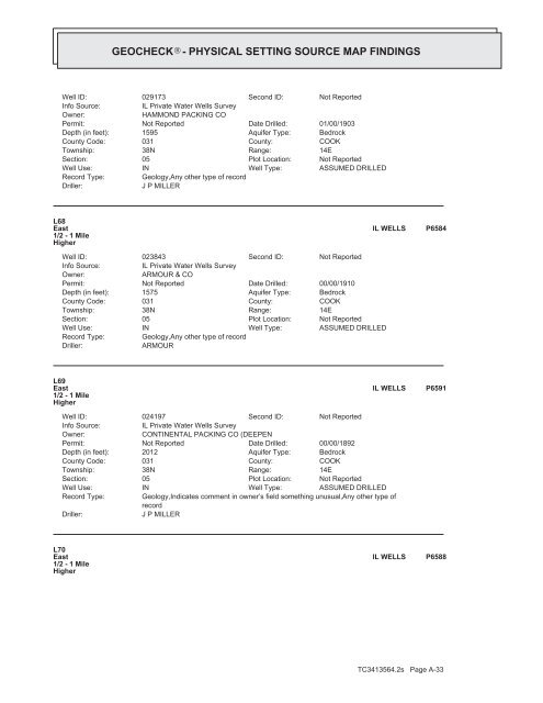
- Page 208 and 209: GEOCHECK ® - PHYSICAL SETTING SOUR
- Page 210 and 211: GEOCHECK ® - PHYSICAL SETTING SOUR
- Page 212 and 213: GEOCHECK ® - PHYSICAL SETTING SOUR
- Page 214 and 215: GEOCHECK ® - PHYSICAL SETTING SOUR
- Page 216 and 217: GEOCHECK ® - PHYSICAL SETTING SOUR
- Page 218 and 219: GEOCHECK ® - PHYSICAL SETTING SOUR
- Page 220 and 221: GEOCHECK ® - PHYSICAL SETTING SOUR
- Page 222 and 223: GEOCHECK ® - PHYSICAL SETTING SOUR
- Page 224 and 225: GEOCHECK ® - PHYSICAL SETTING SOUR
- Page 226 and 227: GEOCHECK ® - PHYSICAL SETTING SOUR
- Page 228 and 229: GEOCHECK ® - PHYSICAL SETTING SOUR
- Page 232 and 233: GEOCHECK ® - PHYSICAL SETTING SOUR
- Page 234 and 235: GEOCHECK ® - PHYSICAL SETTING SOUR
- Page 236 and 237: GEOCHECK ® - PHYSICAL SETTING SOUR
- Page 238 and 239: GEOCHECK ® - PHYSICAL SETTING SOUR
- Page 240 and 241: GEOCHECK ® - PHYSICAL SETTING SOUR
- Page 242 and 243: GEOCHECK ® - PHYSICAL SETTING SOUR
- Page 244 and 245: GEOCHECK ® - PHYSICAL SETTING SOUR
- Page 246 and 247: GEOCHECK ® - PHYSICAL SETTING SOUR
- Page 248 and 249: PHYSICAL SETTING SOURCE RECORDS SEA
- Page 250 and 251: E NVIRONMENTALA SSESSMENT102803.12R
- Page 252 and 253: E NVIRONMENTALA SSESSMENT102803.12R
- Page 254 and 255: EMGAn EnvironmentFor SuccessPage 2P
- Page 256 and 257: To:City of ChicagoDepartment of Bui
- Page 293 and 294:
Prepared for:EMG222 Schilling Circl
- Page 295 and 296:
CHAIN OF TITLE REPORTES-102153 Sept
- Page 297 and 298:
CHAIN OF TITLE REPORTES-102153 Sept
- Page 301 and 302:
E NVIRONMENTALA SSESSMENT102803.12R
- Page 303 and 304:
Statement of Work: FDIC Phase I ESA
- Page 305 and 306:
Statement of Work: FDIC Phase I ESA
- Page 307 and 308:
Statement of Work: FDIC Phase I ESA
- Page 309 and 310:
Statement of Work: FDIC Phase I ESA
- Page 311 and 312:
Statement of Work: FDIC Phase I ESA
- Page 313 and 314:
Statement of Work: FDIC Phase I ESA
- Page 315 and 316:
Statement of Work: FDIC Phase I ESA
- Page 317 and 318:
Statement of Work: FDIC Phase I ESA
- Page 319 and 320:
Statement of Work: FDIC Phase I ESA
- Page 321 and 322:
Statement of Work: FDIC Phase I ESA
- Page 323 and 324:
Statement of Work: FDIC Phase I ESA
- Page 325 and 326:
Statement of Work: FDIC Phase I ESA
- Page 327 and 328:
Statement of Work: FDIC Phase I ESA
- Page 329 and 330:
Statement of Work: FDIC Phase I ESA
- Page 331 and 332:
Statement of Work: FDIC Phase I ESA
- Page 333 and 334:
Statement of Work: FDIC Phase I ESA
- Page 335 and 336:
Statement of Work: FDIC Phase I ESA
- Page 337 and 338:
Statement of Work: FDIC Phase I ESA
- Page 339 and 340:
Statement of Work: FDIC Phase I ESA
- Page 341 and 342:
Statement of Work: FDIC Phase I ESA
- Page 343 and 344:
Statement of Work: FDIC Phase I ESA
- Page 345 and 346:
Statement of Work: FDIC Phase I ESA
- Page 347 and 348:
Statement of Work: FDIC Phase I ESA
- Page 349 and 350:
E NVIRONMENTALA SSESSMENT102803.12R
- Page 351:
EMG RESUMENICHOLAS BRANDTProject Ma