NEW JERSEYGlou_e sterGEODETIC COI{TEOL _UBVEY 19_gCountyDESCRIPTION OF _CH ;,ARKS I GLO-E pa£e 18 I IL ON. 15089- LOGAN f_VP,, GLOUCES_ COUNTY, N.J. On the northwest81de of N.J.$.H. Route 44_ about i°-_4 mile_ _ou_hwostof _he Intersection of _oute 44 ana U°8o Route _22:5_.15 f_ no_hw_s_ of a n_il <strong>in</strong> pole A.C°E° 6_-4_;29.61 f_. northea_t_ 20.24 ft. northwest ana 45.02 ft,northwest of _hree R.R. _plkea <strong>in</strong> _he _enterlln_ of_he highway. A _an_ard N,J,G.C°$. di_k, _et <strong>in</strong> c_ncre_e,flush wi_h _e g_o_md.EO_I. 15090- LO_A_; T_P., _LOUCE_TER COUnTy, N.J. _ _ _@utheaDtslde o_ N°J°_.H. Rou_e 44, abou_ i._8 mil_B _euthwe_tof _e Lutsr_oc_Ion ef Rout_ 44 a_ U.$. _oute _2_!_.i_ f_° southwest of a nail <strong>in</strong> pole A,C.E, 6_4-40|35.16¸ _t. southeast, 2_°_2 ft. 8outhealt sn_ 2_.81 _t,_oa_h of three _°R. _pike_ <strong>in</strong> the centerlln_ of _heflush with _he _roun_.El_va_on _ 8_581 ft__0_° i_091- LOGA_ TWP°, GLOUCESTER COUnTy, N.J, On t_ northwest_de of N°JoS._. _oute 44, about 260_ mil_ _uthweetof the In_a_ec_£_n of Rout_ 44 an_ U_$. _eu%e _2_6_°20 ft. noah of a nail <strong>in</strong> pele A_C°_._ n_ numbe_2_.70 ft. no_th_aBt; 16._4 ft. northwest, ana 2_°60ft. n_rthwe_t of three _._° splke_ <strong>in</strong> the c_nte_itneof the hi6hway° A a_an_ar_ N.J._.C°$. d_k, ae_ _nconcrete, f_uah _ith the Ero_n_°Al_va_ion: 2,0<strong>51</strong> ft_NEW JERSEY GEOLOGICAL SURVEY
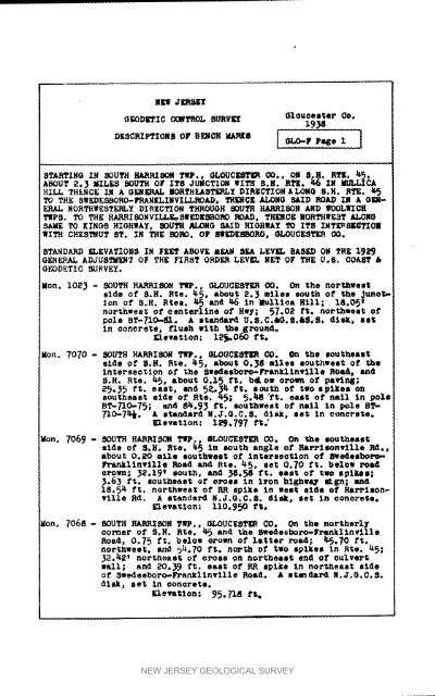
H_J ER_"fGEODETIC CCgTROL HURVI_ Olouoemter Co.DSSORIPTIO.S OrB_CH_U_H ! J[ 6LO-F Page lIITARTIHG IN SOUTH HARRISON TWP., OLOUCEgT_ 00°, ON B.H, RTE. _,_,ABOUT 2._ MILES SOUTH Or ITS JUMCTION WITH H.H. RTE. _,6 lW MULLICAHILL THEHC£ XH A GERF_L HORTHEASTER5_ DIRECTIOHALOMO 8,H. RTH.TO THE 8WEDE_BOflO-FRAHELIHVILLROAD, TH_CE JL_OHG SAID ROAD I_ A G]IIOg-ERAL NORTHWESTERLY DIRECTION T_0_H 8OUT° RAJKRISOHAND WOOLWICHTIPS. TO THE HARRIgONYILLE,-SHEDE_ORO ROAD, THENCE NORTHWEST ALOe6SAME TO KINO8 HIGHWAY, SOOTH °LONG SA_D HIOHWA_ TO IT8 IMTE_SKOTIO_WITH CHESTNUT ST. IN THE BORe. OF _DE_3ORO, GLOUCESTER CO,STANDARD _LEVATIONS IN FEET ABOVE _EA_ SEA LEV_ BASED OJ ThE l_i_9(}ENEPAL ADJUSTMENT OF T_E FIRST ORDER LEV_ LET OF THE HoB. COAET &GEODETIC _JRVE¥oMen. 1023 - SOUTH _ TIP., 6LOUGEST_R CO. On the nor_wution of H.H. °tee. _._ and_ In _t_ltoa Hill; 18.05tnorthwest of oenterltne of Hey; 57.02 ft, northwest o1"pole HT-710-41. A standar_ U.S,C._.B.&_oS. di_, set;<strong>in</strong> _onere_e, flush wi_h the ground.• le_atlon,- 12_0_ f$.Hen. 7070 - SOUTh MARRISO_ TWp,, _LOUCESTER CO. _ the southeastside of S.H. Rteo _, abou_ O,_g miles e0oY, hwesl; of theIntersection of the seedesboro-Fran_[1Lnvllle goa'_, andS.H. B_e° _, about 0,I_ f$. b_, OW orowr_ of pa_r_;25._5 ft. east, and 5&_ _. ft. s ou,_h of two eplEes onsoutheast side of RYe, _; 5._ ft. eae_ of nail In poleBT-_AO-75; and 81t.9_ ft. southwest of nail _-n pole BT-710.-7t_o A standard N.J'.G,C.S. dls_, eel; In Oonorete,_levs_lo.: 1_.797 ft.Men. 7069 - SOUTH HARRISO_ Tip., QLOUCESTER CO, On _he wootheaete_de of S.H. Rse. _5 t, _uth anglo o£ Ra_l_nville Rd.,about 0.20 mile southwew_ of IntereeotXon of fPgedeobot_-FranXltnvilIe Road and RYe. _5, set 0.70 ft. below roadorown; _2.19_ south, and _,_ ft. east of _wo spikes;_.63 ft. southeast of oroee <strong>in</strong> Iron hlghweJ, _g°; and1_.5_¢ ft. northwesl; of RR spike <strong>in</strong> seat side o1' Hard'leonvllleRd. A standard H.J.O,C.B. dl_, oe_ <strong>in</strong> conore_o.¢leva$1on: 110.990 ft.}ion, 706 _: - SOUTH HARRISON TIP., GLOUCESTE8 CO, On the northerlycorner of S.H. RYe. _ and _he Swedesboro-F_LnklloyllleRoad, 0,75 ft. below oroan of latter road; ItS,70 fienorthwest, and _.70 ft. n_._h of two splkee tn Hie. KS;_2._,_ _ northeast of crees on northeast end of oulver_wall; and _O._9 ft. east of RR spike In hot.east sideof Swedeeboro-Fra_llnvllle Road. A etendard N.J.G.C.S.disk, set En oonerete.Elevation: 95._1_ f_NEW JERSEY GEOLOGICAL SURVEY
- Page 1:
THEDEPARTMENTOFCONSERVATION AND 'DE
- Page 6 and 7:
_de by the U. S• Coast & Geodetic
- Page 8 and 9:
CAZDENLooalit_ Name o_ EunWinslowTw
- Page 10 and 11:
NEW JERSEY GEOLOGICAL SURVEY
- Page 12 and 13:
_an0£o_ic OOmTROL SUavE_ 19_7Com'_
- Page 15 and 16:
_R_ Camden Gounty1Q37O_O_?IC CO_?_O
- Page 17 and 18:
GEODETI: CONTROL SURVE_iliI]g[. 960
- Page 19 and 20:
NEW JERSEy Gloucest¢r Co°1937GEOD
- Page 21 and 22:
Gloucest_r Co1_ntyNEW JERS_ Camden
- Page 23 and 24:
Ol_cester count 7OEODETIC CONTRO_ S
- Page 25 and 26:
NEW _R HEYOlouceste r Count7GEODETI
- Page 27 and 28:
NEW JERBEY Gloucester C_19_9O_OD_TI
- Page 29 and 30:
•EW _BE"X Ca_en Count_Ig39GEOD_IC
- Page 31 and 32:
C_enO_t7OEOD_O CO_I_mROL_URVE'_r 19
- Page 33 and 34:
NhW _RSEY Camion County1939GEOLLTIC
- Page 35 and 36:
NEW J_BEY_lo_oes_er Co_m_yDzsc_iP_o
- Page 37 and 38:
_g¢ JERSEYC_denGEODETIC CONTROL SU
- Page 39 and 40:
Camden CountyO£ODET_C CONTR05 5_RV
- Page 41 and 42:
N_ J'_RShy Camden Count 71959GEODET
- Page 43 and 44:
NEW JERSEYCamden CounZyGEODETIC CON
- Page 45 and 46:
NEW JERShT Camden County1959GEODETI
- Page 47 and 48:
N_ _SEY Cawdon County1939O_O,DE.TI(
- Page 49 and 50:
Nh_ JEESE_Camden CountySk0_ETIC COR
- Page 51 and 52:
Camden Cou_JERSEY 1937GEOE_TZC CONT
- Page 53 and 54:
NEW JERSEY Camden C_Int_1959GEODZTI
- Page 55 and 56:
Olouoe s_er Co*_EOD_TIC C_TRO_ S_VE
- Page 57 and 58:
C_m_en Counties.[,_4JDETICC0_ITR01_
- Page 59 and 60:
J ,._;E_I J_RS_ Camden Cotmty19_9_T
- Page 61 and 62:
N_J_8_Camden Co.GEODETIC CONTROL _V
- Page 63 and 64:
N_ /ERSE_ Burl_ton Count 7Camden C_
- Page 65 and 66:
JERSEY(_t_QD_,2'IC CONTROL _UIW_J[C
- Page 67 and 68:
NSW JERS_Y Camden County1939GEODETI
- Page 69 and 70: _E_ _RSEY Ca_en Co_ma_1939GEOD ET I
- Page 71 and 72: NE6 JERSEY Camden County1959GEODETI
- Page 73 and 74: NEW JERSEY Camden CoumtyGlemee_t er
- Page 75 and 76: NEW J_S_ CmBd_ Count_19_9GEODETIC C
- Page 77 and 78: _g_ JERSEY Camden CountyigSgGEODI_T
- Page 79 and 80: Olouae6_erNEW J F.RS_ 1938CountyOEO
- Page 81 and 82: N_; JERSEY Ql_ooater County1959GEOD
- Page 83 and 84: _; OER_L_ Ol_eeeter Ce_nt7O_ODETICC
- Page 85 and 86: Sale_ Count 7_;. J_SL_ Gloucester C
- Page 87 and 88: NE_ JERSEY Gloucester County1939G_O
- Page 89 and 90: NE_ JERSEY G1ouoester COUnty19_9GEO
- Page 91 and 92: NE_ _RSEY Gloucester County19_,9GEO
- Page 93 and 94: NEW JERSEY Gloucester County1959GEO
- Page 95 and 96: NEW JERSEY Glouee_te_ C¢_mty193gGE
- Page 97 and 98: N_W_'J_SEYG1oucea_er Co_ut_GEODETIC
- Page 99 and 100: Nh_ J_S_ Olouceste_ CountyGEODETIC
- Page 101 and 102: NEW _ g1_oester Cmm_ TQEODST,C CONT
- Page 103 and 104: ,."I_RB_t" 01oueest=e_ Cotmt_GEODET
- Page 105 and 106: Camden CountyN_V J_RS_ Gloucester C
- Page 107 and 108: N_7_ _S_" Ol_eestor County19_9GEODE
- Page 109 and 110: NE_' JERSEYGloucester count F_EODET
- Page 111 and 112: Glouoaeter County_Ew /_SEY 19_9GEOD
- Page 113 and 114: NEW JERSEY Gloucester County1939G_O
- Page 115 and 116: N_ JERSEY QlouoeBter Count_19_9Q_OD
- Page 117 and 118: NEW J_$_ Glouoeeter c_u_t_r195gGEOD
- Page 119: Olouceete_-GEODETIC CO_ROL SURVEY 1
- Page 123 and 124: NEW JERSEYOEODETIC COHTROL SURVEY O
- Page 125 and 126: HERJtPR3_TLG_ODET_C CONTR_ SURVEY G
- Page 127 and 128: NL_ JERSEYOlouee|terGEODETIC CONTRO
- Page 129 and 130: N_ J_S_GloucesterGEODETIC CONTROL S
- Page 131 and 132: NE_W JERSEY Gloucester County1939GE
- Page 133 and 134: GloucesterNEW JERSEY 193gCountyGEGD
- Page 135 and 136: _EW/ERSEYGEODETIC CORT_OL 3URVE_ Ql
- Page 137 and 138: NE;'_Jh_h'f Gloucestem Count_G_OD/_
- Page 139 and 140: N_WJERSEYGEODETIC CO_;TROL SURVEy G
- Page 141 and 142: NEW JERSEYG1ouoes_er Count NGEOD_T
- Page 143 and 144: l_ /BR_EY _lo_eeeter _t_X_4_OROD_TI
- Page 145 and 146: NEW JERSEY Gloueester CountyGEGDETI
- Page 147 and 148: _ J_ CamdQn C_t_19,39QEODETIC CO_TR
- Page 149 and 150: NZWaER3EYOEODETIC CONTROL SUEVE_ G1
- Page 151 and 152: Glo_AoeBteP Cc_mt7/_RSEY "10S9OEOD_
- Page 153 and 154: jERS_rGEODETIC CO_ROL _ Gle_oes_oP
- Page 155 and 156: Glo_oesterOEaDSTIC COI_TI_OL_vE_ 19
- Page 157 and 158: GEODETICJ"EESEXCONTROL SURVE_01o_.a
- Page 159 and 160: co RoLEO_ee_erl,=O_n_tMOH.J_X_Zg-1)
- Page 161 and 162: NE_, JEP_.EYOlouoesteeeECiDETIC COF
- Page 163 and 164: Oloucester Cot_ntyGEODETIC CONTBOb
- Page 165 and 166: NEW JERSE_ Gloueestmr COuntyQEODETX
- Page 167 and 168: ..., . ..tCEW JERSEY Olm.taee';4r C
- Page 169 and 170: N_ _RS_ Gio_oestsr Count71959G_ODET
- Page 171 and 172:
N_ .TER_ GZouoeeter Cou_t_GEODETI C
- Page 173 and 174:
NEW _ER_EY Gloucester C_tyGEODETICC
- Page 175 and 176:
NE_ JERSE_ Salem Count_19_9DESCRIPT
- Page 177 and 178:
Nh_ JERSEY$al_m C_yGEODETIC CONTROL
- Page 179 and 180:
NEW JERSEYSalem CountyGEODETIC CONT
- Page 181 and 182:
NEW JERSEYSalem County_EODETIC CONT
- Page 183 and 184:
Nk_','J_RSLY Salem County1939GEODET
- Page 185 and 186:
N_'! JERSEY Salem County1959GEODETI
- Page 187 and 188:
N_ JERSEY Salem County19_9GEODETIC
- Page 189 and 190:
_1_ JE_S]_ Sa;Lm= _eumt 7OF_D_;YIC
- Page 191 and 192:
_EW ._E_SEY Sale= CoUnt 7Zg_8GEODET
- Page 193 and 194:
,= ,_EW JERSEySalem CountyGRODETIC
- Page 195 and 196:
_JE._SEYSalemOmuat¥GKODSTIC CONTRO
- Page 197 and 198:
GEODETICNEW JERSEY Salem Ceumt_CONT
- Page 199 and 200:
. . .N_ JERSEY Salem COunt_GEODETIC
- Page 201 and 202:
NEW JERBE_S_om count 7GEO_TI_ CONTR
- Page 203 and 204:
_TATE OF N_ _R_D_IPTION OF B_NC_ _R
- Page 205 and 206:
Line 5 e Perth _-_,o_r to Atlantlo
- Page 207 and 208:
_a_eISLiz_e 5, _ez_h _boy tD Atlsnt
- Page 209 and 210:
Wr_YIM _0 BRIDOE_q_M_ N,_.-_'T_LIMR
- Page 211 and 212:
Line 9, _a Isle _tlon t_ _m_enn ]_o
- Page 213 and 214:
Line _, Sea Isle Junction to C_nden
- Page 215 and 216:
Pa_e_OLine 9j Sea Isle Junotl_n to
- Page 217:
I•TIs_IIvNEW JERSEY GEOLOGICAL SU