

Bulletin 51, New Jersey Geodetic Control Survey Bench Marks in ...
Bulletin 51, New Jersey Geodetic Control Survey Bench Marks in ...
Bulletin 51, New Jersey Geodetic Control Survey Bench Marks in ...

Create successful ePaper yourself
Turn your PDF publications into a flip-book with our unique Google optimized e-Paper software.
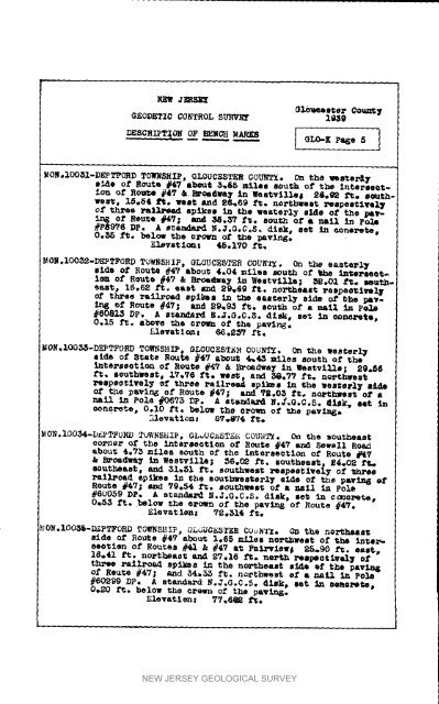
NEW J_RSE_Gl,b_t,s_erGEODETIC CONTROL SD_VE_ l_gGo_n_ TDESCRLPT_ ON O_PE_ZN@H .ARKS I GLO'K P_e fi INON,IOOSI-DEPT_OBD TOWNSHIP, GLOUCESTER COU_F/. On the _s_e_ 7si_e of Route #_7 about 3_E5 miles _u_ of the Intersectionof RouSe #47 &. _wa_ <strong>in</strong> Westville_ 2&._ f_. sc_th*ves_ 15e_4 ft. _st Ju_d 26e69 1_o no_hwest Pespeetlvel¥Of th1"ee xq_e_ epl_Ees ID f_e westerly S_S of the p_-Ing of Nsute #4_; and _.3_ ft. eou_h of • nail <strong>in</strong> polo#P8976 DP. A sta-d.,_ R.J.GoC.S. disk# set <strong>in</strong> eone_e_epOe_ fie below 7*he OZ'OI_I of e.he _vir_eEI_vet ice: 45.1Y0 ft.MON,IOO52-DEPTFORD TOWNSHIP, GLOUCESTER COUR'A_. On the eaaterl_elde of Routs #47 abou_ 4.04 miles south of _he £ute_aeetie_of R_te #47 & Bx_m@wa_ <strong>in</strong> Westville; _.01 f_. a_utheast_16.62 ft. east _ 2_6g ft. no.heart _espeotiwol_three z.allroed spikes <strong>in</strong> the easterly side of She _v-Ia_ of Route #47; and _9_9_ ft. sout_ of a nail <strong>in</strong> Pete#608_b_ DP, A s_anda_ _._.G,C.S. diak_ set <strong>in</strong> oo_te,0.15 Pc. above _he crown of _he pav<strong>in</strong>g.Elevst 1 (m _ _6._ i_,MOR.IOO_-DEPTFORD TOWNSHIP, GLOUCESTER COUNTS. On _he westerl_side of _tate Route #47 a_e_t 4_4_ miles south ef the<strong>in</strong>terssotien of Route #47 & Broadway <strong>in</strong> _estvllls| 29._6ft. S_uthwsst_ 17_76 fie west, a_d _.77 fl_. nort_et_espsstlvely of three rail_e_ epl_es <strong>in</strong> the westerly s_of t_e pav<strong>in</strong>g of Route #4V; and _.05 ft. northwest of ahall <strong>in</strong> Pole #0673 DP. A stenda_ N.,_.G.C.8. _laE, eat <strong>in</strong>oen_rete, 0.I0 ft. below the O_om_ of the psv_Elevation: 87_74 ft*MON,IOO_4-D_PTFOHD TuW_sHxP, OL_UC_STE_i COUi_TM. On the so_heastco,nor of the <strong>in</strong>tersection of Routs #47 and _ewsll Roadabou_ _.73 miles south of _he <strong>in</strong>tersection of Route #47& B_Oadway <strong>in</strong> Westville; 56._ f_, southeast, _4_OR f_aoutbeast, and 31_61 ft. southwes_ _espestivel7 of _h_ee_atla'oad spikes <strong>in</strong> the 8outhwestsrl_ aide of t_e pav<strong>in</strong>_ _fRoute #47; and 79.54 i'_. southwes_ of a nell <strong>in</strong> Pole#_o0_g DP,, A standa_ N,J.G.C.S. dlek_ set <strong>in</strong> c_oret_0_53 ft. below the e_uwn of the pav<strong>in</strong>g of Route #4_.Elevat ion: T_ ._l_ ft._,_OR.IOO_-I_PTFORD TOWNRRIP, _LdUCE_TER COu_TX. O_ the no_atside of RoUte #47 about 1.65 mvl,_e no.west of the <strong>in</strong>ts_-eeotlen of Routes #41 k #47 at Fakevisw_ 25.90 ft. east,16.41 _. noPtheas_ arid $7.16 ft. n_P_ l.espeot_.v_1¥ oi"tl_e a,a_lA_oad spikes <strong>in</strong> the non, beast side of the pav_of ReuSe #4_; and 34,35 l_t. nol'_l_est el" • _aLl <strong>in</strong> PO_#60299 DP* A etandaA_ N.J.G.C.$. fleE, set <strong>in</strong> oael, e_t_0.20 f_. below the ¢_o_n of the p&vln_.NEW JERSEY GEOLOGICAL SURVEY


