

Bulletin 51, New Jersey Geodetic Control Survey Bench Marks in ...
Bulletin 51, New Jersey Geodetic Control Survey Bench Marks in ...
Bulletin 51, New Jersey Geodetic Control Survey Bench Marks in ...

You also want an ePaper? Increase the reach of your titles
YUMPU automatically turns print PDFs into web optimized ePapers that Google loves.
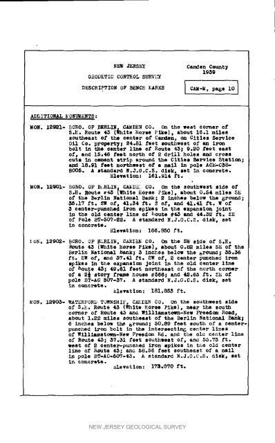
NEW JERShT Camden County1959GEODETIC CONTROL SURVkTDESCRIPTION OF BENCH MARKS ] CAM.M, pa6e i0 IADDITIONAL M O_ENTS :MON. 12921- RORO. OF BERLI_ CAMDEN CO. On the west corner ofS,R. Route 45 (_hite horse Pike), about 16,1 milessoutheast of the center of Camden, on Cities SerViceOil CO. propertT; 24.81 feet southwest of an irc_bolt <strong>in</strong> the ¢enter l_ne of Route 45; 9.20 feet eastof, and 15.46 feet north of 2 drill holes an_ crosscute <strong>in</strong> c_nt strip around the Cities Be_ics _tatIon;and 18.91 feet no_hwDst of a nail <strong>in</strong> pole ACE-C58-8005. A standard N.J.G.CoS. disk, set <strong>in</strong> concrete.Elevation: 161,914 ft.MOR. 12901- BORO. OF B_.RLIN CA_DE: CO. On the southwest elde ofS.b. ROUTS _4_ l_nite terse Pike), about 0.54 miles S_of the Berl<strong>in</strong> National Bank; 2 <strong>in</strong>ches below the ground;_5.17 ft. _ Of, 41.54 ft. S Of, and 41.41 ft. W Of5 center-ptmched iron spikes <strong>in</strong> the expLnsion Jo<strong>in</strong>t<strong>in</strong> the old centeF l<strong>in</strong>e of houte _5 and 44.32 ft. _Eof Pole bT-507-22. A standard R.J.G.C.S. disk, set<strong>in</strong> concl_ete.Elevation: 166.$50 ft.ION. 12902- BORO. OF b_RLIR, CAMDEN CO. On the SW side of _.b._oute 45 (White Horse Pike), about 0.82 miles SE of theBerl<strong>in</strong> Nat2o_ _ank; 5 <strong>in</strong>ches below the _rou_; 35.56ft. _W of_ aria 37.41 ft. SW of, 2 center pttnched Ironspikes <strong>in</strong> the expan81_ Jo<strong>in</strong>t <strong>in</strong> the old center l<strong>in</strong>eof bouts 43; 49.61 feet northeast of the north cornerof a 2_ story frame house _566; and 42.65 ft. 3E ofpole BT-AC 507-5V. A standard N.J.G.C.$. disk, set<strong>in</strong> cunc_."Qte._levaticn: 181.8_ ft.MON. 12905- WATERFORD TOWNSBIF, C_._DEN CO. On the southwest sideof S._. Route 45 (White Norse Pike), nea_ the southcor_er of Route 43 and Willlamstown-<strong>New</strong> Freedom Road,abOUt 1.2S miles eontheast of the Berlln Nation_ Bank|6 <strong>in</strong>ches below the _round; 50,89 feet south of a centerpunchediron bolt <strong>in</strong> the <strong>in</strong>tersectln_ center l$nesof Willi_stow_-<strong>New</strong> FTesd_ _d. and the oi_ center l<strong>in</strong>eO_ Route 4_; 57.31 feet southwest of, and 55.75 ft.west Of 2 center-punched iron spikes <strong>in</strong> ti_e old centerllne of ROUte 45; ana 58.56 feet southeast of a nail<strong>in</strong> pole BT-AC*bOV-43. A standard R.J.G.C.S. disk, seti_ cuncre_ *_isvatlon : iT_=O_O f_.NEW JERSEY GEOLOGICAL SURVEY


