

Bulletin 51, New Jersey Geodetic Control Survey Bench Marks in ...
Bulletin 51, New Jersey Geodetic Control Survey Bench Marks in ...
Bulletin 51, New Jersey Geodetic Control Survey Bench Marks in ...

Create successful ePaper yourself
Turn your PDF publications into a flip-book with our unique Google optimized e-Paper software.
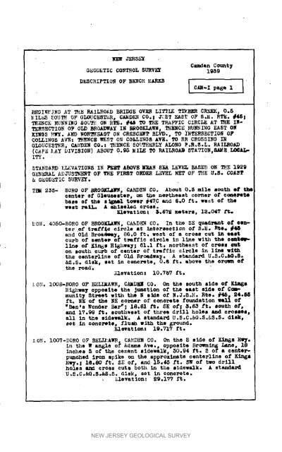
_EW JER_XCsmden Count7GEODE TIC CONTROL SURVEY 1939DESCRIPTIOIq OF BE_CH MARKS I CA_-X pa_e 1 I• _EOI_ING AT mE RAILROAD BRIDOE OVER LITTLE TIMBER CRY, 0.8MIL_S _OUT_ OF GLOUCESTER, CAMD_ CO.! /_ST EAST OF S°H. RTE. #46!TH_CE RUNNINO aOL_: O_ RTE. #48 TO TRE TRAFFIC CIRCLE AT THE IT-TER,_ECTIO_ OF OLD _ROADWA¥ IN _ROOKLAWN, THERCE RhYmING EAST ONKILOS _WY. A_D _ORTHEAST ON CRESSET BLVD°, TO INTERSECTION O_COLLINOS AVE: T_ENCE WEST O_ COLLINOB AYEI TO RR CROSSINO I_OLOUOEST_R, CAI_EN 80. Z _ENCE _O_HERLY ALONG P.R._.L. RAILROAD(C_P_ _•AY DIVISIOn) ABOUT Q.95 MILE TO RAILROA9 STATTO_,RAME LOCAL-ITY.STANDARD EI_VATIO_8 IS PE_T aBOVE MEAN SEA I_¥EL BASED ON T_E 1929O_ERAL ADJUSTM_T OF T_E FIRST O_ER L_VE_ NET OF TH_ _.S. COASTG_ODET IC SURVEY.TT_ 2_- _ORO OF BROOKL£_, C_DE_ CO. About 0._ mile south et thecenter Of O_e_eesteP_ u_ the n@_heast corne_ o_ _ePe_ebaae _ the s_sn_l tower _47C and 6.0 ft. we_t of thewes_ x,ail_ A eh_seled cross.Elevatlon_ &.6V_ _e_ers, I_047 f_.MO_. 4050-BORO OF BROOELA_, CA_,DEN CO. In t_e SE quadrant of eenter_f tra£_ _Ar_le at <strong>in</strong>_ersoe_ion of S_H° Rte. #4_and Old Broa_, 86.0 ft, west o_ a _roas cut <strong>in</strong> e_stcurb o_ eente_ o_ tFa_fle olrcl_ <strong>in</strong> l_ne with the ee_llne of KLn_s H_hwa_; 61.1 ft. northeast o_ cross euton south curb of center of traffic circle •<strong>in</strong> llne wlththe oenterllne of Old B_Oadway. A s_andard U.S.C.&G.S.&S.S. disk, set <strong>in</strong> eencrete, 0.6 _t. above the oro_n otthe roa_._levationt i0.757 fieI•ON° I008-_0R0 OF _LL_AWR, CAMDE_ CO. On the south 8_de of K_s_hwa_ opposite the _unet_on o_ the east s_de o_ _cmmunit_Street w_th the M side o_ N.J°8._. Rte. #45 m 24._ft. NE of the _E corner of conerete foundation will of"_en.B _onder EAr_; 18.81 ft, SE o_; _.63 f_. eouth Of,and 17.99 f_i southwest of three d_ill hole_ _nd crolsea_all _n the sidewalk. A stand&r_ U.S.C.&G.S.&S.S. dlsk ws_ <strong>in</strong> _oncre_o_ _1_eh _Ith the _round.Elevatlon: 19._1V ft._ON. IOOV-_QRO OF BELI_AWE, CA_EN CO. On the S side of K<strong>in</strong>ss H_,_._n the W an_le of A_ams Ave., o_posite Brownln6 Lane_ 18<strong>in</strong>che_ S of the cement sidewalk, 30.94 ft. _ of a ¢enter_punched iron _plke on the approxlmate centerllne of K<strong>in</strong>_sH_,_._ I_.80 f_, S_ of, and 15_45 ft, SW of two drillholes _ cro_s curb both <strong>in</strong> the aldewalk, A BtandardU.S°C°_.S°_.S. dlsk_ set <strong>in</strong> concrete°_levatlon: $9.177 ft.NEW JERSEY GEOLOGICAL SURVEY


