

Bulletin 51, New Jersey Geodetic Control Survey Bench Marks in ...
Bulletin 51, New Jersey Geodetic Control Survey Bench Marks in ...
Bulletin 51, New Jersey Geodetic Control Survey Bench Marks in ...

Create successful ePaper yourself
Turn your PDF publications into a flip-book with our unique Google optimized e-Paper software.
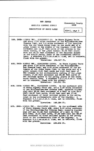
NEW JERSEYG1ouoes_er Count NGEOD_T IC CONTEOL SS_VEy 19_9DESCriPTION OF BENC_ _'ARK_ I GLO'I' P94_" 2 I_GN. 3902- _iONROE TWp., GLOUCESTH_ COo O_ 8tats Hi.way Route_42 about I°25 miles southeast of tbo lilllamstowa-<strong>New</strong>Freedom _oad, ano 0.2 miles no_thweat of i_s Jun_tionwi_h t_ ola _la_k Ho_se _I_Q_ <strong>in</strong> thQ sou_h end of a6ra_s island <strong>in</strong> the mlddle of the hi6nwa_; ii._2 feetnor_hwemt and ll.4_ feet north of two c_osseB <strong>in</strong> thesouth curbln_ of th8 _ra_i _laud; _i°_2 f_t mouth-We_t and 56.1_ feet northwest of two _ailroad _plkos<strong>in</strong> _he middle pavan& Jo_ut of th_ northbound traffl¢lane. A _andard U°_.C._G.S.aS.$. _Isk, _et <strong>in</strong> _ono_e_flush w_t_ the 6*_m_°Elev&t_onz i_4o557 ft._0_° _90_- _GNROE T_P., GI_UC_STER COUNTY. On 3_at_ _i_hw_ Reute#42 about 1.50 _le_ a_uthoa_t of t4_e W1111mm_own-<strong>New</strong> Fm_od_m RQad, and 0.05 m_les _outhoamt of _he entr_Ln_e@£ oI_ Blaak BorsQ F£ke; <strong>in</strong> the _uth ond of a_as8 i_land| 2.61 feet _u_h and _._8 foet _elt Oftwo _OBBeS <strong>in</strong> th_ Boutheasto_l_ cu_bi_ of the &rals_sland_ 17°_ fo_t g_uthQas_ and _,88 fe_t n_th oftwo rm11_omd _Ik_o <strong>in</strong> the pav<strong>in</strong>_ Jo_t_ of the aouthbound traffic laneo A itandard U°S.C._°S°&_.S. di_k,_ <strong>in</strong> concrete, fl_h with the _rou_.FAovatlon: 140°891 f_._ON. 3904- EONROE T_., GLOU_F_TER COUNTY. On the northeast lldeof _tat_ _i_h_a_ _eut_ #42, about 2._0 mile_ _eut_aatof the Wi11_ammte_n-<strong>New</strong> Freedom R_, oppeslto h_hway_lab _65_ _6.81 foet northw_at _ a n_ <strong>in</strong> _oiQ _ACE5_47_ 2_.97 feet north, _8°88 feet _as_ and _7°_f_et _out/_ea_t of th_e rai_ead _plkeB <strong>in</strong> the _av_jo<strong>in</strong>t on th_ no_thea_te_l_ _d_ of tho high,aN° Astandard U.3°C°&_°_.&S°_° dlak, aet <strong>in</strong> c_n¢_, flushw_th the _r_md°Elevat$_ : 14_,I_4 _t._ON. j_05, EONROE TWP., GLOUCESTER COUNTY. _a the no_hemst m_eof S_e _i_h_a_ Route #4_, a_eut _.50 mi_e_ 8¢uthea__f th_ Wi111_mst_-<strong>New</strong> FroQdom R_ o_p_slto hi_hn_Blab _87 aua 54.88 fe_t no,theft _f a m_1 <strong>in</strong> Polo#AGE 5_; _.9_ fe_t no_h, _7°_8 feet _a_t mad _@.__e_t _uthea_t of th_e_ _a_1_ead s@Ike_ <strong>in</strong> the pavi_Jo<strong>in</strong>t on th_ no_t_eaato_l_ I_ of t_ h_&hway. A_tandard U.3.C.&G._.&S._° di_k, oot <strong>in</strong> _en_to, flushNEW JERSEY GEOLOGICAL SURVEY


