

Bulletin 51, New Jersey Geodetic Control Survey Bench Marks in ...
Bulletin 51, New Jersey Geodetic Control Survey Bench Marks in ...
Bulletin 51, New Jersey Geodetic Control Survey Bench Marks in ...

You also want an ePaper? Increase the reach of your titles
YUMPU automatically turns print PDFs into web optimized ePapers that Google loves.
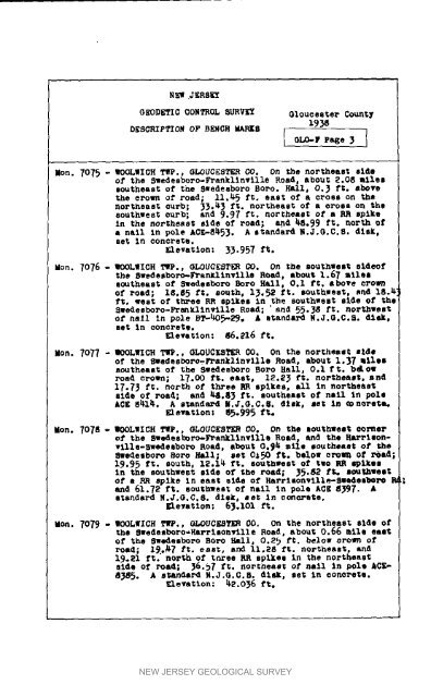
NEW JERSEYOEODETIC COHTROL SURVEY O1ouceeter County193__SCRI,TZO_ Or B_CR _S I _LO-, r_g. 3 IMen. 7075 - WOOLWlGH T_P., 6L_UC[STER CO. On ._e northeast sideof the RWedesboro-Frankllnville Road, about _.O8 milessoutheast of the Swedeeboro Bore. Hall, O, 3 ft. abovethe crown of road; ii,_5 ft, east of a cross on thenortheast curb; 33.4_ ft. northeast of a cross co the8outhgest curb; and 9.9_ ft. flortheast of a RR spikeIn _he northeast side of road; and _8.99 ft. north ofa nail <strong>in</strong> pole ACE-8_5_. A standard N.J.O.C.6, disk,set In concrete.Elevation: 3_.957 ft.Men. 7076 - WOOLWICR T_P., OLOUC[ST_ CO, On the southwest sldeofthe Swedesboro-Fran_l<strong>in</strong>vllle Road, about 1.67 milessoutheast of 5wedesboro Bore Hall, O.1 £t, above crownOf road; 18.8_ ft. sooth, I_.52 ft. southwest, end 18._ft. _est of three RR spikes In the 8outhwest side of theSwedesboro-FranEllnvllle Road; " and 55._8 ft. northwes_of' nail <strong>in</strong> pole BT-_O_-29. & standard g.J.O.C.a, disk,set l_ comcrete.• levation: _._16 ft.Moo. 7077 - BOOLWlCH TI_., GLOUCEeT_ CO. On the northeast sideof the _edesbo_o-Frankllnvllle Road, about i._7 milessoutheast of the sgedesboro Bore Hall, O.l ft. belowroad crown; 17.00 ft. e&st_ 12._ ft. no_Eheaet, aBd17._ ft. north o_ three _q spikes, all <strong>in</strong> northeastaide of road; and _.8_ ft. southeast of nail In polekCE 8_1_. A standard N.J.G.O.8. disk, set In concrete.Elevation: 8_.995 fro.on. 7o7a- _COLWICR T_P., 6LOUCEST_ CO. On the southwest oornePof' the 5wedeeboro,-]h, anklln'_,llle Road, and the Harrisonville-swedeeboroRoad. about 0.9_. mile southeast of the8_edesboro Bore Hall; ee_ 0_50 ft. below oro_ of _ad;19.95 ft. south, 12.1_ ft. southwest of two RR _lkOl<strong>in</strong> the southwes_ side of the road; _5._2 f_. southwestof • RR spike In east side of Harrlson_llle-Sgedesboro Iand 61.7_ ft. eootbwest of mall In pole ACE g_. Astandard H.J.O.C.8. dAcE, se_ In c_ete,Eleya_lon; 6).101 f_oMen. 7079 - WOOLqICH T_P., OLOUC_ CO. On the northeast side stthe 8wedeeboro-Rarrisonwllle Road, about 0.66 mile eastof the Bwadesboro Bore Hall, O,2_ f_. below crown ofroad; 1_._7 ft. east, and 11.28 ft, northeast, and19._1 ft." north of terse RR spikes <strong>in</strong> the northeastside of road; _._7 _t. northeast of mall <strong>in</strong> pole _CE-8_85. A standard _.J.G.C.B. disk, set In concrete.Elevation: _-2.0_6 ft.NEW JERSEY GEOLOGICAL SURVEY


