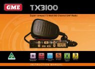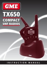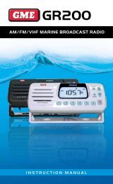
Instruction Manual - GME
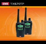
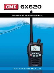
Instruction Manual - GME
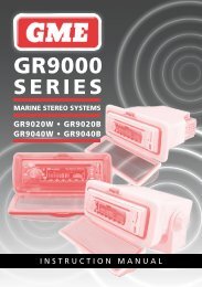
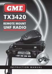
Instruction Manual - GME

You also want an ePaper? Increase the reach of your titles
YUMPU automatically turns print PDFs into web optimized ePapers that Google loves.
Value added data: The Value Added Data (VAD) is acollection of additional cartographic objects which are notpresent on the original paper chart. These objects havebeen obtained from other sources and then merged to theelectronic charts in order to provide more information usefulfor navigation.Lat/Lon Grid: Turns the latitude and longitude grid lines onor off on the chart window.Boundaries: Turns the chart boundaries on, off or auto modewhich shows the chart boundaries of the two charts below thecurrent scale.Text/Icon Size: Changes the size of text and icon onthe chart.Names: Displays area names in the chart.Nav-aids & Light Sector: Turns the presentation of Light,Signals, Buoys and Beacons On, Off, No Sector (Nav-Aids areshown, Light Sectors are hidden) or Animated (The lightswill flash).Nav-aids: The way to display fog, radar and radio stationsignals. (International and US).Attention areas: Areas on the chart where more attentionshould be paid when navigating can be turned on or off.Projected course: Displays the Projected course in agiven time.CDI scale: Set CDI (Course Deviation Indicator) scale which isa parallel line on either side a pottered course.4-2-4 Land & Sea (C-MAP)Water features: Turns the displaying of seabed nature andtide stations icon on or off.Object depths: Turns object depths on or off.Spot soundings: Turns spot sounding on or off.Sounding min: Set the minimum depth limit of depthsounding, bathymetric lines and depth area.Sounding max: Set the maximum depth limit of depthsounding, bathymetric lines and depth area.Tidal stream: Turns the display tidal streams on or off.Land Features: Turns land features on or off.Land elevation: Turns land elevations on or off.Safe Navigation Area: Set the water depth for safenavigation and display safe navigation area in color.4-2-5 Map datumThis unit has a compatibility with most of major chart systemsand this option allows you to select a map datum. The defaultdatum is WGS84.Map datum Selection:1 Press and hold MENU and select chart icon.2 Select general and Map datum.3 Select a desired map datum.4-2-6 NMEA datum offsetWhen you select other Map datums that are different fromWGS84, the latitude and longitude will be different fromWGS84’S coordinates and this might confuse other devicessuch as a DSC VHF radio if connected to the unit. If this optionis applied, latitude and longitude sent via the NMEA outputwill be the same as the coordinates in WGS84.4-2-7 Map shiftSometimes current position of your own ship does not matchthat of the current location on the chart. To correct this positionerror, you can apply a map shift.Applying a map shift:1 In the Chart setup menu, press and hold MENU and selectChart icon.2 Select Map shift and press ENT.3 Move cursor to the actual position on the chart.4 Press MENU and select Set and ENT to save.5 Press ESC to lock in change.Canceling a map shift:If you want to clear the map shift:1 In the Chart setup menu, select Map shift then ENT.2 Press MENU and select Clear.3 Press ESC to lock in change.PAGE 34 INSTRUCTION MANUAL G-COMBO