


Create successful ePaper yourself
Turn your PDF publications into a flip-book with our unique Google optimized e-Paper software.
Rivista bimestrale - anno XXIII - Numero 3/<strong>2019</strong> - Sped. in abb. postale 70% - Filiale di Roma<br />
LAND CARTOGRAPHY<br />
GIS<br />
CADASTRE<br />
GEOGRAPHIC INFORMATION<br />
PHOTOGRAMMETRY<br />
3D<br />
SURVEY TOPOGRAPHY<br />
CAD<br />
BIM<br />
EARTH OBSERVATION SPACE<br />
WEBGIS<br />
UAV<br />
URBAN PLANNING<br />
CONSTRUCTION<br />
LBS<br />
SMART CITY<br />
GNSS<br />
ENVIRONMENT<br />
NETWORKS<br />
LiDAR<br />
CULTURAL HERITAGE<br />
Mag/Giu <strong>2019</strong> anno XXIII N°3<br />
La prima rivista italiana di geomatica e geografia intelligente<br />
Solar System<br />
from Mapping to Prospecting<br />
GNSS WEATHER<br />
PREDICTION<br />
GEOLOGICAL<br />
MAPPING OF MARS<br />
GALILEO AND COPERNICUS<br />
EU AMBASSADORS
Terrestrial and extra-terrestrial geomatics<br />
Spatial data for the management of structures and buildings are of vital importance for decisions<br />
relating to our future. In the next edition of INTERGEO <strong>2019</strong> in Stuttgart, the quality of urban<br />
life and the development of rural areas in the long term will be key topics, since they are embedded<br />
in the political and social debate of the moment.<br />
A special focus of INTERGEO this year will be the spread of digital technology in mobility and<br />
construction, in Smart Cities, Survey, Laser Scanning, Building Information Modeling (BIM),<br />
Unmanned Aerial Vehicles (UAVs) and Virtual, Augmented or Mixed Reality. All topics where<br />
spatial data are essential.<br />
But what about the future possible life outside the Earth?<br />
Fabrizio Bernardini in the Focus of this issue "Exploring the Solar System: from mapping to<br />
prospecting" draws a picture of the situation of the cartography of the planets hoping for future<br />
simpler and faster missions. The results of these missions will allow creating resource maps that will<br />
guide the selection of landing sites. A next step that is not too far as many would like to think.<br />
Examples of specific in-depth studies are not lacking, such as the geological mapping that requires<br />
the combination of many different characteristics of the rock sequences studied. This including<br />
lithology, stratigraphy and structural deformation to reconstruct the variation of environments and<br />
climates over time. The standards of planetary cartography have been associated with principles<br />
defined in the 1970s during the Apollo missions, while recently the need for new cartographic<br />
guidelines emerged in the light of progress in understanding the geological processes that shape<br />
planetary surfaces.<br />
And this is what the Report from Marco Pantaloni, Roberto Graciotti, Lucia Marinangeli and<br />
Matteo Massironi "Revising the geological mapping of Mars", tells us from the networks of<br />
scientific institutes and many Universities involved in a pilot project to apply the rules of the<br />
cartographic standards used in the Italian Geological Cartography Project for the realization of<br />
geological and geomorphological maps in a planetary environment.<br />
GNSS Radio Occultation for weather prediction is the theme of the report from Guillermo Bosch<br />
that will tell us about a well-proven technique that goes back to the mid-1960s when the satellite<br />
Mariner IV transmitted data while it was approaching Mars.<br />
Marco Lisi from Santo Domingo, Dominican Republic, will report on how Galileo and Copernicus<br />
are not only flagship technology programs of the European Union, but they can be considered the<br />
ambassadors of European cooperation in other continents.<br />
The Low Altitude Airspace and the new business dimension is the report from Chiara Mozzetti and<br />
Alberto De Vitis of Aiviewgroup, highlighting the great emerging opportunity for many companies.<br />
Enjoy your reading,<br />
Renzo Carlucci
In this<br />
issue...<br />
FOCUS<br />
REPORT<br />
Exploring the Solar<br />
System: from mapping<br />
to prospecting<br />
by Fabrizio Bernardini<br />
6<br />
COLUMNS<br />
24 NEWS<br />
46 AGENDA<br />
12<br />
Revising the<br />
geological<br />
mapping of Mars<br />
by Marco Pantaloni,<br />
Roberto Graciotti, Lucia<br />
Marinangeli, Matteo<br />
Massironi<br />
16<br />
Low Altitude<br />
Airspace: how<br />
Enterprises discover a<br />
new business dimension<br />
by Chiara Mozzetti,<br />
Alberto DeVitis<br />
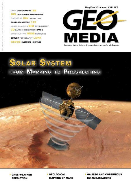
On the cover a<br />
pictorial view of<br />
Mars Reconnaissance<br />
Orbiter using the<br />
SHARAD Radar<br />
Image Courtesy<br />
NASA/Jet Propulsion<br />
Laboratory-Caltech.<br />
geomediaonline.it<br />
<strong>GEOmedia</strong>, published bi-monthly, is the Italian magazine<br />
for geomatics. Since more than 20 years publishing to open<br />
a worldwide window to the Italian market and vice versa.<br />
Themes are on latest news, developments and applications in<br />
the complex field of earth surface sciences.<br />
<strong>GEOmedia</strong> faces with all activities relating to the acquisition,<br />
processing, querying, analysis, presentation, dissemination,<br />
management and use of geo-data and geo-information. The<br />
magazine covers subjects such as surveying, environment,<br />
mapping, GNSS systems, GIS, Earth Observation, Geospatial<br />
Data, BIM, UAV and 3D technologies.
ADVERTISERS<br />
GNSS Radio 34<br />
Occultation in<br />
Advanced Numerical<br />
Weather Prediction<br />
Models<br />
by Guillermo Bosch<br />
22 L’aerofototeca<br />
nazionale racconta…<br />
multi-temporal<br />
photointerpretation<br />
by Roberto Graciotti<br />
3DTARGET 11<br />
AERROBOTIX 15<br />
CODEVINTEC 31<br />
EPSILON 27<br />
ESRI ITALIA 32<br />
GEC SOFTWARE 29<br />
GEOMAX 2<br />
GIS3W 21<br />
GTER 44<br />
IMAGES 33<br />
INTERGEO 26<br />
LEICA GEOSYSTEM 45<br />
PLANETEK 25<br />
PROFILOCOLORE 10<br />
STONEX 47<br />
SURVEYLAB 28<br />
TEOREMA 46<br />
TOPCON 48<br />
Earth like you’ve<br />
never seen it before:<br />
PRISMA reveals the<br />
state of our planet’s<br />
42<br />
38<br />
Galileo helps<br />
increasing the<br />
European Union<br />
cooperation with the<br />
Grand Caribbean,<br />
Central and<br />
South Americas<br />
by Marco Lisi<br />
The image on the<br />
background is a Copernicus<br />
Sentinel-2 over palm<br />
oil plantations in East Kalimantan<br />
- the Indonesian<br />
part of the island Borneo.<br />
In this image, captured<br />
on 15 February <strong>2019</strong>, the<br />
various stages of the deforestation<br />
process are clearly<br />
visible on the green patches<br />
in the plantations are the<br />
well-established palm oil<br />
farms, while the light brown<br />
patches show the newly<br />
harvested land. The surrounding<br />
lush rainforest is<br />
visible in dark green.<br />
Copernicus Sentinel-2 is a<br />
two-satellite mission, used<br />
mostly to track changes in<br />
the way land is being used,<br />
as well as monitoring the<br />
health of vegetation.<br />
Each satellite carries a highresolution<br />
camera that images<br />
Earth's surface in 13<br />
spectral bands.<br />
More on<br />
http://www.geoforall.it/krf3d<br />
Credits: European Space<br />
Agency<br />
health<br />
by Giuseppina Piccirilli<br />
Chief Editor<br />
RENZO CARLUCCI, direttore@rivistageomedia.it<br />
Editorial Board<br />
Vyron Antoniou, Fabrizio Bernardini, Mario Caporale,<br />
Luigi Colombo, Mattia Crespi, Luigi Di Prinzio,<br />
Michele Dussi, Michele Fasolo, Marco Lisi, Flavio Lupia,<br />
Beniamino Murgante, Aldo Riggio, Mauro Salvemini,<br />
Domenico Santarsiero, Attilio Selvini, Donato Tufillaro<br />
Managing Director<br />
FULVIO BERNARDINI, fbernardini@rivistageomedia.it<br />
Editorial Staff<br />
VALERIO CARLUCCI, GIANLUCA PITITTO,<br />
redazione@rivistageomedia.it<br />
Marketing Assistant<br />
TATIANA IASILLO, diffusione@rivistageomedia.it<br />
Account manager<br />
ALFONSO QUAGLIONE, marketing@rivistageomedia.it<br />
Design<br />
DANIELE CARLUCCI, dcarlucci@rivistageomedia.it<br />
MediaGEO soc. coop.<br />
Via Palestro, 95 00185 Roma<br />
Tel. 06.64871209 - Fax. 06.62209510<br />
info@rivistageomedia.it<br />
ISSN 1128-8132<br />
Reg. Trib. di Roma N° 243/2003 del 14.05.03<br />
Stampa: SPADAMEDIA srl<br />
VIA DEL LAVORO 31, 00043 CIAMPINO (ROMA)<br />
Publisher: mediaGEO società cooperativa<br />
Science & Technology Communication<br />
Paid Science subscriptions<br />
& Technology Communication<br />
<strong>GEOmedia</strong> is available bi-monthly on a subscription basis.<br />
The annual subscription rate is € 45. It is possible to subscribe<br />
at any time via https://geo4all.it/abbonamento. The cost of one<br />
issue is € 9 €, for the previous issue the cost is € 12 €. Prices and<br />
conditions may be subject to change.<br />
Magazine founded by: Domenico Santarsiero.<br />
Issue closed on: 20/08/<strong>2019</strong>.
FOCUS<br />
Exploring the Solar System:<br />
from mapping to prospecting<br />
by Fabrizio Bernardini, FBIS<br />
Solar System exploration is<br />
changing, opening the field<br />
to prospectors and then<br />
miners after a long phase of<br />
mapping. This is a process<br />
we have already seen many<br />
times on our planet, but<br />
for the first time in human<br />
history we are witnessing a<br />
revolution that hold the keys<br />
to a new frontier outside the<br />
boundaries of our planet.<br />
The Italian Giovanni Schiaparelli, astronomer and engineer, in the second half of the 19th<br />
century drew the maps that assigned, to features he could barely detect, the names we are still<br />
using today. (Map is reversed, with south at the top).<br />
Credits: INAF Osservatorio Astronomico di Brera, Biblioteca, Foto: Mario Carpino. The assistance<br />
of Agnese Mandrino is gratefully acknowledged.<br />
There has been a first<br />
revolution when humankind<br />
started exploring<br />
the solar system sending<br />
automated emissaries, also<br />
known as deep space probes,<br />
to the Moon first and then the<br />
other main celestial bodies that<br />
orbit the Sun. After the first attempts<br />
at the very dawn of the<br />
space age, attempts which produced<br />
grainy images and few<br />
precious amounts of data, we<br />
had a steady increase in the return<br />
of science data, with larger<br />
missions until we sent flagship<br />
missions to orbit Mars, Jupiter<br />
and Saturn, with landers on the<br />
Moon, Mars, Titan. And then,<br />
other orbiters around Venus,<br />
Mercury and even to comets<br />
and asteroids: many missions<br />
that helped characterize our<br />
Solar System from Mercury and<br />
way beyond Pluto.<br />
From planets to places<br />
All these missions are associated<br />
by a common science goal,<br />
that to explore to improve<br />
our science knowledge (many<br />
models were based only on the<br />
Earth) and to better understand<br />
the evolution and the possible<br />
futures of our Solar System.<br />
These missions, however, also<br />
achieved an important practical<br />
result, transforming far worlds<br />
from astronomical targets into<br />
places. Wherever and whenever<br />
humans have explored, they<br />
first traced the boundary of the<br />
land, then the contours of the<br />
topography, while at the same<br />
time giving names to features:<br />
this is called mapping. Mapping<br />
is essential to continue the exploration,<br />
but also as an aid to<br />
describe the characteristics of<br />
a new territory. The names on<br />
the maps will be foreign ones<br />
initially, but soon they will have<br />
a very practical sense when resource<br />
exploitation or the establishment<br />
of settlements will<br />
take place.<br />
In the Solar System, we have<br />
done the same: we have pictured<br />
distance planetary bodies,<br />
we have established a reference<br />
system, and then we have mapped<br />
the surfaces and the topography<br />
giving names to outstanding<br />
features and regions. What<br />
we have been doing since the<br />
very first deep space probes<br />
started exploring, has been transforming<br />
planets in places.<br />
From science to resources<br />
The tools available to the researcher<br />
are more complex than<br />
just simple images. Even images<br />
are studied at pixel level, considering<br />
the characteristics of the<br />
light received by the detectors,<br />
to extract, or infer, additional<br />
data from them. More than just<br />
visible imagery, we have seen<br />
the importance of other instruments,<br />
like spectrometers, able<br />
6 <strong>GEOmedia</strong> n°3-<strong>2019</strong>
FOCUS<br />
Mars (or finding better proof<br />
of the elusive water ice traces<br />
on the Moon), while others can<br />
target the composition of surface<br />
materials. Smaller, specific,<br />
missions mean also an increase<br />
in operational flexibility, also<br />
for what regards simplifications<br />
in the communications and<br />
propulsion needs, and will be<br />
characterized by a high level of<br />
autonomy, to reduce ground<br />
operations costs substantially.<br />
Mars as a case in point<br />
Going to another world and lito<br />
discern the chemical composition<br />
from a distance, and<br />
sounding radars that provided<br />
incredible results, as on Mars,<br />
with the detection of underground<br />
features not otherwise<br />
discernible from the orbit, and<br />
even from a rover. Variation<br />
detected in the radio waves<br />
for communications, helped<br />
understand the inner structure<br />
of distance bodies with important<br />
clues about subterranean<br />
oceans and other features. The<br />
collection of all this data has<br />
enabled a better understanding<br />
of surface conditions and characteristics,<br />
and particularly its<br />
composition.<br />
The amount of data collected<br />
on specific planetary bodies,<br />
like the Moon and Mars, has<br />
reached such a volume that is<br />
transforming our use of the<br />
same data. While science data<br />
collected so far can keep planetary<br />
scientist busy for many years<br />
to come, the realization that<br />
we can now draw map of minerals<br />
and other resources with<br />
unprecedented precision, has<br />
opened an entire new avenue of<br />
applications. In fact, after more<br />
than 50 years of Solar System<br />
exploration, we are now approaching<br />
a second revolution: the<br />
shift from mapping to prospecting,<br />
that is looking for, and<br />
quantifying, the available local<br />
resources. And the resources looked<br />
for are those specific ones<br />
that will be able to support a<br />
permanent human presence on<br />
other worlds.<br />
In order to facilitate the next<br />
steps in human exploration of<br />
the Solar System, we need to<br />
start building new deep space<br />
probes that will have a focus on<br />
local resources characterization.<br />
Technically speaking, these will<br />
not be much different from<br />
science-oriented missions, but<br />
practically speaking they will<br />
be cheaper and quicker to build<br />
The Mars Orbiting Laser Altimeter provided enough data points to create full topographic maps of<br />
Mars of unprecedented accuracy (on a global scale) in the whole Solar System, the Earth included.<br />
MOLA data are the basis for innumerable analysis and also to enable science investigations with<br />
other instruments.<br />
Credits: Color-Coded Contour Map of Mars, 2003, US Geological Survey Astrogeology Team<br />
and their operations will be initially<br />
constrained to reduce the<br />
uncertainties in specific areas<br />
of a planet. In this respect, it<br />
will be not necessary to design<br />
a spacecraft to explore for many<br />
years a whole planet, but limit<br />
its performances to the achievements<br />
of resource-driven goals,<br />
at least for the main part of its<br />
mission.<br />
Prospecting missions can be<br />
designed for specific kind of<br />
resources, like a better characterization<br />
of water ice deposits on<br />
The recently released new geological map of Mars integrates many layers of information from Viking<br />
to the most recent missions. It can be considered the basis cartographical product for a future<br />
Mars resources map based on existing and prospecting missions data.<br />
Credits: Geological Map of Mars, 2014, Tanaka et al., US Geological Survey Astrogeology Team<br />
<strong>GEOmedia</strong> n°3-<strong>2019</strong> 7
FOCUS<br />
NASA/JPL flagship orbiting mission around Mars, is providing since 2006 and incredible<br />
quantity of data thanks to its powerful instrument and its very high performances<br />
communications system. It is also a key element for landed asset, as it is their main relay<br />
platform to Earth. University of Arizona HiRISE camera, the Italian SHARAD sounding<br />
radar, and all other instruments, have transformed the way we see and understand Mars<br />
and its resources.<br />
Credits: NASA/JPL-Caltech<br />
The discovery of debris covered glacier is<br />
entirely due to radar sounding techniques.<br />
Water ice is invisible at SHARAD frequencies<br />
and assuming its presence the radargram<br />
in (a) has been corrected for the dielectric<br />
constant. The correction produced a flattened<br />
bottom of the glacier coherent with the<br />
rest of the plain. There are hundreds of similar<br />
features in the same area with an average<br />
thickness of 450 meters of 90% pure ice.<br />
Credits: NASA/JPL<br />
ving there off local resources<br />
has always been a theme very<br />
dear to science fiction and to<br />
space exploration visionaries.<br />
The concept is sound, but in<br />
practice too many unknowns<br />
prevented transforming these<br />
visions into reality. Until now.<br />
Despite the recent talks and<br />
actions toward establishing<br />
a more permanent human<br />
presence in lunar orbit, and<br />
maybe even on the surface, the<br />
reality is that lunar resources<br />
are still a big unknown. Water<br />
ice is a major factor for human<br />
exploration, and as of today<br />
there is not a single paper that<br />
clearly identifies a Moon ice<br />
deposit with some hope of<br />
being accessible for extraction.<br />
Mars on the other hand, is a<br />
completely different story.<br />
Mars is the best-known planet<br />
of the Solar System (after the<br />
Earth) in the sense that its topography<br />
is better known that<br />
Earth’s (because of the lack of<br />
oceans). We have landed in different<br />
zones of the planet and<br />
many missions are orbiting it.<br />
A small fleet of more missions<br />
is expected to reach Mars in<br />
the next two years, turning its<br />
orbital environment the busiest<br />
(after Earth’s of course) in the<br />
Solar System.<br />
What it is not well perceived<br />
by the general public, is that<br />
Mars is extremely rich in the<br />
most important resource for<br />
space exploration, which is of<br />
course water ice. And we are<br />
not talking about the polar<br />
caps, we are talking of vastly<br />
abundant reservoirs of water<br />
ice, in multiple zones of<br />
the planet, and in particular<br />
at those latitudes that are of<br />
particular interest for human<br />
exploration.<br />
Italian-built sounding radars,<br />
and in particular SHARAD on<br />
Mars Reconnaissance Orbiter,<br />
have unlocked the knowledge<br />
of these water ice deposits.<br />
Of primary importance is the<br />
discovery, in 2008, of large<br />
debris covered glaciers concentrated<br />
in mid-latitude zones<br />
like Deuteronilus Mensae and<br />
Hellas Basin. These glaciers,<br />
composed of 90% pure water<br />
ice, have been mapped to reach<br />
a current estimate (which is<br />
growing) of 400000 cubic kilometres<br />
of ice, available over the<br />
surface. Other glaciers, in less<br />
practical areas have also been<br />
found, while it is known the<br />
presence of multiple layers of<br />
water ice in the polar caps.<br />
Radar data studies also provided<br />
strong evidence to support<br />
that the soil of northern plains,<br />
like Arcadia and Utopia, is<br />
mixed with water ice. In Arcadia,<br />
there are evidences of<br />
ground ice down to about 40<br />
8 <strong>GEOmedia</strong> n°3-<strong>2019</strong>
FOCUS<br />
meters, in an area about 1 million<br />
square kilometres in size.<br />
In Utopia, soil characteristics<br />
provided clues for another<br />
14000 cubic kilometres of<br />
ice underground. And if in<br />
these cases radar data are not<br />
enough convincing, there are<br />
also images from the powerful<br />
HiRISE camera on MRO, that<br />
has pictured both ice exposed<br />
after meteoroids impacts and<br />
effects of melting ice on cliffs<br />
and slopes. Of the many highresolution<br />
pictures provided by<br />
MRO, one of the most spectacular<br />
one is that of a scarp in<br />
which underground ice layers<br />
are clearly exposed and the<br />
presence of ice can be seen just<br />
one meter below ground.<br />
NASA’s SWIM study, carried<br />
out by the Planetary Science<br />
Institute, is integrating neutron<br />
data, thermal data and radar<br />
data to complete a mapping of<br />
water ice resources in shallow<br />
(< 5 meters) and deep (> 5<br />
meters, down to 100) zones.<br />
While the interpretation of resulting<br />
“data sets is to a degree<br />
subjective and does not lend<br />
itself to precise calculation of<br />
probabilities” but the “identification<br />
and mapping of ice is<br />
warranted and highly desirable<br />
for planning future landing sites<br />
that rely on the presence of<br />
ice for resources”.<br />
This study, like the ongoing<br />
ones for the characterization of<br />
Mars resources (thanks also to<br />
the rovers that crawled over its<br />
surface determined that many<br />
useful minerals are available,<br />
complementing the data of<br />
spectrometers flown on various<br />
orbiting missions) have a clear<br />
accent on the implications that<br />
the results will have for the<br />
human exploration of the Red<br />
Planet.<br />
Conclusions<br />
What about the other “places”<br />
The occurrence of new meteoroid impact craters on Mars, monitored continuously by MRO<br />
CTX and HiRISE cameras, provided clues about ground ice just below the surface in many<br />
regions. In this sequence it is seen that exposed ice is seen dissipate slowly via sublimation<br />
processes, confirming its nature.<br />
Credits: NASA/JPL-Caltech/University of Arizona<br />
we have identified<br />
in the Solar<br />
System? An<br />
extensive mapping<br />
of asteroids<br />
is in the agenda<br />
also of private<br />
entrepreneurs<br />
while NASA is<br />
now focusing its<br />
objectives on the<br />
Moon, despite<br />
its evident shortcomings<br />
in term<br />
of easily available<br />
resources. The<br />
search for life has<br />
found new hope<br />
in the Jovian<br />
moon Europa<br />
(even if the Mars<br />
discoveries may shed new light<br />
in this same arena), while also<br />
Titan is on the list of the most<br />
interesting places of the Solar<br />
System (thanks again also to<br />
Italian instruments and science).<br />
Do we still need pure science<br />
In both Mars hemispheres, steep scarps<br />
gave evidence of layers of underground<br />
water ice in the proximity of the surface.<br />
It is estimated that one third of<br />
Mars surface contains shallow deposits<br />
of water ice in the ground.<br />
Credits: NASA/JPL-Caltech/University<br />
of Arizona<br />
<strong>GEOmedia</strong> n°3-<strong>2019</strong> 9
FOCUS<br />
Current status of SWIM study (https://swim.psi.edu) points at the abundance of water resources in the northern hemisphere of Mars by combining<br />
results from multiple sensors. Mars can provide many resources to support human exploration, but in particular it has an unbelievable<br />
abundance of the most critical of all resources: water. An abundance of water means the ability to create breathable air, manufacture propellants,<br />
grow crops and of course enable many other activities, simplifying and improving the living conditions of the settlers.<br />
missions to explore the Solar<br />
System? Yes, but it is also<br />
time to think more about<br />
simpler, quicker, prospecting<br />
missions. Mapping the<br />
results of these missions will<br />
permit creating the resource<br />
maps that will guide the selection<br />
of landing sites and<br />
that the first settlers will use<br />
to find them. That step will<br />
be the next revolution: extracting<br />
and processing the<br />
resources, a next step that is<br />
not too far as many would<br />
like to think.<br />
REFERENCES<br />
Bernardini F., Sidney W. P., Abbud-Madrid A., Putzig N. P., Clark R. N., Perry M. R., Smith I. B. “Mars Prospector:<br />
Leading the way to in-situ resource utilization on the Red Planet”, IAC 2018<br />
Putzig N. E., Morgan G. A., Sizemore H. G. , Baker D. M. H. , Bramson A. M. , Petersen E. I. , Bain Z. M. , Hoover R.<br />
H. , Perry M. R. , Mastrogiuseppe M. , Smith I. B. , Campbell B. A. , Pathare A. V. , Dundas C. M., <strong>2019</strong>. “Results of<br />
the Mars Subsurface Water Ice Mapping (SWIM) Project” 9th Intl. Mars Conf., Pasadena, CA, July 22-25, Abs. 6427.<br />
Bernardini F., Putzig N., Petersen E., Abbud-Madrid A., Giacinti V., “Implications for resource utilization on mars:<br />
recent discoveries and hypotheses”, JBIS 2018<br />
KEYWORDS<br />
Solar System; Mapping; Mars; Sharad<br />
ABSTRACT<br />
Solar System exploration is changing, opening the field to prospectors and then miners. This is a process we<br />
have already seen many times on our planet and for the first time in human history we are witnessing the<br />
revolution that hold the keys to a new frontier.<br />
AUTHOR<br />
Fabrizio Bernardini - fb@aec2000.eu<br />
FBIS, British Interplanetary Society<br />
CAMGIC<br />
1 SCATTO/ 350 grammi<br />
12 MEGAPIXEL<br />
1 cm/pixel @ 50 m di quota<br />
7 bande calibrate (300-1000 nm) @ 95% di precisione radiometrica<br />
Colorimetria<br />
NDVI<br />
Precision Farming e Land Monitoring<br />
Controllo integrato del territorio in tempo reale<br />
• Estrema precisione spaziale, radiometrica e colorimetrica<br />
• Calibrazione basata su AI: 7 bande UV VIS NIR + CIELAB con 1 scatto<br />
• NDVI da NIR e da RedEdge<br />
• Decine di altri indici di interesse per l’agricoltura ed il territorio<br />
10 <strong>GEOmedia</strong> n°3-<strong>2019</strong><br />
Profilocolore s.r.l., Via Val d’Aosta, 24 - 00141 Roma - tel. +39 0662289818 - www.profilocolore.com / info@profilocolore.com
FOCUS<br />
<strong>GEOmedia</strong> n°3-<strong>2019</strong> 11
REPORT<br />
Revising the geological<br />
mapping of Mars<br />
by Marco Pantaloni, Roberto Graciotti,<br />
Lucia Marinangeli, Matteo Massironi<br />
The geological map is a unique graphical tool that summarises<br />
through colours and symbols, the complex evolution of a planet.<br />
It requires the combination of many different characteristics<br />
of the studied rock sequences including lithology, stratigraphy<br />
and structural deformation to reconstruct the variation of<br />
environments and climates through time. Although based on<br />
the same basic principles as on Earth, planetary geological -<br />
geomorphological mapping has some peculiarities which need to<br />
be addressed in order to standardize the technical and scientific<br />
approach.<br />
The standards of planetary cartography have long been based on<br />
principles defined in the 1970s during the Apollo missions, while<br />
recently it is emerged the need to develop new cartographic<br />
guidelines in the light of advances in the understanding of<br />
geological processes that shape planetary surfaces.<br />
Furthermore, the plethora of new data derived from recent space<br />
missions and the possibility of identifying resources to be used<br />
in situ in view of permanent stations on the Moon and eventually<br />
Mars accentuate this need. This was recently faced by the USGS,<br />
which since the Apollo Era has continuously produced geological<br />
mapping of the surfaces of other planets and by a network of<br />
PLANMAP (https://planmap.eu/).<br />
In this framework, the Geological Survey of Italy, ISPRA, recently<br />
started a collaboration with the Italian Space Agency (ASI), the<br />
National Institute of Astrophysics (INAF) and the Universities of<br />
Chieti, Cagliari, Naples Federico II, Padua, Perugia and Jacobs<br />
University of Bremen. The aim of the project is the attempt to apply the<br />
cartographic standards rules used in the Italian Geological Mapping Project<br />
(CARG Project) for the realization of geological and geomorphological maps<br />
at various scales of detail even in the planetary environments.<br />
Thanks to the excellent coverage of high-resolution images of HiRISE (High<br />
Resolution Imaging Science Experiment) and the availability of medium<br />
and high resolution DTMs of some specific sectors of its surface, the<br />
applicability of the cartographic guidelines, published by the Geological<br />
Survey of Italy in the “Quaderni” series (http://www.isprambiente.gov.<br />
European scientific institutes involved in the pilot project H2020-<br />
it/it/progetti/suolo-e-territorio-1/progetto-carg-cartografia-geologica-egeotematica/linee-guida),<br />
is being tested. In this preliminary phase of the<br />
work, has been tested the production of geological and geomorphological<br />
maps of some sample areas of planet Mars.<br />
Fig. 1 - Topographic map of the western part of Eberswalde crater on Mars,<br />
chosen as a test area for the object of this study<br />
The standards of planetary<br />
cartography have long<br />
been based on principles<br />
defined in the 1970s during the<br />
Apollo missions, while recently<br />
emerged the need to develop new<br />
cartographic guidelines in the<br />
light of advances in the understanding<br />
of geological processes<br />
that shape planetary surfaces.<br />
The plethora of new data derived<br />
from recent space missions<br />
and the possibility of identifying<br />
resources to be used in situ in<br />
view of permanent stations on<br />
12 <strong>GEOmedia</strong> n°3-<strong>2019</strong>
REPORT<br />
Fig. 2-3 - Thematic maps of the selected test area with slopes, exposure and landforms units<br />
the Moon and eventually Mars<br />
accentuate this need. While<br />
USGS has been the reference<br />
for geological mapping and<br />
cartography of the surfaces of<br />
other planets, a network of<br />
European scientific institutes<br />
involved in the pilot project<br />
H2020-PLANMAP is aimed to<br />
define new rules for updating<br />
these products.<br />
In a first experimental phase,<br />
the prototype area of the<br />
Eberswalde crater on Mars (Fig.<br />
1) was chosen due to its great<br />
variability of forms of erosion<br />
and demolition and the conspicuous<br />
reference literature. It<br />
was possible to verify that some<br />
forms, morphostructures and<br />
depositional facies present in<br />
this area of the red planet are,<br />
in some ways, similar to those<br />
observed on Earth.<br />
In planetary science, as well<br />
as in earth science, the geological<br />
map represents the most<br />
objective synthetic product; in<br />
it, the different rock units are<br />
distinguished based on observable<br />
physical parameters: texture,<br />
colour, sedimentary structures<br />
and geographical distribution.<br />
The stratigraphic relationships<br />
between the units are evaluated<br />
by applying the classic principles<br />
of stratigraphy used in the<br />
terrestrial environment, even<br />
if, sometimes, these principles<br />
do not seem to fully respect the<br />
extra-terrestrial geological dynamics.<br />
Moreover, the geological<br />
and geomorphological analysis<br />
carried out in the Martian area<br />
shows that geological units<br />
could be interpreted in terms<br />
of depositional environments,<br />
even if any change in genetic<br />
interpretation would not result<br />
in a change in representation in<br />
the geological map.<br />
Planetary geological mapping is<br />
deeply linked to the availability<br />
and quality of data (resolution<br />
of images and DTMs, availability<br />
of spectral and elemental<br />
composition data, etc.), which<br />
implies great differences in the<br />
potential of the analysis between<br />
different planets but also<br />
between different parts of the<br />
same planet. Moreover, the presence<br />
of direct surface analyses<br />
<strong>GEOmedia</strong> n°3-<strong>2019</strong> 13
REPORT<br />
Some peculiar landforms of Mars<br />
Fig. 4, 5 e 6 - The images show peculiar forms defined in literature as TARs (Transverse Aeolian Ridges). These forms are typical and very common on Mars; TARs are found<br />
in the flat bottom of craters, along the base of canyons, on large flat surfaces and at the base of vertical scarps. TARs are characterized by a great variability in their geometry<br />
(maximum ridge height, average height, wavelength, slope of the surfaces, etc.). These shapes vary in dimensions but above all very peculiar lateral contacts<br />
characterized by sudden transitions between morphotypes dissimilar in size. The direction of alignment of the TARs, on the other hand, is quite constant. Image credits:<br />
NASA/JPL/University of Arizona<br />
Fig. 7 - This image shows a series of landforms that seem, at a first sight, similar to casting phenomena due to gravitational morphogenetic processes as on Earth. It is not possible<br />
to establish the exact origin of this phenomena (debris flow, mud flow or earth flow) not knowing the granulometry of the deposit and the density of the flow. As for the<br />
Earth landforms, also in this case we can identify a detachment zone, a transfer zone and an accumulation area. The flows seem to originate at the edge of the crater. The flows<br />
transfer zone follow a straight line, while it seems that the deposit expands in the accumulation area in peculiar lobed forms. Image credits: NASA/JPL/University of Arizona.<br />
14 <strong>GEOmedia</strong> n°3-<strong>2019</strong>
REPORT<br />
is only rarely available, with the<br />
exceptionof in situ landing and<br />
rovering missions on the Moon<br />
and Mars.<br />
Regarding Mars, geological<br />
mapping is essential for the<br />
identification of landing and<br />
trafficability sites as well as to<br />
define the exploration areas for<br />
landers and rovers.<br />
The geomorphological analysis<br />
and the related cartographic representation<br />
of the main forms<br />
of erosion and accumulation are<br />
based, in principle, on the same<br />
techniques and methodologies<br />
used for the geomorphological<br />
representation of landforms<br />
in the terrestrial environment.<br />
Exceptions are the surveys on<br />
deposits associated with the<br />
forms of accumulation that require<br />
the collection of a series of<br />
specific data (grain size, texture,<br />
sedimentary structures, etc.)<br />
difficult to detect by remote<br />
observation techniques.<br />
The development phases of the<br />
project start with the photointerpretation<br />
of the available<br />
high-resolution images followed<br />
by the creation of DTMs as<br />
much detailed as possible and,<br />
finally, the production of thematic<br />
maps (slopes, exposure,<br />
basic topographic units, etc.).<br />
The data thus acquired and<br />
the morphometric analysis of<br />
the forms, carried out through<br />
the study of topographic profiles<br />
and the evaluation of the<br />
geometric relationships of the<br />
observed morphotypes, could<br />
help in understanding which<br />
have been in the past and which<br />
are currently the main processes<br />
and morphogenetic agents that<br />
have shaped the landscape of<br />
Mars.<br />
Final remarks<br />
This project involves different<br />
professionalities: geologists,<br />
geomorphologists, astronomers,<br />
physicists, chemists and mathematicians;<br />
the contribution of<br />
the Geological Survey of Italy<br />
is to adapt and update the cartographic<br />
protocols guidelines,<br />
developed for the cartographic<br />
representation of the Italian territory,<br />
to make them applicable<br />
to the production of geological<br />
- geomorphological maps of<br />
pilot areas of planet Mars. This<br />
contribution aims to expand<br />
the geological and cartographic<br />
information by including genetic<br />
considerations not currently<br />
provided by existing USGS<br />
KEYWORDS<br />
planetary mapping, geological<br />
mapping, Mars, Geological Survey<br />
ABSTRACT<br />
Planetary geological-geomorphological mapping has some<br />
peculiarities which need to be addressed in order to standardize<br />
the technical and scientific approach. The aim of<br />
this project is the attempt to apply the cartographic standards<br />
rules used in the Italian Geological Mapping Project<br />
(CARG Project) for the realization of geological and geomorphological<br />
maps at various scales of detail even in the<br />
planetary environment.<br />
AUTHOR<br />
Marco Pantaloni (marco.pantaloni@isprambiente.<br />
it), Geological Survey of Italy - ISPRA<br />
Roberto Graciotti (roberto.graciotti@isprambiente.it),<br />
Geological Survey of Italy - ISPRA<br />
Lucia Marinangeli (lucia.marinangeli@unich.it),<br />
Università d’Annunzio, Chieti-Pescara<br />
Matteo Massironi (matteo.massironi@unipd.it),<br />
Department of Geosciences, Università di Padova<br />
The full list of the member of the working group is:<br />
M. D’Orefice, V. Campo, M. Roma, R. Carta, R. Ventura:<br />
Geological Survey of Italy - ISPRA, Rome; M. Pondrelli:<br />
Università d’Annunzio, Chieti-Pescara; R. Pozzobon,<br />
S. Ferrari: Department of Geosciences, Università<br />
di Padova; V.Galluzzi, C. Carli: Istituto di Astrofisica e<br />
Planetologia Spaziali - INAF, Rome; L. Ferranti: Dipartimento<br />
di Scienze della Terra, dell’Ambiente e delle Risorse,<br />
Università di Napoli “Federico II”; C. Pauselli, P.<br />
Mancinelli: Dipartimento di Fisica e Geologia, Università<br />
di Perugia; M.T. Melis: Department of Chemical and<br />
Geological Sciences, Università di Cagliari; A.P. Rossi:<br />
Jacobs University, Bremen; A. Zinzi: Space Science Data<br />
Center - Italian Space Agency, Rome.<br />
This activity is also supported by the Planetary Geology<br />
Division of the Italian Geological Society.<br />
Droni Idrografici polivalenti<br />
• Rilievi batimetrici automatizzati<br />
• Acquisizione dati e immagini<br />
• Mappatura parametri ambientali<br />
• Ispezione fondali<br />
Dighe, laghi, cave in falda, bacini, fiumi e<br />
canali fino a 15 4 m/s. Km/h. Insensibili ai bassi ai bassi<br />
fondali e alla presenza di alghe e detriti<br />
Vendita - Noleggio - Servizi chiavi in mano,<br />
anche con strumentazione cliente<br />
<strong>GEOmedia</strong> n°3-<strong>2019</strong> 15
REPORT<br />
Low Altitude Airspace:<br />
how Enterprises discover a<br />
new business dimension<br />
by Chiara Mozzetti, Alberto DeVitis<br />
Enterprises can offer new solutions<br />
and services in Low Altitude<br />
Airspace, as well as develop<br />
innovative business models. Drones<br />
will be used for Company needs<br />
but will also be a tool to develop<br />
new revenue. Enterprises will use<br />
powerful software platforms to<br />
manage fleets and enhance their<br />
assets and data.<br />
Fig. 1 - LAA – Four different concepts for Low Altitude Airspace access<br />
There is a dimension of<br />
space, which surrounds<br />
us, that we are only now<br />
seeing through different eyes.<br />
Space that wasn’t considered an<br />
asset or interesting by our communities.<br />
On one hand, we have common<br />
human activities that take place<br />
on land; there are streets, shops,<br />
factories and fields. Whereas<br />
in the skies above us there are<br />
other activities and objects; airplanes,<br />
helicopters and satellites.<br />
There is a forgotten no-mansland<br />
between these two dimensions;<br />
an uncharted place that is<br />
sparsely populated and underused<br />
even though it is so close<br />
to us.<br />
Low altitude airspace is a thin<br />
shell that encloses our atmosphere,<br />
which goes from the<br />
ground up to 150 meters high.<br />
In the past few years, intelligent<br />
and efficient objects have started<br />
moving around this space;<br />
at first out of curiosity or as a<br />
game, and later on with more<br />
challenging goals.<br />
The great advancement of<br />
unmanned technologies, of<br />
drones, has suddenly changed<br />
our perspective. We have started<br />
to examine this new world as<br />
explorers. It’s a new resource we<br />
can use, render safe and accessible,<br />
in which we can develop<br />
knowledge and activities.<br />
Terra incognita. As for all new<br />
discoveries, we found ourselves<br />
having to address queries that<br />
all colonizers must face: who<br />
can enter the space and when?<br />
What are the rules? Will we<br />
plan-out routes? Will people<br />
be charged for access? We will<br />
need staging posts, energy posts<br />
and an efficient communication<br />
system. A long list of things to<br />
do, of things to learn, of great<br />
new opportunities.<br />
UTM/U-Space<br />
This new space borders and<br />
interacts with a more populated<br />
and regulated space that has<br />
already had to deal with, and<br />
solve, security and disciplinary<br />
issues. Civil and military aviation<br />
have existed here for over<br />
a hundred years developing<br />
a great set of regulations and<br />
standards. Low altitude air space<br />
must co-exist with this world<br />
and its rules; merging and integrating<br />
with it.<br />
Now that our space, the LAA,<br />
is occupied with thousands of<br />
objects, guaranteeing coexistence<br />
with previous occupants such<br />
as airplanes, rescue vehicles and<br />
16 <strong>GEOmedia</strong> n°3-<strong>2019</strong>
REPORT<br />
recreational aviation becomes<br />
fundamental.<br />
This required the merging of<br />
unmanned systems and drones,<br />
with manned Traffic. The<br />
UTM (Unmanned Traffic<br />
Management) project was born<br />
in the US for this exact purpose:<br />
outlining the division of<br />
airspace and the activities linked<br />
to them.<br />
“UTM is a traffic management<br />
ecosystem for uncontrolled<br />
operations that is separate from,<br />
but complementary to, the<br />
FAA's Air Traffic Management<br />
(ATM) system. UTM development<br />
will ultimately identify<br />
services, roles and responsibilities,<br />
information architecture,<br />
data exchange protocols, software<br />
functions, infrastructure,<br />
and performance requirements<br />
for enabling the management of<br />
low-altitude uncontrolled drone<br />
operations” (source: Federal<br />
Aviation Administration).<br />
Europe developed and launched<br />
a similar project with U-Space.<br />
There are common goals: laying<br />
down a set of rules and<br />
services that guarantee unmanned<br />
activity systems, trying to<br />
facilitate low altitude airspace<br />
access whilst staying in compliance<br />
with safety regulations.<br />
SESR states that “Drones are<br />
a growing business in Europe,<br />
delivering services in all environments,<br />
including urban<br />
areas. Mapping, infrastructure<br />
inspections, precision agriculture,<br />
delivery of goods and e-<br />
commerce are just some of the<br />
services possible using drones.<br />
A clear framework at EU level<br />
would allow the creation of a<br />
truly European market for drone<br />
services and aircraft, thereby<br />
harnessing potential for jobs<br />
and growth creation in this new<br />
sector of the economy. U-space<br />
is a set of new services relying<br />
on a high level of digitalization<br />
and automation of functions<br />
Fig. 2 - DIODE U-Space project: concept of operations.<br />
and specific procedures designed<br />
to support safe, efficient<br />
and secure access to airspace<br />
for large numbers of drones”<br />
(source: SESAR-JU)<br />
A simple principle that corresponds<br />
to a long and articulated<br />
series of actions.<br />
First of all, it is fundamental<br />
to know LAA status, the presence<br />
and location of UAV<br />
systems (as well as the manned<br />
systems obviously); this means<br />
that they should be registered<br />
and be identifiable when in<br />
use. Furthermore, it is crucial<br />
that these systems have access<br />
Fig. 3 - AI-Crew: bridging UTM/U-Space<br />
operations and Enterprise needs.<br />
Fig. 3 - Architettura e<br />
tecnologie di TNC.<br />
to information regarding the<br />
context in which their activities<br />
take place: if there are exclusion<br />
areas or if there are other mediums<br />
in the same space. This<br />
leads to the necessity to have<br />
updated maps, weather conditions<br />
and communication with<br />
air-personnel (NOTAM: notice<br />
to airmen).<br />
LAA won’t host only small and<br />
unimportant drones: we all<br />
known about Amazon’s logistics<br />
projects, or the transportation<br />
of medicines in difficult geographical<br />
areas, or utilizing<br />
drones during great catastro-<br />
<strong>GEOmedia</strong> n°3-<strong>2019</strong> 17
REPORT<br />
in airspace; interacting between<br />
themselves and with civil aviation.<br />
Based on the SESAR Joint<br />
Undertaking (SESAR-JU) input<br />
many European countries have<br />
started carrying out these types<br />
of trials.<br />
Fig. 4 - AI-Inspection, a complete workflow for UAV inspections.<br />
phes. Uber is about to launch<br />
a new urban transportation<br />
service using unmanned vehicles.<br />
These are all missions with<br />
variable levels of importance<br />
and critical points. LAA access<br />
can’t be completely democratic<br />
(“flat”), but must respond to<br />
the urgency and criticality of a<br />
mission. It will be necessary to<br />
outline fixed routes for exclusive<br />
usage for specific; either<br />
that or leaving the decisions to<br />
a referee, who will decide who<br />
to grant access to between those<br />
who apply.<br />
To outline this set of rules and<br />
technologies one must verify<br />
that these can actually be carried<br />
out in reality. Experimental<br />
systems must be launched to<br />
simulate and study real conditions,<br />
with real drones that<br />
carry out different operations<br />
Fig. 5 - UAV inspector manages drone operations and inspection data on-site<br />
DIODE<br />
To answer these needs, Europe<br />
has created a roadmap that integrates<br />
drone safety in LAA,<br />
as well as different finance<br />
programs, for air traffic control<br />
organizations (Eurocontrol,<br />
ENAV, Frequentis) on one<br />
hand; and for technology and<br />
information industries on the<br />
other, that include big corporations<br />
(Leonardo, Airbus,<br />
Boeing) and small-medium<br />
companies that operate in the<br />
airspace field.<br />
Europe aims to build a defined<br />
and rational architecture<br />
of necessary services to access<br />
U-Space safely and efficiently,<br />
keeping in mind the huge<br />
growth that is foreseen for the<br />
drone market in the next few<br />
years: A 10 billion-euro annual<br />
market in 2035 has been estimated.<br />
The DIODE project<br />
(D-Flight Internet of Drones<br />
Environment) is one of ten<br />
Demonstration Projects cofunded<br />
by the SESAR Joint<br />
Undertaking within the<br />
Horizon 2020 project to define<br />
and develop European U-Space.<br />
DIODE fits in the evolving<br />
context of U-Space services<br />
with its own approach on the<br />
matter, based on U-Space demonstrations<br />
in realistic scenarios<br />
characterized by simultaneous,<br />
interacting missions<br />
between unmanned vehicles<br />
and traditional aviation.<br />
DIODEs aim is to demonstrate<br />
how U-Space services grant<br />
unmanned system users LAA<br />
access to carry out professional<br />
or recreational operations in<br />
18 <strong>GEOmedia</strong> n°3-<strong>2019</strong>
REPORT<br />
a scenario where multiple unmanned<br />
missions take place in<br />
the same airspace, at the same<br />
time, in complete compliance<br />
with regulations, with the<br />
correct levels of safety for the<br />
people involved and the land<br />
and air users. The provision of<br />
U-space services will be given<br />
to the D-flight platform, that<br />
is a provider and manager of<br />
U-Space foundation services in<br />
Italy since 2016.<br />
The project is made up of various<br />
phases that go from outlining<br />
a plan, studying the demonstration<br />
activities and their<br />
execution, to the final report on<br />
the results and data achieved,<br />
including discussion points for<br />
possible future developments.<br />
The main phase of the project<br />
is the Live Demonstrations that<br />
will take place from June to<br />
September <strong>2019</strong>. It consists of<br />
a Trial session first, where the<br />
single missions will be tested,<br />
followed by the Demonstration<br />
Days where all the missions will<br />
be carried out simultaneously.<br />
All these Live Demonstrations<br />
will take place in the airspace of<br />
the city of Rieti.<br />
There are ten unmanned missions<br />
in the DIODE project,<br />
with different characteristics<br />
and goals. From infrastructure<br />
inspections, to postal delivery,<br />
from traffic patrolling and archeological<br />
sites detection, from<br />
precision agriculture to search<br />
and rescue investigations. These<br />
demonstrations also include<br />
the interaction with manned<br />
aviation through a light aircraft<br />
emergency landing simulation.<br />
During the live demonstrations,<br />
all airspace users involved<br />
will be able to use the UTM<br />
D-Flight platform through<br />
which they can access U-Space<br />
services as well as receive and<br />
give information on their operations<br />
workflow. Registration<br />
and identification, flight planning,<br />
strategic management of<br />
conflicts and interactions, flight<br />
execution and management,<br />
emergency management, and<br />
communicating with airport<br />
authorities, are just a few examples<br />
of services available through<br />
DIODE.<br />
The Italian involvement in the<br />
DIODE project allows us to<br />
take part in a technological,<br />
juridical, managerial and procedural<br />
evolution. It is important<br />
to highlight the great opportunity<br />
DIODE is for Italy, to<br />
be a part of the European undertaking<br />
in unmanned system<br />
management; keeping in mind<br />
that new EASA Regulations will<br />
unify activities and regulations<br />
of Unmanned Systems in all of<br />
Europe starting from 2021.<br />
The results achieved from the<br />
DIODE project will be the<br />
foundation on which to build<br />
ever-ambitious projects that will<br />
reap the benefits of U-Space<br />
services and functions, allowing<br />
stakeholders to exploit the great<br />
potential that is Low Altitude<br />
Airspace.<br />
Enterprise LAA<br />
Platforms and solutions<br />
At the same time, Enterprises<br />
have finished experimenting on<br />
drone application for their own<br />
operation and maintenance<br />
processes. The past two years<br />
have given companies in telco,<br />
oil & gas, utilities, railways and<br />
highways, the opportunity to<br />
discover the potential and the<br />
business use-cases in which it<br />
is possible to reduce costs of<br />
activities such as inspections,<br />
monitoring, measuring and<br />
transportation.<br />
Many of these companies started<br />
purchasing commercial or<br />
custom drones from different<br />
providers, or in some cases to<br />
manufacture them internally;<br />
followed by the precise execution<br />
of operation’s simulations,<br />
carried out by internal drone<br />
communities or relying on a<br />
variety of external expert consultants.<br />
Enterprises now fully understand<br />
the advantages of using<br />
drones for their activities and<br />
incorporating this technology<br />
as a tool in their everyday operations.<br />
Electrical distribution<br />
Companies use them to check<br />
up on their power plants<br />
and their distribution lines.<br />
Railroads and highways companies<br />
for the inspection of bridges<br />
and flyovers, rest areas, rock<br />
fall barriers etc.<br />
Other companies such as<br />
Autostrade per L’Italia have<br />
launched campaigns that include<br />
up to 400 inspections of<br />
bridges and viaducts.<br />
Nowadays many Enterprises<br />
own a relevant number of drones,<br />
creating what can be described<br />
as fleets.<br />
In the digital transformation<br />
process Enterprises are going<br />
through, drones are part of an<br />
IoT system that collect information.<br />
Therefore, there is a<br />
need to merge Staff and Fleet<br />
coordination with data from<br />
the company information systems,<br />
in order to protect brand<br />
responsibilities and for the valorization<br />
of data.<br />
Since Enterprises are starting<br />
to own not only few, but hundreds<br />
of flying drones, the risk<br />
of uncoordinated and unauthorized<br />
actions and operations<br />
increases, as well as the risk of<br />
accidents. UAV Regulations imply<br />
that organizations must be<br />
certified with well-defined roles<br />
and responsibilities, and must<br />
have operation and maintenance<br />
procedures in place for pilots<br />
and fleets.<br />
The Accountable Manager of<br />
an Enterprise, often a top-level<br />
manager, must have full control<br />
over a fleet of hundreds of<br />
<strong>GEOmedia</strong> n°3-<strong>2019</strong> 19
REPORT<br />
drones, the people who operates<br />
them, the internal authorization<br />
process for the mission<br />
etc. When a pilot in a company<br />
division carries out a mission, it<br />
has to be planned in compliance<br />
with national regulations,<br />
No-flight-zones, Notams, and<br />
other relevant criteria.<br />
Thus, Enterprises need a platform<br />
with which they can<br />
manage their fleets, the organization<br />
and operations. These<br />
platforms allow operational<br />
planning, internal authorizations<br />
of missions, requesting the<br />
reservation of airspace to UTM<br />
systems, managing activity logs<br />
of pilots, fleets and payloads.<br />
Drones create a great amount<br />
of data: 4k optical sensors record<br />
gigabytes of information<br />
during each mission. This must<br />
be combined to the structural<br />
features, quality indicators and<br />
measurement of the inspected<br />
asset.<br />
Enterprises need platforms<br />
that can manage a workflow<br />
of data capture, classification,<br />
analysis and reporting. All<br />
of this completely integrated<br />
with an up-stream pre-existing<br />
Asset Management, and downstream<br />
Predictive or Order<br />
Management.<br />
This is because the main information<br />
retrieved from an<br />
inspection is not only a series of<br />
photos or videos, but contains<br />
different parameters that indicate<br />
the conservation status of<br />
the asset, obtained by applying<br />
a specific defect catalogue and<br />
evaluation weights (intensity,<br />
extension and evolution) that<br />
are unique to the asset.<br />
AIviewgroup (www.aiviewgroup.com)<br />
supports<br />
Enterprises in the introduction<br />
of drones into their Operation<br />
& Maintenance processes, with<br />
an impressive track record,<br />
both for the number of companies<br />
and also for the great variety<br />
of activities of inspection and<br />
reporting carried out. We also<br />
support our clients in BVLOS<br />
experimentations, remotely piloted<br />
and autonomous flights.<br />
Ai-Crew - Drone Operations<br />
Management and Airspace<br />
Access<br />
AI-CREW (www.ai-crew.<br />
com) is a drone-managementplatform<br />
that supports UAV<br />
Organizations for National<br />
Authorities’ regulation compliance.<br />
It also manages the<br />
fleets, the documentation and<br />
personnel.<br />
Through the Control Center<br />
module, AI-CREW allows an<br />
Enterprise to monitor an operation<br />
both from a synoptic point<br />
of view, as well as on a map<br />
with the possibility of communicating<br />
with pilots on the<br />
field. All data and videos can be<br />
seen real-time from the Control<br />
Center.<br />
Interactive airspace map allows<br />
you to visualize real-time regulated<br />
areas and temporary<br />
flight restrictions, plan flights,<br />
interact with operators, and fly<br />
drones safely.<br />
We tailor flights and operations<br />
to our clients’ needs using standardized<br />
flight procedures and<br />
operation checklists, with the<br />
aim to meet companies' safety<br />
requirements while ensuring<br />
efficiency.<br />
Pilots, flight hours, authorizations,<br />
aircrafts and flight plans,<br />
all in one place. AI-Crew is a<br />
drone operation complete system<br />
that makes it easy to manage<br />
systems, people and missions.<br />
Every planned mission<br />
undergoes in-depth validation<br />
from the Enterprises control<br />
center and the integrated UTM<br />
system.<br />
Ai-Inspection - Operational<br />
intelligence and predictive<br />
maintenance<br />
AI-Inspection (https://www.<br />
ai-inspection.com/) platform<br />
was created to manage the<br />
workflow of UAV operations<br />
in inspections and monitoring,<br />
optimizing the cataloguing and<br />
predictive maintenance through<br />
defect analysis using algorithms<br />
in image processing, machine<br />
learning, and data consultation.<br />
All the data acquired during an<br />
inspection (photos, videos, lidar<br />
data or parametric sensors) is<br />
collected by AI-Inspection, catalogued<br />
based on the key plan<br />
of the operation and its rules,<br />
and analyzed using machine<br />
learning & image recognition<br />
algorithms that automatically<br />
produce an inspection report.<br />
All this information can be<br />
temporally cross-checked and<br />
compared with the analytical<br />
and visual results obtained with<br />
previous inspections.<br />
AI-Inspection allows the management<br />
of different types<br />
of data (images, videos, point<br />
clouds, 3D models, CAD, etc.)<br />
for the purpose of inspections,<br />
documentation and maintenance<br />
by linking them to single<br />
structural elements.<br />
The information can be exported<br />
to external systems for<br />
predictive maintenance, order<br />
management, etc.<br />
The combined adoption of<br />
these powerful tools allows<br />
the Enterprise to fully exploit<br />
the potential of Low Altitude<br />
Airspace.<br />
20 <strong>GEOmedia</strong> n°3-<strong>2019</strong>
REPORT<br />
REFERENCES<br />
HGeovectoring: Reducing Traffic Complexity to Increase the Capacity of UAV airspace, Jacco Hoekstra, Joost Ellerbroek, Emmanuel Sunil,<br />
Jerom Maas.<br />
An Evaluation Tool for Low-Altitude Air Traffic Operations: Min Xue, Joseph Rios, NASA Ames Research Center, Moffett Field, CA 94035;<br />
Joseph Silva ASRC Research and Technology Solutions, Moffett Field, CA 94035 Abraham Ishihara, Zhifan Zhu,Stinger Ghaffarian Technologies,<br />
Inc, Moffett Field, CA 94035.<br />
Enabling Airspace Integration for High-Density On-Demand Mobility Operations.<br />
Eric Mueller, Parimal Kopardekar,NASA Ames Research Center, Moffett Field, CA, 94035.<br />
Kenneth Goodrichii NASA Langley Research Center, Hampton, VA, 23666.<br />
Drone Information Service Requirements for U-Space.<br />
Malik Doole, Joost Ellerbroek, Jacco Hoekstra Control and Simulation Faculty of Aerospace Engineering,Delft University of Technology, Alberto<br />
Mennella TOPVIEW SRL, Manuel Onate EuroUSC Espana.<br />
DLR Blueprint Concept for Urban Airspace Integration.<br />
Concept of Operations for U-space CORUS 63551.<br />
European Drones Outlook Study - Unlocking the value for Europe.<br />
ABSTRACT<br />
The development of Low Altitude Airspace activities is a great opportunity for many companies. Work carried-out by drones (inspections,<br />
surveillance and control, mapping etc.) will be supported by other new activities and services that will pave the way for new business models<br />
and revenues.<br />
A new set of rules must be set up to allow the correct use of LAAs; UTM projects and U-Space were created for this purpose. Europe is very<br />
active in this regard and the Italian U-space project DIODE is an example of highly advanced experimentation.<br />
Enterprises are already building large fleets; managing the drones, the people and procedures using advanced platforms that utilize the collected<br />
data effectively. Working in compliance with LAA rules is fundamental for success. AI-Crew and AI-Inspection are two innovative platforms<br />
born to help Enterprises capitalize on LAA, maximizing their assets.<br />
KEYWORDS<br />
Low altitude Airspaces; drones; surveillance; inspections; mapping;<br />
UTM projects; U-space; DIODE<br />
AUTHORS<br />
Chiara Mozzetti<br />
cmozzetti@aiviewgroup.com<br />
Technical Director<br />
Alberto DeVitis<br />
adevitis@aiviewgroup.com<br />
Operation Manager<br />
Aiviewgroup,<br />
Via Tevere , 20 – Rome, Italy<br />
www.aiviewgroup.com<br />
SUITE DEDICATA ALLA GESTIONE E PUBBLICAZIONE<br />
DI PROGETTI QGIS SU SERVIZI WEBGIS<br />
- Pubblicazione autonoma di progetti QGIS per la condivisione<br />
delle proprie realizzazioni<br />
- Pubblicazione di servizi OGC WMS e WFS<br />
- Gestione degli accessi (anche con integrazione LDAP)<br />
- Creazione di gestionali cartografici web configurabili<br />
direttamente da QGIS<br />
- Creazione flussi di lavoro configurabili direttamente da QGIS<br />
- Strumenti di editing per la raccolta condivisa di dati geografici<br />
- Client dedicati all'utilizzo su tablet per il lavoro su campo<br />
CORSI SU PRINCIPALI SOFTWARE GEOGRAFICI OPEN SOURCE<br />
www.gis3w.it - info@gis3w.it - Phone +39 349 1310164<br />
<strong>GEOmedia</strong> n°3-<strong>2019</strong> 21
AEROFOTOTECA<br />
L’AEROFOTOTECA<br />
NAZIONALE RACCON-<br />
TA…..MULTI-TEMPORAL<br />
PHOTOINTERPRETATION<br />
by Roberto Graciotti<br />
Aerial photographs, if taken to<br />
allow a stereoscopic vision,<br />
can increase the physical and<br />
anthropic information of terrestrial<br />
survey acquired by means of<br />
direct field surveying.<br />
The synoptic view from above<br />
even of vast areas shows, almost<br />
immediately, the configuration<br />
of the terrain, the mutual relationships<br />
of the elements and<br />
objects present and the main<br />
forms of erosion and accumulation<br />
that characterize it.<br />
The observation of aerial photos<br />
allows to investigate even inaccessible<br />
areas, characterized by steep<br />
slopes, high altitude, little or no<br />
traffic, where access is difficult, or<br />
areas where access is impossible.<br />
It is therefore clear that photointerpretation<br />
is a particularly useful<br />
investigation technique in the<br />
field of Earth Sciences, especially<br />
for geological and geomorphological<br />
studies. In some university<br />
courses, geological photo-interpretation<br />
or photogeology has<br />
been, and still is, a teaching discipline<br />
in its own right.<br />
Multi-temporal<br />
photointerpretation<br />
Photointerpretation can be<br />
defined multi-temporal when<br />
observation concerns photograms<br />
covering the same portion of<br />
territory in different periods. The<br />
study of the various photograms<br />
allows us to evaluate the natural<br />
and anthropogenic changes in a<br />
given territory, in a precise time<br />
interval and also to estimate their<br />
evolution in terms of speed.<br />
Multi-temporal photointerpretation<br />
is particularly useful in<br />
geomorphology, when certain<br />
morphotypes must be monitored,<br />
such as geometry and morphoevolutive<br />
characteristics of landslides,<br />
damage caused by intense<br />
flood events, amount of volcanic<br />
eruptions and forms of accumulation<br />
and erosion that they<br />
generate in the landscape, area<br />
and volumetric variations of the<br />
glaciers, extension deltas, retreat<br />
of high cliffs and evolution of the<br />
aeolian dunes, etc.<br />
Finally, the increasingly growing<br />
use of multi-temporal photointerpretation<br />
in the estimation<br />
of landscape changes following<br />
anthropic morphogenetic processes<br />
(such as earthworks, terracing,<br />
mining activities and so on) is<br />
worth mentioning.<br />
Of course, the study of a given<br />
territory or of a single morphotype<br />
will be the more accurate<br />
and detailed the more images will<br />
be available, and the larger the<br />
time span they embrace will be.<br />
MAPRW (RAF and USAAF)<br />
and GAI flights<br />
It should be noted that with<br />
Google Earth imagery the changes<br />
in landscape and its evolution<br />
can be observed only since 2001.<br />
However, if we consider the aerial<br />
photos taken by the Gruppo<br />
Aerofotogrammetrico Italiano<br />
(GAI) we might observe the<br />
whole Italian territory in the years<br />
1954-1955; and if we add to<br />
them those taken during World<br />
War II by the Allied Forces on<br />
a large part of central-northern<br />
Italy it is even possible to go back<br />
in time up to the years 1943-<br />
1945.<br />
These two distinct sets of photographs<br />
are very important,<br />
precisely because they allow us<br />
to examine the territory respectively<br />
around 65 and 75 years ago,<br />
establishing comparisons and differences<br />
in its structure. The GAI<br />
flight is available at the Istituto<br />
Geografico Militare, based in<br />
Florence; the Allied coverage<br />
of Italy (collectively known as<br />
MAPRW, Mediterranean Allied<br />
Photo Reconnaissance Wing,<br />
and mainly taken by RAF and<br />
USAAF air forces) are available<br />
from Aerofototeca Nazionale<br />
(AFN), based in Rome, and from<br />
the National Collection of Aerial<br />
Photography (NCAP), based in<br />
Edinburgh.<br />
Two case studies<br />
a) The delta of the Tiber river<br />
Fig. 1 - AFN, MAPRW collection, frame 3076 of mission<br />
no.26, taken by 23rd Squadron RAF on August 20, 1943, 8,30<br />
a.m.; 24” focal, altitude 31,500 feet.<br />
Fig. 2 - © Google Earth, 2004<br />
22 <strong>GEOmedia</strong> n°3-<strong>2019</strong>
AEROFOTOTECA<br />
Fig. 4 - © Google Earth, anno <strong>2019</strong><br />
Fig. 3 - AFN, MAPRW collection, frame 3112 of mission<br />
no.12S-175, taken by 3rd Photo Group USAAF on August<br />
26, 1943, 9,30 a.m.; focal 24”, altitude 29,000 feet.<br />
Image n. 3076, taken on August<br />
20, 1943 (fig. 1), shows the<br />
mouth of the Tiber river and the<br />
various systems of beach ridge,<br />
marked by light-colored arched<br />
bands formed during the progradation<br />
of the delta alternating<br />
with darker bands of beach ridge,<br />
showing the presence of finer sediments<br />
and organic matter.<br />
The image in fig. 2 roughly covers<br />
the same area shown in fig.<br />
1. We immediately notice the<br />
great anthropic changes that<br />
have affected and transformed<br />
the environmental context of this<br />
area.<br />
The part where the beach ridge<br />
were earlier clearly visible is now<br />
notably reduced, due to urban<br />
expansion; both river banks near<br />
the mouth have been completely<br />
invaded by residential settlement<br />
and harbor works that have<br />
modified and altered the coastal<br />
morphodynamics of this particular<br />
natural ecosystem.<br />
b) Ostiense district - via della Villa<br />
di Lucina<br />
The area represented in the image<br />
in fig. 3 includes a part of the urban<br />
territory between the Basilica<br />
of San Paolo fuori le mura and<br />
the Via Cristoforo Colombo, that<br />
appears still under construction.<br />
In earlier IGM maps the area circled<br />
in red is named as "Marrana<br />
di Grotta Perfetta", from the<br />
name of the homonymous tributary<br />
of the Tiber river on its left<br />
side. Until the early 1960s this<br />
was a depression, consisting of<br />
palustrine deposits, of poor consistency<br />
and poor geotechnical<br />
characteristics.<br />
The image in fig. 4 points out<br />
the deep anthropic changes<br />
brought in the area, highlighted<br />
with the red ellipse in the<br />
previous image, between Via<br />
Ostiense (left) and Via Cristoforo<br />
Colombo (right). This area of<br />
"marrana", characterized palustrine<br />
deposits with poor physical<br />
and mechanical characteristics,<br />
has been reclaimed by filling with<br />
large quantities of landfill. The<br />
reclaimed area was then urbanized,<br />
with the construction of<br />
several buildings of considerable<br />
size, whose excessive weight on<br />
unsuitable terrains caused, in a<br />
short time, prolonged and significant<br />
subsidence that caused their<br />
heavy inclination.<br />
Conclusions<br />
The two case studies described<br />
above clearly show the great importance<br />
of multi-temporal photointerpretation,<br />
particularly if<br />
performed with the aid of historical<br />
aerial photos, taken in times<br />
when the territorial context was<br />
nearly everywhere profoundly<br />
different compared to the current<br />
one.<br />
In the first case the progradation<br />
of the Tiber delta can be studied<br />
in its natural geo-environmental<br />
context and the morphodynamic<br />
evolution of the coastline can<br />
be compared before and after<br />
the anthropic expansion of the<br />
1960s.<br />
In the second case it is evident<br />
that the timely use of this survey<br />
technique would have provided a<br />
better physical knowledge of the<br />
territory, and the serious damages<br />
suffered by the anthropic works<br />
carried out on unsuitable foundation<br />
terrains could have been<br />
avoided.<br />
REFERENCES<br />
AMADESI E., Fotointerpretazione e aerofotogrammetria.<br />
Pitagora Editrice, Bologna 1977.<br />
DI MAGGIO R., D’OREFICE M. & GRACIOTTI R.,<br />
L’utilizzo delle tecniche di fotointerpretazione aerea per<br />
reati contro l’ambiente ed il territorio, in www.il penalista.<br />
it, Giuffrè editore, 2016.<br />
D’OREFICE M., GRACIOTTI R., Rilevamento geomorfologico<br />
e cartografia. Realizzazione, lettura, interpretazione.<br />
Dario Flaccovio Editore, Palermo 2015, 376 pp.<br />
GRACIOTTI R., D’OREFICE M., L’utilizzo della tecnica<br />
della fotointerpretazione in campo forense, in DI<br />
MAGGIO R.M., BARONE P.M., PETTINELLI E.,<br />
MATTEI E., LAURO S.E., BANCHELLI A. (a c.),<br />
Geologia forense. Introduzione alle geoscienze applicate<br />
alle indagini giudiziarie. Dario Flaccovio Editore, Palermo<br />
2013, pp. 157-164.<br />
VALERIO SPAGNA, AeroGeologia. Pitagora Editrice,<br />
Bologna 2002.<br />
KEYWORDS<br />
multi-temporal photointerpretation;<br />
aerial imagery; morphodynamic evolution<br />
AUTHOR<br />
Roberto Graciotti<br />
Servizio Geologico d’Italia – ISPRA<br />
roberto.graciotti@isprambiente.it<br />
<strong>GEOmedia</strong> n°3-<strong>2019</strong> 23
NEWS<br />
APPROACHING THE NEW RELEASE OF 3DF<br />
ZEPHYR, VERSION 4.5<br />
3DF Zephyr, the complete software photogrammetry suite<br />
provided by the Italian company 3Dflow srl, has gone<br />
through a lot of improvements and new features. The software<br />
is one of the leading packages for 3D reconstruction<br />
of both terrestrial and aerial photogrammetry and includes<br />
an unbeatable toolset for professional surveyors.<br />
Let’s have a quick review of the main features of 3DF<br />
Zephyr and the updates of the brand-new build of the software,<br />
version 4.5 (Codename Clementine)!<br />
Faster processing – Both the Structure from Motion and the<br />
Multiview Stereo phases have been significantly improved:<br />
during the SfM phase, the bundle adjustment can deal with<br />
massive datasets.<br />
Better detail – The Multiview Stereo routine can recover<br />
even more detail than before. Developments have also been<br />
made in the Photoconsistency algorithm, which can now<br />
better reconstruct thin structures.<br />
Improved UI – Many tools have been reorganized for a much<br />
more efficient workflow and an even cleaner UI, more userfriendly<br />
and intuitive.<br />
Speaking of survey features, 3DF Zephyr Aerial also gets<br />
new exclusive improvements along with the release of<br />
Clementine:<br />
New orthophoto internal algorithm – With the latest version,<br />
the processing speed has also improved a lot, plus there is<br />
no longer any limitation in the maximum orthophoto resolution<br />
output that can now be exported as a single BigTiff<br />
file. Other minor improvements include the smart auto<br />
crop borders feature and improved interoperability with<br />
many viewers.<br />
Planar surface drawing element – Planar surface drawing elements<br />
can be added and saved in the workspace and exported<br />
as CAD elements.<br />
DXF cad import: Users can now import polylines and<br />
points as dxf inside the workspace.<br />
Support for custom geoids – 3DF Zephyr Aerial is now supporting<br />
custom geoid for improved georeferencing capabilities.<br />
The team is also working on a novel registration tool for<br />
laser scan data, that will be unveiled at the next Intergeo<br />
exhibition.<br />
www.3dflow.net<br />
www.microgeo.it<br />
STONEX AT INTERGEO <strong>2019</strong><br />
Stonex is an Italian company, headquartered on the outskirts<br />
of Milan, that produces high quality surveying instruments<br />
which are sold all over the world.<br />
Our operations run worldwide thanks to a high skilled distribution<br />
network (more than 80 distributors all around<br />
the world) capables to look after any kind of customer’s<br />
needs.<br />
The offer of our products is wide and includes hardware<br />
and software always able to satisfy the customer's requirements.<br />
Thanks to the integration of different technologies the range<br />
of solutions allows to meet the needs of many fields of<br />
application and industries, such as:<br />
4Building and construction<br />
4Land survey and cadastral survey<br />
4GIS data collection<br />
43D Scanning (Architecture, Archeology, industrial me<br />
asurements, volume calculations…)<br />
4Agriculture and smart farming<br />
4Land and structure monitoring<br />
From 2016 Stonex is a part of Beijing UniStrong Science &<br />
Technology Co., Ltd. UniStrong is principally engaged in<br />
the research and development, manufacture and distribution<br />
of satellite navigation products, as well as the provision<br />
of related services. As part of Unistrong, Stonex has the opportunity<br />
to offer innovative products for those who work<br />
every day in the field.<br />
The Italian soul of Stonex is always present in the products<br />
made and there are also entirely “Made in Italy” instruments<br />
such as the “X300 Laser Scanner” and the “S900<br />
GNSS Receiver Series”.<br />
Stonex tools allow you to work easily and effectively on any<br />
occasion, the study of the earth, precision positioning or<br />
monitoring has never been easier.<br />
Come to visit us at Intergeo <strong>2019</strong>: HALL 3 - BOOTH: C3.030<br />
24 <strong>GEOmedia</strong> n°3-<strong>2019</strong>
NEWS<br />
<strong>GEOmedia</strong> n°3-<strong>2019</strong> 25
NEWS<br />
KNOWLEDGE AND<br />
ACTION FOR PLANET EARTH<br />
STUTTGART <strong>2019</strong><br />
17 – 19 SEPTEMBER<br />
WWW.INTERGEO.DE<br />
25<br />
YEARS<br />
OF INTERGEO<br />
DIGITAL<br />
BUILDING<br />
SMART<br />
CITY<br />
DRONES<br />
GEOINNOVATION<br />
DIGITAL<br />
MAPPING<br />
SUBSCRIBE FOR UPDATES:<br />
INTERGEO.DE/NEWSLETTER<br />
26 <strong>GEOmedia</strong> n°3-<strong>2019</strong><br />
Host: DVW e.V.<br />
Conference organiser: DVW GmbH<br />
Expo organiser: HINTE GmbH<br />
SPONSORS:
NEWS<br />
C’è vita nel nostro mondo.<br />
Realizzazione di infrastrutture<br />
dati territoriali (SDI) conformi a INSPIRE<br />
Formazione specialistica su tecnologie<br />
GIS Open Source<br />
INSPIRE Helpdesk<br />
We support all INSPIRE implementers<br />
Epsilon Italia S.r.l.<br />
Via Pasquali, 79<br />
87040 Mendicino (CS)<br />
Tel. e Fax (+39) 0984 631949<br />
info@epsilon-italia.it<br />
www.epsilon-italia.it<br />
www.inspire-helpdesk.eu<br />
TEOREMA INTRODUCES LEICA AIBOT SX<br />
– UAV SOLUTION FOR SURVEYING.<br />
Digitise your surveying site in less time to create orthophotos,<br />
point clouds and 3D models for cadastral survey<br />
and asset collection. Professional surveying, geo mapping<br />
and asset inspection are dynamic processes, and the<br />
base for many engineering projects. The Leica Aibot SX<br />
(http://www.geomatica.it/a.pag/leica-aibot-ax20-uavcon-gnss-a-bordo-pzk4660kzczk759.html<br />
) brings several improvements to the surveying industry<br />
by capturing data faster to generate accurate orthophotos,<br />
3D models and point clouds in high density. Efficient<br />
flight planning simplifies parameters essential for professional<br />
photogrammetry. UAV surveying has been proven<br />
to be faster, safer and more cost effective than traditional<br />
survey, making it the perfect addition to the traditional<br />
surveying equipment portfolio. Leica Aibot SX flying parameters<br />
can be optimised for each application from identifying<br />
property boundary lines over topographic mapping<br />
to insurance value assessments and classification.<br />
Leica Aibot SX improves efficiency: Faster completion of<br />
project thanks to lesser set-ups; High resolution and accuracy;<br />
Brings survey from the site to the office; Captures<br />
and stores information of a place at a specific time.<br />
3D mapping: With the millions of points recorded, operators,<br />
contractors and surveyors can generate precise 3D<br />
point clouds with Leica Infinity using easy-to-use software<br />
like Hexagon’s 3D Reshaper for analysis, assessment<br />
and to provide a digital image of the reality.<br />
Asset inspection: Traditional inspection of remote assets<br />
like bridges, transmission lines and railway networks<br />
are unsafe and tedious undertakings. UAVs can reach<br />
and inspect assets remotely keeping staff safe to increase<br />
deployment efficiency and avoid expensive safety shutdowns.<br />
Cadastral survey: Land and cadastral survey of local areas<br />
such as new urban developments and suburbs are ideal<br />
projects for UAV data capture. Accurate, high-resolution<br />
orthophotos provide the base map to mark boundary lines,<br />
assess properties and identify encroachment.<br />
Teorema srl<br />
Via Romilli 20/8 20139 MILANO<br />
Tel 02/5398739 www.geomatica.it<br />
<strong>GEOmedia</strong> n°3-<strong>2019</strong> 27
NEWS<br />
THE POTENTIAL OF LIDAR SYSTEMS<br />
AND POST-PROCESSING SOFTWARE<br />
The potential of the LiDAR systems and the post-processing<br />
software increases day by day. The industry is<br />
always looking for new technologies and new solutions<br />
to improve productivity and efficiency. LiDAR sensor<br />
provide speed, accuracy, processing automation and the<br />
ability to easily integrate into existing engineering and<br />
GIS workflows.<br />
The most known applications are in aerial, UAV or automotive<br />
systems. But what about using LiDAR in a terrestrial<br />
system, specifically, handheld mobile lidar systems?<br />
To answer this question, we performed a quick test in the<br />
urban center of Genova city, to investigate the potential<br />
of utilizing mobile LiDAR in urban environments.<br />
Gter is a reseller of Greenvalley International, so we used<br />
the LiBackpack DG50, the newest HW produced by<br />
the Californian company. This system includes a VLP-<br />
16 laser sensor from Velodyne, can generate up 300.000<br />
pulses per second and integrates SLAM (simultaneous<br />
localization and mapping) technology, allowing the system<br />
to continuously generate real time 3D point cloud<br />
with trajectory, loop and timestamp information. The<br />
scan was completed in approximately 20 minutes for two<br />
loop, due to the operator get into each significant building.<br />
The point cloud obtained after the scan does not<br />
require any raw conversion, it is ready to be used. The<br />
results were processed in LiDAR360 a software solution<br />
that provides tools for efficiently visualizing, generating<br />
& manipulating LiDAR data. We classified the point<br />
cloud and eliminated the noise due to the people flow.<br />
LIDAR 360 contains complex machine learning algorithms<br />
that facilitate the classification process. Buildings and<br />
ground got perfectly defined. This quick test allowed us<br />
to appreciate the potential of using a LiBackpack system.<br />
The results were surprisingly satisfactory even inside the<br />
buildings for a breve’s 15 minutes scan, so is possible to<br />
capture good urban environment data with a mobile handheld<br />
LiDAR solution like the GVI LiBackpack.<br />
www.gter.it<br />
www.lidar-italia.it<br />
https://greenvalleyintl.com/<br />
®<br />
Satellite Services for Structural Monitoring<br />
I.MODI® è un servizio che sfrutta i dati di Osservazione Terrestre per<br />
monitorare la stabilità di edifici e infrastrutture civili in tutto il mondo.<br />
Fornendo report in maniera user-friendly tramite WebGIS,<br />
I.MODI® rende il dato satellitare utilizzabile in modo semplice e intuitivo.<br />
Controllo sistematico<br />
di aree molto vaste<br />
Dati satellitari<br />
facili da capire<br />
Non richiede dispositivi<br />
installati sulla struttura<br />
28 <strong>GEOmedia</strong> n°3-<strong>2019</strong><br />
Back Analysis usando<br />
dati archiviati dal 1992<br />
Integrazione con il<br />
contesto geologico<br />
Servizi modulari per<br />
le esigenze dell’utente<br />
I.MODI® è sviluppato da<br />
Survey Lab, spin off dell’Università La Sapienza di Roma, è<br />
impegnata nello sviluppo di nuove tecnologie per la<br />
realizzazione di prodotti, processi e servizi di geomatica.<br />
Dal 2008 opera nel campo del controllo di edifici e<br />
infrastrutture civili e del monitoraggio del territorio<br />
mediante l’utilizzo integrato di sensori satellitari e terrestri.<br />
www.imodi.info<br />
www.surveylab.info<br />
This project has received funding from the European Union’s Horizon 2020<br />
research and innovation programme under grant agreement No 720121
STRUMENTI<br />
TOPOGRAFICI<br />
NEWS<br />
REACH RS2<br />
MULTIFREQUENZA (L1,L2,L5)<br />
MULTICOSTELLAZIONE (GPS, GLONASS, GALILEO, BEIDOU)<br />
Il ricevitore RTK GNSS multifrequenza con precisione<br />
centimetrica che stavi aspettando!<br />
Dedicato ai professionisti della topografia<br />
se acquistato in configurazione Pro (completo<br />
a partire da*<br />
di tablet windows con il software Libretto)<br />
€ 1999<br />
strumentitopografici.it 0825 191 22 58<br />
*il prezzo è iva e spese di spedizione esclusi e si riferisce alla sola antenna con garanzia come per legge e fattura italia. nessun accessorio e nessun <strong>GEOmedia</strong> software n°3-<strong>2019</strong> sono inclusi. 29<br />
per tutte le configurazioni consultare il sito internet strumentitopografici.it
NEWS<br />
LANDVIEWER NOW FEATURES CHANGE<br />
DETECTION THAT RUNS IN BROWSER<br />
The major utilization of remote sensing data has been to<br />
compare images of an area taken at different times and<br />
identify the changes it underwent. With a wealth of longterm<br />
satellite imagery currently in open use, detecting<br />
such changes manually would be time-consuming and<br />
most likely inaccurate. EOS Data Analytics stepped in<br />
by introducing the automated Change Detection tool to<br />
its flagship product LandViewer, which ranks among the<br />
most capable cloud tools for satellite imagery search and<br />
analysis in today’s market.<br />
Unlike the methods involving neural networks that identify<br />
changes in the previously extracted features, the change<br />
detection algorithm implemented by EOS is using a<br />
pixel-based strategy, meaning that changes between two<br />
raster multi-band images are mathematically calculated by<br />
subtracting the pixel values for one date from the pixel<br />
values of the same coordinates for another date. This new<br />
signature feature is designed to automate your change detection<br />
task and deliver accurate results in fewer steps and<br />
in a fraction of the time needed for change detection with<br />
ArcGIS, QGIS or another image-processing GIS software.<br />
Change detection interface. Images of Beirut city coastline selected<br />
for tracing the developments of the past years.<br />
With LandViewer’s change detection tool, farmers can<br />
quickly identify the areas on their fields that were damaged<br />
by hail, storm or flooding. In forest management, satellite<br />
image detection of changes will come in handy for<br />
estimation of the burned areas following the wildfire and<br />
spotting the illegal logging or encroachment on forest lands.<br />
Observing the rate and extent of climate changes occurring<br />
to the planet (such as polar ice melt, air and water<br />
pollution, natural habitat loss due to urban expansion) is<br />
an ongoing task of environmental scientists, who may now<br />
have it done online in a matter of minutes. By studying the<br />
differences between the past and present using the change<br />
detection tool and years of satellite data in LandViewer, all<br />
these industries can also forecast future changes.<br />
Top change detection use cases:<br />
flood damage and deforestation<br />
A picture is worth a thousand words, and the capabilities<br />
of satellite image change detection in LandViewer can be<br />
best demonstrated on real-life examples.<br />
Forests that still cover around a third of the world’s area<br />
are disappearing at an alarming rate, mostly due to human<br />
activities such as farming, mining, grazing of livestock,<br />
logging, and also the natural factors like wildfires.<br />
Instead of massive ground surveying of thousands of forest<br />
acres, a forestry technician can regularly monitor the forest<br />
safety with a pair of satellite images and the automated<br />
change detection based on NDVI (Normalized Difference<br />
Vegetation Index).<br />
How does it work? NDVI is a known means of determining<br />
vegetation health. By comparing the satellite image<br />
of the intact forest with the recent one acquired after the<br />
trees were cut down, LandViewer will detect the changes<br />
and generate a difference image highlighting the deforestation<br />
spots, which can further be downloaded by users<br />
in .jpg, .png or .tiff format. The surviving forest cover will<br />
have positive values, while the cleared areas will have negative<br />
ones and be shown in red hues indicating there’s no<br />
vegetation present.<br />
Unlimited scope of applications ‒<br />
from farming to environmental monitoring<br />
One of the main goals set by EOS team was to make the<br />
complex process of change detection in remote sensing<br />
data equally accessible and easy for non-expert users coming<br />
from non-GIS industries.<br />
A difference image showing the extent of deforestation in<br />
Madagascar between 2016 and 2018; generated from two<br />
Sentinel-2 satellite images.<br />
30 <strong>GEOmedia</strong> n°3-<strong>2019</strong>
NEWS<br />
Another widespread use case for change detection would<br />
be agricultural flood damage assessment, which is of<br />
most interest to crop growers and insurance companies.<br />
Whenever flooding has taken a heavy toll on your harvest,<br />
the damage can be quickly mapped and measured<br />
with the help of NDWI-based change detection algorithms.<br />
How to run change detection in LandViewer<br />
There are two ways you can launch the tool and start<br />
finding differences on multi-temporal satellite images:<br />
by clicking the right menu icon “Analysis tools” or from<br />
the Comparison slider ‒ whichever is more convenient.<br />
Currently, change detection is performed on optical<br />
(passive) satellite data only; addition of the algorithms<br />
for active remote sensing data is scheduled for future<br />
updates.<br />
For more details, please read this guide to LandViewer’s<br />
change detection tool.<br />
Or start exploring the latest capabilities of LandViewer<br />
on your own.<br />
Here to find more info and links:<br />
http://www.geoforall.it/krr4x<br />
Results of Sentinel-2 scene change detection: the red and<br />
orange areas represent the flooded part of the field; the surrounding<br />
fields are green, meaning they avoided the damage.<br />
California flooding, February 2017.<br />
Sottocontrollo<br />
Echoboat, il più versatile<br />
drone idrografico.<br />
Payload personalizzabile:<br />
multibeam, singlebeam, SBP…<br />
Anche a Noleggio.<br />
Dati: MTS Engineering<br />
CODEVINTEC<br />
Tecnologie per le Scienze della Terra e del Mare<br />
tel. +39 02 4830.2175<br />
info@codevintec.it<br />
www.codevintec.it<br />
<strong>GEOmedia</strong> n°3-<strong>2019</strong> 31
NEWS<br />
Soluzioni e Tecnologie<br />
Geografiche per<br />
la Trasformazione<br />
Digitale<br />
www.esriitalia.it<br />
32 <strong>GEOmedia</strong> n°3-<strong>2019</strong>
NEWS<br />
<strong>GEOmedia</strong> n°3-<strong>2019</strong> 33
REPORT<br />
GNSS Radio Occultation in<br />
Advanced Numerical Weather<br />
Prediction Models<br />
by Guillermo Bosch<br />
Radio Occultation (RO) is a<br />
well-proven technique that<br />
goes back to the mid 1960’s,<br />
when the satellite Mariner IV<br />
transmitted data while it was<br />
approaching Mars. In the<br />
moments as it disappeared<br />
behind the Red Planet, the<br />
transmitted signal, as viewed<br />
from Earth, passed through<br />
the thin Martian atmosphere,<br />
from its upper layers<br />
down to its surface. This<br />
represented history’s first<br />
inter-planetary atmospheric<br />
and ionospheric radio<br />
occultation experiment.<br />
Minutes later, as the signal<br />
reappeared on the other side<br />
of Mars, the first rising radio<br />
occultation was observed<br />
from Earth.<br />
After the Mars experiment,<br />
several other planets, as<br />
well as many bodies of<br />
the solar system, were studied<br />
through RO, until GPS-RO<br />
was used to study the Earth’s<br />
atmosphere. Many experiments<br />
and proofs-of-concept followed,<br />
such as GPS/MET (April<br />
1995), and NASA-sponsored<br />
international missions from<br />
1998 through 2005 (SAC-C of<br />
Argentina, SUNSAT of South<br />
Africa, Oersted of Denmark,<br />
CHAMP of Germany, and<br />
GRACE of US and Germany).<br />
In April 2006, COSMIC-1<br />
(Constellation Observing System<br />
for Meteorology, Ionosphere,<br />
and Climate), a fleet of six Low-<br />
Earth-Orbit (LEO) satellites<br />
mission, sponsored primarily<br />
by Taiwan’s National Space<br />
Organization and managed<br />
in the U.S. by the University<br />
Corporation for Atmospheric<br />
Research (UCAR), become the<br />
first dedicated constellation for<br />
assessing the operational use of<br />
GPS-RO data in NWP models.<br />
When COSMIC-1 RO profiles<br />
were first used as a data source<br />
for NWP - they were providing<br />
about 150 occultations per day<br />
(eventually it would reach 3000<br />
per day), several other small constellations<br />
or single satellites were<br />
launched for the same purpose.<br />
Today, METOP (3 satellites)<br />
are contributing with circa 600<br />
ROs per day, KOMPSAT-5 with<br />
about 350 ROs/day and GNOS-<br />
FY3D with an estimated 800<br />
ROs/day.<br />
Spire’s Technology, expertise<br />
and value chain<br />
Spire Global is a company that<br />
started operations in 2012, with<br />
the mission to collect and to<br />
analyze advanced datasets from<br />
space. With almost complete<br />
control over its value chain,<br />
from the design of its satellites<br />
to the creation of innovative<br />
products that are designed from<br />
the data constantly generated<br />
by its growing satellite constel-<br />
34 <strong>GEOmedia</strong> n°3-<strong>2019</strong>
REPORT<br />
lation, it is one of the only two<br />
non-government companies in<br />
existence to manage a fleet of<br />
more than eighty satellites, and<br />
constantly relay their data to its<br />
cloud infrastructure through its<br />
integrated network of ground<br />
stations.<br />
Manufacturing capacity is close<br />
to one satellite per week at its<br />
facilities. Spire has built on this<br />
hardware base an extensive series<br />
of key software and services,<br />
offering its clients a set of strong<br />
assets and differentiators based<br />
on global, straight-from-space<br />
data. This suite of products is<br />
analyzed and maintained by<br />
teams of scientists, distributed<br />
across our global offices, that<br />
have an ability to build unique,<br />
differentiating products, and to<br />
leverage unique data sets and<br />
decades of fundamental research<br />
in their given scientific field of<br />
expertise.<br />
GNSS-RO. The Key to precise<br />
atmospheric Measurementes<br />
Figure 1 shows a conceptual diagram<br />
of the principles of GNSS-<br />
RO. A GNSS satellite generates<br />
an L-band radio signal that is<br />
received by Spire’s Low Earth<br />
Multi Unit Receiver (LEMUR)<br />
Satellites from the opposite side<br />
of the Earth. Both satellites<br />
need to have descending orbits<br />
relative to each other to be able<br />
to ‘slice’ the atmosphere as they<br />
reciprocally disappear over the<br />
horizon. Due to the refractivity<br />
of the atmosphere, radio waves<br />
experience bending during<br />
propagation from the GNSS satellite<br />
to Spire’s LEMUR. Since<br />
atmospheric refractivity depends<br />
on temperature, pressure, and<br />
water vapor, measurement (called<br />
“soundings”) of the bending<br />
angle (an absolute measurement,<br />
with no need for calibration),<br />
GNSS-RO allows us to retrieve<br />
accurate atmospheric profiles<br />
that are used in advanced NWP<br />
models. Once the bending angle<br />
and other geometric parameters<br />
are measured in a specific point<br />
in the atmosphere, data is preprocessed<br />
on-board and downloaded<br />
to Spire’s proprietary<br />
current ground network of 32<br />
stations. Once data is available<br />
for further processing, a climatology<br />
model is used to compensate<br />
for ionospheric effects and to<br />
calculate the ionosphere’s Total<br />
Electron Content (TEC). At this<br />
point in the process, the refractivity<br />
profile and the associated<br />
temperature profile at the specific<br />
sounding point is obtained.<br />
While by their very nature and<br />
reach, other constellations or<br />
single satellites contribute to<br />
different NWP models with a<br />
smaller numbers of RO profiles,<br />
Spire’s unique fleet of more than<br />
eighty LEMURs is currently measuring<br />
about 4000 RO profiles/<br />
day, with increasing numbers<br />
as Spire launches more satellites<br />
and uses the satellites of additional<br />
GNSS fleets. Today, Spire<br />
performs RO though the GPS<br />
and Galileo fleets. Incidentally,<br />
Spire is the only company in<br />
the world that preforms RO<br />
soundings using Galileo. Spire’s<br />
GNSS-RO capability provides<br />
vertical profiles with high vertical<br />
resolution of 100m and<br />
0.1oc temperature accuracy<br />
from the Mesopause (about 70<br />
kilometers in the atmosphere)<br />
down to near the surface of<br />
Fig. 2 - Quality of Spire’s RO profiles.<br />
Fig. 1 - Conceptual diagram of the principles of<br />
GNSS-RO.<br />
the earth. This unique data set<br />
has been proven, according to<br />
studies by the European Centre<br />
for Medium-Range Weather<br />
Forecasting (ECMWF), to have<br />
a high impact on forecast accuracy<br />
and is a data set that Spire<br />
collects globally, including all<br />
land masses, oceans, poles, and<br />
extremely remote areas. The<br />
quality, accuracy and resolution<br />
of Spire’s RO soundings are a<br />
new key dataset for any NWP.<br />
The two diagrams in Figure 2<br />
below, show the quality of Spire’s<br />
GNSS-RO temperature profiles<br />
(measured in K) taken by two<br />
independent Spire satellites at<br />
nearly the same location (mid-<br />
Pacific). Both show that there is<br />
an error in the National Weather<br />
Service (NWS) Global Forecast<br />
Service (GFS) model analysis in<br />
<strong>GEOmedia</strong> n°3-<strong>2019</strong> 35
REPORT<br />
Fig. 3 - Global Network of radiosondes.<br />
this geographic area. The GFS<br />
has a tropopause of about 12<br />
km, and a colder stratosphere,<br />
whereas Spire RO measurements<br />
show that the actual low is much<br />
deeper, with characteristic lower<br />
tropopause at 10 km, and a<br />
warmer stratosphere. Such theoretical<br />
model errors can amplify<br />
into large errors in prediction<br />
downstream.<br />
Comparison of capabilities of<br />
GNSS-Radio Occultation to<br />
Radiosondes<br />
Currently the main source of<br />
accurate atmospheric data is a<br />
network of about 1,300 radiosondes<br />
that are launched twice a<br />
day (Figure 3). They are expensive<br />
to operate, and they provide<br />
a poor coverage over the oceans<br />
and unpopulated areas. On<br />
the other hand, a single Spire<br />
LEMUR satellite is capable of<br />
producing from a number of<br />
500 to 1000 RO-based atmospheric<br />
profiles (based solely on<br />
the GPS constellation) per day<br />
with a global distribution. If we<br />
multiply the number of ROs<br />
per satellite by the number of<br />
Spire’s LEMUR satellites available<br />
today and scheduled in the<br />
near future, and we also take<br />
in consideration other GNSS<br />
fleets (e.g. Galileo), we obtain a<br />
number close to 120,000 atmospheric<br />
profiles per day (Figure<br />
4), thus contributing immensely<br />
to the atmospheric data available<br />
to NWS models. In Figure 5<br />
are depicted a radiosonde and a<br />
three-unit (measuring 3 dm3)<br />
LEMUR GNSS-RO enabled<br />
satellite.<br />
Operational use of GNS-RO in<br />
NWP models<br />
As previously discussed, GNSS-<br />
RO is a dependable source of<br />
high-quality real time data for<br />
global and regional weather<br />
models. Previous academic<br />
programs like COSMIC, demonstrated<br />
the high quality of<br />
RO atmospheric profiles and<br />
their value for weather forecasts.<br />
Spire has taken the COSMIC<br />
experience to the next level, by<br />
operating a current fleet of more<br />
than eighty LEO satellites (increasing<br />
in number every three<br />
months) with unique atmospheric<br />
sounding capabilities.<br />
Figure 6 below depicts the<br />
conceptual block diagram of a<br />
generic advanced NWP weather<br />
model that takes advantage of<br />
RO data. From left to right, data<br />
is collected from many existing<br />
atmospheric standard sources,<br />
as well as many RO profiles as<br />
they become available. Both RO<br />
data and standard atmospheric<br />
data are ingested into a data<br />
assimilation filter that generates<br />
very precise initial conditions<br />
of the atmosphere at a specific<br />
moment in time. Such initial<br />
conditions are the input to the<br />
advanced NWP model that, at<br />
a certain number of times per<br />
day, and more typically as often<br />
as possible, outputs a certain<br />
number of Forecast Products.<br />
Such products are then stored in<br />
a data server and cloud services<br />
that are the basis for delivery of<br />
the final forecast (Output Data)<br />
to Customers, under the form of<br />
GRIB2 files and APIs. Optional<br />
fully customized products for<br />
specific vertical markets may also<br />
be provided.<br />
Apart from being specifically<br />
designed to assimilate RO data<br />
and other weather data available<br />
from third-party sources, advanced<br />
NWPs core features are<br />
often based upon the following<br />
underlying principles:<br />
Fig. 4 - Spire’s ROatmospheric profiles at full constellation.<br />
• They are non-hydrostatic models<br />
(featuring a dynamic core)<br />
that resolves weather below 10<br />
miles.<br />
• Have a higher vertical and horizontal<br />
resolution by virtue of<br />
highly efficient computing<br />
36 <strong>GEOmedia</strong> n°3-<strong>2019</strong>
REPORT<br />
Fig. 5 - A radiosonde features a balloon and a payload capable of one vertical atmospheric profile/launch<br />
(right) and a LEMUR satellite (above) is capable of measuring 1000 atmospheric profiles/day.<br />
there are plans to implement<br />
operational short-range weather<br />
models in the near future. They<br />
will have an inherent advantage<br />
against other options because no<br />
national center currently runs a<br />
global short-range model. Many<br />
countries use regional models<br />
(WRF) over their area of the<br />
world, but there is compelling<br />
evidence that these limited domain<br />
models are not as accurate<br />
as global models in producing<br />
short-term weather forecasts.<br />
Fig. 6 - Weather Prediction System block diagram.<br />
• They are optimized for shortterm<br />
(0-36 hour) predictions<br />
with frequent assimilation that<br />
often allows for prediction up<br />
to 7 days.<br />
From a study published by<br />
Carla Cardinali et al. [CAR1],<br />
in Figure 7 is shown the importance<br />
of Spire’s GNSS-RO as a<br />
contributing dataset to NWP<br />
models, in terms of comparison<br />
of the performance percentage<br />
increase of weather models depending<br />
on the data source in<br />
Fig. 7 - RO contribution to performance increase of NWPs.<br />
use against cost. Most datasets<br />
shown in the picture are provided<br />
by missions that cost hundreds<br />
of millions of dollars. For<br />
example, datasets provided by<br />
the MetOP program (e.g. through<br />
the IASI Infrared sounder)<br />
cost 756 M Euros, while the<br />
Aqua satellites with AIRS infrared<br />
sounder run over 900 million<br />
dollars.<br />
While most available soundings<br />
datasets are inefficient<br />
in terms of NWP model percentage<br />
performance increase<br />
against mission cost,<br />
Spire’s GNSS-RO<br />
soundings contribute<br />
enormously to<br />
NWP models performance,<br />
at a mere<br />
fraction of the cost<br />
of other options.<br />
In terms of forecasting<br />
capabilities,<br />
REFERENCES<br />
[CAR1] Carla Cardinali and Sean Healy. “Impact of<br />
GPS radio occultation measurements in the ECMWF<br />
system using adjoint based diagnostics.” Q.J.R Meteorol.<br />
Soc. 140(684), 2315-2320, doi:10.1002/qj.2300<br />
KEYWORDS<br />
Spire; GNSS Radio Occultation; smallsats; cubesats;<br />
LEO; TEC; NWP<br />
ABSTRACT<br />
GPS-Radio Occultation (GPS-RO), and generally,<br />
Global Navigation Satellite System Radio Occultation<br />
(GNSS-RO), is a technique that measures the refractivity<br />
of the Earth’s atmosphere as a Low Earth Orbit<br />
(LEO) satellite listens to the radio signal of a GNSS<br />
satellite. As the signal between the two satellites travels<br />
through the different levels of the Earth’s atmosphere,<br />
temperature and water vapor content can be derived at<br />
each occultation point, allowing for a new weather dataset<br />
to be available to meteorologists.<br />
In this article we describe the benefits of large-scale<br />
GNSS-Radio Occultation (GNSS-RO) as a method<br />
of gathering large amounts of extremely accurate atmospheric<br />
data that exceptionally contributes to the<br />
performance of advanced numerical weather prediction<br />
(NWP) models.<br />
AUTHOR<br />
Guillermo Bosch<br />
Guillermo.bosch@spire.com<br />
Spire Global, Inc.<br />
33, Rue de Sainte Zithe L-2763,<br />
Luxembourg,<br />
Tel. +39 335-741-2134<br />
<strong>GEOmedia</strong> n°3-<strong>2019</strong> 37
REPORT<br />
Galileo helps increasing the European Union<br />
cooperation with the Grand Caribbean,<br />
Central and South Americas<br />
by Marco Lisi<br />
Galileo and Copernicus are not<br />
only flagship technology programs<br />
of the European Union: they can<br />
be the ambassadors of European<br />
cooperation in other continents, an<br />
effective opportunity for growth and<br />
development together.<br />
On February 14th and 15th this year,<br />
a post-graduate course on satellites<br />
technologies and applications was<br />
held in Santo Domingo, Dominican<br />
Republic, at the Universidad Nacional<br />
Pedro Henríquez Ureña (UNPHU).<br />
The activity, supported by the<br />
Delegation of the European Union<br />
to the Dominican Republic, was<br />
organized by Dr. ing. Marco Lisi and by<br />
the UNPHU professors Jose Gustavo<br />
Rodriguez Mejia, Director of the<br />
“Escuela de Ingenieria Geomatica”,<br />
and Eugenio Leopoldo Taveras<br />
Polanco.<br />
After a general introduction<br />
to artificial satellites and<br />
their applications (e.g. to<br />
telecommunications and Earth remote<br />
sensing), the course focussed on<br />
global satellite navigation systems<br />
(GNSS’s) and on Galileo, the European<br />
system, in particular.<br />
European Union and<br />
Dominican Republic<br />
Cooperation<br />
The Dominican Republic<br />
is an upper/middle-income<br />
country, with the largest economy<br />
of Central America<br />
and the Caribbean. Since the<br />
early nineties, the Dominican<br />
Republic experienced sustained<br />
economic growth (7.3%<br />
GDP in 2014) with relatively<br />
low inflation rates. Progress<br />
has been made towards<br />
Millennium Development<br />
Goals and extreme poverty has<br />
dropped, however, challenges<br />
to inclusive growth persist. The<br />
Dominican Republic is member<br />
of both the Central American<br />
Integration System (SICA) and<br />
the Cariforum Group of ACP<br />
Countries. The country is also a<br />
signatory of the EU-Caribbean<br />
Partnership Agreement (EPA), a<br />
comprehensive free trade agreement.<br />
Under the 10th and 11th<br />
European Development Funds<br />
(EDF), that is in the periods<br />
2007-2013 and 2014-2020,<br />
the European Union allocation<br />
for the Dominican Republic<br />
totalled €179 million and €72<br />
million respectively.<br />
Cooperation focused on poverty<br />
reduction, human development<br />
and social cohesion<br />
(notably education), institution<br />
building (mainly modernisation<br />
of the public administration),<br />
and enhancing competitiveness.<br />
EU cooperation was instrumental<br />
in introducing strategic<br />
planning in key institutions<br />
in the country, such as the<br />
Ministry of Industry and Trade,<br />
Consumers' Commission,<br />
National Competitiveness<br />
Council, as well as creating<br />
38 <strong>GEOmedia</strong> n°3-<strong>2019</strong>
REPORT<br />
and initiating the operations of<br />
the National Quality System<br />
(SIDOCAL).<br />
Dominican Republic is signatory<br />
of the EU-Central America<br />
Association Agreement, a<br />
comprehensive free trade agreement<br />
with a strong focus on<br />
development cooperation.<br />
Dominican Republic will benefit<br />
during 2014-2020 from the<br />
EU sub-regional programme for<br />
Central America (€120 million).<br />
It must be noted that the focal<br />
sectors of cooperation for the<br />
sub-regional have evolved for<br />
this period. In the past, cooperation<br />
was mainly focused on<br />
social cohesion and economic<br />
growth, while the new programming<br />
exercise responds to the<br />
emerging needs of the region,<br />
namely security and impunity,<br />
climate change and private sector<br />
development as a vehicle for<br />
generating employment opportunities.<br />
Fig. 1 - UNPHU main building.<br />
Fig. 2 - overview of the UNPHU campus.<br />
La Universidad Nacional Pedro<br />
Henríquez Ureña (UNPHU)<br />
UNPHU is the first private<br />
non-profit University in the<br />
Dominican Republic, founded<br />
in 1966. The founders were,<br />
and still are, acknowledged<br />
representatives of important<br />
entrepreneurial organizations<br />
in the country, who created<br />
the Dominican University<br />
Foundation “Fundación<br />
Universitaria Dominicana Pedro<br />
Henriquez Ureña (FUDPHU)”.<br />
“Pedro Henríquez Ureña” was<br />
chosen as the name of the<br />
university to honor the great<br />
Dominican philosopher and<br />
humanist known and respected<br />
throughout the Americas and<br />
worldwide, as a brilliant figure<br />
in the humanities.<br />
The UNPHU campus of more<br />
than 250,000 square meters is<br />
the most privileged campus in<br />
the Country (Figures 1 and 2).<br />
The university has other facilities<br />
in the city of La Vega, an<br />
Experimental Agricultural Farm<br />
with 7,536,000 square meters,<br />
and a facility in New York City-<br />
USA.<br />
The Department of Higher<br />
Education, Science and<br />
Technology, the government organ<br />
ruling the higher education<br />
in Dominican Republic, duly<br />
accredit UNPHU as well as all<br />
of its schools.<br />
Seven faculties compose<br />
UNPHU: Health Sciences;<br />
Agriculture Sciences and<br />
Natural Resources; Education<br />
and Humanities: Legal and<br />
Political Sciences; Economics<br />
and Social; Architecture and<br />
Arts; Science and technology.<br />
UNPHU has been acknowledged<br />
through its existence for the<br />
important contributions to the<br />
national development through<br />
scientific investigation, in special<br />
Agronomy, Medicine and<br />
Engineering.<br />
The UNPHU Geomatics<br />
Department (“Escuela de<br />
Ingeniería Geomática”), managed<br />
by prof. Jose Gustavo<br />
Rodriguez Mejia, is focussed on<br />
the management of geographic<br />
information through the use of<br />
information and communication<br />
technologies.This includes<br />
the acquisition, modelling,<br />
treatment, storage, recovery,<br />
analysis, exploitation, representation<br />
and dissemination of<br />
geodesy, photogrammetry and<br />
remote sensing, Geographic<br />
<strong>GEOmedia</strong> n°3-<strong>2019</strong> 39
REPORT<br />
Fig. 3 - From left to right: prof. Jose Gustavo Rodriguez<br />
Mejia, the Author, prof. dr. José Rafael Espaillat Muñoz<br />
(vice-Rector), Soledad Veronica Perez-Gautier (PRAE),<br />
prof. Eugenio Leopoldo Taveras Polanco, Pedro Manuel<br />
Cabrera Objio (PRAE)<br />
Information Systems and<br />
Spatial Data Infrastructure, and<br />
is related to any science that involves<br />
processing of geographic<br />
information.<br />
The department is a vital reference<br />
on geomatics for all the<br />
Dominican Republic and has<br />
a close relationship with many<br />
institutional and private organizations.<br />
It is worth noting that<br />
UNPHU is the only university<br />
in the Country providing an<br />
academic curriculum in the<br />
Geomatics field.<br />
The UNPHU-IDAC “Air and<br />
Space Project Office”<br />
UNPHU and the “Instituto<br />
Dominicano de Aviacion Civil<br />
(IDAC)” have recently created<br />
the “Air and Space Project<br />
Office” (“Oficina Coordinadora<br />
Fig. 4 - The Author with UNPHU Dean, Prof.<br />
Miguel Fiallo Calderón<br />
de Proyectos del Aire y del<br />
Espacio, PRAE”), unifying their<br />
efforts to work towards the<br />
aviation industry in the academic<br />
and research fields.<br />
The Dominican Republic Civil<br />
Aviation Institute (IDAC) is the<br />
civil aviation authority of the<br />
Dominican Republic. It was a<br />
founding member state of the<br />
International Civil Aviation<br />
Organization (ICAO). IDAC<br />
is an autonomous State agency<br />
that regulates and promotes<br />
civil aviation in the Dominican<br />
Republic; it is the air navigation<br />
service provider, contributing to<br />
the economic development of<br />
the Dominican nation.<br />
The UNPHU Geomatics<br />
Department is heavily involved<br />
in the PRAE activities because<br />
of the growing interest in the<br />
applications of aerial drones<br />
(UAV’s) to remote sensing.<br />
GNSS technologies and in<br />
particular the new possibilities<br />
offered by Galileo (multi-constellation<br />
and dual-frequency<br />
receivers) play a fundamental<br />
role in the adoption of drones<br />
to remote sensing, in a wide<br />
range of applications, spanning<br />
from agriculture to infrastructures<br />
management, natural disasters<br />
management and recovery,<br />
environmental control, surveillance<br />
and borders control. All<br />
these applications are considered<br />
critical by the Dominican<br />
government for the future development<br />
of the country.<br />
The Course/Workshop “Las<br />
Technologías de Satélites y<br />
sus Applicaciones”<br />
The course, the first of this<br />
kind at UNPHU and probably<br />
one of the first in Dominican<br />
Republic, aimed at providing a<br />
general overview about artificial<br />
satellites and their applications,<br />
with a special focus on GNSS.<br />
The initiative was organized by<br />
the Department of Geomatics<br />
and by PRAE, with the close<br />
support by Prof. Dr. José Rafael<br />
Espaillat Muñoz, Vice-Rector of<br />
UNPHU (Figure 3).<br />
The course was also very welcomed<br />
by the university dean<br />
(Rector), prof. Miguel Fiallo<br />
Calderón (Figure 4).<br />
More than fifty university students<br />
and professionals, coming<br />
from a variety of civilian and<br />
military institutions, followed<br />
the course:<br />
1. Servicio Geológico Nacional<br />
(SGN).<br />
2. Instituto Geográfico<br />
Nacional, Hungría Morel<br />
(IGN)<br />
3. Unidad de Electrificación<br />
Rural y Sub-Urbana (UERS)<br />
4. Instituto Cartográfico Militar<br />
(ICM)<br />
5. Instituto Geográfico<br />
Universitario (IGU)<br />
6. Dirección Nacional de<br />
Mensuras Catastrales<br />
(DNMC)<br />
7. Colegio Dominicano de<br />
Ingenieros, Arquitectos y<br />
Agrimensores (CODIA)<br />
8. Saint Lawrence School<br />
9. Universidad Autónoma de<br />
Santo Domingo (UASD)<br />
Estudiantes de Geografía y<br />
Cartografía<br />
10. Universidad Nacional Pedro<br />
Henríquez Ureña (UNPHU)<br />
Estudiantes de Geomática y<br />
Topografía<br />
The audience interacted actively<br />
with the speakers (Figures 5 and<br />
6) and, during the discussions,<br />
it emerged clearly the interest<br />
in satellite technologies, mainly<br />
for applications in remote sensing<br />
and positioning.<br />
It was also clear the high potential<br />
role these technologies will<br />
play in the future development<br />
of the Dominican Republic,<br />
40 <strong>GEOmedia</strong> n°3-<strong>2019</strong>
REPORT<br />
which is the largest economy<br />
in the Caribbean and Central<br />
American region. As a matter of<br />
fact, over the last two decades,<br />
the Dominican Republic have<br />
been standing out as one of the<br />
fastest-growing economies in<br />
the Americas, with an average<br />
real GDP growth rate getting<br />
above 7%, the highest in the<br />
Western Hemisphere.<br />
It is now the right time to give<br />
the Dominican economy a qualitative<br />
boost, taking advantage<br />
of the information and communications<br />
technologies (ICT).<br />
The integration and fusion of<br />
telecommunications (satellites<br />
and 5G), high accuracy positioning<br />
(GNSS) and remote<br />
sensing (satellites, Internet of<br />
Things) will be at the core<br />
of this leap forward of the<br />
Dominican economy.<br />
Fig. 5 – Prof. Jose Gustavo Rodriguez Mejia presenting the course to the audience.<br />
Future activities and plans<br />
(and one dream)<br />
UNPHU, together with public<br />
Dominican institutions and<br />
private industries, seems eager<br />
to be at the forefront of technology<br />
and innovation.<br />
Their efforts will leverage on<br />
the cooperation programs of the<br />
European Union, starting with<br />
Horizon 2020 and its followon.<br />
The Geomatics department<br />
and PRAE are part of a team<br />
presenting a proposal for the<br />
management of infrastructures<br />
using aerial surveying in<br />
association with high accuracy<br />
GNSS positioning.<br />
A technical paper on the effect<br />
of antenna phase center errors<br />
in high accuracy geodetic measurements<br />
will be presented<br />
at the 25th Ka and Broadband<br />
Communications Conference,<br />
to be held at Sorrento (Italy) in<br />
October <strong>2019</strong>.<br />
New courses on satellites and<br />
GNSS are being planned in<br />
the near future. One dream,<br />
discussed with excitement by<br />
students and participants: the<br />
development and launch of the<br />
first satellite of the Dominican<br />
Republic.<br />
KEYWORDS<br />
GNSS; UNPHU; Geomatics; accuracy<br />
positioning; satellites; education<br />
ABSTRACT<br />
Galileo and Copernicus are not only flagship<br />
technology programs of the European<br />
Union: they can be the ambassadors of European<br />
cooperation in other continents, an<br />
effective opportunity for growth and development<br />
together. On February 14th and<br />
15th this year, a post-graduate course on satellites<br />
technologies and applications was held<br />
in Santo Domingo, Dominican Republic, at<br />
the Universidad Nacional Pedro Henríquez<br />
Ureña (UNPHU).<br />
AUTHOR<br />
Dr. ing. Marco Lisi<br />
ingmarcolisi@gmail.com<br />
marco.lisi@ieee.org<br />
Independent Consultant<br />
Fig. 5 – xxxxx.<br />
<strong>GEOmedia</strong> n°3-<strong>2019</strong> 41
REPORT<br />
Earth like you’ve never seen it before:<br />
PRISMA reveals the state<br />
of our planet’s health<br />
by Giuseppina Piccirilli<br />
The first images from the Italian<br />
Space Agency satellite are<br />
now available. Captured by the<br />
hyperspectral sensor, they have been<br />
received in Matera and processed by<br />
a team of engineers and scientists.<br />
This “first look” confirms the<br />
outstanding performance of PRISMA<br />
and its hyperspectral sensor.<br />
Fig. 1 PRISMA image of Trasimeno lake in Italy<br />
The amazing pictures<br />
were captured in Italy,<br />
Peru and Iraq during<br />
the Commissioning of the system.<br />
This phase, managed by<br />
the Space Centre in Fucino,<br />
Italy, involves in-orbit satellite<br />
and instrumentation testing,<br />
until the satellite is fully operational<br />
and its data available to<br />
the scientific community. The<br />
images were received by Matera<br />
Space Centre, where a team of<br />
experts from ASI, Leonardo,<br />
Planetek, Telespazio/e-GEOS<br />
and OHB Italia processed them<br />
with the support of scientists<br />
from the National Research<br />
Council of Italy (IREA/CNR)<br />
and the University of Milano-<br />
Bicocca.<br />
Launched on the 22nd March<br />
<strong>2019</strong>, PRISMA, a satellite of<br />
ASI developed by an industrial<br />
consortium led by OHB<br />
Italia and Leonardo, is the first<br />
European Earth Observation<br />
system with innovative hyperspectral<br />
optical instrumentation<br />
able to perform chemical and<br />
physical analysis from Space.<br />
The first data from the mission<br />
confirms the ability of the<br />
Italian space system, which developed<br />
advanced expertise for<br />
future hyperspectral missions<br />
in Europe and the rest of the<br />
world.<br />
The first PRISMA image features<br />
Trasimeno, the fourth largest<br />
Italian lake, with a surface<br />
of 128 square Km. The water<br />
resource is key for tourism,<br />
agriculture and fisheries. In<br />
less than 2 seconds, PRISMA<br />
measured the turbidity of every<br />
single spot in the lake, identifying<br />
the clearest waters and<br />
algae colonies. Water is the<br />
most precious resource we have<br />
on our Planet and its wise ma-<br />
42 <strong>GEOmedia</strong> n°3-<strong>2019</strong>
REPORT<br />
Fig. 2 PRISMA image of vegetation water content in Perù<br />
nagement – in line with SDGs<br />
"clean water" and "life below<br />
water” – is, in this era signed by<br />
climate change, a commitment<br />
to future generations.<br />
In the second image, PRISMA<br />
detected vegetation water content<br />
in Perù, recognizing wellirrigated<br />
fields and droughts.<br />
Sustainable agriculture is a<br />
major challenge for mankind:<br />
aiming at "zero hunger" and<br />
"sustainable production and<br />
consumption" United Nations<br />
SDGs, PRISMA allows unprecedented<br />
accuracy monitoring<br />
water scarcity in crops, offering<br />
new instruments to precision<br />
agriculture and resource management.<br />
Every year about 65,000 fires<br />
occur in Europe with 85% of<br />
them in the Mediterranean<br />
area. Water monitoring, when<br />
applied to forests, can provide<br />
a precursor signs of wildfire<br />
risk. The third image shows an<br />
example where state of the art<br />
technology can be effectively<br />
used to save human and animal<br />
lives, to protect biodiversity<br />
and preserve soil against hydrogeological<br />
risks due to fires. In<br />
Castel Fusano (Italy), a naturalistic<br />
area put at risk by frequent<br />
fires, PRISMA performed two<br />
analyses: the vegetation status,<br />
with an evaluation of chlorophyll,<br />
and the water content in<br />
forest areas, identifying drier<br />
areas with higher fires risk.<br />
Gas flaring from oil production<br />
in Bassora/Basra (Iraq) has<br />
been captured by PRISMA as<br />
well. In addition to precisely<br />
determining the fire extent,<br />
hyperspectral technology allows<br />
the recognition of the chemical<br />
substances generated by combustion:<br />
CO2 and other hydrocarbons<br />
have a “hyperspectral fingerprint<br />
– PRISMA measures<br />
air pollution and characterizes<br />
it.<br />
PRISMA is able to monitor the<br />
delicate terrestrial ecosystem:<br />
it recognizes not only water<br />
and soil conditions worldwide,<br />
but also atmosphere status and<br />
the chemical substances in it,<br />
Fig. 3a 3b PRISMA image of vegetation status in the naturalistic area of Castel Fusano (Italy)<br />
<strong>GEOmedia</strong> n°3-<strong>2019</strong> 43
TELERILEVAMENTO<br />
REPORT<br />
which is extremely valuable for<br />
evaluating natural disasters.<br />
The amazing pictures released<br />
today are just a small sample<br />
of what to expect when the<br />
system is fully operational:<br />
a crucial contribution to the<br />
controlling pollution, studying<br />
climatic and environment<br />
changes, and unprecedented<br />
support to resource and emergency<br />
management.<br />
ABSTRACT<br />
Water quality, crops monitoring,<br />
drought and wildfire risk, air pollution:<br />
the Italian Space Agency<br />
started to release new images from<br />
the PRISMA satellite, which reveal<br />
the state of our planet’s health and<br />
contributes to the United Nations<br />
Sustainable Development Goals.<br />
Thanks to its hyperspectral sensor,<br />
developed by Leonardo and<br />
the first of its kind ever launched<br />
in Europe, PRISMA proves to be a<br />
versatile guard to protect the environment.<br />
KEYWORDS<br />
ASI, PRISMA, environmental<br />
monitoring, earth observation,<br />
hyperspectral<br />
Fig. 4 PRISMA image of oil spill in Basra (Iraq)<br />
AUTHOR<br />
Giuseppina Piccirilli<br />
press@asi.it<br />
ASI – Italian Space Agency<br />
PRISMA AND INDUSTRIAL CONSORTIUM<br />
PRISMA, a satellite of the Italian Space Agency (ASI), is the first European Earth Observation system with electro-optical<br />
instrumentation that combines a hyperspectral sensor with a medium-resolution panchromatic camera.<br />
Launched on 22 March <strong>2019</strong> with a VEGA rocket, produced by AVIO, PRISMA was developed by a Temporary<br />
Joint Venture of companies, led by OHB Italia, responsible for the mission and management of the three main segments<br />
(ground, flight and launch) and Leonardo, which built the electro-optical hyperspectral instrumentation in<br />
addition to on-board equipment such as attitude sensors and solar panel. Telespazio (Leonardo 67%, Thales 33%)<br />
set up the mission control centre at Fucino Space Centre, while data acquisition and processing will take place at<br />
the ASI Matera Space Centre.<br />
MONITORAGGIO 3D<br />
GIS E WEBGIS<br />
www.gter.it<br />
info@gter.it<br />
44 <strong>GEOmedia</strong> n°3-<strong>2019</strong><br />
GNSS<br />
FORMAZIONE<br />
RICERCA E INNOVAZIONE
REPORT<br />
Scopri di più<br />
<strong>GEOmedia</strong> n°3-<strong>2019</strong> 45
AGENDA<br />
16 - 17 September <strong>2019</strong><br />
EVALUATION AND<br />
BENCHMARKING OF<br />
SENSORS, SYSTEMS AND<br />
GEOSPATIAL DATA IN<br />
PHOTOGRAMMETRY<br />
AND REMOTE SENSING<br />
Warsaw (Poland)<br />
www.geoforall.it/kr6h3<br />
17-19 September <strong>2019</strong><br />
INTERGEO<br />
Knowledge and action for<br />
planet earth<br />
Stuttgart<br />
www.intergeo.de/en<br />
18-20 September <strong>2019</strong><br />
XIII edizione di RemTech<br />
Expo<br />
Ferrara<br />
www.geoforall.it/kqx6w<br />
19-20 September <strong>2019</strong><br />
PIA19 - Photogrammetric<br />
Image Analysis <strong>2019</strong><br />
Munich (Germany)<br />
www.geoforall.it/kqdw6<br />
23-27 September <strong>2019</strong><br />
11th International Symposium<br />
on Digital Earth<br />
Firenze<br />
www.geoforall.it/kq6uq<br />
3-5 October <strong>2019</strong><br />
12th EARSeL Forest Fires SIG<br />
Workshop<br />
Roma<br />
www.geoforall.it/krud9<br />
9 - 10 October <strong>2019</strong><br />
SAR Analytics Symposium<br />
Roma<br />
www.geoforall.it/krquk<br />
24-26 October <strong>2019</strong><br />
SAIE <strong>2019</strong> Tecnologie per<br />
l'edilizia e l'ambiente costruito<br />
4.0<br />
Bari<br />
http://www.geoforall.it/kqwh9<br />
12-14 October <strong>2019</strong><br />
ASITA <strong>2019</strong><br />
Trieste<br />
http://www.geoforall.it/krrwx<br />
27-29 November <strong>2019</strong><br />
The International<br />
Symposium on<br />
Advanced Electrical<br />
and Communication<br />
Technologies<br />
Roma<br />
www.geoforall.it/kr9ph<br />
2-3 december <strong>2019</strong><br />
ISPRS Optical 3D<br />
Metrology workshop<br />
Strasbourg (France)<br />
www.geoforall.it/kr64p<br />
4-6 Dicembre <strong>2019</strong><br />
TECHNOLOGY for ALL<br />
Roma<br />
http://technologyforall.it<br />
14-20 june 2020<br />
XXIVth ISPRS Congress<br />
Nice (France)<br />
www.geoforall.it/krurc<br />
<strong>2019</strong><br />
ROMA 4-6 DICEMBRE<br />
www.technologyforall.it<br />
Dal 1986 Teorema lavora<br />
a fianco dei professionisti<br />
fornendo la tecnologia topografica<br />
più avanzata,<br />
la migliore formazione tecnica,<br />
ed una accurata assistenza<br />
post-vendita,<br />
per rendere più affidabile<br />
e produttivo il vostro lavoro.<br />
leica BlK360°<br />
l’imaging laser scanner che semplifica<br />
il modo in cui gli spazi vengono misurati,<br />
progettati e documentati.<br />
la nuova dimensione nella tecnologia di misura<br />
❚❚Registra le scansioni e visualizza i dati sul campo in pochi istanti, per essere sicuri di aver<br />
catturato tutto ciò che vi serve prima di lasciare il sito di lavoro.<br />
❚❚Genera automaticamente immagini panoramiche a 360° con supporto HDR e flash integrato per<br />
immagini nitide anche in ambienti con scarsa illuminazione.<br />
❚❚Sensore per immagini termiche FLIR ® , nei 30 secondi in cui il BLK360° sta catturando le sue<br />
immagini HDR sferiche, viene anche generata un’immagine termica panoramica da 70° V x 360°O.<br />
❚❚Nuvole di punti ad alta precisione: 360.000 punti/sec. con risoluzione personalizzabile.<br />
❚❚Dimensioni al minimo: solo 16,5 cm x 10 cm con un peso di 1 Kg.<br />
❚❚Teorema Milano è in grado di offrire una soluzione “chiavi in mano” che include: BLK360° + software<br />
ReCap Pro, iPad Pro 12,9”, kit di accessori, training formativi da parte di tecnici specialisti.<br />
Contattaci, scoprirai molto di più.<br />
www.geomatica.it • www.disto.it • www.termocamere.com<br />
Via A. Romilli, 20/8 20139 Milano • Tel. 02 5398739 • teorema@geomatica.it
Ricevitore GNSS<br />
S500<br />
dal GIS alla Topografia<br />
Dove siamo Chiamaci Contaaaci<br />
Seguici sui Social<br />
Via Cimabue, 39<br />
20851, Lissone (MB)<br />
Tel. +39 039 2783008 / +39 039 2785575<br />
Fax +39 039 2789576<br />
www.stonex.it<br />
info@stonex.it - italia@stonex.it
Catturare la realtà,<br />
alla velocità dei veicoli.<br />
Mobile Mapping Mappare, Estrarre e Consegnare, facilmente.<br />
IP-S3 fornisce nuvole di punti ad alta densità ed elevata precisione, combinate<br />
con immagini panoramiche ad alta risoluzione, grazie a un sistema di dimensioni<br />
ridotte, leggero e facile da manovrare.<br />
Scopri di più:<br />
topconpositioning.com<br />
The Intersection of<br />
Infrastructure and Technology


