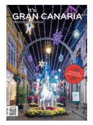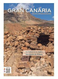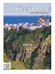
No. 17 - Its Gran Canaria Magazine
Rutas, recomendaciones y noticias de Gran Canaria. Routes, tips and news about Gran Canaria.
Rutas, recomendaciones y noticias de Gran Canaria.
Routes, tips and news about Gran Canaria.

You also want an ePaper? Increase the reach of your titles
YUMPU automatically turns print PDFs into web optimized ePapers that Google loves.
24<br />
GET TO KNOW GRAN CANARIA I CONOCE GRAN CANARIA Nº <strong>17</strong><br />
Water comes in all shapes and sizes in <strong>Gran</strong> <strong>Canaria</strong><br />
By Michel Jorge Millares<br />
Imagine a tiny little continent, about the size of Rio<br />
de Janeiro, covering some 1,500 square kilometres<br />
and then, imagine that the outline of this territory<br />
is almost like a circle surrounded by the sea. That<br />
is <strong>Gran</strong> <strong>Canaria</strong>, an island permanently buffeted<br />
by the Canary Current, from north to south, always<br />
bathed by the trade winds to windward, with a<br />
humidity that floats in from the <strong>No</strong>rth Atlantic to<br />
this enclave situated on the parallel of the Tropic<br />
of Cancer. This is where all this cooling water flows<br />
down to counteract the close proximity of the<br />
largest desert in the world. The sea around here<br />
is home to one of the richest fishing grounds on<br />
the planet while the land features thermophilic forests,<br />
pine and laurel forests or, as we islanders say:<br />
Monteverde. This ocean crosses the islands like a<br />
palette in which the brushstrokes are blended in to<br />
reveal the shades of colour like an oil painting. And<br />
NASA shows us satellite images from space of the<br />
waves rippling in like windsocks extending southwest,<br />
forming the silhouettes of shadows on the<br />
ocean that emerge as the north wind blocks the<br />
mountains, resulting in a change of temperature<br />
on the ocean surface that becomes the leeward<br />
dance into the South Atlantic.<br />
Here, in the interior of this fortunate isle, water<br />
sprouts up, in albeit fewer and fewer springs that<br />
brighten up the landscape with their music. They<br />
are waters that fall or settle on the earth and enter<br />
the fossil volcanoes where they have resided<br />
for many thousands of years, although in just a few<br />
decades they have suffered a process of overexploitation.<br />
Thanks to these deposits, the island was<br />
covered in a carpet of vegetation that is the fruit of<br />
the unique and mythological subtropical humidity<br />
of the Macaronesia region. And, in true mythical<br />
style, the springs are world famous for their curative,<br />
medicinal, if not miraculous, powers.<br />
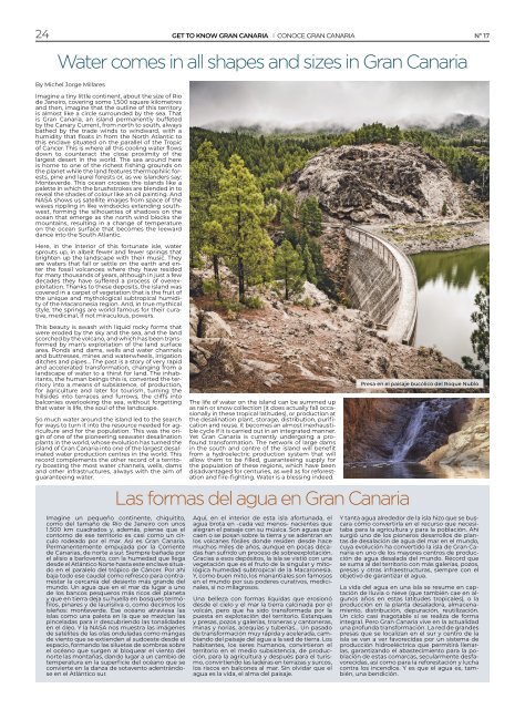
This beauty is awash with liquid rocky forms that<br />
were eroded by the sky and the sea, and the land<br />
scorched by the volcano, and which has been transformed<br />
by man’s exploitation of the land surface<br />
area. Ponds and dams, wells and water channels<br />
and buttresses, mines and waterwheels, irrigation<br />
ditches and pipes... The past is a story of very rapid<br />
and accelerated transformation, changing from a<br />
landscape of water to a thirst for land. The inhabitants,<br />
the human beings this is, converted the territory<br />
into a means of subsistence, of production,<br />
for agriculture and later for tourism, turning the<br />
hillsides into terraces and furrows, the cliffs into<br />
balconies overlooking the sea, without forgetting<br />
that water is life, the soul of the landscape.<br />
So much water around the island led to the search<br />
for ways to turn it into the resource needed for agriculture<br />
and for the population. This was the origin<br />
of one of the pioneering seawater desalination<br />
plants in the world, whose evolution has turned the<br />
island of <strong>Gran</strong> <strong>Canaria</strong> into one of the largest desalinated<br />
water production centres in the world. This<br />
record complements the other record of a territory<br />
boasting the most water channels, wells, dams<br />
and other infrastructures, always with the aim of<br />
guaranteeing water.<br />
The life of water on the island can be summed up<br />
as rain or snow collection (it does actually fall occasionally<br />
in these tropical latitudes), or production at<br />
the desalination plant, storage, distribution, purification<br />
and reuse. It becomes an almost inexhaustible<br />
cycle if it is carried out in an integrated manner.<br />
Yet <strong>Gran</strong> <strong>Canaria</strong> is currently undergoing a profound<br />
transformation. The network of large dams<br />
in the south and centre of the island will benefit<br />
from a hydroelectric production system that will<br />
allow them to be filled, guaranteeing supply for<br />
the population of these regions, which have been<br />
disadvantaged for centuries, as well as for reforestation<br />
and fire-fighting. Water is a blessing indeed.<br />
Las formas del agua en <strong>Gran</strong> <strong>Canaria</strong><br />
Presa en el paisaje bucólico del Roque Nublo<br />
Imagine un pequeño continente, chiquitito,<br />
como del tamaño de Río de Janeiro con unos<br />
1.500 km cuadrados y, además, piense que el<br />
contorno de ese territorio es casi como un círculo<br />
rodeado por el mar. Así es <strong>Gran</strong> <strong>Canaria</strong>.<br />
Permanentemente empujada por la Corriente<br />
de <strong>Canaria</strong>s, de norte a sur. Siempre bañada por<br />
el alisio a barlovento, con la humedad que llega<br />
desde el Atlántico <strong>No</strong>rte hasta este enclave situado<br />
en el paralelo del trópico de Cáncer. Por ahí<br />
baja todo ese caudal como refresco para contrarrestar<br />
la cercanía del desierto más grande del<br />
mundo. Un agua que en el mar da lugar a uno<br />
de los bancos pesqueros más ricos del planeta<br />
y que en tierra deja su huella en bosques termófilos,<br />
pinares y de laurisilva o, como decimos los<br />
isleños: monteverde. Ese océano atraviesa las<br />
islas como una paleta en la que se mezclan las<br />
pinceladas para ir descubriendo las tonalidades<br />
en el óleo. Y la NASA nos muestra las imágenes<br />
de satélites de las olas onduladas como mangas<br />
de viento que se extienden al sudoeste desde el<br />
espacio, formando las siluetas de sombras sobre<br />
el océano que surgen al bloquear el viento del<br />
norte las montañas, dando lugar a un cambio de<br />
temperatura en la superficie del océano que se<br />
convierte en la danza de sotavento adentrándose<br />
en el Atlántico sur.<br />
Aquí, en el interior de esta isla afortunada, el<br />
agua brota en -cada vez menos- nacientes que<br />
alegran el paisaje con su música. Son aguas que<br />
caen o se posan sobre la tierra y se adentran en<br />
los volcanes fósiles donde residen desde hace<br />
muchos miles de años, aunque en pocas décadas<br />
han sufrido un proceso de sobreexplotación.<br />
Gracias a esos depósitos, la isla se vistió con una<br />
vegetación que es el fruto de la singular y mitológica<br />
humedad subtropical de la Macaronesia.<br />
Y, como buen mito, los manantiales son famosos<br />
en el mundo por sus poderes curativos, medicinales,<br />
si no milagrosos.<br />
Una belleza con formas líquidas que erosionó<br />
desde el cielo y el mar la tierra calcinada por el<br />
volcán, pero que ha sido transformada por la<br />
puesta en explotación del territorio. Estanques<br />
y presas, pozos y galerías, troneras y cantoneras,<br />
minas y norias, acequias y tuberías... Un pasado<br />
de transformación muy rápida y acelerada, cambiando<br />
del paisaje del agua a la sed de tierra. Los<br />
habitantes, los seres humanos, convirtieron el<br />
territorio en el medio subsistencia, de producción,<br />
para la agricultura y después para el turismo,<br />
convirtiendo las laderas en terrazas y surcos,<br />
los riscos en balcones al mar. Sin olvidar que el<br />
agua es la vida, el alma del paisaje.<br />
Y tanta agua alrededor de la isla hizo que se buscara<br />
cómo convertirla en el recurso que necesitaba<br />
para la agricultura y para la población. Ahí<br />
surgió uno de los pioneros desarrollos de plantas<br />
de desalación de agua del mar en el mundo,<br />
cuya evolución ha convertido la isla de <strong>Gran</strong> <strong>Canaria</strong><br />
en uno de los mayores centros de producción<br />
de agua desalada del mundo. Récord que<br />
se suma al del territorio con más galerías, pozos,<br />
presas y otras infraestructuras, siempre con el<br />
objetivo de garantizar el agua.<br />
La vida del agua en una isla se resume en captación<br />
de lluvia o nieve (que también cae en algunos<br />
años en estas latitudes tropicales), o la<br />
producción en la planta desaladora, almacenamiento,<br />
distribución, depuración, reutilización.<br />
Un ciclo casi inagotable si se realiza de forma<br />
integral. Pero <strong>Gran</strong> <strong>Canaria</strong> vive en la actualidad<br />
una profunda transformación. La red de grandes<br />
presas que se localizan en el sur y centro de la<br />
isla se van a ver favorecidas por un sistema de<br />
producción hidroeléctrica que permitirá llenarlas,<br />
garantizando el abastecimiento para la población<br />
de estas comarcas, secularmente desfavorecidas,<br />
así como para la reforestación y lucha<br />
contra los incendios. Y es que el agua es, también,<br />
una bendición.