Média resolução - Participatory Avenues
Média resolução - Participatory Avenues
Média resolução - Participatory Avenues

Create successful ePaper yourself
Turn your PDF publications into a flip-book with our unique Google optimized e-Paper software.
Monmonier, M. 1996. How to Lie with Maps, second edition. Chicago and London: University<br />
of Chicago Press.<br />
Montello, D. 1997. NCGIA Core Curriculum in GIS, National Center for Geographic Information<br />
and Analysis, University of California, Santa Barbara, USA.<br />
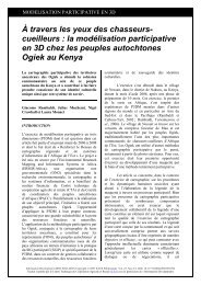
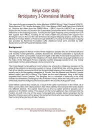
Muchemi, J.; Crawhall, N.; Pedone, G.; Koinante, J. Kiptum, Y.; Kuria, K. 2009. Kenya case<br />
study: <strong>Participatory</strong> 3Dimensional Modelling; (pgs 35-47) published in African Indigenous<br />
Peoples’ Workshop on effective use of Information Communication Technology (ICTs) in environmental<br />
advocacy, IPACC/CTA, Cape Town, South Africa. http://tinyurl.com/yz8hsmj<br />
NCIP. 2002. Administrative Order No. 1, 2 and 3. Series of 2002, National Commission on<br />
Indigenous People, Philippines.<br />
Needham, J. 1986. Science and Civilization in China: Volume 3, Mathematics and the Sciences<br />
of the Heavens and the Earth. Taipei: Caves Books, Ltd.<br />
Nguyen Viet Nhung, Nguyen Xuan Tuyen, Phung Van Bang, Hoang Quoc Viet, Nguyen Van<br />
Hop, Vu Van Manh, et al. (2008, December). Guidelines. <strong>Participatory</strong> land use planning and<br />
forest land allocation in quang binh province. Dong Hoi, Quang Binh: Department of Agriculture<br />
and Rural Development Quang Binh Province.<br />
PAFID. 2001. National Land Tenure for Indigenous People in the Philippines. Terminal Report,<br />
PAFID, MISEREOR.<br />
Pearson, A. W. 2002. Allied Military Model Making during World War II; Cartography and<br />
Geographic Information Science, Vol. 29, No. 3, 2002, pp. 227-241<br />
Pernot, J.F. 1986. L’Histoire des Plans-reliefs. Monuments Historiques No. 148:(24-36).<br />
Perrin, L., La Ville Panoramique, Evolution des Regards Aeriens sur Paris et sa Banlieue. Les<br />
Cahiers de l’Laurif n° 120. Imago Metropolis.<br />
Poffenberger, M and McGean B. 1993. Community Allies: Forest Co-Management in Thailand.<br />
62 pp. Berkeley, CA: Center for Southeast Asia Studies, University of California.<br />
Poiker, T. and Sheppard, E. 1995. GIS and Society. Cartography and Geographic Information<br />
Systems, special issue 22 (1).<br />
Polonovski, M. 1998. Les Plans-relief entre Perfectionisme et Imprecision. Monumental No.<br />
21:(33-39).<br />
Poole, P.1995. Indigenous Peoples, Mapping and Biodiversity Conservation: An Analysis of<br />
Current Activities and Opportunities for Applying Geomatics Technologies. Biodiversity Support<br />
Program (BSP). Reference No.: 15. Corporate Press.<br />
Pretty, J. N.1995. Regenerating Agriculture. Policies and Practice for Sustainability and Self-Reliance.<br />
London: Earthscan Publications Ltd.<br />
Purzuelo, M. 2007. Report of the Raumoco Watershed Vulnerability Mapping East Timor (October<br />
18-31, 2007), Green Forum Visayas, Philippines http://tinyurl.com/yjgj4rr<br />
Rambaldi, G, Muchemi, J., Crawhall, N. and Monaci, L. 2007. Through the Eyes of Huntergatherers:<br />
<strong>Participatory</strong> 3D Modelling among Ogiek Indigenous Peoples in Kenya. Information<br />
Development, Vol. 23, No. 2-3, 113-128 http://tinyurl.com/nkqjeo<br />
Rambaldi, G, Chambers R., McCall M, and Fox J. 2006a. Practical Ethics for PGIS Practitioners,<br />
Facilitators, Technology Intermediaries And Researchers. PLA 54:106-113, IIED, London, UK<br />
86