

The Vertebrate Fauna of Jenolan Karst Conservation Reserve: Final
The Vertebrate Fauna of Jenolan Karst Conservation Reserve: Final
The Vertebrate Fauna of Jenolan Karst Conservation Reserve: Final

You also want an ePaper? Increase the reach of your titles
YUMPU automatically turns print PDFs into web optimized ePapers that Google loves.
1.3 STUDY AREA<br />
1.3.1 Location <strong>of</strong> the reserve<br />
JKCR is located approximately 15 kilometres<br />
south east <strong>of</strong> Oberon, within the Oberon Local<br />
Government Area. It is 3093 hectares in area<br />
and is bounded to the north by <strong>Jenolan</strong> State<br />
Forest (SF), to the south by Kanangra-Boyd<br />
NP, to the east by Kanangra-Boyd NP and<br />
private property, and to the west by private<br />
pine forest plantations and private agricultural<br />
land (Map 1). <strong>The</strong> reserve lies at the western<br />
edge <strong>of</strong> the Greater Blue Mountains World<br />
Heritage Area (GBMWHA), the southern twothirds<br />
<strong>of</strong> the park being within the GBMWHA<br />
and the northern third (a more recent addition)<br />
outside it. <strong>The</strong> reserve is contiguous with a<br />
vast largely-wild landscape along its eastern<br />
and southern boundary.<br />
<strong>The</strong> reserve comprises the upper headwaters<br />
<strong>of</strong> the <strong>Jenolan</strong> River and its tributaries. It<br />
incorporates an extensive limestone karst<br />
system, areas <strong>of</strong> contiguous native vegetation,<br />
small cleared areas and development and<br />
infrastructure related to tourism and cave<br />
management.<br />
1.3.2 Bioregional and regional setting<br />
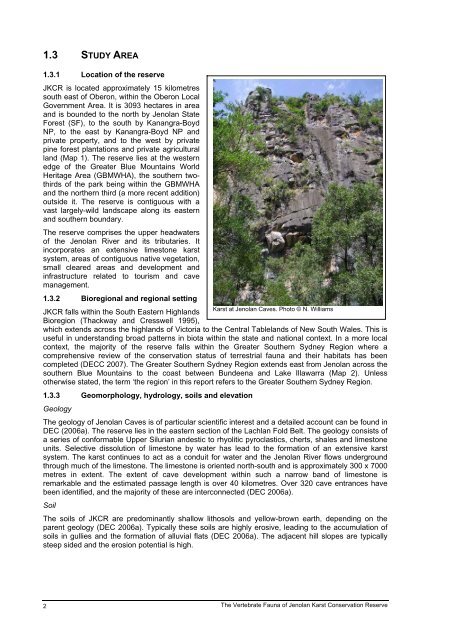
<strong>Karst</strong> at <strong>Jenolan</strong> Caves. Photo © N. Williams<br />
JKCR falls within the South Eastern Highlands<br />
Bioregion (Thackway and Cresswell 1995),<br />
which extends across the highlands <strong>of</strong> Victoria to the Central Tablelands <strong>of</strong> New South Wales. This is<br />
useful in understanding broad patterns in biota within the state and national context. In a more local<br />
context, the majority <strong>of</strong> the reserve falls within the Greater Southern Sydney Region where a<br />
comprehensive review <strong>of</strong> the conservation status <strong>of</strong> terrestrial fauna and their habitats has been<br />
completed (DECC 2007). <strong>The</strong> Greater Southern Sydney Region extends east from <strong>Jenolan</strong> across the<br />
southern Blue Mountains to the coast between Bundeena and Lake Illawarra (Map 2). Unless<br />
otherwise stated, the term ‘the region’ in this report refers to the Greater Southern Sydney Region.<br />
1.3.3 Geomorphology, hydrology, soils and elevation<br />
Geology<br />
<strong>The</strong> geology <strong>of</strong> <strong>Jenolan</strong> Caves is <strong>of</strong> particular scientific interest and a detailed account can be found in<br />
DEC (2006a). <strong>The</strong> reserve lies in the eastern section <strong>of</strong> the Lachlan Fold Belt. <strong>The</strong> geology consists <strong>of</strong><br />
a series <strong>of</strong> conformable Upper Silurian andestic to rhyolitic pyroclastics, cherts, shales and limestone<br />
units. Selective dissolution <strong>of</strong> limestone by water has lead to the formation <strong>of</strong> an extensive karst<br />
system. <strong>The</strong> karst continues to act as a conduit for water and the <strong>Jenolan</strong> River flows underground<br />
through much <strong>of</strong> the limestone. <strong>The</strong> limestone is oriented north-south and is approximately 300 x 7000<br />
metres in extent. <strong>The</strong> extent <strong>of</strong> cave development within such a narrow band <strong>of</strong> limestone is<br />
remarkable and the estimated passage length is over 40 kilometres. Over 320 cave entrances have<br />
been identified, and the majority <strong>of</strong> these are interconnected (DEC 2006a).<br />
Soil<br />
<strong>The</strong> soils <strong>of</strong> JKCR are predominantly shallow lithosols and yellow-brown earth, depending on the<br />
parent geology (DEC 2006a). Typically these soils are highly erosive, leading to the accumulation <strong>of</strong><br />
soils in gullies and the formation <strong>of</strong> alluvial flats (DEC 2006a). <strong>The</strong> adjacent hill slopes are typically<br />
steep sided and the erosion potential is high.<br />
2<br />
<strong>The</strong> <strong>Vertebrate</strong> <strong>Fauna</strong> <strong>of</strong> <strong>Jenolan</strong> <strong>Karst</strong> <strong>Conservation</strong> <strong>Reserve</strong>


