400/500 Series Garmin Optional Displays
400/500 Series Garmin Optional Displays
400/500 Series Garmin Optional Displays

You also want an ePaper? Increase the reach of your titles
YUMPU automatically turns print PDFs into web optimized ePapers that Google loves.
36<br />
Section 2<br />
TERRAIN Operation<br />
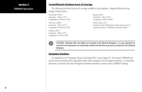
Terrain/Obstacle Database Areas of Coverage<br />
The following describes the area of coverage available in each database. Regional definitions may<br />
change without notice.<br />
Worldwide (WW):<br />
Latitudes: S60 to N75<br />
Longitudes: W180 to E180<br />
Americas (AME):<br />
Latitudes: S60 to N75<br />
Longitudes: W180 to W30<br />
Atlantic (ATL):<br />
Latitudes: S60 to N75<br />
Longitudes: W30 to E90<br />
CAUTION: Obstacles 200’ and higher are included in the Obstacle Database. It is very important to<br />
note that not all obstacles are necessarily charted and therefore may not be contained in the Obstacle<br />
Database.<br />
Navigation Database<br />
Pacific (PAC):<br />
Latitudes: S60 to N75<br />
Longitudes: E60 to E180<br />
United States (US):<br />
Limited to the United States plus some areas of<br />
Canada, Mexico, Caribbean, and the Pacific.<br />
As explained in the “Premature Descent Alerting (PDA)” section (page 41), the <strong>Garmin</strong> TERRAIN premature<br />
descent alerting (PDA) algorithms utilize data contained in the Navigation Database. It is therefore<br />
important to also have the latest Navigation Database installed to ensure correct TERRAIN alerting.